BS24 9RX - 3 bedroom bungalow for sale in Orchard Road, Hutton, Weston…
View on Property Piper
3 bedroom bungalow for sale in Orchard Road, Hutton, Weston-super-Mare, BS24
Property Details
- Price: £390000
- Bedrooms: 3
- Bathrooms: 1
- Property Type: undefined
- Property SubType: undefined
Brochure Descriptions
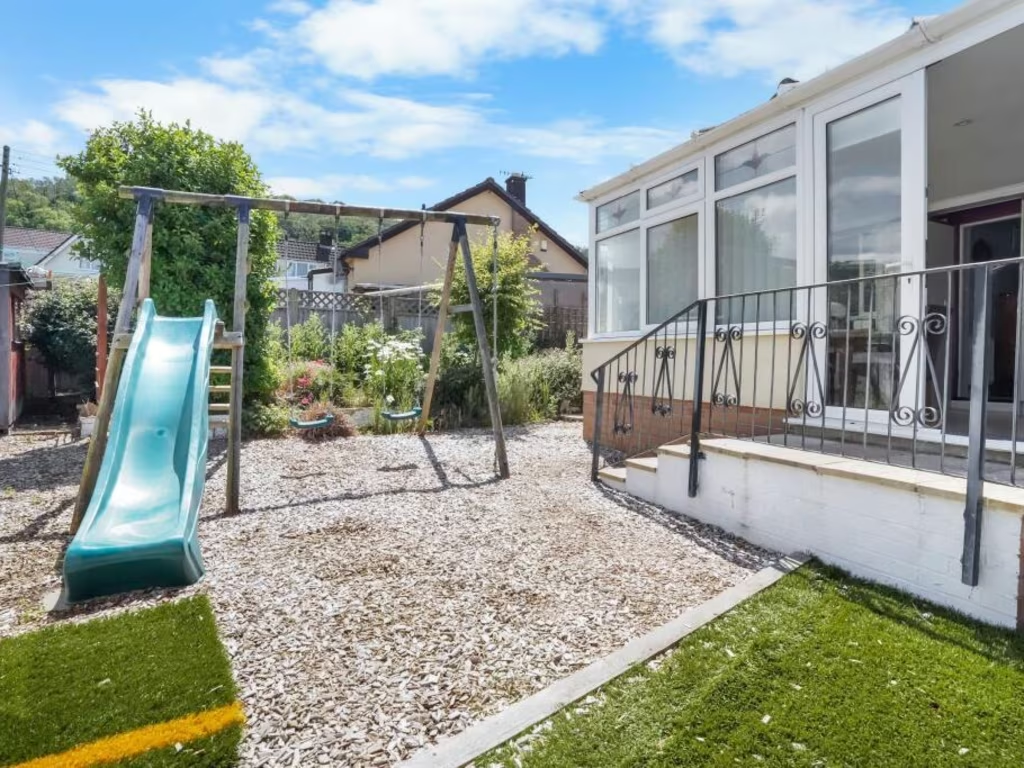
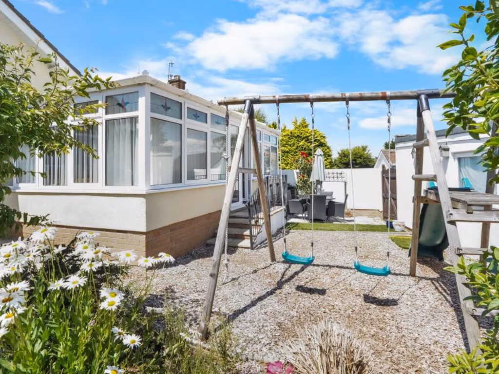
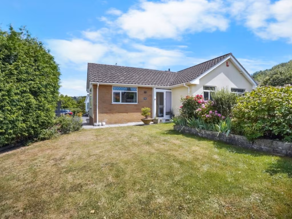
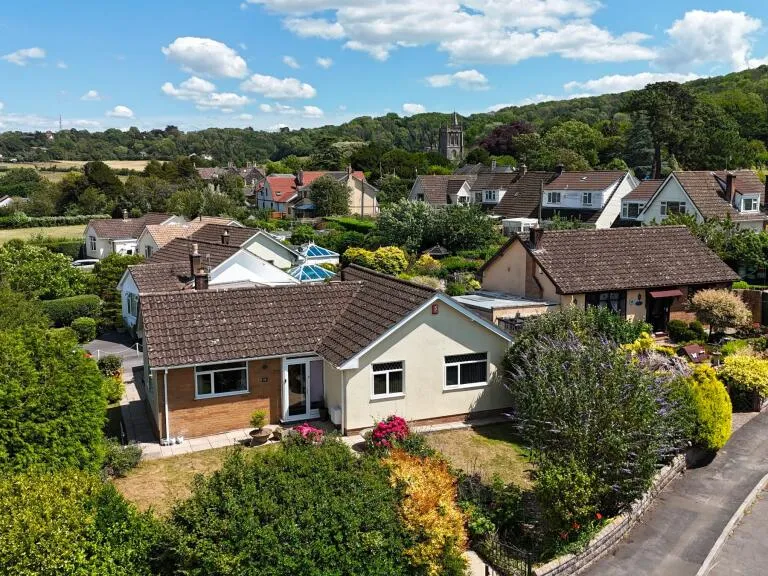
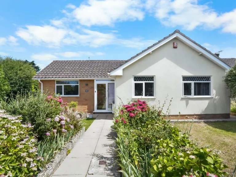
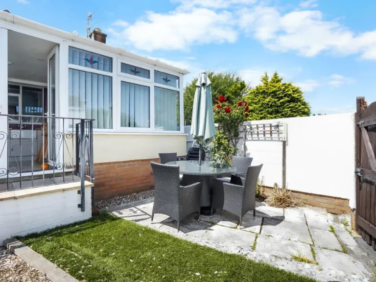
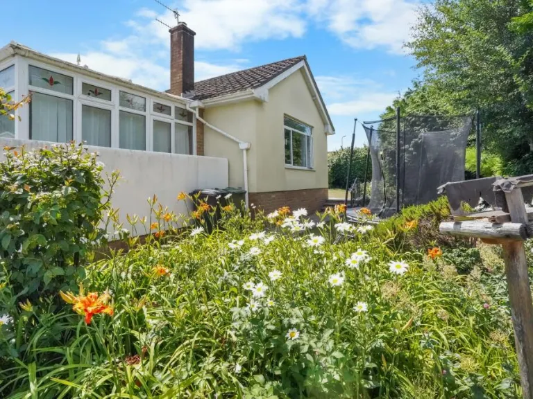
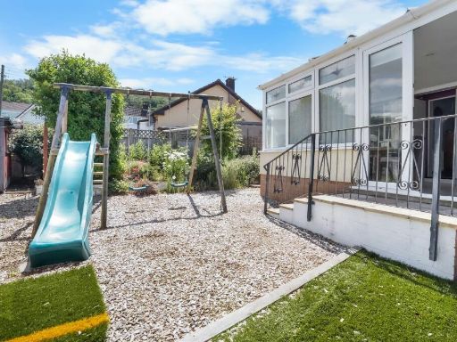
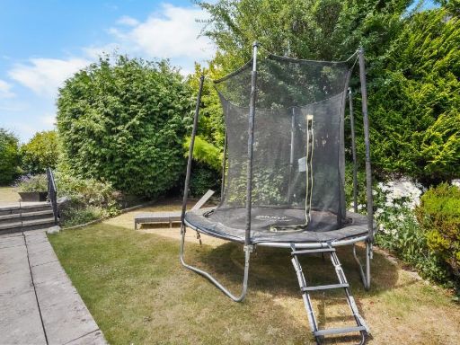
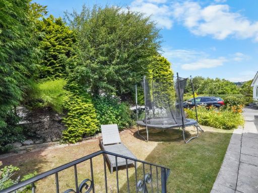
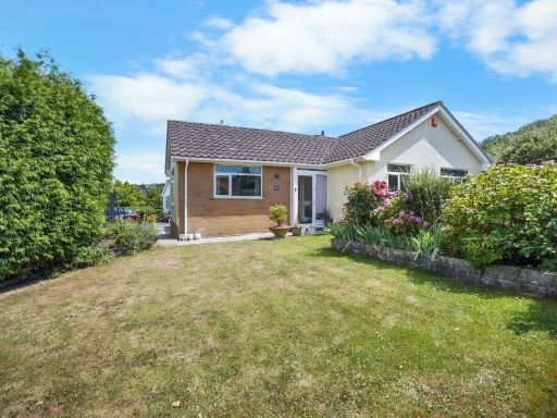
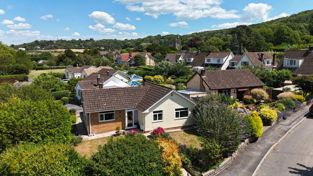
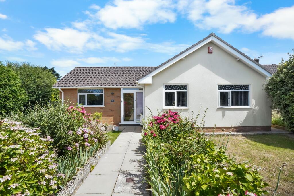
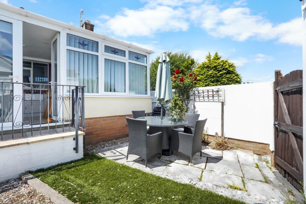
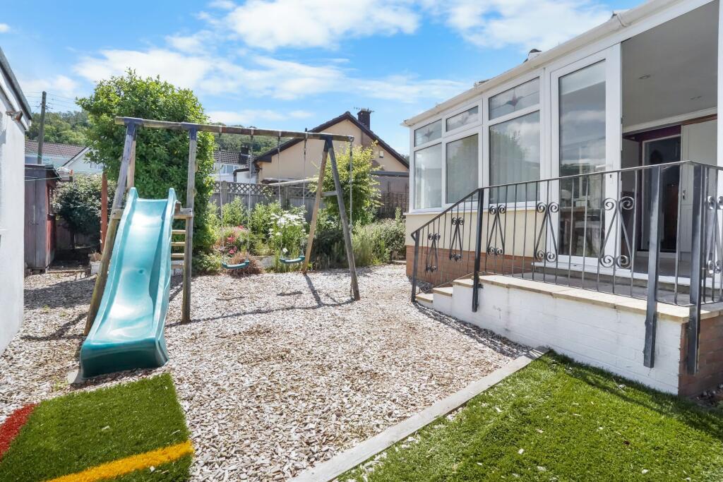
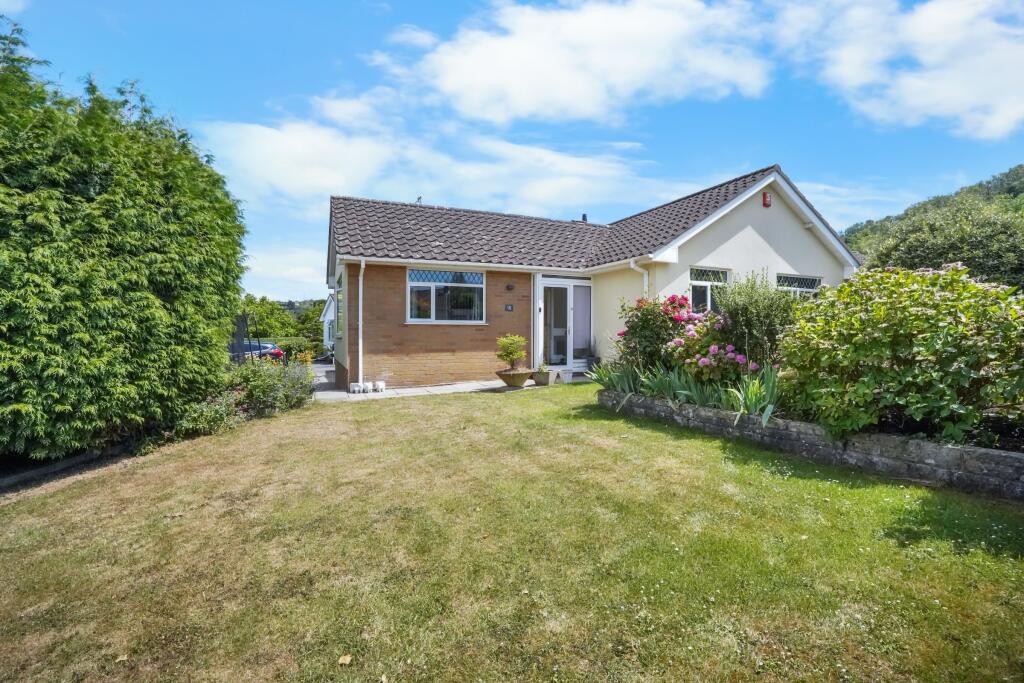
- The property is a charming single-story detached bungalow featuring a traditional tiled roof and a neat facade with a blend of white and brickwork. Surrounded by lush greenery, the house offers serene views over a neighboring forested area and has a well-maintained garden that is quite spacious considering the typical bungalow layouts. The garden has a variety of mature shrubs and plants with plenty of room for further customization or outdoor activities. The neighborhood appears peaceful and ideal for a quiet, suburban lifestyle.
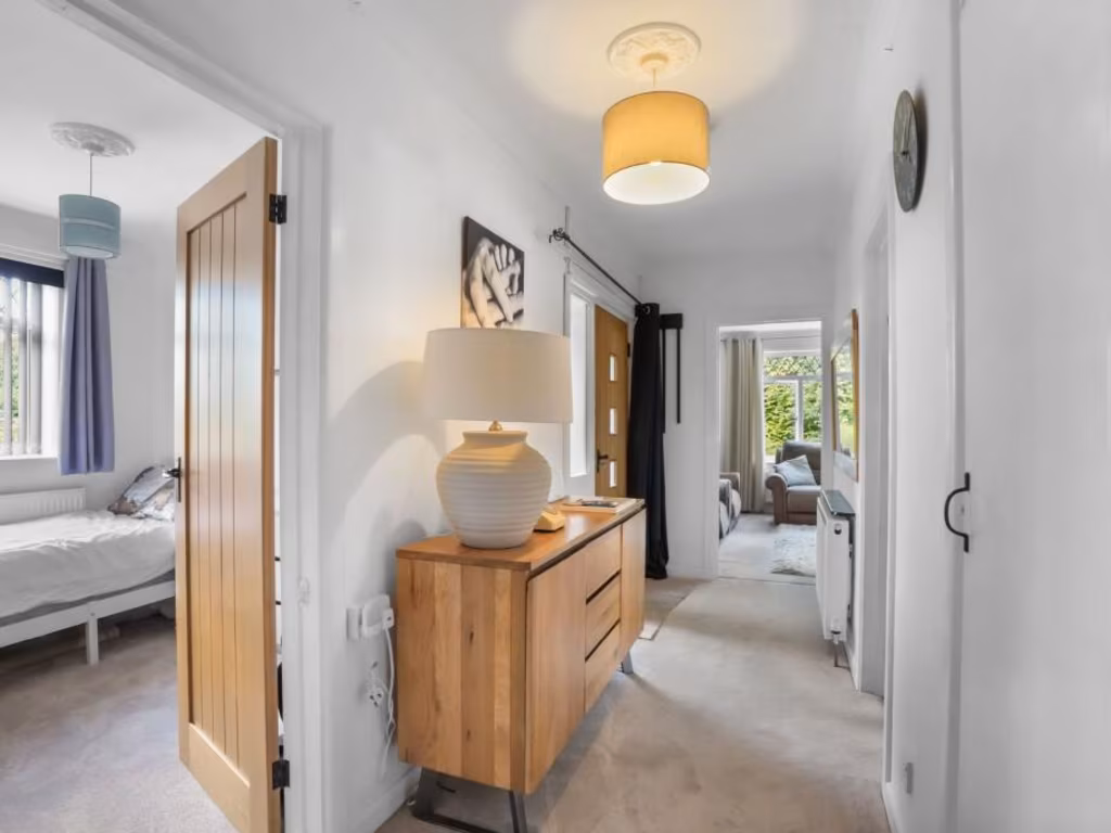
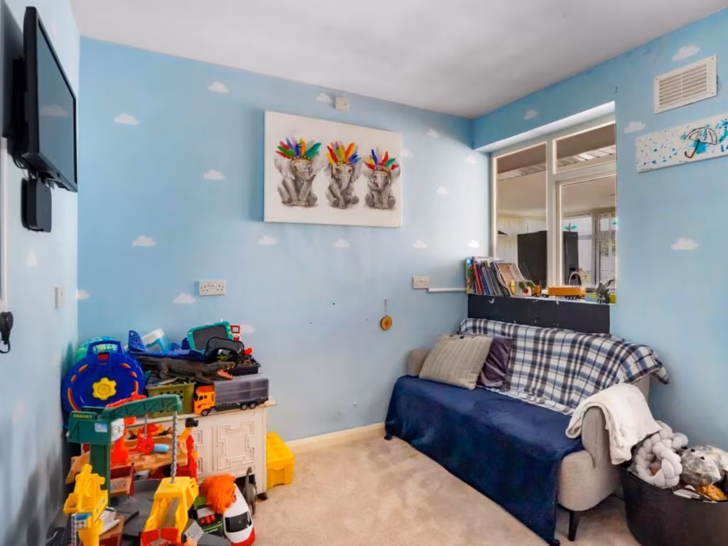
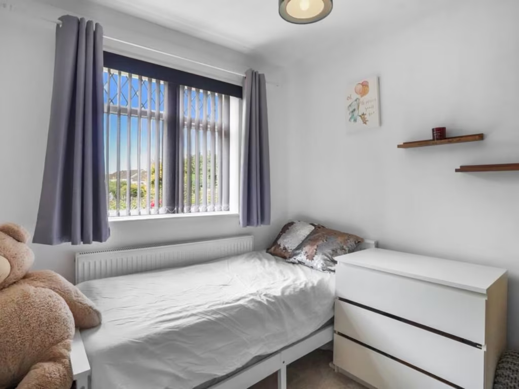
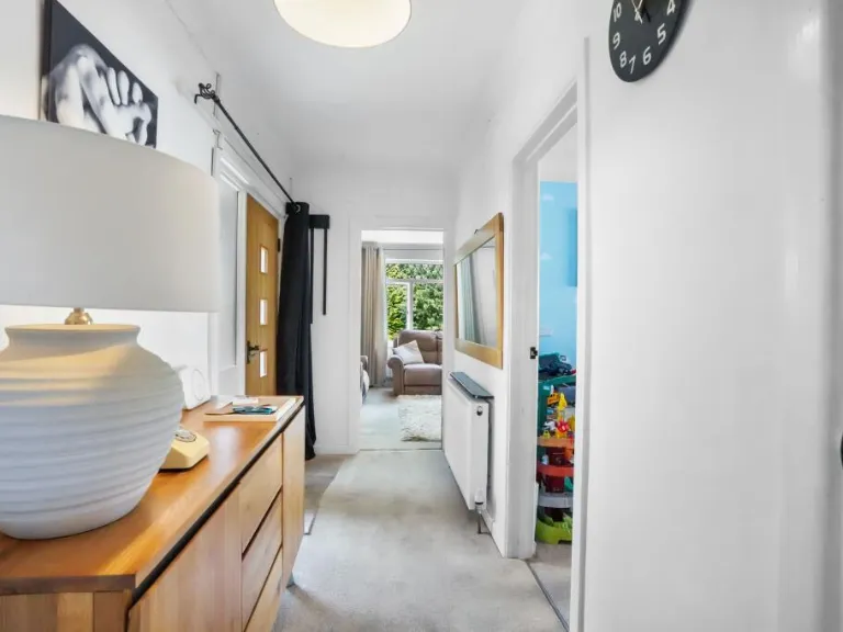
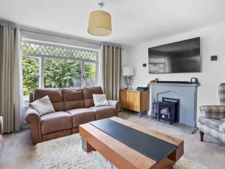
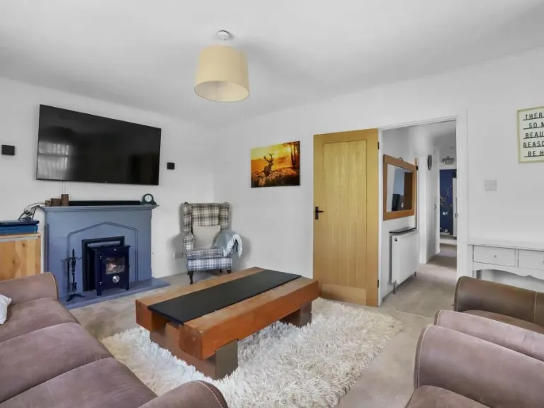
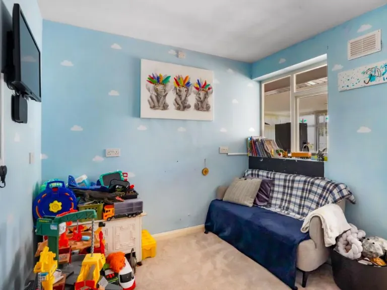
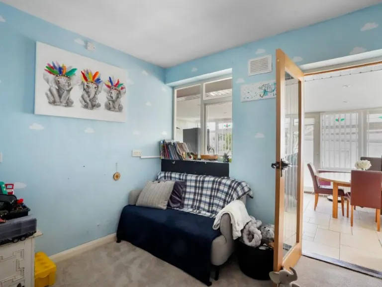
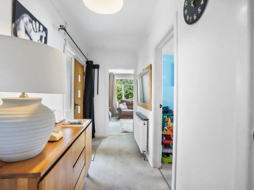
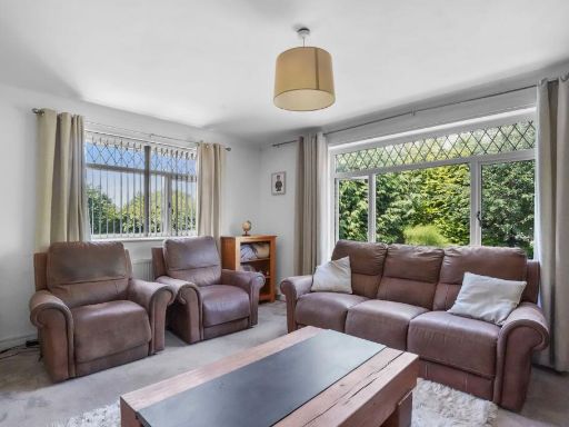
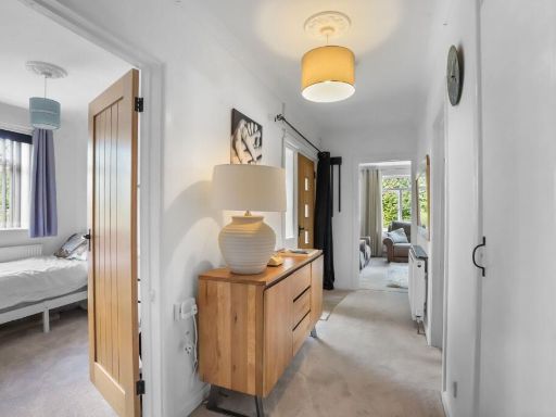
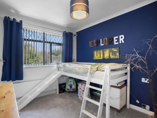
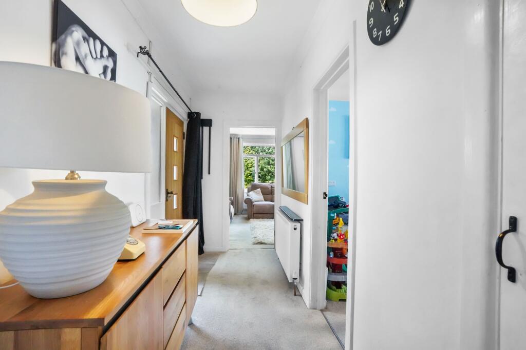
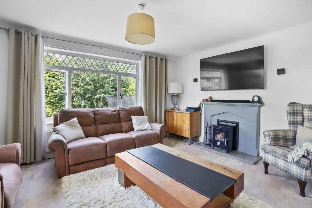
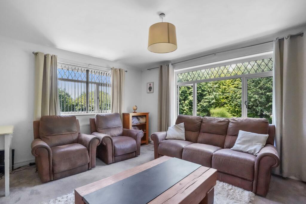
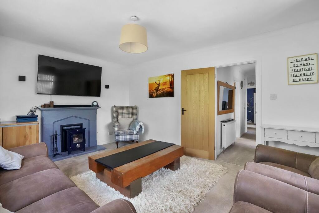
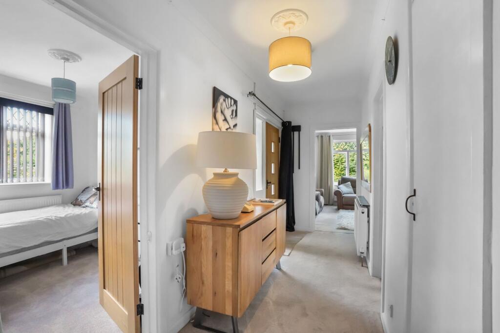
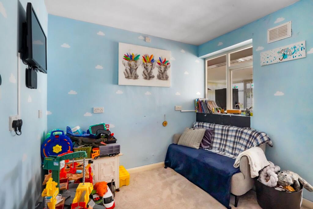
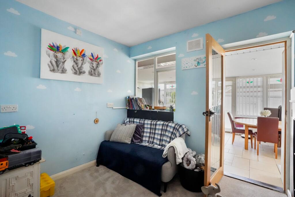
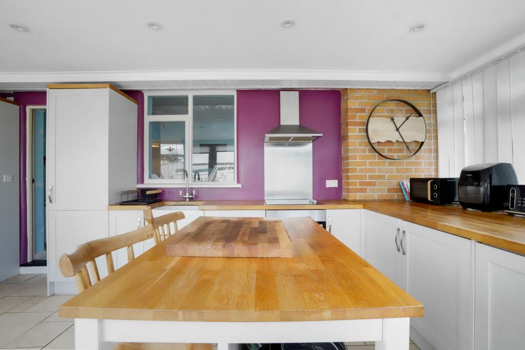
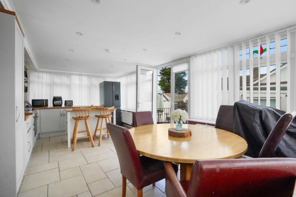
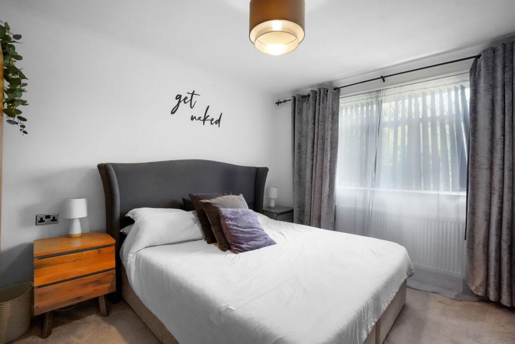
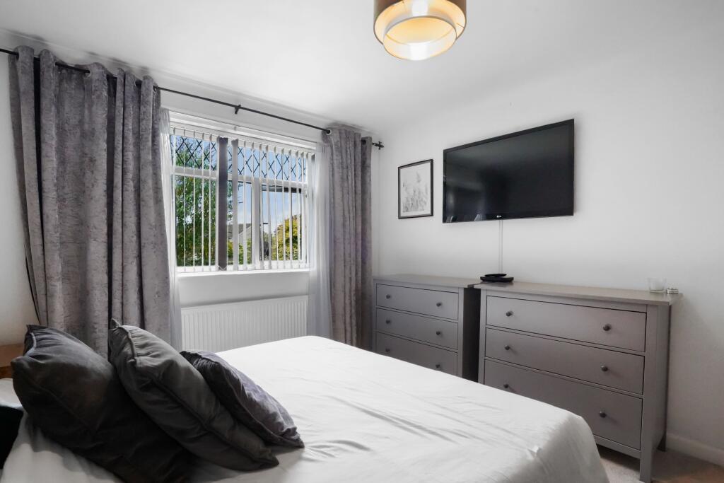
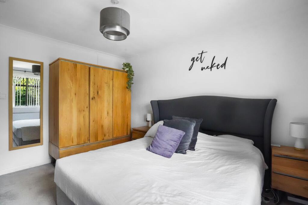
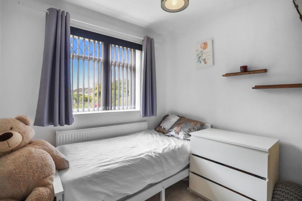
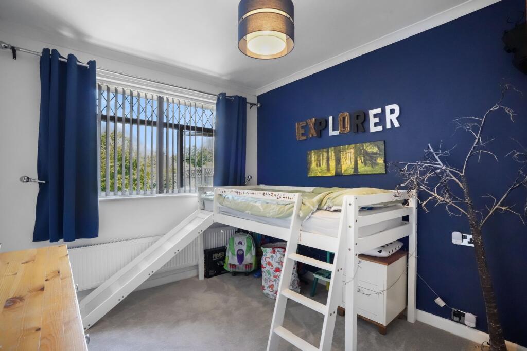
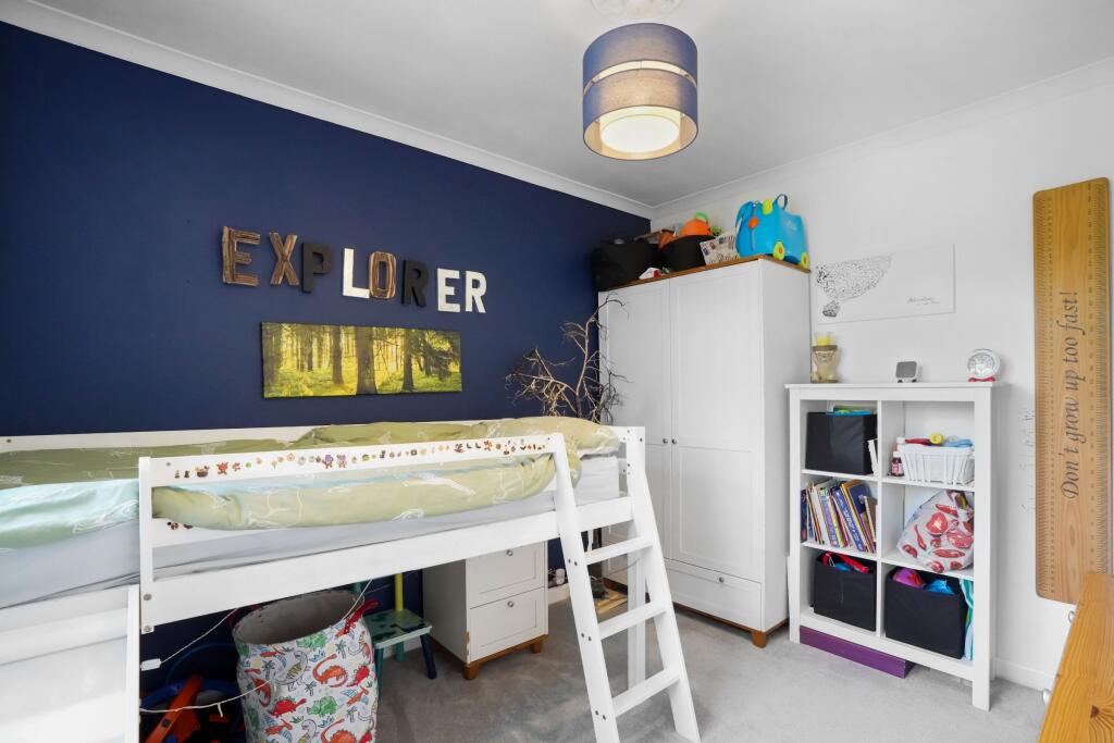
- This property features a spacious living area with large windows offering pleasant garden views, creating a bright and inviting space. The living room is well-proportioned, easily accommodating several seating arrangements, and includes a fireplace feature. The hallway suggests a well-laid-out floor plan, throwing open access to multiple rooms. The lighting fixtures suggest a moderately updated interior.
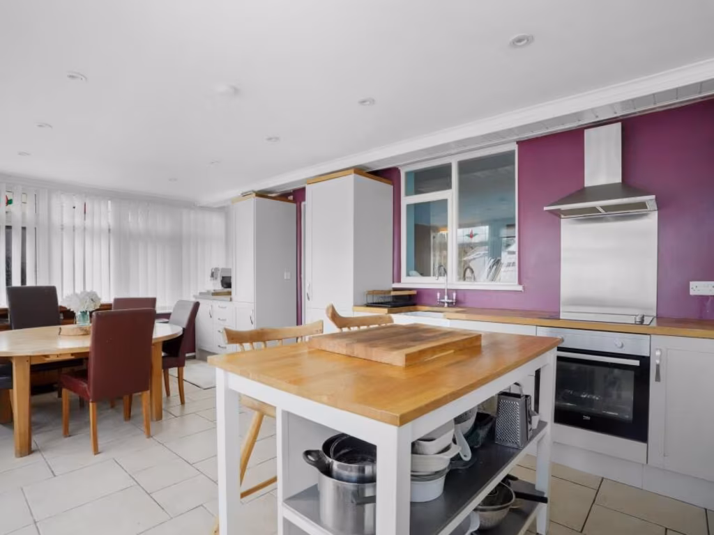
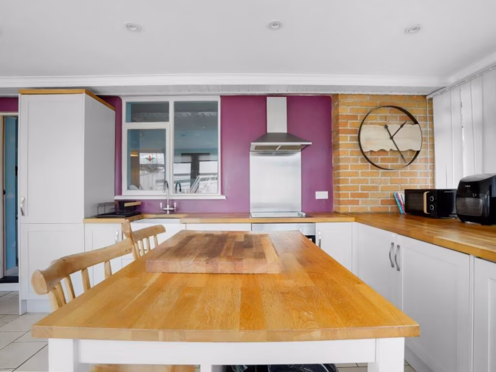
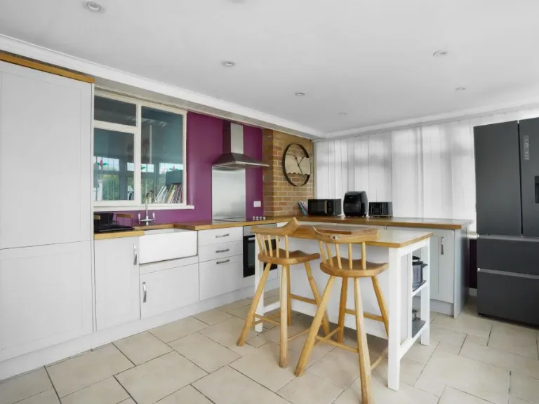
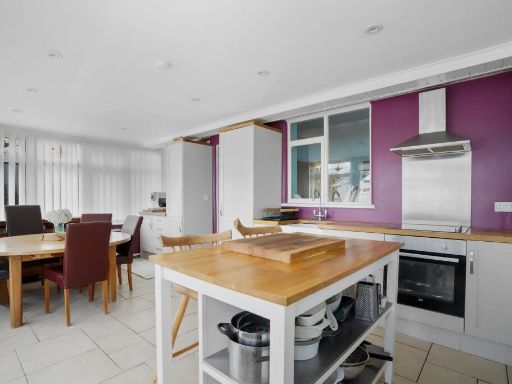
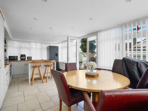
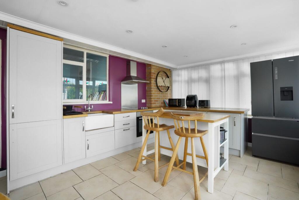
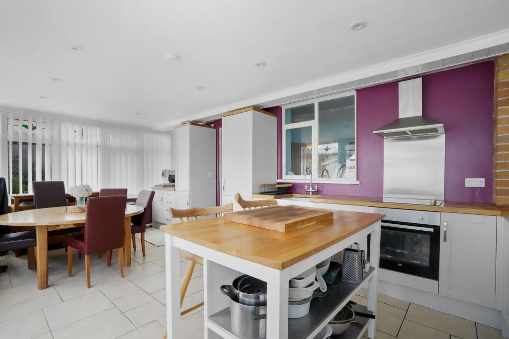
The garden view implies a green and serene residential area, enhancing the property's appeal with its natural ambiance. The room sizes appear average, suitable for a family setting, with the overall property giving an impression of comfort and practicality. The lack of visible dining or kitchen areas suggests these may be separate or that the photos are incomplete. Overall, the house seems to offer average-sized accommodations in a tranquil setting.
Image Descriptions
- detached bungalow Mid-20th Century
- bungalow mid-20th century
Floorplan Description
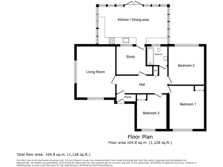
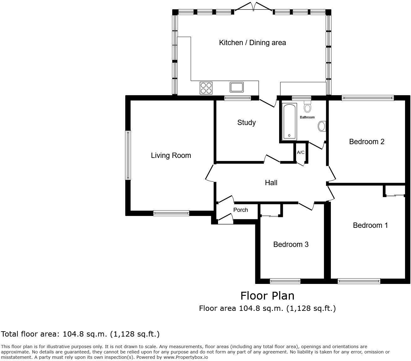
- Single-story house with three bedrooms and an open-plan kitchen/dining area.
Rooms
- Kitchen / Dining area:
- Living Room:
- Study:
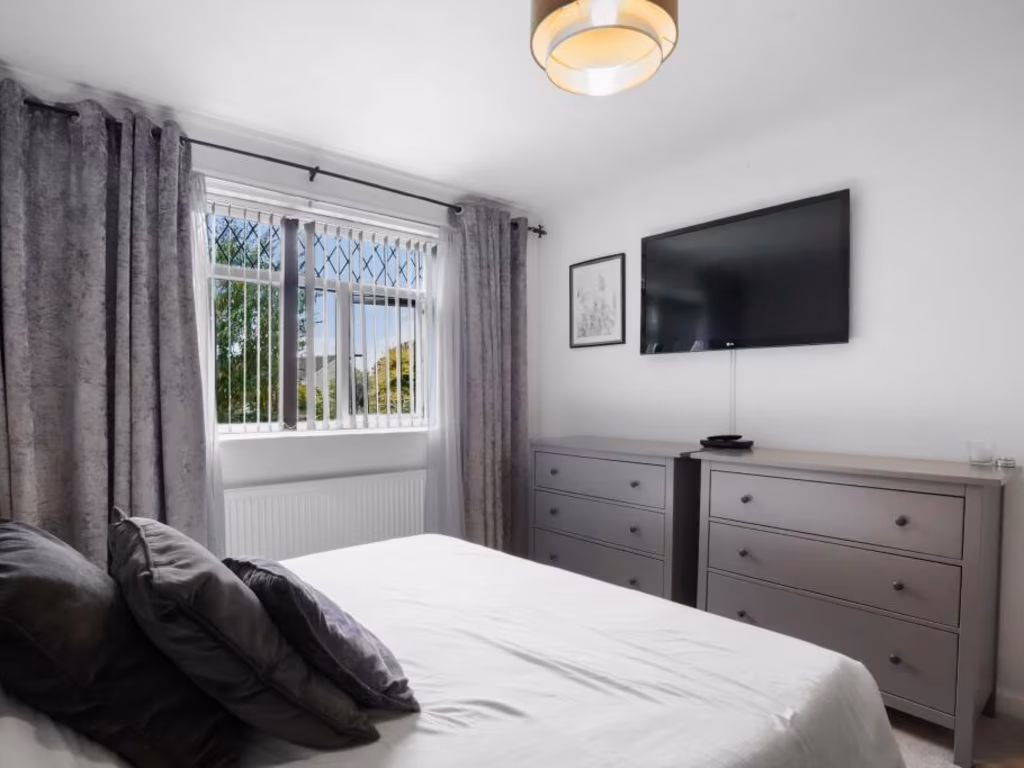
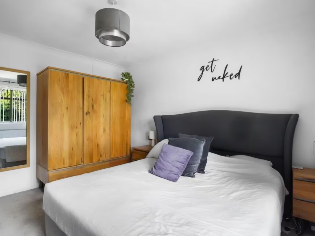
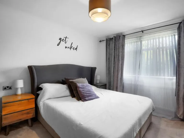
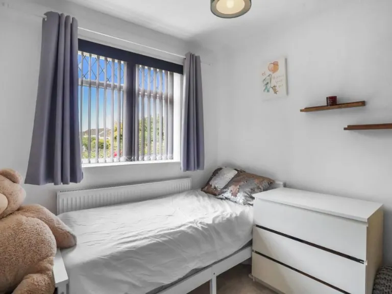
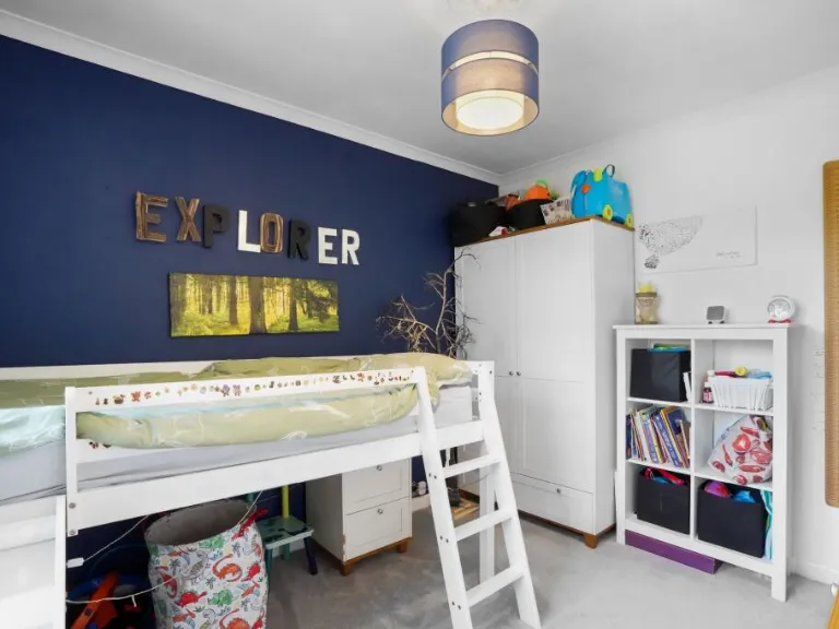
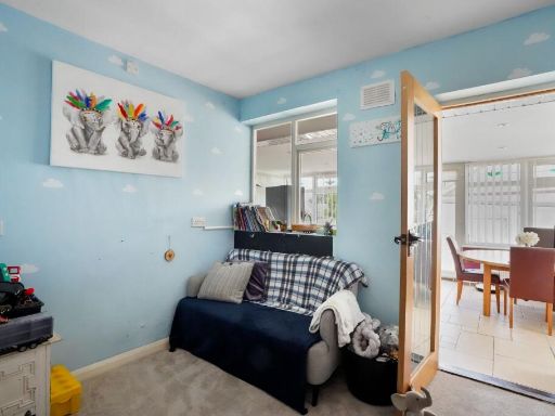
- Bedroom 1:
- Bedroom 2:
- Bedroom 3:
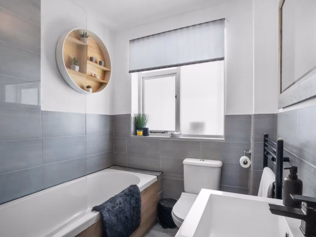
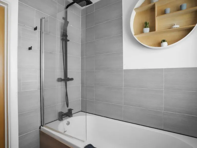
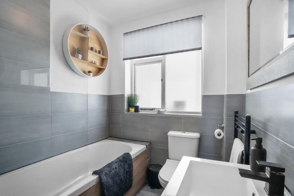
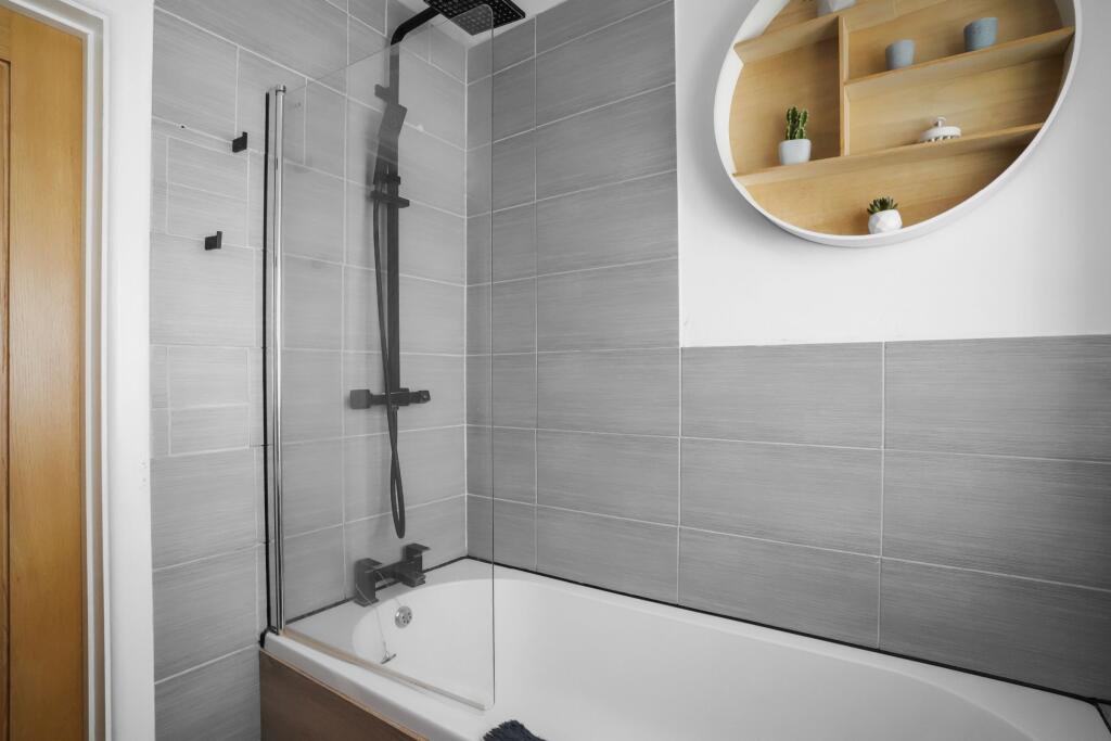
- Bathroom:
- Hall:
- Porch:
Textual Property Features
Detected Visual Features
- detached
- bungalow
- Mid-20th Century
- single-story
- residential
- suburban
- roof tiles
- garden
- garage
- private driveway
- single-storey
- mid-century
EPC Details
- Fully double glazed
- Cavity wall, filled cavity
- Boiler and radiators, mains gas
- Low energy lighting in 25% of fixed outlets
- Suspended, no insulation (assumed)
Nearby Schools
- Lympsham Church of England Academy
- Hutton Church of England Primary School
- Worle Community School
- Mendip Green Primary School
- St Martin's Church of England Primary School
- Becket Primary School
- Priory Community School
- Oldmixon Primary School
- Uphill Village Academy
- Broadoak Academy
- Windwhistle Primary School
- Bournville Primary School
- Winterstoke Hundred Academy
- Ashcombe Primary School
- Christ Church Church of England Primary School
- Mead Vale Community Primary School
- Milton Park Primary School
- Worle Village Primary School
- Kewstoke Primary School
- Locking Primary School
- Parklands Educate Together Primary
- Haywood Village Academy
- Hans Price Academy
- St Anne's Church Academy
- Herons' Moor Academy
- Worlebury St Pauls Church School
- St Mark's Ecumenical Anglican/Methodist Primary School
Nearest General Shops
- Id: 108065060
- Tags:
- Area: yes
- Shop: garden_centre
- Source: Bing
- TagsNormalized:
- Lat: 51.3276735
- Lon: -2.9156741
- FullGeoHash: gcjgvxuv7ggf
- PartitionGeoHash: gcjg
- Images:
- FoodStandards: null
- Distance: 1322.5
,- Id: 526014720
- Tags:
- Name: Hutton Garden Centre
- Shop: garden_centre
- Source: Bing
- TagsNormalized:
- Lat: 51.3276611
- Lon: -2.9156667
- FullGeoHash: gcjgvxuvk192
- PartitionGeoHash: gcjg
- Images:
- FoodStandards: null
- Distance: 1322.4
,- Id: 355121224
- Tags:
- Addr:
- Housenumber: 42
- Street: Main Road
- Building: shop
- Name: Sandra's
- Shop: hairdresser
- Source: Bing
- TagsNormalized:
- Lat: 51.3244374
- Lon: -2.9298889
- FullGeoHash: gcjgvr6d88s6
- PartitionGeoHash: gcjg
- Images:
- FoodStandards: null
- Distance: 273.7
}
Nearest Grocery shops
- Id: 245131188
- Tags:
- Building: yes
- Name: Locking Service Station
- Shop: convenience
- Source: Bing
- TagsNormalized:
- Lat: 51.3379087
- Lon: -2.9230838
- FullGeoHash: gcjuj3z2zpyd
- PartitionGeoHash: gcju
- Images:
- FoodStandards: null
- Distance: 1778.5
,- Id: 9399336120
- Tags:
- Addr:
- Postcode: BS24 9HA
- Street: Broadway
- Brand: Tesco Express
- Brand:wikidata: Q98456772
- Contact:
- Website: https://www.tesco.com/store-locator/weston-super-mare/the-broadway
- Fhrs:
- Name: Tesco Express
- Shop: convenience
- TagsNormalized:
- tesco
- tesco express
- convenience
- shop
- Lat: 51.3217402
- Lon: -2.9569477
- FullGeoHash: gcjguwyff1gc
- PartitionGeoHash: gcjg
- Images:
- FoodStandards:
- Id: 1125962
- FHRSID: 1125962
- LocalAuthorityBusinessID: A06KWMBROA/1
- BusinessName: Tesco Express
- BusinessType: Retailers - supermarkets/hypermarkets
- BusinessTypeID: 7840
- AddressLine1: null
- AddressLine2: Broadway
- AddressLine3: Weston-Super-Mare
- AddressLine4: Someset
- PostCode: BS24 9HA
- RatingValue: 5
- RatingKey: fhrs_5_en-GB
- RatingDate: 2020-12-02
- LocalAuthorityCode: 858
- LocalAuthorityName: North Somerset
- LocalAuthorityWebSite: http://www.n-somerset.gov.uk
- LocalAuthorityEmailAddress: foodandsafety@n-somerset.gov.uk
- Scores:
- Hygiene: 5
- Structural: 5
- ConfidenceInManagement: 5
- NewRatingPending: false
- Geocode:
- Longitude: -2.95643091201782
- Latitude: 51.32179260253910
- Distance: 1648.8
,- Id: 254079564
- Tags:
- Addr:
- City: Weston-Super-Mare
- Housenumber: 21
- Postcode: BS24 9QQ
- Street: Main Road
- Suburb: Hutton
- Amenity: post_office
- Building: yes
- Fhrs:
- Name: Hutton Stores and Post Office
- Shop: convenience
- Source: Bing
- Source:addr: FHRS Open Data
- TagsNormalized:
- office
- post office
- convenience
- shop
- Lat: 51.3244962
- Lon: -2.933179
- FullGeoHash: gcjgvr24ggx1
- PartitionGeoHash: gcjg
- Images:
- FoodStandards: null
- Distance: 138.4
}
Nearest Religious buildings
- Id: 355120473
- Tags:
- Amenity: grave_yard
- Landuse: churchyard
- Source: Bing
- TagsNormalized:
- Lat: 51.3227776
- Lon: -2.930835
- FullGeoHash: gcjgvr1bfe5j
- PartitionGeoHash: gcjg
- Images:
- FoodStandards: null
- Distance: 182.3
,- Id: 355281071
- Tags:
- Amenity: place_of_worship
- Building: church
- Name: Hebron Church
- Religion: christian
- Source: Bing
- TagsNormalized:
- place of worship
- church
- christian
- Lat: 51.3241131
- Lon: -2.9350046
- FullGeoHash: gcjgvpqb9kju
- PartitionGeoHash: gcjg
- Images:
- FoodStandards: null
- Distance: 149.6
,- Id: 402266152
- Tags:
- Addr:
- City: Bristol
- Place: Hutton
- Postcode: BS24 9SN
- Street: Church Lane
- Amenity: school
- Capacity: 202
- Denomination: anglican
- Diocese: Diocese of Bath and Wells
- Isced:
- Max_age: 11
- Min_age: 4
- Name: Hutton Church of England Primary School
- Phone: +44 1934 812852
- Ref:
- Ref:edubase:group: 16798
- Religion: christian
- School:
- Boarding: no
- Gender: mixed
- Selective: no
- Trust: yes
- Type: academy
- School:trust:name: Kaleidoscope Multi Academy Trust
- School:trust:type: multi_academy
- Website: https://www.huttonceprimaryschool.co.uk/
- Wikidata: Q67150091
- TagsNormalized:
- school
- anglican
- church
- christian
- Lat: 51.3237999
- Lon: -2.9315073
- FullGeoHash: gcjgvr1qfctx
- PartitionGeoHash: gcjg
- Images:
- FoodStandards: null
- Distance: 141.3
}
Nearest Airports
- Id: 47483196
- Tags:
- Aerodrome: international
- Aeroway: aerodrome
- Iata: BRS
- Icao: EGGD
- Internet_access: wlan
- Internet_access:fee: no
- Name: Bristol Airport
- Type: public
- Website: https://www.bristolairport.co.uk/
- Wikidata: Q8725
- Wikipedia: en:Bristol Airport
- TagsNormalized:
- airport
- international airport
- Lat: 51.3830799
- Lon: -2.7186615
- FullGeoHash: gcnh64h24s74
- PartitionGeoHash: gcnh
- Images:
- FoodStandards: null
- Distance: 16325.1
,- Id: 319112968
- Tags:
- Aerodrome: international
- Aerodrome:type: public
- Aeroway: aerodrome
- Iata: CWL
- Icao: EGFF
- Internet_access: yes
- Internet_access:fee: no
- Is_in: Cardiff,Wales,UK
- Name: Cardiff Airport
- Operator: Cardiff International Airport Limited
- Source: Gagravarr_Airports
- Type: civil
- Wikidata: Q8994
- Wikipedia: en:Cardiff Airport
- TagsNormalized:
- airport
- international airport
- Lat: 51.3978554
- Lon: -3.3438203
- FullGeoHash: gcjs7utn5qdy
- PartitionGeoHash: gcjs
- Images:
- FoodStandards: null
- Distance: 29682.8
}
Nearest Leisure Facilities
- Id: 324727045
- Tags:
- Leisure: pitch
- Source: Bing
- Sport: soccer
- TagsNormalized:
- Lat: 51.3278579
- Lon: -2.9261046
- FullGeoHash: gcjgvrvq2y4q
- PartitionGeoHash: gcjg
- Images:
- FoodStandards: null
- Distance: 717.6
,- Id: 355121942
- Tags:
- Access: private
- Leisure: swimming_pool
- Source: Bing
- TagsNormalized:
- swimming
- swimming pool
- pool
- leisure
- Lat: 51.3256049
- Lon: -2.9242004
- FullGeoHash: gcjgvrw9m4np
- PartitionGeoHash: gcjg
- Images:
- FoodStandards: null
- Distance: 687
,- Id: 354939889
- Tags:
- Leisure: pitch
- Name: Jubilee Sports Field
- Source: Bing
- TagsNormalized:
- Lat: 51.3278402
- Lon: -2.9358649
- FullGeoHash: gcjgvpynm6um
- PartitionGeoHash: gcjg
- Images:
- FoodStandards: null
- Distance: 539
,- Id: 355281480
- Tags:
- Leisure: pitch
- Source: Bing
- TagsNormalized:
- Lat: 51.3241167
- Lon: -2.9314352
- FullGeoHash: gcjgvr32ssg3
- PartitionGeoHash: gcjg
- Images:
- FoodStandards: null
- Distance: 163.6
,- Id: 355281086
- Tags:
- Leisure: pitch
- Source: Bing
- TagsNormalized:
- Lat: 51.3234602
- Lon: -2.9319219
- FullGeoHash: gcjgvr1hc62t
- PartitionGeoHash: gcjg
- Images:
- FoodStandards: null
- Distance: 101.4
}
Nearest Tourist attractions
- Id: 107947405
- Tags:
- Addr:
- City: Bristol
- Postcode: BS24 8PP
- Building: yes
- Name: Helicopter Museum
- Note: History of Weston Airport
- Tourism: museum
- Wikidata: Q7739330
- Wikipedia: en:The Helicopter Museum (Weston)
- TagsNormalized:
- Lat: 51.3392316
- Lon: -2.9312087
- FullGeoHash: gcjuj6189ykm
- PartitionGeoHash: gcju
- Images:
- FoodStandards: null
- Distance: 1782.6
,- Id: 55489967
- Tags:
- Addr:
- Name: West End Farm Caravan Park
- Source: OS_OpenSource_StreetView
- Tourism: caravan_site
- TagsNormalized:
- Lat: 51.3336956
- Lon: -2.9288902
- FullGeoHash: gcjuj350rymj
- PartitionGeoHash: gcju
- Images:
- FoodStandards: null
- Distance: 1201.4
,- Id: 355180430
- Tags:
- Addr:
- Housenumber: 30
- Street: Main Road
- Building: house
- Guest_house: bed_and_breakfast
- Name: Moorlands B&B
- Source: Bing
- Tourism: guest_house
- TagsNormalized:
- Lat: 51.3241433
- Lon: -2.9326251
- FullGeoHash: gcjgvr28bcu0
- PartitionGeoHash: gcjg
- Images:
- FoodStandards: null
- Distance: 110.6
}
Nearest Train stations
- Id: 474564204
- Tags:
- Name: Highbridge and Burnham
- Naptan:
- Network: National Rail
- Public_transport: station
- Railway: station
- Ref:
- Wikidata: Q2508684
- Wikipedia: en:Highbridge and Burnham railway station
- TagsNormalized:
- Lat: 51.2183132
- Lon: -2.9720037
- FullGeoHash: gcjgkk5b7397
- PartitionGeoHash: gcjg
- Images:
- FoodStandards: null
- Distance: 11975
,- Id: 21277558
- Tags:
- Name: Yatton
- Naptan:
- Network: National Rail
- Operator: GWR
- Platforms: 2
- Public_transport: station
- Railway: station
- Ref:
- Source: NPE + GPX
- Wikidata: Q1957149
- Wikipedia: en:Yatton railway station
- TagsNormalized:
- Lat: 51.3908826
- Lon: -2.8277046
- FullGeoHash: gcjurekvtdye
- PartitionGeoHash: gcju
- Images:
- FoodStandards: null
- Distance: 10505
,- Id: 253893851
- Tags:
- Name: Worle
- Naptan:
- Network: National Rail
- Public_transport: station
- Railway: station
- Ref:
- Wikidata: Q2416797
- Wikipedia: en:Worle railway station
- TagsNormalized:
- Lat: 51.3578502
- Lon: -2.9093225
- FullGeoHash: gcjujv3mpv5v
- PartitionGeoHash: gcju
- Images:
- FoodStandards: null
- Distance: 4193
,- Id: 21277582
- Tags:
- Name: Weston-super-Mare
- Naptan:
- Network: National Rail
- Public_transport: station
- Railway: station
- Ref:
- Source: NPE
- Wikidata: Q2335883
- Wikipedia: en:Weston-super-Mare railway station
- TagsNormalized:
- Lat: 51.344496
- Lon: -2.9718305
- FullGeoHash: gcjuh6gzr7f8
- PartitionGeoHash: gcju
- Images:
- FoodStandards: null
- Distance: 3567.5
,- Id: 21277557
- Tags:
- Name: Weston Milton
- Naptan:
- Network: National Rail
- Operator: GWR
- Public_transport: station
- Railway: station
- Ref:
- Source: NPE + GPX
- Wikidata: Q2432877
- Wikipedia: en:Weston Milton railway station
- TagsNormalized:
- Lat: 51.3485177
- Lon: -2.9422803
- FullGeoHash: gcjuj59qzckz
- PartitionGeoHash: gcju
- Images:
- FoodStandards: null
- Distance: 2876.8
}
Nearest Hotels
- Id: 13040476
- Tags:
- Brand: Premier Inn
- Brand:wikidata: Q2108626
- Brand:wikipedia: en:Premier Inn
- Building: yes
- Internet_access: wlan
- Internet_access:fee: customers
- Internet_access:operator: Virgin Media
- Internet_access:ssid: Premier Inn Free Wi-Fi
- Name: Premier Inn
- Source: OS_OpenData_StreetView
- Tourism: hotel
- Type: multipolygon
- TagsNormalized:
- Lat: 51.3440481
- Lon: -2.9488394
- FullGeoHash: gcjuhfusz03b
- PartitionGeoHash: gcju
- Images:
- FoodStandards: null
- Distance: 2550.3
,- Id: 4437535490
- Tags:
- Name: Cutoff
- Name:en: Cutoff
- Tourism: hotel
- TagsNormalized:
- Lat: 51.3030726
- Lon: -2.9223671
- FullGeoHash: gcjgv7rypcvh
- PartitionGeoHash: gcjg
- Images:
- FoodStandards: null
- Distance: 2370.4
,- Id: 490201899
- Tags:
- Brand: Travelodge
- Brand:wikidata: Q9361374
- Brand:wikipedia: en:Travelodge UK
- Building: yes
- Internet_access: wlan
- Internet_access:fee: customers
- Internet_access:ssid: Travelodge WiFi
- Name: Travelodge
- Source: Bing
- Tourism: hotel
- TagsNormalized:
- Lat: 51.3428752
- Lon: -2.9336117
- FullGeoHash: gcjuj4xvcvss
- PartitionGeoHash: gcju
- Images:
- FoodStandards: null
- Distance: 2181.7
}
Tags
- detached
- bungalow
- Mid-20th Century
- single-story
- residential
- suburban
- roof tiles
- garden
- garage
- private driveway
- bungalow
- detached
- single-storey
- mid-century
- residential
- suburban
- garden
Local Market Stats
- Average Price/sqft: £293
- Avg Income: £46100
- Rental Yield: 4.9%
- Social Housing: 3%
- Planning Success Rate: 94%
AirBnB Data
- 1km average: £151/night
- Listings in 1km: 5
Similar Properties
 3 bedroom detached bungalow for sale in Hutton, BS24 — £450,000 • 3 bed • 1 bath • 849 ft²
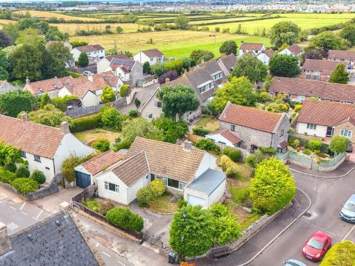 3 bedroom detached bungalow for sale in Main Road, Hutton - EXCITING POTENTIAL!, BS24 — £365,000 • 3 bed • 1 bath • 851 ft²
 2 bedroom bungalow for sale in Vereland Road, Hutton, Weston-super-Mare, Somerset, BS24 — £290,000 • 2 bed • 2 bath • 689 ft²
 2 bedroom semi-detached bungalow for sale in Brent Close, Hutton, Weston-Super-Mare, BS24 — £265,000 • 2 bed • 1 bath • 656 ft²
 3 bedroom bungalow for sale in Haywood Close, Weston-super-Mare, North Somerset, BS24 — £350,000 • 3 bed • 2 bath • 887 ft²
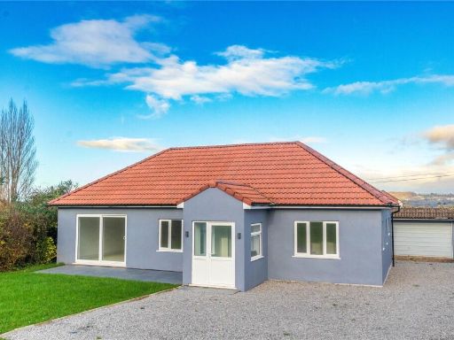 4 bedroom bungalow for sale in Oldmixon Road, Hutton, Weston-super-Mare, Somerset, BS24 — £575,000 • 4 bed • 2 bath • 1590 ft²
Meta
- {
"@context": "https://schema.org",
"@type": "Residence",
"name": "3 bedroom bungalow for sale in Orchard Road, Hutton, Weston…",
"description": "",
"url": "https://propertypiper.co.uk/property/d30d060e-febd-4ba9-a071-8285241908c3",
"image": "https://image-a.propertypiper.co.uk/1bbc959e-21ad-422b-beda-8c55008c7c34-1024.jpeg",
"address": {
"@type": "PostalAddress",
"streetAddress": "15 ORCHARD ROAD HUTTON WESTON-SUPER-MARE",
"postalCode": "BS24 9RX",
"addressLocality": "North Somerset",
"addressRegion": "Weston-Super-Mare",
"addressCountry": "England"
},
"geo": {
"@type": "GeoCoordinates",
"latitude": 51.323255777028585,
"longitude": -2.933344498393631
},
"numberOfRooms": 3,
"numberOfBathroomsTotal": 1,
"floorSize": {
"@type": "QuantitativeValue",
"value": 1045,
"unitCode": "FTK"
},
"offers": {
"@type": "Offer",
"price": 390000,
"priceCurrency": "GBP",
"availability": "https://schema.org/InStock"
},
"additionalProperty": [
{
"@type": "PropertyValue",
"name": "Feature",
"value": "detached"
},
{
"@type": "PropertyValue",
"name": "Feature",
"value": "bungalow"
},
{
"@type": "PropertyValue",
"name": "Feature",
"value": "Mid-20th Century"
},
{
"@type": "PropertyValue",
"name": "Feature",
"value": "single-story"
},
{
"@type": "PropertyValue",
"name": "Feature",
"value": "residential"
},
{
"@type": "PropertyValue",
"name": "Feature",
"value": "suburban"
},
{
"@type": "PropertyValue",
"name": "Feature",
"value": "roof tiles"
},
{
"@type": "PropertyValue",
"name": "Feature",
"value": "garden"
},
{
"@type": "PropertyValue",
"name": "Feature",
"value": "garage"
},
{
"@type": "PropertyValue",
"name": "Feature",
"value": "private driveway"
},
{
"@type": "PropertyValue",
"name": "Feature",
"value": "bungalow"
},
{
"@type": "PropertyValue",
"name": "Feature",
"value": "detached"
},
{
"@type": "PropertyValue",
"name": "Feature",
"value": "single-storey"
},
{
"@type": "PropertyValue",
"name": "Feature",
"value": "mid-century"
},
{
"@type": "PropertyValue",
"name": "Feature",
"value": "residential"
},
{
"@type": "PropertyValue",
"name": "Feature",
"value": "suburban"
},
{
"@type": "PropertyValue",
"name": "Feature",
"value": "garden"
}
]
}
High Res Floorplan Images
Compatible Floorplan Images
FloorplanImages Thumbnail