B91 3QQ - 1 bedroom apartment for sale in Homer Road, Solihull, B91
View on Property Piper
1 bedroom apartment for sale in Homer Road, Solihull, B91
Property Details
- Price: £210000
- Bedrooms: 1
- Bathrooms: 1
- Property Type: undefined
- Property SubType: undefined
Image Descriptions
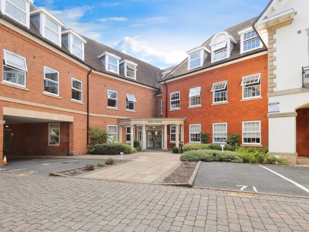
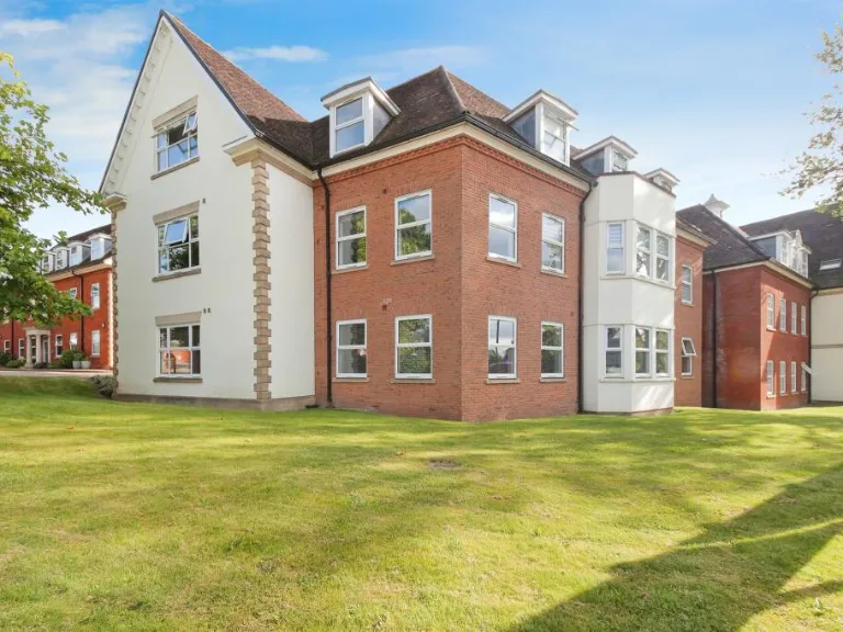
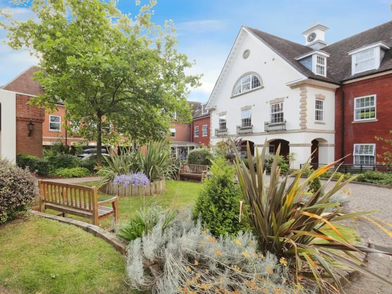
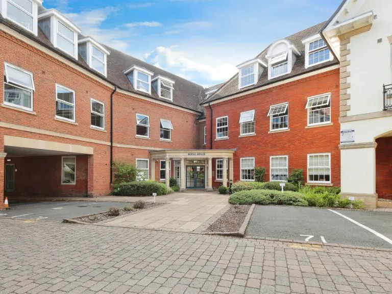
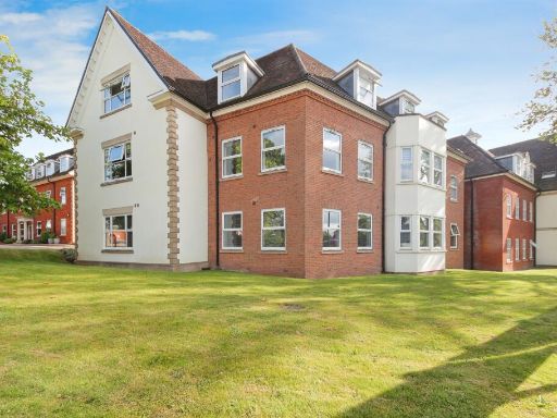
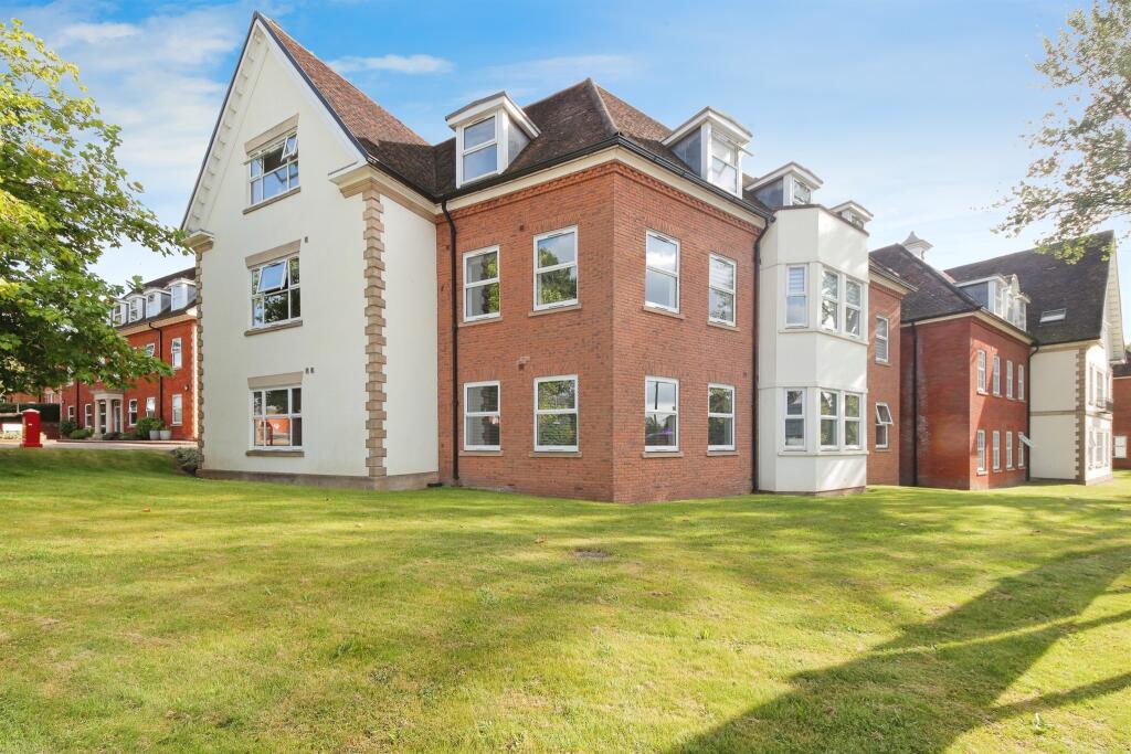
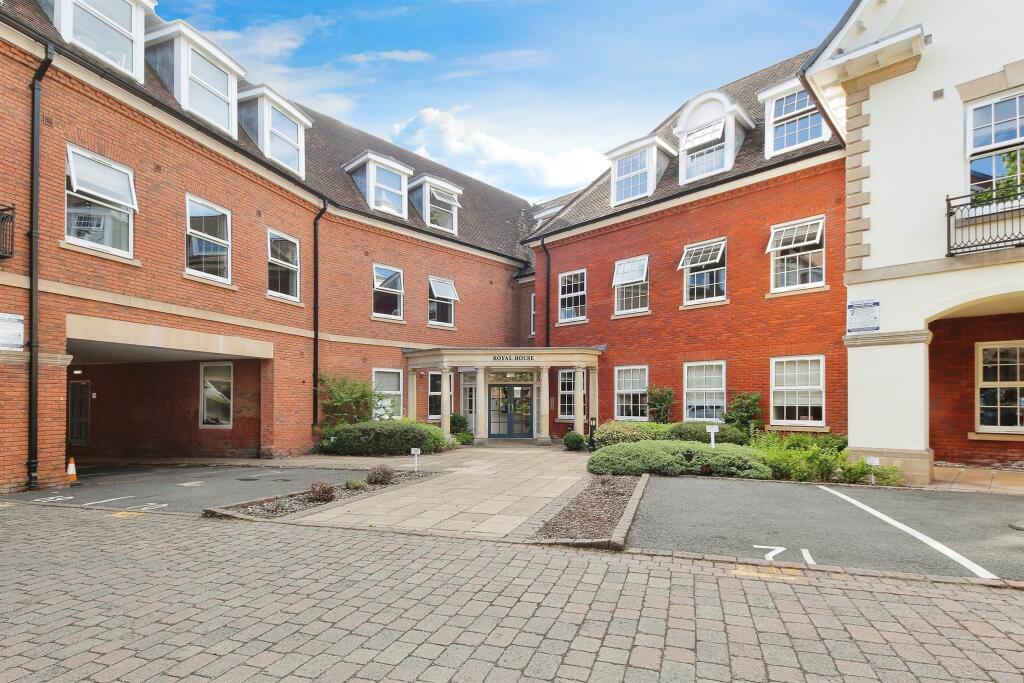
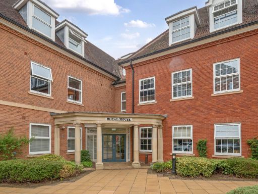
- apartment building modern
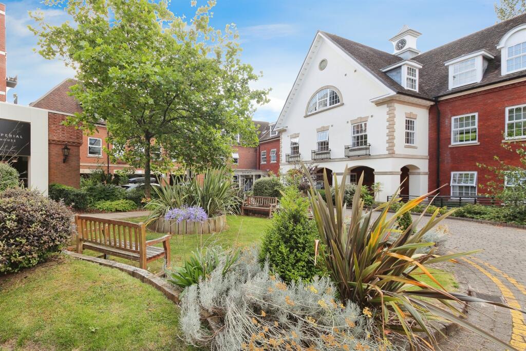
- residential property or housing complex Georgian-inspired
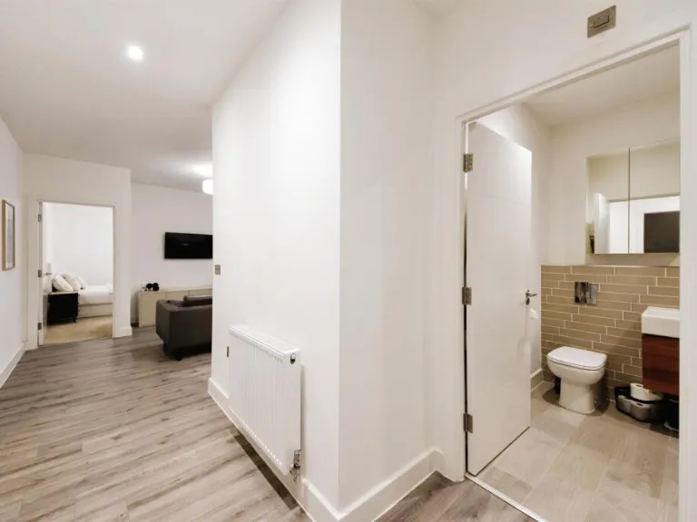
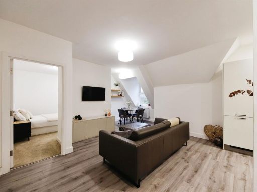
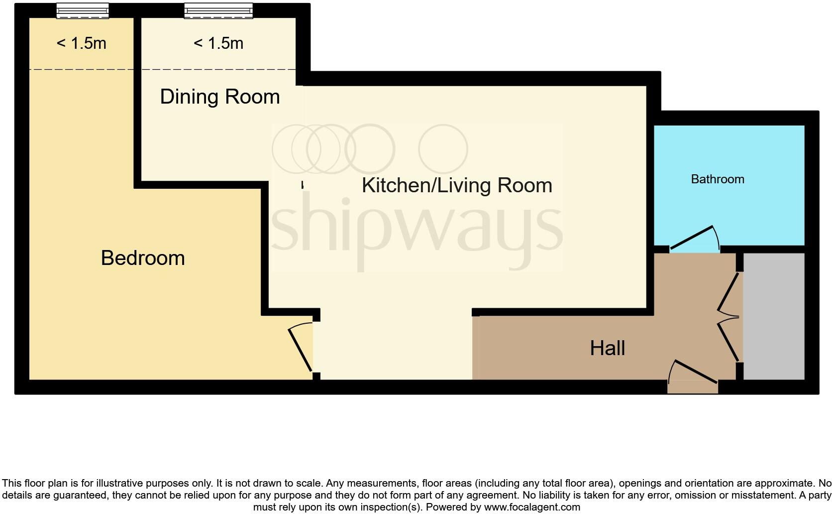
Rooms
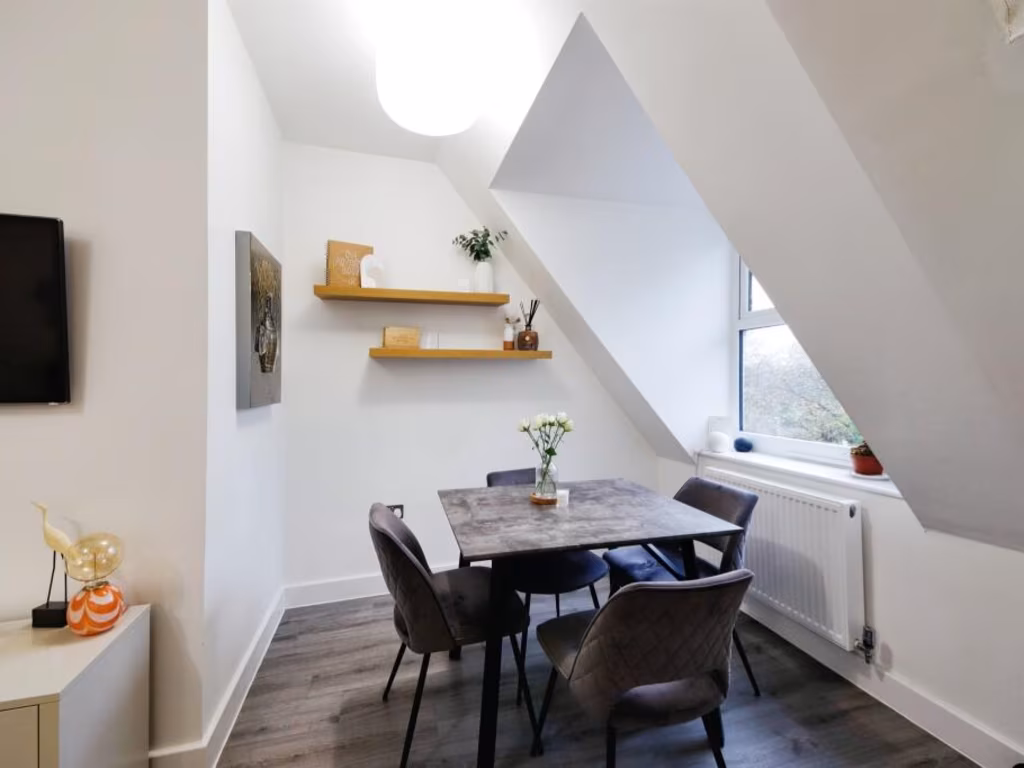
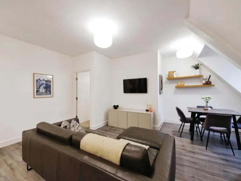
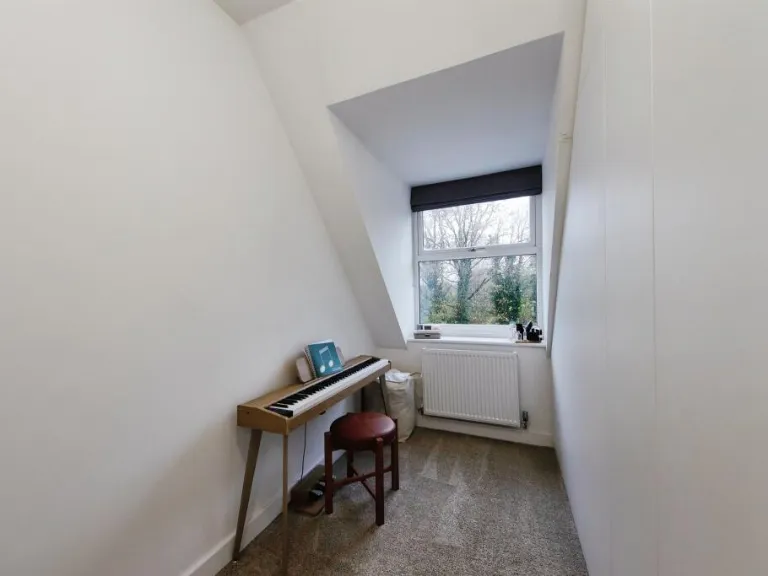
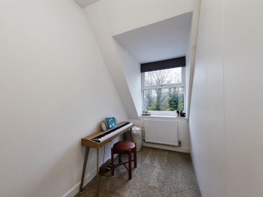
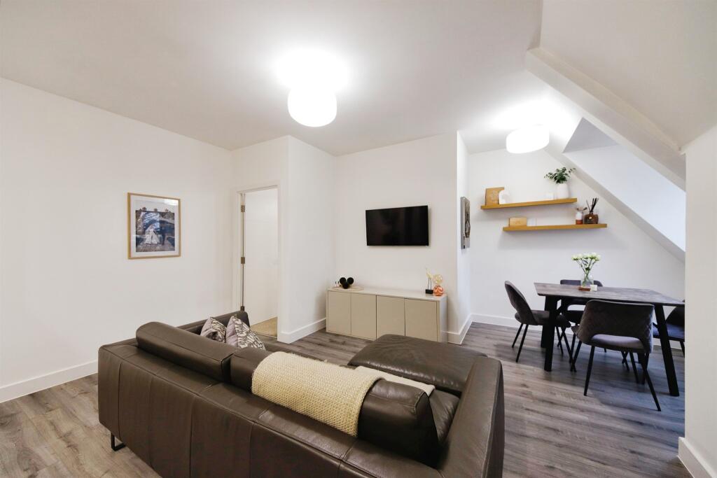
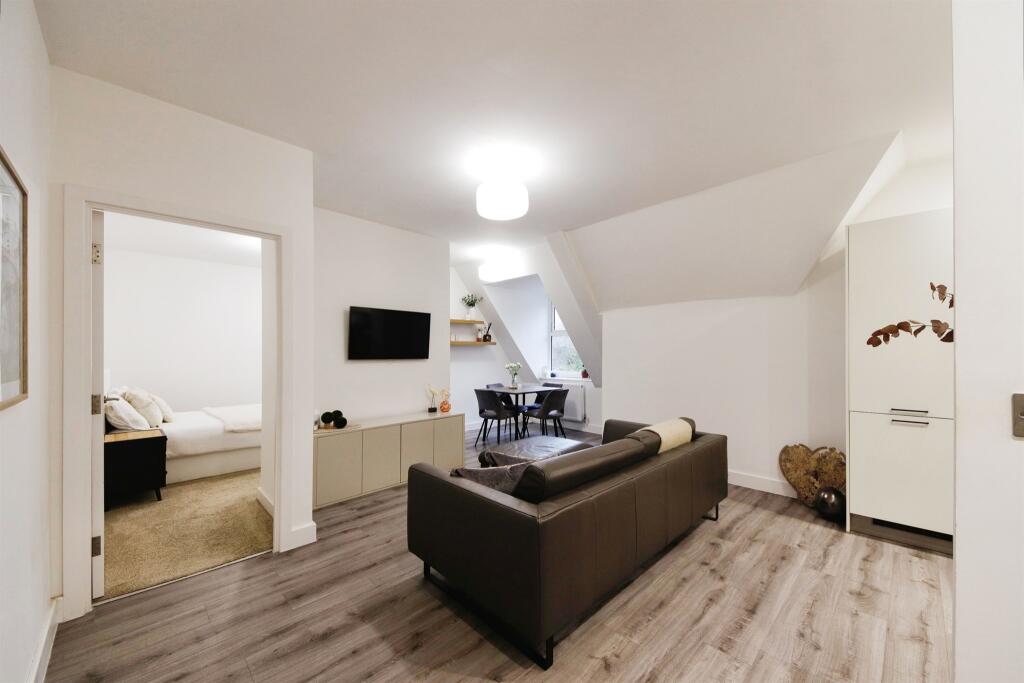
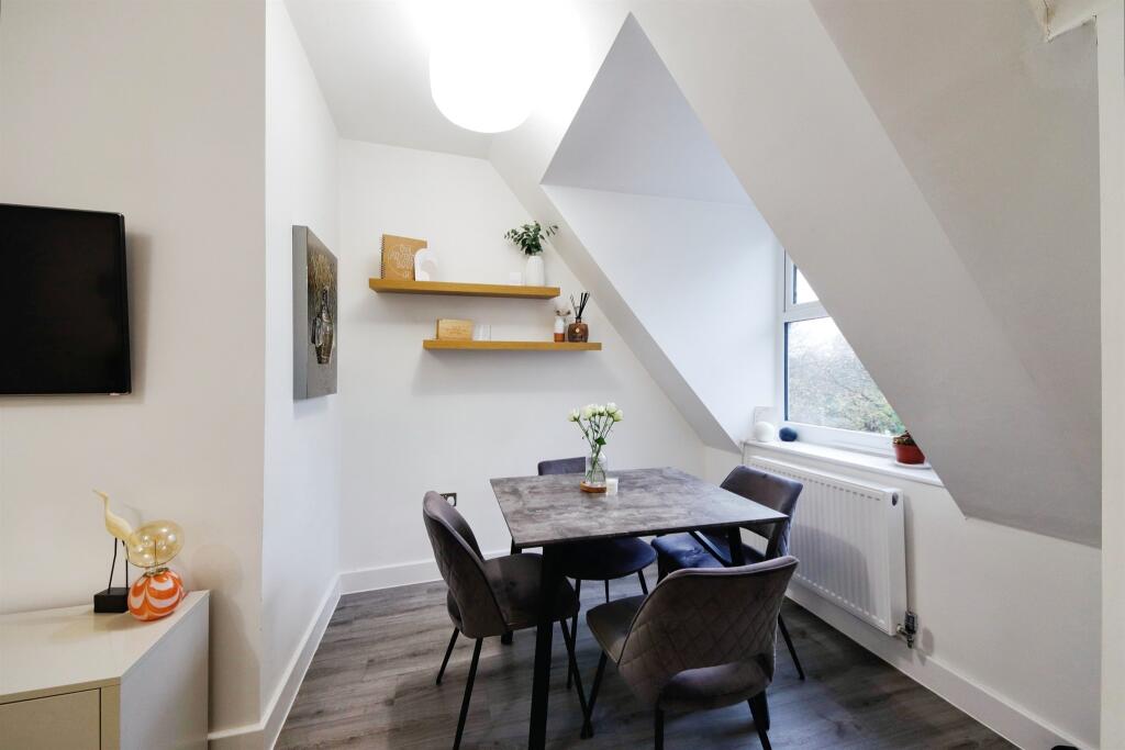
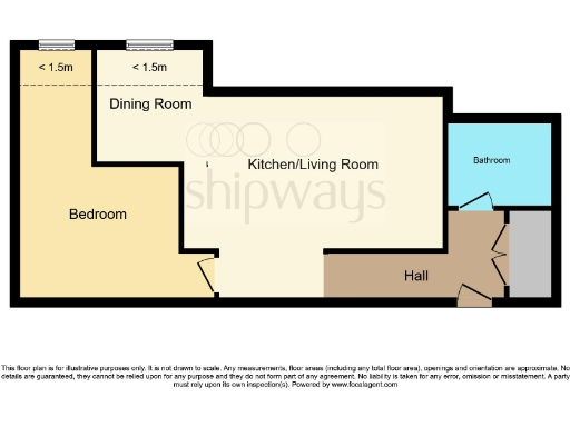
- Dining Room: small
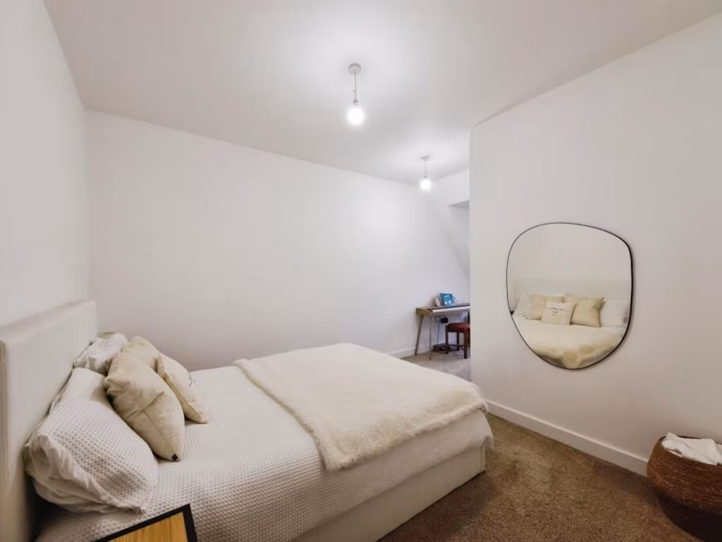
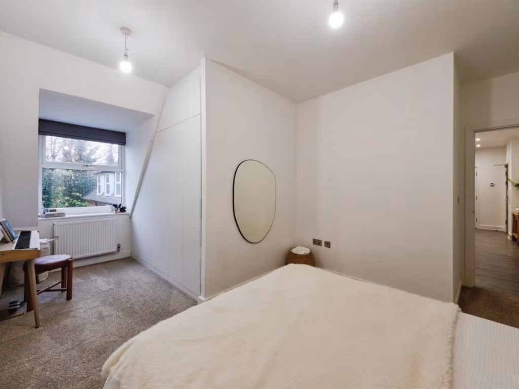
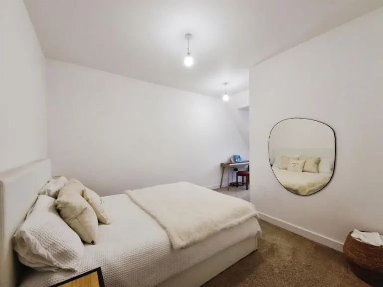
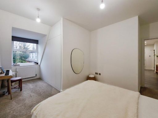
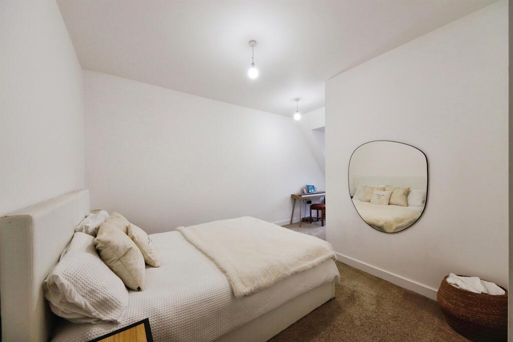
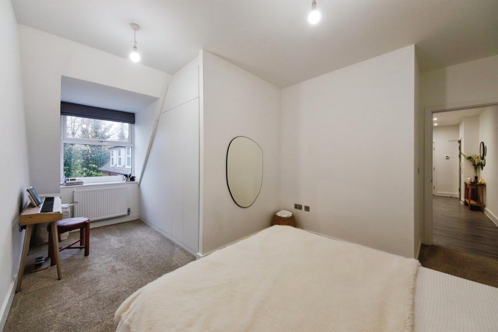
- Bedroom:
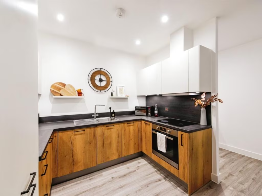
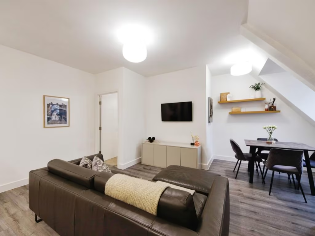
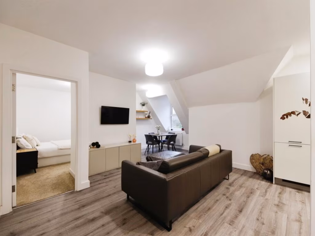
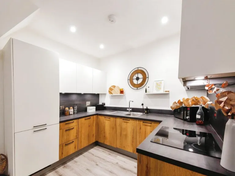
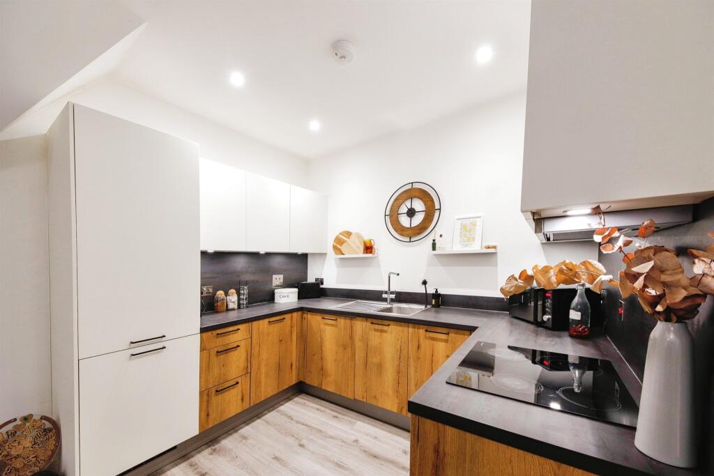
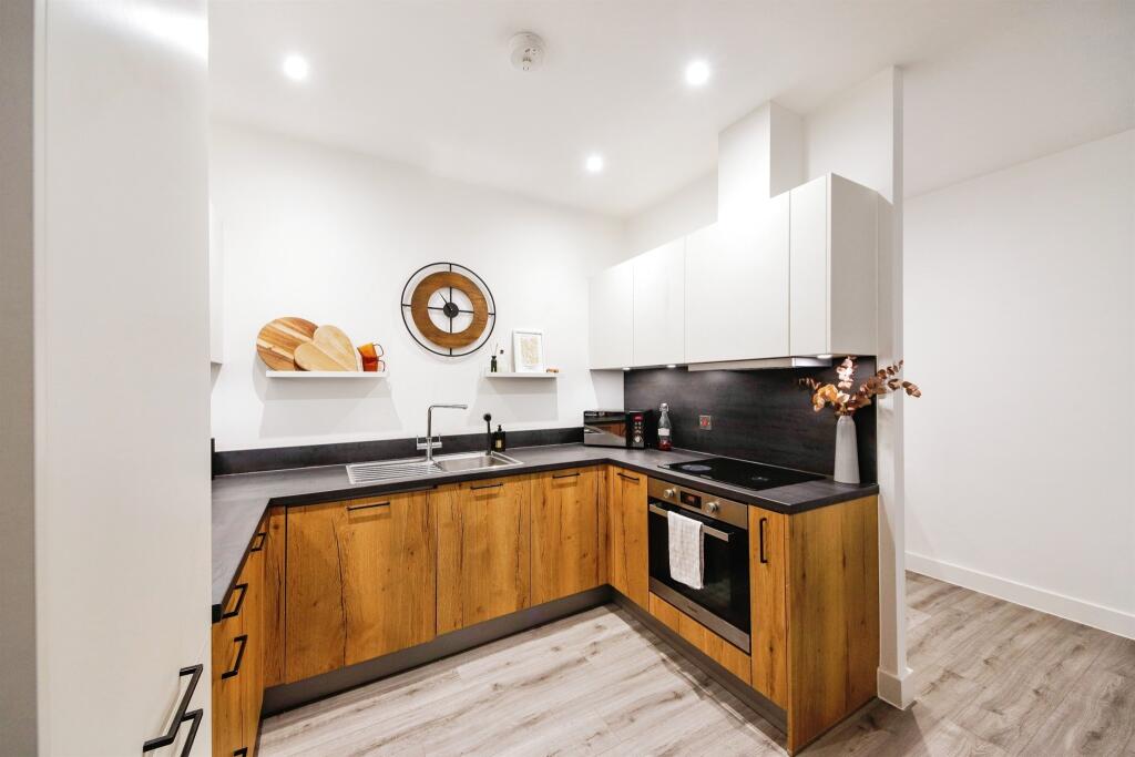
- Kitchen/Living Room:
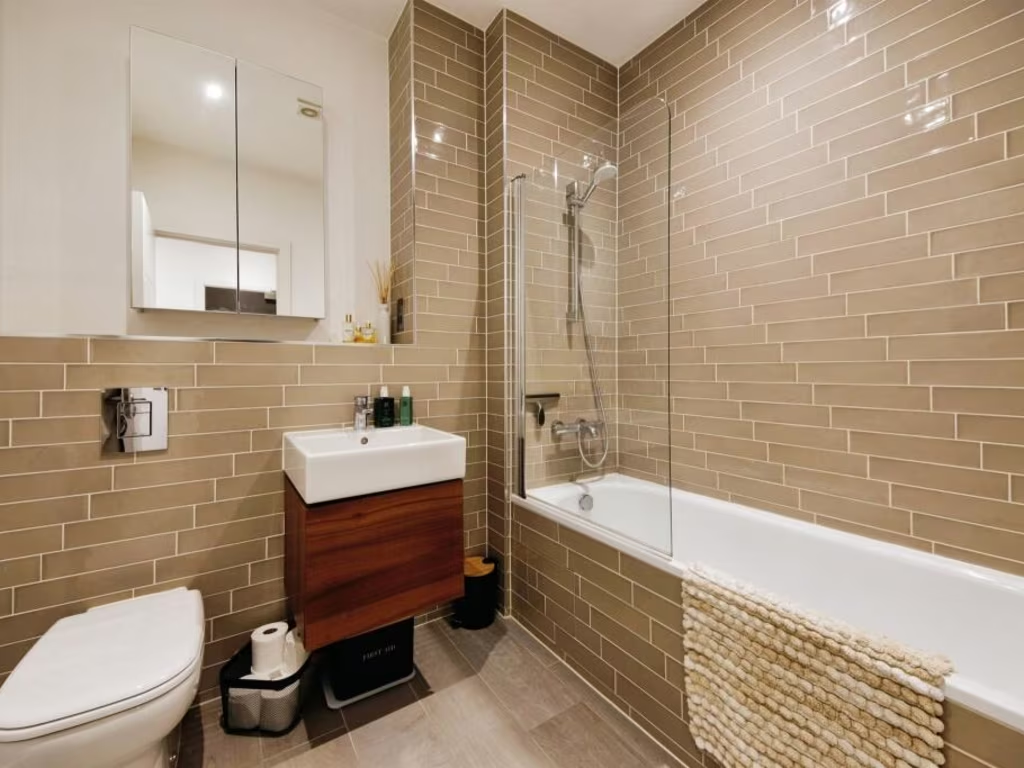
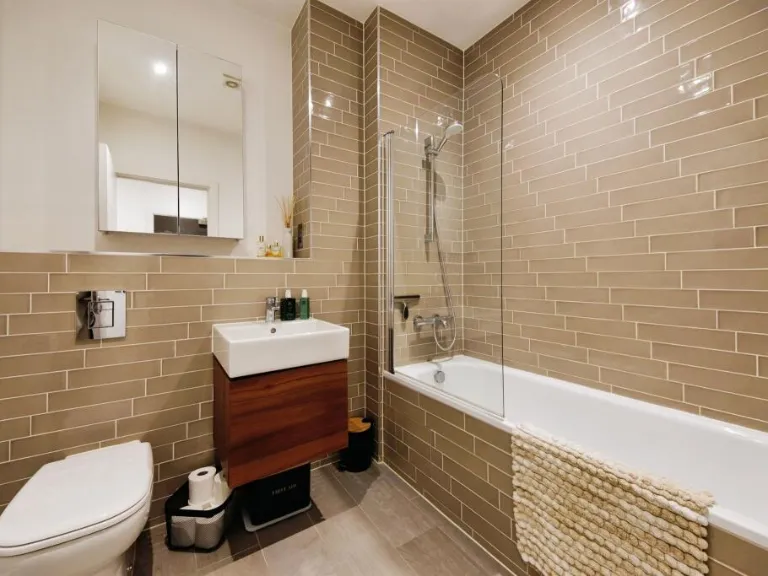
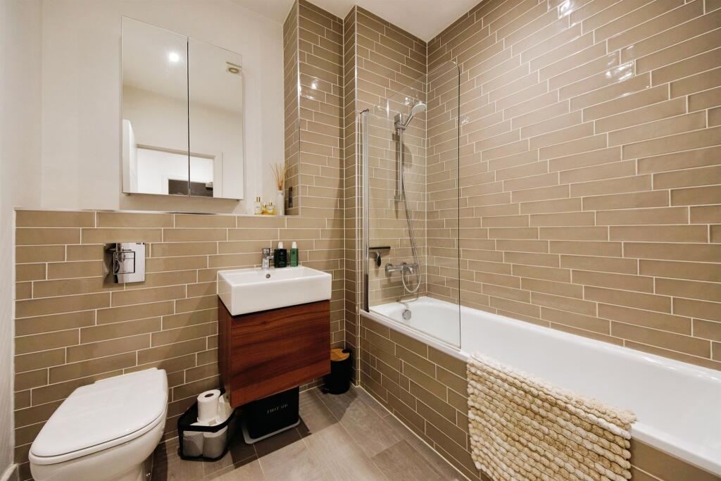
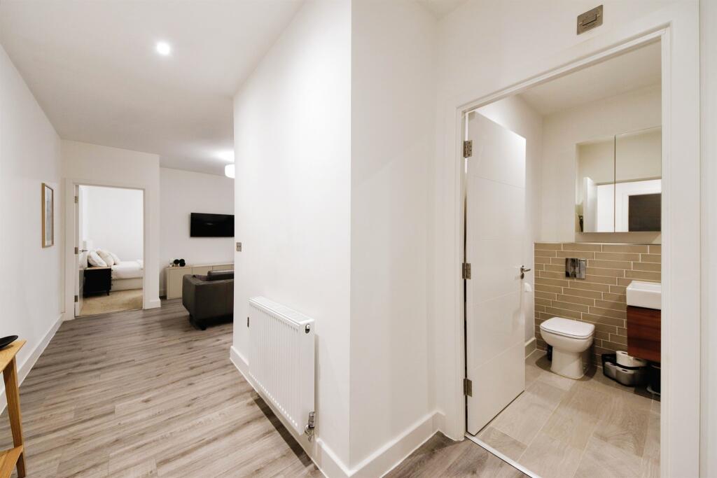
- Bathroom:
Textual Property Features
Detected Visual Features
- modern building
- apartment block
- red brick
- dormer windows
- pitched roof
- large windows
- landscaped lawn
- Georgian-inspired
- residential property
- housing complex
- landscaped garden
- arched windows
- symmetrical design
- traditional architecture
- brick
- modern facilities
EPC Details
- High performance glazing
- Average thermal transmittance 0.47 W/m-¦K
- Community scheme
- Low energy lighting in all fixed outlets
- Average thermal transmittance 0.25 W/m-¦K
Nearby Schools
- Solihull Alternative Provision Academy
- Alderbrook School
- Eversfield Preparatory School
- Lode Heath School
- Coppice Academy
- St Andrew's Catholic Primary School
- Tudor Grange Primary Academy Yew Tree
- Greswold Primary School
- Tudor Grange Primary Academy Langley
- Our Lady of Compassion Catholic Primary School
- St Margaret's Church of England Primary School
- Monkspath Junior and Infant School
- Cranmore Infant School
- Tudor Grange Academy, Solihull
- St Peter's Catholic School
- St Alphege Church of England Junior School
- Blossomfield Infant and Nursery School
- St Alphege Church of England Infant and Nursery School
- Streetsbrook Infant and Early Years Academy
- Ruckleigh School
- Oak Cottage Primary School
- Langley School
- Damson Wood Nursery and Infant School
- Widney Junior School
- St Augustine's Catholic Primary School
- Sharmans Cross Junior School
- Solihull School
- Ulverley School
Nearest Bars And Restaurants
- Id: 4258325863
- Tags:
- Amenity: restaurant
- Name: TurtleBay
- TagsNormalized:
- Lat: 52.4145481
- Lon: -1.7814626
- FullGeoHash: gcqdpmybbgvn
- PartitionGeoHash: gcqd
- Images:
- FoodStandards: null
- Distance: 292.2
,- Id: 3882085840
- Tags:
- Amenity: fast_food
- Name: Smash and Go
- Source: survey
- TagsNormalized:
- Lat: 52.4145725
- Lon: -1.7816722
- FullGeoHash: gcqdpmy9h02z
- PartitionGeoHash: gcqd
- Images:
- FoodStandards: null
- Distance: 278.7
,- Id: 344507360
- Tags:
- Amenity: fast_food
- Brand: Domino's
- Brand:wikidata: Q839466
- Cuisine: pizza
- Name: Domino's
- Source: survey
- Takeaway: yes
- TagsNormalized:
- fast food
- food
- dominos
- pizza
- takeaway
- Lat: 52.4145835
- Lon: -1.781825
- FullGeoHash: gcqdpmy906wc
- PartitionGeoHash: gcqd
- Images:
- FoodStandards: null
- Distance: 268.8
,- Id: 58409821
- Tags:
- Addr:
- City: Solihull
- Postcode: B91 3QE
- Street: Herbert Road
- Amenity: cafe
- Brand: Boston Tea Party
- Brand:wikidata: Q23461358
- Brand:wikipedia: en:Boston Tea Party (café chain)
- Building: yes
- Cuisine: coffee_shop
- Name: Boston Tea Party
- Source: OS_OpenData_StreetView
- Takeaway: yes
- TagsNormalized:
- cafe
- tea
- party
- coffee
- takeaway
- Lat: 52.4136056
- Lon: -1.7821809
- FullGeoHash: gcqdpmw72hjx
- PartitionGeoHash: gcqd
- Images:
- FoodStandards: null
- Distance: 244.5
,- Id: 2620928767
- Tags:
- Amenity: cafe
- Source: survey
- TagsNormalized:
- Lat: 52.4143615
- Lon: -1.7883707
- FullGeoHash: gcqdpm9xzcnj
- PartitionGeoHash: gcqd
- Images:
- FoodStandards: null
- Distance: 183.7
}
Nearest General Shops
- Id: 3882085843
- Tags:
- TagsNormalized:
- Lat: 52.4146656
- Lon: -1.7823691
- FullGeoHash: gcqdpmy1ecc7
- PartitionGeoHash: gcqd
- Images:
- FoodStandards: null
- Distance: 235.3
,- Id: 4675018900
- Tags:
- Name: Newswave
- Shop: newsagent
- Source: survey
- TagsNormalized:
- Lat: 52.4146562
- Lon: -1.7884658
- FullGeoHash: gcqdpmc9t8p5
- PartitionGeoHash: gcqd
- Images:
- FoodStandards: null
- Distance: 198.2
,- Id: 6129372710
- Tags:
- TagsNormalized:
- Lat: 52.4145818
- Lon: -1.7883677
- FullGeoHash: gcqdpmcc040r
- PartitionGeoHash: gcqd
- Images:
- FoodStandards: null
- Distance: 189.3
}
Nearest Grocery shops
- Id: 824607693
- Tags:
- Name: Mills
- Shop: convenience
- Source: survey
- TagsNormalized:
- Lat: 52.4210574
- Lon: -1.7657484
- FullGeoHash: gcqdpyfnz16e
- PartitionGeoHash: gcqd
- Images:
- FoodStandards: null
- Distance: 1559.9
,- Id: 775656419
- Tags:
- Brand: Tesco Express
- Brand:wikidata: Q98456772
- Brand:wikipedia: en:Tesco
- Contact:
- Website: https://www.tesco.com/store-locator/solihull/8-10-hermitage-rd
- Name: Tesco Express
- Shop: convenience
- Source: survey
- TagsNormalized:
- tesco
- tesco express
- convenience
- shop
- Lat: 52.4215964
- Lon: -1.7756509
- FullGeoHash: gcqdpx51bmfd
- PartitionGeoHash: gcqd
- Images:
- FoodStandards: null
- Distance: 1078.6
,- Id: 55219793
- Tags:
- Addr:
- City: Solihull
- Postcode: B91 3AW
- Street: Poplar Road
- Brand: Tesco Express
- Brand:wikidata: Q98456772
- Brand:wikipedia: en:Tesco
- Building: retail
- Contact:
- Website: https://www.tesco.com/store-locator/solihull/1-3-high-street
- Name: Tesco Express
- Shop: convenience
- Source: OS_OpenData_StreetView
- TagsNormalized:
- tesco
- tesco express
- retail
- convenience
- shop
- Lat: 52.4139815
- Lon: -1.7791005
- FullGeoHash: gcqdpt8mxfqd
- PartitionGeoHash: gcqd
- Images:
- FoodStandards: null
- Distance: 447.8
}
Nearest Supermarkets
- Id: 141756878
- Tags:
- Addr:
- City: Solihull
- Postcode: B91 3BX
- Street: Poplar Way
- Brand: Sainsbury's
- Brand:wikidata: Q152096
- Brand:wikipedia: en:Sainsbury's
- Name: Sainsbury's
- Shop: supermarket
- TagsNormalized:
- sainsburys
- supermarket
- shop
- Lat: 52.4140372
- Lon: -1.7780135
- FullGeoHash: gcqdpt9mck9n
- PartitionGeoHash: gcqd
- Images:
- FoodStandards: null
- Distance: 521.4
,- Id: 761175992
- Tags:
- Addr:
- City: Solihull
- Postcode: B91 3QJ
- Street: Homer Road
- Brand: ALDI
- Brand:wikidata: Q41171672
- Brand:wikipedia: en:Aldi
- Building: retail
- Contact:
- Website: https://stores.aldi.co.uk/solihull/homer-road
- Name: ALDI
- Shop: supermarket
- Source: estimate
- Source:addr:postcode: code-point_open
- TagsNormalized:
- aldi
- retail
- supermarket
- shop
- Lat: 52.4127175
- Lon: -1.781245
- FullGeoHash: gcqdpmqyjyxq
- PartitionGeoHash: gcqd
- Images:
- FoodStandards: null
- Distance: 338
,- Id: 426824551
- Tags:
- Addr:
- City: Solihull
- Housenumber: 29
- Postcode: B91 3QG
- Street: Homer Road
- Brand: Waitrose
- Brand:wikidata: Q771734
- Brand:wikipedia: en:Waitrose
- Building: retail
- Name: Waitrose
- Official_name: Waitrose & Partners
- Operator: Waitrose & Partners
- Shop: supermarket
- Source: estimate
- TagsNormalized:
- waitrose
- retail
- supermarket
- shop
- Lat: 52.4132807
- Lon: -1.7826712
- FullGeoHash: gcqdpmtckz8j
- PartitionGeoHash: gcqd
- Images:
- FoodStandards: null
- Distance: 223.9
}
Nearest Religious buildings
- Id: 51014670
- Tags:
- Addr:
- City: Solihull
- Postcode: B91 3RH
- Street: The Square
- Amenity: place_of_worship
- Building: church
- Denomination: anglican
- Heritage: 2
- Heritage:operator: Historic England
- Listed_status: Grade I
- Name: St Alphege Church
- Religion: christian
- Source: visual survey;estimate
- Wikidata: Q3460137
- Wikipedia: en:St. Alphege's Church, Solihull
- TagsNormalized:
- place of worship
- church
- anglican
- christian
- Lat: 52.4113697
- Lon: -1.7759806
- FullGeoHash: gcqdpt4y2eky
- PartitionGeoHash: gcqd
- Images:
- FoodStandards: null
- Distance: 724.9
,- Id: 58409820
- Tags:
- Amenity: place_of_worship
- Building: church
- Denomination: catholic
- Heritage: 2
- Heritage:operator: Historic England
- Listed_status: Grade II
- Name: St Augustine's
- Religion: christian
- TagsNormalized:
- place of worship
- church
- catholic
- christian
- Lat: 52.4138742
- Lon: -1.7812141
- FullGeoHash: gcqdpmwuywqd
- PartitionGeoHash: gcqd
- Images:
- FoodStandards: null
- Distance: 305.2
,- Id: 68587876
- Tags:
- Addr:
- City: Solihull
- Postcode: B91 1LG
- Street: Blossomfield Road
- Amenity: place_of_worship
- Building: yes
- Denomination: methodist
- Name: Solihull Methodist Church
- Religion: christian
- Service_times: Su 10:30,18:30
- Source: visual survey; OS_OpenData_StreetView
- TagsNormalized:
- place of worship
- methodist
- church
- christian
- Lat: 52.4142658
- Lon: -1.7868924
- FullGeoHash: gcqdpmdz4rk6
- PartitionGeoHash: gcqd
- Images:
- FoodStandards: null
- Distance: 83.4
}
Nearest Airports
- Id: 2437117
- Tags:
- Aerodrome: international
- Aerodrome:type: public
- Aeroway: aerodrome
- Ele: 104
- Iata: BHX
- Icao: EGBB
- Internet_access: wlan
- Is_in: Birmingham,England,UK
- Name: Birmingham Airport
- Ref: BHX
- Type: multipolygon
- Website: https://www.birminghamairport.co.uk/
- Wikidata: Q8719
- Wikipedia: en:Birmingham Airport
- TagsNormalized:
- airport
- international airport
- Lat: 52.4543817
- Lon: -1.7468974
- FullGeoHash: gcqf2jpbym6y
- PartitionGeoHash: gcqf
- Images:
- FoodStandards: null
- Distance: 5196.5
}
Nearest Leisure Facilities
- Id: 2752860
- Tags:
- Leisure: track
- Sport: athletics
- Type: multipolygon
- TagsNormalized:
- track
- leisure
- athletic
- athletics
- sports
- Lat: 52.4115019
- Lon: -1.7894524
- FullGeoHash: gcqdpm0znspd
- PartitionGeoHash: gcqd
- Images:
- FoodStandards: null
- Distance: 383.2
,- Id: 338157079
- Tags:
- Leisure: pitch
- Sport: soccer
- TagsNormalized:
- Lat: 52.411542
- Lon: -1.7893273
- FullGeoHash: gcqdpm1p3esf
- PartitionGeoHash: gcqd
- Images:
- FoodStandards: null
- Distance: 374.2
,- Id: 256423608
- Tags:
- Access: private
- Leisure: swimming_pool
- Source: bing
- TagsNormalized:
- swimming
- swimming pool
- pool
- leisure
- Lat: 52.4139703
- Lon: -1.7904978
- FullGeoHash: gcqdpm8jw2hp
- PartitionGeoHash: gcqd
- Images:
- FoodStandards: null
- Distance: 325.5
,- Id: 3882085845
- Tags:
- Leisure: tanning_salon
- Name: Indigo Sun
- TagsNormalized:
- tanning
- tanning salon
- leisure
- Lat: 52.4146043
- Lon: -1.7819411
- FullGeoHash: gcqdpmy3jy2m
- PartitionGeoHash: gcqd
- Images:
- FoodStandards: null
- Distance: 261.7
,- Id: 58409973
- Tags:
- Building: yes
- Leisure: sports_centre
- Name: Tudor Grange Leisure Centre
- Source: OS_OpenData_StreetView
- TagsNormalized:
- sports
- sports centre
- leisure
- Lat: 52.4124717
- Lon: -1.7883352
- FullGeoHash: gcqdpm3ubbbs
- PartitionGeoHash: gcqd
- Images:
- FoodStandards: null
- Distance: 252.6
}
Nearest Tourist attractions
- Id: 89804510
- Tags:
- Addr:
- City: Solihull
- Housenumber: 99
- Postcode: B91 2DQ
- Street: Buryfield Road
- Building: residential
- Fhrs:
- Guest_house: bed_and_breakfast
- Name: Acers
- Tourism: guest_house
- TagsNormalized:
- residential
- guest house
- tourism
- Lat: 52.4250965
- Lon: -1.7873962
- FullGeoHash: gcqdprdqqdkc
- PartitionGeoHash: gcqd
- Images:
- FoodStandards: null
- Distance: 1230.5
,- Id: 452720048
- Tags:
- Addr:
- City: Solihull
- Country: GB
- Housenumber: 56
- Postcode: B91 2AW
- Street: Lode Lane
- Building: yes
- Fhrs:
- Name: Ravenhusrt Guest House
- Source: OS_OpenData_StreetView
- Tourism: guest_house
- TagsNormalized:
- Lat: 52.4199385
- Lon: -1.7757213
- FullGeoHash: gcqdpwfbq8y1
- PartitionGeoHash: gcqd
- Images:
- FoodStandards: null
- Distance: 939.5
,- Id: 9095232790
- Tags:
- Addr:
- City: Solihull
- Housenumber: 654
- Postcode: B91 1LB
- Street: Streetsbrook Road
- Fhrs:
- Guest_house: bed_and_breakfast
- Name: Station Approach Bed and Breakfast
- Tourism: guest_house
- TagsNormalized:
- Lat: 52.4149866
- Lon: -1.7859462
- FullGeoHash: gcqdpmge2mtv
- PartitionGeoHash: gcqd
- Images:
- FoodStandards: null
- Distance: 102.3
}
Nearest Train stations
- Id: 7272762974
- Tags:
- Name: Acocks Green
- Naptan:
- Network: National Rail
- Not:
- Public_transport: station
- Railway: station
- Ref:
- Uic_ref: 7000027
- West_midlands_fare_zone: 3
- Wheelchair: yes
- Wikidata: Q2136949
- Wikipedia: en:Acocks Green railway station
- TagsNormalized:
- Lat: 52.4495299
- Lon: -1.8192378
- FullGeoHash: gcqdqs5k8tjb
- PartitionGeoHash: gcqd
- Images:
- FoodStandards: null
- Distance: 4550.7
,- Id: 8485791831
- Tags:
- Name: Shirley
- Naptan:
- Network: National Rail
- Public_transport: station
- Railway: station
- Ref:
- Source: survey
- West_midlands_fare_zone: 4
- Wikidata: Q1815915
- Wikipedia: en:Shirley railway station (England)
- TagsNormalized:
- Lat: 52.4035742
- Lon: -1.8451962
- FullGeoHash: gcqdn5b2gy3b
- PartitionGeoHash: gcqd
- Images:
- FoodStandards: null
- Distance: 4201.2
,- Id: 8375479369
- Tags:
- Name: Olton
- Naptan:
- Network: National Rail
- Platforms: 2
- Public_transport: station
- Railway: station
- Ref:
- West_midlands_fare_zone: 4
- Wikidata: Q4314461
- Wikipedia: en:Olton railway station
- TagsNormalized:
- Lat: 52.4384167
- Lon: -1.804385
- FullGeoHash: gcqdqfn5fv35
- PartitionGeoHash: gcqd
- Images:
- FoodStandards: null
- Distance: 2988.1
,- Id: 20983015
- Tags:
- Name: Widney Manor
- Naptan:
- Network: National Rail
- Public_transport: station
- Railway: station
- Ref:
- West_midlands_fare_zone: 4
- Wikidata: Q2079928
- Wikipedia: en:Widney Manor railway station
- TagsNormalized:
- Lat: 52.3962802
- Lon: -1.7743426
- FullGeoHash: gcqdpd7yqyd3
- PartitionGeoHash: gcqd
- Images:
- FoodStandards: null
- Distance: 2123.8
,- Id: 20984161
- Tags:
- Name: Solihull
- Naptan:
- Network: National Rail
- Public_transport: station
- Railway: station
- Ref:
- West_midlands_fare_zone: 4
- Wikidata: Q7558107
- Wikipedia: en:Solihull railway station
- TagsNormalized:
- Lat: 52.4146286
- Lon: -1.7888672
- FullGeoHash: gcqdpmc3k6gy
- PartitionGeoHash: gcqd
- Images:
- FoodStandards: null
- Distance: 223.2
}
Nearest Hotels
- Id: 58411058
- Tags:
- Addr:
- City: Solihull
- Country: GB
- Housenumber: 651
- Postcode: B91 1AT
- Street: Warwick Road
- Building: yes
- Fhrs:
- Name: St John's Hotel
- Source: OS_OpenData_StreetView
- Tourism: hotel
- TagsNormalized:
- Lat: 52.4168269
- Lon: -1.7802666
- FullGeoHash: gcqdpqpwhu9p
- PartitionGeoHash: gcqd
- Images:
- FoodStandards: null
- Distance: 478.8
,- Id: 665563133
- Tags:
- Addr:
- City: Solihull
- Housename: Sapphire Court
- Postcode: B91 1QY
- Street: Streetsbrook Road
- Brand: Travelodge
- Brand:wikidata: Q9361374
- Brand:wikipedia: en:Travelodge UK
- Building: yes
- Fhrs:
- Internet_access: wlan
- Internet_access:fee: customers
- Internet_access:ssid: Travelodge WiFi
- Name: Travelodge
- Source: bing
- Tourism: hotel
- TagsNormalized:
- Lat: 52.4163704
- Lon: -1.7903309
- FullGeoHash: gcqdpq076r8s
- PartitionGeoHash: gcqd
- Images:
- FoodStandards: null
- Distance: 404.4
,- Id: 256429089
- Tags:
- Addr:
- City: Solihull
- Country: GB
- Housenumber: 68
- Postcode: B91 3RX
- Street: Station Road
- Brand: Premier Inn
- Brand:wikidata: Q2108626
- Brand:wikipedia: en:Premier Inn
- Building: yes
- Fhrs:
- Internet_access: wlan
- Internet_access:fee: customers
- Internet_access:operator: Virgin Media
- Internet_access:ssid: Premier Inn Free Wi-Fi
- Name: Premier Inn
- Tourism: hotel
- TagsNormalized:
- Lat: 52.4148538
- Lon: -1.781808
- FullGeoHash: gcqdpmyd8ugt
- PartitionGeoHash: gcqd
- Images:
- FoodStandards: null
- Distance: 277.8
}
Tags
- modern building
- apartment block
- red brick
- dormer windows
- pitched roof
- large windows
- landscaped lawn
- Georgian-inspired
- residential property
- housing complex
- landscaped garden
- arched windows
- symmetrical design
- traditional architecture
- brick
- modern facilities
Local Market Stats
- Average Price/sqft: £383
- Avg Income: £56100
- Rental Yield: 3.5%
- Social Housing: 3%
- Planning Success Rate: 96%
AirBnB Data
- 1km average: £85/night
- Listings in 1km: 7
Similar Properties
 2 bedroom apartment for sale in Royal House, Princes Gate 2-6, Homer Road, Solihull, B91 — £275,000 • 2 bed • 1 bath • 867 ft²
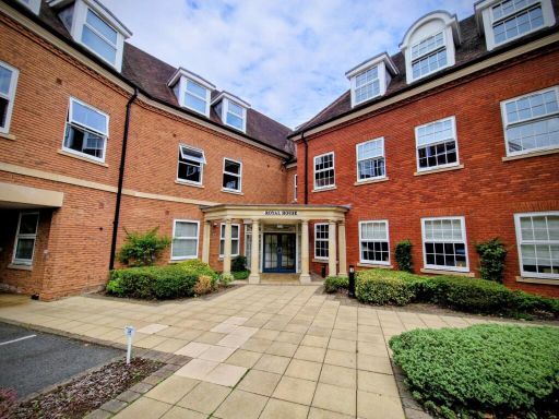 1 bedroom flat for sale in Homer Road, Solihull, West Midlands, B91 — £200,000 • 1 bed • 1 bath • 479 ft²
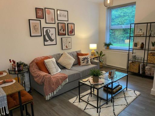 1 bedroom apartment for sale in Princes Gate, Solihull, B91 3QQ, B91 — £225,000 • 1 bed • 1 bath • 603 ft²
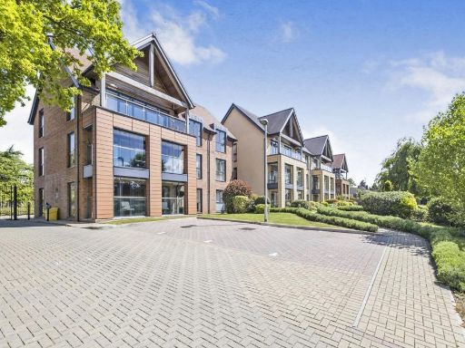 2 bedroom retirement property for sale in Warwick Road, Solihull, B91 — £350,000 • 2 bed • 2 bath • 1271 ft²
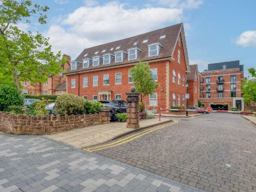 1 bedroom flat for sale in Homer Road, Solihull, B91 — £180,000 • 1 bed • 1 bath • 380 ft²
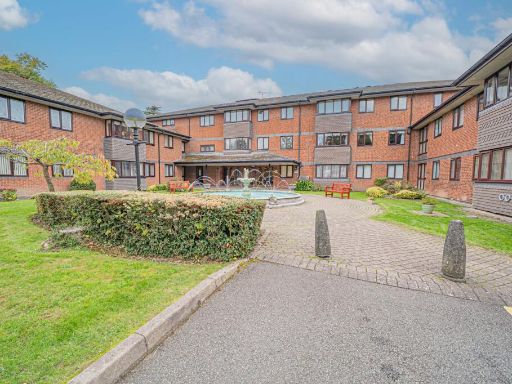 1 bedroom apartment for sale in Lode Lane, Solihull, B91 — £85,000 • 1 bed • 1 bath • 549 ft²
Meta
- {
"@context": "https://schema.org",
"@type": "Residence",
"name": "1 bedroom apartment for sale in Homer Road, Solihull, B91",
"description": "",
"url": "https://propertypiper.co.uk/property/d1abf28e-f7f4-47ac-92a9-c368a35b7f89",
"image": "https://image-a.propertypiper.co.uk/07b881b7-e9c5-4f43-981f-042c8a315f00-1024.jpeg",
"address": {
"@type": "PostalAddress",
"streetAddress": "APARTMENT 41 ROYAL HOUSE, PRINCES GATE, 2-6, HOMER ROAD",
"postalCode": "B91 3QQ",
"addressLocality": "Solihull",
"addressRegion": "Solihull",
"addressCountry": "England"
},
"geo": {
"@type": "GeoCoordinates",
"latitude": 52.41407853867729,
"longitude": -1.7857015451145624
},
"numberOfRooms": 1,
"numberOfBathroomsTotal": 1,
"floorSize": {
"@type": "QuantitativeValue",
"value": 765,
"unitCode": "FTK"
},
"offers": {
"@type": "Offer",
"price": 210000,
"priceCurrency": "GBP",
"availability": "https://schema.org/InStock"
},
"additionalProperty": [
{
"@type": "PropertyValue",
"name": "Feature",
"value": "modern building"
},
{
"@type": "PropertyValue",
"name": "Feature",
"value": "apartment block"
},
{
"@type": "PropertyValue",
"name": "Feature",
"value": "red brick"
},
{
"@type": "PropertyValue",
"name": "Feature",
"value": "dormer windows"
},
{
"@type": "PropertyValue",
"name": "Feature",
"value": "pitched roof"
},
{
"@type": "PropertyValue",
"name": "Feature",
"value": "large windows"
},
{
"@type": "PropertyValue",
"name": "Feature",
"value": "landscaped lawn"
},
{
"@type": "PropertyValue",
"name": "Feature",
"value": "Georgian-inspired"
},
{
"@type": "PropertyValue",
"name": "Feature",
"value": "residential property"
},
{
"@type": "PropertyValue",
"name": "Feature",
"value": "housing complex"
},
{
"@type": "PropertyValue",
"name": "Feature",
"value": "landscaped garden"
},
{
"@type": "PropertyValue",
"name": "Feature",
"value": "arched windows"
},
{
"@type": "PropertyValue",
"name": "Feature",
"value": "symmetrical design"
},
{
"@type": "PropertyValue",
"name": "Feature",
"value": "traditional architecture"
},
{
"@type": "PropertyValue",
"name": "Feature",
"value": "brick"
},
{
"@type": "PropertyValue",
"name": "Feature",
"value": "modern facilities"
}
]
}
High Res Floorplan Images
Compatible Floorplan Images
FloorplanImages Thumbnail