SS3 9FD - 5 bedroom detached house for sale in Gunners Rise, Shoebury…
View on Property Piper
5 bedroom detached house for sale in Gunners Rise, Shoebury Garrison, SS3
Property Details
- Price: £850000
- Bedrooms: 5
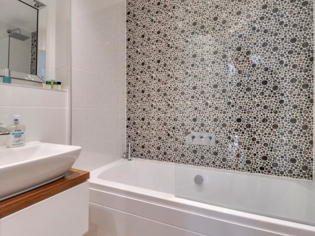
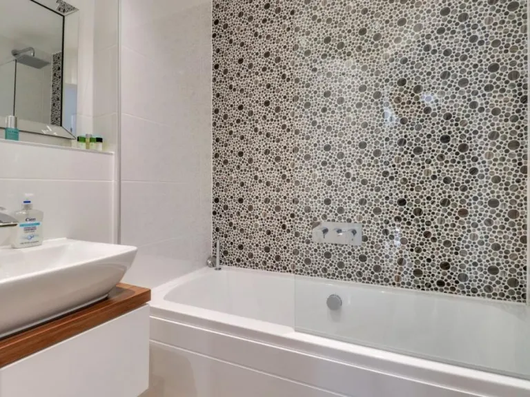
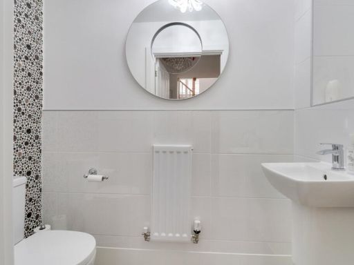
- Bathrooms: 3
- Property Type: undefined
- Property SubType: undefined
Brochure Descriptions
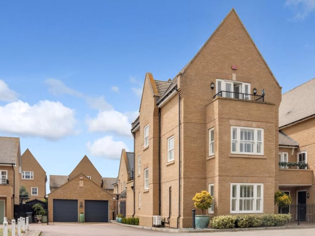
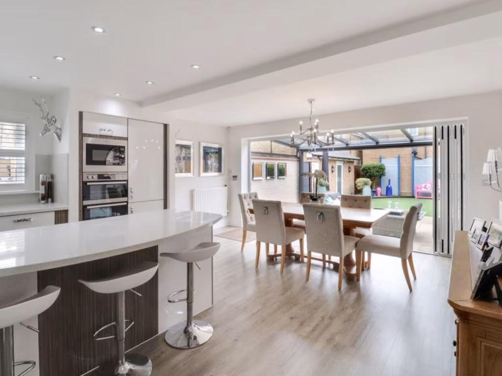
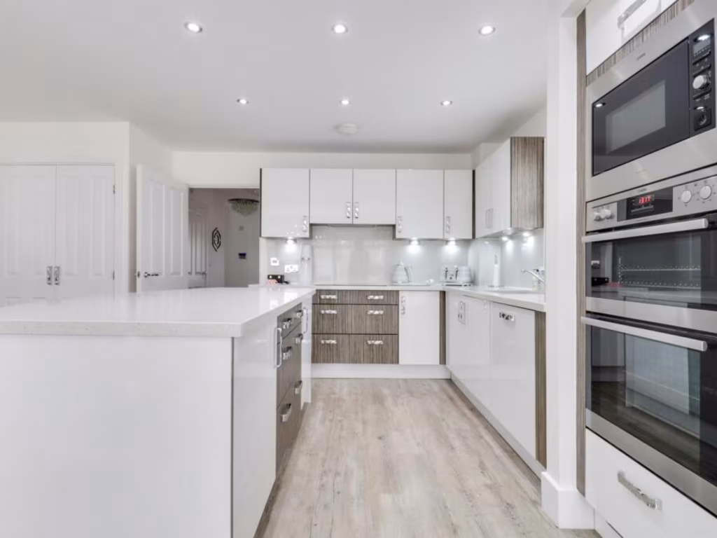
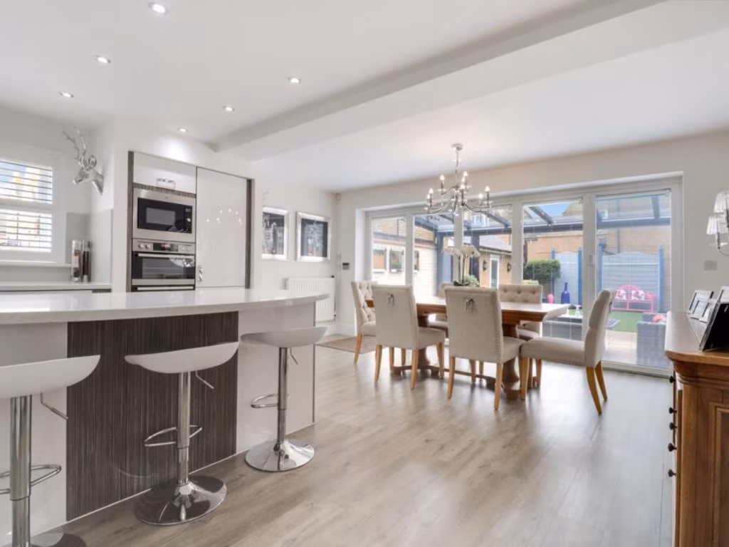
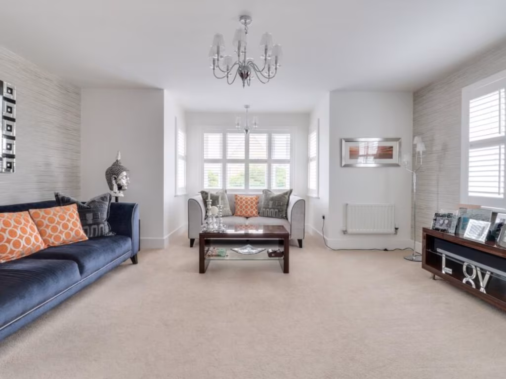
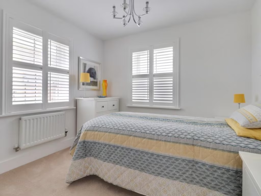
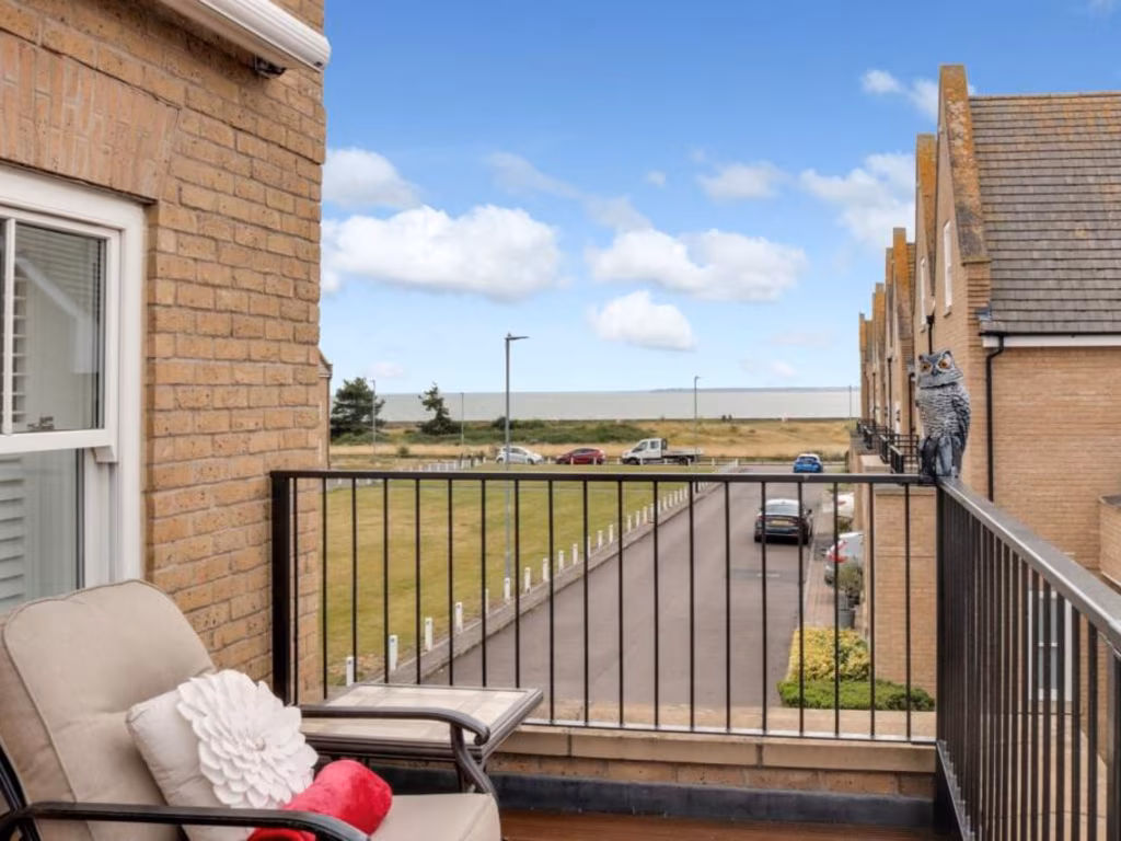
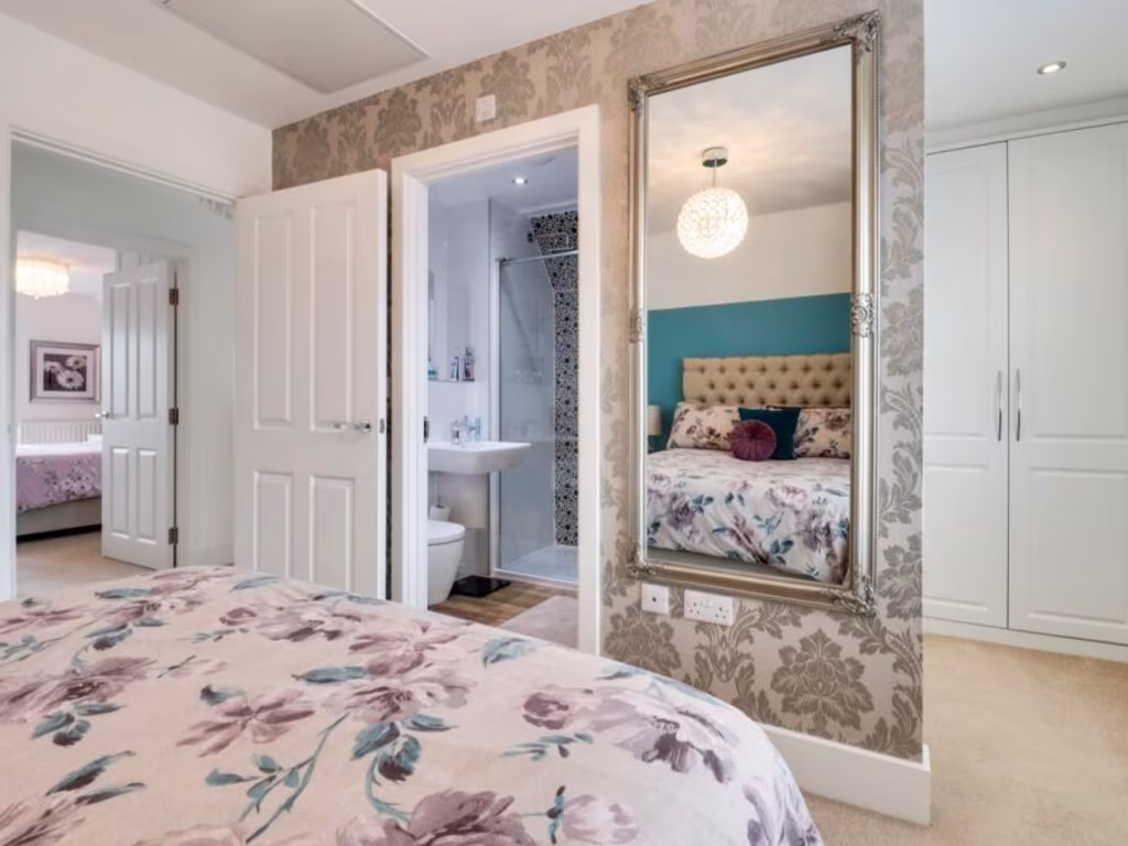
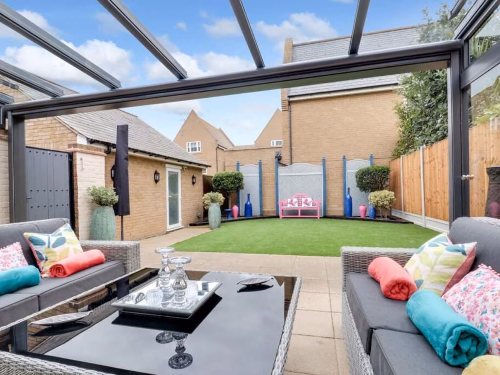
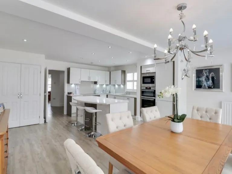
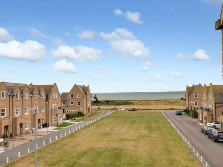
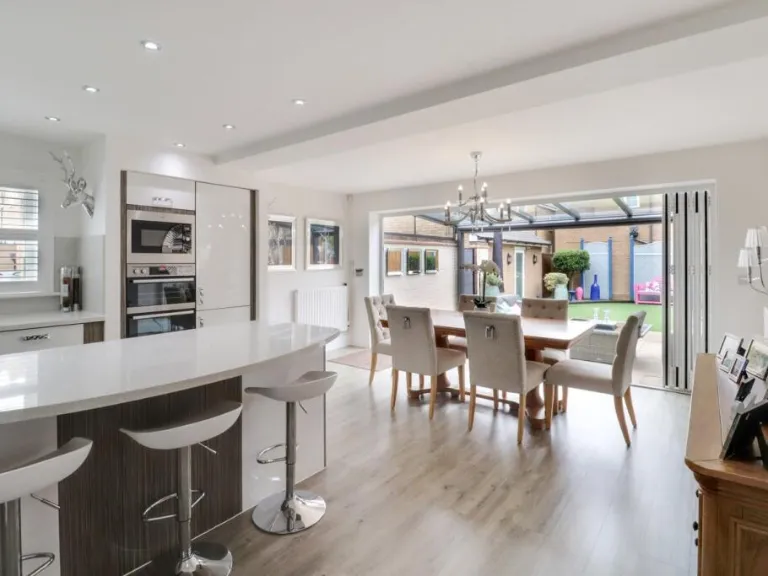
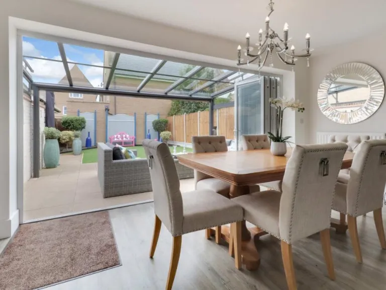
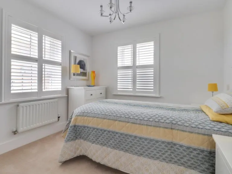
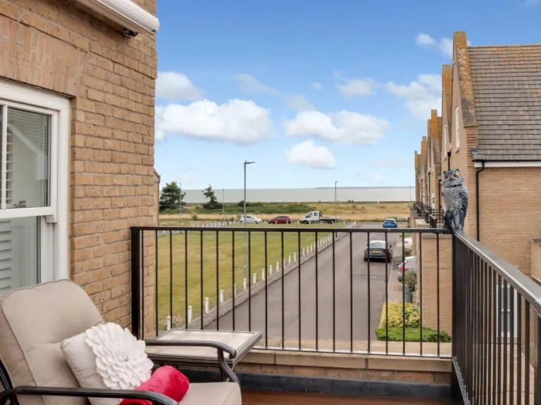
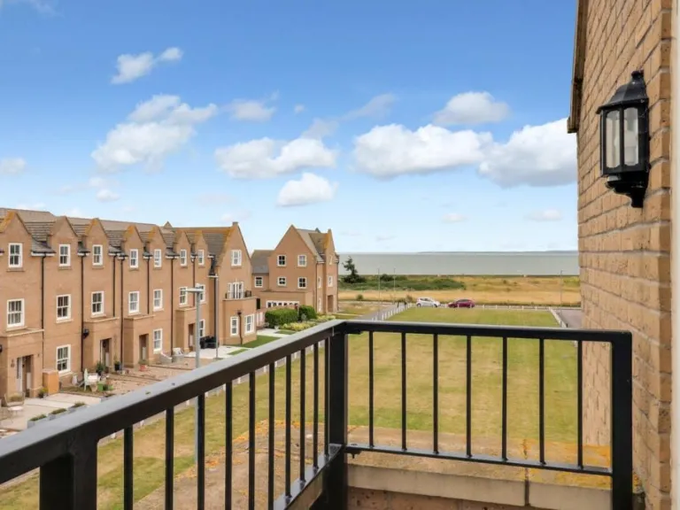
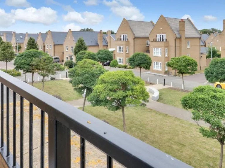
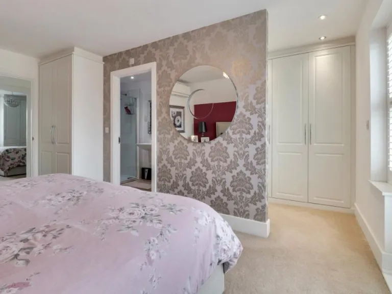
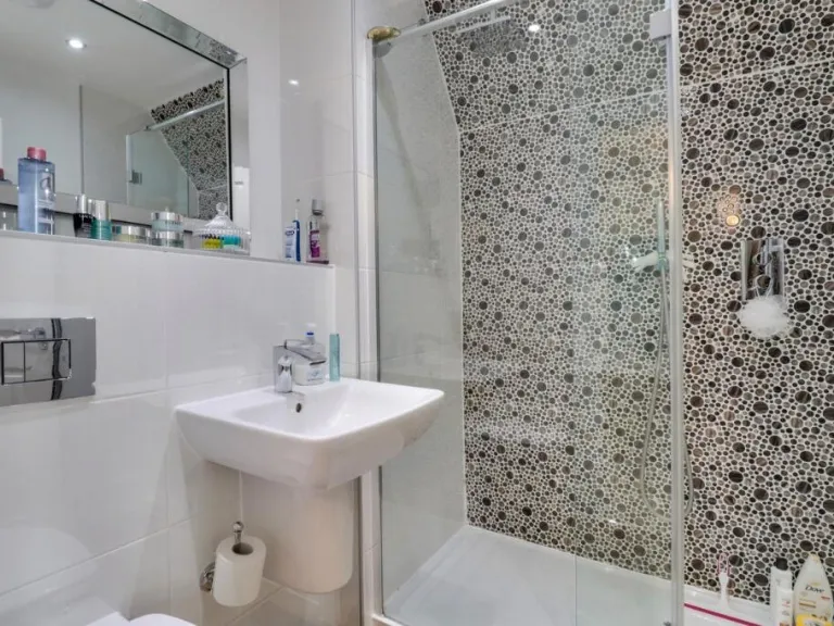
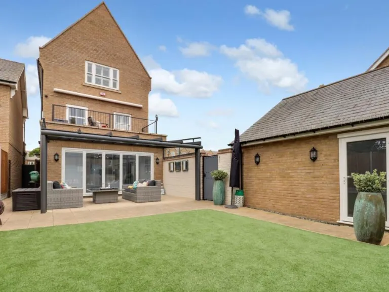
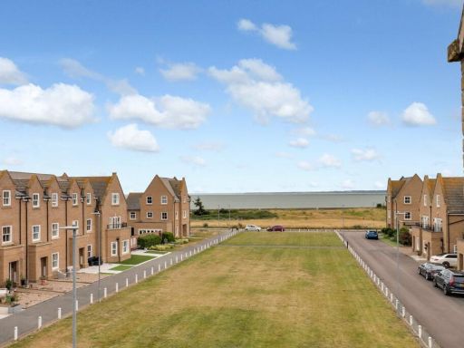
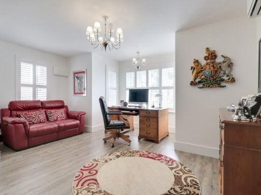
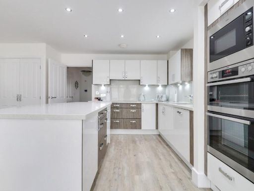
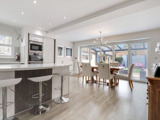
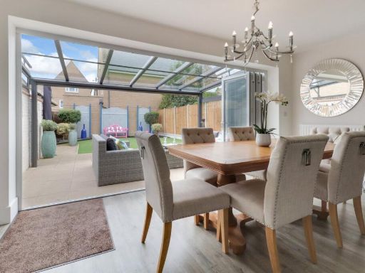
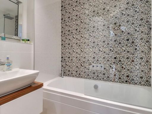
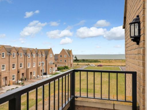
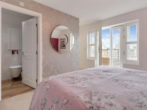
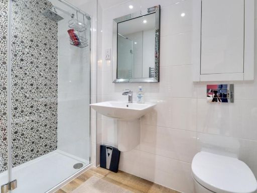
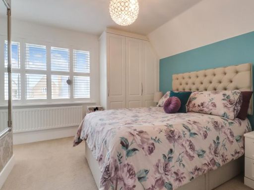
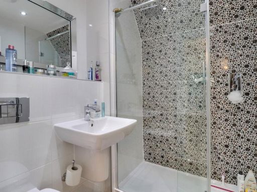
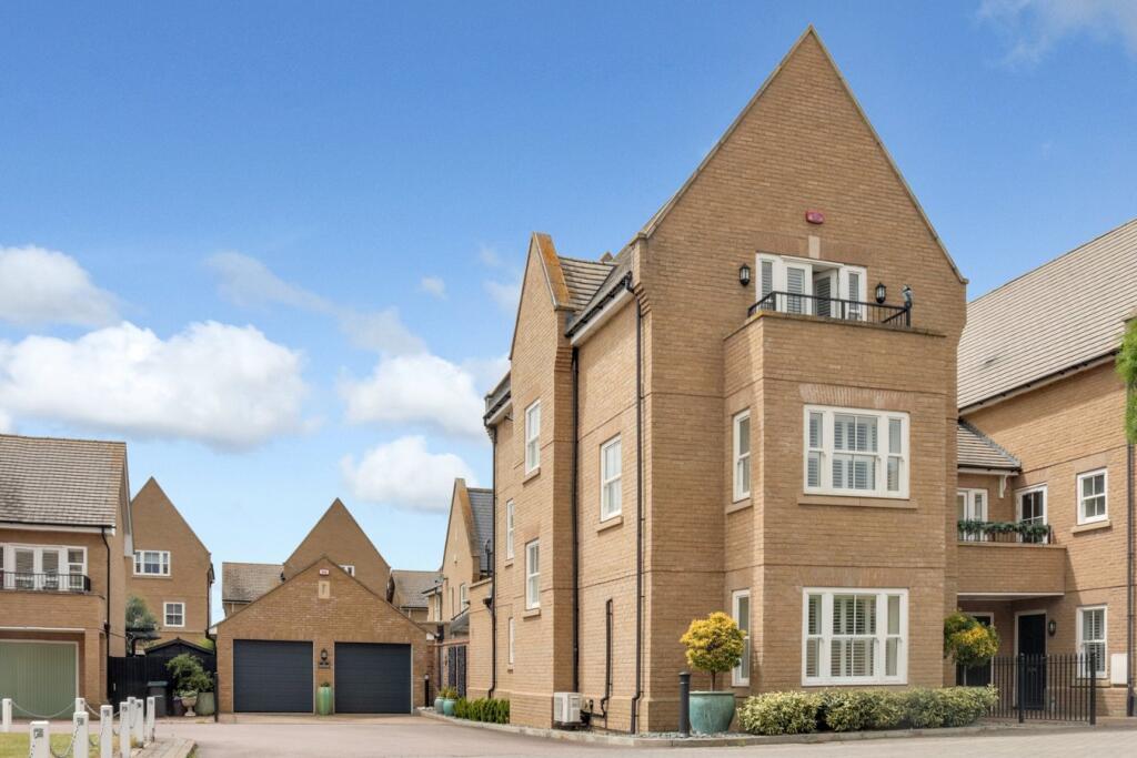
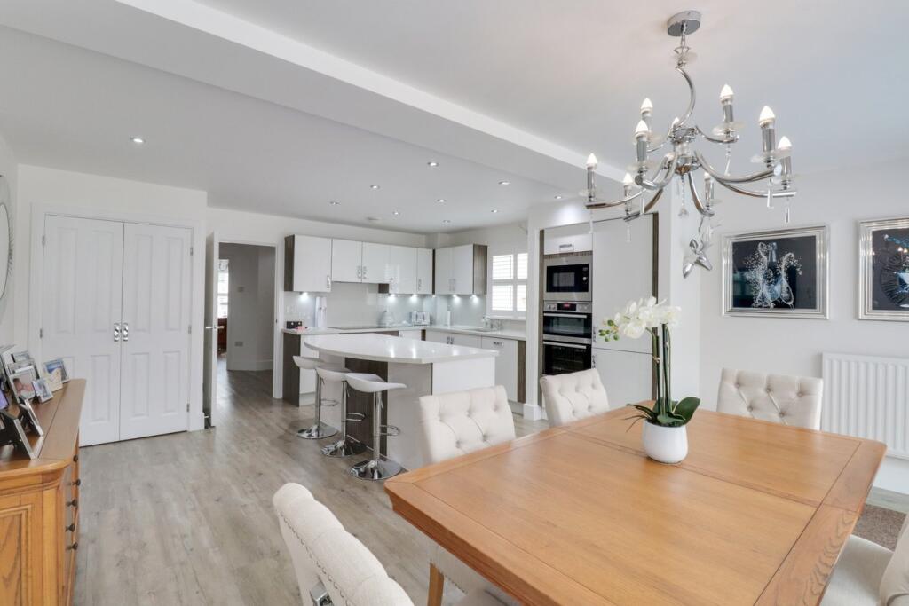
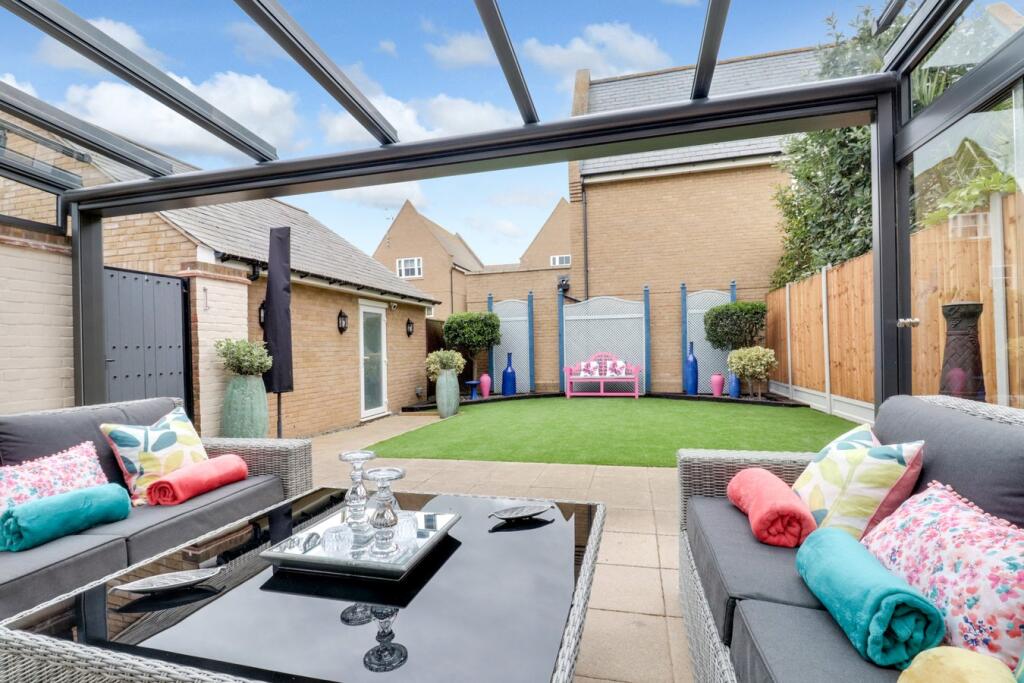
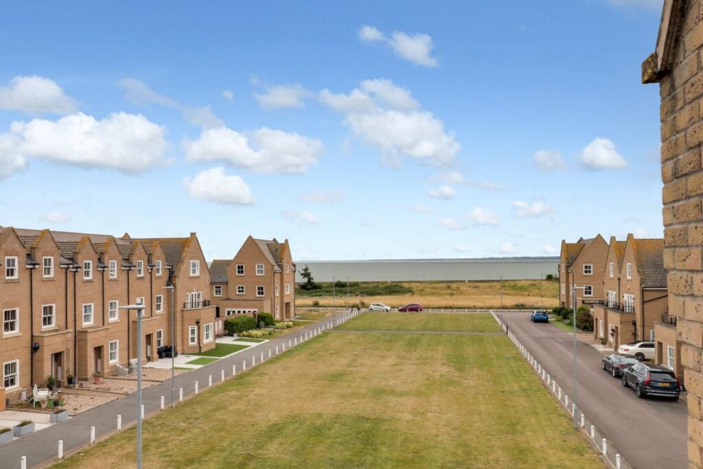
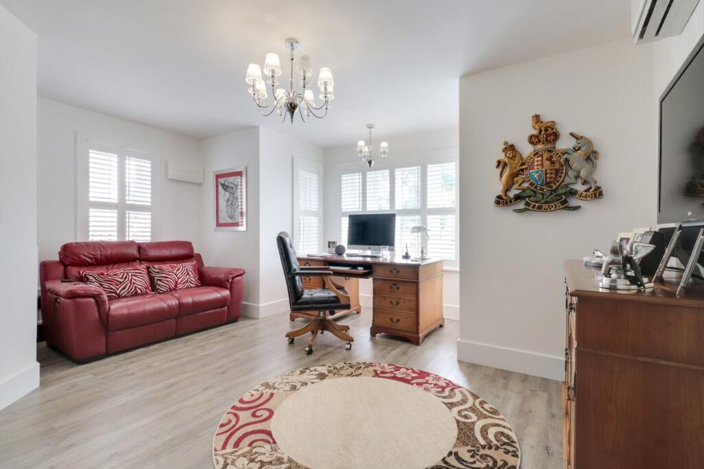
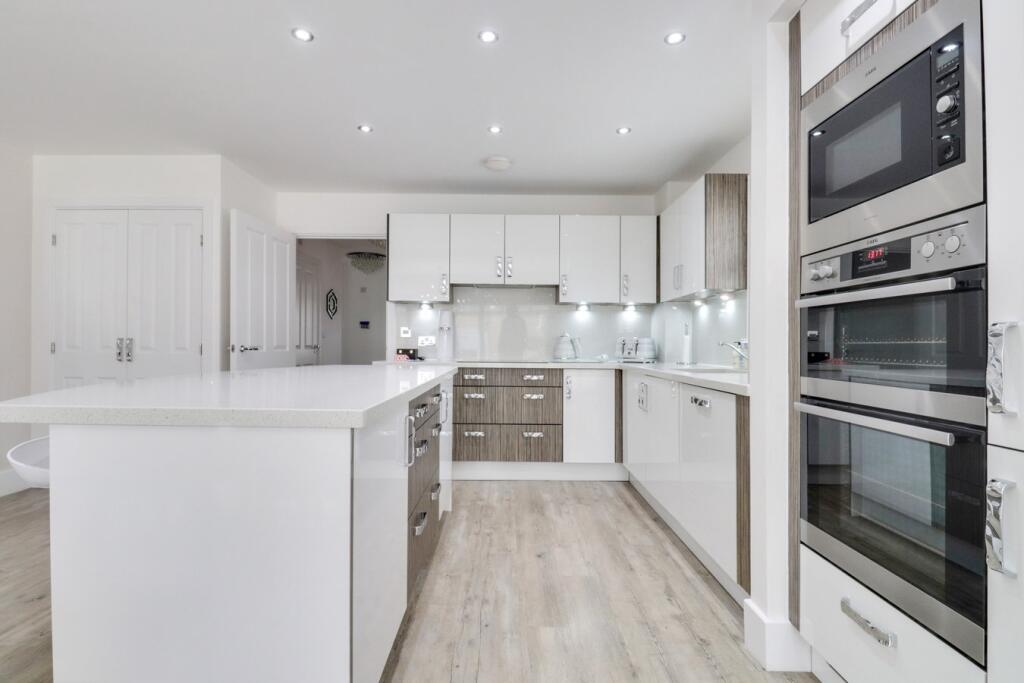
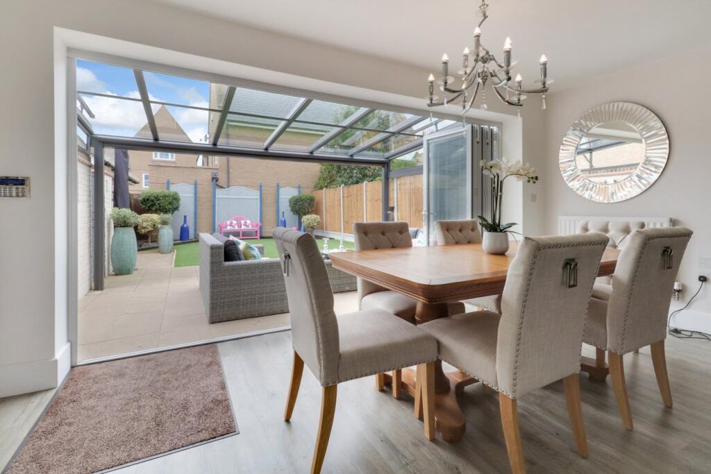
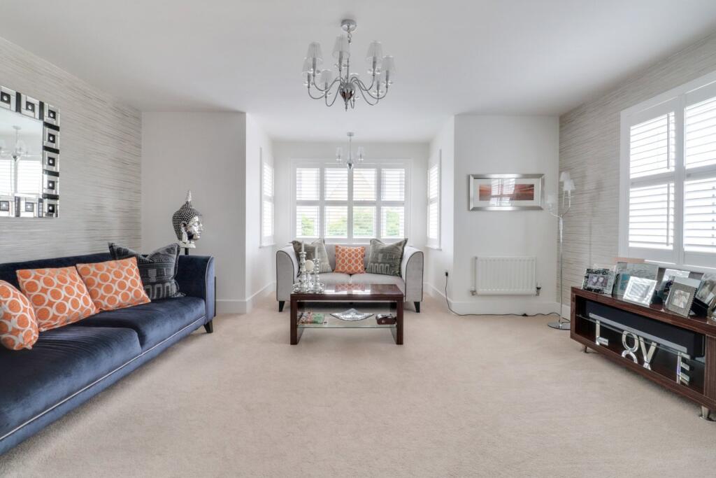
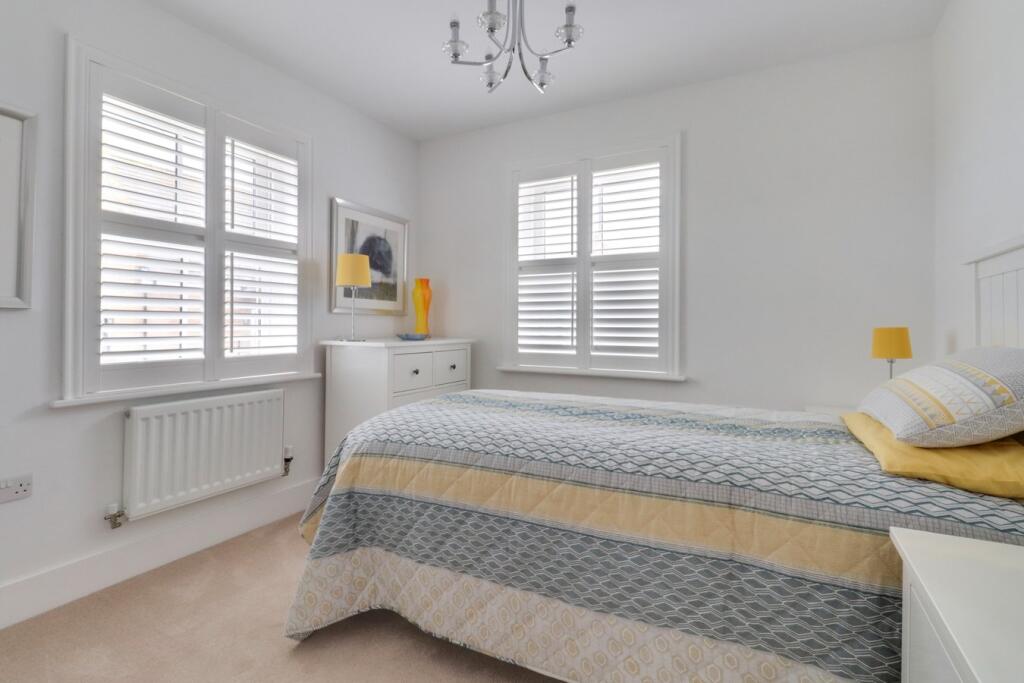
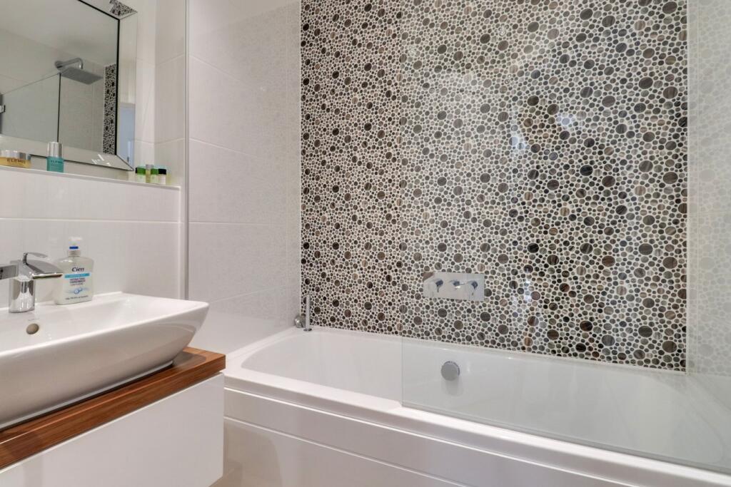
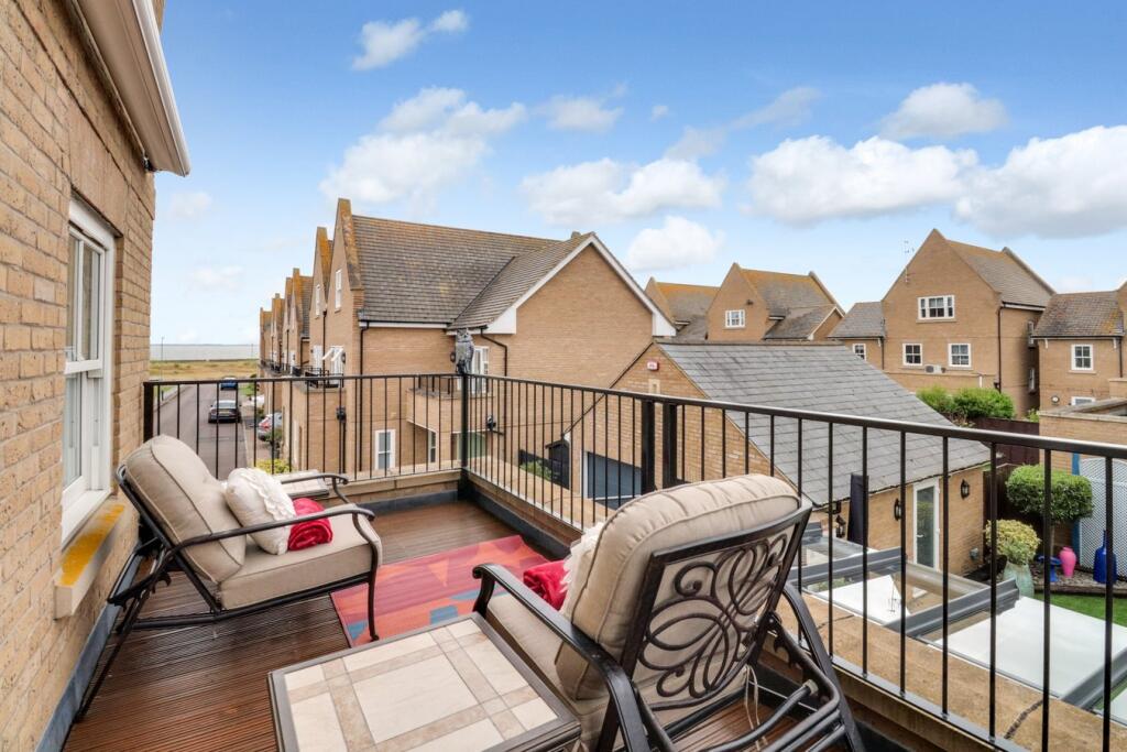
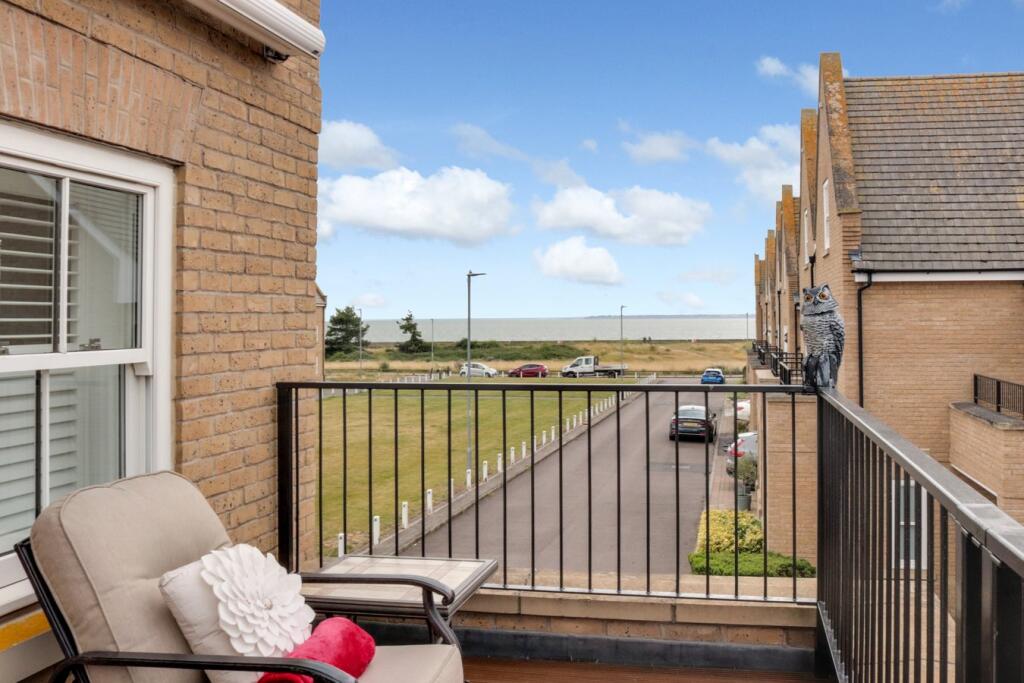
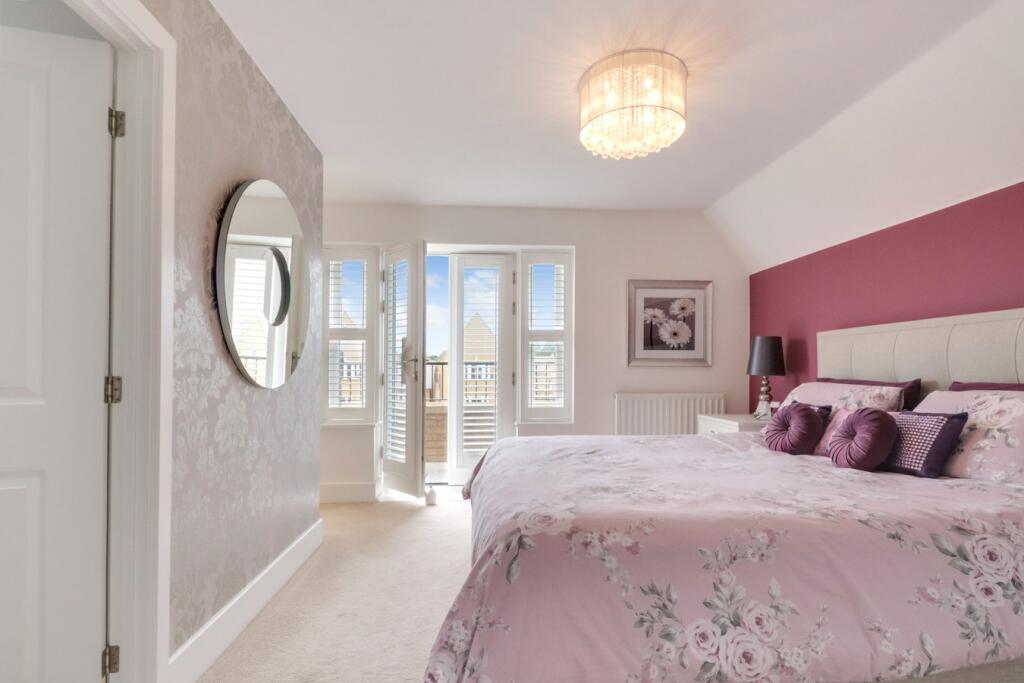
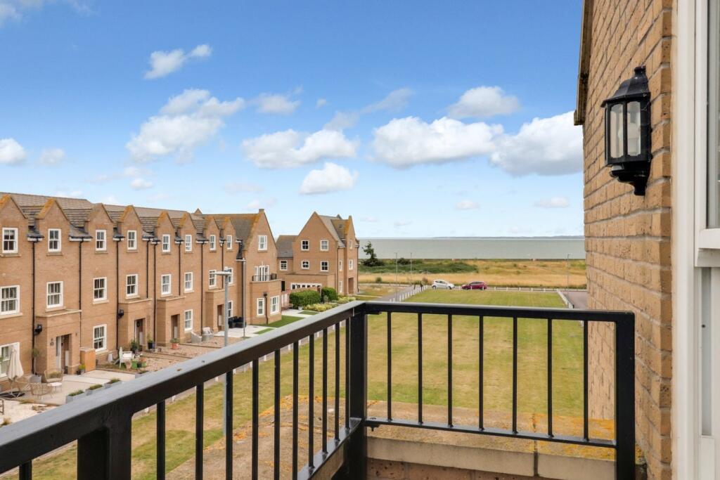
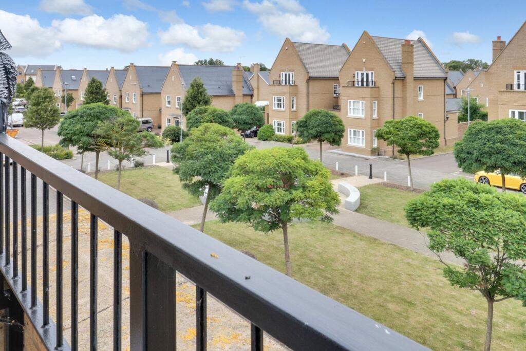
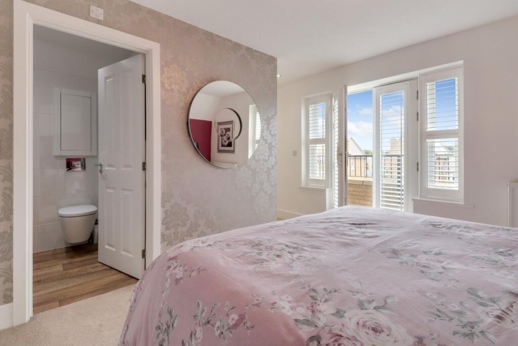
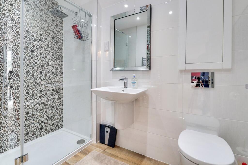
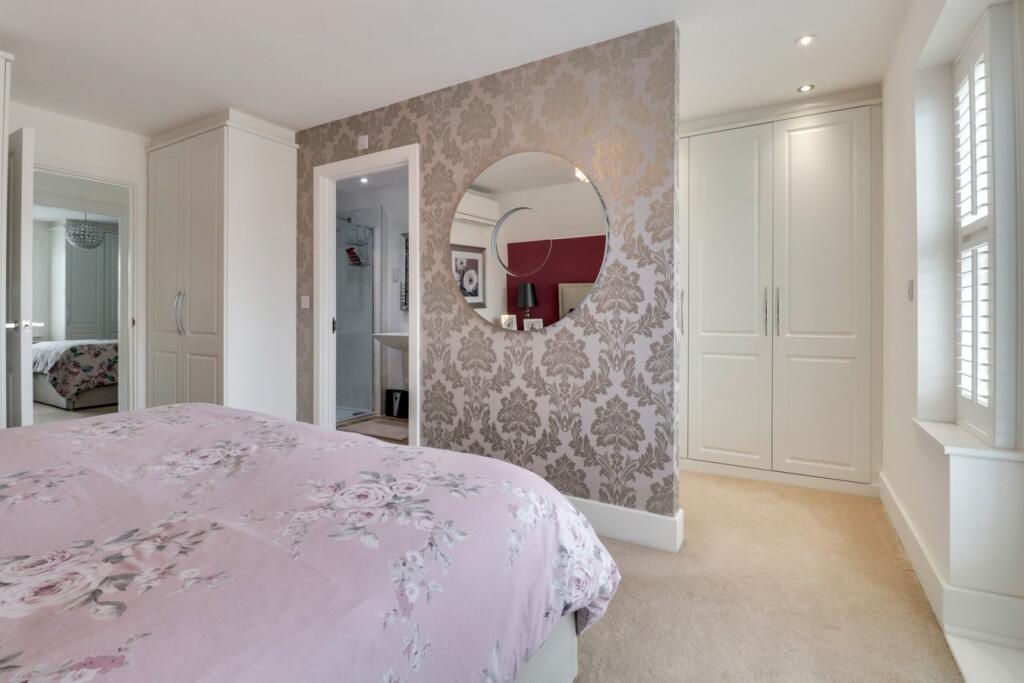
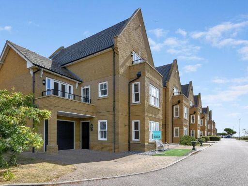
- Executive five-bedroom, three-bathroom detached family home in a favoured Shoebury Garrison location. The property offers an open-plan kitchen/family area to the rear, a landscaped west-facing garden (medium/large), detached double garage and off-street parking. Notable attributes include estuary views, three luxury bathrooms, and positioning within the Hinguar school catchment; walking distance to Shoeburyness train station. Overall scale and accommodation are consistent with a large executive family dwelling benefitting from good natural light and practical living flow. No onward chain.
Image Descriptions
- semi-detached house modern
- kitchen-diner modern
Floorplan Description
- Three-storey residential property floorplan with detached double garage.
Rooms
- GARAGE:
- GARAGE:
- KITCHEN / DINER:
- HALL:
- UTILITY CUPBOARD:
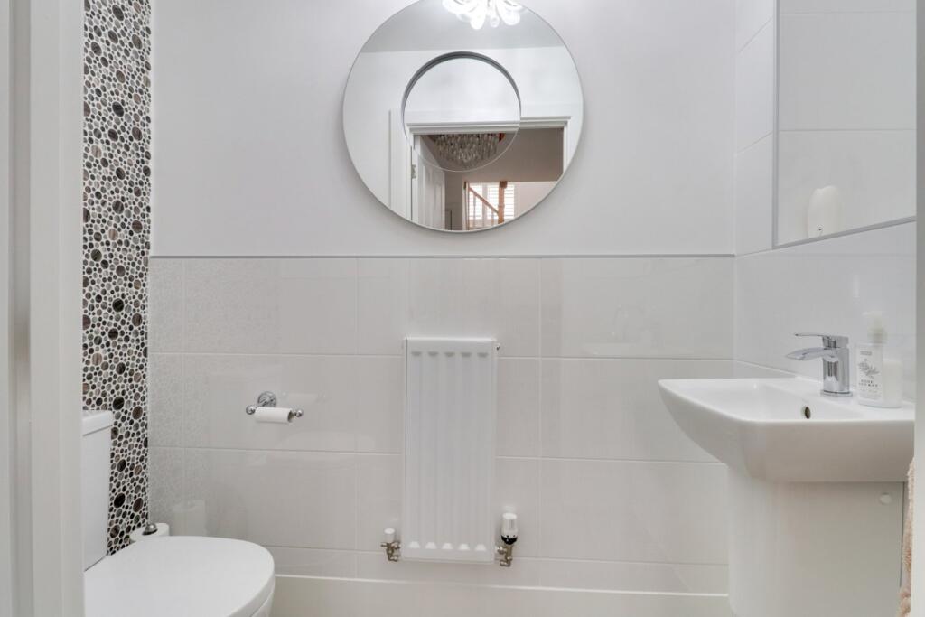
- WC:
- LOUNGE / STUDY:
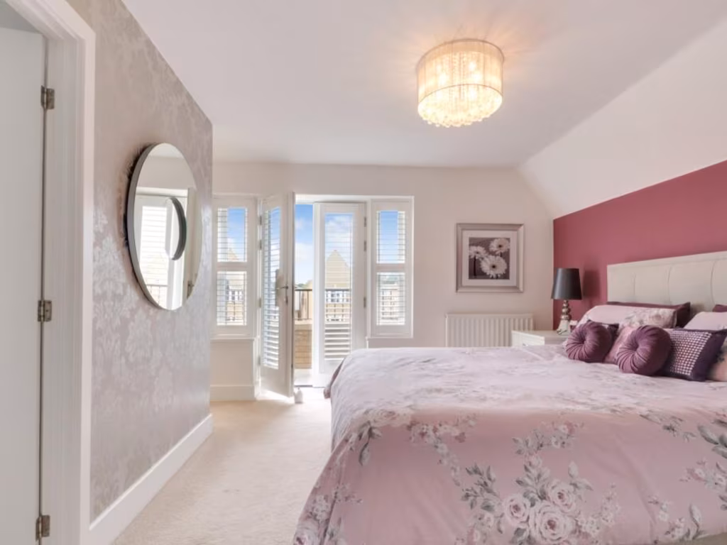
- BALCONY:
- BEDROOM 3:
- BEDROOM 4 / OFFICE:
- STORAGE:
- LANDING:
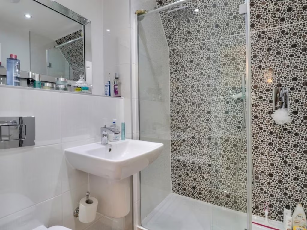
- BATHROOM:
- LOUNGE / BEDROOM 5:
- DRESSING AREA:
- BEDROOM 2:
- ENSUITE:
- STORAGE:
- LANDING:
- ENSUITE:
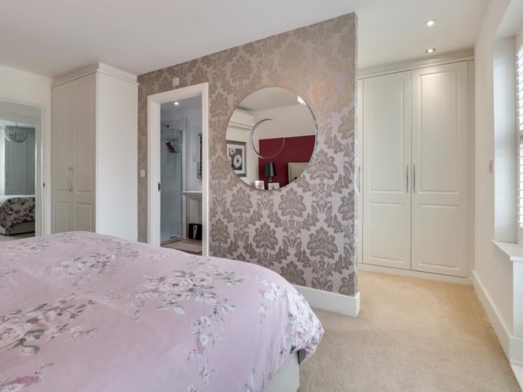
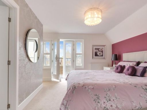
- BEDROOM 1:
- DRESSING AREA:
- BALCONY:
Textual Property Features
- Has Garden
- Chain Free
- Success
Detected Visual Features
- modern
- semi-detached
- garage
- driveway
- brick exterior
- balcony
- modern kitchen
- open plan
- dining area
- integrated appliances
- breakfast bar
- wooden floor
- contemporary lighting
Nearby Schools
- Porters Grange Primary School and Nursery
- Southchurch High School
- Hamstel Infant School and Nursery
- Thorpe Hall School
- Alleyn Court Preparatory School
- Victory Park Academy
- Shoeburyness High School
- Greenways Primary School
- Friars Primary School and Nursery
- Bournes Green Junior School
- Bournes Green Infant School
- Temple Sutton Primary School
- Great Wakering Primary Academy
- Hinguar Community Primary School
- Richmond Avenue Primary and Nursery School
- Sacred Heart Catholic Primary School
- St Helen's Catholic Primary School
- St Mary's, Prittlewell, CofE Primary School
- Bournemouth Park Academy
- Hamstel Junior School
- Barling Magna Primary Academy
- Thorpedene Primary School
- St George's Catholic Primary School
- Southend High School for Girls
- Southend YMCA Community School
- Cecil Jones Academy
- Stambridge Primary School
Nearest General Shops
- Id: 4116795146
- Tags:
- Addr:
- Housenumber: 40
- Postcode: SS1 3PA
- Street: Barnstable Road
- Name: Silvers
- Shop: hairdresser
- Source: survey
- TagsNormalized:
- Lat: 51.5382783
- Lon: 0.7608047
- FullGeoHash: u10t1q600p3j
- PartitionGeoHash: u10t
- Images:
- FoodStandards: null
- Distance: 2416.9
,- Id: 4116795147
- Tags:
- Addr:
- Housenumber: 42
- Postcode: SS1 3PA
- Street: Barnstable Road
- Dance:
- Leisure: dance
- Name: Just Ballet
- Shop: dance
- Source: survey
- Website: https://www.justballet.co.uk/
- TagsNormalized:
- Lat: 51.5382616
- Lon: 0.7609013
- FullGeoHash: u10t1q604k31
- PartitionGeoHash: u10t
- Images:
- FoodStandards: null
- Distance: 2410.6
,- Id: 409802717
- Tags:
- Addr:
- Housenumber: 44
- Postcode: SS1 3PA
- Street: Barnstable Road
- Building: retail
- Fhrs:
- Name: Shakti Newsagent
- Shop: newsagent
- Source: survey
- Source:geometry: Bing
- Source:postcode: FHRS Open Data
- TagsNormalized:
- Lat: 51.5382401
- Lon: 0.7610684
- FullGeoHash: u10t1q60n0m9
- PartitionGeoHash: u10t
- Images:
- FoodStandards:
- Id: 513331
- FHRSID: 513331
- LocalAuthorityBusinessID: 13/00125/NEWS
- BusinessName: Shakti News
- BusinessType: Retailers - other
- BusinessTypeID: 4613
- AddressLine1: 44 Barnstaple Road
- AddressLine2: Thorpe Bay
- AddressLine3: Essex
- AddressLine4: null
- PostCode: SS1 3PA
- RatingValue: 4
- RatingKey: fhrs_4_en-GB
- RatingDate: 2019-05-15
- LocalAuthorityCode: 893
- LocalAuthorityName: Southend-On-Sea
- LocalAuthorityWebSite: http://www.southend.gov.uk
- LocalAuthorityEmailAddress: EnvironmentalHealth@southend.gov.uk
- Scores:
- Hygiene: 0
- Structural: 0
- ConfidenceInManagement: 10
- NewRatingPending: false
- Geocode:
- Longitude: 0.76103300000000
- Latitude: 51.53822500000000
- Distance: 2400.1
}
Nearest Grocery shops
- Id: 8309664793
- Tags:
- Brand: McColl's
- Brand:wikidata: Q16997477
- Brand:wikipedia: en:McColl's
- Contact:
- Website: https://www.mccolls.co.uk/storelocator/shoeburyness-the-renown/
- Name: McColl's
- Shop: convenience
- TagsNormalized:
- Lat: 51.5394234
- Lon: 0.7938411
- FullGeoHash: u10t4n6ncufu
- PartitionGeoHash: u10t
- Images:
- FoodStandards: null
- Distance: 1717.8
,- Id: 172204983
- Tags:
- Building: yes
- Shop: convenience
- TagsNormalized:
- Lat: 51.5312045
- Lon: 0.7966459
- FullGeoHash: u10t4hup50y0
- PartitionGeoHash: u10t
- Images:
- FoodStandards: null
- Distance: 971.1
,- Id: 694692832
- Tags:
- Brand: Sainsbury's Local
- Brand:wikidata: Q13218434
- Building: retail
- Name: Sainsbury's Local
- Shop: convenience
- TagsNormalized:
- sainsburys
- sainsburys local
- retail
- convenience
- shop
- Lat: 51.5294779
- Lon: 0.7864939
- FullGeoHash: u10t1ussywuk
- PartitionGeoHash: u10t
- Images:
- FoodStandards: null
- Distance: 566.3
}
Nearest Religious buildings
- Id: 148269353
- Tags:
- Amenity: place_of_worship
- Denomination: anglican
- Name: St Peters, South Shoebury
- Religion: christian
- Wikidata: Q105083733
- TagsNormalized:
- place of worship
- anglican
- christian
- church
- Lat: 51.530355
- Lon: 0.7930218
- FullGeoHash: u10t4hc6ndru
- PartitionGeoHash: u10t
- Images:
- FoodStandards: null
- Distance: 751.3
,- Id: 148263285
- Tags:
- Amenity: place_of_worship
- Denomination: anglican
- Name: Saint Andrew's, South Shoebury
- Religion: christian
- Wikidata: Q17557101
- TagsNormalized:
- place of worship
- anglican
- christian
- church
- Lat: 51.5273431
- Lon: 0.7800752
- FullGeoHash: u10t1u2090fn
- PartitionGeoHash: u10t
- Images:
- FoodStandards: null
- Distance: 621.4
,- Id: 702919812
- Tags:
- Amenity: place_of_worship
- Name: Garrison Church of St Peter and St Paul
- Source: OS-OpenData_StreetView
- TagsNormalized:
- place of worship
- church
- garrison
- paul
- Lat: 51.5286414
- Lon: 0.7888097
- FullGeoHash: u10t1uw2hdgn
- PartitionGeoHash: u10t
- Images:
- FoodStandards: null
- Distance: 472.2
}
Nearest Medical buildings
- Id: 902053803
- Tags:
- Amenity: hospital
- Healthcare: hospital
- Name: Wellesley Hospital
- Operator: Spire Healthcare
- Ref:
- Website: https://www.spirehealthcare.com/spire-wellesley-hospital/
- Wheelchair: yes
- TagsNormalized:
- Lat: 51.5541559
- Lon: 0.7272361
- FullGeoHash: u10t291s9z4w
- PartitionGeoHash: u10t
- Images:
- FoodStandards: null
- Distance: 5332.3
,- Id: 265088711
- Tags:
- Amenity: dentist
- Building: yes
- Healthcare: dentist
- TagsNormalized:
- Lat: 51.5307397
- Lon: 0.7462806
- FullGeoHash: u10t0uzkmd55
- PartitionGeoHash: u10t
- Images:
- FoodStandards: null
- Distance: 2953.4
,- Id: 1782979609
- Tags:
- Amenity: clinic
- Healthcare: clinic
- Name: Thorpdene clinic
- TagsNormalized:
- Lat: 51.5360184
- Lon: 0.7693859
- FullGeoHash: u10t1tb5pfps
- PartitionGeoHash: u10t
- Images:
- FoodStandards: null
- Distance: 1808.5
,- Id: 7494280719
- Tags:
- Amenity: pharmacy
- Brand: Asda
- Brand:wikidata: Q297410
- Brand:wikipedia: en:Asda
- Contact:
- Phone: +44 1702 382510
- Website: https://storelocator.asda.com/east-of-england/shoeburyness/north-shoebury-road/pharmacy
- Dispensing: yes
- Drive_through: no
- Fixme: Location not accurate
- Healthcare: pharmacy
- Name: Asda
- Opening_hours:
- Covid19: Mo-We, Sa 08:30-20:00; Th 08:30-21:00; Fr 09:00-18:00; Su 10:00-16:00
- Operator: Asda Stores Ltd
- TagsNormalized:
- pharmacy
- asda
- health
- healthcare
- Lat: 51.5391787
- Lon: 0.7811826
- FullGeoHash: u10t1y2v6z7b
- PartitionGeoHash: u10t
- Images:
- FoodStandards: null
- Distance: 1700.2
}
Nearest Airports
- Id: 103894219
- Tags:
- Aerodrome: international
- Aeroway: aerodrome
- Iata: SEN
- Icao: EGMC
- Name: London Southend Airport
- Old_name: Southend Municipal Airport
- Ref: SEN
- Wikidata: Q1415441
- TagsNormalized:
- airport
- international airport
- Lat: 51.5701749
- Lon: 0.6924624
- FullGeoHash: u10mru04p937
- PartitionGeoHash: u10m
- Images:
- FoodStandards: null
- Distance: 8323.2
}
Nearest Leisure Facilities
- Id: 9981516752
- Tags:
- TagsNormalized:
- picnic
- picnic table
- leisure
- Lat: 51.5220004
- Lon: 0.7859925
- FullGeoHash: u10t1gk36uyr
- PartitionGeoHash: u10t
- Images:
- FoodStandards: null
- Distance: 298.1
,- Id: 1022955210
- Tags:
- TagsNormalized:
- Lat: 51.5261555
- Lon: 0.7851322
- FullGeoHash: u10t1u59wgt1
- PartitionGeoHash: u10t
- Images:
- FoodStandards: null
- Distance: 262.9
,- Id: 1022961219
- Tags:
- Leisure: pitch
- Sport: skateboard
- TagsNormalized:
- pitch
- leisure
- skateboard
- sports
- Lat: 51.5241659
- Lon: 0.7842267
- FullGeoHash: u10t1gen1b9v
- PartitionGeoHash: u10t
- Images:
- FoodStandards: null
- Distance: 246.2
,- Id: 1022955211
- Tags:
- TagsNormalized:
- Lat: 51.5241068
- Lon: 0.7848921
- FullGeoHash: u10t1get9m9u
- PartitionGeoHash: u10t
- Images:
- FoodStandards: null
- Distance: 201.7
,- Id: 702919827
- Tags:
- TagsNormalized:
- Lat: 51.5246195
- Lon: 0.7877517
- FullGeoHash: u10t1gv8evnp
- PartitionGeoHash: u10t
- Images:
- FoodStandards: null
- Distance: 19.3
}
Nearest Tourist attractions
- Id: 649598460
- Tags:
- Gauge: 918
- Layer: 1
- Name: Southend Pier Railway
- Railway: light_rail
- Tourism: attraction
- TagsNormalized:
- Lat: 51.5167077
- Lon: 0.7212152
- FullGeoHash: u10t06m4td35
- PartitionGeoHash: u10t
- Images:
- FoodStandards: null
- Distance: 4683.6
,- Id: 649598461
- Tags:
- Gauge: 918
- Layer: 1
- Railway: light_rail
- Service: siding
- Tourism: attraction
- TagsNormalized:
- Lat: 51.5166614
- Lon: 0.7212781
- FullGeoHash: u10t06m4qcxz
- PartitionGeoHash: u10t
- Images:
- FoodStandards: null
- Distance: 4680.3
,- Id: 117690305
- Tags:
- Building: yes
- Name: Sea Life Adventure Aquarium
- Tourism: aquarium
- TagsNormalized:
- Lat: 51.5316759
- Lon: 0.7260765
- FullGeoHash: u10t0t09yb9u
- PartitionGeoHash: u10t
- Images:
- FoodStandards: null
- Distance: 4342
}
Nearest Bus stations and stops
- Id: 1831386455
- Tags:
- Highway: bus_stop
- Name: Shoeburyness East Beach
- Naptan:
- AtcoCode: 15800001
- NaptanCode: soadgapg
- Verified: no
- Public_transport: platform
- Source: naptan
- TagsNormalized:
- Lat: 51.5284902
- Lon: 0.7972753
- FullGeoHash: u10t4hkx1yg8
- PartitionGeoHash: u10t
- Images:
- FoodStandards: null
- Distance: 797.4
,- Id: 7727344117
- Tags:
- Bus: yes
- Highway: bus_stop
- Name: Waterford Road
- Naptan:
- AtcoCode: 15800064
- NaptanCode: soadagwa
- Verified: no
- Public_transport: platform
- Source: naptan
- TagsNormalized:
- Lat: 51.5278142
- Lon: 0.7779918
- FullGeoHash: u10t1sqe28b8
- PartitionGeoHash: u10t
- Images:
- FoodStandards: null
- Distance: 772.4
,- Id: 5406200471
- Tags:
- Bus: yes
- Highway: bus_stop
- Name: Campfield Road
- Naptan:
- AtcoCode: 15800053
- NaptanCode: soadagtm
- Verified: no
- Public_transport: platform
- Source: naptan
- TagsNormalized:
- Lat: 51.5300669
- Lon: 0.7831442
- FullGeoHash: u10t1uf22sdw
- PartitionGeoHash: u10t
- Images:
- FoodStandards: null
- Distance: 701.8
,- Id: 5406200470
- Tags:
- Bus: yes
- Highway: bus_stop
- Name: Ness Road
- Naptan:
- AtcoCode: 15800054
- NaptanCode: soadagtp
- Verified: no
- Public_transport: platform
- Source: naptan
- TagsNormalized:
- Lat: 51.5278604
- Lon: 0.7819649
- FullGeoHash: u10t1u37t17k
- PartitionGeoHash: u10t
- Images:
- FoodStandards: null
- Distance: 552
,- Id: 7727433270
- Tags:
- Bus: yes
- Highway: bus_stop
- Name: Church Road
- Naptan:
- AtcoCode: 15800063
- NaptanCode: soadagtw
- Verified: no
- Public_transport: platform
- Source: naptan
- TagsNormalized:
- Lat: 51.527481
- Lon: 0.7814475
- FullGeoHash: u10t1u31349k
- PartitionGeoHash: u10t
- Images:
- FoodStandards: null
- Distance: 551.7
}
Nearest Hotels
- Id: 10702746514
- Tags:
- Name: The Hope Hotel
- Phone: 0172467413
- Tourism: hotel
- TagsNormalized:
- Lat: 51.533068
- Lon: 0.7203636
- FullGeoHash: u10t0mk9csnh
- PartitionGeoHash: u10t
- Images:
- FoodStandards: null
- Distance: 4759.6
,- Id: 265088714
- Tags:
- Brand: Premier Inn
- Brand:wikidata: Q2108626
- Brand:wikipedia: en:Premier Inn
- Building: yes
- Internet_access: wlan
- Internet_access:fee: customers
- Internet_access:operator: Virgin Media
- Internet_access:ssid: Premier Inn Free Wi-Fi
- Name: Premier Inn
- Operator: Premier Inn
- Tourism: hotel
- TagsNormalized:
- Lat: 51.5309621
- Lon: 0.745049
- FullGeoHash: u10t0uyt8gsf
- PartitionGeoHash: u10t
- Images:
- FoodStandards: null
- Distance: 3042
,- Id: 179649631
- Tags:
- Addr:
- Housenumber: 10-12
- Postcode: SS1 3BG
- Street: Thorpe Bay Esplanade
- Amenity: restaurant
- Building: yes
- Name: Roslin Beach Hotel
- Phone: +44 1702 586 375
- Tourism: hotel
- Website: https://www.roslinhotel.com/
- TagsNormalized:
- restaurant
- beach
- hotel
- tourism
- Lat: 51.5302967
- Lon: 0.7480217
- FullGeoHash: u10t1hb9wpt3
- PartitionGeoHash: u10t
- Images:
- FoodStandards: null
- Distance: 2824.7
}
Tags
- modern
- semi-detached
- garage
- driveway
- brick exterior
- balcony
- modern kitchen
- open plan
- dining area
- integrated appliances
- breakfast bar
- wooden floor
- contemporary lighting
Local Market Stats
- Average Price/sqft: £363
- Avg Income: £43200
- Rental Yield: 3.4%
- Social Housing: 9%
- Planning Success Rate: 47%
AirBnB Data
- 1km average: £55/night
- Listings in 1km: 1
Similar Properties
 5 bedroom detached house for sale in Gunners Rise, * Garrison Location *, Shoeburyness, Essex, SS3 — £845,000 • 5 bed • 4 bath
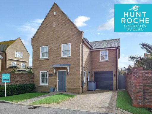 4 bedroom detached house for sale in Gunners Rise, Idyllic Shoebury Garrison, Shoeburyness, Essex, SS3 — £625,000 • 4 bed • 2 bath • 1378 ft²
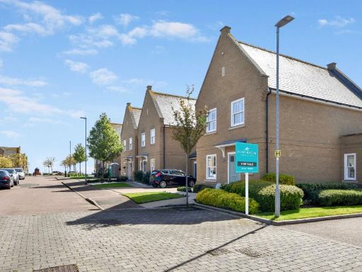 3 bedroom detached house for sale in Gunners Rise, Shoebury Garrison, Shoeburyness, Essex, SS3 — £575,000 • 3 bed • 3 bath • 1023 ft²
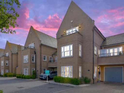 4 bedroom detached house for sale in Gunners Rise, Shoebury Garrison Location, Shoeburyness, Essex, SS3 — £825,000 • 4 bed • 4 bath
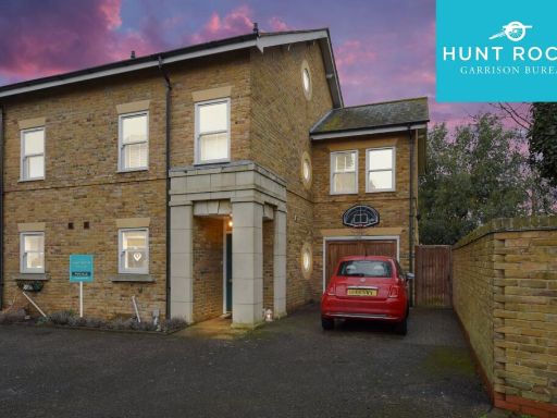 4 bedroom semi-detached house for sale in Horseshoe Crescent, Shoebury Garrison, Shoeburyness, Essex, SS3 — £650,000 • 4 bed • 3 bath
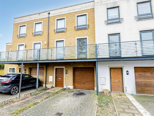 3 bedroom town house for sale in Chapel Place, Southend-on-sea, SS3 — £465,000 • 3 bed • 2 bath • 1163 ft²
Meta
- {
"@context": "https://schema.org",
"@type": "Residence",
"name": "5 bedroom detached house for sale in Gunners Rise, Shoebury…",
"description": "",
"url": "https://propertypiper.co.uk/property/d028e109-33c4-447e-8f5f-10488e899ed8",
"image": "https://image-a.propertypiper.co.uk/9b226e7c-04b9-4e4f-a401-3140245dd372-1024.jpeg",
"address": {
"@type": "PostalAddress",
"streetAddress": "Gunners Rise, Shoebury Garrison, SS3",
"postalCode": "SS3 9FD",
"addressLocality": "Southend-on-Sea",
"addressRegion": "Rochford and Southend East",
"addressCountry": "England"
},
"geo": {
"@type": "GeoCoordinates",
"latitude": 51.5244459,
"longitude": 0.7877564
},
"numberOfRooms": 5,
"numberOfBathroomsTotal": 3,
"offers": {
"@type": "Offer",
"price": 850000,
"priceCurrency": "GBP",
"availability": "https://schema.org/InStock"
},
"additionalProperty": [
{
"@type": "PropertyValue",
"name": "Feature",
"value": "modern"
},
{
"@type": "PropertyValue",
"name": "Feature",
"value": "semi-detached"
},
{
"@type": "PropertyValue",
"name": "Feature",
"value": "garage"
},
{
"@type": "PropertyValue",
"name": "Feature",
"value": "driveway"
},
{
"@type": "PropertyValue",
"name": "Feature",
"value": "brick exterior"
},
{
"@type": "PropertyValue",
"name": "Feature",
"value": "balcony"
},
{
"@type": "PropertyValue",
"name": "Feature",
"value": "modern kitchen"
},
{
"@type": "PropertyValue",
"name": "Feature",
"value": "open plan"
},
{
"@type": "PropertyValue",
"name": "Feature",
"value": "dining area"
},
{
"@type": "PropertyValue",
"name": "Feature",
"value": "integrated appliances"
},
{
"@type": "PropertyValue",
"name": "Feature",
"value": "breakfast bar"
},
{
"@type": "PropertyValue",
"name": "Feature",
"value": "wooden floor"
},
{
"@type": "PropertyValue",
"name": "Feature",
"value": "contemporary lighting"
}
]
}
High Res Floorplan Images
Compatible Floorplan Images
FloorplanImages Thumbnail