LA13 9RY - 3 bedroom house for sale in Gloucester Street, BarrowInFurn…
View on Property Piper
3 bedroom house for sale in Gloucester Street, Barrow-In-Furness, LA13
Property Details
- Price: £220000
- Bedrooms: 3
- Bathrooms: 1
- Property Type: undefined
- Property SubType: undefined
Brochure Descriptions
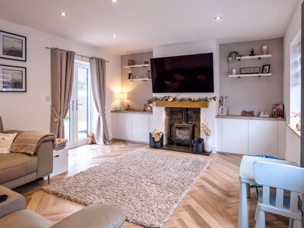
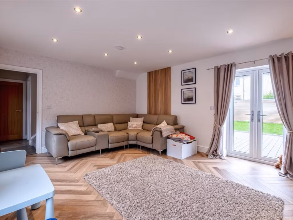
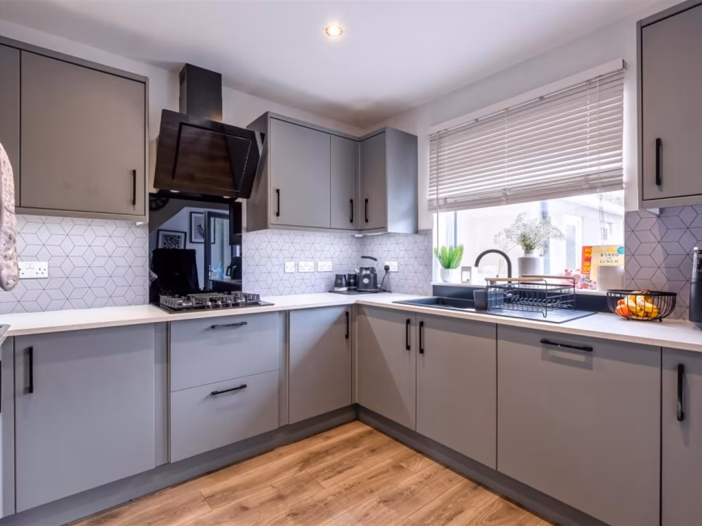
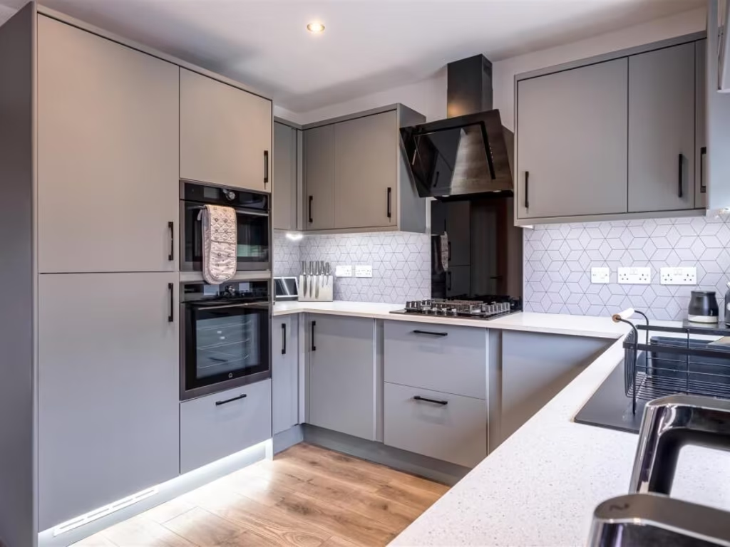
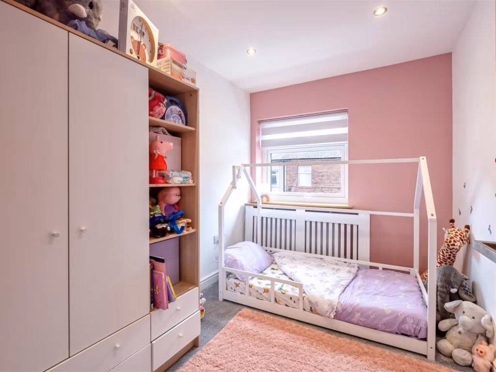
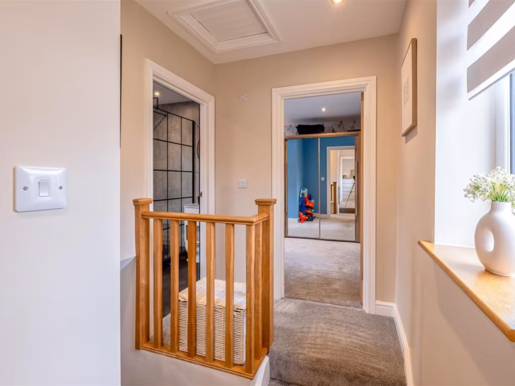
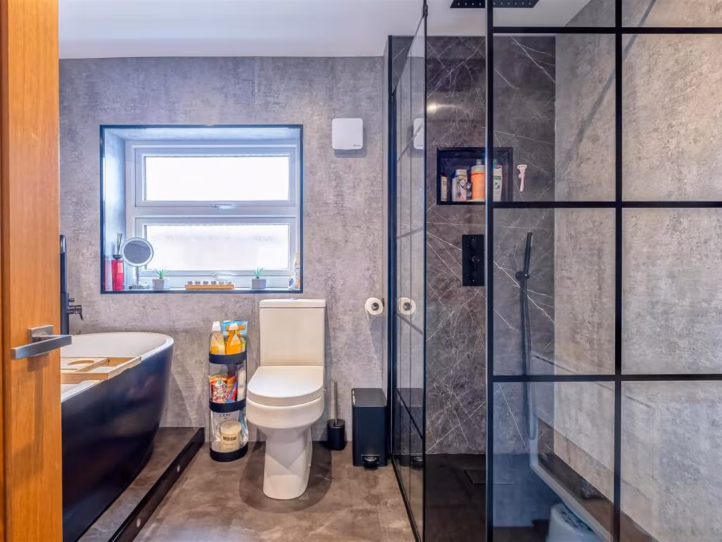
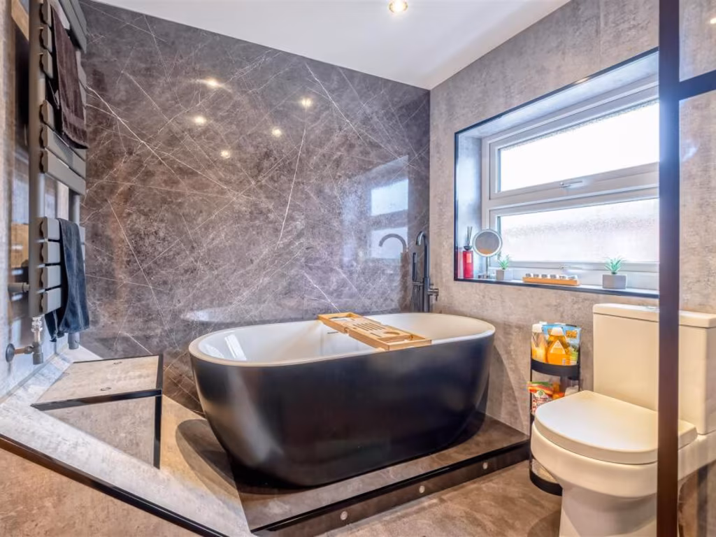
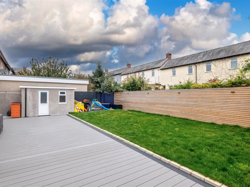
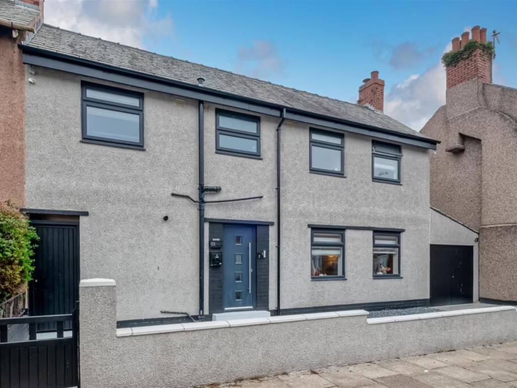
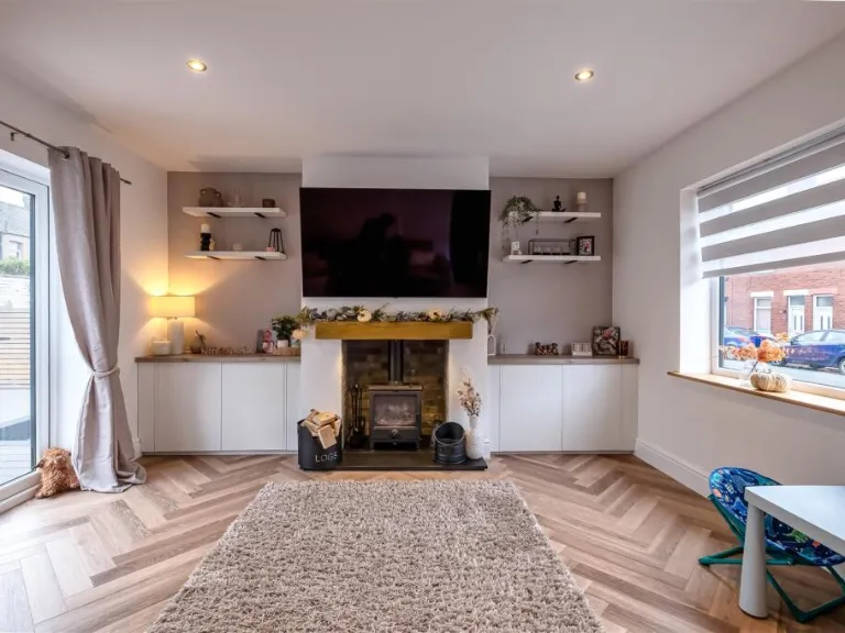
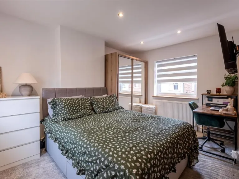
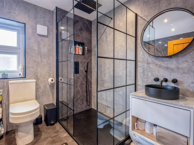
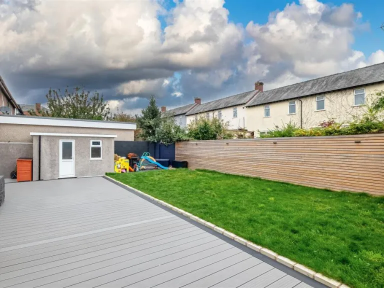
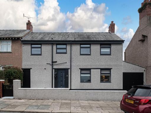
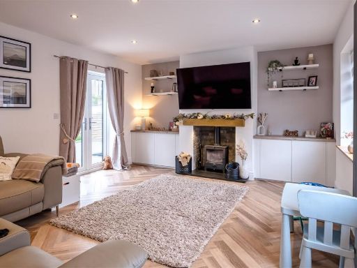
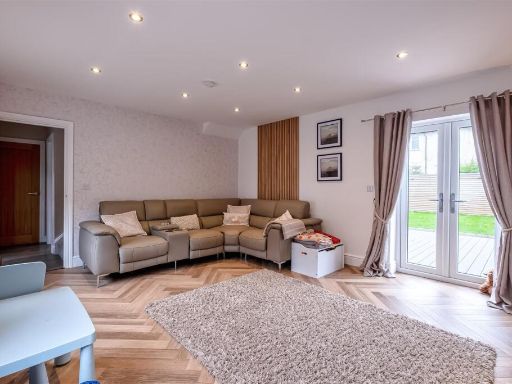
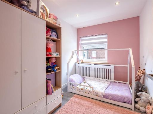
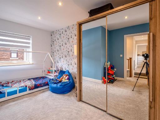
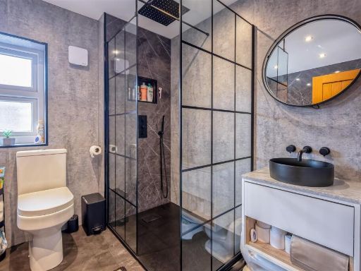
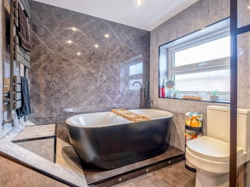
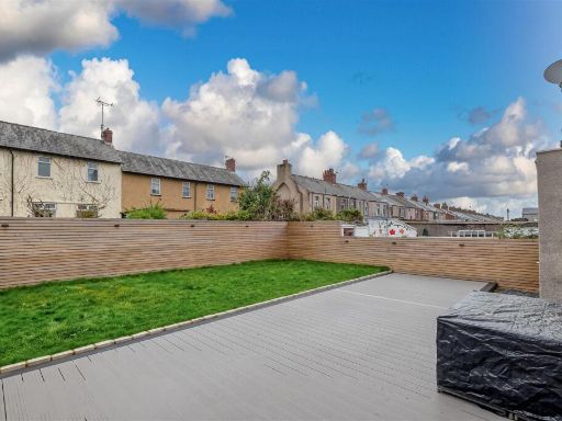
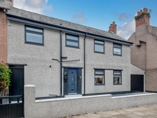
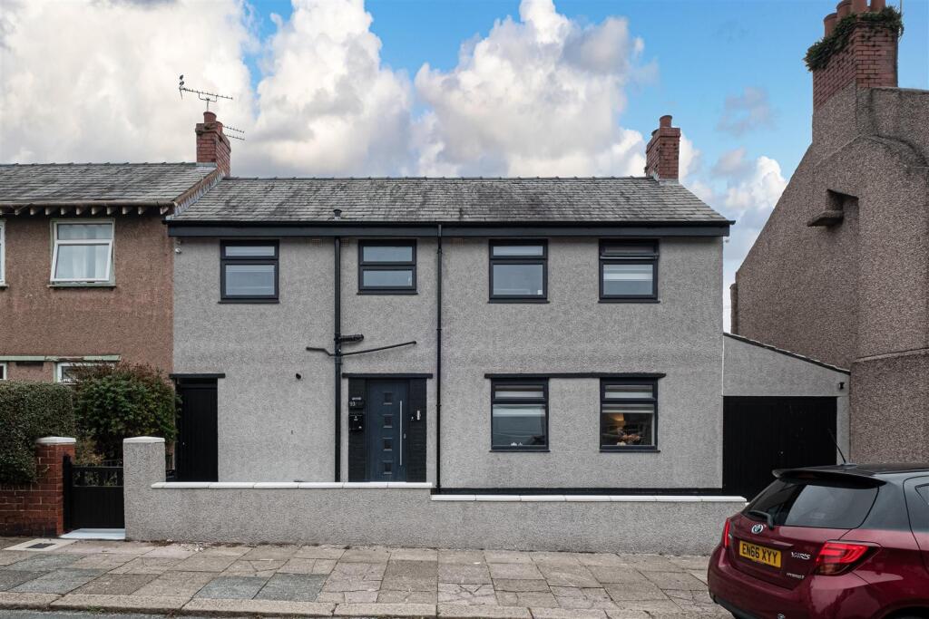
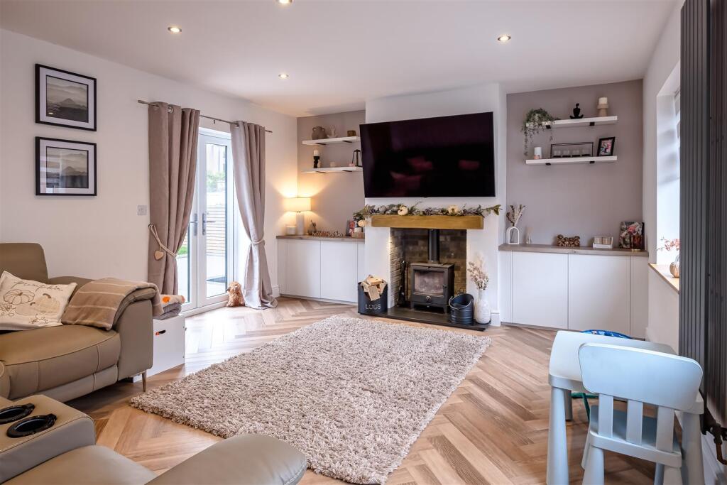
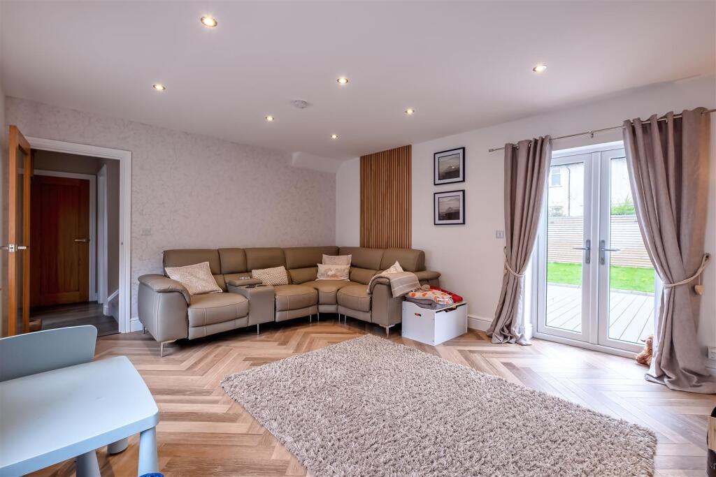
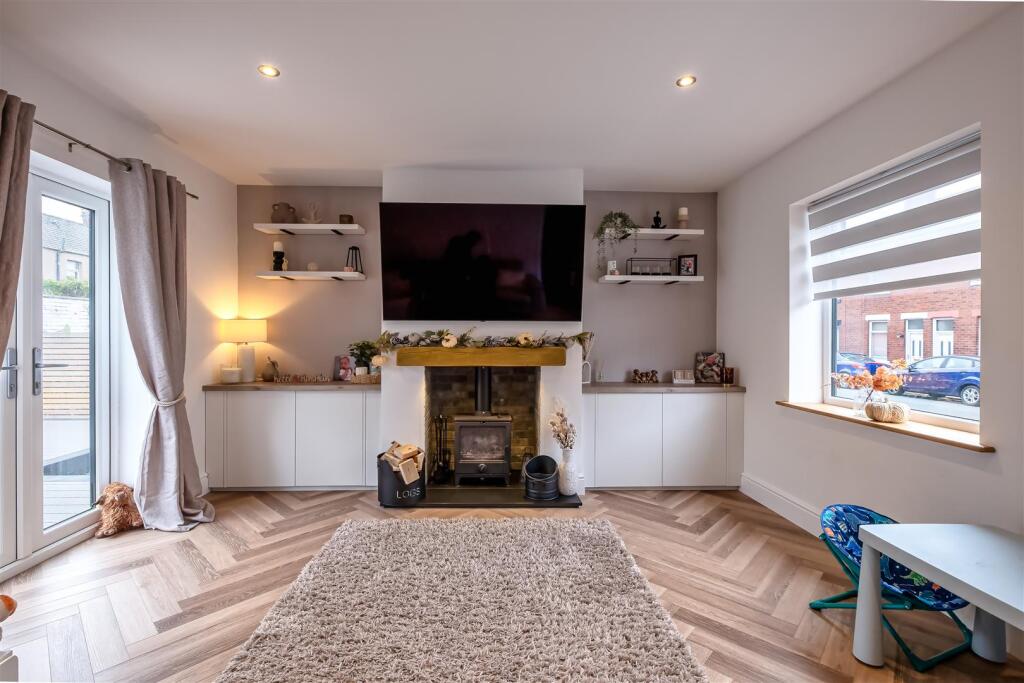
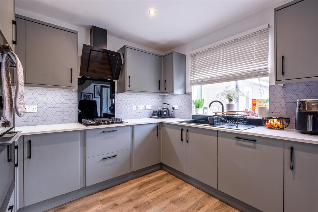
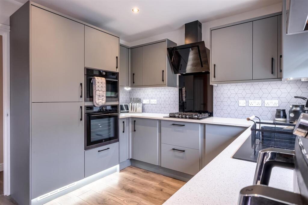
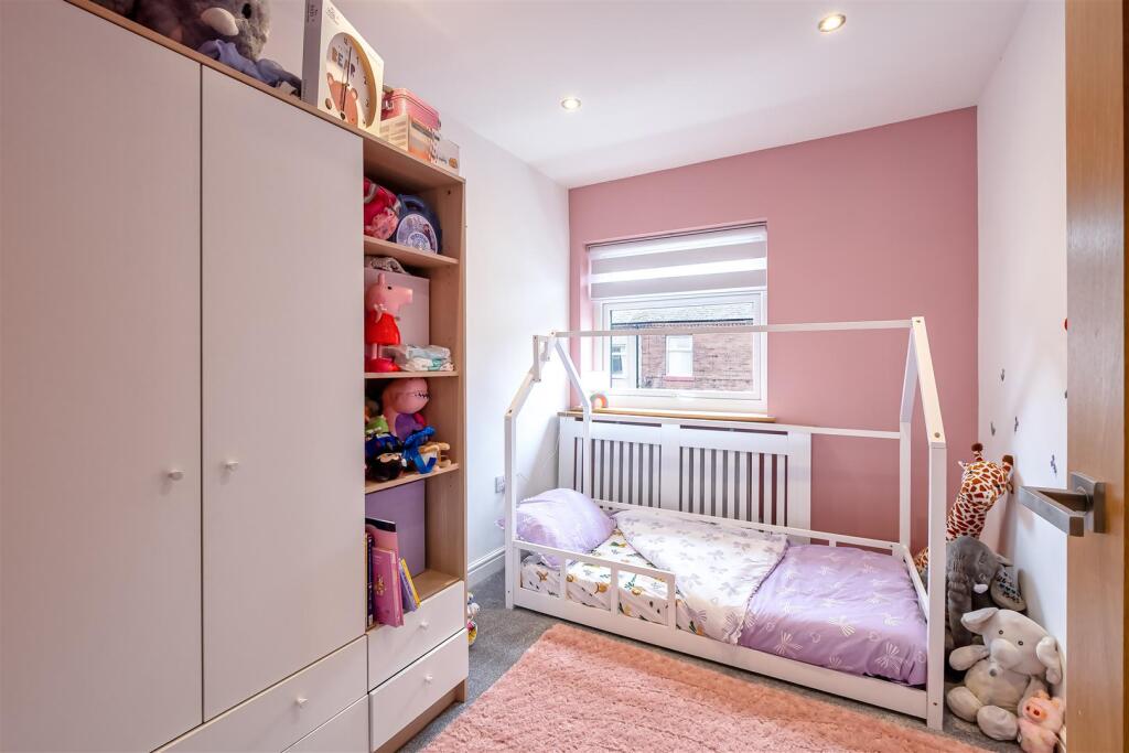
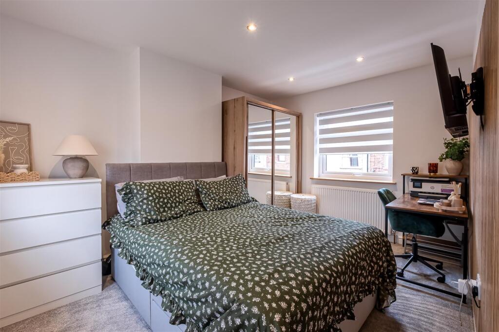
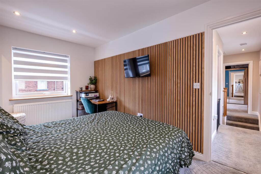
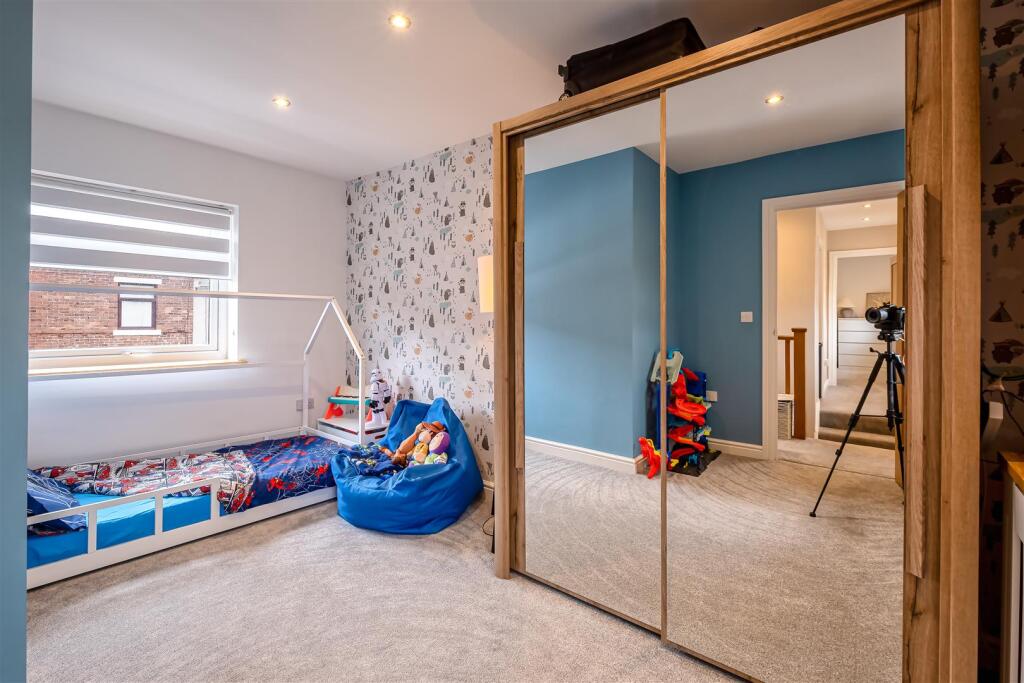
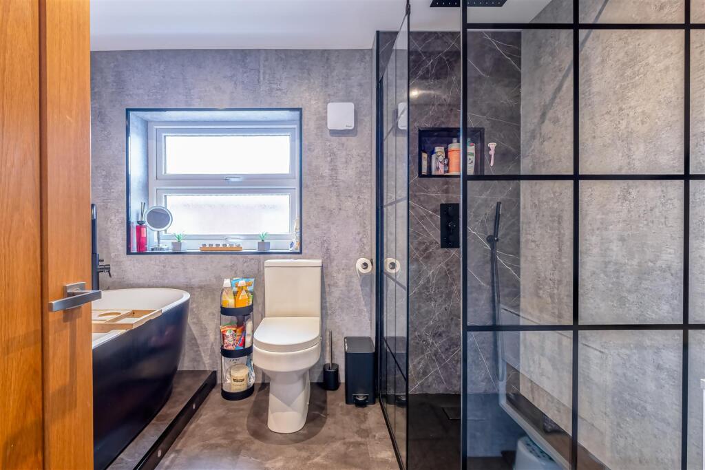
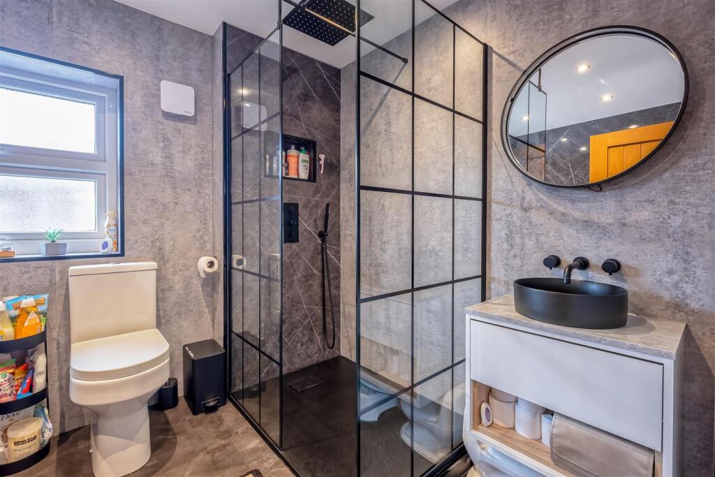
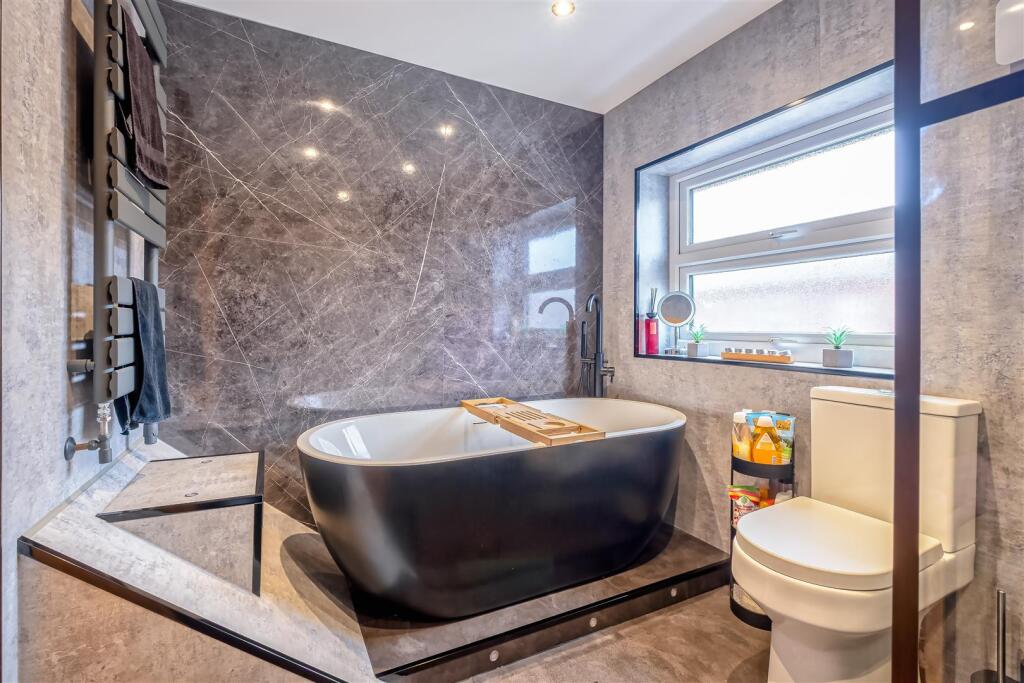
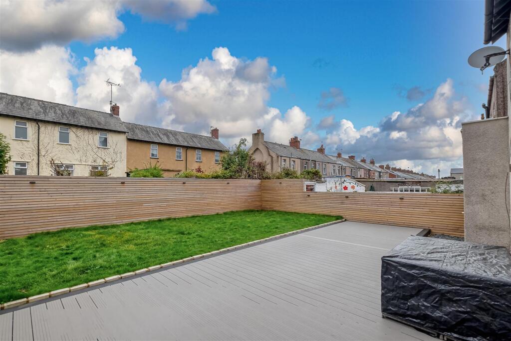
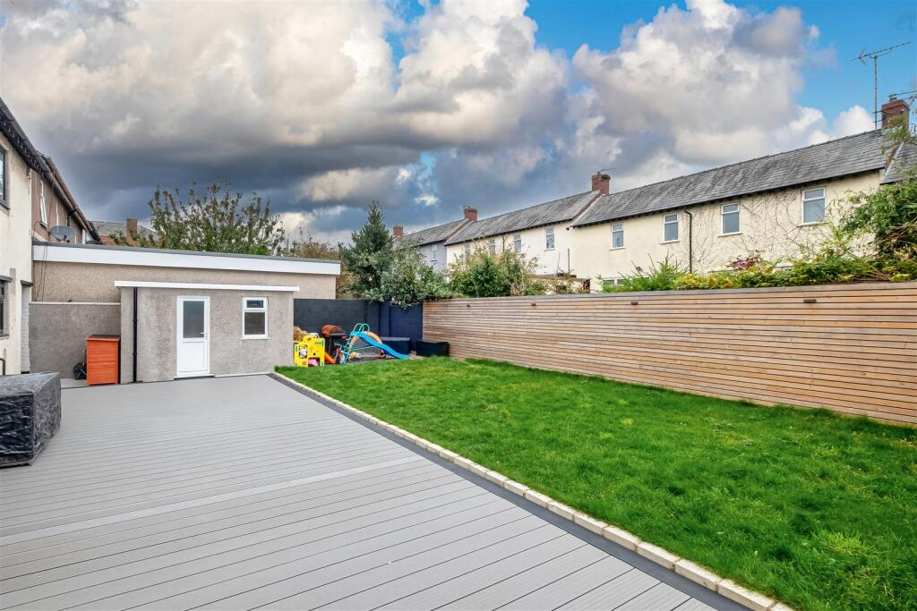
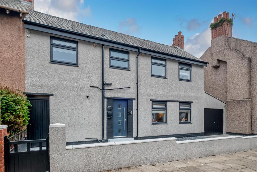
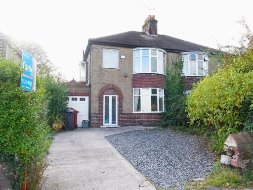
- Mid-terraced/semi-detached two-storey residential property presented in rendered finish with a small walled forecourt and vehicular access/garage to the side. The listing indicates 3 bedrooms, 1 bathroom and 1 reception room with an energy rating of D. Interior photos show a modern, well-presented open-plan living area with good natural light, contemporary finishes and neutral decoration. The property appears to offer a medium-sized overall footprint typical of town housing stock — living space suitable for a family of four, with an average rear garden likely (not shown in main image). Overall condition looks refurbished to a good standard, suitable for immediate occupation or low-cost updating depending on buyer preference.
Image Descriptions
- front view of a two-story house modern
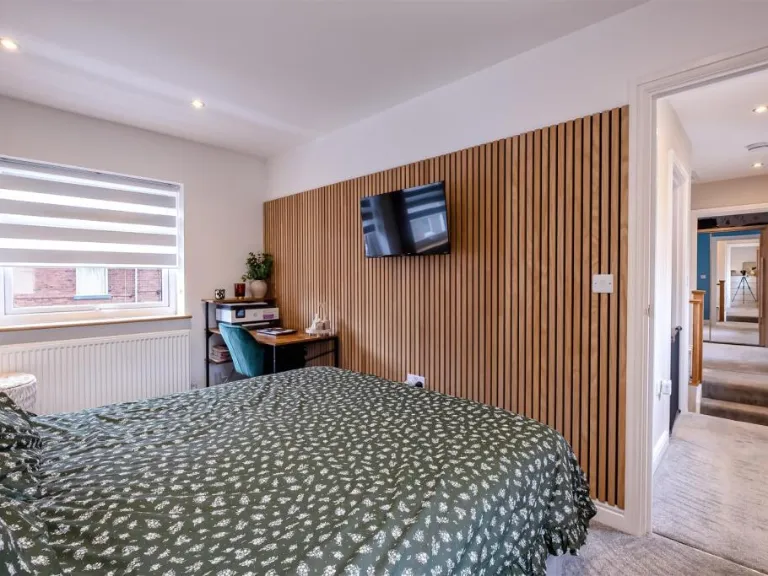
- living room modern
Floorplan Description
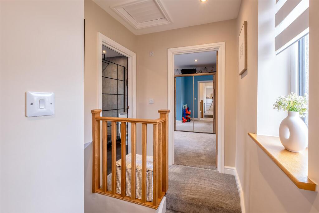
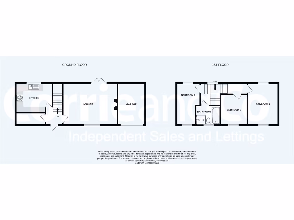
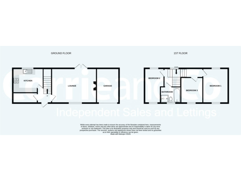
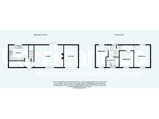
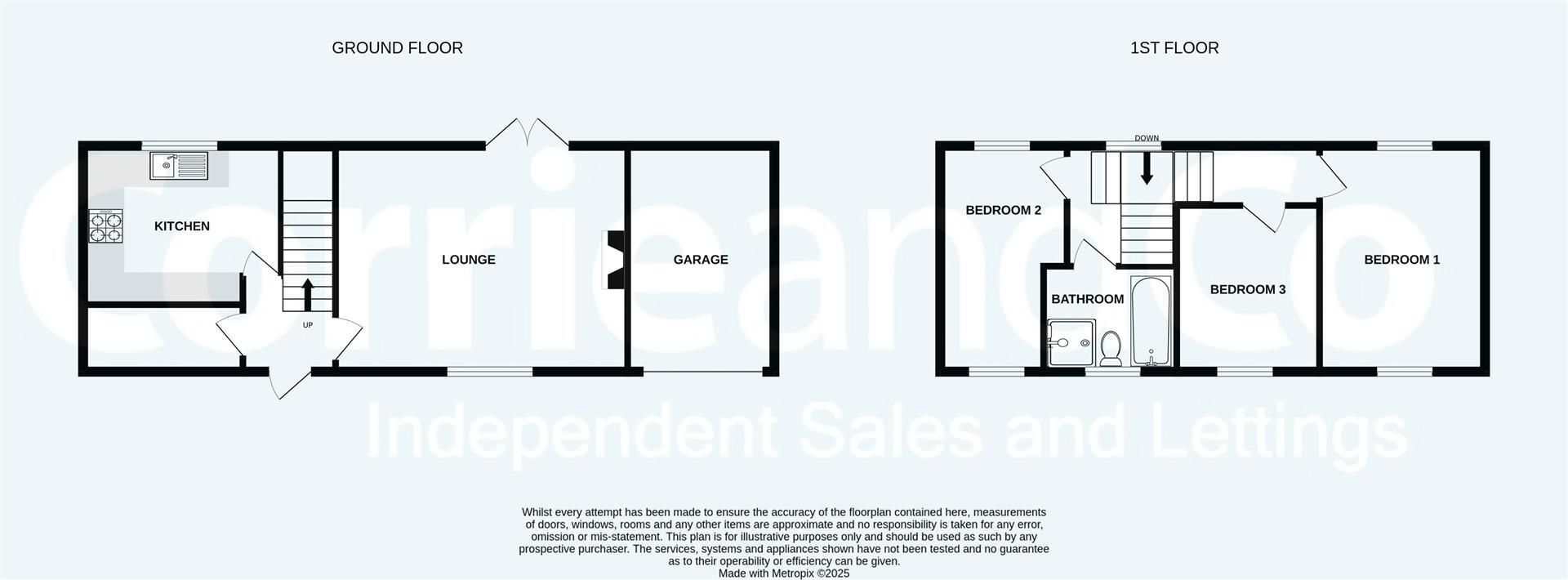
- Two-storey house with ground-floor kitchen, lounge and garage; three bedrooms and a bathroom on first floor.
Rooms
- KITCHEN:
- LOUNGE:
- GARAGE:
- BEDROOM 1:
- BEDROOM 2:
- BEDROOM 3:
- BATHROOM:
Textual Property Features
Detected Visual Features
- modern
- two-story
- grey facade
- black window frames
- residential
- urban
- minimalistic
- detached
- living room
- fireplace
- hardwood floors
- open shelving
- French doors
- spot lighting
- neutral colors
EPC Details
- Fully double glazed
- Cavity wall, as built, no insulation (assumed)
- Boiler and radiators, mains gas
- Low energy lighting in all fixed outlets
- Suspended, no insulation (assumed)
Nearby Schools
- South Walney Infant and Nursery School
- Barrow Island Community Primary School
- St Columba's School
- Cambridge Primary School
- Greengate Junior School
- Furness Academy
- Brisbane Park Infant School
- St James' CofE Junior School
- Yarlside Academy
- St Bernards Catholic High School, Barrow
- Victoria Academy
- Dane Ghyll Community Primary School and Nursery
- St George's CofE School
- Sacred Heart Catholic Primary School, Barrow
- Ramsden Infant School
- Newbarns Primary and Nursery School
- Victoria Infant and Nursery School
- St Paul's CofE Junior School
- Newton Village Academy
- Dalton St Mary's CofE Primary School
- South Walney Junior School
- Vickerstown School
- Moorfield Learning Centre
- Roose School
- Parkside Academy
- Holy Family Catholic Primary School
- Chetwynde School
- St Pius X Catholic Primary School, Barrow
- Ormsgill Nursery and Primary School
Nearest General Shops
- Id: 342091166
- Tags:
- Addr:
- City: Barrow-in-Furness
- Housename: Coral
- Housenumber: 4-6
- Postcode: LA13 9RE
- Street: Risedale Road
- Brand: Coral
- Brand:wikidata: Q54621344
- Brand:wikipedia: en:Coral (bookmaker)
- Building: yes
- Name: Coral
- Operator: Coral
- Shop: bookmaker
- TagsNormalized:
- Lat: 54.1111353
- Lon: -3.2079083
- FullGeoHash: gctez48h4qdp
- PartitionGeoHash: gcte
- Images:
- FoodStandards: null
- Distance: 222
,- Id: 344035977
- Tags:
- Addr:
- Housenumber: 70a
- Postcode: LA13 9QR
- Street: Kent Street
- Building: yes
- Name: Furness Aquatics
- Pet: fish
- Phone: +44 1229 870970
- Shop: pet
- TagsNormalized:
- Lat: 54.1121177
- Lon: -3.2096331
- FullGeoHash: gcteyfycfju5
- PartitionGeoHash: gcte
- Images:
- FoodStandards: null
- Distance: 142.9
,- Id: 344003923
- Tags:
- Addr:
- City: Barrow-in-Furness
- Housenumber: 53
- Postcode: LA13 9RR
- Street: St Lukes Street
- Building: yes
- Name: St. Lukes Street Newsagents
- Shop: newsagent
- TagsNormalized:
- Lat: 54.1125789
- Lon: -3.2067572
- FullGeoHash: gctez4but5ud
- PartitionGeoHash: gcte
- Images:
- FoodStandards: null
- Distance: 115.2
}
Nearest Grocery shops
- Id: 338389499
- Tags:
- Addr:
- City: Barrow-in-Furness
- Housename: Lesh Lane Store
- Street: Lesh Lane
- Building: yes
- Name: Lesh Lane Store
- Shop: convenience
- TagsNormalized:
- Lat: 54.117877
- Lon: -3.2079303
- FullGeoHash: gctez5b53z3y
- PartitionGeoHash: gcte
- Images:
- FoodStandards: null
- Distance: 529.3
,- Id: 338499080
- Tags:
- Addr:
- City: Barrow-in-Furness
- Housename: Quix
- Street: Roose Road
- Building: yes
- Name: Quix
- Shop: convenience
- TagsNormalized:
- Lat: 54.1117027
- Lon: -3.2010933
- FullGeoHash: gctez4tp907z
- PartitionGeoHash: gcte
- Images:
- FoodStandards: null
- Distance: 493.2
,- Id: 338418934
- Tags:
- Addr:
- City: Barrow-in-Furness
- Housename: Premier Stores
- Housenumber: 1A
- Postcode: LA13 9NP
- Street: Friars Lane
- Building: yes
- Name: Premier Stores
- Operator: Premier Stores
- Shop: convenience
- TagsNormalized:
- Lat: 54.1132582
- Lon: -3.2032538
- FullGeoHash: gctez552wf2y
- PartitionGeoHash: gcte
- Images:
- FoodStandards: null
- Distance: 326.8
}
Nearest Supermarkets
- Id: 337604113
- Tags:
- Addr:
- City: Barrow-in-Furness
- Housenumber: 162
- Postcode: LA13 0AX
- Street: Flass Lane
- Brand: Tesco
- Brand:wikidata: Q487494
- Building: yes
- Name: Tesco
- Opening_hours: Mo-Fr 07:00-22:00; Sa 07:00-20:00; Su 12:00-18:00
- Operator: Tesco
- Shop: supermarket
- TagsNormalized:
- Lat: 54.1157103
- Lon: -3.1953452
- FullGeoHash: gctez73nz59f
- PartitionGeoHash: gcte
- Images:
- FoodStandards: null
- Distance: 889.8
,- Id: 337625638
- Tags:
- Addr:
- City: Barrow-in-Furness
- Housename: ALDI
- Housenumber: 148
- Postcode: LA13 9RA
- Street: Risedale Road
- Brand: ALDI
- Brand:wikidata: Q41171672
- Brand:wikipedia: en:Aldi
- Building: retail
- Contact:
- Website: https://stores.aldi.co.uk/barrow-in-furness/148-risedale-road
- Name: ALDI
- Operator: ALDI
- Roof:
- Shop: supermarket
- TagsNormalized:
- aldi
- retail
- supermarket
- shop
- Lat: 54.1159262
- Lon: -3.2105265
- FullGeoHash: gcteygw0j7cc
- PartitionGeoHash: gcte
- Images:
- FoodStandards: null
- Distance: 345
,- Id: 319615974
- Tags:
- Brand: Co-op Food
- Brand:wikidata: Q3277439
- Brand:wikipedia: en:Co-op Food
- Building: yes
- Name: Co-op Food
- Operator: The Co-operative Group
- Shop: supermarket
- TagsNormalized:
- co-op
- co-op food
- food
- supermarket
- shop
- Lat: 54.1112906
- Lon: -3.2060028
- FullGeoHash: gctez49mnexj
- PartitionGeoHash: gcte
- Images:
- FoodStandards: null
- Distance: 251.3
}
Nearest Religious buildings
- Id: 588232631
- Tags:
- Amenity: place_of_worship
- Building: yes
- Denomination: catholic
- Name: Sacred Heart Catholic Church
- Religion: christian
- TagsNormalized:
- place of worship
- catholic
- church
- christian
- Lat: 54.1103017
- Lon: -3.2147735
- FullGeoHash: gcteyf7p6774
- PartitionGeoHash: gcte
- Images:
- FoodStandards: null
- Distance: 527.6
,- Id: 587908432
- Tags:
- Amenity: place_of_worship
- Building: yes
- Denomination: anglican
- Name: St Luke's
- Religion: christian
- TagsNormalized:
- place of worship
- anglican
- christian
- church
- Lat: 54.1110172
- Lon: -3.2050773
- FullGeoHash: gctez4d5s29n
- PartitionGeoHash: gcte
- Images:
- FoodStandards: null
- Distance: 312.8
,- Id: 479549834
- Tags:
- Amenity: place_of_worship
- Building: yes
- Name: Risedale Gospel Hall
- Religion: christian
- TagsNormalized:
- place of worship
- christian
- church
- Lat: 54.1133992
- Lon: -3.210095
- FullGeoHash: gcteygn3rkex
- PartitionGeoHash: gcte
- Images:
- FoodStandards: null
- Distance: 123.4
}
Nearest Medical buildings
- Id: 338499081
- Tags:
- Addr:
- City: Barrow-in-Furness
- Housename: Murray Pharmacy
- Street: Roose Road
- Amenity: pharmacy
- Building: yes
- Healthcare: pharmacy
- Name: Murray Pharmacy
- Operator: Murray Pharmacy
- TagsNormalized:
- Lat: 54.1116744
- Lon: -3.2013255
- FullGeoHash: gctez4sz7enw
- PartitionGeoHash: gcte
- Images:
- FoodStandards: null
- Distance: 479.9
,- Id: 344208916
- Tags:
- Addr:
- City: Barrow-in-Furness
- Housenumber: 2-4
- Postcode: LA13 9RX
- Street: Gloucester Street
- Amenity: doctors
- Building: yes
- Healthcare: doctor
- Name: Risedale Surgery
- TagsNormalized:
- doctor
- doctors
- health
- healthcare
- surgery
- Lat: 54.1112374
- Lon: -3.2074431
- FullGeoHash: gctez48kv1v0
- PartitionGeoHash: gcte
- Images:
- FoodStandards: null
- Distance: 216.2
,- Id: 342091164
- Tags:
- Addr:
- City: Barrow-in-Furness
- Housenumber: 8
- Postcode: LA13 9RD
- Street: Risedale Road
- Amenity: pharmacy
- Brand: Boots
- Brand:wikidata: Q6123139
- Brand:wikipedia: en:Boots UK
- Building: yes
- Healthcare: pharmacy
- Name: Boots
- TagsNormalized:
- pharmacy
- boots
- health
- healthcare
- Lat: 54.1112187
- Lon: -3.2079574
- FullGeoHash: gctez48h9nm8
- PartitionGeoHash: gcte
- Images:
- FoodStandards: null
- Distance: 212.5
,- Id: 337800644
- Tags:
- Addr:
- City: Barrow-in-Furness
- Housename: Bridgegate Medical Centre
- Postcode: LA13 9SH
- Street: Winchester Street
- Amenity: doctors
- Building: yes
- Healthcare: doctor
- Name: Bridgegate Medical Centre
- TagsNormalized:
- doctor
- doctors
- health
- healthcare
- Lat: 54.1148666
- Lon: -3.2091355
- FullGeoHash: gcteygr1vwr1
- PartitionGeoHash: gcte
- Images:
- FoodStandards: null
- Distance: 202.2
}
Nearest Leisure Facilities
- Id: 249978107
- Tags:
- Leisure: pitch
- Name: Salthouse Crown Green Bowls Club
- Sport: bowls
- TagsNormalized:
- pitch
- leisure
- bowls
- club
- sports
- Lat: 54.1098935
- Lon: -3.211487
- FullGeoHash: gcteyfmkyzjx
- PartitionGeoHash: gcte
- Images:
- FoodStandards: null
- Distance: 415.9
,- Id: 588192505
- Tags:
- Building: yes
- Leisure: sports_centre
- Name: The Dojo
- Sport: martial_arts
- TagsNormalized:
- sports
- sports centre
- leisure
- dojo
- martial
- martial arts
- Lat: 54.1108567
- Lon: -3.2076873
- FullGeoHash: gctez484x6yc
- PartitionGeoHash: gcte
- Images:
- FoodStandards: null
- Distance: 254.6
,- Id: 344660887
- Tags:
- TagsNormalized:
- Lat: 54.1147844
- Lon: -3.2063112
- FullGeoHash: gctez531rwcn
- PartitionGeoHash: gcte
- Images:
- FoodStandards: null
- Distance: 224.5
,- Id: 479547909
- Tags:
- Leisure: park
- Name: Little Park
- TagsNormalized:
- Lat: 54.1144476
- Lon: -3.2064538
- FullGeoHash: gctez51ps0nv
- PartitionGeoHash: gcte
- Images:
- FoodStandards: null
- Distance: 188.8
,- Id: 344660621
- Tags:
- Leisure: pitch
- Name: Newdale/Abbots Vale Community Centre (Artificial) Crown Green Bowls Club
- Sport: bowls
- Surface: artificial_turf
- TagsNormalized:
- pitch
- leisure
- bowls
- community centre
- club
- sports
- Lat: 54.1134257
- Lon: -3.2062379
- FullGeoHash: gctez51391xt
- PartitionGeoHash: gcte
- Images:
- FoodStandards: null
- Distance: 136.2
}
Nearest Tourist attractions
- Id: 8909657802
- Tags:
- Amenity: shelter
- Description: shelter shaped like an umbrella with a basket
- Tourism: artwork
- TagsNormalized:
- Lat: 54.1023239
- Lon: -3.200852
- FullGeoHash: gctez1j0yspv
- PartitionGeoHash: gcte
- Images:
- FoodStandards: null
- Distance: 1294.2
,- Id: 6969213908
- Tags:
- Addr:
- City: Barrow-in-Furness
- Postcode: LA14 2HA
- Street: Michaelson Road
- Name: Waterview Apartments
- Tourism: apartment
- Website: https://www.waterviewapartments.co.uk/
- TagsNormalized:
- Lat: 54.1099795
- Lon: -3.227098
- FullGeoHash: gcteyd6j7pm2
- PartitionGeoHash: gcte
- Images:
- FoodStandards: null
- Distance: 1276.5
,- Id: 6726097670
- Tags:
- Addr:
- City: Barrow-in-Furness
- Housenumber: 10
- Street: Glasgow Street
- Internet_access: yes
- Name: The Garden
- Operator: Owner
- Tourism: guest_house
- Website: https://www.booking.com/hotel/gb/the-garden.en-gb.html
- TagsNormalized:
- Lat: 54.1113357
- Lon: -3.2174405
- FullGeoHash: gcteyf9jkhn6
- PartitionGeoHash: gcte
- Images:
- FoodStandards: null
- Distance: 630.3
}
Nearest Train stations
- Id: 671243023
- Tags:
- Amenity: shelter
- Bench: yes
- Building: train_station
- Building:levels: 1
- Nohousenumber: yes
- Roof:
- Shelter_type: public_transport
- TagsNormalized:
- shelter
- station
- train
- train station
- public transport
- Lat: 54.1891476
- Lon: -3.2044286
- FullGeoHash: gctsr0fdemkb
- PartitionGeoHash: gcts
- Images:
- FoodStandards: null
- Distance: 8457.4
,- Id: 6080982976
- Tags:
- Name: Askam
- Naptan:
- Network: National Rail
- Public_transport: station
- Railway: station
- Ref:
- Wheelchair: yes
- Wikidata: Q2501136
- Wikipedia: en:Askam railway station
- TagsNormalized:
- Lat: 54.1891252
- Lon: -3.2045609
- FullGeoHash: gctsr0fd8344
- PartitionGeoHash: gcts
- Images:
- FoodStandards: null
- Distance: 8454.7
,- Id: 48393605
- Tags:
- Alt_name: Dalton-in-Furness
- Name: Dalton
- Naptan:
- Network: National Rail
- Public_transport: station
- Railway: station
- Ref:
- Source: npe
- Wikidata: Q3152097
- Wikipedia: en:Dalton railway station
- TagsNormalized:
- Lat: 54.154226
- Lon: -3.1788365
- FullGeoHash: gctspdmppxrt
- PartitionGeoHash: gcts
- Images:
- FoodStandards: null
- Distance: 4956.4
,- Id: 5065927285
- Tags:
- Name: Barrow-in-Furness
- Naptan:
- Network: National Rail
- Operator: Northern
- Public_transport: station
- Railway: station
- Ref:
- Train: yes
- Wikidata: Q1814436
- Wikipedia: en:Barrow-in-Furness railway station
- TagsNormalized:
- Lat: 54.1191205
- Lon: -3.2260261
- FullGeoHash: gcteys4fspk8
- PartitionGeoHash: gcte
- Images:
- FoodStandards: null
- Distance: 1336.2
,- Id: 8447567917
- Tags:
- Name: Roose
- Naptan:
- Network: National Rail
- Public_transport: station
- Railway: station
- Ref:
- Source: npe
- Wikidata: Q3394586
- Wikipedia: en:Roose railway station
- TagsNormalized:
- Lat: 54.1150592
- Lon: -3.1943835
- FullGeoHash: gctez73gj6pn
- PartitionGeoHash: gcte
- Images:
- FoodStandards: null
- Distance: 929.9
}
Nearest Hotels
- Id: 4307973608
- Tags:
- Addr:
- Postcode: LA14 1HP
- Street: Duke Street
- Brand: OYO
- Internet_access: wlan
- Name: Majestic Hotel
- Opening_hours: 24/7
- Phone: +44 1415360150
- Tourism: hotel
- Website: https://www.oyorooms.com/gb/86189-oyo-hotels-oyo-hotel-majestic-barrow-in-furness/
- TagsNormalized:
- Lat: 54.1107442
- Lon: -3.2270082
- FullGeoHash: gcteydd1vmb6
- PartitionGeoHash: gcte
- Images:
- FoodStandards: null
- Distance: 1250.2
,- Id: 338834269
- Tags:
- Addr:
- City: Barrow-in-Furness
- Housename: Duke of Edinburgh Hotel
- Postcode: LA14 5QR
- Street: Abbey Road
- Amenity: restaurant
- Building: yes
- Cuisine: regional
- Fhrs:
- Name: Duke of Edinburgh Hotel
- Wikidata: Q7731184
- TagsNormalized:
- Lat: 54.1168757
- Lon: -3.2257565
- FullGeoHash: gcteyeejdkv9
- PartitionGeoHash: gcte
- Images:
- FoodStandards: null
- Distance: 1214.2
,- Id: 338502860
- Tags:
- Addr:
- City: Barrow-in-Furness
- Housename: The Washington Hotel
- Postcode: LA13 9RG
- Street: Roose Road
- Amenity: pub
- Building: yes
- Name: The Washington Hotel
- TagsNormalized:
- Lat: 54.1107096
- Lon: -3.2081863
- FullGeoHash: gcteyfxcez6g
- PartitionGeoHash: gcte
- Images:
- FoodStandards: null
- Distance: 268.2
}
Tags
- modern
- two-story
- grey facade
- black window frames
- residential
- urban
- minimalistic
- detached
- modern
- living room
- fireplace
- hardwood floors
- open shelving
- French doors
- spot lighting
- neutral colors
Local Market Stats
- Average Price/sqft: £194
- Avg Income: £38200
- Social Housing: 2%
- Planning Success Rate: 96%
AirBnB Data
- 1km average: £48/night
- Listings in 1km: 1
Similar Properties
 3 bedroom semi-detached house for sale in Flass Lane, Barrow-In-Furness, LA13 — £230,000 • 3 bed • 1 bath • 948 ft²
 3 bedroom detached house for sale in Valley Drive, Barrow-In-Furness, LA13 9JG, LA13 — £260,000 • 3 bed • 2 bath • 1454 ft²
 2 bedroom terraced house for sale in Lorne Road, Barrow-In-Furness, LA13 — £150,000 • 2 bed • 1 bath • 862 ft²
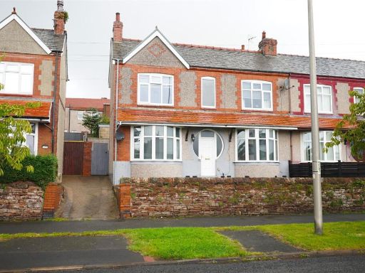 3 bedroom semi-detached house for sale in Roose Road, Barrow-In-Furness, LA13 — £195,000 • 3 bed • 1 bath • 1217 ft²
 3 bedroom terraced house for sale in Urswick Green, Barrow-in-Furness, LA13 — £133,500 • 3 bed • 1 bath • 623 ft²
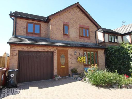 4 bedroom detached house for sale in Tamworth Drive, Barrow-in-Furness, Cumbria, LA13 — £340,000 • 4 bed • 3 bath
Meta
- {
"@context": "https://schema.org",
"@type": "Residence",
"name": "3 bedroom house for sale in Gloucester Street, BarrowInFurn…",
"description": "",
"url": "https://propertypiper.co.uk/property/d009be45-5d66-40b2-93d1-cf2baa522f2a",
"image": "https://image-a.propertypiper.co.uk/f809e6c8-4eb1-41a4-b204-5d2b62aff4f1-1024.jpeg",
"address": {
"@type": "PostalAddress",
"streetAddress": "93 GLOUCESTER STREET BARROW-IN-FURNESS",
"postalCode": "LA13 9RY",
"addressLocality": "Barrow-in-Furness",
"addressRegion": "Barrow and Furness",
"addressCountry": "England"
},
"geo": {
"@type": "GeoCoordinates",
"latitude": 54.113121222129124,
"longitude": -3.208262578968016
},
"numberOfRooms": 3,
"numberOfBathroomsTotal": 1,
"floorSize": {
"@type": "QuantitativeValue",
"value": 905,
"unitCode": "FTK"
},
"offers": {
"@type": "Offer",
"price": 220000,
"priceCurrency": "GBP",
"availability": "https://schema.org/InStock"
},
"additionalProperty": [
{
"@type": "PropertyValue",
"name": "Feature",
"value": "modern"
},
{
"@type": "PropertyValue",
"name": "Feature",
"value": "two-story"
},
{
"@type": "PropertyValue",
"name": "Feature",
"value": "grey facade"
},
{
"@type": "PropertyValue",
"name": "Feature",
"value": "black window frames"
},
{
"@type": "PropertyValue",
"name": "Feature",
"value": "residential"
},
{
"@type": "PropertyValue",
"name": "Feature",
"value": "urban"
},
{
"@type": "PropertyValue",
"name": "Feature",
"value": "minimalistic"
},
{
"@type": "PropertyValue",
"name": "Feature",
"value": "detached"
},
{
"@type": "PropertyValue",
"name": "Feature",
"value": "modern"
},
{
"@type": "PropertyValue",
"name": "Feature",
"value": "living room"
},
{
"@type": "PropertyValue",
"name": "Feature",
"value": "fireplace"
},
{
"@type": "PropertyValue",
"name": "Feature",
"value": "hardwood floors"
},
{
"@type": "PropertyValue",
"name": "Feature",
"value": "open shelving"
},
{
"@type": "PropertyValue",
"name": "Feature",
"value": "French doors"
},
{
"@type": "PropertyValue",
"name": "Feature",
"value": "spot lighting"
},
{
"@type": "PropertyValue",
"name": "Feature",
"value": "neutral colors"
}
]
}
High Res Floorplan Images
Compatible Floorplan Images
FloorplanImages Thumbnail