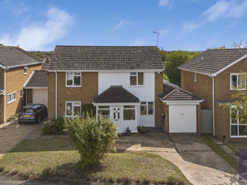
RG10 0BE - 4 bedroom detached house for sale in Mallard Close, Twyford…
View on Property Piper
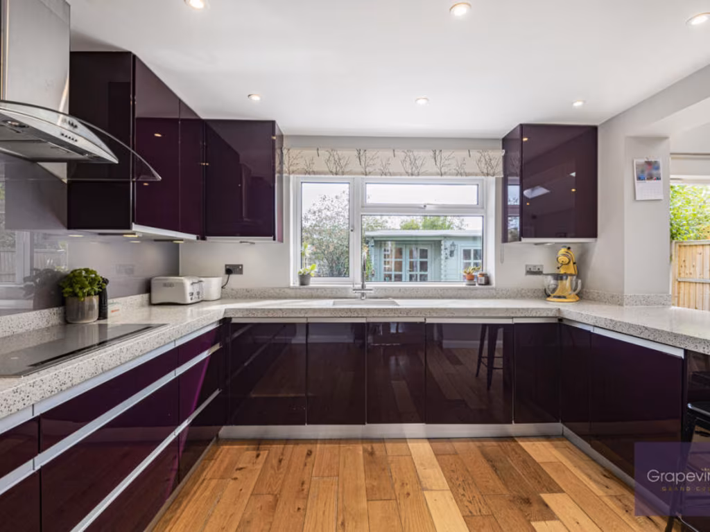
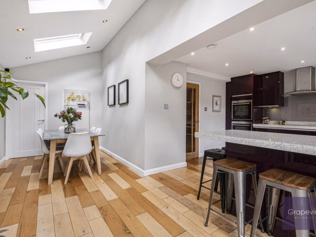
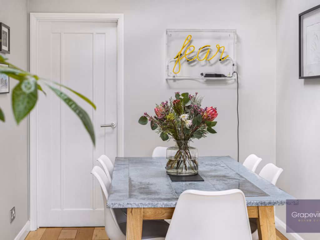
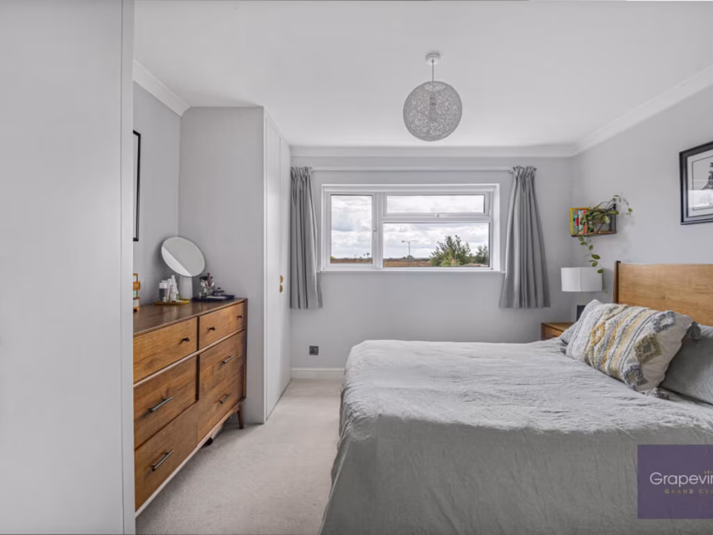
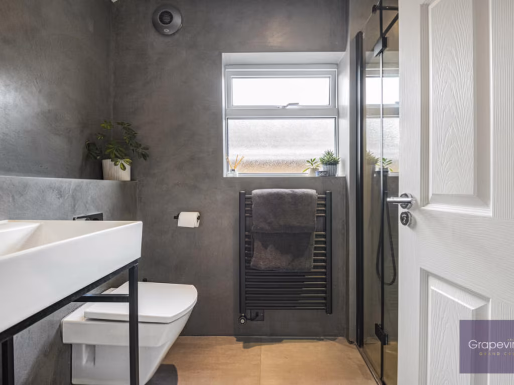
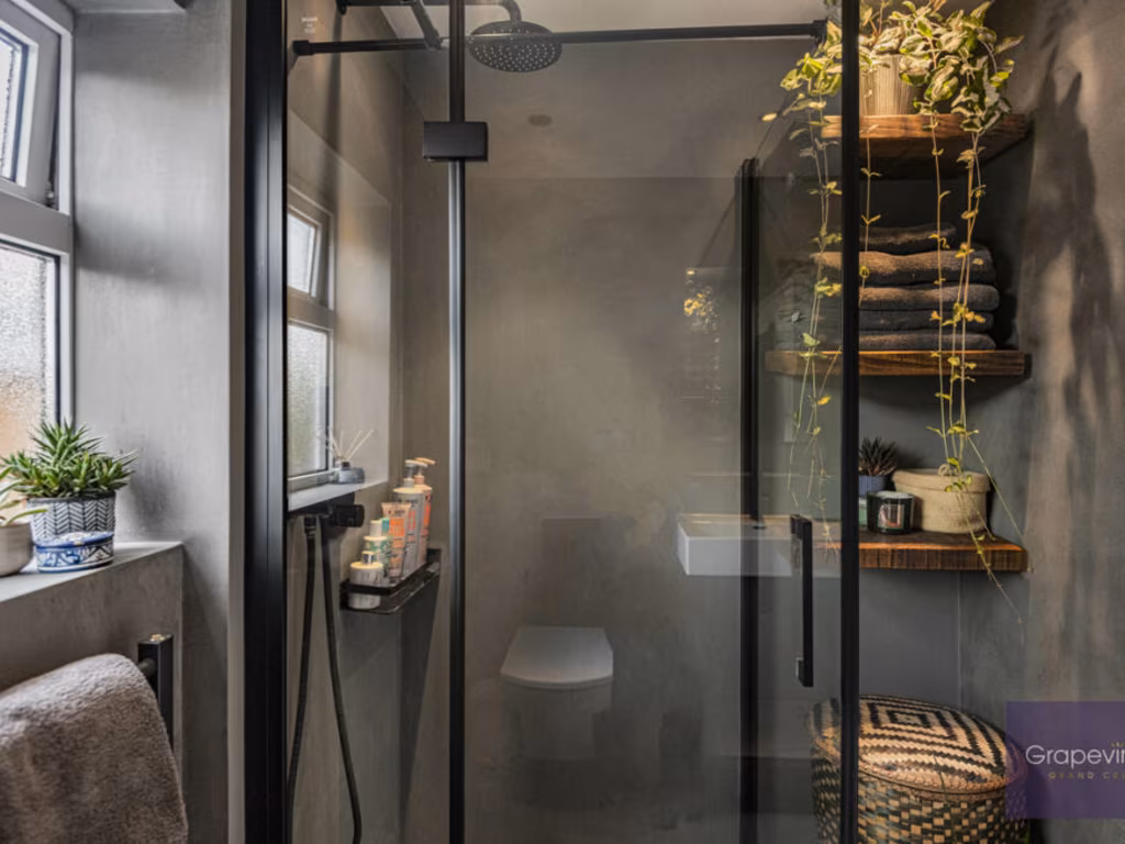
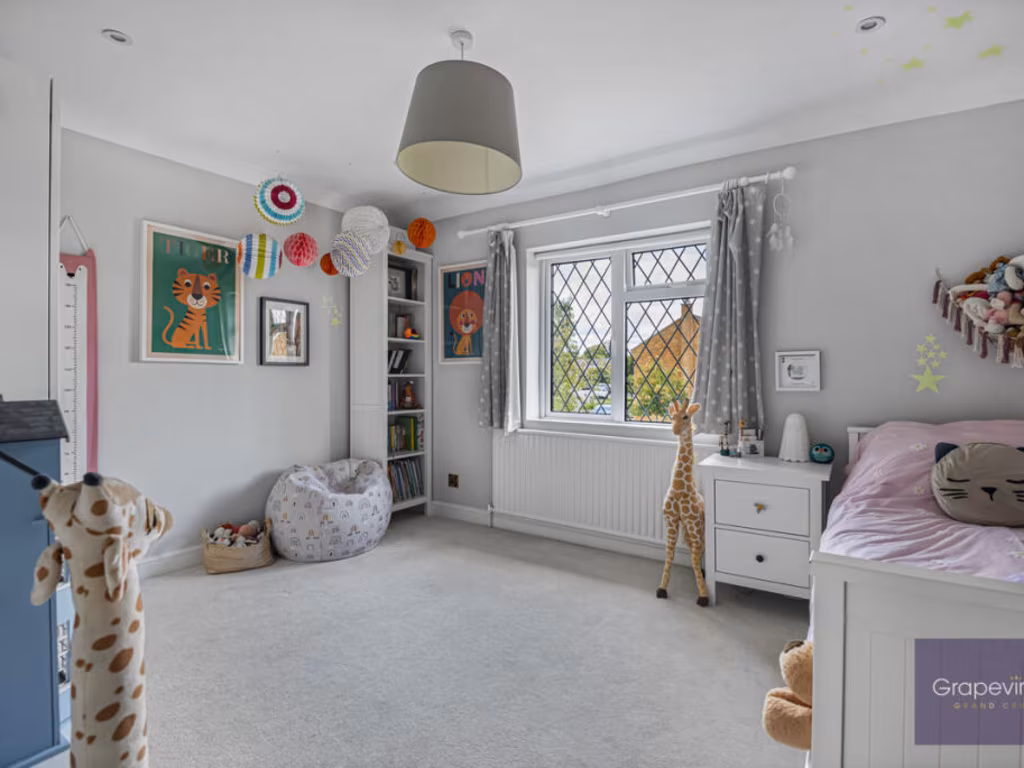
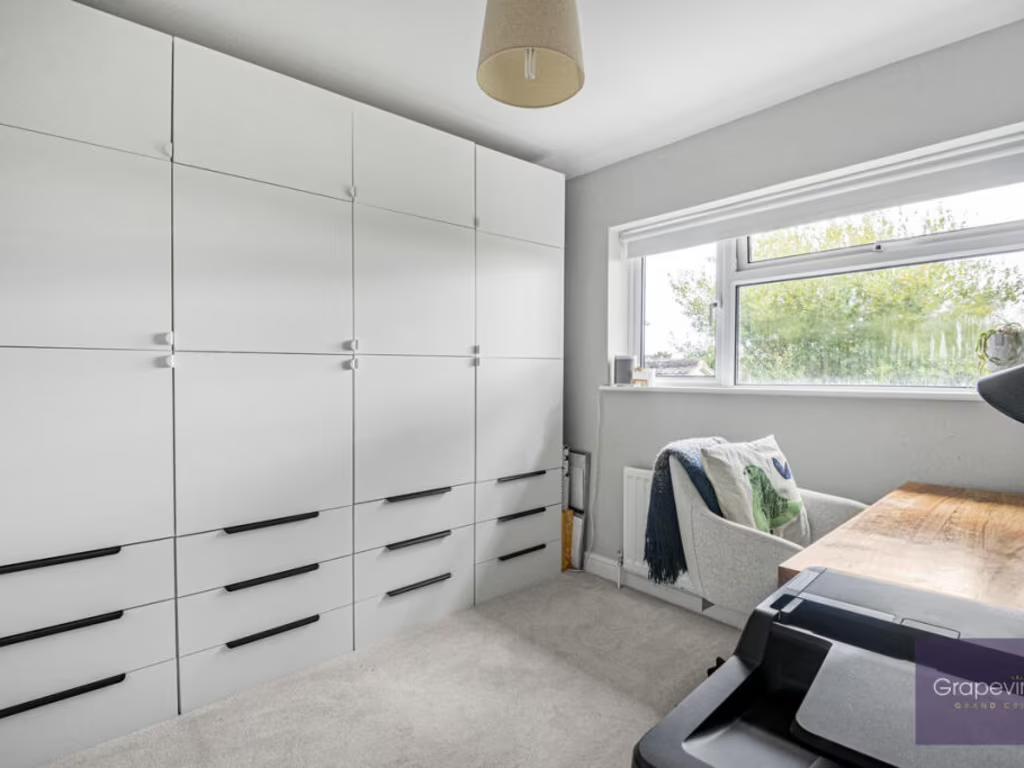
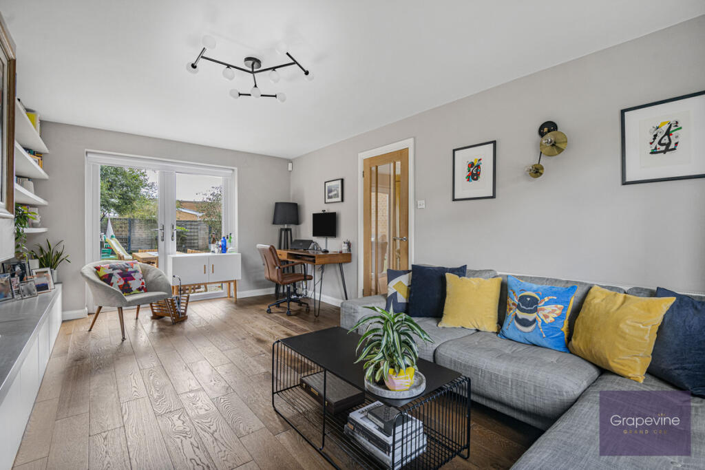
4 bedroom detached house for sale in Mallard Close, Twyford, RG10
Property Details
- Price: £875000
- Bedrooms: 4
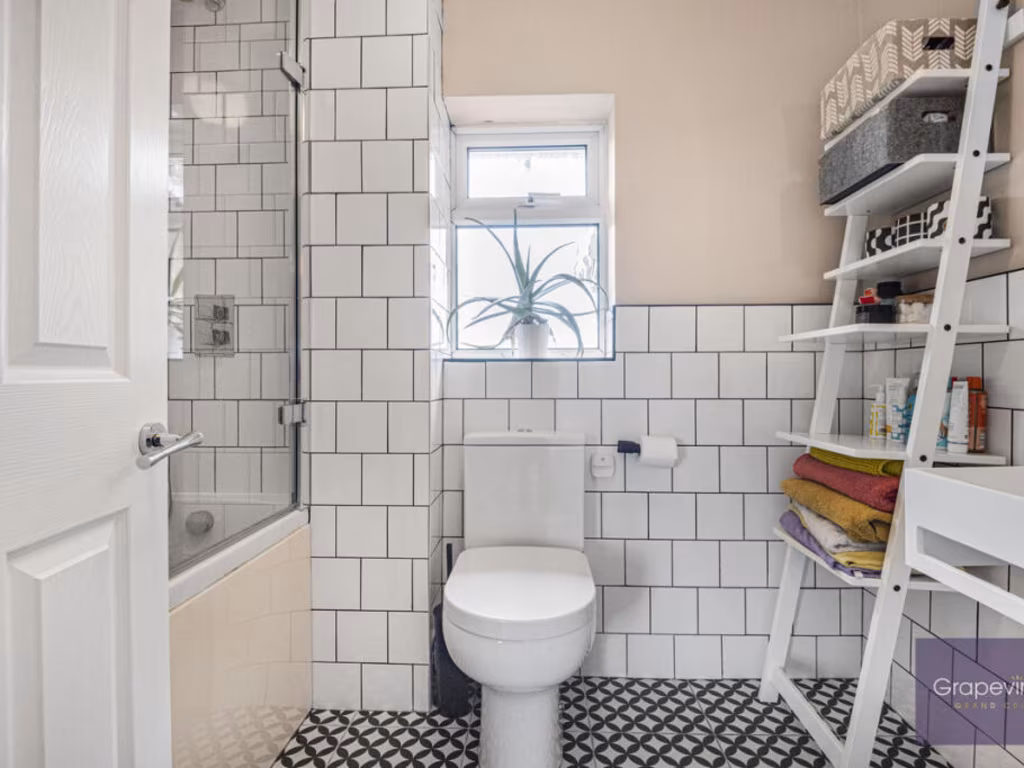
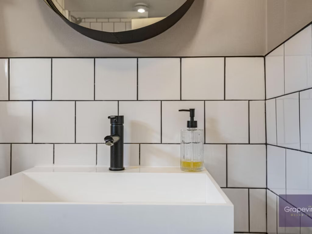
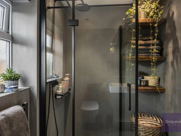
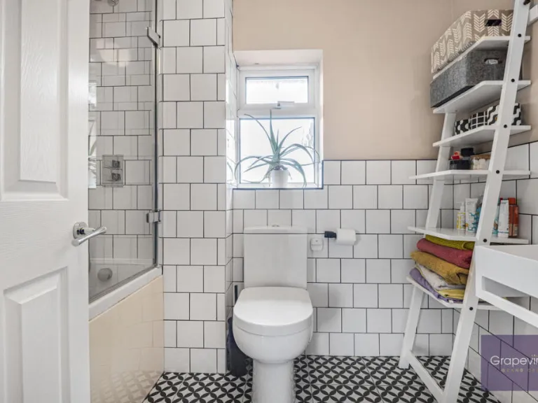
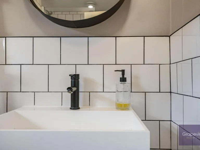
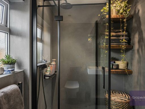
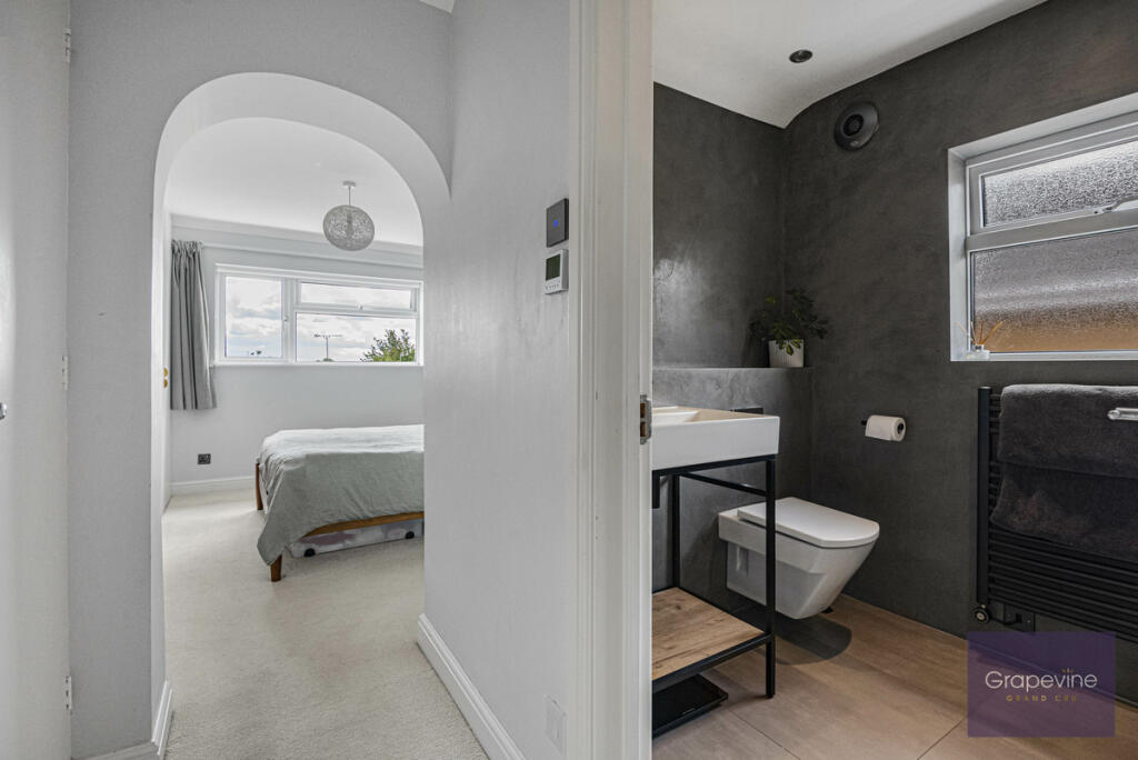
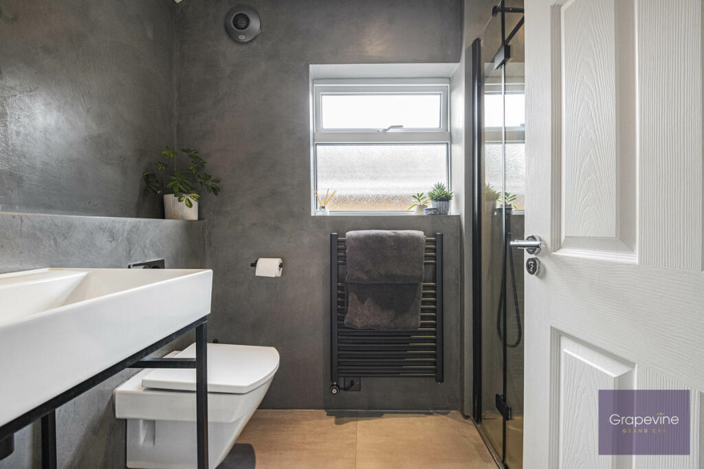
- Bathrooms: 2
- Property Type: undefined
- Property SubType: undefined
Image Descriptions
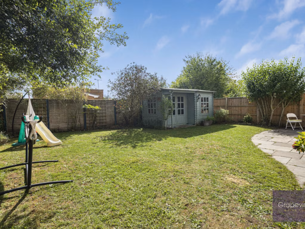
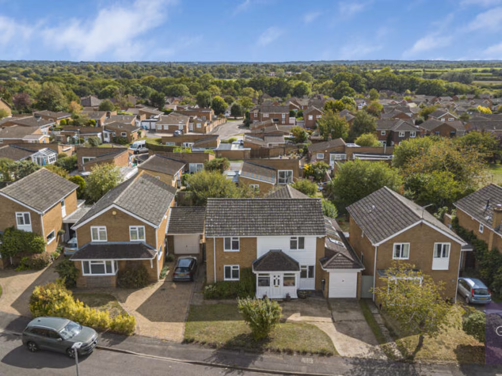
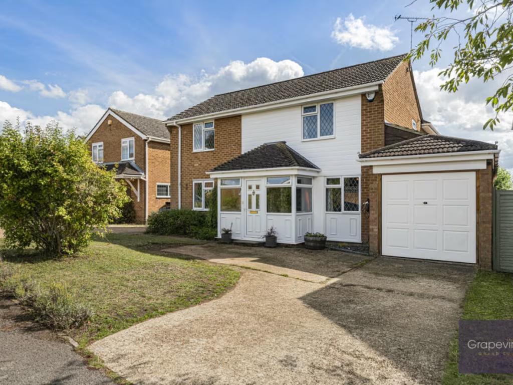
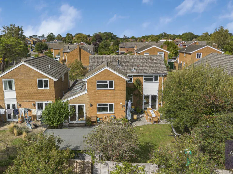
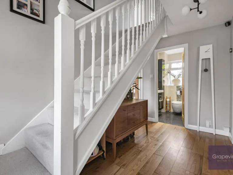
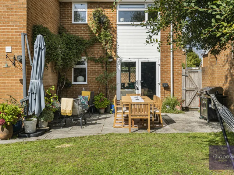
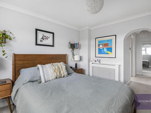
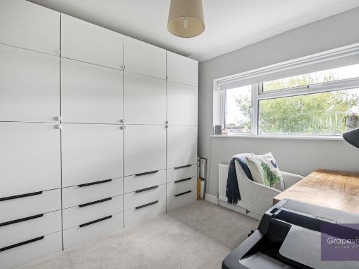
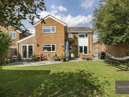
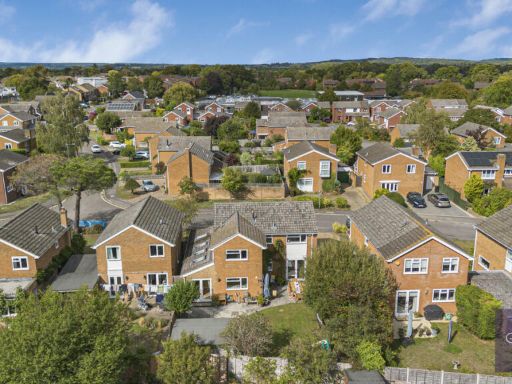
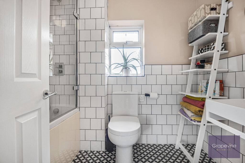
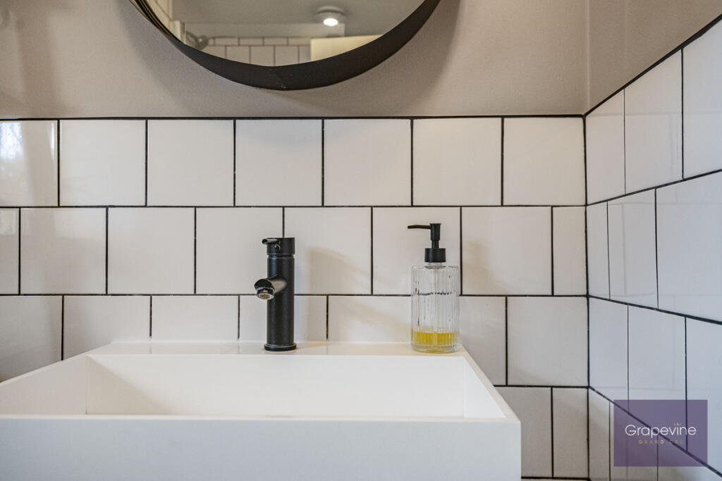
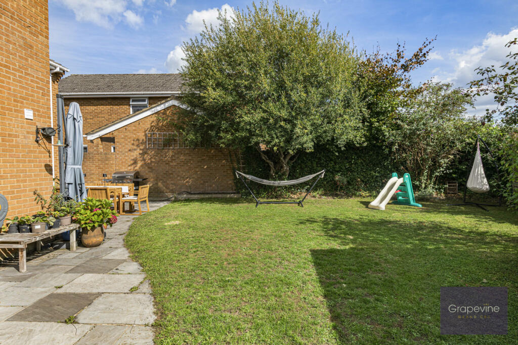
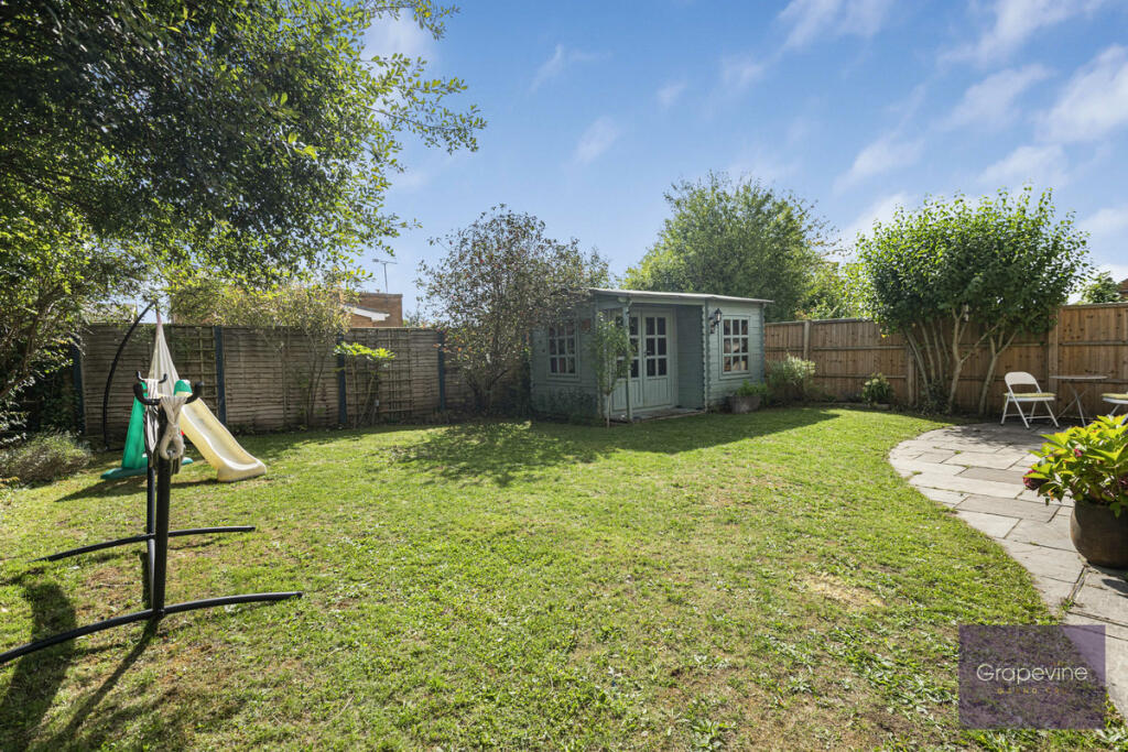
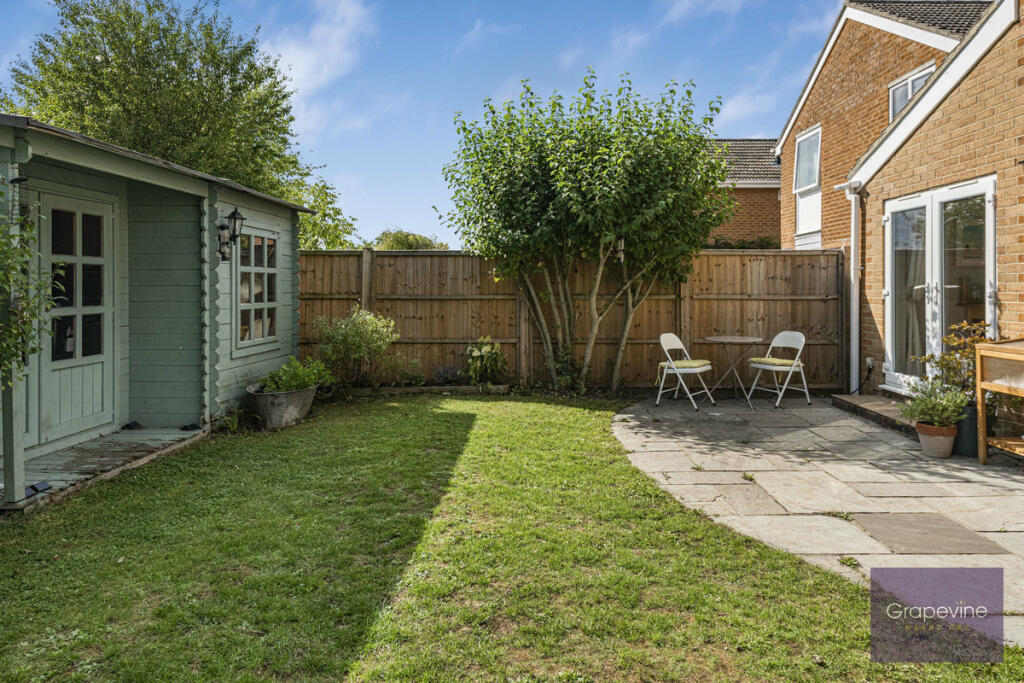
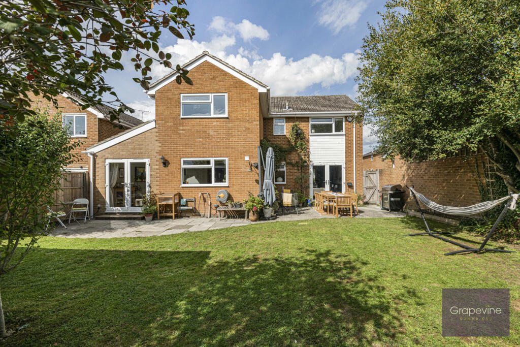
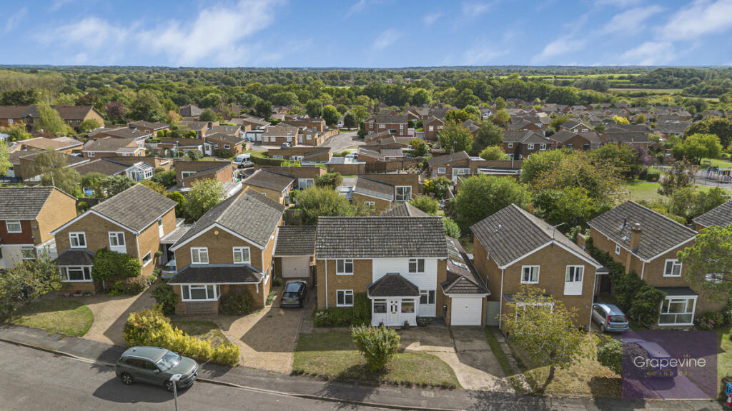
- family home 1980s suburban
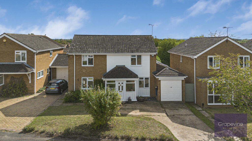
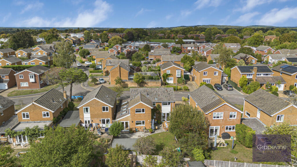
- detached house 1970s suburban
Floorplan Description
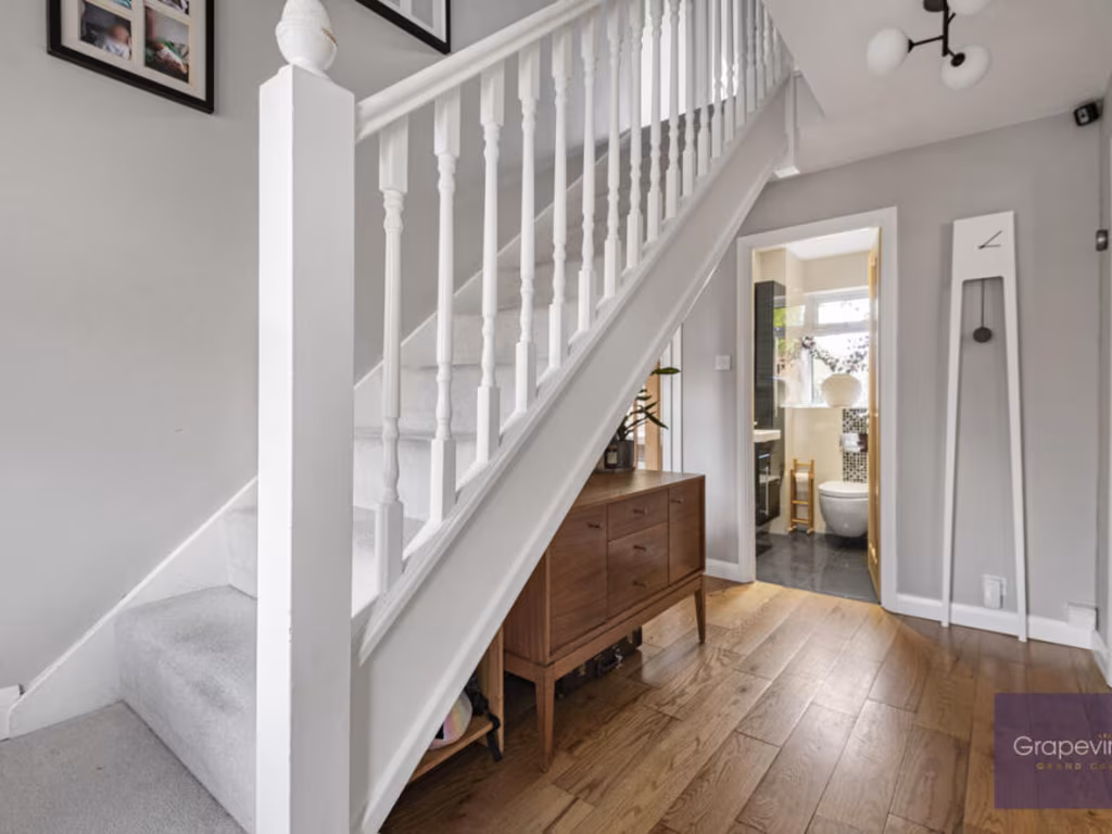
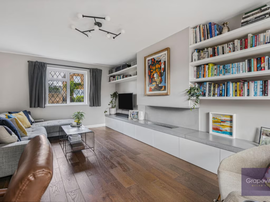
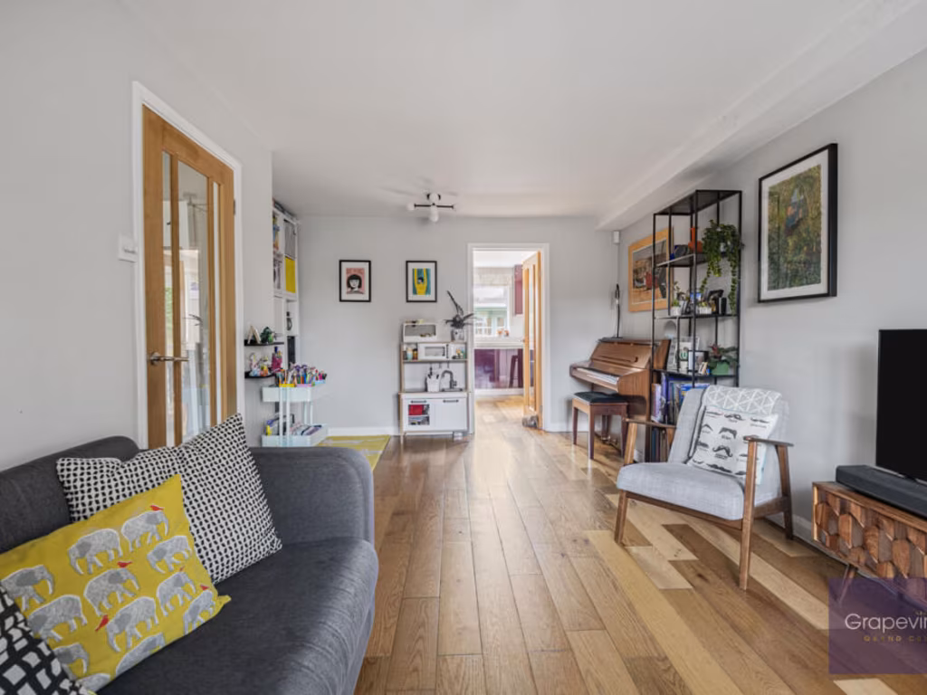
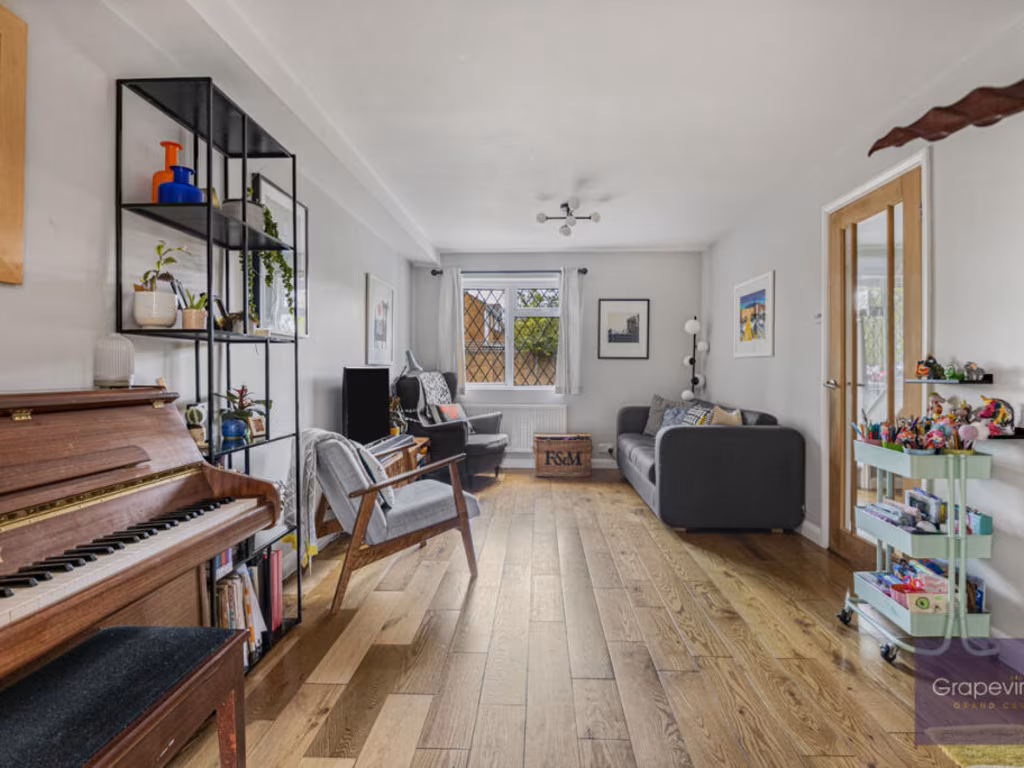
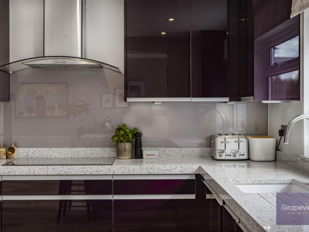
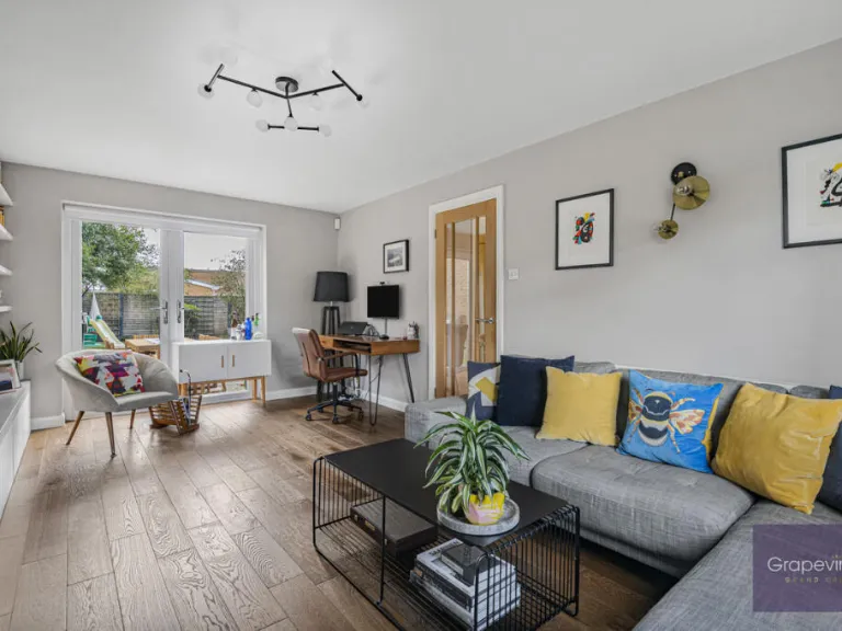
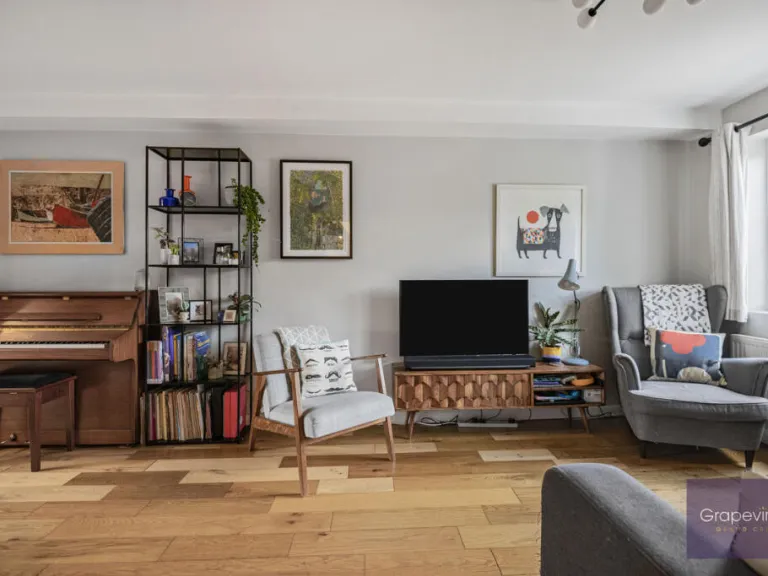
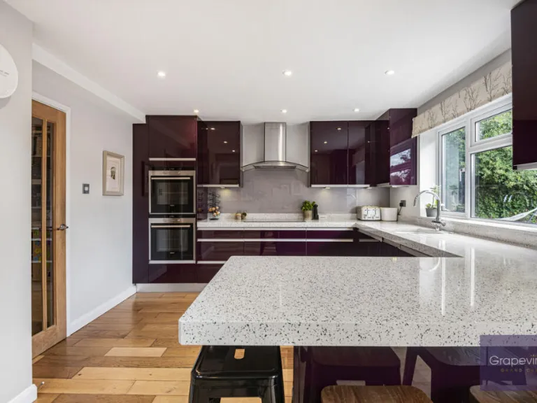
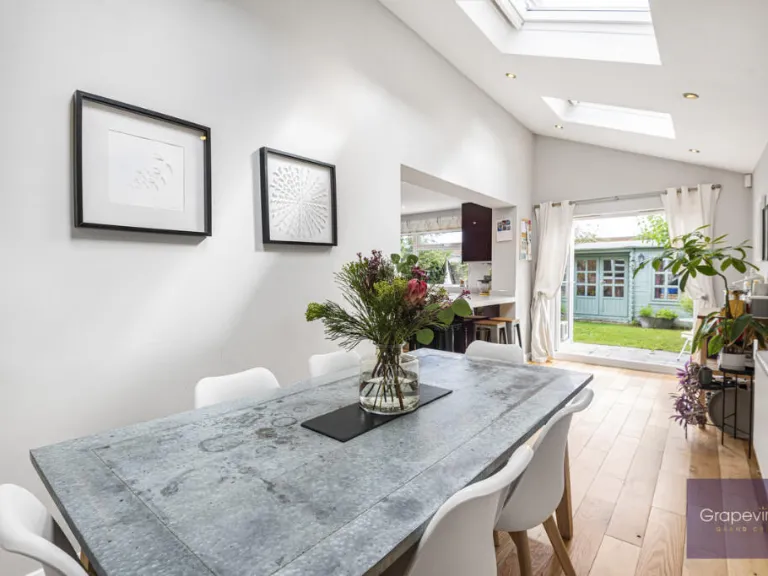
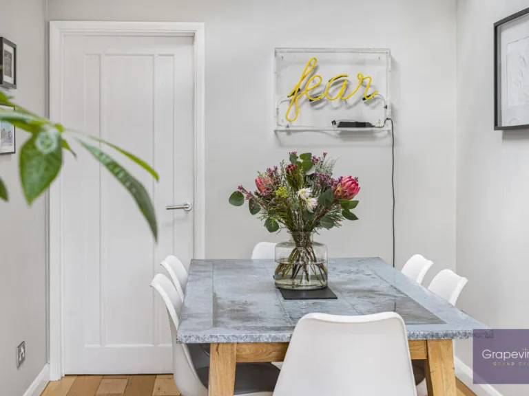
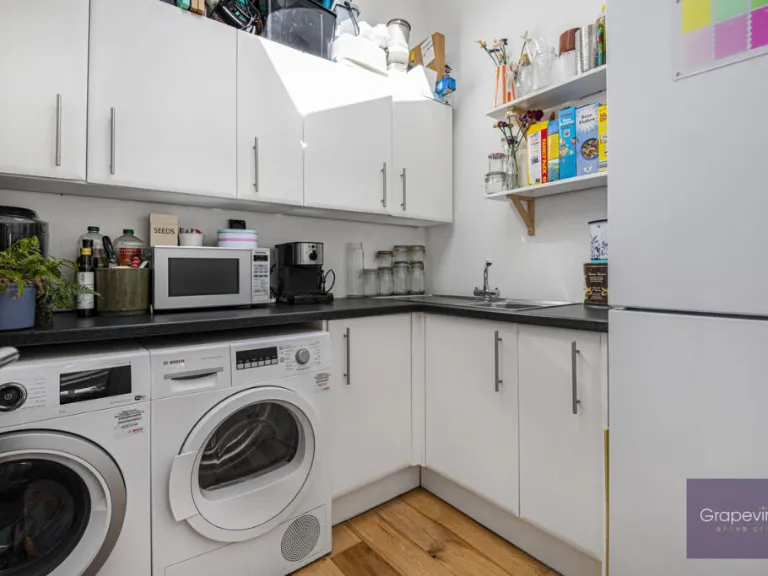
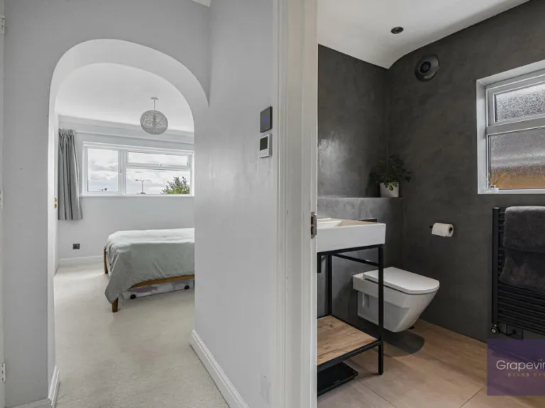
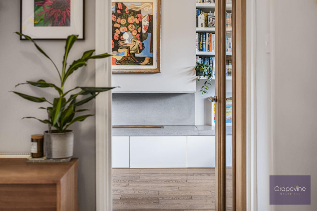
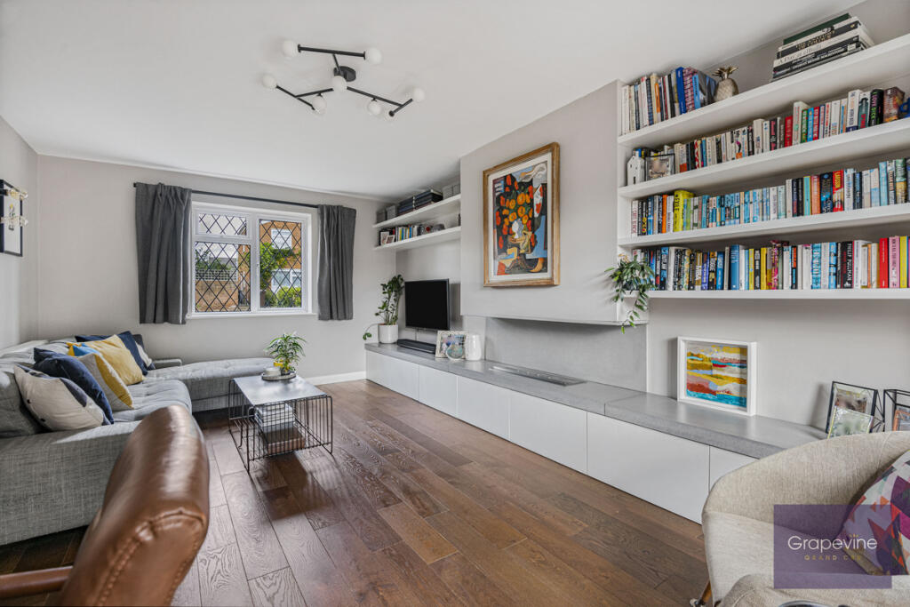
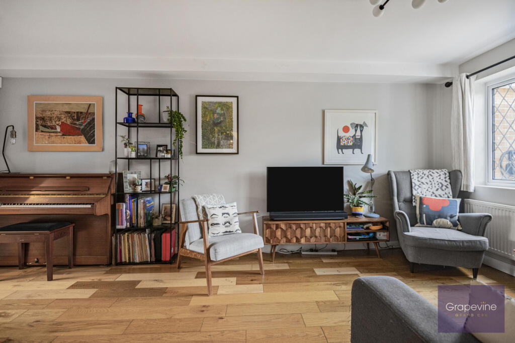
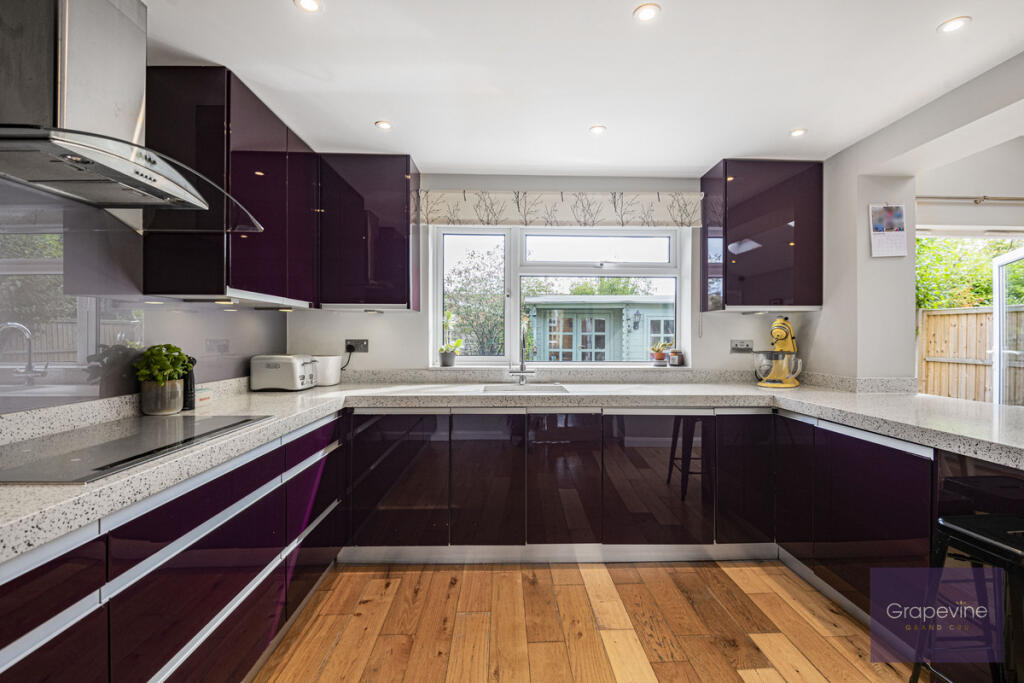
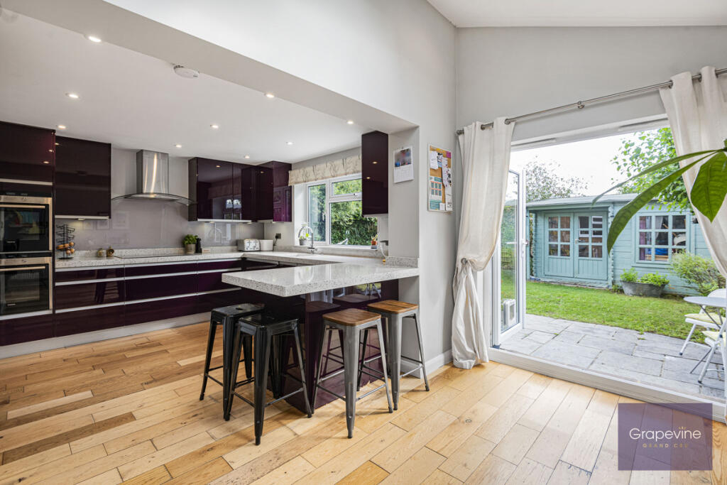
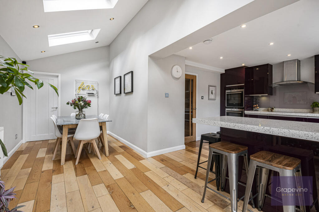
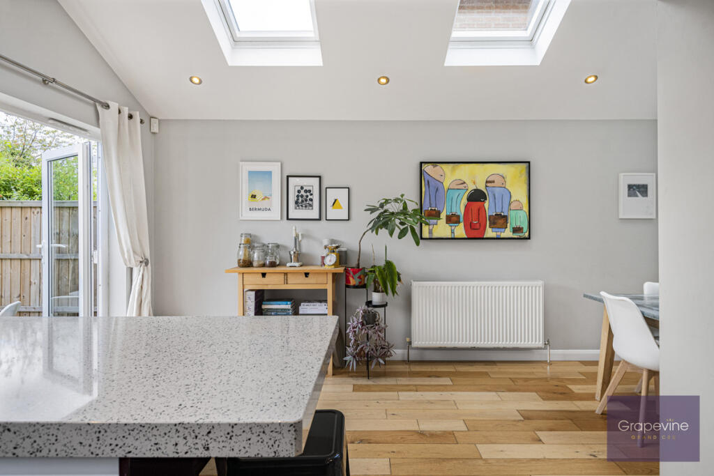
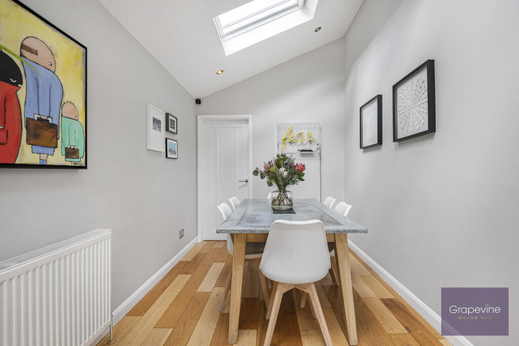
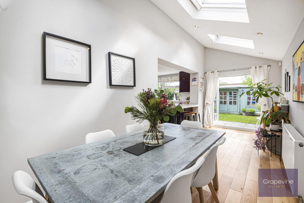
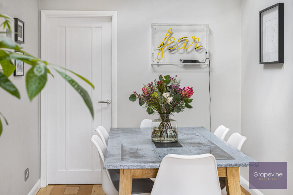
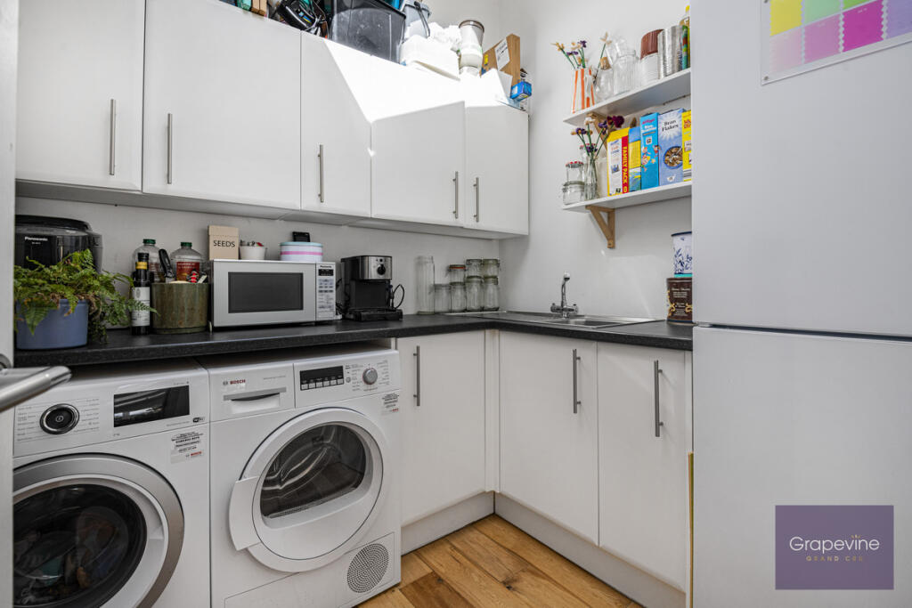
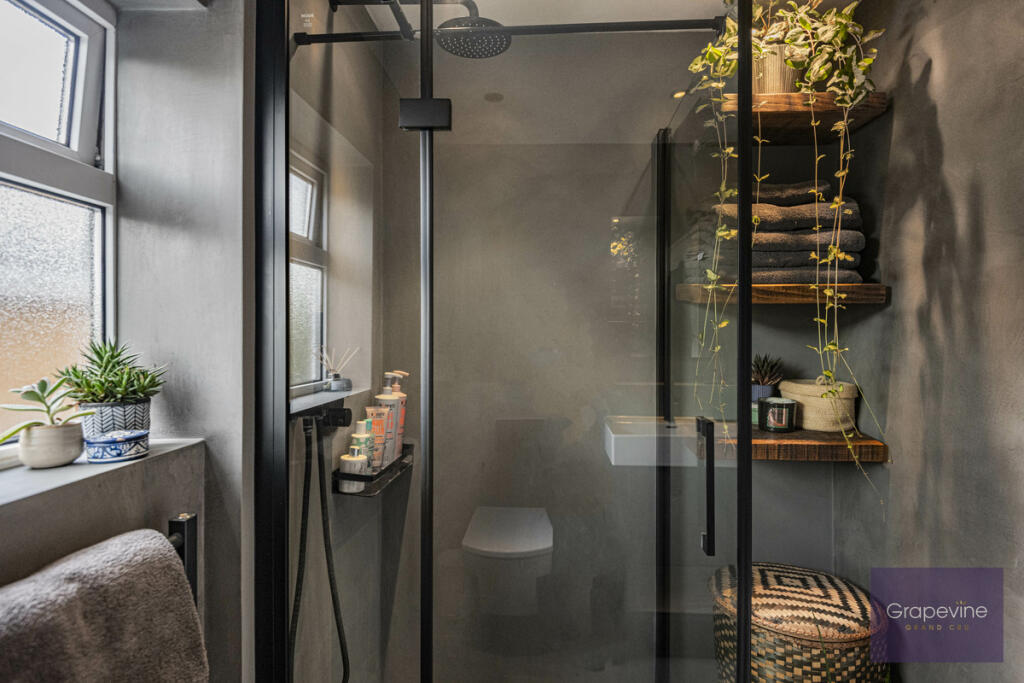
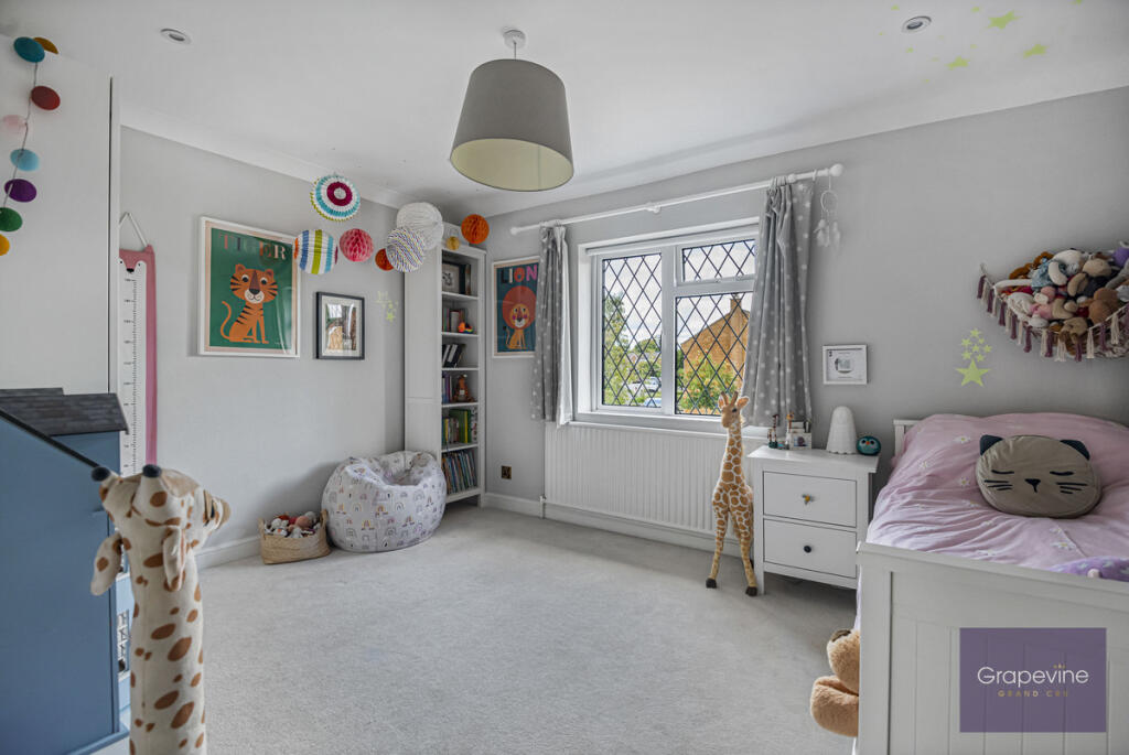
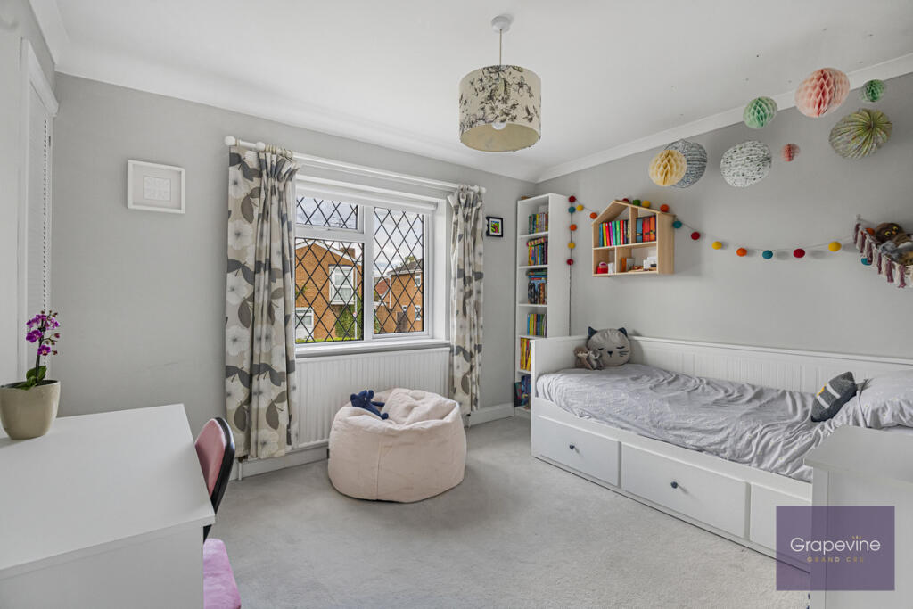
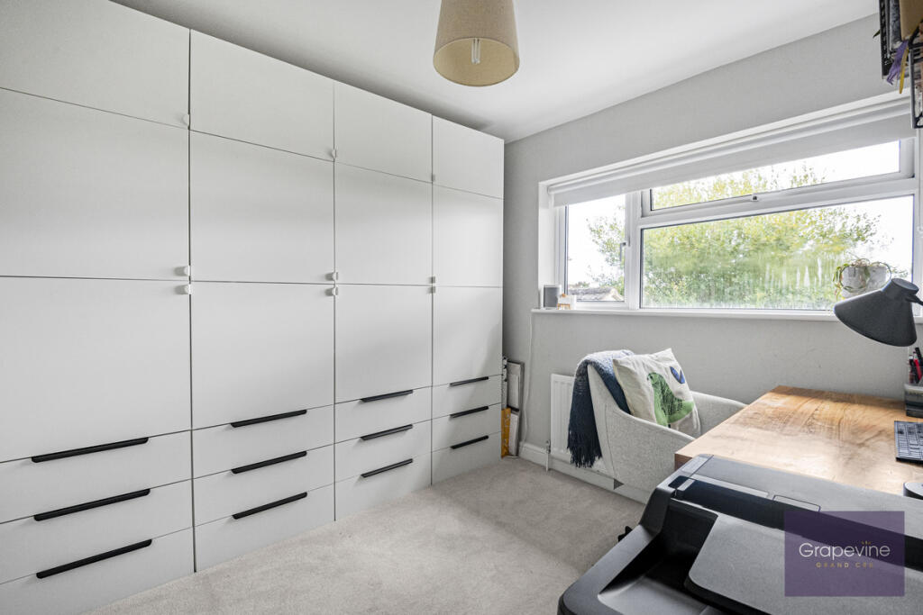
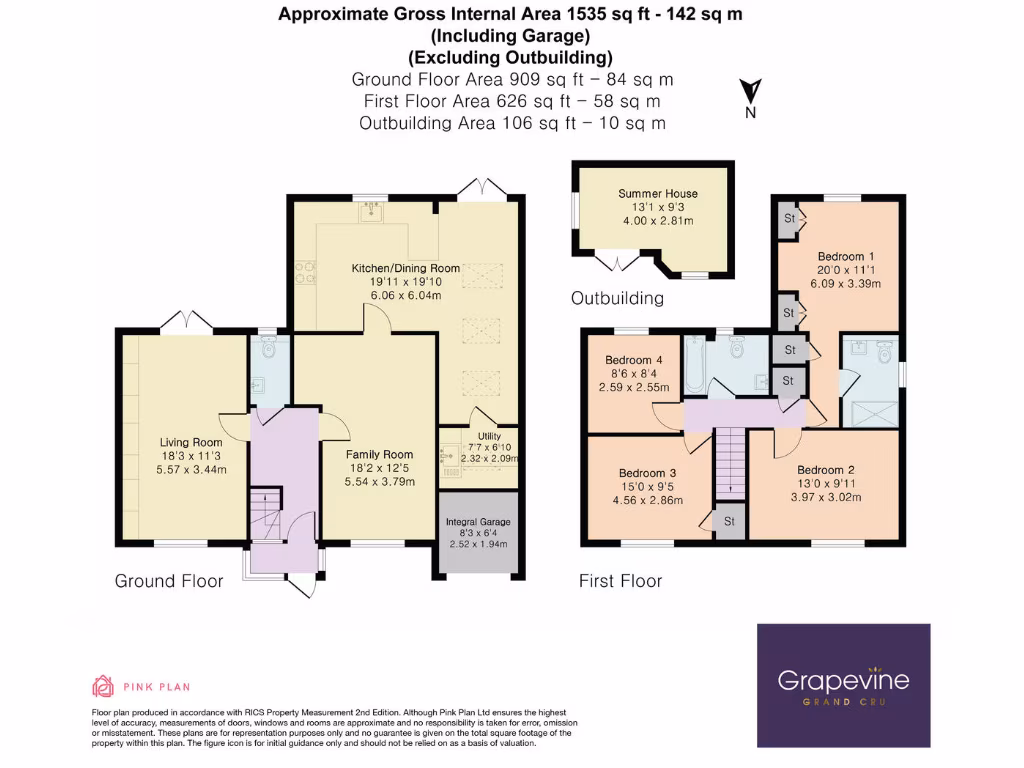
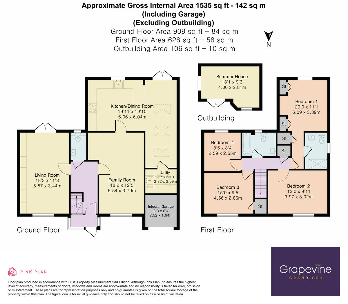
- Two-storey house with kitchen/dining, living and family rooms plus four bedrooms
Rooms
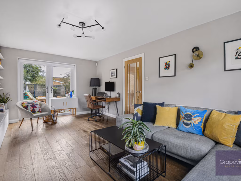
- Living Room:
- Family Room:
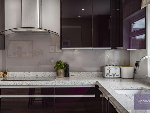
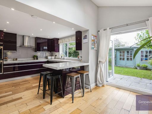
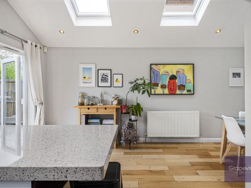
- Kitchen/Dining Room:
- Utility:
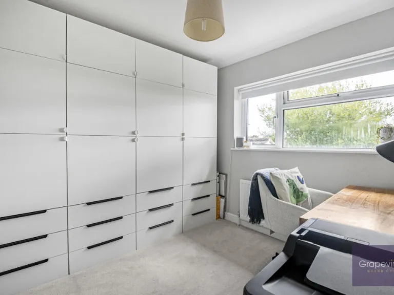
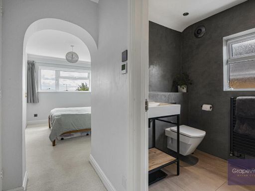
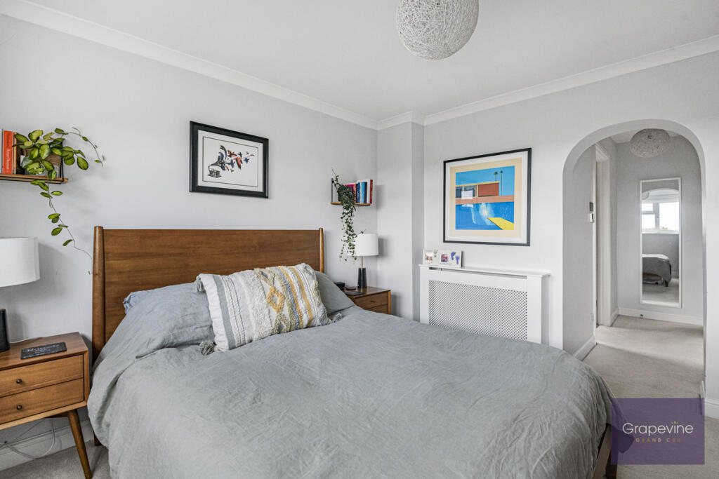
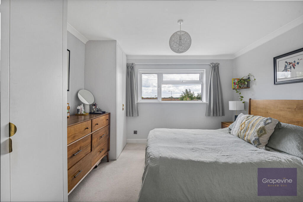
- Bedroom 1:
- Bedroom 2:
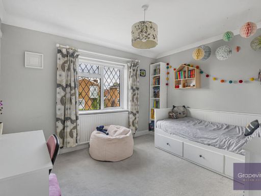
- Bedroom 3:
- Bedroom 4:
- Integral Garage:
Textual Property Features
Detected Visual Features
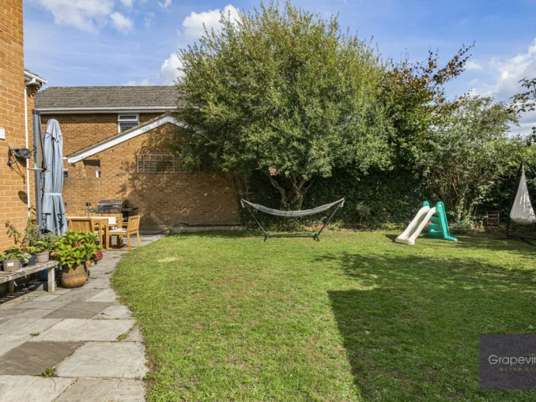
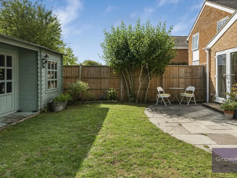
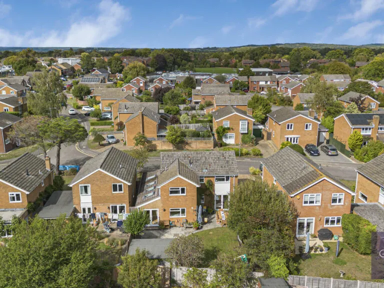
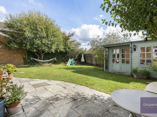
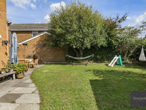
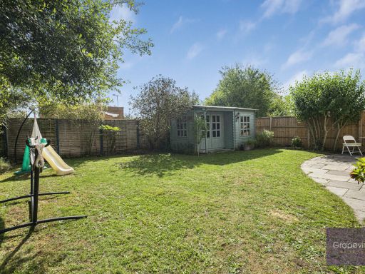
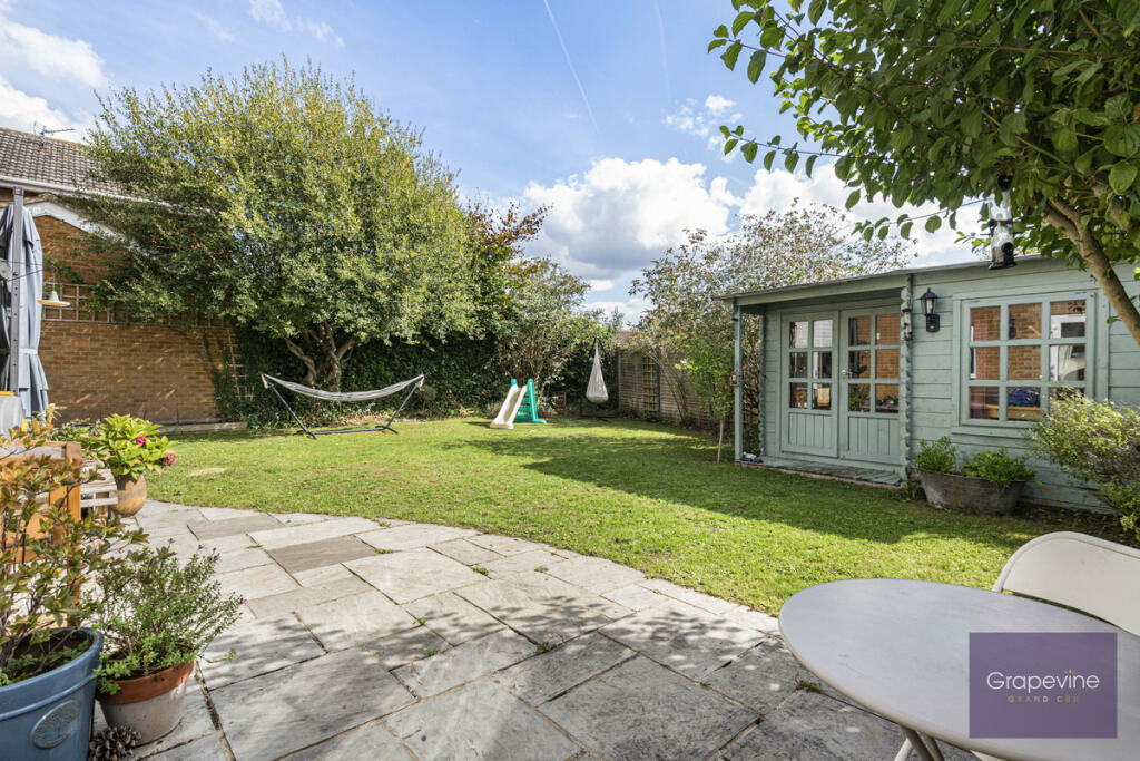
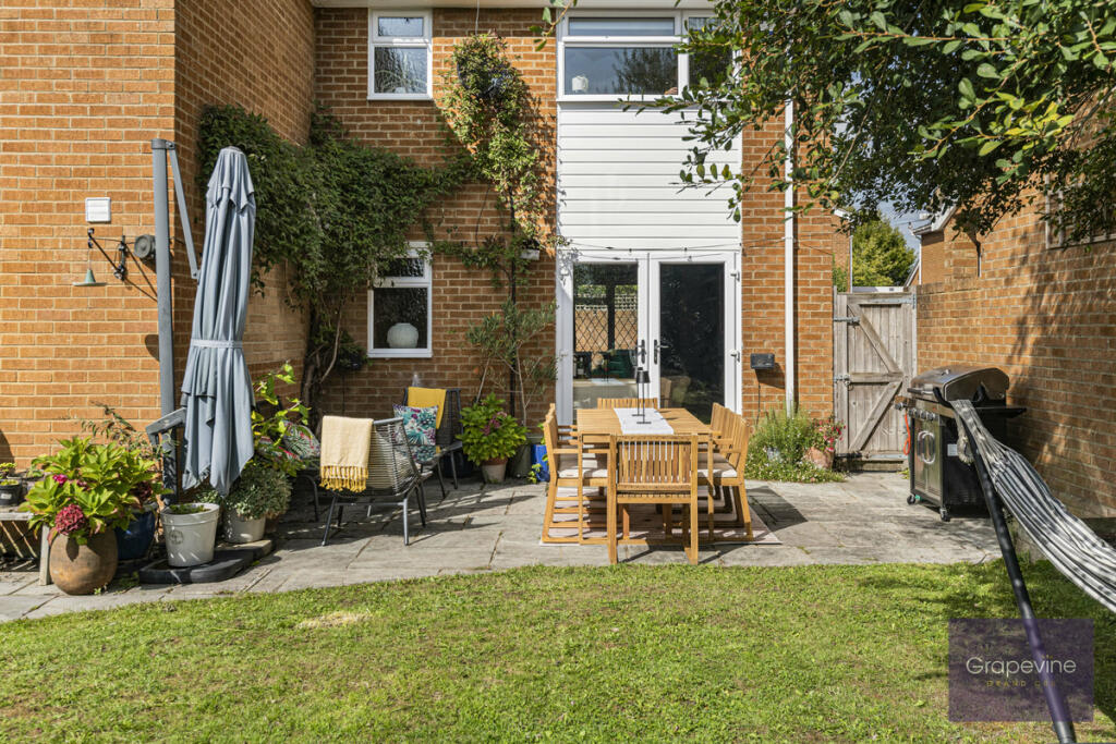
- garage
- suburban
- detached
- 1980s
- brick facade
- driveway
- family home
- 1970s
- brickwork
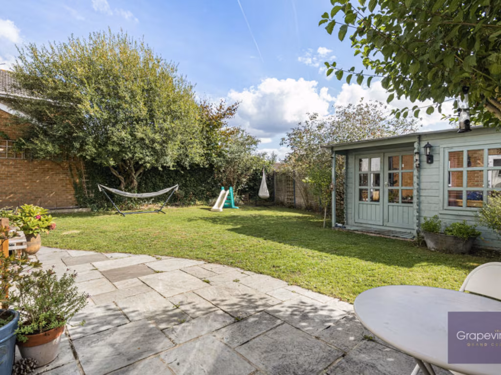
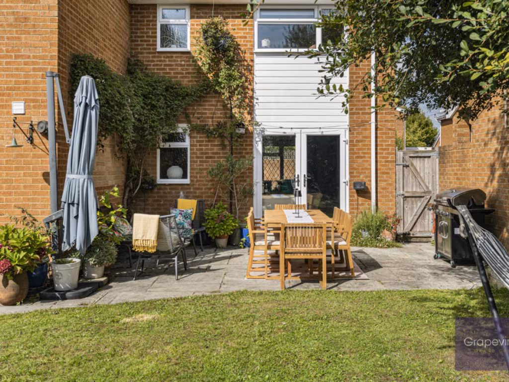
- garden
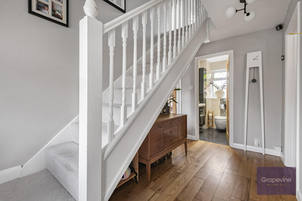
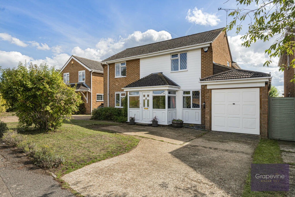
- medium room size
- standard ceiling
- residential area
EPC Details
- Fully double glazed
- Cavity wall, filled cavity
- Boiler and radiators, mains gas
- Low energy lighting in 29% of fixed outlets
- Suspended, no insulation (assumed)
Nearby Schools
- Emmbrook Junior School
- St Cecilia's CofE Primary School
- Winnersh Primary School
- St Nicholas Church of England Primary, Hurst
- Willow Bank Infant School
- Sonning Church of England Primary School
- Waltham St Lawrence Primary School
- The Piggott School
- The Emmbrook School
- The Forest School
- Rivermead Primary School
- Woodley CofE Primary School
- Polehampton Church of England Infant School
- Robert Piggott CofE Junior School
- Robert Piggott CofE Infant School
- The Hawthorns Primary School
- Wheatfield Primary School
- Beechwood Primary School
- Willow Bank Junior School
- Dolphin School
- Shiplake College
- Crazies Hill Church of England Primary School
- Bearwood Primary School
- Emmbrook Infant School
- St Dominic Savio Catholic Primary School
- Waingels
- The Colleton Primary School
- Polehampton Church of England Junior School
Nearest General Shops
- Id: 1583670887
- Tags:
- Name: Twyford Barbers
- Shop: hairdresser
- TagsNormalized:
- Lat: 51.4779106
- Lon: -0.865882
- FullGeoHash: gcpku732x6p9
- PartitionGeoHash: gcpk
- Images:
- FoodStandards: null
- Distance: 1059.5
,- Id: 1583675931
- Tags:
- Name: Bulldog Twyford
- Shop: car
- TagsNormalized:
- Lat: 51.4782352
- Lon: -0.8648588
- FullGeoHash: gcpku764rqdd
- PartitionGeoHash: gcpk
- Images:
- FoodStandards: null
- Distance: 1054
,- Id: 9502305870
- Tags:
- Addr:
- City: Twyford
- Housename: The B ia Hub
- Postcode: RG10 9EE
- Street: Waltham Road
- Name: The Bia Hub
- Opening_hours: Tu-Sa 10:00-16:00; Su 09:30-14:00
- Phone: +44 118 929 1004
- Service:
- Bicycle:
- Bicycle_Sales_and_Service: yes
- Clothing: yes
- Pump: yes
- Repair: yes
- Retail: yes
- Tools: yes
- Shop: bicycle
- Website: www.biacycling.com
- TagsNormalized:
- Lat: 51.4767549
- Lon: -0.8650783
- FullGeoHash: gcpku741f4wg
- PartitionGeoHash: gcpk
- Images:
- FoodStandards: null
- Distance: 921.7
}
Nearest Grocery shops
- Id: 204208027
- Tags:
- Addr:
- Housenumber: 36
- Postcode: RG10 9QX
- Building: yes
- Name: Nisa Local
- Opening_hours: Mo-Su 07:00-21:30
- Shop: convenience
- Website: http://www.nisalocally.co.uk
- TagsNormalized:
- nisa
- nisa local
- convenience
- shop
- Lat: 51.4785655
- Lon: -0.8862809
- FullGeoHash: gcpkgg6skhjh
- PartitionGeoHash: gcpk
- Images:
- FoodStandards: null
- Distance: 2210.8
,- Id: 5967288392
- Tags:
- Brand: M&S Simply Food
- Brand:wikidata: Q714491
- Name: M&S Simply Food
- Shop: convenience
- Website: https://www.marksandspencer.com/stores/twyford-bp-1327
- TagsNormalized:
- m&s simply food
- food
- convenience
- shop
- Lat: 51.4871905
- Lon: -0.8687568
- FullGeoHash: gcpkuhzqs7zy
- PartitionGeoHash: gcpk
- Images:
- FoodStandards: null
- Distance: 2071
,- Id: 9399621428
- Tags:
- Addr:
- Housenumber: 25
- Postcode: RG10 9EH
- Street: London Road
- Brand: Tesco Express
- Brand:wikidata: Q98456772
- Contact:
- Website: https://www.tesco.com/store-locator/twyford/25-london-rd
- Fhrs:
- Name: Tesco Express
- Shop: convenience
- TagsNormalized:
- tesco
- tesco express
- convenience
- shop
- Lat: 51.4778598
- Lon: -0.8660479
- FullGeoHash: gcpku73278ef
- PartitionGeoHash: gcpk
- Images:
- FoodStandards:
- Id: 283065
- FHRSID: 283065
- LocalAuthorityBusinessID: 51281
- BusinessName: Tesco
- BusinessType: Retailers - supermarkets/hypermarkets
- BusinessTypeID: 7840
- AddressLine1: null
- AddressLine2: 25 London Road
- AddressLine3: Twyford
- AddressLine4: null
- PostCode: RG10 9EH
- RatingValue: 5
- RatingKey: fhrs_5_en-GB
- RatingDate: 2018-03-13
- LocalAuthorityCode: 887
- LocalAuthorityName: Wokingham
- LocalAuthorityWebSite: http://www.wokingham.gov.uk/welcome/
- LocalAuthorityEmailAddress: environmental.health@wokingham.gov.uk
- Scores:
- Hygiene: 0
- Structural: 0
- ConfidenceInManagement: 0
- NewRatingPending: false
- Geocode:
- Longitude: -0.86637100000000
- Latitude: 51.47789200000000
- Distance: 1061.1
}
Nearest Religious buildings
- Id: 229371098
- Tags:
- Addr:
- City: Ruscombe
- Postcode: RG10 9UD
- Street: Southbury Lane
- Amenity: place_of_worship
- Building: yes
- Denomination: anglican
- Name: Parish Church of Saint James the great
- Religion: christian
- Source: NPE
- Source:building: OS_OpenData_StreetView
- Wikidata: Q17530243
- TagsNormalized:
- place of worship
- anglican
- church
- parish
- christian
- Lat: 51.4800022
- Lon: -0.8521698
- FullGeoHash: gcpkueekxpbn
- PartitionGeoHash: gcpk
- Images:
- FoodStandards: null
- Distance: 1180
,- Id: 229041050
- Tags:
- Amenity: place_of_worship
- Building: yes
- Denomination: united_reformed
- Name: United Reformed Church
- Religion: christian
- Source:
- Building: OS_OpenData_StreetView
- TagsNormalized:
- place of worship
- united reformed
- church
- christian
- Lat: 51.4770148
- Lon: -0.8663493
- FullGeoHash: gcpku715ke54
- PartitionGeoHash: gcpk
- Images:
- FoodStandards: null
- Distance: 997
,- Id: 229041049
- Tags:
- Amenity: place_of_worship
- Building: yes
- Denomination: anglican
- Name: Twyford Parish Church
- Religion: christian
- Source: NPE
- Source:building: OS_OpenData_StreetView
- Wikidata: Q26605214
- TagsNormalized:
- place of worship
- anglican
- church
- parish
- christian
- Lat: 51.4763938
- Lon: -0.8659785
- FullGeoHash: gcpku6crtpr9
- PartitionGeoHash: gcpk
- Images:
- FoodStandards: null
- Distance: 927
}
Nearest Medical buildings
- Id: 475599652
- Tags:
- TagsNormalized:
- Lat: 51.4847514
- Lon: -0.8624104
- FullGeoHash: gcpkuks02mk0
- PartitionGeoHash: gcpk
- Images:
- FoodStandards: null
- Distance: 1682.6
,- Id: 47840255
- Tags:
- Amenity: doctors
- Building: yes
- Name: Twyford Surgery
- TagsNormalized:
- Lat: 51.4816702
- Lon: -0.8619237
- FullGeoHash: gcpku7uq7wzh
- PartitionGeoHash: gcpk
- Images:
- FoodStandards: null
- Distance: 1340.6
,- Id: 475221599
- Tags:
- Amenity: pharmacy
- Name: Phillips
- TagsNormalized:
- Lat: 51.4776171
- Lon: -0.8667876
- FullGeoHash: gcpku70yf7k7
- PartitionGeoHash: gcpk
- Images:
- FoodStandards: null
- Distance: 1068.7
,- Id: 476284367
- Tags:
- Amenity: pharmacy
- Brand: Day Lewis Pharmacy
- Brand:wikidata: Q62563772
- Healthcare: pharmacy
- Name: Day Lewis Pharmacy
- TagsNormalized:
- pharmacy
- day lewis pharmacy
- health
- healthcare
- Lat: 51.4777962
- Lon: -0.8661745
- FullGeoHash: gcpku71rbstr
- PartitionGeoHash: gcpk
- Images:
- FoodStandards: null
- Distance: 1060.2
}
Nearest Airports
- Id: 14001268
- Tags:
- Access: yes
- Aerodrome: international
- Aerodrome:type: public
- Aeroway: aerodrome
- Alt_name: London Heathrow
- Alt_name_2: London Heathrow Airport
- Ele: 25
- Iata: LHR
- Icao: EGLL
- Int_name: Heathrow Airport
- Name: London Heathrow Airport
- Note: area still approx
- Old_name: London Airport
- Operator: Heathrow Airport Limited
- Rank_aci:
- Ref: LHR
- Short_name: Heathrow
- Type: multipolygon
- Website: https://www.heathrow.com/
- Wikidata: Q8691
- Wikipedia: en:Heathrow Airport
- TagsNormalized:
- airport
- international airport
- Lat: 51.4677522
- Lon: -0.4547736
- FullGeoHash: gcpsv9kv7h2h
- PartitionGeoHash: gcps
- Images:
- FoodStandards: null
- Distance: 27899
}
Nearest Leisure Facilities
- Id: 792178550
- Tags:
- Access: private
- Description: school swimming pool
- Leisure: swimming_pool
- Location: outdoor
- Name: Colleton Swimming Pool
- Swimming_pool: outdoor
- TagsNormalized:
- swimming
- swimming pool
- pool
- leisure
- Lat: 51.4716794
- Lon: -0.8564993
- FullGeoHash: gcpkud0k607z
- PartitionGeoHash: gcpk
- Images:
- FoodStandards: null
- Distance: 207.4
,- Id: 1021675614
- Tags:
- Leisure: playground
- Operator: The Colleton School
- Playground:
- TagsNormalized:
- Lat: 51.4717016
- Lon: -0.8572419
- FullGeoHash: gcpku6pu2ud5
- PartitionGeoHash: gcpk
- Images:
- FoodStandards: null
- Distance: 198.2
,- Id: 47053920
- Tags:
- TagsNormalized:
- Lat: 51.4709393
- Lon: -0.8592837
- FullGeoHash: gcpku3yrcnx8
- PartitionGeoHash: gcpk
- Images:
- FoodStandards: null
- Distance: 165.6
,- Id: 227747684
- Tags:
- Access: yes
- Leisure: playground
- Surface: asphalt
- TagsNormalized:
- Lat: 51.4693591
- Lon: -0.8584868
- FullGeoHash: gcpku3wyezcy
- PartitionGeoHash: gcpk
- Images:
- FoodStandards: null
- Distance: 91.7
,- Id: 47053919
- Tags:
- TagsNormalized:
- Lat: 51.4693788
- Lon: -0.8583762
- FullGeoHash: gcpku3wyy7s7
- PartitionGeoHash: gcpk
- Images:
- FoodStandards: null
- Distance: 84.7
}
Nearest Tourist attractions
- Id: 56419154
- Tags:
- Addr:
- Building: yes
- Name: Anne's B&B
- Source:
- Building: OS_OpenData_StreetView
- Tourism: guest_house
- TagsNormalized:
- Lat: 51.4290908
- Lon: -0.8766016
- FullGeoHash: gcpks43sjtqk
- PartitionGeoHash: gcpk
- Images:
- FoodStandards: null
- Distance: 4729.4
,- Id: 1243353056
- Tags:
- TagsNormalized:
- Lat: 51.4416627
- Lon: -0.8757201
- FullGeoHash: gcpkshdm6hzy
- PartitionGeoHash: gcpk
- Images:
- FoodStandards: null
- Distance: 3386.3
,- Id: 82487215
- Tags:
- Addr:
- City: Woodley
- Country: GB
- County: Berkshire
- Housename: Museum of Berkshire Aviation
- Postcode: RG5 4UE
- Street: Mohawk Way
- Building: yes
- Name: The Museum Of Berkshire Aviation
- Opening_hours: Apr-Oct: We, Sa-Su 10:30-17:00;Apr-Oct: We 10:30-17:00;Apr-Oct: Su 12:00-16:00
- Source:
- Building: OS_OpenData_StreetView
- Tourism: museum
- Url: https://museumofberkshireaviation.co.uk/
- Wikidata: Q6940780
- Wikipedia: en:Museum of Berkshire Aviation
- TagsNormalized:
- Lat: 51.4504848
- Lon: -0.8828848
- FullGeoHash: gcpkeym0g392
- PartitionGeoHash: gcpk
- Images:
- FoodStandards: null
- Distance: 2785.7
}
Nearest Bus stations and stops
- Id: 530647140
- Tags:
- Bus: yes
- Highway: bus_stop
- Public_transport: platform
- TagsNormalized:
- Lat: 51.4543841
- Lon: -0.8888881
- FullGeoHash: gcpkeybxx2ku
- PartitionGeoHash: gcpk
- Images:
- FoodStandards: null
- Distance: 2776.2
,- Id: 530647176
- Tags:
- Highway: bus_stop
- Name: Woodley Plaza
- Public_transport: platform
- Route_ref: 19;19a
- TagsNormalized:
- Lat: 51.454404
- Lon: -0.8886453
- FullGeoHash: gcpkeybzth45
- PartitionGeoHash: gcpk
- Images:
- FoodStandards: null
- Distance: 2761.7
,- Id: 530647216
- Tags:
- Bus: yes
- Highway: bus_stop
- Name: Lysander Close
- Public_transport: platform
- TagsNormalized:
- Lat: 51.4549907
- Lon: -0.8853977
- FullGeoHash: gcpkez5709rx
- PartitionGeoHash: gcpk
- Images:
- FoodStandards: null
- Distance: 2546.8
,- Id: 9139663241
- Tags:
- Bus: yes
- Highway: bus_stop
- Name: Comet Way - Rose Close
- Public_transport: platform
- TagsNormalized:
- Lat: 51.4535952
- Lon: -0.8831849
- FullGeoHash: gcpkeyufum3d
- PartitionGeoHash: gcpk
- Images:
- FoodStandards: null
- Distance: 2541.2
,- Id: 530647185
- Tags:
- Highway: bus_stop
- Name: Lysander Close
- Public_transport: platform
- TagsNormalized:
- Lat: 51.4553934
- Lon: -0.8848001
- FullGeoHash: gcpkez5tqst1
- PartitionGeoHash: gcpk
- Images:
- FoodStandards: null
- Distance: 2486.3
}
Nearest Hotels
- Id: 82885263
- Tags:
- Addr:
- Building: yes
- Name: The Great House Hotel
- Source:
- Building: OS_OpenData_StreetView
- Tourism: hotel
- TagsNormalized:
- Lat: 51.4753669
- Lon: -0.9125477
- FullGeoHash: gcpkg4z98pgh
- PartitionGeoHash: gcpk
- Images:
- FoodStandards: null
- Distance: 3858.4
,- Id: 578522660
- Tags:
- Building: yes
- Name: The Bull
- Tourism: hotel
- TagsNormalized:
- Lat: 51.5005546
- Lon: -0.8702986
- FullGeoHash: gcpkupqk2x4q
- PartitionGeoHash: gcpk
- Images:
- FoodStandards: null
- Distance: 3518.4
,- Id: 204176132
- Tags:
- Addr:
- City: Charvil
- Postcode: RG10 9RA
- Street: Old Bath Road
- Amenity: pub
- Brand: Hungry Horse
- Brand:wikidata: Q5943510
- Building: yes
- Fhrs:
- Name: The Wee Waif
- Operator: Greene King
- Source:
- Building: OS_OpenData_StreetView
- Tourism: hotel
- Website: https://www.hungryhorse.co.uk/pubs/berkshire/wee-waif/
- TagsNormalized:
- bar
- pub
- horses
- hungry horse
- hotel
- tourism
- Lat: 51.4749486
- Lon: -0.8899359
- FullGeoHash: gcpkgdxzqczs
- PartitionGeoHash: gcpk
- Images:
- FoodStandards: null
- Distance: 2313
}
Tags
- garage
- suburban
- detached
- 1980s
- brick facade
- driveway
- family home
- detached
- 1970s
- brickwork
- suburban
- garage
- garden
- family home
- medium room size
- standard ceiling
- residential area
Local Market Stats
- Average Price/sqft: £513
- Avg Income: £69100
- Rental Yield: 3%
- Social Housing: 6%
- Planning Success Rate: 83%
AirBnB Data
- 1km average: £98/night
- Listings in 1km: 1
Similar Properties
 4 bedroom detached house for sale in Mallard Close, Twyford, RG10 — £875,000 • 4 bed • 2 bath • 1440 ft²
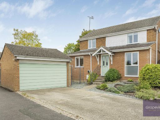 4 bedroom detached house for sale in Broadwater Road, Twyford, RG10 — £750,000 • 4 bed • 2 bath • 1461 ft²
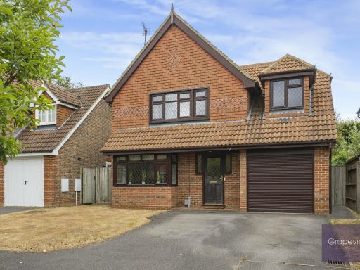 4 bedroom detached house for sale in Jarvis Drive, Twyford, RG10 — £850,000 • 4 bed • 2 bath • 1511 ft²
 4 bedroom detached house for sale in Wessex Gardens, Twyford, RG10 — £685,000 • 4 bed • 2 bath • 1410 ft²
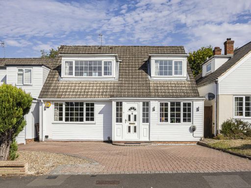 3 bedroom detached house for sale in Wessex Gardens, Twyford, RG10 — £700,000 • 3 bed • 2 bath • 1619 ft²
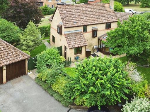 4 bedroom detached house for sale in Harrison Close, Twyford, Reading, Berkshire, RG10 — £870,000 • 4 bed • 2 bath • 1873 ft²
Meta
- {
"@context": "https://schema.org",
"@type": "Residence",
"name": "4 bedroom detached house for sale in Mallard Close, Twyford…",
"description": "",
"url": "https://propertypiper.co.uk/property/cfdbe916-a9c0-4322-b6cb-5e03540e1ee1",
"image": "https://image-a.propertypiper.co.uk/14e6e38e-2d69-47be-b5d4-a9b689041c26-1024.jpeg",
"address": {
"@type": "PostalAddress",
"streetAddress": "29 MALLARD CLOSE TWYFORD READING",
"postalCode": "RG10 0BE",
"addressLocality": "Wokingham",
"addressRegion": "Maidenhead",
"addressCountry": "England"
},
"geo": {
"@type": "GeoCoordinates",
"latitude": 51.46992838287421,
"longitude": -0.8575289412817492
},
"numberOfRooms": 4,
"numberOfBathroomsTotal": 2,
"floorSize": {
"@type": "QuantitativeValue",
"value": 1482,
"unitCode": "FTK"
},
"offers": {
"@type": "Offer",
"price": 875000,
"priceCurrency": "GBP",
"availability": "https://schema.org/InStock"
},
"additionalProperty": [
{
"@type": "PropertyValue",
"name": "Feature",
"value": "garage"
},
{
"@type": "PropertyValue",
"name": "Feature",
"value": "suburban"
},
{
"@type": "PropertyValue",
"name": "Feature",
"value": "detached"
},
{
"@type": "PropertyValue",
"name": "Feature",
"value": "1980s"
},
{
"@type": "PropertyValue",
"name": "Feature",
"value": "brick facade"
},
{
"@type": "PropertyValue",
"name": "Feature",
"value": "driveway"
},
{
"@type": "PropertyValue",
"name": "Feature",
"value": "family home"
},
{
"@type": "PropertyValue",
"name": "Feature",
"value": "detached"
},
{
"@type": "PropertyValue",
"name": "Feature",
"value": "1970s"
},
{
"@type": "PropertyValue",
"name": "Feature",
"value": "brickwork"
},
{
"@type": "PropertyValue",
"name": "Feature",
"value": "suburban"
},
{
"@type": "PropertyValue",
"name": "Feature",
"value": "garage"
},
{
"@type": "PropertyValue",
"name": "Feature",
"value": "garden"
},
{
"@type": "PropertyValue",
"name": "Feature",
"value": "family home"
},
{
"@type": "PropertyValue",
"name": "Feature",
"value": "medium room size"
},
{
"@type": "PropertyValue",
"name": "Feature",
"value": "standard ceiling"
},
{
"@type": "PropertyValue",
"name": "Feature",
"value": "residential area"
}
]
}
High Res Floorplan Images
Compatible Floorplan Images
FloorplanImages Thumbnail