HA5 4BS - 3 bedroom house for sale in Sequoia Park, Pinner, HA5
View on Property Piper
3 bedroom house for sale in Sequoia Park, Pinner, HA5
Property Details
- Price: £875000
- Bedrooms: 3
- Bathrooms: 1
- Property Type: undefined
- Property SubType: undefined
Brochure Descriptions
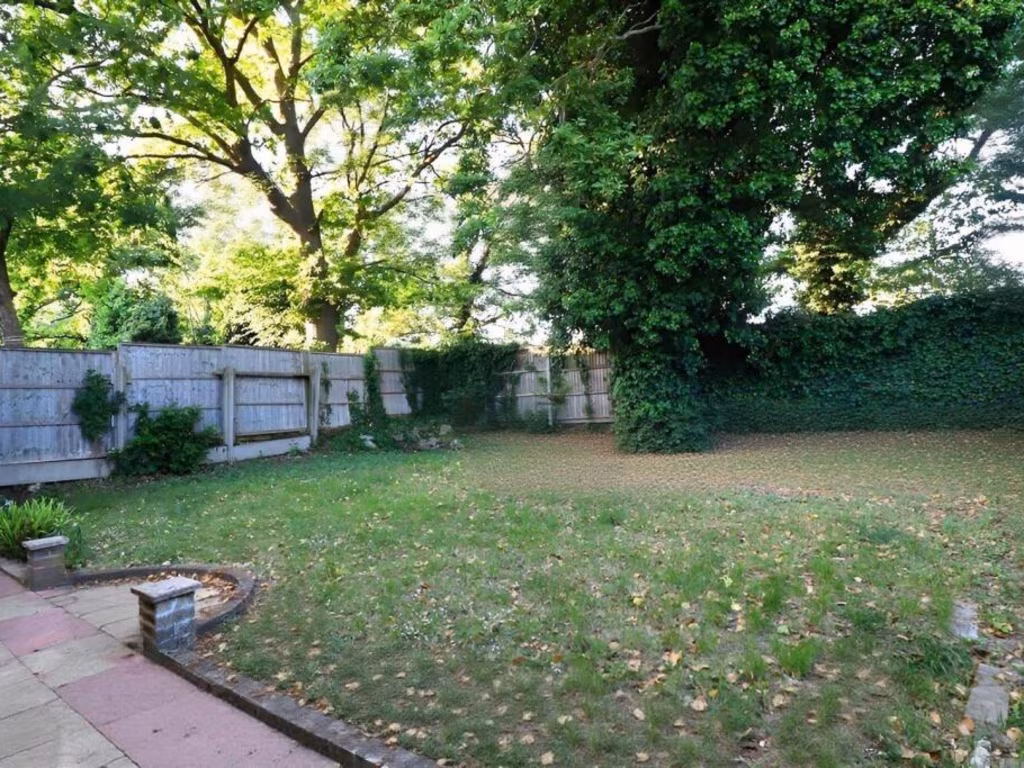
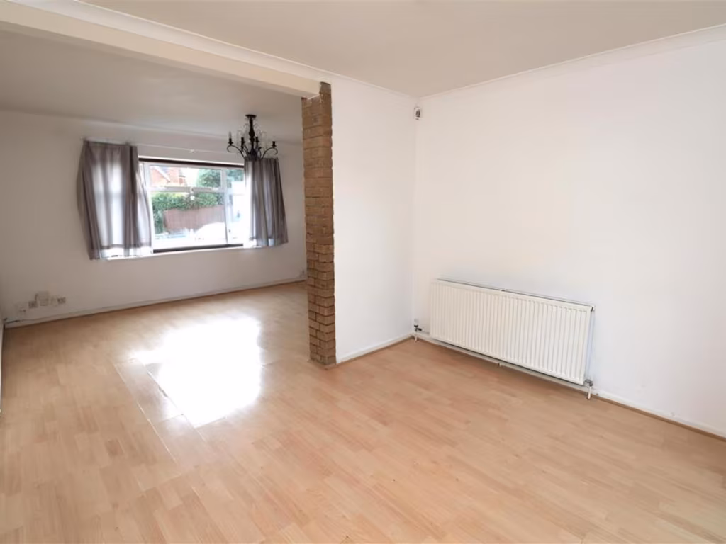
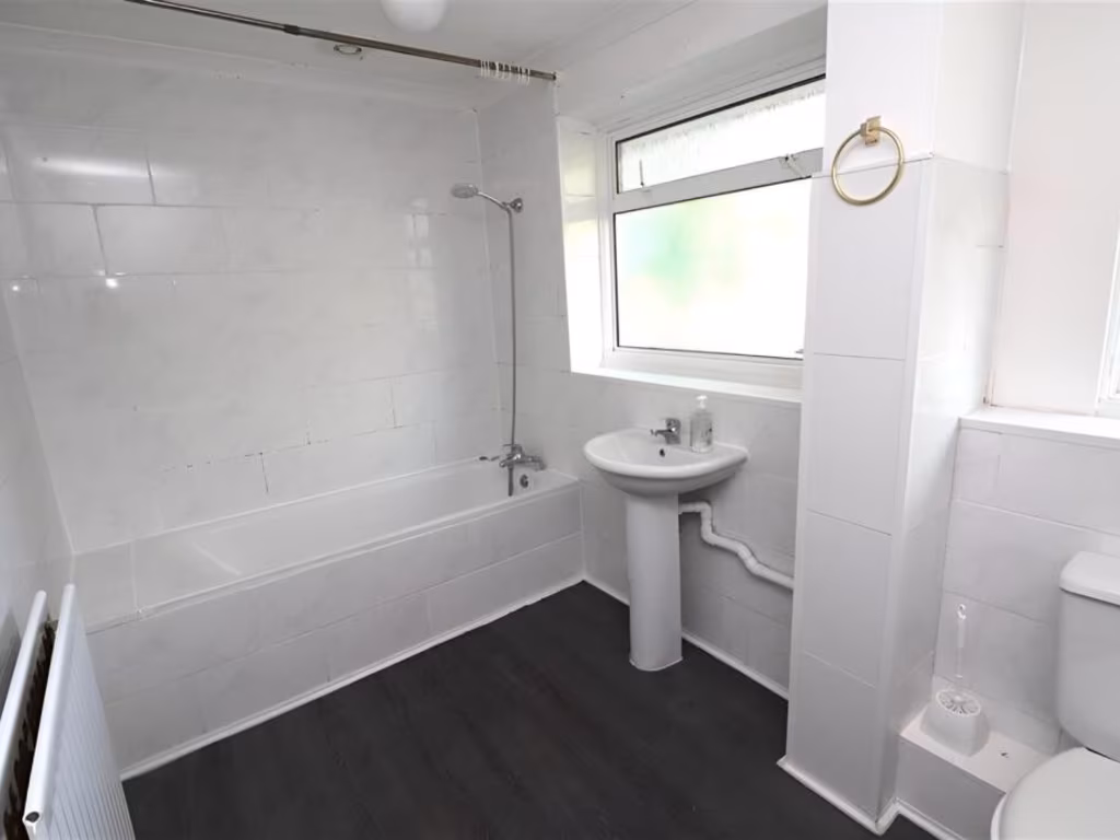
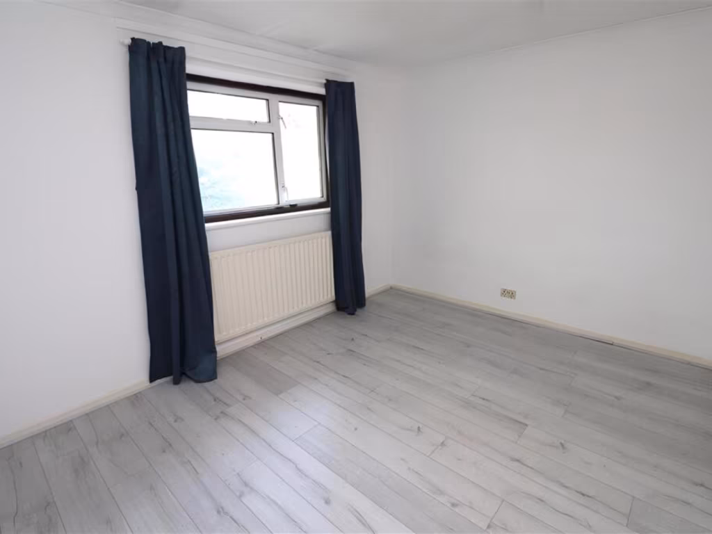
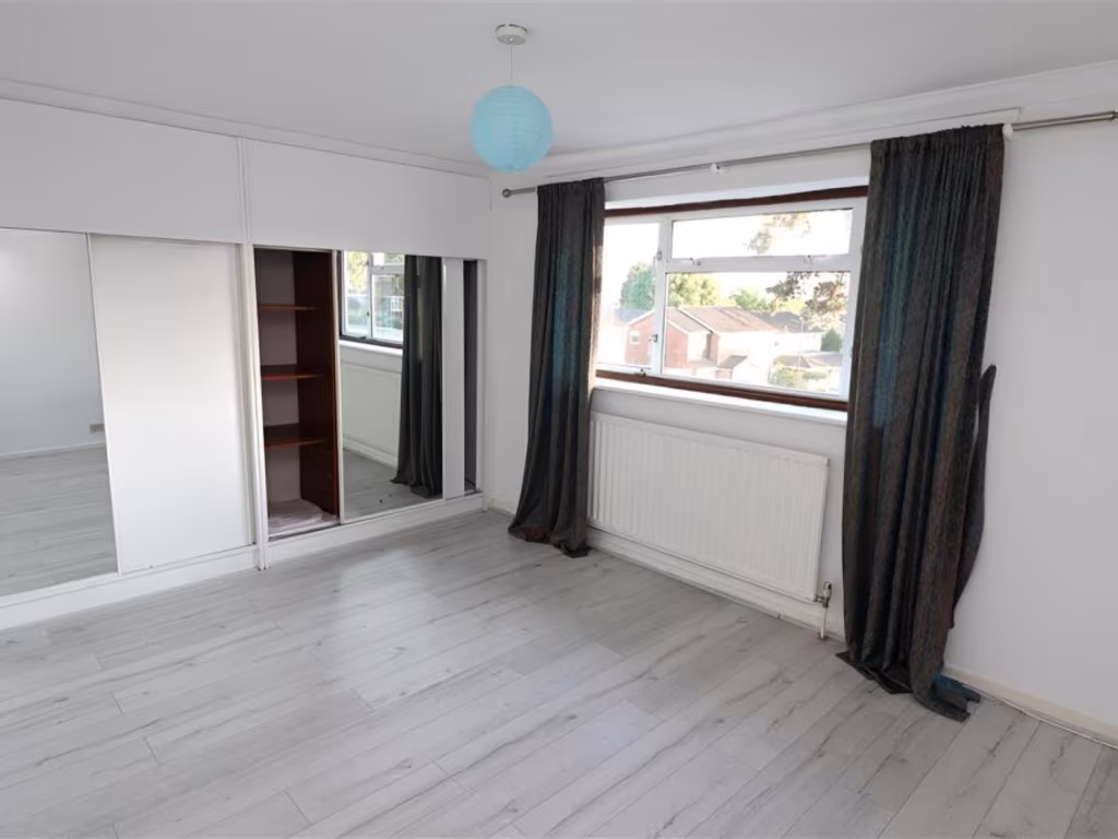
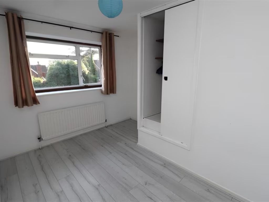
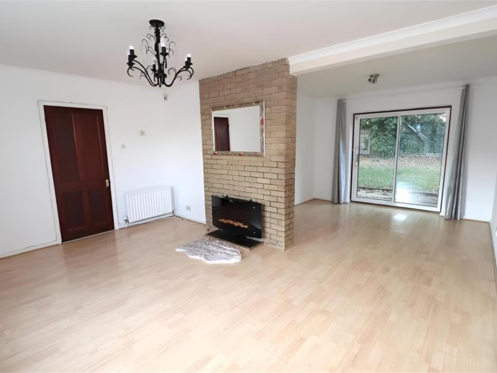
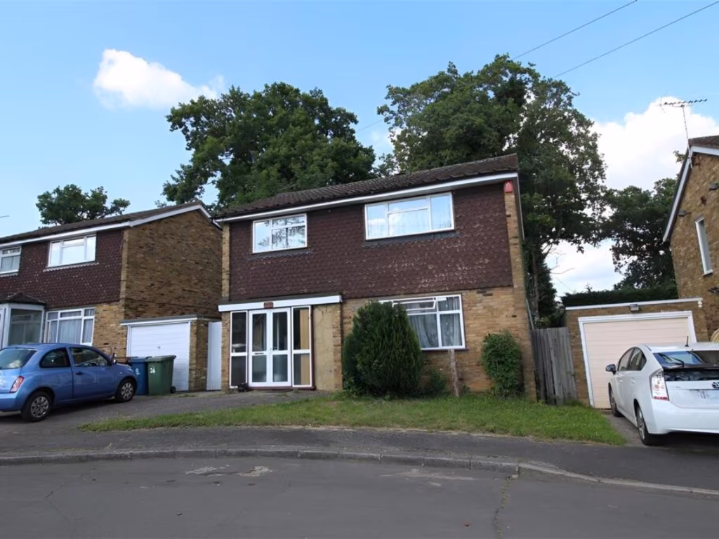
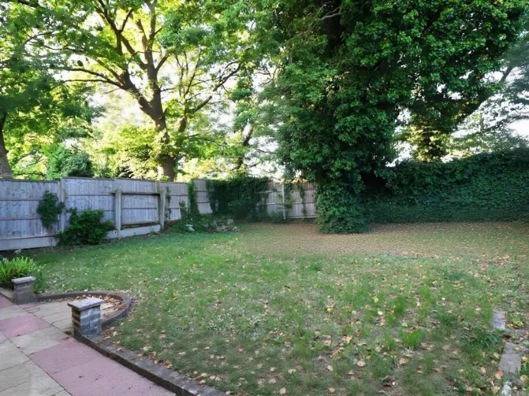
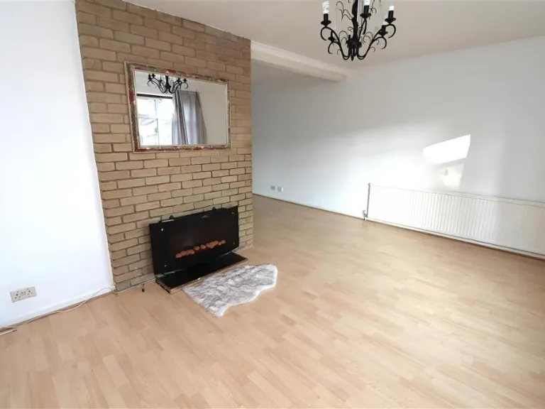
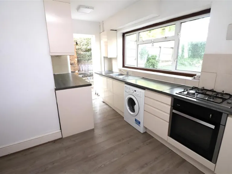
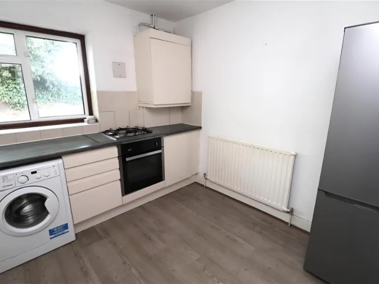
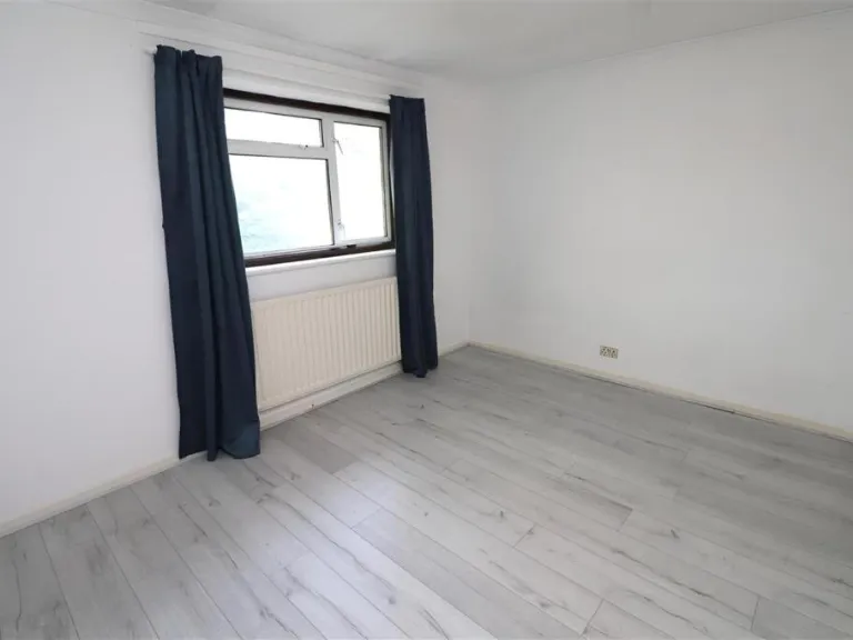
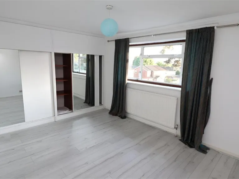
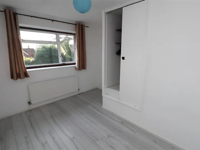
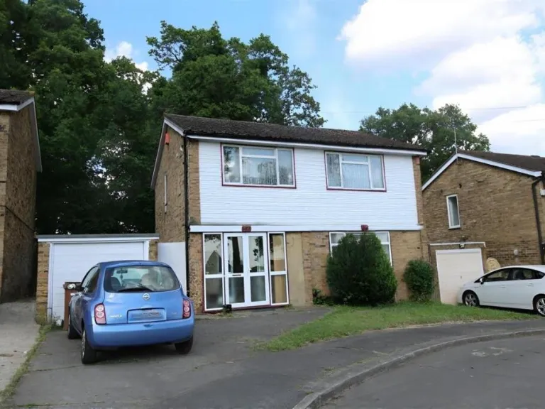
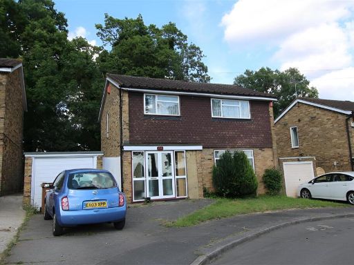
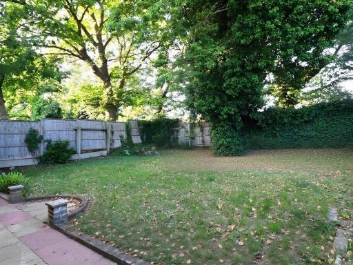
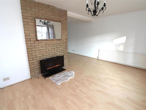
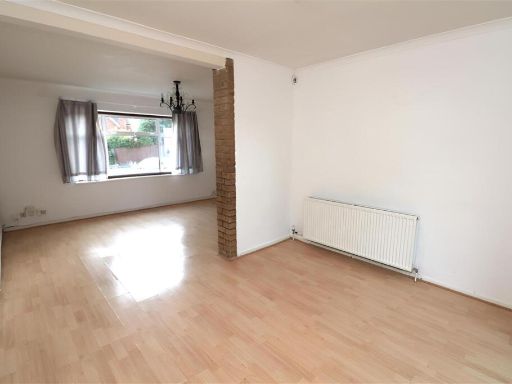
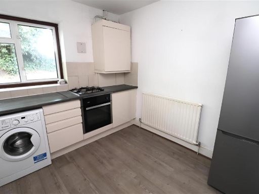
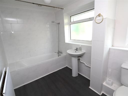
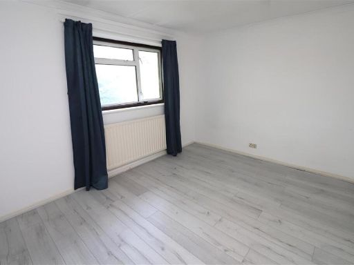
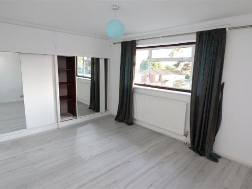
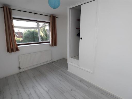
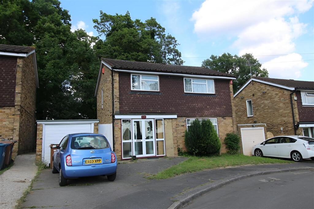
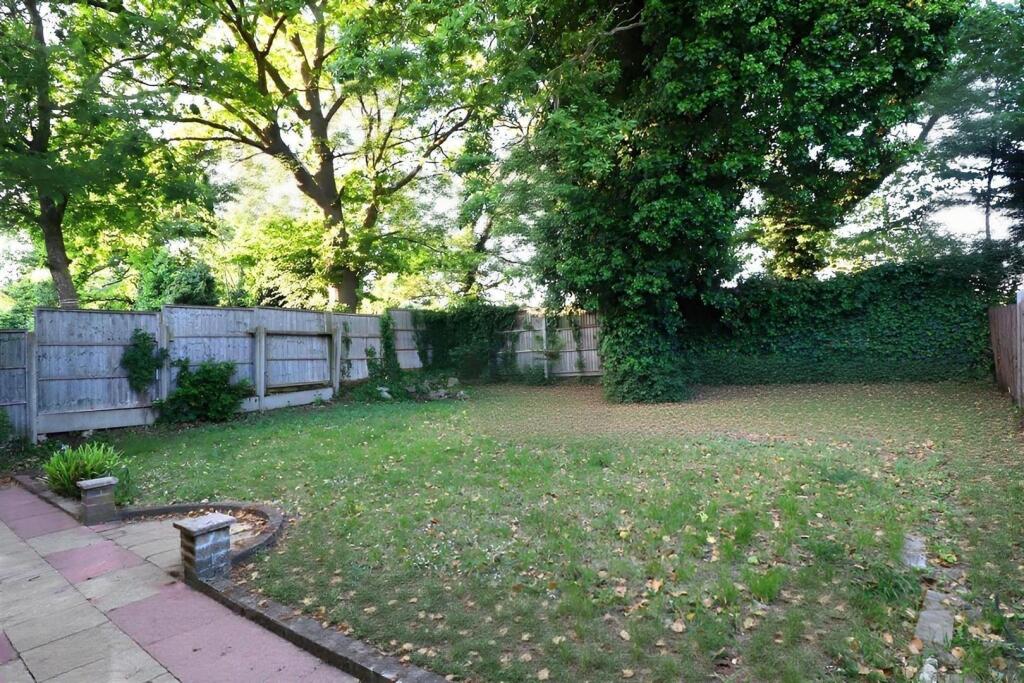
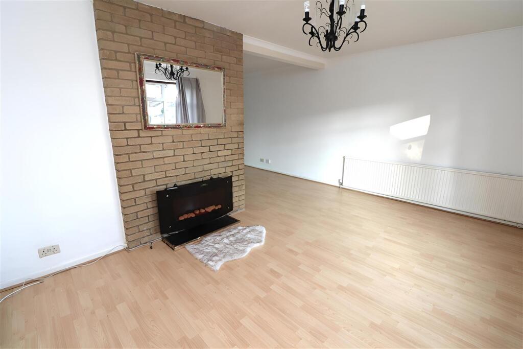
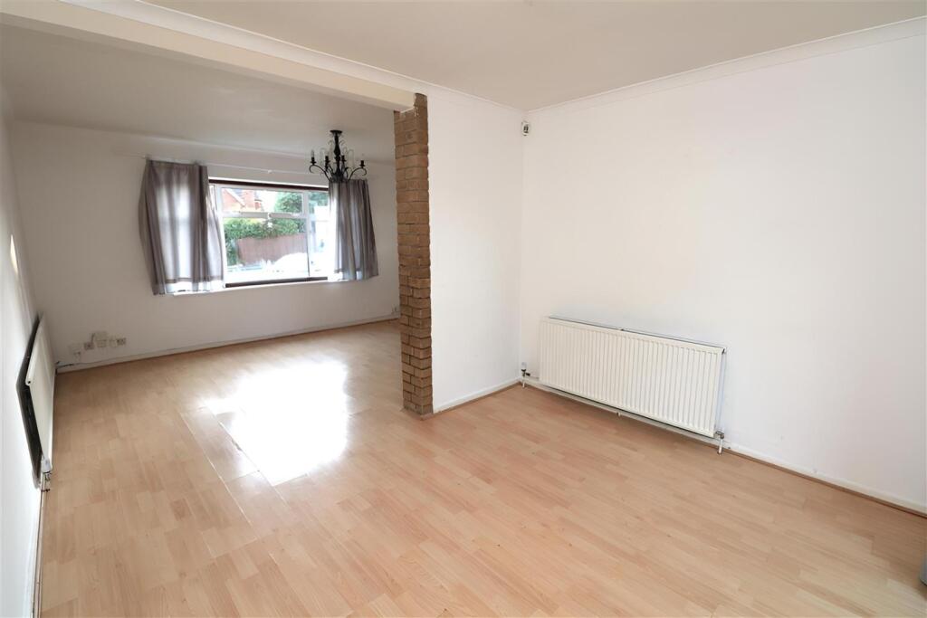
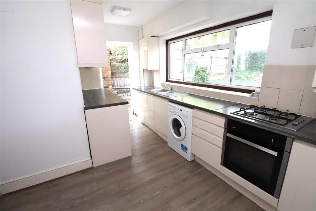
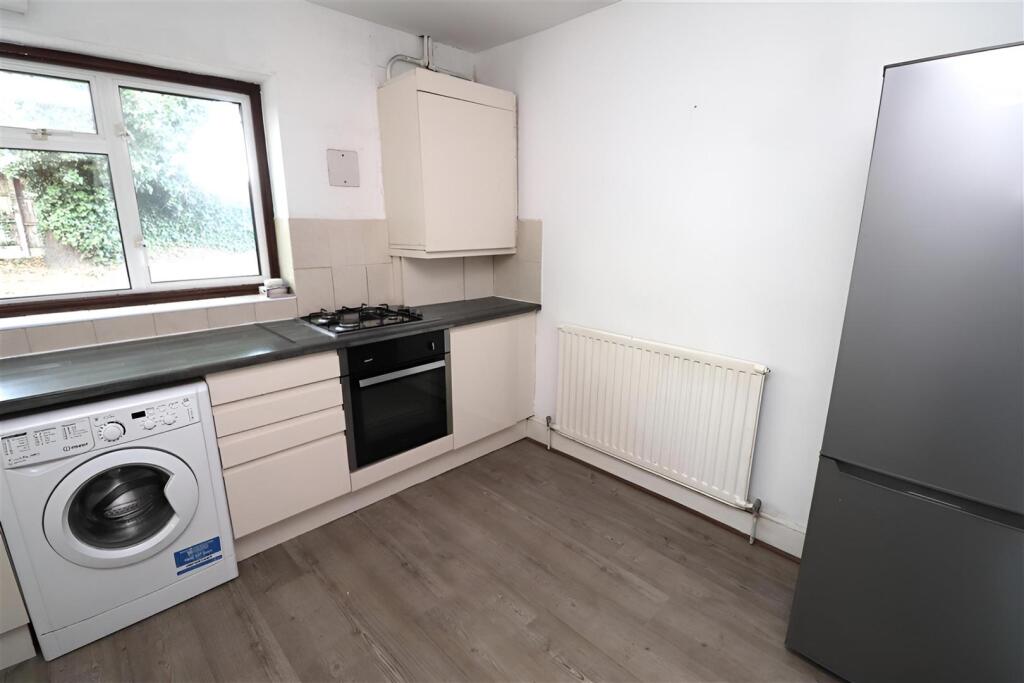
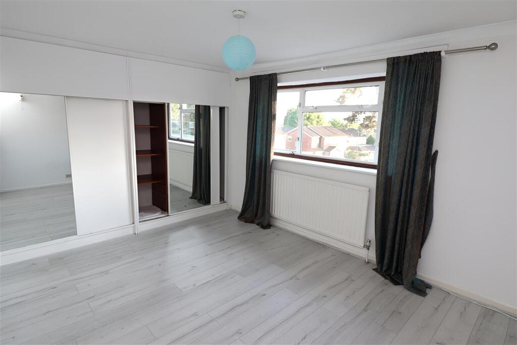
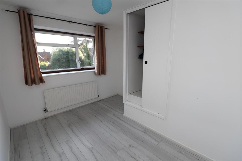
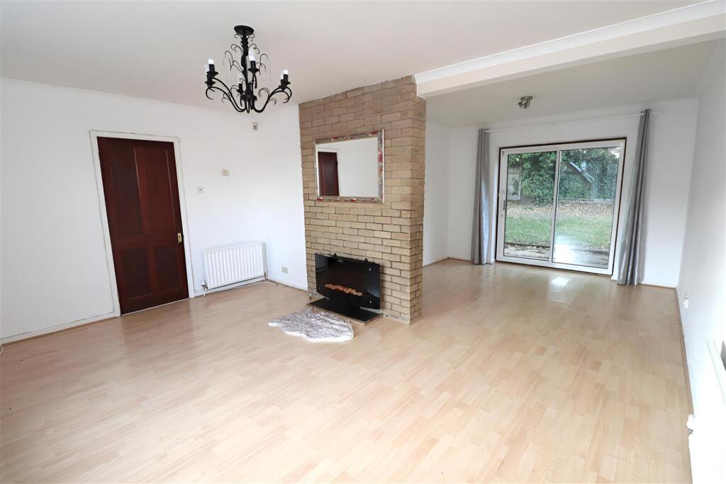
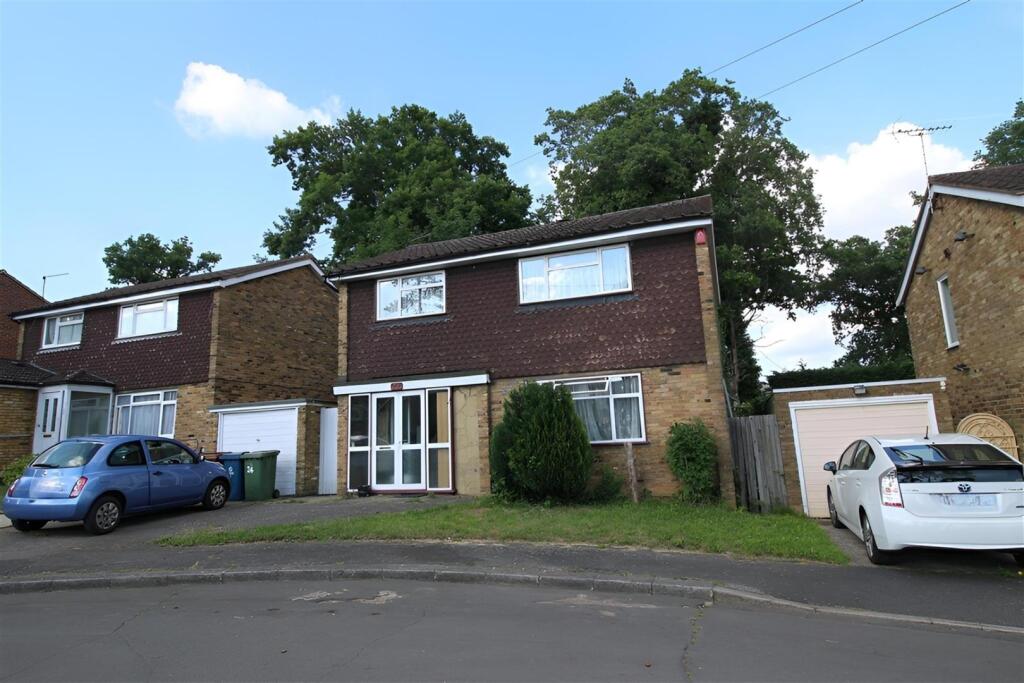
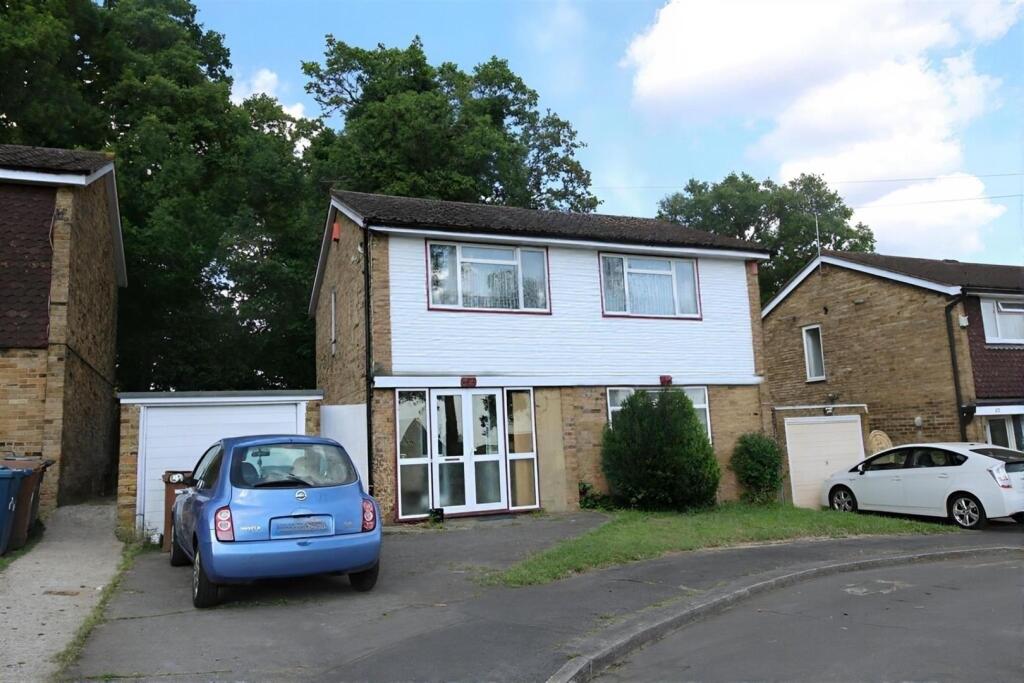
- Well-proportioned three-bedroom detached family house in Sequoia Park, Pinner. The property sits on a plot with a front garden and driveway for one car, and a large mature rear garden backing onto substantial trees/woodland (providing a pleasant, private outlook). Internally the accommodation comprises a hallway and WC, a good-sized kitchen and a very generous sitting room on the ground floor. The first floor provides three double bedrooms with fitted wardrobes and an extra-large bathroom. Located minutes from Hatch End town centre and Overground station and within the catchment for Grimsdyke First and Middle School. Overall the dwelling offers generous room proportions for its type and a sizeable garden, suited to a family market.
Image Descriptions
- detached house mid-20th century
- garden
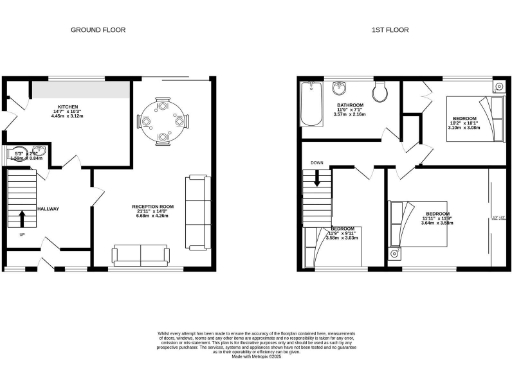
Floorplan Description
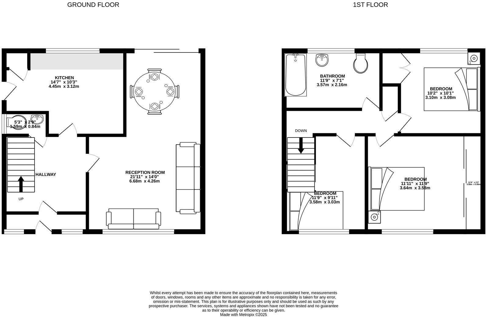
- Two-storey house with kitchen, reception room, three bedrooms and a bathroom
Rooms
- KITCHEN:
- RECEPTION ROOM:
- :
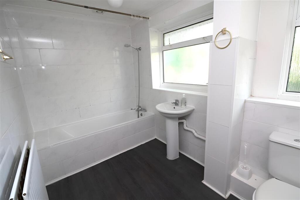
- BATHROOM:
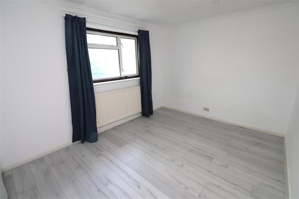
- BEDROOM:
- BEDROOM:
- BEDROOM:
Textual Property Features
Detected Visual Features
- detached house
- brick facade
- mid-20th century
- two-storey
- garage
- driveway
- suburban
- family home
- garden
- natural
- fenced
- trees
- outdoor
- greenery
- private
- landscape
EPC Details
- Fully double glazed
- Cavity wall, as built, insulated (assumed)
- Boiler and radiators, mains gas
- Low energy lighting in all fixed outlets
- Solid, no insulation (assumed)
Nearby Schools
- Reddiford School
- Pinner Park Primary School
- Whitefriars School
- St Teresa's Catholic Primary School and Nursery
- St Meryl School
- Merry Hill Infant School and Nursery
- Ashfield Junior School
- Nower Hill High School
- The Sacred Heart Language College
- Hatch End High School
- Hujjat Primary School
- Bentley Wood High School
- Oxhey Wood Primary School
- Marlborough Primary School
- Cedars Manor School
- Woodhall Primary School
- Hartsbourne Primary School
- St Margaret's School
- Vaughan Primary School
- St John Fisher Catholic Primary School
- Salvatorian Roman Catholic College
- Weald Rise Primary School
- Grimsdyke School
- Avanti House Primary School
- Bushey Heath Primary School
- St Hilda's School
- Sacred Heart Catholic Primary School and Nursery
Nearest General Shops
- Id: 609808890
- Tags:
- Addr:
- City: Pinner
- Housenumber: 339
- Street: Uxbridge Road
- Building: retail
- Building:levels: 2
- Clothes: children;men;suits;wedding
- Level: 0
- Name: Impeccable
- Shop: clothes
- TagsNormalized:
- Lat: 51.6082861
- Lon: -0.371646
- FullGeoHash: gcptxe12h1bd
- PartitionGeoHash: gcpt
- Images:
- FoodStandards: null
- Distance: 1025.4
,- Id: 582235622
- Tags:
- Addr:
- Name: Oxhey Lane Farm Shop
- Phone: +44 20 8428 3974
- Shop: farm
- TagsNormalized:
- Lat: 51.6184491
- Lon: -0.3674893
- FullGeoHash: gcptxsu7kbk4
- PartitionGeoHash: gcpt
- Images:
- FoodStandards: null
- Distance: 782.4
,- Id: 10293180928
- Tags:
- Name: We Buy Any Car
- Shop: car
- TagsNormalized:
- Lat: 51.6088519
- Lon: -0.3656368
- FullGeoHash: gcptxejg2533
- PartitionGeoHash: gcpt
- Images:
- FoodStandards: null
- Distance: 673.3
}
Nearest Religious buildings
- Id: 866403958
- Tags:
- Amenity: place_of_worship
- Building: church
- Denomination: anglican
- Name: St Anselm
- Religion: christian
- Wikidata: Q26489015
- TagsNormalized:
- place of worship
- church
- anglican
- christian
- Lat: 51.6098155
- Lon: -0.3709212
- FullGeoHash: gcptxe3buyvj
- PartitionGeoHash: gcpt
- Images:
- FoodStandards: null
- Distance: 894.7
,- Id: 909277252
- Tags:
- Amenity: place_of_worship
- Building: church
- Denomination: roman_catholic
- Name: St Teresa
- Religion: christian
- TagsNormalized:
- place of worship
- church
- catholic
- roman catholic
- christian
- Lat: 51.6084396
- Lon: -0.3584437
- FullGeoHash: gcptxg4bzwmj
- PartitionGeoHash: gcpt
- Images:
- FoodStandards: null
- Distance: 568.1
,- Id: 380774800
- Tags:
- Amenity: place_of_worship
- Denomination: baptist
- Name: Hatch End Free Church
- Religion: christian
- TagsNormalized:
- place of worship
- baptist
- church
- christian
- Lat: 51.6090393
- Lon: -0.3601605
- FullGeoHash: gcptxg1srwhz
- PartitionGeoHash: gcpt
- Images:
- FoodStandards: null
- Distance: 500.2
}
Nearest Medical buildings
- Id: 628410640
- Tags:
- Addr:
- City: Pinner
- Postcode: HA5 4HP
- Street: The Broadway
- Amenity: pharmacy
- Building: retail
- Building:levels: 3
- Name: Hall Healthcare
- TagsNormalized:
- pharmacy
- retail
- health
- healthcare
- Lat: 51.6073868
- Lon: -0.3759273
- FullGeoHash: gcptx6y6b60m
- PartitionGeoHash: gcpt
- Images:
- FoodStandards: null
- Distance: 1328.4
,- Id: 628144630
- Tags:
- Addr:
- City: Pinner
- Housenumber: 320
- Postcode: HA5 4HR
- Street: Uxbridge Road
- Amenity: pharmacy
- Building: retail
- Building:levels: 3
- Name: Tanna Pharmacy
- TagsNormalized:
- Lat: 51.607877
- Lon: -0.3744802
- FullGeoHash: gcptx6zm9vx3
- PartitionGeoHash: gcpt
- Images:
- FoodStandards: null
- Distance: 1214.6
,- Id: 609808905
- Tags:
- Addr:
- City: Pinner
- Housenumber: 272
- Postcode: HA5 4HS
- Street: Uxbridge Road
- Amenity: pharmacy
- Building: retail
- Building:levels: 3
- Healthcare: pharmacy
- Name: Village Pharmacy
- TagsNormalized:
- pharmacy
- retail
- health
- healthcare
- Lat: 51.6081655
- Lon: -0.3732004
- FullGeoHash: gcptxdbprg3d
- PartitionGeoHash: gcpt
- Images:
- FoodStandards: null
- Distance: 1122.5
,- Id: 4706545150
- Tags:
- Amenity: dentist
- Name: Aqua Dental Clinic
- TagsNormalized:
- Lat: 51.6092328
- Lon: -0.3656009
- FullGeoHash: gcptxejv8fk1
- PartitionGeoHash: gcpt
- Images:
- FoodStandards: null
- Distance: 639.6
}
Nearest Airports
- Id: 14001268
- Tags:
- Access: yes
- Aerodrome: international
- Aerodrome:type: public
- Aeroway: aerodrome
- Alt_name: London Heathrow
- Alt_name_2: London Heathrow Airport
- Ele: 25
- Iata: LHR
- Icao: EGLL
- Int_name: Heathrow Airport
- Name: London Heathrow Airport
- Note: area still approx
- Old_name: London Airport
- Operator: Heathrow Airport Limited
- Rank_aci:
- Ref: LHR
- Short_name: Heathrow
- Type: multipolygon
- Website: https://www.heathrow.com/
- Wikidata: Q8691
- Wikipedia: en:Heathrow Airport
- TagsNormalized:
- airport
- international airport
- Lat: 51.4677522
- Lon: -0.4547736
- FullGeoHash: gcpsv9kv7h2h
- PartitionGeoHash: gcps
- Images:
- FoodStandards: null
- Distance: 17498.3
}
Nearest Leisure Facilities
- Id: 667708553
- Tags:
- Leisure: park
- Name: The Cedars
- TagsNormalized:
- Lat: 51.6088161
- Lon: -0.3535627
- FullGeoHash: gcptxgne1kse
- PartitionGeoHash: gcpt
- Images:
- FoodStandards: null
- Distance: 660.3
,- Id: 14028718
- Tags:
- Area: yes
- Leisure: track
- Length: 400 m
- Lit: yes
- Sport: athletics
- Type: multipolygon
- TagsNormalized:
- track
- leisure
- athletic
- athletics
- sports
- Lat: 51.6112357
- Lon: -0.3517037
- FullGeoHash: gcptxgxchxwt
- PartitionGeoHash: gcpt
- Images:
- FoodStandards: null
- Distance: 589.5
,- Id: 22475508
- Tags:
- Leisure: sports_centre
- Name: Bannister Outdoor Sports Centre
- Sport: soccer;athletics;rugby_union;table_tennis
- Website: https://www.everyoneactive.com/centre/bannister-outdoor-sports-centre/
- TagsNormalized:
- sports
- sports centre
- leisure
- outdoor
- soccer
- athletic
- athletics
- rugby
- rugby union
- table tennis
- tennis
- Lat: 51.6118259
- Lon: -0.3522683
- FullGeoHash: gcptxgxkxt9t
- PartitionGeoHash: gcpt
- Images:
- FoodStandards: null
- Distance: 527.8
,- Id: 1051028697
- Tags:
- Leisure: pitch
- Lit: yes
- Sport: soccer
- Surface: artificial_turf
- TagsNormalized:
- Lat: 51.6122218
- Lon: -0.3536409
- FullGeoHash: gcptxgwqzx6p
- PartitionGeoHash: gcpt
- Images:
- FoodStandards: null
- Distance: 423.6
,- Id: 33460093
- Tags:
- Leisure: pitch
- Name: Hatch End Lawn Tennis Club
- Sport: tennis
- TagsNormalized:
- pitch
- leisure
- tennis
- club
- sports
- Lat: 51.6124399
- Lon: -0.3636538
- FullGeoHash: gcptxez0q20h
- PartitionGeoHash: gcpt
- Images:
- FoodStandards: null
- Distance: 316.2
}
Nearest Tourist attractions
- Id: 343653433
- Tags:
- Created_by: Potlatch 0.10f
- Tourism: picnic_site
- TagsNormalized:
- Lat: 51.6183828
- Lon: -0.4003899
- FullGeoHash: gcptwuu6y5zx
- PartitionGeoHash: gcpt
- Images:
- FoodStandards: null
- Distance: 2880.6
,- Id: 2455741108
- Tags:
- Heritage: 2
- Museum: aviation
- Museum_type: military
- Name: Bentley Priory Museum
- Operator_type: charitable_trust
- Tourism: museum
- Website: https://bentleypriorymuseum.org.uk/
- TagsNormalized:
- Lat: 51.6264811
- Lon: -0.3333653
- FullGeoHash: gcpv8qm6018g
- PartitionGeoHash: gcpv
- Images:
- FoodStandards: null
- Distance: 2305
,- Id: 559262652
- Tags:
- Addr:
- Name: Harrow Museum
- Tourism: museum
- Wikidata: Q15223102
- Wikipedia: en:Harrow Museum
- TagsNormalized:
- Lat: 51.5945827
- Lon: -0.3543766
- FullGeoHash: gcptxbtbnrmd
- PartitionGeoHash: gcpt
- Images:
- FoodStandards: null
- Distance: 2133.5
}
Nearest Hotels
- Id: 677046379
- Tags:
- Addr:
- City: Harrow
- Housename: Temple House
- Housenumber: 1
- Postcode: HA1 1LE
- Street: Greenhill Way
- Brand: Travelodge
- Brand:wikidata: Q9361374
- Brand:wikipedia: en:Travelodge UK
- Building: commercial
- Building:levels: 4
- Fhrs:
- Authority: Harrow
- Id: 1068824
- Local_authority_id: PI/000109176
- Internet_access: wlan
- Internet_access:fee: customers
- Internet_access:ssid: Travelodge WiFi
- Name: Travelodge
- Roof:
- Source:
- Tourism: hotel
- TagsNormalized:
- Lat: 51.5838567
- Lon: -0.3329228
- FullGeoHash: gcpv2qt9drfg
- PartitionGeoHash: gcpv
- Images:
- FoodStandards: null
- Distance: 3771.3
,- Id: 4225839194
- Tags:
- Internet_access: wlan
- Name: Hotel Crescent
- Tourism: hostel
- TagsNormalized:
- Lat: 51.5828274
- Lon: -0.3375832
- FullGeoHash: gcpv2q65txzw
- PartitionGeoHash: gcpv
- Images:
- FoodStandards: null
- Distance: 3730.4
,- Id: 287046028
- Tags:
- Addr:
- City: Harrow Weald
- Postcode: HA3 6SH
- Street: Old Redding
- Brand: Best Western Plus
- Brand:wikidata: Q830334
- Brand:wikipedia: en:Best Western
- Building: house
- Historic: manor
- Name: Grim's Dyke Hotel
- Operator: Best Western Plus
- Tourism: hotel
- Website: http://www.grimsdyke.com/
- Wikidata: Q5609183
- TagsNormalized:
- Lat: 51.6231379
- Lon: -0.3521702
- FullGeoHash: gcptxvxw9f6u
- PartitionGeoHash: gcpt
- Images:
- FoodStandards: null
- Distance: 1181.2
}
Tags
- detached house
- brick facade
- mid-20th century
- two-storey
- garage
- driveway
- suburban
- family home
- garden
- natural
- fenced
- trees
- outdoor
- greenery
- private
- landscape
Local Market Stats
- Average Price/sqft: £595
- Avg Income: £64900
- Rental Yield: 3.4%
- Social Housing: 8%
- Planning Success Rate: 75%
Similar Properties
 3 bedroom detached house for sale in Colburn Avenue, Pinner, HA5 — £1,250,000 • 3 bed • 2 bath • 1627 ft²
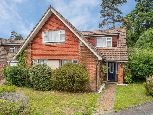 5 bedroom detached house for sale in Sequoia Park, Hatch End, Pinner HA5 — £1,075,000 • 5 bed • 3 bath • 1896 ft²
 5 bedroom detached house for sale in Thornton Grove, Hatch End, Pinner HA5 — £1,399,500 • 5 bed • 2 bath • 2324 ft²
 4 bedroom detached house for sale in Royston Park Road, Hatch End, Pinner HA5 — £1,400,000 • 4 bed • 2 bath • 2200 ft²
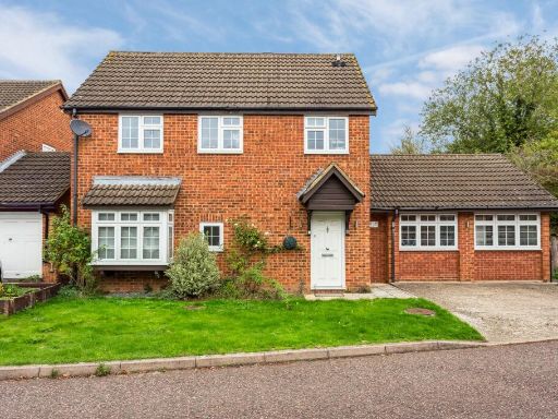 3 bedroom detached house for sale in Newland Close, Pinner, HA5 — £700,000 • 3 bed • 2 bath • 1151 ft²
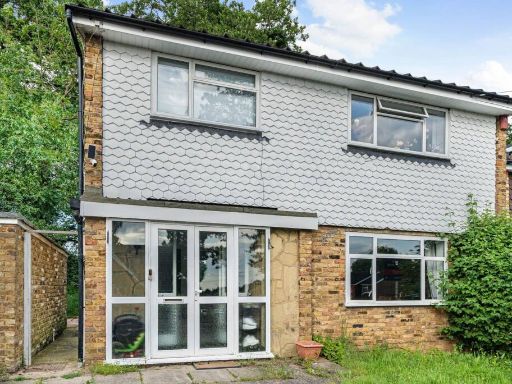 3 bedroom house for sale in Sequoia Park, Hatch End, Pinner, HA5 — £800,000 • 3 bed • 1 bath • 1214 ft²
Meta
- {
"@context": "https://schema.org",
"@type": "Residence",
"name": "3 bedroom house for sale in Sequoia Park, Pinner, HA5",
"description": "",
"url": "https://propertypiper.co.uk/property/cf947951-f247-4434-a1f2-6e6f38495baf",
"image": "https://image-a.propertypiper.co.uk/9bea58b5-3986-4af3-b34d-b71131375335-1024.jpeg",
"address": {
"@type": "PostalAddress",
"streetAddress": "24 Sequoia Park",
"postalCode": "HA5 4BS",
"addressLocality": "Harrow",
"addressRegion": "Ruislip, Northwood and Pinner",
"addressCountry": "England"
},
"geo": {
"@type": "GeoCoordinates",
"latitude": 51.61351348515132,
"longitude": -0.3594129348288585
},
"numberOfRooms": 3,
"numberOfBathroomsTotal": 1,
"floorSize": {
"@type": "QuantitativeValue",
"value": 912,
"unitCode": "FTK"
},
"offers": {
"@type": "Offer",
"price": 875000,
"priceCurrency": "GBP",
"availability": "https://schema.org/InStock"
},
"additionalProperty": [
{
"@type": "PropertyValue",
"name": "Feature",
"value": "detached house"
},
{
"@type": "PropertyValue",
"name": "Feature",
"value": "brick facade"
},
{
"@type": "PropertyValue",
"name": "Feature",
"value": "mid-20th century"
},
{
"@type": "PropertyValue",
"name": "Feature",
"value": "two-storey"
},
{
"@type": "PropertyValue",
"name": "Feature",
"value": "garage"
},
{
"@type": "PropertyValue",
"name": "Feature",
"value": "driveway"
},
{
"@type": "PropertyValue",
"name": "Feature",
"value": "suburban"
},
{
"@type": "PropertyValue",
"name": "Feature",
"value": "family home"
},
{
"@type": "PropertyValue",
"name": "Feature",
"value": "garden"
},
{
"@type": "PropertyValue",
"name": "Feature",
"value": "natural"
},
{
"@type": "PropertyValue",
"name": "Feature",
"value": "fenced"
},
{
"@type": "PropertyValue",
"name": "Feature",
"value": "trees"
},
{
"@type": "PropertyValue",
"name": "Feature",
"value": "outdoor"
},
{
"@type": "PropertyValue",
"name": "Feature",
"value": "greenery"
},
{
"@type": "PropertyValue",
"name": "Feature",
"value": "private"
},
{
"@type": "PropertyValue",
"name": "Feature",
"value": "landscape"
}
]
}
High Res Floorplan Images
Compatible Floorplan Images
FloorplanImages Thumbnail