TN15 8SA - 4 bedroom detached house for sale in McDermott Road, Boroug…
View on Property Piper
4 bedroom detached house for sale in McDermott Road, Borough Green, Sevenoaks, TN15
Property Details
- Price: £625000
- Bedrooms: 4
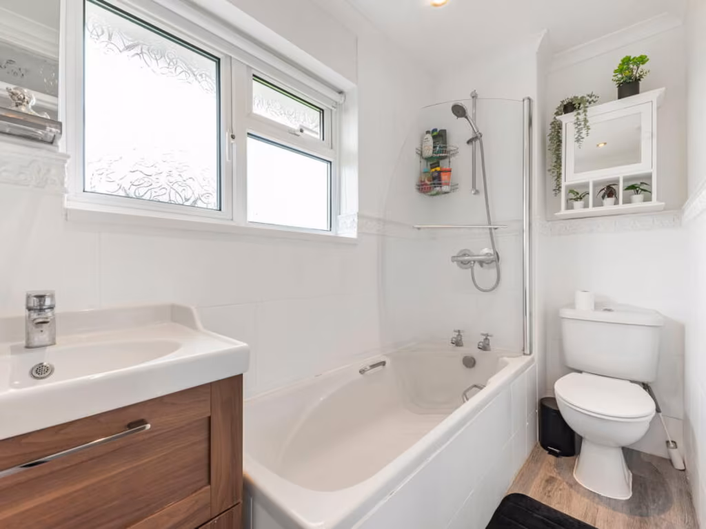
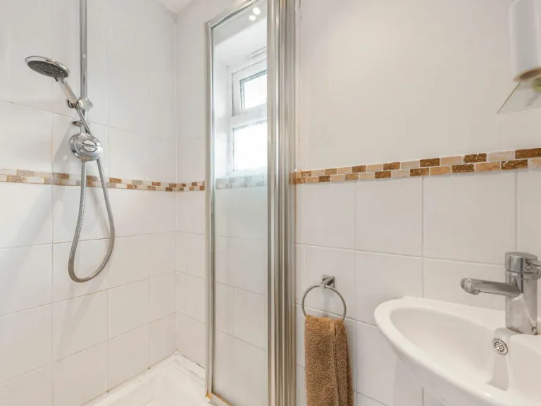
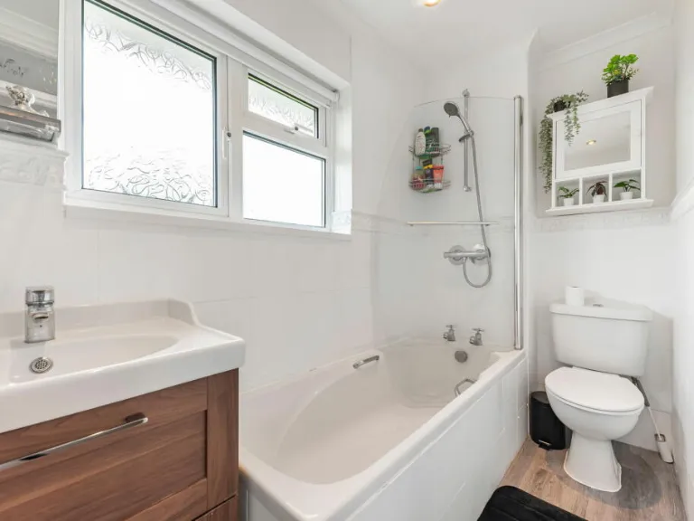
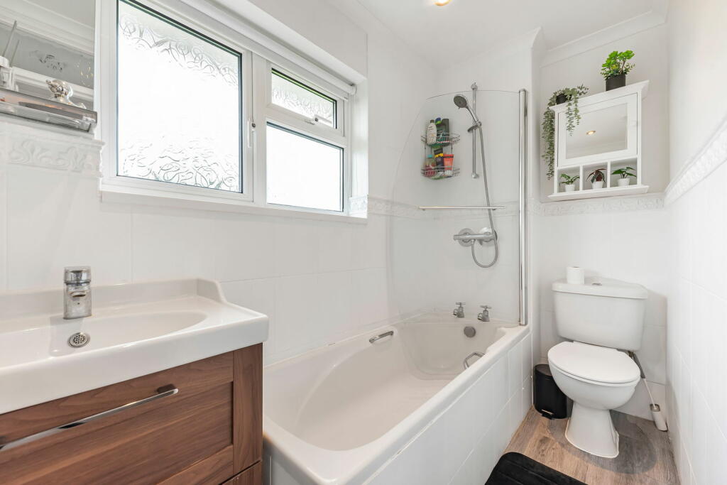
- Bathrooms: 2
- Property Type: undefined
- Property SubType: undefined
Brochure Descriptions
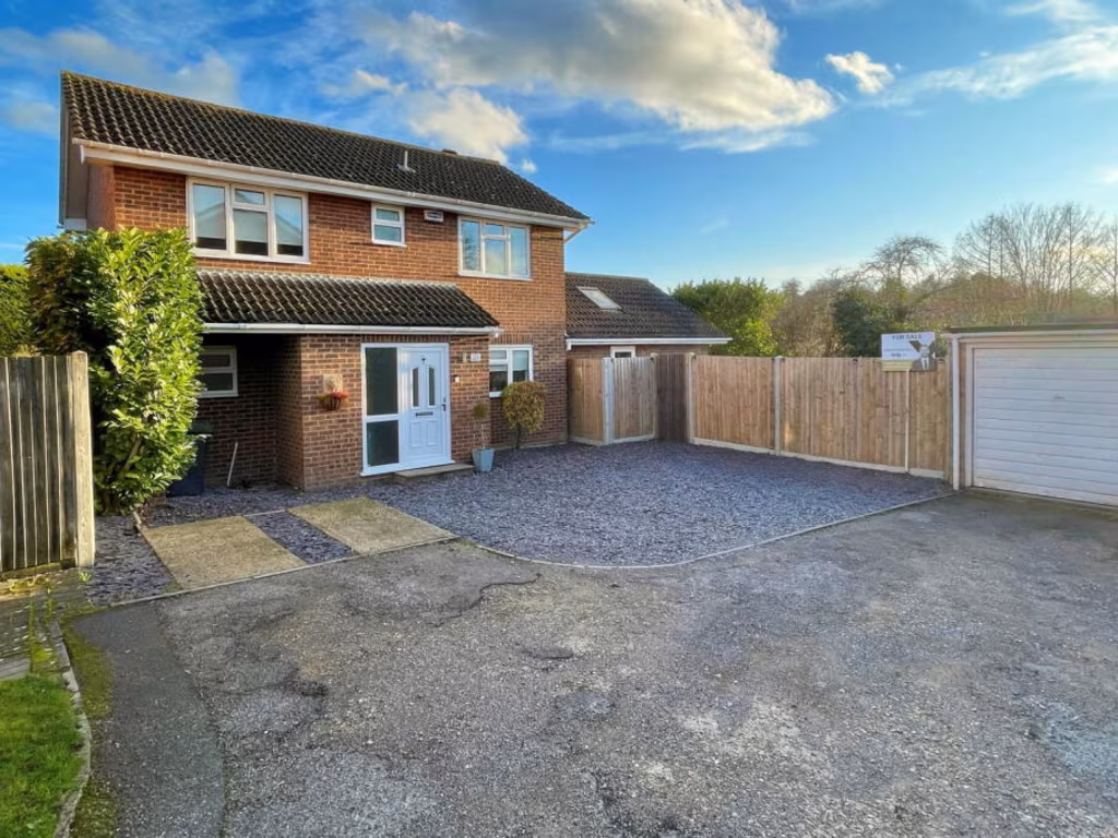
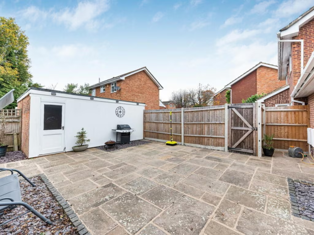
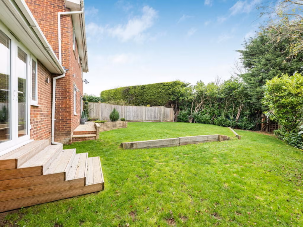
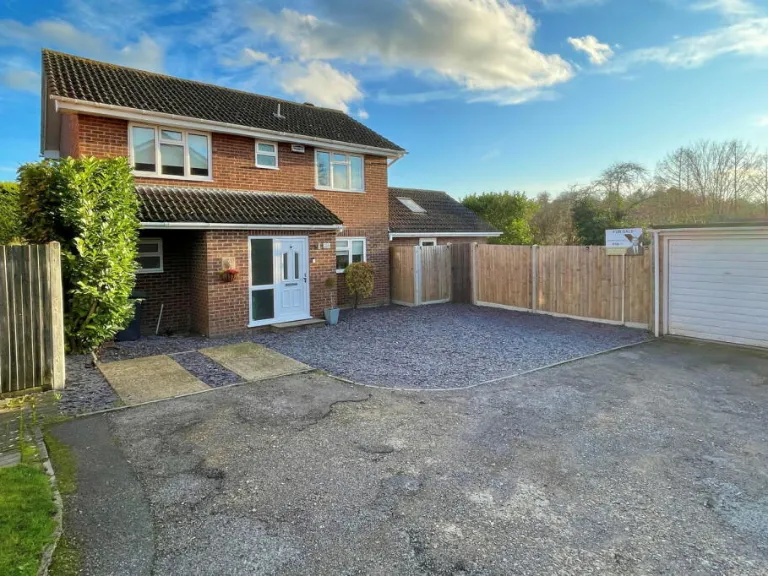
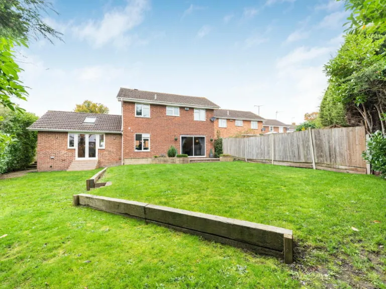
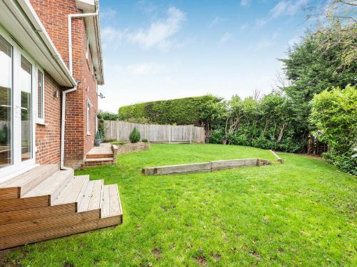
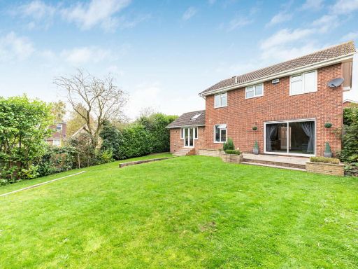
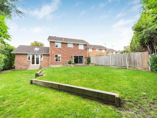
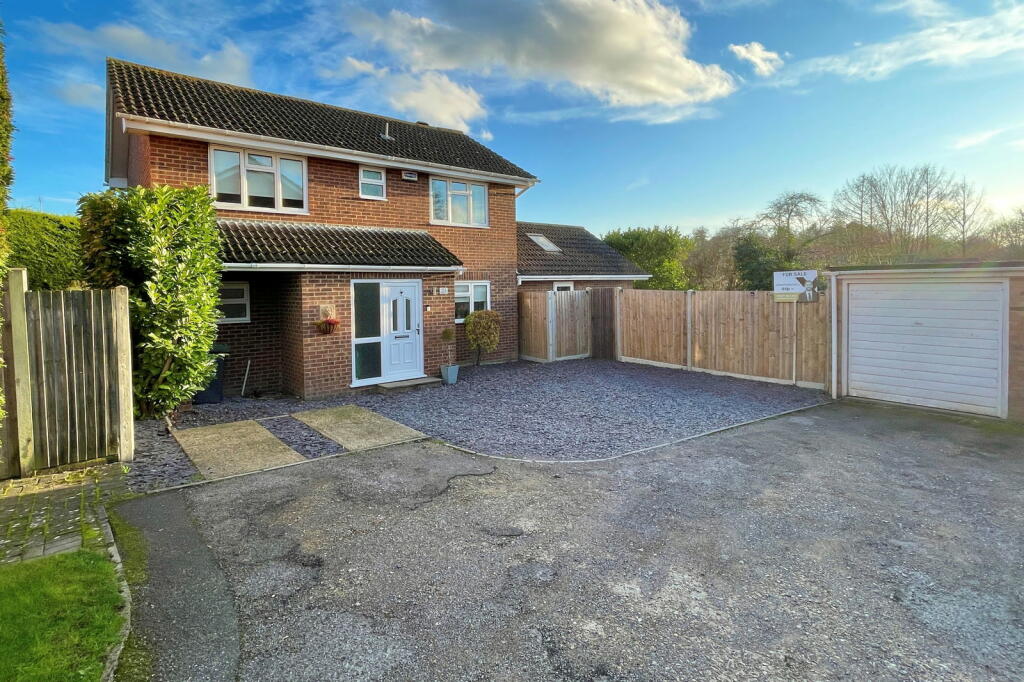
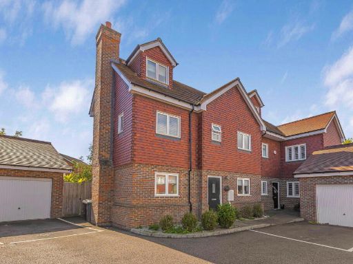
- The property is a two-story detached house with a brick exterior and a gable roof. The front yard features a moderately sized driveway with space for multiple vehicles and has a surrounding wooden fence. The property offers views of trees and open sky, indicating its location may be in a suburban or semi-rural setting. The garden and property size appear to be average, suitable for a family home. There is also a detached single-car garage visible adjacent to the house.
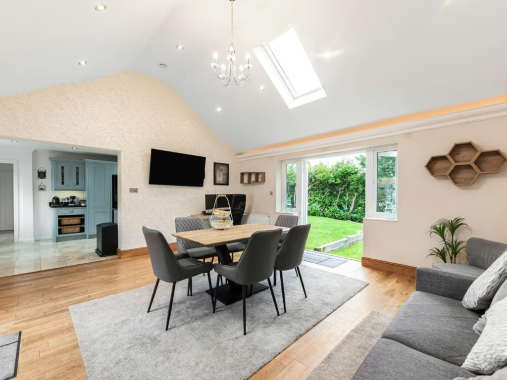
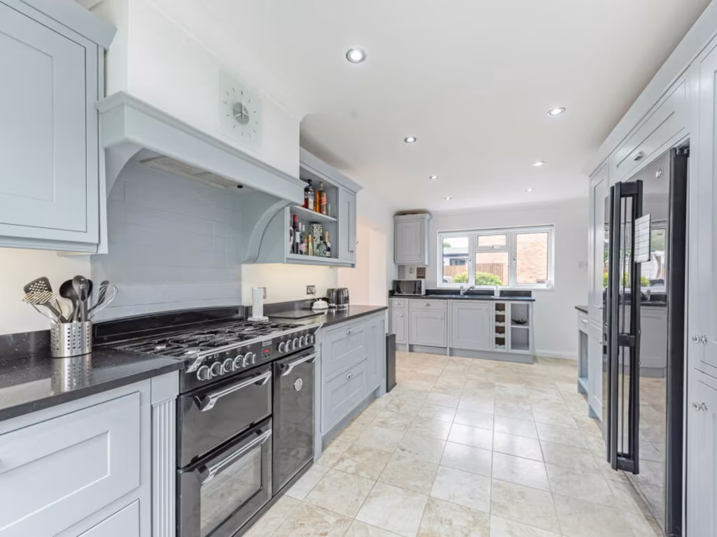
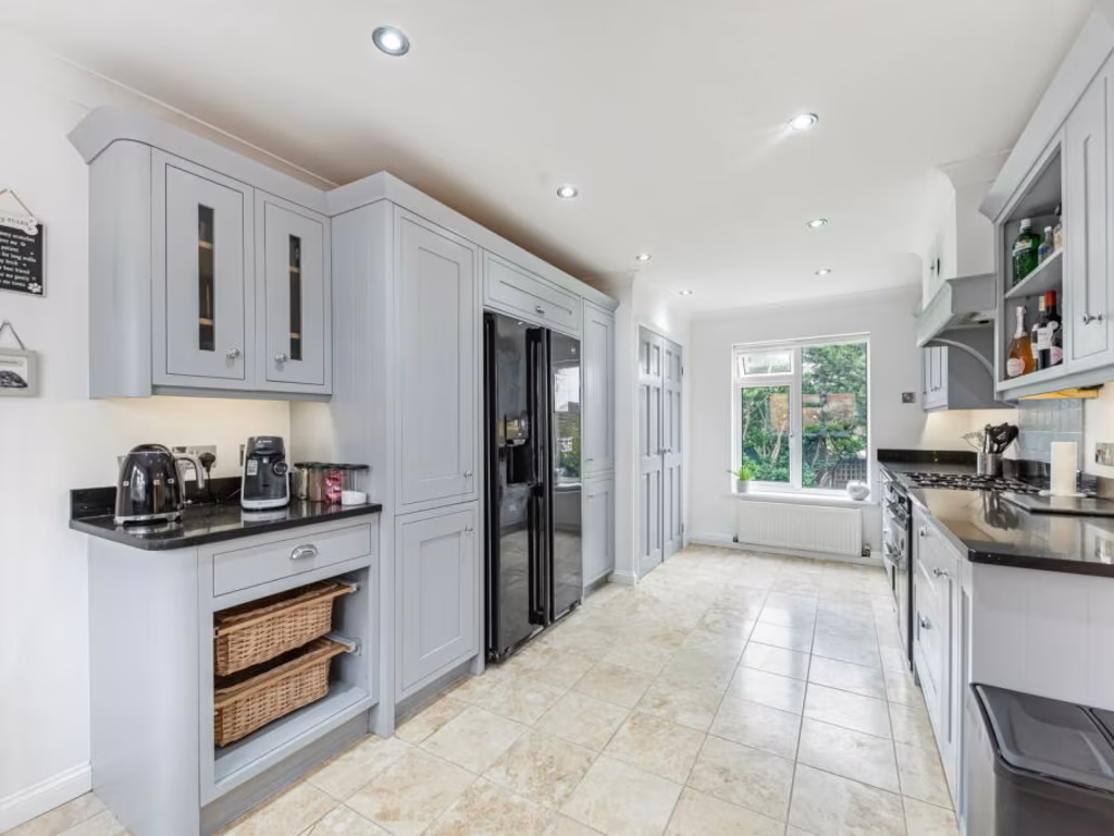
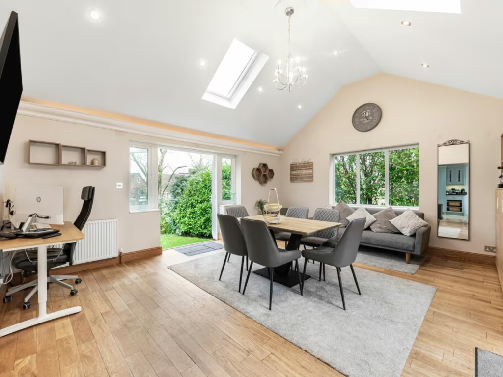
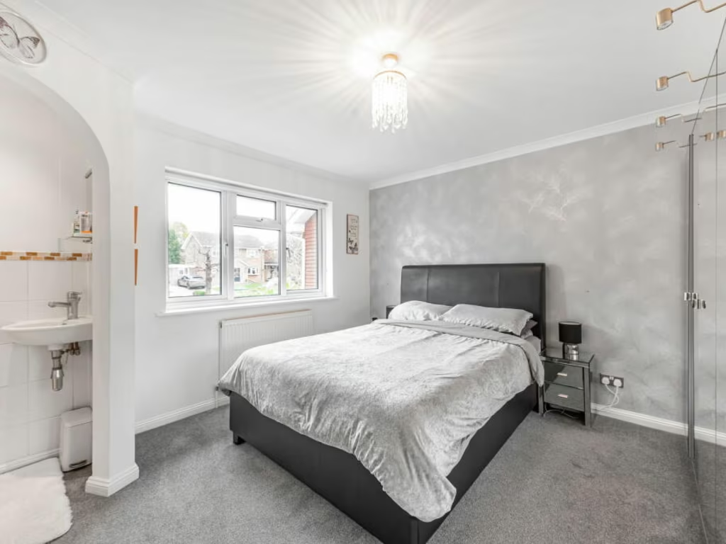
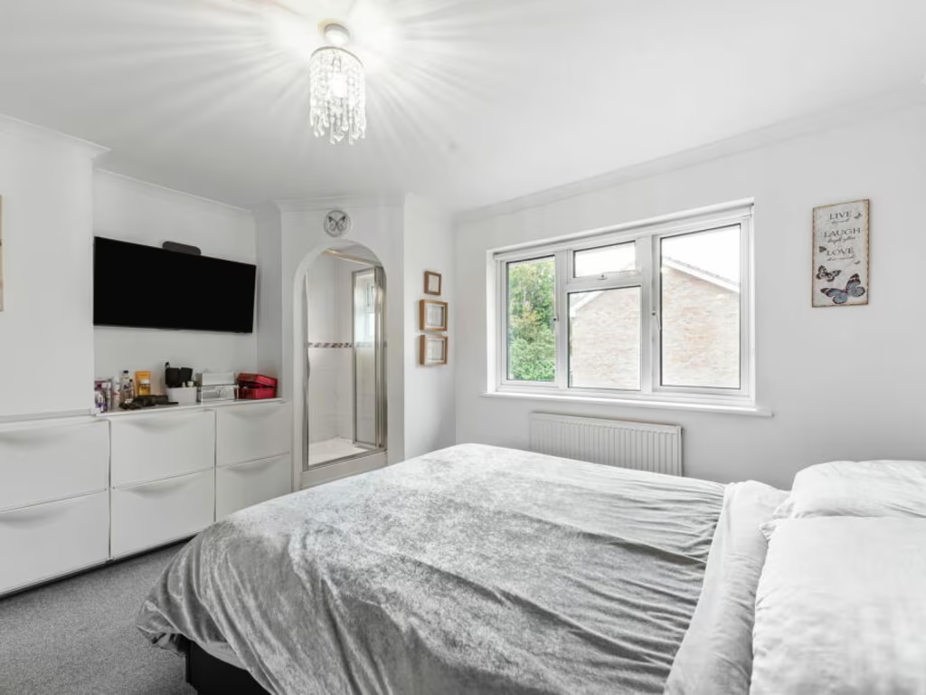
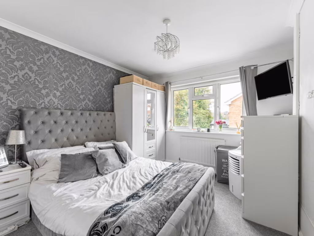
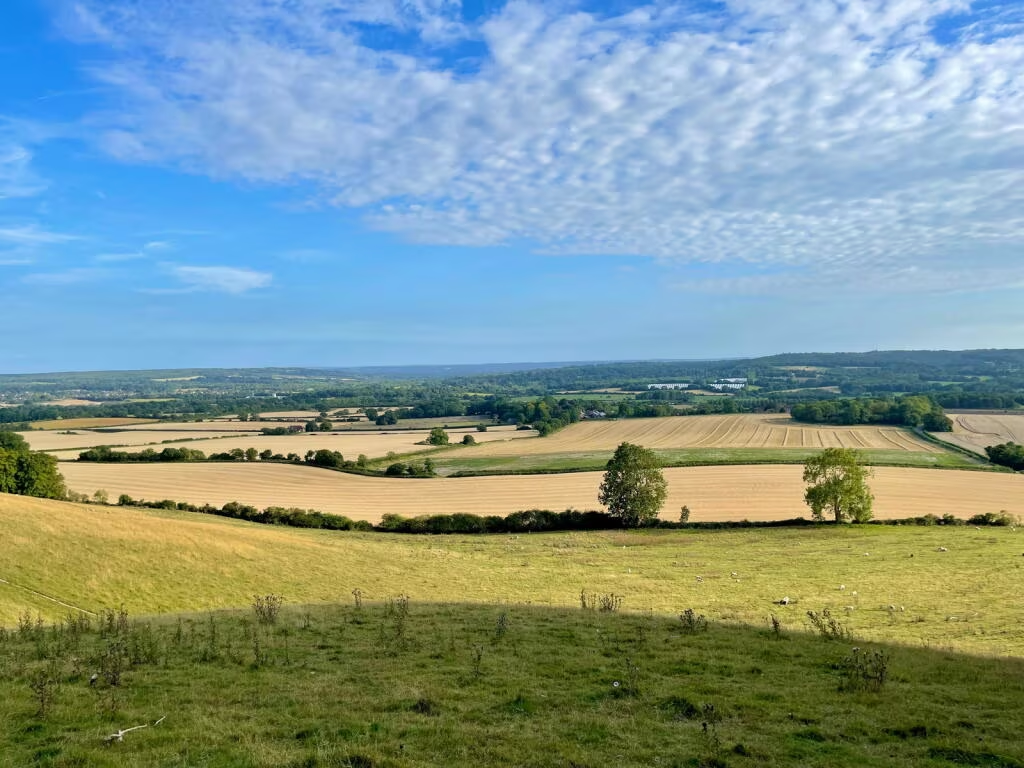
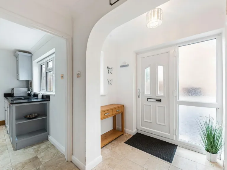
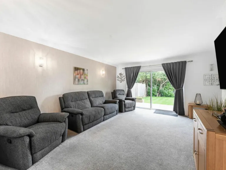
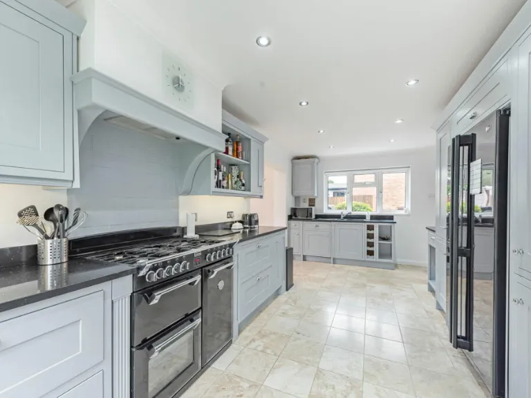
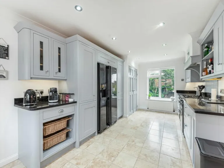
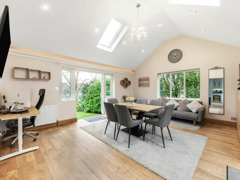
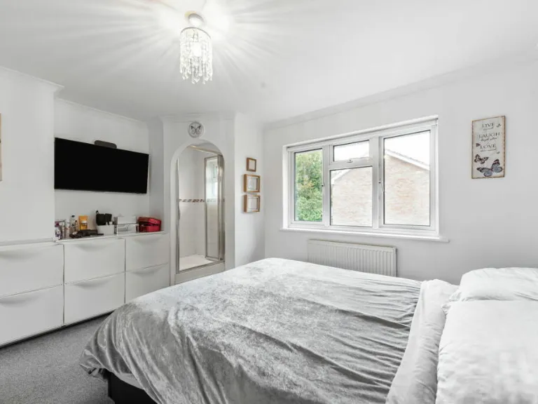
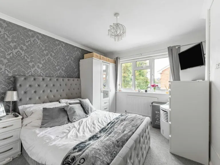
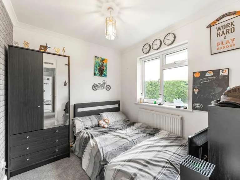
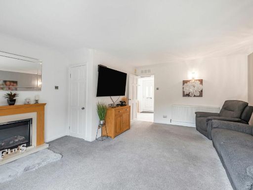
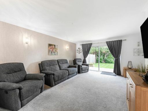
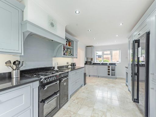
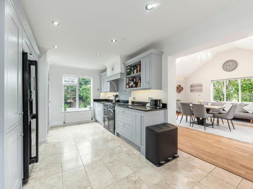
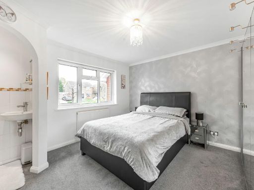
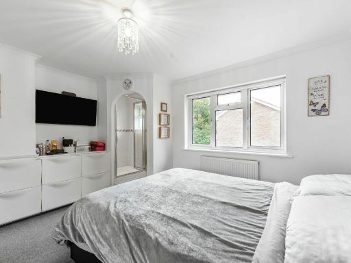
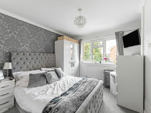
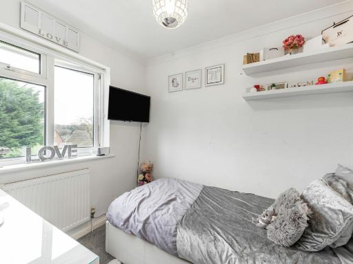
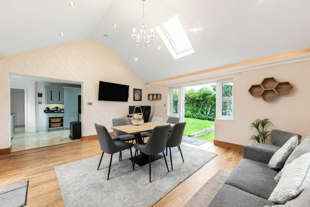
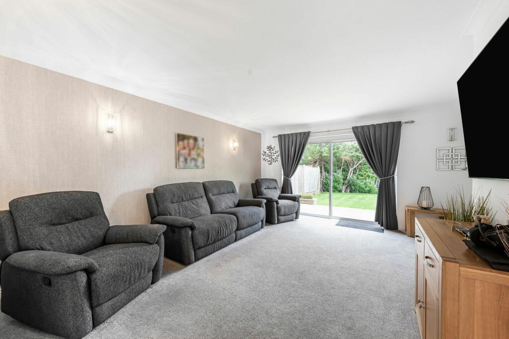
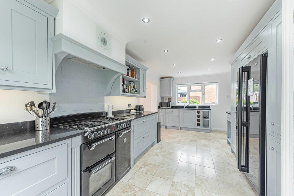
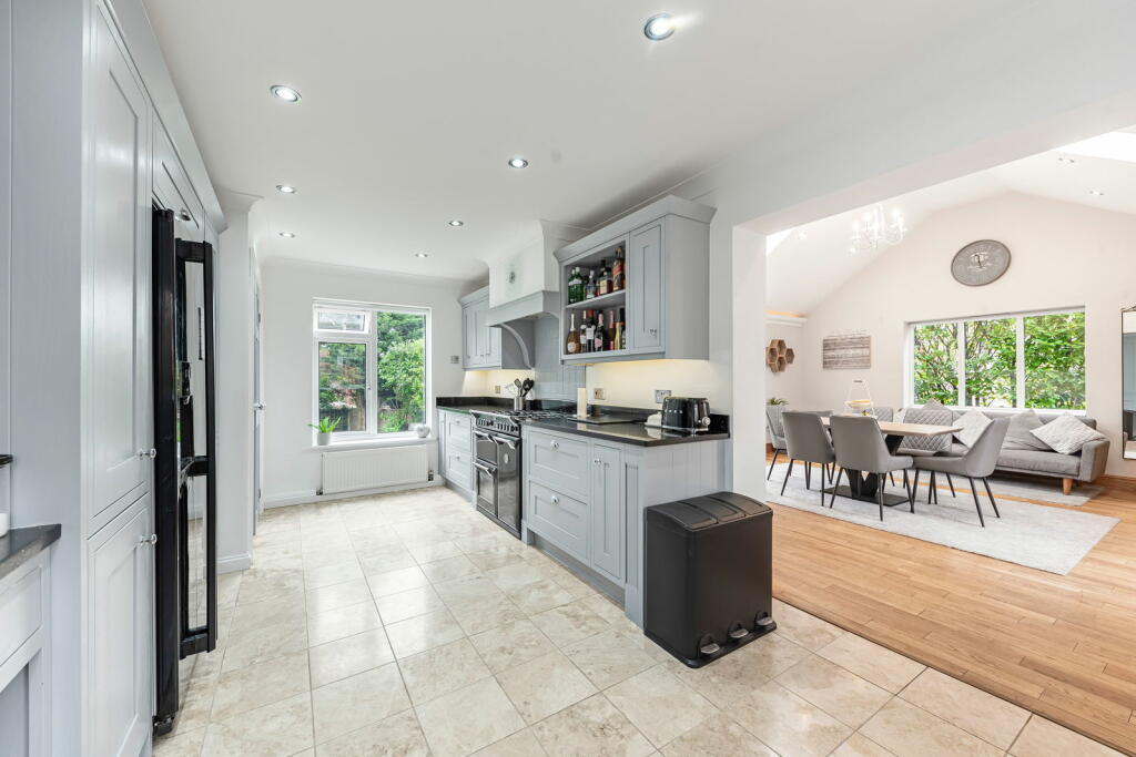
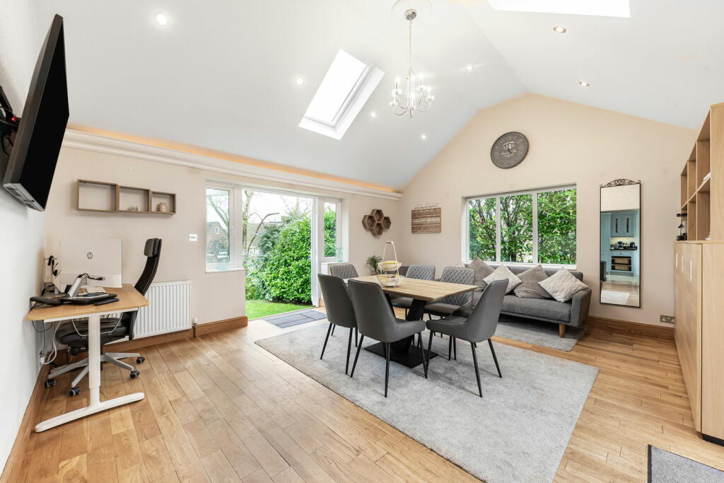
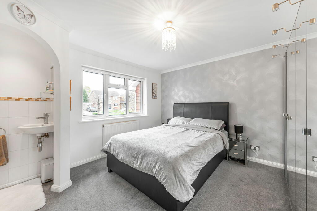
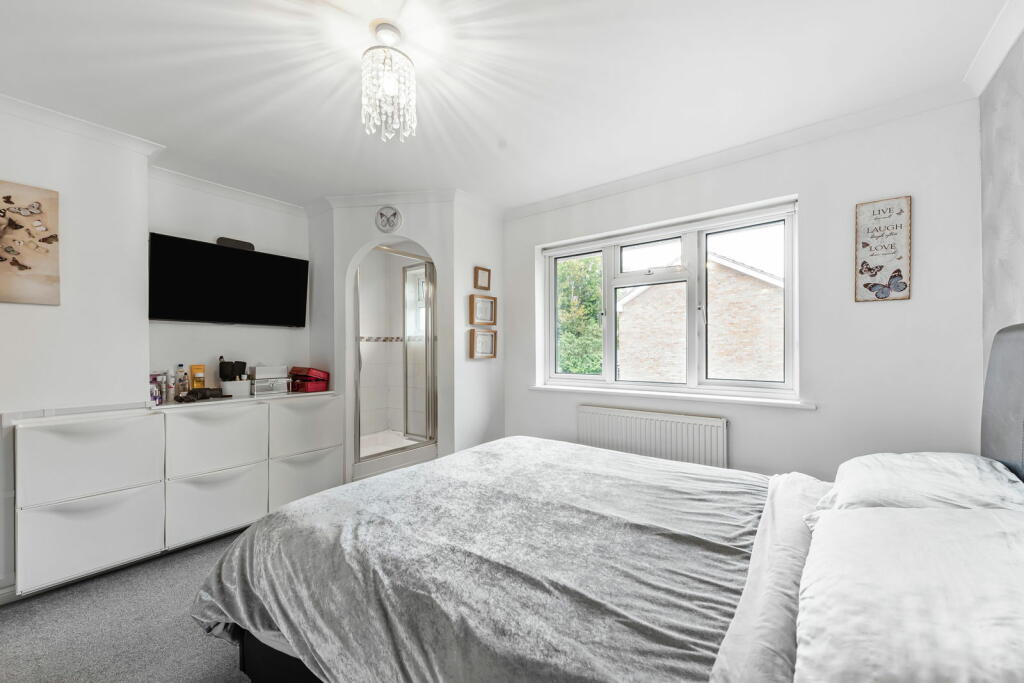
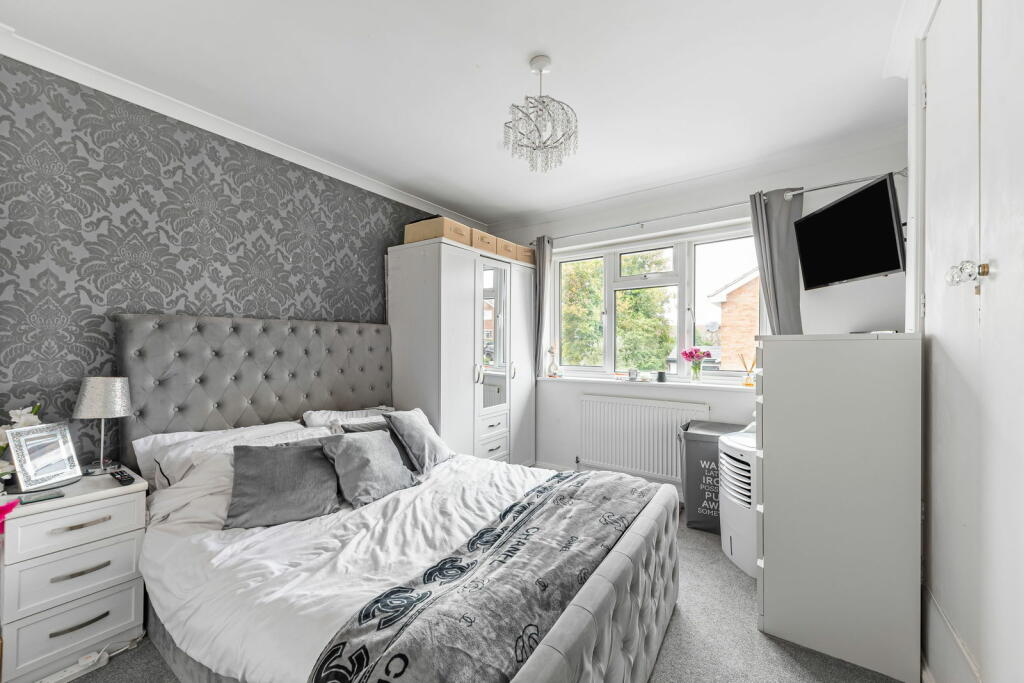
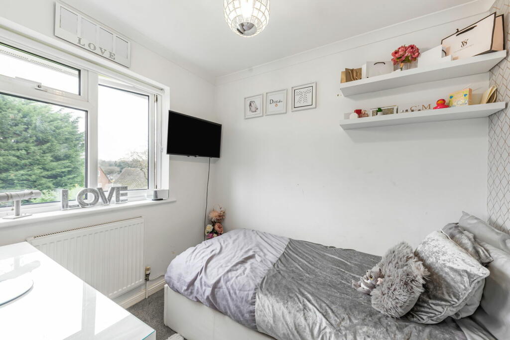
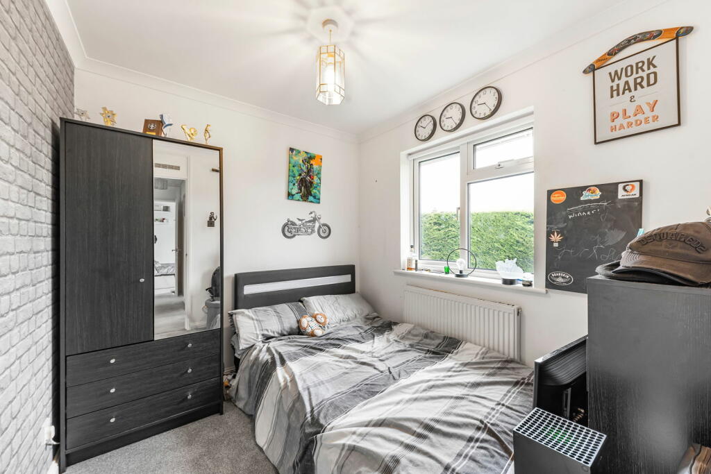
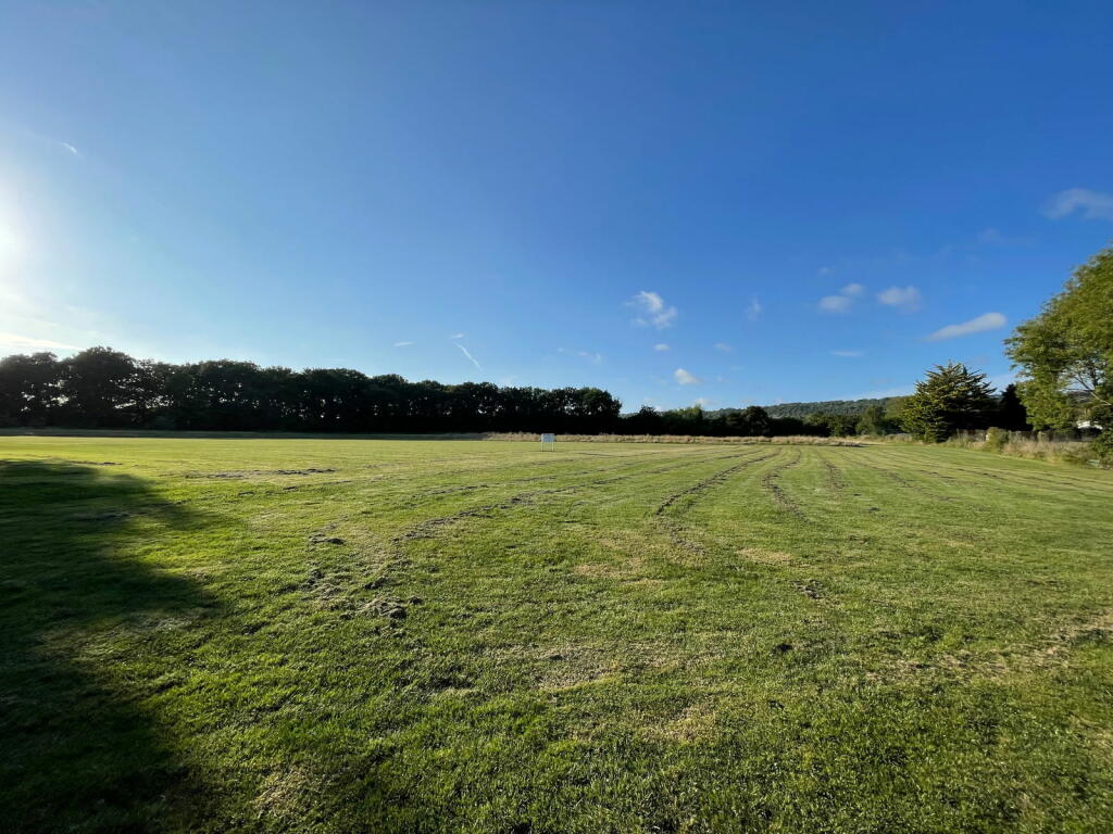
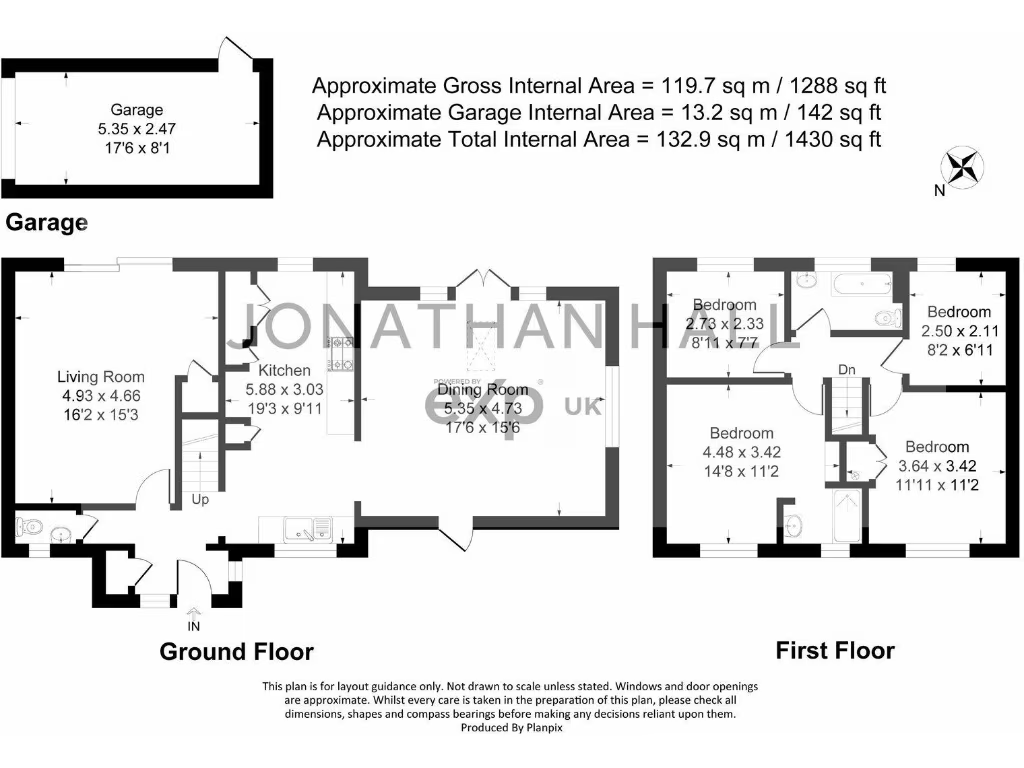
- This property features a spacious layout with approximately 1,430 sq ft of internal area. The ground floor includes a sizable living room, a well-proportioned kitchen, and a dining room. The first floor houses the bedrooms, including a large main bedroom and two additional bedrooms. The property offers a scenic view with lush greenery, suggesting a tranquil setting possibly near pastoral or forested landscapes. The overall property size appears large, with ample outdoor space ideal for families or those seeking a peaceful environment.
Image Descriptions
- semi-detached house modern suburban
- dining area modern
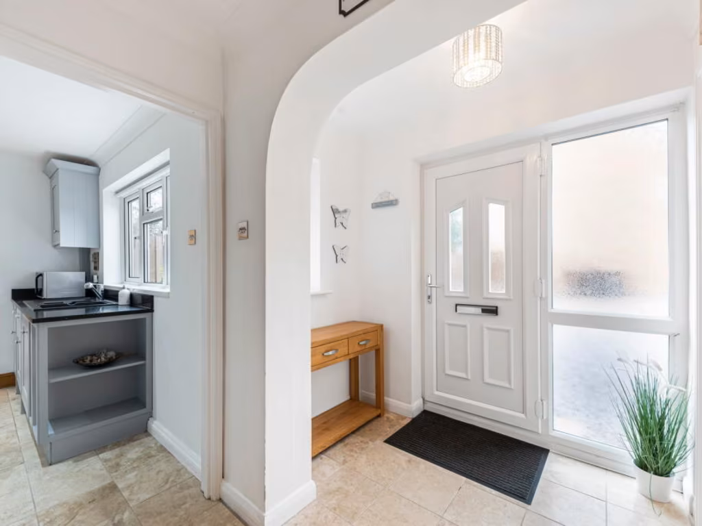
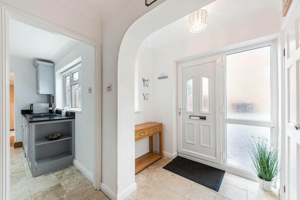
- entryway and kitchen modern
Floorplan Description
- A two-story property with a garage, living room, kitchen, dining room, and four bedrooms.
Rooms
- Garage: Average
- Living Room: Large
- Kitchen: Large
- Dining Room: Large
- Bedroom 1: Small
- Bedroom 2: Small
- Bedroom 3: Large
- Bedroom 4: Average
Textual Property Features
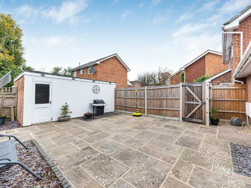
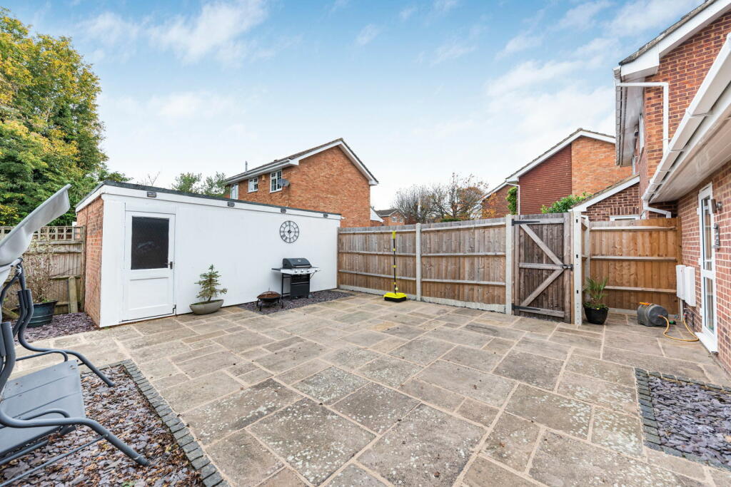
- Has Garden
- Chain Free
- Success
Detected Visual Features
- semi-detached
- brick exterior
- modern
- suburban
- driveway
- two-story
- fence
- residential
- high ceiling
- dining area
- open plan
- natural light
- skylights
- garden view
- wood flooring
- neutral colors
- entryway
- kitchen
- archway
- tile flooring
- bright
- white door
- shelves
- simple design
EPC Details
- High performance glazing
- Timber frame, as built, insulated (assumed)
- Boiler and radiators, mains gas
- Low energy lighting in 98% of fixed outlets
- Solid, no insulation (assumed)
Nearby Schools
- Mereworth Community Primary School
- Wrotham School
- Kemsing Primary School
- St Michael's Prep School
- Culverstone Green Primary School
- Hadlow Rural Community School
- Kings Hill School Primary and Nursery
- Offham Primary School
- Valley Invicta Primary School At Leybourne Chase
- Hildenborough Church of England Primary School
- Hadlow Primary School
- Plaxtol Primary School
- Sevenoaks Preparatory School
- St Lawrence Church of England Primary School
- Ightham Primary School
- Trinity School
- Platt Church of England Voluntary Aided Primary School
- St George's Church of England Voluntary Controlled Primary School
- Trottiscliffe Church of England Primary School
- Vigo Village School
- Shipbourne School
- Valley Invicta Primary School At Kings Hill
- Seal Church of England Voluntary Controlled Primary School
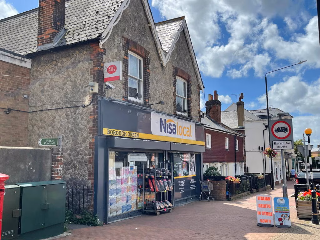
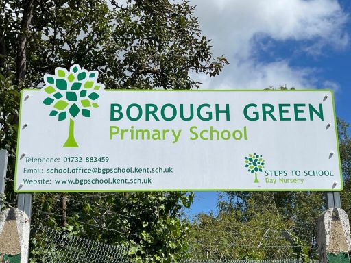
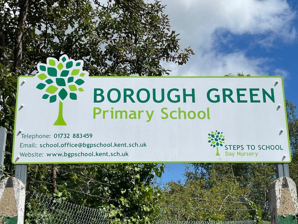
- Borough Green Primary School
- Ryarsh Primary School
- St. Edmund's Church of England Primary School
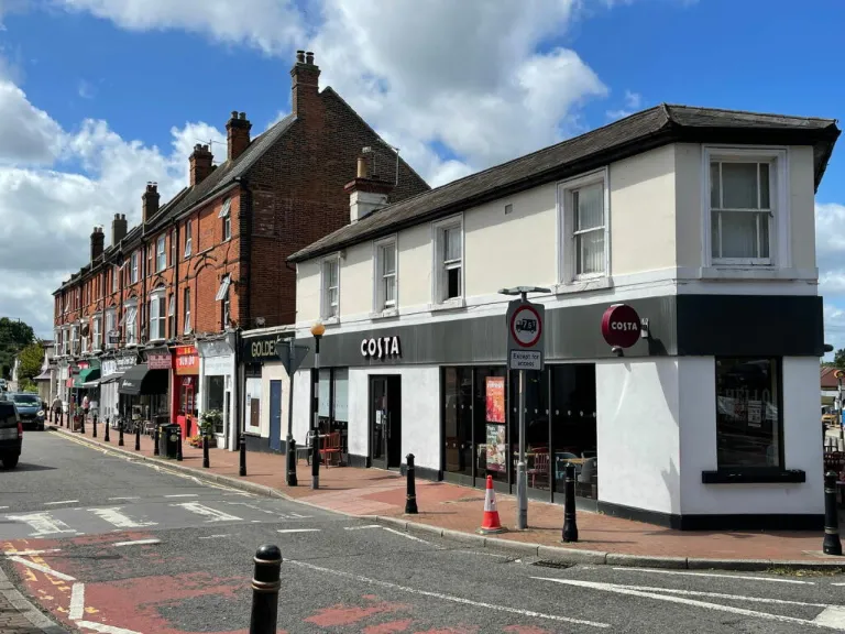
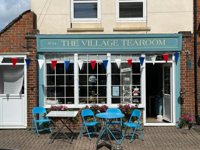
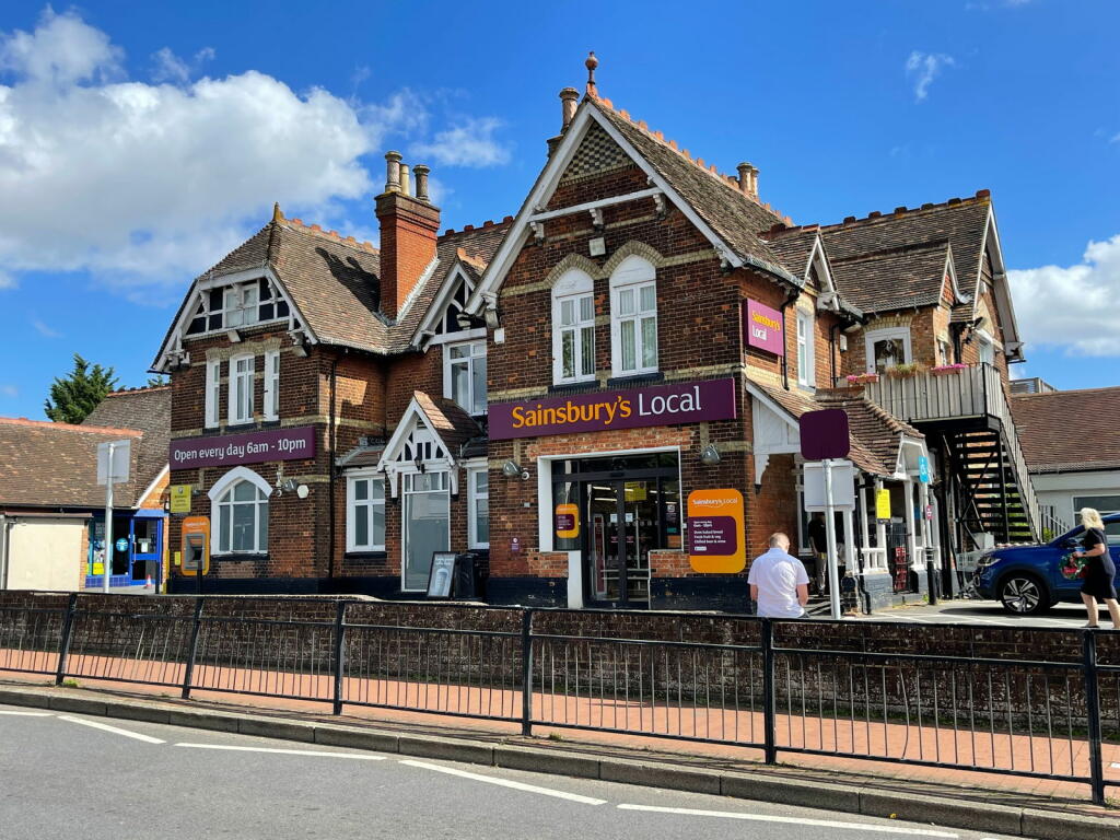
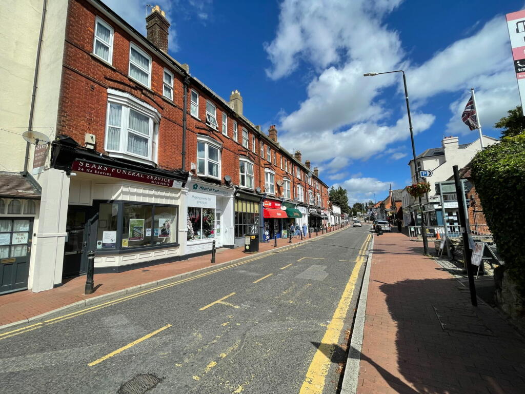
Nearest Bars And Restaurants
- Id: 6644600891
- Tags:
- Amenity: restaurant
- Name: The George and Dragon
- TagsNormalized:
- Lat: 51.2870984
- Lon: 0.2864081
- FullGeoHash: u105y8891b16
- PartitionGeoHash: u105
- Images:
- FoodStandards: null
- Distance: 1319.8
,- Id: 10591807320
- Tags:
- Amenity: restaurant
- Cuisine: chinese
- Name: Happy Garden
- TagsNormalized:
- Lat: 51.2938316
- Lon: 0.3073342
- FullGeoHash: u105yczb1rhz
- PartitionGeoHash: u105
- Images:
- FoodStandards: null
- Distance: 468.5
,- Id: 208691208
- Tags:
- Addr:
- City: Borough Green
- Street: High Street
- Amenity: fast_food
- Building: yes
- Cuisine: fish_and_chips
- Name: Tony's Chippy
- Source: survey;Bing
- TagsNormalized:
- Lat: 51.2927396
- Lon: 0.3069964
- FullGeoHash: u105ycx9ce9j
- PartitionGeoHash: u105
- Images:
- FoodStandards: null
- Distance: 347.7
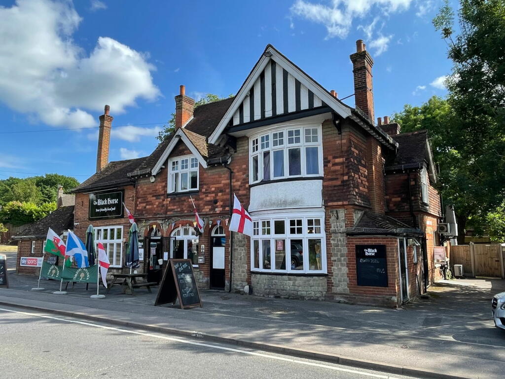
,- Id: 261624734
- Tags:
- Amenity: pub
- Created_by: Potlatch 0.8c
- Name: Black Horse
- TagsNormalized:
- Lat: 51.290548
- Lon: 0.3097121
- FullGeoHash: u105z11t0g4h
- PartitionGeoHash: u105
- Images:
- FoodStandards: null
- Distance: 345.7
,- Id: 2598200491
- Tags:
- Amenity: fast_food
- Cuisine: kebab
- TagsNormalized:
- Lat: 51.2927231
- Lon: 0.3029179
- FullGeoHash: u105ycs9f2xg
- PartitionGeoHash: u105
- Images:
- FoodStandards: null
- Distance: 339.6
}
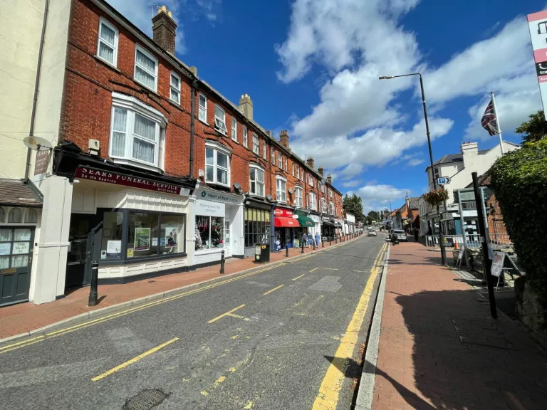
Nearest General Shops
- Id: 208568832
- Tags:
- Addr:
- City: Borough Green
- Housenumber: 40
- Street: High Street
- Building: yes
- Name: D Fisher & Co. Solicitors
- Shop: solicitors
- Source: survey;Bing
- TagsNormalized:
- Lat: 51.2922332
- Lon: 0.3063493
- FullGeoHash: u105ycrnfmq9
- PartitionGeoHash: u105
- Images:
- FoodStandards: null
- Distance: 278
,- Id: 208568834
- Tags:
- Addr:
- City: Borough Green
- Street: High Street
- Building: yes
- Name: Kristies Antiques
- Shop: antiques
- Source: survey;Bing
- TagsNormalized:
- Lat: 51.2922114
- Lon: 0.3063161
- FullGeoHash: u105ycrnc9jz
- PartitionGeoHash: u105
- Images:
- FoodStandards: null
- Distance: 274.9
,- Id: 208568833
- Tags:
- Addr:
- City: Borough Green
- Street: High Street
- Building: yes
- Name: Ibbett Mosley
- Shop: estate_agent
- Source: survey;Bing
- TagsNormalized:
- Lat: 51.2921886
- Lon: 0.3062815
- FullGeoHash: u105ycrn8uup
- PartitionGeoHash: u105
- Images:
- FoodStandards: null
- Distance: 271.7
}
Nearest Grocery shops
- Id: 2598200490
- Tags:
- TagsNormalized:
- Lat: 51.2927197
- Lon: 0.3028414
- FullGeoHash: u105ycs98xyz
- PartitionGeoHash: u105
- Images:
- FoodStandards: null
- Distance: 341.4
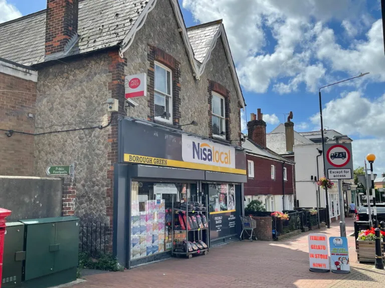
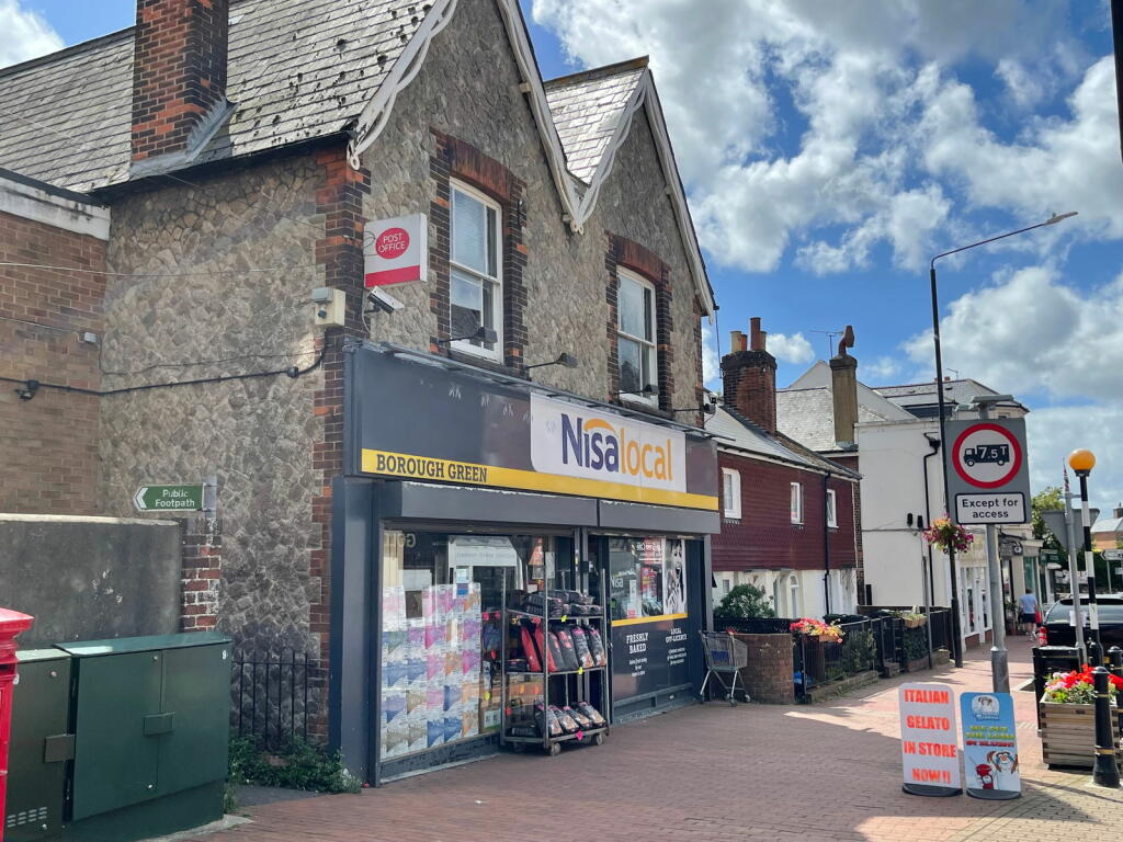
,- Id: 208691206
- Tags:
- Addr:
- City: Borough Green
- Street: High Street
- Brand: Nisa Local
- Brand:wikidata: Q16999069
- Brand:wikipedia: en:Nisa (retailer)
- Building: yes
- Name: Nisa Local
- Shop: convenience
- Source: survey;Bing
- TagsNormalized:
- nisa
- nisa local
- convenience
- shop
- Lat: 51.2924457
- Lon: 0.3066798
- FullGeoHash: u105ycx24hvh
- PartitionGeoHash: u105
- Images:
- FoodStandards: null
- Distance: 308.8
,- Id: 208568836
- Tags:
- Addr:
- City: Borough Green
- Housenumber: 34
- Street: High Street
- Building: yes
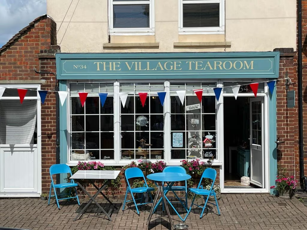
- Name: Wells the Greengrocer
- Shop: greengrocer
- Source: survey;Bing
- TagsNormalized:
- Lat: 51.2921543
- Lon: 0.3062294
- FullGeoHash: u105ycqyrwt4
- PartitionGeoHash: u105
- Images:
- FoodStandards: null
- Distance: 266.8
}
Nearest Religious buildings
- Id: 992306054
- Tags:
- Amenity: place_of_worship
- Building: church
- Denomination: roman_catholic
- Name: Catholic Church of St Joseph
- Religion: christian
- TagsNormalized:
- place of worship
- church
- catholic
- roman catholic
- christian
- Lat: 51.2929173
- Lon: 0.3056121
- FullGeoHash: u105ycwdckbc
- PartitionGeoHash: u105
- Images:
- FoodStandards: null
- Distance: 337.9
,- Id: 253971423
- Tags:
- Addr:
- City: Borough Green
- Postcode: TN15 8BJ
- Street: High Street
- Amenity: place_of_worship
- Building: chapel
- Denomination: baptist
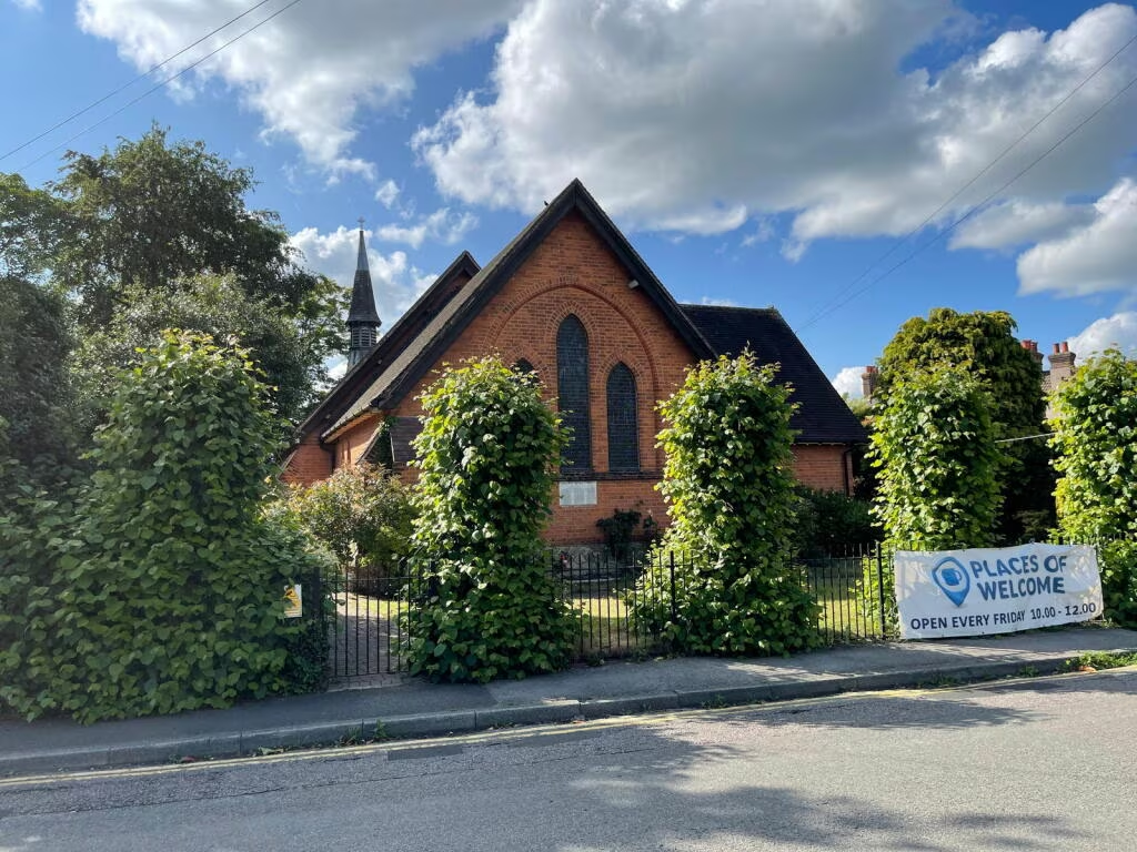
- Name: Borough Green Baptist Church
- Religion: christian
- TagsNormalized:
- place of worship
- chapel
- baptist
- church
- christian
- Lat: 51.2916088
- Lon: 0.3055998
- FullGeoHash: u105ycqe2bzs
- PartitionGeoHash: u105
- Images:
- FoodStandards: null
- Distance: 195.4
,- Id: 186393713
- Tags:
- Amenity: place_of_worship
- Building: church
- Denomination: anglican
- Name: The Church of the Good Shepherd
- Religion: christian
- Wikidata: Q105102746
- TagsNormalized:
- place of worship
- church
- anglican
- christian
- Lat: 51.2913146
- Lon: 0.3039905
- FullGeoHash: u105ycm3e6p9
- PartitionGeoHash: u105
- Images:
- FoodStandards: null
- Distance: 166.4
}
Nearest Airports
- Id: 260720166
- Tags:
- Aerodrome: international
- Aeroway: aerodrome
- Alt_name: Gatwick Airport
- Ele: 62
- Iata: LGW
- Icao: EGKK
- Internet_access: wlan
- Internet_access:fee: no
- Internet_access:ssid: Gatwick FREE Wi-Fi
- Name: London Gatwick Airport
- Operator: Gatwick Airport Limited
- Ref: LGW
- Website: https://www.gatwickairport.com/
- Wikidata: Q8703
- Wikipedia: en:Gatwick Airport
- TagsNormalized:
- airport
- international airport
- Lat: 51.1540917
- Lon: -0.1883773
- FullGeoHash: gcpg58qf4mzd
- PartitionGeoHash: gcpg
- Images:
- FoodStandards: null
- Distance: 37522.6
}
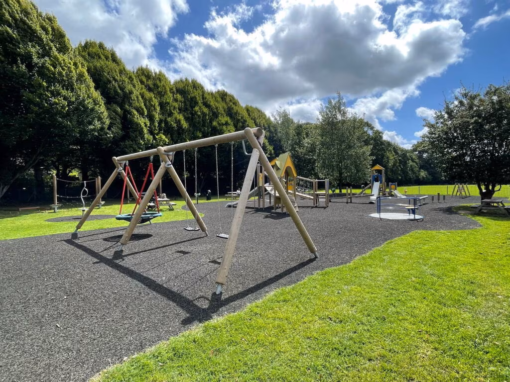
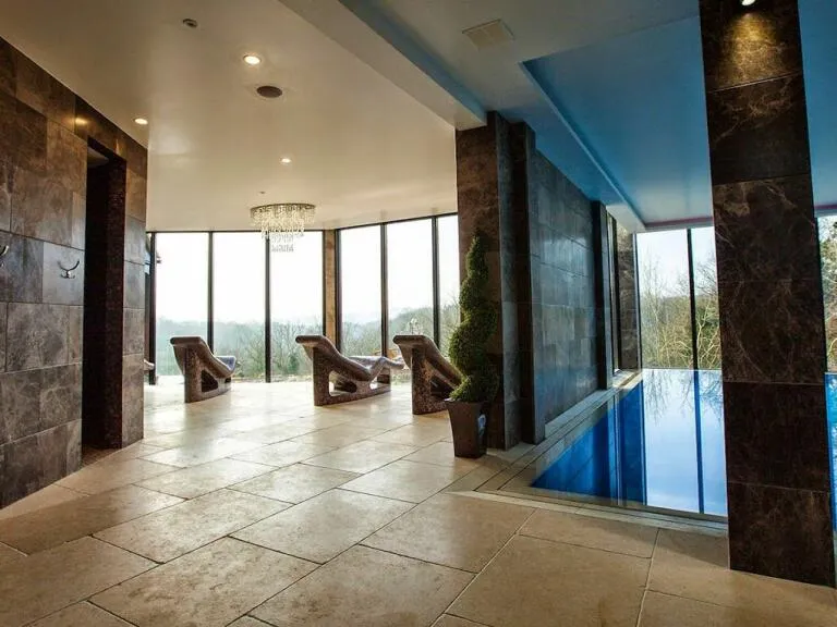
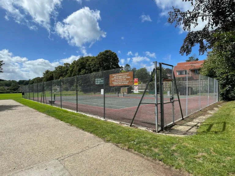
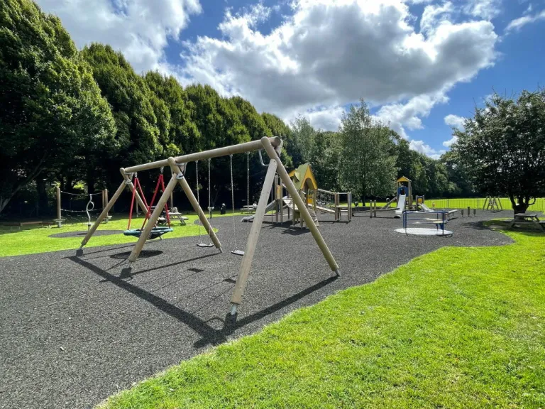
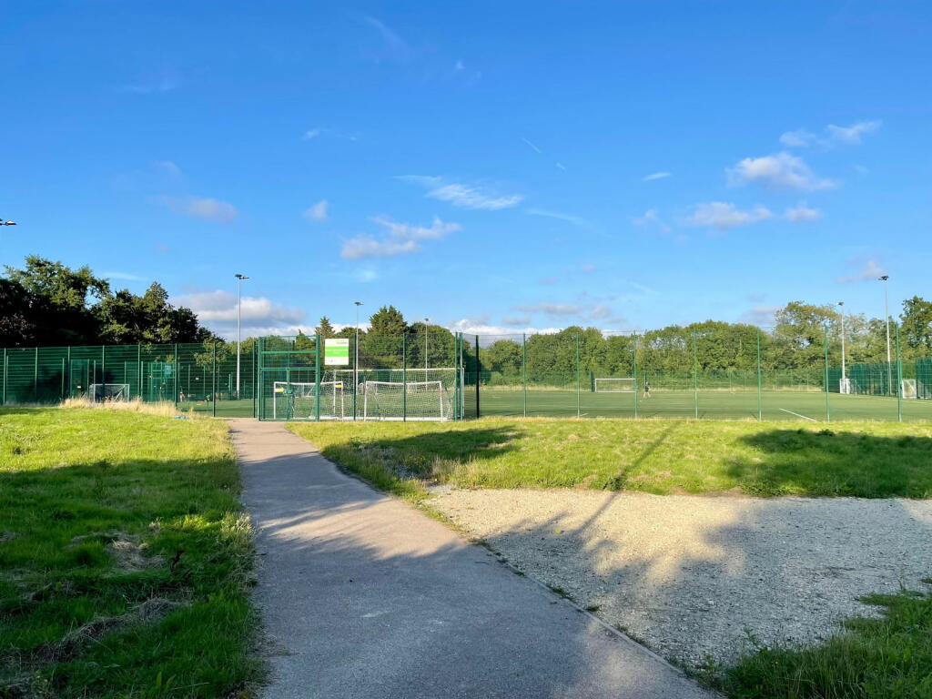
Nearest Leisure Facilities
- Id: 4427740528
- Tags:
- Covered: no
- Leisure: picnic_table
- TagsNormalized:
- picnic
- picnic table
- leisure
- Lat: 51.2832328
- Lon: 0.3033498
- FullGeoHash: u105wzufkx6p
- PartitionGeoHash: u105
- Images:
- FoodStandards: null
- Distance: 750.4
,- Id: 4427740753
- Tags:
- Covered: no
- Leisure: picnic_table
- TagsNormalized:
- picnic
- picnic table
- leisure
- Lat: 51.2835777
- Lon: 0.3033098
- FullGeoHash: u105wzuu7xu1
- PartitionGeoHash: u105
- Images:
- FoodStandards: null
- Distance: 712.9
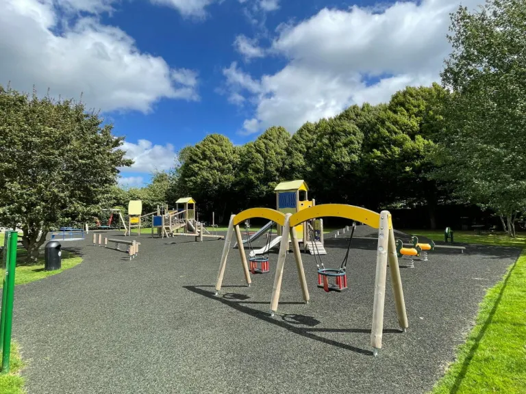
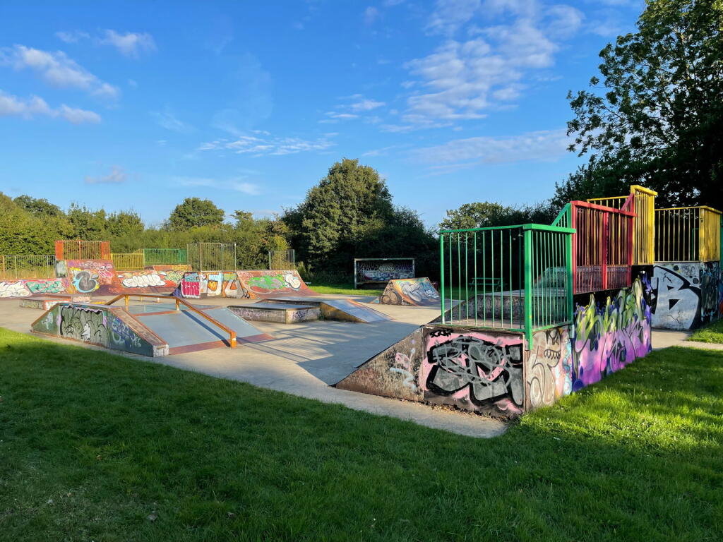
,- Id: 24151665
- Tags:
- Access: yes
- Created_by: Potlatch 0.8c
- Leisure: playground
- TagsNormalized:
- Lat: 51.2906107
- Lon: 0.3089755
- FullGeoHash: u105z10vrwuf
- PartitionGeoHash: u105
- Images:
- FoodStandards: null
- Distance: 297.4
,- Id: 24151633
- Tags:
- Leisure: pitch
- Sport: tennis
- TagsNormalized:
- Lat: 51.2907503
- Lon: 0.3085459
- FullGeoHash: u105z10wm8u7
- PartitionGeoHash: u105
- Images:
- FoodStandards: null
- Distance: 273.6
,- Id: 307786981
- Tags:
- Leisure: pitch
- Name: Borough Green Bowls Club
- Sport: bowls
- TagsNormalized:
- pitch
- leisure
- bowls
- club
- sports
- Lat: 51.288989
- Lon: 0.3072348
- FullGeoHash: u105ybzsp0db
- PartitionGeoHash: u105
- Images:
- FoodStandards: null
- Distance: 195.6
}
Nearest Tourist attractions
- Id: 682226489
- Tags:
- Addr:
- Place: Wrotham Heath
- Postcode: TN15 7SD
- Street: Ford Lane
- Fhrs:
- Authority: Tonbridge and Malling
- Id: 291784
- Inspectiondate: 2010-04-28
- Rating: 4
- Name: Gate House Wood Touring Park
- Phone: +441732843062
- Source: survey
- Tourism: camp_site
- TagsNormalized:
- Lat: 51.2995464
- Lon: 0.3444292
- FullGeoHash: u105zffc9b94
- PartitionGeoHash: u105
- Images:
- FoodStandards:
- Id: 291784
- FHRSID: 291784
- LocalAuthorityBusinessID: 10/00054/MIXED
- BusinessName: Gate House Wood Touring Park
- BusinessType: Retailers - other
- BusinessTypeID: 4613
- AddressLine1: Managers Flat
- AddressLine2: Gate House Wood Touring Park
- AddressLine3: Ford Lane
- AddressLine4: Wrotham Heath
- PostCode: TN15 7SD
- RatingValue: Exempt
- RatingKey: fhrs_exempt_en-GB
- RatingDate: 2022-07-27
- LocalAuthorityCode: 191
- LocalAuthorityName: Tonbridge and Malling
- LocalAuthorityWebSite: http://www.tmbc.gov.uk
- LocalAuthorityEmailAddress: foodandsafety@tmbc.gov.uk
- Scores:
- Hygiene: null
- Structural: null
- ConfidenceInManagement: null
- NewRatingPending: false
- Geocode:
- Longitude: 0.34603800000000
- Latitude: 51.30083700000000
- Distance: 2953.3
,- Id: 1087214712
- Tags:
- TagsNormalized:
- Lat: 51.3163056
- Lon: 0.3065922
- FullGeoHash: u105yvz70hew
- PartitionGeoHash: u105
- Images:
- FoodStandards: null
- Distance: 2936.8
,- Id: 4427740529
- Tags:
- TagsNormalized:
- Lat: 51.2834089
- Lon: 0.303316
- FullGeoHash: u105wzugeb2f
- PartitionGeoHash: u105
- Images:
- FoodStandards: null
- Distance: 731.4
}
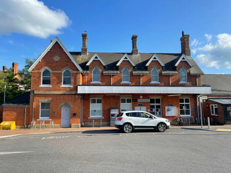
Nearest Train stations
- Id: 6855385779
- Tags:
- Alt_name: West Malling for Kings Hill
- Name: West Malling
- Naptan:
- Network: National Rail
- Postal_code: ME19 6HJ
- Public_transport: station
- Railway: station
- Ref:
- Source:
- Train: yes
- Wheelchair: limited
- Wikidata: Q2053919
- Wikipedia: en:West Malling railway station
- TagsNormalized:
- Lat: 51.2920962
- Lon: 0.4186871
- FullGeoHash: u107c92yh5ex
- PartitionGeoHash: u107
- Images:
- FoodStandards: null
- Distance: 7920
,- Id: 3727341276
- Tags:
- Name: Otford
- Naptan:
- Network: National Rail
- Public_transport: station
- Railway: station
- Ref:
- Wikidata: Q2023511
- Wikipedia: en:Otford railway station
- TagsNormalized:
- Lat: 51.3129318
- Lon: 0.1971759
- FullGeoHash: u105umpx6xc1
- PartitionGeoHash: u105
- Images:
- FoodStandards: null
- Distance: 7910.7
,- Id: 4337914382
- Tags:
- Addr:
- Street: Bat and Ball Road
- Name: Bat & Ball
- Naptan:
- Network: National Rail
- Old_name: Sevenoaks Bat & Ball
- Public_transport: station
- Railway: station
- Ref:
- Source: NPE
- Wikidata: Q4868455
- Wikipedia: en:Bat & Ball railway station
- TagsNormalized:
- Lat: 51.2901134
- Lon: 0.1941812
- FullGeoHash: u105u3j6sdpg
- PartitionGeoHash: u105
- Images:
- FoodStandards: null
- Distance: 7695.5
,- Id: 6692612523
- Tags:
- Name: Kemsing
- Naptan:
- Network: National Rail
- Public_transport: station
- Railway: station
- Ref:
- Source: NPE
- Wikidata: Q2870503
- Wikipedia: en:Kemsing railway station
- TagsNormalized:
- Lat: 51.2972539
- Lon: 0.2474224
- FullGeoHash: u105vdkhjm5w
- PartitionGeoHash: u105
- Images:
- FoodStandards: null
- Distance: 4075.3
,- Id: 6692612524
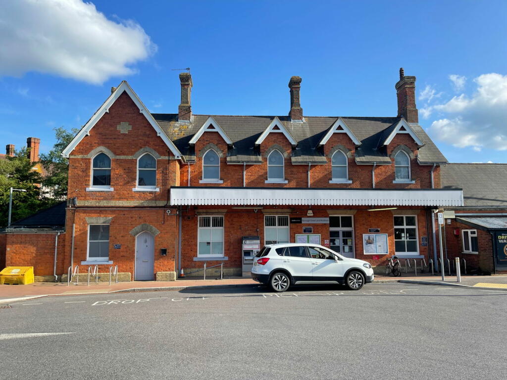
- Tags:
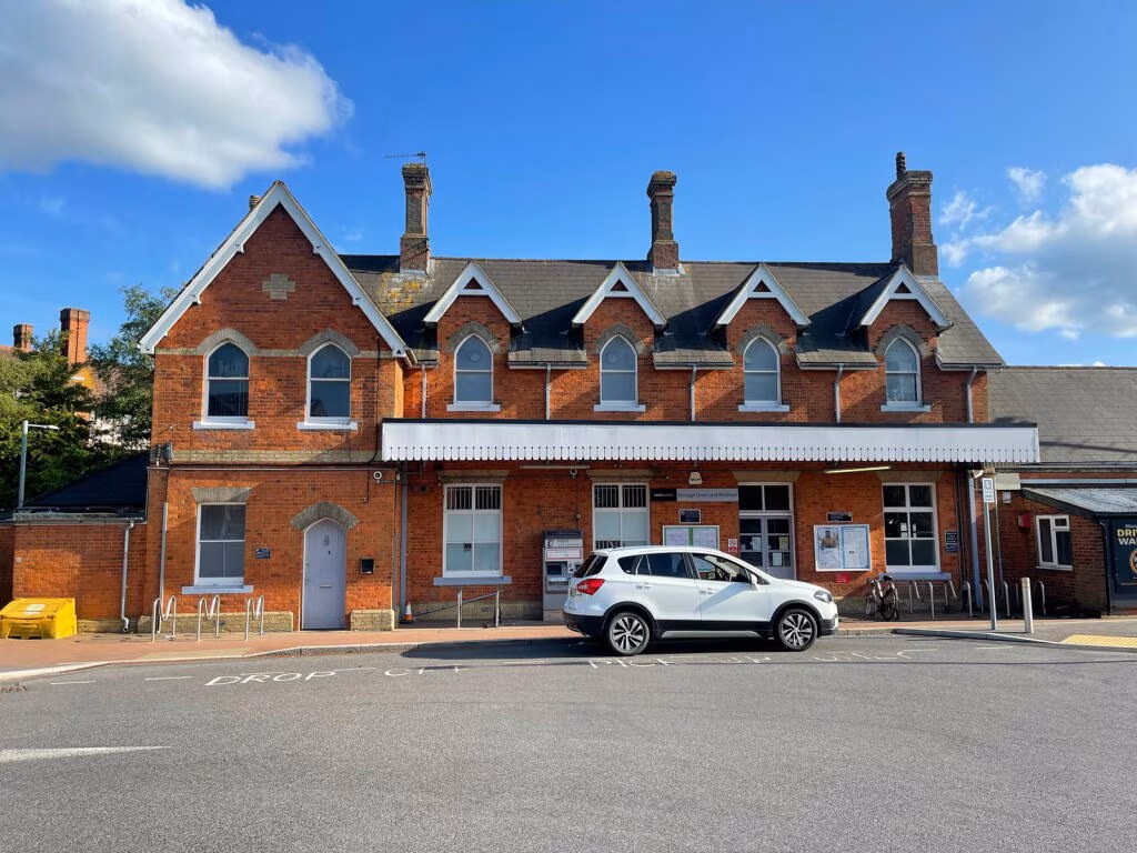
- Name: Borough Green & Wrotham
- Naptan:
- Network: National Rail
- Public_transport: station
- Railway: station
- Ref:
- Wikidata: Q4946312
- Wikipedia: en:Borough Green & Wrotham railway station
- TagsNormalized:
- Lat: 51.2931422
- Lon: 0.3061936
- FullGeoHash: u105ycwunydr
- PartitionGeoHash: u105
- Images:
- FoodStandards: null
- Distance: 370.7
}
Nearest Hotels
- Id: 1579557194
- Tags:
- Brand: Premier Inn
- Brand:wikidata: Q2108626
- Name: Premier Inn
- Tourism: hotel
- TagsNormalized:
- Lat: 51.2975789
- Lon: 0.3430027
- FullGeoHash: u105zf3y09c3
- PartitionGeoHash: u105
- Images:
- FoodStandards: null
- Distance: 2786.7
,- Id: 195459784
- Tags:
- Brand: Holiday Inn
- Brand:wikidata: Q2717882
- Building: hotel
- Name: Holiday Inn Maidstone
- Tourism: hotel
- TagsNormalized:
- Lat: 51.3003647
- Lon: 0.3386443
- FullGeoHash: u105zdyw6cp7
- PartitionGeoHash: u105
- Images:
- FoodStandards: null
- Distance: 2621.6
,- Id: 684362815
- Tags:
- Addr:
- City: Wrotham
- Country: GB
- Postcode: TN15 7RF
- Street: Bull Lane
- Building: hotel
- Name: The Bull Hotel
- Tourism: hotel
- Wikidata: Q26555326
- TagsNormalized:
- Lat: 51.3084194
- Lon: 0.3115894
- FullGeoHash: u105zh6vhw9g
- PartitionGeoHash: u105
- Images:
- FoodStandards: null
- Distance: 2110.2
}
Tags
- semi-detached
- brick exterior
- modern
- suburban
- driveway
- two-story
- fence
- residential
- modern
- high ceiling
- dining area
- open plan
- natural light
- skylights
- garden view
- wood flooring
- neutral colors
- entryway
- kitchen
- modern
- archway
- tile flooring
- bright
- white door
- natural light
- shelves
- simple design
Local Market Stats
- Average Price/sqft: £454
- Avg Income: £56200
- Rental Yield: 3.9%
- Social Housing: 4%
- Planning Success Rate: 82%
Similar Properties
 4 bedroom semi-detached house for sale in Red Lion Square, Borough Green, Sevenoaks, TN15 — £475,000 • 4 bed • 3 bath • 1281 ft²
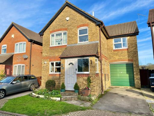 3 bedroom link detached house for sale in Tolsey Mead, Borough Green, Sevenoaks, TN15 — £450,000 • 3 bed • 2 bath • 1059 ft²
 5 bedroom semi-detached house for sale in Lingfield Road, Borough Green, Sevenoaks, TN15 — £600,000 • 5 bed • 3 bath • 1494 ft²
 5 bedroom detached house for sale in Novello Close, Borough Green, Sevenoaks, TN15 8FQ, TN15 — £800,000 • 5 bed • 3 bath • 2136 ft²
 3 bedroom semi-detached house for sale in Borough Green, TN15 — £500,000 • 3 bed • 1 bath • 997 ft²
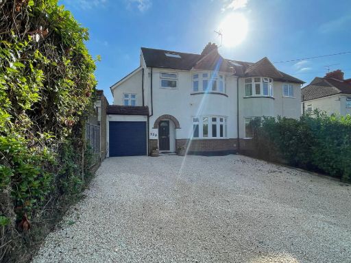 4 bedroom semi-detached house for sale in Maidstone Road, Borough Green, Sevenoaks, TN15 — £600,000 • 4 bed • 3 bath • 1576 ft²
Meta
- {
"@context": "https://schema.org",
"@type": "Residence",
"name": "4 bedroom detached house for sale in McDermott Road, Boroug…",
"description": "",
"url": "https://propertypiper.co.uk/property/cf934062-6249-4588-8c51-569256eb2916",
"image": "https://image-a.propertypiper.co.uk/d3fba7a3-51a7-44e0-af94-4006e58d51e2-1024.jpeg",
"address": {
"@type": "PostalAddress",
"streetAddress": "23 MCDERMOTT ROAD, BOROUGH GREEN, SEVENOAKS",
"postalCode": "TN15 8SA",
"addressLocality": "Tonbridge and Malling",
"addressRegion": "Tonbridge and Malling",
"addressCountry": "England"
},
"geo": {
"@type": "GeoCoordinates",
"latitude": 51.2899165,
"longitude": 0.3048448
},
"numberOfRooms": 4,
"numberOfBathroomsTotal": 2,
"floorSize": {
"@type": "QuantitativeValue",
"value": 1288,
"unitCode": "FTK"
},
"offers": {
"@type": "Offer",
"price": 625000,
"priceCurrency": "GBP",
"availability": "https://schema.org/InStock"
},
"additionalProperty": [
{
"@type": "PropertyValue",
"name": "Feature",
"value": "semi-detached"
},
{
"@type": "PropertyValue",
"name": "Feature",
"value": "brick exterior"
},
{
"@type": "PropertyValue",
"name": "Feature",
"value": "modern"
},
{
"@type": "PropertyValue",
"name": "Feature",
"value": "suburban"
},
{
"@type": "PropertyValue",
"name": "Feature",
"value": "driveway"
},
{
"@type": "PropertyValue",
"name": "Feature",
"value": "two-story"
},
{
"@type": "PropertyValue",
"name": "Feature",
"value": "fence"
},
{
"@type": "PropertyValue",
"name": "Feature",
"value": "residential"
},
{
"@type": "PropertyValue",
"name": "Feature",
"value": "modern"
},
{
"@type": "PropertyValue",
"name": "Feature",
"value": "high ceiling"
},
{
"@type": "PropertyValue",
"name": "Feature",
"value": "dining area"
},
{
"@type": "PropertyValue",
"name": "Feature",
"value": "open plan"
},
{
"@type": "PropertyValue",
"name": "Feature",
"value": "natural light"
},
{
"@type": "PropertyValue",
"name": "Feature",
"value": "skylights"
},
{
"@type": "PropertyValue",
"name": "Feature",
"value": "garden view"
},
{
"@type": "PropertyValue",
"name": "Feature",
"value": "wood flooring"
},
{
"@type": "PropertyValue",
"name": "Feature",
"value": "neutral colors"
},
{
"@type": "PropertyValue",
"name": "Feature",
"value": "entryway"
},
{
"@type": "PropertyValue",
"name": "Feature",
"value": "kitchen"
},
{
"@type": "PropertyValue",
"name": "Feature",
"value": "modern"
},
{
"@type": "PropertyValue",
"name": "Feature",
"value": "archway"
},
{
"@type": "PropertyValue",
"name": "Feature",
"value": "tile flooring"
},
{
"@type": "PropertyValue",
"name": "Feature",
"value": "bright"
},
{
"@type": "PropertyValue",
"name": "Feature",
"value": "white door"
},
{
"@type": "PropertyValue",
"name": "Feature",
"value": "natural light"
},
{
"@type": "PropertyValue",
"name": "Feature",
"value": "shelves"
},
{
"@type": "PropertyValue",
"name": "Feature",
"value": "simple design"
}
]
}
High Res Floorplan Images
Compatible Floorplan Images
FloorplanImages Thumbnail