NG6 7DY - 2 bedroom semidetached house for sale in Gunn Close, Nottin…
View on Property Piper
2 bedroom semi-detached house for sale in Gunn Close, Nottingham, NG6
Property Details
- Price: £160000
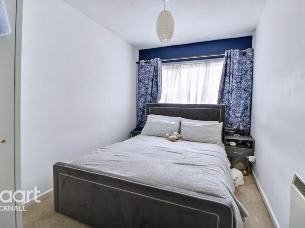
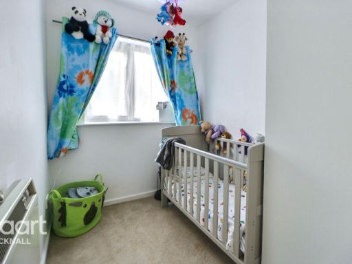
- Bedrooms: 2
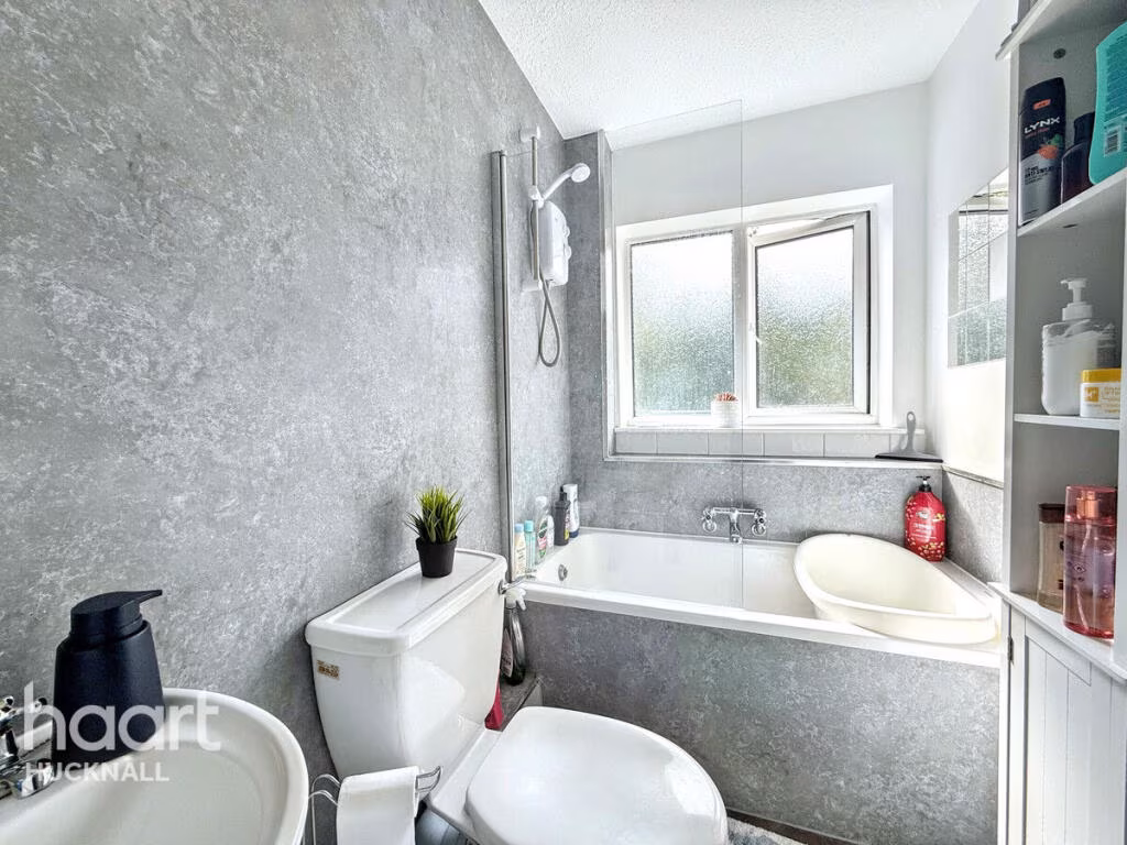
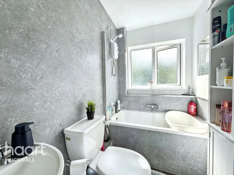
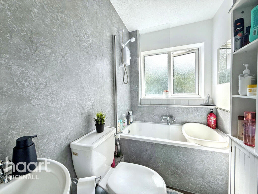
- Bathrooms: 1
- Property Type: undefined
- Property SubType: undefined
Image Descriptions
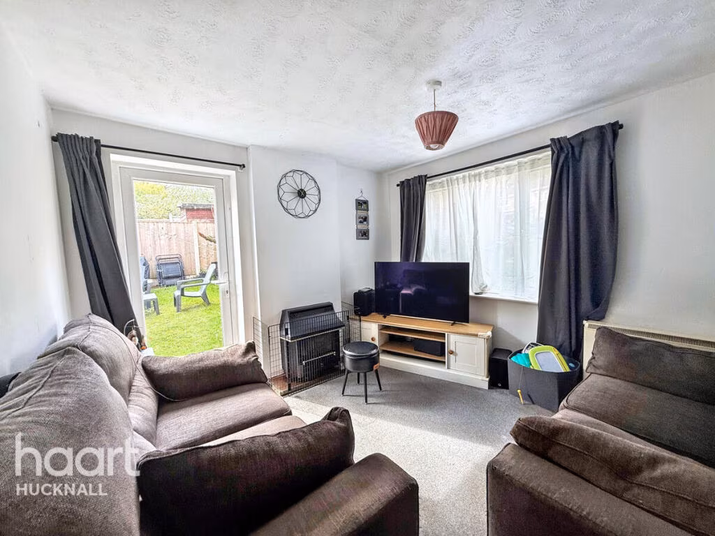
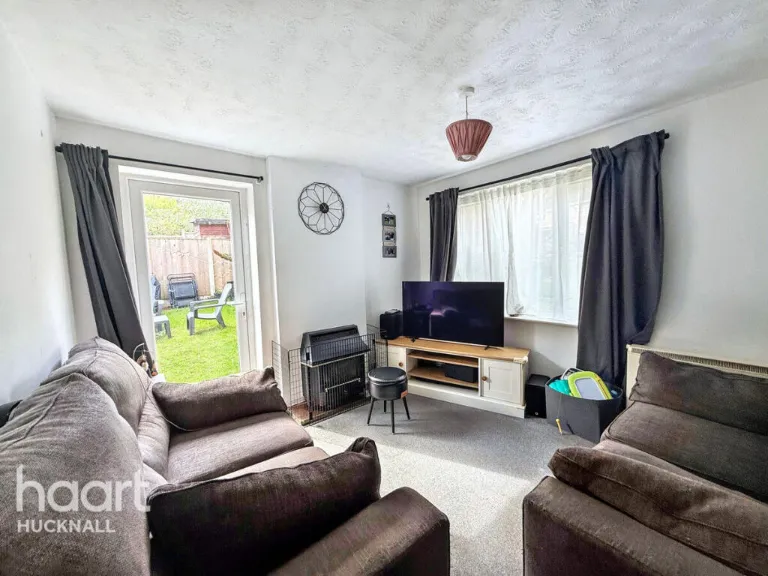
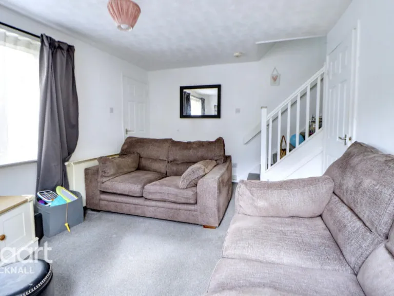
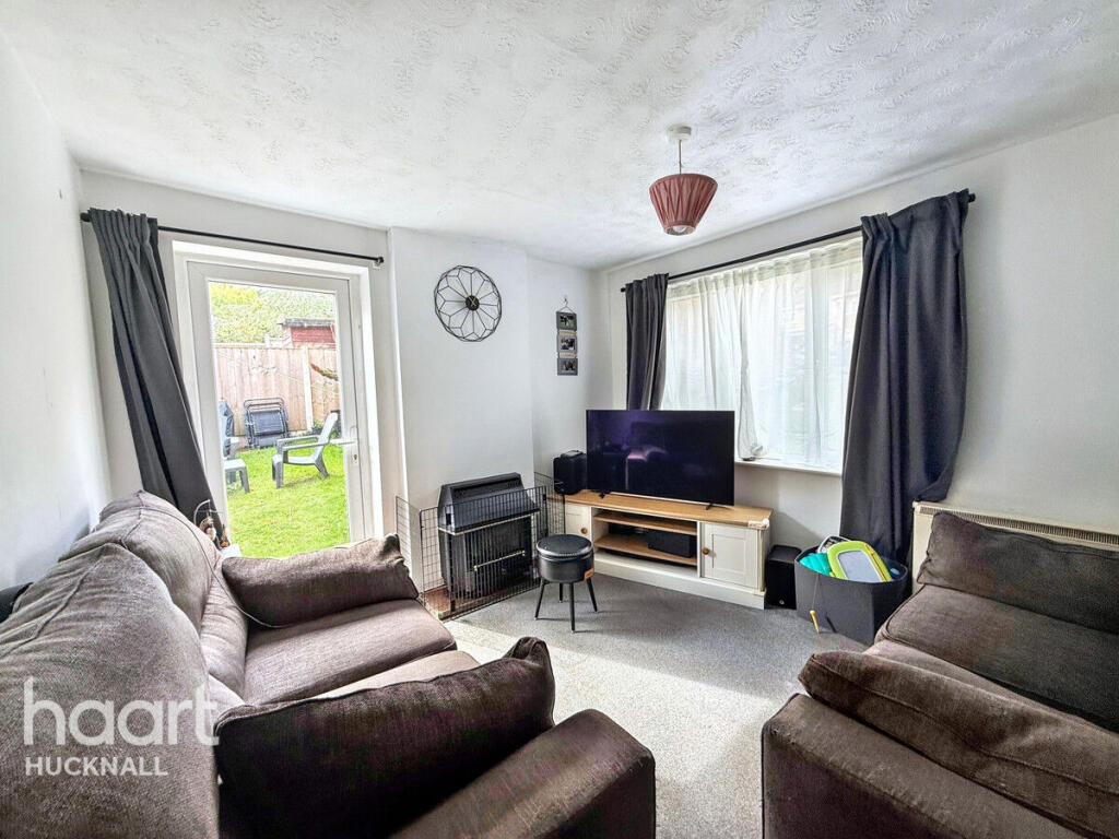
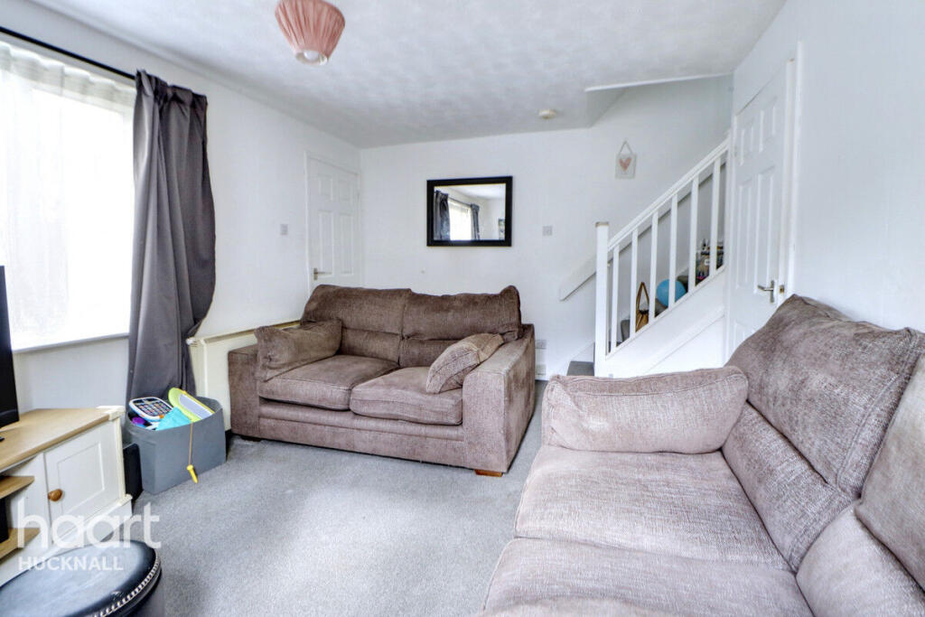
- living room modern
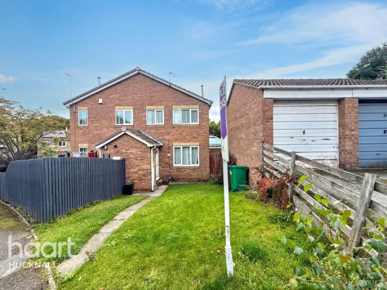
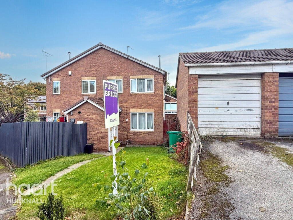
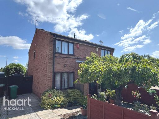
- exterior 1970s semi-detached
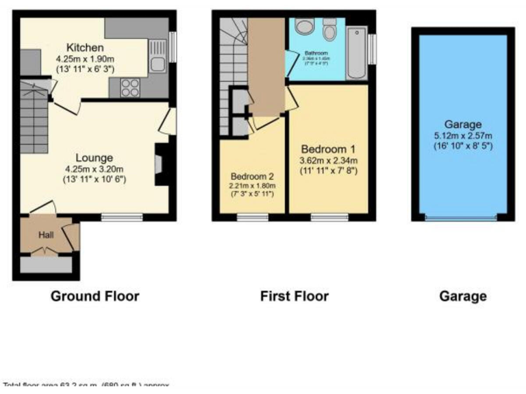
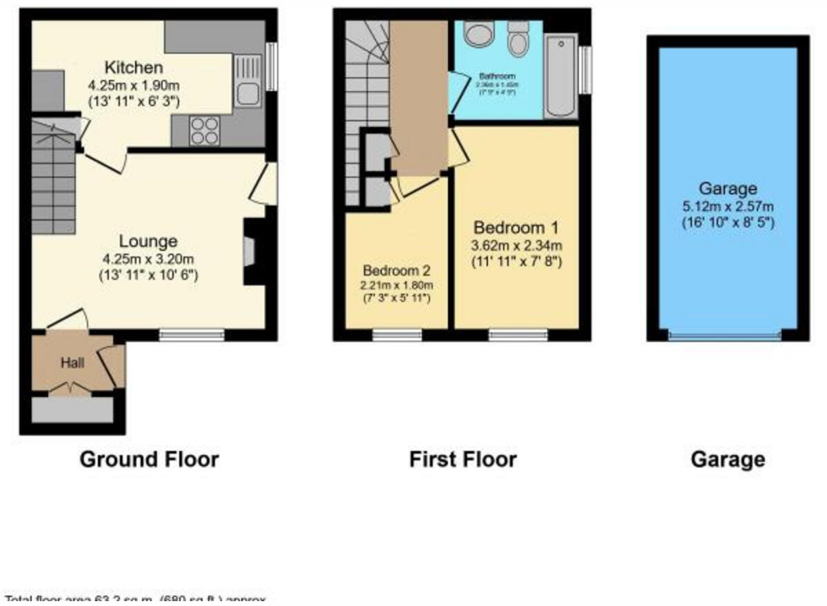
Floorplan Description
- Two-bedroom property with kitchen, lounge and bathroom (garage shown separately).
Rooms
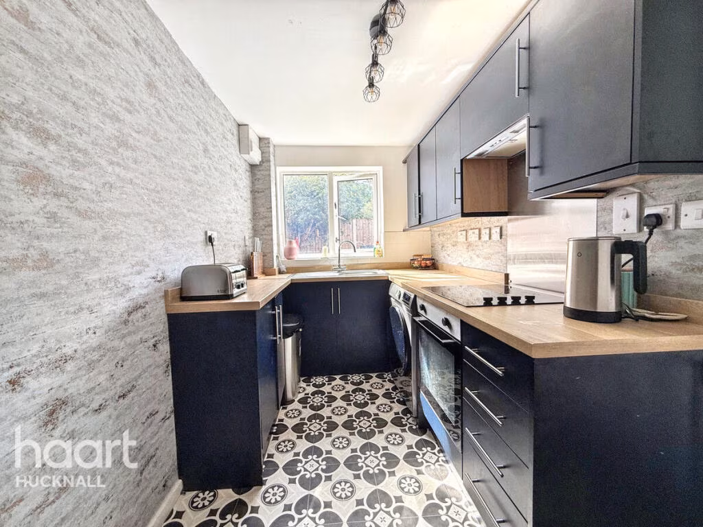
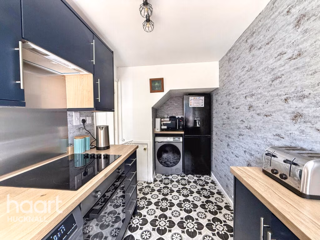
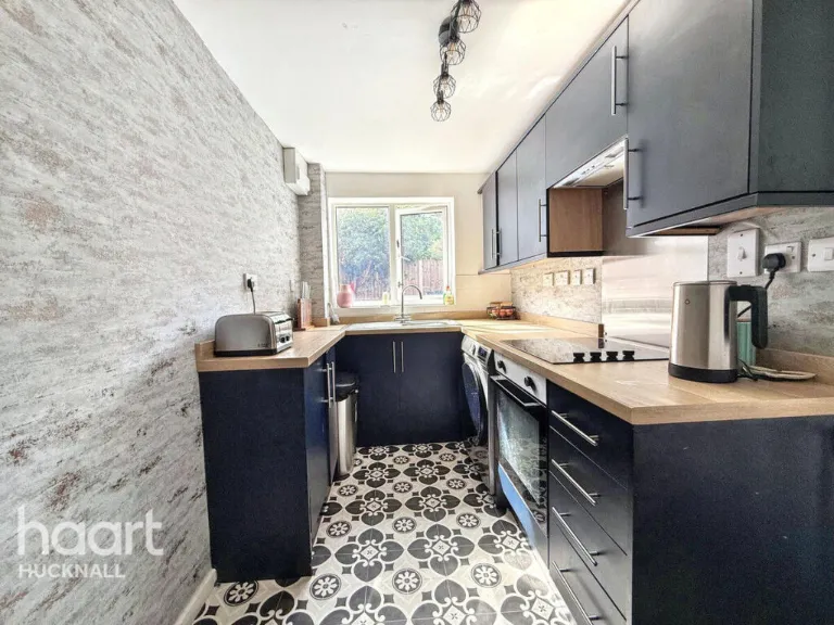
- Kitchen:
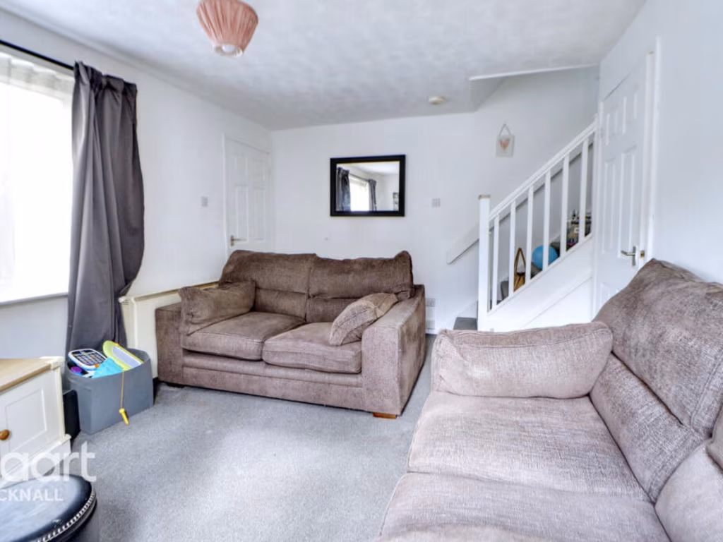
- Lounge:
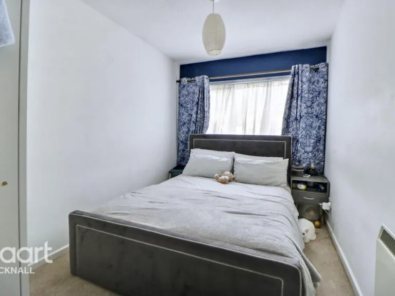
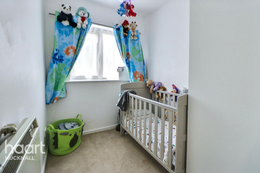
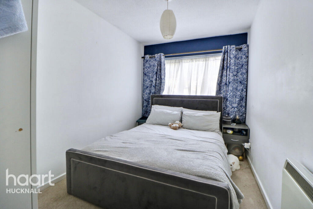
- Bedroom 1:
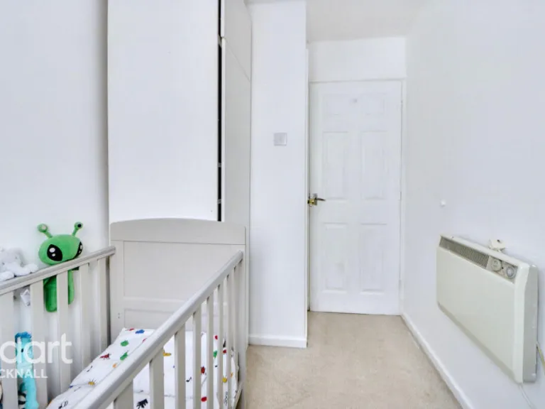
- Bedroom 2:
- Bathroom:
Textual Property Features
Detected Visual Features
- modern
- living room
- patio door
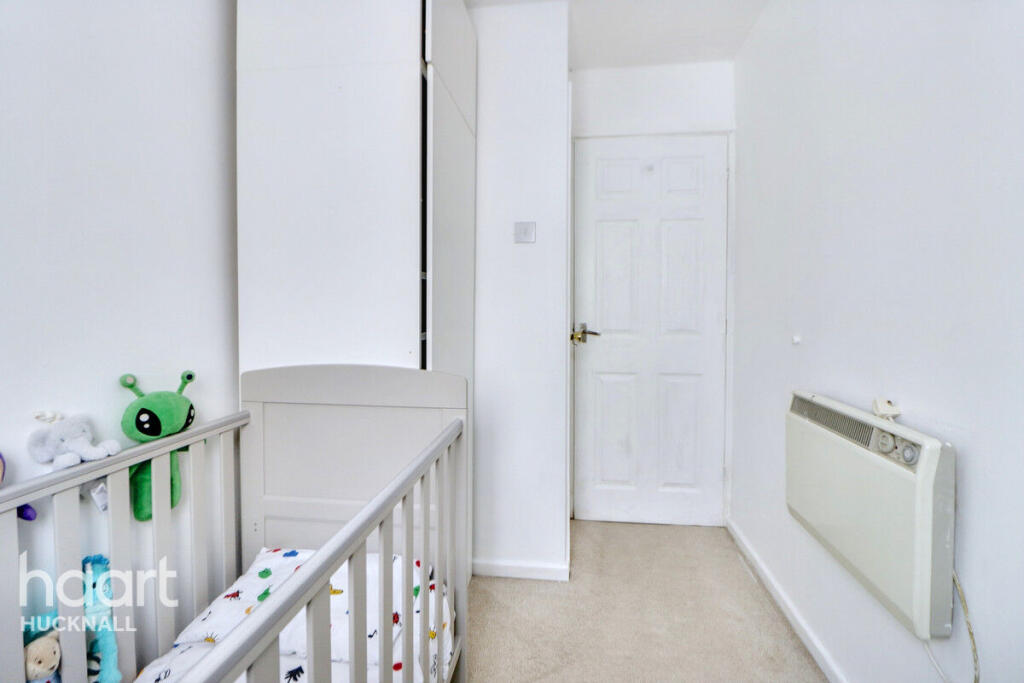
- small room
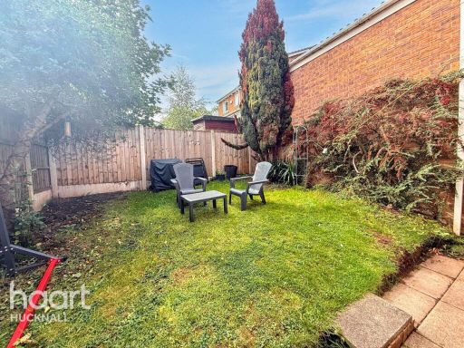
- garden access
- natural light
- 1970s
- semi-detached
- brick facade
- gabled roof
- driveway
- garage
- front garden
- residential
- family home
- starter home
- suburban
- quiet neighborhood
EPC Details
- Fully double glazed
- Cavity wall, as built, insulated (assumed)
- Boiler and radiators, mains gas
- Low energy lighting in 29% of fixed outlets
- Suspended, no insulation (assumed)
Nearby Schools
- Hucknall Flying High Academy
- Butler's Hill Infant and Nursery School
- Broomhill Junior School
- Bluecoat Primary Academy
- St Teresa's Catholic Primary School
- Ellis Guilford School
- Rosslyn Park Primary and Nursery School
- Horsendale Primary School
- Green Crescent School
- Mornington Primary School
- Our Lady of Perpetual Succour Catholic Primary School
- Hempshill Hall Primary School
- Crabtree Farm Primary School
- Springfield Academy
- Holgate Primary and Nursery School
- The Trinity Catholic School A Voluntary Academy
- Jubilee L.E.A.D. Academy
- Djanogly Strelley Academy
- Bulwell St Mary's Primary and Nursery School
- The Bulwell Academy
- Brocklewood Primary and Nursery School
- Old Basford School
- Cantrell Primary and Nursery School
- Snape Wood Primary and Nursery School
- Rufford Primary and Nursery School
- Stanstead Nursery and Primary School
- Ambleside Primary School
- Southwark Primary School
Nearest General Shops
- Id: 424427030
- Tags:
- Addr:
- Building: industrial
- Name: BMC Car Sales
- Second_hand: only
- Shop: car_repair
- TagsNormalized:
- industrial
- car repair
- repair
- shop
- Lat: 53.0012304
- Lon: -1.2013882
- FullGeoHash: gcrjs8t4t9kn
- PartitionGeoHash: gcrj
- Images:
- FoodStandards: null
- Distance: 497.8
,- Id: 4238366006
- Tags:
- Addr:
- Name: Nottingham Autos
- Shop: car_repair
- Source: survey
- TagsNormalized:
- Lat: 53.0017442
- Lon: -1.2017
- FullGeoHash: gcrjs8svw35x
- PartitionGeoHash: gcrj
- Images:
- FoodStandards: null
- Distance: 495.1
,- Id: 4238366007
- Tags:
- Addr:
- Name: Vag Tech Nottingham Ltd
- Shop: car_repair
- Source: survey
- TagsNormalized:
- Lat: 52.9995704
- Lon: -1.201863
- FullGeoHash: gcrjs8kbfs1b
- PartitionGeoHash: gcrj
- Images:
- FoodStandards: null
- Distance: 455.7
}
Nearest Religious buildings
- Id: 538102949
- Tags:
- Addr:
- City: Nottingham
- Postcode: NG6 8FR
- Street: Strelley Street
- Alt_name: Bulwell Christian Fellowship
- Amenity: place_of_worship
- Building: church
- Name: The Well
- Old_fhrs:
- Religion: christian
- Source:
- Website: http://www.thewellchurch.org.uk/
- TagsNormalized:
- place of worship
- church
- christian
- Lat: 53.0022687
- Lon: -1.1985167
- FullGeoHash: gcrjs8z28e10
- PartitionGeoHash: gcrj
- Images:
- FoodStandards: null
- Distance: 715.2
,- Id: 336753085
- Tags:
- Addr:
- City: Nottingham
- Housename: St John's Church
- Postcode: NG6 8JL
- Street: Keys Close
- Alt_name: St John the Divine
- Amenity: place_of_worship
- Building: church
- Denomination: anglican
- Name: St John's Church
- Polling_station: 20190308
- Religion: christian
- Source: NCC_OpenData (OGL - Open Government Licence);survey
- Source:area: Bing;survey
- Wikidata: Q5117252
- Wikipedia: en:Church of St John the Divine, Bulwell
- TagsNormalized:
- place of worship
- church
- anglican
- christian
- Lat: 53.003731
- Lon: -1.2045427
- FullGeoHash: gcrjs94ch5eg
- PartitionGeoHash: gcrj
- Images:
- FoodStandards: null
- Distance: 482.5
,- Id: 387001860
- Tags:
- Addr:
- City: Nottingham
- Postcode: NG6 8ZB
- Amenity: place_of_worship
- Building: yes
- Denomination: latter-day_saints
- Name: The Church of Jesus Christ of Latter-day Saints
- Religion: christian
- Source: Member (copied from node)
- TagsNormalized:
- place of worship
- church
- christian
- Lat: 52.9978142
- Lon: -1.2052941
- FullGeoHash: gcrjkxfqdses
- PartitionGeoHash: gcrj
- Images:
- FoodStandards: null
- Distance: 341
}
Nearest Medical buildings
- Id: 4237927696
- Tags:
- Addr:
- City: Nottingham
- Place: Bulwell Riverside
- Postcode: NG6 8QJ
- Street: Main Street
- Amenity: doctors
- Healthcare: doctor
- Name: Leen View Surgery
- Source:
- Website: https://www.leenviewsurgery.co.uk/
- TagsNormalized:
- doctor
- doctors
- health
- healthcare
- surgery
- Lat: 52.9982237
- Lon: -1.1966786
- FullGeoHash: gcrjsb0952gy
- PartitionGeoHash: gcrj
- Images:
- FoodStandards: null
- Distance: 826.2
,- Id: 4237927697
- Tags:
- Addr:
- City: Nottingham
- Place: Bulwell Riverside
- Postcode: NG6 8QJ
- Street: Main Street
- Amenity: doctors
- Healthcare: doctor
- Name: Parkside Medical Practice
- Source:
- Website: https://www.parksidemedicalpractice.co.uk/
- TagsNormalized:
- doctor
- doctors
- health
- healthcare
- Lat: 52.9983399
- Lon: -1.1967054
- FullGeoHash: gcrjsb09dwxg
- PartitionGeoHash: gcrj
- Images:
- FoodStandards: null
- Distance: 821.2
,- Id: 4237927698
- Tags:
- Addr:
- City: Nottingham
- Place: Bulwell Riverside
- Postcode: NG6 8QJ
- Street: Main Street
- Amenity: pharmacy
- Healthcare: pharmacy
- Name: Riverside Pharmacy
- Source: survey
- Source:addr: interpolation
- TagsNormalized:
- Lat: 52.9984507
- Lon: -1.196802
- FullGeoHash: gcrjsb0d27r8
- PartitionGeoHash: gcrj
- Images:
- FoodStandards: null
- Distance: 812
,- Id: 728361963
- Tags:
- Addr:
- City: Nottingham
- Housenumber: 5
- Postcode: NG6 8QH
- Street: Main Street
- Amenity: pharmacy
- Brand: Boots
- Brand:wikidata: Q6123139
- Brand:wikipedia: en:Boots (company)
- Healthcare: pharmacy
- Name: Boots
- Old_amenity: pharmacy
- Old_fhrs:
- Old_name: Burrows and Close
- Source: survey
- Source:addr: NCC Open Data
- TagsNormalized:
- pharmacy
- boots
- health
- healthcare
- Lat: 52.997992
- Lon: -1.1974312
- FullGeoHash: gcrjkzbp9vf8
- PartitionGeoHash: gcrj
- Images:
- FoodStandards: null
- Distance: 785.1
}
Nearest Airports
- Id: 11359528
- Tags:
- Aerodrome: international
- Aerodrome:type: public
- Aeroway: aerodrome
- Iata: EMA
- Icao: EGNX
- Is_in: Castle Donington,England,UK
- Name: East Midlands Airport
- Old_name: RAF Castle Donington
- Operator: Manchester Airports Holdings Limited
- Operator:type: private
- Ref: EMA
- Type: multipolygon
- Website: https://www.eastmidlandsairport.com/
- Wikidata: Q8977
- Wikipedia: en:East Midlands Airport
- TagsNormalized:
- airport
- international airport
- Lat: 52.8281122
- Lon: -1.3322143
- FullGeoHash: gcrh99jfj1vh
- PartitionGeoHash: gcrh
- Images:
- FoodStandards: null
- Distance: 20847.6
}
Nearest Leisure Facilities
- Id: 336753071
- Tags:
- Leisure: pitch
- Source: survey; Bing
- Sport: soccer
- TagsNormalized:
- Lat: 53.0034465
- Lon: -1.2055884
- FullGeoHash: gcrjs8fp7y84
- PartitionGeoHash: gcrj
- Images:
- FoodStandards: null
- Distance: 418.9
,- Id: 220253914
- Tags:
- TagsNormalized:
- Lat: 53.0038111
- Lon: -1.2081878
- FullGeoHash: gcrjs901x4tb
- PartitionGeoHash: gcrj
- Images:
- FoodStandards: null
- Distance: 408.6
,- Id: 99785313
- Tags:
- Helmet: yes
- Leisure: park
- Source: Bing;survey
- Sport: mtb;skateboard
- TagsNormalized:
- Lat: 52.9998214
- Lon: -1.2054658
- FullGeoHash: gcrjs864qdg9
- PartitionGeoHash: gcrj
- Images:
- FoodStandards: null
- Distance: 213.1
,- Id: 774728355
- Tags:
- Bicycle: designated
- Leisure: track
- Name: Nottingham Outlaws Bulwell BMX Pump Track
- Sport: cycling;bmx;mtb
- TagsNormalized:
- track
- leisure
- bmx
- cycling
- sports
- Lat: 52.9998237
- Lon: -1.2056067
- FullGeoHash: gcrjs864774r
- PartitionGeoHash: gcrj
- Images:
- FoodStandards: null
- Distance: 203.8
,- Id: 285827502
- Tags:
- Leisure: playground
- Source: survey; Bing
- TagsNormalized:
- Lat: 52.9986042
- Lon: -1.2069915
- FullGeoHash: gcrjs8155pcu
- PartitionGeoHash: gcrj
- Images:
- FoodStandards: null
- Distance: 202.5
}
Nearest Tourist attractions
- Id: 235954783
- Tags:
- Building: dovecote
- Historic: dovecote
- Listed_status: Grade II
- Name: Wollaton Dovecote
- Operator: Wollaton Historical & Conservation Society
- Owner: Nottingham City Council
- Source: Bing
- Source:listed_status: English Heritage
- Start_date_est: 1580
- Toilets:
- Tourism: museum
- Website: http://www.ournottinghamshire.org.uk/page_id__1006_path__0p31p39p344p198p.aspx
- Wheelchair: limited
- Wikidata: Q26539894
- TagsNormalized:
- Lat: 52.9526577
- Lon: -1.2229574
- FullGeoHash: gcrjhptrx4bg
- PartitionGeoHash: gcrj
- Images:
- FoodStandards: null
- Distance: 5367.1
,- Id: 209377353
- Tags:
- Addr:
- City: Nottingham
- Housenumber: 39
- Postcode: NG7 6BE
- Street: Gregory Boulevard
- Building: yes
- Fhrs:
- Museum: gallery
- Name: New Art Exchange
- Source: Bing
- Source:name: survey
- Tourism: museum
- Wheelchair: yes
- Wikidata: Q24993766
- TagsNormalized:
- Lat: 52.9659396
- Lon: -1.1684435
- FullGeoHash: gcrjm6jhvqc2
- PartitionGeoHash: gcrj
- Images:
- FoodStandards:
- Id: 217146
- FHRSID: 217146
- LocalAuthorityBusinessID: 44540
- BusinessName: The New Art Exchange
- BusinessType: Other catering premises
- BusinessTypeID: 7841
- AddressLine1: null
- AddressLine2: 39 Gregory Boulevard
- AddressLine3: null
- AddressLine4: Nottingham
- PostCode: NG7 6BE
- RatingValue: 5
- RatingKey: fhrs_5_en-GB
- RatingDate: 2022-09-14
- LocalAuthorityCode: 899
- LocalAuthorityName: Nottingham City
- LocalAuthorityWebSite: http://www.nottinghamcity.gov.uk/foodsafety
- LocalAuthorityEmailAddress: food.enforcement@nottinghamcity.gov.uk
- Scores:
- Hygiene: 0
- Structural: 5
- ConfidenceInManagement: 0
- NewRatingPending: false
- Geocode:
- Longitude: -1.16807300000000
- Latitude: 52.96606000000000
- Distance: 4657.8
,- Id: 6307651
- Tags:
- Addr:
- City: Nottingham
- Housenumber: 3
- Postcode: NG6 8SA
- Street: The Cliff
- Building: yes
- Guest_house: bed_and_breakfast
- Name: Rufford Court Bed & Breakfast
- Old_amenity: nursing_home
- Old_fhrs:
- Source: survey
- Source:addr: FHRS Open Data
- Tourism: guest_house
- Type: multipolygon
- TagsNormalized:
- Lat: 52.9894245
- Lon: -1.2018736
- FullGeoHash: gcrjkwkvf2dj
- PartitionGeoHash: gcrj
- Images:
- FoodStandards: null
- Distance: 1274.4
}
Nearest Hotels
- Id: 393911810
- Tags:
- Addr:
- City: Nottingham
- Housenumber: 432
- Postcode: NG8 5DQ
- Street: Nuthall Road
- Building: commercial
- Name: Commodore Hotel
- Old_fhrs:
- Source: survey
- Source:addr: NCC Open Data
- Tourism: hotel
- Website: http://commodorehotelnottingham.com/
- TagsNormalized:
- Lat: 52.9784849
- Lon: -1.1912019
- FullGeoHash: gcrjkukw4crk
- PartitionGeoHash: gcrj
- Images:
- FoodStandards: null
- Distance: 2675.4
,- Id: 136170454
- Tags:
- Addr:
- City: Nottingham
- Postcode: NG8 6AZ
- Street: Nuthall Road
- Brand: DoubleTree
- Brand:wikidata: Q2504643
- Brand:wikipedia: en:DoubleTree
- Building: yes
- Contact:
- Facebook: https://www.facebook.com/NottinghamGatewayHotel
- Instagram: https://www.instagram.com/doubletreenott/
- Linkedin: https://www.linkedin.com/company/doubletree-by-hilton-hotel-nottingham---gateway/
- Twitter: https://twitter.com/gateway_hotel
- Email: sales@nottinghamgatewayhotel.co.uk
- Fax: +44-115-9797167
- Fhrs:
- Name: DoubleTree by Hilton Hotel Nottingham - Gateway
- Official_name: DoubleTree by Hilton
- Operator: Hilton Worldwide
- Phone: +44 115 9794949
- Smoking: no
- Stars: 4
- Tourism: hotel
- Website: https://www.hilton.com/en/hotels/emanudi-doubletree-nottingham-gateway/?WT.mc_id=zELWAKN0EMEA1DT2DMH3LocalSearch4DGGenericx6EMANUDI
- Wheelchair: yes
- Wikidata: Q89882546
- TagsNormalized:
- Lat: 52.9861358
- Lon: -1.2009518
- FullGeoHash: gcrjktv6xg97
- PartitionGeoHash: gcrj
- Images:
- FoodStandards: null
- Distance: 1639.8
,- Id: 95262350
- Tags:
- Addr:
- City: Nottingham
- Postcode: NG8 6AS
- Street: Millennium Way West
- Brand: Premier Inn
- Brand:wikidata: Q2108626
- Brand:wikipedia: en:Premier Inn
- Building: yes
- Contact:
- Website: https://www.premierinn.com/gb/en/hotels/england/nottinghamshire/nottingham/nottingham-west.html
- Internet_access: wlan
- Internet_access:fee: customers
- Internet_access:operator: Virgin Media
- Internet_access:ssid: Premier Inn Free Wi-Fi
- Name: Premier Inn
- Source: survey
- Source:area: Bing
- Tourism: hotel
- TagsNormalized:
- Lat: 52.9881889
- Lon: -1.2077317
- FullGeoHash: gcrjkw0w9f3f
- PartitionGeoHash: gcrj
- Images:
- FoodStandards: null
- Distance: 1330.8
}
Tags
- modern
- living room
- patio door
- small room
- garden access
- natural light
- 1970s
- semi-detached
- brick facade
- gabled roof
- driveway
- garage
- front garden
- residential
- family home
- starter home
- suburban
- quiet neighborhood
Local Market Stats
- Average Price/sqft: £194
- Avg Income: £33500
- Rental Yield: 5.8%
- Social Housing: 23%
- Planning Success Rate: 97%
Similar Properties
 2 bedroom semi-detached house for sale in Sankey Drive, Nottingham, NG6 — £170,000 • 2 bed • 1 bath • 569 ft²
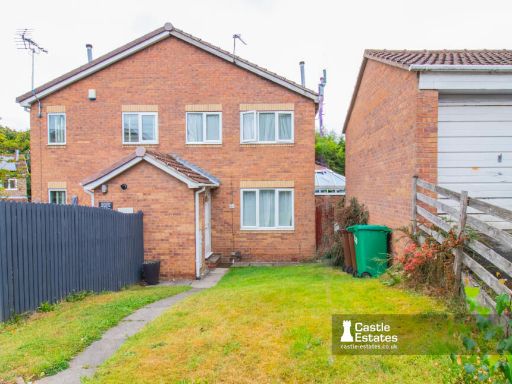 2 bedroom semi-detached house for sale in Gunn Close, Nottingham, NG6 7DY, NG6 — £160,000 • 2 bed • 1 bath • 494 ft²
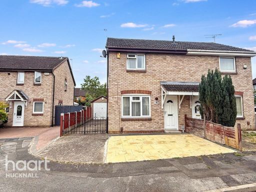 3 bedroom semi-detached house for sale in Birling Close, Nottingham, NG6 — £195,000 • 3 bed • 1 bath
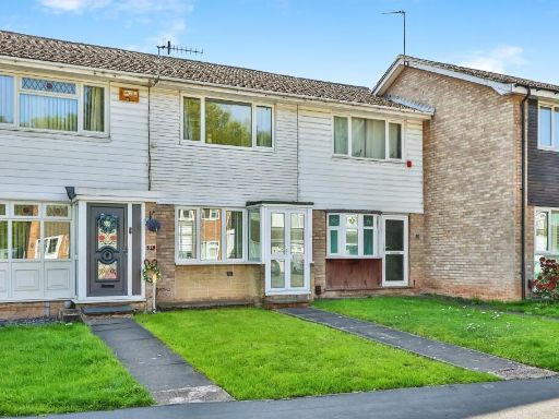 2 bedroom semi-detached house for sale in Neston Drive, Nottingham, NG6 — £160,000 • 2 bed • 1 bath • 608 ft²
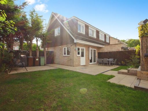 3 bedroom semi-detached house for sale in Howick Drive, Nottingham, NG6 — £230,000 • 3 bed • 1 bath • 579 ft²
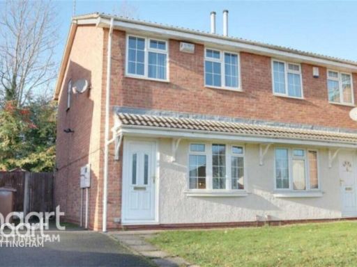 2 bedroom semi-detached house for sale in Cranwell Road, Nottingham, NG8 — £180,000 • 2 bed • 1 bath • 436 ft²
Meta
- {
"@context": "https://schema.org",
"@type": "Residence",
"name": "2 bedroom semidetached house for sale in Gunn Close, Nottin…",
"description": "",
"url": "https://propertypiper.co.uk/property/ccf18c09-bff5-4da4-87a9-4896201da230",
"image": "https://image-a.propertypiper.co.uk/b792a7ba-a815-4808-a5ad-710601efb497-1024.jpeg",
"address": {
"@type": "PostalAddress",
"streetAddress": "16 GUNN CLOSE NOTTINGHAM",
"postalCode": "NG6 7DY",
"addressLocality": "Nottingham",
"addressRegion": "Nottingham North",
"addressCountry": "England"
},
"geo": {
"@type": "GeoCoordinates",
"latitude": 53.000145389208754,
"longitude": -1.2086046848090704
},
"numberOfRooms": 2,
"numberOfBathroomsTotal": 1,
"floorSize": {
"@type": "QuantitativeValue",
"value": 409,
"unitCode": "FTK"
},
"offers": {
"@type": "Offer",
"price": 160000,
"priceCurrency": "GBP",
"availability": "https://schema.org/InStock"
},
"additionalProperty": [
{
"@type": "PropertyValue",
"name": "Feature",
"value": "modern"
},
{
"@type": "PropertyValue",
"name": "Feature",
"value": "living room"
},
{
"@type": "PropertyValue",
"name": "Feature",
"value": "patio door"
},
{
"@type": "PropertyValue",
"name": "Feature",
"value": "small room"
},
{
"@type": "PropertyValue",
"name": "Feature",
"value": "garden access"
},
{
"@type": "PropertyValue",
"name": "Feature",
"value": "natural light"
},
{
"@type": "PropertyValue",
"name": "Feature",
"value": "1970s"
},
{
"@type": "PropertyValue",
"name": "Feature",
"value": "semi-detached"
},
{
"@type": "PropertyValue",
"name": "Feature",
"value": "brick facade"
},
{
"@type": "PropertyValue",
"name": "Feature",
"value": "gabled roof"
},
{
"@type": "PropertyValue",
"name": "Feature",
"value": "driveway"
},
{
"@type": "PropertyValue",
"name": "Feature",
"value": "garage"
},
{
"@type": "PropertyValue",
"name": "Feature",
"value": "front garden"
},
{
"@type": "PropertyValue",
"name": "Feature",
"value": "residential"
},
{
"@type": "PropertyValue",
"name": "Feature",
"value": "family home"
},
{
"@type": "PropertyValue",
"name": "Feature",
"value": "starter home"
},
{
"@type": "PropertyValue",
"name": "Feature",
"value": "suburban"
},
{
"@type": "PropertyValue",
"name": "Feature",
"value": "quiet neighborhood"
}
]
}
High Res Floorplan Images
Compatible Floorplan Images
FloorplanImages Thumbnail