SA42 0TJ - 4 bedroom detached house for sale in Long Street, Newport,…
View on Property Piper
4 bedroom detached house for sale in Long Street, Newport, Pembrokeshire, SA42
Property Details
- Price: £665000
- Bedrooms: 4
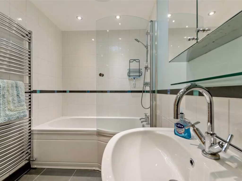
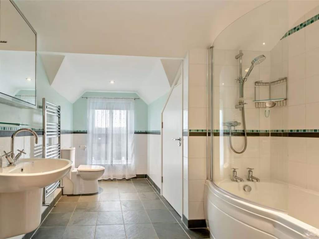
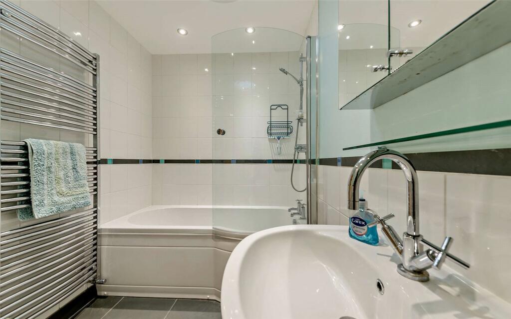
- Bathrooms: 4
- Property Type: undefined
- Property SubType: undefined
Image Descriptions
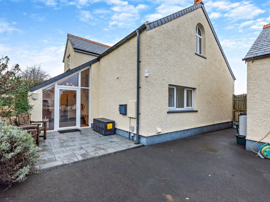
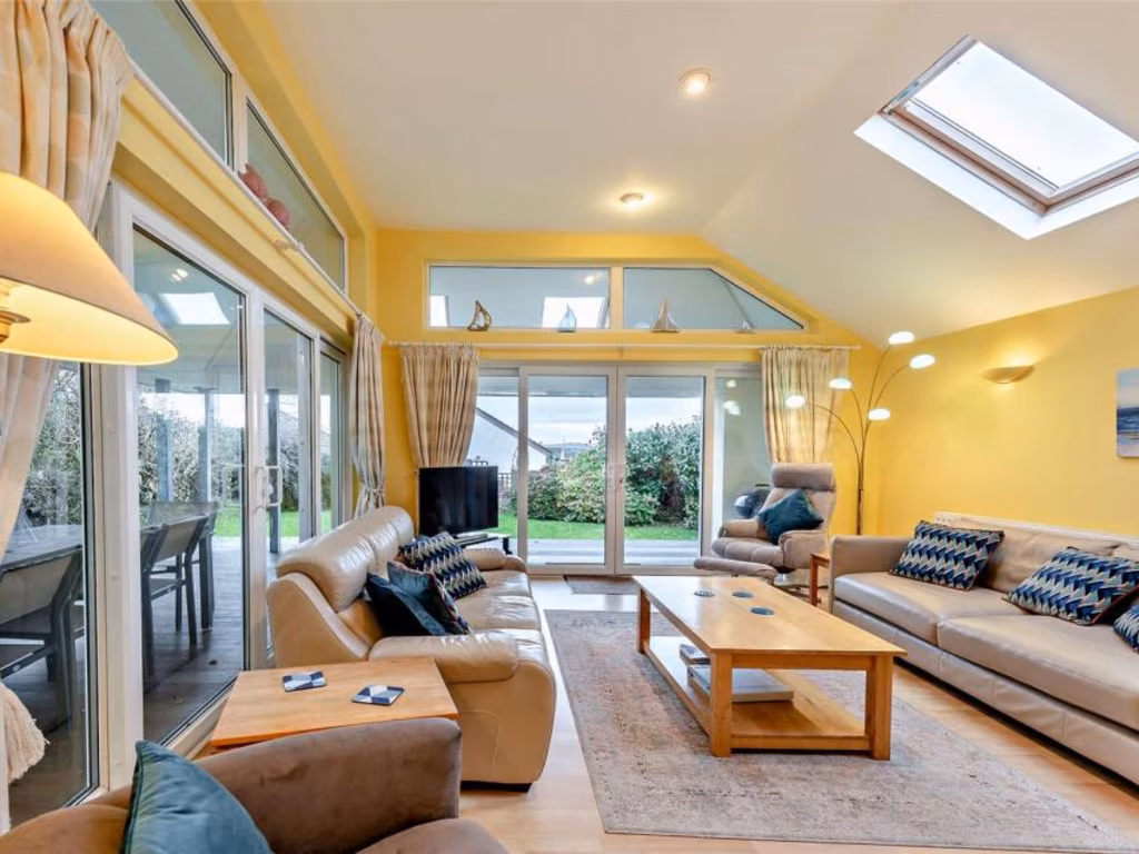
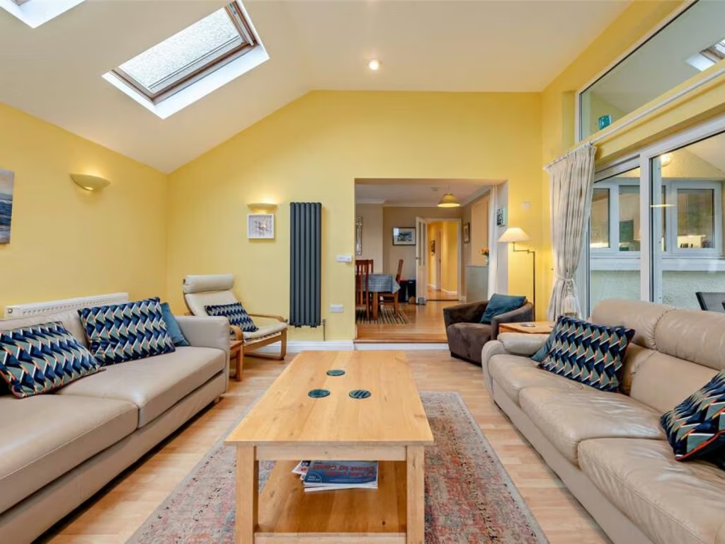
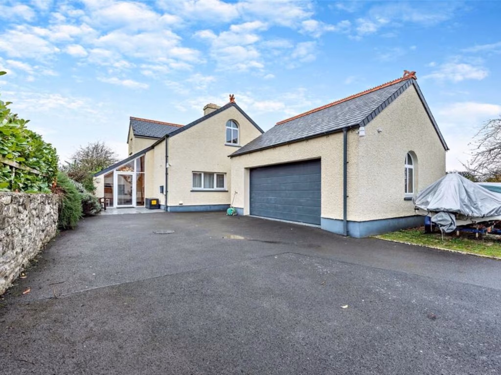
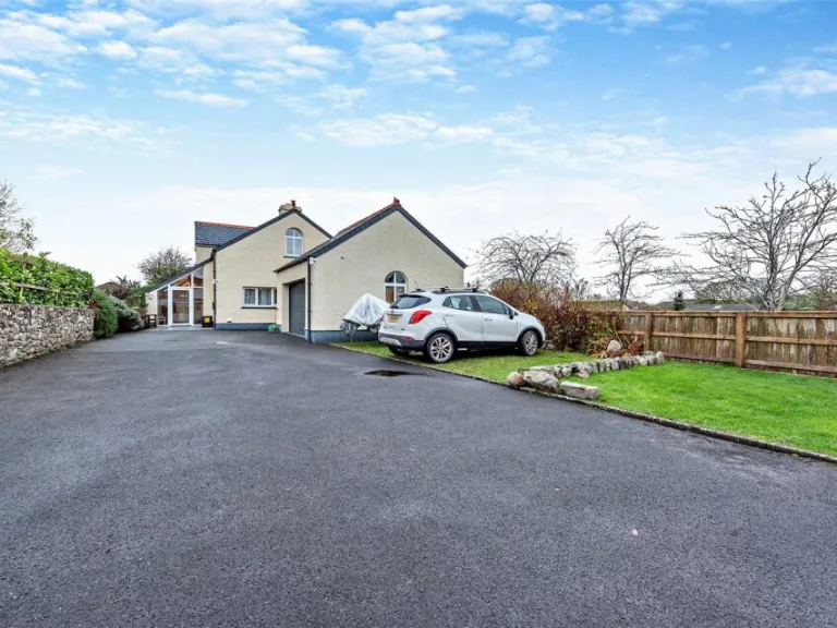
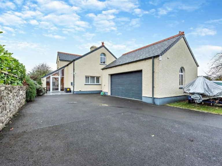
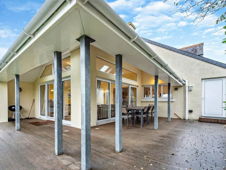
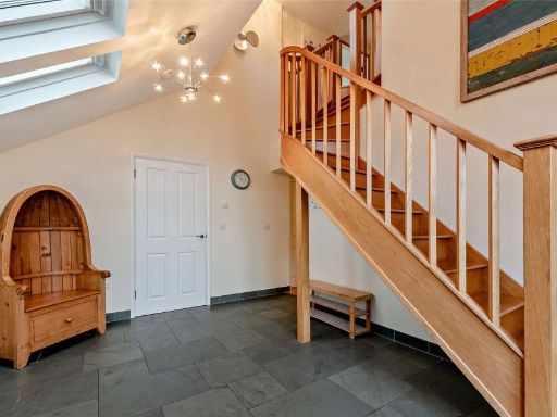
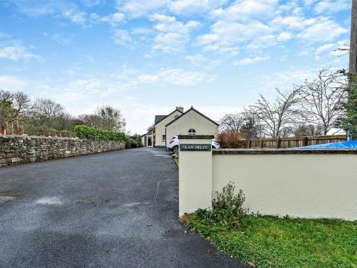
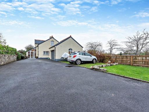
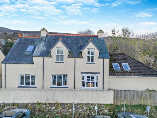
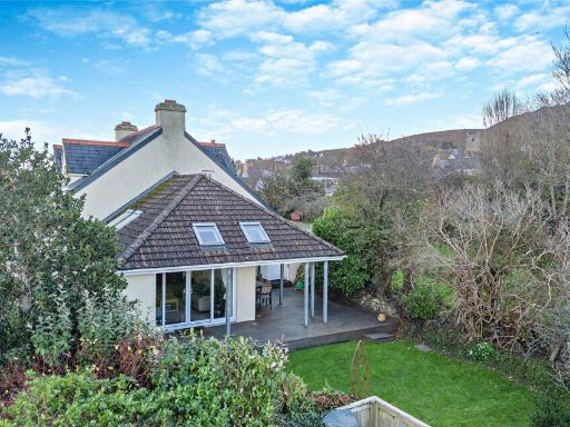
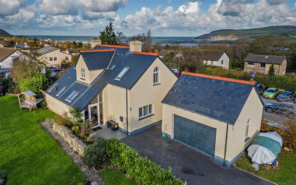
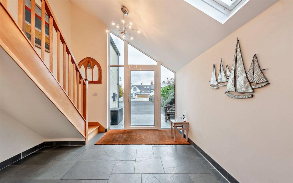
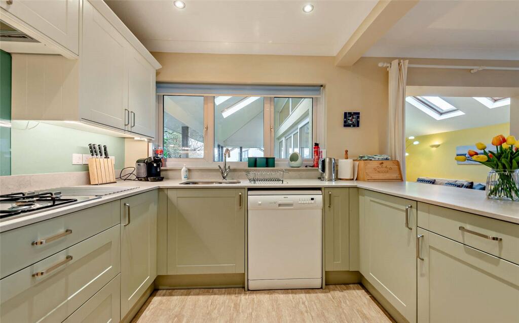
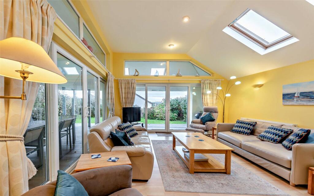
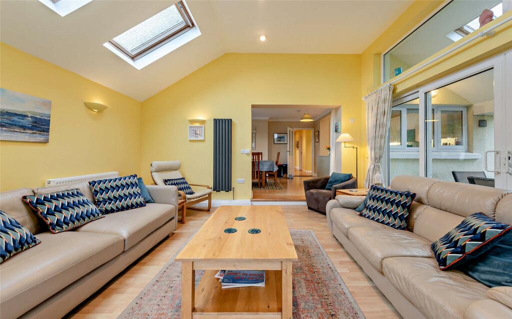
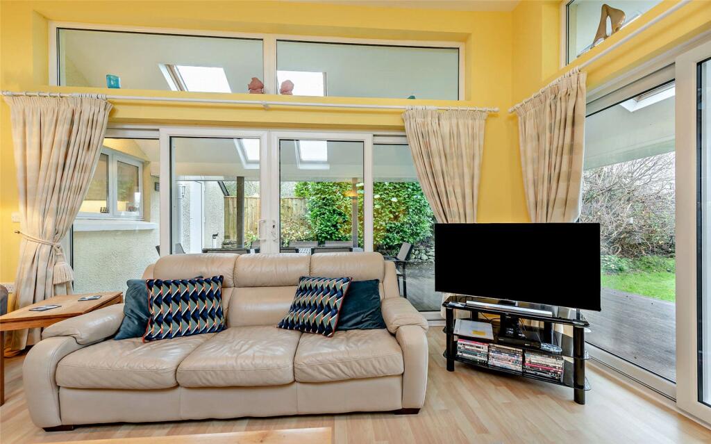
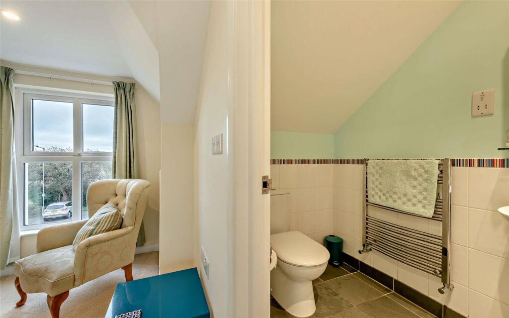
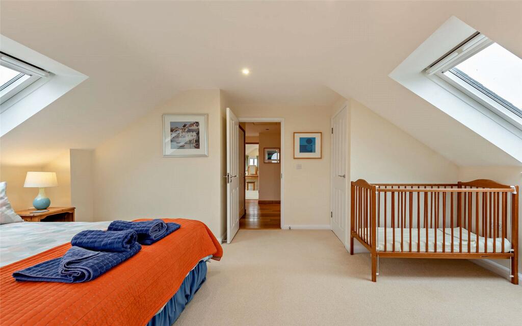
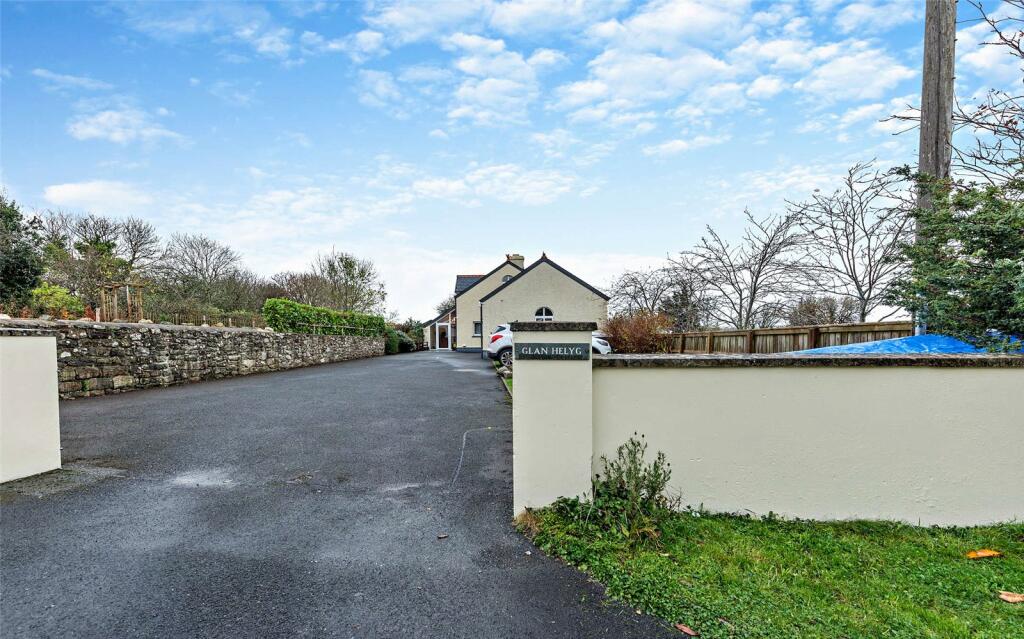
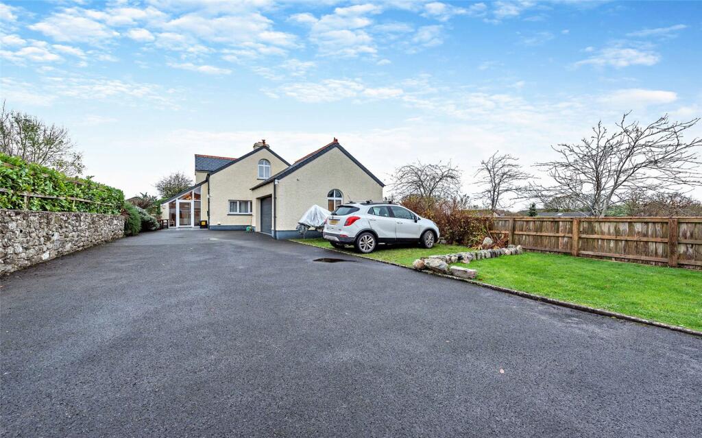
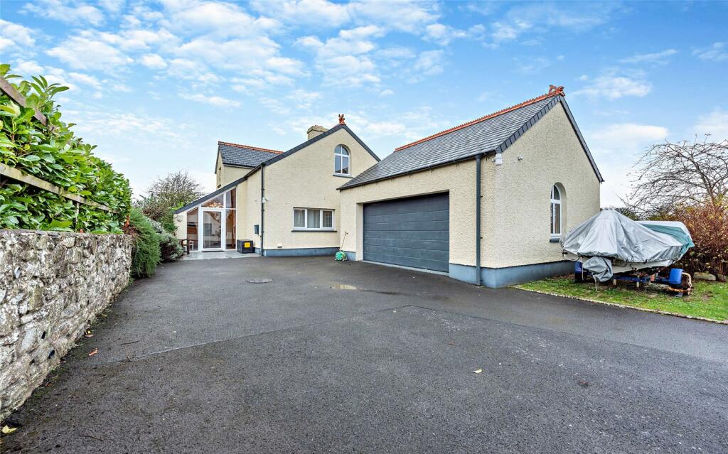
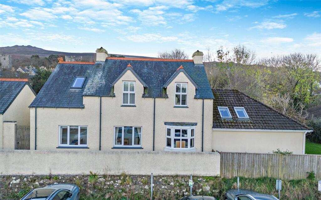
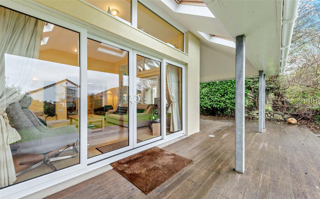
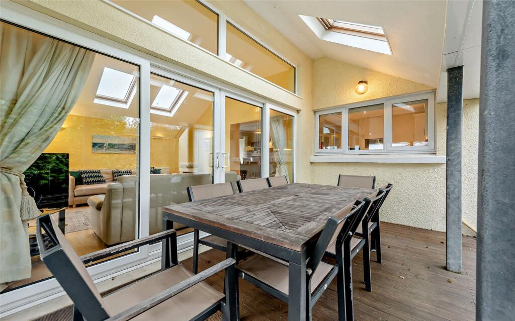
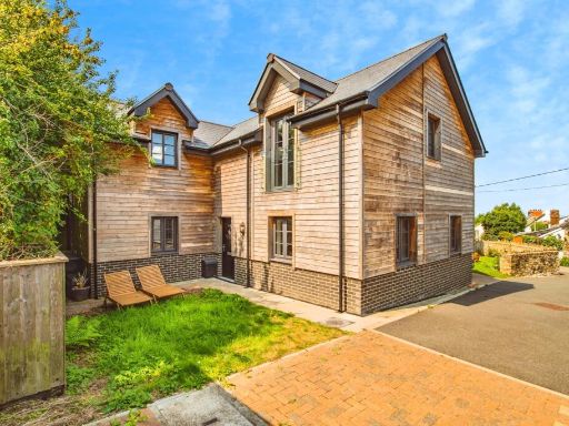
- detached house with garage Contemporary
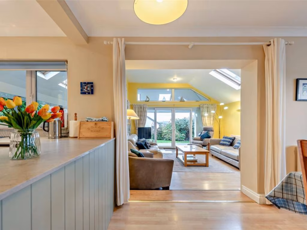
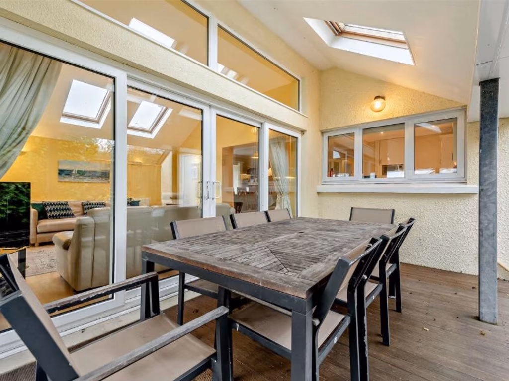
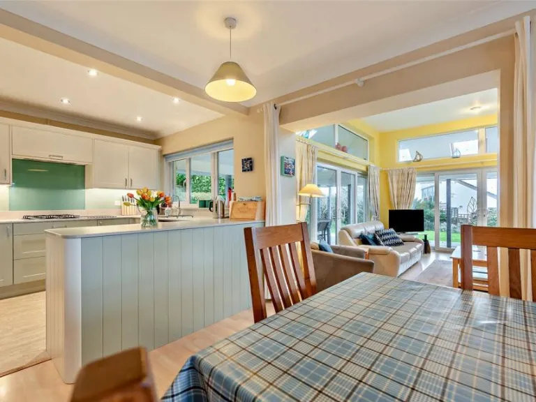
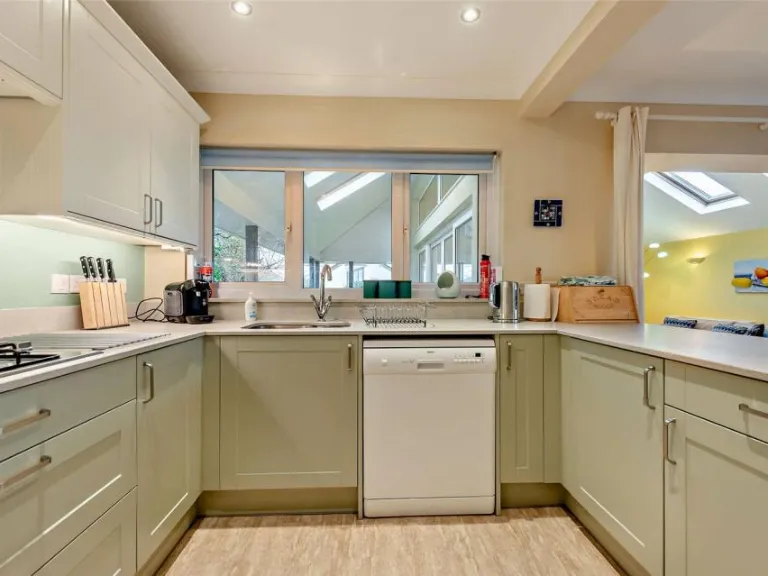
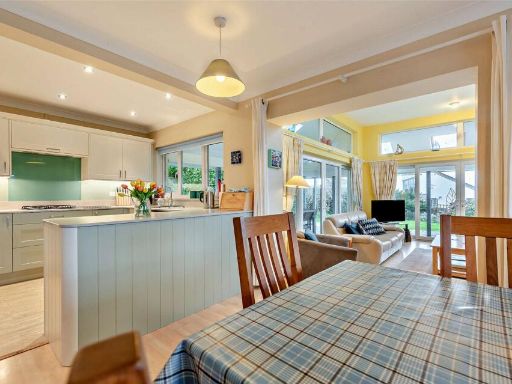
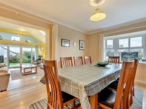
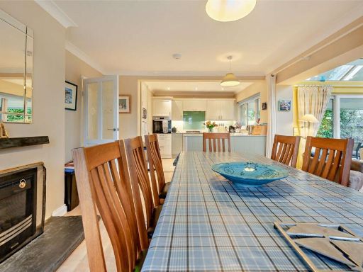
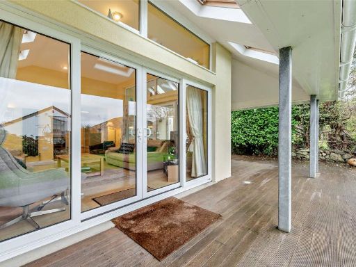
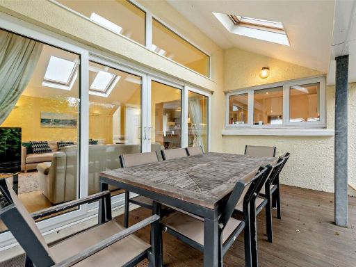
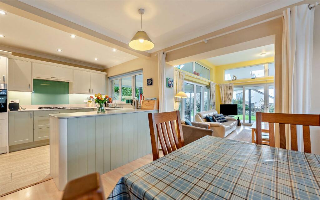
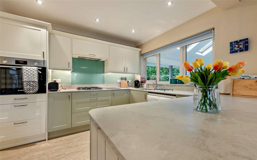
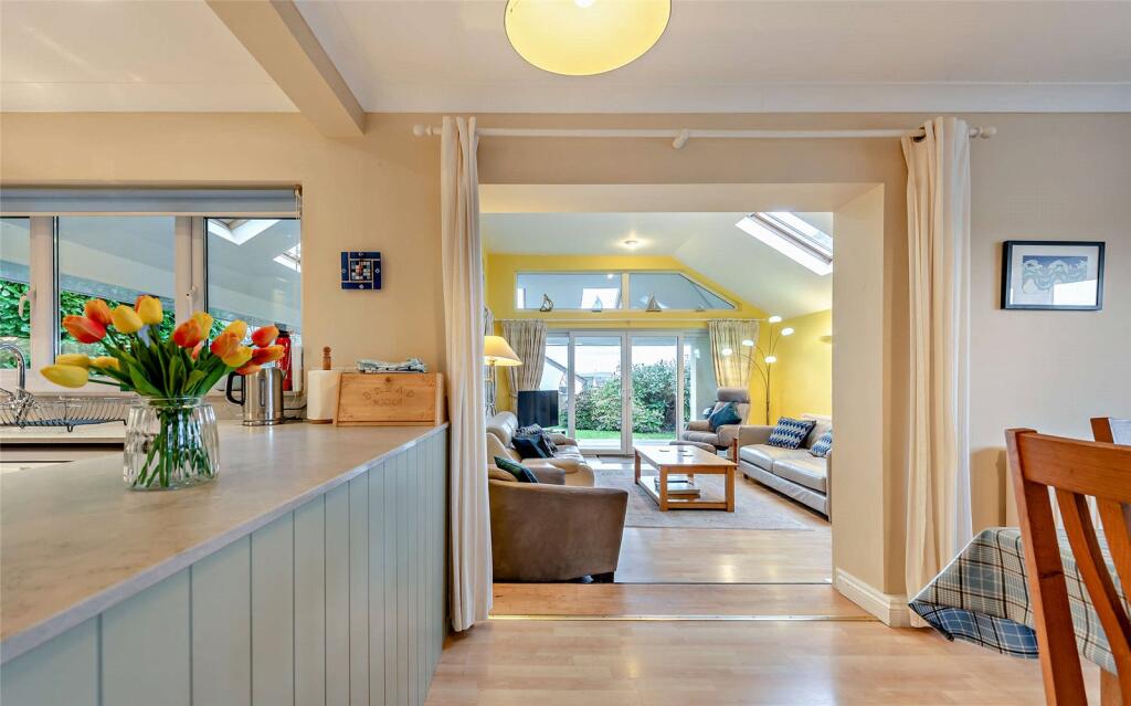
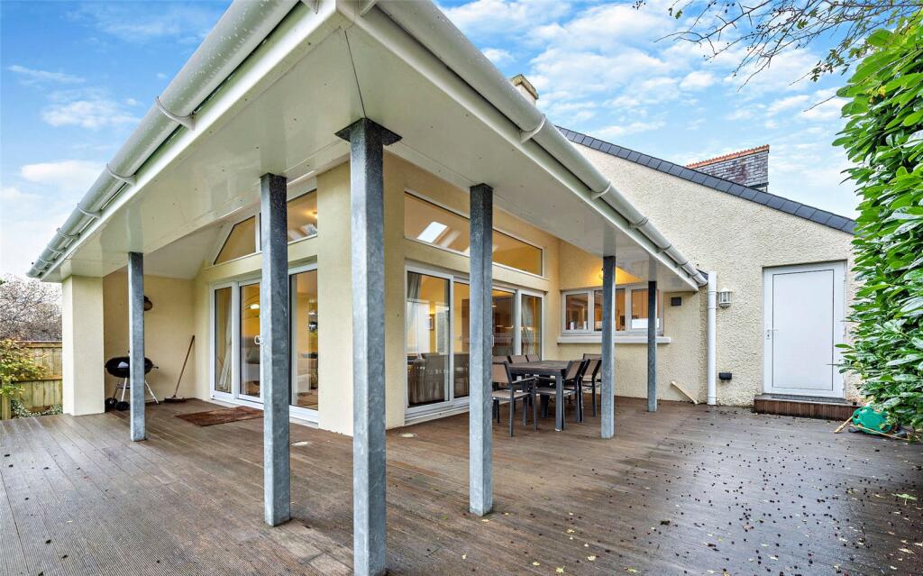
- open plan kitchen and living area Contemporary
Floorplan Description
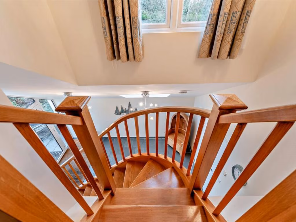
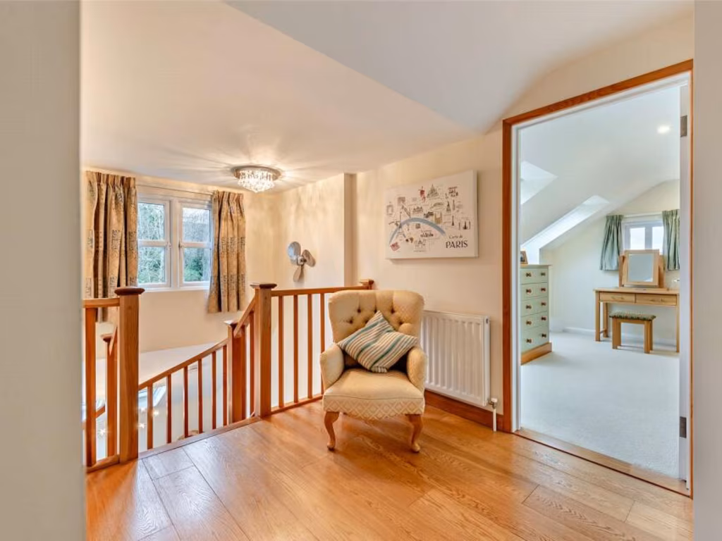
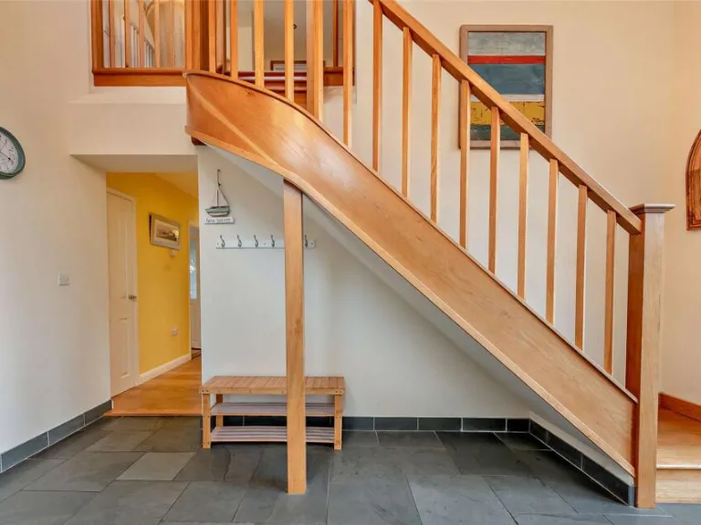
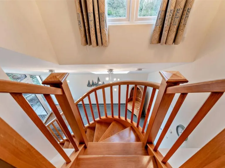
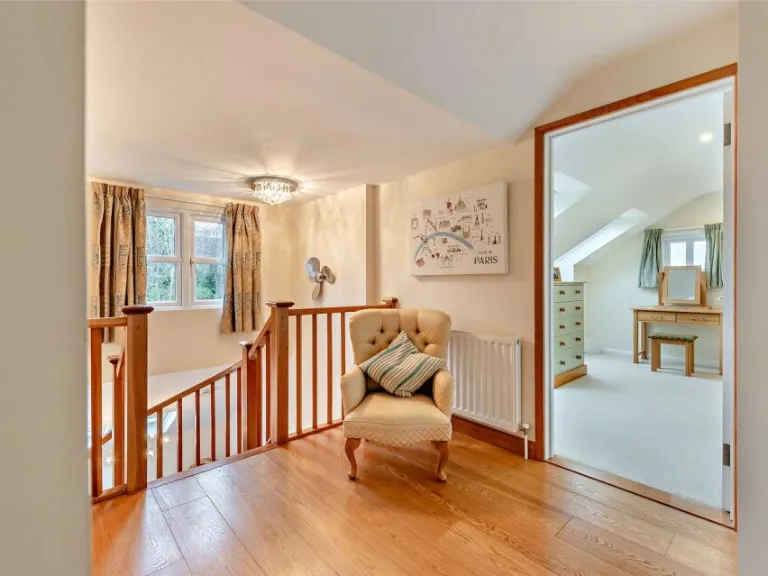
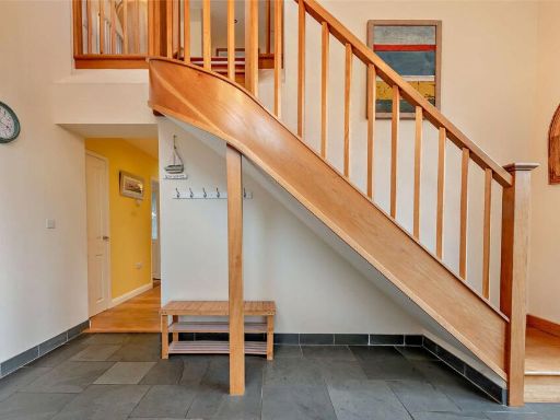
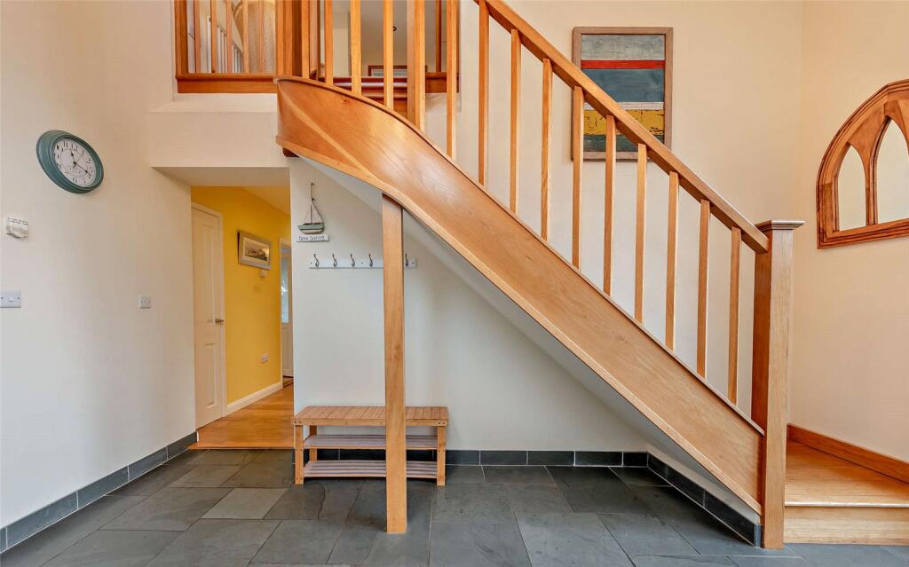
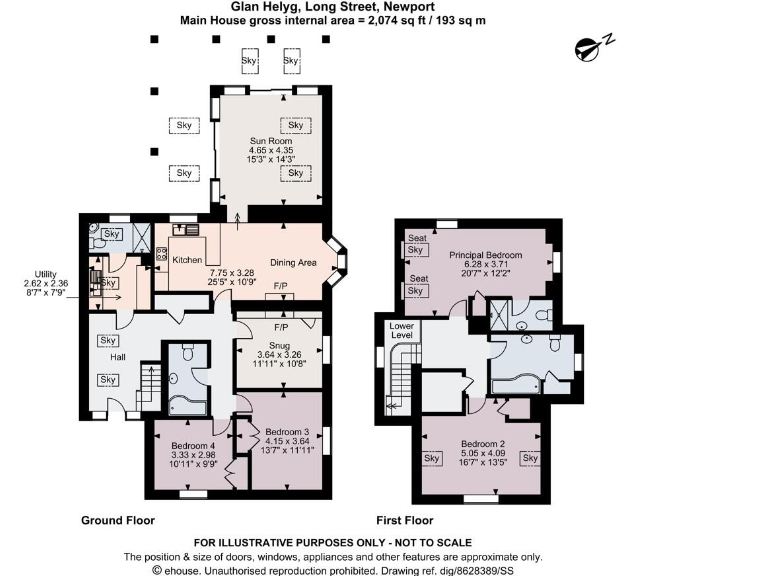
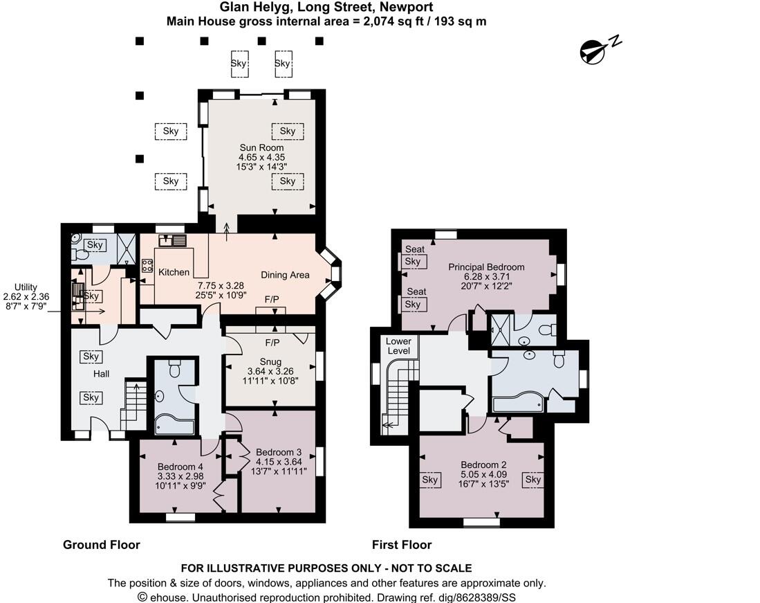
- A spacious multi-story property located in Newport, featuring comfortable living areas and ample bedrooms.
Rooms
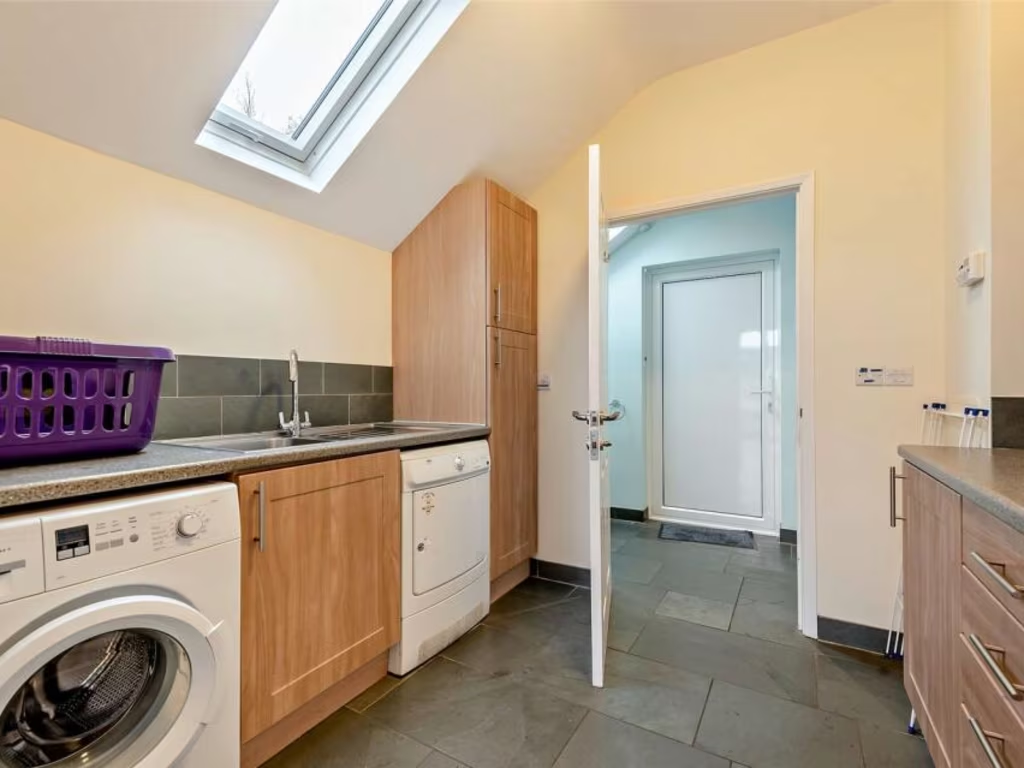
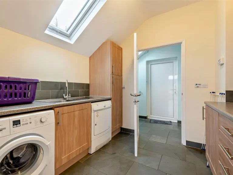
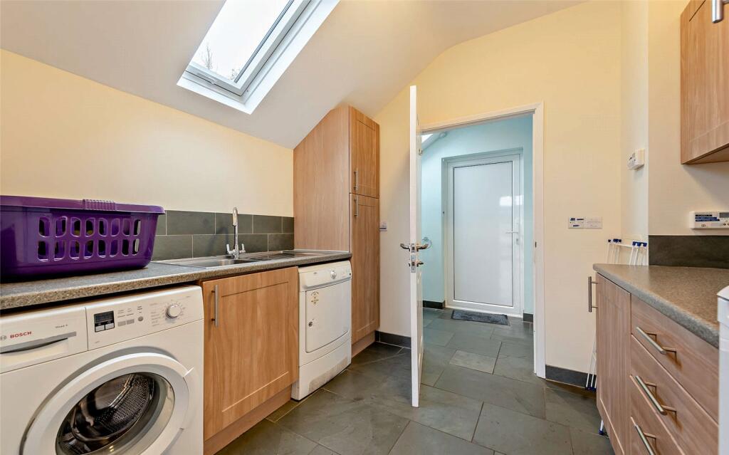
- Utility: Small
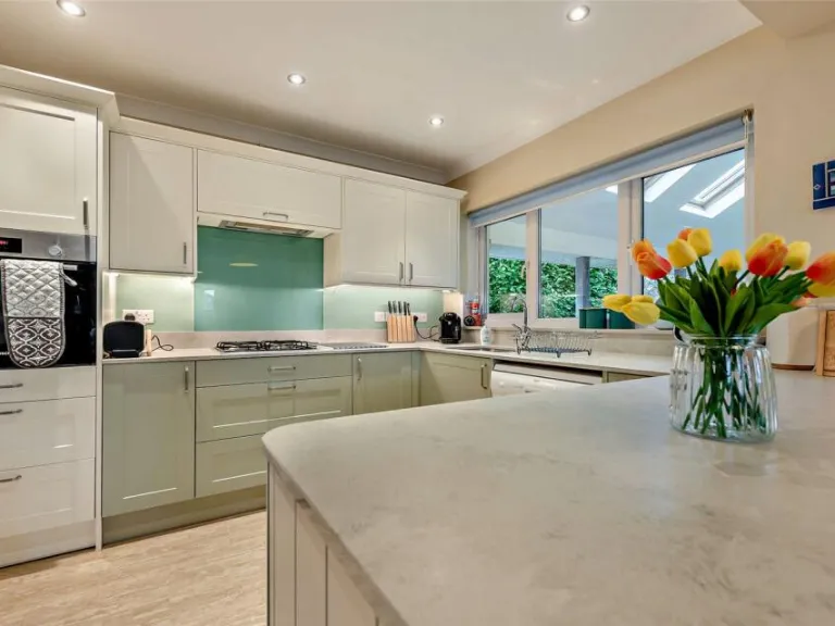
- Kitchen: Large
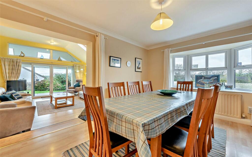
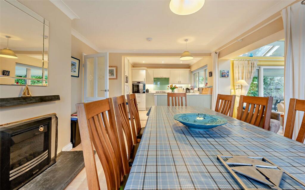
- Dining Area: Average
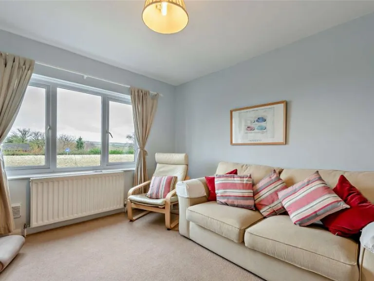
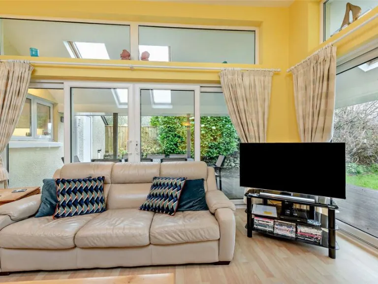
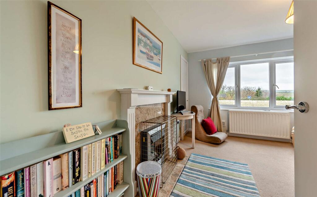
- Snug: Average
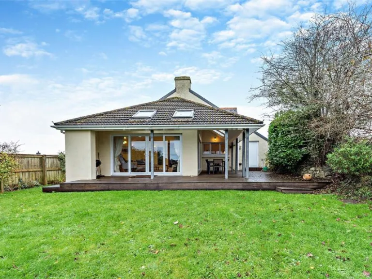
- Sun Room: Average
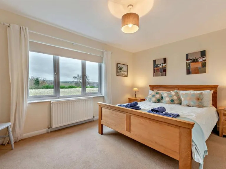
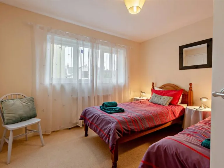
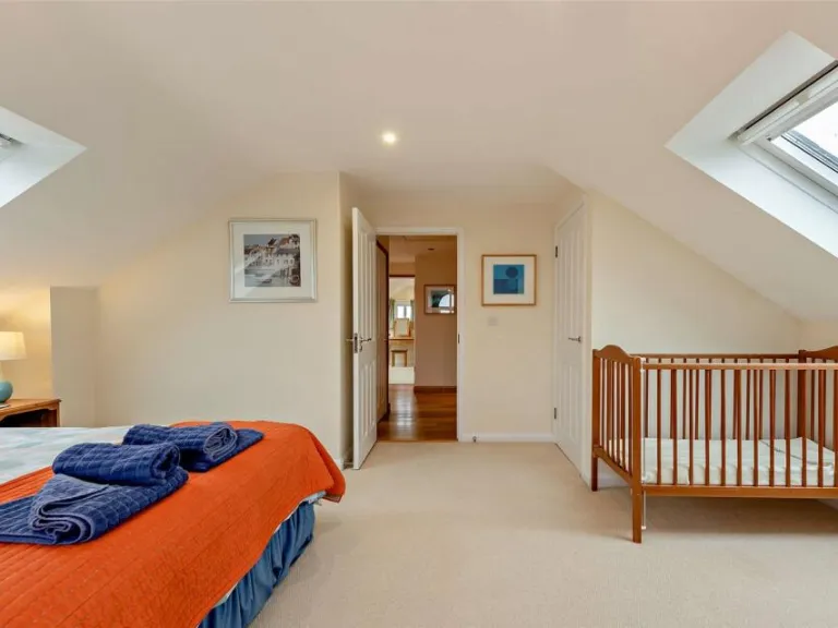
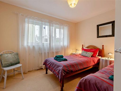
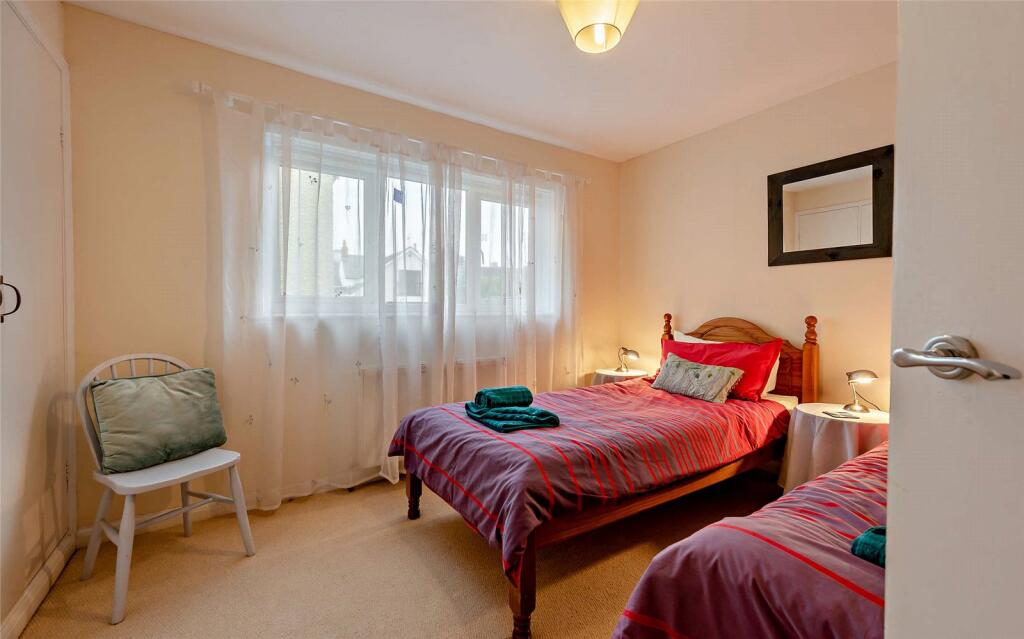
- Bedroom 4: Average
- Bedroom 3: Average
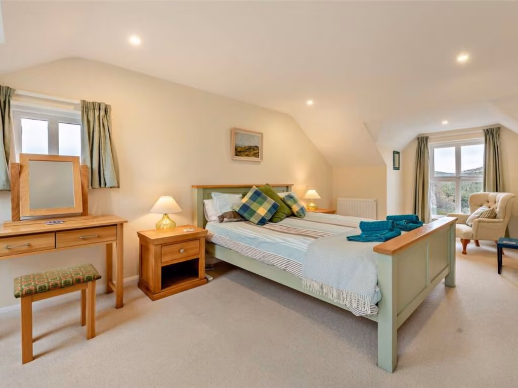
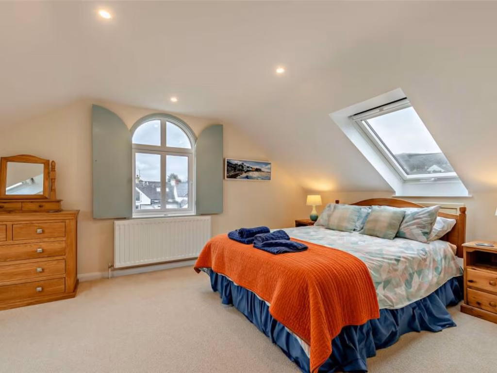
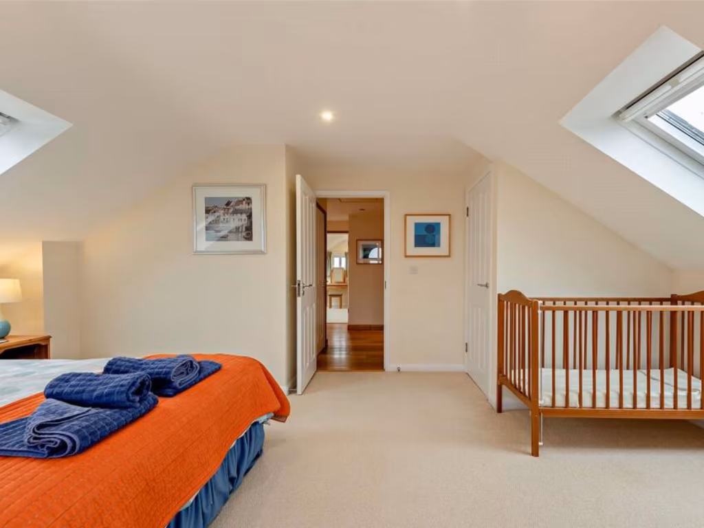
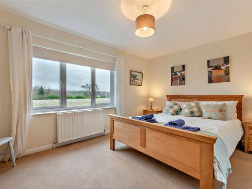
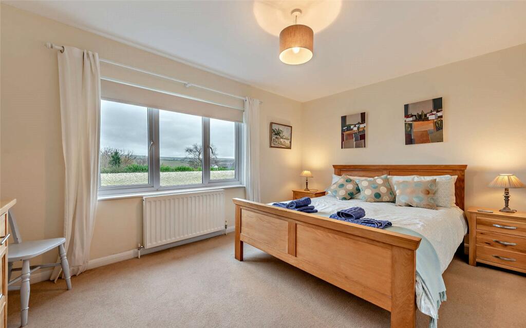
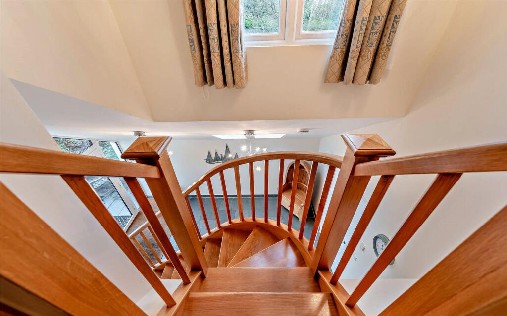
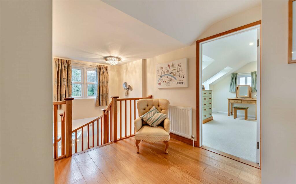
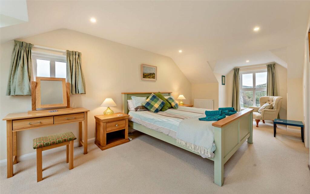
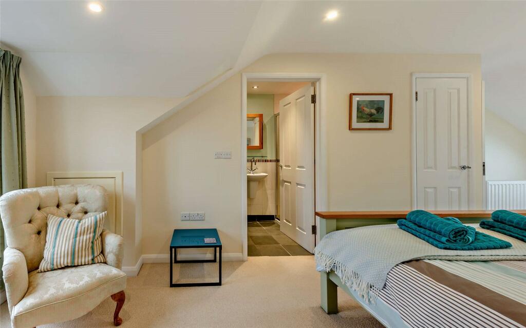
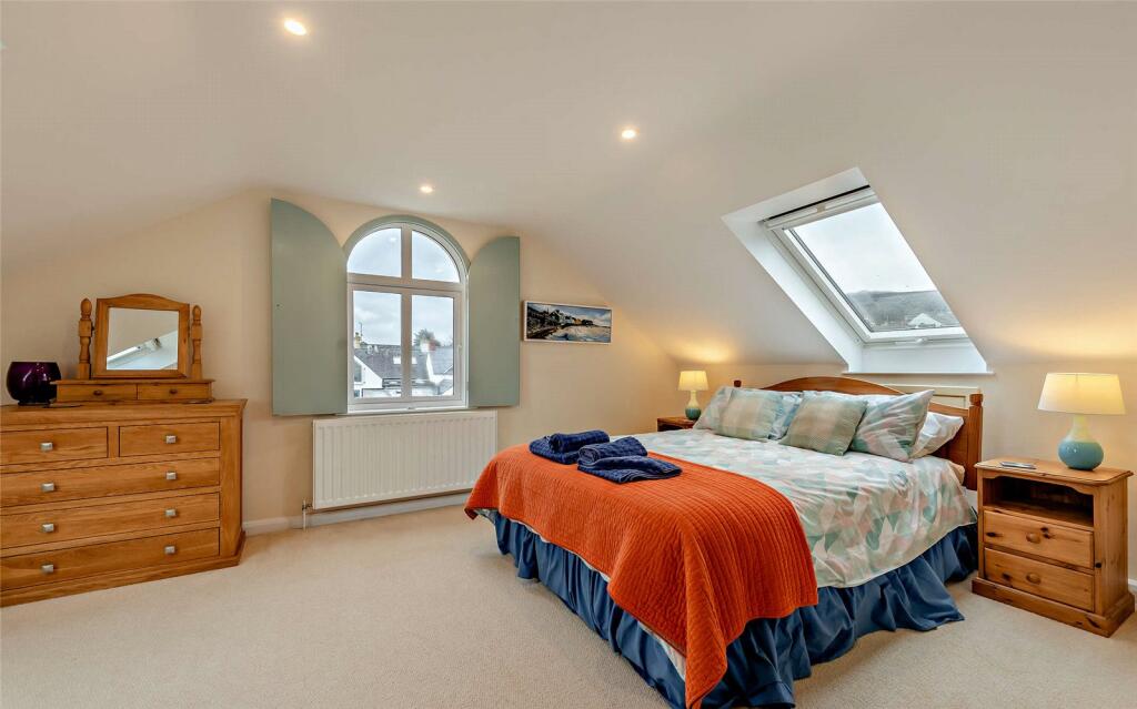
- Principal Bedroom: Large
- Bedroom 2: Average
Textual Property Features
Detected Visual Features
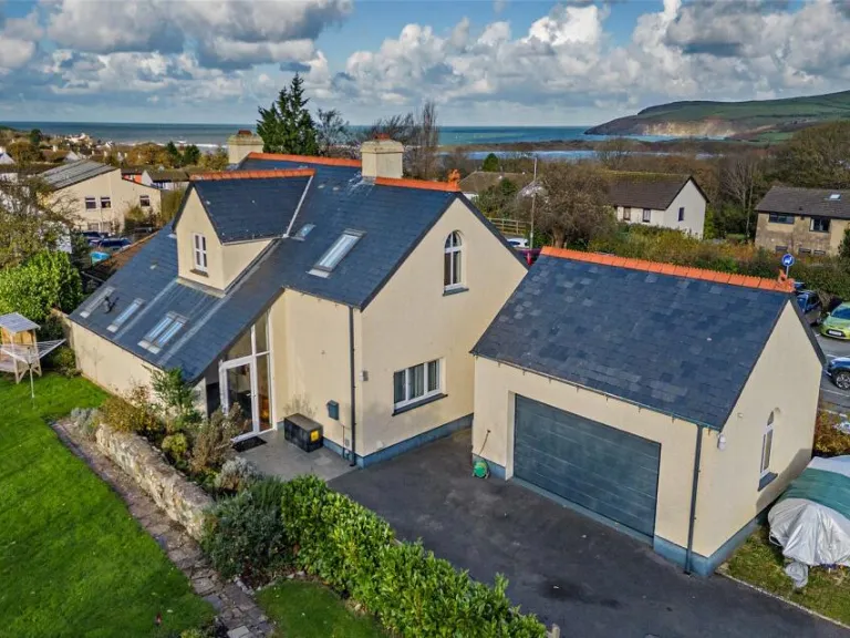
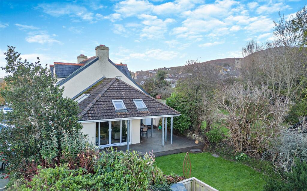
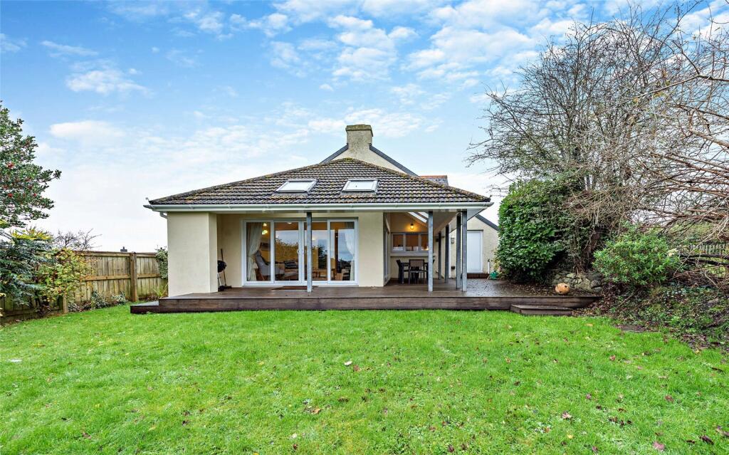
- detached house
- garage
- Contemporary style
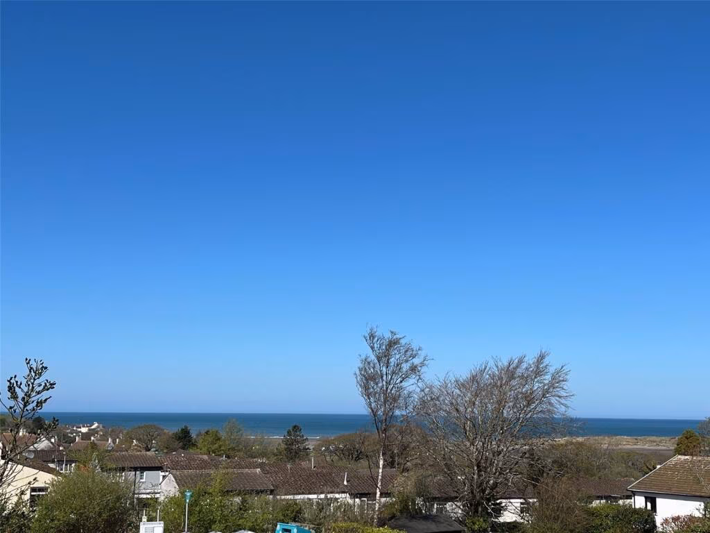
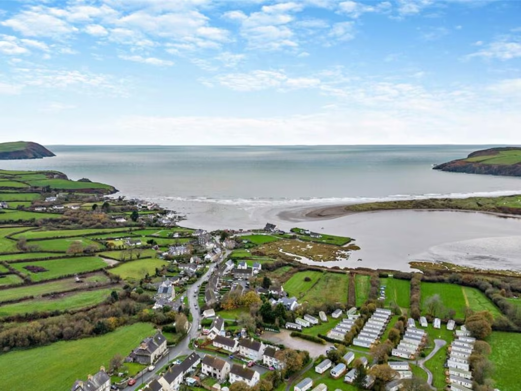
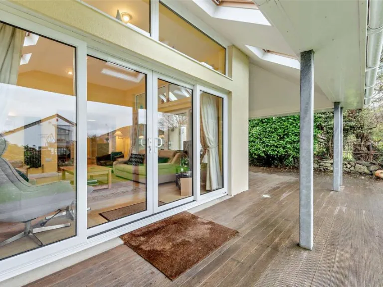
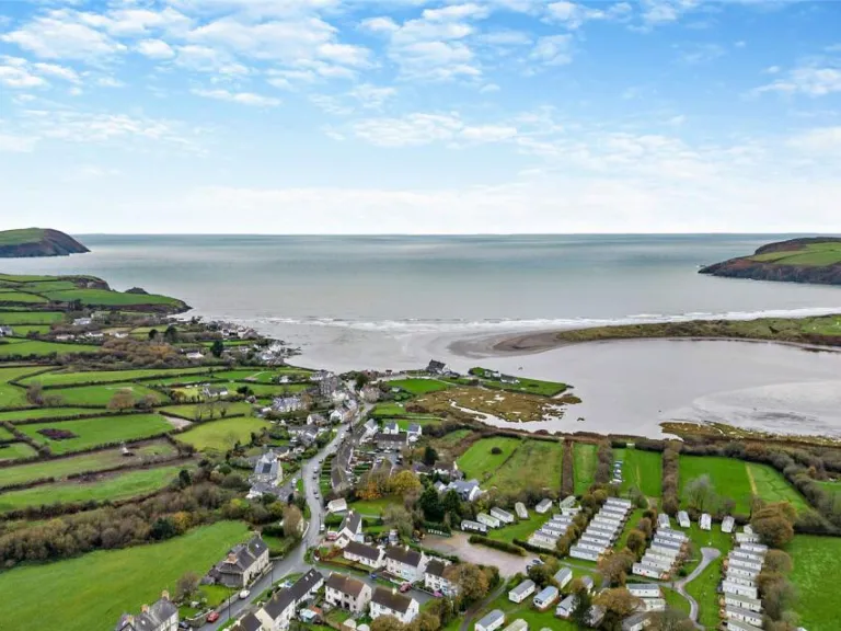
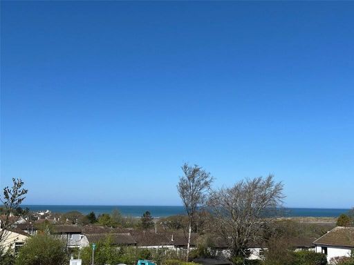
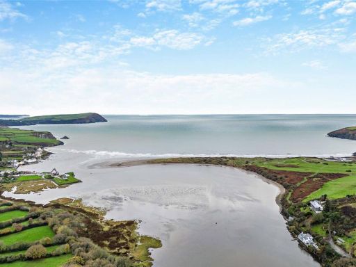
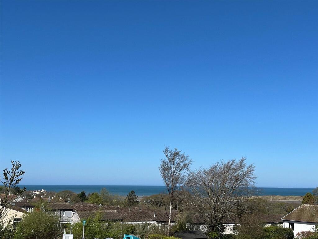
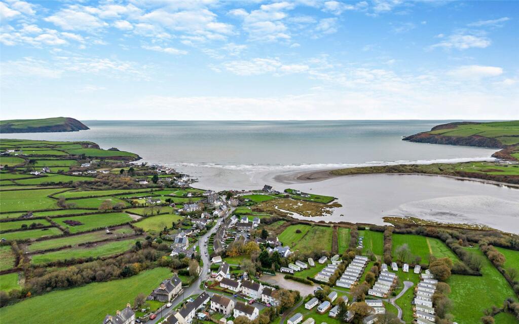
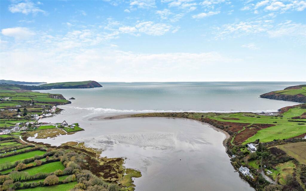
- sea view
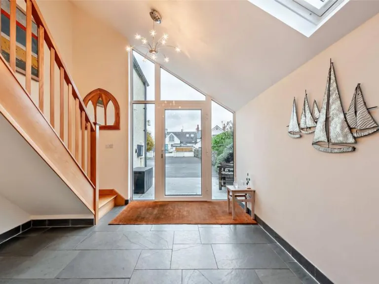
- large windows
- sloped roof
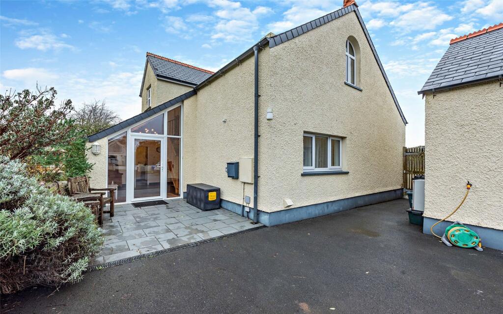
- garden
- two-story
- chimney
- driveway
- quiet neighborhood
- family home
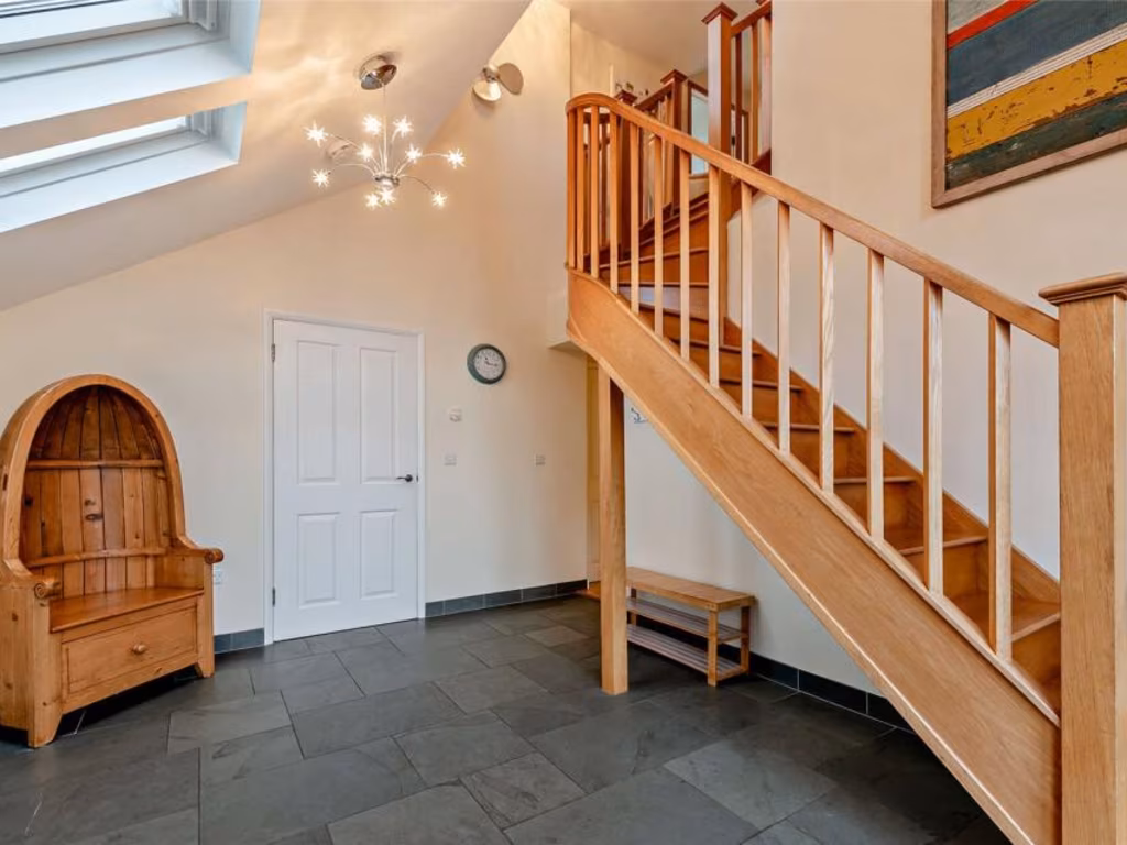
- open plan
- kitchen
- living area
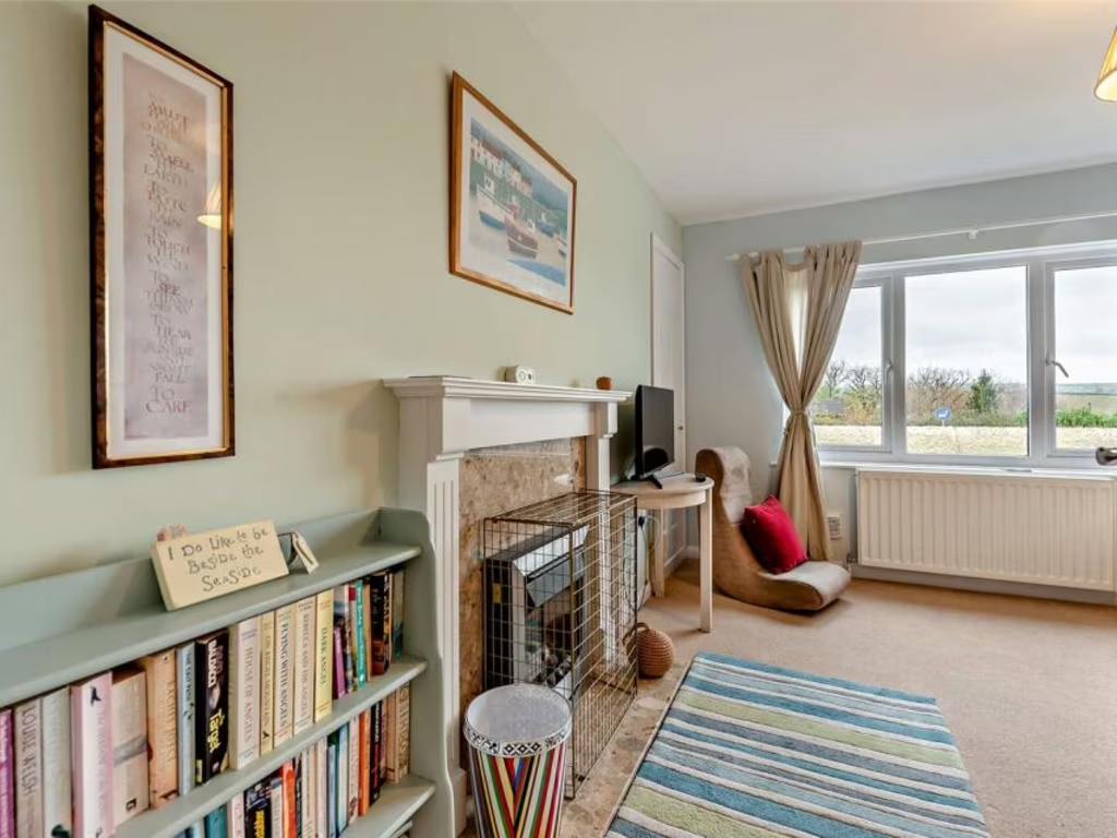
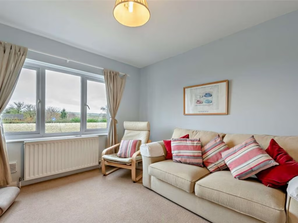
- modern
- bright
- natural light
- patio doors
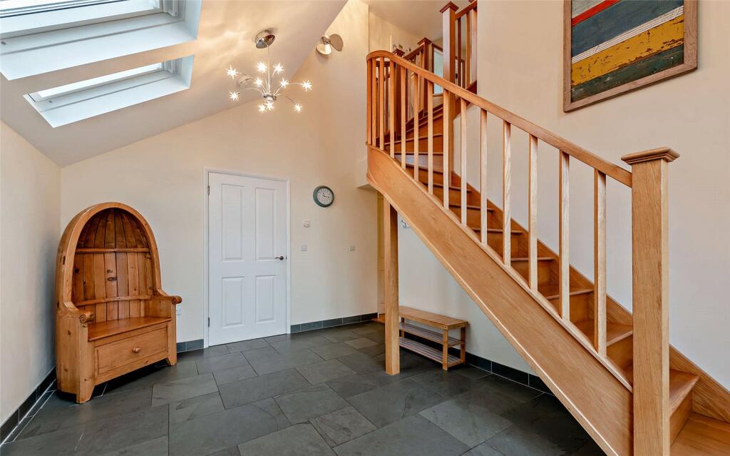
- skylight
- extension
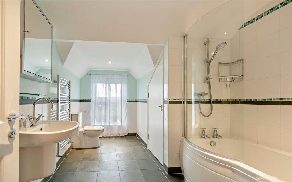
EPC Details
- Partial double glazing
- Cavity wall, as built, insulated (assumed)
- Boiler and radiators, oil
- Low energy lighting in 67% of fixed outlets
- Solid, no insulation (assumed)
Nearest General Shops
- Id: 917573900
- Tags:
- Building: yes
- Name: Elements
- Shop: clothes
- Source: Bing
- TagsNormalized:
- Lat: 52.0164923
- Lon: -4.8305038
- FullGeoHash: gchxfj6d10gq
- PartitionGeoHash: gchx
- Images:
- FoodStandards: null
- Distance: 208.6
,- Id: 917573897
- Tags:
- Building: yes
- Name: Washday
- Shop: laundry
- Source: Bing
- TagsNormalized:
- Lat: 52.0166236
- Lon: -4.8304769
- FullGeoHash: gchxfj6dc9rq
- PartitionGeoHash: gchx
- Images:
- FoodStandards: null
- Distance: 204.7
,- Id: 441752154
- Tags:
- Addr:
- City: Newport
- Postcode: SA42 0PH
- Street: Market Street
- Alt_name: SPAR Newport Dyfed
- Brand: Spar
- Brand:wikidata: Q610492
- Brand:wikipedia: en:SPAR (retailer)
- Building: yes
- Fhrs:
- Name: Spar
- Opening_hours: Mo-Su 08:00-22:00
- Shop: supermarket
- Wheelchair: yes
- TagsNormalized:
- Lat: 52.0158866
- Lon: -4.8324945
- FullGeoHash: gchxfj1nd8nc
- PartitionGeoHash: gchx
- Images:
- FoodStandards:
- Id: 856331
- FHRSID: 856331
- LocalAuthorityBusinessID: 231018
- BusinessName: Spar Stores
- BusinessType: Retailers - other
- BusinessTypeID: 4613
- AddressLine1: Ridgeway House Market Street
- AddressLine2: null
- AddressLine3: Newport
- AddressLine4: Pembrokeshire
- PostCode: SA42 0PH
- RatingValue: 4
- RatingKey: fhrs_4_en-GB
- RatingDate: 2017-10-16
- LocalAuthorityCode: 565
- LocalAuthorityName: Pembrokeshire
- LocalAuthorityWebSite: http://www.pembrokeshire.gov.uk
- LocalAuthorityEmailAddress: foodratings@pembrokeshire.gov.uk
- Scores:
- Hygiene: 0
- Structural: 10
- ConfidenceInManagement: 0
- NewRatingPending: false
- Geocode:
- Longitude: -4.83252700000000
- Latitude: 52.01601600000000
- Distance: 162.7
}
Nearest Grocery shops
- Id: 7946400421
- Tags:
- Brand: Londis
- Brand:wikidata: Q21008564
- Brand:wikipedia: en:Londis (United Kingdom)
- Name: Londis
- Shop: convenience
- TagsNormalized:
- Lat: 52.0118292
- Lon: -4.899542
- FullGeoHash: gchxbs2qb7sw
- PartitionGeoHash: gchx
- Images:
- FoodStandards: null
- Distance: 4574.9
,- Id: 686402677
- Tags:
- Addr:
- Brand: Mace
- Brand:wikidata: Q75240338
- Brand:wikipedia: en:Mace (shop)
- Building: yes
- Fhrs:
- Name: Mace
- Shop: convenience
- Source:
- TagsNormalized:
- Lat: 52.0125606
- Lon: -4.8982754
- FullGeoHash: gchxbs95juj1
- PartitionGeoHash: gchx
- Images:
- FoodStandards:
- Id: 856340
- FHRSID: 856340
- LocalAuthorityBusinessID: 231027
- BusinessName: Kiel House
- BusinessType: Retailers - other
- BusinessTypeID: 4613
- AddressLine1: Keil House
- AddressLine2: null
- AddressLine3: Dinas Cross
- AddressLine4: Pembrokeshire
- PostCode: SA42 0UX
- RatingValue: 4
- RatingKey: fhrs_4_en-GB
- RatingDate: 2019-04-17
- LocalAuthorityCode: 565
- LocalAuthorityName: Pembrokeshire
- LocalAuthorityWebSite: http://www.pembrokeshire.gov.uk
- LocalAuthorityEmailAddress: foodratings@pembrokeshire.gov.uk
- Scores:
- Hygiene: 0
- Structural: 5
- ConfidenceInManagement: 10
- NewRatingPending: false
- Geocode:
- Longitude: -4.89829000000000
- Latitude: 52.01259800000000
- Distance: 4478.8
,- Id: 9259534067
- Tags:
- Amenity: cafe
- Name: Cafe/Shop
- Shop: convenience
- TagsNormalized:
- Lat: 52.0287502
- Lon: -4.8375706
- FullGeoHash: gchxczt3kqjb
- PartitionGeoHash: gchx
- Images:
- FoodStandards: null
- Distance: 1310.1
}
Nearest Religious buildings
- Id: 293997507
- Tags:
- Amenity: place_of_worship
- Name: Bethlehem Chapel
- Religion: christian
- Source: survey
- Source:name: voice
- TagsNormalized:
- place of worship
- chapel
- christian
- church
- Lat: 52.0157924
- Lon: -4.8346503
- FullGeoHash: gchxcvptbqrr
- PartitionGeoHash: gchx
- Images:
- FoodStandards: null
- Distance: 189
,- Id: 293019206
- Tags:
- Amenity: place_of_worship
- Name: Ebeneser Chapel
- Religion: christian
- Source: survey
- Source:name: voice
- TagsNormalized:
- place of worship
- chapel
- christian
- church
- Lat: 52.0169749
- Lon: -4.8312928
- FullGeoHash: gchxfj3uydyv
- PartitionGeoHash: gchx
- Images:
- FoodStandards: null
- Distance: 139.8
,- Id: 206199222
- Tags:
- Amenity: place_of_worship
- Created_by: JOSM
- Denomination: calvinist_methodist
- Name: Tabernacle Chapel
- Note: Erected 1815, 1904
- Religion: christian
- Source: survey
- Source:name: voice
- Wikidata: Q99451849
- TagsNormalized:
- place of worship
- methodist
- chapel
- tabernacle
- christian
- church
- Lat: 52.0173366
- Lon: -4.8323296
- FullGeoHash: gchxfj3nyw3g
- PartitionGeoHash: gchx
- Images:
- FoodStandards: null
- Distance: 65.4
}
Nearest Medical buildings
- Id: 854583499
- Tags:
- Amenity: hospital
- Healthcare: hospital
- TagsNormalized:
- Lat: 51.9948477
- Lon: -4.9793799
- FullGeoHash: gchry9q5un15
- PartitionGeoHash: gchr
- Images:
- FoodStandards: null
- Distance: 10306.5
,- Id: 854583498
- Tags:
- Amenity: pharmacy
- Brand: Lloyds Pharmacy
- Brand:wikidata: Q6662870
- Brand:wikipedia: en:LloydsPharmacy
- Building: yes
- Dispensing: yes
- Drive_through: no
- Healthcare: pharmacy
- Name: Fferyllfa Lloyds Pharmacy
- TagsNormalized:
- pharmacy
- lloyds pharmacy
- health
- healthcare
- Lat: 51.994777
- Lon: -4.9790307
- FullGeoHash: gchry9q7s0vw
- PartitionGeoHash: gchr
- Images:
- FoodStandards: null
- Distance: 10285.3
,- Id: 652739371
- Tags:
- Amenity: pharmacy
- Brand: Boots
- Brand:wikidata: Q6123139
- Brand:wikipedia: en:Boots UK
- Healthcare: pharmacy
- Name: Boots
- TagsNormalized:
- pharmacy
- boots
- health
- healthcare
- Lat: 51.9935849
- Lon: -4.9763931
- FullGeoHash: gchryc0k9dsq
- PartitionGeoHash: gchr
- Images:
- FoodStandards: null
- Distance: 10144
,- Id: 5040656208
- Tags:
- Amenity: pharmacy
- Healthcare: pharmacy
- Name: Fferyllya / Newport Pharmacy
- TagsNormalized:
- Lat: 52.0160032
- Lon: -4.8328429
- FullGeoHash: gchxfj0z4tg1
- PartitionGeoHash: gchx
- Images:
- FoodStandards: null
- Distance: 143.7
}
Nearest Leisure Facilities
- Id: 441751170
- Tags:
- Leisure: pitch
- Sport: tennis
- TagsNormalized:
- Lat: 52.0201106
- Lon: -4.8315874
- FullGeoHash: gchxfjcxpg7q
- PartitionGeoHash: gchx
- Images:
- FoodStandards: null
- Distance: 336.6
,- Id: 516177449
- Tags:
- Leisure: pitch
- Sport: rugby_league
- TagsNormalized:
- pitch
- leisure
- rugby
- rugby league
- sports
- Lat: 52.0195484
- Lon: -4.8310315
- FullGeoHash: gchxfjf5uf9v
- PartitionGeoHash: gchx
- Images:
- FoodStandards: null
- Distance: 296.6
,- Id: 516177450
- Tags:
- Leisure: pitch
- Sport: soccer
- TagsNormalized:
- Lat: 52.0175422
- Lon: -4.8294637
- FullGeoHash: gchxfje21kdv
- PartitionGeoHash: gchx
- Images:
- FoodStandards: null
- Distance: 262.9
,- Id: 441751167
- Tags:
- TagsNormalized:
- Lat: 52.0191303
- Lon: -4.8314067
- FullGeoHash: gchxfjcckhdp
- PartitionGeoHash: gchx
- Images:
- FoodStandards: null
- Distance: 243.5
,- Id: 441751173
- Tags:
- TagsNormalized:
- Lat: 52.0185293
- Lon: -4.83082
- FullGeoHash: gchxfjdmcsxw
- PartitionGeoHash: gchx
- Images:
- FoodStandards: null
- Distance: 219.1
}
Nearest Tourist attractions
- Id: 917573896
- Tags:
- Amenity: restaurant
- Building: yes
- Name: Llys Meddyg
- Phone: +44 1239820008
- Source: Bing
- Tourism: guest_house
- TagsNormalized:
- restaurant
- guest house
- tourism
- Lat: 52.0168899
- Lon: -4.8300618
- FullGeoHash: gchxfj6u77hf
- PartitionGeoHash: gchx
- Images:
- FoodStandards: null
- Distance: 224.1
,- Id: 404431586
- Tags:
- Addr:
- City: Newport
- Postcode: SA42 0TS
- Street: Lower St Mary's Street
- Building: yes
- Name: Newport Youth Hostel
- Operator: YHA
- Phone: +44 845 371 9543
- Tourism: hostel
- Website: https://www.yha.org.uk/hostel/newport
- TagsNormalized:
- Lat: 52.0172725
- Lon: -4.830678
- FullGeoHash: gchxfj6qt43k
- PartitionGeoHash: gchx
- Images:
- FoodStandards: null
- Distance: 178
,- Id: 917573902
- Tags:
- Amenity: restaurant
- Building: yes
- Name: Cnapan
- Source: Bing
- Tourism: guest_house
- TagsNormalized:
- restaurant
- guest house
- tourism
- Lat: 52.0166279
- Lon: -4.8314526
- FullGeoHash: gchxfj3fffpz
- PartitionGeoHash: gchx
- Images:
- FoodStandards: null
- Distance: 143.8
}
Nearest Train stations
- Id: 1590432668
- Tags:
- Name: Main Entrance Station
- Public_transport: station
- Railway: station
- Usage: tourism
- TagsNormalized:
- Lat: 51.7775924
- Lon: -4.8001387
- FullGeoHash: gchwdcbdkdv1
- PartitionGeoHash: gchw
- Images:
- FoodStandards: null
- Distance: 26747.5
,- Id: 858361120
- Tags:
- Name: Oakwood Park Station
- Public_transport: station
- Railway: station
- Usage: tourism
- TagsNormalized:
- Lat: 51.7789542
- Lon: -4.8028585
- FullGeoHash: gchwddndm29h
- PartitionGeoHash: gchw
- Images:
- FoodStandards: null
- Distance: 26581.3
,- Id: 19840285
- Tags:
- Name: Haverfordwest
- Name:cy: Hwlffordd
- Naptan:
- Network: National Rail
- Operator: Trafnidiaeth Cymru
- Operator:cy: Trafnidiaeth Cymru
- Operator:en: Transport for Wales
- Public_transport: station
- Railway: station
- Ref:
- Wikidata: Q1931357
- Wikipedia: en:Haverfordwest railway station
- TagsNormalized:
- Lat: 51.8026795
- Lon: -4.960232
- FullGeoHash: gchqxnkh6pqg
- PartitionGeoHash: gchq
- Images:
- FoodStandards: null
- Distance: 25400.6
,- Id: 6049272877
- Tags:
- Name: Narberth
- Name:cy: Arberth
- Naptan:
- Network: National Rail
- Operator: Trafnidiaeth Cymru
- Operator:cy: Trafnidiaeth Cymru
- Operator:en: Transport for Wales
- Public_transport: station
- Railway: station
- Ref:
- Request_stop: yes
- Wikidata: Q2258074
- Wikipedia: en:Narberth railway station (Wales)
- TagsNormalized:
- Lat: 51.7994595
- Lon: -4.7270386
- FullGeoHash: gchwsmvcsp0e
- PartitionGeoHash: gchw
- Images:
- FoodStandards: null
- Distance: 25291.9
,- Id: 20466178
- Tags:
- Alt_name: Clynderwen
- Name: Clunderwen
- Naptan:
- Network: National Rail
- Operator: Trafnidiaeth Cymru
- Operator:cy: Trafnidiaeth Cymru
- Operator:en: Transport for Wales
- Public_transport: station
- Railway: station
- Ref:
- Request_stop: yes
- Wikidata: Q3400242
- Wikipedia: en:Clunderwen railway station
- TagsNormalized:
- Lat: 51.8401054
- Lon: -4.7310195
- FullGeoHash: gchwum4yx204
- PartitionGeoHash: gchw
- Images:
- FoodStandards: null
- Distance: 20910.2
}
Nearest Bus stations and stops
- Id: 6539967402
- Tags:
- Bus: yes
- Highway: bus_stop
- Public_transport: platform
- TagsNormalized:
- Lat: 51.9954762
- Lon: -4.9681593
- FullGeoHash: gchrycqr97rb
- PartitionGeoHash: gchr
- Images:
- FoodStandards: null
- Distance: 9545.1
,- Id: 6539956877
- Tags:
- Bus: yes
- Highway: bus_stop
- Public_transport: platform
- TagsNormalized:
- Lat: 52.068433
- Lon: -4.7477674
- FullGeoHash: gck85yyb952j
- PartitionGeoHash: gck8
- Images:
- FoodStandards: null
- Distance: 8159.2
,- Id: 6539956876
- Tags:
- Bus: yes
- Highway: bus_stop
- Public_transport: platform
- TagsNormalized:
- Lat: 52.0683902
- Lon: -4.747731
- FullGeoHash: gck85yyb3g7j
- PartitionGeoHash: gck8
- Images:
- FoodStandards: null
- Distance: 8157.6
,- Id: 6540074260
- Tags:
- Bus: yes
- Highway: bus_stop
- Public_transport: platform
- TagsNormalized:
- Lat: 52.0288756
- Lon: -4.8368677
- FullGeoHash: gchxcztfhv6h
- PartitionGeoHash: gchx
- Images:
- FoodStandards: null
- Distance: 1313.9
,- Id: 6423717685
- Tags:
- Bus: yes
- Highway: bus_stop
- Name: Castle Inn
- Public_transport: platform
- TagsNormalized:
- Lat: 52.0160882
- Lon: -4.8334703
- FullGeoHash: gchxfj0revxk
- PartitionGeoHash: gchx
- Images:
- FoodStandards: null
- Distance: 131.8
}
Nearest Hotels
- Id: 422240667
- Tags:
- Name: Llwyngwair Manor Caravan Park & Hotel
- Tourism: caravan_site
- TagsNormalized:
- Lat: 52.0215597
- Lon: -4.8121934
- FullGeoHash: gchxfqpzec8e
- PartitionGeoHash: gchx
- Images:
- FoodStandards: null
- Distance: 1519.7
,- Id: 1003444986
- Tags:
- Addr:
- Postcode: SA42 0NR
- Street: Golf Course Rd.
- Building: yes
- Name: Newport Sands Hotel
- Phone: +44 1239 820244
- Source: Bing
- Tourism: hotel
- TagsNormalized:
- Lat: 52.0298892
- Lon: -4.8334091
- FullGeoHash: gchxfpb2j6kf
- PartitionGeoHash: gchx
- Images:
- FoodStandards: null
- Distance: 1403.5
,- Id: 917575731
- Tags:
- Addr:
- Postcode: SA42 0TB
- Street: Bridge Street
- Amenity: pub
- Building: yes
- Fhrs:
- Name: Castle Hotel
- Source: Bing
- Source:addr: FHRS Open Data
- Wikidata: Q80856675
- TagsNormalized:
- Lat: 52.0161834
- Lon: -4.8334589
- FullGeoHash: gchxfj22hpru
- PartitionGeoHash: gchx
- Images:
- FoodStandards: null
- Distance: 121.2
}
Tags
- detached house
- garage
- Contemporary style
- sea view
- large windows
- sloped roof
- garden
- two-story
- chimney
- driveway
- quiet neighborhood
- family home
- open plan
- kitchen
- living area
- modern
- bright
- natural light
- patio doors
- skylight
- extension
Local Market Stats
- Average Price/sqft: £318
- Avg Income: £34700
- Social Housing: 1%
- Planning Success Rate: 89%
AirBnB Data
- 1km average: £148/night
- Listings in 1km: 5
Similar Properties
 4 bedroom semi-detached house for sale in Parrog Road, Newport, Pembrokeshire, SA42 — £475,000 • 4 bed • 1 bath • 1088 ft²
 3 bedroom semi-detached house for sale in Parrog Road, Newport, Pembrokeshire, SA42 — £560,000 • 3 bed • 2 bath • 1619 ft²
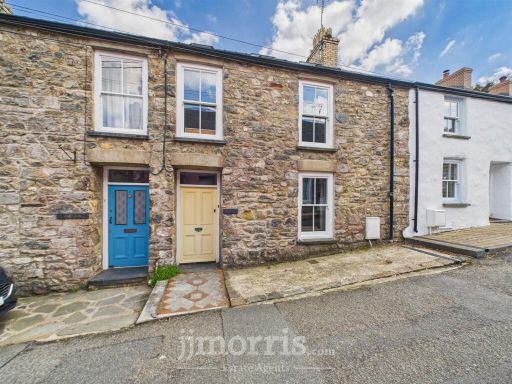 4 bedroom terraced house for sale in LLysfair, Upper St. Mary Street, Newport, SA42 — £475,000 • 4 bed • 2 bath • 356 ft²
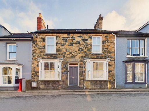 4 bedroom country house for sale in West Street, Newport, SA42 — £695,000 • 4 bed • 4 bath • 1205 ft²
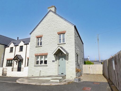 3 bedroom semi-detached house for sale in West Street, Newport, SA42 — £387,500 • 3 bed • 2 bath • 1092 ft²
 3 bedroom link detached house for sale in Bank House, Upper West Street, Newport, SA42 — £399,950 • 3 bed • 2 bath • 1335 ft²
Meta
- {
"@context": "https://schema.org",
"@type": "Residence",
"name": "4 bedroom detached house for sale in Long Street, Newport,…",
"description": "",
"url": "https://propertypiper.co.uk/property/cabf9d36-5096-4b7e-bbe5-9e4b7e84dcd6",
"image": "https://image-a.propertypiper.co.uk/3eb5405a-f70c-46ef-9ca7-8b6c3fd05531-1024.jpeg",
"address": {
"@type": "PostalAddress",
"streetAddress": "GLAN HELYG LONG STREET NEWPORT ",
"postalCode": "SA42 0TJ",
"addressLocality": "Pembrokeshire",
"addressRegion": "Preseli Pembrokeshire",
"addressCountry": "Wales"
},
"geo": {
"@type": "GeoCoordinates",
"latitude": 52.017267786323444,
"longitude": -4.8332788755037015
},
"numberOfRooms": 4,
"numberOfBathroomsTotal": 4,
"floorSize": {
"@type": "QuantitativeValue",
"value": 2074,
"unitCode": "FTK"
},
"offers": {
"@type": "Offer",
"price": 665000,
"priceCurrency": "GBP",
"availability": "https://schema.org/InStock"
},
"additionalProperty": [
{
"@type": "PropertyValue",
"name": "Feature",
"value": "detached house"
},
{
"@type": "PropertyValue",
"name": "Feature",
"value": "garage"
},
{
"@type": "PropertyValue",
"name": "Feature",
"value": "Contemporary style"
},
{
"@type": "PropertyValue",
"name": "Feature",
"value": "sea view"
},
{
"@type": "PropertyValue",
"name": "Feature",
"value": "large windows"
},
{
"@type": "PropertyValue",
"name": "Feature",
"value": "sloped roof"
},
{
"@type": "PropertyValue",
"name": "Feature",
"value": "garden"
},
{
"@type": "PropertyValue",
"name": "Feature",
"value": "two-story"
},
{
"@type": "PropertyValue",
"name": "Feature",
"value": "chimney"
},
{
"@type": "PropertyValue",
"name": "Feature",
"value": "driveway"
},
{
"@type": "PropertyValue",
"name": "Feature",
"value": "quiet neighborhood"
},
{
"@type": "PropertyValue",
"name": "Feature",
"value": "family home"
},
{
"@type": "PropertyValue",
"name": "Feature",
"value": "open plan"
},
{
"@type": "PropertyValue",
"name": "Feature",
"value": "kitchen"
},
{
"@type": "PropertyValue",
"name": "Feature",
"value": "living area"
},
{
"@type": "PropertyValue",
"name": "Feature",
"value": "modern"
},
{
"@type": "PropertyValue",
"name": "Feature",
"value": "bright"
},
{
"@type": "PropertyValue",
"name": "Feature",
"value": "natural light"
},
{
"@type": "PropertyValue",
"name": "Feature",
"value": "patio doors"
},
{
"@type": "PropertyValue",
"name": "Feature",
"value": "skylight"
},
{
"@type": "PropertyValue",
"name": "Feature",
"value": "extension"
}
]
}
High Res Floorplan Images
Compatible Floorplan Images
FloorplanImages Thumbnail