SS8 0JQ - 4 bedroom bungalow for sale in Long Road, Canvey Island, SS8
View on Property Piper
4 bedroom bungalow for sale in Long Road, Canvey Island, SS8
Property Details
- Price: £700000
- Bedrooms: 4
- Bathrooms: 3
- Property Type: undefined
- Property SubType: undefined
Brochure Descriptions
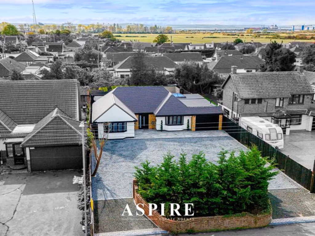
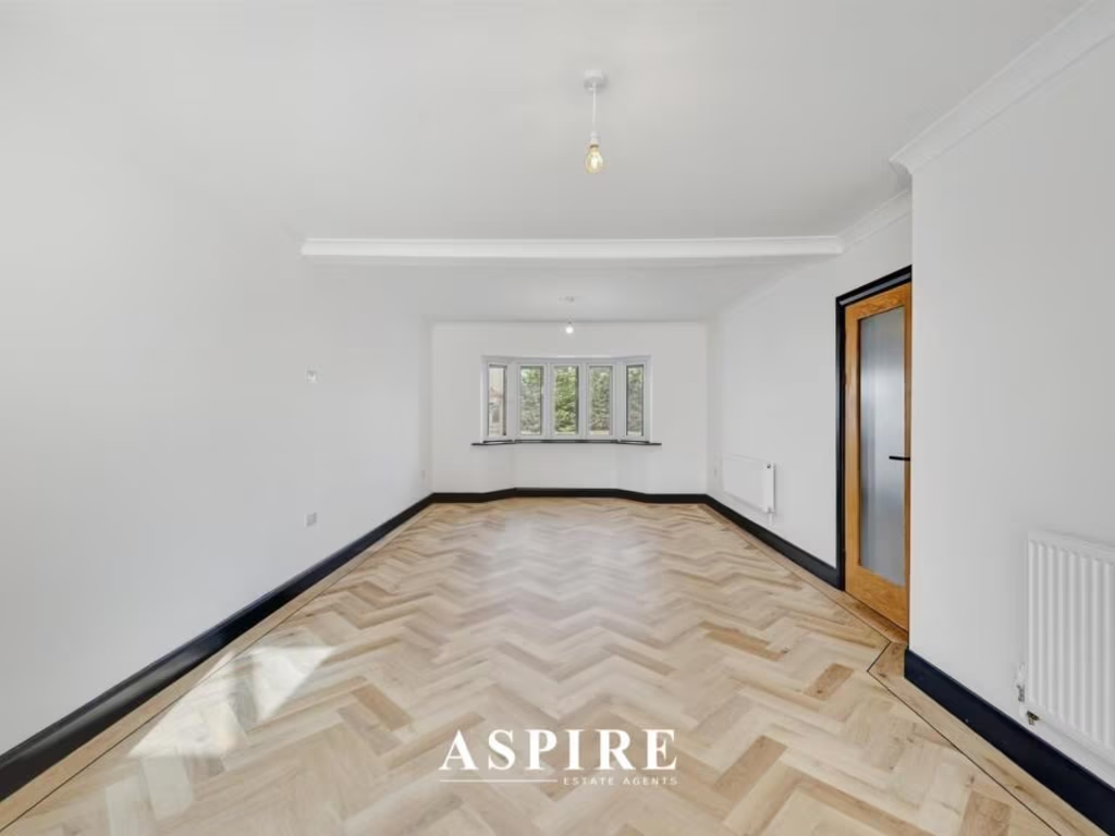
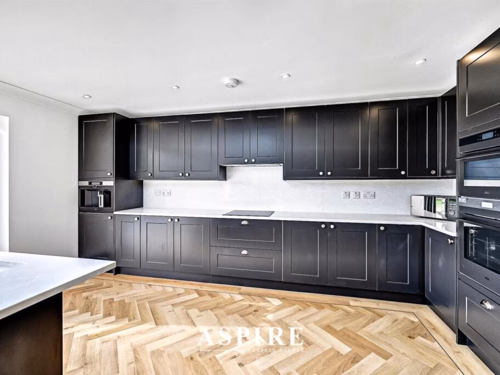
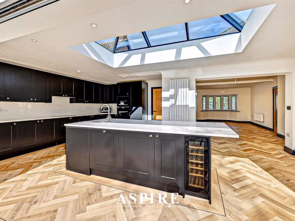
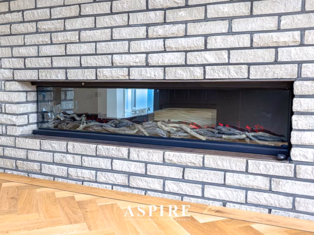
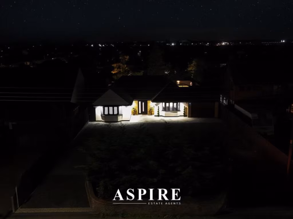
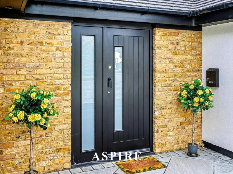
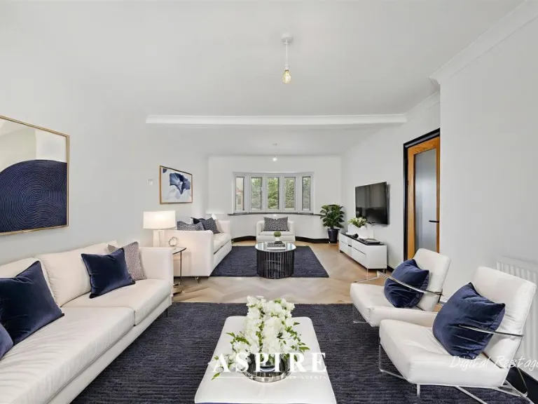
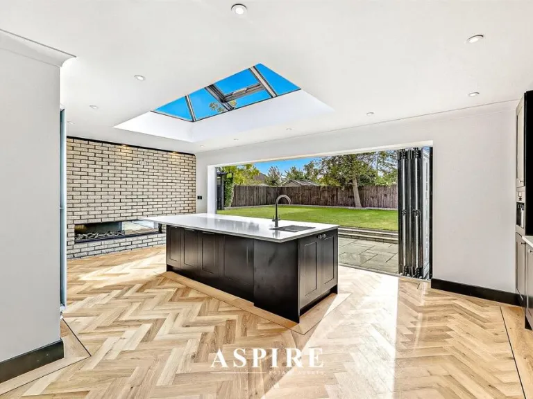
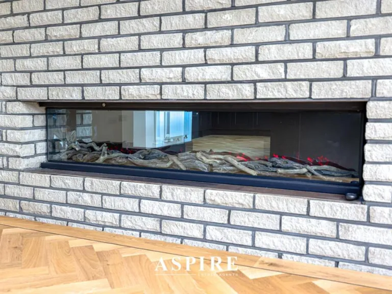
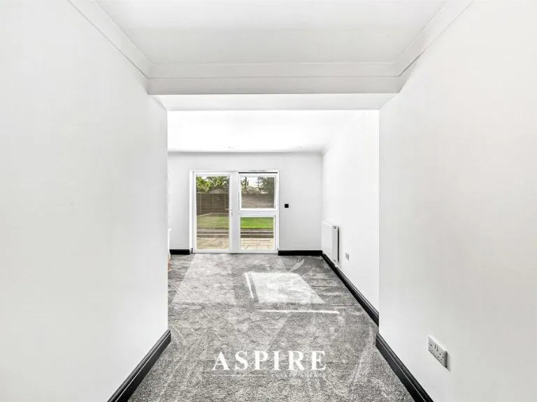
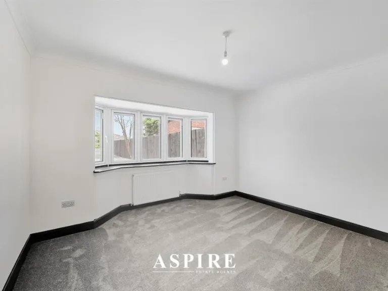
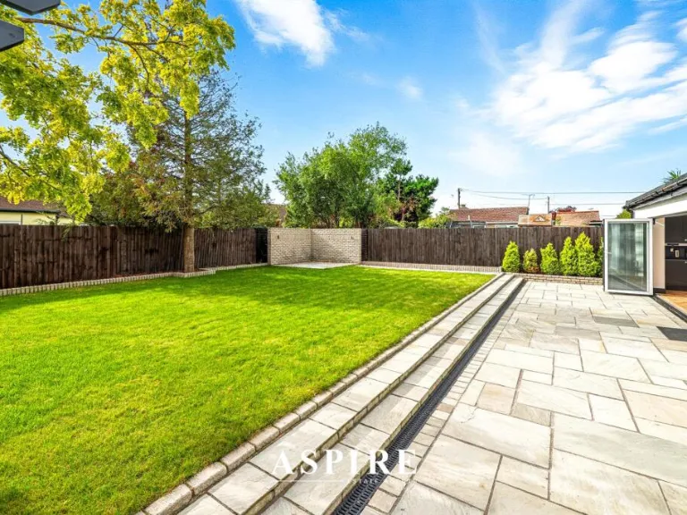
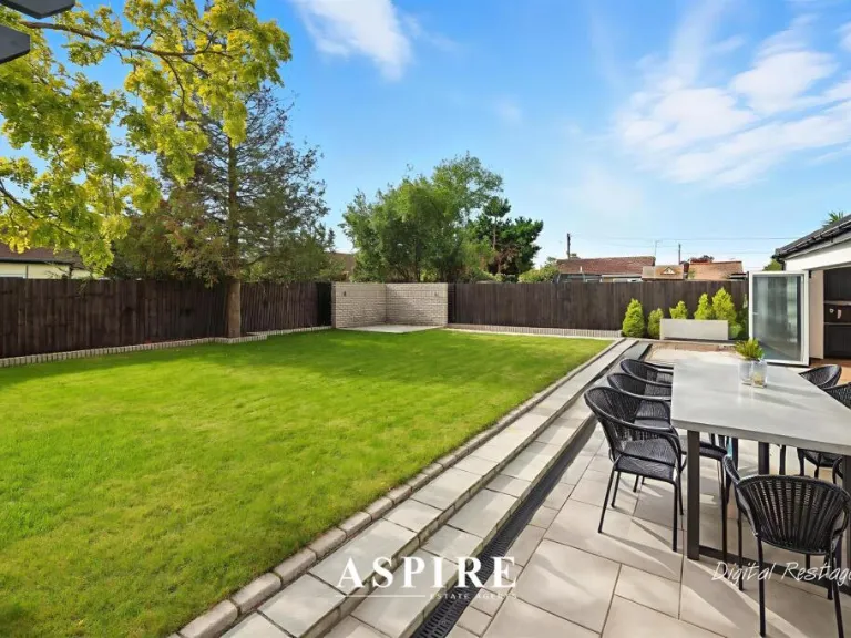
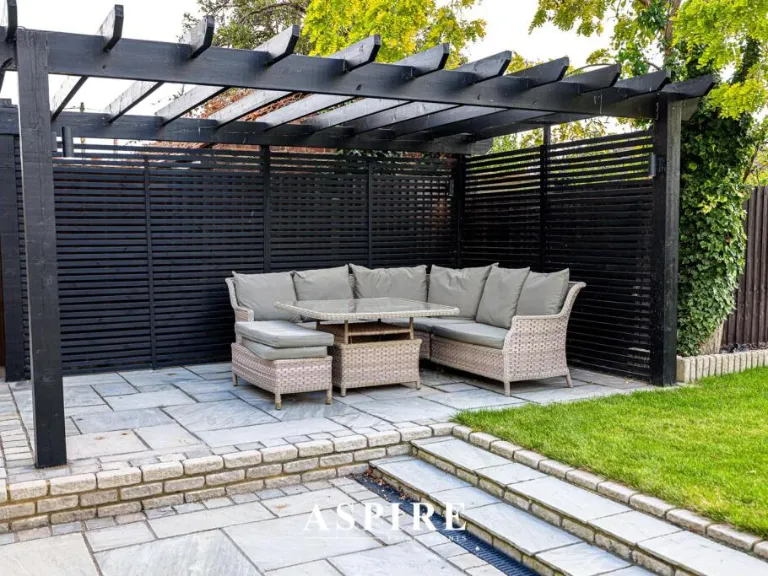
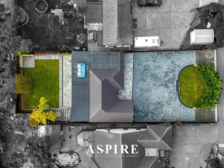
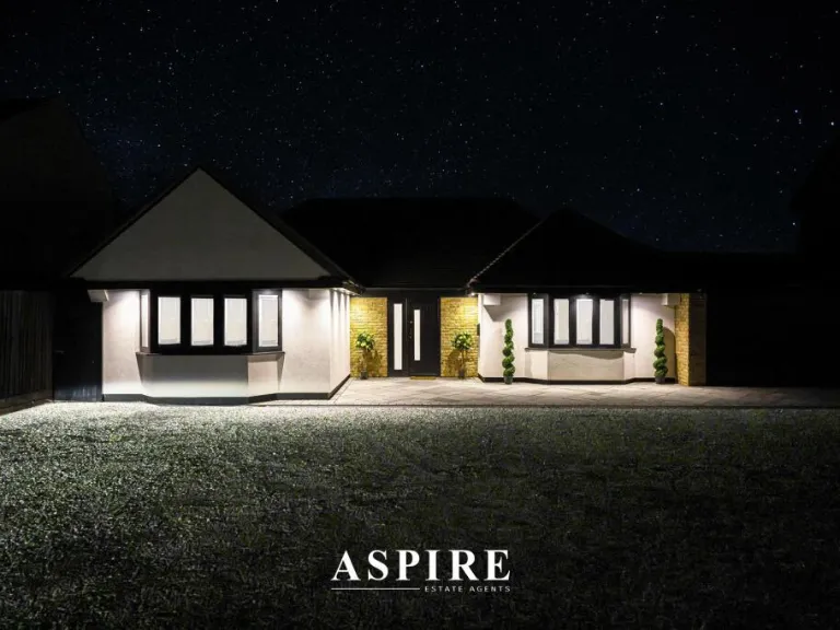
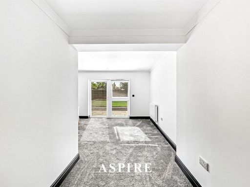
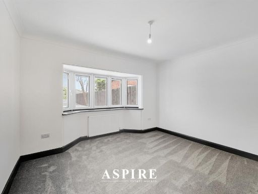
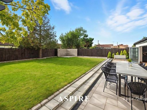
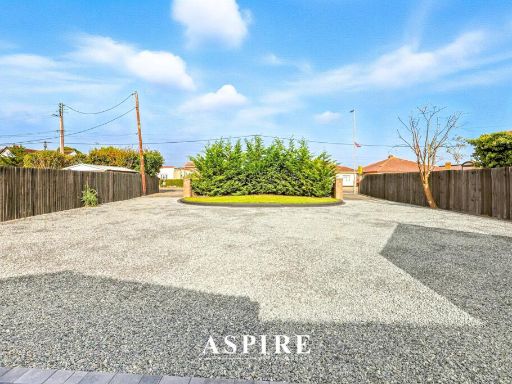
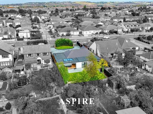
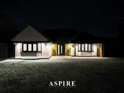
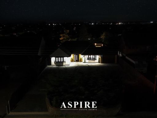
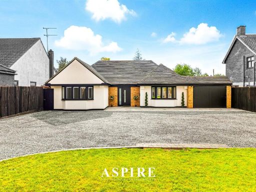
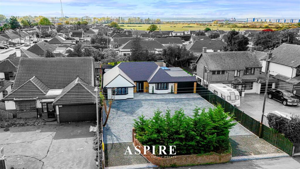
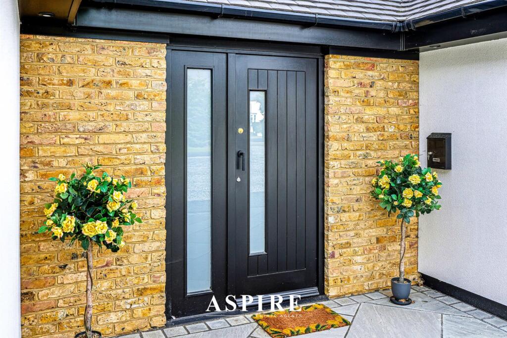
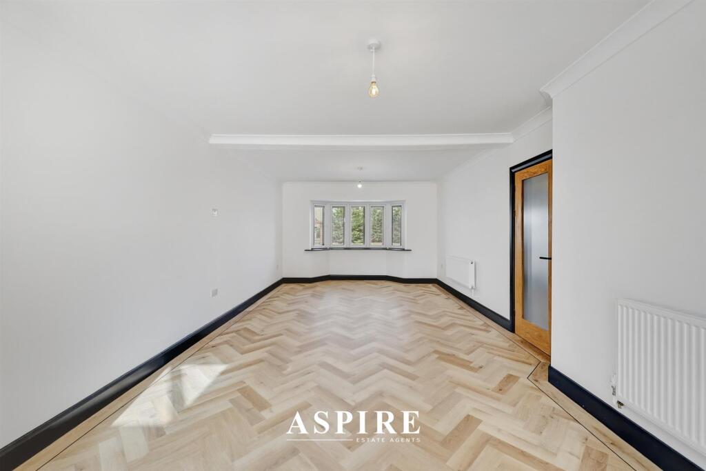
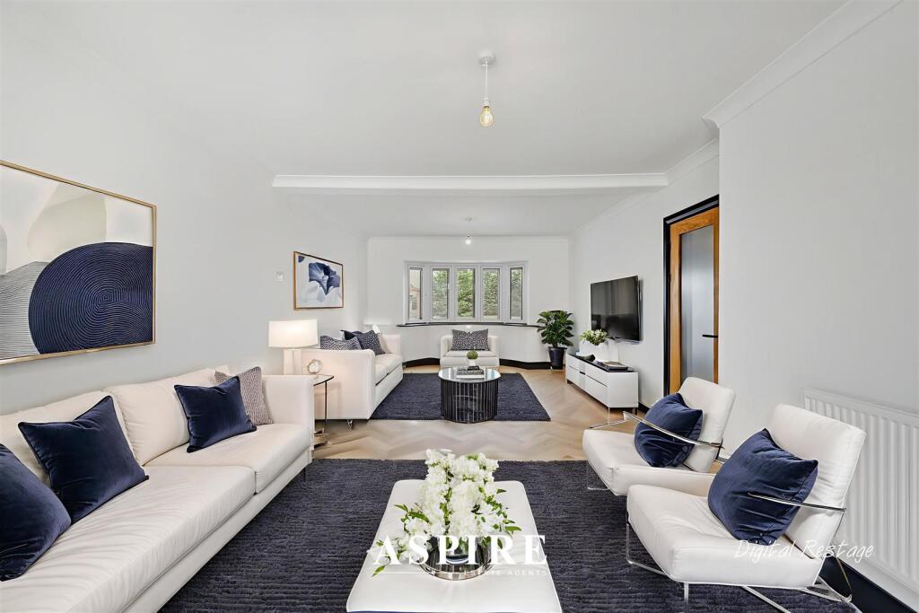
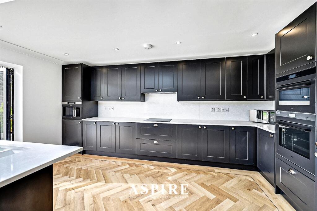
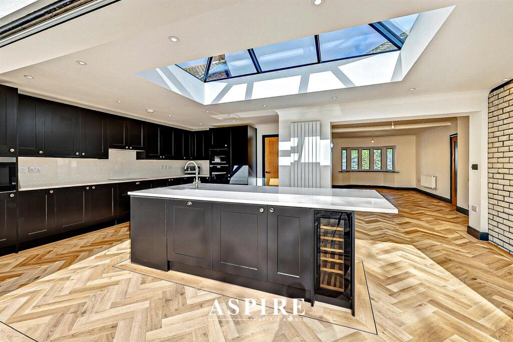
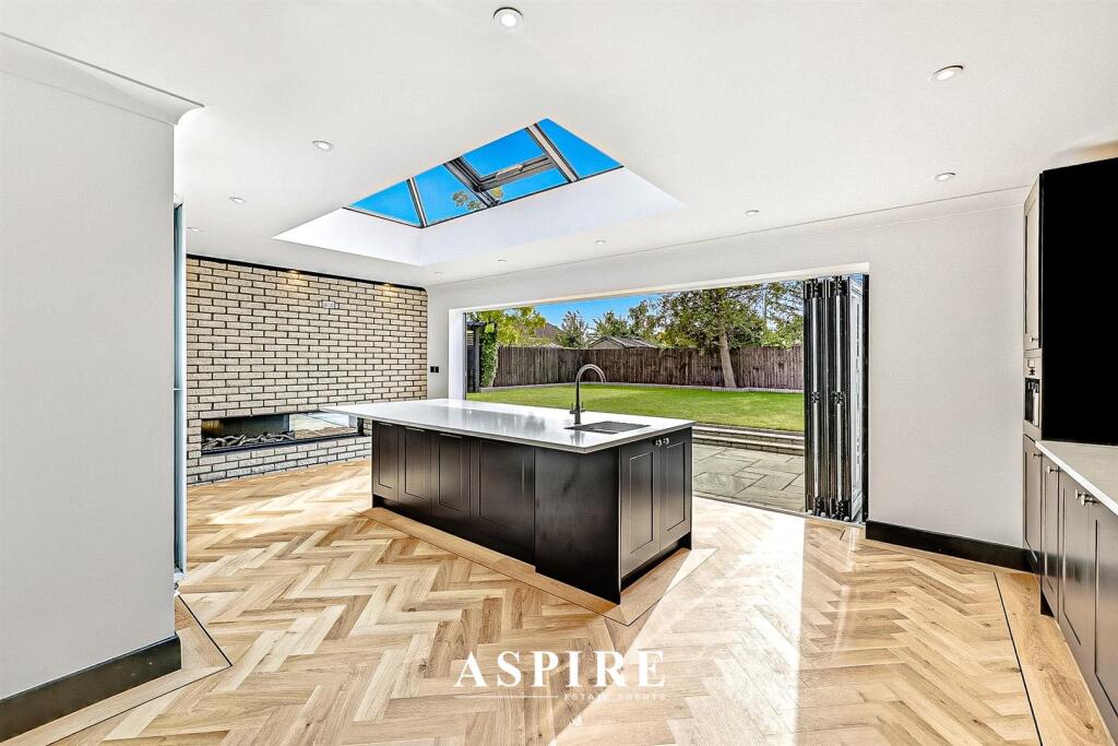
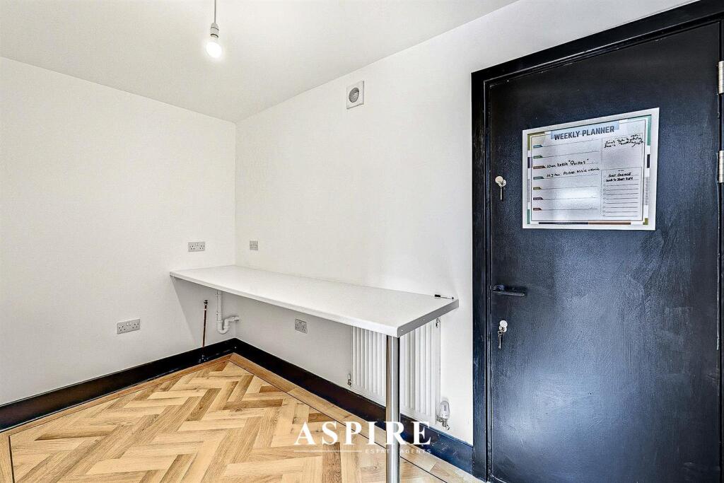
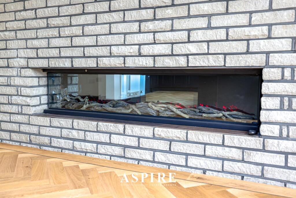
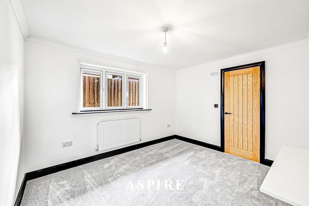
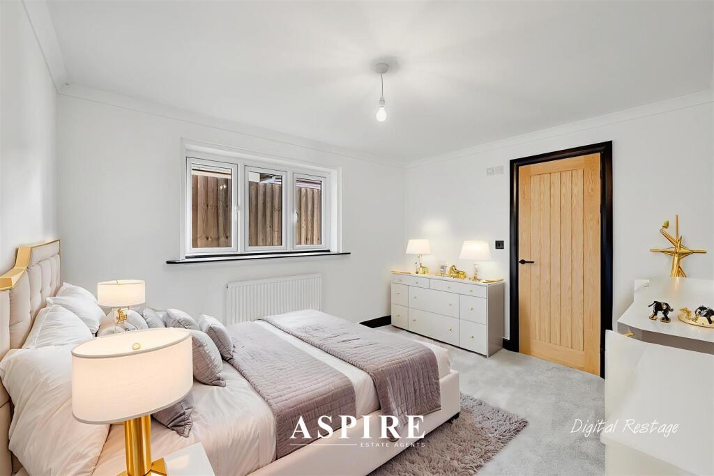
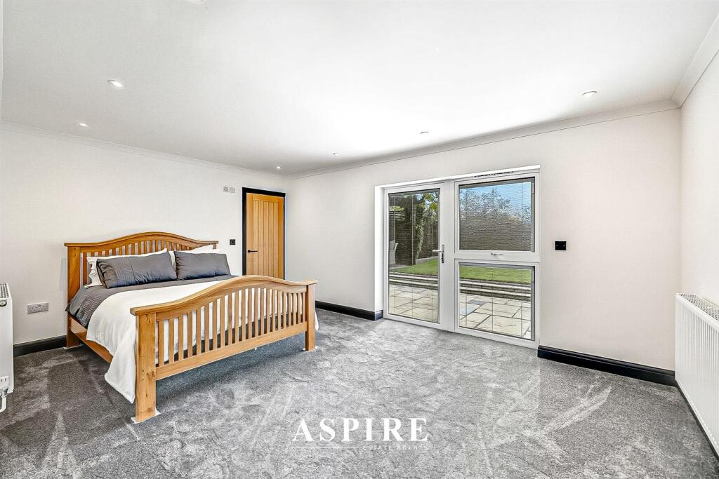
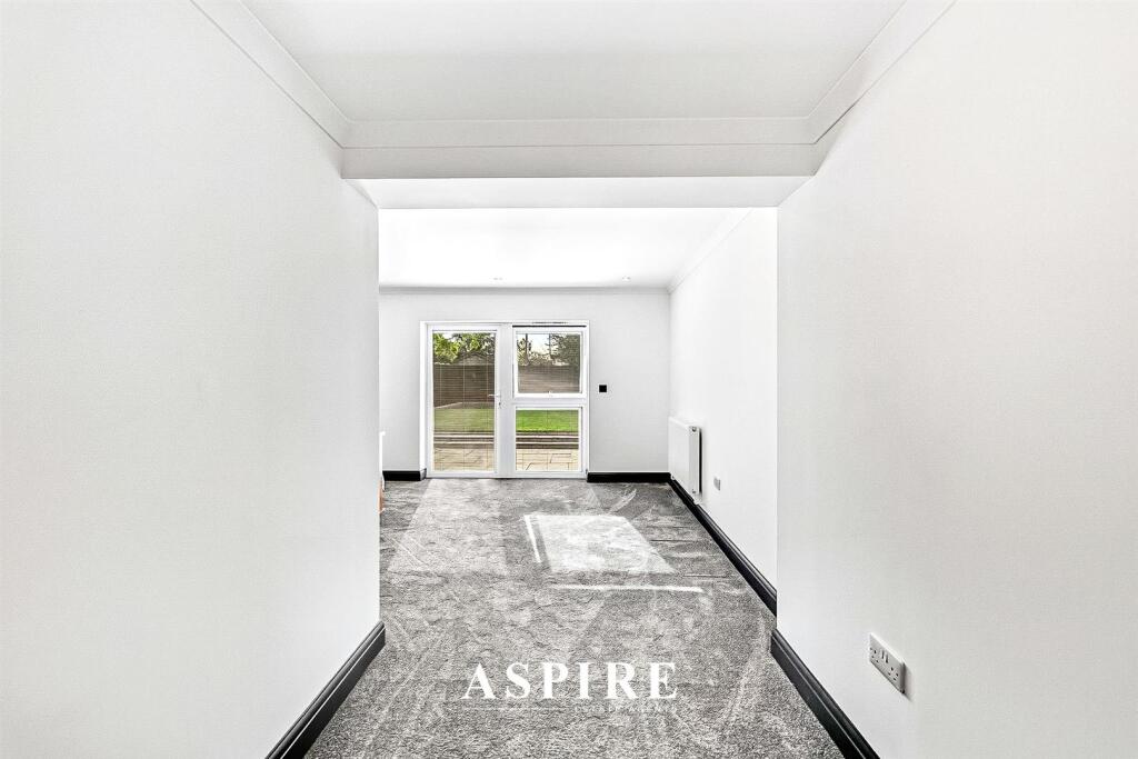
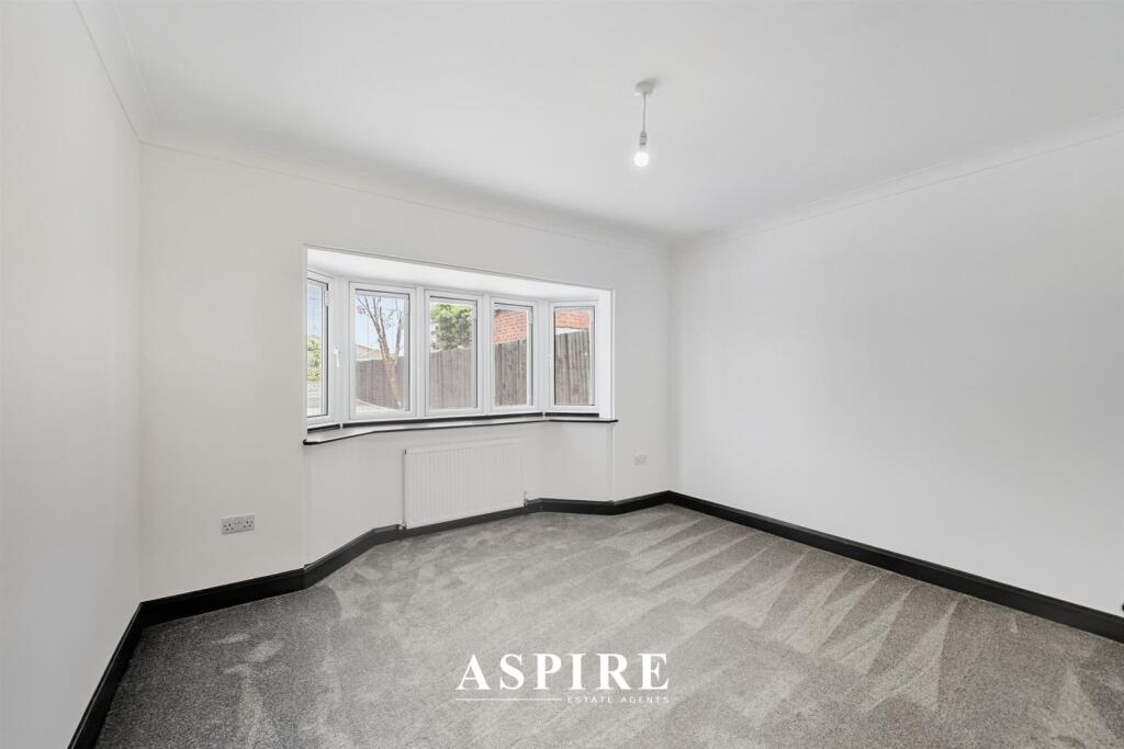
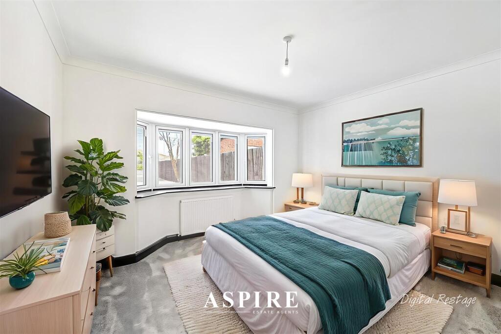
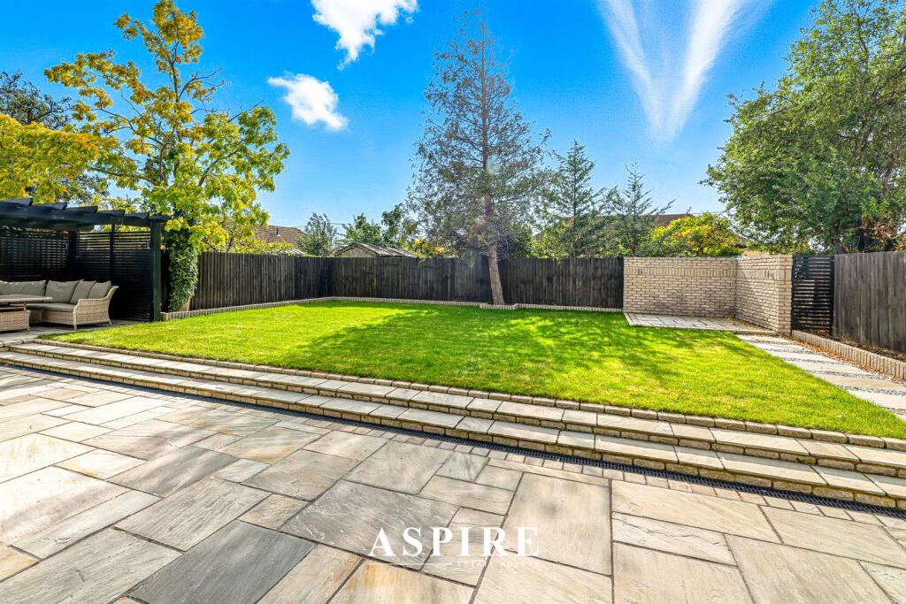
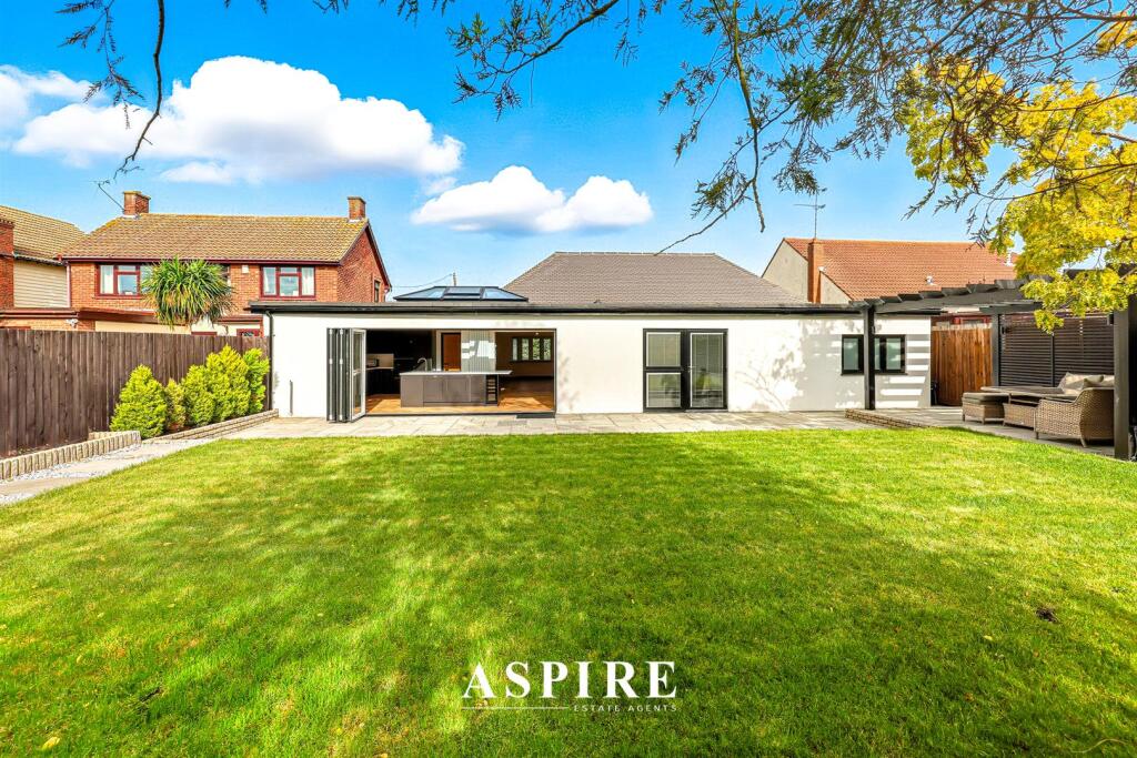
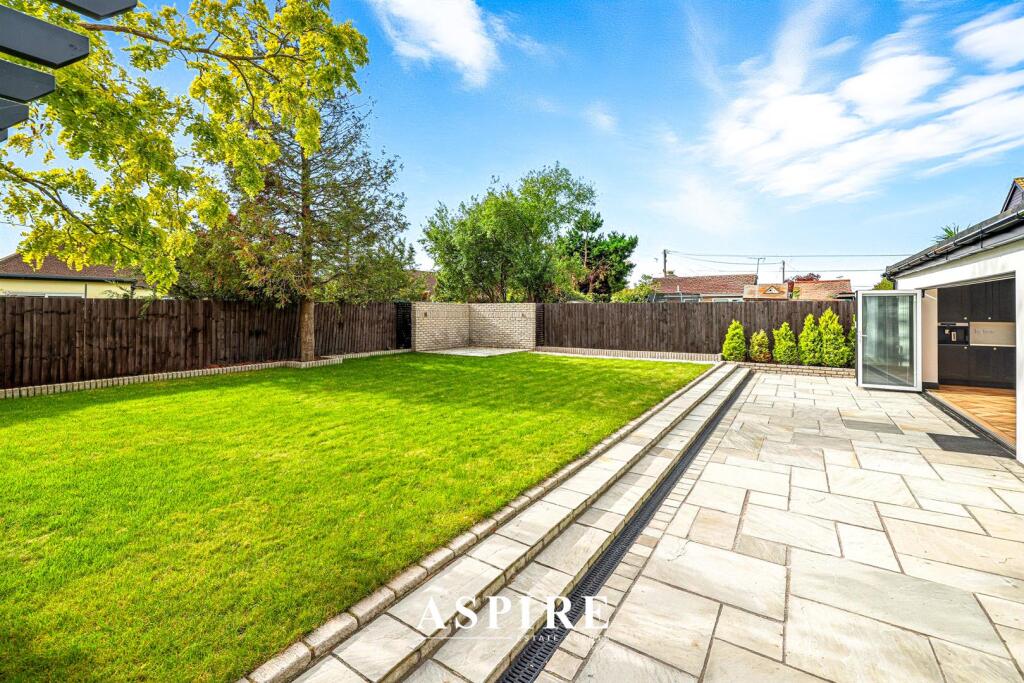
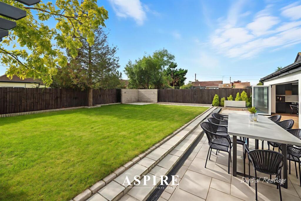
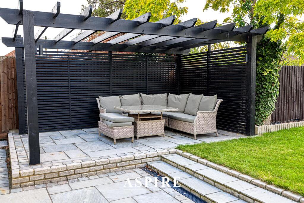
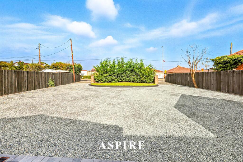
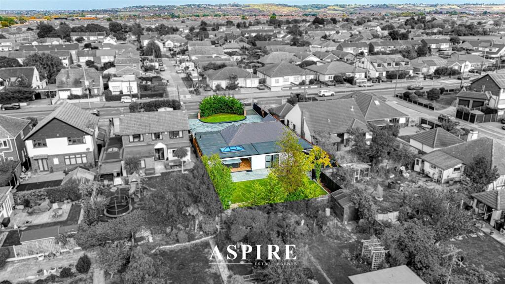
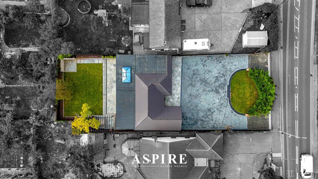
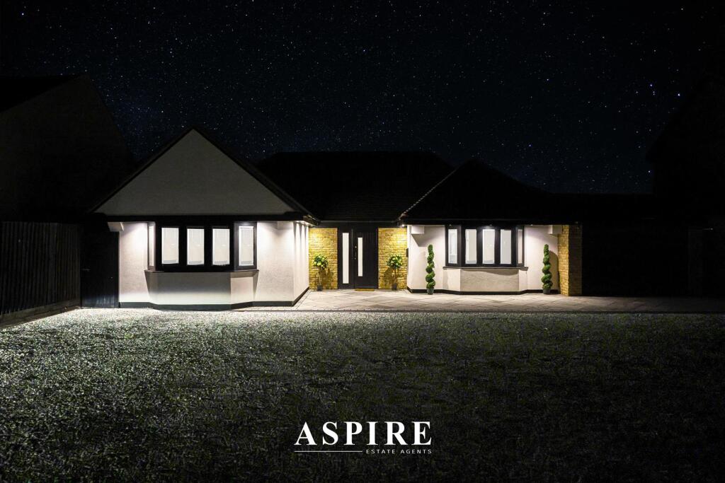
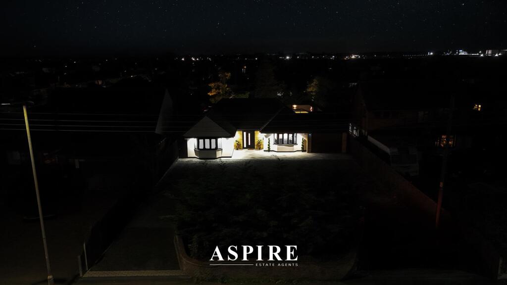
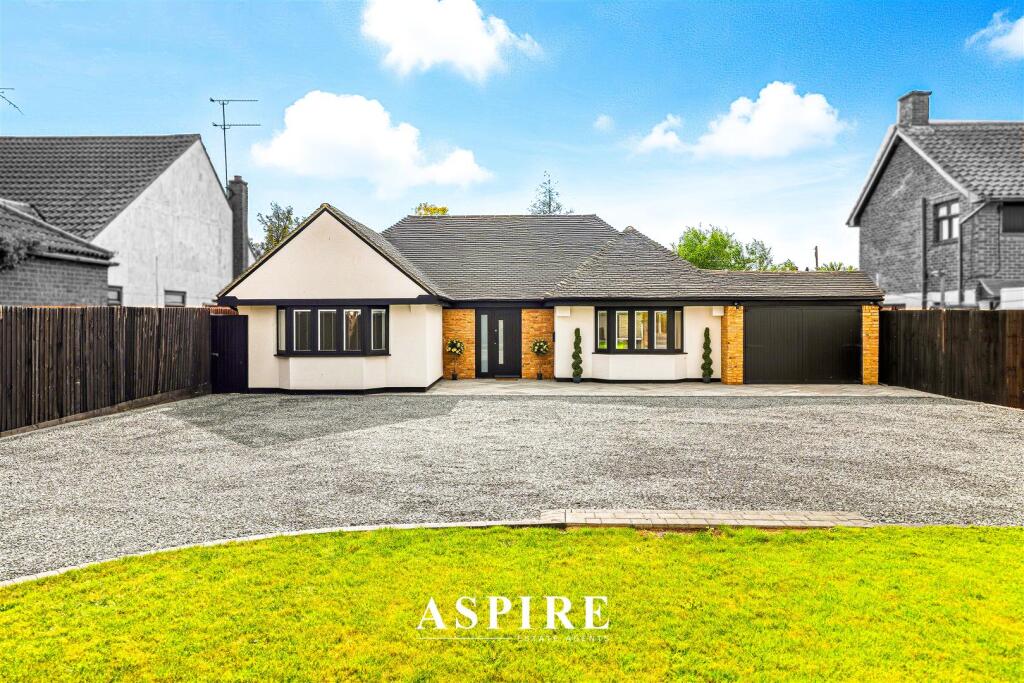
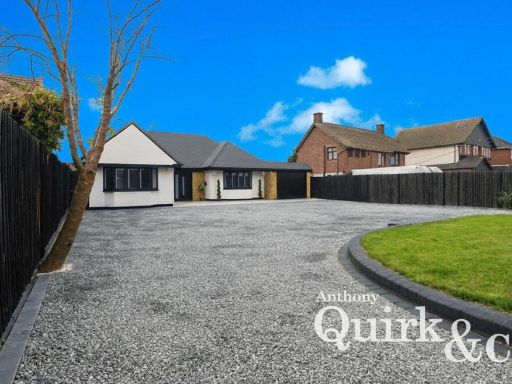
- A detached, single‑storey bungalow located on Long Road, Canvey Island. Shown as a generously proportioned, recently refurbished four‑bedroom bungalow set on a large plot (approaching a quarter of an acre as stated). The property benefits from a wide gravel driveway and extensive off‑street parking, gated/front hedge boundary, a south‑facing rear garden and single‑level, open‑plan living spaces with high‑quality finishes. External appearance indicates a modern entrance and refreshed exterior; internal photos show neutral decoration, new flooring and spacious reception/living areas. Overall the plot is large, the house footprint is substantial for a bungalow and the presentation suggests move‑in condition suitable for family occupation or downsizers seeking one‑level living.
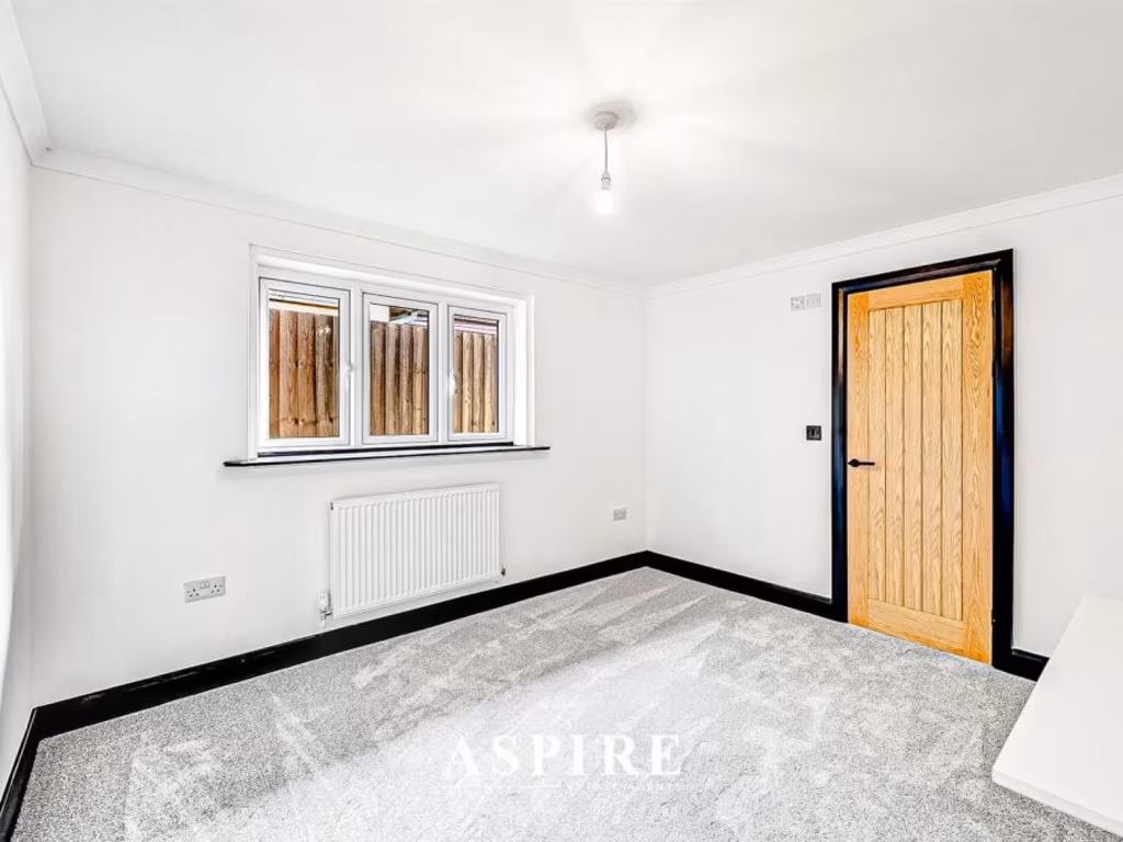
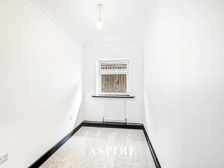
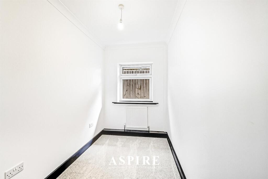
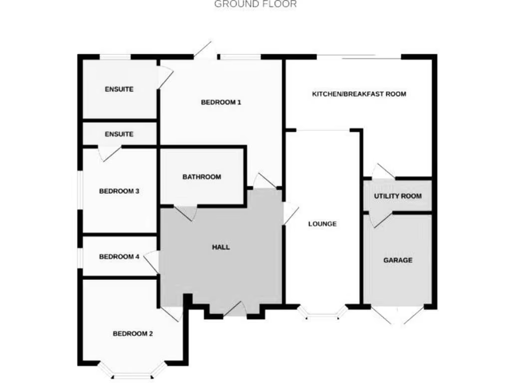
- Single-storey detached house (bungalow-style) indicated by the provided floorplan. Accommodation comprises central entrance hall, lounge, kitchen/breakfast room with adjacent utility room and attached garage. Four bedrooms are shown: Bedroom 1 with ensuite, a second ensuite serving another bedroom, plus a separate family bathroom. The internal layout is compact and efficient with circulation focused around the central hall. Based on the plan proportions the bedrooms and living spaces are small-to-average in size; the lounge and kitchen/breakfast room are of average size for a bungalow. No external views (sea, river, forest, city skyline) are shown on the materials; a local map is included but does not supply a full postal property address. Overall the property appears suitable for family occupation or downsizing purchasers seeking single-level living with garage and en-suite facilities. No furniture or removable items were considered in this description.
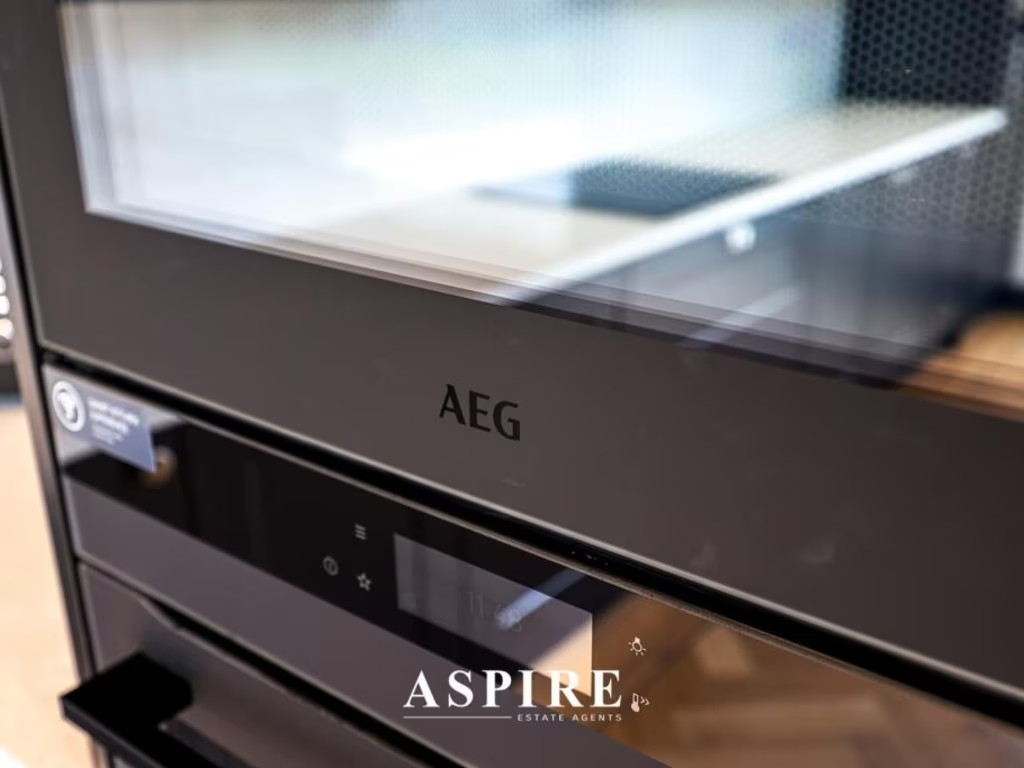
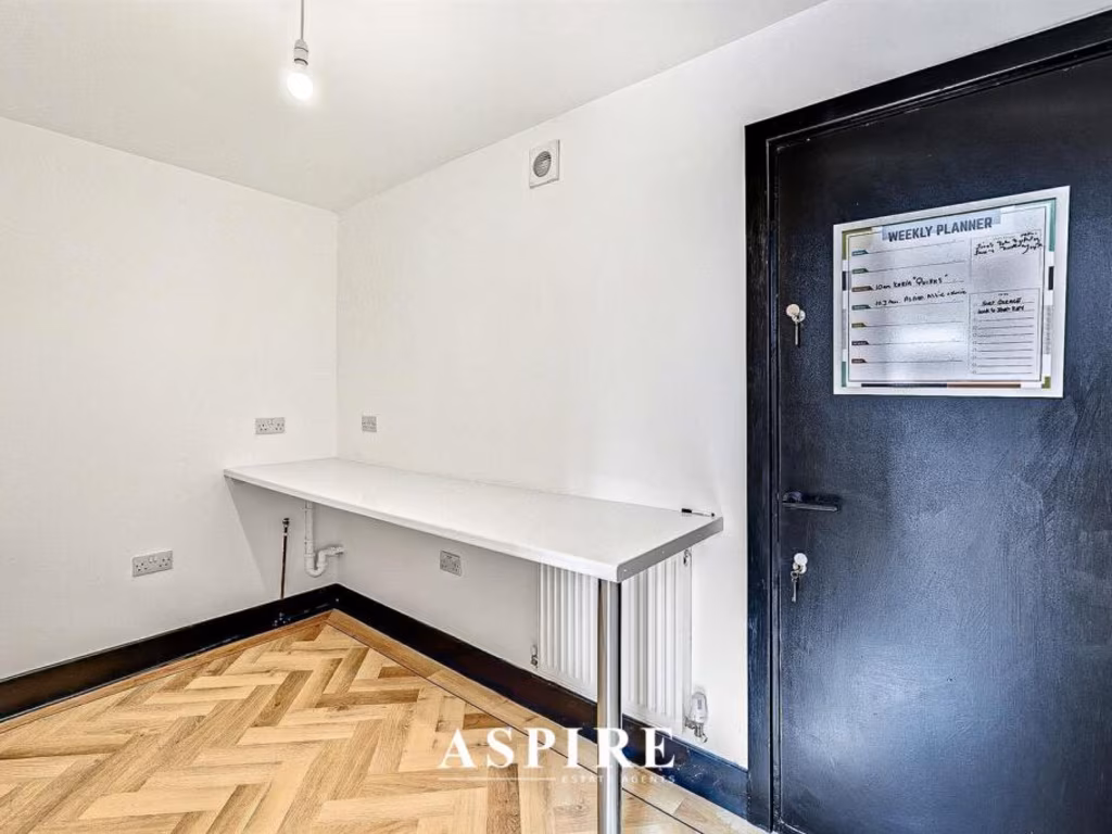
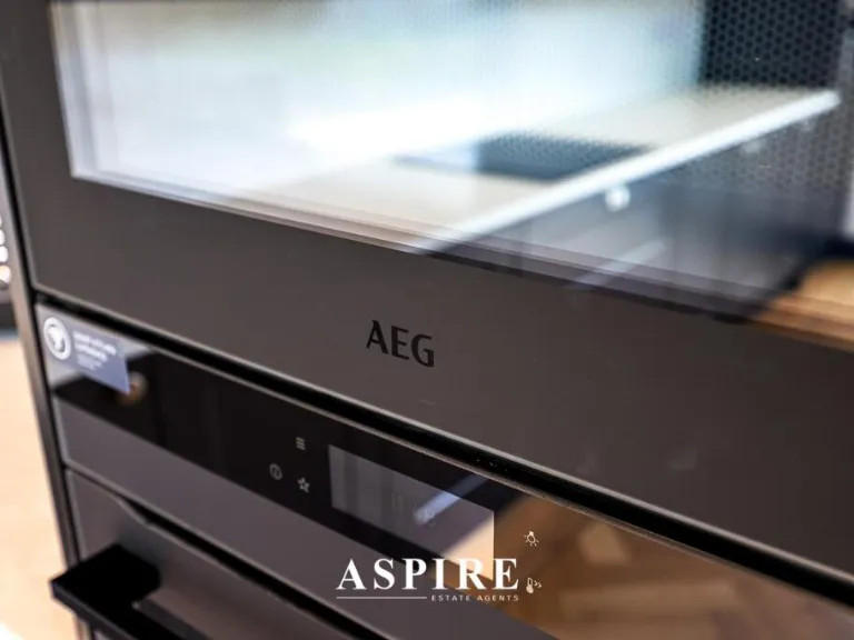
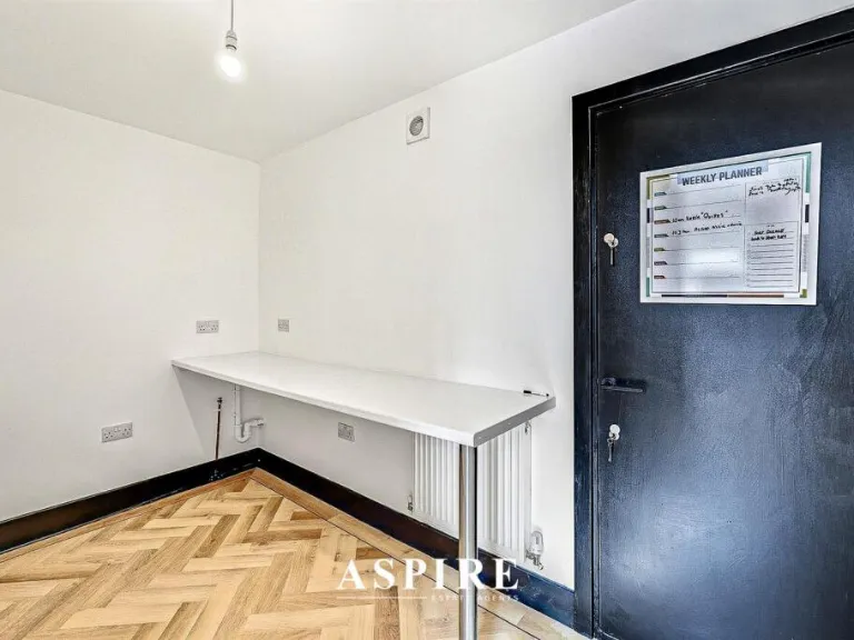
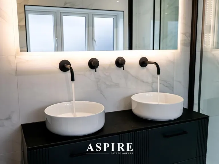
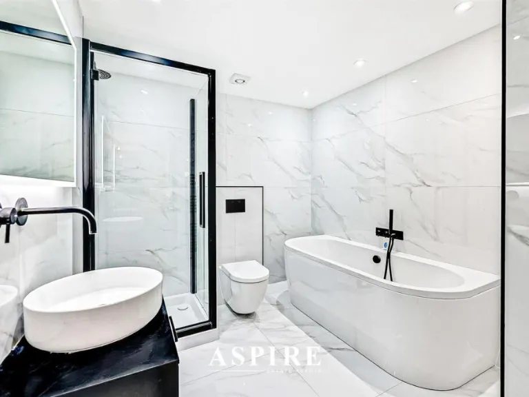
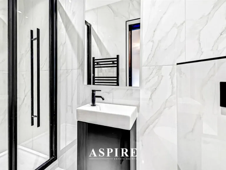
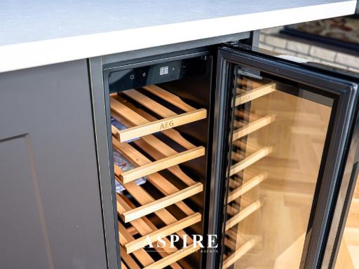
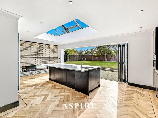
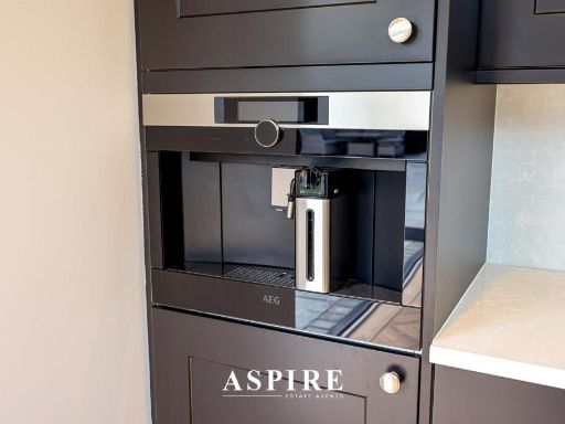
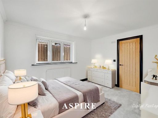
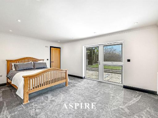
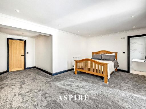
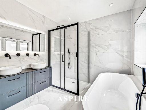
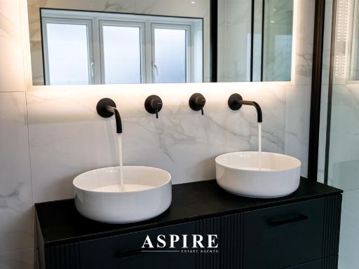
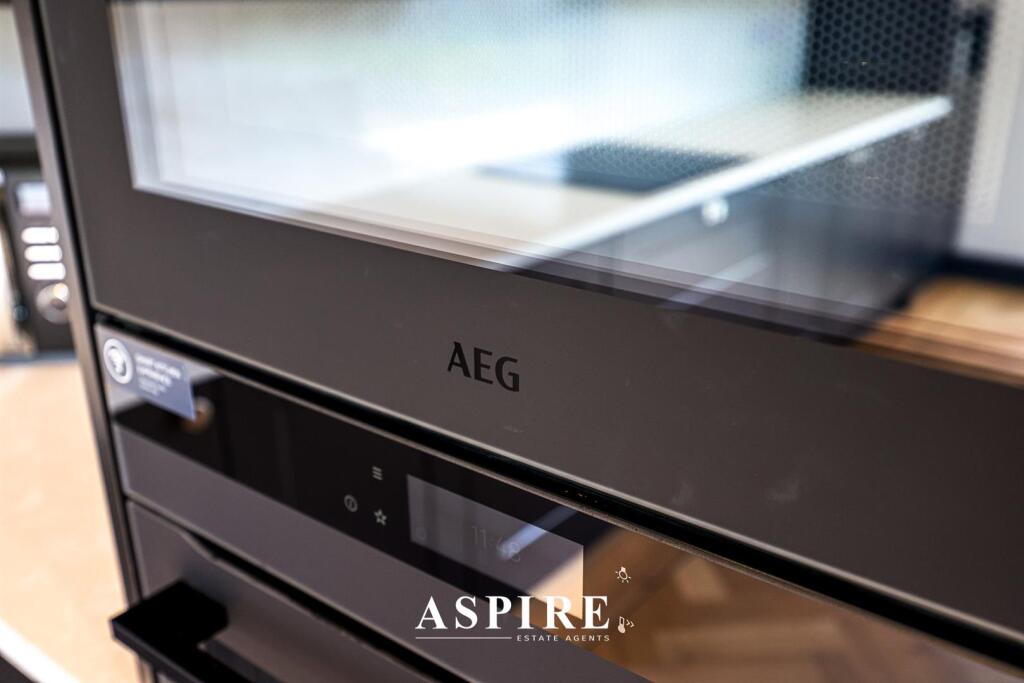
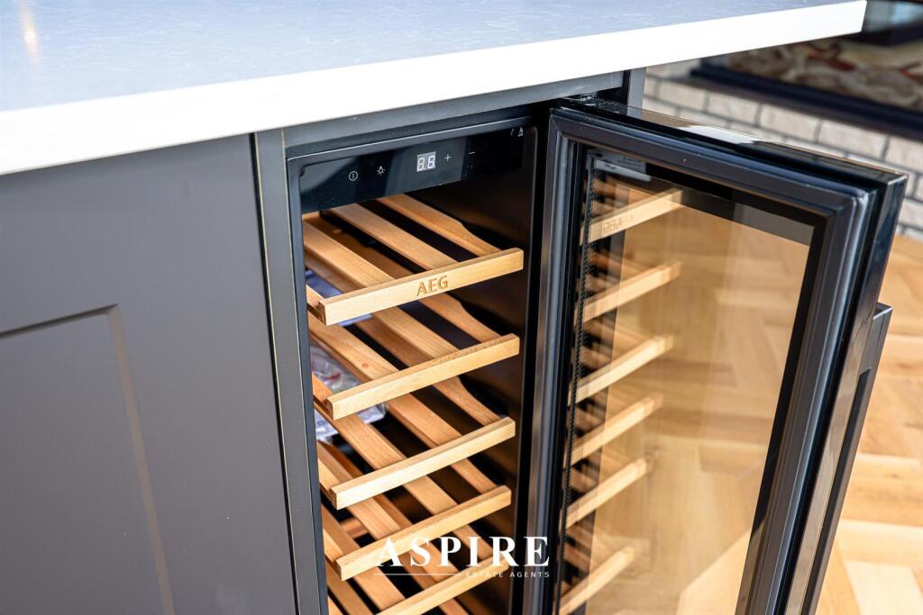
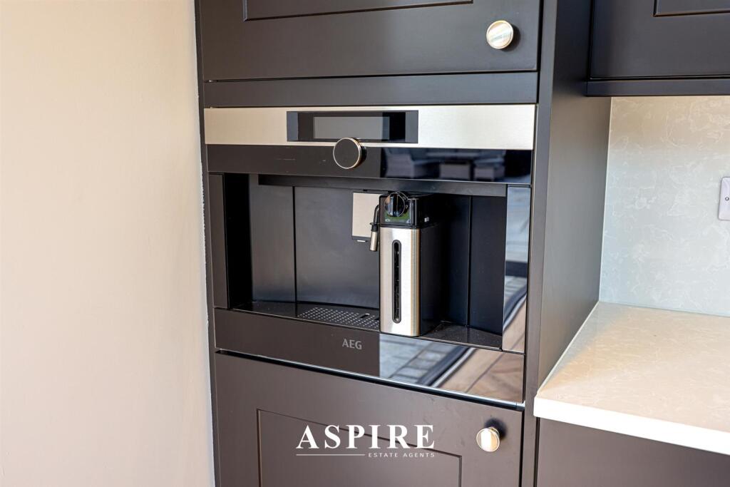
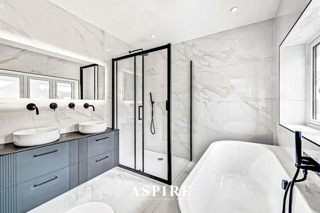
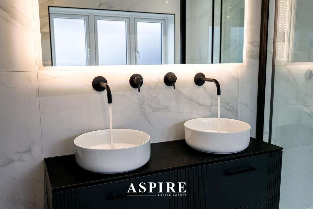
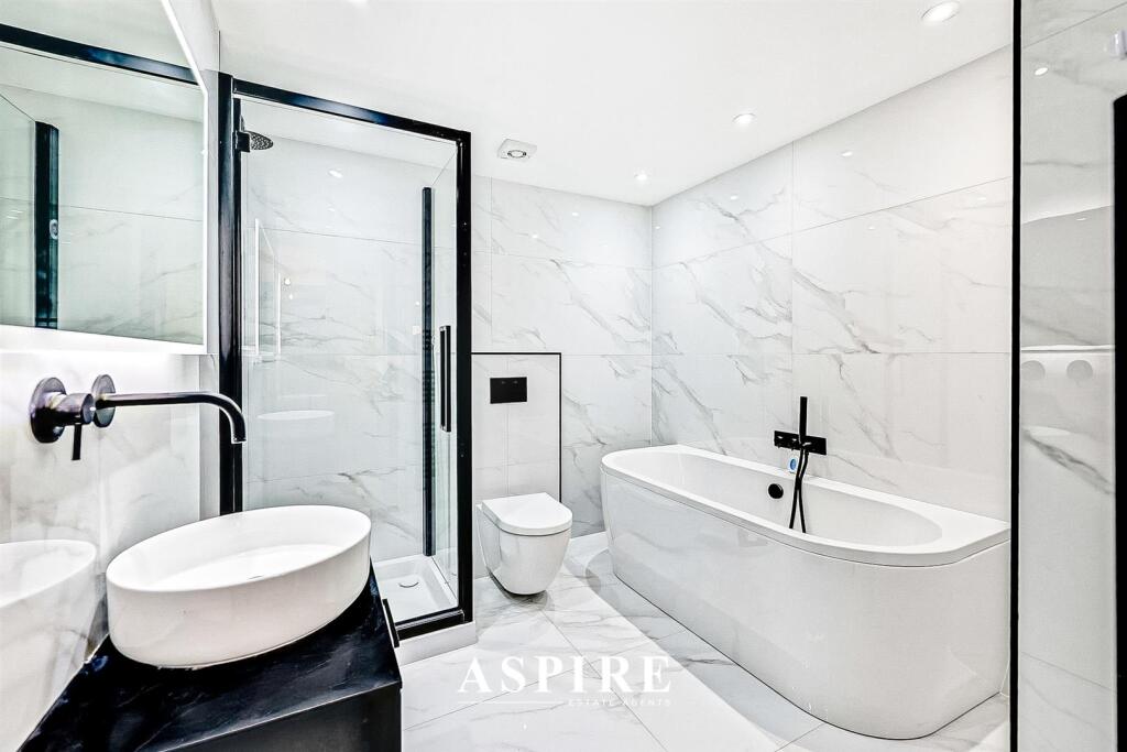
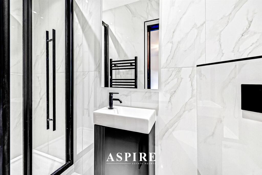
- Detached, single-storey bungalow refurbished to a high standard. The accommodation comprises an impressive open-plan kitchen/dining/family room with a large central island and bi-folding doors to the garden (22'4" x 16'2" / 6.81m x 4.93m), a spacious lounge (11'4" x 22'0" / 3.45m x 6.71m), utility room, and a well-proportioned entrance hall. The property offers four bedrooms including a luxurious master suite with an en suite shower room, a second en suite to bedroom two, plus a family bathroom. Additional practical features include an integral garage, separate utility room, wheelchair-friendly design throughout, and ample off-street parking. Externally there is a beautifully maintained south-facing garden described as expansive. Room dimensions are provided in the listing; based on those and the single-storey layout this presents as a medium–to–large detached bungalow with a large garden and good circulation space suitable for long-term family occupation or adapting for accessibility needs. No residential address for the property itself is visible in the images (the address shown in the footer appears to be an estate agent office).
Image Descriptions
- modern bungalow modern
- front_entryway modern
Rooms
- ENSUITE:
- ENSUITE:
- BEDROOM 3:
- BEDROOM 4:
- BEDROOM 2:
- BEDROOM 1:
- BATHROOM:
- HALL:
- KITCHEN/BREAKFAST ROOM:
- LOUNGE:
- UTILITY ROOM:
- GARAGE:
Textual Property Features
Detected Visual Features
- modern
- bungalow
- detached
- single-story
- paved driveway
- off-street parking
- low-maintenance
- privacy trees
- residential neighborhood
- brick exterior
- modern entryway
- black door
- side windows
- contemporary design
- potential curb appeal
EPC Details
- Fully double glazed
- Solid brick, as built, no insulation (assumed)
- Boiler and radiators, mains gas
- Low energy lighting in all fixed outlets
- Suspended, no insulation (assumed)
Nearby Schools
- Lubbins Park Primary Academy
- Canvey Junior School
- Castle View School
- St Katherine's Church of England Primary School
- The King John School
- William Read Primary Academy
- The Cornelius Vermuyden School
- Hadleigh Junior School
- Westwood Academy
- Kents Hill Junior School
- Kingston Primary School
- Leigh Beck Junior School
- Canvey Island Infant School and Nursery
- South Benfleet Primary School
- Hadleigh Infant and Nursery School
- The Appleton School
- Thundersley Primary School
- The Deanes
- Leigh Beck Infant School and Nursery Academy
- St Joseph's Catholic Primary School
- Northwick Park Primary and Nursery Academy
- Winter Gardens Academy
- Kents Hill Infant Academy
- Jotmans Hall Primary School
- Holy Family Catholic Primary School
- Woodham Ley Primary School
- The Robert Drake Primary School
- Montgomerie Primary School
Nearest General Shops
- Id: 4887749819
- Tags:
- Addr:
- Country: GB
- Housename: Matrix House
- Housenumber: 12-16
- Place: Canvey Island
- Postcode: SS8 9DE
- Street: Lionel Road
- Description: High quality Website Design, Graphic Design and Marketing in Essex
- Email: info@essexwebstudio.co.uk
- Name: Essex Web Studio
- Note: All major credit and debit cards, paypal, bank transfer
- Opening_hours: Mo-Fr 09:00-17:30
- Operator: Gary Sumpter
- Phone: +44 1268 923477
- Shop: web_design
- Website: https://www.essexwebstudio.co.uk/
- TagsNormalized:
- Lat: 51.5216579
- Lon: 0.5918999
- FullGeoHash: u10mj7pp2m0s
- PartitionGeoHash: u10m
- Images:
- FoodStandards: null
- Distance: 1541
,- Id: 120808453
- Tags:
- TagsNormalized:
- Lat: 51.5240725
- Lon: 0.5510115
- FullGeoHash: u10mhe9jrrrb
- PartitionGeoHash: u10m
- Images:
- FoodStandards: null
- Distance: 1396.7
,- Id: 465455656
- Tags:
- Landuse: retail
- Shop: garden_centre
- TagsNormalized:
- Lat: 51.5238324
- Lon: 0.5560348
- FullGeoHash: u10mhesuhd98
- PartitionGeoHash: u10m
- Images:
- FoodStandards: null
- Distance: 1067
}
Nearest Grocery shops
- Id: 8821065669
- Tags:
- Brand: The Food Warehouse
- Brand:wikidata: Q87263899
- Name: The Food Warehouse
- Shop: supermarket
- TagsNormalized:
- food
- the food warehouse
- warehouse
- shop
- Lat: 51.5219653
- Lon: 0.5503645
- FullGeoHash: u10mhe2c0qmw
- PartitionGeoHash: u10m
- Images:
- FoodStandards: null
- Distance: 1375.3
,- Id: 547865497
- Tags:
- Brand: The Co-operative Food
- Brand:wikidata: Q107617274
- Building: yes
- Name: The Co-operative Food
- Shop: supermarket
- TagsNormalized:
- the co-operative food
- food
- shop
- Lat: 51.5198646
- Lon: 0.5804693
- FullGeoHash: u10mj4ysvyv7
- PartitionGeoHash: u10m
- Images:
- FoodStandards: null
- Distance: 733.6
,- Id: 500204329
- Tags:
- Amenity: post_office
- Brand: Nisa Local
- Brand:wikidata: Q16999069
- Brand:wikipedia: en:Nisa (retailer)
- Building: yes
- Name: Nisa Local
- Shop: convenience
- Source: OS OpenMap Local
- TagsNormalized:
- office
- post office
- nisa
- nisa local
- convenience
- shop
- Lat: 51.5197935
- Lon: 0.5797169
- FullGeoHash: u10mj4yhs3s7
- PartitionGeoHash: u10m
- Images:
- FoodStandards: null
- Distance: 681.3
}
Nearest Supermarkets
- Id: 545365966
- Tags:
- Addr:
- Brand: Morrisons
- Brand:wikidata: Q922344
- Brand:wikipedia: en:Morrisons
- Building: supermarket
- Contact:
- Website: https://my.morrisons.com/storefinder/482
- Height: 7
- Name: Morrisons
- Shop: supermarket
- TagsNormalized:
- Lat: 51.5302177
- Lon: 0.5797143
- FullGeoHash: u10mjhy1k2f3
- PartitionGeoHash: u10m
- Images:
- FoodStandards: null
- Distance: 1362.9
,- Id: 56002212
- Tags:
- Addr:
- Postcode: SS8 0PT
- Street: Northwick Road
- Brand: Morrisons
- Brand:wikidata: Q922344
- Brand:wikipedia: en:Morrisons
- Building: yes
- Contact:
- Website: https://my.morrisons.com/storefinder/276
- Height: 9
- Name: Morrisons
- Shop: supermarket
- Source: bing
- Source:name: http://www.geograph.org.uk/photo/1212358
- TagsNormalized:
- Lat: 51.5227675
- Lon: 0.550986
- FullGeoHash: u10mhe3jyguz
- PartitionGeoHash: u10m
- Images:
- FoodStandards: null
- Distance: 1353.6
,- Id: 976497808
- Tags:
- Addr:
- City: Canvey Island
- Postcode: SS8 0PU
- Street: Northwick Road
- Brand: Lidl
- Brand:wikidata: Q151954
- Brand:wikipedia: en:Lidl
- Building: yes
- Name: Lidl
- Opening_hours: Mo-Sa 08:00-22:00; Su 10:00-16:00; PH 08:00-22:00
- Opening_hours:covid19: same
- Shop: supermarket
- Website: https://www.lidl.co.uk/
- TagsNormalized:
- Lat: 51.5228361
- Lon: 0.5555978
- FullGeoHash: u10mhekw62g8
- PartitionGeoHash: u10m
- Images:
- FoodStandards: null
- Distance: 1051.4
}
Nearest Religious buildings
- Id: 149827525
- Tags:
- Amenity: place_of_worship
- Denomination: anglican
- Name: St Nicholas, Canvey Island
- Religion: christian
- Wikidata: Q105083472
- TagsNormalized:
- place of worship
- anglican
- christian
- church
- Lat: 51.5203288
- Lon: 0.577232
- FullGeoHash: u10mj4urdmrk
- PartitionGeoHash: u10m
- Images:
- FoodStandards: null
- Distance: 515.4
,- Id: 701830192
- Tags:
- Amenity: place_of_worship
- Source: OS OpenData StreetView
- TagsNormalized:
- Lat: 51.5205232
- Lon: 0.5630581
- FullGeoHash: u10mhg40b1we
- PartitionGeoHash: u10m
- Images:
- FoodStandards: null
- Distance: 482.7
,- Id: 543726099
- Tags:
- Amenity: place_of_worship
- Building: yes
- Name: Our Lady Of Canvey & The English Martyrs R C Church
- TagsNormalized:
- Lat: 51.5202888
- Lon: 0.5751529
- FullGeoHash: u10mj4fz6jcj
- PartitionGeoHash: u10m
- Images:
- FoodStandards: null
- Distance: 373.1
}
Nearest Medical buildings
- Id: 10693578046
- Tags:
- Amenity: pharmacy
- Name: Daynite Pharmacy
- Survey:
- TagsNormalized:
- Lat: 51.5531034
- Lon: 0.6106639
- FullGeoHash: u10mmbuwte00
- PartitionGeoHash: u10m
- Images:
- FoodStandards: null
- Distance: 4673.1
,- Id: 6138063204
- Tags:
- Addr:
- City: Canvey Island
- Housename: Toothcare Limited
- Housenumber: 90A
- Postcode: SS8 7SQ
- Street: High Street
- Amenity: dentist
- Description: Established in 1987 Toothcare Limited's dental surgery is a family based single dentist practice with support from receptionists and dental nurses.
- Email: info@toothcare.ltd.uk
- Healthcare: dentist
- Level: 0
- Name: Toothcare Limited
- Payment:
- Phone: +44 1268 683739
- Website: https://www.toothcare.ltd.uk
- TagsNormalized:
- Lat: 51.522644
- Lon: 0.5975711
- FullGeoHash: u10mje7jhkvr
- PartitionGeoHash: u10m
- Images:
- FoodStandards: null
- Distance: 1945.9
,- Id: 543722260
- Tags:
- Amenity: doctors
- Building: yes
- Healthcare: doctor
- Name: Canvey Island Doctors Surgery
- TagsNormalized:
- doctor
- doctors
- health
- healthcare
- surgery
- Lat: 51.5194243
- Lon: 0.5917464
- FullGeoHash: u10mj6yfksy0
- PartitionGeoHash: u10m
- Images:
- FoodStandards: null
- Distance: 1513.4
,- Id: 547865498
- Tags:
- Amenity: pharmacy
- Brand: Boots
- Brand:wikidata: Q6123139
- Brand:wikipedia: en:Boots (company)
- Building: yes
- Dispensing: yes
- Drive_through: no
- Healthcare: pharmacy
- Name: Boots
- TagsNormalized:
- pharmacy
- boots
- health
- healthcare
- Lat: 51.5198958
- Lon: 0.5806012
- FullGeoHash: u10mj4yv0uxt
- PartitionGeoHash: u10m
- Images:
- FoodStandards: null
- Distance: 742.9
}
Nearest Airports
- Id: 103894219
- Tags:
- Aerodrome: international
- Aeroway: aerodrome
- Iata: SEN
- Icao: EGMC
- Name: London Southend Airport
- Old_name: Southend Municipal Airport
- Ref: SEN
- Wikidata: Q1415441
- TagsNormalized:
- airport
- international airport
- Lat: 51.5701749
- Lon: 0.6924624
- FullGeoHash: u10mru04p937
- PartitionGeoHash: u10m
- Images:
- FoodStandards: null
- Distance: 10172.9
,- Id: 121158889
- Tags:
- Aerodrome: continental
- Aeroway: aerodrome
- Fhrs:
- Authority: City of London Corporation
- Iata: LCY
- Icao: EGLC
- Name: London City Airport
- Operator: London City Airport Limited
- Ref: LCY
- Website: https://www.londoncityairport.com/
- Wikidata: Q8982
- Wikipedia: en:London City Airport
- TagsNormalized:
- airport
- continental airport
- Lat: 51.5042658
- Lon: 0.0539987
- FullGeoHash: u10j10p64702
- PartitionGeoHash: u10j
- Images:
- FoodStandards: null
- Distance: 35740.5
}
Nearest Leisure Facilities
- Id: 543717792
- Tags:
- Leisure: park
- Name: Canvey Dyke
- Name_1: Canvey Lake
- Wikidata: Q28446523
- TagsNormalized:
- Lat: 51.5247608
- Lon: 0.580095
- FullGeoHash: u10mj5y3mpw4
- PartitionGeoHash: u10m
- Images:
- FoodStandards: null
- Distance: 910.7
,- Id: 149495269
- Tags:
- Addr:
- City: Canvey Island
- Country: GB
- Postcode: SS8 0HH
- Street: Thames Road
- Leisure: stadium
- Name: Concord Rangers Football Club
- Sport: soccer
- Wikidata: Q5158850
- TagsNormalized:
- stadium
- leisure
- football
- club
- soccer
- sports
- Lat: 51.5125601
- Lon: 0.5754428
- FullGeoHash: u10mj1e42v1q
- PartitionGeoHash: u10m
- Images:
- FoodStandards: null
- Distance: 872.4
,- Id: 55893228
- Tags:
- Leisure: park
- Source: OS OpenData StreetView
- TagsNormalized:
- Lat: 51.5173587
- Lon: 0.5594961
- FullGeoHash: u10mhdrqm5ww
- PartitionGeoHash: u10m
- Images:
- FoodStandards: null
- Distance: 760.2
,- Id: 676282887
- Tags:
- Leisure: pitch
- Name: Gunney
- Sport: skateboard
- TagsNormalized:
- pitch
- leisure
- skateboard
- sports
- Lat: 51.5239485
- Lon: 0.5762759
- FullGeoHash: u10mj5esu0nk
- PartitionGeoHash: u10m
- Images:
- FoodStandards: null
- Distance: 655.7
,- Id: 543723528
- Tags:
- Leisure: park
- Name: New Road Fields
- TagsNormalized:
- Lat: 51.5207391
- Lon: 0.5681095
- FullGeoHash: u10mhgjdjcv5
- PartitionGeoHash: u10m
- Images:
- FoodStandards: null
- Distance: 176
}
Nearest Tourist attractions
- Id: 700428265
- Tags:
- Name: Dutch Cottage Museum
- Source: OS OpenData StreetView
- Source:name: http://www.geograph.org.uk/photo/246513
- Tourism: museum
- Wikidata: Q26416751
- TagsNormalized:
- Lat: 51.5250837
- Lon: 0.5565805
- FullGeoHash: u10mhev737b8
- PartitionGeoHash: u10m
- Images:
- FoodStandards: null
- Distance: 1103.6
,- Id: 351187289
- Tags:
- Name: Thorney Bay Camp
- Source: OS OpenData StreetView
- Tourism: camp_site
- Website: http://www.thorneybay.co.uk
- TagsNormalized:
- Lat: 51.5119962
- Lon: 0.5796895
- FullGeoHash: u10mj1qp5spf
- PartitionGeoHash: u10m
- Images:
- FoodStandards: null
- Distance: 1084.4
,- Id: 700428300
- Tags:
- Museum: history
- Name: Canvey Island Heritage Centre Museum
- Source: OS OpenData StreetView
- Tourism: museum
- Website: https://www.canveyisland.org/category/places-3/museums/heritage-centre-museum
- TagsNormalized:
- Lat: 51.5207979
- Lon: 0.5627604
- FullGeoHash: u10mhg1f3kbd
- PartitionGeoHash: u10m
- Images:
- FoodStandards: null
- Distance: 510
}
Nearest Train stations
- Id: 7140234412
- Tags:
- Name: Westcliff
- Naptan:
- Network: National Rail
- Public_transport: station
- Railway: station
- Ref:
- Wikidata: Q2319277
- Wikipedia: en:Westcliff railway station
- TagsNormalized:
- Lat: 51.5374449
- Lon: 0.6915156
- FullGeoHash: u10mpwpe3kp3
- PartitionGeoHash: u10m
- Images:
- FoodStandards: null
- Distance: 8645.5
,- Id: 56151624
- Tags:
- Name: Rayleigh
- Naptan:
- Network: National Rail
- Public_transport: station
- Railway: station
- Ref:
- Source: NPE
- Wheelchair: yes
- Wheelchair:description: Book in advance. Access to train via ramp. Use entrance from Station Road for trains to London and booking hall. Use entrance from The Approach for trains to Southend.
- Wikidata: Q2290604
- Wikipedia: en:Rayleigh railway station
- TagsNormalized:
- Lat: 51.5894866
- Lon: 0.6002479
- FullGeoHash: u10mmxt4dc36
- PartitionGeoHash: u10m
- Images:
- FoodStandards: null
- Distance: 8049.8
,- Id: 6733461094
- Tags:
- Name: Chalkwell
- Naptan:
- Network: National Rail
- Public_transport: station
- Railway: station
- Ref:
- Source: NPE
- Wikidata: Q744484
- Wikipedia: en:Chalkwell railway station
- TagsNormalized:
- Lat: 51.5386117
- Lon: 0.6698419
- FullGeoHash: u10mpnrf0mw6
- PartitionGeoHash: u10m
- Images:
- FoodStandards: null
- Distance: 7231.2
,- Id: 6733461096
- Tags:
- Name: Pitsea
- Naptan:
- Network: National Rail
- Operator: c2c
- Platforms: 4
- Public_transport: station
- Railway: station
- Ref:
- Source: NPE
- Wikidata: Q2982936
- Wikipedia: en:Pitsea railway station
- TagsNormalized:
- Lat: 51.5602396
- Lon: 0.5079761
- FullGeoHash: u10m7d3bhtq3
- PartitionGeoHash: u10m
- Images:
- FoodStandards: null
- Distance: 6224.8
,- Id: 6733461087
- Tags:
- Name: Benfleet
- Name:lt: Benflitas
- Naptan:
- Network: National Rail
- Public_transport: station
- Railway: station
- Ref:
- Source: NPE
- Wikidata: Q2561112
- Wikipedia: en:Benfleet railway station
- TagsNormalized:
- Lat: 51.5441005
- Lon: 0.5616239
- FullGeoHash: u10mhz2fnuc0
- PartitionGeoHash: u10m
- Images:
- FoodStandards: null
- Distance: 2783.5
}
Nearest Hotels
- Id: 9103089222
- Tags:
- Addr:
- Country: GB
- Housenumber: 33
- Postcode: SS6 7JD
- Street: Eastwood Road
- Amenity: pub
- Fhrs:
- Name: Crafty Casks
- Survey:
- Tourism: hotel
- TagsNormalized:
- Lat: 51.5850262
- Lon: 0.6060175
- FullGeoHash: u10mmyc291z7
- PartitionGeoHash: u10m
- Images:
- FoodStandards: null
- Distance: 7692.3
,- Id: 135551062
- Tags:
- Addr:
- Postcode: SS6 7SP
- Street: Arterial Road
- Brand: Premier Inn
- Brand:wikidata: Q2108626
- Brand:wikipedia: en:Premier Inn
- Building: yes
- Contact:
- Fax: +44 871 527 8059
- Phone: +44 871 527 8058
- Website: http://www.premierinn.com/en/hotel/BASCOL/basildon-rayleigh
- Fhrs:
- Internet_access: yes
- Internet_access:fee: customers
- Internet_access:operator: Virgin Media
- Internet_access:ssid: Premier Inn Free Wi-Fi
- Name: Premier Inn
- Operator: Premier Inn
- Smoking: no
- Source:
- Tourism: hotel
- Wheelchair: yes
- TagsNormalized:
- Lat: 51.5772666
- Lon: 0.6005668
- FullGeoHash: u10mmtm765r5
- PartitionGeoHash: u10m
- Images:
- FoodStandards: null
- Distance: 6754.4
,- Id: 702967806
- Tags:
- Amenity: pub
- Fixme: check location
- Name: The Oysterfleet
- Source: http://www.geograph.org.uk/photo/1207207
- Tourism: hotel
- TagsNormalized:
- Lat: 51.5239306
- Lon: 0.5920254
- FullGeoHash: u10mj7xhehy1
- PartitionGeoHash: u10m
- Images:
- FoodStandards: null
- Distance: 1606.4
}
Tags
- modern
- bungalow
- detached
- single-story
- paved driveway
- off-street parking
- low-maintenance
- privacy trees
- residential neighborhood
- brick exterior
- modern entryway
- black door
- side windows
- contemporary design
- potential curb appeal
Local Market Stats
- Average Price/sqft: £362
- Avg Income: £38800
- Rental Yield: 5.1%
- Social Housing: 4%
- Planning Success Rate: 72%
Similar Properties
 4 bedroom detached bungalow for sale in Long Road, Canvey Island, SS8 — £700,000 • 4 bed • 3 bath
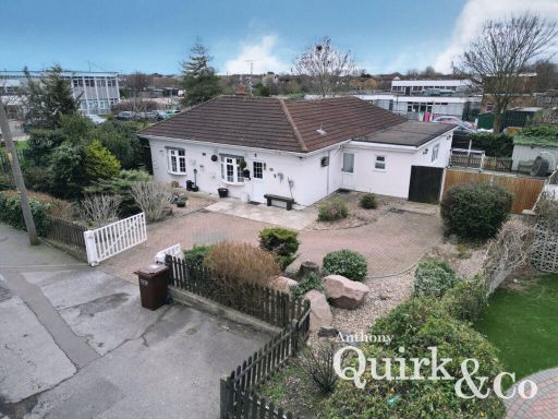 4 bedroom detached bungalow for sale in Long Road, Canvey Island, SS8 — £425,000 • 4 bed • 2 bath • 1178 ft²
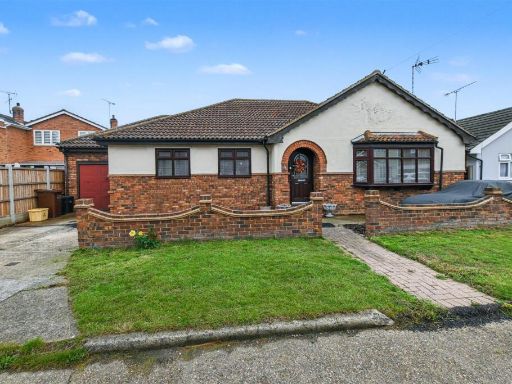 4 bedroom detached bungalow for sale in Clarendon Road, Canvey Island, SS8 — £450,000 • 4 bed • 2 bath • 1084 ft²
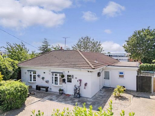 4 bedroom detached bungalow for sale in Must Be Seen Long Road, Canvey Island, SS8 — £425,000 • 4 bed • 2 bath • 1255 ft²
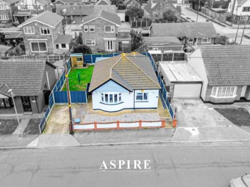 2 bedroom detached bungalow for sale in Maurice Road, Canvey Island, SS8 — £350,000 • 2 bed • 1 bath • 926 ft²
 3 bedroom semi-detached bungalow for sale in Batavia Road, Canvey Island, SS8 — £425,000 • 3 bed • 1 bath • 991 ft²
Meta
- {
"@context": "https://schema.org",
"@type": "Residence",
"name": "4 bedroom bungalow for sale in Long Road, Canvey Island, SS8",
"description": "",
"url": "https://propertypiper.co.uk/property/c9f82f06-13ac-4368-a9c3-0ddb29eebea8",
"image": "https://image-a.propertypiper.co.uk/c8d024f1-7138-4f63-b3ae-6aa3873acffd-1024.jpeg",
"address": {
"@type": "PostalAddress",
"streetAddress": "Long Road, Canvey Island",
"postalCode": "SS8 0JQ",
"addressLocality": "Castle Point",
"addressRegion": "Castle Point",
"addressCountry": "England"
},
"geo": {
"@type": "GeoCoordinates",
"latitude": 51.51959937322994,
"longitude": 0.569875338473957
},
"numberOfRooms": 4,
"numberOfBathroomsTotal": 3,
"floorSize": {
"@type": "QuantitativeValue",
"value": 1642,
"unitCode": "FTK"
},
"offers": {
"@type": "Offer",
"price": 700000,
"priceCurrency": "GBP",
"availability": "https://schema.org/InStock"
},
"additionalProperty": [
{
"@type": "PropertyValue",
"name": "Feature",
"value": "modern"
},
{
"@type": "PropertyValue",
"name": "Feature",
"value": "bungalow"
},
{
"@type": "PropertyValue",
"name": "Feature",
"value": "detached"
},
{
"@type": "PropertyValue",
"name": "Feature",
"value": "single-story"
},
{
"@type": "PropertyValue",
"name": "Feature",
"value": "paved driveway"
},
{
"@type": "PropertyValue",
"name": "Feature",
"value": "off-street parking"
},
{
"@type": "PropertyValue",
"name": "Feature",
"value": "low-maintenance"
},
{
"@type": "PropertyValue",
"name": "Feature",
"value": "privacy trees"
},
{
"@type": "PropertyValue",
"name": "Feature",
"value": "residential neighborhood"
},
{
"@type": "PropertyValue",
"name": "Feature",
"value": "brick exterior"
},
{
"@type": "PropertyValue",
"name": "Feature",
"value": "modern entryway"
},
{
"@type": "PropertyValue",
"name": "Feature",
"value": "black door"
},
{
"@type": "PropertyValue",
"name": "Feature",
"value": "side windows"
},
{
"@type": "PropertyValue",
"name": "Feature",
"value": "contemporary design"
},
{
"@type": "PropertyValue",
"name": "Feature",
"value": "potential curb appeal"
}
]
}
High Res Floorplan Images
Compatible Floorplan Images
FloorplanImages Thumbnail