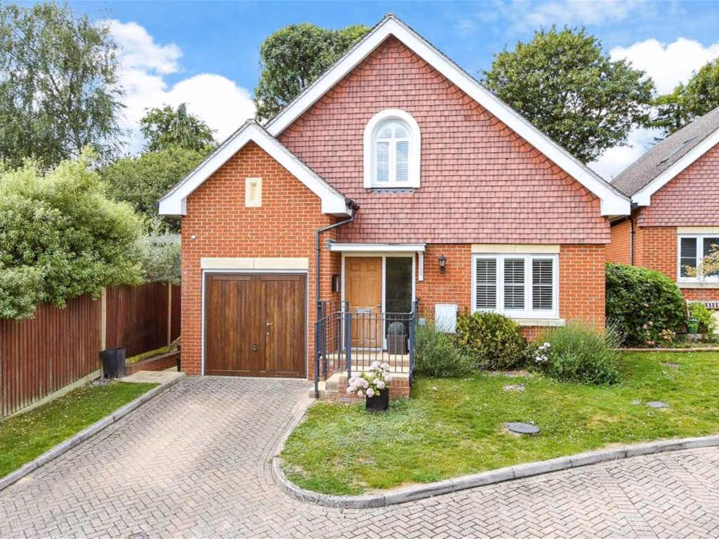
KT17 3AR - 4 bedroom detached house for sale in Bankside, Epsom, Surre…
View on Property Piper
4 bedroom detached house for sale in Bankside, Epsom, Surrey, KT17
Property Details
- Price: £850000
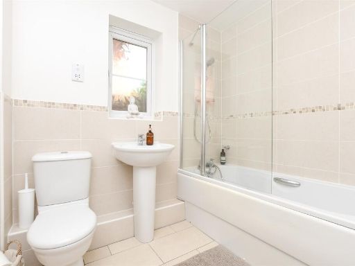
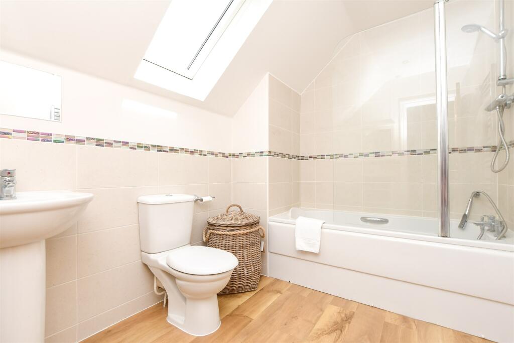
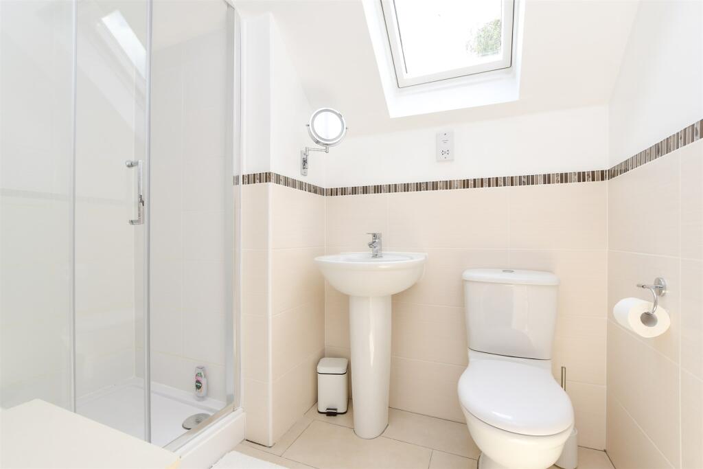
- Bedrooms: 4
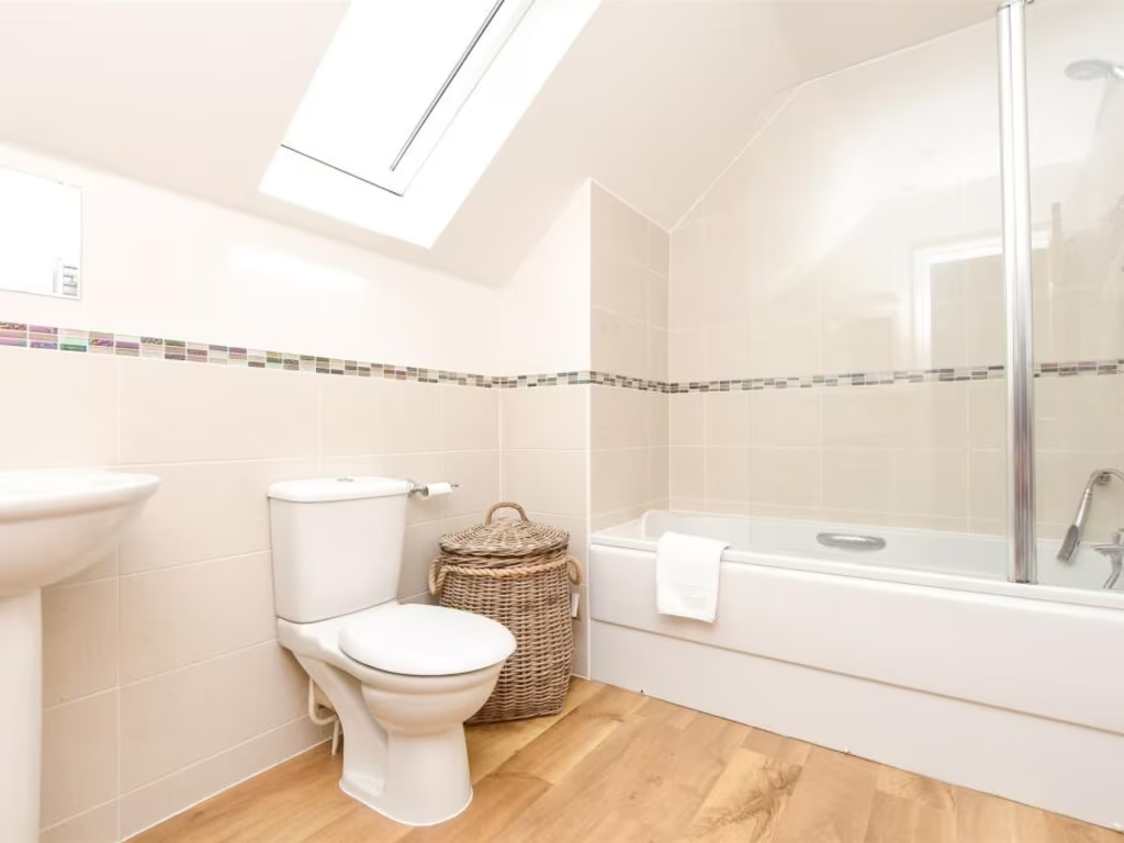
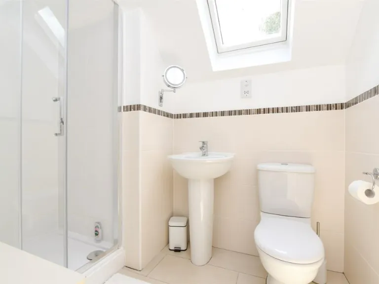
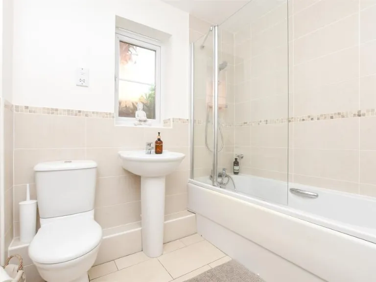
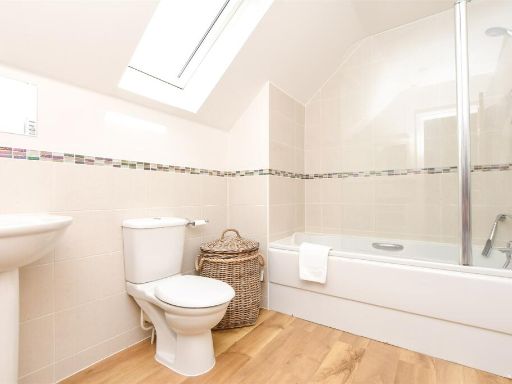
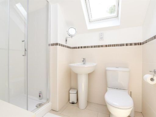
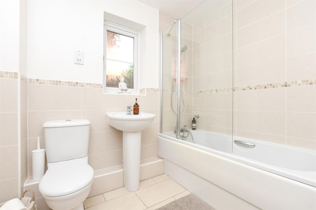
- Bathrooms: 3
- Property Type: undefined
- Property SubType: undefined
Image Descriptions
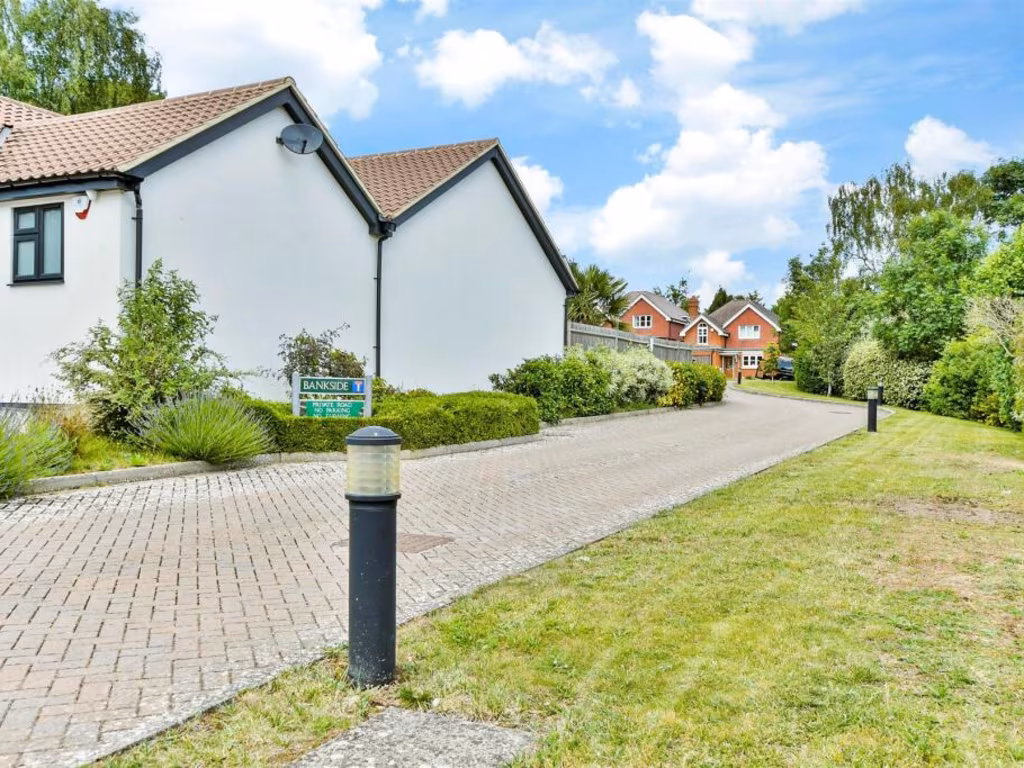
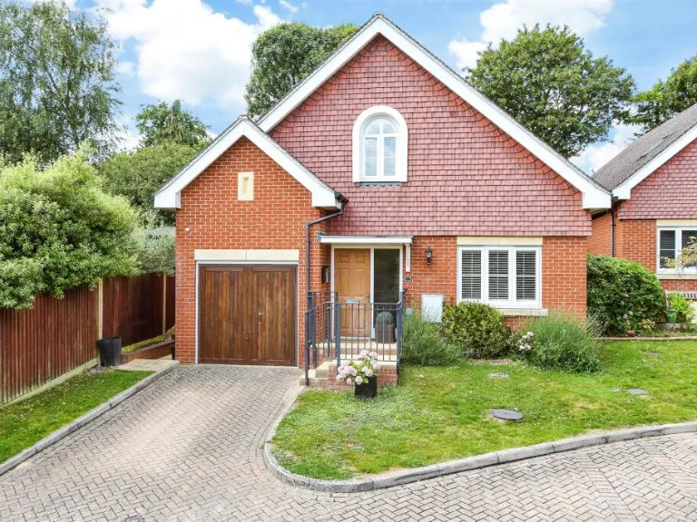
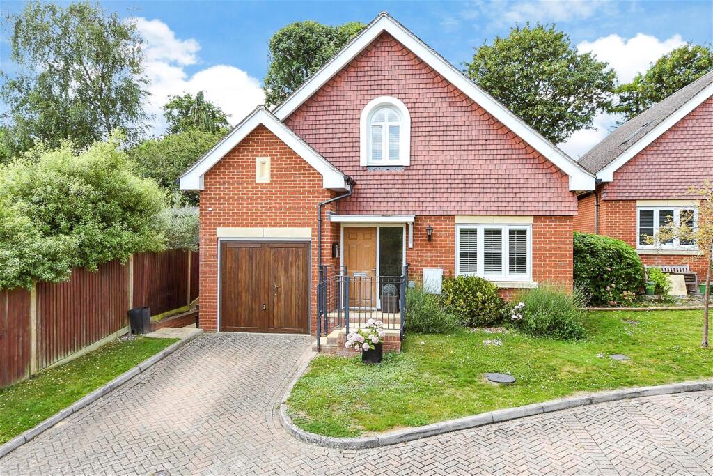
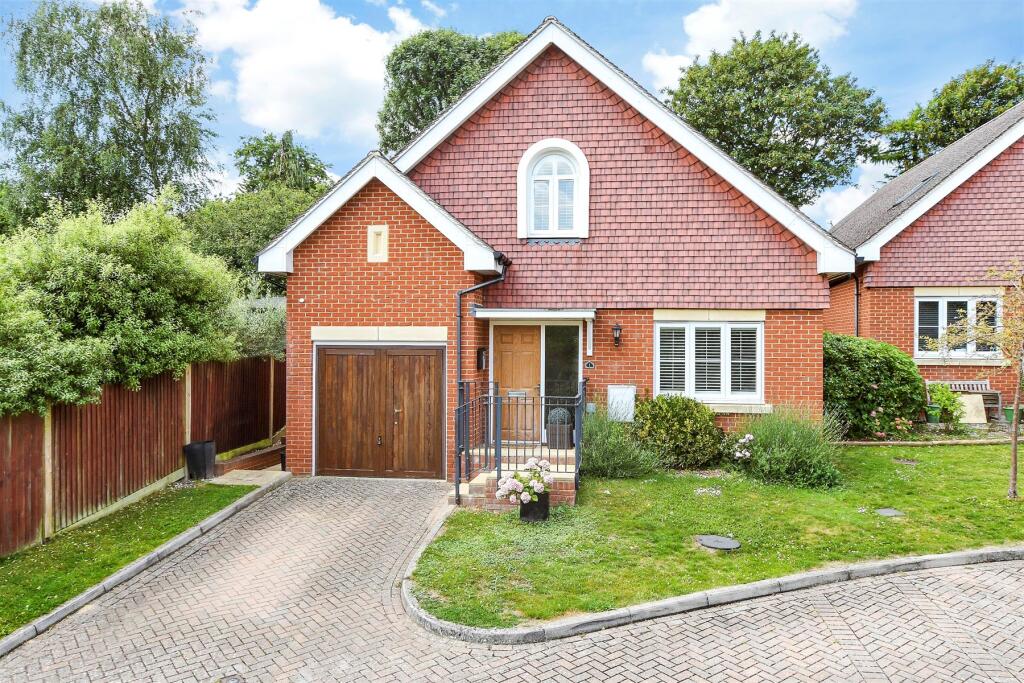
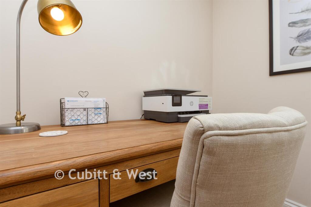
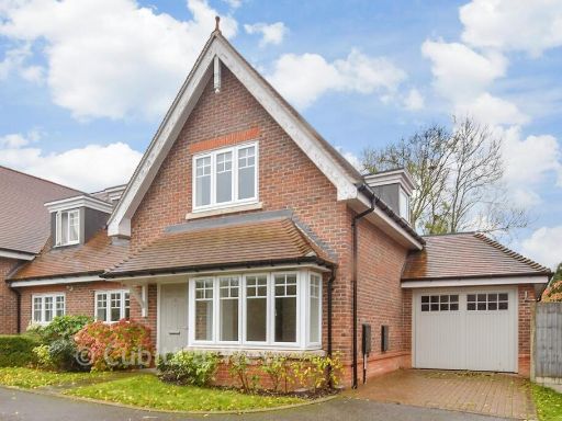
- front garden modern
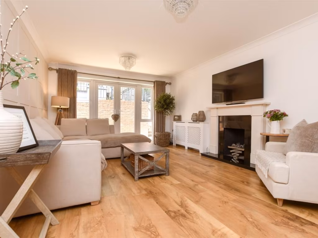
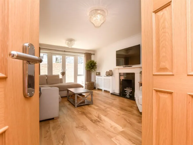
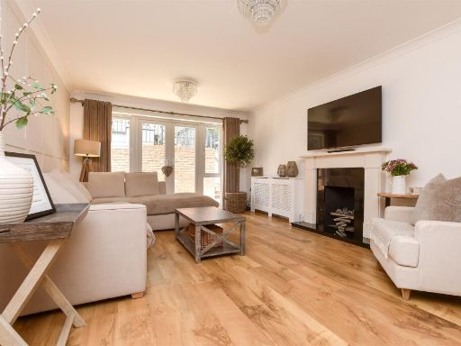
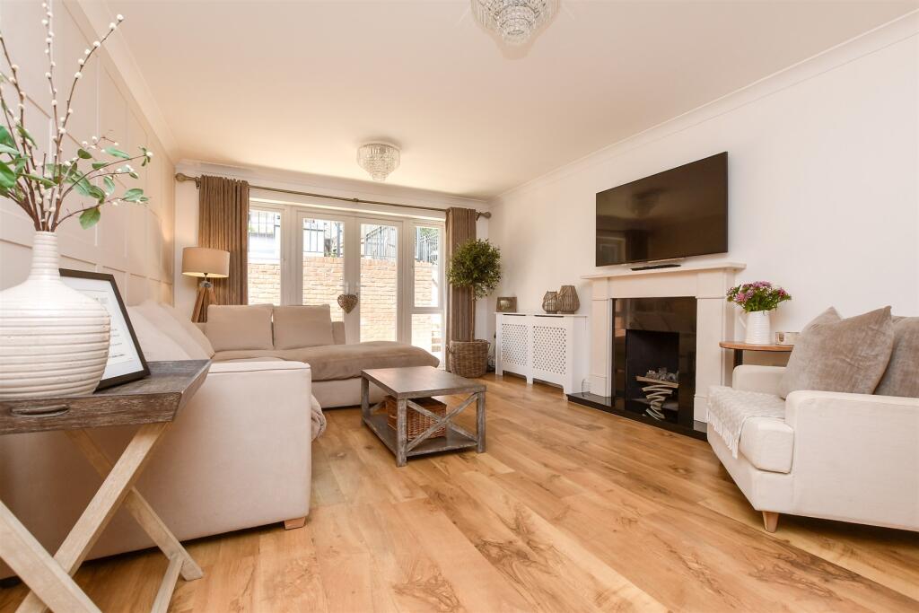
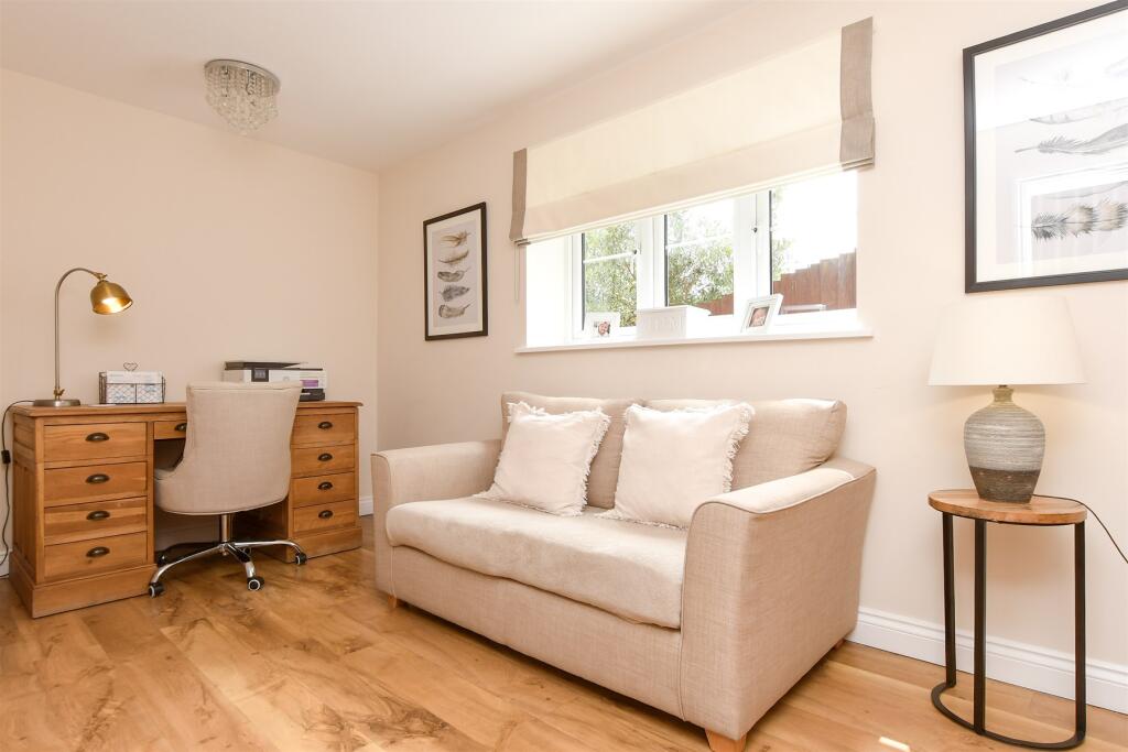
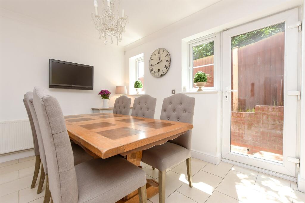
- living room contemporary
Floorplan Description
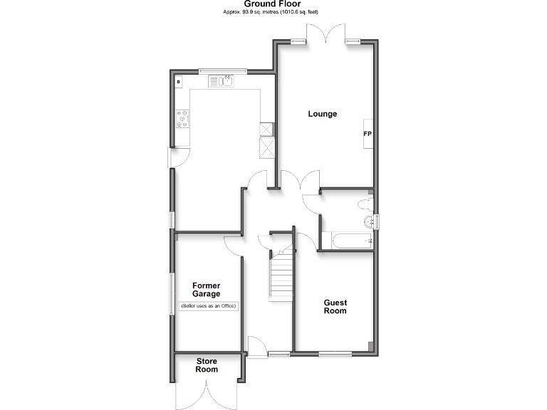
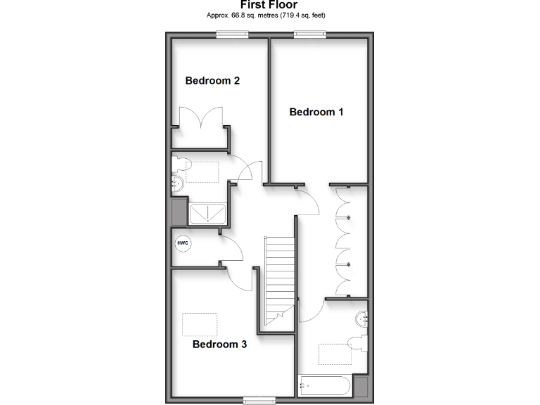
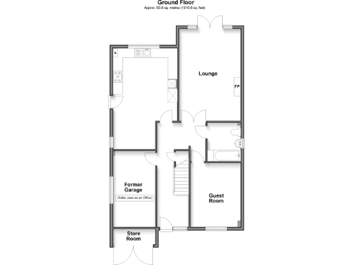
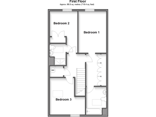
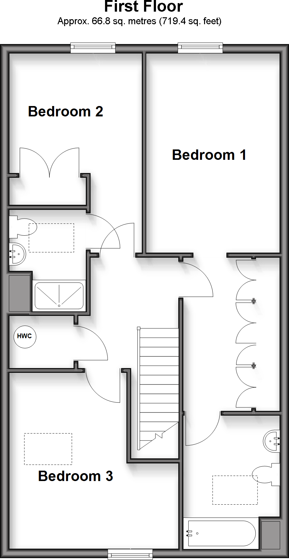
- A layout with three bedrooms and a bathroom.
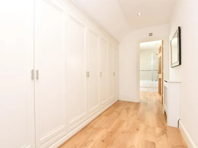
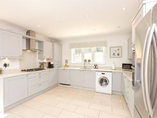
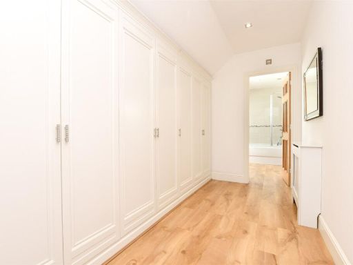
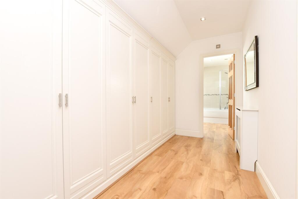
Rooms
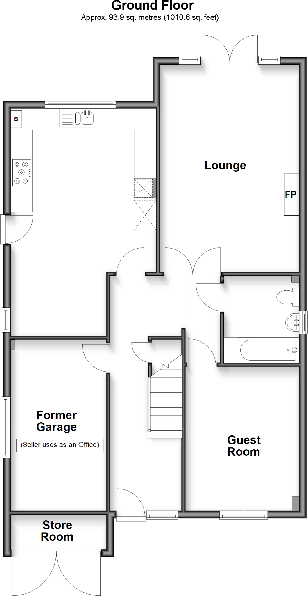
- Former Garage:
- Store Room:
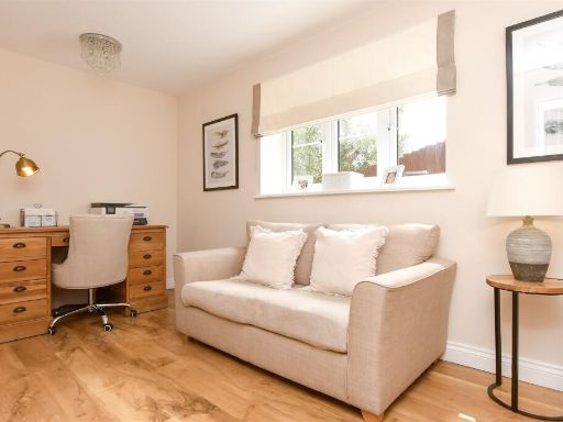
- Guest Room:
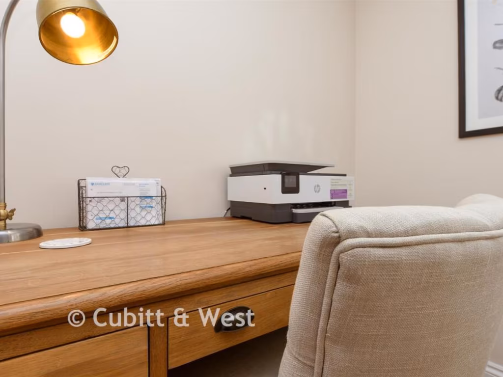
- Lounge:
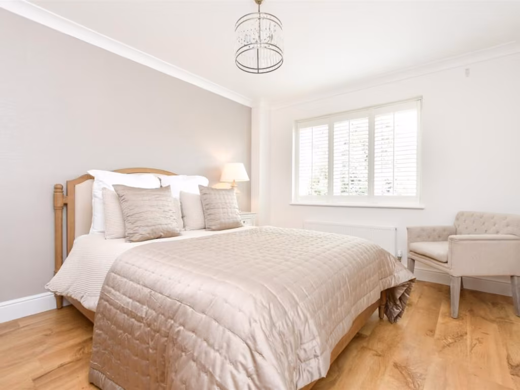
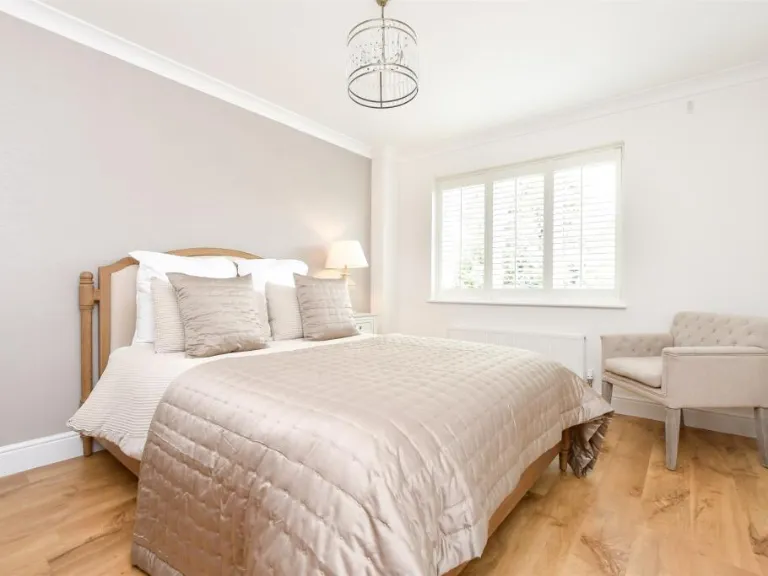
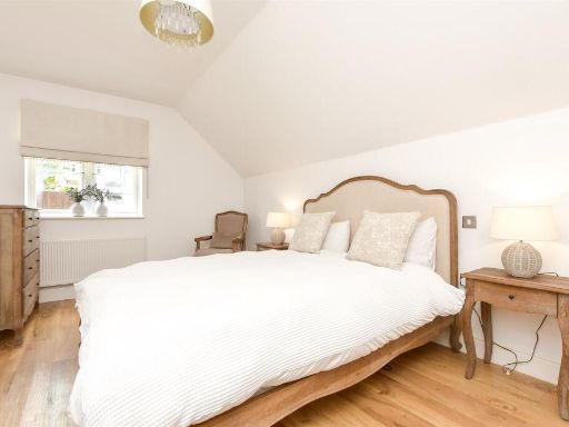
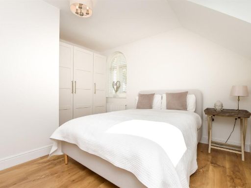
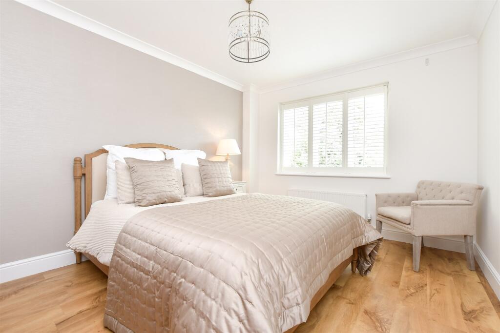
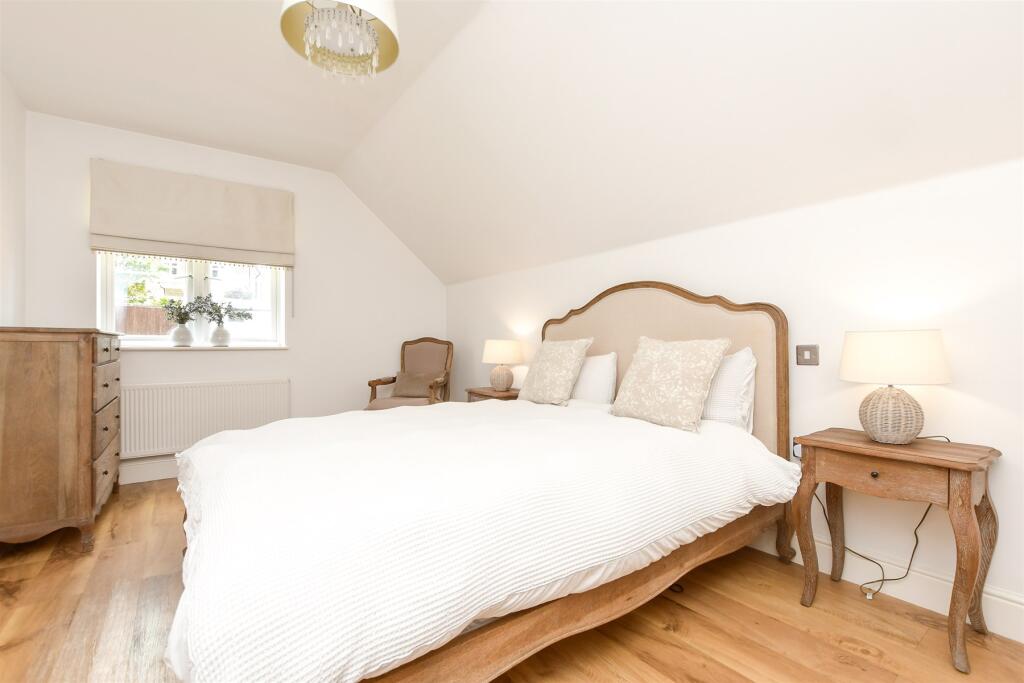
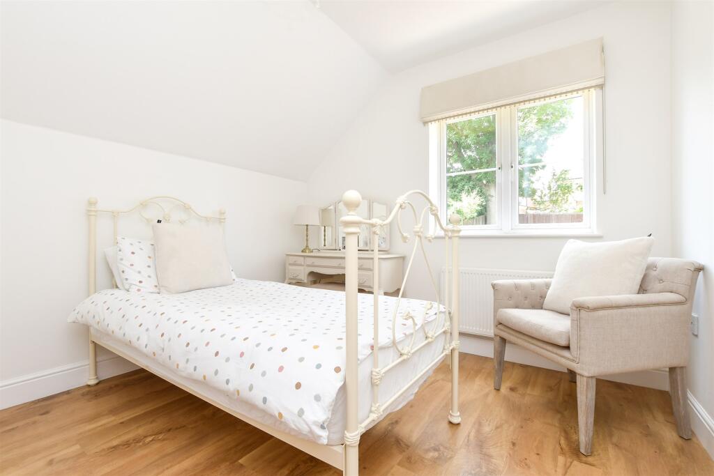
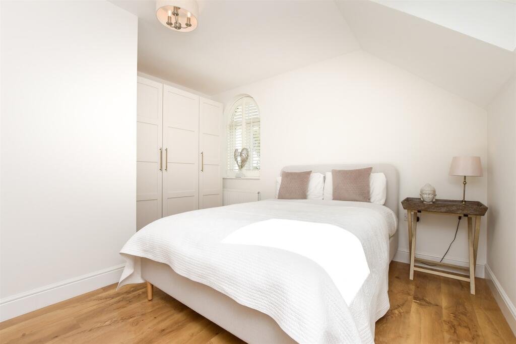
- Bedroom 1: average
- Bedroom 2: average
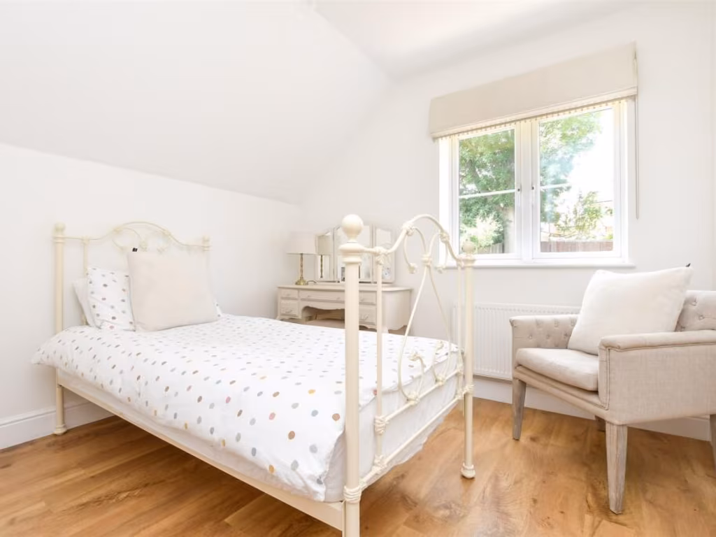
- Bedroom 3: small
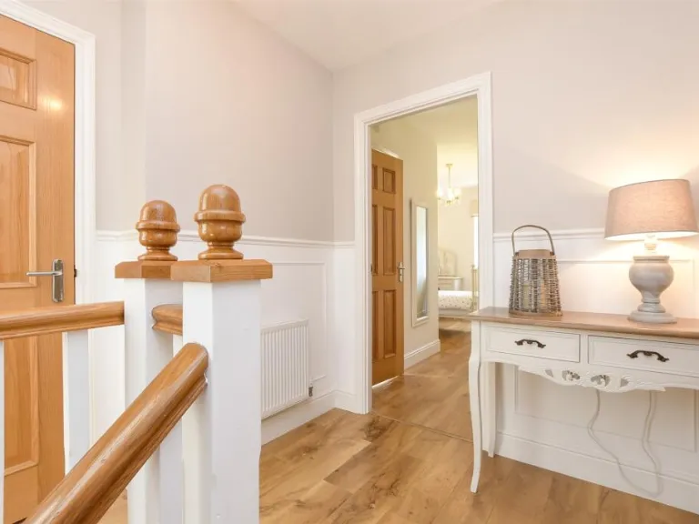
Textual Property Features
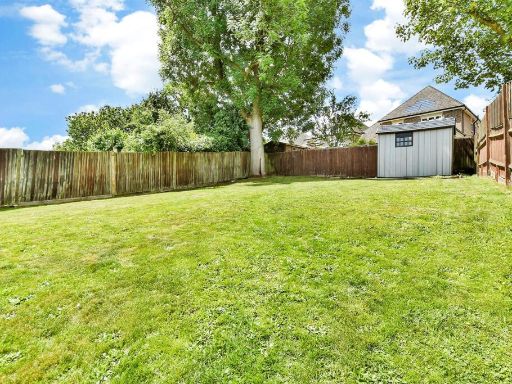
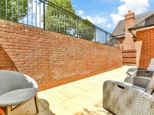
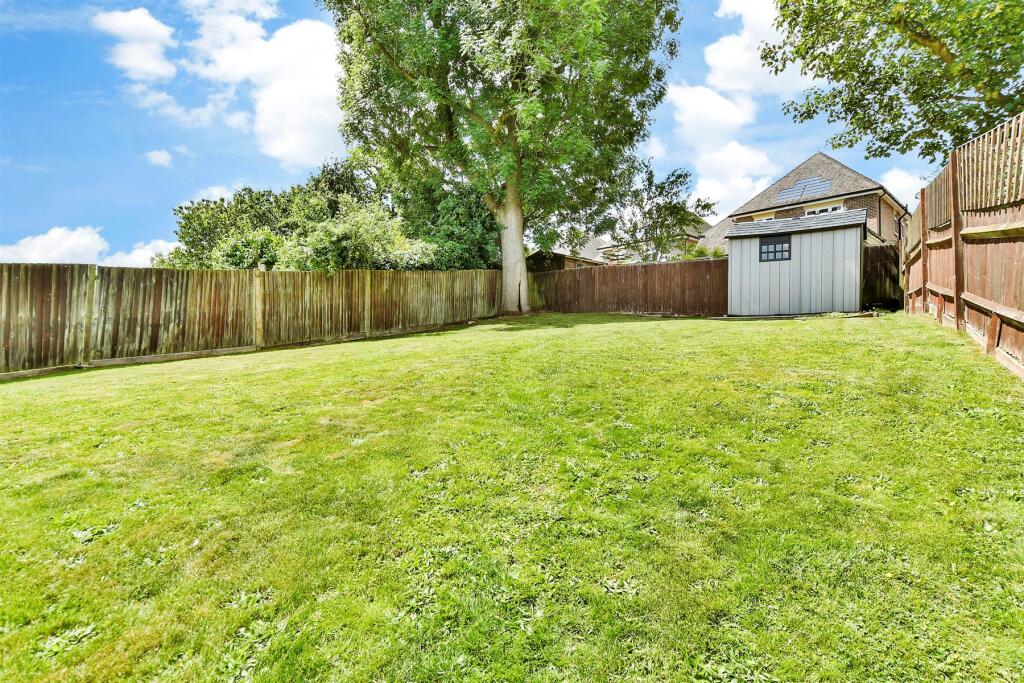
- Has Garden
- Chain Free
- Success
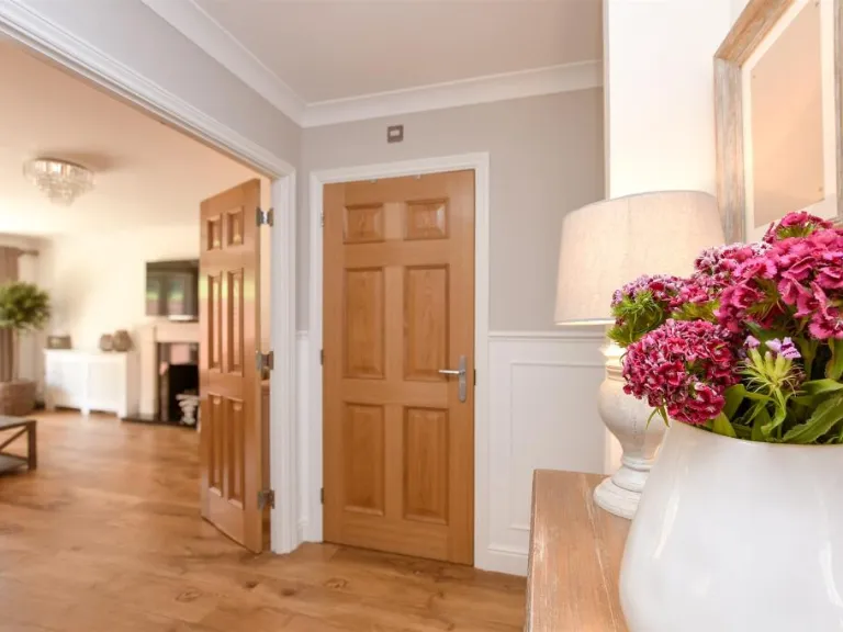
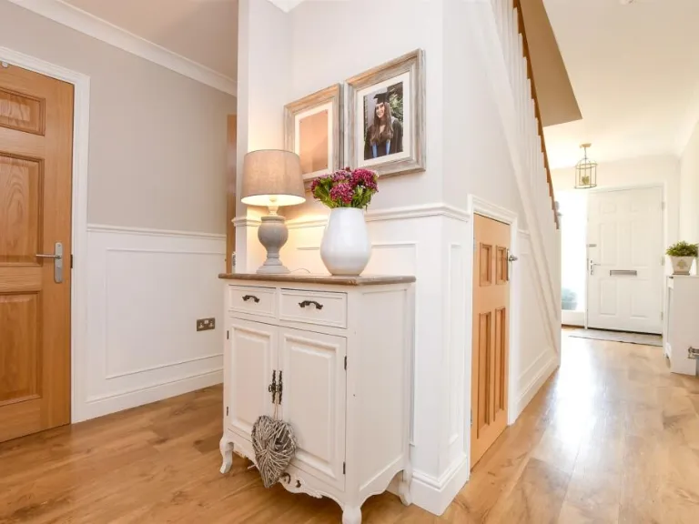
Detected Visual Features
- modern
- residential
- detached
- brickwork
- arched window
- gabled roof
- integrated garage
- family home
- driveway
- garden
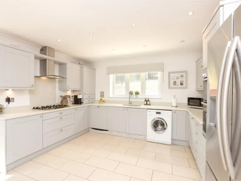
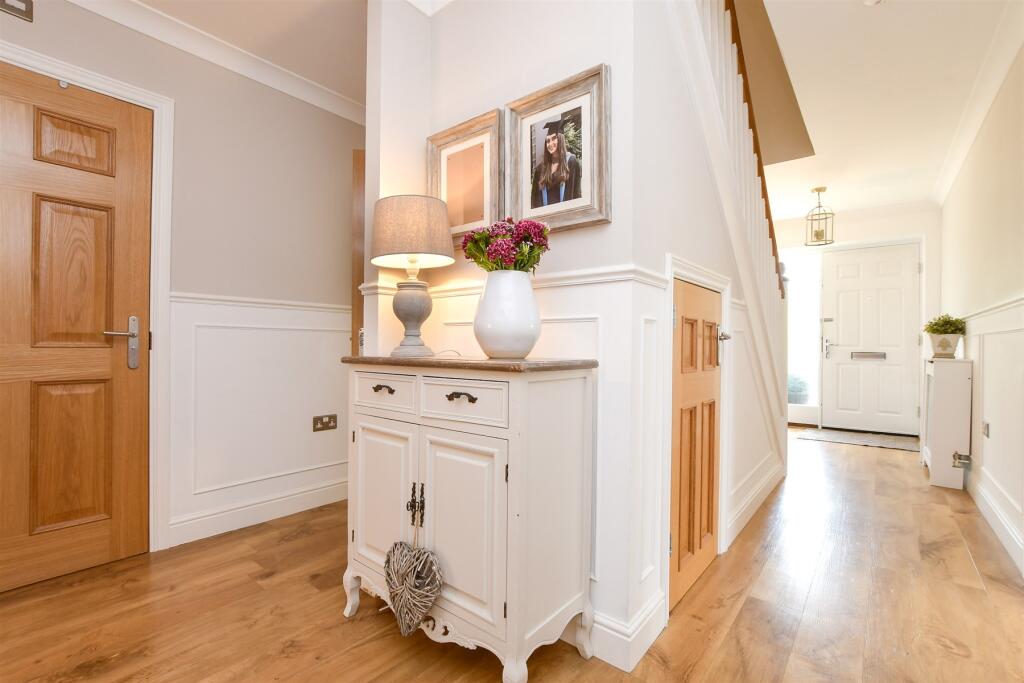
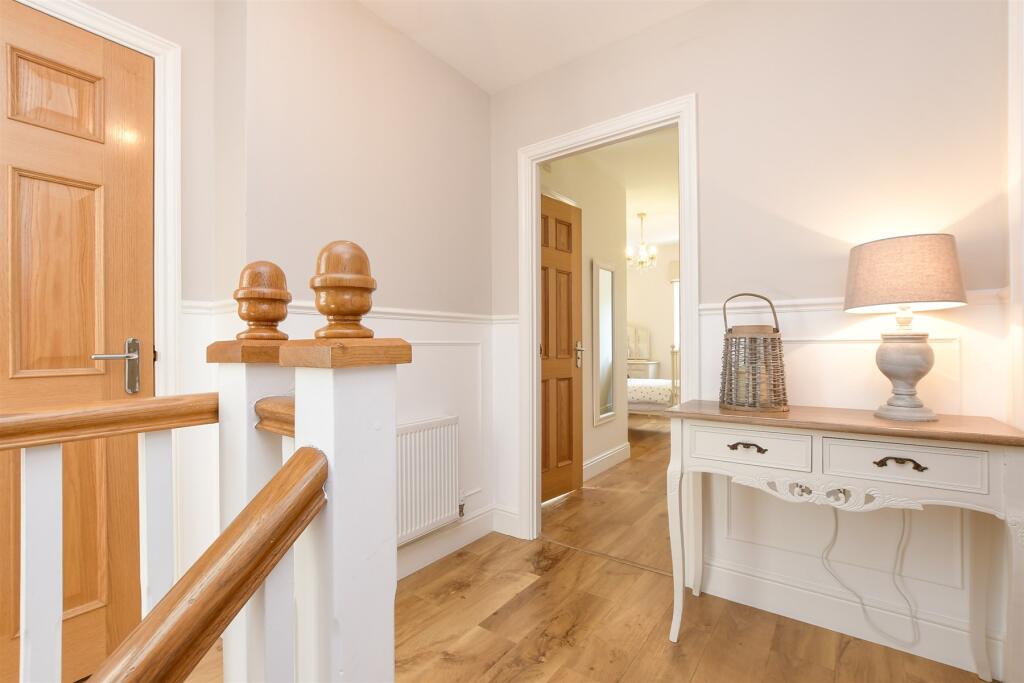
- contemporary style
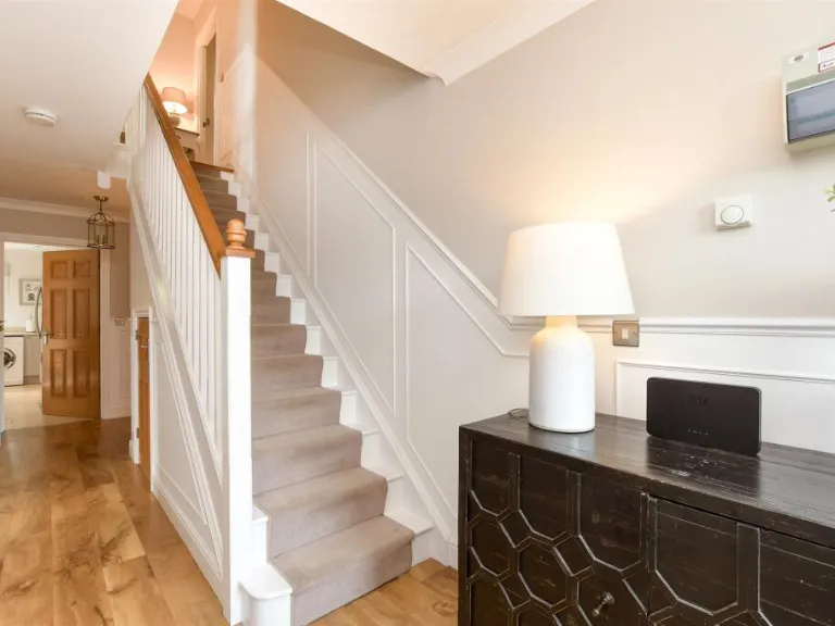
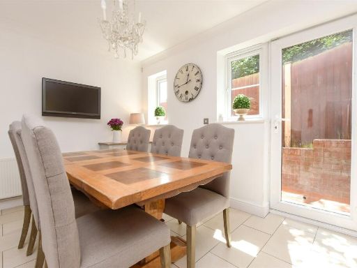
- wood flooring
- fireplace
- double doors
- natural light
- medium-sized room
EPC Details
- Fully double glazed
- Cavity wall, as built, insulated (assumed)
- Boiler and radiators, mains gas
- Low energy lighting in all fixed outlets
- Solid, insulated (assumed)
Nearby Schools
- The Beacon School
- St Anne's Catholic Primary School
- Warren Mead Infant School
- Epsom College
- St Clement's Catholic Primary School
- Walton-on-the-Hill Primary School
- Aberdour Preparatory School
- Warren Mead Junior School
- Wallace Fields Infant School and Nursery
- Chinthurst School
- Shawley Community Primary Academy
- Banstead Infant School
- St Christopher's School Trust (Epsom) Ltd
- Blenheim High School
- Ewell Castle School
- Cuddington Croft Primary School
- Nonsuch High School for Girls
- St Dunstan's Cheam CofE Primary School
- Tadworth Primary School
- The Vale Primary School
- Epsom Downs Community School & Early Years Centres
- Banstead Community Junior School
- St Martins Church of England Infant School
- St Martins Church of England Junior School
- Little Downsend Epsom
- Wallace Fields Junior School
- Glyn School
Nearest Bars And Restaurants
- Id: 949727222
- Tags:
- Amenity: restaurant
- Building: yes
- TagsNormalized:
- Lat: 51.3253239
- Lon: -0.2335894
- FullGeoHash: gcpgfxmzsvz4
- PartitionGeoHash: gcpg
- Images:
- FoodStandards: null
- Distance: 503.4
,- Id: 8792175940
- Tags:
- Addr:
- Housenumber: 211
- Postcode: KT17 3LB
- Street: Fir Tree Road
- Amenity: restaurant
- Cuisine: indian
- Name: Le Raj
- TagsNormalized:
- Lat: 51.3252549
- Lon: -0.2333009
- FullGeoHash: gcpgfxqp78yp
- PartitionGeoHash: gcpg
- Images:
- FoodStandards: null
- Distance: 498.1
,- Id: 949727224
- Tags:
- Amenity: restaurant
- Building: yes
- TagsNormalized:
- Lat: 51.325163
- Lon: -0.2336632
- FullGeoHash: gcpgfxmyerb4
- PartitionGeoHash: gcpg
- Images:
- FoodStandards: null
- Distance: 485.1
,- Id: 8792175958
- Tags:
- Addr:
- Housenumber: 215
- Postcode: KT17 3LB
- Street: Fir Tree Road
- Amenity: restaurant
- Cuisine: indian
- Name: Amani
- TagsNormalized:
- Lat: 51.3251019
- Lon: -0.2334199
- FullGeoHash: gcpgfxqn2umw
- PartitionGeoHash: gcpg
- Images:
- FoodStandards: null
- Distance: 480.1
,- Id: 8792175959
- Tags:
- Addr:
- Housenumber: 217
- Postcode: KT17 3LB
- Street: Fir Tree Road
- Amenity: cafe
- Name: Drift Bridge Cafe
- TagsNormalized:
- Lat: 51.3250403
- Lon: -0.2334472
- FullGeoHash: gcpgfxqn02cp
- PartitionGeoHash: gcpg
- Images:
- FoodStandards: null
- Distance: 473.1
}
Nearest General Shops
- Id: 8792175939
- Tags:
- Addr:
- Housenumber: 209
- Postcode: KT17 3LB
- Street: Fir Tree Road
- Name: Flowerwise
- Shop: florist
- TagsNormalized:
- Lat: 51.3253122
- Lon: -0.2332609
- FullGeoHash: gcpgfxqpsesh
- PartitionGeoHash: gcpg
- Images:
- FoodStandards: null
- Distance: 504.8
,- Id: 8792175970
- Tags:
- Name: Mulberry and Thyme
- Shop: hairdresser
- TagsNormalized:
- Lat: 51.3248971
- Lon: -0.2335584
- FullGeoHash: gcpgfxmvjwq0
- PartitionGeoHash: gcpg
- Images:
- FoodStandards: null
- Distance: 456.4
,- Id: 8792175971
- Tags:
- Name: By Invitation Only
- Shop: beauty
- TagsNormalized:
- Lat: 51.3248356
- Lon: -0.2335955
- FullGeoHash: gcpgfxmuuff9
- PartitionGeoHash: gcpg
- Images:
- FoodStandards: null
- Distance: 449.3
}
Nearest Grocery shops
- Id: 270175655
- Tags:
- Brand: Tesco Express
- Brand:wikidata: Q98456772
- Contact:
- Website: https://www.tesco.com/store-locator/surrey/203-fir-tree-road
- Name: Tesco Express
- Shop: convenience
- TagsNormalized:
- tesco
- tesco express
- convenience
- shop
- Lat: 51.3255024
- Lon: -0.2331413
- FullGeoHash: gcpgfxw0xrj5
- PartitionGeoHash: gcpg
- Images:
- FoodStandards: null
- Distance: 527
,- Id: 949727223
- Tags:
- Building: yes
- Shop: convenience
- TagsNormalized:
- Lat: 51.3252133
- Lon: -0.233582
- FullGeoHash: gcpgfxmzj1hx
- PartitionGeoHash: gcpg
- Images:
- FoodStandards: null
- Distance: 491.2
,- Id: 8792175941
- Tags:
- Addr:
- Housenumber: 213
- Postcode: KT17 3LB
- Street: Fir Tree Road
- Brand: Londis
- Brand:wikidata: Q21008564
- Brand:wikipedia: en:Londis (United Kingdom)
- Name: Londis
- Shop: convenience
- TagsNormalized:
- Lat: 51.325158
- Lon: -0.2334024
- FullGeoHash: gcpgfxqn9qft
- PartitionGeoHash: gcpg
- Images:
- FoodStandards: null
- Distance: 486.5
}
Nearest Religious buildings
- Id: 537787998
- Tags:
- Amenity: place_of_worship
- Denomination: methodist
- Name: Methodist Church
- Religion: christian
- TagsNormalized:
- place of worship
- methodist
- church
- christian
- Lat: 51.3183253
- Lon: -0.2130127
- FullGeoHash: gcpggnhyumnn
- PartitionGeoHash: gcpg
- Images:
- FoodStandards: null
- Distance: 1505.1
,- Id: 802619305
- Tags:
- Amenity: place_of_worship
- Building: church
- Denomination: anglican
- Name: St Mark
- Religion: christian
- Wikidata: Q105086219
- TagsNormalized:
- place of worship
- church
- anglican
- christian
- Lat: 51.3090131
- Lon: -0.2317558
- FullGeoHash: gcpgfsx0xtq3
- PartitionGeoHash: gcpg
- Images:
- FoodStandards: null
- Distance: 1324.6
,- Id: 772165248
- Tags:
- Amenity: place_of_worship
- Building: church
- Denomination: anglican
- Name: St Paul
- Religion: christian
- Wikidata: Q105086114
- TagsNormalized:
- place of worship
- church
- anglican
- paul
- christian
- Lat: 51.3255413
- Lon: -0.2241897
- FullGeoHash: gcpgfzsbbn25
- PartitionGeoHash: gcpg
- Images:
- FoodStandards: null
- Distance: 877.1
}
Nearest Medical buildings
- Id: 7243156967
- Tags:
- Addr:
- City: Epsom
- Housenumber: 1
- Postcode: KT18 5QG
- Street: Tattenham Crescent
- Amenity: pharmacy
- Brand: Lloyds Pharmacy
- Brand:wikidata: Q6662870
- Brand:wikipedia: en:LloydsPharmacy
- Dispensing: yes
- Fhrs:
- Authority: Reigate and Banstead
- Id: 607571
- Healthcare: pharmacy
- Name: Lloyds Pharmacy
- Source: survey;https://ratings.food.gov.uk/OpenDataFiles/FHRS309en-GB.xml;code-point open
- TagsNormalized:
- pharmacy
- lloyds pharmacy
- health
- healthcare
- Lat: 51.3094897
- Lon: -0.2415615
- FullGeoHash: gcpgfs857nns
- PartitionGeoHash: gcpg
- Images:
- FoodStandards: null
- Distance: 1357.1
,- Id: 7243183735
- Tags:
- Addr:
- City: Epsom
- Housenumber: 33
- Postcode: KT18 5QJ
- Street: Tattenham Crescent
- Amenity: pharmacy
- Dispensing: yes
- Fhrs:
- Authority: Reigate and Banstead
- Id: 607572
- Healthcare: pharmacy
- Name: Paydens Pharmacy
- Source: survey;https://ratings.food.gov.uk/OpenDataFiles/FHRS309en-GB.xml;code-point open
- TagsNormalized:
- Lat: 51.3099454
- Lon: -0.2405078
- FullGeoHash: gcpgfs8y5g06
- PartitionGeoHash: gcpg
- Images:
- FoodStandards: null
- Distance: 1283.8
,- Id: 776303048
- Tags:
- Addr:
- City: Epsom
- Postcode: KT18 5NU
- Street: Tattenham Crescent
- Amenity: doctors
- Building: yes
- Healthcare: doctor
- Name: Tattenham Health Centre
- TagsNormalized:
- doctor
- doctors
- health
- healthcare
- health centre
- Lat: 51.310535
- Lon: -0.2393276
- FullGeoHash: gcpgfsc9x2br
- PartitionGeoHash: gcpg
- Images:
- FoodStandards: null
- Distance: 1195.7
,- Id: 8792175937
- Tags:
- Addr:
- Housenumber: 205
- Postcode: KT17 3LB
- Street: Fir Tree Road
- Amenity: veterinary
- Name: The Bridge Veterinary Surgery
- TagsNormalized:
- Lat: 51.3254304
- Lon: -0.2331732
- FullGeoHash: gcpgfxw0q9tq
- PartitionGeoHash: gcpg
- Images:
- FoodStandards: null
- Distance: 518.7
}
Nearest Airports
- Id: 260720166
- Tags:
- Aerodrome: international
- Aeroway: aerodrome
- Alt_name: Gatwick Airport
- Ele: 62
- Iata: LGW
- Icao: EGKK
- Internet_access: wlan
- Internet_access:fee: no
- Internet_access:ssid: Gatwick FREE Wi-Fi
- Name: London Gatwick Airport
- Operator: Gatwick Airport Limited
- Ref: LGW
- Website: https://www.gatwickairport.com/
- Wikidata: Q8703
- Wikipedia: en:Gatwick Airport
- TagsNormalized:
- airport
- international airport
- Lat: 51.1540917
- Lon: -0.1883773
- FullGeoHash: gcpg58qf4mzd
- PartitionGeoHash: gcpg
- Images:
- FoodStandards: null
- Distance: 18812.9
,- Id: 14001268
- Tags:
- Access: yes
- Aerodrome: international
- Aerodrome:type: public
- Aeroway: aerodrome
- Alt_name: London Heathrow
- Alt_name_2: London Heathrow Airport
- Ele: 25
- Iata: LHR
- Icao: EGLL
- Int_name: Heathrow Airport
- Name: London Heathrow Airport
- Note: area still approx
- Old_name: London Airport
- Operator: Heathrow Airport Limited
- Rank_aci:
- Ref: LHR
- Short_name: Heathrow
- Type: multipolygon
- Website: https://www.heathrow.com/
- Wikidata: Q8691
- Wikipedia: en:Heathrow Airport
- TagsNormalized:
- airport
- international airport
- Lat: 51.4677522
- Lon: -0.4547736
- FullGeoHash: gcpsv9kv7h2h
- PartitionGeoHash: gcps
- Images:
- FoodStandards: null
- Distance: 22381.3
}
Nearest Leisure Facilities
- Id: 12873780
- Tags:
- Leisure: park
- Type: multipolygon
- TagsNormalized:
- Lat: 51.318855
- Lon: -0.2259006
- FullGeoHash: gcpgfy79bpuq
- PartitionGeoHash: gcpg
- Images:
- FoodStandards: null
- Distance: 623.2
,- Id: 951232562
- Tags:
- Leisure: pitch
- Sport: tennis
- TagsNormalized:
- Lat: 51.3179065
- Lon: -0.2409975
- FullGeoHash: gcpgfw0s2r5h
- PartitionGeoHash: gcpg
- Images:
- FoodStandards: null
- Distance: 567
,- Id: 951232563
- Tags:
- Leisure: pitch
- Sport: tennis
- TagsNormalized:
- Lat: 51.3187214
- Lon: -0.2412871
- FullGeoHash: gcpgfw231x53
- PartitionGeoHash: gcpg
- Images:
- FoodStandards: null
- Distance: 538.7
,- Id: 951232572
- Tags:
- TagsNormalized:
- swimming
- swimming pool
- pool
- leisure
- Lat: 51.3181458
- Lon: -0.2404746
- FullGeoHash: gcpgfw0vue9p
- PartitionGeoHash: gcpg
- Images:
- FoodStandards: null
- Distance: 522
,- Id: 951696084
- Tags:
- Leisure: pitch
- Sport: tennis
- TagsNormalized:
- Lat: 51.3206214
- Lon: -0.2378881
- FullGeoHash: gcpgfwdu2c1z
- PartitionGeoHash: gcpg
- Images:
- FoodStandards: null
- Distance: 250.3
}
Nearest Tourist attractions
- Id: 231387994
- Tags:
- Name: Banstead & District Scout Campsite
- Scout: yes
- Tourism: camp_site
- TagsNormalized:
- Lat: 51.3092598
- Lon: -0.1840768
- FullGeoHash: gcpggu9fneq2
- PartitionGeoHash: gcpg
- Images:
- FoodStandards: null
- Distance: 3719.7
,- Id: 6266973817
- Tags:
- Fee: no
- Name: Bourne hall
- Tourism: museum
- Website: https://www.bournehall.org/
- TagsNormalized:
- Lat: 51.3503373
- Lon: -0.2524295
- FullGeoHash: gcpu4k01muwv
- PartitionGeoHash: gcpu
- Images:
- FoodStandards: null
- Distance: 3515.6
,- Id: 26563318
- Tags:
- Name: Epsom Downs Racecourse
- Tourism: attraction
- Wikidata: Q5383997
- Wikipedia: en:Epsom Downs Racecourse
- TagsNormalized:
- Lat: 51.3099991
- Lon: -0.2526878
- FullGeoHash: gcpgfhxyrvn6
- PartitionGeoHash: gcpg
- Images:
- FoodStandards: null
- Distance: 1755.2
}
Nearest Hotels
- Id: 6187878853
- Tags:
- Addr:
- Postcode: KT18 5BY
- Street: The Parade
- Brand: Premier Inn
- Brand:wikidata: Q2108626
- Brand:wikipedia: en:Premier Inn
- Fhrs:
- Internet_access: wlan
- Internet_access:fee: customers
- Internet_access:operator: Virgin Media
- Internet_access:ssid: Premier Inn Free Wi-Fi
- Name: Premier Inn
- Source:
- Tourism: hotel
- TagsNormalized:
- Lat: 51.332988
- Lon: -0.2660592
- FullGeoHash: gcpu1byk26eb
- PartitionGeoHash: gcpu
- Images:
- FoodStandards: null
- Distance: 2588.6
,- Id: 921422908
- Tags:
- Addr:
- Brand: Premier Inn
- Brand:wikidata: Q2108626
- Brand:wikipedia: en:Premier Inn
- Building: yes
- Name: Premier Inn
- Tourism: hotel
- TagsNormalized:
- Lat: 51.30377
- Lon: -0.2188661
- FullGeoHash: gcpgg58dh5cs
- PartitionGeoHash: gcpg
- Images:
- FoodStandards: null
- Distance: 2178.2
,- Id: 293982227
- Tags:
- Addr:
- Postcode: KT18 5LG
- Street: Langley Vale Road
- Brand: Holiday Inn Express
- Brand:wikidata: Q5880423
- Brand:wikipedia: en:Holiday Inn Express
- Fhrs:
- Name: Holiday Inn Express
- Source:
- Tourism: hotel
- TagsNormalized:
- Lat: 51.3130158
- Lon: -0.2594057
- FullGeoHash: gcpgfj5pgrmn
- PartitionGeoHash: gcpg
- Images:
- FoodStandards: null
- Distance: 1948.6
}
Tags
- modern
- residential
- detached
- brickwork
- arched window
- gabled roof
- integrated garage
- family home
- driveway
- garden
- contemporary style
- wood flooring
- fireplace
- double doors
- natural light
- medium-sized room
Local Market Stats
- Average Price/sqft: £541
- Avg Income: £70300
- Rental Yield: 3.6%
- Social Housing: 3%
- Planning Success Rate: 83%
Similar Properties
 4 bedroom semi-detached house for sale in Nower Close, Epsom, Surrey, KT18 — £800,000 • 4 bed • 1 bath • 1178 ft²
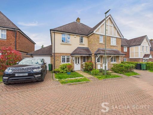 3 bedroom semi-detached house for sale in Whitebeam Close, Epsom, KT17 — £620,000 • 3 bed • 2 bath • 987 ft²
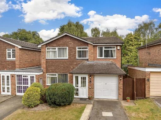 4 bedroom link detached house for sale in Cypress Way, Banstead, Surrey, SM7 — £650,000 • 4 bed • 2 bath • 1053 ft²
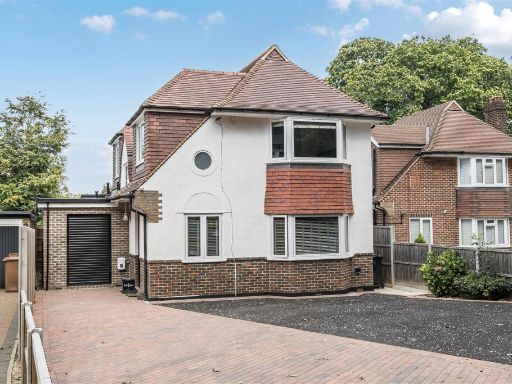 4 bedroom detached house for sale in Tangier Way, Burgh Heath, Tadworth, KT20 — £975,000 • 4 bed • 3 bath • 2019 ft²
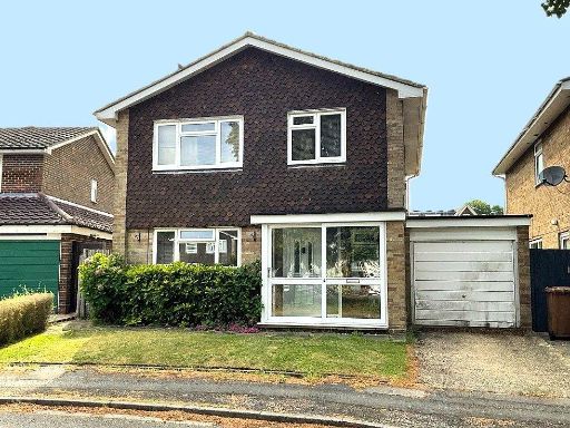 4 bedroom detached house for sale in North Acre, Banstead, Surrey, SM7 — £700,000 • 4 bed • 1 bath • 777 ft²
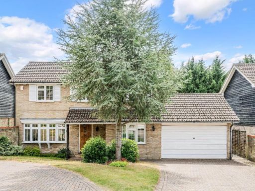 4 bedroom detached house for sale in Blue Cedars, Banstead, SM7 — £800,000 • 4 bed • 2 bath • 1659 ft²
Meta
- {
"@context": "https://schema.org",
"@type": "Residence",
"name": "4 bedroom detached house for sale in Bankside, Epsom, Surre…",
"description": "",
"url": "https://propertypiper.co.uk/property/c38eff30-99c0-4565-83fd-a21d8ad38f32",
"image": "https://image-a.propertypiper.co.uk/6786b6b1-f343-4712-9bf4-bb7b29cf8b81-1024.jpeg",
"address": {
"@type": "PostalAddress",
"streetAddress": "1 Bankside",
"postalCode": "KT17 3AR",
"addressLocality": "Reigate and Banstead",
"addressRegion": "Epsom and Ewell",
"addressCountry": "England"
},
"geo": {
"@type": "GeoCoordinates",
"latitude": 51.320818987704094,
"longitude": -0.23429996323954866
},
"numberOfRooms": 4,
"numberOfBathroomsTotal": 3,
"floorSize": {
"@type": "QuantitativeValue",
"value": 1690,
"unitCode": "FTK"
},
"offers": {
"@type": "Offer",
"price": 850000,
"priceCurrency": "GBP",
"availability": "https://schema.org/InStock"
},
"additionalProperty": [
{
"@type": "PropertyValue",
"name": "Feature",
"value": "modern"
},
{
"@type": "PropertyValue",
"name": "Feature",
"value": "residential"
},
{
"@type": "PropertyValue",
"name": "Feature",
"value": "detached"
},
{
"@type": "PropertyValue",
"name": "Feature",
"value": "brickwork"
},
{
"@type": "PropertyValue",
"name": "Feature",
"value": "arched window"
},
{
"@type": "PropertyValue",
"name": "Feature",
"value": "gabled roof"
},
{
"@type": "PropertyValue",
"name": "Feature",
"value": "integrated garage"
},
{
"@type": "PropertyValue",
"name": "Feature",
"value": "family home"
},
{
"@type": "PropertyValue",
"name": "Feature",
"value": "driveway"
},
{
"@type": "PropertyValue",
"name": "Feature",
"value": "garden"
},
{
"@type": "PropertyValue",
"name": "Feature",
"value": "contemporary style"
},
{
"@type": "PropertyValue",
"name": "Feature",
"value": "wood flooring"
},
{
"@type": "PropertyValue",
"name": "Feature",
"value": "fireplace"
},
{
"@type": "PropertyValue",
"name": "Feature",
"value": "double doors"
},
{
"@type": "PropertyValue",
"name": "Feature",
"value": "natural light"
},
{
"@type": "PropertyValue",
"name": "Feature",
"value": "medium-sized room"
}
]
}
High Res Floorplan Images
Compatible Floorplan Images
FloorplanImages Thumbnail