SS17 7DZ - 3 bedroom semidetached house for sale in The Sorrells, Corr…
View on Property Piper
3 bedroom semi-detached house for sale in The Sorrells, Corringham, SS17
Property Details
- Price: £410000
- Bedrooms: 3
- Bathrooms: 2
- Property Type: undefined
- Property SubType: undefined
Brochure Descriptions
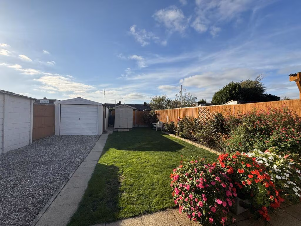
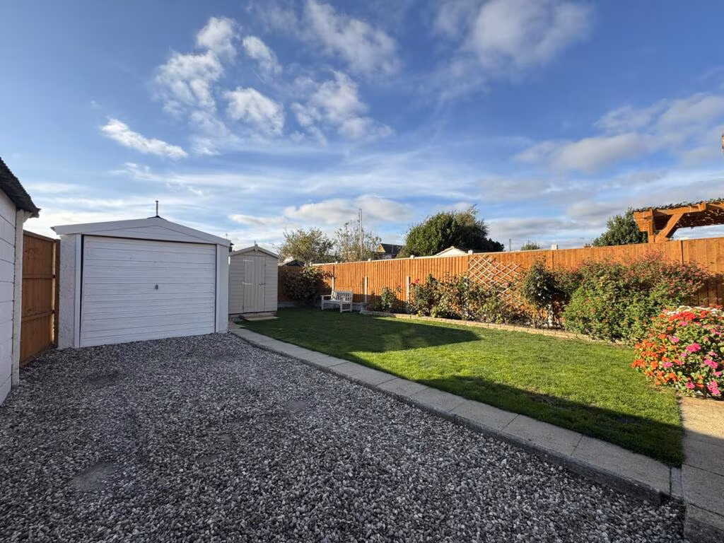
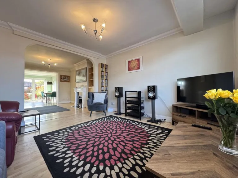
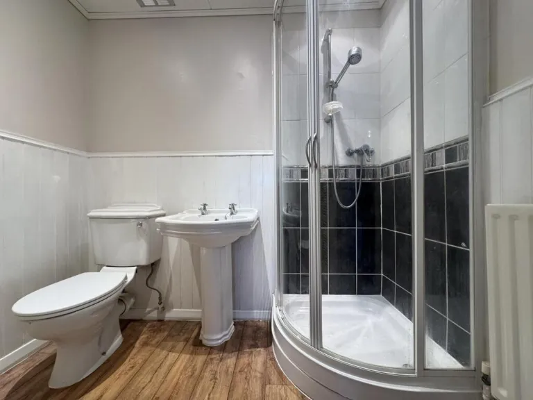
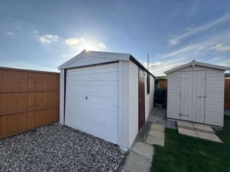
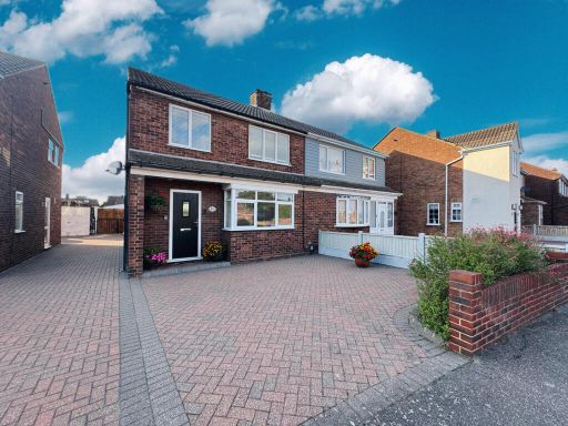
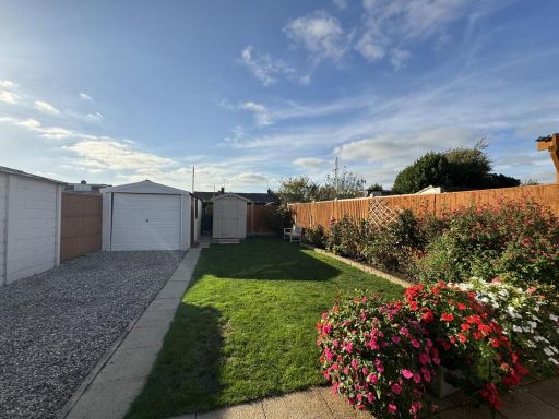
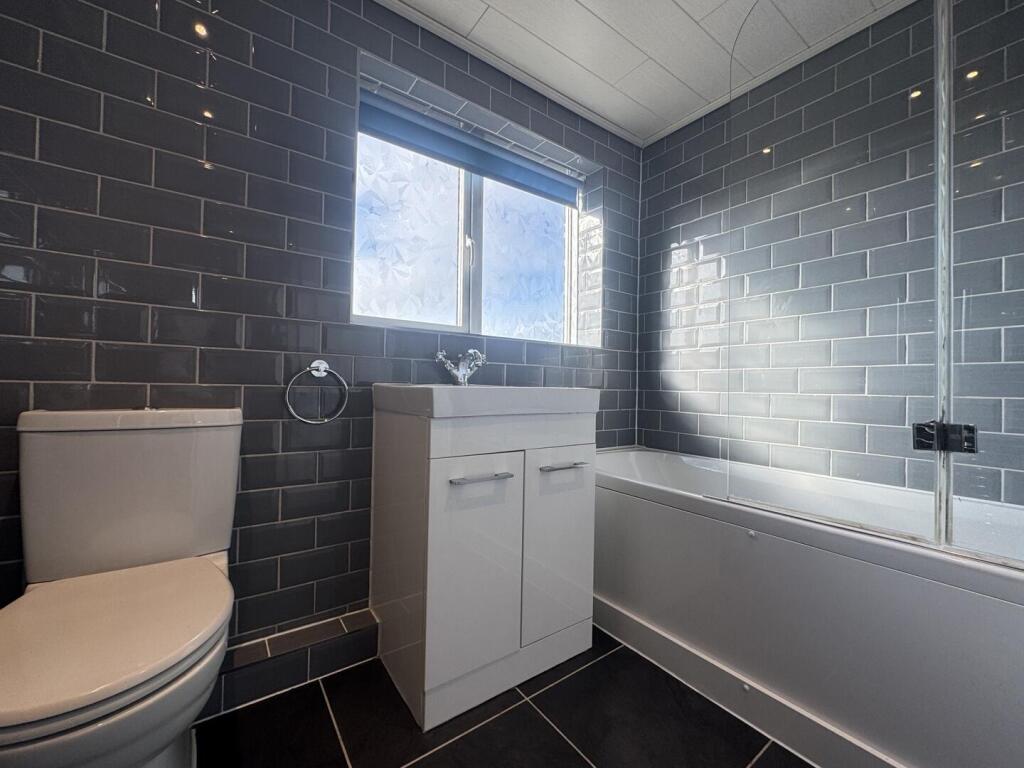
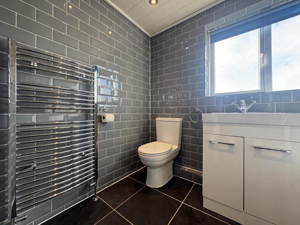
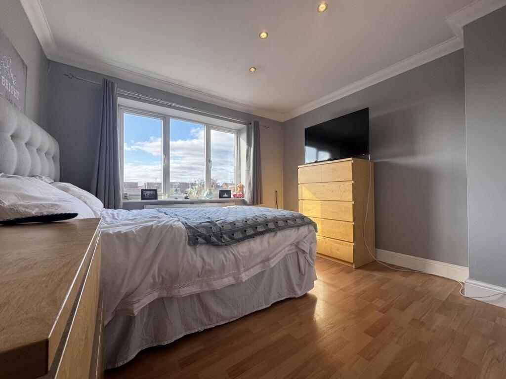
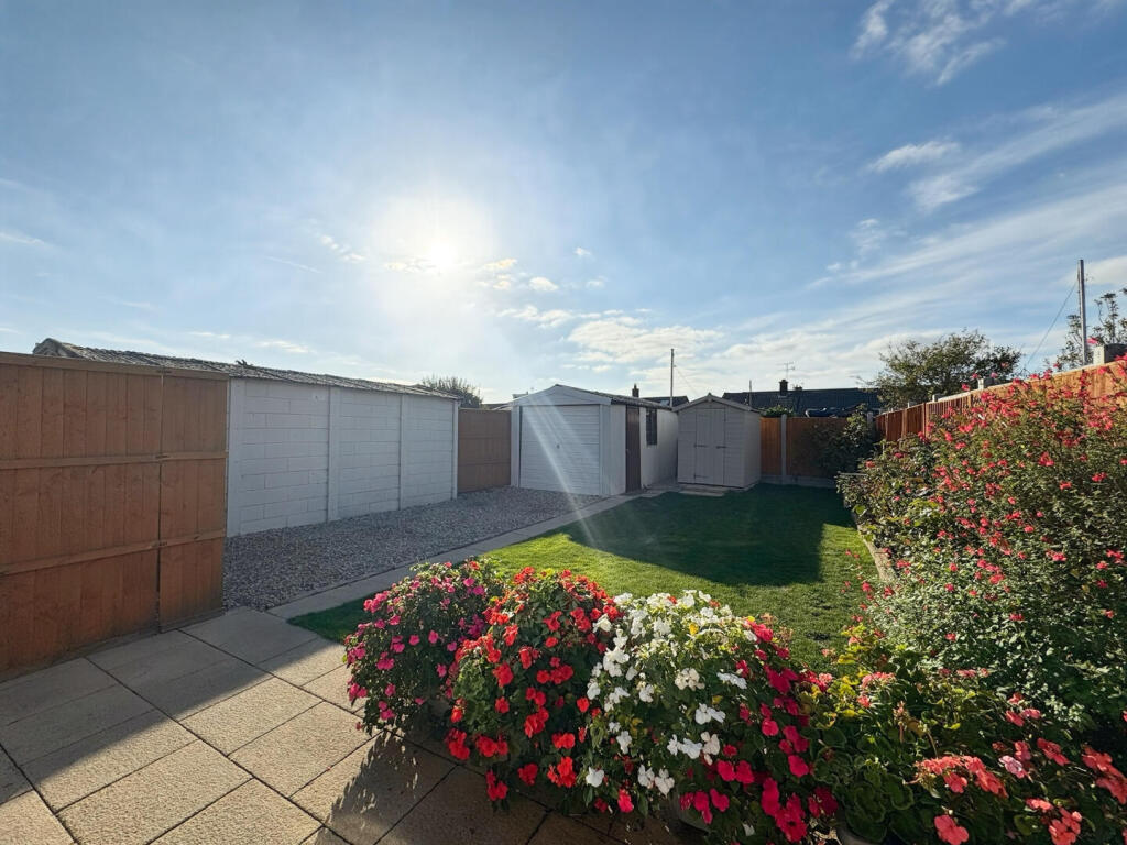
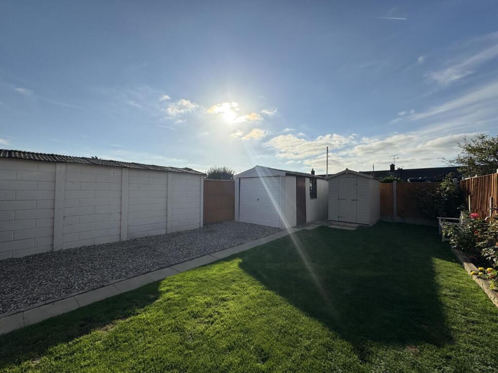
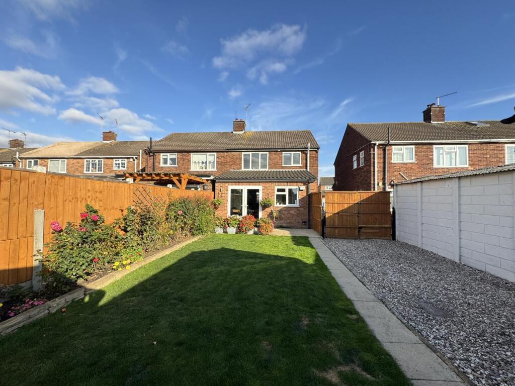
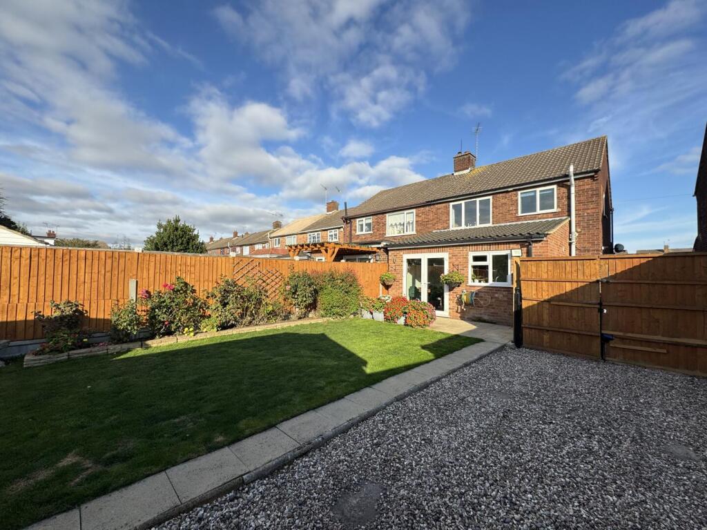
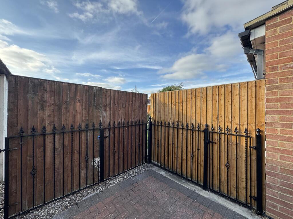
- Three-bedroom extended semi-detached family home in Corringham. Well-presented property offering generous internal living space including a large ground-floor rear extension, lovely lounge, large dining room and a bright kitchen/diner/family room with convenient utility. Accommodation includes a ground-floor shower room and a first-floor bathroom with three good-sized bedrooms. Externally the property benefits from a substantial block-paved driveway with gated parking and a garage to the side, plus a wonderful sizeable rear garden. Overall this is a larger-than-average family home on a good plot, suitable for growing families and retaining strong practical parking and outside space.
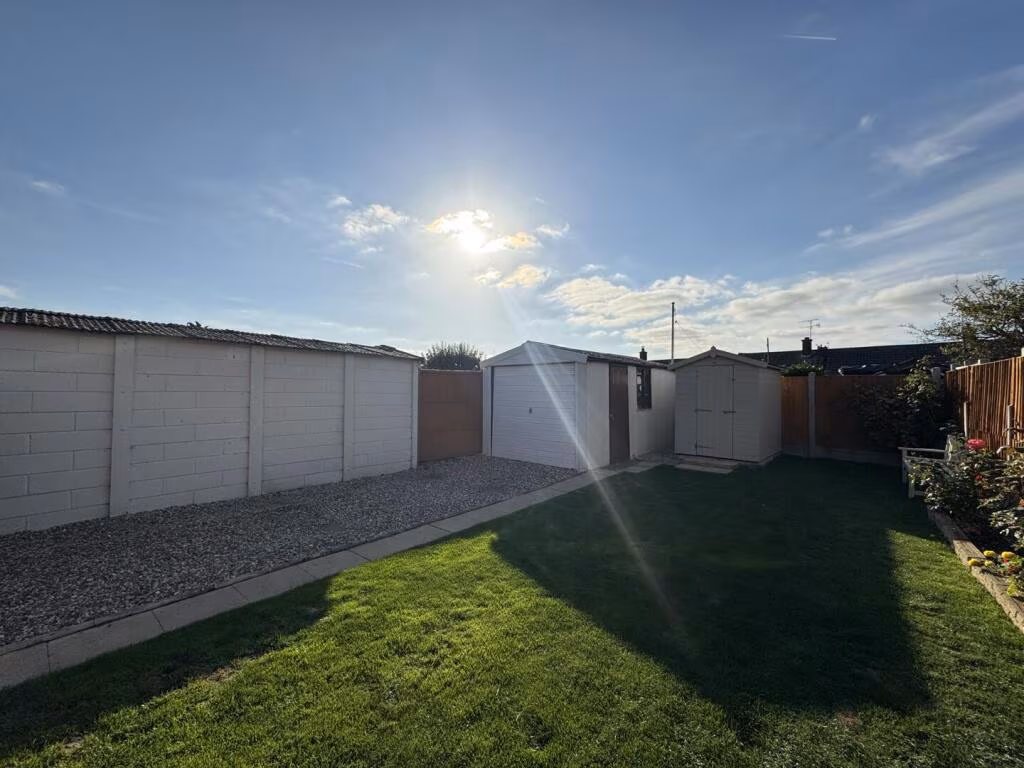
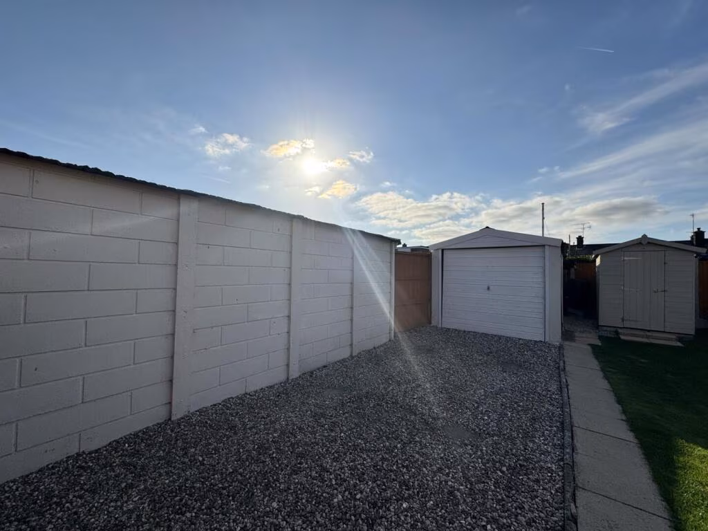
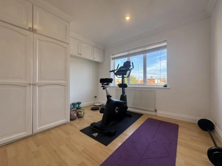
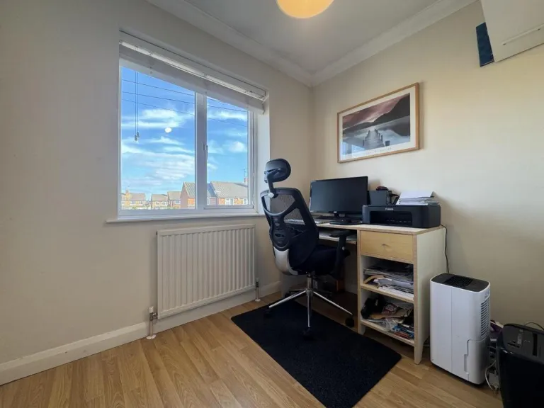
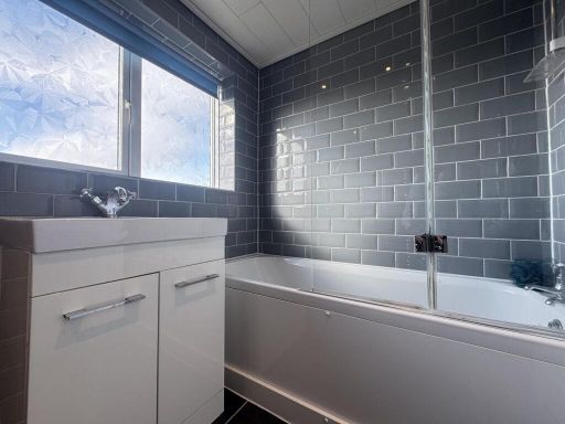
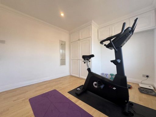
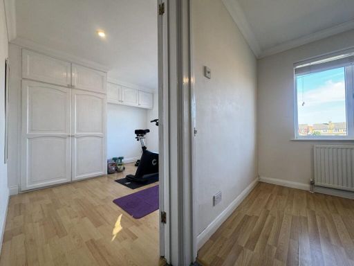
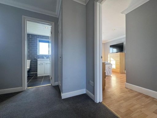
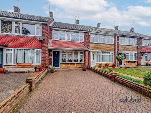
- Mid-20th century terraced/semi-detached family home (external appearance indicates a two-storey house with rear garden and outbuildings/garages). Internally the property offers an open-plan ground-floor living / dining area with tiled flooring to the dining section, a fitted kitchen opening to the living space, a ground-floor shower room/WC and an upstairs family bathroom with full-size bath. First floor presents a principal double bedroom with a large window and two further good-sized single bedrooms currently used as a home gym and a study. Neutral modern finishes throughout (grey tiling in bathrooms, laminate wood flooring in bedrooms). Rear garden is long and rectangular, predominantly laid to lawn with planted borders, a side gravelled drive/parking area and at least one single garage or outbuilding to the rear — overall garden size is medium/above-average for an urban/suburban plot. Overall property size: small-to-medium family house (likely 2–3 bedrooms) suitable for family occupation or buy-to-let. Condition appears well-presented and maintained with contemporary bathroom fittings and adequate natural light to principal rooms. Views: typical suburban outlook over neighbouring gardens and rooftops.
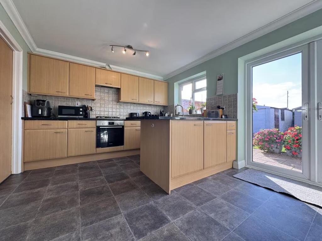
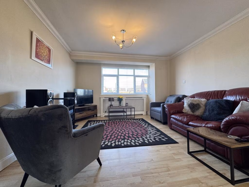
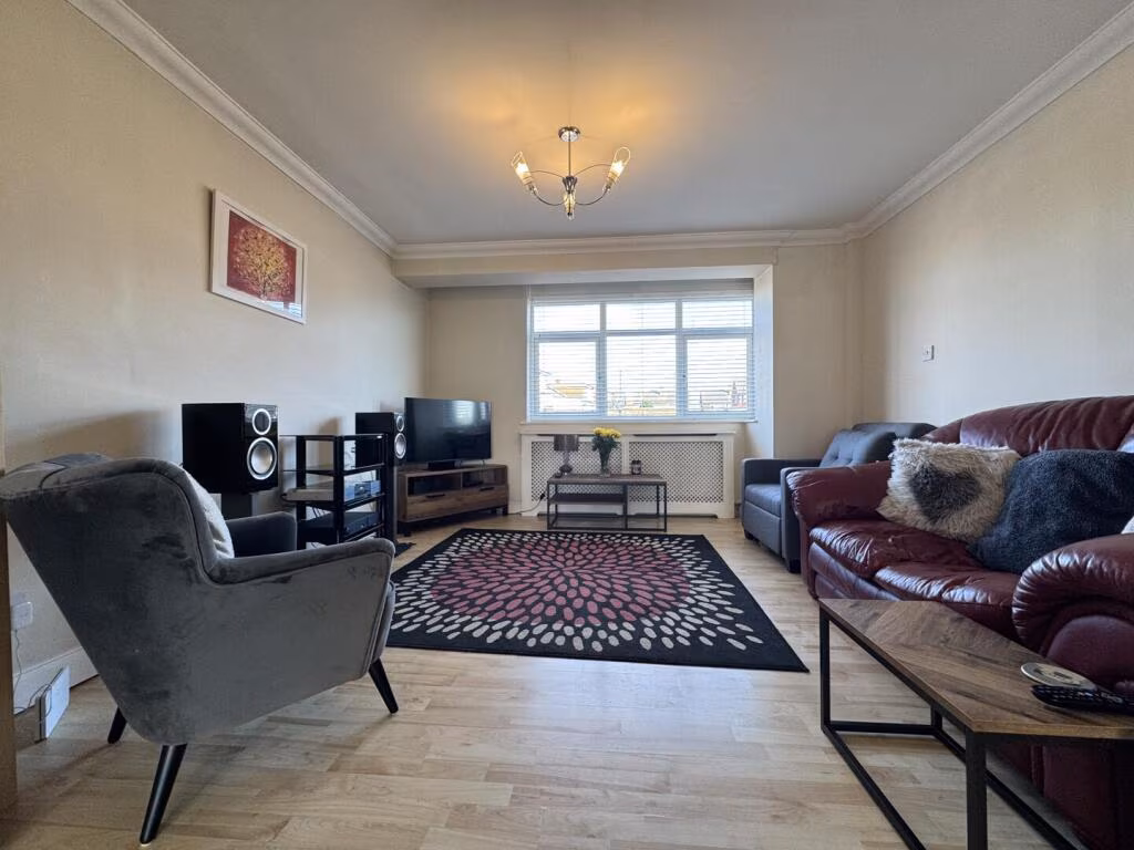
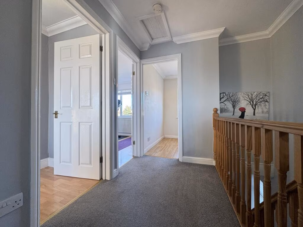
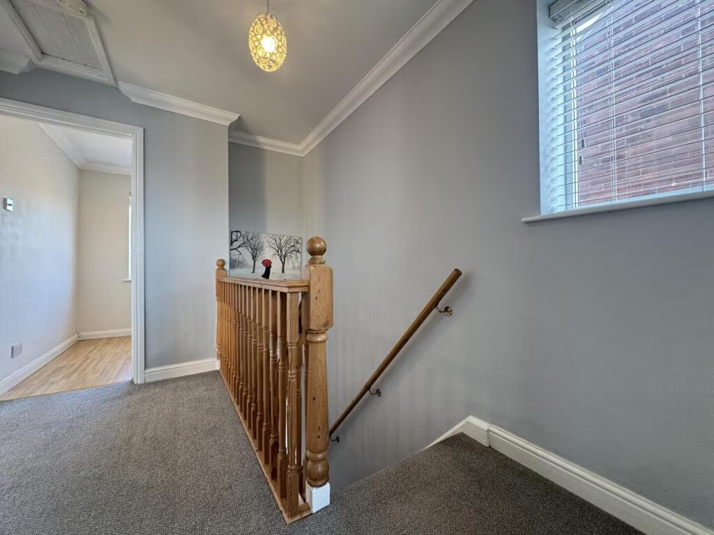
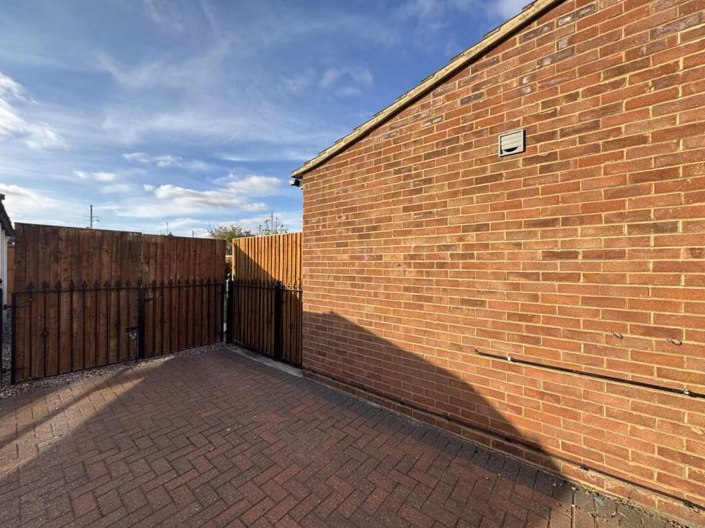
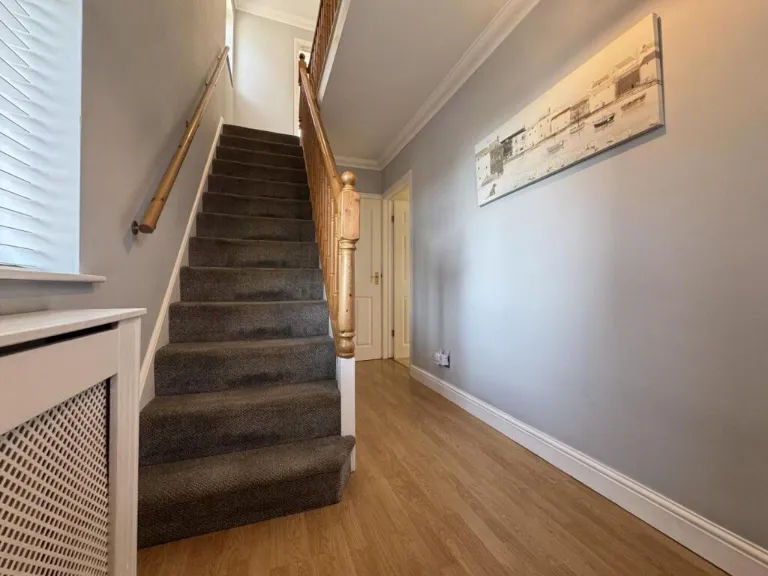
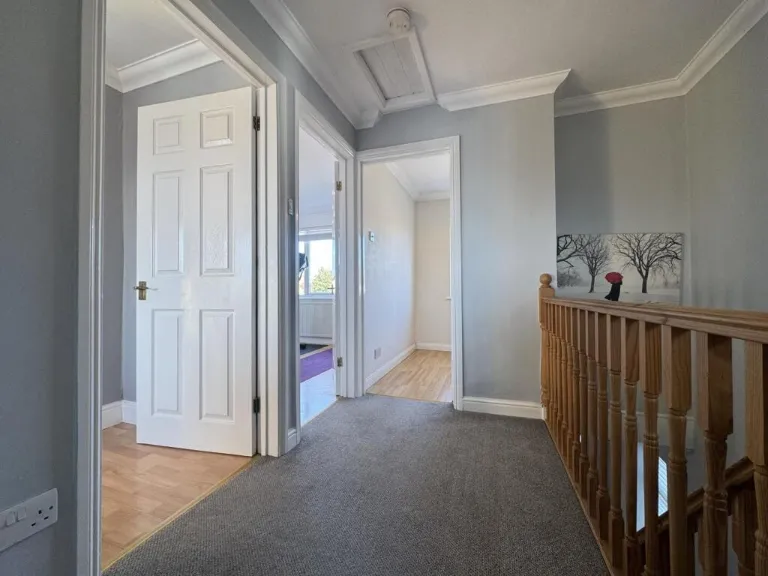
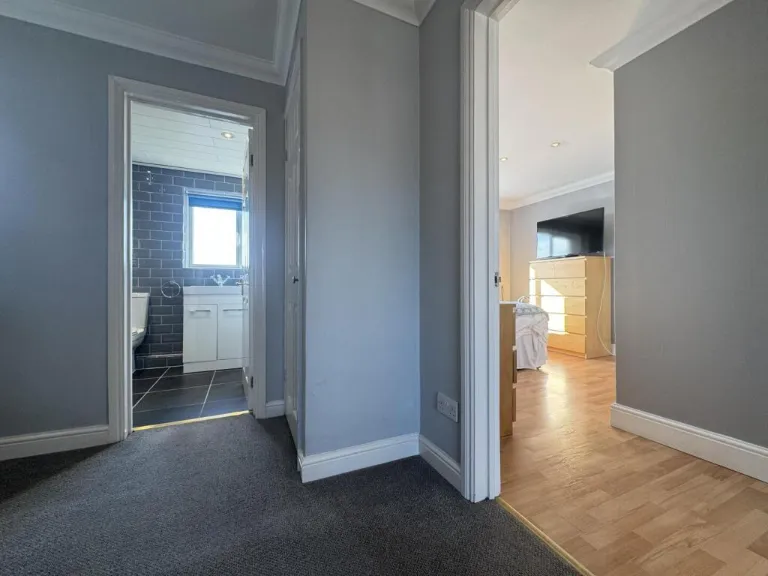
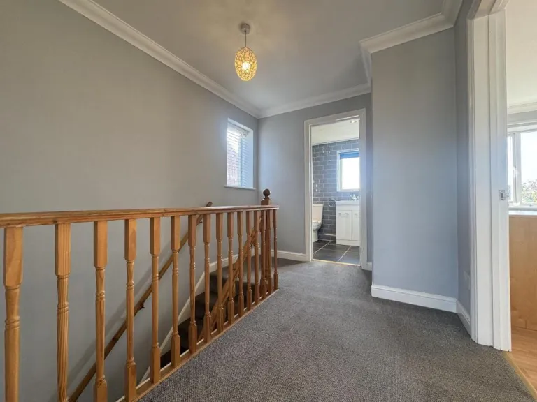
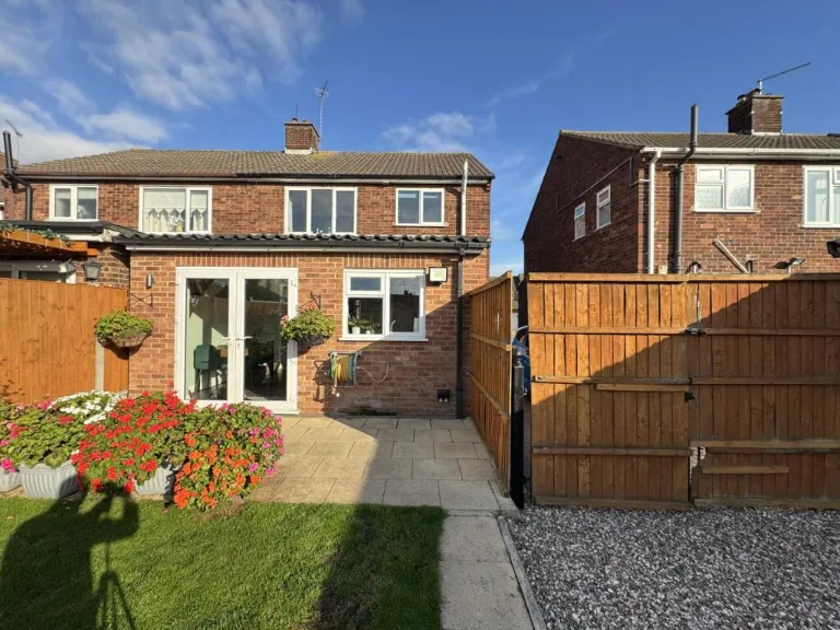
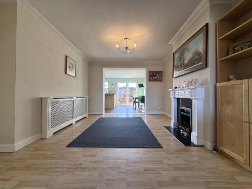
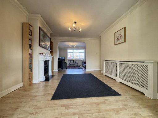
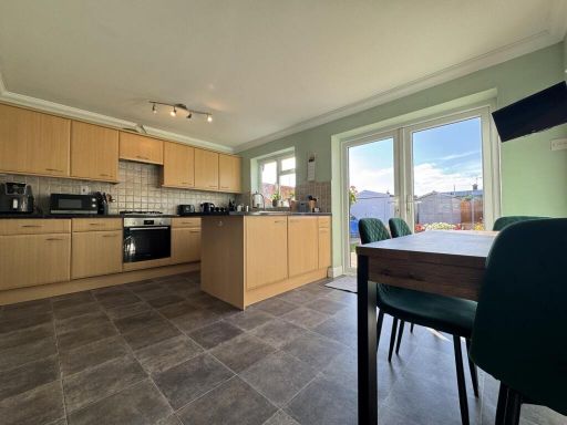
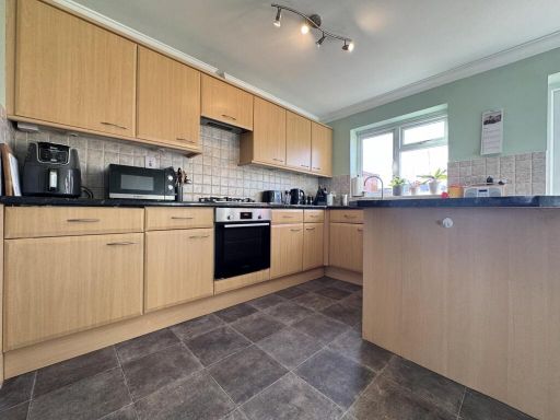
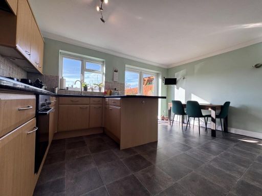
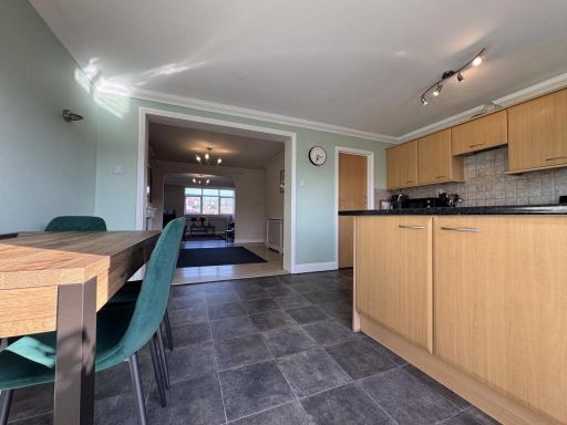
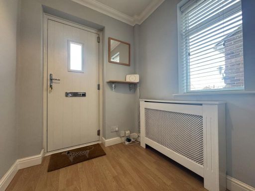
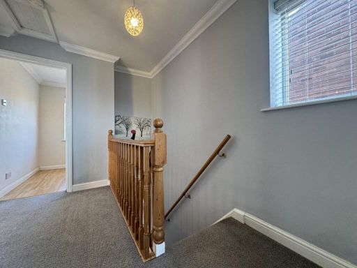
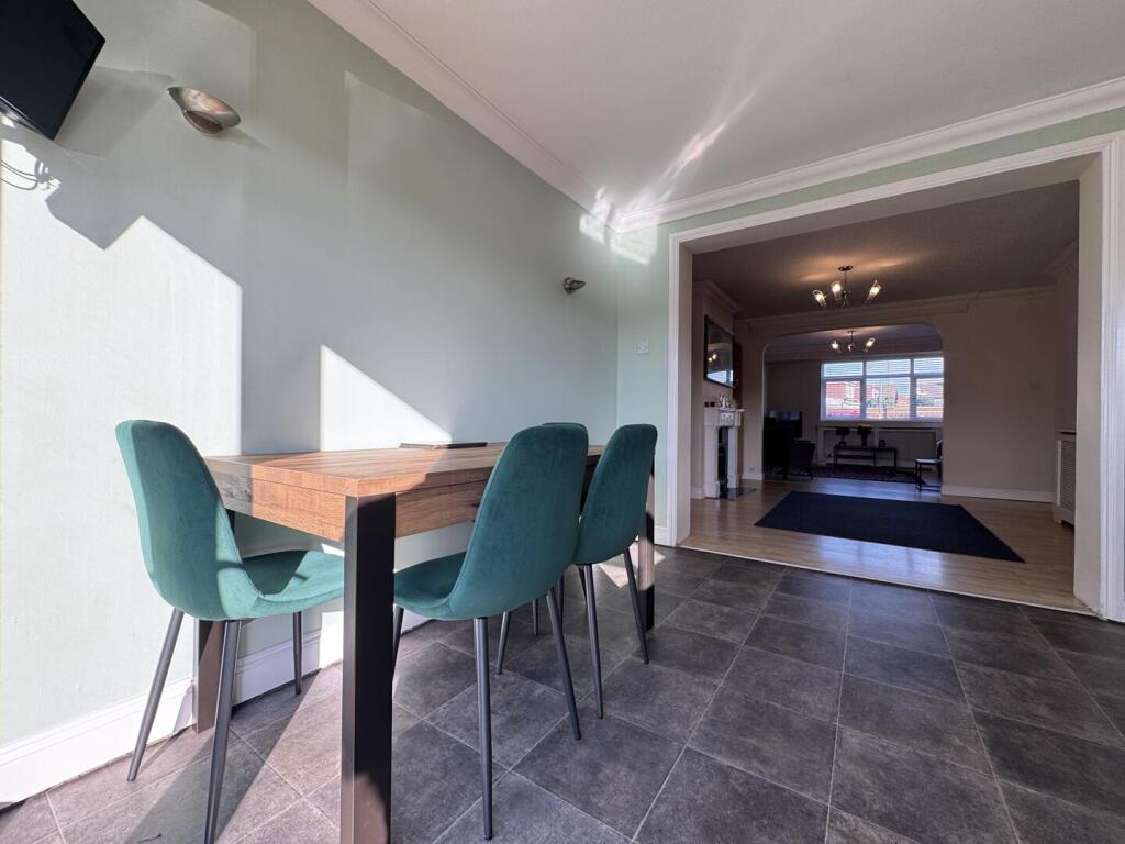
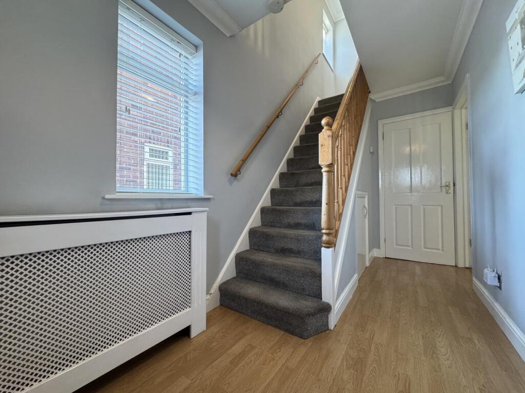
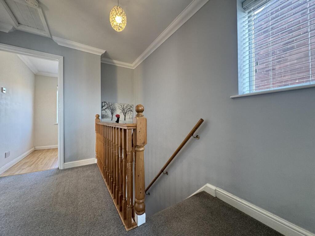
- Well-presented semi‑detached family home located in the desirable area of The Sorrells, Corringham. The accommodation extends over two floors and comprises an inviting entrance hall, a generously sized lounge with boxed bay window and wooden flooring, an extended open-plan kitchen/dining/family room with French glazed doors to the rear, a ground-floor shower room/utility area and first‑floor family bathroom. There are three comfortably sized bedrooms on the first floor. Externally the property benefits from a large rear garden with patio seating area and established lawn, a gated driveway providing off‑street parking for one vehicle and an attached single garage. Overall the plot and rear garden read as large for the type; internal living space is consistent with a mid-sized three-bedroom family house. Fixtures include built-in kitchen appliances, wood-style flooring to principal reception and double glazing throughout.
Image Descriptions
- semi-detached house Post-war
- open plan living room contemporary
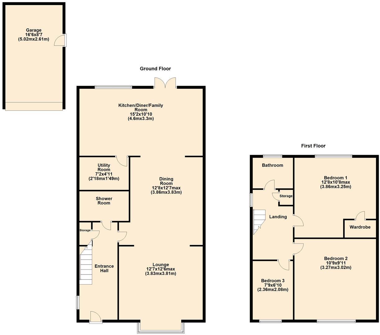
Floorplan Description
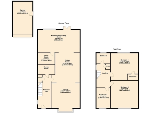
- Two-storey residence with kitchen/diner, lounge, utility and three bedrooms
Rooms
- Kitchen/Diner/Family Room:
- Dining Room:
- Utility Room:
- Lounge:
- Bedroom 1:
- Bedroom 2:
- Bedroom 3:
Textual Property Features
Detected Visual Features
- semi-detached
- brick exterior
- post-war
- driveway
- modern windows
- flower beds
- suburban
- family home
- open plan
- living room
- contemporary
- modern
- spacious
- open layout
- living area
- extension potential
- light
- airy
EPC Details
- Fully double glazed
- Cavity wall, filled cavity
- Boiler and radiators, mains gas
- Low energy lighting in all fixed outlets
- Solid, no insulation (assumed)
Nearby Schools
- Horndon-On-the-Hill CofE Primary School
- Lee Chapel Primary School
- East Tilbury Primary School
- Ortu Hassenbrook Academy
- Arthur Bugler Primary School
- Graham James Primary Academy
- Giffards Primary School
- Ortu Gable Hall School
- Great Berry Primary School
- Fairhouse Community Primary School
- The James Hornsby School
- Stanford-Le-Hope Primary School
- St Joseph's Catholic Primary School
- Abbots Hall Primary School
- Bardfield Academy
- Woodlands School
- Kingswood Primary School and Nursery
- Cherry Tree Primary School
- Ghyllgrove Primary School
- Laindon Park Primary School & Nursery
- St Clere's School
- Ortu Corringham Primary School and Nursery
- Vange Primary School and Nursery
- Ryedene Primary and Nursery School
- St Anne Line Catholic Junior School
- Janet Duke Primary School
- The Phoenix Primary School
Nearest Bars And Restaurants
- Id: 5071118609
- Tags:
- Amenity: cafe
- Name: Mama's Cabin
- TagsNormalized:
- Lat: 51.5250115
- Lon: 0.4476257
- FullGeoHash: u10m45vfyqmc
- PartitionGeoHash: u10m
- Images:
- FoodStandards: null
- Distance: 578.4
,- Id: 5739281571
- Tags:
- Amenity: fast_food
- Brand: Subway
- Brand:wikidata: Q244457
- Brand:wikipedia: en:Subway (restaurant)
- Cuisine: sandwich
- Name: Subway
- Takeaway: yes
- TagsNormalized:
- fast food
- food
- sandwich
- takeaway
- Lat: 51.5251726
- Lon: 0.4468776
- FullGeoHash: u10m45v7vh24
- PartitionGeoHash: u10m
- Images:
- FoodStandards: null
- Distance: 572.4
,- Id: 3580964812
- Tags:
- Amenity: cafe
- Name: Corringham Cafe
- Wifi: no
- TagsNormalized:
- Lat: 51.524652
- Lon: 0.4475177
- FullGeoHash: u10m45vbggm3
- PartitionGeoHash: u10m
- Images:
- FoodStandards: null
- Distance: 539.7
,- Id: 943353295
- Tags:
- Amenity: fast_food
- Brand: Greggs
- Brand:wikidata: Q3403981
- Brand:wikipedia: en:Greggs
- Contact:
- Website: https://www.greggs.co.uk/shop-finder?shop-code=0877
- Cuisine: sandwich;bakery
- Name: Greggs
- Takeaway: yes
- TagsNormalized:
- fast food
- food
- greggs
- sandwich
- bakery
- takeaway
- Lat: 51.5246309
- Lon: 0.4467633
- FullGeoHash: u10m45v2dr6g
- PartitionGeoHash: u10m
- Images:
- FoodStandards: null
- Distance: 514
,- Id: 6316971696
- Tags:
- Addr:
- Amenity: fast_food
- Brand: Domino's
- Brand:wikidata: Q839466
- Brand:wikipedia: en:Domino's Pizza
- Contact:
- Website: https://www.dominos.co.uk/pizza-near-me/corringham/unit-13-grover-walk
- Cuisine: pizza
- Name: Domino's
- Takeaway: yes
- TagsNormalized:
- fast food
- food
- dominos
- pizza
- takeaway
- Lat: 51.5243853
- Lon: 0.4464117
- FullGeoHash: u10m45tp61sd
- PartitionGeoHash: u10m
- Images:
- FoodStandards: null
- Distance: 479.2
}
Nearest General Shops
- Id: 679747659
- Tags:
- Name: Goldsmith Webb
- Shop: optician
- TagsNormalized:
- Lat: 51.5240666
- Lon: 0.4464985
- FullGeoHash: u10m45tjknjm
- PartitionGeoHash: u10m
- Images:
- FoodStandards: null
- Distance: 449.4
,- Id: 6316971692
- Tags:
- Name: Eagle News
- Shop: newsagent
- TagsNormalized:
- Lat: 51.5240311
- Lon: 0.4465706
- FullGeoHash: u10m45tjjze1
- PartitionGeoHash: u10m
- Images:
- FoodStandards: null
- Distance: 448
,- Id: 6316971693
- Tags:
- Name: Abbey Domestics
- Shop: appliance
- TagsNormalized:
- Lat: 51.5239722
- Lon: 0.4466383
- FullGeoHash: u10m45thzktd
- PartitionGeoHash: u10m
- Images:
- FoodStandards: null
- Distance: 444.3
}
Nearest Grocery shops
- Id: 5596878287
- Tags:
- Brand: Mace
- Brand:wikidata: Q75240338
- Name: Mace
- Shop: convenience
- TagsNormalized:
- Lat: 51.5260701
- Lon: 0.4601594
- FullGeoHash: u10m4kp147xs
- PartitionGeoHash: u10m
- Images:
- FoodStandards: null
- Distance: 1300.6
,- Id: 5739281560
- Tags:
- Brand: Iceland
- Brand:wikidata: Q721810
- Brand:wikipedia: en:Iceland (supermarket)
- Contact:
- Website: https://www.iceland.co.uk/store-finder/store?StoreID=838&StoreName=CORRINGHAM
- Name: Iceland
- Shop: frozen_food
- TagsNormalized:
- iceland
- frozen food
- food
- shop
- Lat: 51.5246149
- Lon: 0.4479778
- FullGeoHash: u10m45y0wsk7
- PartitionGeoHash: u10m
- Images:
- FoodStandards: null
- Distance: 552.5
,- Id: 5071118610
- Tags:
- Brand: Costcutter
- Brand:wikidata: Q5175072
- Brand:wikipedia: en:Costcutter
- Name: Costcutter
- Shop: convenience
- TagsNormalized:
- costcutter
- convenience
- shop
- Lat: 51.5245917
- Lon: 0.4476367
- FullGeoHash: u10m45vbw8n1
- PartitionGeoHash: u10m
- Images:
- FoodStandards: null
- Distance: 538
}
Nearest Supermarkets
- Id: 6219395922
- Tags:
- Addr:
- City: Corringham
- Housenumber: 33-37
- Postcode: SS17 7SE
- Street: Gardner Avenue
- Brand: Co-op Food
- Brand:wikidata: Q3277439
- Brand:wikipedia: en:Co-op Food
- Name: Co-op Food
- Operator: The Co-operative Group
- Operator:wikidata: Q117202
- Shop: supermarket
- TagsNormalized:
- co-op
- co-op food
- food
- supermarket
- shop
- Lat: 51.5305936
- Lon: 0.4453272
- FullGeoHash: u10m4hu72yuh
- PartitionGeoHash: u10m
- Images:
- FoodStandards: null
- Distance: 1136.9
,- Id: 579547565
- Tags:
- Brand: Morrisons
- Brand:wikidata: Q922344
- Brand:wikipedia: en:Morrisons
- Building: yes
- Contact:
- Website: https://my.morrisons.com/storefinder/486
- Designation: WM Morrisons
- Name: Morrisons
- Shop: supermarket
- TagsNormalized:
- Lat: 51.5252972
- Lon: 0.4464716
- FullGeoHash: u10m45vhee93
- PartitionGeoHash: u10m
- Images:
- FoodStandards: null
- Distance: 575.3
,- Id: 97973555
- Tags:
- Addr:
- City: Stanford Le Hope
- Postcode: SS17 7DZ
- Street: The Sorrells
- Brand: Co-op Food
- Brand:wikidata: Q3277439
- Brand:wikipedia: en:Co-op Food
- Name: Co-op Food
- Operator: Chelmsford Star Co-operative Society
- Shop: supermarket
- TagsNormalized:
- co-op
- co-op food
- food
- supermarket
- shop
- Lat: 51.5193435
- Lon: 0.4435799
- FullGeoHash: u10m44g1bjtn
- PartitionGeoHash: u10m
- Images:
- FoodStandards: null
- Distance: 119.9
}
Nearest Religious buildings
- Id: 500205220
- Tags:
- Amenity: place_of_worship
- Building: yes
- Source: OS OpenMap Local
- TagsNormalized:
- Lat: 51.5186468
- Lon: 0.4272286
- FullGeoHash: u10m1dxjg5ud
- PartitionGeoHash: u10m
- Images:
- FoodStandards: null
- Distance: 1156.6
,- Id: 500205252
- Tags:
- Amenity: place_of_worship
- Building: yes
- Denomination: baptist
- Name: Corringham & Stanford-Le-Hope Baptist Church
- Religion: christian
- Source: OS OpenMap Local
- TagsNormalized:
- place of worship
- baptist
- church
- christian
- Lat: 51.5256837
- Lon: 0.4497939
- FullGeoHash: u10m45zwbgwe
- PartitionGeoHash: u10m
- Images:
- FoodStandards: null
- Distance: 721.4
,- Id: 149081823
- Tags:
- Amenity: place_of_worship
- Building: yes
- Denomination: anglican
- Name: St John the Evangelist ?, Corringham
- Religion: christian
- Wikidata: Q105083497
- TagsNormalized:
- place of worship
- anglican
- evangelist
- christian
- church
- Lat: 51.5253323
- Lon: 0.448453
- FullGeoHash: u10m45yscdng
- PartitionGeoHash: u10m
- Images:
- FoodStandards: null
- Distance: 637.6
}
Nearest Medical buildings
- Id: 6620185418
- Tags:
- Leisure: fitness_centre
- Name: Oasis Health & Fitness Club
- TagsNormalized:
- fitness
- fitness centre
- leisure
- health
- club
- Lat: 51.515521
- Lon: 0.4276874
- FullGeoHash: u10m1dp7tv4u
- PartitionGeoHash: u10m
- Images:
- FoodStandards: null
- Distance: 1234.6
,- Id: 661612059
- Tags:
- Amenity: doctors
- Building: yes
- Healthcare: doctor
- Name: Hassengate Medical Centre
- TagsNormalized:
- doctor
- doctors
- health
- healthcare
- Lat: 51.5204243
- Lon: 0.4283247
- FullGeoHash: u10m1epbhxnn
- PartitionGeoHash: u10m
- Images:
- FoodStandards: null
- Distance: 1063.8
,- Id: 719938405
- Tags:
- Amenity: pharmacy
- Building: yes
- Dispensing: yes
- Healthcare: pharmacy
- Name: Hassengate Pharmacy
- TagsNormalized:
- Lat: 51.5205681
- Lon: 0.4283611
- FullGeoHash: u10m1epcj9cp
- PartitionGeoHash: u10m
- Images:
- FoodStandards: null
- Distance: 1061.4
,- Id: 5739281569
- Tags:
- Amenity: pharmacy
- Brand: Boots
- Brand:wikidata: Q6123139
- Brand:wikipedia: en:Boots UK
- Dispensing: yes
- Healthcare: pharmacy
- Name: Boots
- TagsNormalized:
- pharmacy
- boots
- health
- healthcare
- Lat: 51.52509
- Lon: 0.4470188
- FullGeoHash: u10m45ve2kcm
- PartitionGeoHash: u10m
- Images:
- FoodStandards: null
- Distance: 567.8
}
Nearest Airports
- Id: 103894219
- Tags:
- Aerodrome: international
- Aeroway: aerodrome
- Iata: SEN
- Icao: EGMC
- Name: London Southend Airport
- Old_name: Southend Municipal Airport
- Ref: SEN
- Wikidata: Q1415441
- TagsNormalized:
- airport
- international airport
- Lat: 51.5701749
- Lon: 0.6924624
- FullGeoHash: u10mru04p937
- PartitionGeoHash: u10m
- Images:
- FoodStandards: null
- Distance: 18070.1
,- Id: 121158889
- Tags:
- Aerodrome: continental
- Aeroway: aerodrome
- Fhrs:
- Authority: City of London Corporation
- Iata: LCY
- Icao: EGLC
- Name: London City Airport
- Operator: London City Airport Limited
- Ref: LCY
- Website: https://www.londoncityairport.com/
- Wikidata: Q8982
- Wikipedia: en:London City Airport
- TagsNormalized:
- airport
- continental airport
- Lat: 51.5042658
- Lon: 0.0539987
- FullGeoHash: u10j10p64702
- PartitionGeoHash: u10j
- Images:
- FoodStandards: null
- Distance: 27027.7
}
Nearest Leisure Facilities
- Id: 506700212
- Tags:
- Leisure: park
- Name: Hardie Park Hill
- TagsNormalized:
- Lat: 51.5191196
- Lon: 0.4342466
- FullGeoHash: u10m1fu0wevx
- PartitionGeoHash: u10m
- Images:
- FoodStandards: null
- Distance: 669.8
,- Id: 28829953
- Tags:
- Amenity: parking
- Name: Corringham Leisure Centre
- TagsNormalized:
- Lat: 51.525997
- Lon: 0.4469992
- FullGeoHash: u10m4hj2xy4b
- PartitionGeoHash: u10m
- Images:
- FoodStandards: null
- Distance: 660.9
,- Id: 8079249
- Tags:
- Leisure: park
- Name: Corringham Park
- TagsNormalized:
- Lat: 51.5257531
- Lon: 0.444477
- FullGeoHash: u10m45gxm0d1
- PartitionGeoHash: u10m
- Images:
- FoodStandards: null
- Distance: 595.5
,- Id: 6316971697
- Tags:
- Brand: Curves
- Brand:wikidata: Q5196080
- Brand:wikipedia: en:Curves International
- Leisure: fitness_centre
- Name: Curves
- TagsNormalized:
- fitness
- fitness centre
- leisure
- Lat: 51.5246735
- Lon: 0.446845
- FullGeoHash: u10m45v2uprc
- PartitionGeoHash: u10m
- Images:
- FoodStandards: null
- Distance: 520.7
,- Id: 607509033
- Tags:
- TagsNormalized:
- Lat: 51.5186022
- Lon: 0.4384892
- FullGeoHash: u10m1fxm9e90
- PartitionGeoHash: u10m
- Images:
- FoodStandards: null
- Distance: 413.3
}
Nearest Tourist attractions
- Id: 138226831
- Tags:
- Building: yes
- Name: Motorboat Museum
- Tourism: museum
- TagsNormalized:
- Lat: 51.551163
- Lon: 0.5060319
- FullGeoHash: u10m7887r3k9
- PartitionGeoHash: u10m
- Images:
- FoodStandards: null
- Distance: 5502.1
,- Id: 122458146
- Tags:
- Addr:
- Country: GB
- Postcode: SS17 9NR
- Street: High Road
- Building: yes
- Fhrs:
- Name: The Haywain
- Tourism: motel
- TagsNormalized:
- Lat: 51.550828
- Lon: 0.4667812
- FullGeoHash: u10m68eckfc7
- PartitionGeoHash: u10m
- Images:
- FoodStandards:
- Id: 104867
- FHRSID: 104867
- LocalAuthorityBusinessID: 3588
- BusinessName: The Haywain
- BusinessType: Hotel/bed & breakfast/guest house
- BusinessTypeID: 7842
- AddressLine1: null
- AddressLine2: High Road
- AddressLine3: Fobbing, Stanford-Le-Hope
- AddressLine4: Essex
- PostCode: SS17 9NR
- RatingValue: 5
- RatingKey: fhrs_5_en-GB
- RatingDate: 2021-07-29
- LocalAuthorityCode: 109
- LocalAuthorityName: Basildon
- LocalAuthorityWebSite: http://www.basildon.gov.uk
- LocalAuthorityEmailAddress: ehs@basildon.gov.uk
- Scores:
- Hygiene: 0
- Structural: 5
- ConfidenceInManagement: 0
- NewRatingPending: false
- Geocode:
- Longitude: 0.46649900000000
- Latitude: 51.55071600000000
- Distance: 3739.2
,- Id: 4936961022
- Tags:
- Name: Walton Hall Farm
- Name:en: Walton Hall Farm
- Tourism: caravan_site
- TagsNormalized:
- Lat: 51.4950204
- Lon: 0.4132757
- FullGeoHash: u10kcqkunp89
- PartitionGeoHash: u10k
- Images:
- FoodStandards: null
- Distance: 3522.8
}
Nearest Train stations
- Id: 6733461096
- Tags:
- Name: Pitsea
- Naptan:
- Network: National Rail
- Operator: c2c
- Platforms: 4
- Public_transport: station
- Railway: station
- Ref:
- Source: NPE
- Wikidata: Q2982936
- Wikipedia: en:Pitsea railway station
- TagsNormalized:
- Lat: 51.5602396
- Lon: 0.5079761
- FullGeoHash: u10m7d3bhtq3
- PartitionGeoHash: u10m
- Images:
- FoodStandards: null
- Distance: 6274.2
,- Id: 6733268329
- Tags:
- Name: Laindon
- Naptan:
- Network: National Rail
- Public_transport: station
- Railway: station
- Ref:
- Source: NPE
- Wheelchair: yes
- Wikidata: Q2801845
- Wikipedia: en:Laindon railway station
- TagsNormalized:
- Lat: 51.5675954
- Lon: 0.4237157
- FullGeoHash: u10m3ese1292
- PartitionGeoHash: u10m
- Images:
- FoodStandards: null
- Distance: 5424.7
,- Id: 2008917061
- Tags:
- Name: Basildon
- Name:lt: Bazildonas
- Naptan:
- Network: National Rail
- Public_transport: station
- Railway: station
- Ref:
- Wheelchair: yes
- Wikidata: Q2752701
- Wikipedia: en:Basildon railway station
- TagsNormalized:
- Lat: 51.5681417
- Lon: 0.4567961
- FullGeoHash: u10m67swhn7g
- PartitionGeoHash: u10m
- Images:
- FoodStandards: null
- Distance: 5383.2
,- Id: 6735092345
- Tags:
- Name: East Tilbury
- Naptan:
- Network: National Rail
- Operator: c2c
- Public_transport: station
- Railway: station
- Ref:
- Wikidata: Q2487544
- Wikipedia: en:East Tilbury railway station
- TagsNormalized:
- Lat: 51.4845202
- Lon: 0.4127175
- FullGeoHash: u10kckkx140m
- PartitionGeoHash: u10k
- Images:
- FoodStandards: null
- Distance: 4531.4
,- Id: 6735092344
- Tags:
- Name: Stanford-le-Hope
- Naptan:
- Network: National Rail
- Operator: c2c
- Public_transport: station
- Railway: station
- Ref:
- Wikidata: Q2062756
- Wikipedia: en:Stanford-le-Hope railway station
- TagsNormalized:
- Lat: 51.5141935
- Lon: 0.4229093
- FullGeoHash: u10m19ggyt8j
- PartitionGeoHash: u10m
- Images:
- FoodStandards: null
- Distance: 1596.5
}
Nearest Hotels
- Id: 122529130
- Tags:
- Addr:
- City: Basildon
- Postcode: SS14 3DG
- Street: Cranes Farm Road
- Brand: Holiday Inn
- Brand:wikidata: Q2717882
- Brand:wikipedia: en:Holiday Inn
- Building: yes
- Internet_access: yes
- Internet_access:fee: customers
- Name: Holiday Inn
- Phone: +44 371 942 9003
- Tourism: hotel
- Website: https://www.ihg.com/holidayinn/hotels/gb/en/reservation
- Wheelchair: yes
- TagsNormalized:
- Lat: 51.5836089
- Lon: 0.4607461
- FullGeoHash: u10m6qx821th
- PartitionGeoHash: u10m
- Images:
- FoodStandards: null
- Distance: 7124.5
,- Id: 607501652
- Tags:
- Addr:
- Country: GB
- Postcode: SS14 3AE
- Street: Burches
- Fhrs:
- Name: Hotel Campanile
- Tourism: hotel
- TagsNormalized:
- Lat: 51.5843737
- Lon: 0.4426479
- FullGeoHash: u10m6ndkf2np
- PartitionGeoHash: u10m
- Images:
- FoodStandards: null
- Distance: 7111.8
,- Id: 29012772
- Tags:
- Addr:
- City: Orsett
- Housename: Orsett Hall Hotel
- Postcode: RM16 3HS
- Street: Prince Charles Avenue
- Amenity: restaurant
- Amenity_1: spa
- Name: Orsett Hall
- Phone: +44 1375 891402
- Tourism: hotel
- Website: http://www.orsetthall.co.uk/
- Wikidata: Q15264369
- Wikipedia: en:Orsett Hall
- TagsNormalized:
- Lat: 51.5158749
- Lon: 0.3779297
- FullGeoHash: u10m0d5jwrhg
- PartitionGeoHash: u10m
- Images:
- FoodStandards: null
- Distance: 4578.8
}
Tags
- semi-detached
- brick exterior
- post-war
- driveway
- modern windows
- flower beds
- suburban
- family home
- open plan
- living room
- contemporary
- modern
- spacious
- open layout
- living area
- extension potential
- light
- airy
Local Market Stats
- Average Price/sqft: £378
- Avg Income: £46700
- Rental Yield: 4.1%
- Social Housing: 9%
- Planning Success Rate: 76%
Similar Properties
 3 bedroom terraced house for sale in Corringham Road, Corringham, SS17 — £325,000 • 3 bed • 1 bath • 880 ft²
 3 bedroom semi-detached house for sale in Giffords Cross Road, Corringham, SS17 — £375,000 • 3 bed • 1 bath • 836 ft²
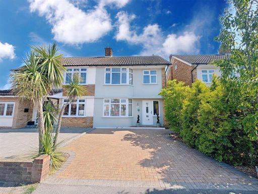 3 bedroom semi-detached house for sale in Lampits Hill, Corringham, SS17 — £400,000 • 3 bed • 1 bath • 652 ft²
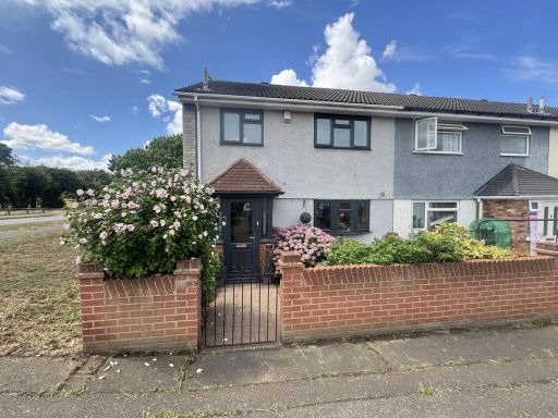 3 bedroom end of terrace house for sale in Bellmaine Avenue, Corringham, SS17 — £325,000 • 3 bed • 2 bath • 767 ft²
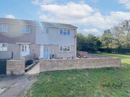 3 bedroom end of terrace house for sale in Rachael Clarke Close, Corringham, SS17 — £325,000 • 3 bed • 2 bath • 765 ft²
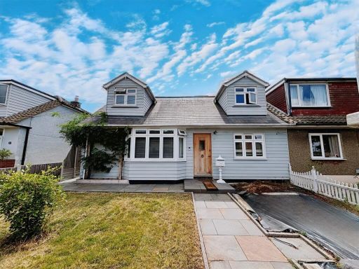 5 bedroom semi-detached house for sale in Elmstead Close, Corringham, SS17 — £475,000 • 5 bed • 2 bath • 1443 ft²
Meta
- {
"@context": "https://schema.org",
"@type": "Residence",
"name": "3 bedroom semidetached house for sale in The Sorrells, Corr…",
"description": "",
"url": "https://propertypiper.co.uk/property/c144f0c1-8d77-44b8-a6bd-dccea227a57a",
"image": "https://image-a.propertypiper.co.uk/3ca52665-d12b-4dae-978d-2118f25993b3-1024.jpeg",
"address": {
"@type": "PostalAddress",
"streetAddress": "39 THE SORRELLS STANFORD-LE-HOPE ",
"postalCode": "SS17 7DZ",
"addressLocality": "Thurrock",
"addressRegion": "South Basildon and East Thurrock",
"addressCountry": "England"
},
"geo": {
"@type": "GeoCoordinates",
"latitude": 51.5204195,
"longitude": 0.4436995
},
"numberOfRooms": 3,
"numberOfBathroomsTotal": 2,
"floorSize": {
"@type": "QuantitativeValue",
"value": 803,
"unitCode": "FTK"
},
"offers": {
"@type": "Offer",
"price": 410000,
"priceCurrency": "GBP",
"availability": "https://schema.org/InStock"
},
"additionalProperty": [
{
"@type": "PropertyValue",
"name": "Feature",
"value": "semi-detached"
},
{
"@type": "PropertyValue",
"name": "Feature",
"value": "brick exterior"
},
{
"@type": "PropertyValue",
"name": "Feature",
"value": "post-war"
},
{
"@type": "PropertyValue",
"name": "Feature",
"value": "driveway"
},
{
"@type": "PropertyValue",
"name": "Feature",
"value": "modern windows"
},
{
"@type": "PropertyValue",
"name": "Feature",
"value": "flower beds"
},
{
"@type": "PropertyValue",
"name": "Feature",
"value": "suburban"
},
{
"@type": "PropertyValue",
"name": "Feature",
"value": "family home"
},
{
"@type": "PropertyValue",
"name": "Feature",
"value": "open plan"
},
{
"@type": "PropertyValue",
"name": "Feature",
"value": "living room"
},
{
"@type": "PropertyValue",
"name": "Feature",
"value": "contemporary"
},
{
"@type": "PropertyValue",
"name": "Feature",
"value": "modern"
},
{
"@type": "PropertyValue",
"name": "Feature",
"value": "spacious"
},
{
"@type": "PropertyValue",
"name": "Feature",
"value": "open layout"
},
{
"@type": "PropertyValue",
"name": "Feature",
"value": "living area"
},
{
"@type": "PropertyValue",
"name": "Feature",
"value": "extension potential"
},
{
"@type": "PropertyValue",
"name": "Feature",
"value": "light"
},
{
"@type": "PropertyValue",
"name": "Feature",
"value": "airy"
}
]
}
High Res Floorplan Images
Compatible Floorplan Images
FloorplanImages Thumbnail