B26 2HT - 3 bedroom semidetached house for sale in Gleneagles Road, Y…
View on Property Piper
3 bedroom semi-detached house for sale in Gleneagles Road, Yardley, Birmingham, B26
Property Details
- Price: £240000
- Bedrooms: 3
- Bathrooms: 1
- Property Type: undefined
- Property SubType: undefined
Brochure Descriptions
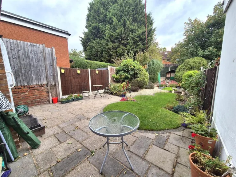
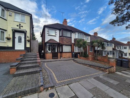
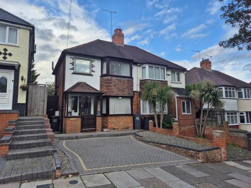
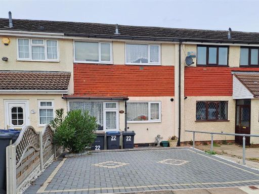
- Semi‑detached, two‑storey family house located on a residential road. The property presents a covered front porch entrance, bay window to the ground/front room and an attached neighbouring house to one side. The front exterior benefits from a wide block‑paved driveway providing off‑street parking for two cars and a small planted/gravelled front garden with several mature ornamental palms. The plot and front garden are small to average in size; overall the property appears to be an average sized semi‑detached family home suitable for 3–4 bedrooms (internal layout not visible). The setting is a suburban street with neighbouring similar properties and no exceptional views visible from the images.
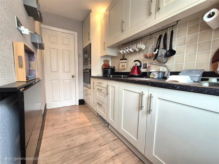
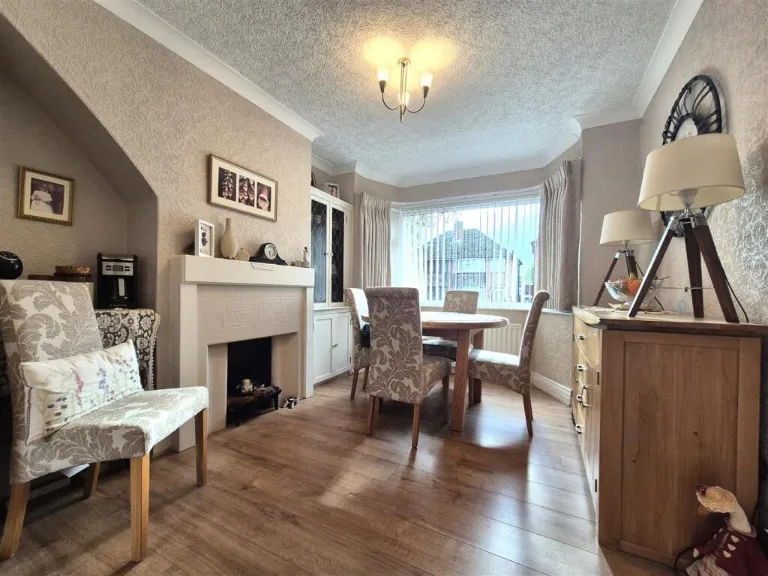
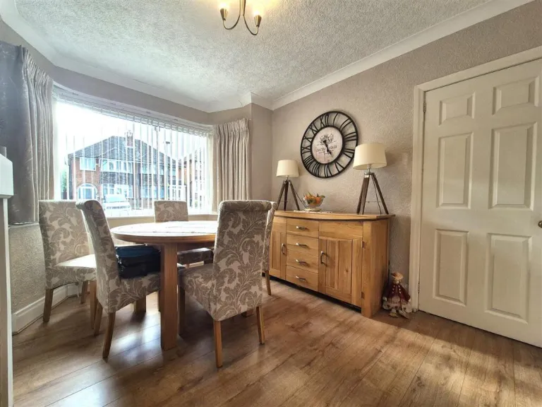
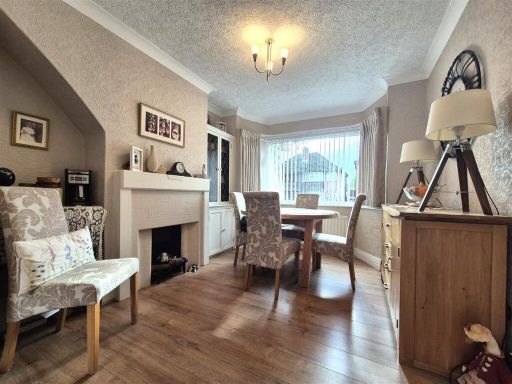
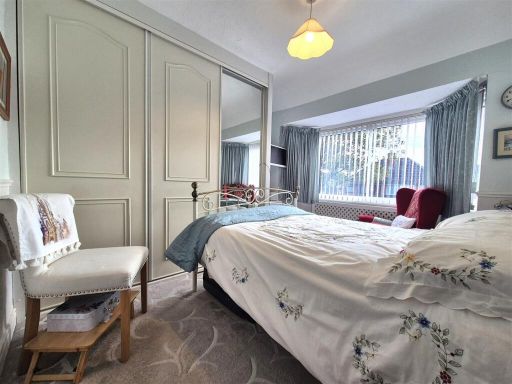
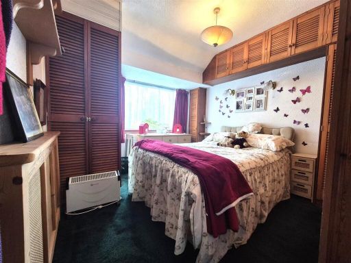
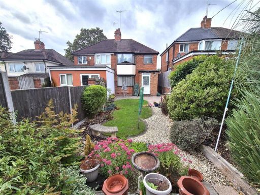
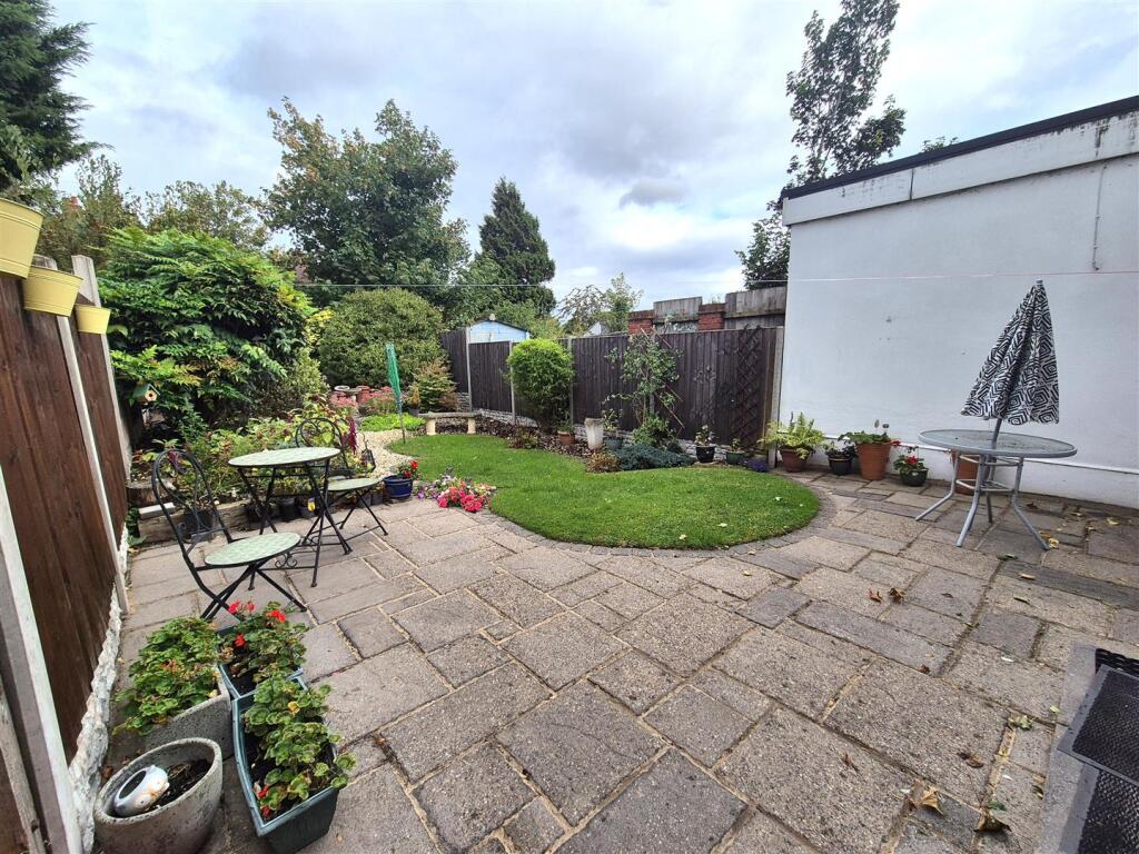
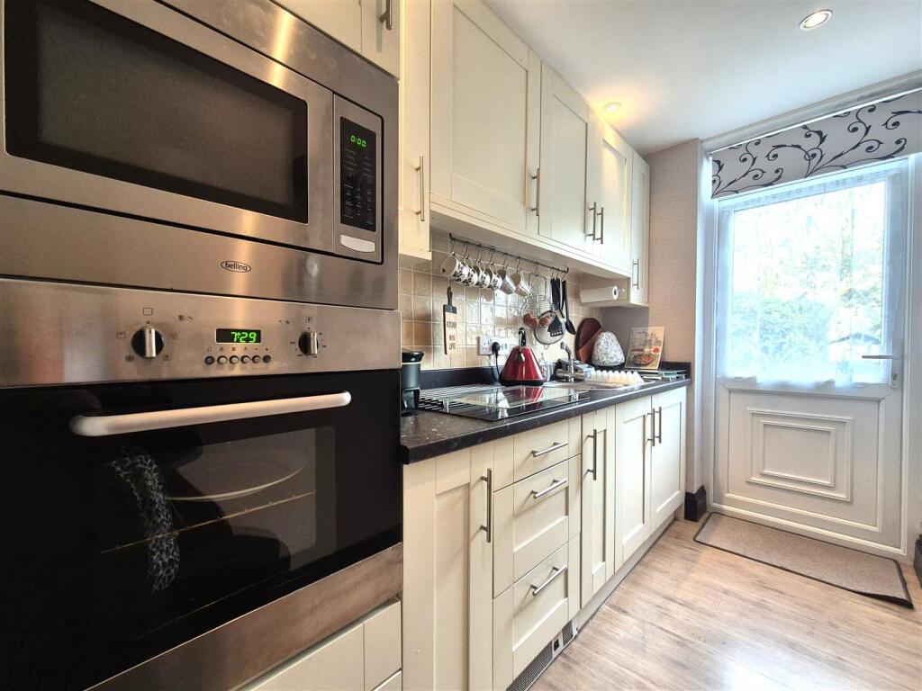
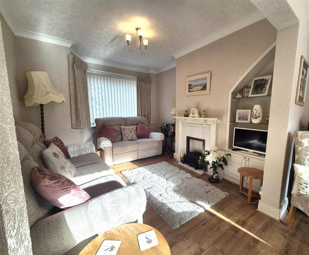
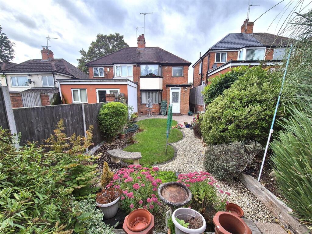
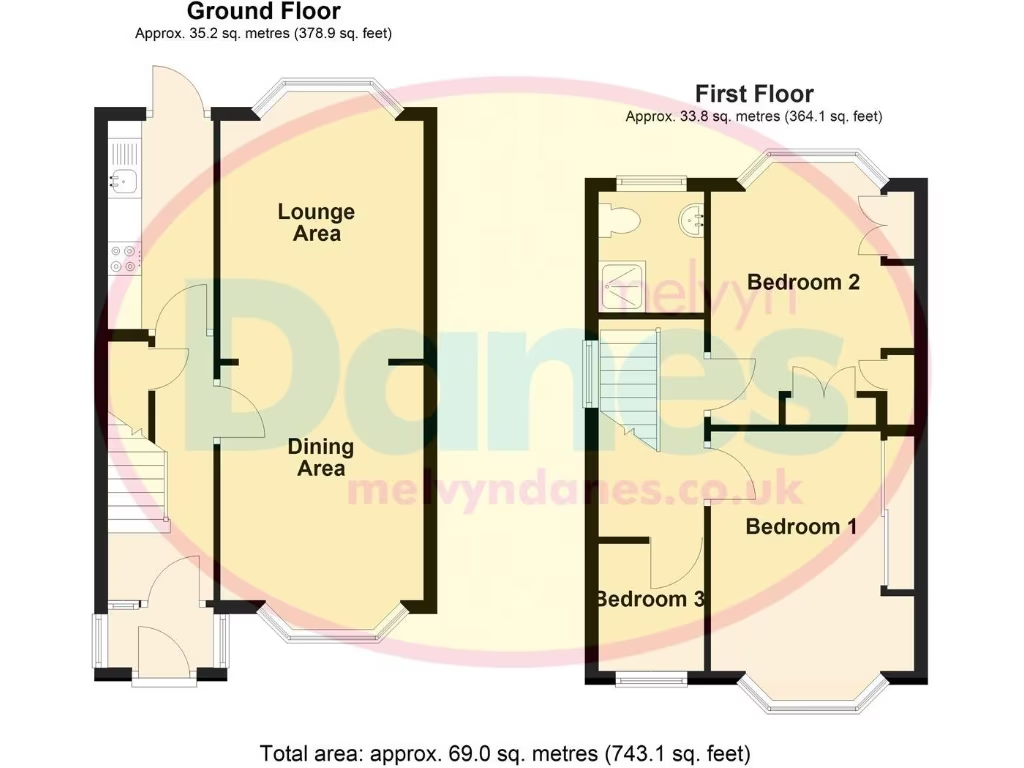
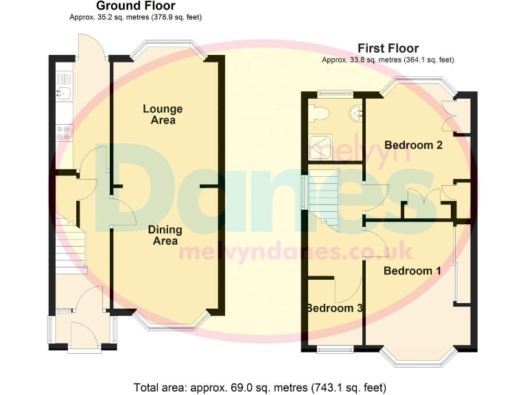
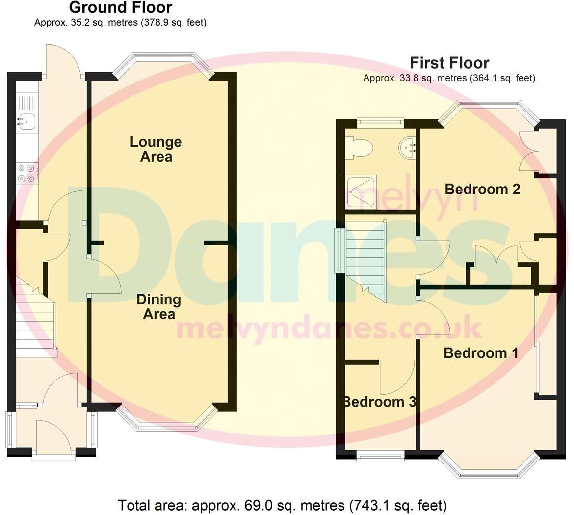
- Mid-terrace / mid-row suburban house shown on a two-floor floorplan (ground and first). Accommodation appears to comprise a lounge, separate dining area, kitchen on the ground floor and three bedrooms plus a bathroom on the first floor. Total internal area stated on the plan is approximately 69.0 sq. metres (c. 743 sq. ft). The plot appears to be of average size for a suburban terraced property with a small to average rear garden (not explicitly drawn but implied by layout). Map extract indicates a residential location in Yardley, Birmingham with nearby streets and local amenities. Overall the property is a modestly sized, conventional 3-bedroom family house suitable for owner-occupation or rental; finishes and condition are not indicated on the images so valuation would need inspection for condition, any extensions or loft conversions and accurate external area measurements.
Image Descriptions
- semi-detached house mid-20th century suburban
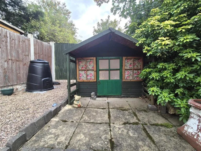
- backyard and garden
Floorplan Description
- Two-storey residential layout with lounge, dining area and three bedrooms.
Rooms
- Lounge Area:
- Dining Area:
- Bedroom 1:
- Bedroom 2:
- Bedroom 3:
Textual Property Features
- Has Garden
- Chain Free
- Success
Detected Visual Features
- semi-detached
- 1950s
- 1960s
- suburban
- driveway
- brickwork
- two-storey
- renovation potential
- mid-century
- residential area
- backyard
- garden
- landscaped
- outdoor space
- patio
- fencing
- mature trees
- flower beds
- paved area
- private
EPC Details
- Fully double glazed
- Solid brick, as built, no insulation (assumed)
- Boiler and radiators, mains gas
- Low energy lighting in 78% of fixed outlets
- Suspended, no insulation (assumed)
Nearby Schools
- St Andrew's Catholic Primary School
- Elms Farm Community Primary School
- Oasis Academy Hobmoor
- Blakesley Hall Primary School
- Our Lady's Catholic Primary School
- St Margaret's Church of England Primary School
- Olton Primary School
- Lyndon School
- Gilbertstone Primary School
- Gossey Lane Academy
- Corpus Christi Catholic Primary School
- Stanville Primary School
- East Birmingham Network Academy
- Cockshut Hill School
- Stechford Primary School
- Lea Forest Primary Academy
- Daylesford Academy
- St Thomas More Catholic Primary School
- Lyndon Green Junior School
- Lyndon Green Infant School
- Yardley Primary School
- King Edward VI Sheldon Heath Academy
- Oasis Academy Blakenhale Junior
- Oasis Academy Blakenhale Infants
- The Oval School
- Audley Primary School
Nearest Bars And Restaurants
- Id: 727677441
- Tags:
- Amenity: fast_food
- Name: Broadstone Chinese Takeaway
- Source: survey
- TagsNormalized:
- fast food
- food
- chinese
- takeaway
- Lat: 52.4758148
- Lon: -1.7931153
- FullGeoHash: gcqdx0ymc2uk
- PartitionGeoHash: gcqd
- Images:
- FoodStandards: null
- Distance: 758.9
,- Id: 58732892
- Tags:
- Amenity: pub
- Building: yes
- Name: St Bernards Grange
- Source: OS_OpenData_StreetView
- TagsNormalized:
- Lat: 52.4637676
- Lon: -1.7939287
- FullGeoHash: gcqdrntxw7jg
- PartitionGeoHash: gcqd
- Images:
- FoodStandards: null
- Distance: 584.4
,- Id: 727766305
- Tags:
- Amenity: cafe
- Name: Sandra's Coffee Shop
- Source: survey
- TagsNormalized:
- Lat: 52.465394
- Lon: -1.7961043
- FullGeoHash: gcqdrph15dr9
- PartitionGeoHash: gcqd
- Images:
- FoodStandards: null
- Distance: 452.9
,- Id: 727766303
- Tags:
- Amenity: fast_food
- Name: Stella's Fish Bar
- Source: survey
- TagsNormalized:
- Lat: 52.465475
- Lon: -1.7960762
- FullGeoHash: gcqdrph1s3kt
- PartitionGeoHash: gcqd
- Images:
- FoodStandards: null
- Distance: 444
,- Id: 727763229
- Tags:
- Amenity: fast_food
- Name: Bake 'n' Butties
- Source: survey
- TagsNormalized:
- Lat: 52.4676334
- Lon: -1.7910149
- FullGeoHash: gcqdrpry47f2
- PartitionGeoHash: gcqd
- Images:
- FoodStandards: null
- Distance: 200.6
}
Nearest General Shops
- Id: 727688814
- Tags:
- Name: Garrets Green Garden Centre
- Shop: garden_centre
- Source: survey
- TagsNormalized:
- Lat: 52.4701509
- Lon: -1.784701
- FullGeoHash: gcqdrrukv3n3
- PartitionGeoHash: gcqd
- Images:
- FoodStandards: null
- Distance: 574.6
,- Id: 98603762
- Tags:
- Addr:
- City: Birmingham
- Housenumber: 236
- Postcode: B26 1RL
- Street: Barrows Lane
- Building: retail
- Name: Sheldon Supermarket Londis
- Shop: supermarket
- Source: visual survey; bing
- TagsNormalized:
- Lat: 52.4653061
- Lon: -1.7958126
- FullGeoHash: gcqdrph2d9cj
- PartitionGeoHash: gcqd
- Images:
- FoodStandards: null
- Distance: 452.8
,- Id: 727763234
- Tags:
- Name: Lily's Florist
- Shop: florist
- Source: survey
- TagsNormalized:
- Lat: 52.4678348
- Lon: -1.7903399
- FullGeoHash: gcqdrr2r613c
- PartitionGeoHash: gcqd
- Images:
- FoodStandards: null
- Distance: 219.5
}
Nearest Grocery shops
- Id: 98842122
- Tags:
- Addr:
- Brand: Costcutter
- Brand:wikidata: Q5175072
- Brand:wikipedia: en:Costcutter
- Building: yes
- Contact:
- Website: https://store-locator.costcutter.co.uk/costcutter-fe871eafa496
- Name: Costcutter
- Old_name: Stirrup Cup
- Shop: convenience
- Source: bing
- TagsNormalized:
- costcutter
- convenience
- shop
- Lat: 52.4620846
- Lon: -1.7840782
- FullGeoHash: gcqdrqkvgcqu
- PartitionGeoHash: gcqd
- Images:
- FoodStandards: null
- Distance: 975.8
,- Id: 727677476
- Tags:
- Amenity: convenience_store
- Name: Sky News & Convenience Store
- Shop: convenience
- Source: survey
- TagsNormalized:
- Lat: 52.475726
- Lon: -1.7929517
- FullGeoHash: gcqdx0ymm0q6
- PartitionGeoHash: gcqd
- Images:
- FoodStandards: null
- Distance: 749
,- Id: 727763232
- Tags:
- Name: Super Saver
- Shop: convenience
- Source: survey
- TagsNormalized:
- Lat: 52.4678818
- Lon: -1.7901994
- FullGeoHash: gcqdrr2rt64d
- PartitionGeoHash: gcqd
- Images:
- FoodStandards: null
- Distance: 224.3
}
Nearest Supermarkets
- Id: 85403892
- Tags:
- Addr:
- City: Birmingham
- Postcode: B26 3YH
- Street: Church Road
- Brand: Co-op Food
- Brand:wikidata: Q3277439
- Brand:wikipedia: en:Co-op Food
- Building: retail
- Name: Co-op Food
- Operator: The Co-operative Group
- Operator:wikidata: Q117202
- Shop: supermarket
- Source: visual survey;OS_OpenData_StreetView
- TagsNormalized:
- co-op
- co-op food
- food
- retail
- supermarket
- shop
- Lat: 52.4636029
- Lon: -1.7766902
- FullGeoHash: gcqdrwdq8h7v
- PartitionGeoHash: gcqd
- Images:
- FoodStandards: null
- Distance: 1254.8
,- Id: 147546384
- Tags:
- Brand: Co-op Food
- Brand:wikidata: Q3277439
- Brand:wikipedia: en:Co-op Food
- Building: retail
- Name: Co-op Food
- Operator: The Co-operative Group
- Operator:wikidata: Q117202
- Shop: supermarket
- Source: OS_OpenData_StreetView
- Wheelchair: yes
- TagsNormalized:
- co-op
- co-op food
- food
- retail
- supermarket
- shop
- Lat: 52.4672134
- Lon: -1.8107245
- FullGeoHash: gcqdqz37xj3y
- PartitionGeoHash: gcqd
- Images:
- FoodStandards: null
- Distance: 1219.1
,- Id: 101216515
- Tags:
- Addr:
- City: Birmingham
- Country: GB
- Housenumber: 105
- Postcode: B33 8LF
- Street: Kelynmead Road
- Brand: Asda
- Brand:wikidata: Q297410
- Brand:wikipedia: en:Asda
- Building: retail
- Contact:
- Facebook: https://www.facebook.com/asda/
- Twitter: @asda
- Website: https://storelocator.asda.com/west-midlands/birmingham/105-kelynmead-road-sheldon
- Name: Asda
- Old_name: Netto
- Operator: Asda Stores Ltd
- Shop: supermarket
- Source: visual survey;bing
- TagsNormalized:
- asda
- retail
- supermarket
- shop
- Lat: 52.4776382
- Lon: -1.7907234
- FullGeoHash: gcqdx3203hgc
- PartitionGeoHash: gcqd
- Images:
- FoodStandards: null
- Distance: 973.5
}
Nearest Religious buildings
- Id: 58707040
- Tags:
- Amenity: place_of_worship
- Building: yes
- Denomination: anglican
- Heritage: 2
- Heritage:operator: Historic England
- Listed_status: Grade I
- Name: St Edburgha's
- Religion: christian
- Source: visual survey; bing
- Wikidata: Q7592989
- Wikipedia: en:St Edburgha's Church, Yardley
- TagsNormalized:
- place of worship
- anglican
- christian
- church
- Lat: 52.4745247
- Lon: -1.802642
- FullGeoHash: gcqdwbxq72ks
- PartitionGeoHash: gcqd
- Images:
- FoodStandards: null
- Distance: 899
,- Id: 61959049
- Tags:
- Amenity: place_of_worship
- Building: yes
- Denomination: anglican
- Name: Digbeth in the Field
- Religion: christian
- TagsNormalized:
- place of worship
- anglican
- christian
- church
- Lat: 52.4654552
- Lon: -1.8004667
- FullGeoHash: gcqdrp0cqjdw
- PartitionGeoHash: gcqd
- Images:
- FoodStandards: null
- Distance: 642.4
,- Id: 58704120
- Tags:
- Amenity: place_of_worship
- Building: church
- Denomination: anglican
- Heritage: 6
- Heritage:operator: Birmingham City Council
- Listed_status: local_grade_C
- Name: St Thomas' Church Garretts Green
- Religion: christian
- Source: visual survey;OS_OpenData_StreetView
- Wikidata: Q105084573
- TagsNormalized:
- place of worship
- church
- anglican
- christian
- Lat: 52.4691991
- Lon: -1.7857163
- FullGeoHash: gcqdrrexjz9k
- PartitionGeoHash: gcqd
- Images:
- FoodStandards: null
- Distance: 491.7
}
Nearest Medical buildings
- Id: 96706791
- Tags:
- Addr:
- City: Birmingham
- Housenumber: 315
- Postcode: B26 2TY
- Street: Sheldon Heath Road
- Amenity: doctors
- Building: residential
- Healthcare: doctor
- Name: Downsfield Medical Centre
- Source: bing
- TagsNormalized:
- doctor
- doctors
- residential
- health
- healthcare
- Lat: 52.4663454
- Lon: -1.7789838
- FullGeoHash: gcqdrx0wdett
- PartitionGeoHash: gcqd
- Images:
- FoodStandards: null
- Distance: 991.8
,- Id: 96705514
- Tags:
- Addr:
- City: Birmingham
- Housenumber: 194
- Postcode: B26 2DR
- Street: Sheldon Heath Road
- Amenity: doctors
- Building: yes
- Healthcare: doctor
- Name: Sheldon Medical Centre
- Source: bing
- TagsNormalized:
- doctor
- doctors
- health
- healthcare
- Lat: 52.4708523
- Lon: -1.7839467
- FullGeoHash: gcqdx2hbz5bc
- PartitionGeoHash: gcqd
- Images:
- FoodStandards: null
- Distance: 645.1
,- Id: 257904765
- Tags:
- Addr:
- City: Birmingham
- Housenumber: 29
- Postcode: B26 2PB
- Street: Horrell Road
- Amenity: doctors
- Building: yes
- Healthcare: doctor
- Name: Horrell Road Clinic
- Source: bing
- TagsNormalized:
- doctor
- doctors
- health
- healthcare
- clinic
- Lat: 52.4661968
- Lon: -1.7902373
- FullGeoHash: gcqdrr0msryq
- PartitionGeoHash: gcqd
- Images:
- FoodStandards: null
- Distance: 361.5
,- Id: 727763237
- Tags:
- Amenity: pharmacy
- Healthcare: pharmacy
- Name: Dranes
- Source: survey
- TagsNormalized:
- Lat: 52.4677244
- Lon: -1.7907068
- FullGeoHash: gcqdrr2n9s8p
- PartitionGeoHash: gcqd
- Images:
- FoodStandards: null
- Distance: 207.9
}
Nearest Airports
- Id: 2437117
- Tags:
- Aerodrome: international
- Aerodrome:type: public
- Aeroway: aerodrome
- Ele: 104
- Iata: BHX
- Icao: EGBB
- Internet_access: wlan
- Is_in: Birmingham,England,UK
- Name: Birmingham Airport
- Ref: BHX
- Type: multipolygon
- Website: https://www.birminghamairport.co.uk/
- Wikidata: Q8719
- Wikipedia: en:Birmingham Airport
- TagsNormalized:
- airport
- international airport
- Lat: 52.4543817
- Lon: -1.7468974
- FullGeoHash: gcqf2jpbym6y
- PartitionGeoHash: gcqf
- Images:
- FoodStandards: null
- Distance: 3518.6
}
Nearest Leisure Facilities
- Id: 289378643
- Tags:
- Leisure: pitch
- Sport: soccer
- TagsNormalized:
- Lat: 52.4729843
- Lon: -1.7983616
- FullGeoHash: gcqdx06mr1hr
- PartitionGeoHash: gcqd
- Images:
- FoodStandards: null
- Distance: 575.2
,- Id: 289376526
- Tags:
- Leisure: pitch
- Source: bing
- Sport: soccer
- TagsNormalized:
- Lat: 52.4699607
- Lon: -1.8002315
- FullGeoHash: gcqdrpc5etd5
- PartitionGeoHash: gcqd
- Images:
- FoodStandards: null
- Distance: 503.8
,- Id: 289376529
- Tags:
- Leisure: pitch
- Source: bing
- Sport: soccer
- TagsNormalized:
- Lat: 52.4700172
- Lon: -1.7990441
- FullGeoHash: gcqdrpcup0pk
- PartitionGeoHash: gcqd
- Images:
- FoodStandards: null
- Distance: 427.2
,- Id: 289376525
- Tags:
- Leisure: pitch
- Source: bing
- Sport: soccer
- TagsNormalized:
- Lat: 52.4699858
- Lon: -1.7979714
- FullGeoHash: gcqdrpfgb4r2
- PartitionGeoHash: gcqd
- Images:
- FoodStandards: null
- Distance: 356.6
,- Id: 289378645
- Tags:
- Leisure: pitch
- Source: bing
- Sport: rugby_union
- TagsNormalized:
- pitch
- leisure
- rugby
- rugby union
- sports
- Lat: 52.4717111
- Lon: -1.7944377
- FullGeoHash: gcqdx0jmfefk
- PartitionGeoHash: gcqd
- Images:
- FoodStandards: null
- Distance: 318.5
}
Nearest Tourist attractions
- Id: 9063640173
- Tags:
- Addr:
- City: Birmingham
- Country: GB
- Housenumber: 371-373
- Postcode: B33 8PL
- Street: Station Road
- Fhrs:
- Name: Alcombe House
- Operator: Alcombe House Ltd
- Tourism: guest_house
- TagsNormalized:
- Lat: 52.4771853
- Lon: -1.8078733
- FullGeoHash: gcqdwc5tc2rg
- PartitionGeoHash: gcqd
- Images:
- FoodStandards:
- Id: 600217
- FHRSID: 600217
- LocalAuthorityBusinessID: PI/000366809
- BusinessName: Alcombe House Ltd
- BusinessType: Hotel/bed & breakfast/guest house
- BusinessTypeID: 7842
- AddressLine1: 371-373 Station Road
- AddressLine2: Stechford And Yardley North
- AddressLine3: Birmingham
- AddressLine4: null
- PostCode: B33 8PL
- RatingValue: 5
- RatingKey: fhrs_5_en-GB
- RatingDate: 2018-02-02
- LocalAuthorityCode: 402
- LocalAuthorityName: Birmingham
- LocalAuthorityWebSite: http://www.birmingham.gov.uk/environmental-health
- LocalAuthorityEmailAddress: Admin.EH@birmingham.gov.uk
- Scores:
- Hygiene: 0
- Structural: 0
- ConfidenceInManagement: 0
- NewRatingPending: false
- Geocode:
- Longitude: -1.80784800000000
- Latitude: 52.47715500000000
- Distance: 1360.1
,- Id: 88512077
- Tags:
- Addr:
- City: Birmingham
- Postcode: B25 8RN
- Street: Blakesley Road
- Building: heritage
- Heritage: 2
- Heritage:operator: Historic England
- Listed_status: Grade II*
- Name: Blakesley Hall
- Opening_hours: Easter-Oct 31: Tu-Su 12:00-16:00
- Operator: Birmingham City Council
- Source: OS_OpenData_StreetView
- Start_date: ~1590
- Tourism: museum
- Wikidata: Q4924644
- Wikipedia: en:Blakesley Hall
- TagsNormalized:
- Lat: 52.4734505
- Lon: -1.8094123
- FullGeoHash: gcqdwbd2j8hk
- PartitionGeoHash: gcqd
- Images:
- FoodStandards: null
- Distance: 1219.4
,- Id: 100639009
- Tags:
- Addr:
- City: Birmingham
- Country: GB
- Housenumber: 330,332
- Postcode: B25 8XT
- Street: Church Road
- Building: residential
- Fhrs:
- Name: Yardley Guest House
- Source: bing
- Tourism: guest_house
- TagsNormalized:
- residential
- guest house
- tourism
- Lat: 52.4706768
- Lon: -1.8046835
- FullGeoHash: gcqdqzvzgg46
- PartitionGeoHash: gcqd
- Images:
- FoodStandards: null
- Distance: 815.5
}
Nearest Hotels
- Id: 188350776
- Tags:
- Addr:
- City: Birmingham
- Country: GB
- Housenumber: 1270
- Postcode: B25 8BS
- Street: Coventry Road
- Brand: Holiday Inn Express
- Brand:wikidata: Q5880423
- Brand:wikipedia: en:Holiday Inn Express
- Building: yes
- Fhrs:
- Name: Holiday Inn Express
- Source: bing
- Tourism: hotel
- TagsNormalized:
- Lat: 52.463014
- Lon: -1.8255097
- FullGeoHash: gcqdqqwenw9k
- PartitionGeoHash: gcqd
- Images:
- FoodStandards: null
- Distance: 2302.6
,- Id: 58069689
- Tags:
- Addr:
- City: Birmingham
- Housename: Travelodge
- Housenumber: 2225
- Postcode: B26 3EH
- Street: Coventry Road
- Suburb: Sheldon
- Brand: Travelodge
- Brand:wikidata: Q9361374
- Brand:wikipedia: en:Travelodge UK
- Building: hotel
- Fhrs:
- Authority: Birmingham
- Id: 604189
- Local_authority_id: PI/000507149
- Internet_access: wlan
- Internet_access:fee: customers
- Internet_access:ssid: Travelodge WiFi
- Name: Travelodge Sheldon
- Source: OS_OpenData_StreetView
- Source:addr: FHRS Open Data
- Tourism: hotel
- TagsNormalized:
- Lat: 52.4513874
- Lon: -1.7830386
- FullGeoHash: gcqdrkmxkpq1
- PartitionGeoHash: gcqd
- Images:
- FoodStandards: null
- Distance: 2069.7
,- Id: 72055424
- Tags:
- Addr:
- City: Birmingham
- Country: GB
- Housenumber: 1741
- Postcode: B26 1DS
- Street: Coventry Road
- Brand: Travelodge
- Brand:wikidata: Q9361374
- Brand:wikipedia: en:Travelodge UK
- Building: yes
- Fhrs:
- Authority: Birmingham
- Id: 600604
- Local_authority_id: PI/000423884
- Internet_access: wlan
- Internet_access:fee: customers
- Internet_access:ssid: Travelodge WiFi
- Name: Travelodge
- Source: OS_OpenData_StreetView
- Tourism: hotel
- TagsNormalized:
- Lat: 52.4599894
- Lon: -1.8040213
- FullGeoHash: gcqdqyn3e6b4
- PartitionGeoHash: gcqd
- Images:
- FoodStandards: null
- Distance: 1250
}
Tags
- semi-detached
- 1950s
- 1960s
- suburban
- driveway
- brickwork
- two-storey
- renovation potential
- mid-century
- residential area
- backyard
- garden
- landscaped
- outdoor space
- patio
- fencing
- mature trees
- flower beds
- paved area
- private
Local Market Stats
- Average Price/sqft: £258
- Avg Income: £40000
- Rental Yield: 5.1%
- Social Housing: 14%
- Planning Success Rate: 81%
AirBnB Data
- 1km average: £36/night
- Listings in 1km: 1
Similar Properties
 3 bedroom terraced house for sale in Kew Gardens, Stechford, Birmingham, B33 — £250,000 • 3 bed • 1 bath • 797 ft²
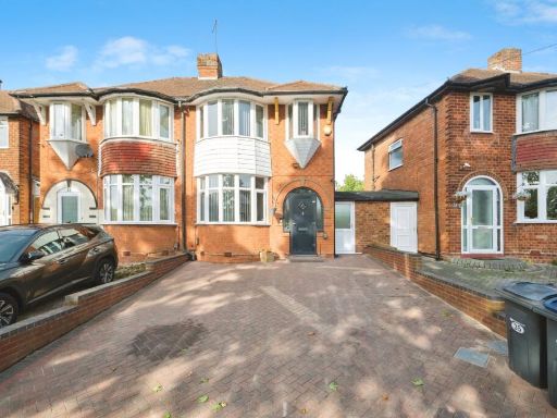 3 bedroom semi-detached house for sale in Duncroft Road, Birmingham, West Midlands, B26 — £280,000 • 3 bed • 1 bath • 860 ft²
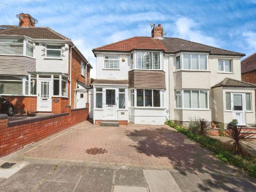 3 bedroom semi-detached house for sale in Charlbury Crescent, BIRMINGHAM, B26 — £260,000 • 3 bed • 1 bath • 668 ft²
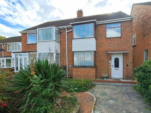 3 bedroom semi-detached house for sale in Elmstead Avenue, Sheldon, Birmingham, B33 — £240,000 • 3 bed • 1 bath • 1122 ft²
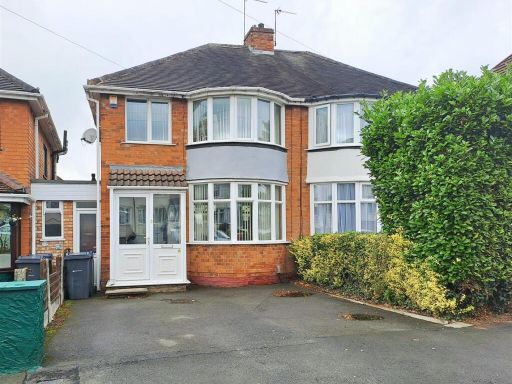 3 bedroom semi-detached house for sale in Steyning Road, South Yardley, Birmingham, B26 — £250,000 • 3 bed • 1 bath • 979 ft²
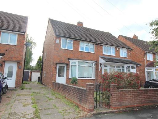 3 bedroom semi-detached house for sale in Chaffcombe Road, Sheldon, Birmingham, B26 — £235,000 • 3 bed • 1 bath • 734 ft²
Meta
- {
"@context": "https://schema.org",
"@type": "Residence",
"name": "3 bedroom semidetached house for sale in Gleneagles Road, Y…",
"description": "",
"url": "https://propertypiper.co.uk/property/c0b68c2b-c559-435f-b63d-03f7c3653c2a",
"image": "https://image-a.propertypiper.co.uk/e569c3a9-8005-47fb-8058-08d0162b4777-1024.jpeg",
"address": {
"@type": "PostalAddress",
"streetAddress": "43, GLENEAGLES ROAD, BIRMINGHAM",
"postalCode": "B26 2HT",
"addressLocality": "Birmingham",
"addressRegion": "Birmingham, Yardley",
"addressCountry": "England"
},
"geo": {
"@type": "GeoCoordinates",
"latitude": 52.4689902,
"longitude": -1.7929664
},
"numberOfRooms": 3,
"numberOfBathroomsTotal": 1,
"floorSize": {
"@type": "QuantitativeValue",
"value": 743,
"unitCode": "FTK"
},
"offers": {
"@type": "Offer",
"price": 240000,
"priceCurrency": "GBP",
"availability": "https://schema.org/InStock"
},
"additionalProperty": [
{
"@type": "PropertyValue",
"name": "Feature",
"value": "semi-detached"
},
{
"@type": "PropertyValue",
"name": "Feature",
"value": "1950s"
},
{
"@type": "PropertyValue",
"name": "Feature",
"value": "1960s"
},
{
"@type": "PropertyValue",
"name": "Feature",
"value": "suburban"
},
{
"@type": "PropertyValue",
"name": "Feature",
"value": "driveway"
},
{
"@type": "PropertyValue",
"name": "Feature",
"value": "brickwork"
},
{
"@type": "PropertyValue",
"name": "Feature",
"value": "two-storey"
},
{
"@type": "PropertyValue",
"name": "Feature",
"value": "renovation potential"
},
{
"@type": "PropertyValue",
"name": "Feature",
"value": "mid-century"
},
{
"@type": "PropertyValue",
"name": "Feature",
"value": "residential area"
},
{
"@type": "PropertyValue",
"name": "Feature",
"value": "backyard"
},
{
"@type": "PropertyValue",
"name": "Feature",
"value": "garden"
},
{
"@type": "PropertyValue",
"name": "Feature",
"value": "landscaped"
},
{
"@type": "PropertyValue",
"name": "Feature",
"value": "outdoor space"
},
{
"@type": "PropertyValue",
"name": "Feature",
"value": "patio"
},
{
"@type": "PropertyValue",
"name": "Feature",
"value": "fencing"
},
{
"@type": "PropertyValue",
"name": "Feature",
"value": "mature trees"
},
{
"@type": "PropertyValue",
"name": "Feature",
"value": "flower beds"
},
{
"@type": "PropertyValue",
"name": "Feature",
"value": "paved area"
},
{
"@type": "PropertyValue",
"name": "Feature",
"value": "private"
}
]
}
High Res Floorplan Images
Compatible Floorplan Images
FloorplanImages Thumbnail