G61 3JW - 1 bedroom flat for sale in Flat 1D, Lennox Court, 14 Suther…
View on Property Piper
1 bedroom flat for sale in Flat 1D, Lennox Court, 14 Sutherland Avenue, Bearsden, G61 3JW, G61
Property Details
- Price: £120000
- Bedrooms: 1
- Bathrooms: 1
- Property Type: undefined
- Property SubType: undefined
Image Descriptions
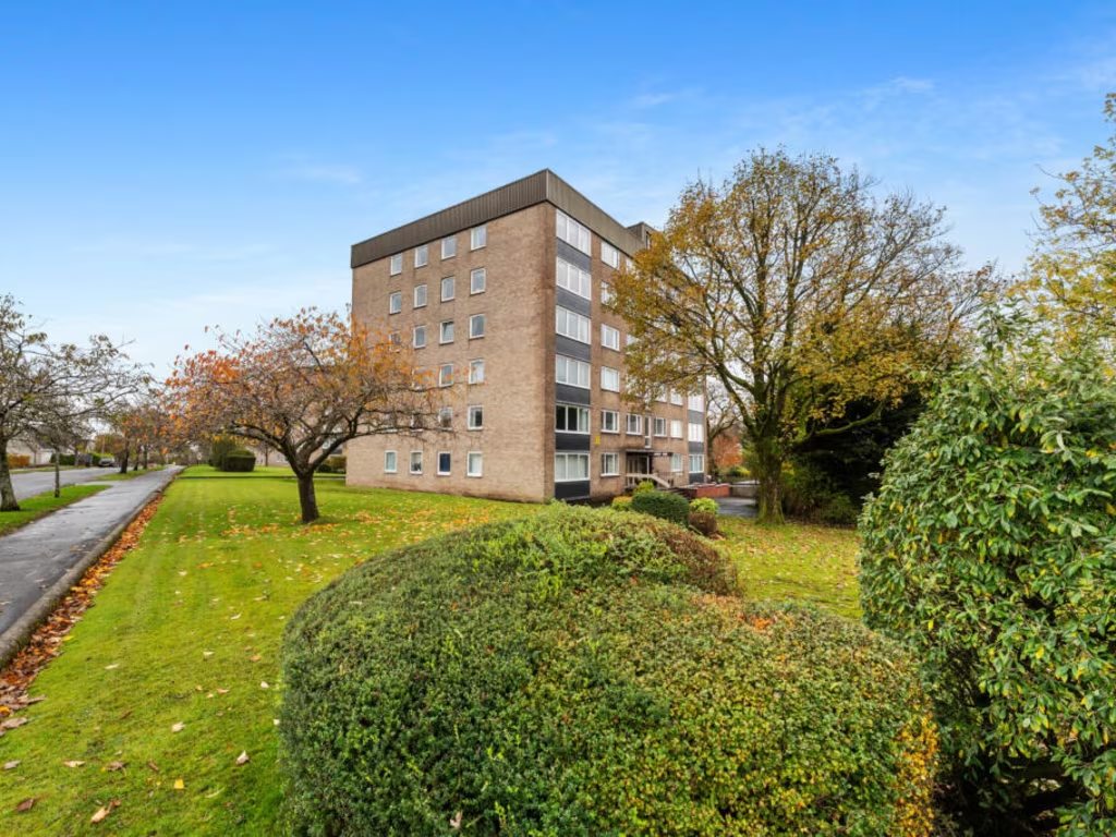
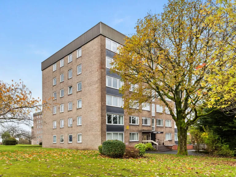
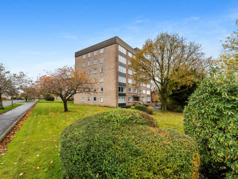
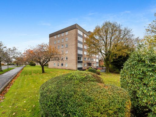
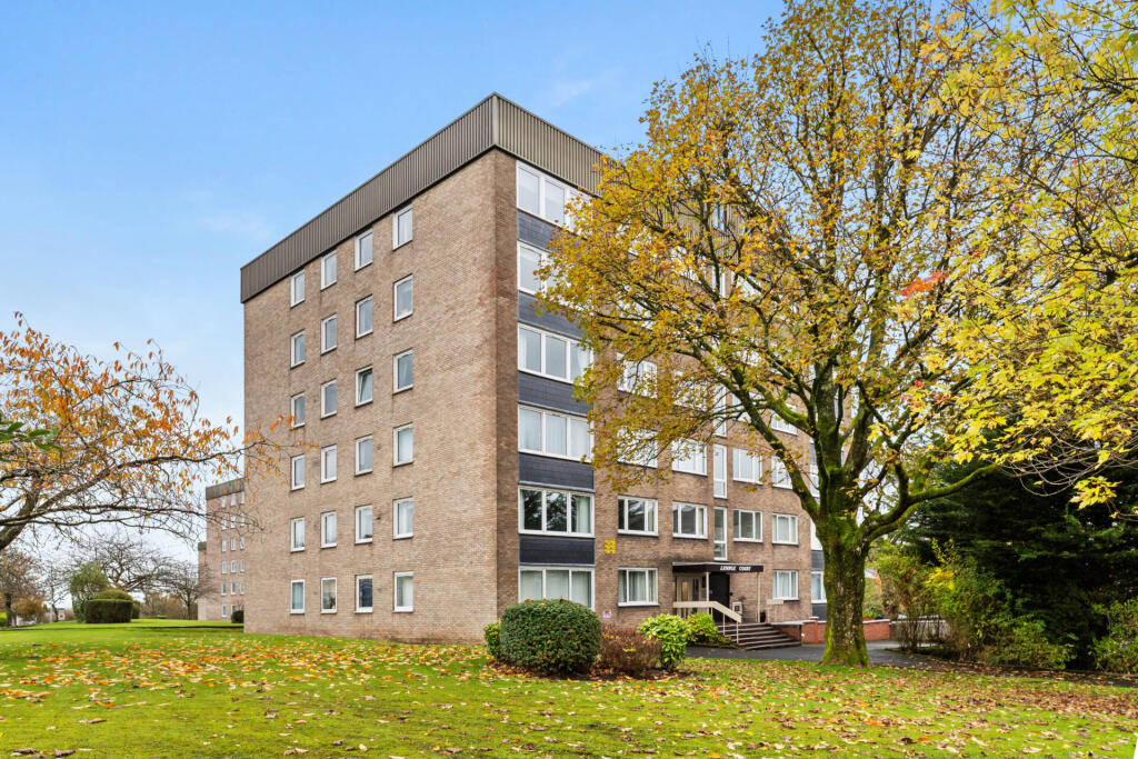
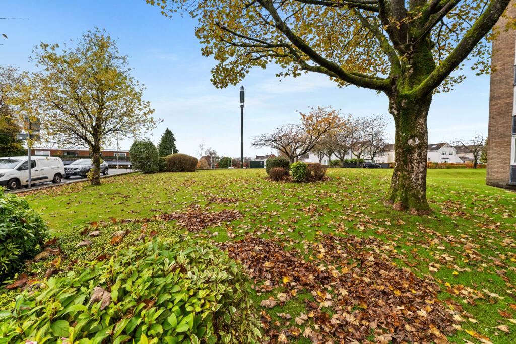
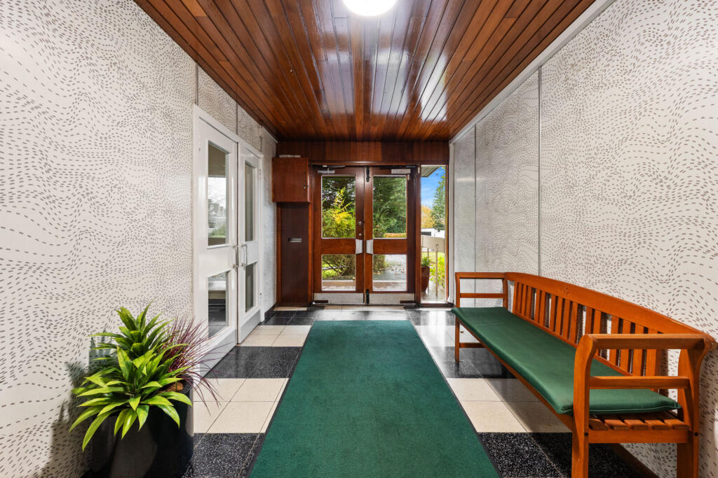
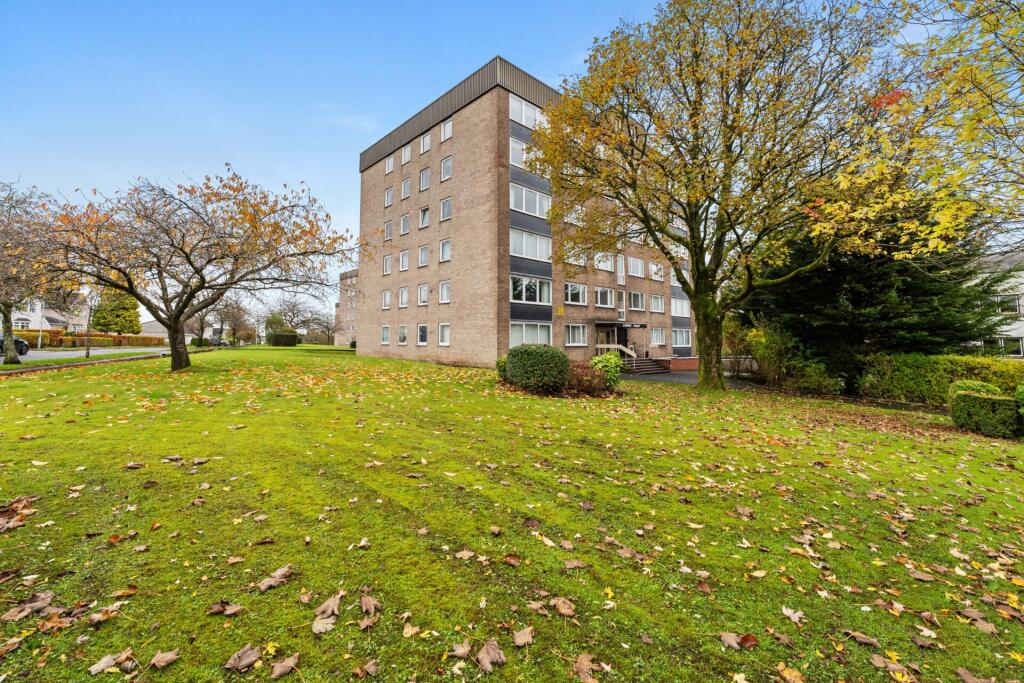
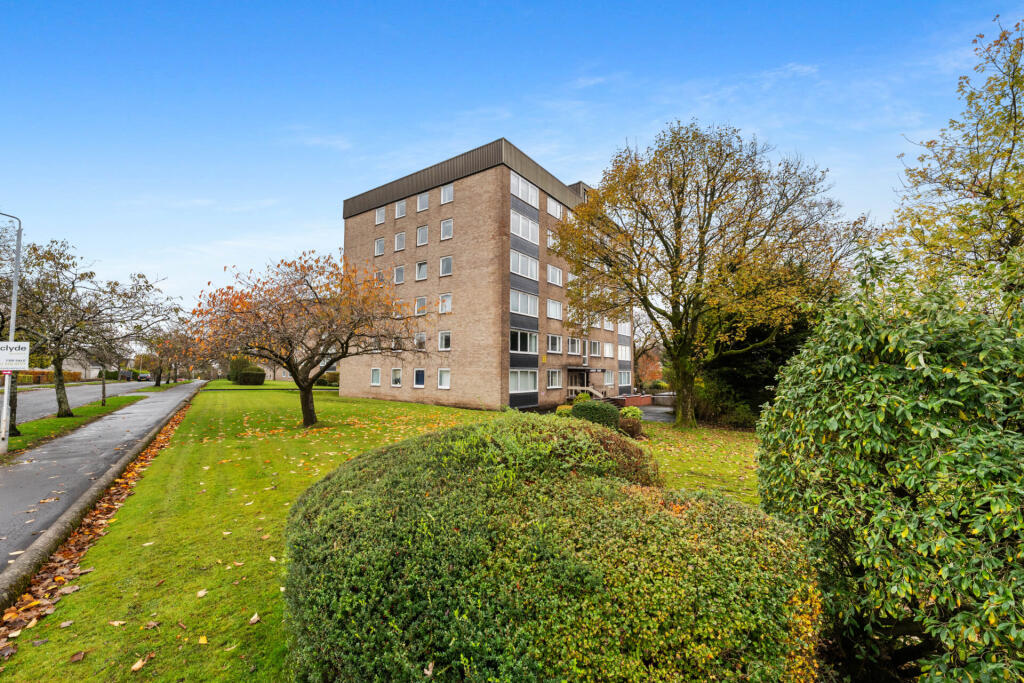
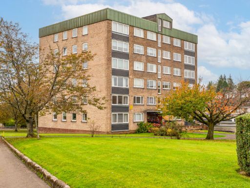
- apartment building 1960s-1970s
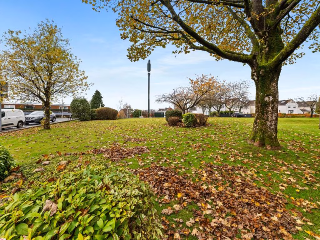
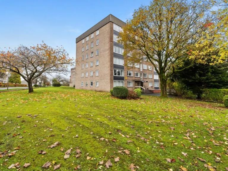
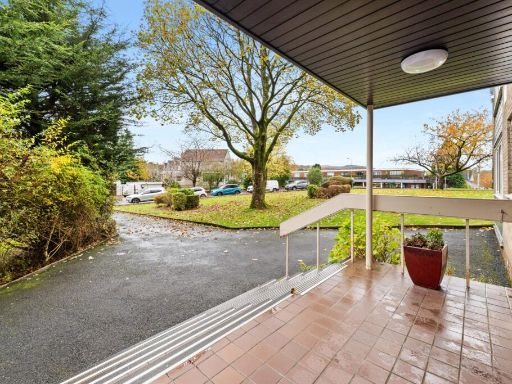
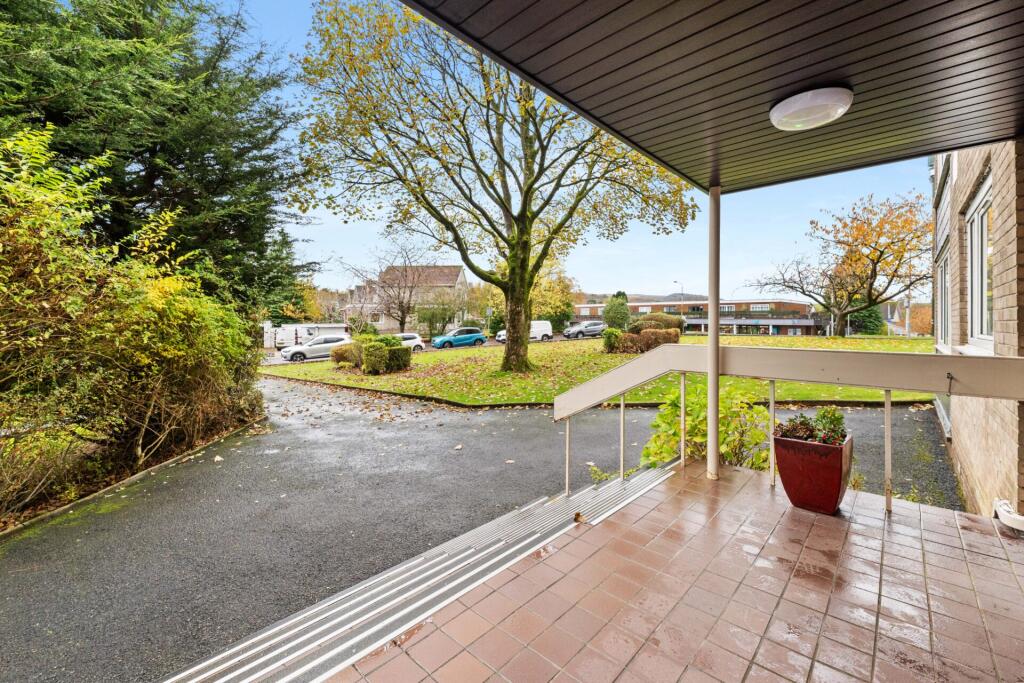
- garden
Floorplan Description
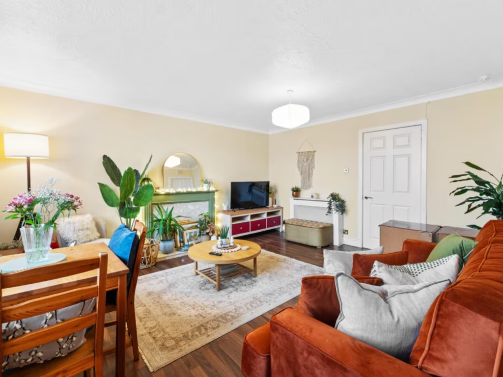
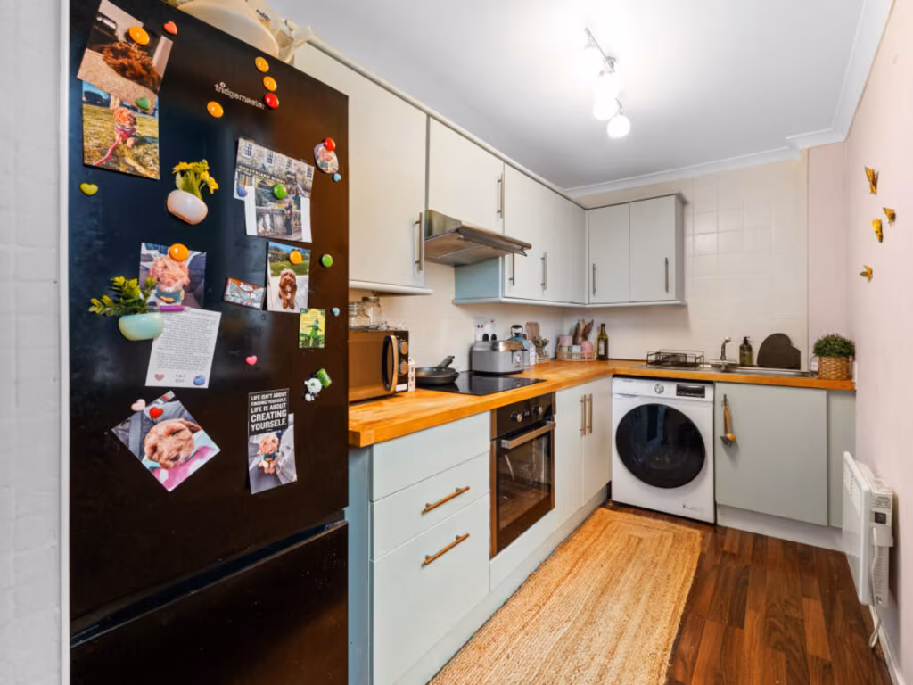
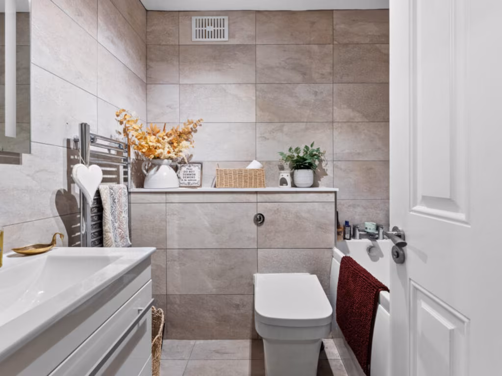
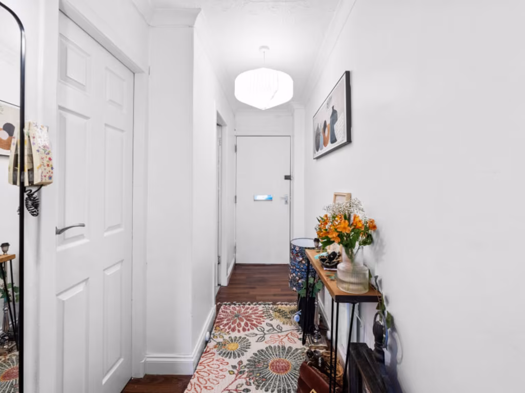
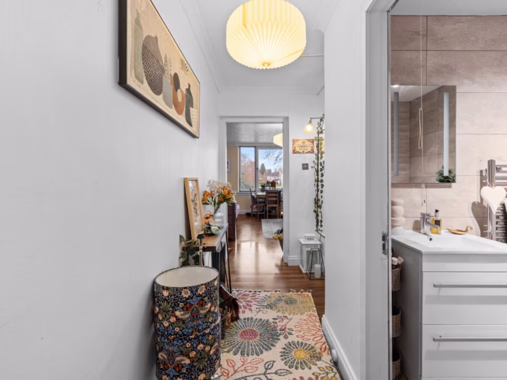
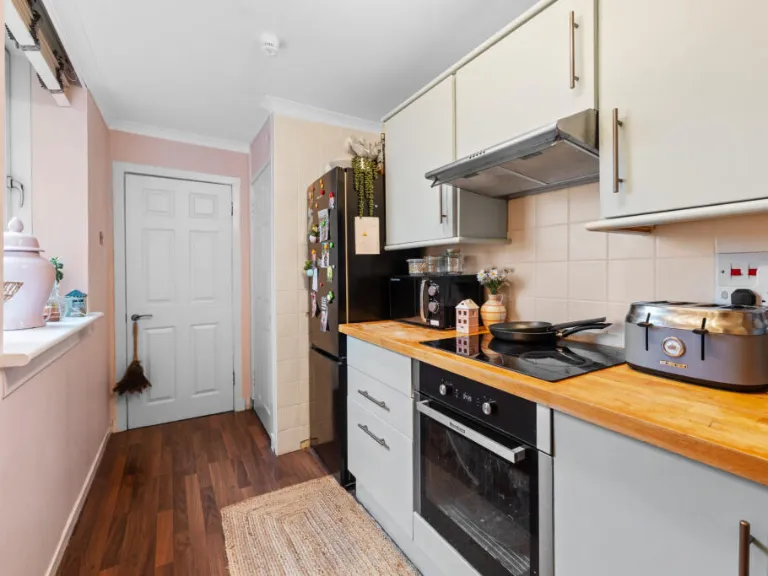
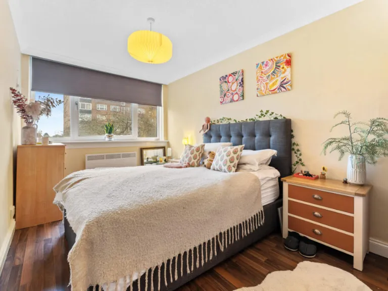
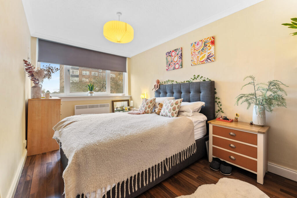
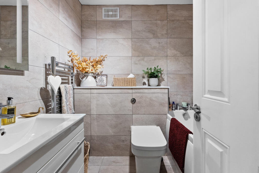
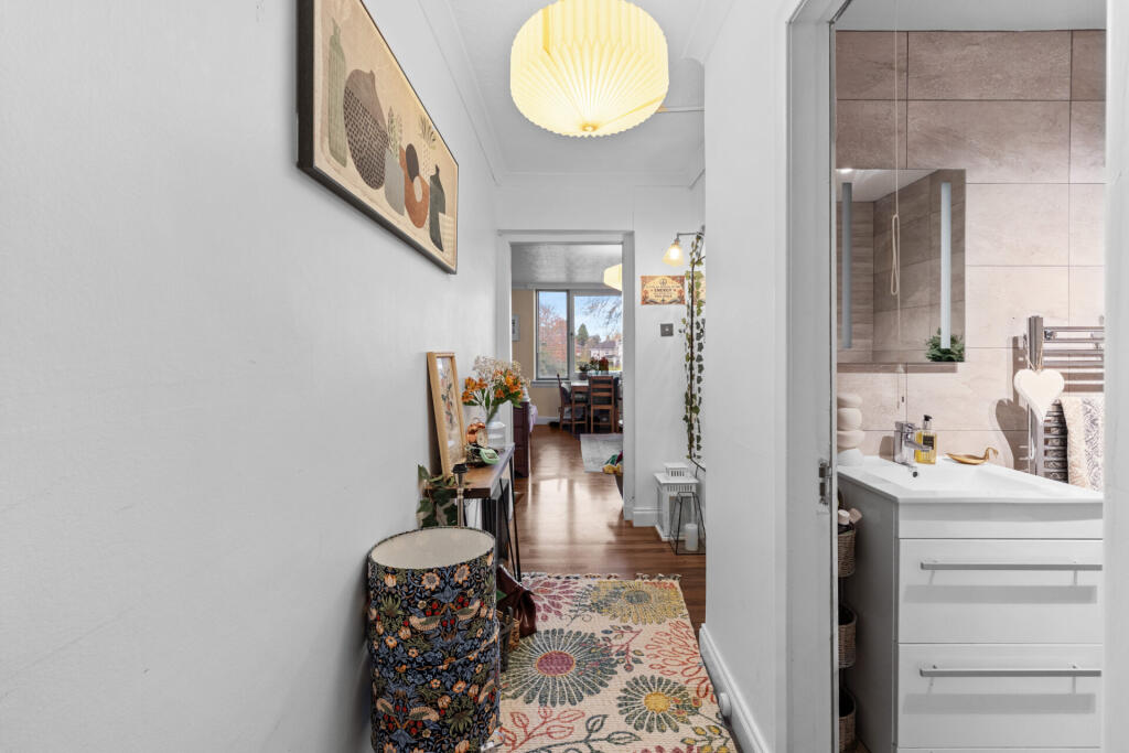
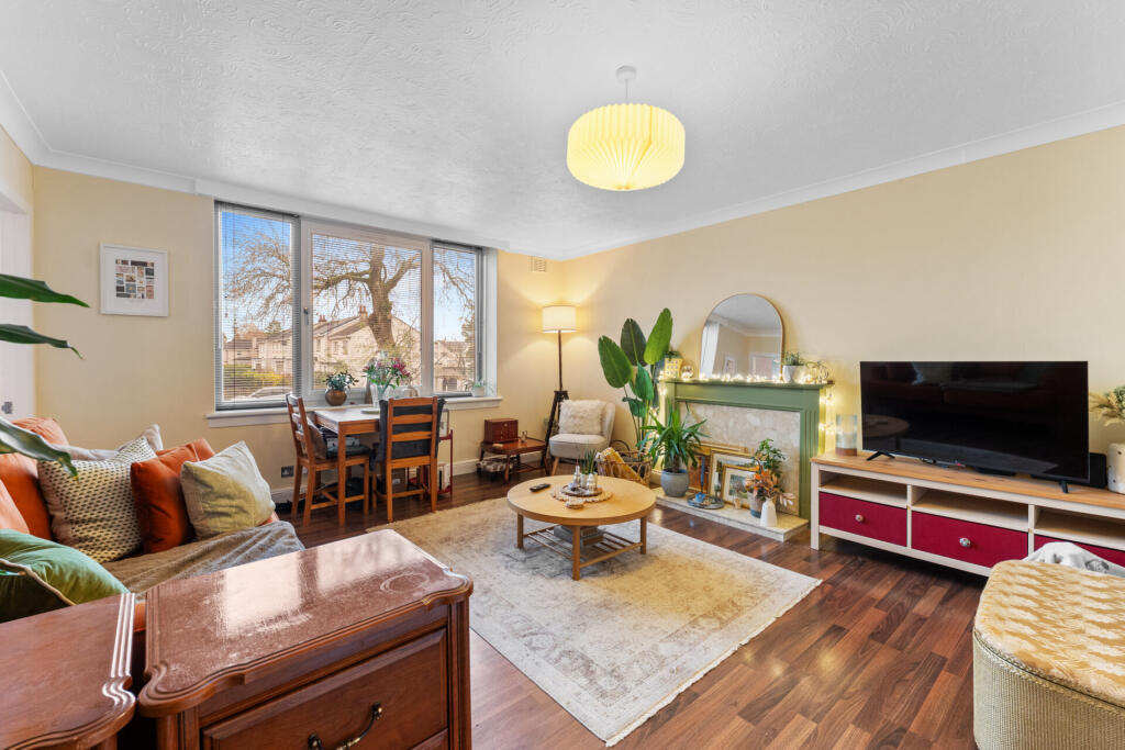
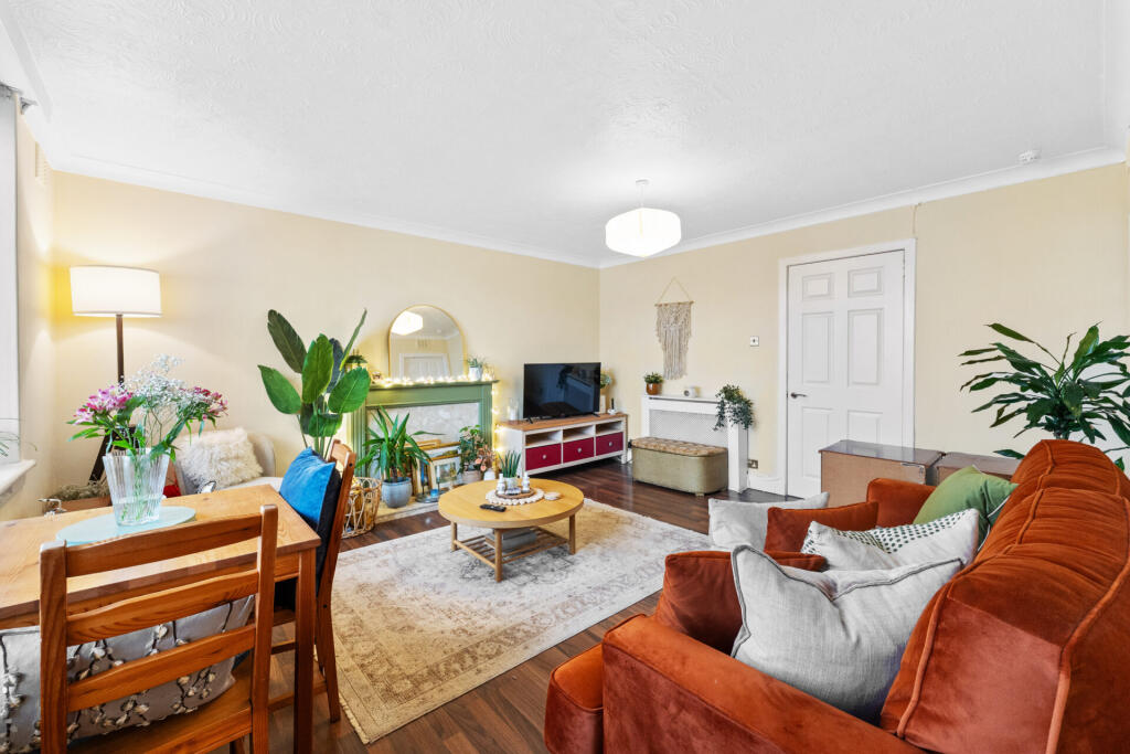
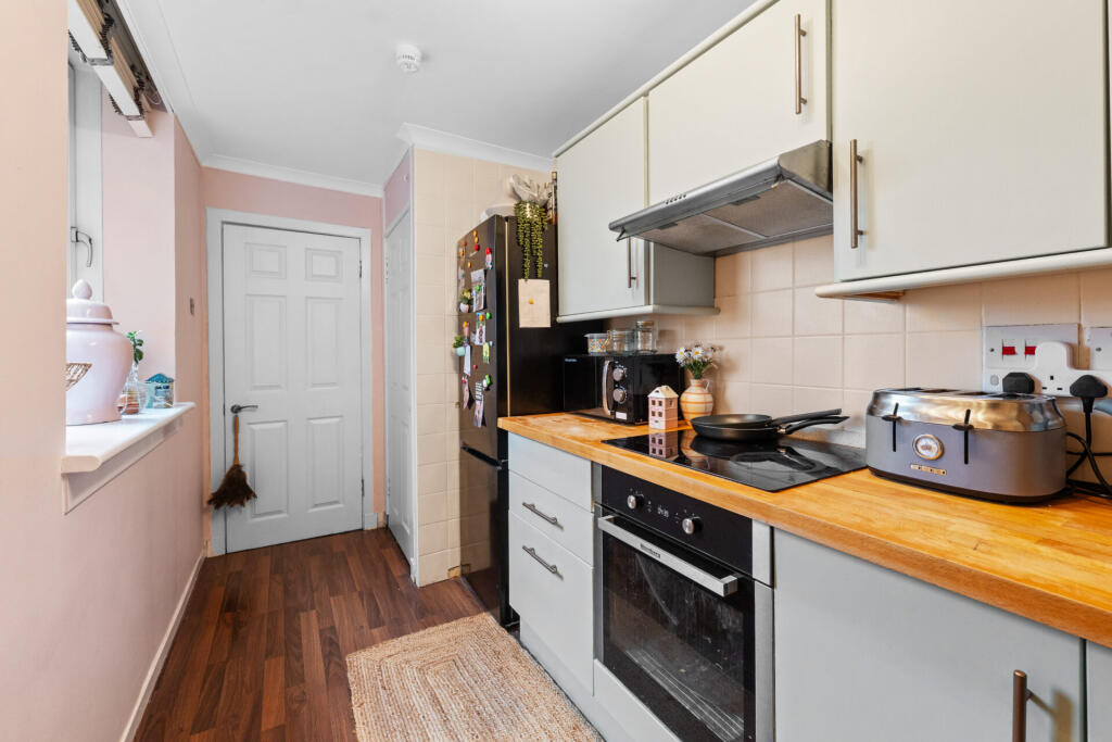
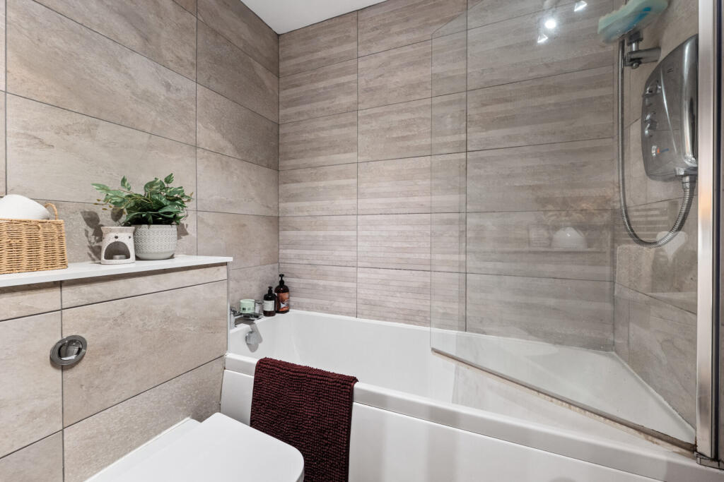
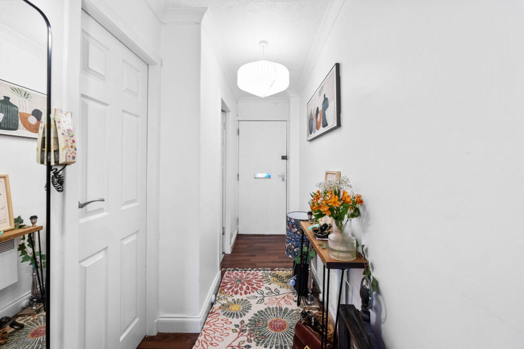
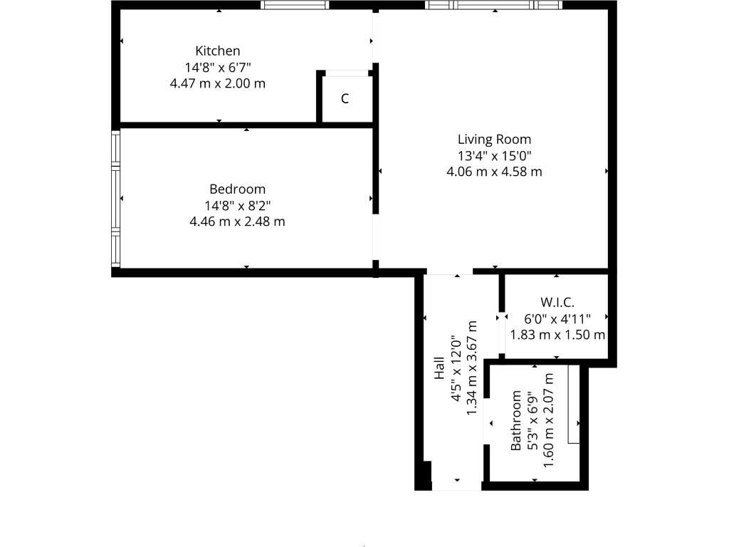
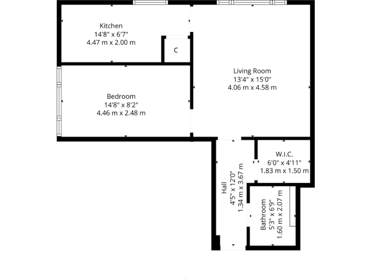
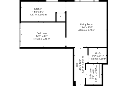
- One-floor layout with kitchen, bedroom, living room, hall, W.I.C., and bathroom.
- Single-storey floorplan showing kitchen, bedroom, living room, hall, W.I.C., and bathroom.
Rooms
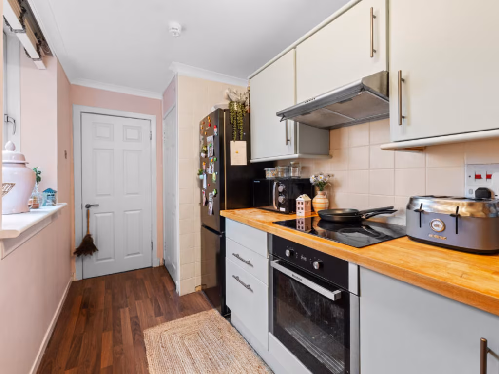
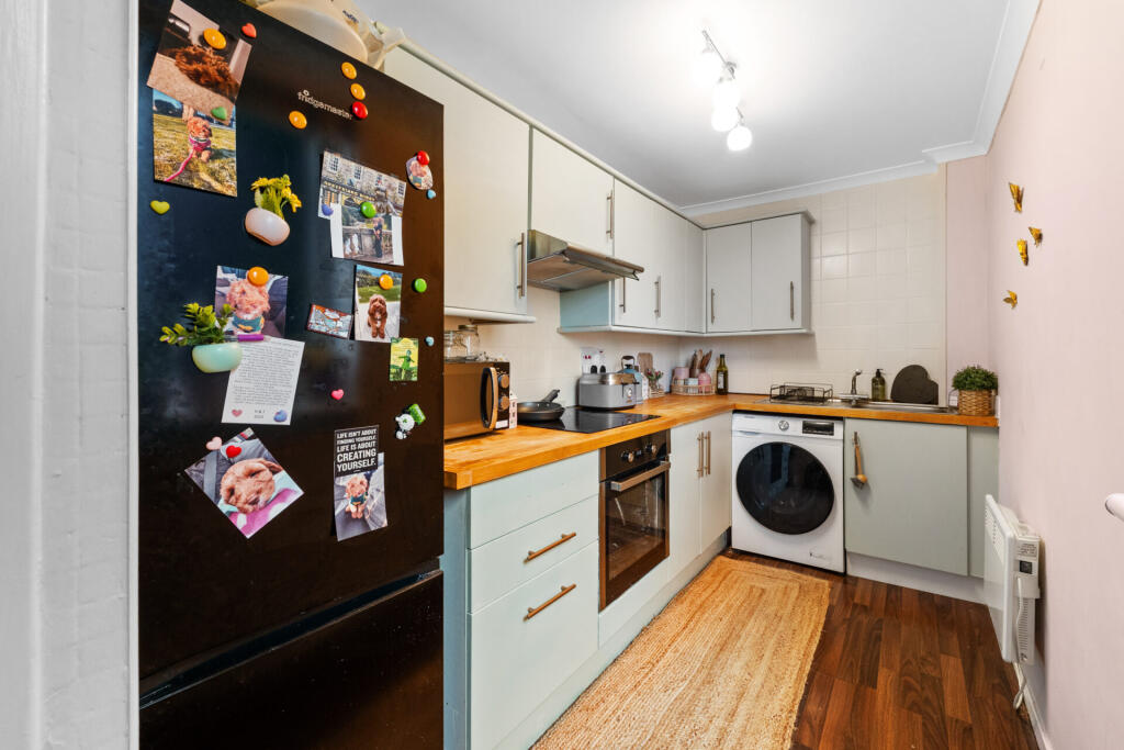
- Kitchen:
- Bedroom:
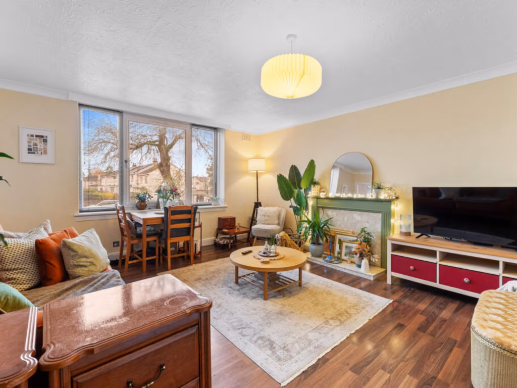
- Living Room:
- Hall:
- W.I.C.:
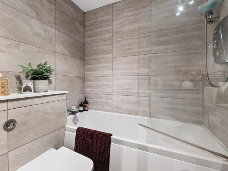
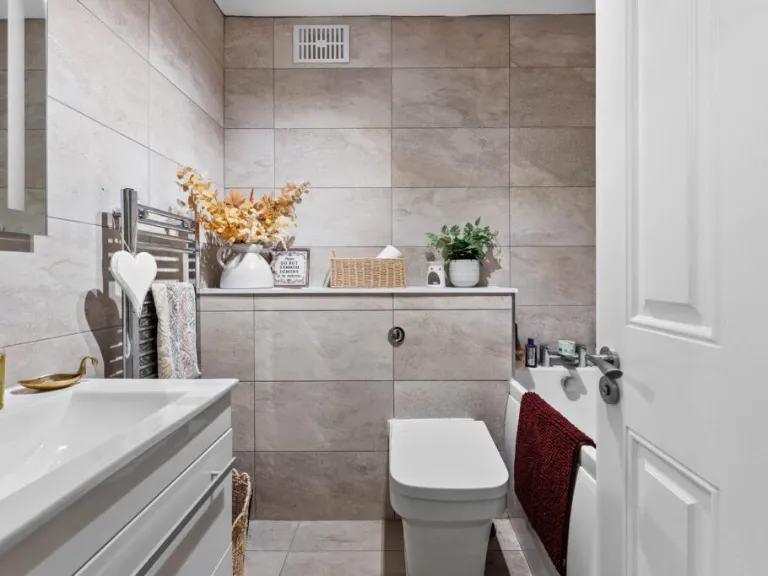
- Bathroom:
- Kitchen:
- Bedroom:
- Living Room:
- Hall:
- W.I.C.:
- Bathroom:
Textual Property Features
Detected Visual Features
- apartment building
- mid-century
- 1960s
- 1970s
- brick facade
- six stories
- urban
- communal garden
- residential
- investment potential
- garden
- outdoor space
- landscaped
- lawn
- trees
- greenery
Nearest General Shops
- Id: 1607886072
- Tags:
- Addr:
- City: Bearsden
- Housenumber: 3a
- Street: Kirk Road
- Check_date: 2022-09-03
- Entrance: main
- Name: The Wellbeing Rooms
- Shop: beauty
- TagsNormalized:
- Lat: 55.9207773
- Lon: -4.3336514
- FullGeoHash: gcuyjkh64s7q
- PartitionGeoHash: gcuy
- Images:
- FoodStandards: null
- Distance: 1051.1
,- Id: 89632799
- Tags:
- Building: yes
- Name: Baljaffray Shopping Centre
- Shop: mall
- Source: Bing
- TagsNormalized:
- Lat: 55.932542
- Lon: -4.350216
- FullGeoHash: gcuyjn0q8tec
- PartitionGeoHash: gcuy
- Images:
- FoodStandards: null
- Distance: 975.5
,- Id: 10221628395
- Tags:
- Check_date: 2022-11-27
- Name: Laundrette Revolution
- Self_service: yes
- Shop: laundry
- TagsNormalized:
- Lat: 55.9259428
- Lon: -4.3481321
- FullGeoHash: gcuyjj1b1pme
- PartitionGeoHash: gcuy
- Images:
- FoodStandards: null
- Distance: 937.9
}
Nearest Grocery shops
- Id: 226419228
- Tags:
- Addr:
- Housename: Baljaffray Shopping Centre
- Housenumber: 1-2
- Postcode: G61 4RN
- Street: Grampian Way
- Brand: Farmfoods
- Brand:wikidata: Q5435841
- Brand:wikipedia: en:Farmfoods
- Contact:
- Website: https://www.farmfoods.co.uk/store-finder.php?branch_code=222
- Name: Farmfoods
- Opening_hours:
- Url: https://www.farmfoods.co.uk/store-finder.php?branch_code=222
- Operator: Farmfoods
- Shop: frozen_food
- TagsNormalized:
- farmfoods
- frozen food
- food
- shop
- Lat: 55.9325646
- Lon: -4.3497299
- FullGeoHash: gcuyjn0wgcy2
- PartitionGeoHash: gcuy
- Images:
- FoodStandards: null
- Distance: 947
,- Id: 953975783
- Tags:
- Brand: M&S Simply Food
- Brand:wikidata: Q714491
- Building: retail
- Building:levels: 1
- Name: M&S Simply Food
- Operator: M&S
- Roof:
- Shop: convenience
- TagsNormalized:
- m&s simply food
- food
- retail
- convenience
- shop
- Lat: 55.9345143
- Lon: -4.3443175
- FullGeoHash: gcuyjnsd4j4n
- PartitionGeoHash: gcuy
- Images:
- FoodStandards: null
- Distance: 747.3
,- Id: 1038051413
- Tags:
- Addr:
- Housenumber: 57-59
- Postcode: G61 3JJ
- Street: Stockiemuir Avenue
- Brand: Co-op Food
- Brand:wikidata: Q3277439
- Brand:wikipedia: en:Co-op Food
- Building:
- Check_date:
- Opening_hours: 2022-02-16
- Name: Co-op Food
- Opening_hours: 07:00-22:00
- Operator: The Co-operative Group
- Operator:wikidata: Q117202
- Phone: +44 1419 427 226
- Shop: convenience
- Website: https://www.coop.co.uk/store-finder/G61-3JJ/57-59-stockiemuir-avenue
- TagsNormalized:
- co-op
- co-op food
- food
- convenience
- shop
- Lat: 55.9307599
- Lon: -4.3359537
- FullGeoHash: gcuyjmfskcqd
- PartitionGeoHash: gcuy
- Images:
- FoodStandards: null
- Distance: 81.3
}
Nearest Supermarkets
- Id: 839005123
- Tags:
- Brand: ALDI
- Brand:wikidata: Q41171672
- Brand:wikipedia: en:Aldi
- Building: retail
- Contact:
- Website: https://stores.aldi.co.uk/milngavie/unit-1-west-rp-main-st
- Name: ALDI
- Shop: supermarket
- TagsNormalized:
- aldi
- retail
- supermarket
- shop
- Lat: 55.932722
- Lon: -4.315143
- FullGeoHash: gcuyjy1z9zh5
- PartitionGeoHash: gcuy
- Images:
- FoodStandards: null
- Distance: 1276.2
,- Id: 1607886119
- Tags:
- Addr:
- City: Bearsden
- Housenumber: 134-138
- Postcode: G61 3RB
- Street: Drymen Road
- Brand: Marks & Spencer
- Brand:wikidata: Q714491
- Check_date: 2022-09-03
- Contact:
- Website: https://www.marksandspencer.com/stores/bearsden-simply-food-8866
- Entrance: main
- Name: Marks & Spencer
- Opening_hours: Mo-Sa 08:00-19:00; Su 09:00-18:00
- Operator: Marks & Spencer
- Shop: supermarket
- TagsNormalized:
- marks & spencer
- supermarket
- shop
- Lat: 55.9204979
- Lon: -4.3342965
- FullGeoHash: gcuyjk5be867
- PartitionGeoHash: gcuy
- Images:
- FoodStandards: null
- Distance: 1079.4
,- Id: 89632805
- Tags:
- Addr:
- Country: GB
- Housename: Baljaffray Shopping Centre
- Postcode: G61 4RN
- Street: Grampian Way
- Unit: 1
- Brand: Lidl
- Brand:wikidata: Q151954
- Building: supermarket
- Fhrs:
- Name: Lidl
- Opening_hours: Mo-Su 08:00-20:00
- Shop: supermarket
- Source: Bing
- TagsNormalized:
- Lat: 55.9327352
- Lon: -4.3509564
- FullGeoHash: gcuyhypxz3ec
- PartitionGeoHash: gcuy
- Images:
- FoodStandards:
- Id: 552728
- FHRSID: 552728
- LocalAuthorityBusinessID: PI/000054514
- BusinessName: Lidl
- BusinessType: Retailers - supermarkets/hypermarkets
- BusinessTypeID: 7840
- AddressLine1: Unit 1
- AddressLine2: Baljaffray Shopping Centre
- AddressLine3: Grampian Way
- AddressLine4: Bearsden
- PostCode: G61 4RN
- RatingValue: Pass
- RatingKey: fhis_pass_en-GB
- RatingDate: 2019-03-07
- LocalAuthorityCode: 771
- LocalAuthorityName: East Dunbartonshire
- LocalAuthorityWebSite: http://www.eastdunbarton.gov.uk/home.aspx
- LocalAuthorityEmailAddress: environmental.health@eastdunbarton.gov.uk
- Scores:
- Hygiene: null
- Structural: null
- ConfidenceInManagement: null
- NewRatingPending: false
- Geocode:
- Longitude: -4.34966421127319
- Latitude: 55.93255996704100
- Distance: 1025.7
}
Nearest Religious buildings
- Id: 146389205
- Tags:
- Amenity: place_of_worship
- Building: church
- Denomination: scottish_episcopal
- Name: All Saints
- Religion: christian
- Source: Bing
- TagsNormalized:
- place of worship
- church
- scottish episcopal
- christian
- Lat: 55.9206547
- Lon: -4.3350566
- FullGeoHash: gcuyjk533ved
- PartitionGeoHash: gcuy
- Images:
- FoodStandards: null
- Distance: 1060.7
,- Id: 85255179
- Tags:
- Amenity: place_of_worship
- Building: church
- Denomination: church_of_scotland
- Name: New Kilpatrick
- Religion: christian
- Wikidata: Q15122816
- TagsNormalized:
- place of worship
- church
- church of scotland
- christian
- Lat: 55.921329
- Lon: -4.3328
- FullGeoHash: gcuyjkhvq7q1
- PartitionGeoHash: gcuy
- Images:
- FoodStandards: null
- Distance: 996.3
,- Id: 85396724
- Tags:
- Amenity: place_of_worship
- Building: yes
- Denomination: church_of_scotland
- Name: Baljaffray Parish Church
- Religion: christian
- Source: Bing
- TagsNormalized:
- place of worship
- church
- church of scotland
- parish
- christian
- Lat: 55.9330158
- Lon: -4.3489452
- FullGeoHash: gcuyjn31qjz7
- PartitionGeoHash: gcuy
- Images:
- FoodStandards: null
- Distance: 916.1
}
Nearest Medical buildings
- Id: 938376449
- Tags:
- Amenity: dentist
- Building: yes
- Healthcare: dentist
- Name: Park Cottage Dental Practice
- TagsNormalized:
- dentist
- health
- healthcare
- dental
- Lat: 55.919531
- Lon: -4.3309516
- FullGeoHash: gcuyj7y6cs07
- PartitionGeoHash: gcuy
- Images:
- FoodStandards: null
- Distance: 1213.8
,- Id: 8693472464
- Tags:
- Addr:
- Housenumber: 104
- Postcode: G61 3RA
- Street: Drymen Road
- Amenity: pharmacy
- Dispensing: yes
- Drive_through: no
- Healthcare: pharmacy
- Name: J H C Suttie & Co
- Opening_hours: Mo-Fr 09:00-18:00; Sa 09:00-13:00
- Phone: +44 141 942 0274
- TagsNormalized:
- Lat: 55.9196351
- Lon: -4.3336929
- FullGeoHash: gcuyj7u73xs2
- PartitionGeoHash: gcuy
- Images:
- FoodStandards: null
- Distance: 1177.4
,- Id: 8693472465
- Tags:
- Addr:
- Housenumber: 8
- Postcode: G61 3SL
- Street: New Kirk Road
- Amenity: pharmacy
- Brand: Lloyds Pharmacy
- Brand:wikidata: Q6662870
- Brand:wikipedia: en:LloydsPharmacy
- Check_date: 2022-09-03
- Dispensing: yes
- Drive_through: no
- Healthcare: pharmacy
- Name: Lloyds Pharmacy
- Opening_hours: Mo-Fr 09:00-18:00; Sa 09:00-17:00
- Phone: +44 141 942 9248
- Website: https://lloydspharmacy.com/
- TagsNormalized:
- pharmacy
- lloyds pharmacy
- health
- healthcare
- Lat: 55.9198909
- Lon: -4.333652
- FullGeoHash: gcuyj7ukfx4y
- PartitionGeoHash: gcuy
- Images:
- FoodStandards: null
- Distance: 1149.3
,- Id: 1612033048
- Tags:
- Addr:
- Housenumber: 160
- Street: Drymen Road
- Amenity: doctors
- Check_date: 2023-02-02
- Entrance: yes
- Name: The Terrace Medical Practice
- Phone: +44 141 942 6644
- TagsNormalized:
- Lat: 55.9213122
- Lon: -4.3348269
- FullGeoHash: gcuyjk5mr0nu
- PartitionGeoHash: gcuy
- Images:
- FoodStandards: null
- Distance: 987.7
}
Nearest Airports
- Id: 1100796130
- Tags:
- Addr:
- City: Paisley
- Postcode: PA3 2SW
- Aerodrome: international
- Aerodrome:type: public
- Aeroway: aerodrome
- Iata: GLA
- Icao: EGPF
- Ifr: yes
- Is_in: Paisley, Scotland, UK
- Name: Glasgow Airport
- Operator: Glasgow Airport Limited
- Phone: +44 141 887 1111
- Ref: GLA
- Source: CAA AIP
- Wikidata: Q8721
- Wikipedia: en:Glasgow Airport
- TagsNormalized:
- airport
- international airport
- Lat: 55.8705835
- Lon: -4.4351667
- FullGeoHash: gcuvg4fmtpsh
- PartitionGeoHash: gcuv
- Images:
- FoodStandards: null
- Distance: 9101
,- Id: 4519551
- Tags:
- Aerodrome: international
- Name: Glasgow International Airport
- Type: site
- Wikidata: Q8721
- TagsNormalized:
- airport
- international airport
- Lat: 55.8705829
- Lon: -4.4355768
- FullGeoHash: gcuvg4fjexd0
- PartitionGeoHash: gcuv
- Images:
- FoodStandards: null
- Distance: 9118.6
}
Nearest Leisure Facilities
- Id: 911312935
- Tags:
- Access: private
- Garden:
- Leisure: garden
- TagsNormalized:
- Lat: 55.9288545
- Lon: -4.3288795
- FullGeoHash: gcuyjmxc1y1k
- PartitionGeoHash: gcuy
- Images:
- FoodStandards: null
- Distance: 416.7
,- Id: 27237891
- Tags:
- TagsNormalized:
- Lat: 55.9309303
- Lon: -4.3416708
- FullGeoHash: gcuyjjymr9pe
- PartitionGeoHash: gcuy
- Images:
- FoodStandards: null
- Distance: 415.7
,- Id: 1041446218
- Tags:
- Access: yes
- Leisure: playground
- TagsNormalized:
- Lat: 55.9329269
- Lon: -4.3373938
- FullGeoHash: gcuyjq38gmkc
- PartitionGeoHash: gcuy
- Images:
- FoodStandards: null
- Distance: 335.1
,- Id: 122270949
- Tags:
- Leisure: pitch
- Lit: no
- Source: Bing
- Sport: soccer
- Surface: compacted
- TagsNormalized:
- Lat: 55.931196
- Lon: -4.3309992
- FullGeoHash: gcuyjmyqb6su
- PartitionGeoHash: gcuy
- Images:
- FoodStandards: null
- Distance: 280.3
,- Id: 122270948
- Tags:
- Access: private
- Leisure: playground
- Source: Bing
- TagsNormalized:
- Lat: 55.9307675
- Lon: -4.3310784
- FullGeoHash: gcuyjmyhqd9z
- PartitionGeoHash: gcuy
- Images:
- FoodStandards: null
- Distance: 260.2
}
Nearest Tourist attractions
- Id: 6502359003
- Tags:
- Addr:
- Postcode: G12 0PR
- Street: Bellshaugh Court
- Name: Queen Margaret Residence
- Name:en: Queen Margaret Residences
- Tourism: apartment
- Website: http://sanctuary-housing.co.uk
- TagsNormalized:
- Lat: 55.8844396
- Lon: -4.2971478
- FullGeoHash: gcuvyjqymnw7
- PartitionGeoHash: gcuv
- Images:
- FoodStandards: null
- Distance: 5611.4
,- Id: 7425904798
- Tags:
- Name: Auld Wive's Lifts
- Natural: stone
- Note: Three rocks, 1 stacked on top of the other 2, with carvings on them both ancient and modern
- Tourism: attraction
- TagsNormalized:
- Lat: 55.9603311
- Lon: -4.273284
- FullGeoHash: gcuyqg2293b9
- PartitionGeoHash: gcuy
- Images:
- FoodStandards: null
- Distance: 5104.8
,- Id: 443593726
- Tags:
- Building: yes
- Name: Best Foot Forward
- Tourism: guest_house
- TagsNormalized:
- Lat: 55.9385625
- Lon: -4.3099706
- FullGeoHash: gcuyjzm9druf
- PartitionGeoHash: gcuy
- Images:
- FoodStandards: null
- Distance: 1822.4
}
Nearest Bus stations and stops
- Id: 8565817167
- Tags:
- Bench: no
- Bin: no
- Bus: yes
- Departures_board: timetable
- Highway: bus_stop
- Lit: no
- Name: Baljaffray, Opp The Poplars On Grampian Way
- Public_transport: platform
- Shelter: no
- Tactile_paving: no
- TagsNormalized:
- Lat: 55.9326902
- Lon: -4.3449314
- FullGeoHash: gcuyjnhpec0m
- PartitionGeoHash: gcuy
- Images:
- FoodStandards: null
- Distance: 670.8
,- Id: 8565817165
- Tags:
- Bus: yes
- Departures_board: timetable
- Highway: bus_stop
- Name: Bearsden, Opp Caird Terrace On Grampian Way
- Public_transport: platform
- TagsNormalized:
- Lat: 55.9311676
- Lon: -4.3455379
- FullGeoHash: gcuyjjgwttk4
- PartitionGeoHash: gcuy
- Images:
- FoodStandards: null
- Distance: 657.5
,- Id: 8565817166
- Tags:
- Bench: no
- Bin: no
- Bus: yes
- Departures_board: timetable
- Highway: bus_stop
- Lit: no
- Name: Bearsden, Opp Alva Gardens On Grampian Way
- Public_transport: platform
- Shelter: no
- Tactile_paving: no
- TagsNormalized:
- Lat: 55.9325615
- Lon: -4.344532
- FullGeoHash: gcuyjnhqv14j
- PartitionGeoHash: gcuy
- Images:
- FoodStandards: null
- Distance: 642.3
,- Id: 8518248871
- Tags:
- Bench: no
- Bin: no
- Bus: yes
- Departures_board: timetable
- Highway: bus_stop
- Lit: no
- Name: Bearsden, Before Thorn Drive on Drymen Road
- Public_transport: platform
- Shelter: no
- Tactile_paving: no
- TagsNormalized:
- Lat: 55.925306
- Lon: -4.3401223
- FullGeoHash: gcuyjhzsebdk
- PartitionGeoHash: gcuy
- Images:
- FoodStandards: null
- Distance: 626.2
,- Id: 7873574256
- Tags:
- Bus: yes
- Departures_board: timetable
- Highway: bus_stop
- Name: Bearsden, After Thorn Drive On Drymen Road
- Public_transport: platform
- Shelter: yes
- TagsNormalized:
- Lat: 55.9250695
- Lon: -4.3388907
- FullGeoHash: gcuyjkbe0s8d
- PartitionGeoHash: gcuy
- Images:
- FoodStandards: null
- Distance: 616.1
}
Nearest Hotels
- Id: 442131076
- Tags:
- Addr:
- City: Bearsden
- Housenumber: 100
- Postcode: G61 2TQ
- Street: Milngavie Road
- Building: yes
- Name: Boclair House Hotel
- Operator: Manorview
- Phone: +44 141 942 4278
- Tourism: hotel
- TagsNormalized:
- Lat: 55.9181521
- Lon: -4.3204739
- FullGeoHash: gcuyjetfvej4
- PartitionGeoHash: gcuy
- Images:
- FoodStandards: null
- Distance: 1620.6
,- Id: 146223215
- Tags:
- Brand: Premier Inn
- Brand:wikidata: Q2108626
- Brand:wikipedia: en:Premier Inn
- Building: hotel
- Name: Premier Inn Milngavie
- Operator: Premier Inn
- Source: Bing
- Tourism: hotel
- TagsNormalized:
- Lat: 55.934955
- Lon: -4.3153745
- FullGeoHash: gcuyjy9ssrre
- PartitionGeoHash: gcuy
- Images:
- FoodStandards: null
- Distance: 1339.4
,- Id: 146223214
- Tags:
- Addr:
- Housenumber: 279
- Street: Milngavie Road
- Brand: Premier Inn
- Brand:wikidata: Q2108626
- Brand:wikipedia: en:Premier Inn
- Building: hotel
- Name: Premier Inn Bearsden
- Operator: Premier Inn
- Source: Bing
- Tourism: hotel
- Wheelchair: yes
- TagsNormalized:
- Lat: 55.9310991
- Lon: -4.3178036
- FullGeoHash: gcuyjtzy7bs6
- PartitionGeoHash: gcuy
- Images:
- FoodStandards: null
- Distance: 1083.8
}
Tags
- apartment building
- mid-century
- 1960s
- 1970s
- brick facade
- six stories
- urban
- communal garden
- residential
- investment potential
- garden
- outdoor space
- landscaped
- lawn
- trees
- greenery
Local Market Stats
- Average Price/sqft: £308
- Planning Success Rate: 88%
AirBnB Data
- 1km average: £51/night
- Listings in 1km: 1
Similar Properties
 1 bedroom flat for sale in Lennox Court, Stockiemuir Avenue, G61 — £125,000 • 1 bed • 1 bath • 775 ft²
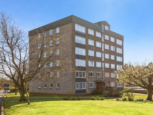 1 bedroom flat for sale in Lennox Court, Stockiemuir Avenue, Bearsden, Glasgow, G61 — £105,000 • 1 bed • 1 bath • 441 ft²
 1 bedroom flat for sale in Flat 4, 148 Milngavie Road, Bearsden, G61 3EA, G61 — £95,000 • 1 bed • 1 bath • 517 ft²
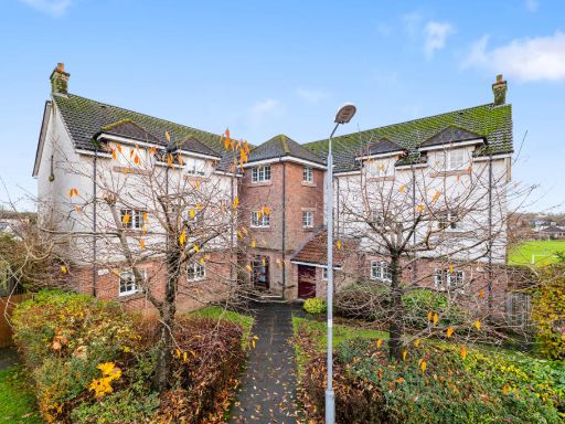 2 bedroom flat for sale in 12 Kessington Square, Bearsden, G61 2QQ, G61 — £225,000 • 2 bed • 2 bath • 861 ft²
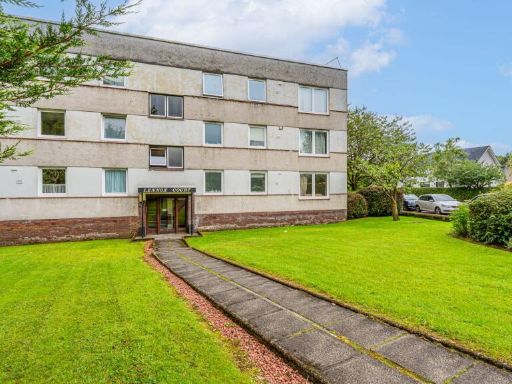 2 bedroom flat for sale in Lennox Court, 12 Sutherland Avenue, G61 — £150,000 • 2 bed • 1 bath • 926 ft²
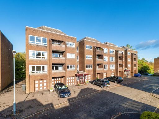 2 bedroom flat for sale in 77 Roman Court, Bearsden, G61 2NW, G61 — £285,000 • 2 bed • 2 bath • 1076 ft²
Meta
- {
"@context": "https://schema.org",
"@type": "Residence",
"name": "1 bedroom flat for sale in Flat 1D, Lennox Court, 14 Suther…",
"description": "",
"url": "https://propertypiper.co.uk/property/c0439a59-ac68-4976-87fe-43e9269f77e6",
"image": "https://image-a.propertypiper.co.uk/5d3823fb-ddf8-450e-bdc7-e8329652636c-1024.jpeg",
"address": {
"@type": "PostalAddress",
"streetAddress": "FLAT 1D, LENNOX COURT, 14, SUTHERLAND AVENUE, GLASGOW, BEARSDEN",
"postalCode": "G61 3JW",
"addressLocality": "East Dunbartonshire",
"addressRegion": "East Dunbartonshire",
"addressCountry": "Scotland"
},
"geo": {
"@type": "GeoCoordinates",
"latitude": 55.9301936,
"longitude": -4.3351275
},
"numberOfRooms": 1,
"numberOfBathroomsTotal": 1,
"floorSize": {
"@type": "QuantitativeValue",
"value": 527,
"unitCode": "FTK"
},
"offers": {
"@type": "Offer",
"price": 120000,
"priceCurrency": "GBP",
"availability": "https://schema.org/InStock"
},
"additionalProperty": [
{
"@type": "PropertyValue",
"name": "Feature",
"value": "apartment building"
},
{
"@type": "PropertyValue",
"name": "Feature",
"value": "mid-century"
},
{
"@type": "PropertyValue",
"name": "Feature",
"value": "1960s"
},
{
"@type": "PropertyValue",
"name": "Feature",
"value": "1970s"
},
{
"@type": "PropertyValue",
"name": "Feature",
"value": "brick facade"
},
{
"@type": "PropertyValue",
"name": "Feature",
"value": "six stories"
},
{
"@type": "PropertyValue",
"name": "Feature",
"value": "urban"
},
{
"@type": "PropertyValue",
"name": "Feature",
"value": "communal garden"
},
{
"@type": "PropertyValue",
"name": "Feature",
"value": "residential"
},
{
"@type": "PropertyValue",
"name": "Feature",
"value": "investment potential"
},
{
"@type": "PropertyValue",
"name": "Feature",
"value": "garden"
},
{
"@type": "PropertyValue",
"name": "Feature",
"value": "outdoor space"
},
{
"@type": "PropertyValue",
"name": "Feature",
"value": "landscaped"
},
{
"@type": "PropertyValue",
"name": "Feature",
"value": "lawn"
},
{
"@type": "PropertyValue",
"name": "Feature",
"value": "trees"
},
{
"@type": "PropertyValue",
"name": "Feature",
"value": "greenery"
}
]
}
High Res Floorplan Images
Compatible Floorplan Images
FloorplanImages Thumbnail