BR1 4LX - 1 bedroom apartment for sale in Old Bromley Road, Bromley,…
View on Property Piper
1 bedroom apartment for sale in Old Bromley Road, Bromley, BR1
Property Details
- Price: £225000
- Bedrooms: 1
- Bathrooms: 1
- Property Type: undefined
- Property SubType: undefined
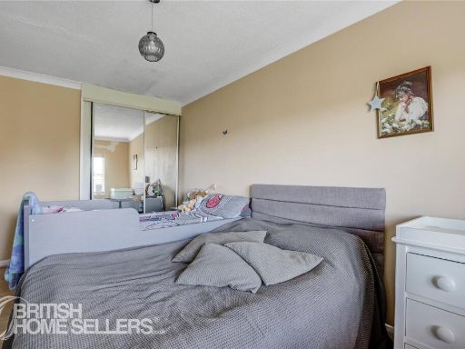
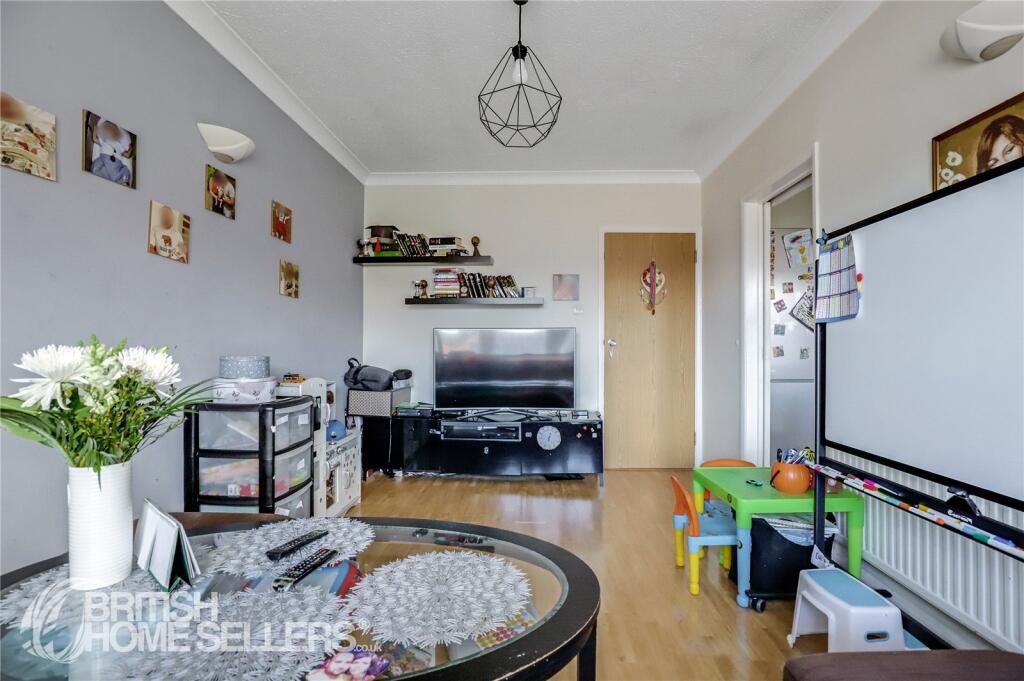
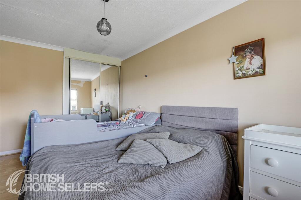
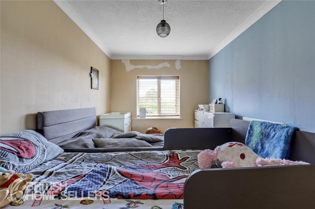
Image Descriptions
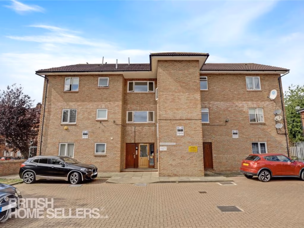
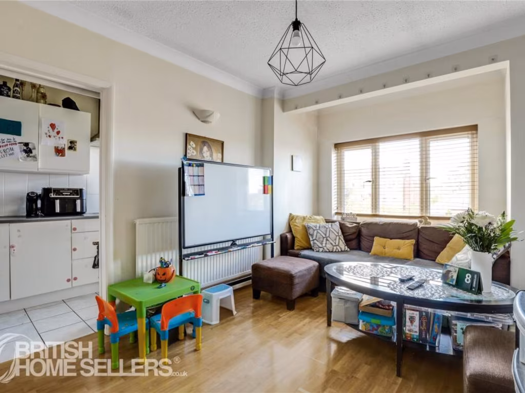
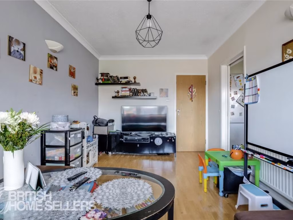
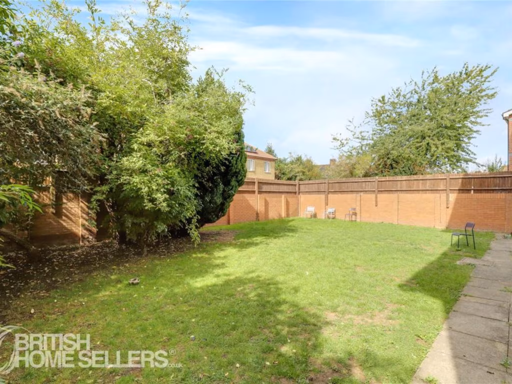
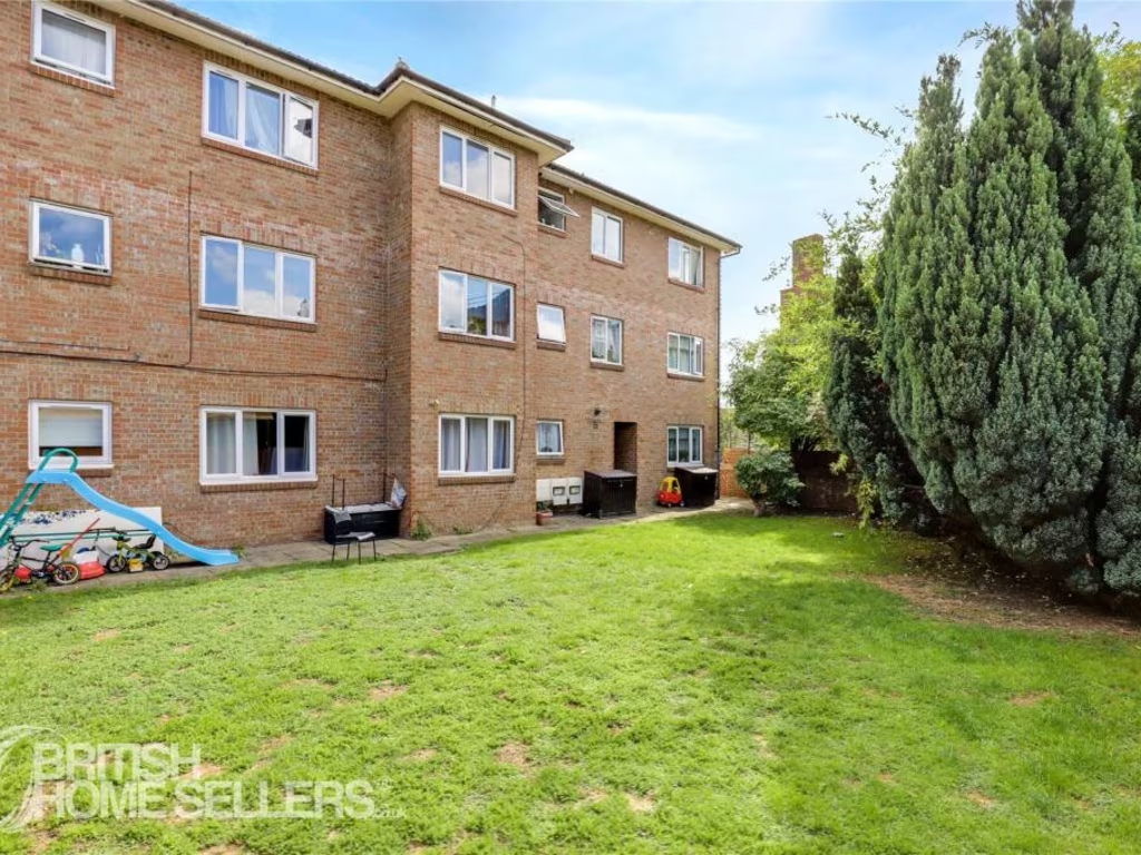
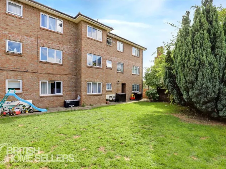
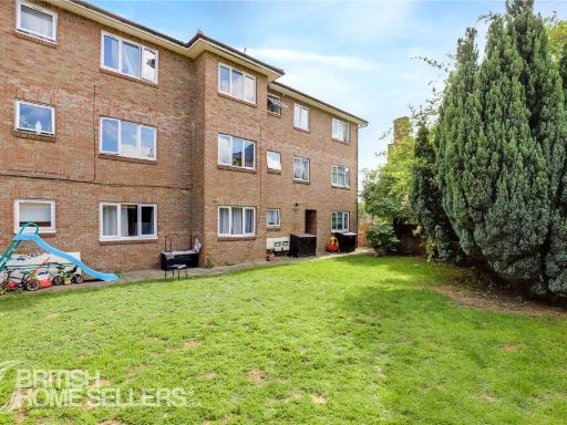
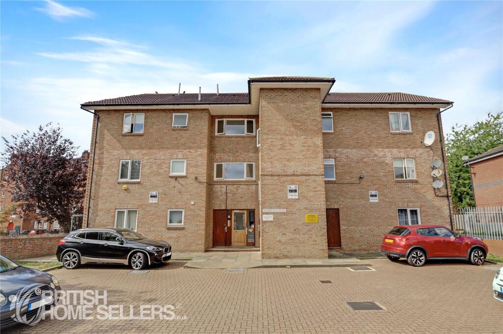
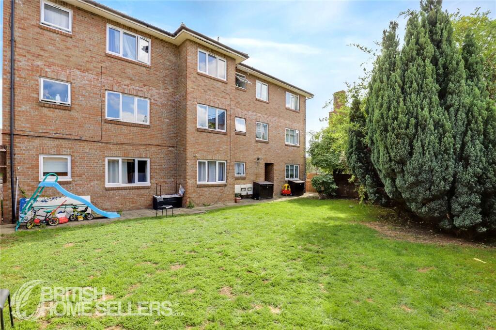
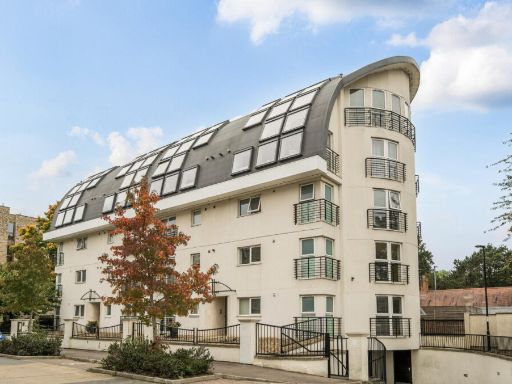
- apartment building Modernist
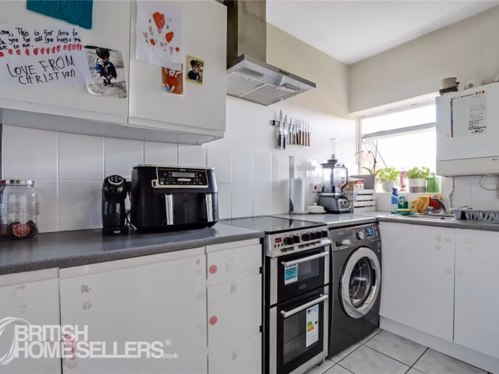
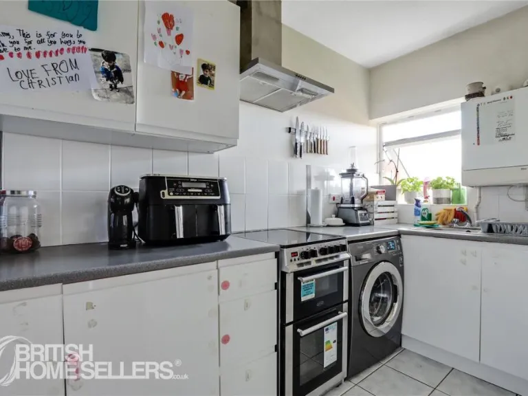
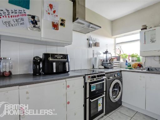
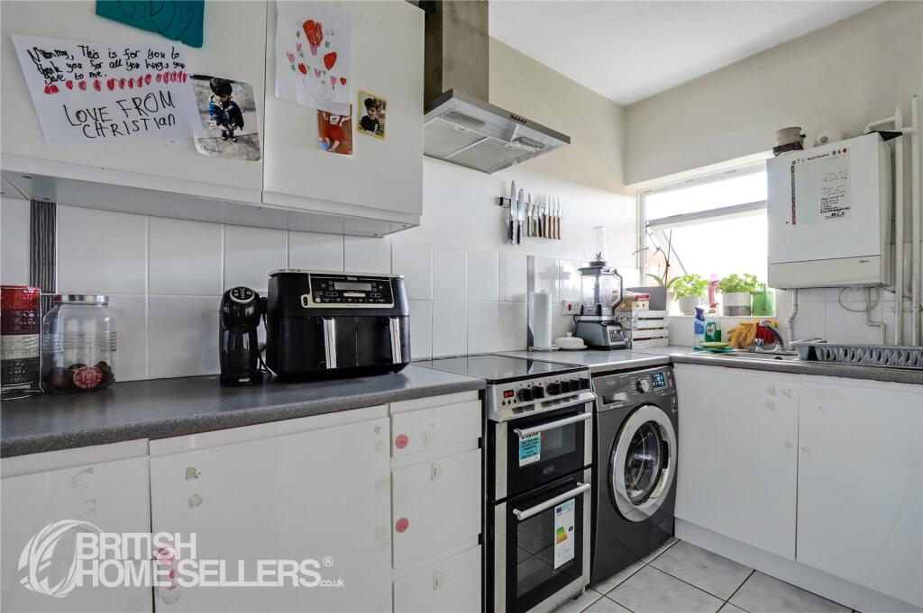
- kitchen 1980s
Textual Property Features
Detected Visual Features
- apartment
- brick
- modernist
- flat roof
- urban
- parking
- small kitchen
- standard ceiling height
- 1980s style
- white cabinets
- window
- modern appliances
EPC Details
- Single glazed
- Cavity wall, as built, no insulation (assumed)
- Boiler and radiators, mains gas
- No low energy lighting
- (another dwelling below)
Nearby Schools
- Valley Primary School
- Burnt Ash Primary School
- Haberdashers' Knights Academy
- Sandhurst Primary School
- Clare House Primary School
- Athelney Primary School
- Holy Cross Catholic Primary School
- Parish Church of England Primary School
- Good Shepherd RC School
- Downderry Primary School
- Forster Park Primary School
- Bishop Challoner School
- St Augustine's Catholic Primary School and Nursery
- Rangefield Primary School
- Launcelot Primary School
- St Mary's Catholic Primary School
- Sedgehill Academy
- Elfrida Primary School
- Education-My Life Matters
- St Christophers The Hall School
- St John Baptist Southend Church of England Primary School
- Torridon Primary School
- Rushey Green Primary School
Nearest General Shops
- Id: 10632592996
- Tags:
- Addr:
- City: London
- Housename: The Stables
- Place: Beckenham Place Park
- Postcode: BR3 5BP
- Suburb: Beckenham
- Contact:
- Email: info@eddiesdogshop.com
- Facebook: https://www.facebook.com/102532101925601
- Instagram: https://www.instagram.com/eddies_dog_shop
- Phone: +44 7702 367453
- Dog: yes
- Name: Eddie's Dog Shop
- Opening_hours: Tu 08:00-16:00;We-Th 08:00-16:30;Fr-Sa 08:00-17:30;Su 08:00–16:30
- Shop: pet
- Website: https://www.eddiesdogshop.com/
- TagsNormalized:
- Lat: 51.4199127
- Lon: -0.0178082
- FullGeoHash: gcpux8en9n3n
- PartitionGeoHash: gcpu
- Images:
- FoodStandards: null
- Distance: 991.3
,- Id: 4075885
- Tags:
- Brand: Homebase
- Brand:wikidata: Q9293447
- Brand:wikipedia: en:Homebase
- Building: store
- Contact:
- Website: https://store.homebase.co.uk/london/10-beckenham-hill-rd
- Name: Homebase
- Shop: doityourself
- TagsNormalized:
- Lat: 51.4270764
- Lon: -0.0124306
- FullGeoHash: gcpuxdnbqmgh
- PartitionGeoHash: gcpu
- Images:
- FoodStandards: null
- Distance: 538.2
,- Id: 119173934
- Tags:
- Addr:
- Housenumber: 359
- Postcode: SE6 2RP
- Street: Btomley Road
- Building: retail
- Int_name: Ancaster Group
- Name: Car dealership
- Shop: car
- TagsNormalized:
- Lat: 51.4271876
- Lon: -0.010225
- FullGeoHash: gcpuxf091dxe
- PartitionGeoHash: gcpu
- Images:
- FoodStandards: null
- Distance: 421
}
Nearest Religious buildings
- Id: 295244672
- Tags:
- Amenity: place_of_worship
- Building: yes
- Denomination: anglican
- Name: St Barnabas
- Religion: christian
- Wikidata: Q105075394
- TagsNormalized:
- place of worship
- anglican
- christian
- church
- Lat: 51.4263302
- Lon: 0.0024803
- FullGeoHash: u10h81cu1fc2
- PartitionGeoHash: u10h
- Images:
- FoodStandards: null
- Distance: 597.2
,- Id: 860090127
- Tags:
- Addr:
- Street: Beachborough Road
- Amenity: place_of_worship
- Building: church
- Denomination: anglican
- Name: St John the Baptist
- Postal_code: BR1 5RL
- Religion: christian
- Wikidata: Q26354258
- TagsNormalized:
- place of worship
- church
- anglican
- baptist
- christian
- Lat: 51.4282878
- Lon: -0.0113381
- FullGeoHash: gcpuxdpxrz9w
- PartitionGeoHash: gcpu
- Images:
- FoodStandards: null
- Distance: 561.5
,- Id: 447082090
- Tags:
- Amenity: hall
- Name: St John the Baptist church hall
- TagsNormalized:
- Lat: 51.4279184
- Lon: -0.0112357
- FullGeoHash: gcpuxdpv64y4
- PartitionGeoHash: gcpu
- Images:
- FoodStandards: null
- Distance: 527.6
}
Nearest Medical buildings
- Id: 996118947
- Tags:
- Addr:
- City: Bromley
- Housenumber: 443
- Postcode: BR1 5HS
- Street: Downham Way
- Amenity: pharmacy
- Building: yes
- Fhrs:
- Id: 1034848
- Local_authority_id: PI/000295669
- Healthcare: pharmacy
- Name: Day Lewis
- Operator: Day Lewis PLC
- TagsNormalized:
- Lat: 51.427684
- Lon: 0.0131464
- FullGeoHash: u10h861efr4s
- PartitionGeoHash: u10h
- Images:
- FoodStandards:
- Id: 1034848
- FHRSID: 1034848
- LocalAuthorityBusinessID: PI/000295669
- BusinessName: Day Lewis PLC
- BusinessType: Retailers - other
- BusinessTypeID: 4613
- AddressLine1: 443 Downham Way
- AddressLine2: Bromley
- AddressLine3: null
- AddressLine4: null
- PostCode: BR1 5HS
- RatingValue: Exempt
- RatingKey: fhrs_exempt_en-GB
- RatingDate: 2017-11-21
- LocalAuthorityCode: 523
- LocalAuthorityName: Lewisham
- LocalAuthorityWebSite: http://www.lewisham.gov.uk/myservices/business/food-safety/Pages/default.aspx
- LocalAuthorityEmailAddress: david.edwards@lewisham.gov.uk
- Scores:
- Hygiene: null
- Structural: null
- ConfidenceInManagement: null
- NewRatingPending: false
- Geocode:
- Longitude: 0.01309100000000
- Latitude: 51.42780100000000
- Distance: 1349.7
,- Id: 612024075
- Tags:
- Amenity: doctors
- Name: Downham Family Medical Practice
- TagsNormalized:
- Lat: 51.4264622
- Lon: 0.0128855
- FullGeoHash: u10h83cku72h
- PartitionGeoHash: u10h
- Images:
- FoodStandards: null
- Distance: 1304.5
,- Id: 906672314
- Tags:
- Amenity: doctors
- Name: South Lewisham Health Centre
- Phone: +44 20 3049 2580
- Wheelchair: yes
- TagsNormalized:
- doctor
- doctors
- health
- health centre
- Lat: 51.4299101
- Lon: -0.013473
- FullGeoHash: gcpuxdw0yn1g
- PartitionGeoHash: gcpu
- Images:
- FoodStandards: null
- Distance: 794.3
,- Id: 906672311
- Tags:
- Addr:
- Amenity: pharmacy
- Healthcare: pharmacy
- Name: Vantage Pharmacy
- Operator: Vantage
- TagsNormalized:
- Lat: 51.4297665
- Lon: -0.0128592
- FullGeoHash: gcpuxdw8h777
- PartitionGeoHash: gcpu
- Images:
- FoodStandards: null
- Distance: 754
}
Nearest Airports
- Id: 260720166
- Tags:
- Aerodrome: international
- Aeroway: aerodrome
- Alt_name: Gatwick Airport
- Ele: 62
- Iata: LGW
- Icao: EGKK
- Internet_access: wlan
- Internet_access:fee: no
- Internet_access:ssid: Gatwick FREE Wi-Fi
- Name: London Gatwick Airport
- Operator: Gatwick Airport Limited
- Ref: LGW
- Website: https://www.gatwickairport.com/
- Wikidata: Q8703
- Wikipedia: en:Gatwick Airport
- TagsNormalized:
- airport
- international airport
- Lat: 51.1540917
- Lon: -0.1883773
- FullGeoHash: gcpg58qf4mzd
- PartitionGeoHash: gcpg
- Images:
- FoodStandards: null
- Distance: 32657.5
,- Id: 121158889
- Tags:
- Aerodrome: continental
- Aeroway: aerodrome
- Fhrs:
- Authority: City of London Corporation
- Iata: LCY
- Icao: EGLC
- Name: London City Airport
- Operator: London City Airport Limited
- Ref: LCY
- Website: https://www.londoncityairport.com/
- Wikidata: Q8982
- Wikipedia: en:London City Airport
- TagsNormalized:
- airport
- continental airport
- Lat: 51.5042658
- Lon: 0.0539987
- FullGeoHash: u10j10p64702
- PartitionGeoHash: u10j
- Images:
- FoodStandards: null
- Distance: 9770.5
,- Id: 14001268
- Tags:
- Access: yes
- Aerodrome: international
- Aerodrome:type: public
- Aeroway: aerodrome
- Alt_name: London Heathrow
- Alt_name_2: London Heathrow Airport
- Ele: 25
- Iata: LHR
- Icao: EGLL
- Int_name: Heathrow Airport
- Name: London Heathrow Airport
- Note: area still approx
- Old_name: London Airport
- Operator: Heathrow Airport Limited
- Rank_aci:
- Ref: LHR
- Short_name: Heathrow
- Type: multipolygon
- Website: https://www.heathrow.com/
- Wikidata: Q8691
- Wikipedia: en:Heathrow Airport
- TagsNormalized:
- airport
- international airport
- Lat: 51.4677522
- Lon: -0.4547736
- FullGeoHash: gcpsv9kv7h2h
- PartitionGeoHash: gcps
- Images:
- FoodStandards: null
- Distance: 31488
}
Nearest Leisure Facilities
- Id: 8227525108
- Tags:
- Leisure: pitch
- Sport: skateboard
- TagsNormalized:
- pitch
- leisure
- skateboard
- sports
- Lat: 51.4224114
- Lon: -0.0063254
- FullGeoHash: gcpuxc5mk872
- PartitionGeoHash: gcpu
- Images:
- FoodStandards: null
- Distance: 253.6
,- Id: 1141379296
- Tags:
- TagsNormalized:
- outdoor
- outdoor seating
- leisure
- Lat: 51.4225607
- Lon: -0.0059403
- FullGeoHash: gcpuxc5wjs4d
- PartitionGeoHash: gcpu
- Images:
- FoodStandards: null
- Distance: 233.9
,- Id: 886667205
- Tags:
- TagsNormalized:
- Lat: 51.4230896
- Lon: -0.0056696
- FullGeoHash: gcpuxc7c5ysm
- PartitionGeoHash: gcpu
- Images:
- FoodStandards: null
- Distance: 174.5
,- Id: 595935656
- Tags:
- Leisure: park
- Name: Downham memorial park.
- TagsNormalized:
- Lat: 51.4241558
- Lon: -0.0042087
- FullGeoHash: gcpuxckzmvmy
- PartitionGeoHash: gcpu
- Images:
- FoodStandards: null
- Distance: 117.9
,- Id: 886572235
- Tags:
- TagsNormalized:
- Lat: 51.4239336
- Lon: -0.0057099
- FullGeoHash: gcpuxc7y4un2
- PartitionGeoHash: gcpu
- Images:
- FoodStandards: null
- Distance: 80.6
}
Nearest Tourist attractions
- Id: 116299181
- Tags:
- Addr:
- City: London
- Country: GB
- Housenumber: 17
- Street: Aylward Road
- Building: yes
- Internet_access: no
- Internet_access:fee: no
- Name: B+B Tarling
- Smoking: no
- Stars: 1
- Tourism: guest_house
- Wheelchair: no
- TagsNormalized:
- Lat: 51.4357833
- Lon: -0.0455675
- FullGeoHash: gcpuwgwg4hyq
- PartitionGeoHash: gcpu
- Images:
- FoodStandards: null
- Distance: 3027.7
,- Id: 5842530001
- Tags:
- Addr:
- City: Sydenham
- Housenumber: 140
- Postcode: SE26 5JZ
- Street: Sydenham Road
- Name: The Lovely Gallery
- Tourism: gallery
- TagsNormalized:
- Lat: 51.42558
- Lon: -0.0455646
- FullGeoHash: gcpuwcwzdqbt
- PartitionGeoHash: gcpu
- Images:
- FoodStandards: null
- Distance: 2765.5
,- Id: 768475632
- Tags:
- Addr:
- Housenumber: 30
- Street: Bromley Road
- Building: yes
- Name: The Croft
- Tourism: apartment
- TagsNormalized:
- Lat: 51.4420026
- Lon: -0.0208878
- FullGeoHash: gcpuxs8z3k2f
- PartitionGeoHash: gcpu
- Images:
- FoodStandards: null
- Distance: 2197
}
Nearest Hotels
- Id: 965750885
- Tags:
- Addr:
- City: Bromley
- Housenumber: 37
- Postcode: BR1 1DG
- Street: London Road
- Brand: Travelodge
- Brand:wikidata: Q9361374
- Brand:wikipedia: en:Travelodge UK
- Fhrs:
- Authority: Bromley
- Id: 778374
- Local_authority_id: 14/00255/MIXED
- Internet_access: wlan
- Internet_access:fee: customers
- Internet_access:ssid: Travelodge WiFi
- Name: Travelodge
- Tourism: hotel
- TagsNormalized:
- Lat: 51.4102766
- Lon: 0.0098025
- FullGeoHash: u10h2nzns6jm
- PartitionGeoHash: u10h
- Images:
- FoodStandards: null
- Distance: 1927.2
,- Id: 539644959
- Tags:
- Addr:
- City: London Borough of Bromley
- Housename: Bromley Court Hotel
- Postcode: BR1 4JD
- Street: Coniston Road
- Building: yes
- Fhrs:
- Name: Bromley Court Hotel
- Phone: +44 20 8461 8600
- Source:
- Tourism: hotel
- TagsNormalized:
- Lat: 51.4167004
- Lon: 0.0018655
- FullGeoHash: u10h8017grxh
- PartitionGeoHash: u10h
- Images:
- FoodStandards: null
- Distance: 1029
,- Id: 5340962869
- Tags:
- Addr:
- City: Bromley
- Postcode: BR1 4JD
- Street: Coniston Road
- Fhrs:
- Name: Bromley Court Hotel
- Source:
- Tourism: hotel
- TagsNormalized:
- Lat: 51.4168577
- Lon: 0.0021527
- FullGeoHash: u10h801sfhvp
- PartitionGeoHash: u10h
- Images:
- FoodStandards: null
- Distance: 1024.4
}
Tags
- apartment
- brick
- modernist
- flat roof
- urban
- parking
- small kitchen
- standard ceiling height
- 1980s style
- white cabinets
- window
- modern appliances
Local Market Stats
- Average Price/sqft: £498
- Avg Income: £56600
- Rental Yield: 4.2%
- Social Housing: 12%
- Planning Success Rate: 74%
AirBnB Data
- 1km average: £79/night
- Listings in 1km: 3
Similar Properties
 2 bedroom apartment for sale in Melfield Gardens, London, SE6 — £400,000 • 2 bed • 2 bath • 783 ft²
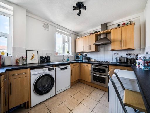 1 bedroom flat for sale in Beckenham Hill Road, Beckenham Hill, London, SE6 — £230,000 • 1 bed • 1 bath • 626 ft²
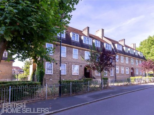 2 bedroom apartment for sale in Lushington Road, London, SE6 — £325,000 • 2 bed • 1 bath • 544 ft²
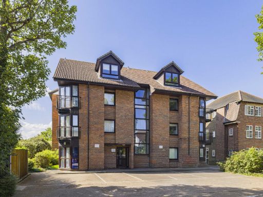 1 bedroom apartment for sale in Croydon Road, Beckenham, BR3 — £240,000 • 1 bed • 1 bath • 397 ft²
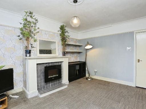 2 bedroom ground floor flat for sale in Beckenham Hill Road, Beckenham Hill, SE6 — £300,000 • 2 bed • 2 bath • 754 ft²
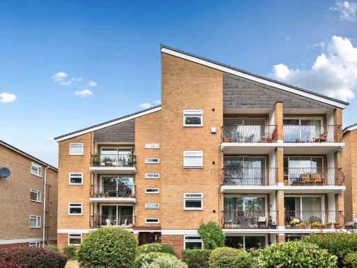 1 bedroom apartment for sale in Waylands Mead, Beckenham, BR3 — £300,000 • 1 bed • 1 bath • 599 ft²
Meta
- {
"@context": "https://schema.org",
"@type": "Residence",
"name": "1 bedroom apartment for sale in Old Bromley Road, Bromley,…",
"description": "",
"url": "https://propertypiper.co.uk/property/c0293b52-b7e7-4f3f-a9a7-eda69867891c",
"image": "https://image-a.propertypiper.co.uk/0220b59d-bbca-41cc-b1a6-9e7fd55f005a-1024.jpeg",
"address": {
"@type": "PostalAddress",
"streetAddress": "CORK HOUSE, 20 FLAT 8 OLD BROMLEY ROAD BROMLEY",
"postalCode": "BR1 4LX",
"addressLocality": "Lewisham",
"addressRegion": "Lewisham East",
"addressCountry": "England"
},
"geo": {
"@type": "GeoCoordinates",
"latitude": 51.42465875248271,
"longitude": -0.005706061672710514
},
"numberOfRooms": 1,
"numberOfBathroomsTotal": 1,
"offers": {
"@type": "Offer",
"price": 225000,
"priceCurrency": "GBP",
"availability": "https://schema.org/InStock"
},
"additionalProperty": [
{
"@type": "PropertyValue",
"name": "Feature",
"value": "apartment"
},
{
"@type": "PropertyValue",
"name": "Feature",
"value": "brick"
},
{
"@type": "PropertyValue",
"name": "Feature",
"value": "modernist"
},
{
"@type": "PropertyValue",
"name": "Feature",
"value": "flat roof"
},
{
"@type": "PropertyValue",
"name": "Feature",
"value": "urban"
},
{
"@type": "PropertyValue",
"name": "Feature",
"value": "parking"
},
{
"@type": "PropertyValue",
"name": "Feature",
"value": "small kitchen"
},
{
"@type": "PropertyValue",
"name": "Feature",
"value": "standard ceiling height"
},
{
"@type": "PropertyValue",
"name": "Feature",
"value": "1980s style"
},
{
"@type": "PropertyValue",
"name": "Feature",
"value": "white cabinets"
},
{
"@type": "PropertyValue",
"name": "Feature",
"value": "window"
},
{
"@type": "PropertyValue",
"name": "Feature",
"value": "modern appliances"
}
]
}