GU9 7AS - 4 bedroom detached house for sale in West Street, Farnham,…
View on Property Piper
4 bedroom detached house for sale in West Street,
Farnham,
GU9 7AS, GU9
Property Details
- Price: £1075000
- Bedrooms: 4
- Bathrooms: 1
- Property Type: undefined
- Property SubType: undefined
Brochure Descriptions
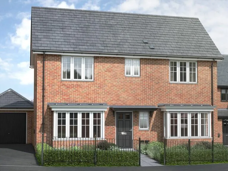
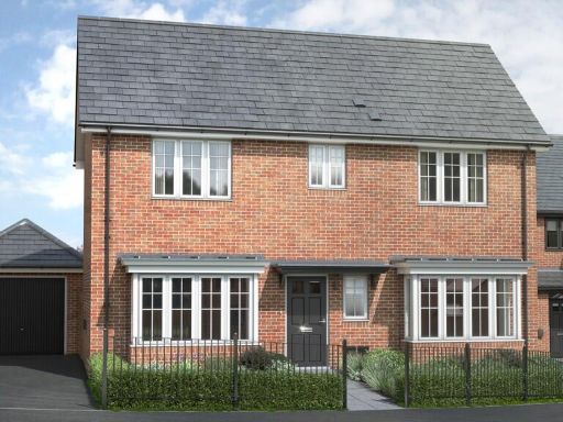
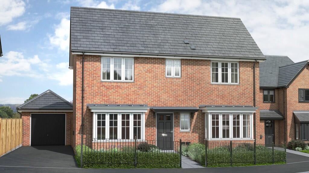
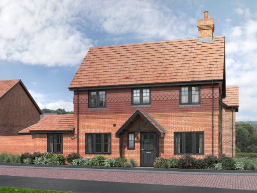
- Marketing artwork for a residential development named 'Birchwood' located in Farnham. The image shows a family scene in an outdoor lawn/garden area, suggesting family-oriented homes with private gardens. Based on the branding and imagery, the development appears aimed at detached or semi‑detached family homes with small-to‑average rear gardens and a suburban setting; no internal layout, room counts or exact plot sizes are visible. Overall the property appears to be part of a new-build development targeted at families rather than city apartments.
- Marketing image only — property identified as 'Birchwood' on West Street, Farnham (GU9 7AS). The image conveys a family-oriented, suburban setting with mature trees and a well-treed, park-like aspect visible from the grounds. Based solely on the visual, the plot appears to benefit from garden or lawn space (small-to-medium/medium-to-large garden rather than a compact urban plot). The presentation and name suggest a family home rather than an apartment, located in a pleasant, leafy neighbourhood. No interior or floorplan details are visible, so bed/bath count and total living area cannot be determined. For valuation or accuracy, an internal inspection and floorplan or EPC are recommended.
- Large rural parcel of land set in rolling countryside with extensive panoramic views to the horizon. The site comprises open pasture fields interspersed with pockets of mature woodland and hedgerows, typical of agricultural use. Terrain appears gently undulating and well drained. No buildings or internal fixtures are visible in the image. Access is likely from local country lanes; the setting is private and secluded with long sightlines across neighbouring farmland. As a valuator: this is best described as a substantial agricultural or amenity holding offering significant landscape value, potential for grazing, forestry or diversification (subject to planning consent). Plot/garden size: large/huge. Overall property size: large (likely several acres).
- Marketing image for a residential development called 'Birchwood' in Farnham. Image suggests a family‑oriented suburban/semi‑rural development with private garden space and landscaped greenery. The presentation implies detached or semi‑detached family homes aimed at households with children; the outdoor area visible appears medium to large for suburban plots. No interior details, number of bedrooms, or exact plot sizes are shown, and the photograph is promotional rather than technical. Valuation note: positioned as a family development in Farnham with garden amenity and likely strong appeal to owner‑occupiers; detailed valuation would require floorplans, net/internal area, and specification information.
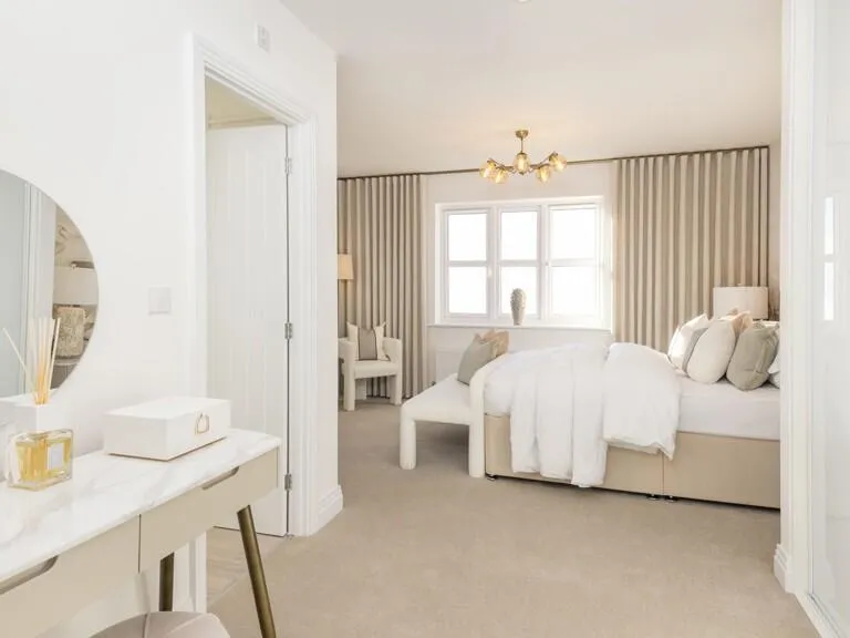
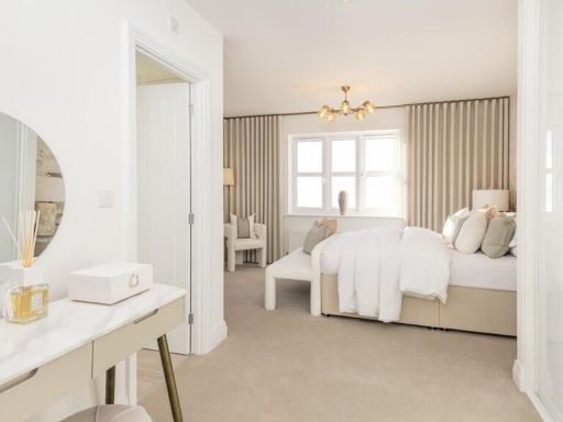
- Residential property named Birchwood on West Street in Farnham (GU9 7AS). The marketing image emphasises a family-oriented home set close to or overlooking green open space or parkland (visible mature trees and grass in the background), suggesting pleasant outlooks and likely access to outdoor amenity. No interior images are provided, so finish, layout and number of bedrooms cannot be assessed. Garden/grounds appear likely to be average to large for a family house given the focus on outdoor setting. Overall impression (valuator style): a family-focused detached or semi-detached dwelling in a desirable, leafy location in Farnham with strong appeal to buyers seeking green outlooks and outdoor space; valuation considerations should prioritise plot size, proximity to local amenities and schools, and the condition and internal layout once inspected.
- Rural countryside holding viewed from aerial perspective. The image shows extensive, contiguous pasture and mixed woodland parcels with well-defined field boundaries and hedgerows, indicating a large agricultural or amenity holding. Topography appears gently undulating with long, open vistas across farmland — likely attractive south/ west-facing views. No built residential façade is visible in detail, so internal accommodation and exact plot boundaries cannot be confirmed. Property characteristics and valuation considerations: large plot size (appears to be several hectares/ acres), good privacy and seclusion, potential for equestrian/agricultural use or conversion (subject to planning), likely need for vehicular access improvements and confirmation of services (mains water, electricity, drainage). Factors that will materially affect value: exact acreage, presence/condition of any buildings or access rights, planning designation/permits, road access and utility connections, and landscape/SSSI or conservation constraints. Overall impression: high rural amenity value with strong development or recreational potential contingent on planning and services verification.
Image Descriptions
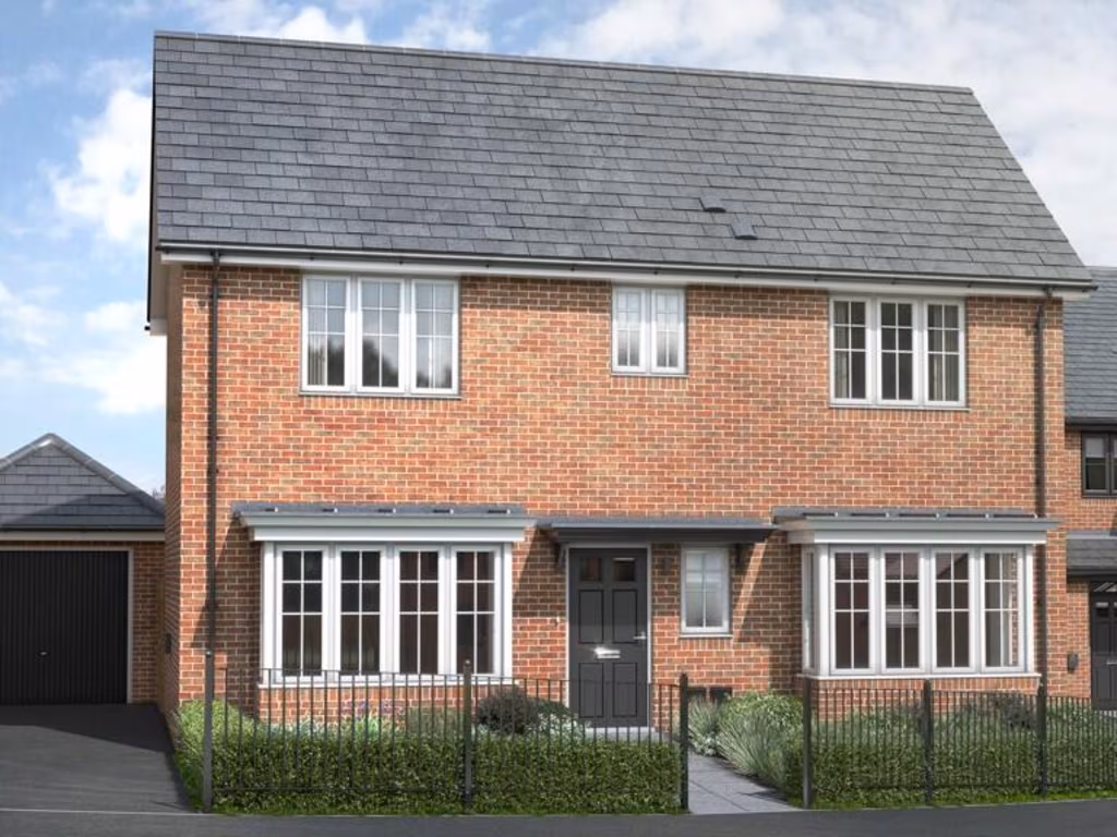
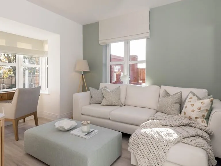
- detached house modern suburban
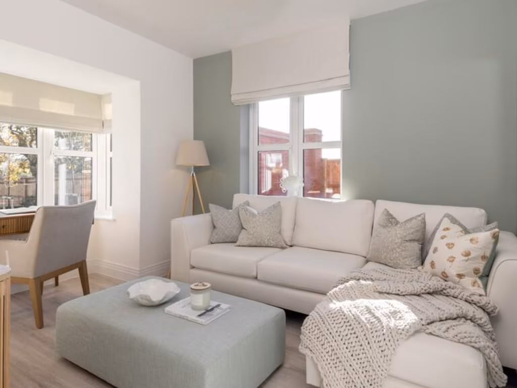
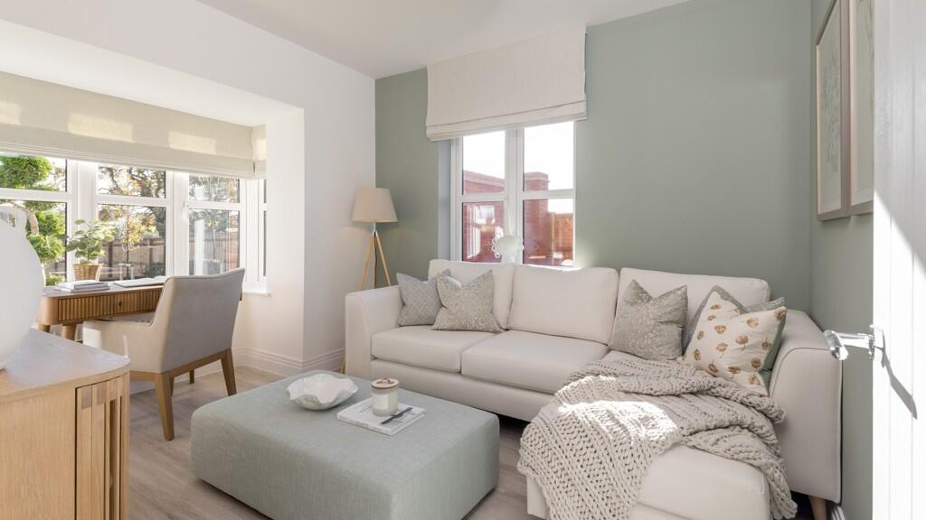
- living room contemporary
Floorplan Description
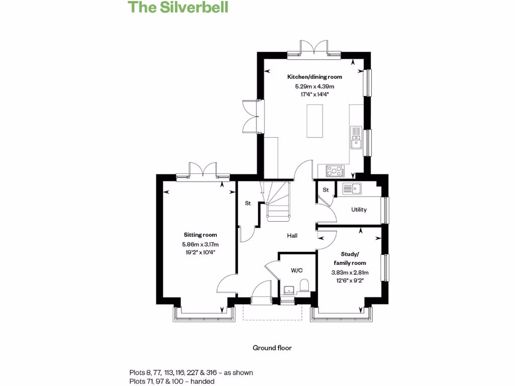
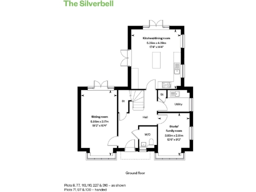
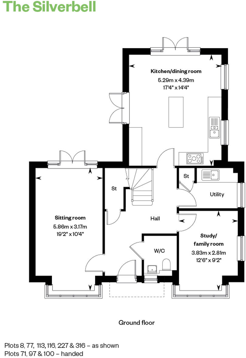
- Ground floor plan showing kitchen/dining room, sitting room and study/family room.
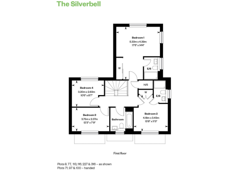
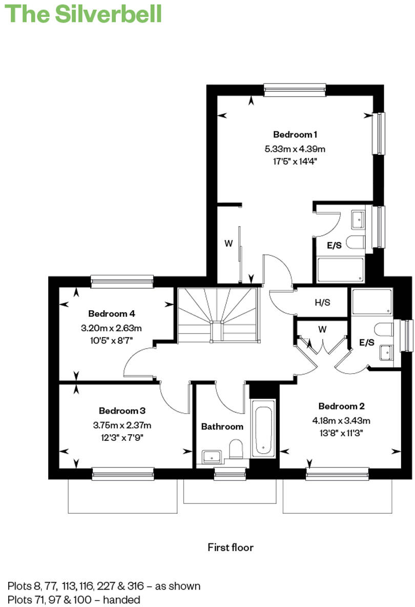
- First floor plan showing four bedrooms and a bathroom.
Rooms
- Kitchen/dining room:
- Sitting room:
- Study/ family room:
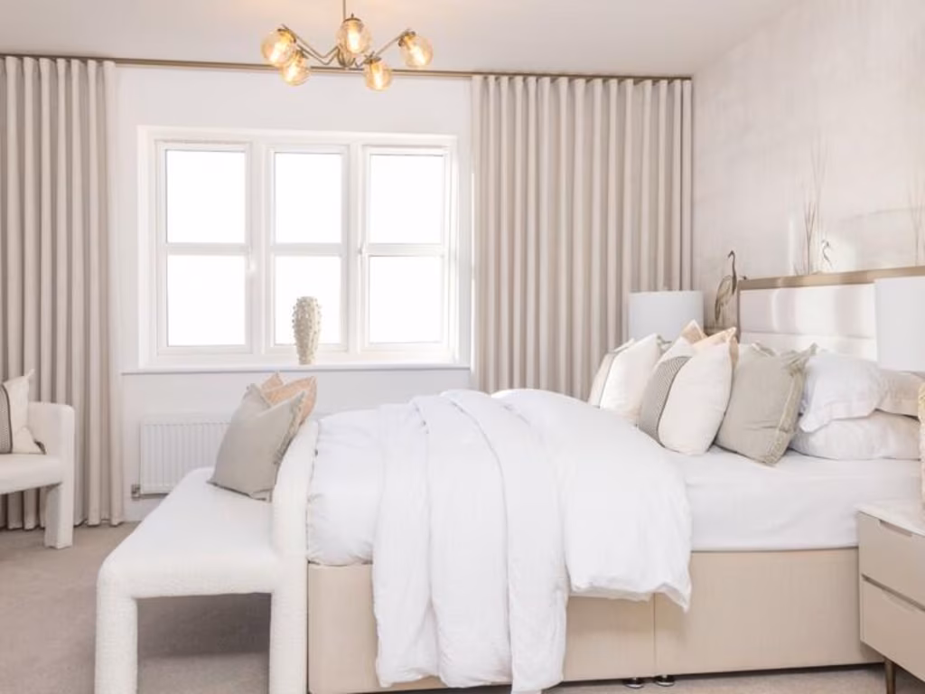
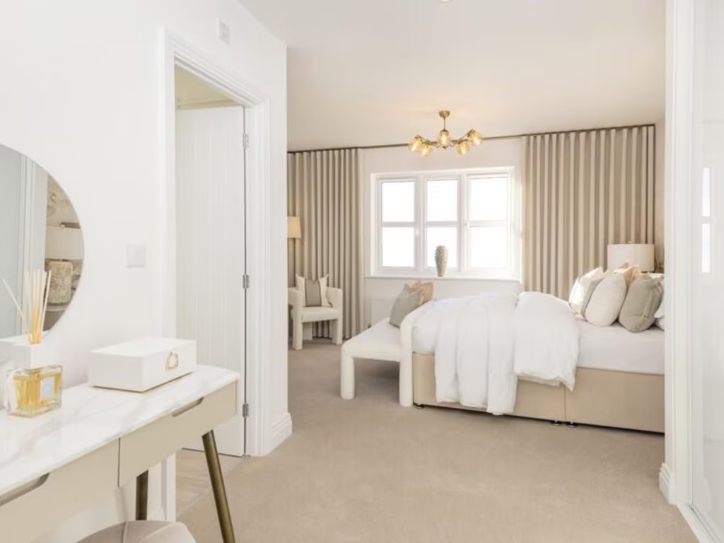
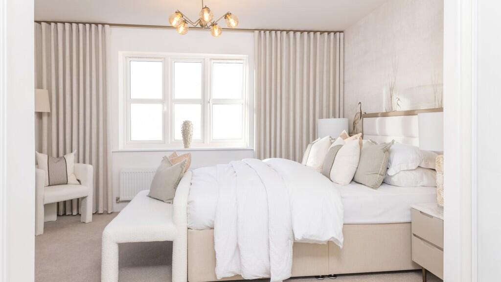
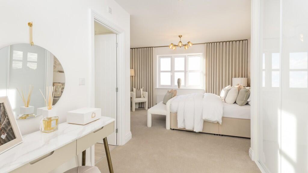
- Bedroom 1:
- Bedroom 2:
- Bedroom 3:
- Bedroom 4:
- Bathroom:
Textual Property Features
Detected Visual Features
- modern
- suburban
- detached house
- brick exterior
- pitched roof
- new build
- double glazing
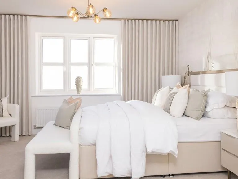
- contemporary
- neutral decor
- natural light
- living room
Nearby Schools
- St Andrew's Church of England Infant School
- South Farnham School
- St Peter's CofE Primary School
- Potters Gate CofE Primary School
- Folly Hill Infant Academy
- William Cobbett Primary School
- Hale Nursery & Primary Academy
- St Joseph's Catholic Primary School
- St Nicholas' School
- Tweseldown Infant School
- Church Crookham Junior School
- St Mary's CofE Aided Infant School, Frensham
- Frensham Heights School
- Edgeborough School
- Bentley Church of England Primary School
- Weydon School
- Barfield Prep School
- Badshot Lea Village Infant School
- Farnham Heath End
- Wellington Community Primary School
- Crookham Church of England Aided Infant School
- Rowledge Church of England Controlled Primary School
- Highfield South Farnham School
- St Polycarp's Catholic Primary School
Nearest General Shops
- Id: 298066678
- Tags:
- Addr:
- City: Farnham
- Housename: CTD Tiles
- Housenumber: Grovebell Industrial Estate
- Postcode: GU10 4PL
- Street: Wrecclesham Road
- Name: CTD Tile Showroom
- Phone: +44 1252 721 624
- Shop: shop
- Website: https://www.ctdtiles.co.uk/t-tile-showroom-farnham.aspx
- TagsNormalized:
- Lat: 51.2009792
- Lon: -0.8175319
- FullGeoHash: gcp7m2ueq4k1
- PartitionGeoHash: gcp7
- Images:
- FoodStandards: null
- Distance: 765.6
,- Id: 7543086299
- Tags:
- Brand: Screwfix
- Brand:wikidata: Q7439115
- Brand:wikipedia: en:Screwfix
- Name: Screwfix
- Shop: doityourself
- TagsNormalized:
- Lat: 51.2015516
- Lon: -0.8172233
- FullGeoHash: gcp7m2uytm40
- PartitionGeoHash: gcp7
- Images:
- FoodStandards: null
- Distance: 699.2
,- Id: 928951378
- Tags:
- Brand: Volkswagen
- Brand:wikidata: Q246
- Contact:
- Marque: VW
- Name: Martins
- Operator: Martins Group
- Shop: car
- TagsNormalized:
- Lat: 51.2120669
- Lon: -0.8082315
- FullGeoHash: gcp7mdg7yv4y
- PartitionGeoHash: gcp7
- Images:
- FoodStandards: null
- Distance: 699
}
Nearest Religious buildings
- Id: 295432521
- Tags:
- Addr:
- Postcode: GU9 8RR
- Street: Talbot Road
- Amenity: place_of_worship
- Building: yes
- Building:levels: 1
- Denomination: anglican
- Name: The church at Brambleton Hall
- Phone: +44 1252 715505
- Religion: christian
- Website: https://www.thebourne.org.uk/index.php/ourchurches
- Wikidata: Q105109181
- TagsNormalized:
- place of worship
- anglican
- church
- christian
- Lat: 51.2041432
- Lon: -0.803045
- FullGeoHash: gcp7m9rjz8n5
- PartitionGeoHash: gcp7
- Images:
- FoodStandards: null
- Distance: 957.3
,- Id: 952471724
- Tags:
- Amenity: community_centre
- Building: yes
- Community_centre: church_hall
- Name: St Francis Byworth Church Hall
- Roof:
- TagsNormalized:
- community centre
- church
- church hall
- Lat: 51.2151281
- Lon: -0.8154426
- FullGeoHash: gcp7m7qjwzcg
- PartitionGeoHash: gcp7
- Images:
- FoodStandards: null
- Distance: 820.6
,- Id: 878909166
- Tags:
- Amenity: place_of_worship
- Building: church
- Denomination: anglican
- Name: St Francis, Byworth
- Religion: christian
- Wikidata: Q105085999
- TagsNormalized:
- place of worship
- church
- anglican
- christian
- Lat: 51.2150398
- Lon: -0.815725
- FullGeoHash: gcp7m7qj0prk
- PartitionGeoHash: gcp7
- Images:
- FoodStandards: null
- Distance: 810.9
}
Nearest Airports
- Id: 14001268
- Tags:
- Access: yes
- Aerodrome: international
- Aerodrome:type: public
- Aeroway: aerodrome
- Alt_name: London Heathrow
- Alt_name_2: London Heathrow Airport
- Ele: 25
- Iata: LHR
- Icao: EGLL
- Int_name: Heathrow Airport
- Name: London Heathrow Airport
- Note: area still approx
- Old_name: London Airport
- Operator: Heathrow Airport Limited
- Rank_aci:
- Ref: LHR
- Short_name: Heathrow
- Type: multipolygon
- Website: https://www.heathrow.com/
- Wikidata: Q8691
- Wikipedia: en:Heathrow Airport
- TagsNormalized:
- airport
- international airport
- Lat: 51.4677522
- Lon: -0.4547736
- FullGeoHash: gcpsv9kv7h2h
- PartitionGeoHash: gcps
- Images:
- FoodStandards: null
- Distance: 38260.3
}
Nearest Leisure Facilities
- Id: 545456225
- Tags:
- Leisure: pitch
- Sport: basketball
- TagsNormalized:
- pitch
- leisure
- basketball
- sports
- Lat: 51.2037161
- Lon: -0.8081795
- FullGeoHash: gcp7m97e2098
- PartitionGeoHash: gcp7
- Images:
- FoodStandards: null
- Distance: 680.3
,- Id: 27205303
- Tags:
- TagsNormalized:
- Lat: 51.2039821
- Lon: -0.808398
- FullGeoHash: gcp7m97kffnf
- PartitionGeoHash: gcp7
- Images:
- FoodStandards: null
- Distance: 649.5
,- Id: 1069257110
- Tags:
- Leisure: pitch
- Sport: multi
- TagsNormalized:
- Lat: 51.2020293
- Lon: -0.8147231
- FullGeoHash: gcp7m3n9rw43
- PartitionGeoHash: gcp7
- Images:
- FoodStandards: null
- Distance: 638.4
,- Id: 27205299
- Tags:
- Access: yes
- Leisure: playground
- Name: Baldreys playground
- Note: fenced
- TagsNormalized:
- Lat: 51.2042012
- Lon: -0.8085315
- FullGeoHash: gcp7m97npfgj
- PartitionGeoHash: gcp7
- Images:
- FoodStandards: null
- Distance: 626.8
,- Id: 297005835
- Tags:
- TagsNormalized:
- Lat: 51.2113727
- Lon: -0.8131849
- FullGeoHash: gcp7m6xzg7v3
- PartitionGeoHash: gcp7
- Images:
- FoodStandards: null
- Distance: 434.7
}
Nearest Tourist attractions
- Id: 5259316550
- Tags:
- Addr:
- City: Farnham
- Street: West Street
- Fee: no
- Note: Open air in garden behind library
- Tourism: gallery
- Wheelchair: yes
- Wheelchair:description: Outdoors. Brick paths from street and library to lawn
- TagsNormalized:
- Lat: 51.2130795
- Lon: -0.8029594
- FullGeoHash: gcp7mep3c9yn
- PartitionGeoHash: gcp7
- Images:
- FoodStandards: null
- Distance: 1057.1
,- Id: 297039884
- Tags:
- Addr:
- City: Farnham
- Housenumber: 38
- Postcode: GU9 7DX
- Street: West Street
- Fhrs:
- Name: Museum of Farnham
- Phone: +44 1252 715094
- Toilets:
- Tourism: museum
- Website: https://www.farnham.gov.uk/discover/history-and-heritage/museum-of-farnham
- Wheelchair: limited
- Wheelchair:description: Historic frontage, Step-free side entrance, lower floor accessible, stairs only to upper floor. Uncluttered rooms. New Accessible toilet. Ramp to Gallery Garden with sculptures (q.v.)
- Wikidata: Q113369807
- TagsNormalized:
- Lat: 51.2132044
- Lon: -0.8045247
- FullGeoHash: gcp7men4t1nz
- PartitionGeoHash: gcp7
- Images:
- FoodStandards: null
- Distance: 977.3
,- Id: 5238570858
- Tags:
- Addr:
- City: Farnham
- Street: West Street
- Name: Museum of Farnham Garden Gallery
- Toilets:
- Tourism: gallery
- Wheelchair: yes
- Wheelchair:description: (Accessible toilet in Museum shown 1st) Step-free access via garden gate or Museum, firm brick paths. Toilet in Conference space not yet snapped.
- TagsNormalized:
- Lat: 51.2129863
- Lon: -0.8043376
- FullGeoHash: gcp7men338d6
- PartitionGeoHash: gcp7
- Images:
- FoodStandards: null
- Distance: 972.8
}
Nearest Train stations
- Id: 5967525974
- Tags:
- Name: Aldershot
- Naptan:
- Network: National Rail
- Public_transport: station
- Railway: station
- Ref:
- Wheelchair: yes
- Wikidata: Q4502625
- Wikipedia: en:Aldershot railway station
- TagsNormalized:
- Lat: 51.2462388
- Lon: -0.760113
- FullGeoHash: gcp7w9ndbp69
- PartitionGeoHash: gcp7
- Images:
- FoodStandards: null
- Distance: 5762.4
,- Id: 2458373284
- Tags:
- Name: Bentley
- Name:lt: Bentlis
- Naptan:
- Network: National Rail
- Operator: South Western Railway
- Public_transport: station
- Railway: station
- Ref:
- Wheelchair: yes
- Wikidata: Q1883564
- Wikipedia: en:Bentley railway station (Hampshire)
- TagsNormalized:
- Lat: 51.1812254
- Lon: -0.8681985
- FullGeoHash: gcp7hjrb1xbm
- PartitionGeoHash: gcp7
- Images:
- FoodStandards: null
- Distance: 4708.6
,- Id: 7580843583
- Tags:
- Name: Mills Wood
- Public_transport: station
- Railway: station
- Usage: tourism
- TagsNormalized:
- Lat: 51.1838357
- Lon: -0.7720564
- FullGeoHash: gcp7nmtz3y90
- PartitionGeoHash: gcp7
- Images:
- FoodStandards: null
- Distance: 4030.4
,- Id: 5764440887
- Tags:
- Name: Oatlands
- Note: Repositioned beside entrance to platform
- Operator: OKLR
- Public_transport: station
- Railway: station
- Usage: tourism
- TagsNormalized:
- Lat: 51.1843885
- Lon: -0.7739411
- FullGeoHash: gcp7nmu6tved
- PartitionGeoHash: gcp7
- Images:
- FoodStandards: null
- Distance: 3891.4
,- Id: 3689292913
- Tags:
- Addr:
- City: Farnham
- Street: Station Hill
- Name: Farnham
- Name:lt: Farnamas
- Naptan:
- Network: National Rail
- Operator: South Western Railway
- Public_transport: station
- Railway: station
- Ref:
- Toilets:
- Website: http://www.nationalrail.co.uk/stations/FNH/details.html
- Wheelchair: limited
- Wheelchair:description: Step-free to London trains via steep slope & side "gate". Route from opposite platform across uneven level crossing. Step-free to bus stops. Narrow "accessible" Toilet
- Wikidata: Q2178927
- Wikipedia: en:Farnham railway station
- TagsNormalized:
- Lat: 51.2118094
- Lon: -0.7924218
- FullGeoHash: gcp7mfyfrjpq
- PartitionGeoHash: gcp7
- Images:
- FoodStandards: null
- Distance: 1671.4
}
Nearest Hotels
- Id: 889515963
- Tags:
- TagsNormalized:
- Lat: 51.2041588
- Lon: -0.8357482
- FullGeoHash: gcp7kcrmvehb
- PartitionGeoHash: gcp7
- Images:
- FoodStandards: null
- Distance: 1464.4
,- Id: 1743981117
- Tags:
- Addr:
- City: Farnham
- County: Surrey
- Housenumber: 22
- Postcode: GU9 8LQ
- Street: Firgrove Hill
- Fhrs:
- Name: Hotel de Vie
- Source:
- Tourism: hotel
- TagsNormalized:
- Lat: 51.2087885
- Lon: -0.7961055
- FullGeoHash: gcp7mfk2c6hd
- PartitionGeoHash: gcp7
- Images:
- FoodStandards: null
- Distance: 1357.6
,- Id: 297040810
- Tags:
- Addr:
- City: Farnham
- Housenumber: 27
- Postcode: GU9 7DR
- Street: West Street
- Fhrs:
- Name: Bishops Table
- Tourism: hotel
- Wheelchair: limited
- Wheelchair:description: Historic building. Step at front, low step at rear patio/car park entrance to Reception. No rooms checked.
- TagsNormalized:
- Lat: 51.2136246
- Lon: -0.8028484
- FullGeoHash: gcp7mepkur8f
- PartitionGeoHash: gcp7
- Images:
- FoodStandards: null
- Distance: 1098.4
}
Tags
- modern
- suburban
- detached house
- brick exterior
- pitched roof
- new build
- double glazing
- contemporary
- neutral decor
- natural light
- modern
- living room
Local Market Stats
- Average Price/sqft: £469
- Avg Income: £59500
- Rental Yield: 3.6%
- Social Housing: 10%
- Planning Success Rate: 87%
AirBnB Data
- 1km average: £90/night
- Listings in 1km: 1
Similar Properties
 3 bedroom detached house for sale in West Street,
Farnham,
GU9 7AS, GU9 — £750,000 • 3 bed • 1 bath • 438 ft²
3 bedroom detached house for sale in West Street,
Farnham,
GU9 7AS, GU9 — £750,000 • 3 bed • 1 bath • 438 ft²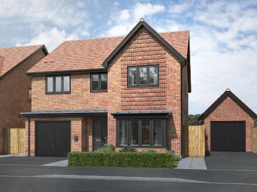 4 bedroom detached house for sale in West Street,
Farnham,
GU9 7AS, GU9 — £1,195,000 • 4 bed • 1 bath • 630 ft²
4 bedroom detached house for sale in West Street,
Farnham,
GU9 7AS, GU9 — £1,195,000 • 4 bed • 1 bath • 630 ft²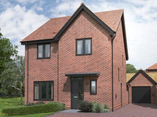 4 bedroom detached house for sale in West Street,
Farnham,
GU9 7AS, GU9 — £925,000 • 4 bed • 1 bath • 938 ft²
4 bedroom detached house for sale in West Street,
Farnham,
GU9 7AS, GU9 — £925,000 • 4 bed • 1 bath • 938 ft²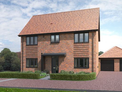 3 bedroom detached house for sale in West Street,
Farnham,
GU9 7AS, GU9 — £890,000 • 3 bed • 1 bath • 477 ft²
3 bedroom detached house for sale in West Street,
Farnham,
GU9 7AS, GU9 — £890,000 • 3 bed • 1 bath • 477 ft² 3 bedroom detached house for sale in West Street,
Farnham,
GU9 7AS, GU9 — £845,000 • 3 bed • 1 bath • 1297 ft²
3 bedroom detached house for sale in West Street,
Farnham,
GU9 7AS, GU9 — £845,000 • 3 bed • 1 bath • 1297 ft² 3 bedroom semi-detached house for sale in West Street,
Farnham,
GU9 7AS, GU9 — £775,000 • 3 bed • 1 bath • 770 ft²
3 bedroom semi-detached house for sale in West Street,
Farnham,
GU9 7AS, GU9 — £775,000 • 3 bed • 1 bath • 770 ft²
Meta
- {
"@context": "https://schema.org",
"@type": "Residence",
"name": "4 bedroom detached house for sale in West Street, Farnham,…",
"description": "",
"url": "https://propertypiper.co.uk/property/bfa1e6f7-9c32-432c-a314-39f9da2e8f5f",
"image": "https://image-a.propertypiper.co.uk/32923f2a-9d4a-442c-a0f5-7c86cc3596d9-1024.jpeg",
"address": {
"@type": "PostalAddress",
"streetAddress": "West Street,\r\nFarnham,\r\nGU9 7AS",
"postalCode": "GU9 7AS",
"addressLocality": "Waverley",
"addressRegion": "South West Surrey",
"addressCountry": "England"
},
"geo": {
"@type": "GeoCoordinates",
"latitude": 51.2077486,
"longitude": -0.8155235
},
"numberOfRooms": 4,
"numberOfBathroomsTotal": 1,
"floorSize": {
"@type": "QuantitativeValue",
"value": 565,
"unitCode": "FTK"
},
"offers": {
"@type": "Offer",
"price": 1075000,
"priceCurrency": "GBP",
"availability": "https://schema.org/InStock"
},
"additionalProperty": [
{
"@type": "PropertyValue",
"name": "Feature",
"value": "modern"
},
{
"@type": "PropertyValue",
"name": "Feature",
"value": "suburban"
},
{
"@type": "PropertyValue",
"name": "Feature",
"value": "detached house"
},
{
"@type": "PropertyValue",
"name": "Feature",
"value": "brick exterior"
},
{
"@type": "PropertyValue",
"name": "Feature",
"value": "pitched roof"
},
{
"@type": "PropertyValue",
"name": "Feature",
"value": "new build"
},
{
"@type": "PropertyValue",
"name": "Feature",
"value": "double glazing"
},
{
"@type": "PropertyValue",
"name": "Feature",
"value": "contemporary"
},
{
"@type": "PropertyValue",
"name": "Feature",
"value": "neutral decor"
},
{
"@type": "PropertyValue",
"name": "Feature",
"value": "natural light"
},
{
"@type": "PropertyValue",
"name": "Feature",
"value": "modern"
},
{
"@type": "PropertyValue",
"name": "Feature",
"value": "living room"
}
]
}
High Res Floorplan Images
Compatible Floorplan Images
FloorplanImages Thumbnail