CM77 8RA - 5 bedroom detached house for sale in Mary Ruck Way, Black N…
View on Property Piper
5 bedroom detached house for sale in Mary Ruck Way, Black Notley, Braintree, CM77
Property Details
- Price: £475000
- Bedrooms: 5
- Bathrooms: 3
- Property Type: undefined
- Property SubType: undefined
Brochure Descriptions
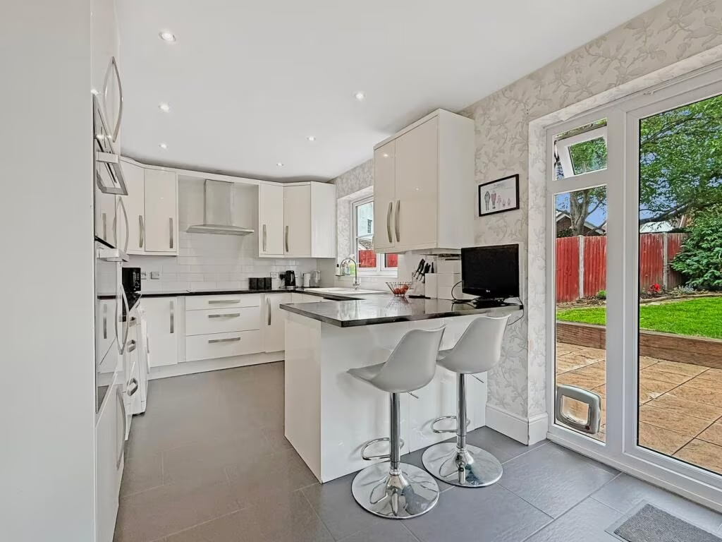
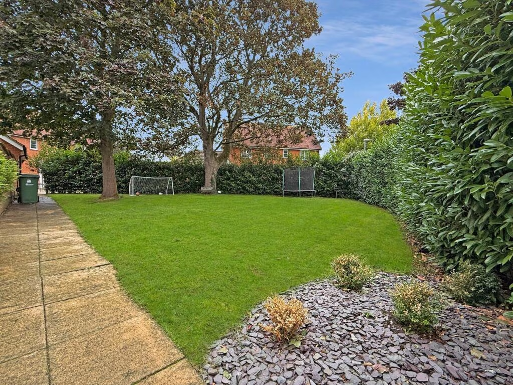
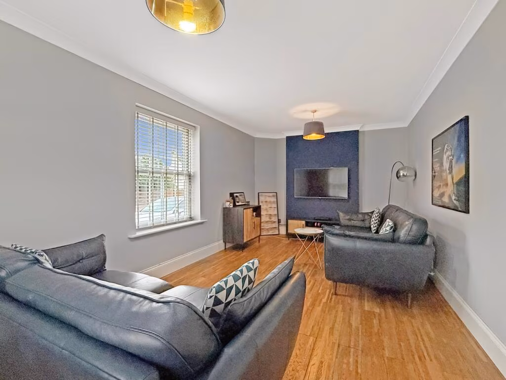
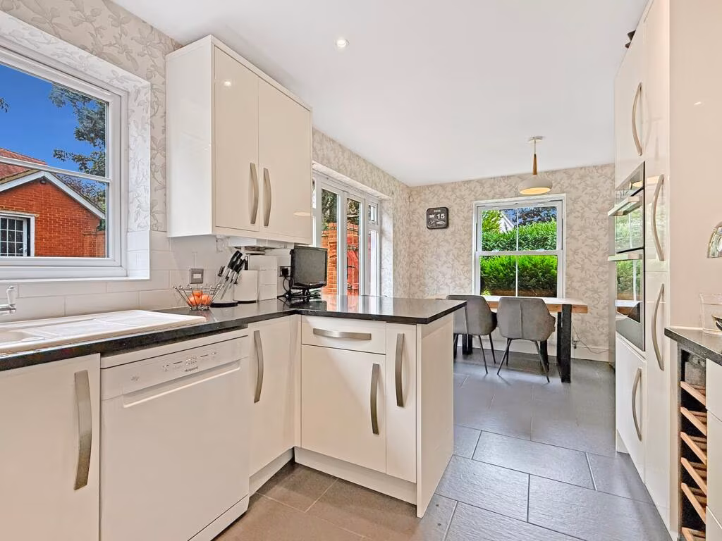
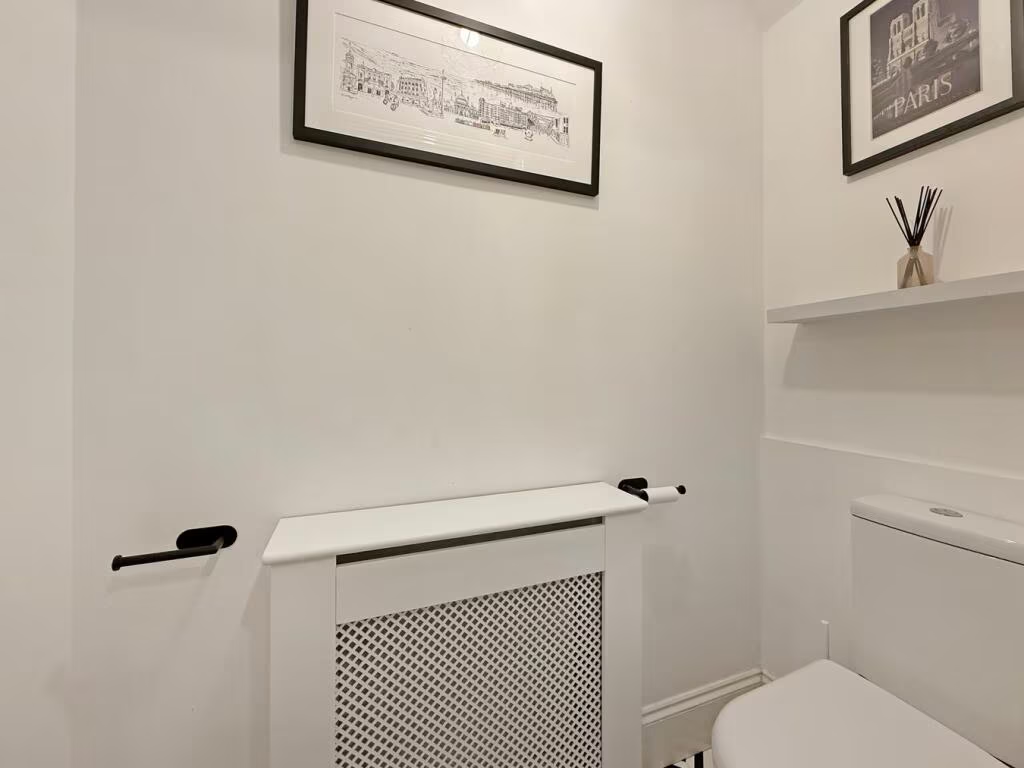
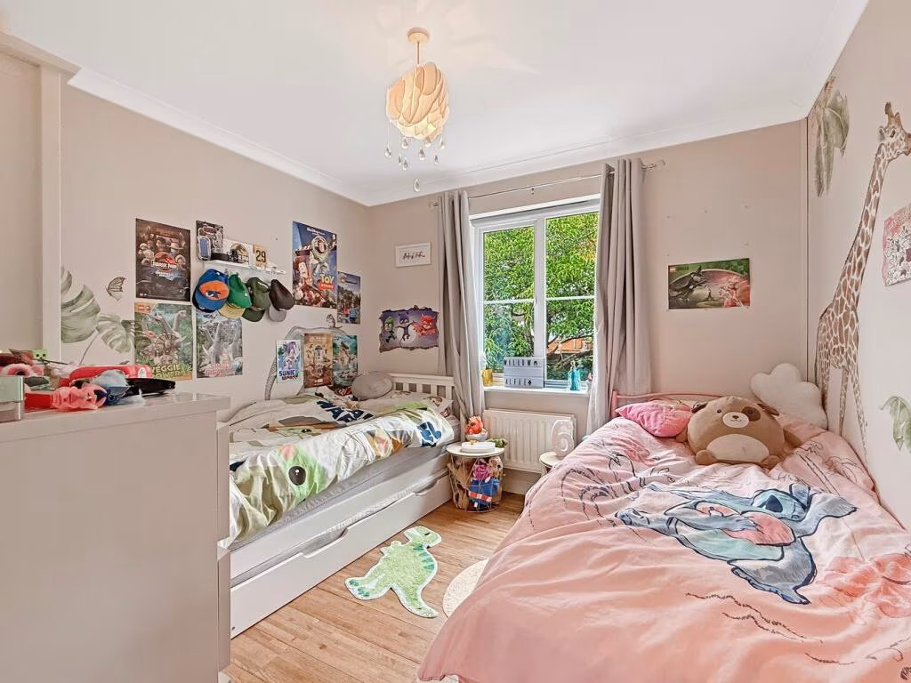
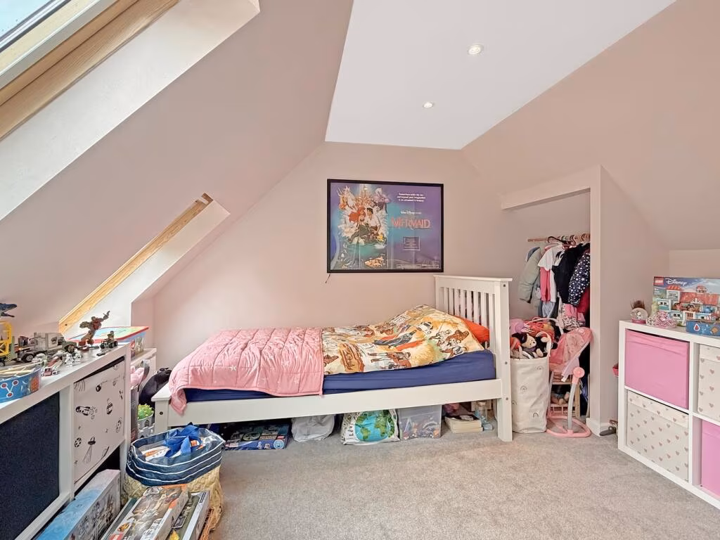
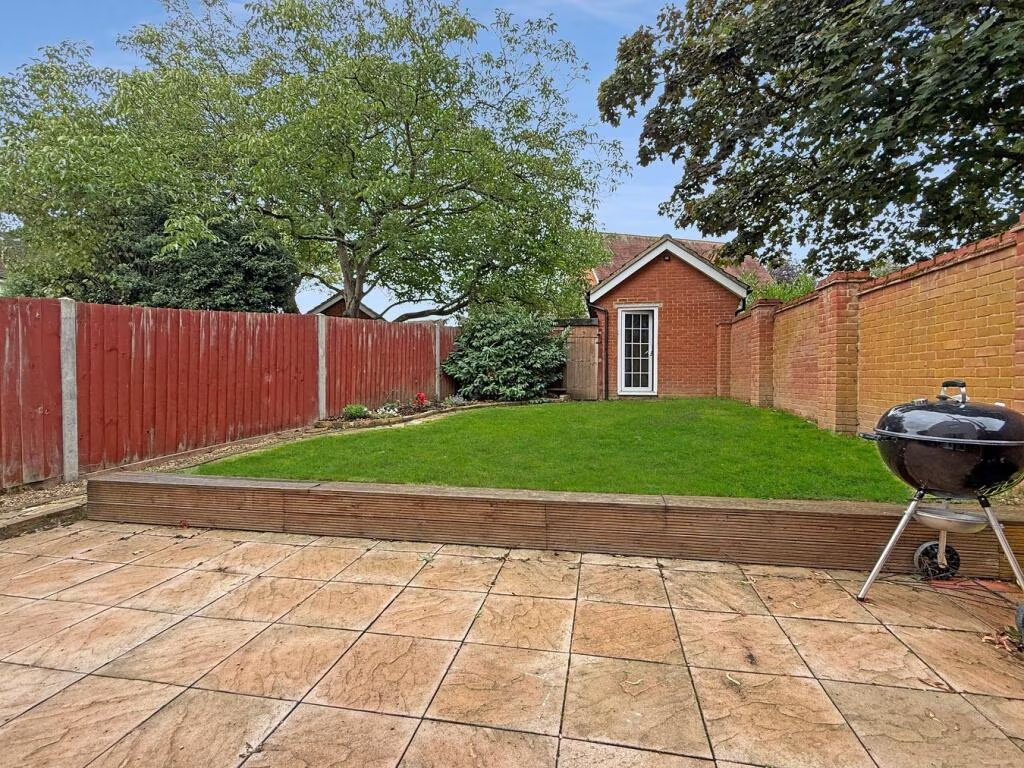
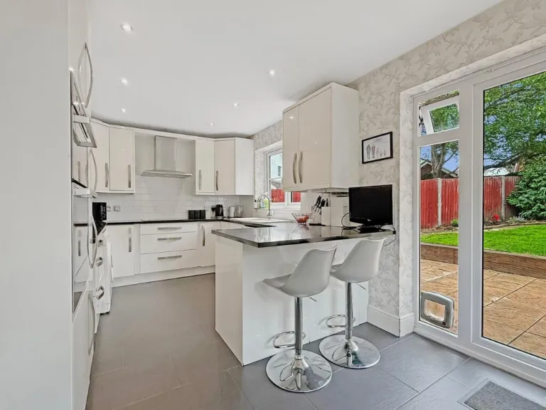
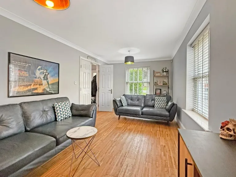
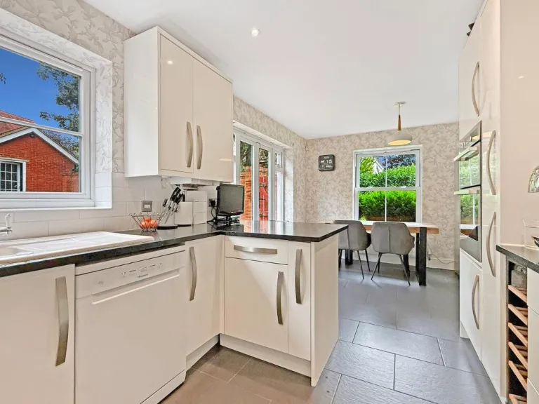
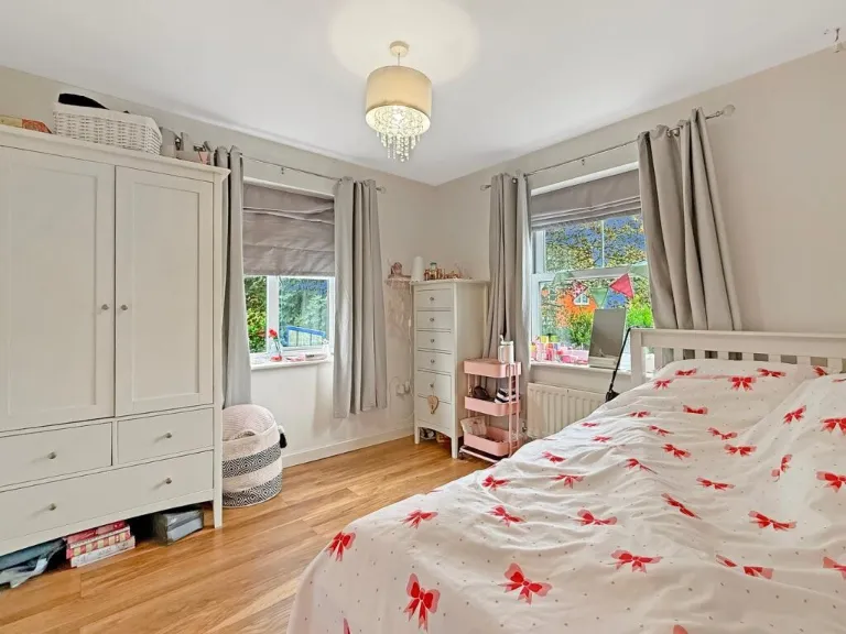
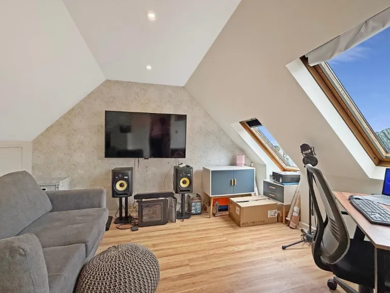
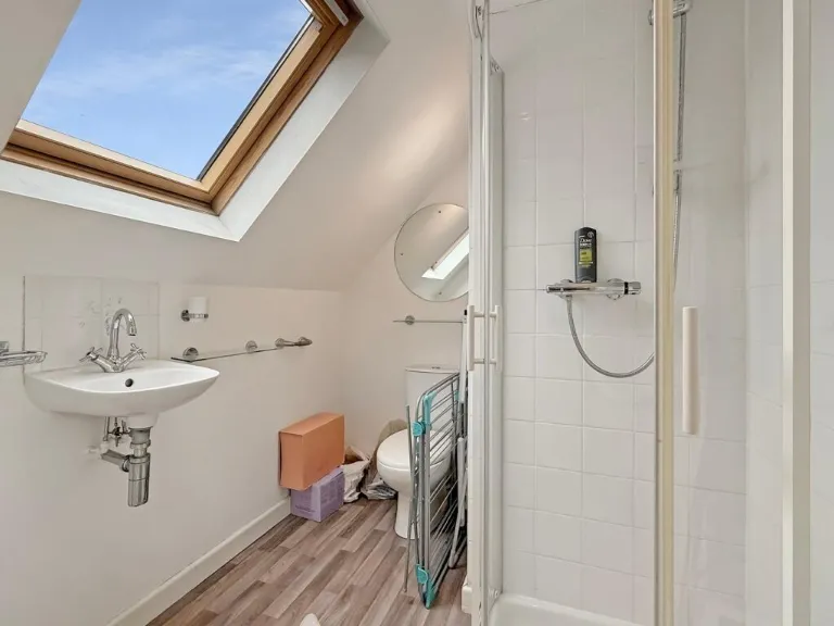
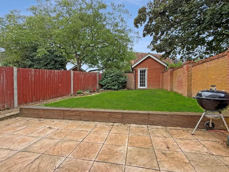
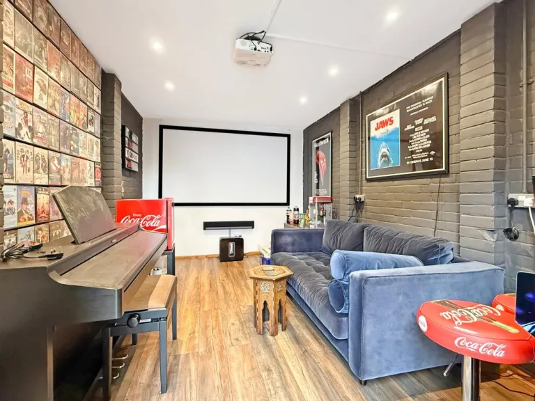
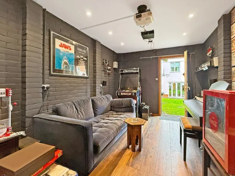
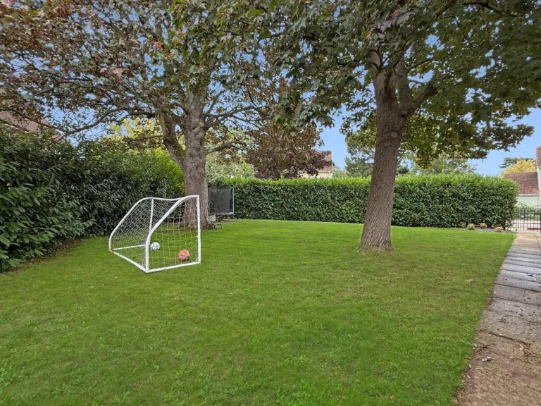
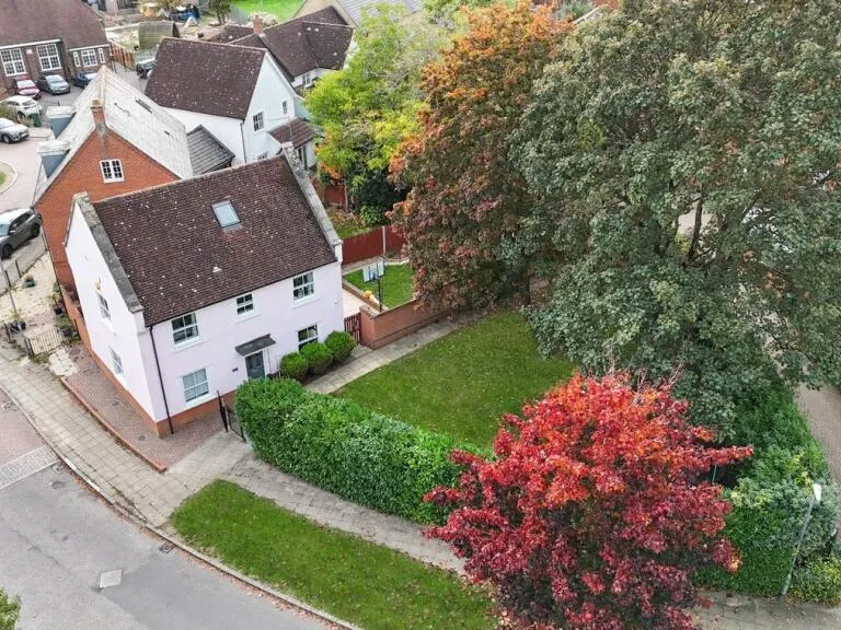
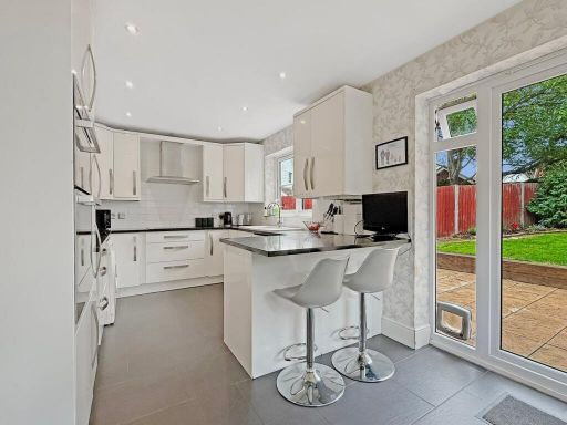
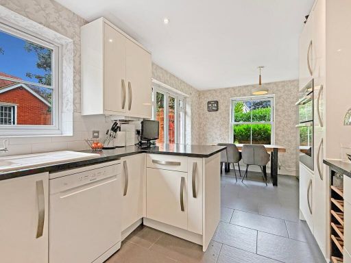
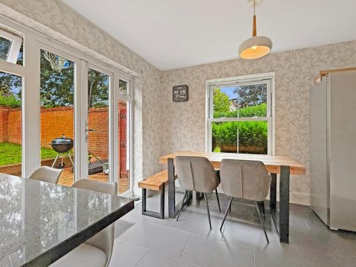
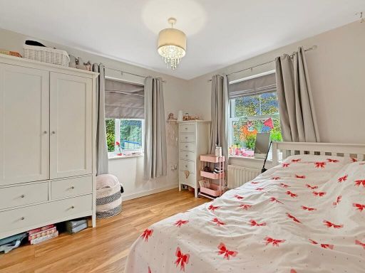
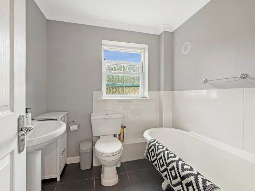
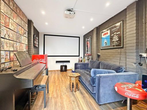
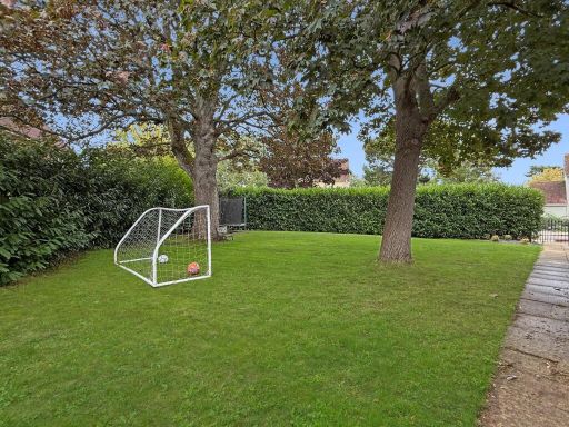
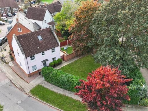
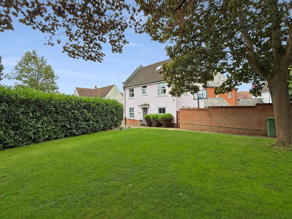
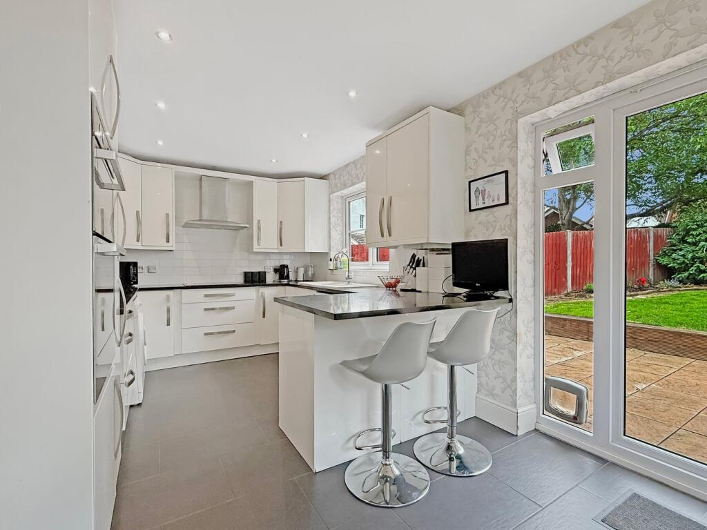
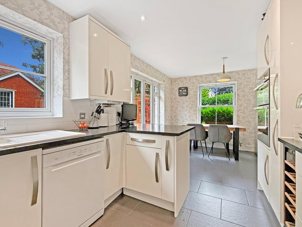
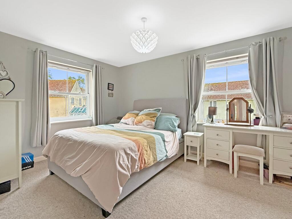
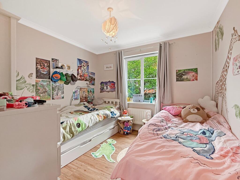
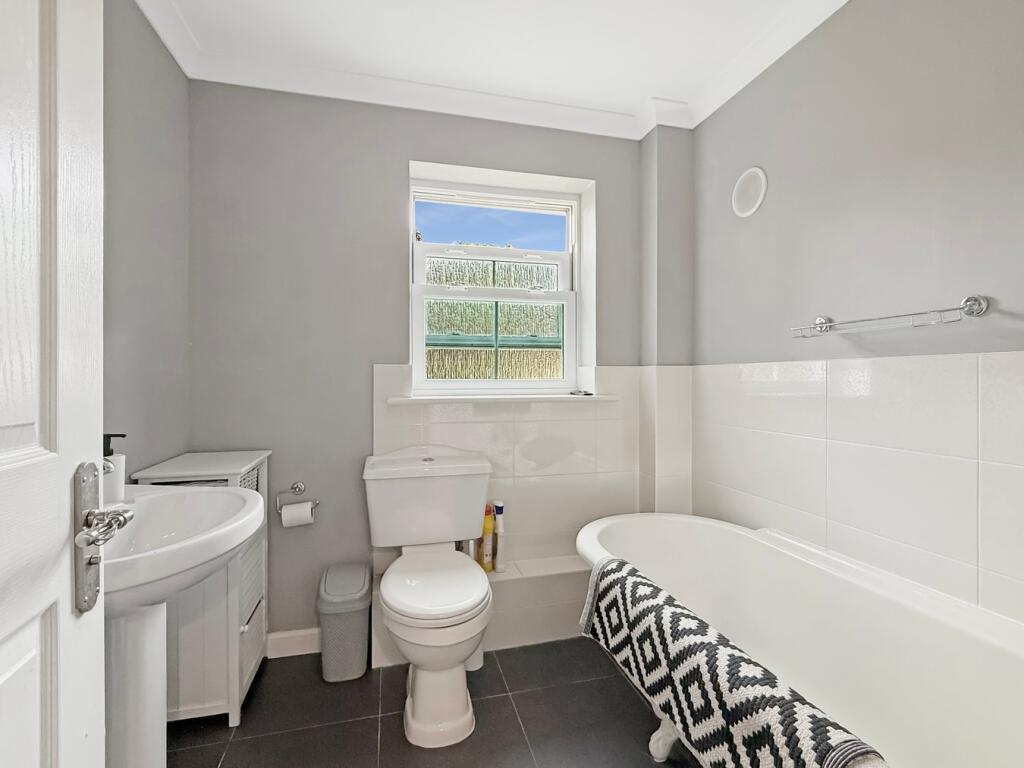
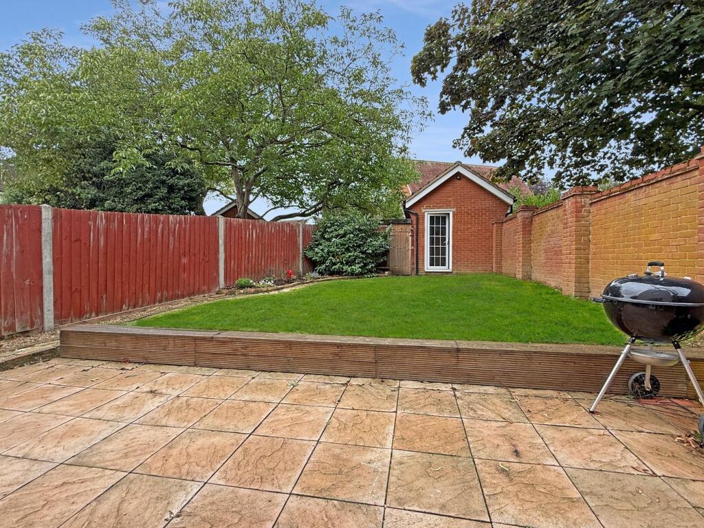
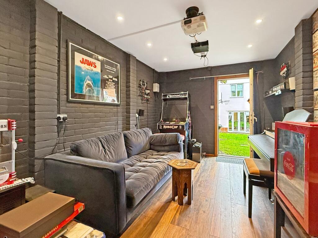
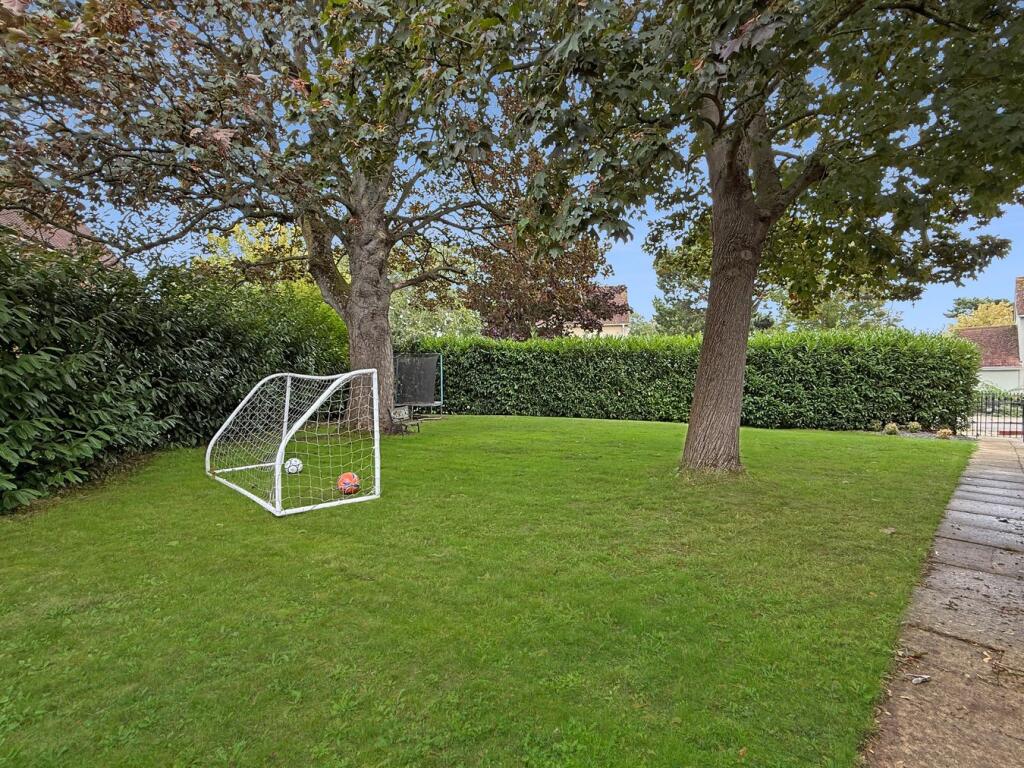
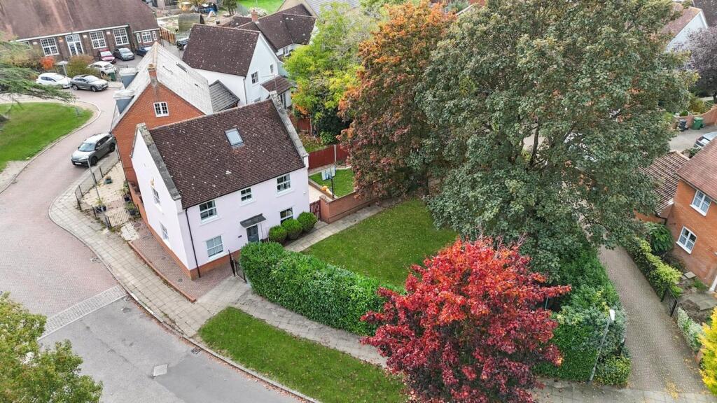
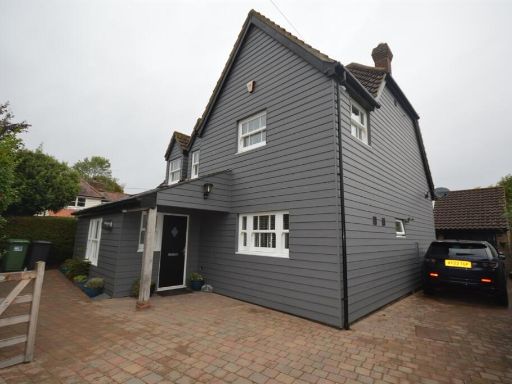
- A well-presented five-bedroom detached family residence occupying a large corner/side plot in the sought-after village of Black Notley. The property benefits from an additional garden area to the side, a substantial private lawn to the front and mature tree screening providing privacy. Accommodation includes a modern fitted kitchen with granite worktops, ground-floor cloakroom, family bathroom and two en-suite shower rooms. The former garage has been converted into a cinema room and there is rear parking. Constructed and finished with uPVC windows and gas central heating, this detached house offers generous internal space (large family property) and a large overall plot suitable for alfresco dining and outside activities. The immediate outlook is suburban/village gardens and private boundaries rather than open countryside or sea views.
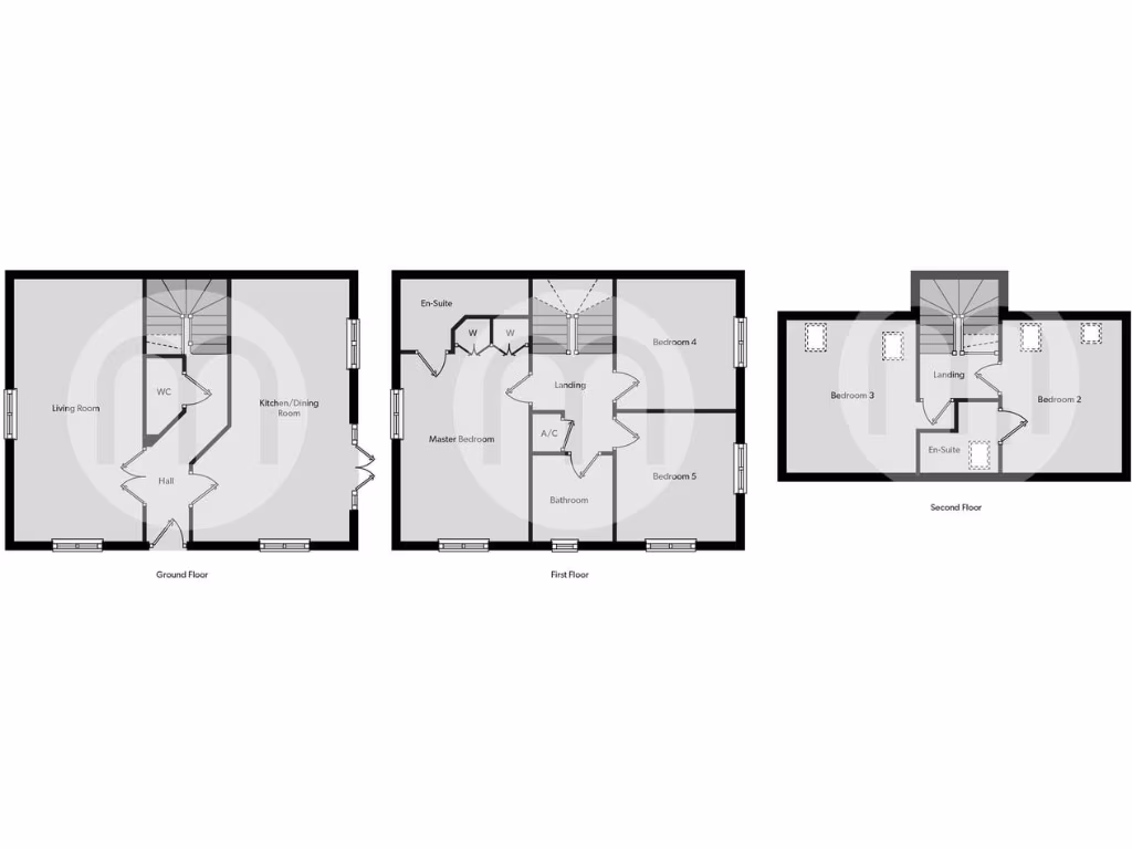
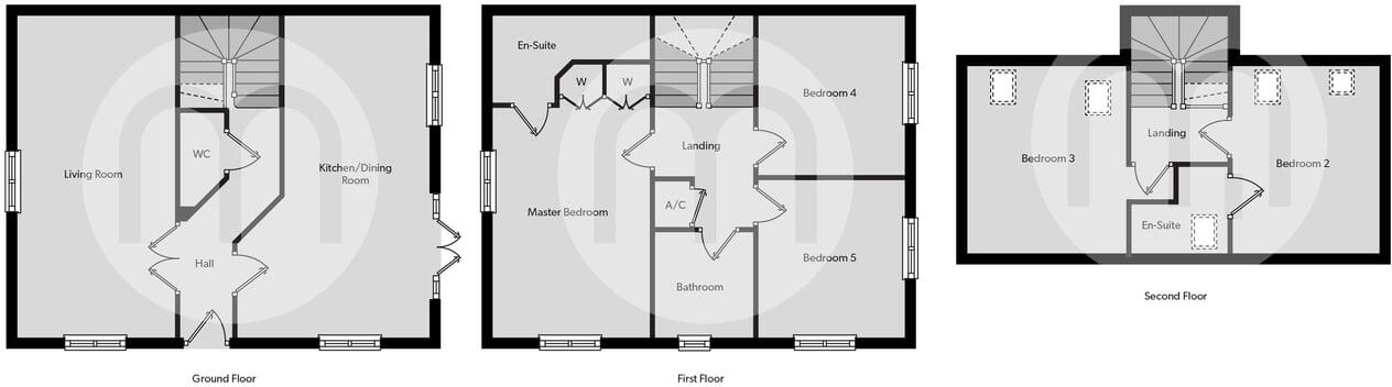
- Three-storey residential dwelling shown on floorplans and located in the Black Notley area (map pin visible). The brochure includes an Energy Performance Certificate graphic with a rating of 77 (Band C), indicating above-average energy efficiency. Floorplans for multiple levels are provided (suggesting a townhouse-style layout). No specific number of bedrooms, exact room dimensions or an exact postal address for the property are shown on the images. Garden/grounds cannot be sized reliably from these images. Overall: a mid-sized, multi-level house in Black Notley with good energy efficiency, accompanied by standard agent disclaimers.
Image Descriptions
- house exterior mid-20th century detached
- kitchen contemporary
Floorplan Description
- Three-storey residential floorplan showing living spaces, kitchen/dining, five bedrooms across first and second floors with ensuites and bathrooms.
Rooms
- Living Room:
- Kitchen/Dining Room:
- Hall:
- WC:
- Master Bedroom:
- En-Suite:
- W:
- W:
- Landing:
- A/C:
- Bathroom:
- Bedroom 4:
- Bedroom 5:
- Landing:
- Bedroom 3:
- Bedroom 2:
- En-Suite:
Textual Property Features
Detected Visual Features
- detached
- garden
- brick
- rendered
- gabled roof
- mid-20th century
- lawn
- residential area
- modern kitchen
- contemporary design
- island
- tiled floor
- neutral colors
- patio access
- garden view
- under cabinet lighting
EPC Details
- Fully double glazed
- Cavity wall, as built, insulated (assumed)
- Boiler and radiators, mains gas
- Low energy lighting in all fixed outlets
- Solid, insulated (assumed)
Nearby Schools
- Templars Academy
- Beckers Green Primary School
- Terling Church of England Voluntary Aided Primary School
- New Rickstones Academy
- White Notley Church of England Voluntary Controlled Primary School
- St Michael's Church of England Voluntary Aided Primary School
- Rayne Primary and Nursery School
- Great Bradfords Junior School
- Great Bradfords Infant and Nursery School
- Tabor Academy
- Stisted Church of England Primary Academy
- Powers Hall Academy
- Elm Hall Primary School
- Cressing Primary School
- Notley Green Primary School
- John Ray Junior School
- Lyons Hall School
- Bocking Primary School
- Acorn Academy
- Great Leighs Primary School
- Silver End Academy
- White Court School
- Notley High School and Braintree Sixth Form
- Alec Hunter Academy
- St Francis Catholic Primary School, Braintree
- John Bunyan Primary School and Nursery
Nearest General Shops
- Id: 490479575
- Tags:
- Addr:
- City: Braintree
- Postcode: CM77 8YJ
- Street: Charter Way
- Brand: Dreams
- Brand:wikidata: Q5306688
- Brand:wikipedia: en:Dreams (bed retailer)
- Building: yes
- Contact:
- Website: https://dreams.co.uk/store/braintree
- Name: Dreams
- Shop: bed
- Source:
- Addr:
- Postcode: ons_uprn_directory
- TagsNormalized:
- Lat: 51.8683922
- Lon: 0.5723631
- FullGeoHash: u10rj42g310g
- PartitionGeoHash: u10r
- Images:
- FoodStandards: null
- Distance: 1929.1
,- Id: 177807395
- Tags:
- Addr:
- City: Braintree
- Housename: Chapel Hill Retail Park
- Housenumber: Unit 9
- Postcode: CM77 8YJ
- Street: Charter Way
- Brand: B&Q
- Brand:wikidata: Q707602
- Brand:wikipedia: en:B&Q
- Building: yes
- Contact:
- Website: https://www.diy.com/store/1198
- Name: B&Q
- Shop: doityourself
- TagsNormalized:
- Lat: 51.8678511
- Lon: 0.5745552
- FullGeoHash: u10rj462hh5r
- PartitionGeoHash: u10r
- Images:
- FoodStandards: null
- Distance: 1914.9
,- Id: 8259853609
- Tags:
- TagsNormalized:
- Lat: 51.8548211
- Lon: 0.5661563
- FullGeoHash: u10quzuk0rk8
- PartitionGeoHash: u10q
- Images:
- FoodStandards: null
- Distance: 363.6
}
Nearest Grocery shops
- Id: 9426210585
- Tags:
- Addr:
- City: Braintree
- Postcode: CM77 8YH
- Street: Charter Way
- Unit: 62
- Brand: Holland & Barrett
- Brand:wikidata: Q5880870
- Brand:wikipedia: en:Holland & Barrett
- Contact:
- Website: https://braintree-village.com/shops/holland-and-barrett
- Level: 0
- Name: Holland & Barrett Outlet
- Opening_hours: Mo-Fr 10:00-18:00; Sa 09:00-19:00; Su 10:00-17:00
- Phone: +44 1376 334525
- Shop: health_food
- Website: https://www.hollandandbarrett.com/stores/braintree-freeport-outlet-4076/
- TagsNormalized:
- holland & barrett
- health
- health food
- food
- shop
- Lat: 51.8705648
- Lon: 0.5716647
- FullGeoHash: u10rj48rby05
- PartitionGeoHash: u10r
- Images:
- FoodStandards: null
- Distance: 2153.9
,- Id: 490481876
- Tags:
- Addr:
- City: Braintree
- Housenumber: Unit 7
- Postcode: CM77 8YJ
- Street: Charter Way
- Brand: M&S Simply Food
- Brand:wikidata: Q714491
- Brand:wikipedia: en:Marks & Spencer
- Building: yes
- Contact:
- Website: https://www.marksandspencer.com/stores/braintree-simply-food-1303
- Name: M&S Simply Food
- Shop: supermarket
- Source: knowledge
- TagsNormalized:
- Lat: 51.8684646
- Lon: 0.5741264
- FullGeoHash: u10rj465dnee
- PartitionGeoHash: u10r
- Images:
- FoodStandards: null
- Distance: 1970.3
,- Id: 8259853606
- Tags:
- Amenity: post_office
- Brand: Premier
- Brand:wikidata: Q7240340
- Name: Premier
- Shop: convenience
- TagsNormalized:
- office
- post office
- premier
- convenience
- shop
- Lat: 51.8547992
- Lon: 0.5660596
- FullGeoHash: u10quzuhn5ht
- PartitionGeoHash: u10q
- Images:
- FoodStandards: null
- Distance: 360.3
}
Nearest Supermarkets
- Id: 177806542
- Tags:
- Addr:
- City: Braintree
- Housenumber: 1
- Postcode: CM7 1XH
- Street: Tofts Walk
- Alt_name: Sainsbury's Braintree Superstore
- Brand: Sainsbury's
- Brand:wikidata: Q152096
- Brand:wikipedia: en:Sainsbury's
- Building: yes
- Contact:
- Website: https://stores.sainsburys.co.uk/0224/braintree
- Name: Sainsbury's
- Opening_hours: Mo-We,Sa 07:00-20:00; Th-Fr 07:00-21:00; Su 10:00-16:00
- Phone: +44 1376 551308
- Shop: supermarket
- TagsNormalized:
- sainsburys
- supermarket
- shop
- Lat: 51.8790032
- Lon: 0.5527335
- FullGeoHash: u10rhs63pe5u
- PartitionGeoHash: u10r
- Images:
- FoodStandards: null
- Distance: 3170.5
,- Id: 177805720
- Tags:
- Addr:
- City: Braintree
- Postcode: CM7 1ES
- Street: Market Place
- Alt_name: Tesco Braintree Town Centre Superstore
- Brand: Tesco
- Brand:wikidata: Q487494
- Brand:wikipedia: en:Tesco
- Building: yes
- Contact:
- Website: https://www.tesco.com/store-locator/braintree/market-place
- Name: Tesco
- Opening_hours: Mo-We,Sa 06:00-20:00; Th-Fr 06:00-21:00; Su 10:00-16:00
- Operator: Tesco Stores Ltd
- Phone: +44 345 677 9075
- Shop: supermarket
- Wheelchair: yes
- TagsNormalized:
- Lat: 51.8778478
- Lon: 0.5524164
- FullGeoHash: u10rhs4625z8
- PartitionGeoHash: u10r
- Images:
- FoodStandards: null
- Distance: 3053.4
,- Id: 177805980
- Tags:
- Addr:
- City: Braintree
- Housename: 1 The Square
- Postcode: CM77 7WW
- Street: Notley Green
- Brand: Tesco
- Brand:wikidata: Q487494
- Brand:wikipedia: en:Tesco
- Building: retail
- Contact:
- Website: https://www.tesco.com/store-locator/braintree/1-the-square
- Name: Tesco
- Opening_hours: Mo-Sa 00:00-23:59; Su 10:00-16:00
- Opening_hours:covid19: Mo-Sa 08:00-22:00; Su 10:00-16:00
- Operator: Tesco Stores Ltd
- Roof:
- Shop: supermarket
- Wheelchair: yes
- TagsNormalized:
- tesco
- retail
- supermarket
- shop
- Lat: 51.8575886
- Lon: 0.5226688
- FullGeoHash: u10r5bks754j
- PartitionGeoHash: u10r
- Images:
- FoodStandards: null
- Distance: 3009.8
}
Nearest Religious buildings
- Id: 512867538
- Tags:
- Amenity: place_of_worship
- Building: church
- Denomination: anglican
- Name: St Barnabas
- Religion: christian
- Source: OS OpenMap Local
- Wikidata: Q105093366
- TagsNormalized:
- place of worship
- church
- anglican
- christian
- Lat: 51.8574686
- Lon: 0.585315
- FullGeoHash: u10rj265wuf3
- PartitionGeoHash: u10r
- Images:
- FoodStandards: null
- Distance: 1516.2
,- Id: 144343880
- Tags:
- Amenity: place_of_worship
- Denomination: anglican
- Name: St Peter and St Paul, Black Notley
- Religion: christian
- Wikidata: Q17557479
- TagsNormalized:
- place of worship
- anglican
- paul
- christian
- church
- Lat: 51.8572891
- Lon: 0.5564193
- FullGeoHash: u10rh8m4te26
- PartitionGeoHash: u10r
- Images:
- FoodStandards: null
- Distance: 884.8
,- Id: 512867536
- Tags:
- Amenity: place_of_worship
- Building: yes
- Name: Cornerstone Braintree
- Religion: christian
- Source: OS OpenMap Local
- TagsNormalized:
- place of worship
- christian
- church
- Lat: 51.8541848
- Lon: 0.5685697
- FullGeoHash: u10quzy088sk
- PartitionGeoHash: u10q
- Images:
- FoodStandards: null
- Distance: 361.9
}
Nearest Medical buildings
- Id: 1693859187
- Tags:
- Amenity: pharmacy
- Brand: Boots
- Brand:wikidata: Q6123139
- Dispensing: yes
- Drive_through: no
- Healthcare: pharmacy
- Name: Boots
- TagsNormalized:
- pharmacy
- boots
- health
- healthcare
- Lat: 51.8465365
- Lon: 0.6224046
- FullGeoHash: u10qynm5znft
- PartitionGeoHash: u10q
- Images:
- FoodStandards: null
- Distance: 3955.6
,- Id: 715548760
- Tags:
- Addr:
- City: Braintree
- Street: Chadwick Drive
- Amenity: hospital
- Emergency: no
- Healthcare: hospital
- Healthcare:speciality: maternity
- Name: Braintree Community Hospital
- Operator: NHS
- Operator:type: government
- Operator:wikidata: Q918396
- TagsNormalized:
- hospital
- health
- healthcare
- maternity
- Lat: 51.8795775
- Lon: 0.5408639
- FullGeoHash: u10rhk3u7n1q
- PartitionGeoHash: u10r
- Images:
- FoodStandards: null
- Distance: 3539.4
,- Id: 546893183
- Tags:
- Addr:
- City: Braintree
- Postcode: CM7 2AE
- Street: Mace Avenue
- Amenity: doctors
- Building: yes
- Healthcare: doctor
- Name: Blandford Medical Centre
- Opening_hours: Mo-Fr 08:00-18:30; Sa-Su off
- Operator: NHS England
- Phone: +44 1376 347100
- Website: http://www.blandfordmedicalcentre.co.uk/
- TagsNormalized:
- doctor
- doctors
- health
- healthcare
- Lat: 51.8789889
- Lon: 0.5408255
- FullGeoHash: u10rhk3c40kx
- PartitionGeoHash: u10r
- Images:
- FoodStandards: null
- Distance: 3483.2
,- Id: 130073956
- Tags:
- Addr:
- City: Braintree
- Country: GB
- Housename: St Michael's House
- Postcode: CM7 1EY
- Street: St Michael's Lane
- Amenity: dentist
- Building: yes
- Healthcare: dentist
- Name: Dr R Patel
- TagsNormalized:
- Lat: 51.8777261
- Lon: 0.5504731
- FullGeoHash: u10rhs0cdvn6
- PartitionGeoHash: u10r
- Images:
- FoodStandards: null
- Distance: 3082.2
}
Nearest Airports
- Id: 495488524
- Tags:
- Aerodrome: international
- Aerodrome:type: public
- Aeroway: aerodrome
- Alt_name: Stansted
- Iata: STN
- Icao: EGSS
- Is_in: Essex,England,UK
- Name: London Stansted Airport
- Ref: STN
- Source: Gagravarr_Airports
- Website: https://www.stanstedairport.com/
- Wikidata: Q8709
- Wikipedia: en:London Stansted Airport
- TagsNormalized:
- airport
- international airport
- Lat: 51.8869677
- Lon: 0.2429264
- FullGeoHash: u10pjt8zkxg4
- PartitionGeoHash: u10p
- Images:
- FoodStandards: null
- Distance: 22487.3
,- Id: 103894219
- Tags:
- Aerodrome: international
- Aeroway: aerodrome
- Iata: SEN
- Icao: EGMC
- Name: London Southend Airport
- Old_name: Southend Municipal Airport
- Ref: SEN
- Wikidata: Q1415441
- TagsNormalized:
- airport
- international airport
- Lat: 51.5701749
- Lon: 0.6924624
- FullGeoHash: u10mru04p937
- PartitionGeoHash: u10m
- Images:
- FoodStandards: null
- Distance: 32492.9
,- Id: 121158889
- Tags:
- Aerodrome: continental
- Aeroway: aerodrome
- Fhrs:
- Authority: City of London Corporation
- Iata: LCY
- Icao: EGLC
- Name: London City Airport
- Operator: London City Airport Limited
- Ref: LCY
- Website: https://www.londoncityairport.com/
- Wikidata: Q8982
- Wikipedia: en:London City Airport
- TagsNormalized:
- airport
- continental airport
- Lat: 51.5042658
- Lon: 0.0539987
- FullGeoHash: u10j10p64702
- PartitionGeoHash: u10j
- Images:
- FoodStandards: null
- Distance: 52295.6
}
Nearest Leisure Facilities
- Id: 469517184
- Tags:
- Leisure: park
- Name: Black Notley Playing Field
- TagsNormalized:
- Lat: 51.8591417
- Lon: 0.5620432
- FullGeoHash: u10rhb9m2s9y
- PartitionGeoHash: u10r
- Images:
- FoodStandards: null
- Distance: 871.4
,- Id: 469517020
- Tags:
- TagsNormalized:
- Lat: 51.8503019
- Lon: 0.5644149
- FullGeoHash: u10quz4czuf6
- PartitionGeoHash: u10q
- Images:
- FoodStandards: null
- Distance: 157.9
,- Id: 469515505
- Tags:
- TagsNormalized:
- swimming
- swimming pool
- pool
- leisure
- Lat: 51.8524908
- Lon: 0.5669511
- FullGeoHash: u10quzkyduv7
- PartitionGeoHash: u10q
- Images:
- FoodStandards: null
- Distance: 146.6
,- Id: 469515830
- Tags:
- TagsNormalized:
- Lat: 51.8527261
- Lon: 0.5664267
- FullGeoHash: u10quzs2n8wr
- PartitionGeoHash: u10q
- Images:
- FoodStandards: null
- Distance: 145.2
,- Id: 469515373
- Tags:
- TagsNormalized:
- Lat: 51.8525419
- Lon: 0.5662373
- FullGeoHash: u10quzkqfq3h
- PartitionGeoHash: u10q
- Images:
- FoodStandards: null
- Distance: 121
}
Nearest Tourist attractions
- Id: 4195908299
- Tags:
- Name: Wildlife Area
- Tourism: attraction
- TagsNormalized:
- Lat: 51.884406
- Lon: 0.5538161
- FullGeoHash: u10rht728f71
- PartitionGeoHash: u10r
- Images:
- FoodStandards: null
- Distance: 3735.3
,- Id: 4195908298
- Tags:
- Name: John Ray Garden
- Tourism: attraction
- TagsNormalized:
- Lat: 51.8837687
- Lon: 0.5539758
- FullGeoHash: u10rht5kue6r
- PartitionGeoHash: u10r
- Images:
- FoodStandards: null
- Distance: 3663.7
,- Id: 3414742549
- Tags:
- Name: Braintree Museum
- Tourism: museum
- Wikidata: Q85400375
- TagsNormalized:
- Lat: 51.8783949
- Lon: 0.5541701
- FullGeoHash: u10rhs5t91ep
- PartitionGeoHash: u10r
- Images:
- FoodStandards: null
- Distance: 3079.3
}
Nearest Train stations
- Id: 187033767
- Tags:
- Amenity: cafe
- Building: train_station
- Name: Cafe Alexander
- TagsNormalized:
- cafe
- station
- train
- train station
- Lat: 51.8753588
- Lon: 0.5565999
- FullGeoHash: u10rhet7ceyb
- PartitionGeoHash: u10r
- Images:
- FoodStandards: null
- Distance: 2711.8
,- Id: 1997260503
- Tags:
- Name: Braintree
- Name:lt: Breintris
- Naptan:
- Network: National Rail
- Old_name: Braintree and Bocking
- Public_transport: station
- Railway: station
- Ref:
- Train: yes
- Wikidata: Q2716690
- Wikipedia: en:Braintree railway station (England)
- TagsNormalized:
- Lat: 51.8753105
- Lon: 0.5567303
- FullGeoHash: u10rhet7sfb0
- PartitionGeoHash: u10r
- Images:
- FoodStandards: null
- Distance: 2704.6
,- Id: 55420882
- Tags:
- Addr:
- Postcode: CM77 8YH
- Street: Chapel Hill Retail Park
- Name: Braintree Freeport
- Naptan:
- Network: National Rail
- Note: FIXME location approximate, judged from landsat
- Public_transport: station
- Railway: station
- Ref:
- Train: yes
- Wikidata: Q2540597
- Wikipedia: en:Braintree Freeport railway station
- TagsNormalized:
- Lat: 51.8692939
- Lon: 0.5681965
- FullGeoHash: u10rhft8xcnn
- PartitionGeoHash: u10r
- Images:
- FoodStandards: null
- Distance: 1978.5
,- Id: 187038971
- Tags:
- Amenity: shelter
- Building: train_station
- TagsNormalized:
- shelter
- station
- train
- train station
- Lat: 51.8692466
- Lon: 0.5682988
- FullGeoHash: u10rhftb626k
- PartitionGeoHash: u10r
- Images:
- FoodStandards: null
- Distance: 1974
,- Id: 55420748
- Tags:
- Name: Cressing
- Naptan:
- Network: National Rail
- Public_transport: station
- Railway: station
- Ref:
- Train: yes
- Wikidata: Q1886114
- Wikipedia: en:Cressing railway station
- TagsNormalized:
- Lat: 51.852306
- Lon: 0.5779203
- FullGeoHash: u10qvpkvdd2t
- PartitionGeoHash: u10q
- Images:
- FoodStandards: null
- Distance: 863.6
}
Nearest Hotels
- Id: 146338280
- Tags:
- Addr:
- Brand: Holiday Inn Express
- Brand:wikidata: Q5880423
- Brand:wikipedia: en:Holiday Inn Express
- Building: hotel
- Key: FLP BP Alt Tues
- Name: Holiday Inn Express
- Source:
- Tourism: hotel
- TagsNormalized:
- Lat: 51.8684265
- Lon: 0.5365901
- FullGeoHash: u10rh4qerrqx
- PartitionGeoHash: u10r
- Images:
- FoodStandards: null
- Distance: 2724.3
,- Id: 104310066
- Tags:
- Brand: Premier Inn
- Brand:wikidata: Q2108626
- Brand:wikipedia: en:Premier Inn
- Building: yes
- Internet_access: wlan
- Internet_access:fee: customers
- Internet_access:operator: Virgin Media
- Internet_access:ssid: Premier Inn Free Wi-Fi
- Name: Premier Inn
- Tourism: hotel
- Wheelchair: yes
- TagsNormalized:
- Lat: 51.8691903
- Lon: 0.5819277
- FullGeoHash: u10rj4rxzvus
- PartitionGeoHash: u10r
- Images:
- FoodStandards: null
- Distance: 2262.9
,- Id: 183548592
- Tags:
- Brand: Premier Inn
- Brand:wikidata: Q2108626
- Brand:wikipedia: en:Premier Inn
- Building: yes
- Internet_access: wlan
- Internet_access:fee: customers
- Internet_access:operator: Virgin Media
- Internet_access:ssid: Premier Inn Free Wi-Fi
- Name: Premier Inn
- Tourism: hotel
- TagsNormalized:
- Lat: 51.866618
- Lon: 0.5832058
- FullGeoHash: u10rj608vwmg
- PartitionGeoHash: u10r
- Images:
- FoodStandards: null
- Distance: 2071.1
}
Tags
- detached
- garden
- brick
- rendered
- gabled roof
- mid-20th century
- lawn
- residential area
- modern kitchen
- contemporary design
- island
- tiled floor
- neutral colors
- patio access
- garden view
- under cabinet lighting
Local Market Stats
- Average Price/sqft: £368
- Avg Income: £52400
- Rental Yield: 3.8%
- Social Housing: 9%
- Planning Success Rate: 72%
Similar Properties
 5 bedroom detached house for sale in Bulford Lane, Black Notley, Braintree, CM77 — £600,000 • 5 bed • 3 bath • 1470 ft²
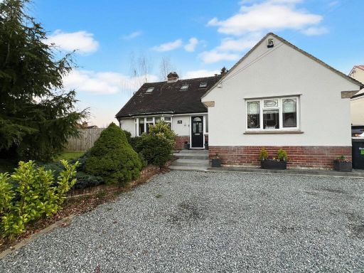 5 bedroom detached house for sale in The Street, Black Notley, Braintree, CM77 — £575,000 • 5 bed • 2 bath
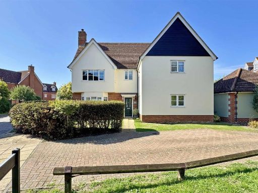 5 bedroom detached house for sale in Mary Ruck Way, Black Notley, Braintree, CM77 — £625,000 • 5 bed • 4 bath • 2250 ft²
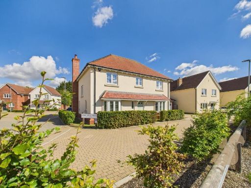 4 bedroom detached house for sale in Crab Apple Drive, Black Notley, Braintree, CM77 — £650,000 • 4 bed • 2 bath • 1463 ft²
 4 bedroom detached house for sale in Bulford Lane, Black Notley, CM77 — £600,000 • 4 bed • 3 bath • 1883 ft²
 3 bedroom town house for sale in Turner Close, Black Notley, Braintree, CM77 — £375,000 • 3 bed • 2 bath • 638 ft²
Meta
- {
"@context": "https://schema.org",
"@type": "Residence",
"name": "5 bedroom detached house for sale in Mary Ruck Way, Black N…",
"description": "",
"url": "https://propertypiper.co.uk/property/beaf3fa8-4aab-4432-b55b-fbb972871366",
"image": "https://image-a.propertypiper.co.uk/805e6d54-b0f1-4e2a-ab2d-48962f7347dd-1024.jpeg",
"address": {
"@type": "PostalAddress",
"streetAddress": "17 MARY RUCK WAY BLACK NOTLEY BRAINTREE",
"postalCode": "CM77 8RA",
"addressLocality": "Braintree",
"addressRegion": "Witham",
"addressCountry": "England"
},
"geo": {
"@type": "GeoCoordinates",
"latitude": 51.85158451718705,
"longitude": 0.5654005464398547
},
"numberOfRooms": 5,
"numberOfBathroomsTotal": 3,
"floorSize": {
"@type": "QuantitativeValue",
"value": 1454,
"unitCode": "FTK"
},
"offers": {
"@type": "Offer",
"price": 475000,
"priceCurrency": "GBP",
"availability": "https://schema.org/InStock"
},
"additionalProperty": [
{
"@type": "PropertyValue",
"name": "Feature",
"value": "detached"
},
{
"@type": "PropertyValue",
"name": "Feature",
"value": "garden"
},
{
"@type": "PropertyValue",
"name": "Feature",
"value": "brick"
},
{
"@type": "PropertyValue",
"name": "Feature",
"value": "rendered"
},
{
"@type": "PropertyValue",
"name": "Feature",
"value": "gabled roof"
},
{
"@type": "PropertyValue",
"name": "Feature",
"value": "mid-20th century"
},
{
"@type": "PropertyValue",
"name": "Feature",
"value": "lawn"
},
{
"@type": "PropertyValue",
"name": "Feature",
"value": "residential area"
},
{
"@type": "PropertyValue",
"name": "Feature",
"value": "modern kitchen"
},
{
"@type": "PropertyValue",
"name": "Feature",
"value": "contemporary design"
},
{
"@type": "PropertyValue",
"name": "Feature",
"value": "island"
},
{
"@type": "PropertyValue",
"name": "Feature",
"value": "tiled floor"
},
{
"@type": "PropertyValue",
"name": "Feature",
"value": "neutral colors"
},
{
"@type": "PropertyValue",
"name": "Feature",
"value": "patio access"
},
{
"@type": "PropertyValue",
"name": "Feature",
"value": "garden view"
},
{
"@type": "PropertyValue",
"name": "Feature",
"value": "under cabinet lighting"
}
]
}
High Res Floorplan Images
Compatible Floorplan Images
FloorplanImages Thumbnail