GL16 8EX - 4 bedroom detached house for sale in Blakes Way, Coleford,…
View on Property Piper
4 bedroom detached house for sale in Blakes Way, Coleford, GL16
Property Details
- Price: £340000
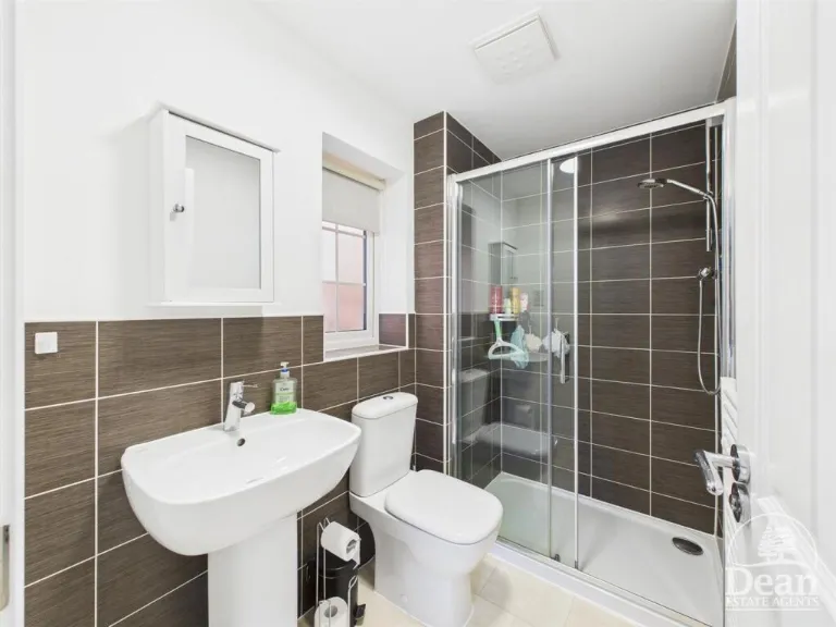
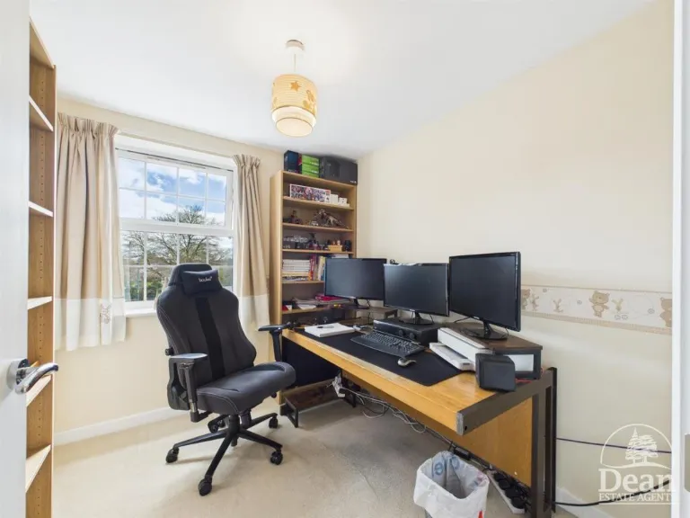
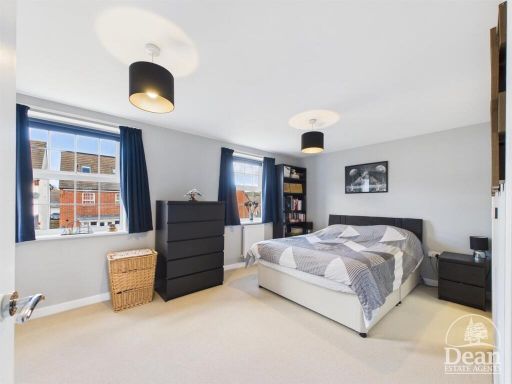
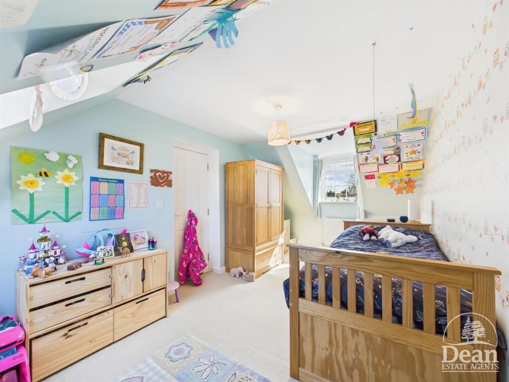
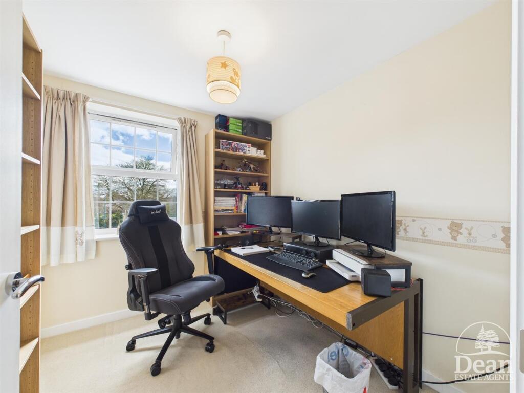
- Bedrooms: 4
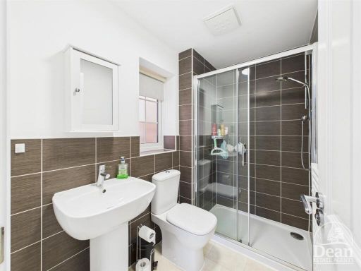
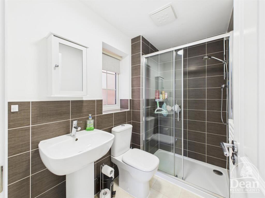
- Bathrooms: 2
- Property Type: undefined
- Property SubType: undefined
Brochure Descriptions
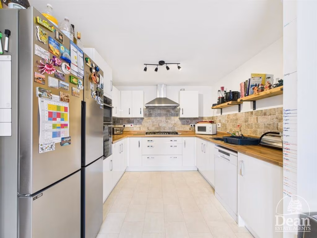
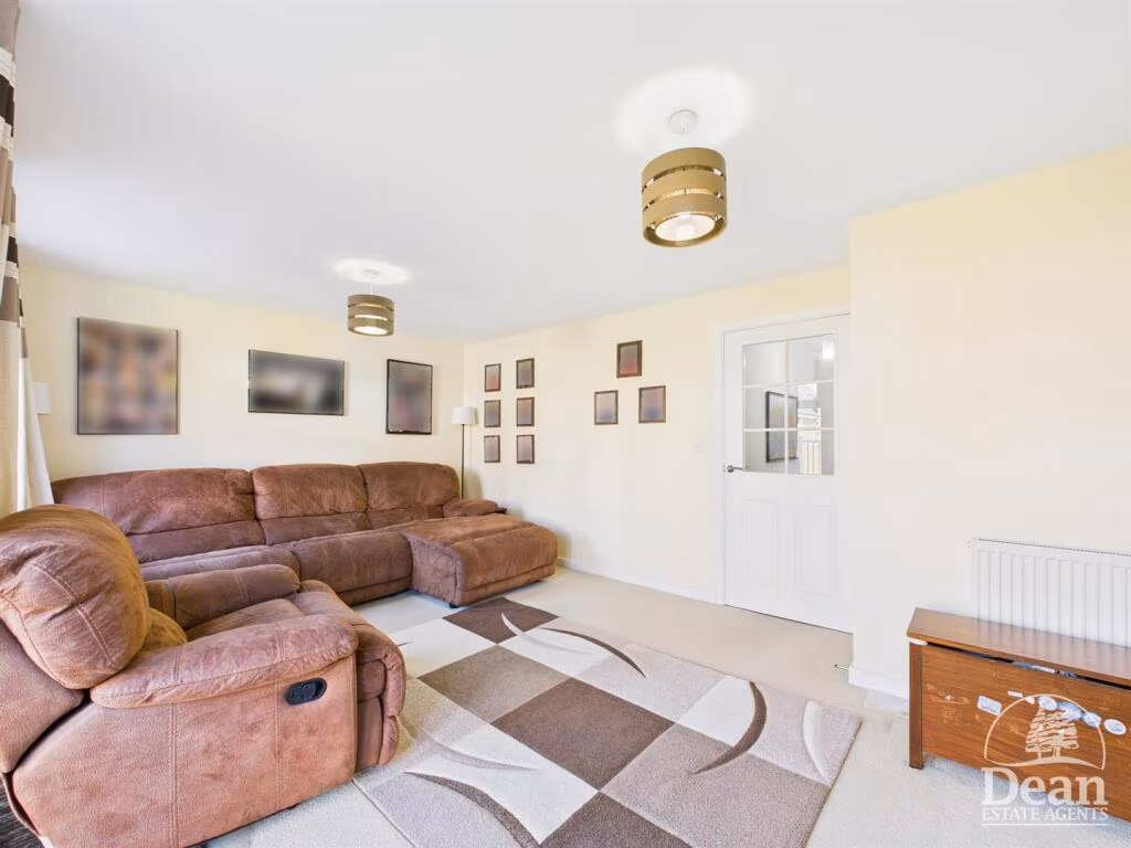
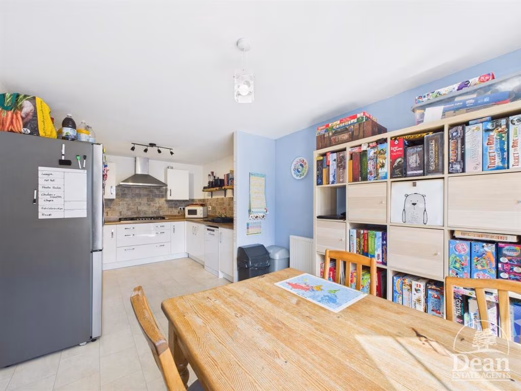
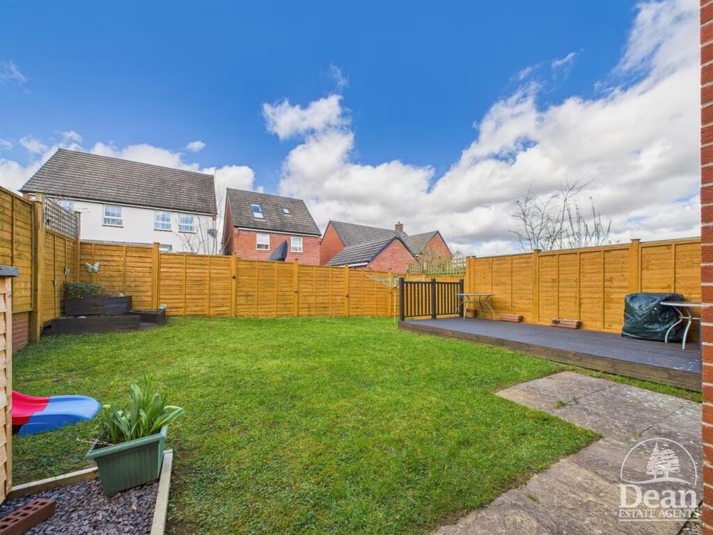
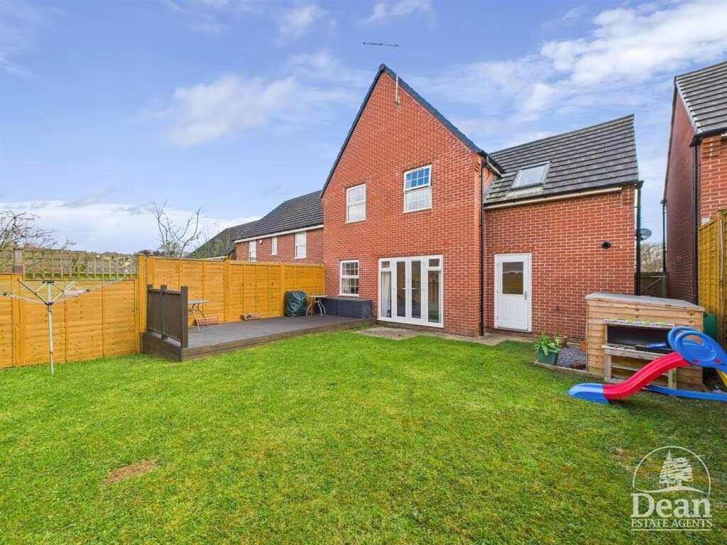
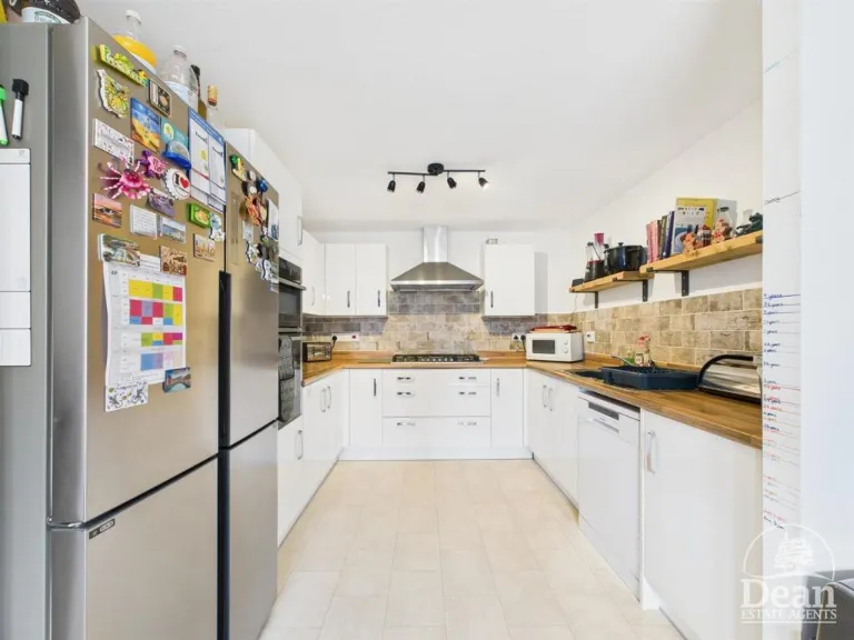
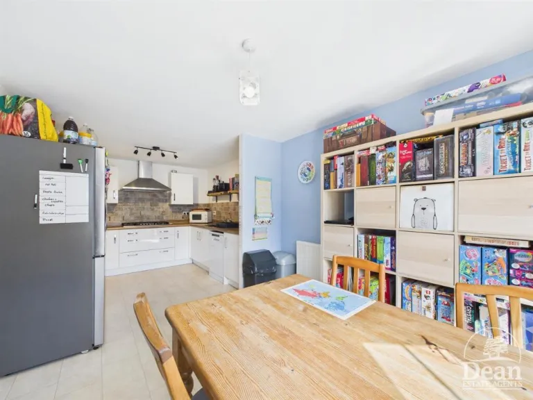
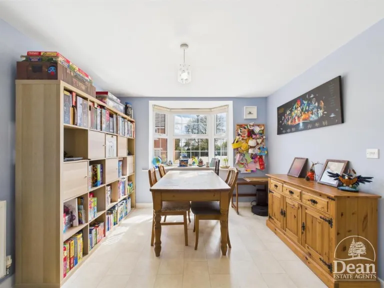
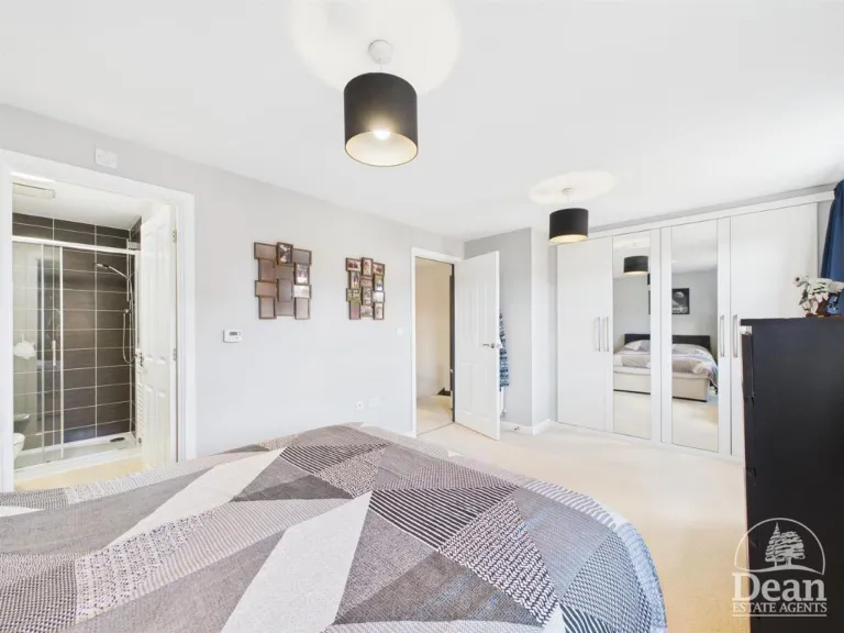
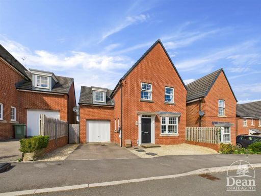
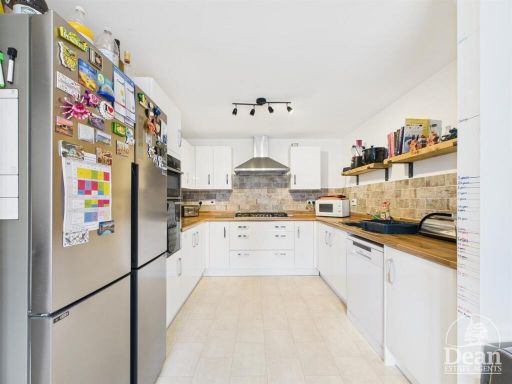
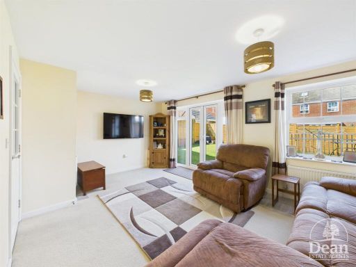
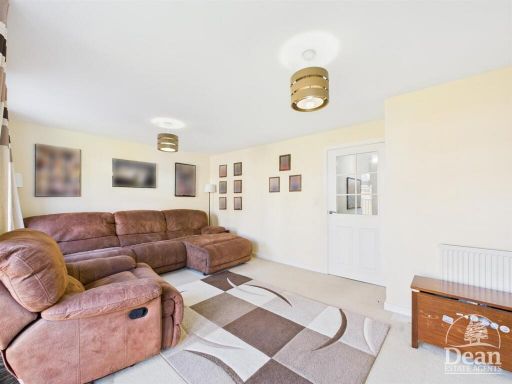
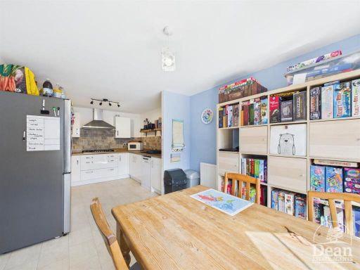
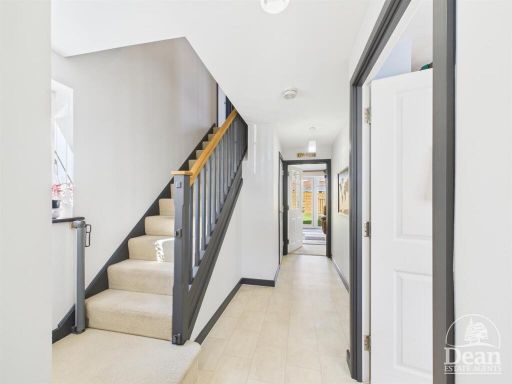
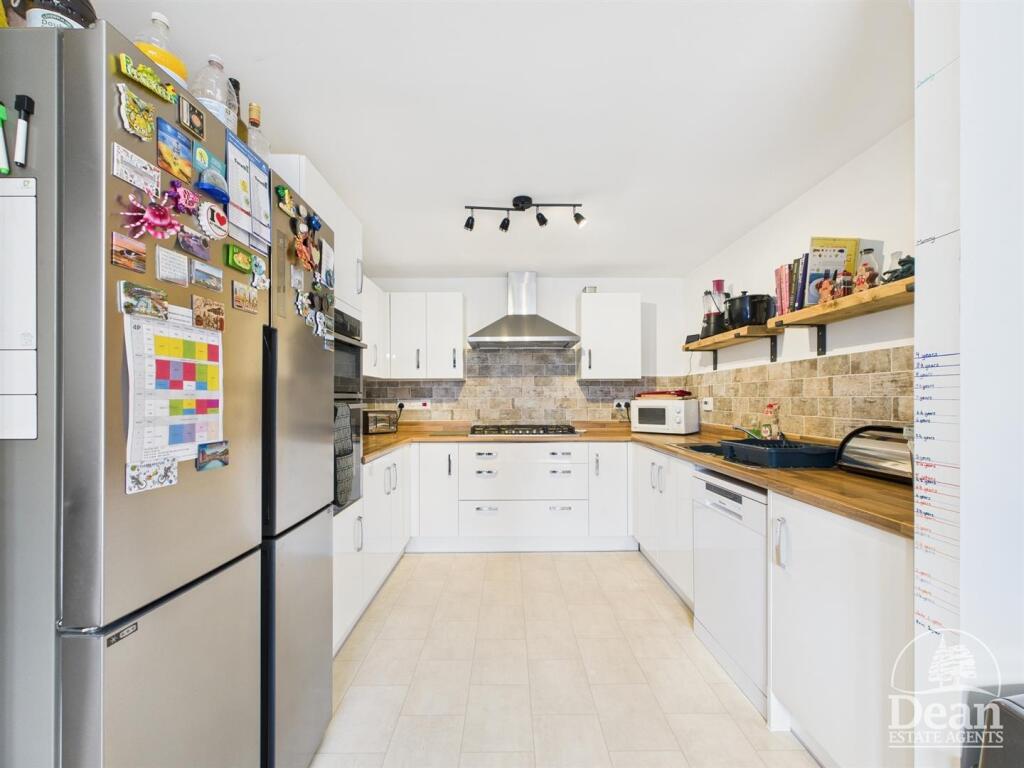
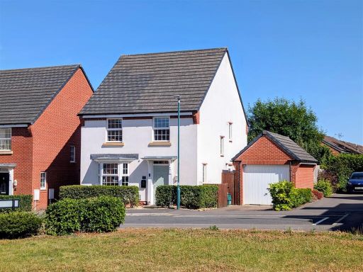
- This residential property at 26 Blakes Way presents a modern detached home characterized by its red brick façade and a neatly paved driveway. The home includes four bedrooms, suggesting spacious accommodations likely suitable for families. Inside, the property showcases a well-appointed kitchen with ample storage space and a dining room fitted with a large window, providing bright ambient light. The size of both rooms seems average for family living, with the overall property offering a standard residential layout. The property is nestled in a suburban setting with neighboring homes, indicating a community environment.
Image Descriptions
- semi-detached house Modern
- kitchen modern
Floorplan Description
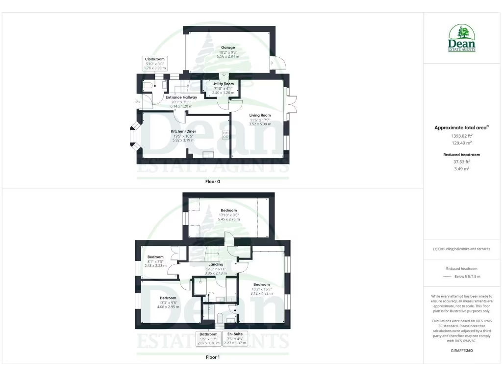
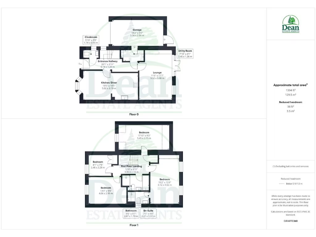
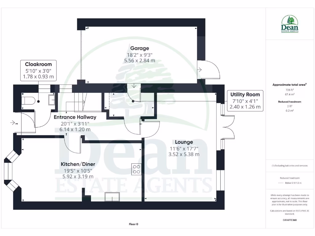
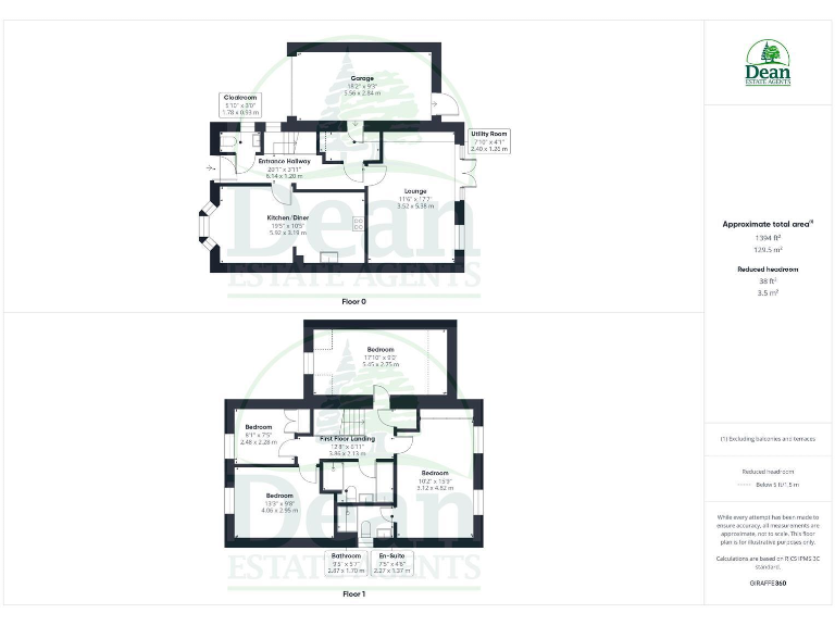
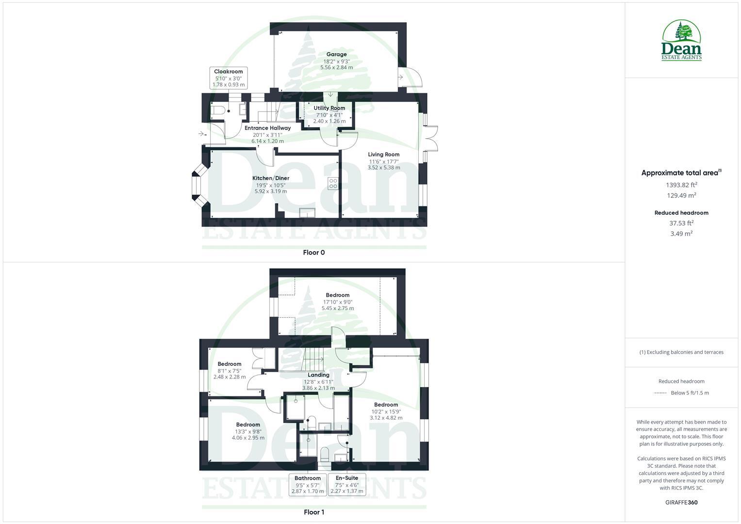
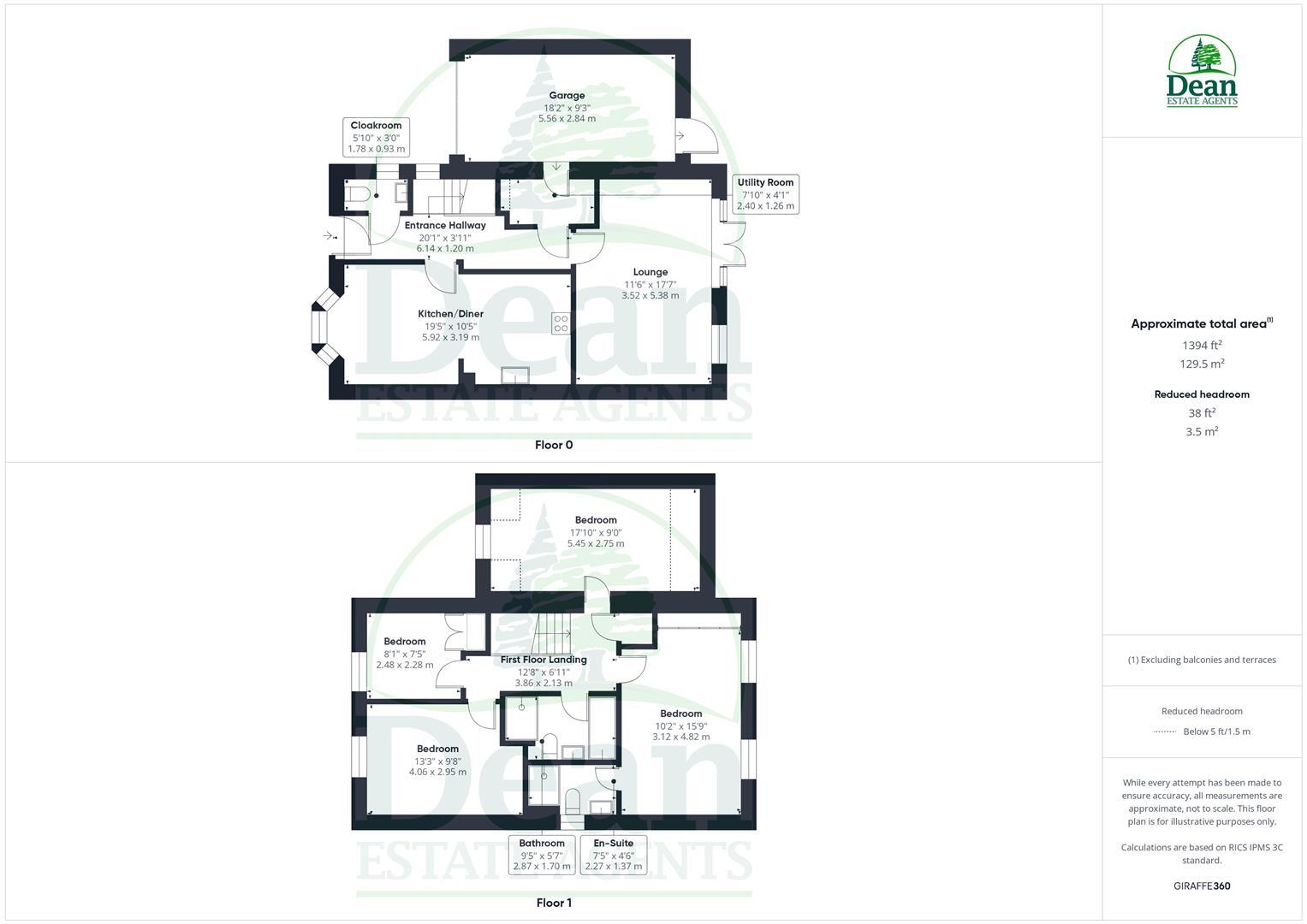
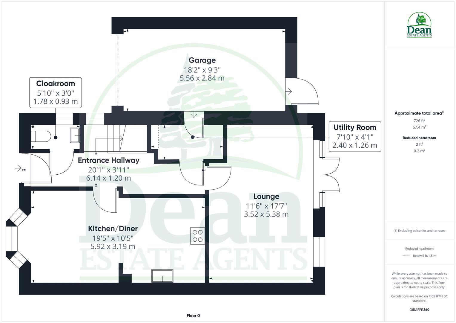
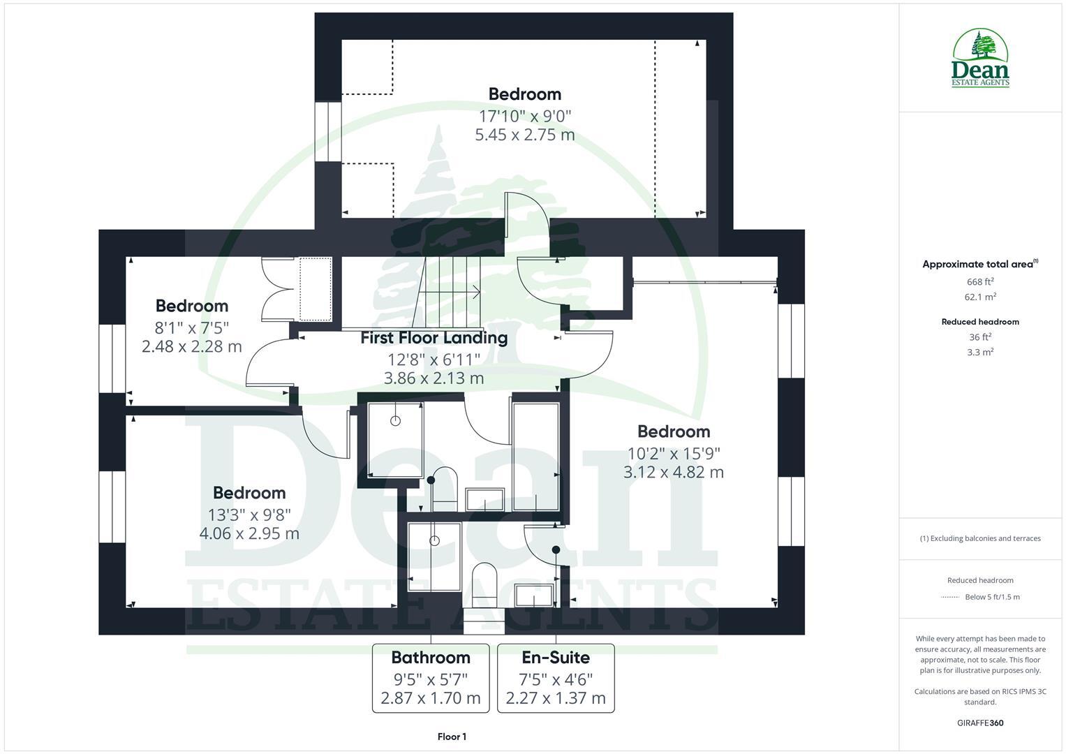
- A multi-story property with large living spaces and a spacious garage.
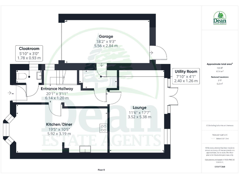
- A property with a kitchen/diner, living room, entrance hallway, utility room, and cloakroom.
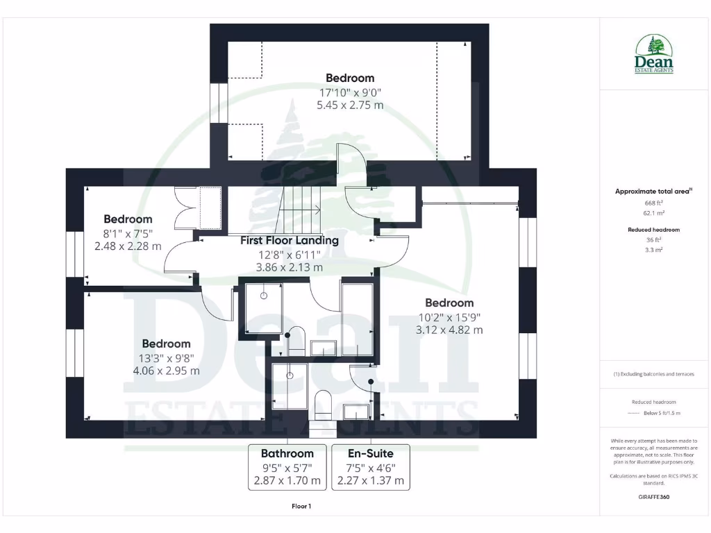
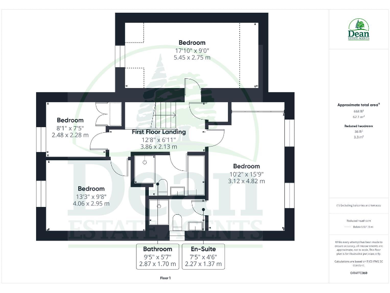
- This property features multiple bedrooms and a spacious kitchen/diner area.
- A single-story property with a kitchen/diner, lounge, cloakroom, utility room, and entrance hallway.
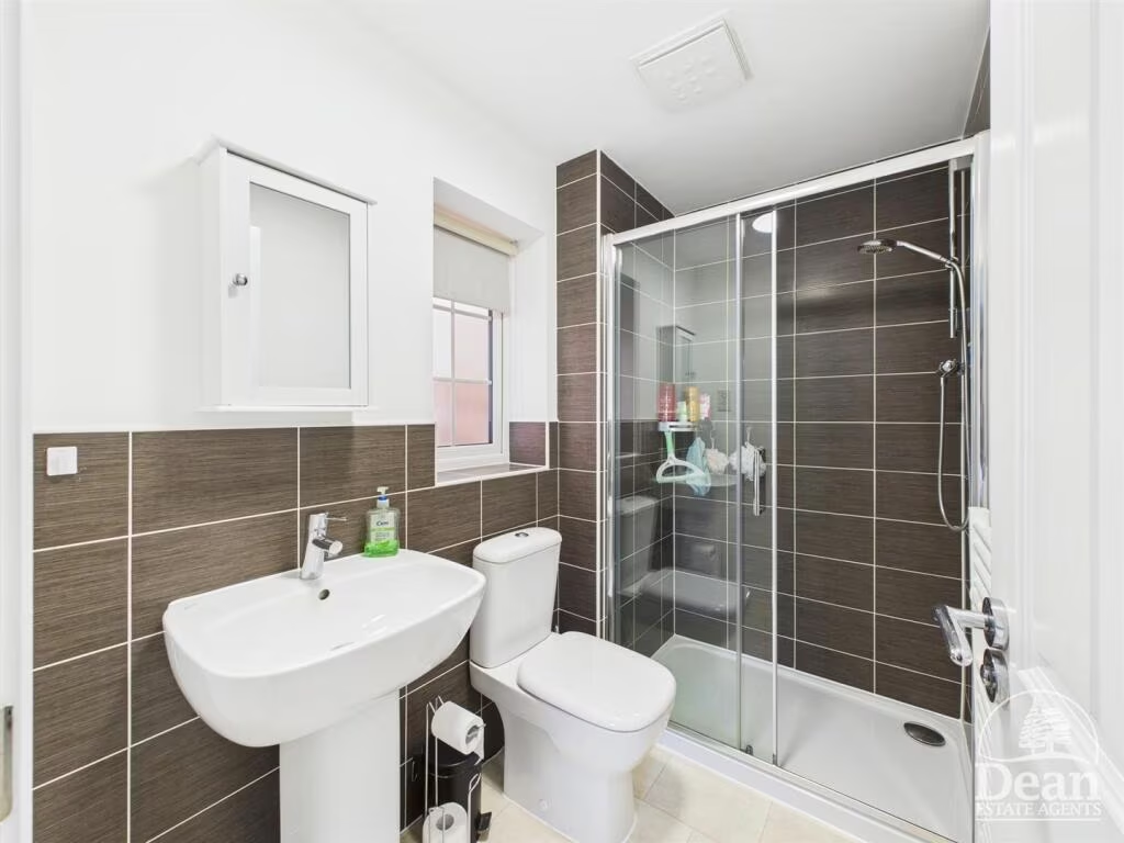
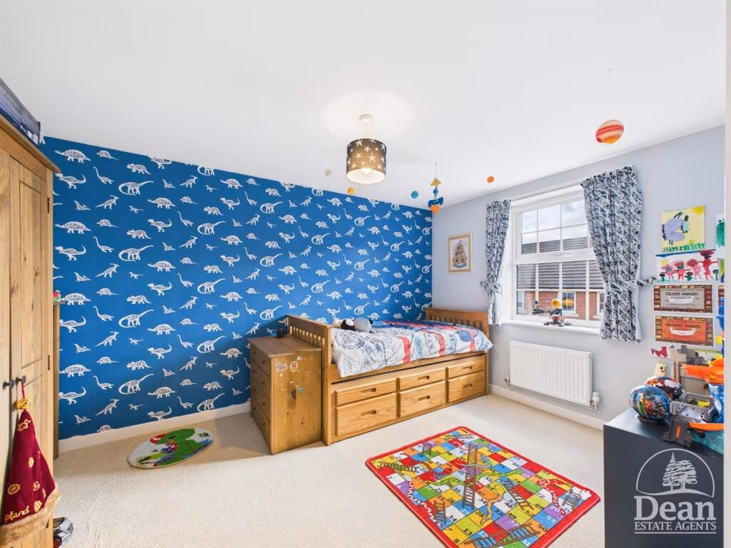
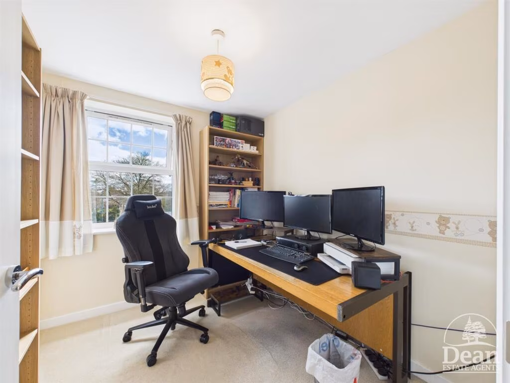
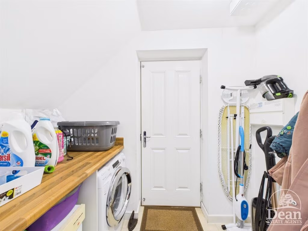
Rooms
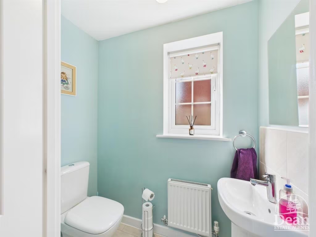
- Cloakroom: Small
- Entrance Hallway: Large
- Kitchen/Diner: Large
- Utility Room: Small
- Living Room: Large
- Garage: Large
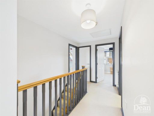
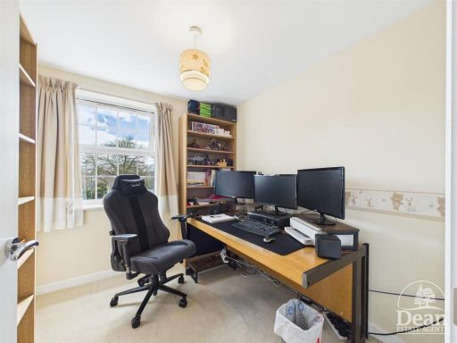
- Landing: Average
- Bedroom: Average
- Bedroom: Large
- Bedroom: Large
- Bedroom: Large
- Bathroom: Small
- En-suite: Small
- Cloakroom:
- Entrance Hallway:
- Kitchen/Diner:
- Living Room:
- Utility Room:
- Bedroom:
- Bedroom:
- Bedroom:
- Bedroom:
- Bathroom:
- En-Suite:
- Cloakroom: small
- Entrance Hallway: average
- Kitchen/Diner: large
- Lounge: large
- Utility Room: small
- Bedroom: small
- Bedroom: small
- Bedroom: average
- Bathroom: small
- En-Suite: average
- Cloakroom: small
- Entrance Hallway: average
- Kitchen/Diner: large
- Lounge: large
- Utility Room: small
- Bedroom:
- Bedroom:
- Bedroom:
- Bedroom:
- First Floor Landing:
- Bathroom:
- En-Suite:
Textual Property Features
- Is Ex Local Authority
- Is New Build
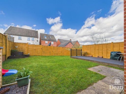
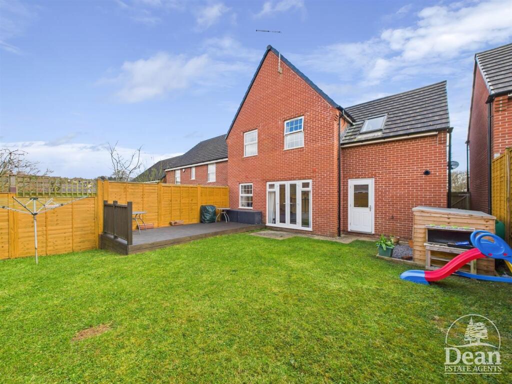
- Has Garden
- Chain Free
- Success
Detected Visual Features
- modern
- semi-detached
- garage
- driveway
- red brick
- well-maintained
- suburban
- modern kitchen
- white cabinets
- tile backsplash
- wood countertop
- integrated appliances
- bright
- track lighting
- clean
- functional
EPC Details
- High performance glazing
- Average thermal transmittance 0.27 W/m-¦K
- Boiler and radiators, mains gas
- Low energy lighting in all fixed outlets
- Average thermal transmittance 0.17 W/m-¦K
Nearby Schools
- St Briavels Parochial Church of England Primary School
- Parkend Primary School
- Ellwood Primary School
- Redbrook Church of England Primary School
- Five Acres High School
- Woodside Primary School
- Pillowell Community Primary School
- English Bicknor Church of England Primary School
- Ruardean Church of England Primary School
- Bream Church of England Primary School
- Clearwell Church of England Primary School
- St John's C of E Academy
- Berry Hill Primary School
- Yorkley Primary School
- Coalway Junior School
- Coalway Community Infant School
- Lydbrook Primary School
- Whitchurch CofE Primary School
Nearest Bars And Restaurants
- Id: 8088790673
- Tags:
- Amenity: pub
- Name: The Dog House
- TagsNormalized:
- Lat: 51.794135
- Lon: -2.6178637
- FullGeoHash: gcnnskvdxqe3
- PartitionGeoHash: gcnn
- Images:
- FoodStandards: null
- Distance: 494.7
,- Id: 8091799458
- Tags:
- Amenity: restaurant
- Cuisine: indian
- Name: Cinnamons
- TagsNormalized:
- Lat: 51.7942855
- Lon: -2.6177674
- FullGeoHash: gcnnskvg9de5
- PartitionGeoHash: gcnn
- Images:
- FoodStandards: null
- Distance: 492.7
,- Id: 8088790676
- Tags:
- TagsNormalized:
- Lat: 51.7941983
- Lon: -2.6178889
- FullGeoHash: gcnnskvenf2e
- PartitionGeoHash: gcnn
- Images:
- FoodStandards: null
- Distance: 489.8
,- Id: 8088790662
- Tags:
- Amenity: fast_food
- Cuisine: fish_and_chips
- Name: The Tram Stop
- TagsNormalized:
- Lat: 51.7943012
- Lon: -2.6179379
- FullGeoHash: gcnnskvetts1
- PartitionGeoHash: gcnn
- Images:
- FoodStandards: null
- Distance: 481.5
,- Id: 7167337452
- Tags:
- Amenity: cafe
- Name: Sixteen Community Cafe
- TagsNormalized:
- Lat: 51.7948165
- Lon: -2.6178172
- FullGeoHash: gcnnskvy8mw5
- PartitionGeoHash: gcnn
- Images:
- FoodStandards: null
- Distance: 466
}
Nearest General Shops
- Id: 8088790667
- Tags:
- Name: Oasis Beauty and Nails
- Shop: beauty
- TagsNormalized:
- Lat: 51.7944529
- Lon: -2.6180027
- FullGeoHash: gcnnskvss1gd
- PartitionGeoHash: gcnn
- Images:
- FoodStandards: null
- Distance: 470
,- Id: 8088790669
- Tags:
- Name: J D Hair
- Shop: hairdresser
- TagsNormalized:
- Lat: 51.7944922
- Lon: -2.6180336
- FullGeoHash: gcnnskvsg3hs
- PartitionGeoHash: gcnn
- Images:
- FoodStandards: null
- Distance: 466.2
,- Id: 8088790671
- Tags:
- Name: Raymond Stores
- Shop: carpet
- TagsNormalized:
- Lat: 51.794597
- Lon: -2.6180833
- FullGeoHash: gcnnskvt6hxt
- PartitionGeoHash: gcnn
- Images:
- FoodStandards: null
- Distance: 458.2
}
Nearest Religious buildings
- Id: 870831459
- Tags:
- Amenity: place_of_worship
- Building: church
- Denomination: roman_catholic
- Name: St Margaret Mary
- Religion: christian
- TagsNormalized:
- place of worship
- church
- catholic
- roman catholic
- christian
- Lat: 51.7885331
- Lon: -2.6169365
- FullGeoHash: gcnns7y6hfq9
- PartitionGeoHash: gcnn
- Images:
- FoodStandards: null
- Distance: 994.4
,- Id: 871071231
- Tags:
- Amenity: place_of_worship
- Building: church
- Name: Mount of Olives
- Religion: christian
- TagsNormalized:
- place of worship
- church
- christian
- Lat: 51.7953854
- Lon: -2.6113092
- FullGeoHash: gcnnst49bpds
- PartitionGeoHash: gcnn
- Images:
- FoodStandards: null
- Distance: 889.8
,- Id: 240958892
- Tags:
- Addr:
- City: Coleford
- Postcode: GL16 8AN
- Street: Newland Street
- Amenity: place_of_worship
- Building: yes
- Building:levels: 2
- Denomination: baptist
- Fhrs:
- Name: Coleford Baptist Church
- Phone: +44 1594 839377
- Religion: christian
- Website: www.colefordbaptists.org
- Wheelchair: yes
- TagsNormalized:
- place of worship
- baptist
- church
- christian
- Lat: 51.7928196
- Lon: -2.6198367
- FullGeoHash: gcnnsks713k5
- PartitionGeoHash: gcnn
- Images:
- FoodStandards:
- Id: 401680
- FHRSID: 401680
- LocalAuthorityBusinessID: 12/00065/COM
- BusinessName: Coleford Baptist Church
- BusinessType: Restaurant/Cafe/Canteen
- BusinessTypeID: 1
- AddressLine1: Newland Street
- AddressLine2: Coleford
- AddressLine3: Gloucestershire
- AddressLine4: null
- PostCode: GL16 8AN
- RatingValue: Exempt
- RatingKey: fhrs_exempt_en-GB
- RatingDate: null
- LocalAuthorityCode: 126
- LocalAuthorityName: Forest of Dean
- LocalAuthorityWebSite: http://www.fdean.gov.uk
- LocalAuthorityEmailAddress: ERS@publicagroup.uk
- Scores:
- Hygiene: null
- Structural: null
- ConfidenceInManagement: null
- NewRatingPending: false
- Geocode:
- Longitude: -2.61908800000000
- Latitude: 51.79291400000000
- Distance: 486.4
}
Nearest Medical buildings
- Id: 815551631
- Tags:
- Addr:
- Housenumber: 1
- Postcode: GL15 6JS
- Street: High Street
- Amenity: pharmacy
- Brand:
- Building: yes
- Name: Boots
- Opening_hours: Mo,We 09:00-18:00; Tu,Th,Fr 09:00-18:30; Sa 09:00-12:00
- Phone: +44 1594 562271
- TagsNormalized:
- Lat: 51.7520487
- Lon: -2.5730056
- FullGeoHash: gcnnmmnms95g
- PartitionGeoHash: gcnn
- Images:
- FoodStandards: null
- Distance: 6048
,- Id: 293296822
- Tags:
- Amenity: doctors
- Building: yes
- Healthcare: doctor
- Name: Brunston Surgery
- TagsNormalized:
- doctor
- doctors
- health
- healthcare
- surgery
- Lat: 51.7905499
- Lon: -2.616919
- FullGeoHash: gcnnsknmv65z
- PartitionGeoHash: gcnn
- Images:
- FoodStandards: null
- Distance: 808.8
,- Id: 870438446
- Tags:
- Amenity: doctors
- Building: yes
- Healthcare: doctor
- Name: Coleford Health Centre
- TagsNormalized:
- doctor
- doctors
- health
- healthcare
- health centre
- Lat: 51.7912167
- Lon: -2.6158161
- FullGeoHash: gcnnskr1xnd1
- PartitionGeoHash: gcnn
- Images:
- FoodStandards: null
- Distance: 804.1
,- Id: 2888354344
- Tags:
- Amenity: hospital
- Name: Great Oaks Hospice
- TagsNormalized:
- Lat: 51.7993713
- Lon: -2.6169191
- FullGeoHash: gcnnsmy3jqet
- PartitionGeoHash: gcnn
- Images:
- FoodStandards: null
- Distance: 605.7
}
Nearest Leisure Facilities
- Id: 9104699397
- Tags:
- Leisure: fitness_station
- Sport: fitness
- TagsNormalized:
- fitness
- fitness station
- station
- leisure
- sports
- Lat: 51.7937898
- Lon: -2.6107931
- FullGeoHash: gcnnssfbsn5w
- PartitionGeoHash: gcnn
- Images:
- FoodStandards: null
- Distance: 960.5
,- Id: 1030426247
- Tags:
- TagsNormalized:
- Lat: 51.7898547
- Lon: -2.6189364
- FullGeoHash: gcnnskhcy2ek
- PartitionGeoHash: gcnn
- Images:
- FoodStandards: null
- Distance: 799.7
,- Id: 6513986152
- Tags:
- Leisure: park
- Name: 2nd Lawdley Road park
- Opening_hours: 24/7
- TagsNormalized:
- Lat: 51.7894771
- Lon: -2.6214827
- FullGeoHash: gcnns7gpe42b
- PartitionGeoHash: gcnn
- Images:
- FoodStandards: null
- Distance: 778.4
,- Id: 911023176
- Tags:
- Leisure: pitch
- Sport: bowls
- TagsNormalized:
- Lat: 51.7926222
- Lon: -2.6261478
- FullGeoHash: gcnnshx9ykd3
- PartitionGeoHash: gcnn
- Images:
- FoodStandards: null
- Distance: 428.7
,- Id: 942884712
- Tags:
- TagsNormalized:
- Lat: 51.7966033
- Lon: -2.6239267
- FullGeoHash: gcnnsm3344dm
- PartitionGeoHash: gcnn
- Images:
- FoodStandards: null
- Distance: 39.8
}
Nearest Tourist attractions
- Id: 969564827
- Tags:
- Name: Whitecliff Ironworks
- Tourism: yes
- TagsNormalized:
- Lat: 51.7882601
- Lon: -2.6267355
- FullGeoHash: gcnns5z22xkh
- PartitionGeoHash: gcnn
- Images:
- FoodStandards: null
- Distance: 908.8
,- Id: 1256903749
- Tags:
- Addr:
- Name: Coleford Great Western Railway Museum
- Tourism: museum
- Wikidata: Q5142750
- Wikipedia: en:Coleford Great Western Railway Museum
- TagsNormalized:
- Lat: 51.7914721
- Lon: -2.6153416
- FullGeoHash: gcnnskre4n5v
- PartitionGeoHash: gcnn
- Images:
- FoodStandards: null
- Distance: 808.7
,- Id: 1074290927
- Tags:
- Fee: yes
- Name: Greenacres Campsite
- Tourism: camp_site
- TagsNormalized:
- Lat: 51.7950803
- Lon: -2.6345101
- FullGeoHash: gcnnsj185qyb
- PartitionGeoHash: gcnn
- Images:
- FoodStandards: null
- Distance: 723.6
}
Nearest Train stations
- Id: 262378723
- Tags:
- Name: Lydney Town
- Naptan:
- Operator: Dean Forest Railway
- Public_transport: station
- Railway: station
- Usage: tourism
- Wheelchair: no
- Wikidata: Q6707734
- TagsNormalized:
- Lat: 51.725442
- Lon: -2.5319837
- FullGeoHash: gcnnq2k68920
- PartitionGeoHash: gcnn
- Images:
- FoodStandards: null
- Distance: 10113.9
,- Id: 262378693
- Tags:
- Name: Norchard
- Public_transport: station
- Railway: station
- Usage: tourism
- Wikidata: Q7050477
- TagsNormalized:
- Lat: 51.7357697
- Lon: -2.5395674
- FullGeoHash: gcnnq4nwxy3r
- PartitionGeoHash: gcnn
- Images:
- FoodStandards: null
- Distance: 8897.3
,- Id: 7689205151
- Tags:
- Name: Oakiron
- Public_transport: station
- Railway: station
- Train: yes
- Usage: tourism
- Wikidata: Q7073925
- Wikipedia: en:Oakiron railway station
- TagsNormalized:
- Lat: 51.7824969
- Lon: -2.6102566
- FullGeoHash: gcnnsdeqbt59
- PartitionGeoHash: gcnn
- Images:
- FoodStandards: null
- Distance: 1806.5
,- Id: 7689205150
- Tags:
- Name: Perrygrove
- Public_transport: station
- Railway: station
- Train: yes
- Usage: tourism
- Wikidata: Q7169991
- Wikipedia: en:Perrygrove railway station
- TagsNormalized:
- Lat: 51.7825235
- Lon: -2.6111685
- FullGeoHash: gcnnsddx5658
- PartitionGeoHash: gcnn
- Images:
- FoodStandards: null
- Distance: 1771.5
,- Id: 8693763578
- Tags:
- Name: Rookwood
- Public_transport: station
- Railway: station
- Usage: tourism
- Wikidata: Q7366236
- Wikipedia: en:Rookwood railway station
- TagsNormalized:
- Lat: 51.7850193
- Lon: -2.6127976
- FullGeoHash: gcnnse1mt7kb
- PartitionGeoHash: gcnn
- Images:
- FoodStandards: null
- Distance: 1476
}
Nearest Hotels
- Id: 1304508888
- Tags:
- Name: Lambsquay House Hotel
- Tourism: hotel
- TagsNormalized:
- Lat: 51.7770091
- Lon: -2.6098758
- FullGeoHash: gcnns9ewcqp9
- PartitionGeoHash: gcnn
- Images:
- FoodStandards: null
- Distance: 2357.3
,- Id: 7167337451
- Tags:
- Name: Kings Head Hotel
- Tourism: hotel
- TagsNormalized:
- Lat: 51.7940103
- Lon: -2.6161274
- FullGeoHash: gcnnskyczz64
- PartitionGeoHash: gcnn
- Images:
- FoodStandards: null
- Distance: 607.7
,- Id: 7167337455
- Tags:
- Name: Angel Hotel
- Tourism: hotel
- Wikidata: Q26481559
- TagsNormalized:
- Lat: 51.793825
- Lon: -2.61715
- FullGeoHash: gcnnsky0zuz8
- PartitionGeoHash: gcnn
- Images:
- FoodStandards: null
- Distance: 554.3
}
Tags
- modern
- semi-detached
- garage
- driveway
- red brick
- well-maintained
- suburban
- modern kitchen
- white cabinets
- tile backsplash
- wood countertop
- integrated appliances
- bright
- track lighting
- clean
- functional
Local Market Stats
- Average Price/sqft: £276
- Avg Income: £40500
- Rental Yield: 2.9%
- Social Housing: 10%
- Planning Success Rate: 89%
AirBnB Data
- 1km average: £112/night
- Listings in 1km: 2
Similar Properties
 4 bedroom detached house for sale in Blakes Way, Coleford, GL16 — £350,000 • 4 bed • 2 bath • 1174 ft²
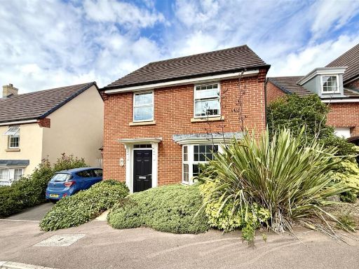 4 bedroom detached house for sale in Blakes Way, Coleford, GL16 — £340,000 • 4 bed • 2 bath • 1170 ft²
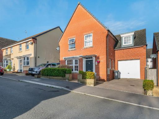 4 bedroom detached house for sale in Blakes Way, Coleford, GL16 — £350,000 • 4 bed • 2 bath • 1346 ft²
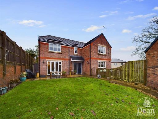 4 bedroom detached house for sale in Copper Beech Close, Coleford, GL16 — £400,000 • 4 bed • 2 bath • 1410 ft²
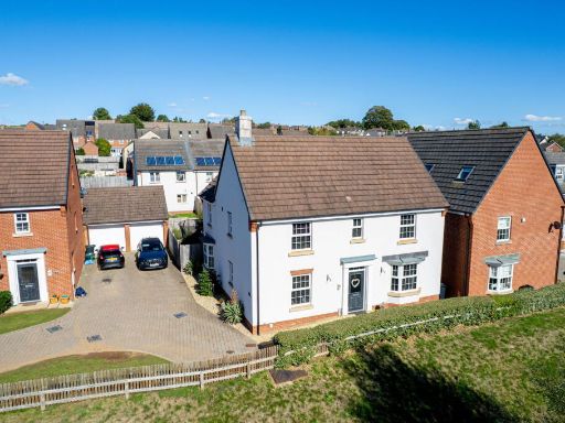 4 bedroom detached house for sale in Caudwell Close, Coleford, GL16 — £415,000 • 4 bed • 2 bath • 1400 ft²
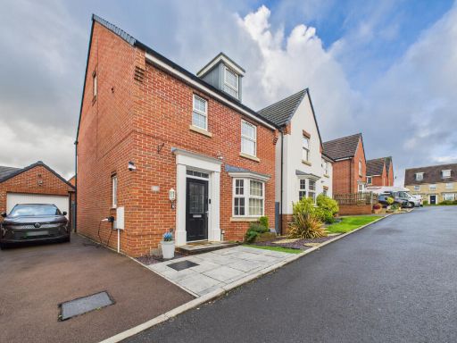 4 bedroom detached house for sale in Bircham Drive, Coleford, Gloucestershire, GL16 8EU, GL16 — £360,000 • 4 bed • 3 bath • 1244 ft²
Meta
- {
"@context": "https://schema.org",
"@type": "Residence",
"name": "4 bedroom detached house for sale in Blakes Way, Coleford,…",
"description": "",
"url": "https://propertypiper.co.uk/property/be0f1957-94d4-4c1e-825e-c416ed7b6995",
"image": "https://image-a.propertypiper.co.uk/79fe447d-2c43-4163-a5d3-6d31c0ac6283-1024.jpeg",
"address": {
"@type": "PostalAddress",
"streetAddress": "26, Blakes Way, COLEFORD",
"postalCode": "GL16 8EX",
"addressLocality": "Forest of Dean",
"addressRegion": "Forest of Dean",
"addressCountry": "England"
},
"geo": {
"@type": "GeoCoordinates",
"latitude": 51.79627743847709,
"longitude": -2.624167604719086
},
"numberOfRooms": 4,
"numberOfBathroomsTotal": 2,
"floorSize": {
"@type": "QuantitativeValue",
"value": 1394,
"unitCode": "FTK"
},
"offers": {
"@type": "Offer",
"price": 340000,
"priceCurrency": "GBP",
"availability": "https://schema.org/InStock"
},
"additionalProperty": [
{
"@type": "PropertyValue",
"name": "Feature",
"value": "modern"
},
{
"@type": "PropertyValue",
"name": "Feature",
"value": "semi-detached"
},
{
"@type": "PropertyValue",
"name": "Feature",
"value": "garage"
},
{
"@type": "PropertyValue",
"name": "Feature",
"value": "driveway"
},
{
"@type": "PropertyValue",
"name": "Feature",
"value": "red brick"
},
{
"@type": "PropertyValue",
"name": "Feature",
"value": "well-maintained"
},
{
"@type": "PropertyValue",
"name": "Feature",
"value": "suburban"
},
{
"@type": "PropertyValue",
"name": "Feature",
"value": "modern kitchen"
},
{
"@type": "PropertyValue",
"name": "Feature",
"value": "white cabinets"
},
{
"@type": "PropertyValue",
"name": "Feature",
"value": "tile backsplash"
},
{
"@type": "PropertyValue",
"name": "Feature",
"value": "wood countertop"
},
{
"@type": "PropertyValue",
"name": "Feature",
"value": "integrated appliances"
},
{
"@type": "PropertyValue",
"name": "Feature",
"value": "bright"
},
{
"@type": "PropertyValue",
"name": "Feature",
"value": "track lighting"
},
{
"@type": "PropertyValue",
"name": "Feature",
"value": "clean"
},
{
"@type": "PropertyValue",
"name": "Feature",
"value": "functional"
}
]
}
High Res Floorplan Images
Compatible Floorplan Images
FloorplanImages Thumbnail