NG20 0DS - 4 bedroom detached house for sale in Stonebridge Lane, Mark…
View on Property Piper
4 bedroom detached house for sale in Stonebridge Lane,
Market Warsop,
Mansfield,
Nottinghamshire,
NG20 0DS, NG20
Property Details
- Price: £409995
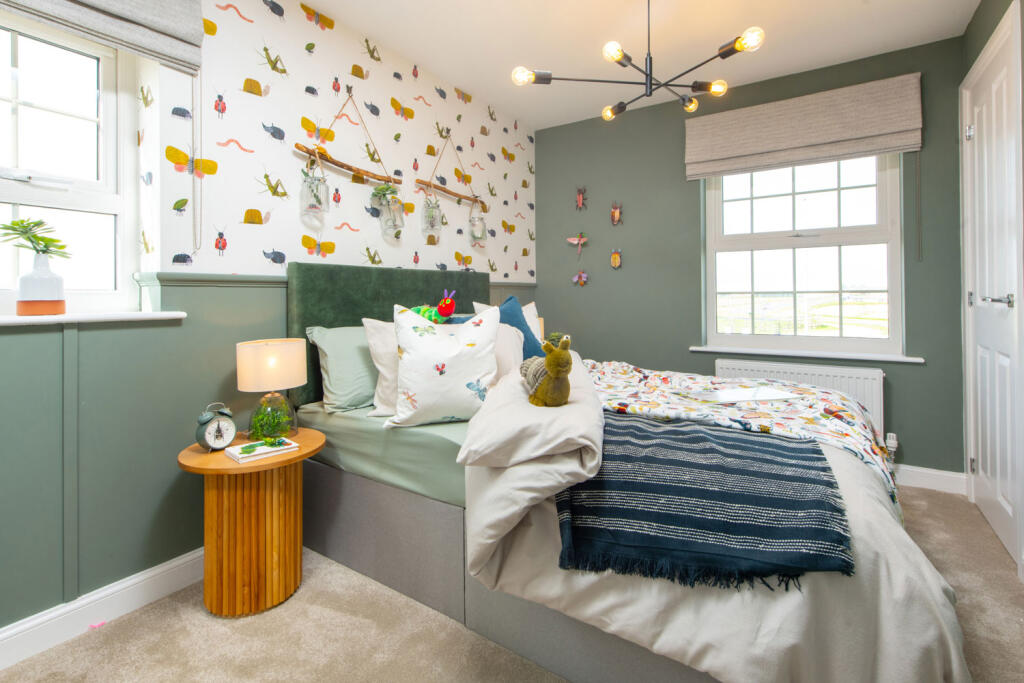
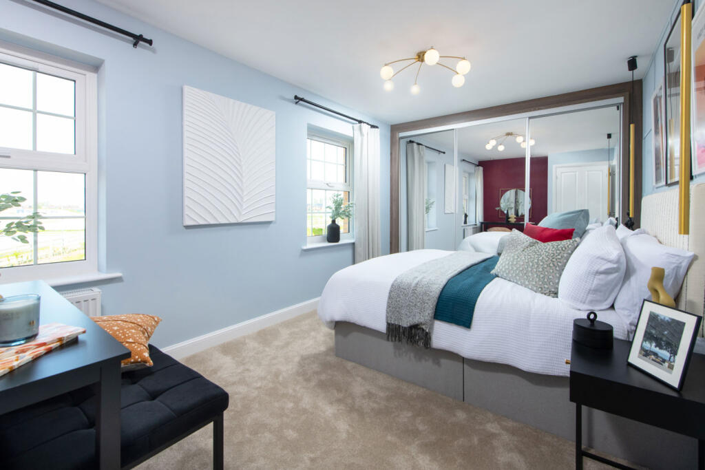
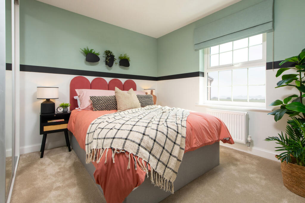
- Bedrooms: 4
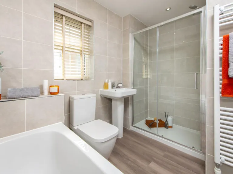
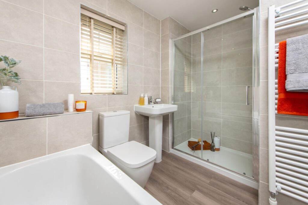
- Bathrooms: 1
- Property Type: undefined
- Property SubType: undefined
Brochure Descriptions
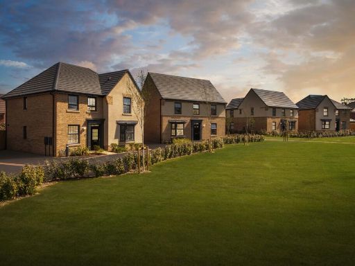
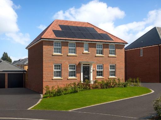
- Identified as a residential development named "Stonebridge Fields" located in Market Warsop, marketed by David Wilson Homes. The image is a branding/title slide rather than photographs of the dwelling, so no internal layout, room counts, finishes or external landscaping can be confirmed. As a valuator-style summary: this appears to be a new-build housing development likely comprising multiple dwellings under a single development name. Market position would typically be mid-to-upper market given the professional branding; likely appeal to families and owner-occupiers. No specific views (sea, river, woodland, city) are visible in the image. Plot and building sizes cannot be determined from this artwork; total floor area and individual room/garden sizes are unknown and would require site plans or sales particulars to assess accurately.
- No property images or residential address visible in the supplied image. The image contains only David Wilson Homes branding, website (dwh.co.uk) and a contact number. As a valuator: there is insufficient information to assess accommodation, layout, plot or square footage. The only inference possible is that the listing may be for a David Wilson Homes new-build development; without floorplans, photographs of the dwelling or an address, market value, room sizes and external features cannot be determined.
- No residential property is shown in the image — this is a marketing/brochure page from David Wilson Homes (signed by John Reddington, Managing Director). There are no photographs or floorplans of a specific house, and no street or house number for a property for sale. As a valuator-style note: the document promotes David Wilson new-build homes in desirable locations built to a high specification; however, without images, floor area or location data I cannot assess room sizes, plot size or provide a valuation. Estimated property size and features cannot be inferred from this marketing page.
Image Descriptions
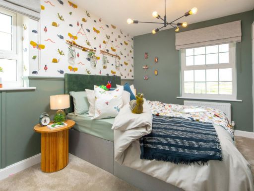
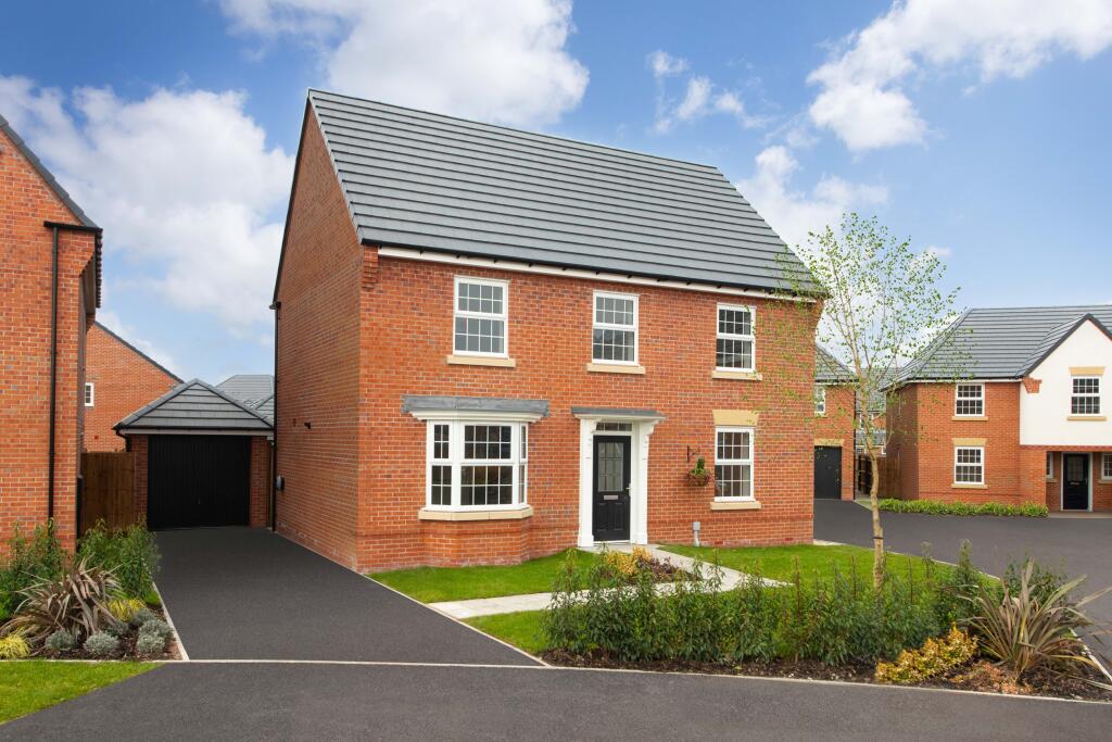
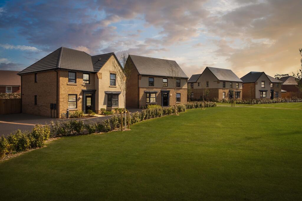
- detached house modern
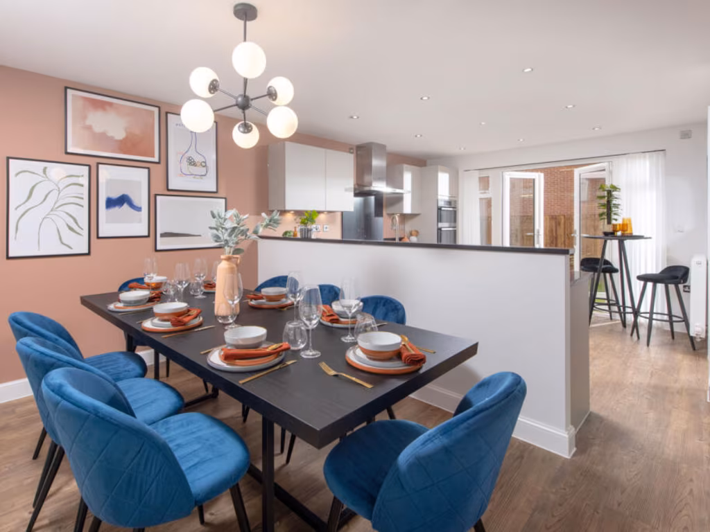
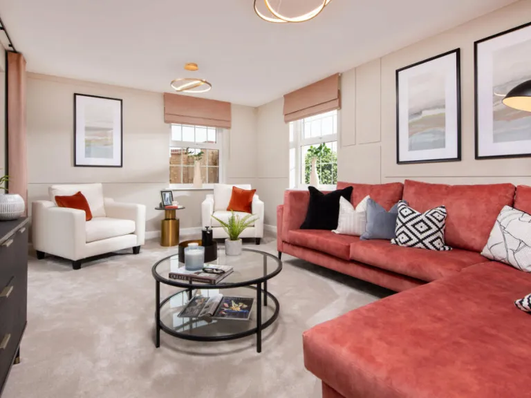
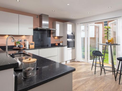
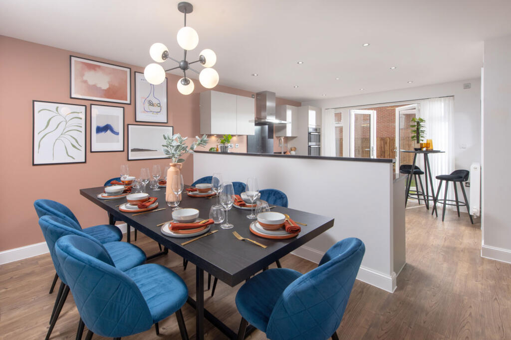
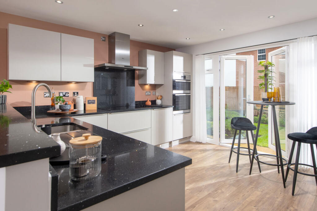
- dining and kitchen area contemporary
Floorplan Description
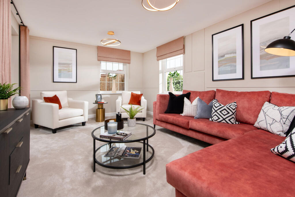
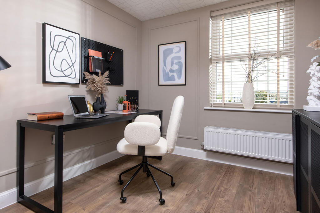
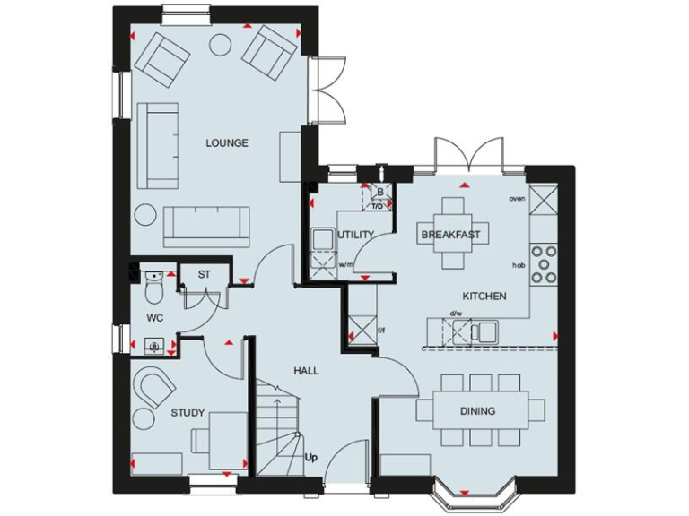
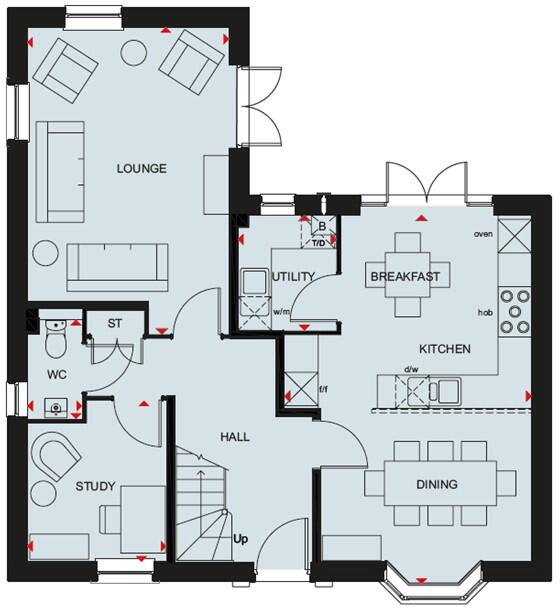
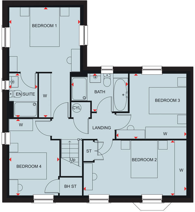
- Ground floor plan showing lounge, kitchen, dining, breakfast area, utility, study, hall, WC and storage.
Rooms
- LOUNGE:
- WC:
- ST:
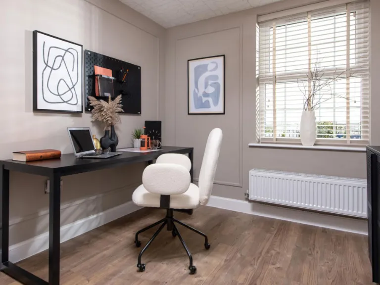
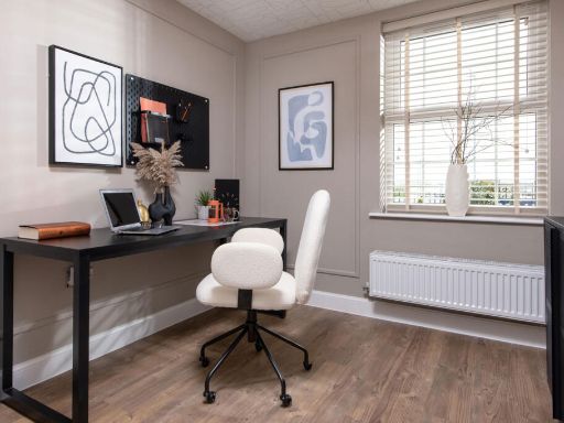
- STUDY:
- HALL:
- UTILITY:
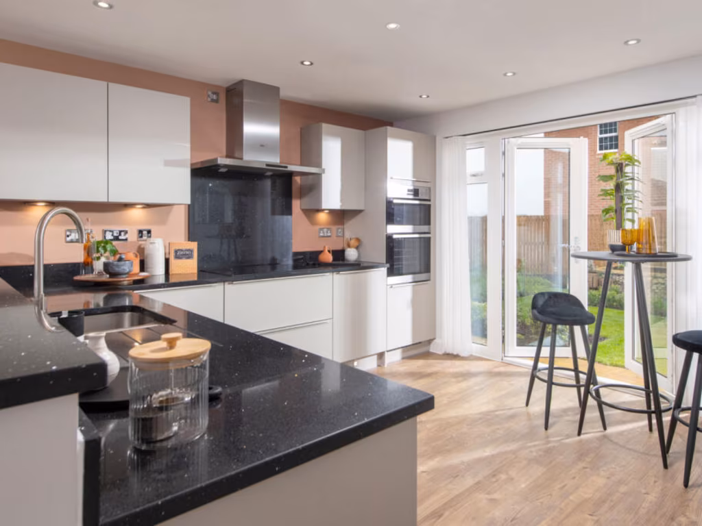
- KITCHEN:
- BREAKFAST:
- DINING:
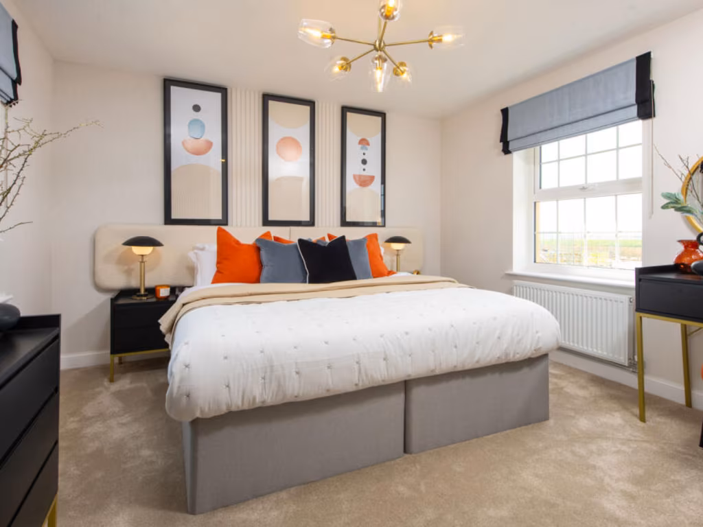
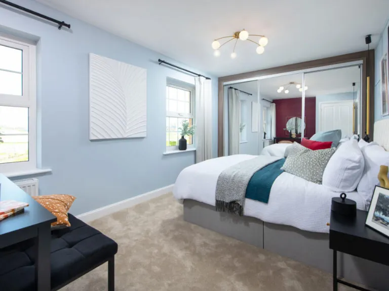
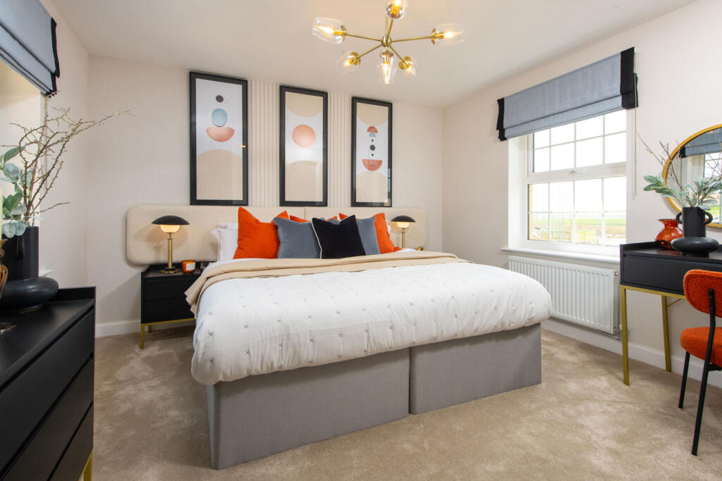
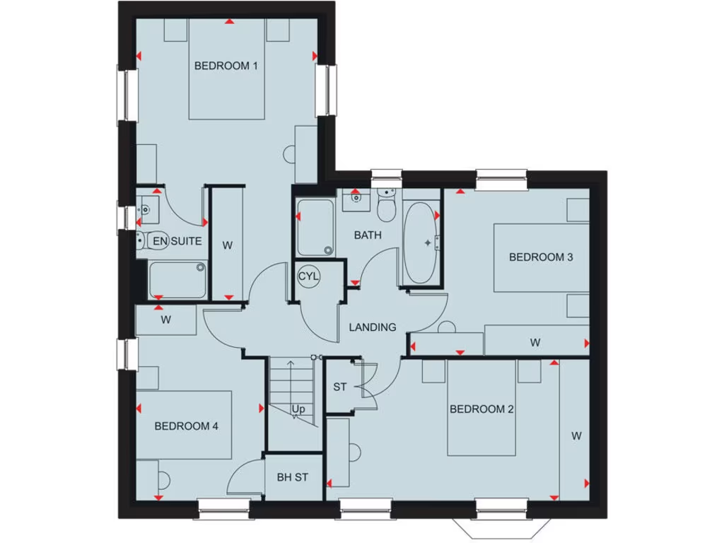
- BEDROOM 1:
- EN SUITE:
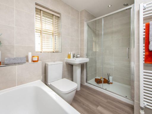
- BATH:
- BEDROOM 3:
- BEDROOM 2:
- BEDROOM 4:
- LANDING:
- ST:
- BH ST:
- CYL:
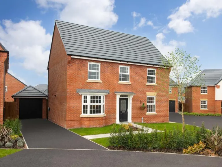
Textual Property Features
Detected Visual Features
- modern
- detached
- brick exterior
- double garage
- garden
- new-build
- driveway
- contemporary
- open-plan
- modern kitchen
- dining area
- French doors
- natural light
Nearby Schools
- The Brunts Academy
- Nettleworth Infant and Nursery School
- Church Vale Primary School and Foundation Unit
- Cuckney CofE Primary School
- Whaley Thorns Primary School
- Abbey Primary School
- Heatherley Primary School
- Holly Primary School
- The Garibaldi School
- John T Rice Infant and Nursery School
- The Bramble Academy
- Peafield Lane Academy
- The Manor Academy
- St Joseph's Catholic Primary School, A Voluntary Academy
- Samworth Church Academy
- Forest Town Primary School
- St Edmund's CofE (C) Primary School
- Northfield Primary and Nursery School
- Model Village Primary School
- Sherwood Junior School
- Birklands Primary School
- Meden School
- Langwith Bassett Junior Academy
- Netherfield Infant School (Welbeck Federation of Schools)
- Newlands Junior School
- Leas Park Junior School
- Hetts Lane Infant and Nursery School
- Brookfield Primary School
- Eastlands Junior School (Welbeck Federation of Schools)
Nearest General Shops
- Id: 4691236455
- Tags:
- Name: The Fashion Shop
- Shop: clothes
- TagsNormalized:
- Lat: 53.2039317
- Lon: -1.1547649
- FullGeoHash: gcrnttrpk58y
- PartitionGeoHash: gcrn
- Images:
- FoodStandards: null
- Distance: 336.7
,- Id: 254166078
- Tags:
- Brand: Ford
- Brand:wikidata: Q44294
- Brand:wikipedia: en:Ford Motor Company
- Landuse: retail
- Name: Warsop Motor Company
- Shop: car
- TagsNormalized:
- Lat: 53.2023595
- Lon: -1.1576301
- FullGeoHash: gcrnttjn1q8k
- PartitionGeoHash: gcrn
- Images:
- FoodStandards: null
- Distance: 231.5
,- Id: 10671076785
- Tags:
- TagsNormalized:
- Lat: 53.2025429
- Lon: -1.1576088
- FullGeoHash: gcrnttjp3bb6
- PartitionGeoHash: gcrn
- Images:
- FoodStandards: null
- Distance: 217
}
Nearest Grocery shops
- Id: 254165622
- Tags:
- Addr:
- Housenumber: 11-15
- Postcode: NG20 0AA
- Street: High Street
- Brand: Co-op Food
- Brand:wikidata: Q3277439
- Brand:wikipedia: en:Co-op Food
- Building: yes
- Fhrs:
- Name: Co-op Food
- Operator: The Co-operative Group
- Operator:wikidata: Q117202
- Shop: convenience
- Source:
- TagsNormalized:
- co-op
- co-op food
- food
- convenience
- shop
- Lat: 53.2047432
- Lon: -1.1527243
- FullGeoHash: gcrntv8s5dfr
- PartitionGeoHash: gcrn
- Images:
- FoodStandards:
- Id: 223157
- FHRSID: 223157
- LocalAuthorityBusinessID: 52565
- BusinessName: Co-operative Group
- BusinessType: Retailers - supermarkets/hypermarkets
- BusinessTypeID: 7840
- AddressLine1: 13 High Street
- AddressLine2: Warsop
- AddressLine3: Nottinghamshire
- AddressLine4: null
- PostCode: NG20 0AA
- RatingValue: 4
- RatingKey: fhrs_4_en-GB
- RatingDate: 2022-01-12
- LocalAuthorityCode: 263
- LocalAuthorityName: Mansfield
- LocalAuthorityWebSite: http://www.mansfield.gov.uk
- LocalAuthorityEmailAddress: environmentaladministration@mansfield.gov.uk
- Scores:
- Hygiene: 0
- Structural: 10
- ConfidenceInManagement: 5
- NewRatingPending: false
- Geocode:
- Longitude: -1.15276900000000
- Latitude: 53.20471760000000
- Distance: 480.2
,- Id: 987851319
- Tags:
- Building: yes
- Name: Desco
- Shop: convenience
- TagsNormalized:
- Lat: 53.2032168
- Lon: -1.1539578
- FullGeoHash: gcrnttreny6w
- PartitionGeoHash: gcrn
- Images:
- FoodStandards: null
- Distance: 399.5
,- Id: 254166080
- Tags:
- Addr:
- Postcode: NG20 0BZ
- Street: High Street
- Brand: The Co-operative Food
- Brand:wikidata: Q107617274
- Building: yes
- Disused:
- Fhrs:
- Food: yes
- Name: The Co-operative Food
- Not:
- Opening_hours:
- Operator: Central England Co-operative
- Operator:wikidata: Q16986583
- Parking: yes
- Shop: convenience
- Source: survey
- Source:addr: FHRS Open Data
- TagsNormalized:
- the co-operative food
- food
- convenience
- shop
- Lat: 53.2027399
- Lon: -1.1569288
- FullGeoHash: gcrnttm83te3
- PartitionGeoHash: gcrn
- Images:
- FoodStandards: null
- Distance: 236.6
}
Nearest Supermarkets
- Id: 245720683
- Tags:
- Brand: Morrisons
- Brand:wikidata: Q922344
- Brand:wikipedia: en:Morrisons
- Building: yes
- Name: Morrisons
- Shop: supermarket
- Website: https://my.morrisons.com/storefinder/472
- TagsNormalized:
- Lat: 53.1647381
- Lon: -1.191091
- FullGeoHash: gcrnkykej96p
- PartitionGeoHash: gcrn
- Images:
- FoodStandards: null
- Distance: 4835.1
,- Id: 317222000
- Tags:
- Brand: ALDI
- Brand:wikidata: Q41171672
- Brand:wikipedia: en:Aldi
- Building: yes
- Contact:
- Website: https://stores.aldi.co.uk/shirebrook/carter-lane
- Name: Aldi
- Shop: supermarket
- TagsNormalized:
- Lat: 53.204916
- Lon: -1.2142975
- FullGeoHash: gcrnsmev0g4n
- PartitionGeoHash: gcrn
- Images:
- FoodStandards: null
- Distance: 3629.8
,- Id: 740937135
- Tags:
- Addr:
- Country: GB
- Housenumber: 8
- Postcode: NG20 8TY
- Street: Portland Road
- Brand: Lidl
- Brand:wikidata: Q151954
- Brand:wikipedia: en:Lidl
- Building: yes
- Fhrs:
- Name: Lidl
- Shop: supermarket
- TagsNormalized:
- Lat: 53.202319
- Lon: -1.2105672
- FullGeoHash: gcrnsmnmzxpd
- PartitionGeoHash: gcrn
- Images:
- FoodStandards:
- Id: 1038421
- FHRSID: 1038421
- LocalAuthorityBusinessID: 18/00038/COMM
- BusinessName: Lidl
- BusinessType: Retailers - supermarkets/hypermarkets
- BusinessTypeID: 7840
- AddressLine1: Lidl Foodstore
- AddressLine2: 8 Portland Road
- AddressLine3: Shirebrook
- AddressLine4: Mansfield
- PostCode: NG20 8TY
- RatingValue: 5
- RatingKey: fhrs_5_en-GB
- RatingDate: 2022-07-05
- LocalAuthorityCode: 063
- LocalAuthorityName: Bolsover
- LocalAuthorityWebSite: http://www.bolsover.gov.uk/
- LocalAuthorityEmailAddress: enquiries@bolsover.gov.uk
- Scores:
- Hygiene: 5
- Structural: 0
- ConfidenceInManagement: 0
- NewRatingPending: false
- Geocode:
- Longitude: -1.21193504333496
- Latitude: 53.20246887207030
- Distance: 3384.9
}
Nearest Religious buildings
- Id: 254143867
- Tags:
- Amenity: place_of_worship
- Building: yes
- Denomination: anglican
- Name: Warsop Parish Church (St Peter & St Paul)
- Religion: christian
- Source: survey;Bing
- Wikidata: Q15979482
- Wikipedia: en:St Peter and St Paul's Church, Church Warsop
- TagsNormalized:
- place of worship
- anglican
- church
- parish
- christian
- Lat: 53.2132397
- Lon: -1.1511132
- FullGeoHash: gcrntz1v94gg
- PartitionGeoHash: gcrn
- Images:
- FoodStandards: null
- Distance: 1182
,- Id: 475708484
- Tags:
- Amenity: place_of_worship
- Building: church
- Denomination: methodist
- Name: Warsop Methodist Church
- Religion: christian
- Source: Survey
- TagsNormalized:
- place of worship
- church
- methodist
- christian
- Lat: 53.2043149
- Lon: -1.1518777
- FullGeoHash: gcrntv91x71s
- PartitionGeoHash: gcrn
- Images:
- FoodStandards: null
- Distance: 530.3
,- Id: 474498605
- Tags:
- Amenity: place_of_worship
- Building: yes
- Denomination: roman_catholic
- Name: St Teresa
- Religion: christian
- Source: Bing
- TagsNormalized:
- place of worship
- catholic
- roman catholic
- christian
- church
- Lat: 53.2031262
- Lon: -1.1553711
- FullGeoHash: gcrnttqdtvsc
- PartitionGeoHash: gcrn
- Images:
- FoodStandards: null
- Distance: 311
}
Nearest Medical buildings
- Id: 2821666637
- Tags:
- Amenity: doctors
- Healthcare: doctor
- Name: Warsop Primary Care Centre
- TagsNormalized:
- doctor
- doctors
- health
- healthcare
- Lat: 53.207166
- Lon: -1.1525584
- FullGeoHash: gcrnty0dpqwh
- PartitionGeoHash: gcrn
- Images:
- FoodStandards: null
- Distance: 599.7
,- Id: 4215342234
- Tags:
- Amenity: pharmacy
- Brand: Rowlands Pharmacy
- Brand:wikidata: Q62663235
- Dispensing: yes
- Healthcare: pharmacy
- Name: Rowlands Pharmacy
- TagsNormalized:
- pharmacy
- rowlands pharmacy
- health
- healthcare
- Lat: 53.2070359
- Lon: -1.1525126
- FullGeoHash: gcrnty0c2w2k
- PartitionGeoHash: gcrn
- Images:
- FoodStandards: null
- Distance: 593.8
,- Id: 4694335199
- Tags:
- Amenity: pharmacy
- Healthcare: pharmacy
- TagsNormalized:
- Lat: 53.2043515
- Lon: -1.1513509
- FullGeoHash: gcrntv99g9fx
- PartitionGeoHash: gcrn
- Images:
- FoodStandards: null
- Distance: 565.6
,- Id: 4694357545
- Tags:
- Amenity: pharmacy
- Brand: Rowlands Pharmacy
- Brand:wikidata: Q62663235
- Dispensing: yes
- Healthcare: pharmacy
- Name: Rowlands Pharmacy
- TagsNormalized:
- pharmacy
- rowlands pharmacy
- health
- healthcare
- Lat: 53.2047854
- Lon: -1.1520512
- FullGeoHash: gcrntv9h76b7
- PartitionGeoHash: gcrn
- Images:
- FoodStandards: null
- Distance: 525.2
}
Nearest Leisure Facilities
- Id: 1098385236
- Tags:
- TagsNormalized:
- Lat: 53.2041867
- Lon: -1.1479823
- FullGeoHash: gcrntvs0f54r
- PartitionGeoHash: gcrn
- Images:
- FoodStandards: null
- Distance: 788.8
,- Id: 469232492
- Tags:
- TagsNormalized:
- Lat: 53.208822
- Lon: -1.1538952
- FullGeoHash: gcrntwrgb736
- PartitionGeoHash: gcrn
- Images:
- FoodStandards: null
- Distance: 667.8
,- Id: 475707826
- Tags:
- Leisure: fitness_centre
- Name: Maxwell's Fitness and Tanning
- TagsNormalized:
- fitness
- fitness centre
- leisure
- tanning
- Lat: 53.2034727
- Lon: -1.1504535
- FullGeoHash: gcrntv6k8qps
- PartitionGeoHash: gcrn
- Images:
- FoodStandards: null
- Distance: 626.4
,- Id: 912755740
- Tags:
- Leisure: pitch
- Sport: bowls
- TagsNormalized:
- Lat: 53.2021214
- Lon: -1.1513996
- FullGeoHash: gcrntv1sf6np
- PartitionGeoHash: gcrn
- Images:
- FoodStandards: null
- Distance: 597.6
,- Id: 1081229540
- Tags:
- Leisure: track
- Sport: cycling
- TagsNormalized:
- track
- leisure
- cycling
- sports
- Lat: 53.2069096
- Lon: -1.1603597
- FullGeoHash: gcrntw509wv4
- PartitionGeoHash: gcrn
- Images:
- FoodStandards: null
- Distance: 328.1
}
Nearest Tourist attractions
- Id: 1265549478
- Tags:
- Source: OS OpenData StreetView
- Tourism: museum
- TagsNormalized:
- Lat: 53.2339699
- Lon: -1.2053226
- FullGeoHash: gcrnudfq3gnr
- PartitionGeoHash: gcrn
- Images:
- FoodStandards: null
- Distance: 4505.7
,- Id: 294261656
- Tags:
- Name: Sherwood Forest Holiday Park
- Source: ACSI;Sign on main road;Bing
- Tourism: camp_site
- TagsNormalized:
- Lat: 53.1794315
- Lon: -1.1148328
- FullGeoHash: gcrnw9h0ws83
- PartitionGeoHash: gcrn
- Images:
- FoodStandards: null
- Distance: 4053.6
,- Id: 604973971
- Tags:
- Name: Blakeley Lane Campsite
- Tourism: camp_site
- TagsNormalized:
- Lat: 53.1968775
- Lon: -1.1293271
- FullGeoHash: gcrnwk1wkb8w
- PartitionGeoHash: gcrn
- Images:
- FoodStandards: null
- Distance: 2179.1
}
Nearest Hotels
- Id: 7697551391
- Tags:
- Amenity: pub
- Name: Midland Hotel
- TagsNormalized:
- Lat: 53.1425663
- Lon: -1.1985962
- FullGeoHash: gcrnkdr1ysmg
- PartitionGeoHash: gcrn
- Images:
- FoodStandards: null
- Distance: 7301.2
,- Id: 544279250
- Tags:
- Addr:
- City: Mansfield
- Housename: Mansfield Manor
- Postcode: NG18 2AL
- Street: Windmill Lane
- Building: house
- Name: Mansfield Manor
- Tourism: hotel
- TagsNormalized:
- Lat: 53.1495718
- Lon: -1.1901165
- FullGeoHash: gcrnkgt6sq2c
- PartitionGeoHash: gcrn
- Images:
- FoodStandards: null
- Distance: 6377.6
,- Id: 310891313
- Tags:
- Name: Mansfield Lodge
- Tourism: hotel
- TagsNormalized:
- Lat: 53.1506828
- Lon: -1.193651
- FullGeoHash: gcrnkgfc1vmk
- PartitionGeoHash: gcrn
- Images:
- FoodStandards: null
- Distance: 6340.4
}
Tags
- modern
- detached
- brick exterior
- double garage
- garden
- new-build
- driveway
- contemporary
- open-plan
- modern kitchen
- dining area
- French doors
- natural light
Local Market Stats
- Average Price/sqft: £165
- Avg Income: £34900
- Rental Yield: 4.9%
- Social Housing: 12%
- Planning Success Rate: 57%
Similar Properties
 4 bedroom detached house for sale in Stonebridge Lane,
Market Warsop,
Mansfield,
Nottinghamshire,
NG20 0DS, NG20 — £439,995 • 4 bed • 1 bath • 1315 ft²
4 bedroom detached house for sale in Stonebridge Lane,
Market Warsop,
Mansfield,
Nottinghamshire,
NG20 0DS, NG20 — £439,995 • 4 bed • 1 bath • 1315 ft²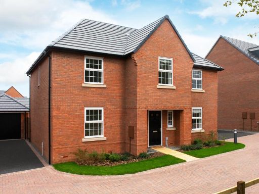 4 bedroom detached house for sale in Stonebridge Lane,
Market Warsop,
Mansfield,
Nottinghamshire,
NG20 0DS, NG20 — £464,995 • 4 bed • 1 bath • 1503 ft²
4 bedroom detached house for sale in Stonebridge Lane,
Market Warsop,
Mansfield,
Nottinghamshire,
NG20 0DS, NG20 — £464,995 • 4 bed • 1 bath • 1503 ft²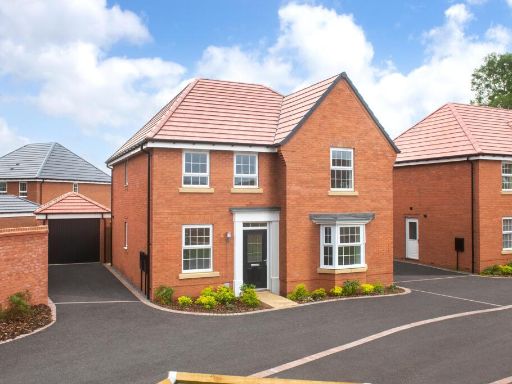 4 bedroom detached house for sale in Stonebridge Lane,
Market Warsop,
Mansfield,
Nottinghamshire,
NG20 0DS, NG20 — £412,995 • 4 bed • 1 bath • 1302 ft²
4 bedroom detached house for sale in Stonebridge Lane,
Market Warsop,
Mansfield,
Nottinghamshire,
NG20 0DS, NG20 — £412,995 • 4 bed • 1 bath • 1302 ft²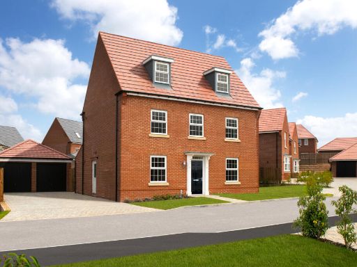 5 bedroom detached house for sale in Stonebridge Lane,
Market Warsop,
Mansfield,
Nottinghamshire,
NG20 0DS, NG20 — £447,995 • 5 bed • 1 bath • 1399 ft²
5 bedroom detached house for sale in Stonebridge Lane,
Market Warsop,
Mansfield,
Nottinghamshire,
NG20 0DS, NG20 — £447,995 • 5 bed • 1 bath • 1399 ft²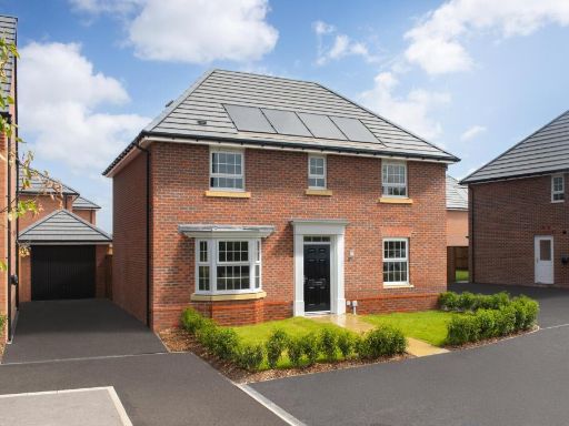 4 bedroom detached house for sale in Stonebridge Lane,
Market Warsop,
Mansfield,
Nottinghamshire,
NG20 0DS, NG20 — £399,995 • 4 bed • 1 bath • 1352 ft²
4 bedroom detached house for sale in Stonebridge Lane,
Market Warsop,
Mansfield,
Nottinghamshire,
NG20 0DS, NG20 — £399,995 • 4 bed • 1 bath • 1352 ft²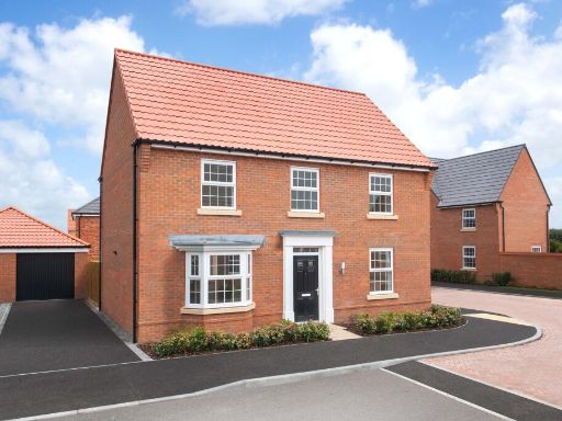 4 bedroom detached house for sale in Stonebridge Lane,
Market Warsop,
Mansfield,
Nottinghamshire,
NG20 0DS, NG20 — £399,995 • 4 bed • 1 bath • 1303 ft²
4 bedroom detached house for sale in Stonebridge Lane,
Market Warsop,
Mansfield,
Nottinghamshire,
NG20 0DS, NG20 — £399,995 • 4 bed • 1 bath • 1303 ft²
Meta
- {
"@context": "https://schema.org",
"@type": "Residence",
"name": "4 bedroom detached house for sale in Stonebridge Lane, Mark…",
"description": "",
"url": "https://propertypiper.co.uk/property/bd9197ce-bc5e-4c8f-9d18-b11aa666aea8",
"image": "https://image-a.propertypiper.co.uk/2ede0c87-cdba-43c7-8641-18126b885e19-1024.jpeg",
"address": {
"@type": "PostalAddress",
"streetAddress": "4 STONEBRIDGE LANE WARSOP MANSFIELD",
"postalCode": "NG20 0DS",
"addressLocality": "Mansfield",
"addressRegion": "Mansfield",
"addressCountry": "England"
},
"geo": {
"@type": "GeoCoordinates",
"latitude": 53.2039764,
"longitude": -1.1598203
},
"numberOfRooms": 4,
"numberOfBathroomsTotal": 1,
"floorSize": {
"@type": "QuantitativeValue",
"value": 1303,
"unitCode": "FTK"
},
"offers": {
"@type": "Offer",
"price": 409995,
"priceCurrency": "GBP",
"availability": "https://schema.org/InStock"
},
"additionalProperty": [
{
"@type": "PropertyValue",
"name": "Feature",
"value": "modern"
},
{
"@type": "PropertyValue",
"name": "Feature",
"value": "detached"
},
{
"@type": "PropertyValue",
"name": "Feature",
"value": "brick exterior"
},
{
"@type": "PropertyValue",
"name": "Feature",
"value": "double garage"
},
{
"@type": "PropertyValue",
"name": "Feature",
"value": "garden"
},
{
"@type": "PropertyValue",
"name": "Feature",
"value": "new-build"
},
{
"@type": "PropertyValue",
"name": "Feature",
"value": "driveway"
},
{
"@type": "PropertyValue",
"name": "Feature",
"value": "contemporary"
},
{
"@type": "PropertyValue",
"name": "Feature",
"value": "open-plan"
},
{
"@type": "PropertyValue",
"name": "Feature",
"value": "modern kitchen"
},
{
"@type": "PropertyValue",
"name": "Feature",
"value": "dining area"
},
{
"@type": "PropertyValue",
"name": "Feature",
"value": "French doors"
},
{
"@type": "PropertyValue",
"name": "Feature",
"value": "natural light"
}
]
}
High Res Floorplan Images
Compatible Floorplan Images
FloorplanImages Thumbnail