NW6 1TS - 2 bedroom apartment for sale in Pandora Road, West Hampstea…
View on Property Piper
2 bedroom apartment for sale in Pandora Road, West Hampstead, London, NW6
Property Details
- Price: £825000
- Bedrooms: 2
- Bathrooms: 1
- Property Type: undefined
- Property SubType: undefined
Brochure Descriptions
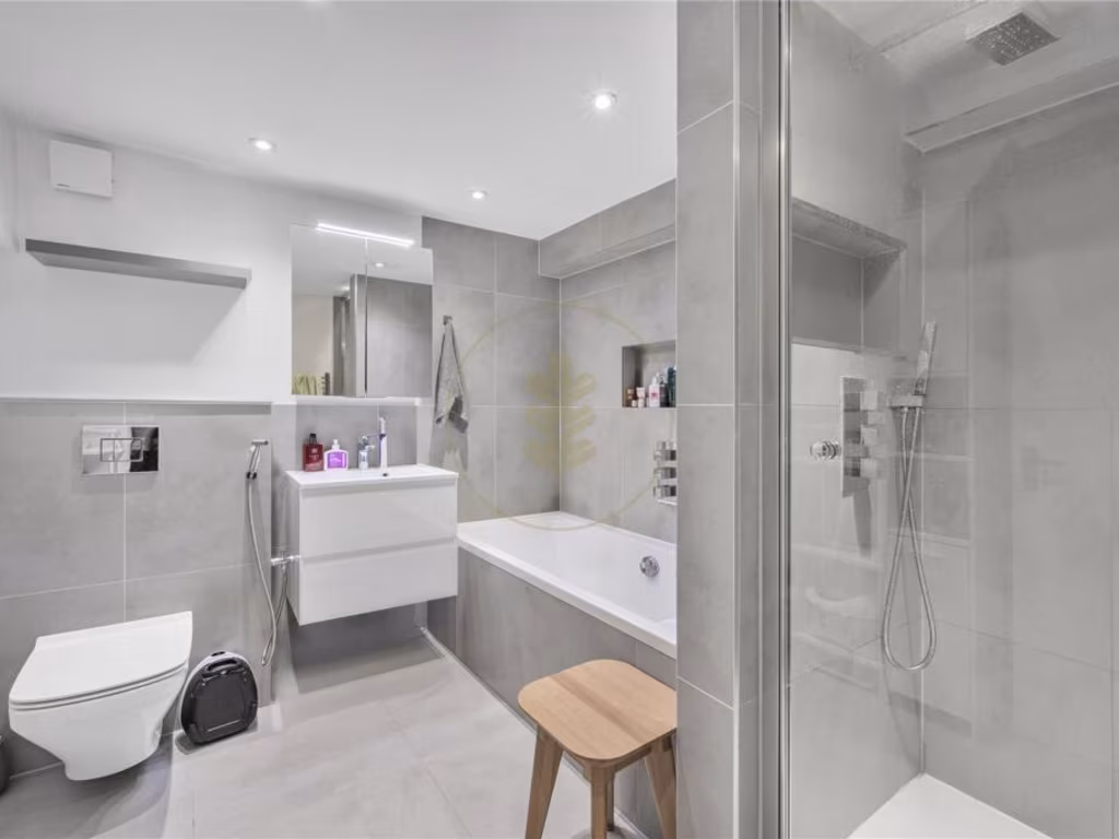
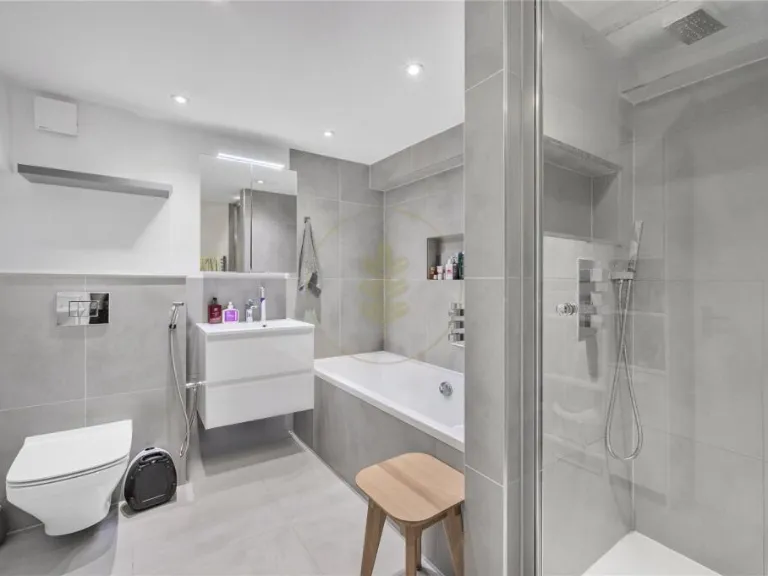
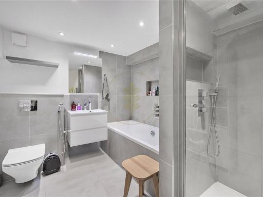
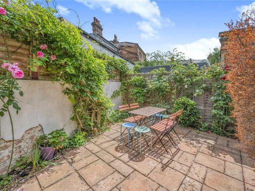
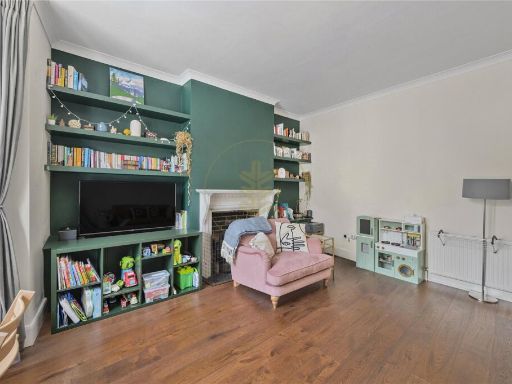
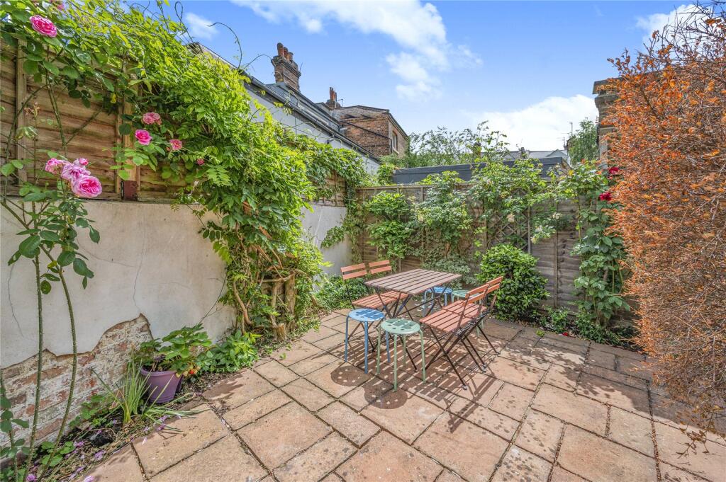
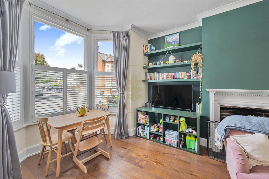
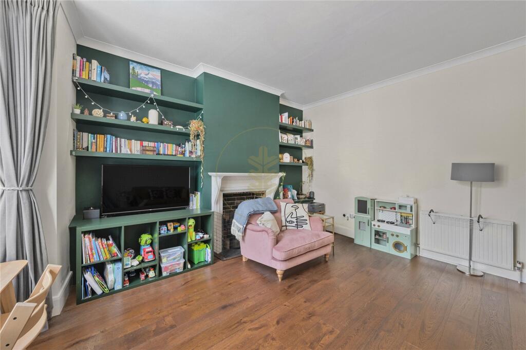
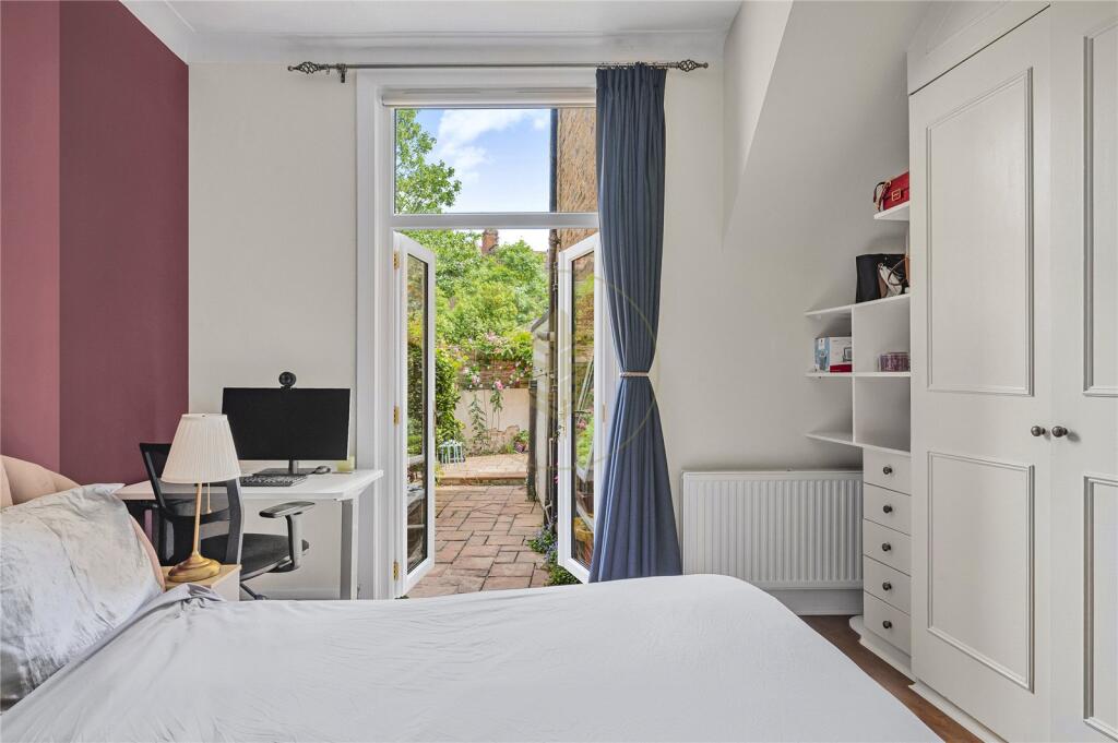
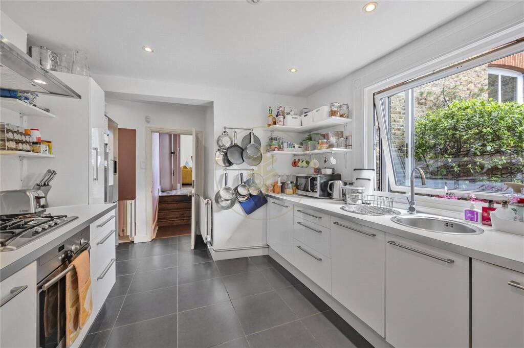
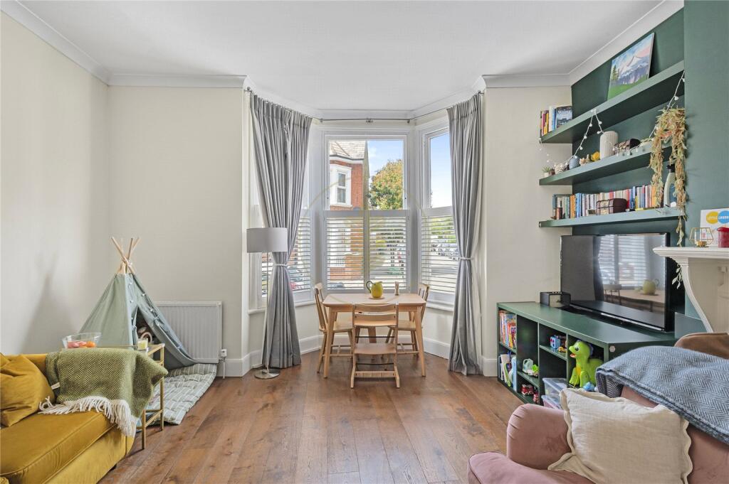
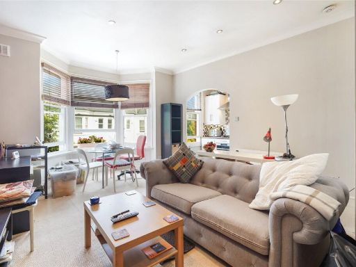
- Charming two-bedroom duplex apartment with private garden access on Pandora Road, West Hampstead. Bright and spacious reception room with large bay window allowing abundant natural light; principal bedroom with built-in wardrobes and direct access to a private garden (small–average garden). Versatile second bedroom/study accessible from the kitchen, suitable for guests or home working. Larger-than-average galley-style kitchen with good worktop and storage provision. Well-sized family bathroom with bathtub and additional separate storage/utility room. Property benefits from generous ceiling height, period features, integrated storage and thoughtfully arranged accommodation providing good circulation and practical layout. Overall property footprint consistent with a medium-sized two-bedroom apartment in a desirable, residential West Hampstead location.
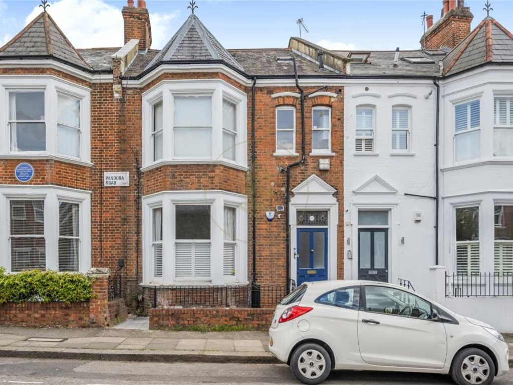
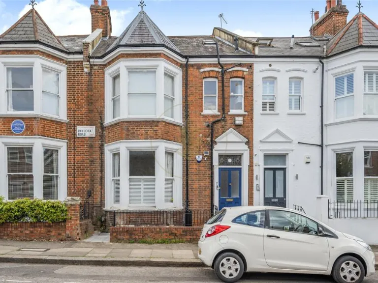
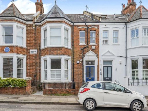
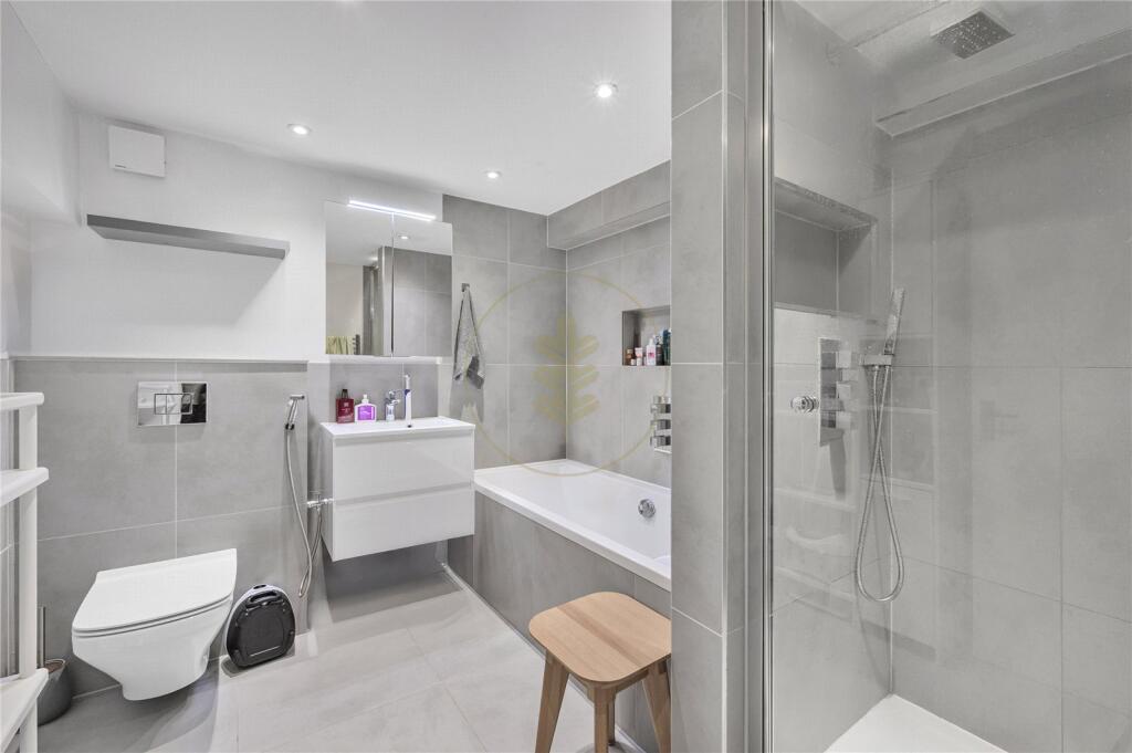
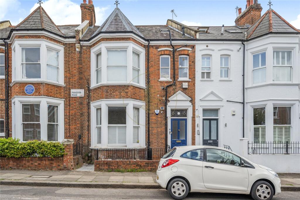
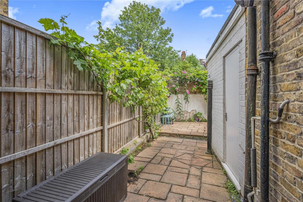
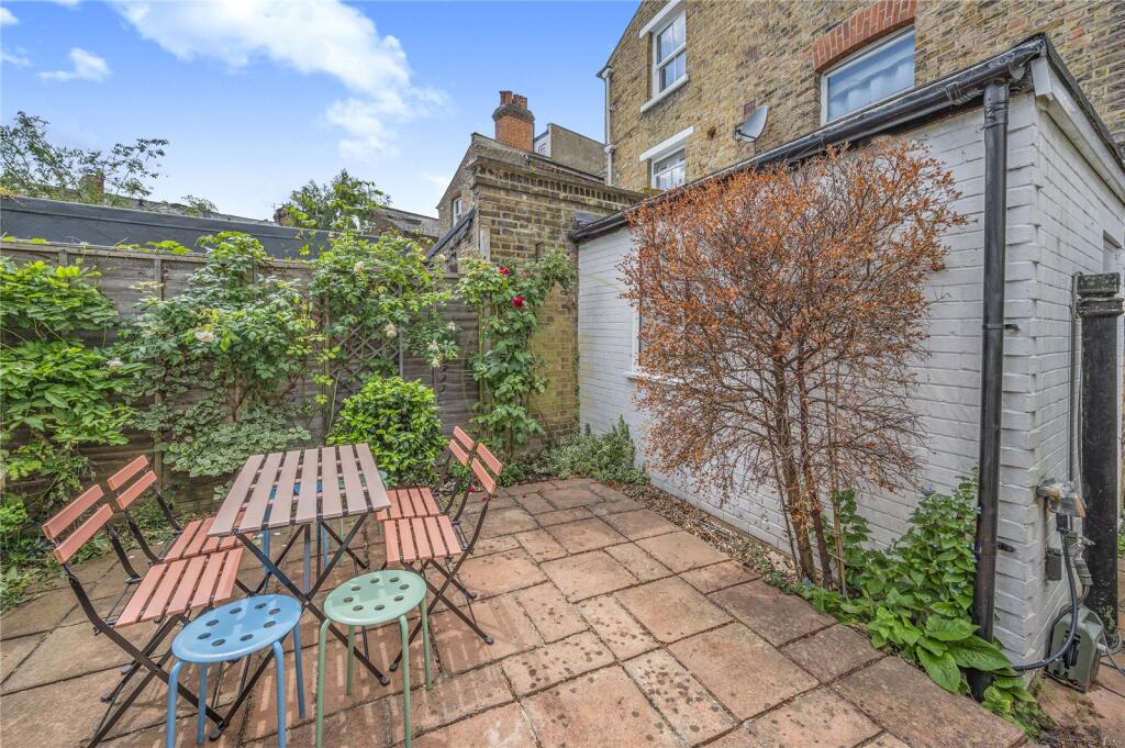
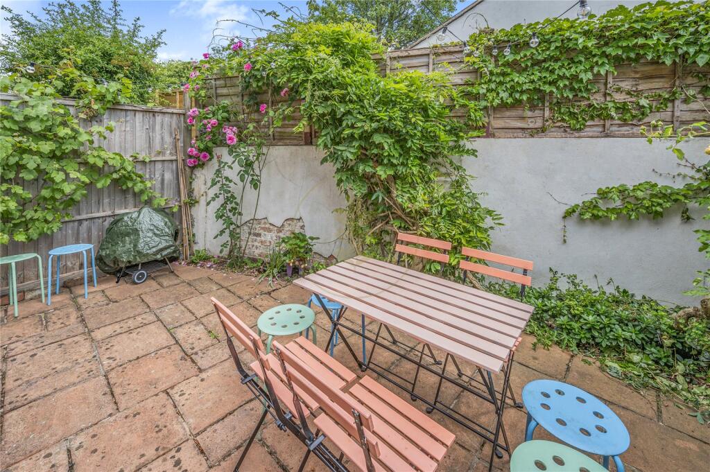
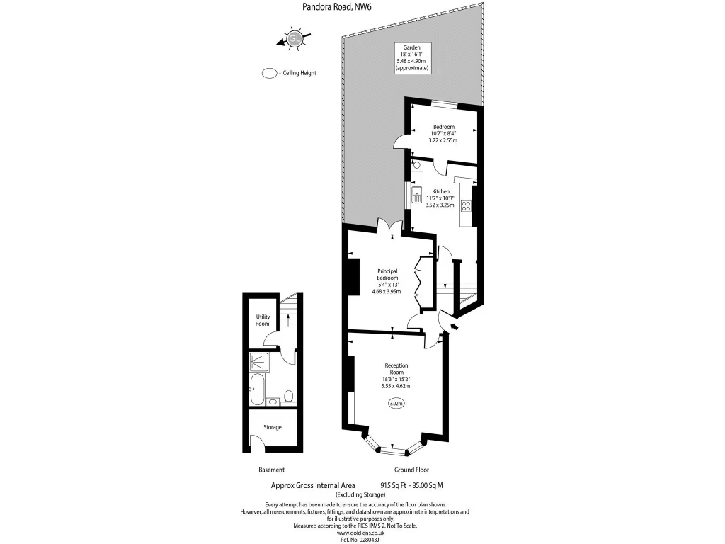
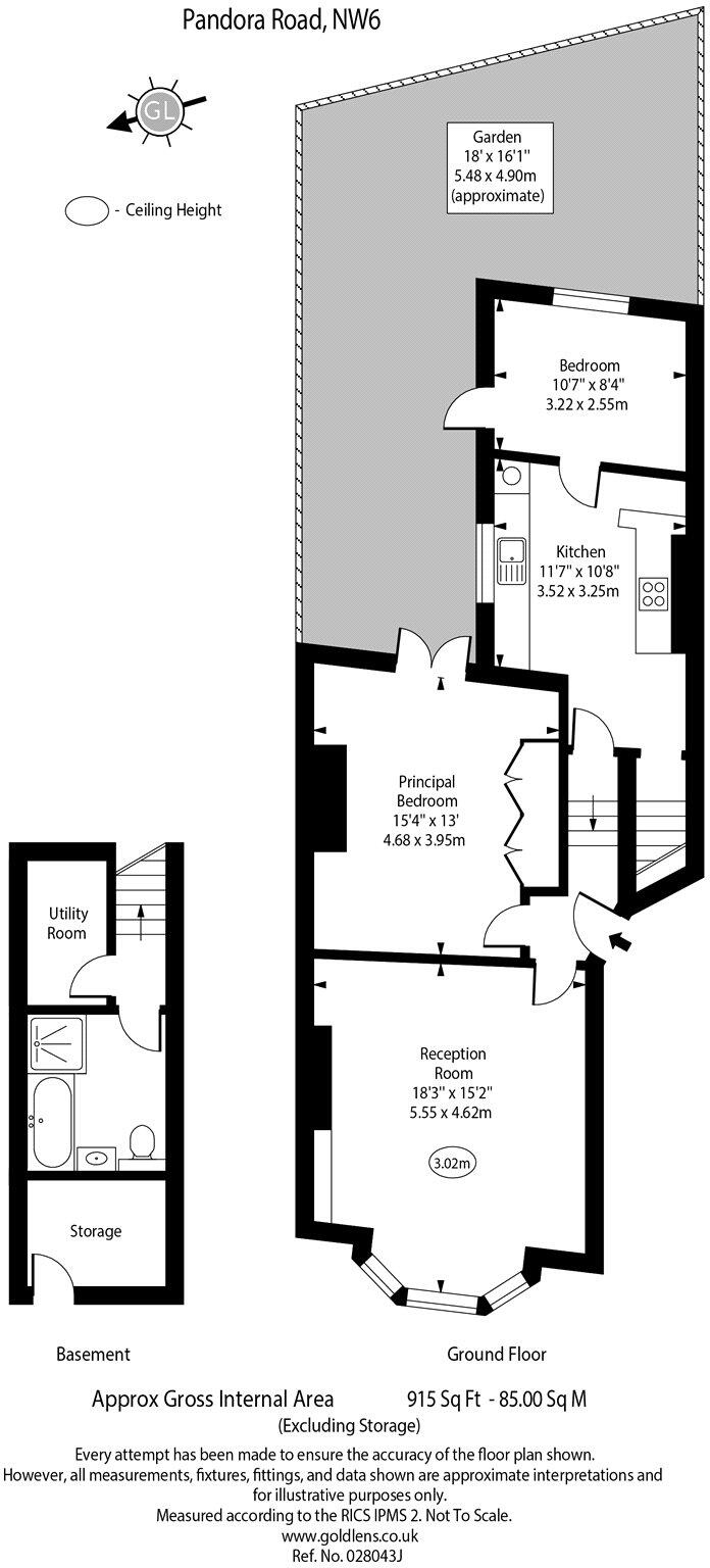
- Mid-terrace residential property arranged over ground floor with a basement. Floorplan shows principal reception to front, a sizable principal bedroom and a second bedroom toward the rear, kitchen and bathroom, plus a private rear garden. Basement contains utility room and storage. Garden is generous for an urban property (labelled approximately 18' x 16' / 5.48 x 4.90m). Overall accommodation footprint is medium/large for a flat/house conversion in this area; internal rooms are average-to-large (reception approx 18'3" x 15'2"; principal bedroom approx 14'9" x 13'; second bedroom approx 10'7" x 8'). Suitable for a small family or professional sharers; good basement storage and outside amenity add functional value. No furniture or removable items considered in this description.
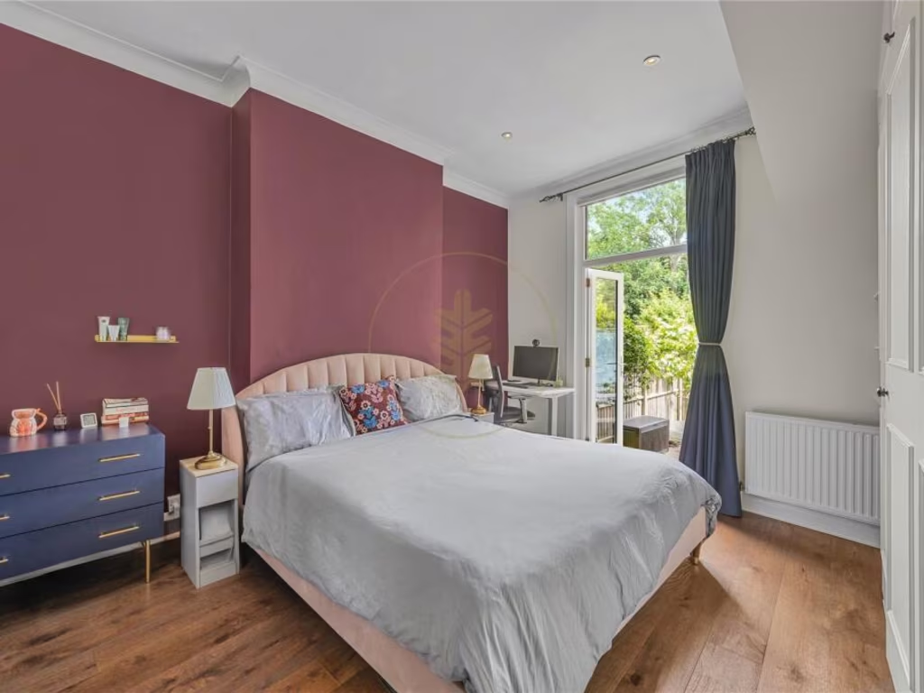
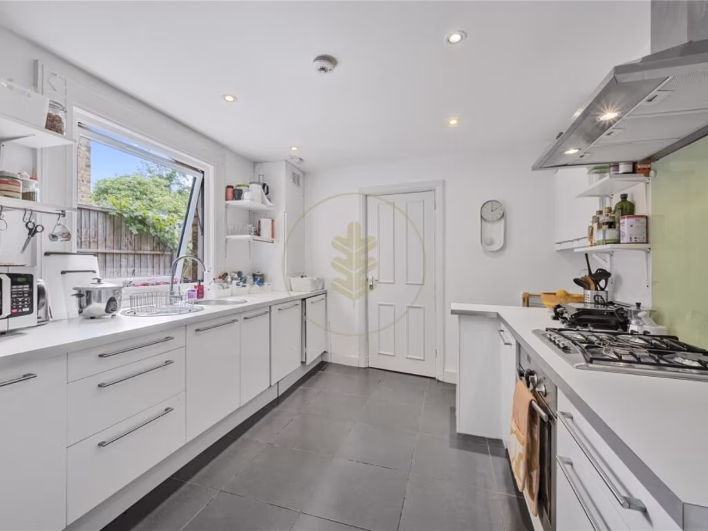
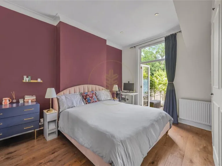
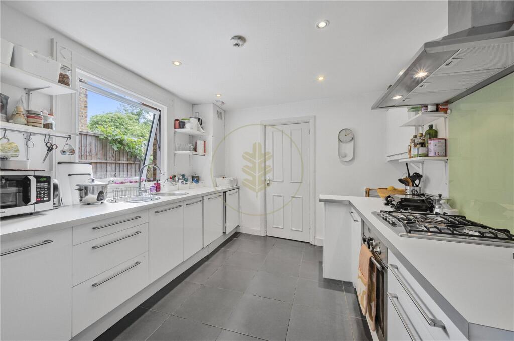
- Residential property presented by Oakhill. Images show a well‑finished mid‑town property: a double bedroom with engineered wood flooring, recessed ceiling lights, feature painted accent wall and glazed door opening onto an outdoor area (small garden or balcony) providing good natural light and greenery views. The kitchen is a long galley style with contemporary white units, stone or composite worktops, integrated gas hob with extractor, tiled floor, and a large opening/window to the outside — practical for family cooking and everyday use. Overall impression: a modernised, mid‑sized terraced/period conversion style home with good natural light, quality finishes and an outdoor space of small to average size. Suitable for professionals or a small family; overall property size appears average for an inner‑city 1–3 bedroom dwelling.
Image Descriptions
- living room Victorian
- bedroom Contemporary
Floorplan Description
- Two-floor property with reception, principal bedroom, kitchen, and second bedroom with rear garden.
Rooms
- Reception Room: large
- Principal Bedroom: large
- Kitchen: average
- Bedroom: small
Textual Property Features
Detected Visual Features
- Victorian
- living room
- high ceiling
- bay window
- hardwood floor
- fireplace
- period property
- light
- contemporary
- bedroom
- medium size
- standard ceiling
- garden access
- modern decor
Nearby Schools
- The School of the Islamic Republic of Iran
- Christ Church CofE Primary School
- Holy Trinity CofE Primary School, NW3
- North Bridge House Nursery & Pre-Prep Schools
- West Hampstead Primary School
- Devonshire House Preparatory School
- Hampstead Parochial Church of England Primary School
- St Luke's Church of England School
- All Saints' CofE Primary School NW2
- Al-Sadiq School
- Islamia Primary School
- North West London Jewish Day School
- University College School
- St Margaret's School
- St Augustine's Federated Schools: CE High School
- Naima Jewish Preparatory School
- St Augustines Federated Schools: CofE Primary School
- Islamia School for Girls'
- Al-Zahra School
- St Mary's Kilburn Church of England Primary School
- Kilburn Grange School
- St Eugene de Mazenod Roman Catholic Primary School
- Kingsgate Primary School
- Emmanuel Church of England Primary School
- Childs Hill Primary School
- Salusbury Primary School
- Southbank International School Hampstead
- The Mulberry House School
- Hampstead School
Nearest Bars And Restaurants
- Id: 5962673179
- Tags:
- Amenity: restaurant
- Name: The Cedar
- TagsNormalized:
- Lat: 51.5499045
- Lon: -0.1912324
- FullGeoHash: gcpv78kezywy
- PartitionGeoHash: gcpv
- Images:
- FoodStandards: null
- Distance: 259.1
,- Id: 5417354028
- Tags:
- Addr:
- Amenity: restaurant
- Name: Bobby Fitzpatrick
- TagsNormalized:
- Lat: 51.5505625
- Lon: -0.1915921
- FullGeoHash: gcpv78krz96e
- PartitionGeoHash: gcpv
- Images:
- FoodStandards: null
- Distance: 248.8
,- Id: 321784558
- Tags:
- Addr:
- Housenumber: 267
- Street: West End Lane
- Amenity: cafe
- Building: yes
- Name: Lena's Cafe 2
- TagsNormalized:
- Lat: 51.5504467
- Lon: -0.1915999
- FullGeoHash: gcpv78krp7ub
- PartitionGeoHash: gcpv
- Images:
- FoodStandards: null
- Distance: 244.2
,- Id: 630502026
- Tags:
- Amenity: restaurant
- Name: The Banana Tree Canteen
- TagsNormalized:
- Lat: 51.549541
- Lon: -0.191594
- FullGeoHash: gcpv78k3zdcj
- PartitionGeoHash: gcpv
- Images:
- FoodStandards: null
- Distance: 235.6
,- Id: 676851665
- Tags:
- Addr:
- Housenumber: 255
- Street: West End Lane
- Amenity: fast_food
- Cuisine: pizza
- Delivery: yes
- Name: Firezza
- Takeaway: only
- TagsNormalized:
- fast food
- food
- pizza
- takeaway
- Lat: 51.5499533
- Lon: -0.1916243
- FullGeoHash: gcpv78kknzf9
- PartitionGeoHash: gcpv
- Images:
- FoodStandards: null
- Distance: 232.3
}
Nearest General Shops
- Id: 1020299122
- Tags:
- Addr:
- Housename: Charlton House
- Building: yes
- Shop: yes
- TagsNormalized:
- Lat: 51.5515555
- Lon: -0.1926638
- FullGeoHash: gcpv78etwd7q
- PartitionGeoHash: gcpv
- Images:
- FoodStandards: null
- Distance: 252.1
,- Id: 321784557
- Tags:
- Addr:
- Housenumber: 277
- Postcode: NW6 1QS
- Street: West End Lane
- Building: yes
- Name: West End Lane Books
- Shop: books
- TagsNormalized:
- Lat: 51.550674
- Lon: -0.1916379
- FullGeoHash: gcpv78s2qw0k
- PartitionGeoHash: gcpv
- Images:
- FoodStandards: null
- Distance: 250.3
,- Id: 1020299117
- Tags:
- Building: yes
- Name: Mill Lane
- Shop: garden_centre
- TagsNormalized:
- Lat: 51.5514176
- Lon: -0.1937021
- FullGeoHash: gcpv78duy2v0
- PartitionGeoHash: gcpv
- Images:
- FoodStandards: null
- Distance: 200.1
}
Nearest Grocery shops
- Id: 392030896
- Tags:
- TagsNormalized:
- Lat: 51.5469082
- Lon: -0.1909414
- FullGeoHash: gcpv5xufw8pu
- PartitionGeoHash: gcpv
- Images:
- FoodStandards: null
- Distance: 425.9
,- Id: 392030837
- Tags:
- TagsNormalized:
- Lat: 51.5472194
- Lon: -0.1909952
- FullGeoHash: gcpv5xuum6pt
- PartitionGeoHash: gcpv
- Images:
- FoodStandards: null
- Distance: 397.8
,- Id: 615934921
- Tags:
- Addr:
- Housenumber: 176
- Postcode: NW6 1SG
- Street: West End Lane
- Atm: yes
- Brand: Tesco Express
- Brand:wikidata: Q98456772
- Brand:wikipedia: en:Tesco
- Contact:
- Website: https://www.tesco.com/store-locator/london/176-180-w-end-ln
- Fhrs:
- Name: Tesco Express
- Opening_hours: 06:00-23:00
- Shop: convenience
- Source:
- TagsNormalized:
- atm
- tesco
- tesco express
- convenience
- shop
- Lat: 51.549395
- Lon: -0.1911743
- FullGeoHash: gcpv78kbcrdn
- PartitionGeoHash: gcpv
- Images:
- FoodStandards:
- Id: 425713
- FHRSID: 425713
- LocalAuthorityBusinessID: 60001
- BusinessName: Tesco Express
- BusinessType: Retailers - supermarkets/hypermarkets
- BusinessTypeID: 7840
- AddressLine1: null
- AddressLine2: 176-178 West End Lane
- AddressLine3: null
- AddressLine4: null
- PostCode: NW6 1SG
- RatingValue: 5
- RatingKey: fhrs_5_en-GB
- RatingDate: 2019-01-10
- LocalAuthorityCode: 506
- LocalAuthorityName: Camden
- LocalAuthorityWebSite: http://www.camden.gov.uk
- LocalAuthorityEmailAddress: foodsafety@camden.gov.uk
- Scores:
- Hygiene: 5
- Structural: 5
- ConfidenceInManagement: 5
- NewRatingPending: false
- Geocode:
- Longitude: -0.19117600000000
- Latitude: 51.54980500000000
- Distance: 266.7
}
Nearest Supermarkets
- Id: 124434631
- Tags:
- Addr:
- City: London
- Housename: O2 Centre
- Housenumber: 255
- Postcode: NW3 6LU
- Street: Finchley Road
- Alt_name: Sainsbury's Finchley Road Superstore
- Brand: Sainsbury's
- Brand:wikidata: Q152096
- Brand:wikipedia: en:Sainsbury's
- Building:
- Levels: 5
- Min_level: 4
- Part: yes
- Name: Sainsbury's
- Opening_hours: Mo-Fr 06:00-24:00; Sa 06:00-23:30; Su 11:00-17:00
- Shop: supermarket
- TagsNormalized:
- sainsburys
- supermarket
- shop
- Lat: 51.5480581
- Lon: -0.1819127
- FullGeoHash: gcpv7b591ns0
- PartitionGeoHash: gcpv
- Images:
- FoodStandards: null
- Distance: 923.8
,- Id: 6798574590
- Tags:
- Addr:
- Housenumber: 204
- Street: West End Lane
- Brand:
- Name: Sainsbury's Local
- Opening_hours: 07:00-23:00
- Shop: supermarket
- TagsNormalized:
- sainsburys
- sainsburys local
- supermarket
- shop
- Lat: 51.5500194
- Lon: -0.1911823
- FullGeoHash: gcpv78ku9hh5
- PartitionGeoHash: gcpv
- Images:
- FoodStandards: null
- Distance: 263.4
,- Id: 411095362
- Tags:
- Brand: Waitrose & Partners
- Brand:wikidata: Q771734
- Brand:wikipedia: en:Waitrose & Partners
- Name: Little Waitrose
- Shop: supermarket
- TagsNormalized:
- waitrose
- little waitrose
- supermarket
- shop
- Lat: 51.5515632
- Lon: -0.192598
- FullGeoHash: gcpv78ev85us
- PartitionGeoHash: gcpv
- Images:
- FoodStandards: null
- Distance: 255.7
}
Nearest Religious buildings
- Id: 35403287
- Tags:
- Amenity: place_of_worship
- Building: yes
- Denomination: anglican
- Name: St James, West Hampstead
- Religion: christian
- Source: Bing
- Wikidata: Q27086133
- TagsNormalized:
- place of worship
- anglican
- christian
- church
- Lat: 51.5458335
- Lon: -0.1917648
- FullGeoHash: gcpv5xsk5xcc
- PartitionGeoHash: gcpv
- Images:
- FoodStandards: null
- Distance: 494
,- Id: 103110142
- Tags:
- Amenity: place_of_worship
- Building: yes
- Denomination: anglican
- Name: Emmanuel Church, West Hampstead
- Religion: christian
- Source: OS;website
- Sub_denomination: anglo_catholic
- Url: http://www.emmanuelnw6.com/
- Wikidata: Q19864789
- TagsNormalized:
- place of worship
- anglican
- church
- christian
- Lat: 51.5526613
- Lon: -0.1925055
- FullGeoHash: gcpv78gu4297
- PartitionGeoHash: gcpv
- Images:
- FoodStandards: null
- Distance: 360.9
,- Id: 496492774
- Tags:
- HE_ref: 1271984
- Amenity: place_of_worship
- Building: yes
- Building:material: brick
- Denomination: orthodox
- Heritage: 2
- Heritage:operator: he
- Heritage:website: https://www.historicengland.org.uk/listing/the-list/list-entry/1271984
- Listed_status: Grade II*
- Name: Hampstead Synagogue
- Religion: jewish
- Website: https://www.hampsteadshul.org.uk/
- Wikidata: Q16983205
- Wikipedia: en:Hampstead Synagogue
- Year_of_construction: 1892..1901
- TagsNormalized:
- place of worship
- orthodox
- synagogue
- jewish
- Lat: 51.5497929
- Lon: -0.1919725
- FullGeoHash: gcpv78k5q9yu
- PartitionGeoHash: gcpv
- Images:
- FoodStandards: null
- Distance: 207.7
}
Nearest Medical buildings
- Id: 909388968
- Tags:
- Amenity: doctors
- Healthcare: doctor
- Healthcare:speciality: general
- Name: Chomley Gardens Surgery
- Operator: Dr E Ansell
- TagsNormalized:
- doctor
- doctors
- health
- healthcare
- general
- surgery
- Lat: 51.5521635
- Lon: -0.1953564
- FullGeoHash: gcpv78c9pgg9
- PartitionGeoHash: gcpv
- Images:
- FoodStandards: null
- Distance: 263.9
,- Id: 405272947
- Tags:
- TagsNormalized:
- Lat: 51.5520811
- Lon: -0.195801
- FullGeoHash: gcpv78c2ts2n
- PartitionGeoHash: gcpv
- Images:
- FoodStandards: null
- Distance: 259.8
,- Id: 1056623512
- Tags:
- Amenity: doctors
- Building: yes
- Healthcare: doctor
- TagsNormalized:
- doctor
- doctors
- health
- healthcare
- Lat: 51.5498548
- Lon: -0.1963743
- FullGeoHash: gcpv78358jkt
- PartitionGeoHash: gcpv
- Images:
- FoodStandards: null
- Distance: 96.9
,- Id: 617342498
- Tags:
- Amenity: doctors
- Name: Solent Road Health Centre
- TagsNormalized:
- doctor
- doctors
- health
- health centre
- Lat: 51.5499371
- Lon: -0.1963367
- FullGeoHash: gcpv783h1hb8
- PartitionGeoHash: gcpv
- Images:
- FoodStandards: null
- Distance: 95.3
}
Nearest Airports
- Id: 121158889
- Tags:
- Aerodrome: continental
- Aeroway: aerodrome
- Fhrs:
- Authority: City of London Corporation
- Iata: LCY
- Icao: EGLC
- Name: London City Airport
- Operator: London City Airport Limited
- Ref: LCY
- Website: https://www.londoncityairport.com/
- Wikidata: Q8982
- Wikipedia: en:London City Airport
- TagsNormalized:
- airport
- continental airport
- Lat: 51.5042658
- Lon: 0.0539987
- FullGeoHash: u10j10p64702
- PartitionGeoHash: u10j
- Images:
- FoodStandards: null
- Distance: 17952.7
,- Id: 14001268
- Tags:
- Access: yes
- Aerodrome: international
- Aerodrome:type: public
- Aeroway: aerodrome
- Alt_name: London Heathrow
- Alt_name_2: London Heathrow Airport
- Ele: 25
- Iata: LHR
- Icao: EGLL
- Int_name: Heathrow Airport
- Name: London Heathrow Airport
- Note: area still approx
- Old_name: London Airport
- Operator: Heathrow Airport Limited
- Rank_aci:
- Ref: LHR
- Short_name: Heathrow
- Type: multipolygon
- Website: https://www.heathrow.com/
- Wikidata: Q8691
- Wikipedia: en:Heathrow Airport
- TagsNormalized:
- airport
- international airport
- Lat: 51.4677522
- Lon: -0.4547736
- FullGeoHash: gcpsv9kv7h2h
- PartitionGeoHash: gcps
- Images:
- FoodStandards: null
- Distance: 20162.2
}
Nearest Leisure Facilities
- Id: 814641266
- Tags:
- TagsNormalized:
- Lat: 51.5515763
- Lon: -0.1942869
- FullGeoHash: gcpv78dt8y34
- PartitionGeoHash: gcpv
- Images:
- FoodStandards: null
- Distance: 202.9
,- Id: 8747137887
- Tags:
- TagsNormalized:
- Lat: 51.5514473
- Lon: -0.1942163
- FullGeoHash: gcpv78dsfqmc
- PartitionGeoHash: gcpv
- Images:
- FoodStandards: null
- Distance: 190.3
,- Id: 71887204
- Tags:
- Leisure: park
- Name: Mill Lane Open Space
- Note: Approximate area, not explored on foot.
- TagsNormalized:
- Lat: 51.5513805
- Lon: -0.1941096
- FullGeoHash: gcpv78dsscv6
- PartitionGeoHash: gcpv
- Images:
- FoodStandards: null
- Distance: 185.4
,- Id: 727367251
- Tags:
- Leisure: playground
- Name: Sumatra Road Play Area
- TagsNormalized:
- Lat: 51.549529
- Lon: -0.1968053
- FullGeoHash: gcpv7829y0eq
- PartitionGeoHash: gcpv
- Images:
- FoodStandards: null
- Distance: 130.1
,- Id: 275138935
- Tags:
- Description: Playground and 5-aside pitch
- Leisure: park
- Name: Sumatra Road Open Space
- Phone: +44 20 7974 1693
- TagsNormalized:
- Lat: 51.5496611
- Lon: -0.196729
- FullGeoHash: gcpv782dxck4
- PartitionGeoHash: gcpv
- Images:
- FoodStandards: null
- Distance: 122.2
}
Nearest Tourist attractions
- Id: 103107384
- Tags:
- Addr:
- Housenumber: 20
- Postcode: NW3 5SX
- Street: Maresfield Gardens
- Building: yes
- Name: Freud Museum London
- Name:en: Freud Museum London
- Name:ja: フロイト博物館
- Notable_tenant:
- Opening_hours: We-Mo 12:00-17:00
- Source: OS
- Tourism: museum
- Website: https://freud.org.uk
- Wikidata: Q1455777
- Wikipedia: en:Freud Museum
- TagsNormalized:
- Lat: 51.5483111
- Lon: -0.1773927
- FullGeoHash: gcpv7bnfdmwm
- PartitionGeoHash: gcpv
- Images:
- FoodStandards: null
- Distance: 1227
,- Id: 115263332
- Tags:
- Addr:
- Housename: Mapesbury Lodge
- Housenumber: 7A
- Postcode: NW2 4HX
- Street: Mapesbury Road
- Building: yes
- Building:colour: brown
- Building:levels: 2
- Name: Palmers Lodge
- Operator: Palmers Lodge
- Roof:
- Colour: black
- Shape: hipped
- Tourism: hostel
- Website: https://palmerslodge.uk/
- TagsNormalized:
- Lat: 51.5458756
- Lon: -0.2111726
- FullGeoHash: gcpv5pwhrrdk
- PartitionGeoHash: gcpv
- Images:
- FoodStandards: null
- Distance: 1202.1
,- Id: 5239348756
- Tags:
- Addr:
- City: London
- Postcode: NW6 7PY
- Street: Kilburn High Road
- Unit: 322
- Name: Medium Studio Apartment #KB3
- Tourism: apartment
- TagsNormalized:
- Lat: 51.5449008
- Lon: -0.2017313
- FullGeoHash: gcpv5rmng3fn
- PartitionGeoHash: gcpv
- Images:
- FoodStandards: null
- Distance: 717.8
}
Nearest Hotels
- Id: 96643752
- Tags:
- Addr:
- Housenumber: 2
- Postcode: NW6 7QU
- Street: Mowbray Road
- Building: yes
- Building:colour: brown
- Building:levels: 2
- Check_date: 2020-04-29
- Name: Bishop's Lodge Hotel
- Roof:
- Colour: black
- Shape: hipped
- Tourism: hostel
- TagsNormalized:
- Lat: 51.5446038
- Lon: -0.2065696
- FullGeoHash: gcpv5r3t4ddd
- PartitionGeoHash: gcpv
- Images:
- FoodStandards: null
- Distance: 988.4
,- Id: 224268576
- Tags:
- Addr:
- City: London
- Housenumber: 5
- Postcode: NW3 6AL
- Street: Frognal
- Building: yes
- Name: Quality Hotel Hampstead
- Phone: +44 20 7794 0101
- Tourism: hotel
- Website: http://www.qualityhampstead.com/
- TagsNormalized:
- Lat: 51.5499691
- Lon: -0.1809141
- FullGeoHash: gcpv7bkk26sx
- PartitionGeoHash: gcpv
- Images:
- FoodStandards: null
- Distance: 972.5
,- Id: 4329666190
- Tags:
- Name: Dawson House Hotel
- Tourism: guest_house
- TagsNormalized:
- Lat: 51.5442047
- Lon: -0.1864514
- FullGeoHash: gcpv5z24z25v
- PartitionGeoHash: gcpv
- Images:
- FoodStandards: null
- Distance: 857.2
}
Tags
- Victorian
- living room
- high ceiling
- bay window
- hardwood floor
- fireplace
- period property
- light
- contemporary
- bedroom
- medium size
- standard ceiling
- garden access
- modern decor
Local Market Stats
- Average Price/sqft: £865
- Avg Income: £64100
- Rental Yield: 3.9%
- Social Housing: 28%
- Planning Success Rate: 84%
AirBnB Data
- 1km average: £123/night
- Listings in 1km: 76
Similar Properties
 1 bedroom flat for sale in Pandora Road, West Hampstead, NW6 — £425,000 • 1 bed • 1 bath • 519 ft²
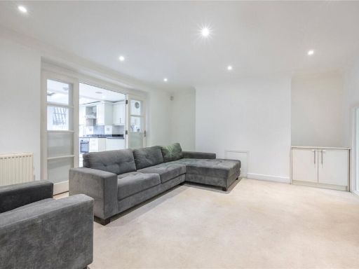 2 bedroom apartment for sale in Dennington Park Road, London, NW6 — £730,000 • 2 bed • 2 bath • 905 ft²
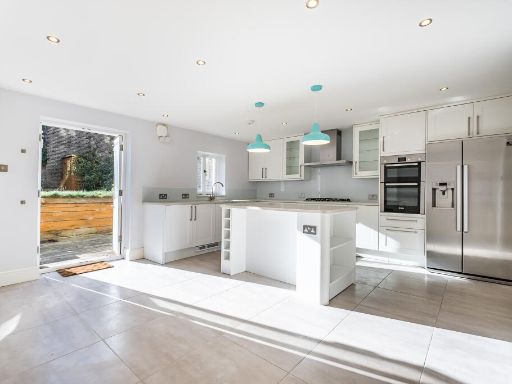 2 bedroom maisonette for sale in Holmdale Road, London, NW6 — £1,100,000 • 2 bed • 1 bath • 1258 ft²
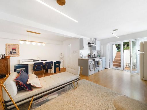 2 bedroom flat for sale in West End Lane, West Hampstead, NW6 — £600,000 • 2 bed • 2 bath • 872 ft²
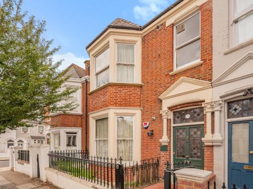 5 bedroom terraced house for sale in Pandora Road, London, NW6 1TR, NW6 — £2,500,000 • 5 bed • 4 bath • 3100 ft²
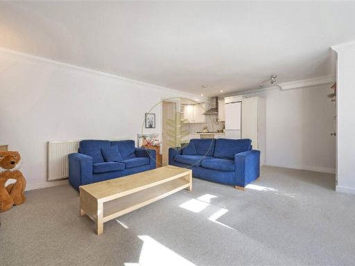 2 bedroom apartment for sale in Kingdon Road, West Hampstead, London, NW6 — £650,000 • 2 bed • 1 bath • 714 ft²
Meta
- {
"@context": "https://schema.org",
"@type": "Residence",
"name": "2 bedroom apartment for sale in Pandora Road, West Hampstea…",
"description": "",
"url": "https://propertypiper.co.uk/property/bbc62b98-6c22-481d-91f2-7311783a844f",
"image": "https://image-a.propertypiper.co.uk/67ac6711-b445-46a7-a093-f2248f7573d4-1024.jpeg",
"address": {
"@type": "PostalAddress",
"streetAddress": "Pandora Road, NW6",
"postalCode": "NW6 1TS",
"addressLocality": "Camden",
"addressRegion": "Hampstead and Kilburn",
"addressCountry": "England"
},
"geo": {
"@type": "GeoCoordinates",
"latitude": 51.5498021,
"longitude": -0.1949756
},
"numberOfRooms": 2,
"numberOfBathroomsTotal": 1,
"floorSize": {
"@type": "QuantitativeValue",
"value": 915,
"unitCode": "FTK"
},
"offers": {
"@type": "Offer",
"price": 825000,
"priceCurrency": "GBP",
"availability": "https://schema.org/InStock"
},
"additionalProperty": [
{
"@type": "PropertyValue",
"name": "Feature",
"value": "Victorian"
},
{
"@type": "PropertyValue",
"name": "Feature",
"value": "living room"
},
{
"@type": "PropertyValue",
"name": "Feature",
"value": "high ceiling"
},
{
"@type": "PropertyValue",
"name": "Feature",
"value": "bay window"
},
{
"@type": "PropertyValue",
"name": "Feature",
"value": "hardwood floor"
},
{
"@type": "PropertyValue",
"name": "Feature",
"value": "fireplace"
},
{
"@type": "PropertyValue",
"name": "Feature",
"value": "period property"
},
{
"@type": "PropertyValue",
"name": "Feature",
"value": "light"
},
{
"@type": "PropertyValue",
"name": "Feature",
"value": "contemporary"
},
{
"@type": "PropertyValue",
"name": "Feature",
"value": "bedroom"
},
{
"@type": "PropertyValue",
"name": "Feature",
"value": "medium size"
},
{
"@type": "PropertyValue",
"name": "Feature",
"value": "standard ceiling"
},
{
"@type": "PropertyValue",
"name": "Feature",
"value": "garden access"
},
{
"@type": "PropertyValue",
"name": "Feature",
"value": "modern decor"
}
]
}
High Res Floorplan Images
Compatible Floorplan Images
FloorplanImages Thumbnail