HG3 1RY - Office for sale in 11 Cardale Court, Cardale Park, Harrogat…
View on Property Piper
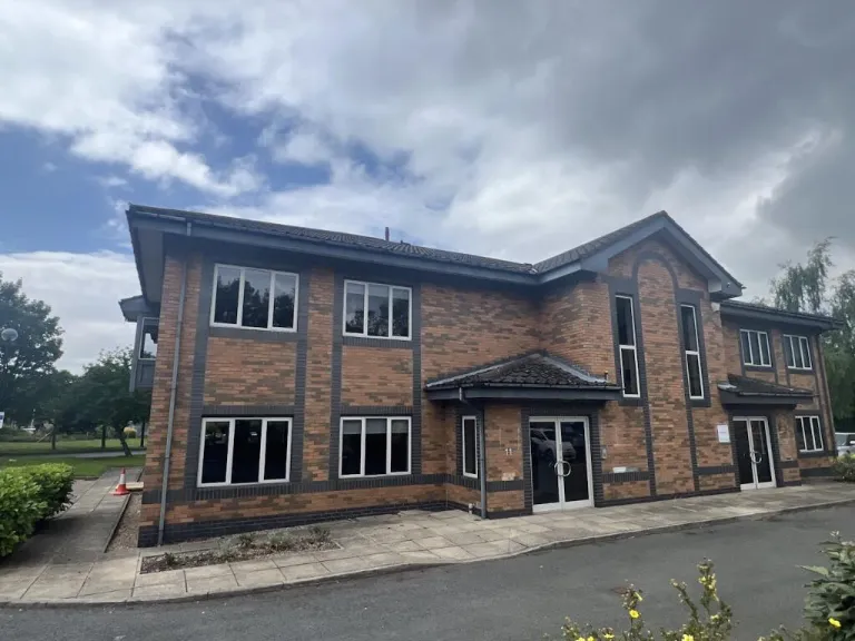
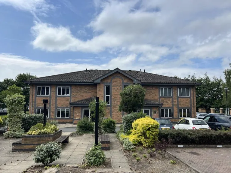
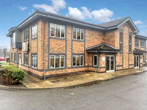
Office for sale in 11 Cardale Court, Cardale Park, Harrogate, HG3 1RY, HG3
Property Details
- Price: £550000
- Bedrooms: 1
- Bathrooms: 1
- Property Type: undefined
- Property SubType: undefined
Brochure Descriptions
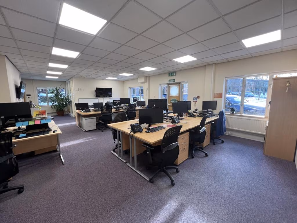
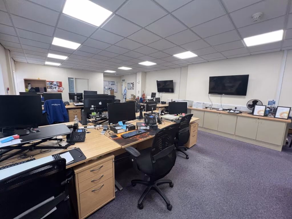
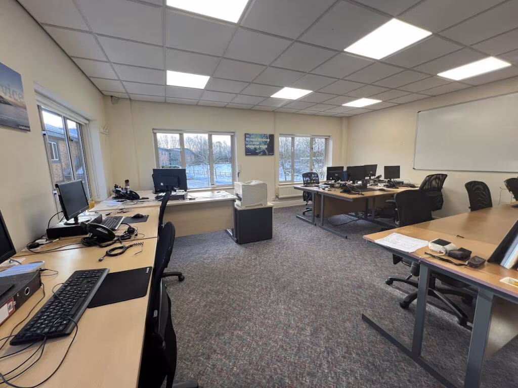
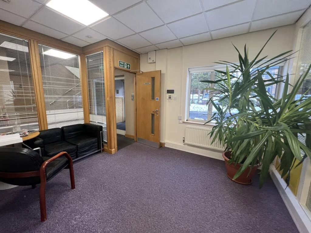
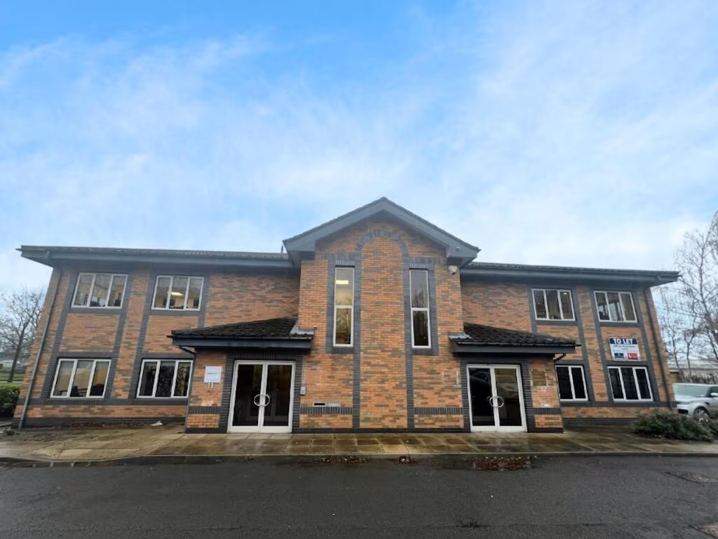
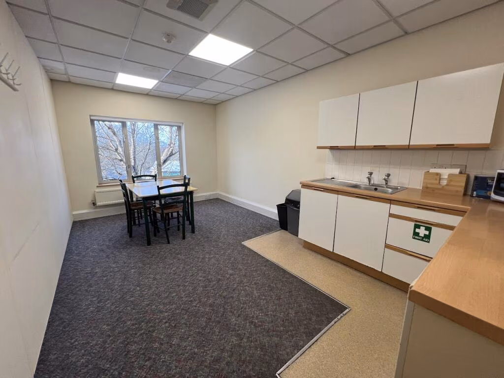
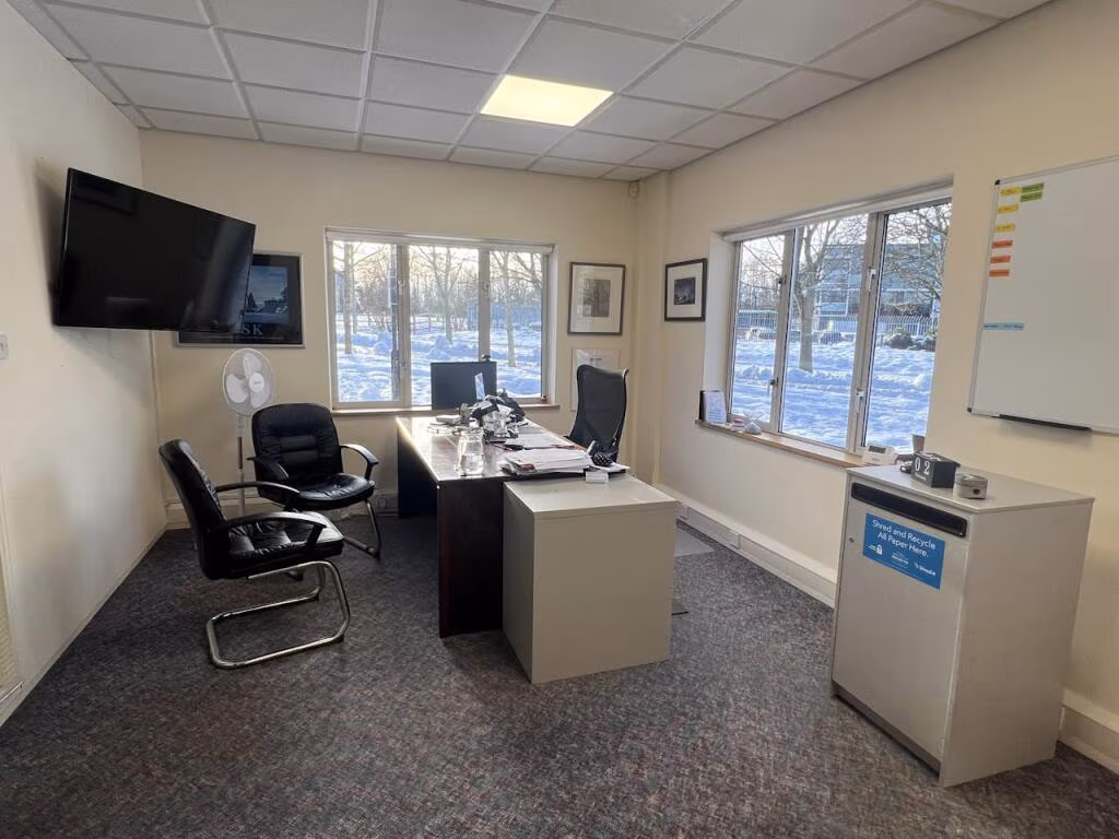
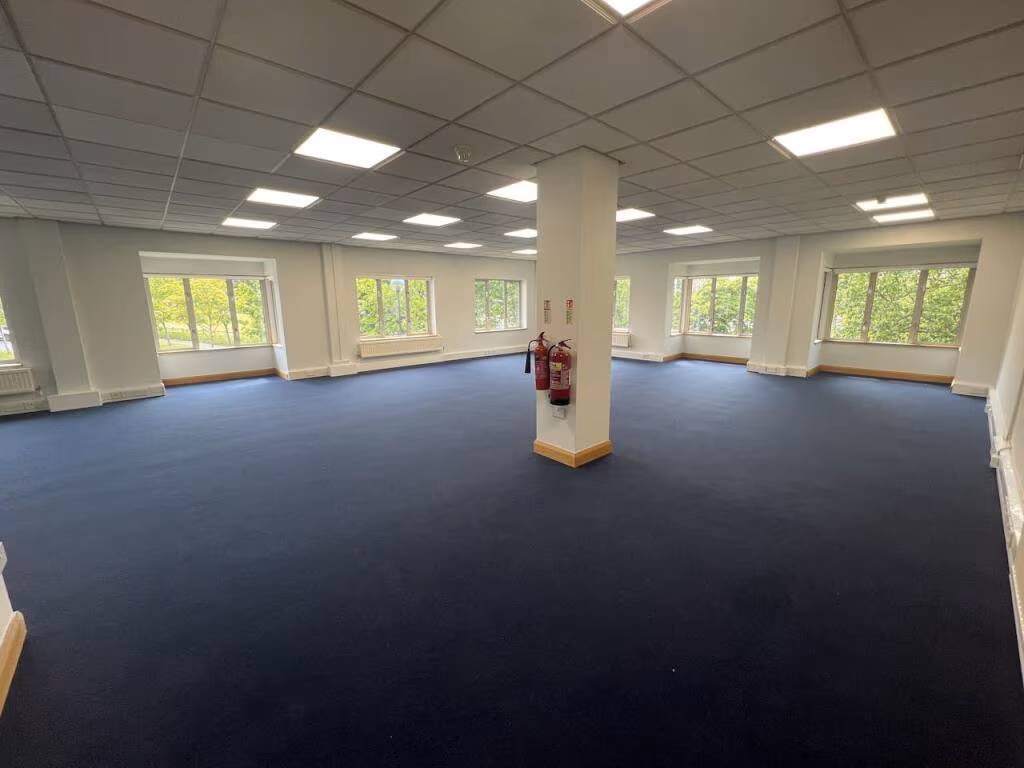
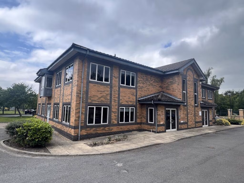
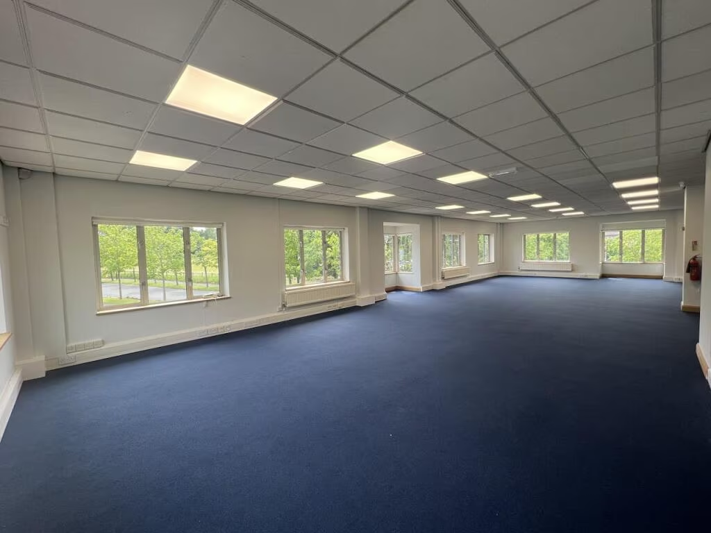
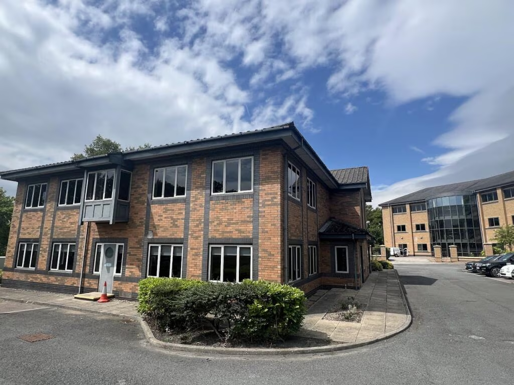
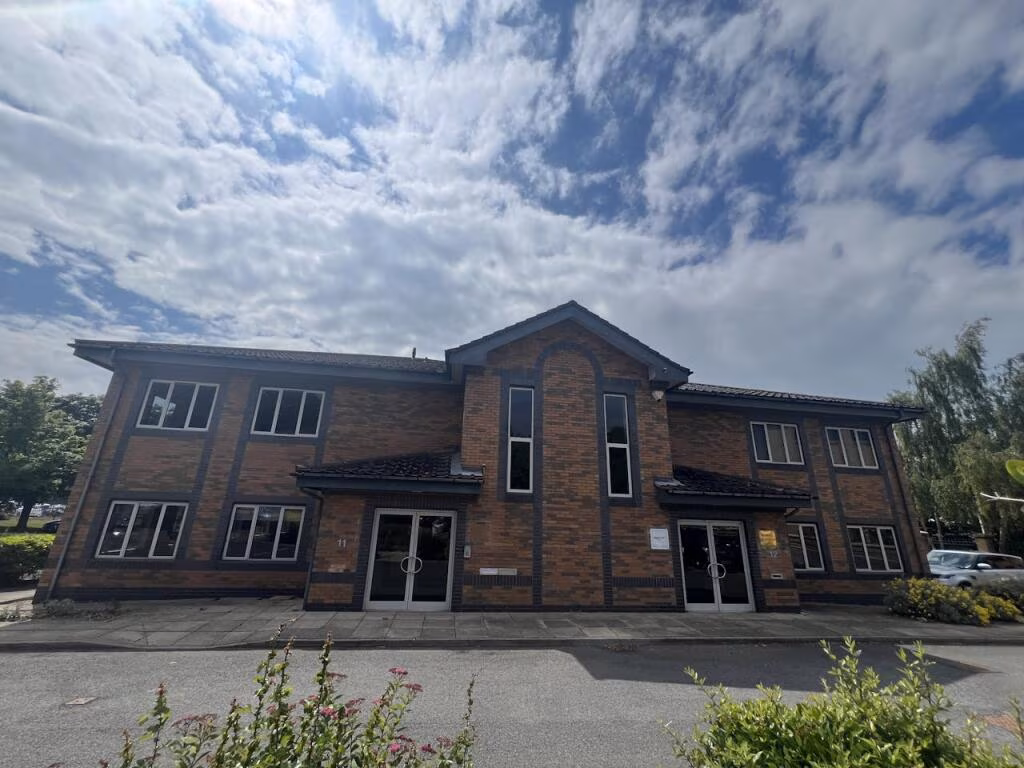
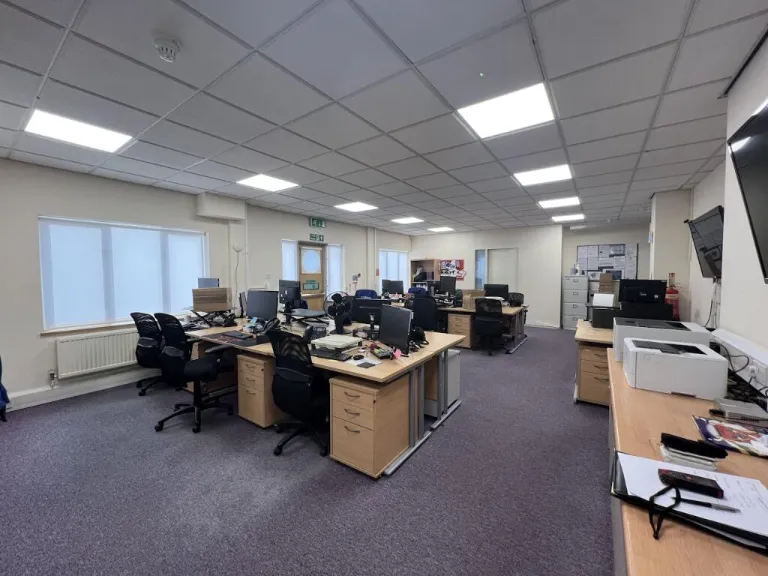
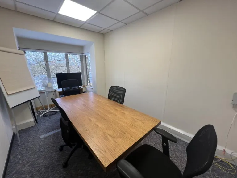
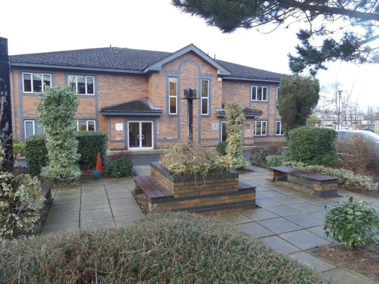
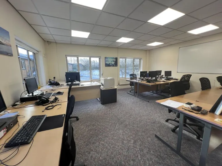
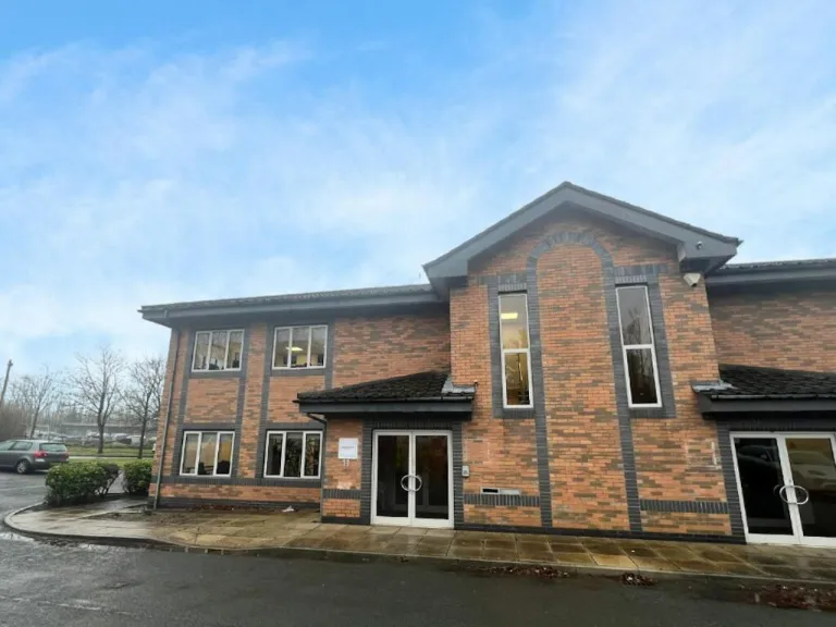
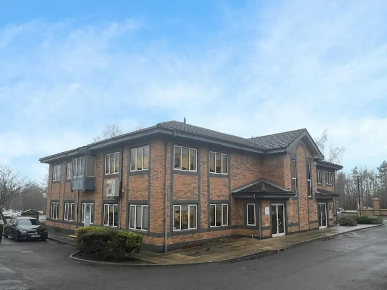
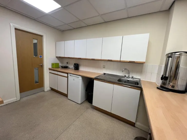
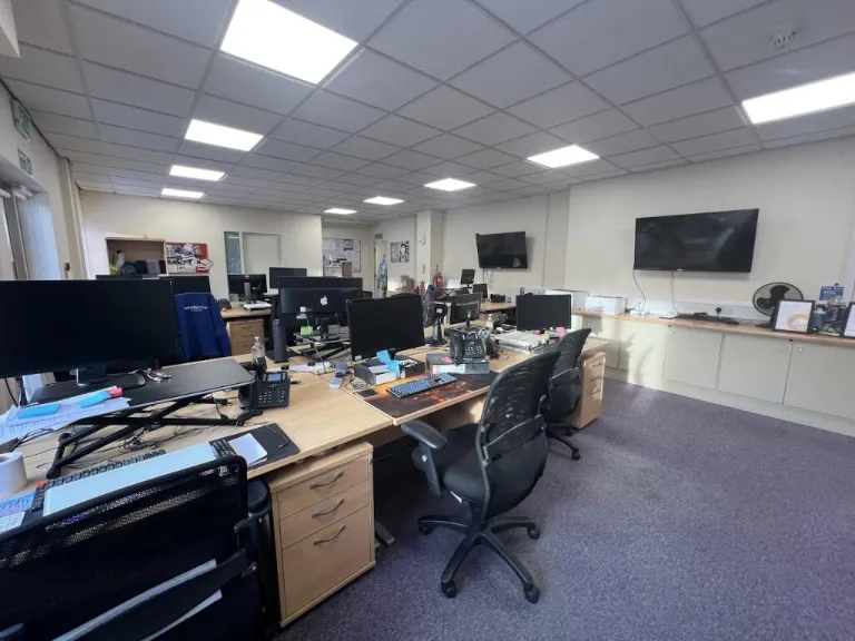
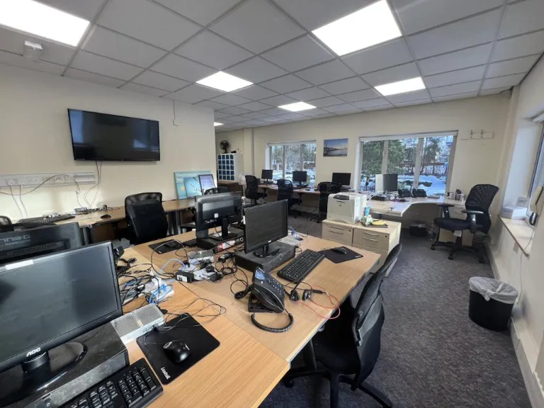
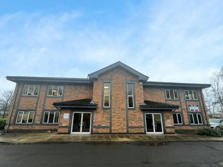
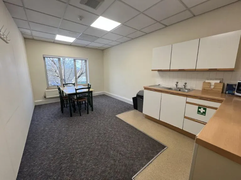
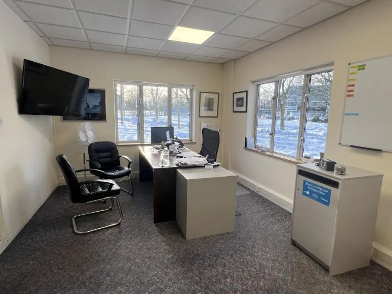
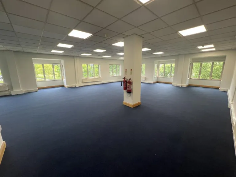
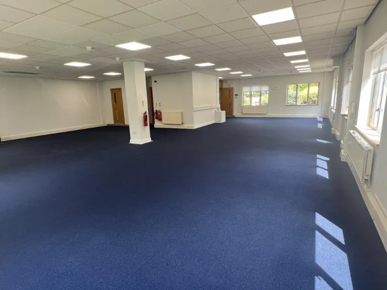
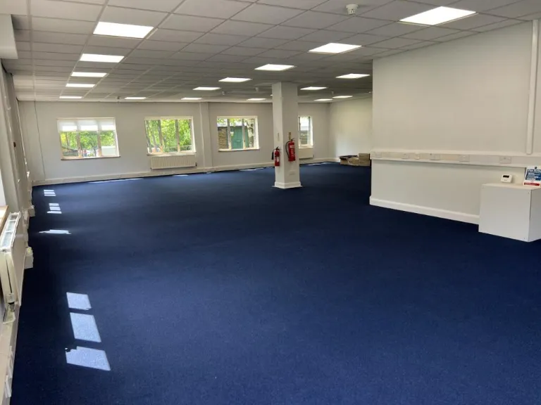
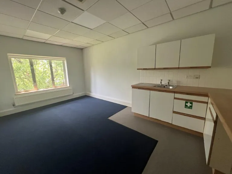
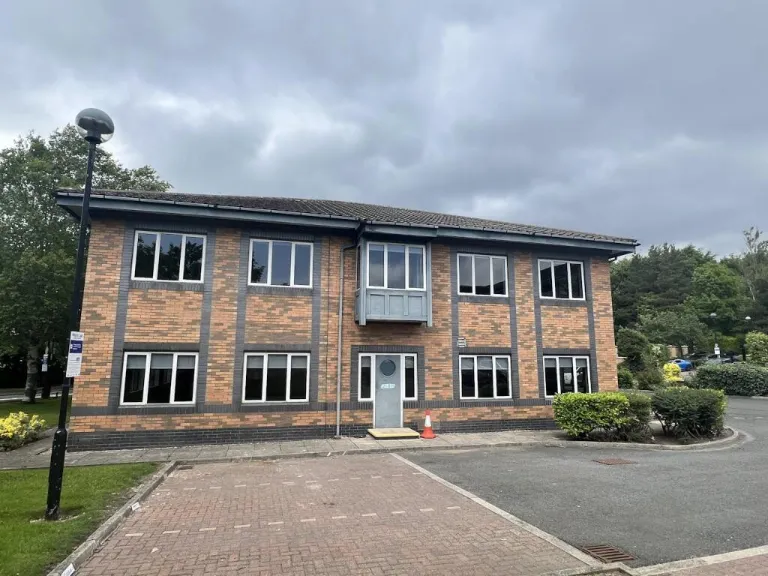
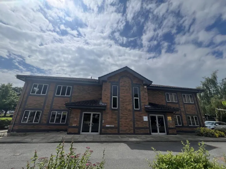
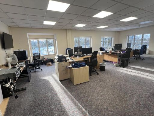
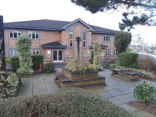
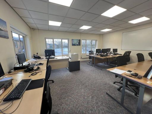
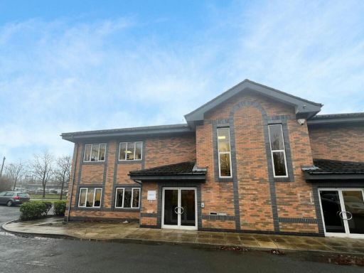
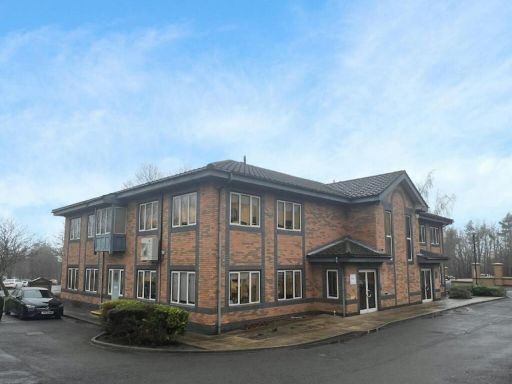
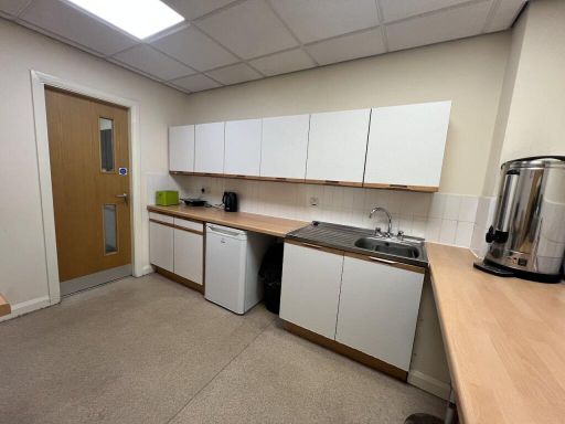
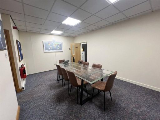
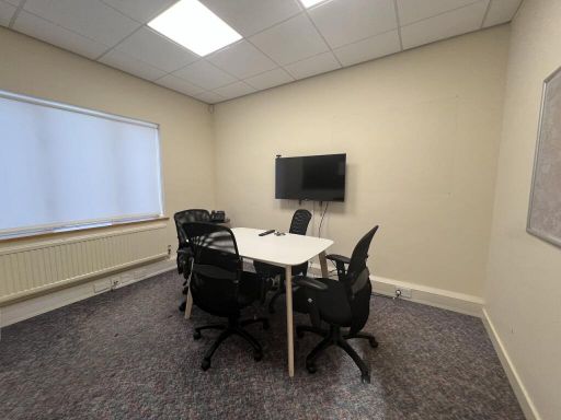
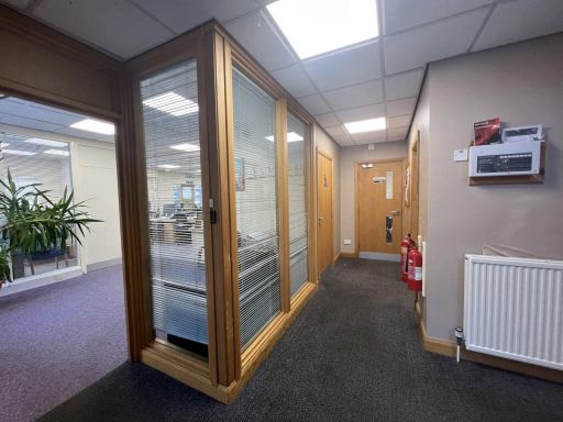
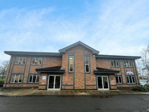
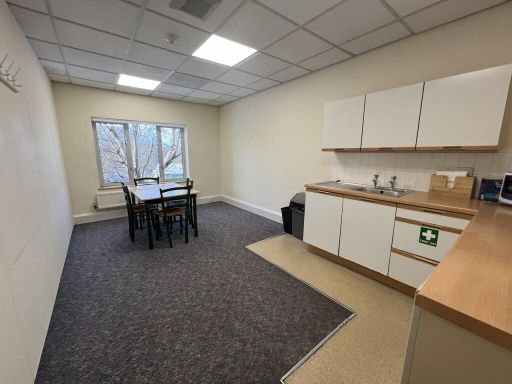
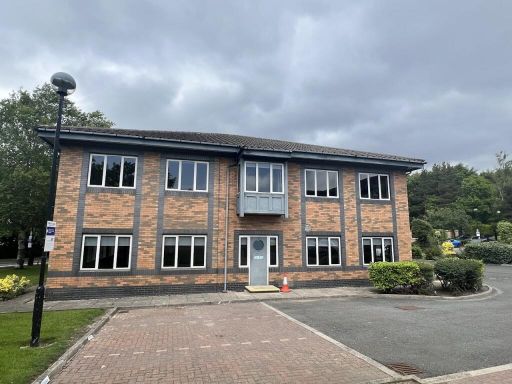
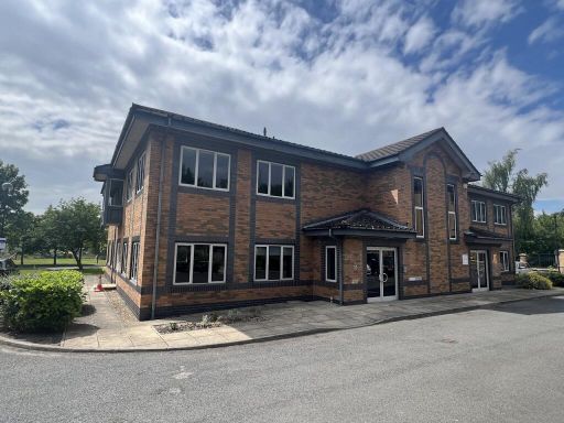
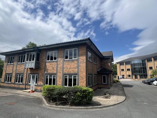
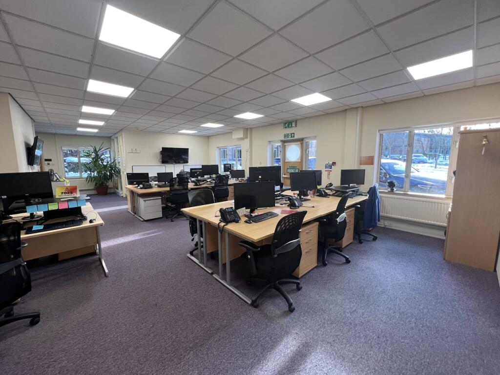
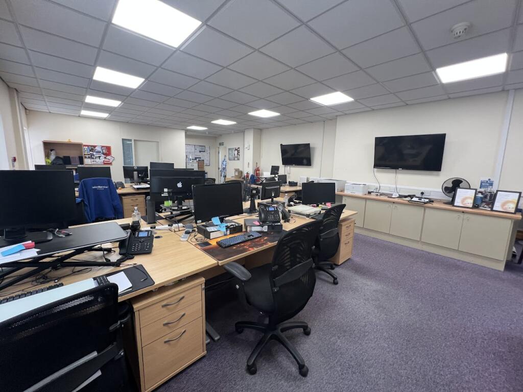
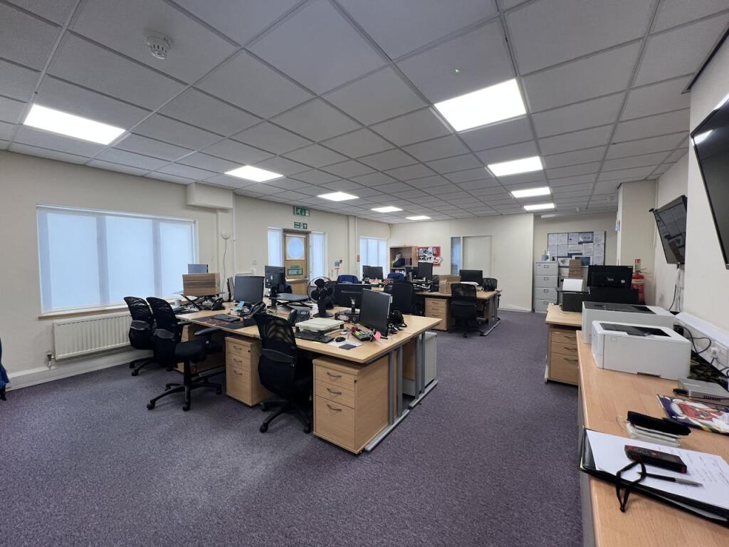
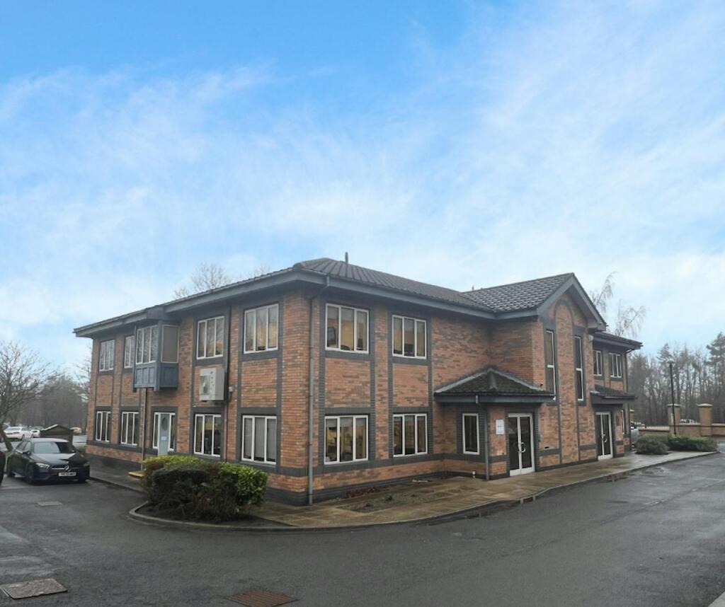
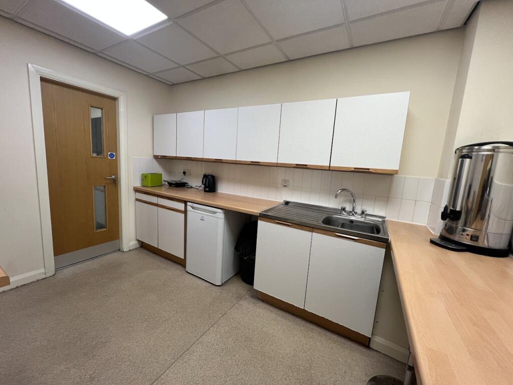
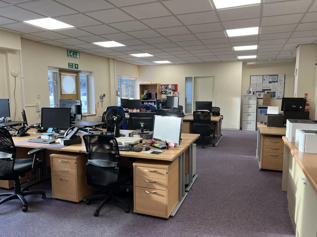
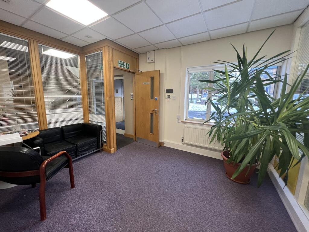
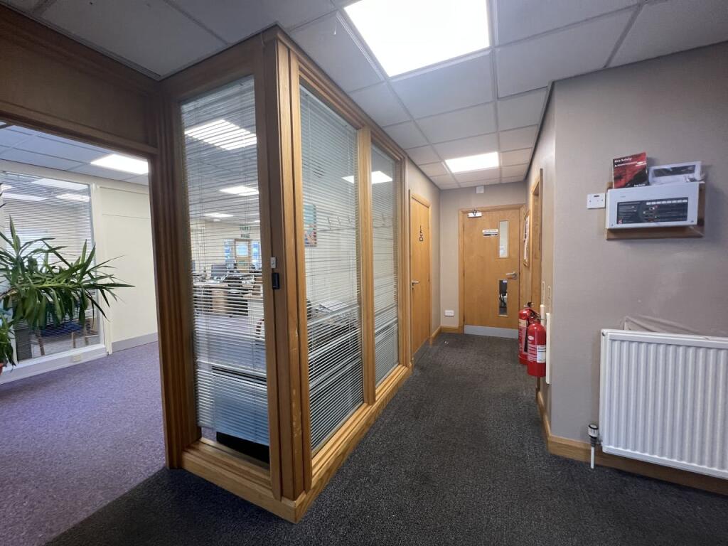
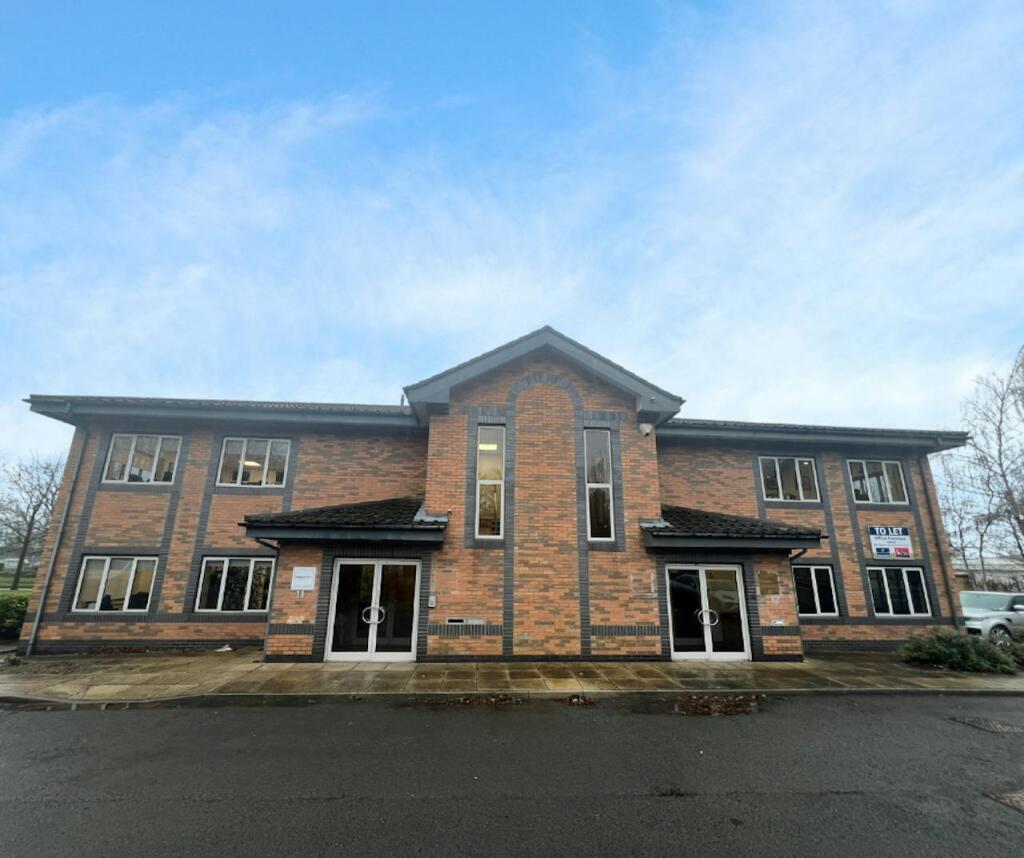
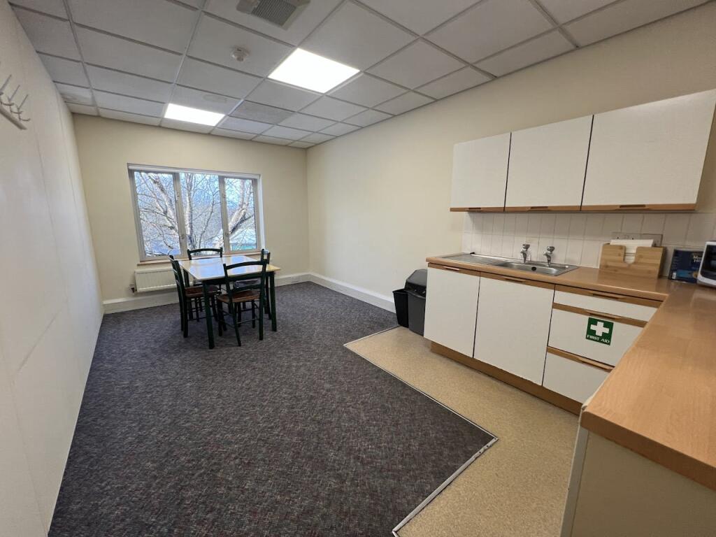
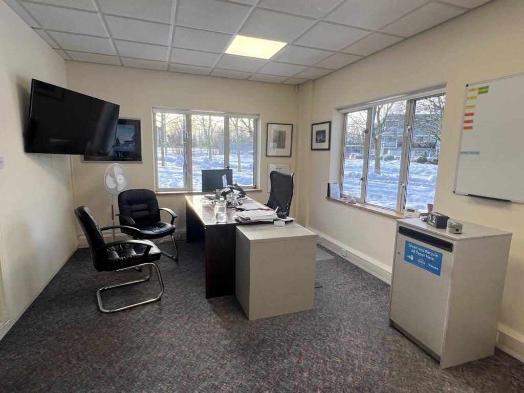
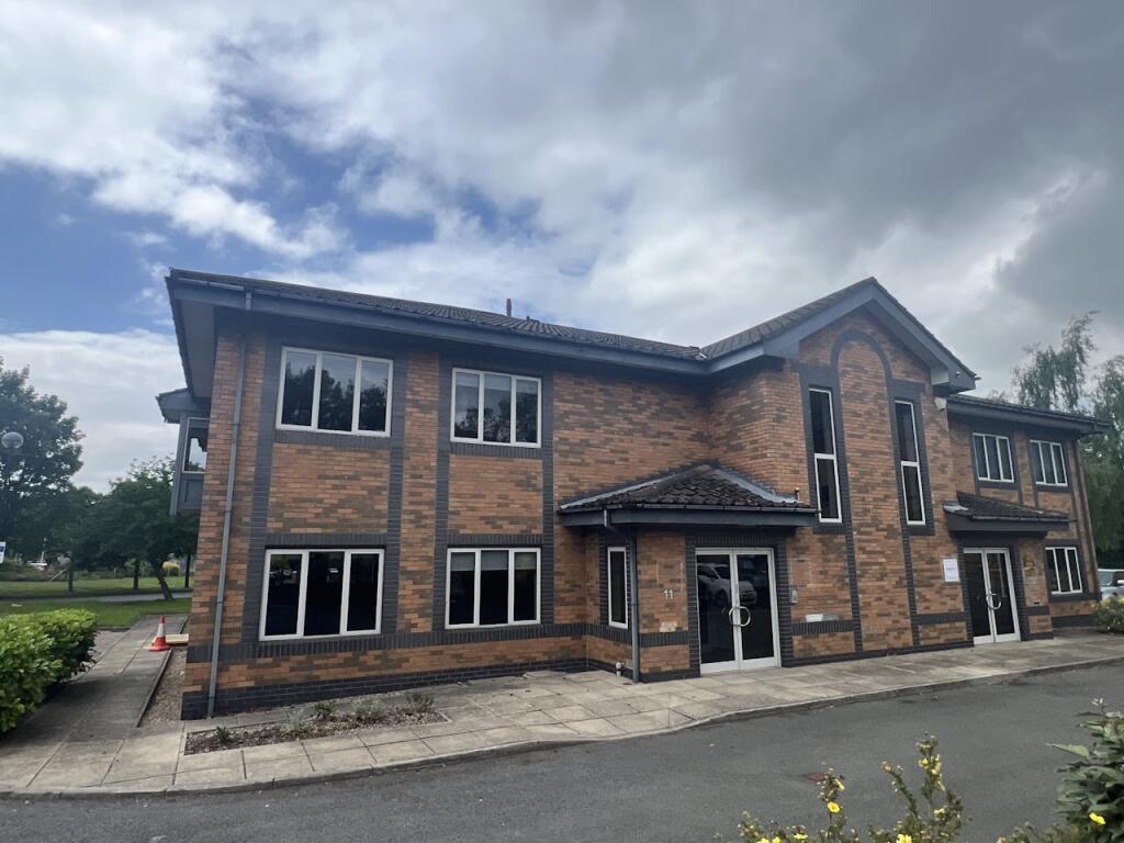
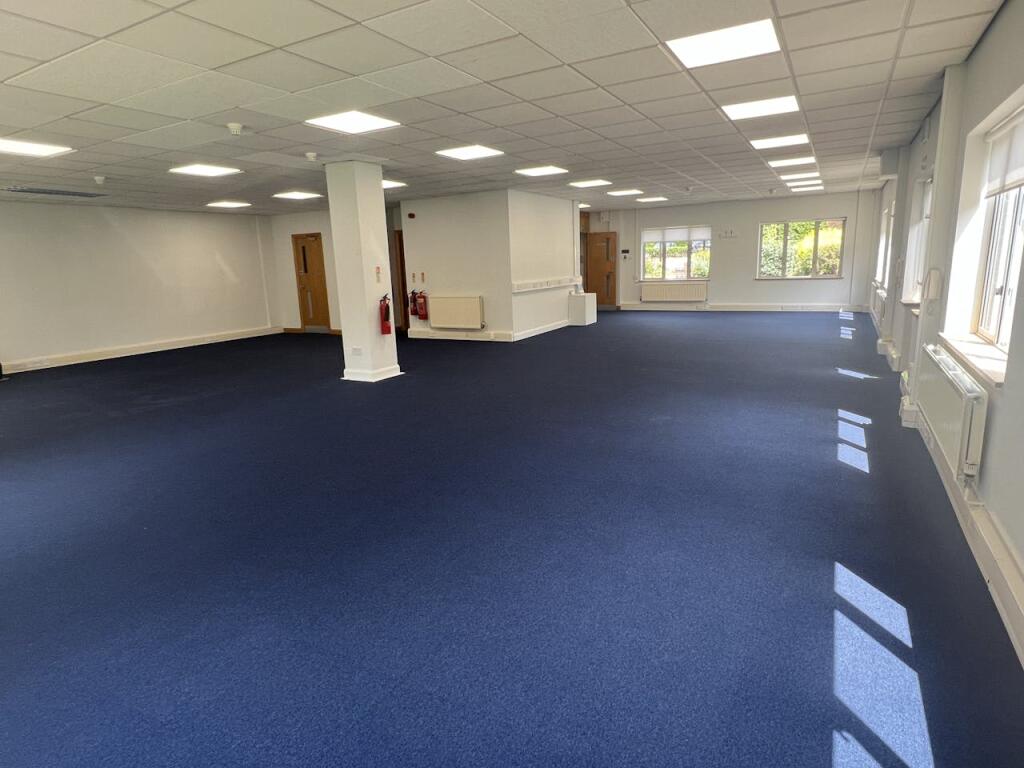
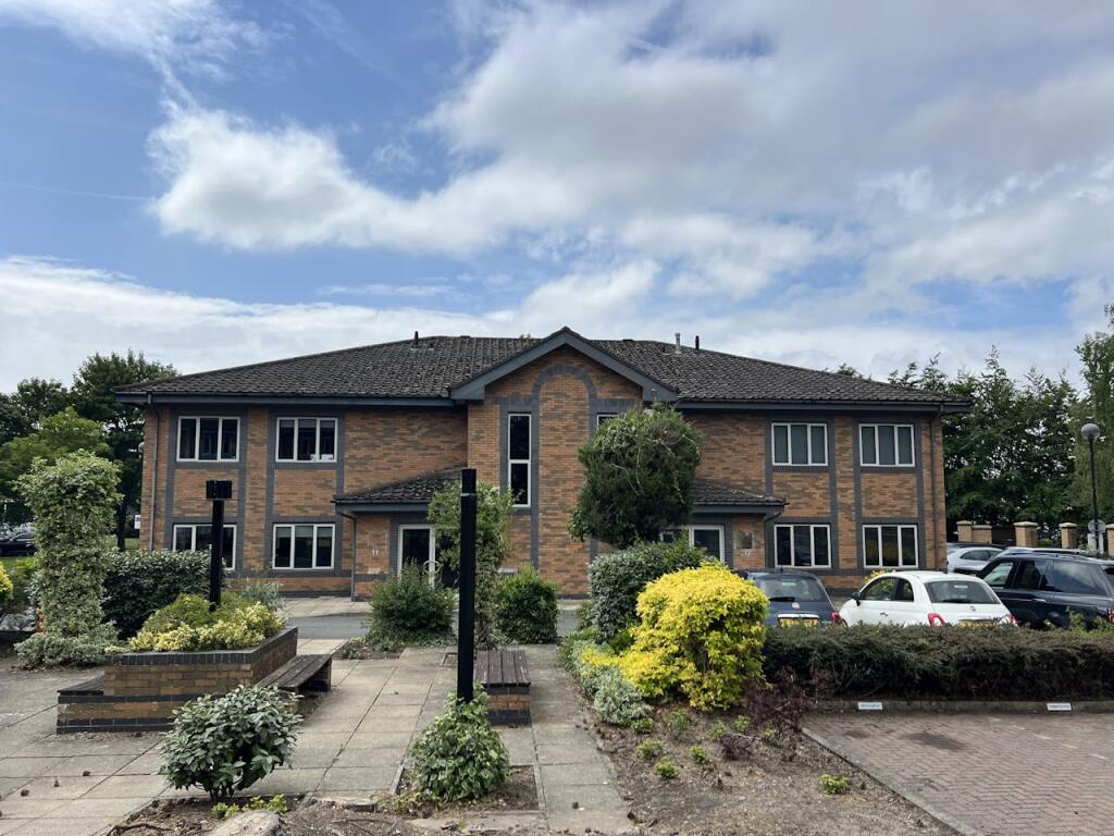
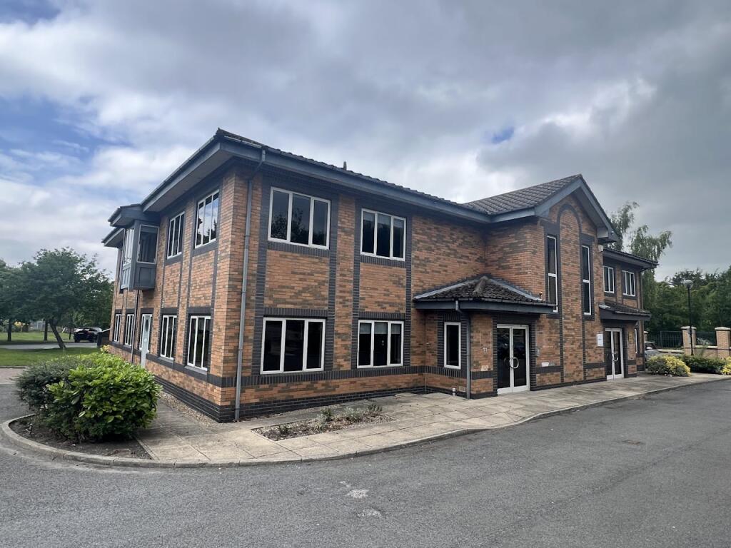
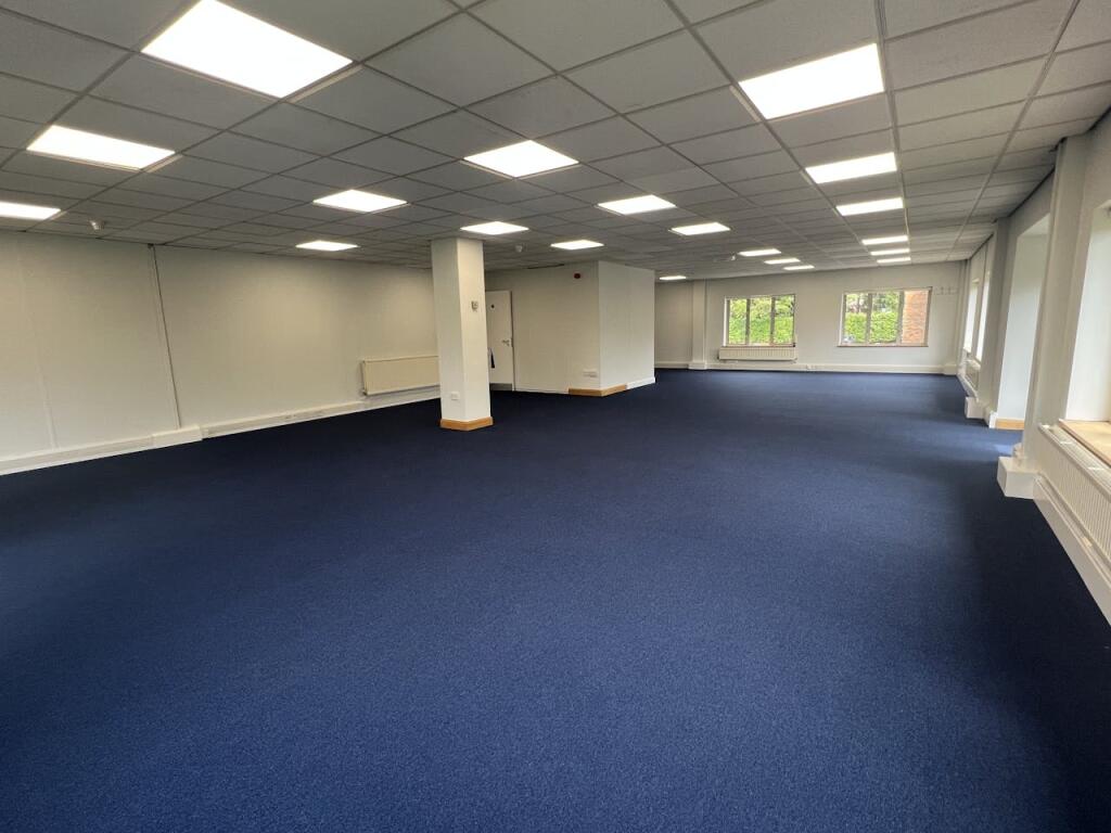
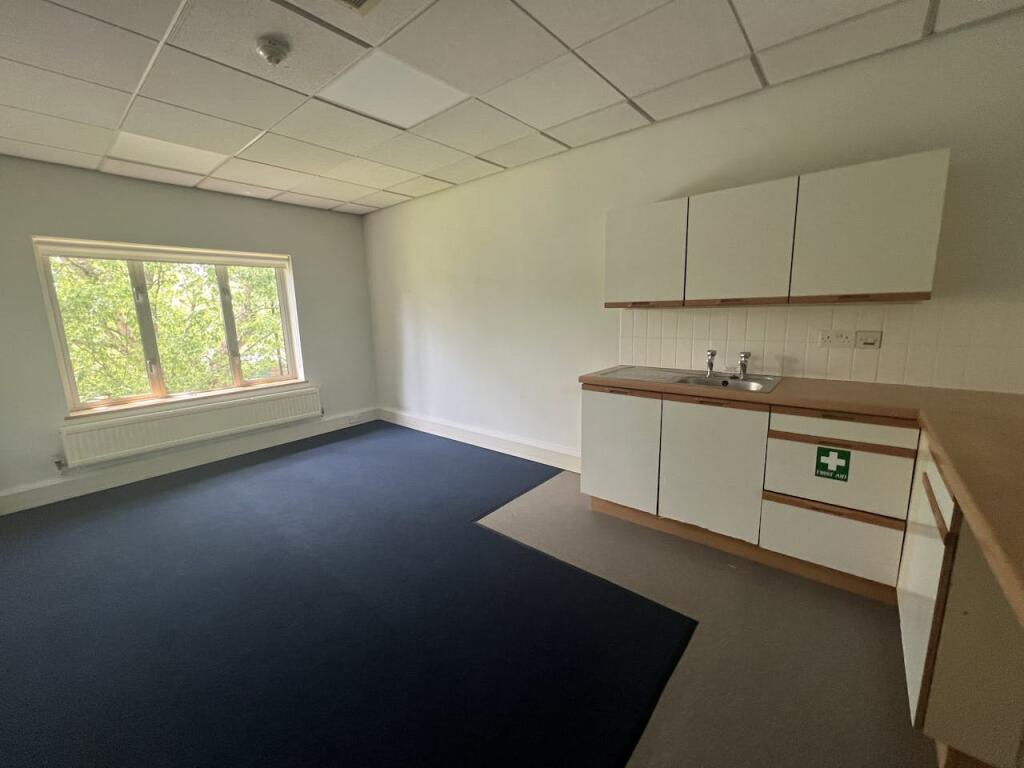
- The property for sale is a self-contained two-storey office building located within an established business park. It offers versatile office space that includes a reception area, offices, a board room, and staff facilities such as WCs and a kitchen. The building benefits from attractive landscaped grounds and ample parking with 12 dedicated spaces. The structure appears robust and modern, suitable for creating a professional working environment. The overall size of the building is moderately large, offering significant space for business operations.
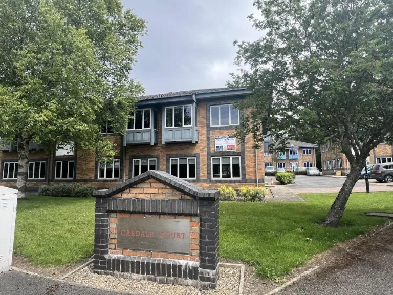
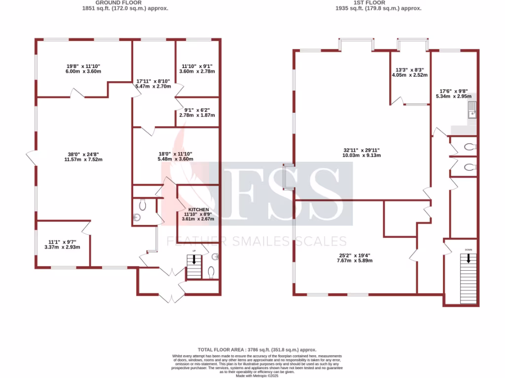
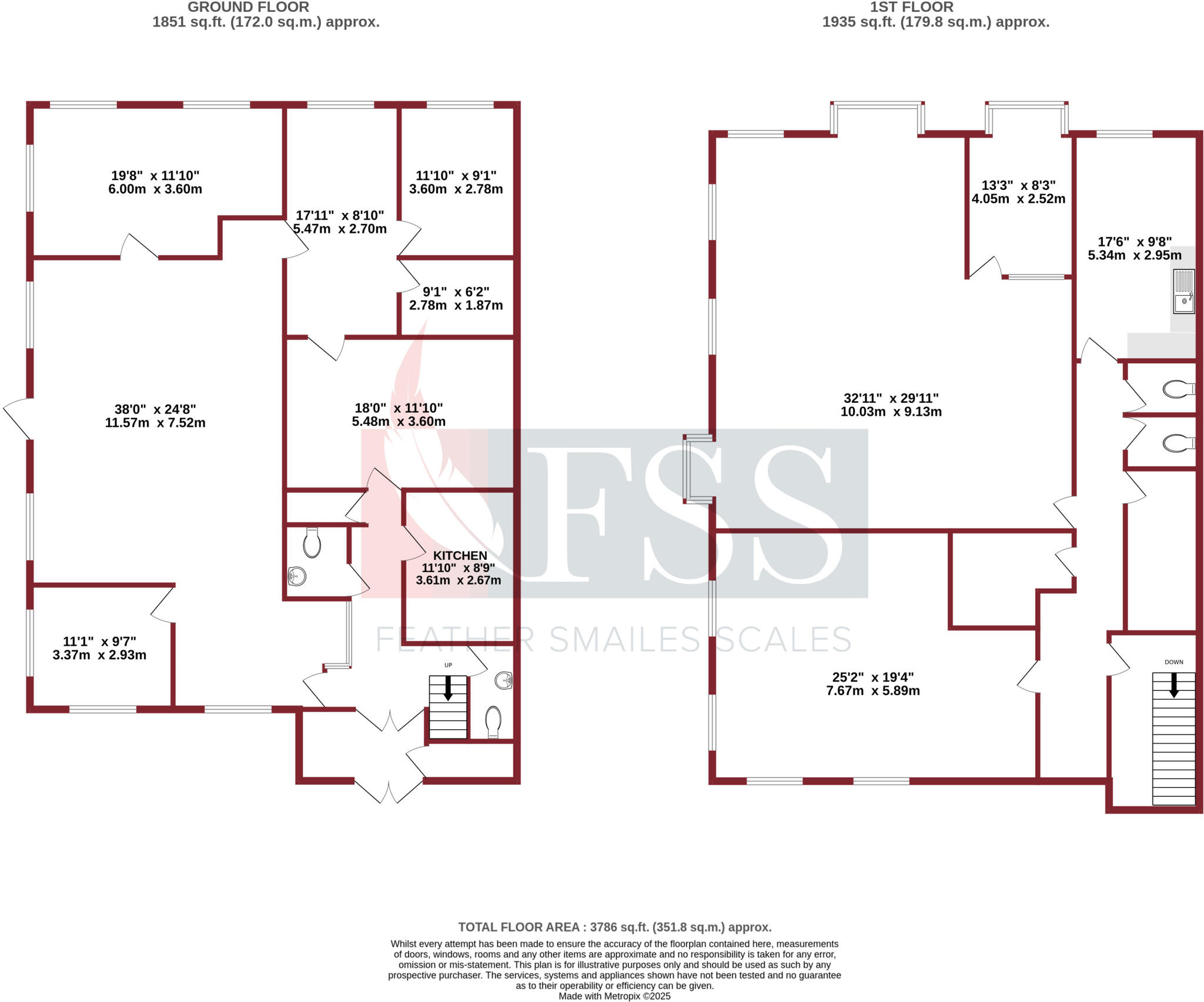
- This is a purpose-built office space located within Cardale Park, one of Harrogate's most prestigious out-of-town business parks. The premise is spacious, with a total floor area of 3,786 sq ft, distributed between a generous ground floor and an equally ample first floor, making it ideal for business operations requiring sizeable office space. The interior presents a modern aesthetic with a self-contained reception area, dedicated male and female washrooms, and double-glazed windows. Additionally, the facility boasts central heating and dedicated parking for 12 vehicles, which is a significant advantage for staff and visitors. The park location, along with its proximity to key local routes and the Harrogate town center, enhances its desirability as a business venue. The development benefits from beautiful surroundings, potentially enriching the work environment for employees and offering expansive views of the well-planned business park landscape.
Image Descriptions
- office space Modern commercial
- office space contemporary
Floorplan Description
- A spacious two-story property with multiple rooms and large living areas.
Rooms
- : Large
- : Average
- : Small
- : Small
- : Small
- : Average
- Kitchen: Small
- : Large
- : Small
- : Large
- : Average
Textual Property Features
Detected Visual Features
- office space
- commercial property
- modern
- open plan
- central heating
- natural light
- parking
- contemporary
- open-plan
- contrived ceiling
- natural lighting
Nearby Schools
- St Robert's Catholic Primary School, A Voluntary Academy
- St Joseph's Catholic Primary School, Harrogate, A Voluntary Academy
- Saltergate Community Junior School
- New Park Primary Academy
- Richard Taylor Church of England Primary School
- Rossett School
- Oatlands Community Junior School
- Oatlands Infant School
- Harrogate Grammar School
- St John Fisher Catholic Academy
- Harrogate High School
- Harrogate, Grove Road Community Primary School
- Coppice Valley Primary School
- Harrogate, Bilton Grange Primary School
- Killinghall Church of England Primary School
- North Rigton Church of England Primary School
- Ashville College
- Rossett Acre Primary School
- Brackenfield School
- Harrogate Ladies' College
- Pannal Primary School
- Beckwithshaw Community Primary School
- St Aidan's Church of England High School
- St Peter's Church of England Primary School
- Saltergate Infant School
- Hampsthwaite Church of England Primary School
- Western Primary School
- Willow Tree Community Primary School
Nearest General Shops
- Id: 380603869
- Tags:
- Name: Harlow Carr Gardens Shop
- Name:en: Harlow Carr Gardens Shop
- Shop: garden_centre
- TagsNormalized:
- Lat: 53.9826828
- Lon: -1.5729395
- FullGeoHash: gcwgh5nxgv7q
- PartitionGeoHash: gcwg
- Images:
- FoodStandards: null
- Distance: 744.6
,- Id: 835889748
- Tags:
- Amenity: social_facility
- Name: Horticap
- Shop: garden_centre
- Social_facility: workshop
- Social_facility:for: disabled
- Website: https://www.horticap.org/
- TagsNormalized:
- social facility
- garden centre
- shop
- Lat: 53.9756557
- Lon: -1.579121
- FullGeoHash: gcwgh1fngz6p
- PartitionGeoHash: gcwg
- Images:
- FoodStandards: null
- Distance: 729.6
,- Id: 9574992995
- Tags:
- Name: Harlow Carr Garden Centre
- Shop: garden_centre
- TagsNormalized:
- Lat: 53.9824257
- Lon: -1.5726314
- FullGeoHash: gcwgh5ny7j90
- PartitionGeoHash: gcwg
- Images:
- FoodStandards: null
- Distance: 710.2
}
Nearest Grocery shops
- Id: 187803633
- Tags:
- Addr:
- Housenumber: 55
- Postcode: HG2 8AY
- Street: Leeds Road
- Brand: Sainsbury's Local
- Brand:wikidata: Q13218434
- Brand:wikipedia: en:Sainsbury's Local
- Building: yes
- Name: Sainsbury's Local
- Old_name: The Mile Post Pub
- Shop: convenience
- Wheelchair: yes
- TagsNormalized:
- sainsburys
- sainsburys local
- convenience
- shop
- Lat: 53.978784
- Lon: -1.5341861
- FullGeoHash: gcwgj4dc4yeu
- PartitionGeoHash: gcwg
- Images:
- FoodStandards: null
- Distance: 2229.8
,- Id: 297420681
- Tags:
- Addr:
- City: Harrogate
- Housenumber: 111
- Postcode: HG2 0NU
- Street: Cold Bath Road
- Alt_name: Sainsbury's Cold Bath Road Local
- Brand: Sainsbury's Local
- Brand:wikidata: Q13218434
- Building: retail
- Name: Sainsbury's Local
- Operator: Sainsbury's
- Phone: +44 1423 504484
- Shop: convenience
- TagsNormalized:
- sainsburys
- sainsburys local
- retail
- convenience
- shop
- Lat: 53.9895843
- Lon: -1.5481812
- FullGeoHash: gcwghu88hgbr
- PartitionGeoHash: gcwg
- Images:
- FoodStandards: null
- Distance: 1941.7
,- Id: 3628692925
- Tags:
- Brand: McColl's
- Brand:wikidata: Q16997477
- Brand:wikipedia: en:McColl's
- Contact:
- Website: https://www.mccolls.co.uk/storelocator/harlow-hill-119-otley-rd/
- Name: McColl's
- Operator: McColls
- Shop: convenience
- TagsNormalized:
- Lat: 53.9817731
- Lon: -1.5576402
- FullGeoHash: gcwghe1f87g7
- PartitionGeoHash: gcwg
- Images:
- FoodStandards: null
- Distance: 891.2
}
Nearest Supermarkets
- Id: 178726375
- Tags:
- Addr:
- Housenumber: 92
- Postcode: HG1 1HD
- Street: Station Parade
- Alt_name: Waitrose Harrogate
- Brand: Waitrose
- Brand:wikidata: Q771734
- Brand:wikipedia: en:Waitrose & Partners
- Building: supermarket
- Name: Waitrose
- Official_name: Waitrose & Partners
- Operator: Waitrose & Partners
- Shop: supermarket
- TagsNormalized:
- Lat: 53.9899155
- Lon: -1.5362539
- FullGeoHash: gcwgjh9649wn
- PartitionGeoHash: gcwg
- Images:
- FoodStandards: null
- Distance: 2552.6
,- Id: 187802299
- Tags:
- Addr:
- Housenumber: 73
- Postcode: HG2 8BE
- Street: Leeds Road
- Brand: Co-op Food
- Brand:wikidata: Q3277439
- Brand:wikipedia: en:Co-op Food
- Building: yes
- Name: Co-op Food
- Operator: The Co-operative Group
- Operator:wikidata: Q117202
- Shop: supermarket
- Wheelchair: yes
- TagsNormalized:
- co-op
- co-op food
- food
- supermarket
- shop
- Lat: 53.9779143
- Lon: -1.5338421
- FullGeoHash: gcwgj47h4us2
- PartitionGeoHash: gcwg
- Images:
- FoodStandards: null
- Distance: 2244
,- Id: 361427541
- Tags:
- Addr:
- Brand: Co-op Food
- Brand:wikidata: Q3277439
- Brand:wikipedia: en:Co-op Food
- Building: yes
- Name: Co-op Food
- Operator: The Co-operative Group
- Operator:wikidata: Q117202
- Shop: supermarket
- TagsNormalized:
- co-op
- co-op food
- food
- supermarket
- shop
- Lat: 53.9840994
- Lon: -1.5508594
- FullGeoHash: gcwghew8nme2
- PartitionGeoHash: gcwg
- Images:
- FoodStandards: null
- Distance: 1399.9
}
Nearest Religious buildings
- Id: 346000072
- Tags:
- Amenity: place_of_worship
- Building: church
- Denomination: anglican
- Name: St Michael & All Angels
- Religion: christian
- Wikidata: Q16246221
- Wikipedia: en:Church of St Michael and All Angels, Beckwithshaw
- TagsNormalized:
- place of worship
- church
- anglican
- christian
- Lat: 53.9737001
- Lon: -1.5926973
- FullGeoHash: gcwg5c85x6yy
- PartitionGeoHash: gcwg
- Images:
- FoodStandards: null
- Distance: 1642
,- Id: 767717518
- Tags:
- Amenity: place_of_worship
- Building: yes
- Denomination: methodist
- Name: Harlow Hill Methodist Church
- Religion: christian
- TagsNormalized:
- place of worship
- methodist
- church
- christian
- Lat: 53.9816168
- Lon: -1.5579501
- FullGeoHash: gcwghe199nsp
- PartitionGeoHash: gcwg
- Images:
- FoodStandards: null
- Distance: 864.5
,- Id: 117119095
- Tags:
- Amenity: place_of_worship
- Building: church
- Denomination: anglican
- Name: All Saints
- Religion: christian
- Wikidata: Q26581906
- TagsNormalized:
- place of worship
- church
- anglican
- christian
- Lat: 53.980547
- Lon: -1.565056
- FullGeoHash: gcwgh6u77x39
- PartitionGeoHash: gcwg
- Images:
- FoodStandards: null
- Distance: 479
}
Nearest Medical buildings
- Id: 7528773066
- Tags:
- Addr:
- City: Harrogate
- Housenumber: 1
- Postcode: HG1 1NS
- Street: Cambridge Road
- Amenity: pharmacy
- Brand: Superdrug
- Brand:wikidata: Q7643261
- Brand:wikipedia: en:Superdrug
- Healthcare: pharmacy
- Name: Superdrug
- Note: is in Superdrug
- TagsNormalized:
- pharmacy
- superdrug
- health
- healthcare
- Lat: 53.9934557
- Lon: -1.5410445
- FullGeoHash: gcwghvjyej9u
- PartitionGeoHash: gcwg
- Images:
- FoodStandards: null
- Distance: 2574.6
,- Id: 4184890794
- Tags:
- Amenity: pharmacy
- Healthcare: pharmacy
- Name: Marsden Pharmacy
- Wheelchair: yes
- TagsNormalized:
- Lat: 53.9774036
- Lon: -1.5336766
- FullGeoHash: gcwgj471ntrf
- PartitionGeoHash: gcwg
- Images:
- FoodStandards: null
- Distance: 2251.9
,- Id: 377140695
- Tags:
- Addr:
- City: Harrogate
- Housenumber: 111
- Postcode: HG2 0NU
- Street: Cold Bath Road
- Amenity: pharmacy
- Building: yes
- Healthcare: pharmacy
- Name: Co-operative
- Phone: +44 1423 504484
- TagsNormalized:
- Lat: 53.9891771
- Lon: -1.5485978
- FullGeoHash: gcwghu2mg01f
- PartitionGeoHash: gcwg
- Images:
- FoodStandards: null
- Distance: 1889.9
,- Id: 165756017
- Tags:
- Amenity: hospital
- Building: hospital
- Emergency: no
- Healthcare: hospital
- Name: Duchy Hospital
- Source: Local Knowlege
- Wikidata: Q30265240
- TagsNormalized:
- Lat: 53.9876034
- Lon: -1.5479096
- FullGeoHash: gcwghu0ue4dy
- PartitionGeoHash: gcwg
- Images:
- FoodStandards: null
- Distance: 1797.4
}
Nearest Airports
- Id: 11519546
- Tags:
- Addr:
- City: Leeds
- Postcode: LS19 7TU
- Aerodrome: international
- Aerodrome:type: public
- Aeroway: aerodrome
- Iata: LBA
- Icao: EGNM
- Name: Leeds Bradford Airport
- Operator: Leeds Bradford Airport Limited
- Operator:type: private
- Ref: LBA
- Type: multipolygon
- Website: https://www.leedsbradfordairport.co.uk/
- Wikidata: Q8699
- Wikipedia: en:Leeds Bradford Airport
- TagsNormalized:
- airport
- international airport
- Lat: 53.8667047
- Lon: -1.660138
- FullGeoHash: gcwf6nph7cx3
- PartitionGeoHash: gcwf
- Images:
- Q8699-1
- Q8699-2
- Q8699-3
- Q8699-4
- FoodStandards: null
- Distance: 13628.1
}
Nearest Leisure Facilities
- Id: 538335
- Tags:
- Addr:
- Postcode: HG3 1QB
- Street: Crag Lane
- Attraction: garden
- Description: One of the 4 national botanic gardens run by the Royal Horticultural Society.
- Fee: yes
- Leisure: garden
- Name: RHS Garden Harlow Carr
- Tourism: attraction
- Type: multipolygon
- Website: https://www.rhs.org.uk/
- Wikidata: Q4617946
- TagsNormalized:
- Lat: 53.9815456
- Lon: -1.5755752
- FullGeoHash: gcwgh5h9q3my
- PartitionGeoHash: gcwg
- Images:
- FoodStandards: null
- Distance: 734.3
,- Id: 122619508
- Tags:
- Leisure: park
- Name: Harlow Hill Park
- Surface: grass
- TagsNormalized:
- Lat: 53.9818297
- Lon: -1.5618156
- FullGeoHash: gcwgh7ndzn3v
- PartitionGeoHash: gcwg
- Images:
- FoodStandards: null
- Distance: 709.3
,- Id: 117119118
- Tags:
- Leisure: pitch
- Sport: tennis
- TagsNormalized:
- Lat: 53.9816395
- Lon: -1.562471
- FullGeoHash: gcwgh7n1zfcn
- PartitionGeoHash: gcwg
- Images:
- FoodStandards: null
- Distance: 667.6
,- Id: 122619039
- Tags:
- Leisure: playground
- Name: Harlow Hill Play Area
- TagsNormalized:
- Lat: 53.9810714
- Lon: -1.5614514
- FullGeoHash: gcwgh6yyx913
- PartitionGeoHash: gcwg
- Images:
- FoodStandards: null
- Distance: 657.8
,- Id: 8755659272
- Tags:
- Access: customers
- Leisure: playground
- TagsNormalized:
- Lat: 53.9800212
- Lon: -1.5727928
- FullGeoHash: gcwgh4y8rm29
- PartitionGeoHash: gcwg
- Images:
- FoodStandards: null
- Distance: 487.1
}
Nearest Tourist attractions
- Id: 461982642
- Tags:
- Name: The Royal Pump Room Museum
- Tourism: museum
- Wikidata: Q7374742
- Wikipedia: en:Royal Pump Room, Harrogate
- TagsNormalized:
- Lat: 53.9935628
- Lon: -1.5468529
- FullGeoHash: gcwghv1x79wg
- PartitionGeoHash: gcwg
- Images:
- FoodStandards: null
- Distance: 2339.7
,- Id: 39017804
- Tags:
- Building: yes
- Name: Sun Pavilion
- Tourism: attraction
- TagsNormalized:
- pavilion
- attraction
- tourism
- Lat: 53.9921571
- Lon: -1.5513641
- FullGeoHash: gcwghsyr4ee4
- PartitionGeoHash: gcwg
- Images:
- FoodStandards: null
- Distance: 2044.1
,- Id: 380094964
- Tags:
- TagsNormalized:
- Lat: 53.9786844
- Lon: -1.5903996
- FullGeoHash: gcwg5f9bth04
- PartitionGeoHash: gcwg
- Images:
- FoodStandards: null
- Distance: 1477
}
Nearest Bus stations and stops
- Id: 2376657576
- Tags:
- Bus: yes
- Highway: bus_stop
- Public_transport: platform
- TagsNormalized:
- Lat: 53.9877212
- Lon: -1.5396855
- FullGeoHash: gcwghunv68xm
- PartitionGeoHash: gcwg
- Images:
- FoodStandards: null
- Distance: 2229.5
,- Id: 3524865485
- Tags:
- Bus: yes
- Highway: bus_stop
- Public_transport: platform
- TagsNormalized:
- Lat: 53.9775581
- Lon: -1.5341218
- FullGeoHash: gcwgj46fh65u
- PartitionGeoHash: gcwg
- Images:
- FoodStandards: null
- Distance: 2223.5
,- Id: 3524865605
- Tags:
- Bus: yes
- Highway: bus_stop
- Public_transport: platform
- TagsNormalized:
- Lat: 53.9816844
- Lon: -1.5360772
- FullGeoHash: gcwgj516ng3f
- PartitionGeoHash: gcwg
- Images:
- FoodStandards: null
- Distance: 2167.4
,- Id: 3524175358
- Tags:
- Bus: yes
- Highway: bus_stop
- Public_transport: platform
- TagsNormalized:
- Lat: 53.9833729
- Lon: -1.5371778
- FullGeoHash: gcwgj52evnj4
- PartitionGeoHash: gcwg
- Images:
- FoodStandards: null
- Distance: 2155.9
,- Id: 9006727302
- Tags:
- Bus: yes
- Highway: bus_stop
- Public_transport: platform
- TagsNormalized:
- Lat: 53.9705716
- Lon: -1.5447088
- FullGeoHash: gcwghc51metx
- PartitionGeoHash: gcwg
- Images:
- FoodStandards: null
- Distance: 1670.5
}
Nearest Hotels
- Id: 102851298
- Tags:
- Building: hotel
- Name: The Crown Hotel
- Tourism: hotel
- Wikidata: Q26602170
- TagsNormalized:
- Lat: 53.9937089
- Lon: -1.545933
- FullGeoHash: gcwghv621hug
- PartitionGeoHash: gcwg
- Images:
- FoodStandards: null
- Distance: 2388.8
,- Id: 341779922
- Tags:
- Brand: Travelodge
- Brand:wikidata: Q9361374
- Brand:wikipedia: en:Travelodge UK
- Building: hotel
- Internet_access: wlan
- Internet_access:fee: customers
- Internet_access:ssid: Travelodge WiFi
- Name: Travelodge West Park
- Tourism: hotel
- TagsNormalized:
- Lat: 53.9891141
- Lon: -1.5388382
- FullGeoHash: gcwghurmqkr4
- PartitionGeoHash: gcwg
- Images:
- FoodStandards: null
- Distance: 2363.4
,- Id: 219555645
- Tags:
- Building: hotel
- Name: White Hart Hotel
- Tourism: hotel
- Wikidata: Q17536678
- Wikipedia: en:White Hart Hotel, Harrogate
- TagsNormalized:
- Lat: 53.9926604
- Lon: -1.5460684
- FullGeoHash: gcwghv44jcru
- PartitionGeoHash: gcwg
- Images:
- FoodStandards: null
- Distance: 2291.6
}
Tags
- office space
- commercial property
- modern
- open plan
- central heating
- natural light
- parking
- office space
- contemporary
- open-plan
- contrived ceiling
- natural lighting
- commercial property
Local Market Stats
- Average Price/sqft: £336
- Avg Income: £49300
- Rental Yield: 3%
- Social Housing: 4%
- Planning Success Rate: 88%
AirBnB Data
- 1km average: £114/night
- Listings in 1km: 2
Similar Properties
 Office for sale in Cardale Park, Harrogate, North Yorkshire, HG3 — £550,000 • 1 bed • 1 bath • 3786 ft²
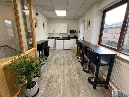 Office for sale in 34 Harrogate Business Park, Freemans Way, Harrogate, HG3 1DH, HG3 — £325,000 • 1 bed • 1 bath • 1994 ft²
 Office for sale in Nidderdale House - Office Building, Beckwith Knowle, Harrogate, HG3 1SA, HG3 — £1,850,000 • 1 bed • 1 bath • 18350 ft²
 Warehouse for sale in Cardale 23, Beckwith Knowle, Harrogate, HG3 1SA, HG3 — £1,950,000 • 1 bed • 1 bath • 23432 ft²
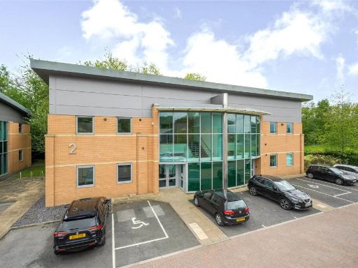 Office for sale in Greengate, Cardale Park, Harrogate, North Yorkshire, HG3 — £650,000 • 1 bed • 1 bath • 5755 ft²
 Office for sale in Harrogate House, 33-35 Parliament Street, Harrogate, HG1 2RE, HG1 — POA • 1 bed • 1 bath • 1636 ft²
Meta
- {
"@context": "https://schema.org",
"@type": "Residence",
"name": "Office for sale in 11 Cardale Court, Cardale Park, Harrogat…",
"description": "",
"url": "https://propertypiper.co.uk/property/bb326385-9759-4398-a6d9-3644d1861764",
"image": "https://image-a.propertypiper.co.uk/46c87d6c-a62e-45f1-8538-b3521d4c3ce0-1024.jpeg",
"address": {
"@type": "PostalAddress",
"streetAddress": "11, CARDALE PARK",
"postalCode": "HG3 1RY",
"addressLocality": "Harrogate",
"addressRegion": "Harrogate and Knaresborough",
"addressCountry": "England"
},
"geo": {
"@type": "GeoCoordinates",
"latitude": 53.97662527041854,
"longitude": -1.5680863104967975
},
"numberOfRooms": 1,
"numberOfBathroomsTotal": 1,
"floorSize": {
"@type": "QuantitativeValue",
"value": 3786,
"unitCode": "FTK"
},
"offers": {
"@type": "Offer",
"price": 550000,
"priceCurrency": "GBP",
"availability": "https://schema.org/InStock"
},
"additionalProperty": [
{
"@type": "PropertyValue",
"name": "Feature",
"value": "office space"
},
{
"@type": "PropertyValue",
"name": "Feature",
"value": "commercial property"
},
{
"@type": "PropertyValue",
"name": "Feature",
"value": "modern"
},
{
"@type": "PropertyValue",
"name": "Feature",
"value": "open plan"
},
{
"@type": "PropertyValue",
"name": "Feature",
"value": "central heating"
},
{
"@type": "PropertyValue",
"name": "Feature",
"value": "natural light"
},
{
"@type": "PropertyValue",
"name": "Feature",
"value": "parking"
},
{
"@type": "PropertyValue",
"name": "Feature",
"value": "office space"
},
{
"@type": "PropertyValue",
"name": "Feature",
"value": "contemporary"
},
{
"@type": "PropertyValue",
"name": "Feature",
"value": "open-plan"
},
{
"@type": "PropertyValue",
"name": "Feature",
"value": "contrived ceiling"
},
{
"@type": "PropertyValue",
"name": "Feature",
"value": "natural lighting"
},
{
"@type": "PropertyValue",
"name": "Feature",
"value": "commercial property"
}
]
}
High Res Floorplan Images
Compatible Floorplan Images
FloorplanImages Thumbnail