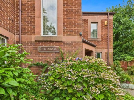
L35 6NG - 3 bedroom detached house for sale in Mill Lane, Rainhill, P…
View on Property Piper
3 bedroom detached house for sale in Mill Lane, Rainhill, Prescot, L35
Property Details
- Price: £750000
- Bedrooms: 3
- Bathrooms: 2
- Property Type: undefined
- Property SubType: undefined
Brochure Descriptions
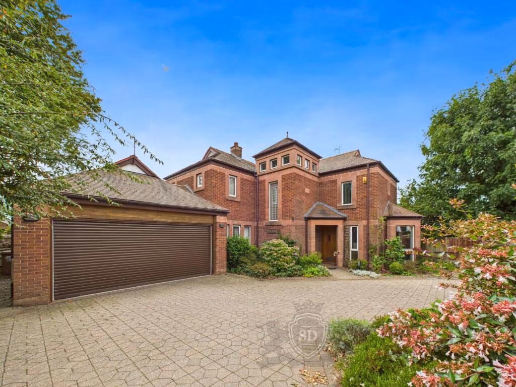
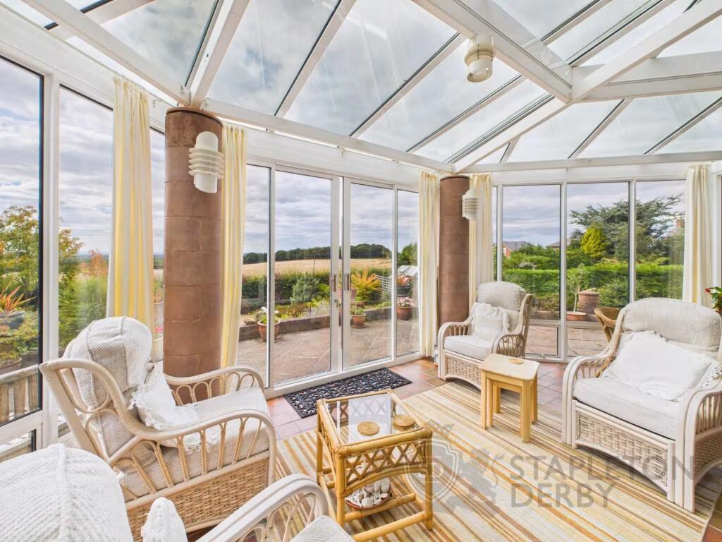
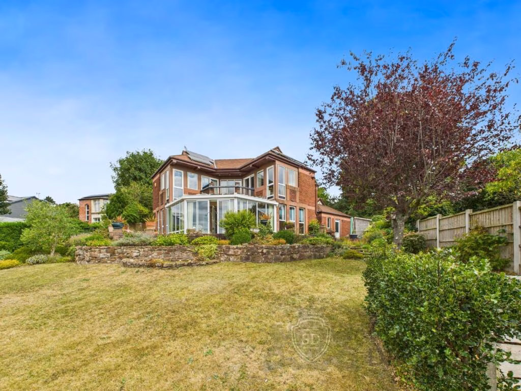
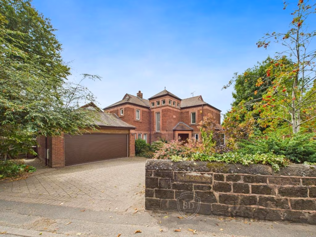
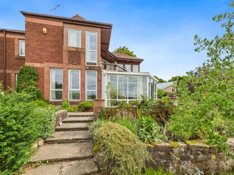
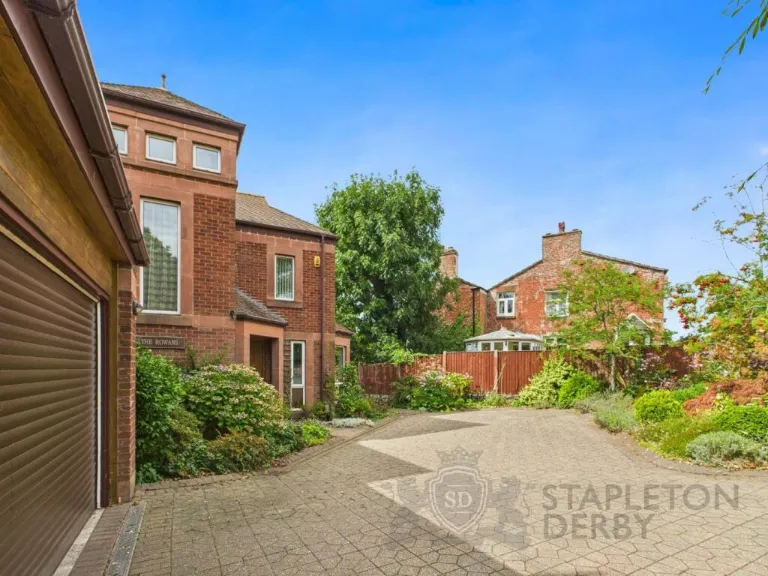
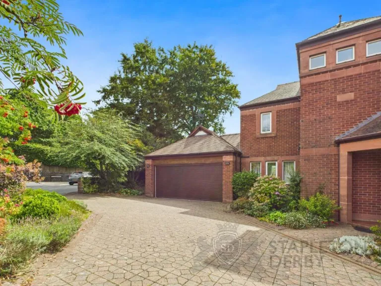
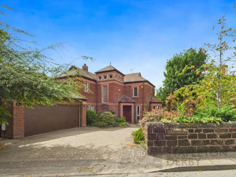
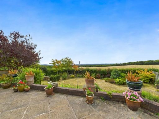
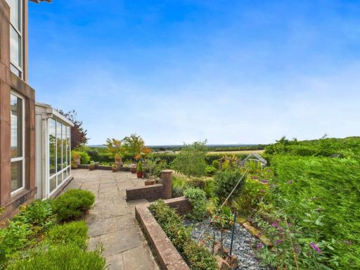
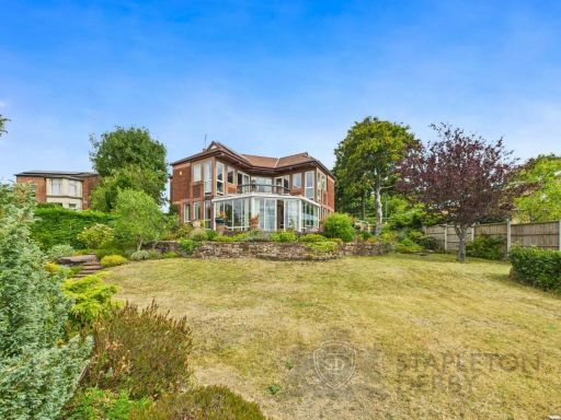
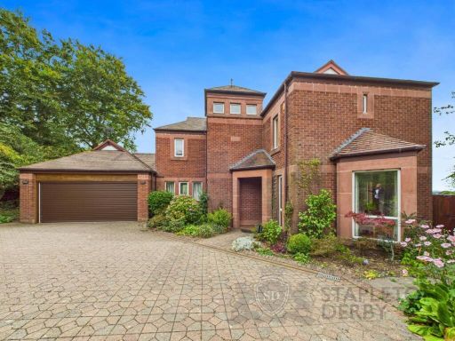
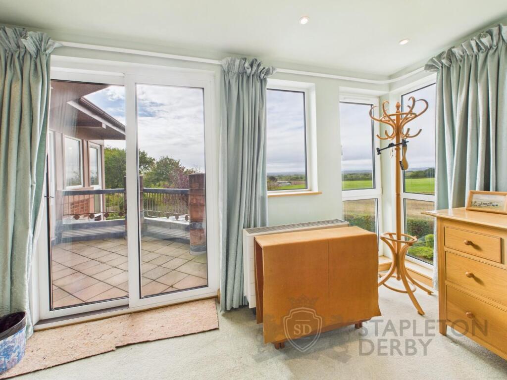
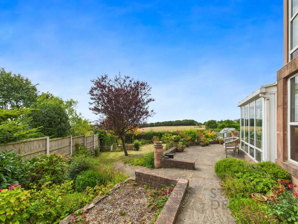
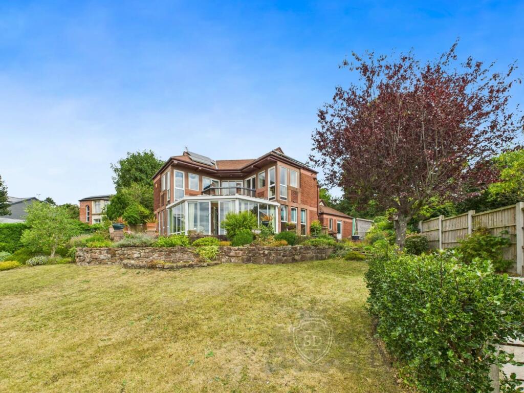
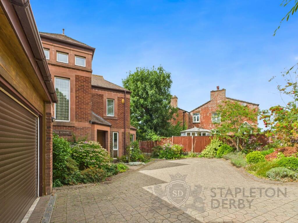
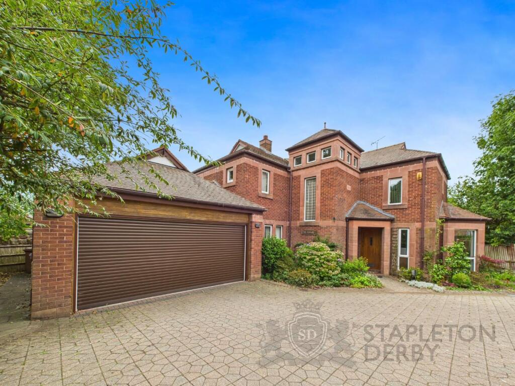
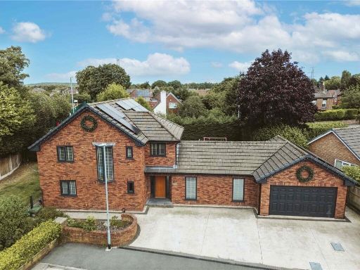
- Detached, modern brick-built family residence set behind a large paved driveway with double garage. The property appears to be a substantial two-storey home with a central entrance tower/feature, multiple bay-style windows and a detached/attached double garage to the left. Landscaped front beds and mature trees provide privacy and a pleasant curbside aspect. The plot frontage and paved drive suggest ample off-street parking for several vehicles; garden size cannot be fully seen from this elevation but the presence of mature planting and boundary fencing indicates a medium to large rear garden is likely. Overall property footprint and massing indicate a large family house (generous internal living space with multiple reception rooms and bedrooms). The setting is residential and appears quiet and well maintained.
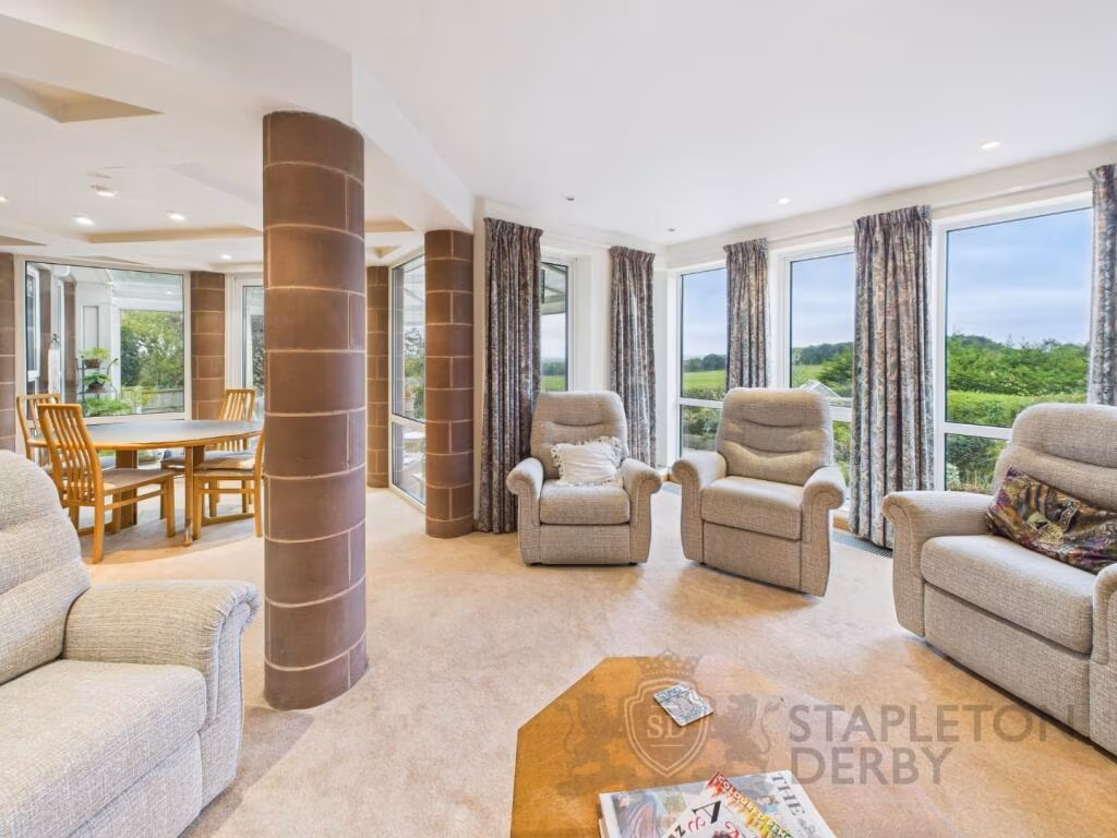
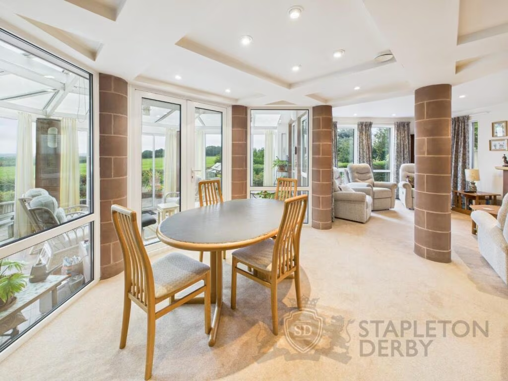
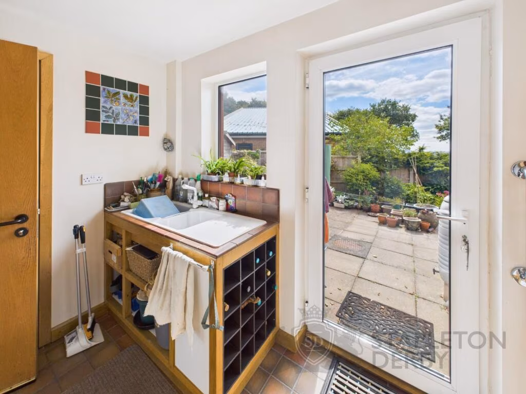
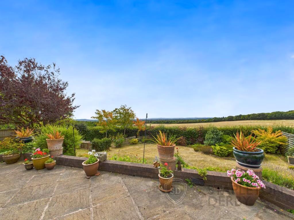
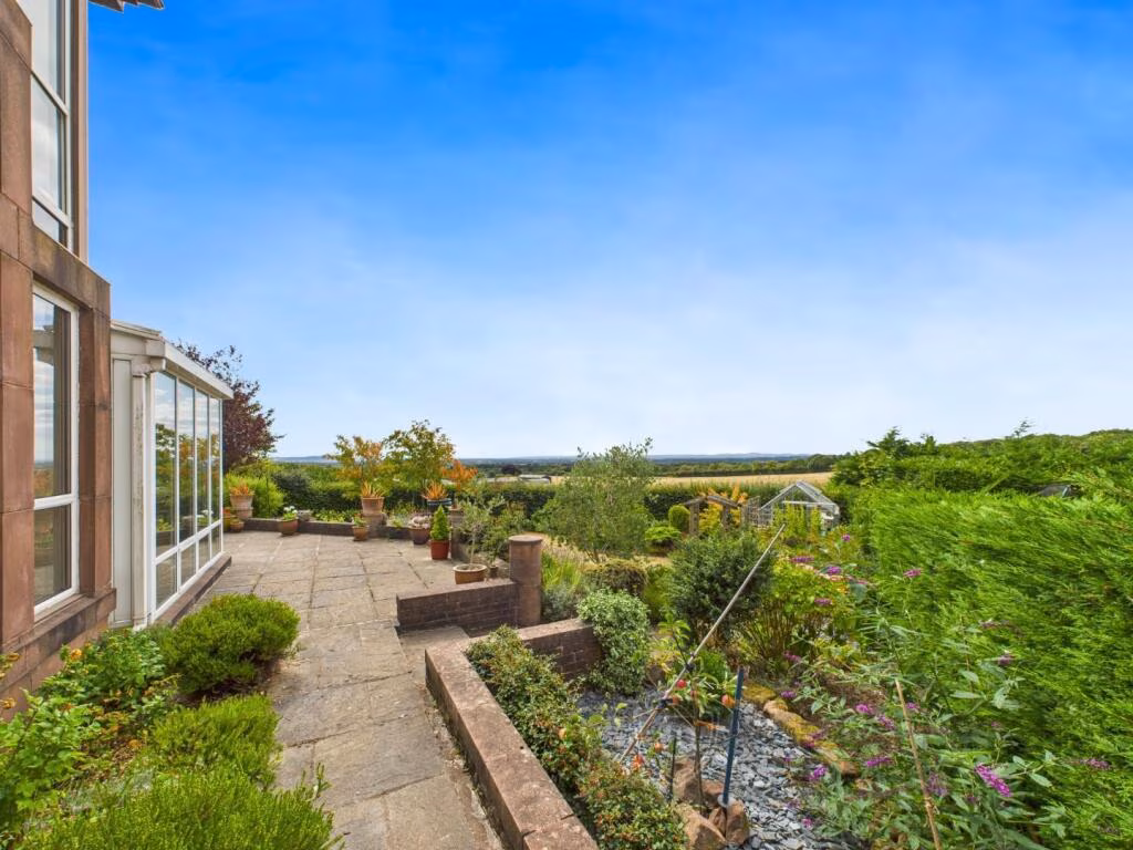
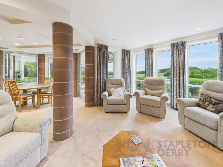
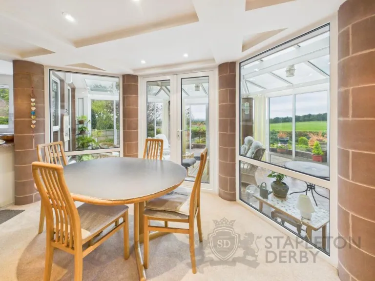
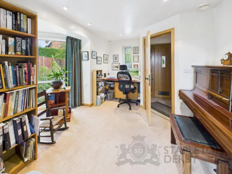
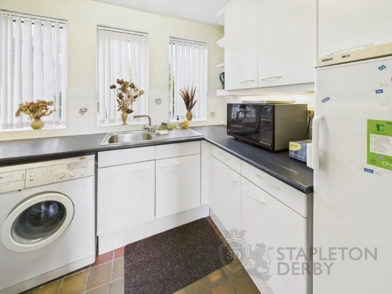
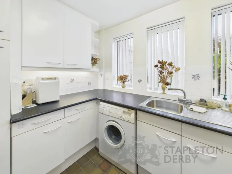
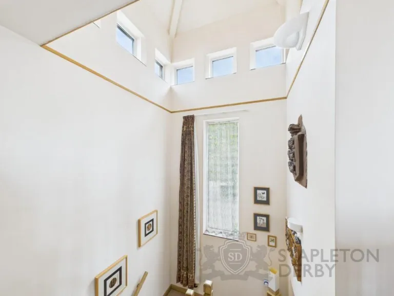
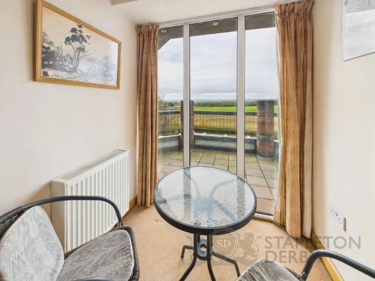
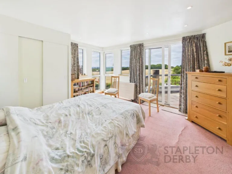
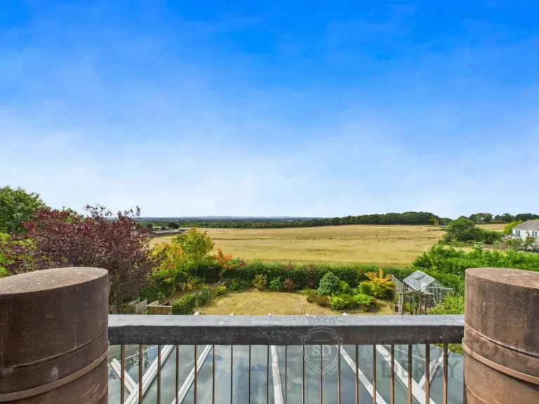
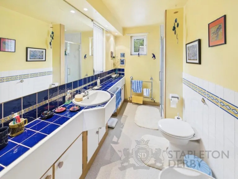
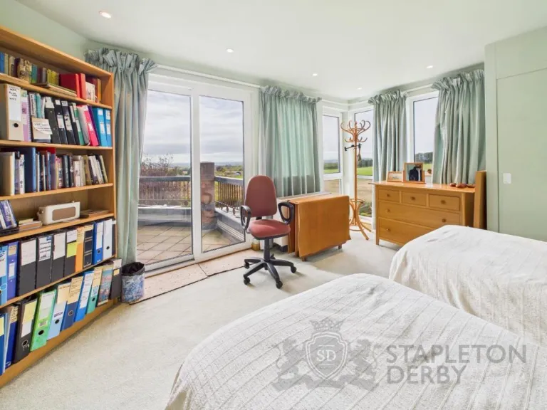
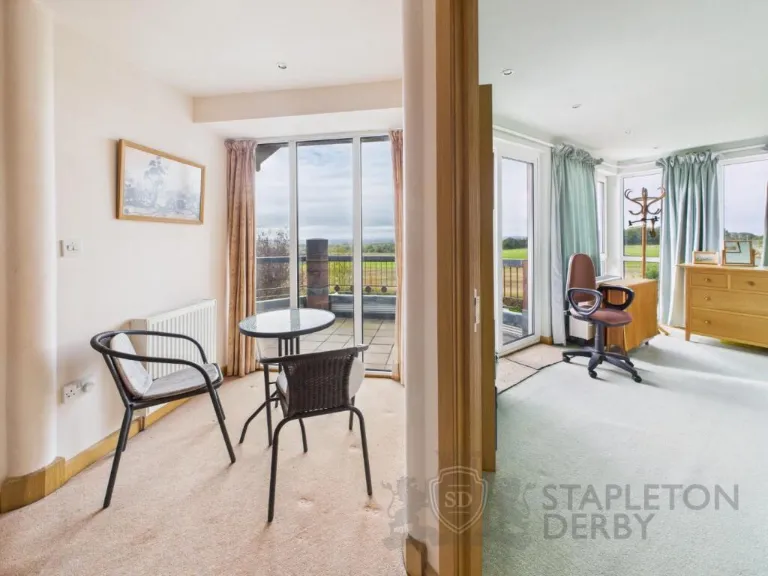
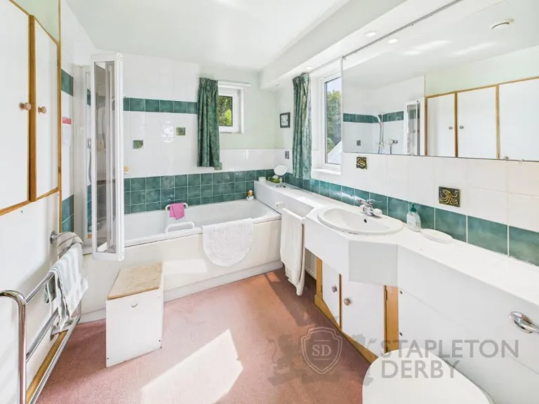
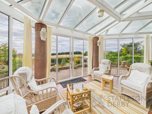
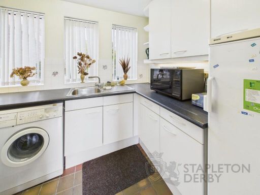
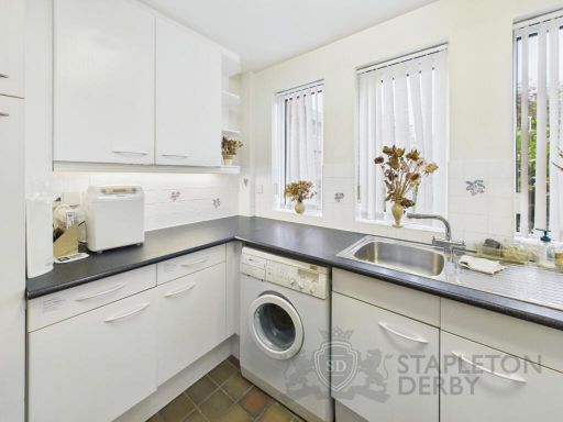
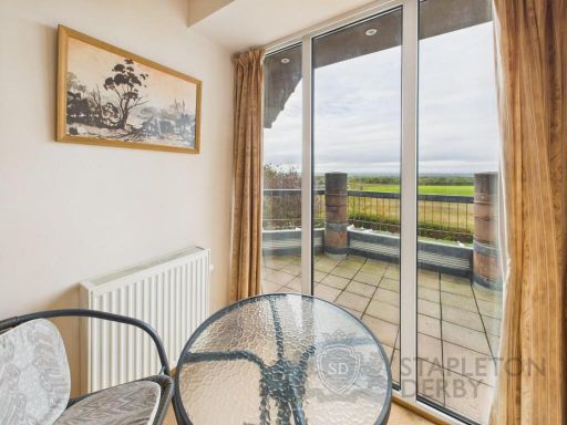
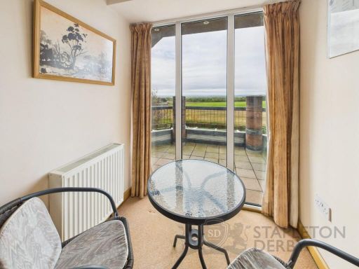
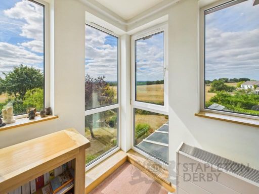
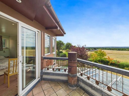
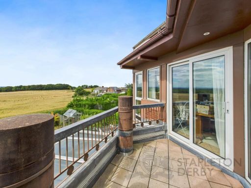
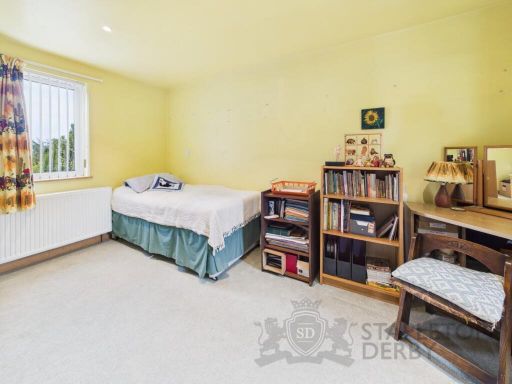
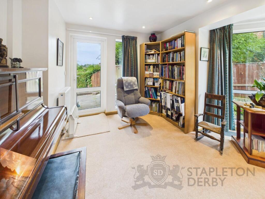
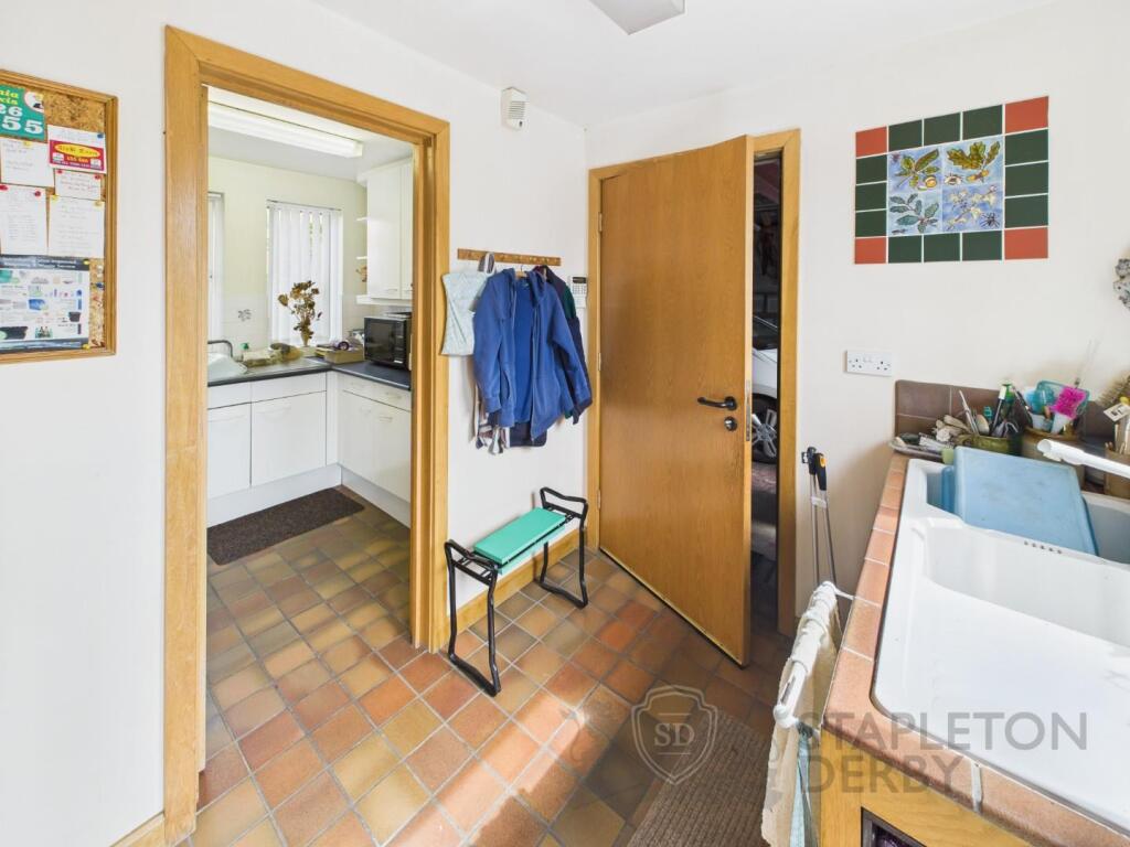
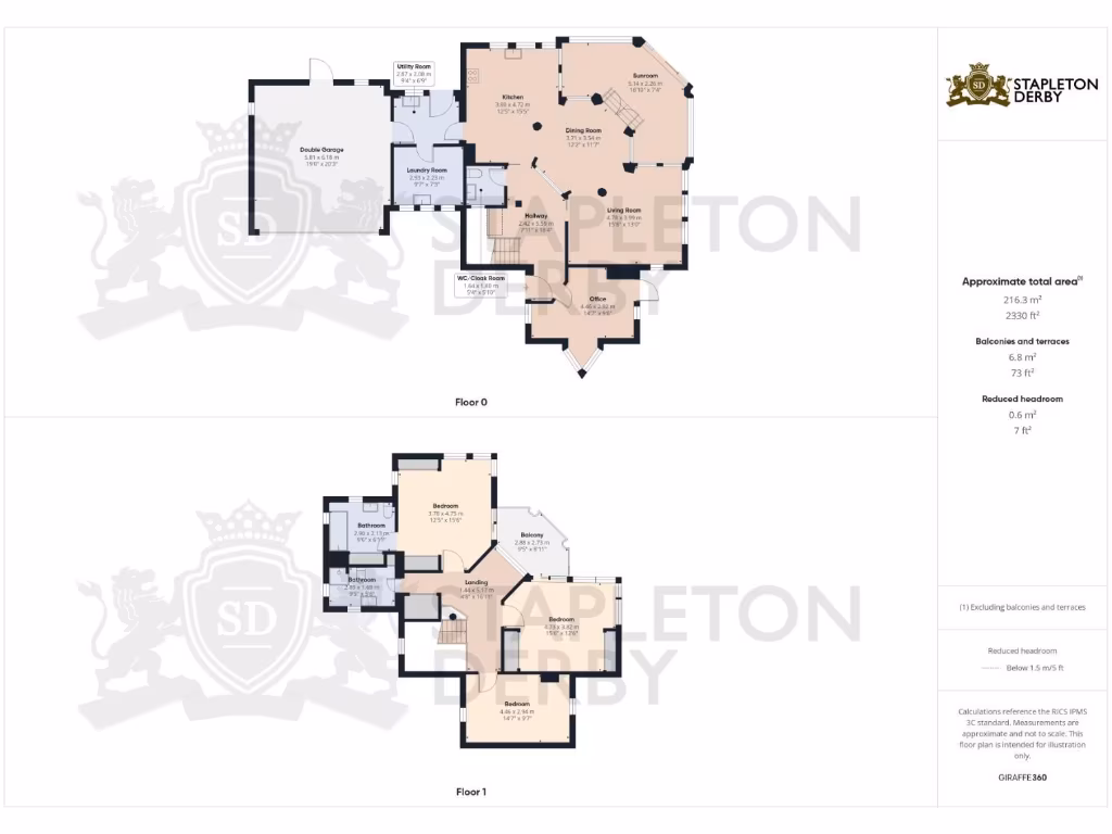
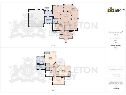
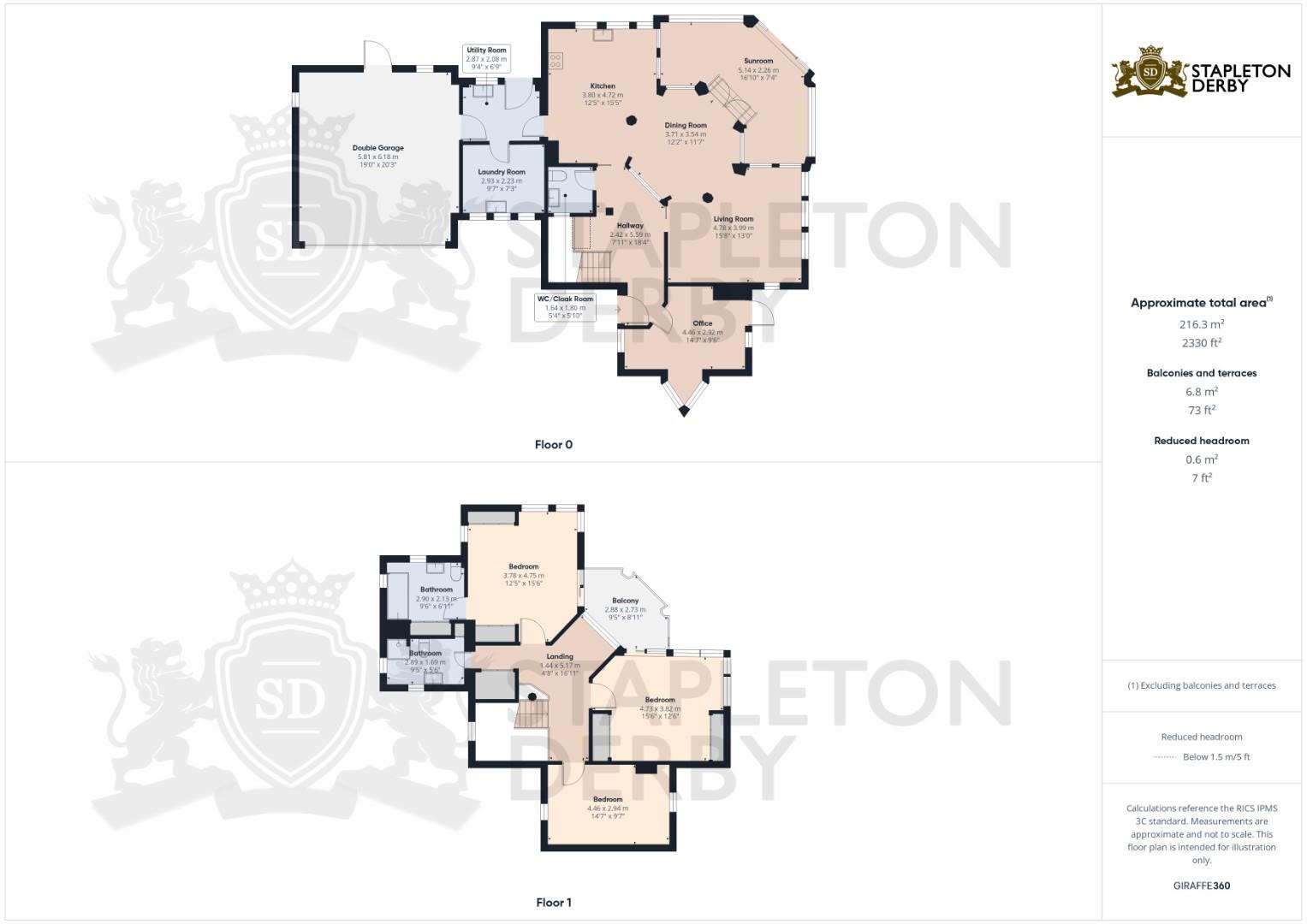
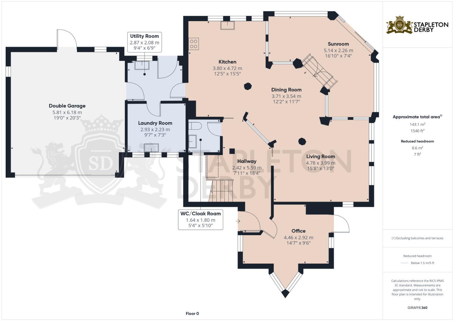
- Large detached residential property arranged over two floors as shown on the provided floorplans. The layout indicates multiple principal reception rooms, a formal dining area, kitchen, utility and cloakroom on the ground floor, with three or more bedrooms and at least two bathrooms on the first floor. An attached garage/boot room is shown. The accommodation footprint is substantial (overall property size appears large) and the internal room sizes read as generous. The site sits in a suburban setting (Rainhill area) with no obvious exceptional views (sea/river/forest) visible on the images. Garden size cannot be determined from the images but would typically be average for this house type. Overall impression (valuer style): substantial family home with a versatile floorplan, good-sized principal rooms and attached garage — suitable for a mid-to-upper market valuation in a suburban location; likely to appeal to families seeking spacious accommodation and convenient access to local road links.
Image Descriptions
- detached house modern
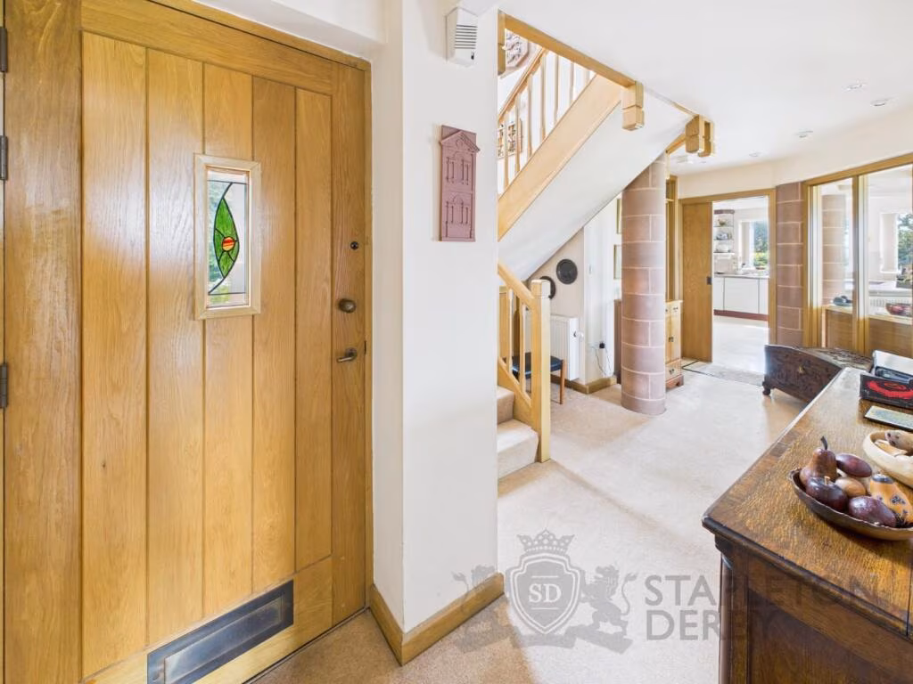
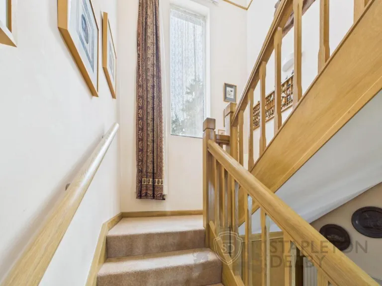
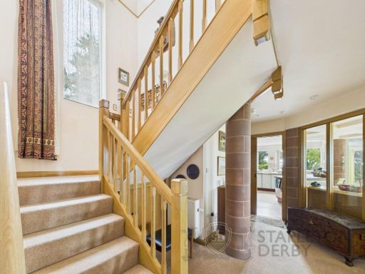
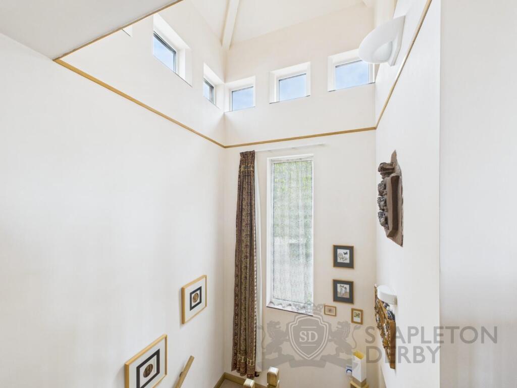
- hallway Modern
Floorplan Description
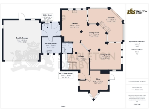
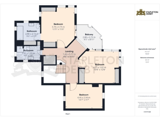
- Ground-floor plan with kitchen, dining, living, sunroom, office and utility spaces
Rooms
- Utility Room:
- Laundry Room:
- Kitchen:
- Sunroom:
- Dining Room:
- Living Room:
- Hallway:
- WC/Cloak Room:
- Office:
- Bedroom:
- Balcony:
- Bedroom:
- Bedroom:
- Landing:
- Bathroom:
- Bathroom:
Textual Property Features
Detected Visual Features
- modern
- detached
- brick
- garage
- garden
- driveway
- two-story
- landscaped
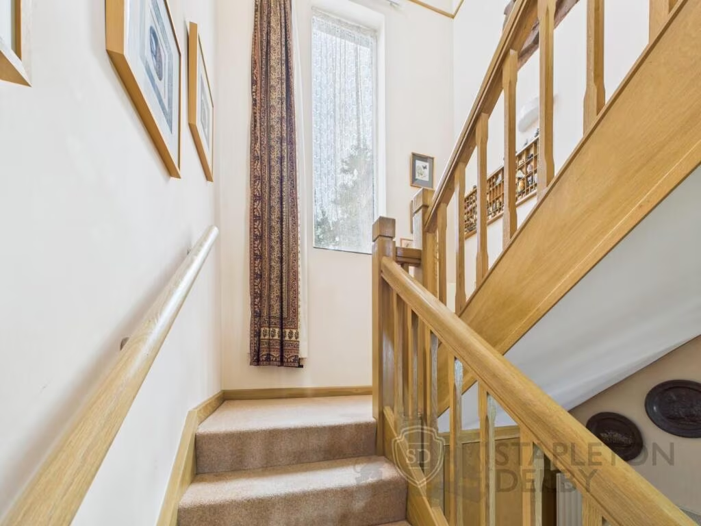
- hallway
- stairs
- wooden door
- stained glass
- banister
- brick column
- light
- bright
EPC Details
- Fully double glazed
- Cavity wall, as built, no insulation (assumed)
- Boiler and radiators, mains gas
- Low energy lighting in all fixed outlets
- Suspended, no insulation (assumed)
Nearby Schools
- Ditton Primary School
- All Saints Upton Church of England Voluntary Controlled Primary School
- St Leo's and Southmead Catholic Primary School Serving the Community
- St Luke's Catholic Primary School
- St Basil's Catholic Primary School
- Cronton Church of England Primary Academy
- Tower College
- Whiston Willis Primary Academy
- Saint Edmund Arrowsmith Catholic Academy
- St John Vianney Catholic Primary School
- Evelyn Community Primary School
- Our Lady's Catholic Primary School
- Thatto Heath Community Primary School
- St Michael with St Thomas CE Primary School
- Ormiston Chadwick Academy
- Holy Family Catholic Primary School & Nursery
- Oakdene Primary School
- Rainhill High School
- Halsnead Primary School
- Sutton Manor Community Primary School
- St Ann's Church of England Primary School
- Prescot Primary School
- Eccleston Lane Ends Primary School
- St Austin's Catholic Primary School
- St Bartholomew's Catholic Primary School
- St Mary and St Paul's CofE Primary School
- Longton Lane Community Primary School
- Nutgrove Methodist Primary School
Nearest Bars And Restaurants
- Id: 935118009
- Tags:
- Amenity: restaurant
- Name: Kozi
- TagsNormalized:
- Lat: 53.4168088
- Lon: -2.7664751
- FullGeoHash: gcqpch1x2qys
- PartitionGeoHash: gcqp
- Images:
- FoodStandards: null
- Distance: 805.6
,- Id: 334252382
- Tags:
- Amenity: pub
- Building: yes
- Name: CookHouse Pub & Carvery (Victoria Hotel)
- TagsNormalized:
- Lat: 53.4165255
- Lon: -2.7651136
- FullGeoHash: gcqpch4tb4jf
- PartitionGeoHash: gcqp
- Images:
- FoodStandards: null
- Distance: 785.5
,- Id: 4523366082
- Tags:
- Amenity: restaurant
- Cuisine: indian
- Name: Blue Mango
- TagsNormalized:
- Lat: 53.4165883
- Lon: -2.767122
- FullGeoHash: gcqpch1n1mu2
- PartitionGeoHash: gcqp
- Images:
- FoodStandards: null
- Distance: 779.4
,- Id: 935118004
- Tags:
- Amenity: restaurant
- Name: Galleria
- TagsNormalized:
- Lat: 53.4164763
- Lon: -2.7654613
- FullGeoHash: gcqpch4m80fs
- PartitionGeoHash: gcqp
- Images:
- FoodStandards: null
- Distance: 776.2
,- Id: 4523373650
- Tags:
- Amenity: restaurant
- Cuisine: chinese
- Name: China Garden
- TagsNormalized:
- Lat: 53.4163365
- Lon: -2.7670925
- FullGeoHash: gcqpch1hdnf6
- PartitionGeoHash: gcqp
- Images:
- FoodStandards: null
- Distance: 751.4
}
Nearest General Shops
- Id: 482702724
- Tags:
- Brand: Wolseley
- Brand:wikidata: Q8030423
- Building: industrial
- Name: Wolseley
- Shop: trade
- Trade: plumbing
- TagsNormalized:
- wolseley
- industrial
- trade
- shop
- Lat: 53.4163704
- Lon: -2.7774459
- FullGeoHash: gcqpbu1sbv4j
- PartitionGeoHash: gcqp
- Images:
- FoodStandards: null
- Distance: 1012.3
,- Id: 5254101156
- Tags:
- Addr:
- City: Rainhill
- Housenumber: 489
- Postcode: L35 0LR
- Street: Warrington Road
- Name: Screenking
- Shop: t-shirt_printing
- Website: https://www.screenking.co.uk/
- TagsNormalized:
- Lat: 53.4167095
- Lon: -2.7665032
- FullGeoHash: gcqpch1qzu3e
- PartitionGeoHash: gcqp
- Images:
- FoodStandards: null
- Distance: 794.4
,- Id: 469245181
- Tags:
- Addr:
- Housenumber: 576
- Postcode: L35 4LZ
- Street: Warrington Road
- Name: J Showering Butchers
- Phone: +44 151 426 4604
- Shop: butcher
- TagsNormalized:
- Lat: 53.4163394
- Lon: -2.7655954
- FullGeoHash: gcqpch4hszqs
- PartitionGeoHash: gcqp
- Images:
- FoodStandards: null
- Distance: 759.8
}
Nearest Grocery shops
- Id: 4713174989
- Tags:
- Addr:
- Country: GB
- Housenumber: 377-379
- Postcode: L35 8LD
- Street: Warrington Road
- Brand: Morrisons Daily
- Brand:wikidata: Q99752411
- Contact:
- Website: https://my.morrisons.com/storefinder/31116
- Fhrs:
- Name: Morrisons Daily
- Old_name: McColl's
- Operator: McColl's
- Operator:website: https://www.mccolls.co.uk/storelocator/rainhill-warrington-road/
- Operator:wikidata: Q16997477
- Shop: convenience
- TagsNormalized:
- morrisons
- morrisons daily
- convenience
- shop
- Lat: 53.4188664
- Lon: -2.7755441
- FullGeoHash: gcqpbudgmnkq
- PartitionGeoHash: gcqp
- Images:
- FoodStandards:
- Id: 1157628
- FHRSID: 1157628
- LocalAuthorityBusinessID: A47GSH377-/1
- BusinessName: Morrisons Daily
- BusinessType: Retailers - other
- BusinessTypeID: 4613
- AddressLine1: null
- AddressLine2: 377-379 Warrington Road
- AddressLine3: Rainhill
- AddressLine4: null
- PostCode: L35 8LD
- RatingValue: 4
- RatingKey: fhrs_4_en-GB
- RatingDate: 2022-01-07
- LocalAuthorityCode: 421
- LocalAuthorityName: St Helens
- LocalAuthorityWebSite: http://www.sthelens.gov.uk
- LocalAuthorityEmailAddress: environmentalhealth@sthelens.gov.uk
- Scores:
- Hygiene: 5
- Structural: 10
- ConfidenceInManagement: 5
- NewRatingPending: false
- Geocode:
- Longitude: -2.77553390000000
- Latitude: 53.41886570000000
- Distance: 1169.1
,- Id: 1043617146
- Tags:
- Addr:
- Housename: Rainhill Service Station
- Housenumber: 388
- Postcode: L35 9JB
- Street: Warrington Road
- Brand: Spar
- Brand:wikidata: Q610492
- Brand:wikipedia: en:SPAR (retailer)
- Building: yes
- Name: Spar
- Phone: +44 151 426 5641
- Shop: convenience
- Website: https://www.spar.co.uk/store-locator/hal29530-spar-euro-garage-rainhill
- TagsNormalized:
- Lat: 53.4182204
- Lon: -2.775593
- FullGeoHash: gcqpbu6zeypb
- PartitionGeoHash: gcqp
- Images:
- FoodStandards: null
- Distance: 1107.8
,- Id: 469216496
- Tags:
- Addr:
- Housenumber: 23
- Postcode: L35 4LG
- Street: Longton Lane
- Name: Longton Lane Wine Stores
- Phone: +44 151 426 4352
- Shop: convenience
- TagsNormalized:
- Lat: 53.4189862
- Lon: -2.7703275
- FullGeoHash: gcqpbuwsnsy0
- PartitionGeoHash: gcqp
- Images:
- FoodStandards: null
- Distance: 1065.4
}
Nearest Supermarkets
- Id: 454345520
- Tags:
- Brand: Tesco Extra
- Brand:wikidata: Q25172225
- Brand:wikipedia: en:Tesco Extra
- Building: yes
- Contact:
- Website: https://www.tesco.com/store-locator/prescot/cables-retail-park
- Name: Tesco Extra
- Shop: supermarket
- TagsNormalized:
- tesco
- tesco extra
- supermarket
- shop
- Lat: 53.4265348
- Lon: -2.8035505
- FullGeoHash: gcqpbnn80ecn
- PartitionGeoHash: gcqp
- Images:
- FoodStandards: null
- Distance: 3055.2
,- Id: 1044513011
- Tags:
- Addr:
- City: St Helens
- Postcode: WA9 5BT
- Street: Elton Head Road
- Suburb: Sutton Heath
- Brand: Co-op Food
- Brand:wikidata: Q3277439
- Brand:wikipedia: en:Co-op Food
- Building: yes
- Name: Co-op Food
- Operator: The Co-operative Group
- Operator:wikidata: Q117202
- Phone: +44 1744 818530
- Shop: supermarket
- Website: https://www.coop.co.uk/store-finder/WA9-5BT/elton-head-road
- TagsNormalized:
- co-op
- co-op food
- food
- supermarket
- shop
- Lat: 53.4286417
- Lon: -2.7473706
- FullGeoHash: gcqpcqrkmssn
- PartitionGeoHash: gcqp
- Images:
- FoodStandards: null
- Distance: 2496.4
,- Id: 322347107
- Tags:
- Addr:
- Housenumber: 580
- Postcode: L35 4LP
- Street: Warrington Road
- Brand: Co-op Food
- Brand:wikidata: Q3277439
- Brand:wikipedia: en:Co-op Food
- Building: yes
- Name: Co-op Food
- Opening_hours: Mo-Sa 07:00-21:00;Su 10:00-16:00
- Operator: The Co-operative Group
- Phone: +44 151 426 6717
- Shop: supermarket
- TagsNormalized:
- co-op
- co-op food
- food
- supermarket
- shop
- Lat: 53.4161124
- Lon: -2.7652466
- FullGeoHash: gcqpch47mj49
- PartitionGeoHash: gcqp
- Images:
- FoodStandards: null
- Distance: 738.7
}
Nearest Religious buildings
- Id: 4713198217
- Tags:
- Amenity: place_of_worship
- Name: St James' Church
- Religion: christian
- TagsNormalized:
- place of worship
- church
- christian
- Lat: 53.4153264
- Lon: -2.7623289
- FullGeoHash: gcqpc5uwc4d3
- PartitionGeoHash: gcqp
- Images:
- FoodStandards: null
- Distance: 718.1
,- Id: 334252373
- Tags:
- Amenity: place_of_worship
- Building: yes
- Denomination: anglican
- Name: St Ann's Church
- Religion: christian
- Wikidata: Q26545015
- TagsNormalized:
- place of worship
- anglican
- church
- christian
- Lat: 53.4156579
- Lon: -2.76381
- FullGeoHash: gcqpch52y83f
- PartitionGeoHash: gcqp
- Images:
- FoodStandards: null
- Distance: 713.7
,- Id: 33061223
- Tags:
- Addr:
- Postcode: L35 0LQ
- Street: View Road
- Amenity: school
- Capacity: 420
- Denomination: anglican
- Diocese: Diocese of Liverpool
- Isced:
- Max_age: 11
- Min_age: 5
- Name: St Ann's Church of England Primary School
- Phone: +44 151 4265869
- Ref:
- Ref:edubase:group: 15718
- Religion: christian
- School:
- Boarding: no
- Gender: mixed
- Selective: no
- Trust: yes
- Type: academy
- School:trust:name: The Three Saints Academy Trust
- School:trust:type: multi_academy
- Source:
- Addr:
- Postcode: get-information-schools.service.gov.uk
- Website: https://www.rainhillstanns.co.uk/
- Wikidata: Q66140563
- TagsNormalized:
- school
- anglican
- church
- christian
- Lat: 53.4152545
- Lon: -2.7666046
- FullGeoHash: gcqpc5cqmmnh
- PartitionGeoHash: gcqp
- Images:
- FoodStandards: null
- Distance: 632.5
}
Nearest Medical buildings
- Id: 32886893
- Tags:
- Amenity: hospital
- Healthcare: hospital
- Name: Whiston Hospital
- Wikidata: Q30281154
- TagsNormalized:
- Lat: 53.4204174
- Lon: -2.7846765
- FullGeoHash: gcqpbsuk2rdd
- PartitionGeoHash: gcqp
- Images:
- FoodStandards: null
- Distance: 1668.2
,- Id: 469252602
- Tags:
- Addr:
- Housenumber: 473
- Postcode: L35 4LL
- Street: Warrington Road
- Amenity: pharmacy
- Brand: Lloyds Pharmacy
- Brand:wikidata: Q6662870
- Brand:wikipedia: en:LloydsPharmacy
- Healthcare: pharmacy
- Name: Lloyds Pharmacy
- Opening_hours: Mo-Fr 09:00-18:00; Sa 09:00-13:00
- Phone: +44 151 430 9888
- TagsNormalized:
- pharmacy
- lloyds pharmacy
- health
- healthcare
- Lat: 53.4173011
- Lon: -2.7689943
- FullGeoHash: gcqpburdmf8h
- PartitionGeoHash: gcqp
- Images:
- FoodStandards: null
- Distance: 866.1
,- Id: 469245182
- Tags:
- Addr:
- Housenumber: 578
- Postcode: L35 4LZ
- Street: Warrington Road
- Amenity: pharmacy
- Healthcare: pharmacy
- Name: Longster Pharmacy
- Phone: +44 151 426 2122
- TagsNormalized:
- Lat: 53.4162933
- Lon: -2.765398
- FullGeoHash: gcqpch4k3wcc
- PartitionGeoHash: gcqp
- Images:
- FoodStandards: null
- Distance: 756.8
,- Id: 334256450
- Tags:
- Amenity: clinic
- Building: yes
- Healthcare: clinic
- TagsNormalized:
- Lat: 53.4146552
- Lon: -2.7648642
- FullGeoHash: gcqpc5fdvvrv
- PartitionGeoHash: gcqp
- Images:
- FoodStandards: null
- Distance: 586.5
}
Nearest Airports
- Id: 1224469
- Tags:
- Addr:
- City: Manchester
- Country: GB
- Postcode: M90 1QX
- Aerodrome: international
- Aeroway: aerodrome
- Arp: yes
- Atis: 128.175
- Iata: MAN
- Icao: EGCC
- Name: Manchester Airport
- Note: rough sketched outline referring to Yahoo imagery - true boundary is where?
- Old_name: Ringway
- Operator: Manchester Airport PLC
- Size: 18720000
- Source:
- Tower_frequency: 118.625,119.400
- Type: multipolygon
- Website: https://www.manchesterairport.co.uk/
- Wikidata: Q8694
- Wikipedia: en:Manchester Airport
- TagsNormalized:
- airport
- international airport
- Lat: 53.3503197
- Lon: -2.2798822
- FullGeoHash: gcqrs05u4ukt
- PartitionGeoHash: gcqr
- Images:
- FoodStandards: null
- Distance: 32992.4
,- Id: 116737532
- Tags:
- Addr:
- City: Liverpool
- Country: GB
- Postcode: L24 1YD
- Street: Speke Hall Avenue
- Aerodrome: international
- Aerodrome:type: public
- Aeroway: aerodrome
- Iata: LPL
- Icao: EGGP
- Is_in: Liverpool,England,UK
- Name: Liverpool John Lennon Airport
- Old_name: Speke Airport
- Operator: Liverpool Airport plc
- Source: wikipedia
- Website: https://www.liverpoolairport.com/
- Wikidata: Q8727
- Wikipedia: en:Liverpool John Lennon Airport
- TagsNormalized:
- airport
- international airport
- Lat: 53.3357677
- Lon: -2.8518179
- FullGeoHash: gcmzrj7r7gdr
- PartitionGeoHash: gcmz
- Images:
- FoodStandards: null
- Distance: 9940.9
}
Nearest Leisure Facilities
- Id: 1084436952
- Tags:
- TagsNormalized:
- Lat: 53.4152948
- Lon: -2.7741083
- FullGeoHash: gcqpbggywsdu
- PartitionGeoHash: gcqp
- Images:
- FoodStandards: null
- Distance: 780.5
,- Id: 413092781
- Tags:
- Leisure: pitch
- Source: Bing
- TagsNormalized:
- Lat: 53.4055495
- Lon: -2.7578769
- FullGeoHash: gcqpc4pvbgcz
- PartitionGeoHash: gcqp
- Images:
- FoodStandards: null
- Distance: 767.2
,- Id: 341914083
- Tags:
- TagsNormalized:
- Lat: 53.4159328
- Lon: -2.7660341
- FullGeoHash: gcqpch1f6ex6
- PartitionGeoHash: gcqp
- Images:
- FoodStandards: null
- Distance: 711.2
,- Id: 413092780
- Tags:
- Leisure: pitch
- Source: Bing
- Sport: tennis
- TagsNormalized:
- Lat: 53.4059412
- Lon: -2.759836
- FullGeoHash: gcqpc4q25jj0
- PartitionGeoHash: gcqp
- Images:
- FoodStandards: null
- Distance: 637.7
,- Id: 337805972
- Tags:
- TagsNormalized:
- Lat: 53.4078505
- Lon: -2.7584321
- FullGeoHash: gcqpc4x77bgv
- PartitionGeoHash: gcqp
- Images:
- FoodStandards: null
- Distance: 616.7
}
Nearest Tourist attractions
- Id: 445962917
- Tags:
- TagsNormalized:
- Lat: 53.4042034
- Lon: -2.7949715
- FullGeoHash: gcqpb3uy03n4
- PartitionGeoHash: gcqp
- Images:
- FoodStandards: null
- Distance: 1931
,- Id: 327000695
- Tags:
- Name: Sunny Side Naturist Camp
- Tourism: camp_site
- TagsNormalized:
- Lat: 53.3974745
- Lon: -2.7841562
- FullGeoHash: gcqpb8swu6ww
- PartitionGeoHash: gcqp
- Images:
- FoodStandards: null
- Distance: 1750.6
,- Id: 298904021
- Tags:
- Building: yes
- Name: Rainhill Railway Museum
- Tourism: museum
- TagsNormalized:
- Lat: 53.4148171
- Lon: -2.764441
- FullGeoHash: gcqpc5fgzge7
- PartitionGeoHash: gcqp
- Images:
- FoodStandards: null
- Distance: 611.8
}
Nearest Train stations
- Id: 24829877
- Tags:
- Name: Thatto Heath
- Naptan:
- Network: National Rail
- Public_transport: station
- Railway: station
- Ref:
- Source: npe
- Wikipedia: en:Thatto Heath railway station
- TagsNormalized:
- Lat: 53.4366896
- Lon: -2.7594696
- FullGeoHash: gcqpcpye78ym
- PartitionGeoHash: gcqp
- Images:
- FoodStandards: null
- Distance: 3058.5
,- Id: 3773234337
- Tags:
- Name: Prescot
- Naptan:
- Network: National Rail
- Public_transport: station
- Railway: station
- Ref:
- Source: NPE
- Wikidata: Q1938051
- Wikipedia: en:Prescot railway station
- TagsNormalized:
- Lat: 53.4235274
- Lon: -2.7989869
- FullGeoHash: gcqpbm3ydgk4
- PartitionGeoHash: gcqp
- Images:
- FoodStandards: null
- Distance: 2612.1
,- Id: 3773234334
- Tags:
- Name: Eccleston Park
- Naptan:
- Network: National Rail
- Public_transport: station
- Railway: station
- Ref:
- Source: NPE
- Wikipedia: en:Eccleston Park railway station
- TagsNormalized:
- Lat: 53.4307355
- Lon: -2.7803346
- FullGeoHash: gcqpbwz2te02
- PartitionGeoHash: gcqp
- Images:
- FoodStandards: null
- Distance: 2506.6
,- Id: 255278185
- Tags:
- Name: Whiston
- Naptan:
- Network: National Rail
- Public_transport: station
- Railway: station
- Ref:
- Wheelchair: yes
- Wikidata: Q2459451
- Wikipedia: en:Whiston railway station
- TagsNormalized:
- Lat: 53.4139015
- Lon: -2.7965367
- FullGeoHash: gcqpb7ewebzj
- PartitionGeoHash: gcqp
- Images:
- FoodStandards: null
- Distance: 1998.3
,- Id: 30581638
- Tags:
- Name: Rainhill
- Naptan:
- Network: National Rail
- Public_transport: station
- Railway: station
- Ref:
- Crs: RNH
- Tiploc: RHIL
- Tipoc: RHIL
- Source: npe
- Wikidata: Q2634815
- Wikipedia: en:Rainhill railway station
- TagsNormalized:
- Lat: 53.4171892
- Lon: -2.7662872
- FullGeoHash: gcqpch39svfc
- PartitionGeoHash: gcqp
- Images:
- FoodStandards: null
- Distance: 848.6
}
Nearest Hotels
- Id: 911040151
- Tags:
- Amenity: pub
- Building: yes
- Name: The Carrs Hotel
- TagsNormalized:
- Lat: 53.4152026
- Lon: -2.7972615
- FullGeoHash: gcqpb7gn556w
- PartitionGeoHash: gcqp
- Images:
- FoodStandards: null
- Distance: 2083.7
,- Id: 40894059
- Tags:
- Brand: Premier Inn
- Brand:wikidata: Q2108626
- Brand:wikipedia: en:Premier Inn
- Building: yes
- Internet_access: wlan
- Internet_access:fee: customers
- Internet_access:operator: Virgin Media
- Internet_access:ssid: Premier Inn Free Wi-Fi
- Name: Premier Inn St. Helens South
- Tourism: hotel
- TagsNormalized:
- Lat: 53.417234
- Lon: -2.7445237
- FullGeoHash: gcqpcs33zynu
- PartitionGeoHash: gcqp
- Images:
- FoodStandards: null
- Distance: 1731.3
,- Id: 4713198208
- Tags:
- Brand: Premier Inn
- Brand:wikidata: Q2108626
- Brand:wikipedia: en:Travelodge UK
- Internet_access: wlan
- Internet_access:fee: customers
- Internet_access:operator: Virgin Media
- Internet_access:ssid: Premier Inn Free Wi-Fi
- Name: Premier Inn
- Tourism: hotel
- TagsNormalized:
- Lat: 53.4074556
- Lon: -2.7526514
- FullGeoHash: gcqpc6e8fx66
- PartitionGeoHash: gcqp
- Images:
- FoodStandards: null
- Distance: 997.5
}
Tags
- modern
- detached
- brick
- garage
- garden
- driveway
- two-story
- landscaped
- modern
- hallway
- stairs
- wooden door
- stained glass
- banister
- brick column
- light
- bright
Local Market Stats
- Average Price/sqft: £196
- Avg Income: £41000
- Rental Yield: 4.9%
- Social Housing: 7%
- Planning Success Rate: 93%
AirBnB Data
- 1km average: £86/night
- Listings in 1km: 1
Similar Properties
 3 bedroom detached house for sale in Mill Hey, Rainhill, Prescot, Merseyside, L35 — £725,000 • 3 bed • 3 bath • 1930 ft²
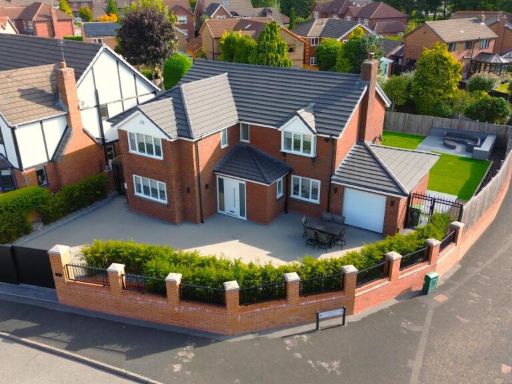 5 bedroom detached house for sale in Stonecross Drive, Rainhill, Prescot, L35 — £799,995 • 5 bed • 3 bath • 1480 ft²
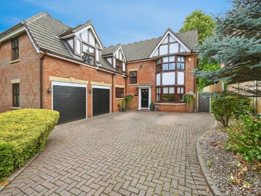 4 bedroom detached house for sale in St. James Road, Rainhill, Prescot, Merseyside, L35 — £775,000 • 4 bed • 4 bath • 2652 ft²
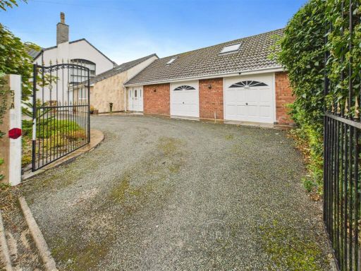 3 bedroom semi-detached house for sale in Bushey Lane, Rainford, St. Helens, WA11 — £450,000 • 3 bed • 2 bath • 1682 ft²
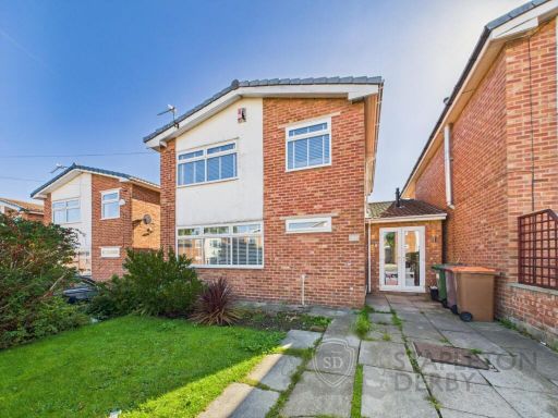 4 bedroom detached house for sale in Galston Avenue, Rainhill, Prescot, L35 — £350,000 • 4 bed • 2 bath • 1129 ft²
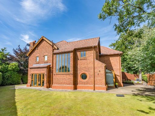 6 bedroom detached house for sale in St. James Road, Rainhill, Merseyside, L35 — £1,140,000 • 6 bed • 5 bath • 2497 ft²
Meta
- {
"@context": "https://schema.org",
"@type": "Residence",
"name": "3 bedroom detached house for sale in Mill Lane, Rainhill, P…",
"description": "",
"url": "https://propertypiper.co.uk/property/bb20bca2-c562-4650-9e3e-d11dc9e71fe3",
"image": "https://image-a.propertypiper.co.uk/f25c729e-2fc2-4e6a-ad6d-53b9780caa83-1024.jpeg",
"address": {
"@type": "PostalAddress",
"streetAddress": "THE ROWANS, MILL LANE, PRESCOT, RAINHILL",
"postalCode": "L35 6NG",
"addressLocality": "St. Helens",
"addressRegion": "St Helens South and Whiston",
"addressCountry": "England"
},
"geo": {
"@type": "GeoCoordinates",
"latitude": 53.4095798,
"longitude": -2.7672717
},
"numberOfRooms": 3,
"numberOfBathroomsTotal": 2,
"floorSize": {
"@type": "QuantitativeValue",
"value": 2330,
"unitCode": "FTK"
},
"offers": {
"@type": "Offer",
"price": 750000,
"priceCurrency": "GBP",
"availability": "https://schema.org/InStock"
},
"additionalProperty": [
{
"@type": "PropertyValue",
"name": "Feature",
"value": "modern"
},
{
"@type": "PropertyValue",
"name": "Feature",
"value": "detached"
},
{
"@type": "PropertyValue",
"name": "Feature",
"value": "brick"
},
{
"@type": "PropertyValue",
"name": "Feature",
"value": "garage"
},
{
"@type": "PropertyValue",
"name": "Feature",
"value": "garden"
},
{
"@type": "PropertyValue",
"name": "Feature",
"value": "driveway"
},
{
"@type": "PropertyValue",
"name": "Feature",
"value": "two-story"
},
{
"@type": "PropertyValue",
"name": "Feature",
"value": "landscaped"
},
{
"@type": "PropertyValue",
"name": "Feature",
"value": "modern"
},
{
"@type": "PropertyValue",
"name": "Feature",
"value": "hallway"
},
{
"@type": "PropertyValue",
"name": "Feature",
"value": "stairs"
},
{
"@type": "PropertyValue",
"name": "Feature",
"value": "wooden door"
},
{
"@type": "PropertyValue",
"name": "Feature",
"value": "stained glass"
},
{
"@type": "PropertyValue",
"name": "Feature",
"value": "banister"
},
{
"@type": "PropertyValue",
"name": "Feature",
"value": "brick column"
},
{
"@type": "PropertyValue",
"name": "Feature",
"value": "light"
},
{
"@type": "PropertyValue",
"name": "Feature",
"value": "bright"
}
]
}
High Res Floorplan Images
Compatible Floorplan Images
FloorplanImages Thumbnail