RG45 6JB - 3 bedroom detached bungalow for sale in Wulwyn Side, Linkwa…
View on Property Piper
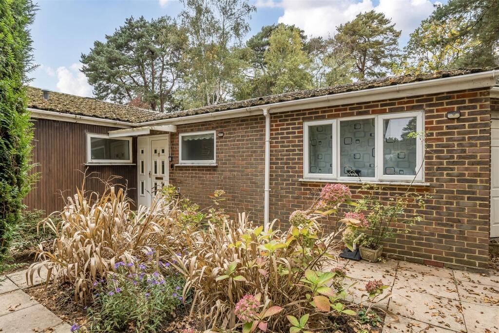
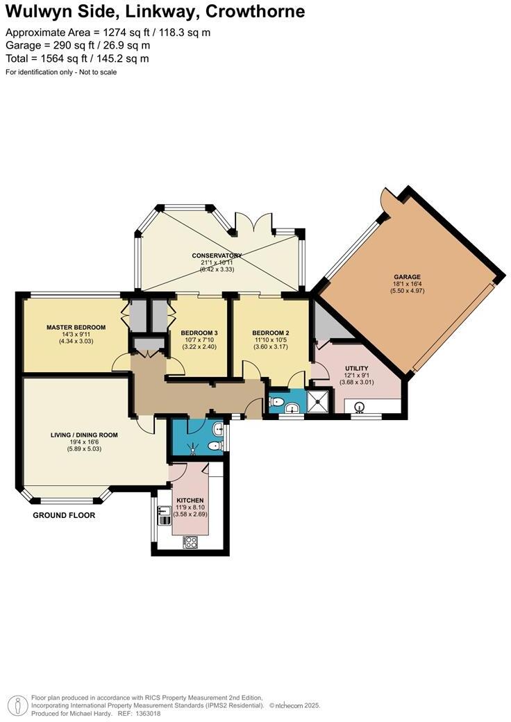
3 bedroom detached bungalow for sale in Wulwyn Side, Linkway, Crowthorne, Berkshire, RG45 6ES, RG45
Property Details
- Price: £650000
- Bedrooms: 3
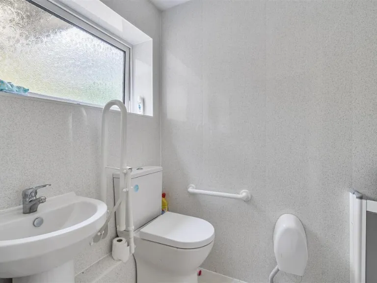
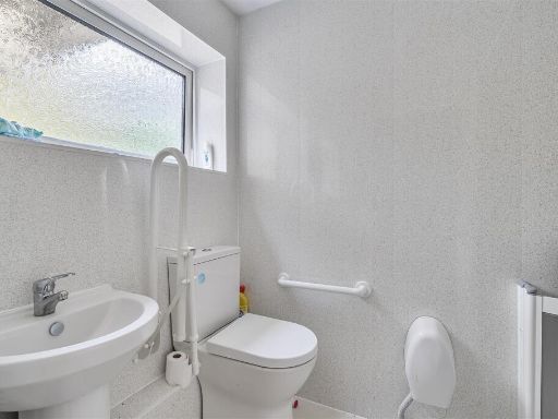
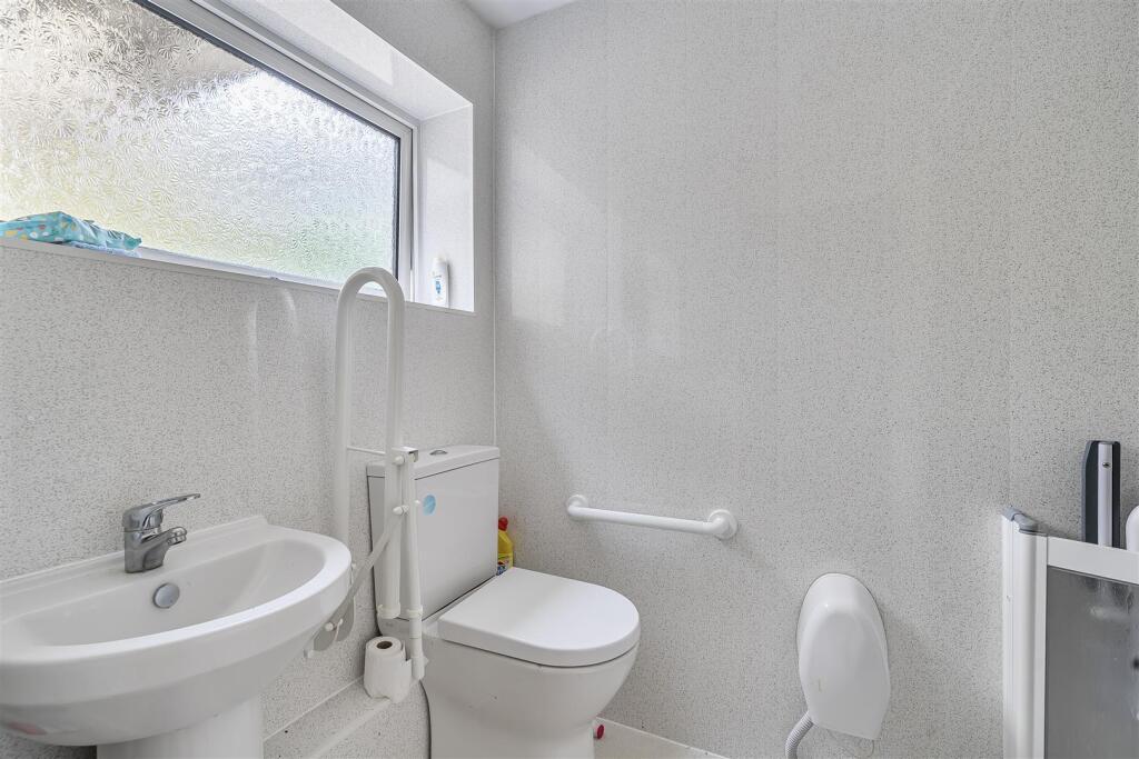
- Bathrooms: 1
- Property Type: undefined
- Property SubType: undefined
Image Descriptions
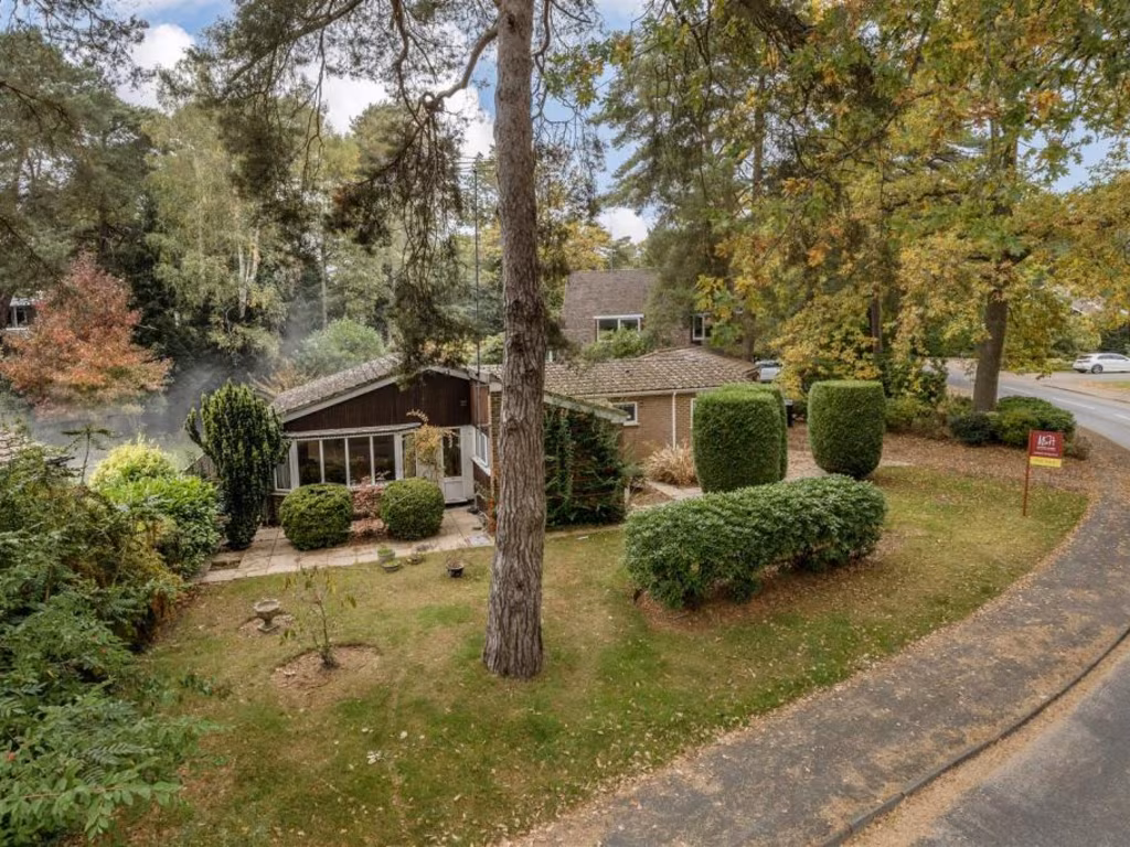
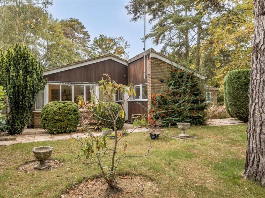
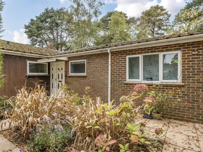
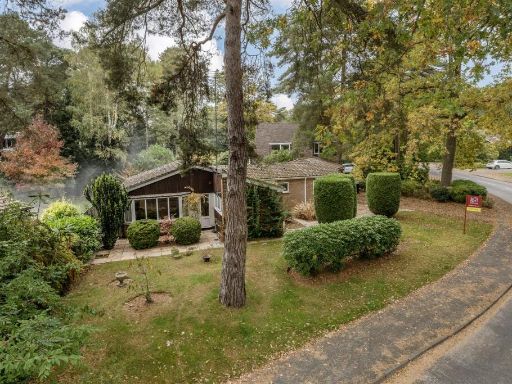
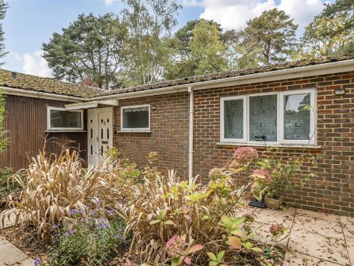
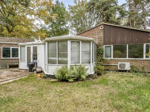
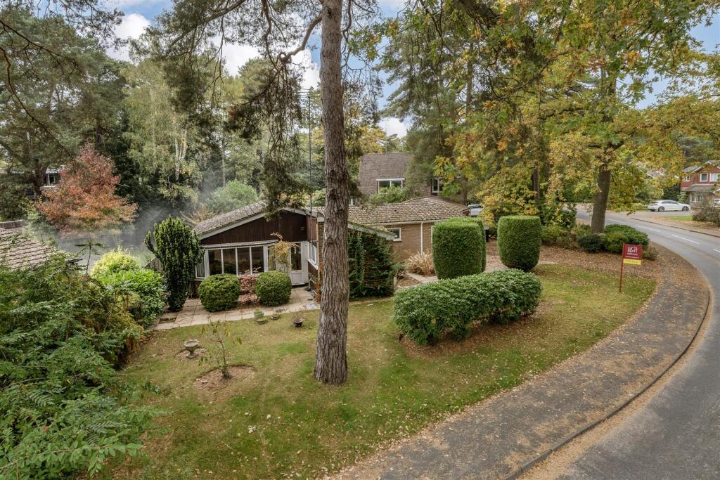
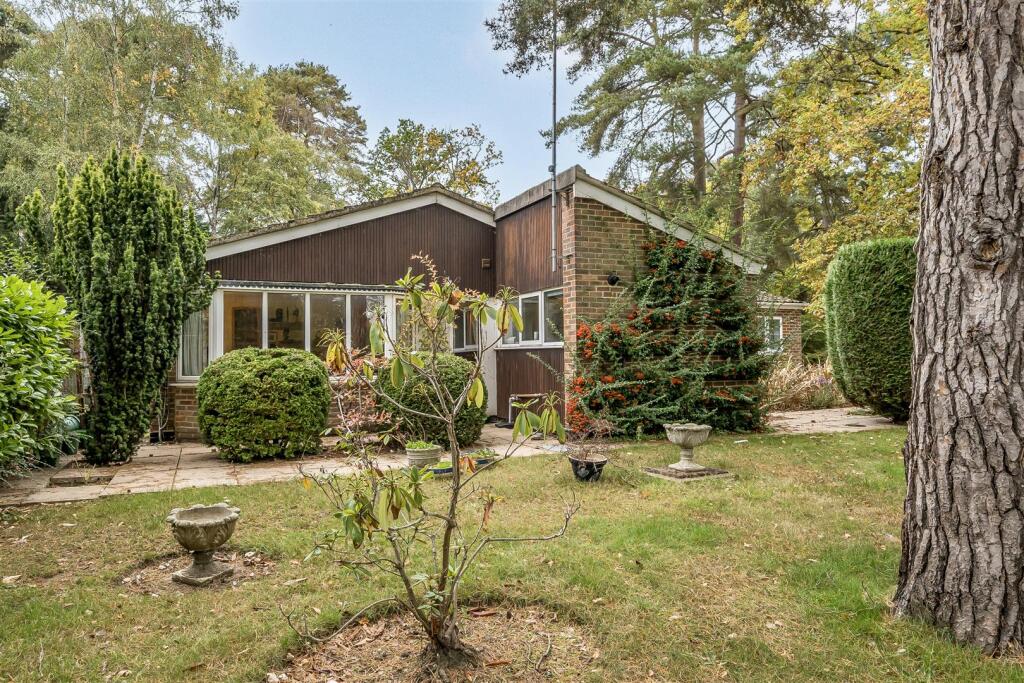
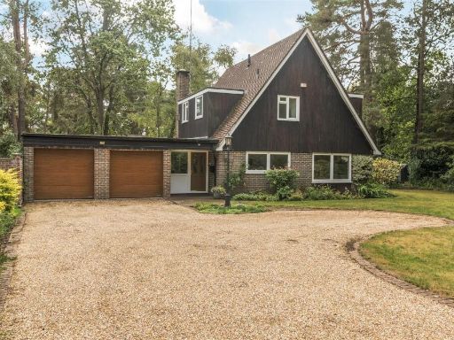
- bungalow mid-century
- exterior Mid-century modern
Rooms
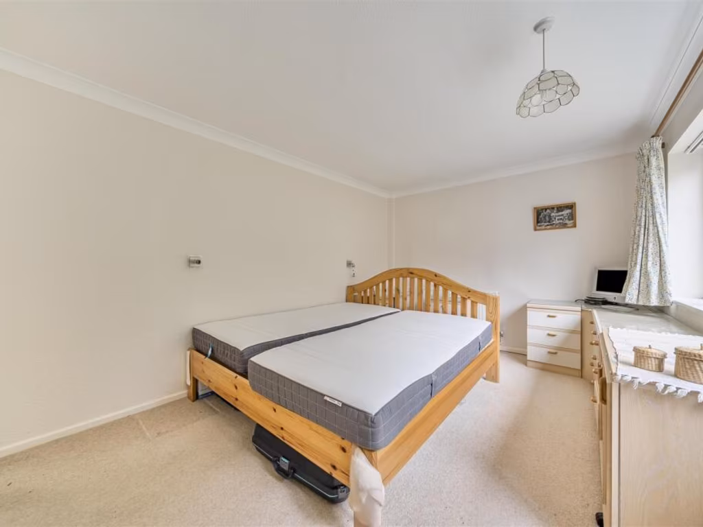
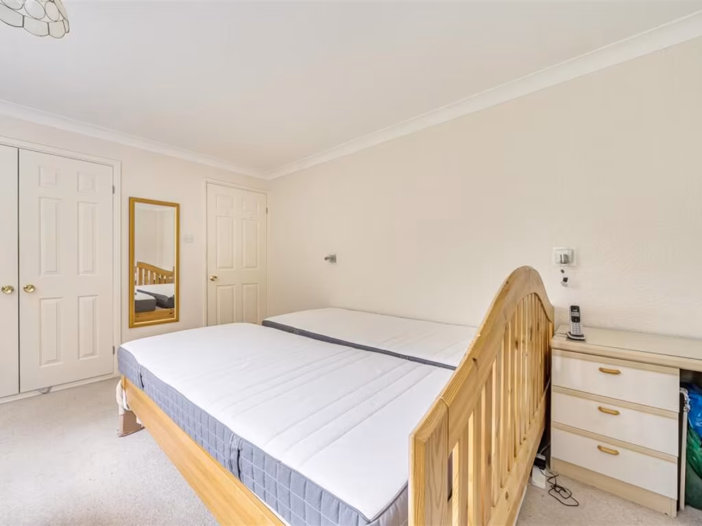
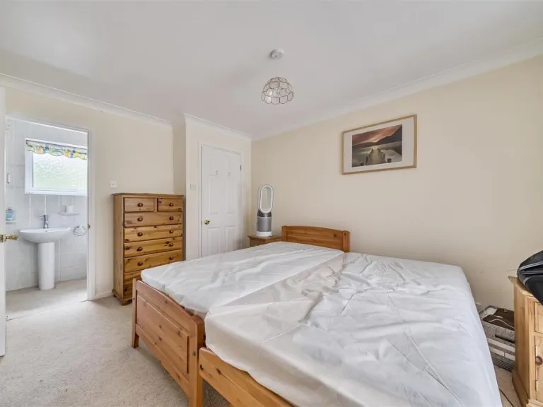
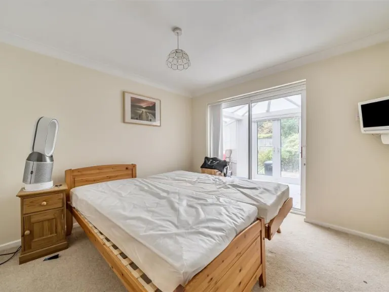
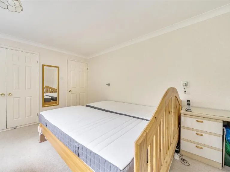
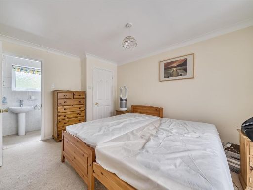
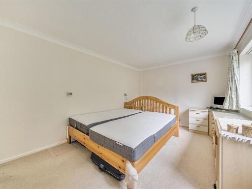
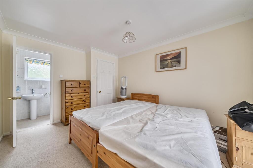
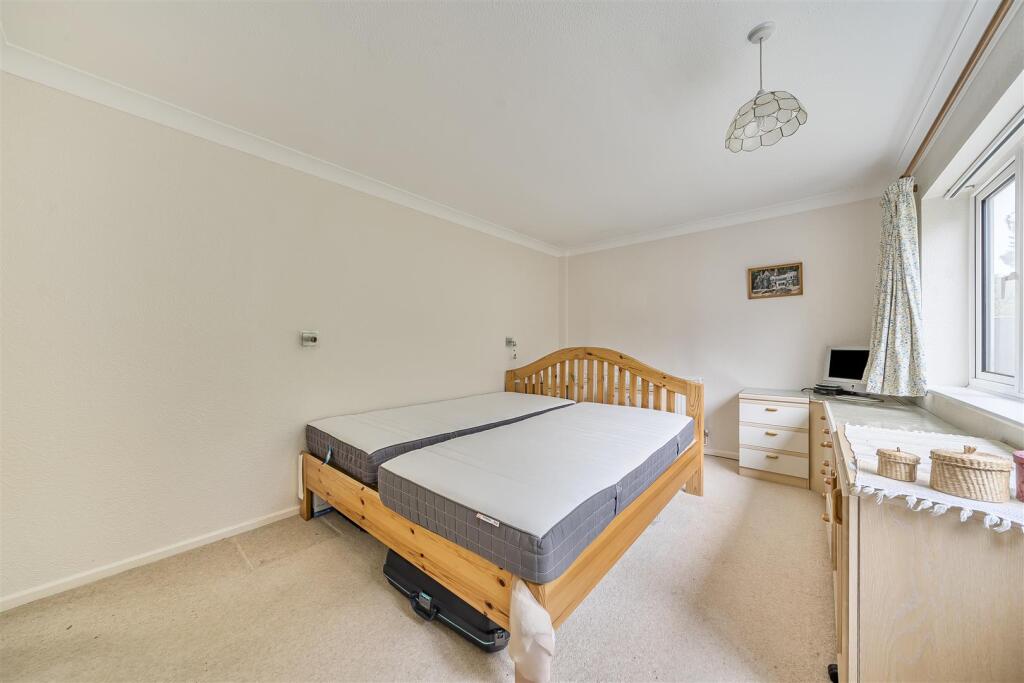
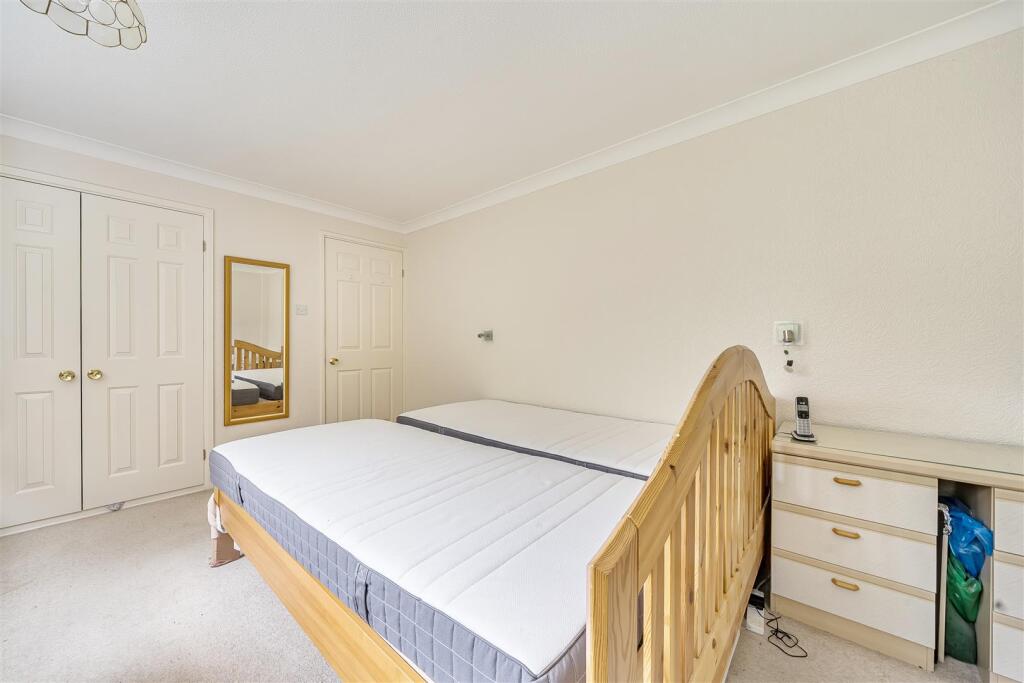
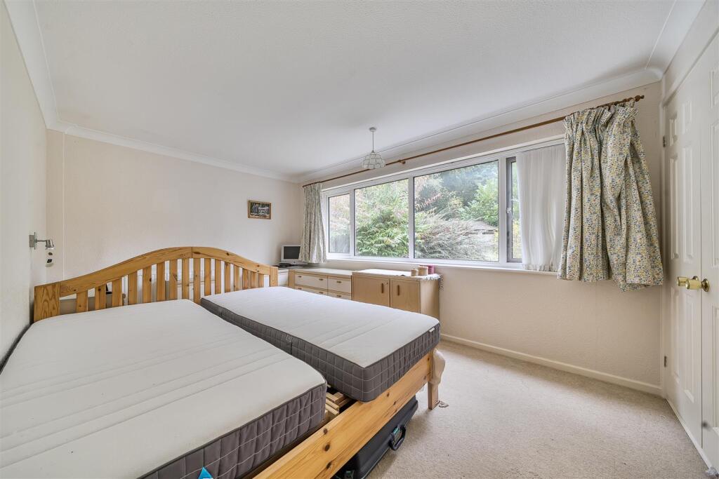
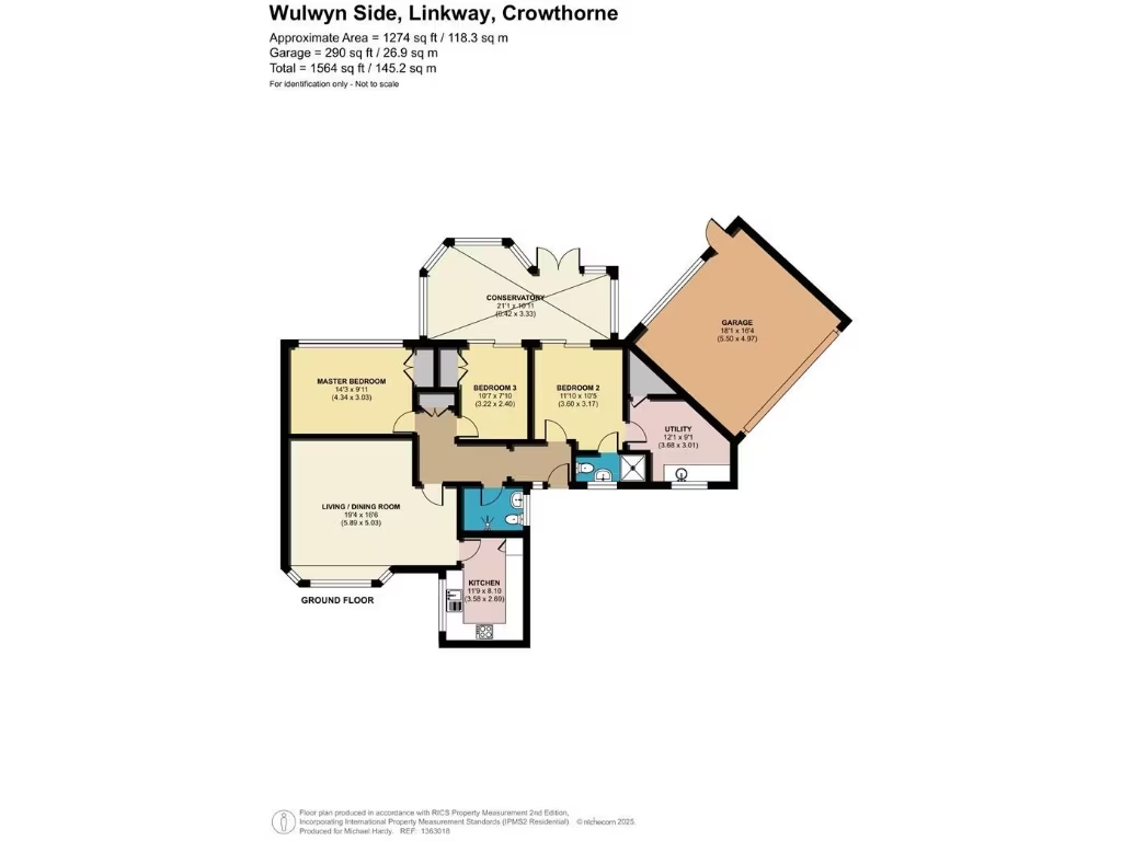
- MASTER BEDROOM:
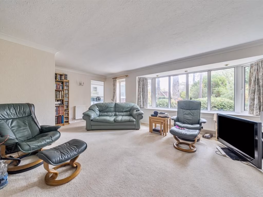
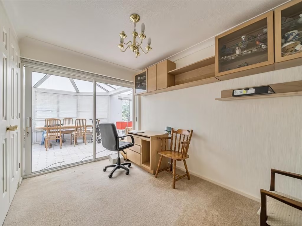
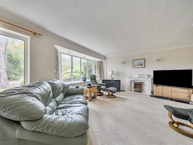
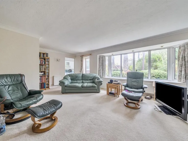
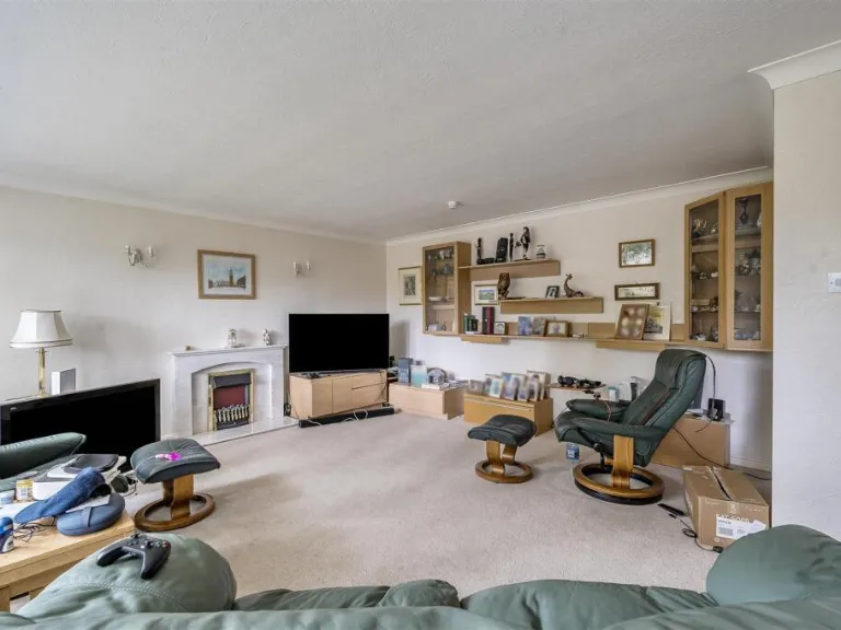
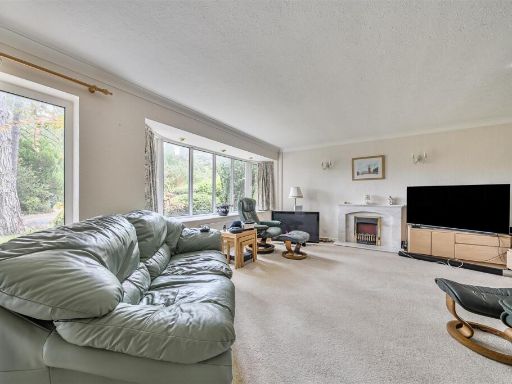
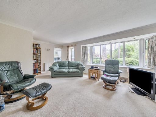
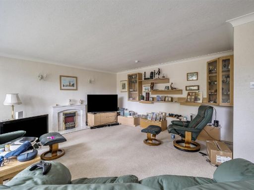
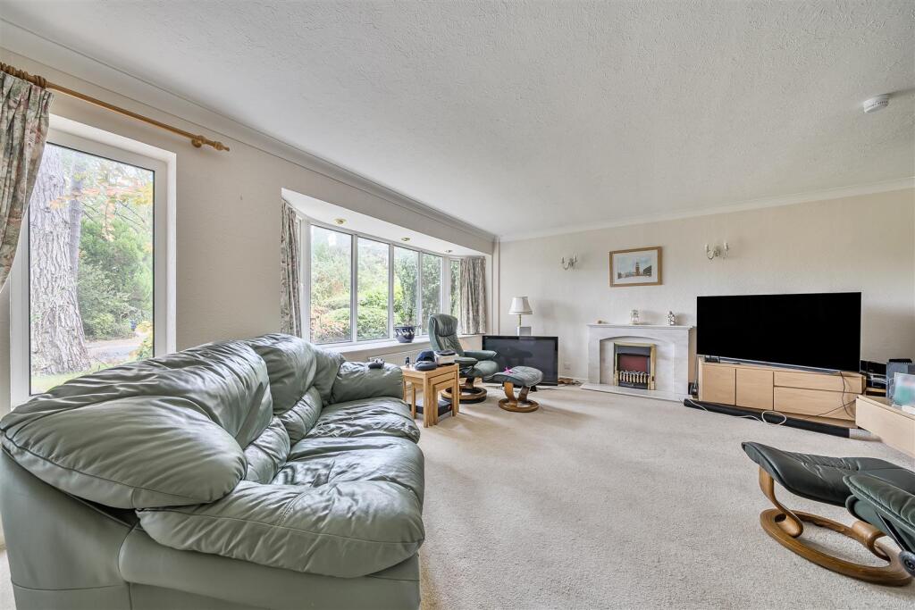
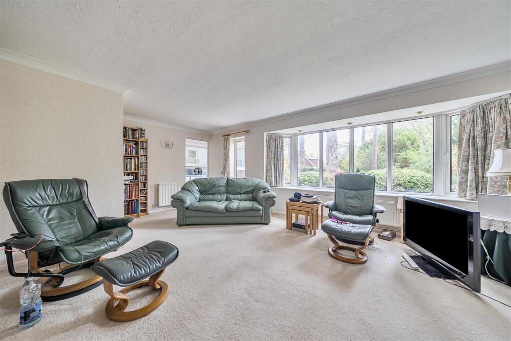
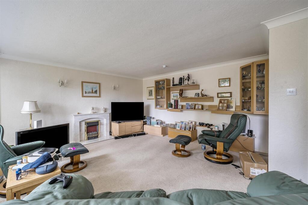
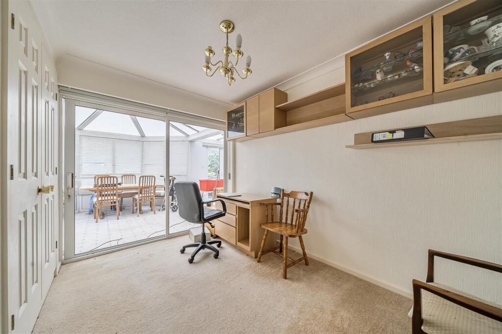
- LIVING / DINING ROOM:
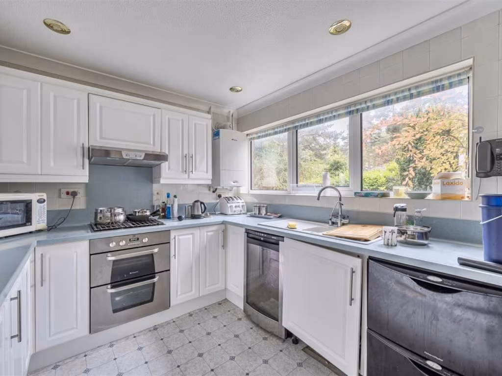
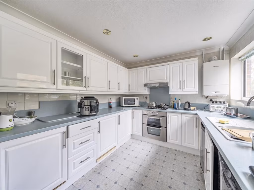
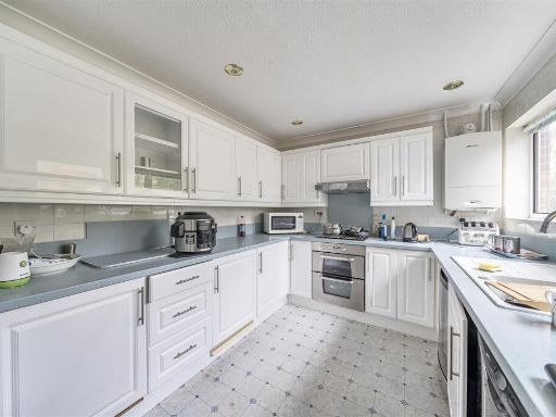
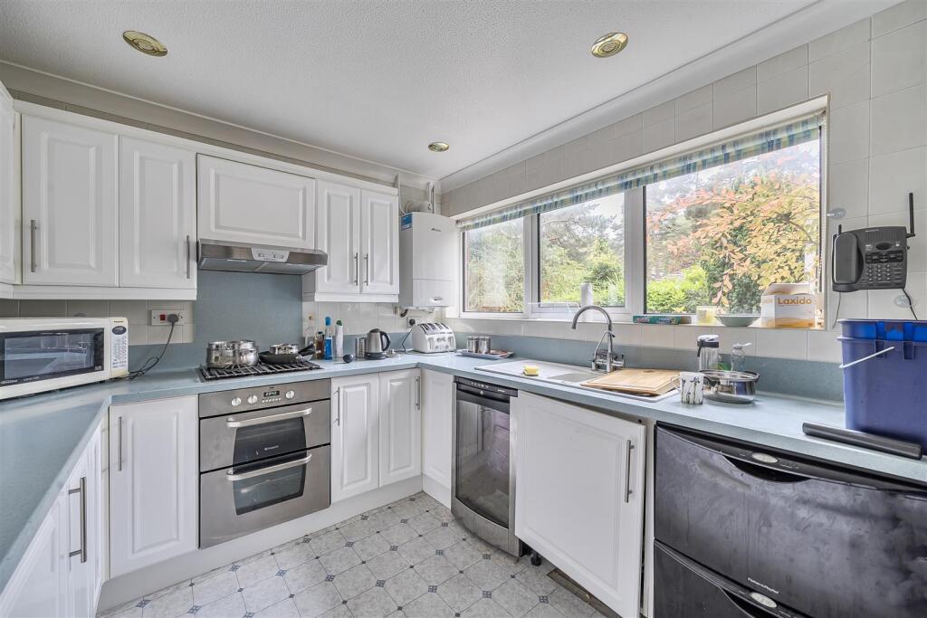
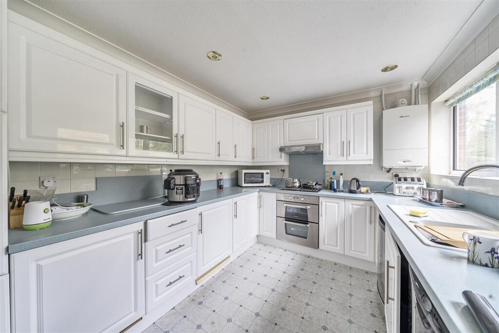
- KITCHEN:
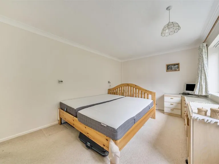
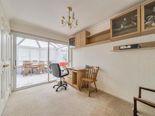
- BEDROOM 3:
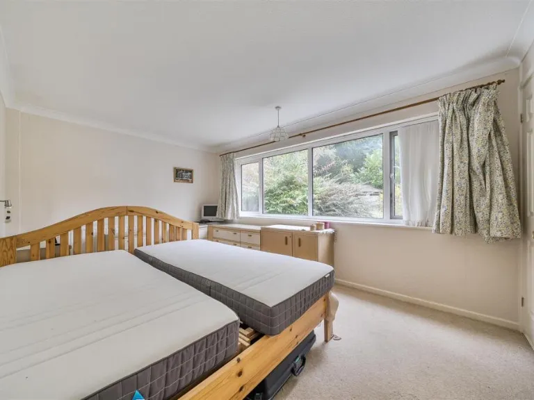
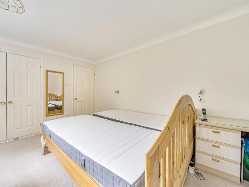
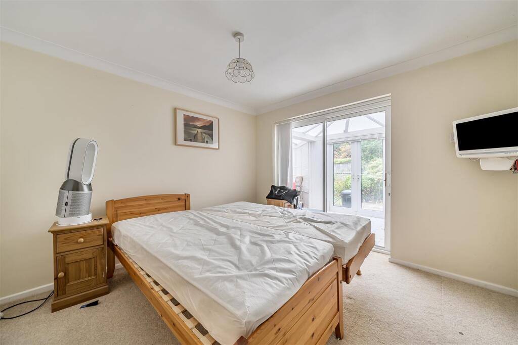
- BEDROOM 2:
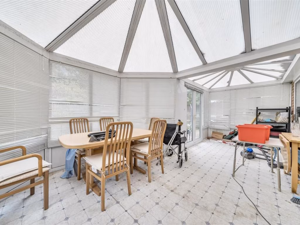
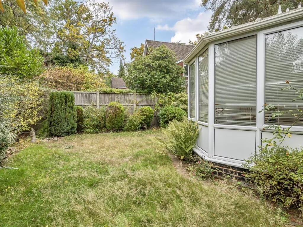
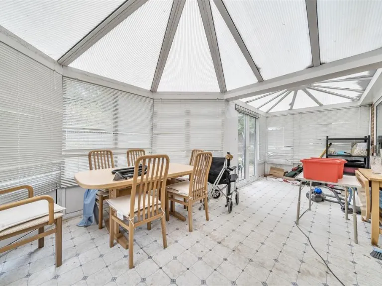
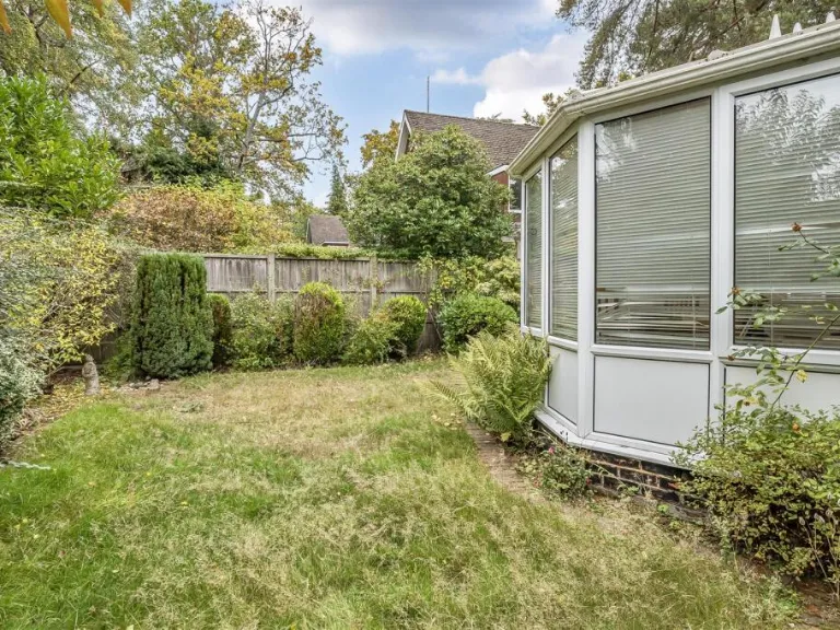
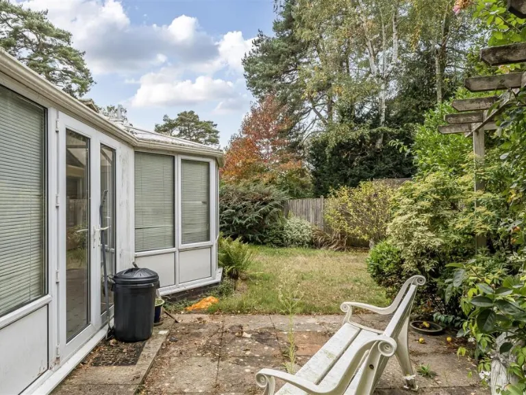
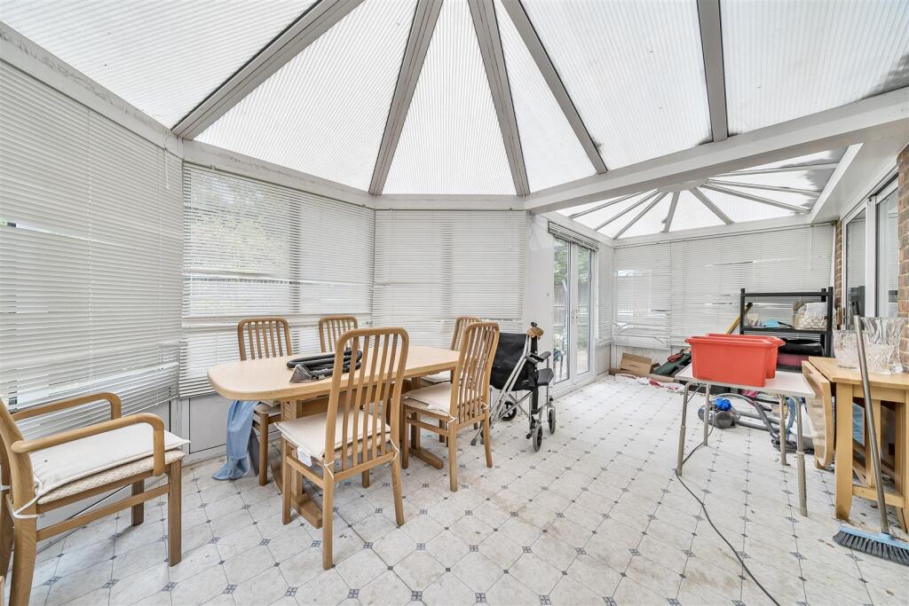
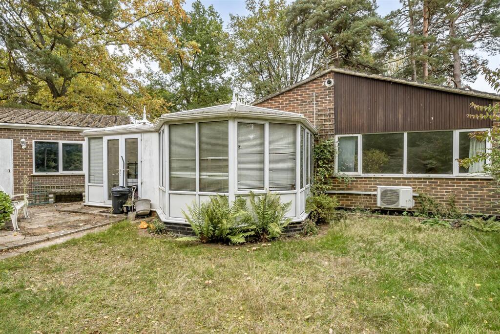
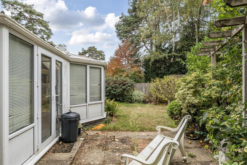
- CONSERVATORY:
- UTILITY:
Textual Property Features
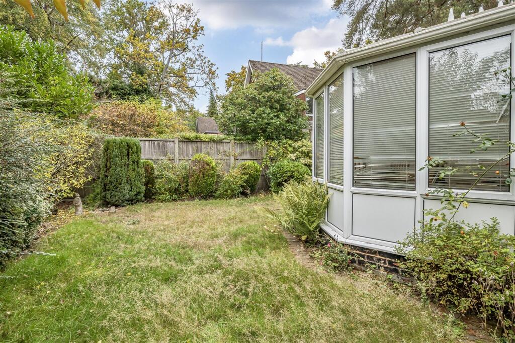
- Has Garden
- Chain Free
- Success
Detected Visual Features
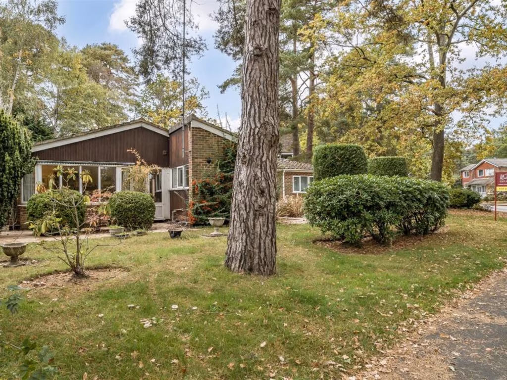
- bungalow
- mid-century
- garden
- trees
- patio
- wooden exterior
- nature
- landscaped garden
- privacy
- single-story
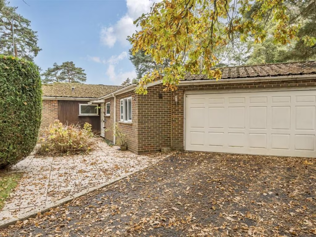
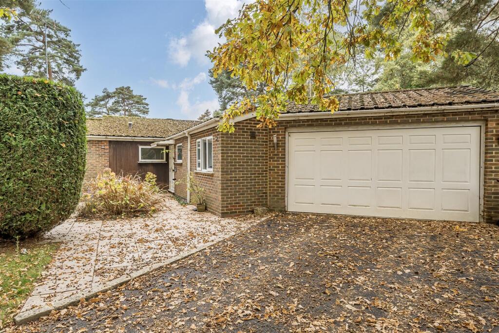
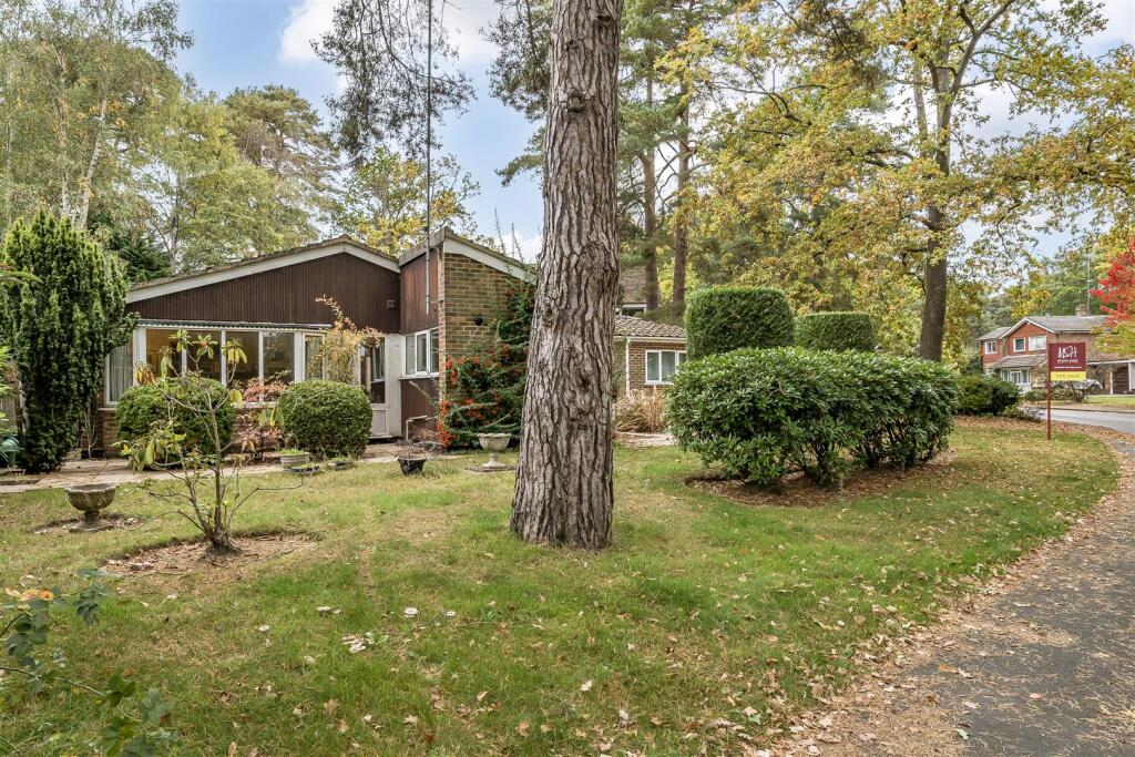
- brick
- exterior
- garage
- sidewalk
- driveway
- overgrown
- landscaping
- needs maintenance
- tree
EPC Details
- Fully double glazed
- Cavity wall, filled cavity
- Warm air, mains gas
- Low energy lighting in 33% of fixed outlets
- Solid, no insulation (assumed)
Nearby Schools
- Frogmore Infant School
- College Town Primary School
- Edgbarrow School
- Crowthorne Church of England Primary School
- Saint Sebastians Church of England Primary School
- Luckley House School
- Ludgrove School Trust Limited
- Frogmore Junior School
- Potley Hill Primary School
- Cranford Park Primary
- St Michael's Church of England Primary School, Sandhurst
- New Scotland Hill Primary School
- Wildmoor Heath School
- Our Lady's Preparatory School
- Oaklands Infant School
- Yateley Manor School
- Eagle House School
- Oaklands Junior School
- Hatch Ride Primary School
- Holme Grange School
- Sandhurst School
- Owlsmoor Primary School
- Wellington College
- Wooden Hill Primary and Nursery School
- King's Academy Easthampstead Park
- Floreat Montague Park Primary School
Nearest Bars And Restaurants
- Id: 2281852813
- Tags:
- Amenity: cafe
- Cuisine: sandwich
- Name: The Rolling Feast
- Wheelchair: yes
- TagsNormalized:
- Lat: 51.3669354
- Lon: -0.7946819
- FullGeoHash: gcpkjzj64df1
- PartitionGeoHash: gcpk
- Images:
- FoodStandards: null
- Distance: 1051.8
,- Id: 9358220717
- Tags:
- Addr:
- Housenumber: 17
- Postcode: RG45 6QX
- Street: Greenwood Road
- Amenity: restaurant
- Contact:
- Facebook: rayskitchenofficial
- Instagram: rayskitchenofficial
- Cuisine: indian;thai;vegan;vegetarian
- Name: Ray's Kitchen
- Opening_hours: Mo-Su 17:00-22:00
- Phone: +44 1344 777449;+44 1344 777567
- Website: https://rays-kitchen.co.uk/
- TagsNormalized:
- restaurant
- indian
- thai
- vegan
- vegetarian
- kitchen
- Lat: 51.377191
- Lon: -0.7994615
- FullGeoHash: gcpkmbcvg4w6
- PartitionGeoHash: gcpk
- Images:
- FoodStandards: null
- Distance: 917.2
,- Id: 8930438020
- Tags:
- Addr:
- Housenumber: 204
- Postcode: RG45 6DS
- Street: Duke's Ride
- Amenity: restaurant
- Contact:
- Facebook: Cumin-Garden-Crowthorne-110702753972983
- Cuisine: indian
- Name: Cumin Garden
- Opening_hours: Mo-Su 17:00-23:00
- Phone: +44 1344 780347;+44 1344 949401
- Website: http://cumincrowthorne.co.uk/
- TagsNormalized:
- Lat: 51.3673149
- Lon: -0.8180335
- FullGeoHash: gcpkjrhk63w0
- PartitionGeoHash: gcpk
- Images:
- FoodStandards: null
- Distance: 793.3
,- Id: 5625413296
- Tags:
- Amenity: cafe
- Name: V&A Cafe
- TagsNormalized:
- Lat: 51.3641143
- Lon: -0.8061488
- FullGeoHash: gcpkjwscxkgu
- PartitionGeoHash: gcpk
- Images:
- FoodStandards: null
- Distance: 787.5
,- Id: 6786186745
- Tags:
- Amenity: cafe
- Name: Good Food Deli
- TagsNormalized:
- Lat: 51.367528
- Lon: -0.8172771
- FullGeoHash: gcpkjrhvs160
- PartitionGeoHash: gcpk
- Images:
- FoodStandards: null
- Distance: 736.2
}
Nearest General Shops
- Id: 6786186751
- Tags:
- Addr:
- Name: LM Designs Contract Interiors
- Shop: interior_decoration
- TagsNormalized:
- Lat: 51.3675481
- Lon: -0.8167166
- FullGeoHash: gcpkjrjm9hgz
- PartitionGeoHash: gcpk
- Images:
- FoodStandards: null
- Distance: 702.4
,- Id: 6786186750
- Tags:
- Name: 2 Left Paws
- Shop: pet_grooming
- Website: https://www.2leftpaws.com/
- TagsNormalized:
- Lat: 51.3675649
- Lon: -0.8166334
- FullGeoHash: gcpkjrjmg04h
- PartitionGeoHash: gcpk
- Images:
- FoodStandards: null
- Distance: 696.6
,- Id: 6786186749
- Tags:
- Name: Taylor & Co
- Shop: jewelry
- TagsNormalized:
- Lat: 51.3675808
- Lon: -0.8165208
- FullGeoHash: gcpkjrjmvejg
- PartitionGeoHash: gcpk
- Images:
- FoodStandards: null
- Distance: 689.1
}
Nearest Grocery shops
- Id: 1034554808
- Tags:
- Addr:
- Housenumber: 21-23
- Postcode: RG45 6QX
- Street: Greenwood Road
- Brand: Tesco Express
- Brand:wikidata: Q98456772
- Building: yes
- Fhrs:
- Name: Tesco Express
- Name:en: Tesco Express
- Opening_hours: Mo-Fr 07:00-22:00; Sa 08:00-22:00; Su 09:00-19:00
- Phone: +44 345 674 6393
- Shop: convenience
- Website: https://www.tesco.com/store-locator/crowthorne/21-23-greenwood-rd
- TagsNormalized:
- tesco
- tesco express
- convenience
- shop
- Lat: 51.3770805
- Lon: -0.7996307
- FullGeoHash: gcpkmbctpmbn
- PartitionGeoHash: gcpk
- Images:
- FoodStandards:
- Id: 282601
- FHRSID: 282601
- LocalAuthorityBusinessID: 49146
- BusinessName: Tesco
- BusinessType: Retailers - supermarkets/hypermarkets
- BusinessTypeID: 7840
- AddressLine1: null
- AddressLine2: 21-23 Greenwood Road
- AddressLine3: Crowthorne
- AddressLine4: null
- PostCode: RG45 6QX
- RatingValue: 5
- RatingKey: fhrs_5_en-GB
- RatingDate: 2018-03-13
- LocalAuthorityCode: 887
- LocalAuthorityName: Wokingham
- LocalAuthorityWebSite: http://www.wokingham.gov.uk/welcome/
- LocalAuthorityEmailAddress: environmental.health@wokingham.gov.uk
- Scores:
- Hygiene: 0
- Structural: 0
- ConfidenceInManagement: 0
- NewRatingPending: false
- Geocode:
- Longitude: -0.79926000000000
- Latitude: 51.37717900000000
- Distance: 900.2
,- Id: 9358728817
- Tags:
- Addr:
- Housenumber: 167
- Postcode: RG45 6DR
- Street: Duke's Ride
- Amenity: post_office
- Name: Crowthorne News & Post Office
- Phone: +44 1344 772221
- Shop: convenience
- TagsNormalized:
- office
- post office
- convenience
- shop
- Lat: 51.3670124
- Lon: -0.8186598
- FullGeoHash: gcpkjr5fec5h
- PartitionGeoHash: gcpk
- Images:
- FoodStandards: null
- Distance: 848
,- Id: 2297010216
- Tags:
- Addr:
- Housenumber: 218
- Postcode: RG45 6DS
- Street: Duke's Ride
- Name: Dukes Ride Food & Wine
- Opening_hours: Mo-Sa 07:00-09:30; Su 07:00-08:30
- Shop: convenience
- TagsNormalized:
- Lat: 51.3672535
- Lon: -0.818595
- FullGeoHash: gcpkjr5gvq56
- PartitionGeoHash: gcpk
- Images:
- FoodStandards: null
- Distance: 830.2
}
Nearest Supermarkets
- Id: 775307323
- Tags:
- Name: Co-Op
- Shop: supermarket
- TagsNormalized:
- Lat: 51.3526543
- Lon: -0.7793173
- FullGeoHash: gcpknk2wbsdf
- PartitionGeoHash: gcpk
- Images:
- FoodStandards: null
- Distance: 2871.3
,- Id: 1034168081
- Tags:
- Alt_name: Co-op
- Brand: Co-op Food
- Brand:wikidata: Q3277439
- Brand:wikipedia: en:Co-op Food
- Building: retail
- Name: Co-op Food
- Opening_hours: Mo-Sa 07:00-22:00; Su 10:00-16:00
- Operator: The Co-operative Group
- Operator:wikidata: Q117202
- Shop: supermarket
- Wheelchair: yes
- TagsNormalized:
- co-op
- co-op food
- food
- retail
- supermarket
- shop
- Lat: 51.3684627
- Lon: -0.7929773
- FullGeoHash: gcpkjzqdfr3r
- PartitionGeoHash: gcpk
- Images:
- FoodStandards: null
- Distance: 1103.2
,- Id: 175968074
- Tags:
- Addr:
- City: Crowthorne
- Country: GB
- Housenumber: 80
- Postcode: RG45 7BE
- Street: High Street
- Brand: Lidl
- Brand:wikidata: Q151954
- Brand:wikipedia: en:Lidl
- Building: retail
- Building:levels: 1
- Fhrs:
- Name: Lidl
- Opening_hours: Mo-Sa 08:00-22:00; Su 10:00-16:00; PH 08:00-20:00
- Shop: supermarket
- Source:
- Building: OS_OpenData_StreetView
- Wheelchair: yes
- TagsNormalized:
- lidl
- retail
- supermarket
- shop
- Lat: 51.3691086
- Lon: -0.7933279
- FullGeoHash: gcpkjzqqdpgu
- PartitionGeoHash: gcpk
- Images:
- FoodStandards:
- Id: 985535
- FHRSID: 985535
- LocalAuthorityBusinessID: 05/20259/CP
- BusinessName: Lidl
- BusinessType: Retailers - supermarkets/hypermarkets
- BusinessTypeID: 7840
- AddressLine1: 80 High Street
- AddressLine2: Crowthorne
- AddressLine3: null
- AddressLine4: null
- PostCode: RG45 7BE
- RatingValue: 5
- RatingKey: fhrs_5_en-GB
- RatingDate: 2021-11-22
- LocalAuthorityCode: 882
- LocalAuthorityName: Bracknell Forest
- LocalAuthorityWebSite: http://www.bracknell-forest.gov.uk
- LocalAuthorityEmailAddress: environmental.health@bracknell-forest.gov.uk
- Scores:
- Hygiene: 0
- Structural: 5
- ConfidenceInManagement: 0
- NewRatingPending: false
- Geocode:
- Longitude: -0.79333700000000
- Latitude: 51.36913300000000
- Distance: 1062.7
}
Nearest Religious buildings
- Id: 1034168085
- Tags:
- Addr:
- City: Crowthorne
- Housenumber: 144
- Postcode: RG45 7AT
- Street: High Street
- Amenity: place_of_worship
- Building: yes
- Denomination: baptist
- Name: Crowthorne Baptist Church
- Religion: christian
- Website: https://www.crowthornebaptist.org.uk/
- Wheelchair: yes
- TagsNormalized:
- place of worship
- baptist
- church
- christian
- Lat: 51.3682638
- Lon: -0.7938655
- FullGeoHash: gcpkjzmcvd6v
- PartitionGeoHash: gcpk
- Images:
- FoodStandards: null
- Distance: 1050.2
,- Id: 293933116
- Tags:
- Amenity: place_of_worship
- Building: yes
- Denomination: anglican
- Name: St John the Baptist
- Religion: christian
- Wikidata: Q26672714
- TagsNormalized:
- place of worship
- anglican
- baptist
- christian
- church
- Lat: 51.3682173
- Lon: -0.7978792
- FullGeoHash: gcpkjz7181dp
- PartitionGeoHash: gcpk
- Images:
- FoodStandards: null
- Distance: 790.5
,- Id: 299659740
- Tags:
- Amenity: place_of_worship
- Building: yes
- Denomination: catholic
- Name: Holy Ghost Church
- Religion: christian
- TagsNormalized:
- place of worship
- catholic
- church
- christian
- Lat: 51.3720711
- Lon: -0.8039564
- FullGeoHash: gcpkm8n842ns
- PartitionGeoHash: gcpk
- Images:
- FoodStandards: null
- Distance: 322.4
}
Nearest Medical buildings
- Id: 6571200415
- Tags:
- Amenity: pharmacy
- Brand: Lloyds Pharmacy
- Brand:wikidata: Q6662870
- Brand:wikipedia: en:LloydsPharmacy
- Dispensing: yes
- Drive_through: no
- Healthcare: pharmacy
- Name: Lloyds Pharmacy
- Operator: Lloyds
- Wheelchair: yes
- TagsNormalized:
- pharmacy
- lloyds pharmacy
- health
- healthcare
- Lat: 51.3682971
- Lon: -0.7936473
- FullGeoHash: gcpkjzq448te
- PartitionGeoHash: gcpk
- Images:
- FoodStandards: null
- Distance: 1063.6
,- Id: 2281853379
- Tags:
- Addr:
- City: Crowthorne
- Housenumber: 182
- Postcode: RG45 7AP
- Street: High Street
- Amenity: pharmacy
- Dispensing: yes
- Drive_through: no
- Healthcare: pharmacy
- Name: McParland Pharmacy
- Operator: H A McParland
- Wheelchair: limited
- TagsNormalized:
- Lat: 51.3673725
- Lon: -0.7943548
- FullGeoHash: gcpkjzjsdhq0
- PartitionGeoHash: gcpk
- Images:
- FoodStandards: null
- Distance: 1052.4
,- Id: 8930438022
- Tags:
- Amenity: pharmacy
- Dispensing: yes
- Healthcare: pharmacy
- Name: Dukes Pharmacy
- TagsNormalized:
- Lat: 51.3675227
- Lon: -0.8174006
- FullGeoHash: gcpkjrhv90mb
- PartitionGeoHash: gcpk
- Images:
- FoodStandards: null
- Distance: 743.8
,- Id: 5630864220
- Tags:
- Leisure: sports_centre
- Name: Wellington College Health and Fitness Club
- TagsNormalized:
- sports
- sports centre
- leisure
- college
- fitness
- health
- club
- Lat: 51.3659644
- Lon: -0.812645
- FullGeoHash: gcpkjwbhrvzb
- PartitionGeoHash: gcpk
- Images:
- FoodStandards: null
- Distance: 642.1
}
Nearest Airports
- Id: 14001268
- Tags:
- Access: yes
- Aerodrome: international
- Aerodrome:type: public
- Aeroway: aerodrome
- Alt_name: London Heathrow
- Alt_name_2: London Heathrow Airport
- Ele: 25
- Iata: LHR
- Icao: EGLL
- Int_name: Heathrow Airport
- Name: London Heathrow Airport
- Note: area still approx
- Old_name: London Airport
- Operator: Heathrow Airport Limited
- Rank_aci:
- Ref: LHR
- Short_name: Heathrow
- Type: multipolygon
- Website: https://www.heathrow.com/
- Wikidata: Q8691
- Wikipedia: en:Heathrow Airport
- TagsNormalized:
- airport
- international airport
- Lat: 51.4677522
- Lon: -0.4547736
- FullGeoHash: gcpsv9kv7h2h
- PartitionGeoHash: gcps
- Images:
- FoodStandards: null
- Distance: 26769.1
}
Nearest Leisure Facilities
- Id: 589667858
- Tags:
- Building: commercial
- Leisure: sports_centre
- TagsNormalized:
- sports
- sports centre
- leisure
- Lat: 51.3661745
- Lon: -0.8123598
- FullGeoHash: gcpkjwbmwsuw
- PartitionGeoHash: gcpk
- Images:
- FoodStandards: null
- Distance: 612.2
,- Id: 589054288
- Tags:
- Access: customers
- Leisure: pitch
- Sport: tennis
- TagsNormalized:
- Lat: 51.3670791
- Lon: -0.812716
- FullGeoHash: gcpkjx04yme4
- PartitionGeoHash: gcpk
- Images:
- FoodStandards: null
- Distance: 538.5
,- Id: 589693493
- Tags:
- Leisure: pitch
- Sport: cricket_nets
- TagsNormalized:
- pitch
- leisure
- cricket
- cricket nets
- sports
- Lat: 51.3662865
- Lon: -0.8085189
- FullGeoHash: gcpkjwgq21ud
- PartitionGeoHash: gcpk
- Images:
- FoodStandards: null
- Distance: 531.7
,- Id: 589054289
- Tags:
- Leisure: pitch
- Lit: yes
- Sport: hockey;association_football
- TagsNormalized:
- pitch
- leisure
- hockey
- football
- sports
- Lat: 51.3668811
- Lon: -0.8119717
- FullGeoHash: gcpkjx09z8wj
- PartitionGeoHash: gcpk
- Images:
- FoodStandards: null
- Distance: 530.2
,- Id: 589693495
- Tags:
- Access: private
- Leisure: swimming_pool
- TagsNormalized:
- swimming
- swimming pool
- pool
- leisure
- Lat: 51.3674002
- Lon: -0.8062976
- FullGeoHash: gcpkjxhugckv
- PartitionGeoHash: gcpk
- Images:
- FoodStandards: null
- Distance: 431
}
Nearest Tourist attractions
- Id: 954733592
- Tags:
- Name: Bomb Hole Drops
- Tourism: attraction
- TagsNormalized:
- Lat: 51.3785178
- Lon: -0.7663851
- FullGeoHash: gcpkq91vtcvu
- PartitionGeoHash: gcpk
- Images:
- FoodStandards: null
- Distance: 3025.9
,- Id: 291971667
- Tags:
- Name: Trilakes Animal Park
- Tourism: zoo
- Zoo: petting_zoo
- TagsNormalized:
- Lat: 51.3453331
- Lon: -0.8132239
- FullGeoHash: gcpkj7pu4xb6
- PartitionGeoHash: gcpk
- Images:
- FoodStandards: null
- Distance: 2881.6
,- Id: 183399645
- Tags:
- Access: private
- Barrier: fence
- Name: Heritage Club
- Nudism: yes
- Tents: yes
- Tourism: caravan_site
- Website: http://www.heritageclub.org
- TagsNormalized:
- Lat: 51.3691212
- Lon: -0.8307925
- FullGeoHash: gcpkjp7nc4hp
- PartitionGeoHash: gcpk
- Images:
- FoodStandards: null
- Distance: 1575.4
}
Nearest Bus stations and stops
- Id: 5902494292
- Tags:
- Highway: bus_stop
- Public_transport: platform
- Source: Bing
- TagsNormalized:
- Lat: 51.3704768
- Lon: -0.7914983
- FullGeoHash: gcpkjzxwsybn
- PartitionGeoHash: gcpk
- Images:
- FoodStandards: null
- Distance: 1169
,- Id: 8622076347
- Tags:
- Bus: yes
- Highway: bus_stop
- Public_transport: platform
- Shelter: yes
- TagsNormalized:
- Lat: 51.366021
- Lon: -0.7951559
- FullGeoHash: gcpkjyuuz82f
- PartitionGeoHash: gcpk
- Images:
- FoodStandards: null
- Distance: 1071.9
,- Id: 8622076346
- Tags:
- Bus: yes
- Highway: bus_stop
- Public_transport: platform
- TagsNormalized:
- Lat: 51.3661868
- Lon: -0.7951293
- FullGeoHash: gcpkjyvj8phx
- PartitionGeoHash: gcpk
- Images:
- FoodStandards: null
- Distance: 1063.9
,- Id: 8621768891
- Tags:
- Bus: yes
- Highway: bus_stop
- Public_transport: platform
- TagsNormalized:
- Lat: 51.3708275
- Lon: -0.7958745
- FullGeoHash: gcpkjzu2yb2f
- PartitionGeoHash: gcpk
- Images:
- FoodStandards: null
- Distance: 863.8
,- Id: 2975049947
- Tags:
- Bench: no
- Highway: bus_stop
- Name: Ellis Road
- Public_transport: platform
- Shelter: no
- Tactile_paving: no
- TagsNormalized:
- Lat: 51.3742829
- Lon: -0.8041507
- FullGeoHash: gcpkm8qkvumy
- PartitionGeoHash: gcpk
- Images:
- FoodStandards: null
- Distance: 459.8
}
Nearest Hotels
- Id: 1967390
- Tags:
- Addr:
- City: Wokingham
- Postcode: RG40 1ST
- Street: London Road
- Building: yes
- Contact:
- Facebook: https://www.facebook.com/Stannesmanor/
- Instagram: https://www.instagram.com/stannes_manor/
- Twitter: https://twitter.com/DTHiltonStAnnes
- Email: reservations.stannes@hilton.com
- Fax: 44-118-977-2526
- Name: DoubleTree by Hilton St. Anne's Manor
- Operator: Hilton Hotels
- Phone: +44 118 977 2550
- Smoking: no
- Tourism: hotel
- Type: multipolygon
- Website: https://www.hilton.com/en/hotels/brasadi-doubletree-st-annes-manor/
- Wheelchair: yes
- Wikidata: Q52179170
- TagsNormalized:
- Lat: 51.4103648
- Lon: -0.7983634
- FullGeoHash: gcpkmyfxhf95
- PartitionGeoHash: gcpk
- Images:
- FoodStandards: null
- Distance: 4424
,- Id: 925210596
- Tags:
- Addr:
- Country: GB
- Housenumber: 221
- Postcode: GU47 0RT
- Street: Yorktown Road
- Brand: Premier Inn
- Brand:wikidata: Q2108626
- Brand:wikipedia: en:Premier Inn
- Building: yes
- Fhrs:
- Internet_access: wlan
- Internet_access:fee: customers
- Internet_access:operator: Virgin Media
- Internet_access:ssid: Premier Inn Free Wi-Fi
- Name: Premier Inn
- Operator: Whitbread
- Tourism: hotel
- Wheelchair: yes
- TagsNormalized:
- Lat: 51.3459151
- Lon: -0.785428
- FullGeoHash: gcpkn5hpdhq6
- PartitionGeoHash: gcpk
- Images:
- FoodStandards: null
- Distance: 3216.6
,- Id: 323111444
- Tags:
- Addr:
- City: Crowthorne
- Country: GB
- Housenumber: 62
- Postcode: RG45 6DL
- Street: Duke's Ride
- Building: yes
- Fhrs:
- Name: Dial House Hotel
- Tourism: hotel
- TagsNormalized:
- Lat: 51.3703768
- Lon: -0.8018063
- FullGeoHash: gcpkjz8nhs3c
- PartitionGeoHash: gcpk
- Images:
- FoodStandards: null
- Distance: 458.1
}
Tags
- bungalow
- mid-century
- garden
- trees
- patio
- wooden exterior
- nature
- landscaped garden
- privacy
- single-story
- bungalow
- mid-century
- brick
- exterior
- garage
- sidewalk
- driveway
- overgrown
- landscaping
- needs maintenance
- tree
- nature
Local Market Stats
- Average Price/sqft: £442
- Avg Income: £73200
- Rental Yield: 4.1%
- Social Housing: 8%
- Planning Success Rate: 92%
Similar Properties
 5 bedroom detached house for sale in Edgcumbe Park Drive Crowthorne, Berkshire, RG45 6HX, RG45 — £925,000 • 5 bed • 3 bath • 2797 ft²
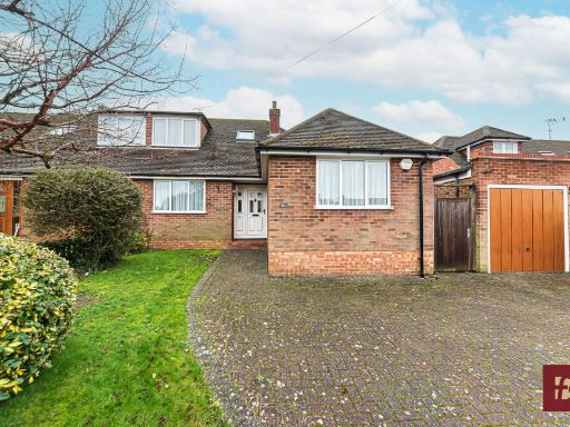 3 bedroom semi-detached bungalow for sale in Belmont Road, Crowthorne, Berkshire, RG45 6SA, RG45 — £510,000 • 3 bed • 1 bath • 1139 ft²
 4 bedroom detached house for sale in Bramblegate, Crowthorne, Berkshire, RG45 6JA, RG45 — £850,000 • 4 bed • 2 bath • 2222 ft²
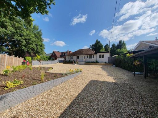 3 bedroom detached bungalow for sale in Heath Ride, Finchampstead, RG40 — £775,000 • 3 bed • 2 bath • 1475 ft²
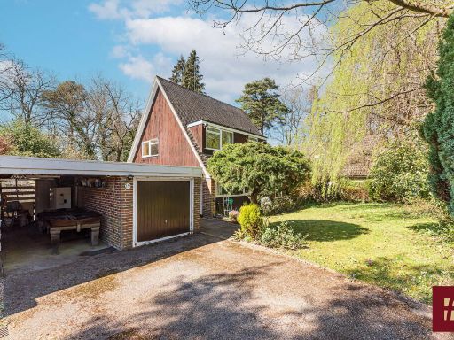 3 bedroom detached house for sale in Linkway, Crowthorne, Berkshire, RG45 6ES, RG45 — £800,000 • 3 bed • 2 bath • 2038 ft²
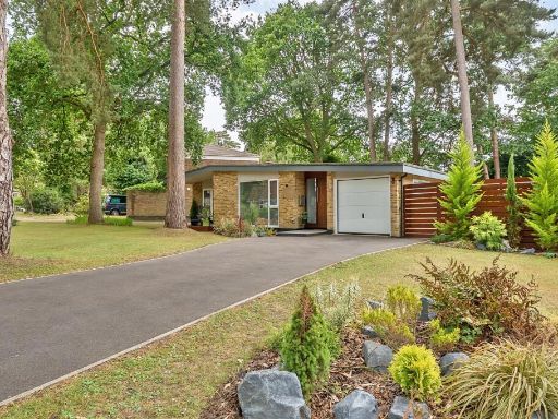 3 bedroom detached bungalow for sale in Heathermount Drive Crowthorne, Berkshire, RG45 6HJ, RG45 — £685,000 • 3 bed • 1 bath • 1095 ft²
Meta
- {
"@context": "https://schema.org",
"@type": "Residence",
"name": "3 bedroom detached bungalow for sale in Wulwyn Side, Linkwa…",
"description": "",
"url": "https://propertypiper.co.uk/property/b652a019-7e8b-4932-93d1-c438de6d3c92",
"image": "https://image-a.propertypiper.co.uk/9e5b394f-4f87-4c39-924b-4e6ad6b66a87-1024.jpeg",
"address": {
"@type": "PostalAddress",
"streetAddress": "\n 4 Wulwyn Side,Linkway,CROWTHORNE,RG45 6JB\n ",
"postalCode": "RG45 6JB",
"addressLocality": "Wokingham",
"addressRegion": "Bracknell",
"addressCountry": "England"
},
"geo": {
"@type": "GeoCoordinates",
"latitude": 51.3710663,
"longitude": -0.8083127
},
"numberOfRooms": 3,
"numberOfBathroomsTotal": 1,
"floorSize": {
"@type": "QuantitativeValue",
"value": 1564,
"unitCode": "FTK"
},
"offers": {
"@type": "Offer",
"price": 650000,
"priceCurrency": "GBP",
"availability": "https://schema.org/InStock"
},
"additionalProperty": [
{
"@type": "PropertyValue",
"name": "Feature",
"value": "bungalow"
},
{
"@type": "PropertyValue",
"name": "Feature",
"value": "mid-century"
},
{
"@type": "PropertyValue",
"name": "Feature",
"value": "garden"
},
{
"@type": "PropertyValue",
"name": "Feature",
"value": "trees"
},
{
"@type": "PropertyValue",
"name": "Feature",
"value": "patio"
},
{
"@type": "PropertyValue",
"name": "Feature",
"value": "wooden exterior"
},
{
"@type": "PropertyValue",
"name": "Feature",
"value": "nature"
},
{
"@type": "PropertyValue",
"name": "Feature",
"value": "landscaped garden"
},
{
"@type": "PropertyValue",
"name": "Feature",
"value": "privacy"
},
{
"@type": "PropertyValue",
"name": "Feature",
"value": "single-story"
},
{
"@type": "PropertyValue",
"name": "Feature",
"value": "bungalow"
},
{
"@type": "PropertyValue",
"name": "Feature",
"value": "mid-century"
},
{
"@type": "PropertyValue",
"name": "Feature",
"value": "brick"
},
{
"@type": "PropertyValue",
"name": "Feature",
"value": "exterior"
},
{
"@type": "PropertyValue",
"name": "Feature",
"value": "garage"
},
{
"@type": "PropertyValue",
"name": "Feature",
"value": "sidewalk"
},
{
"@type": "PropertyValue",
"name": "Feature",
"value": "driveway"
},
{
"@type": "PropertyValue",
"name": "Feature",
"value": "overgrown"
},
{
"@type": "PropertyValue",
"name": "Feature",
"value": "landscaping"
},
{
"@type": "PropertyValue",
"name": "Feature",
"value": "needs maintenance"
},
{
"@type": "PropertyValue",
"name": "Feature",
"value": "tree"
},
{
"@type": "PropertyValue",
"name": "Feature",
"value": "nature"
}
]
}
High Res Floorplan Images
Compatible Floorplan Images
FloorplanImages Thumbnail