DA2 6EW - 4 bedroom semidetached house for sale in Watling Street, Da…
View on Property Piper
4 bedroom semi-detached house for sale in Watling Street, Dartford, DA2
Property Details
- Price: £525000
- Bedrooms: 4
- Bathrooms: 2
- Property Type: undefined
- Property SubType: undefined
Brochure Descriptions
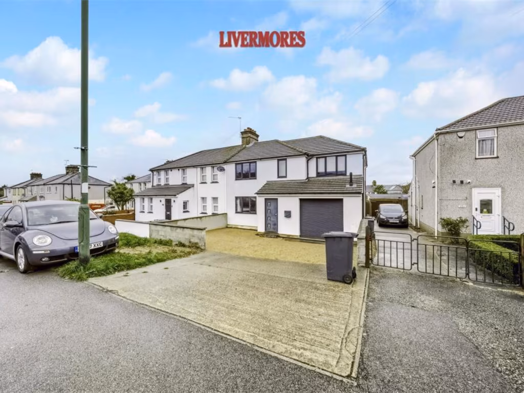
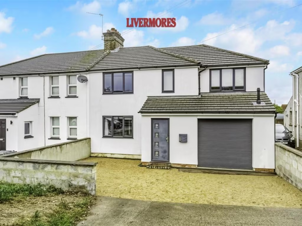
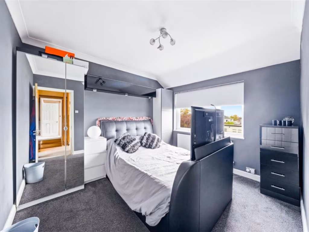
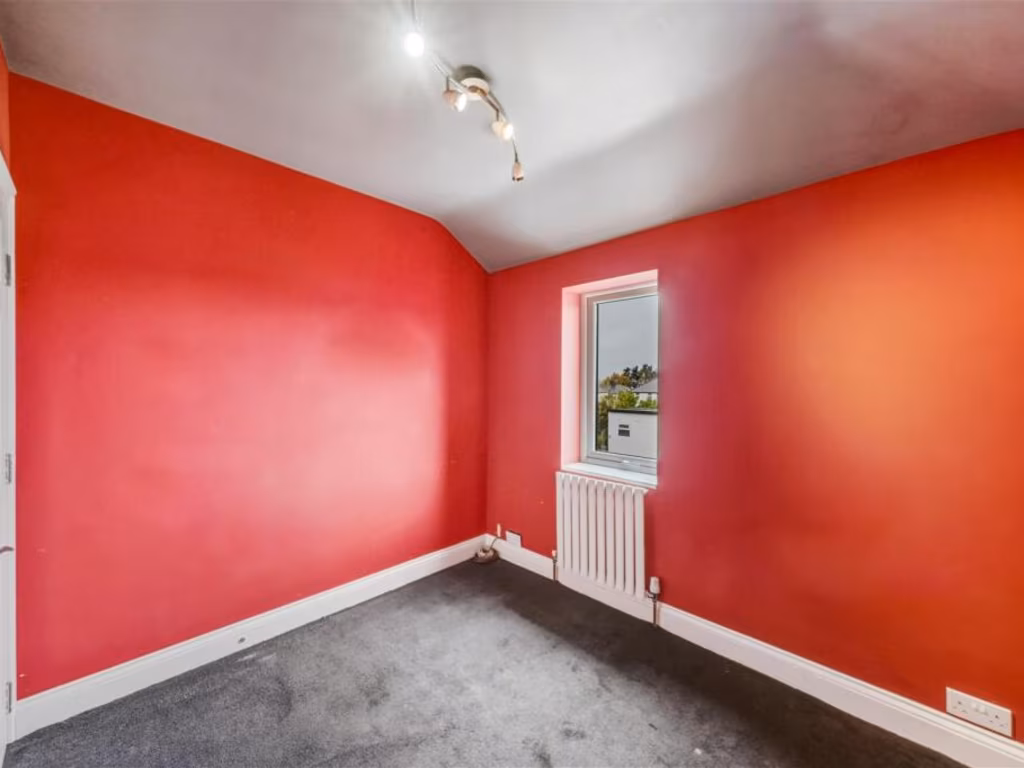
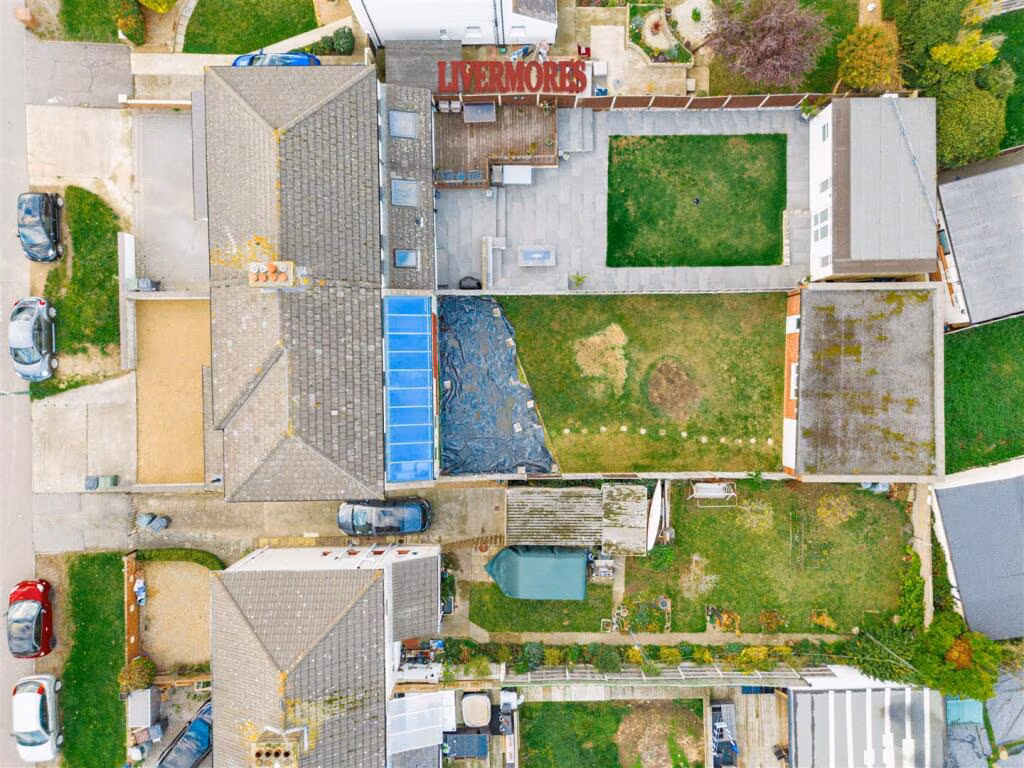
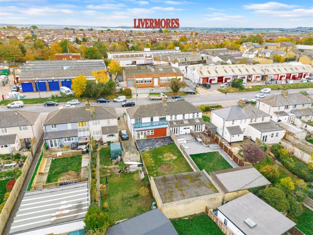
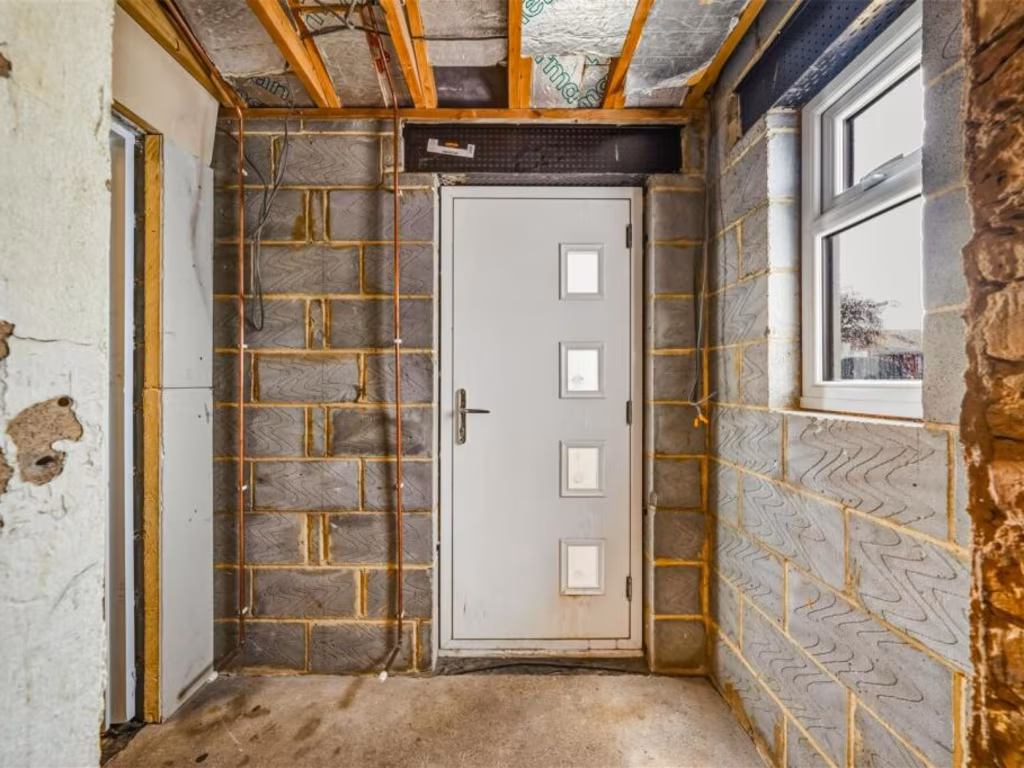
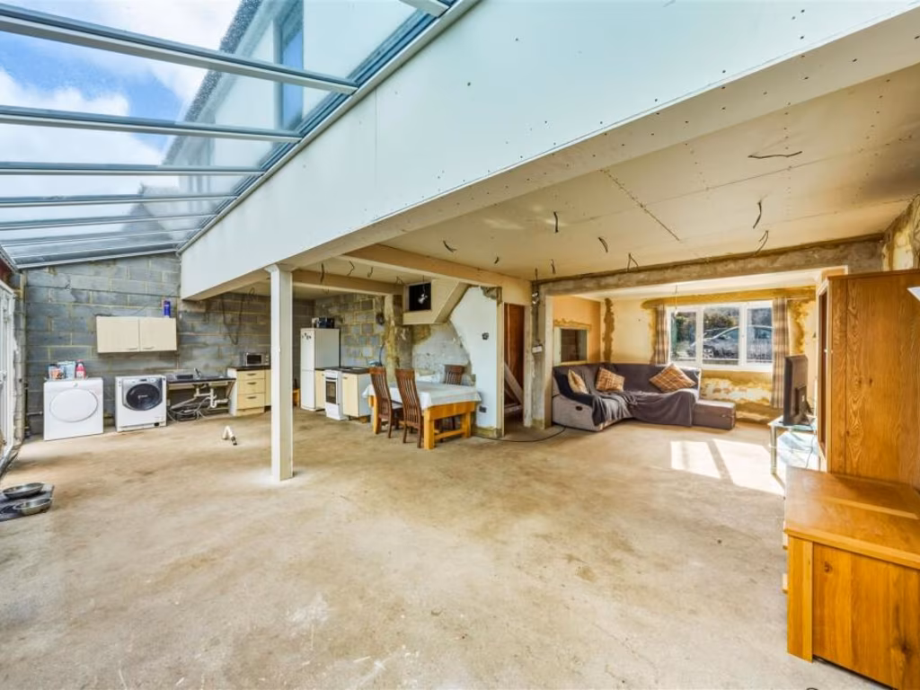
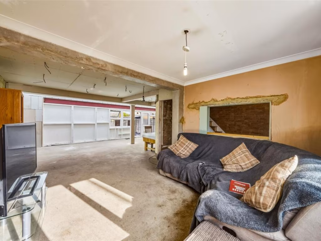
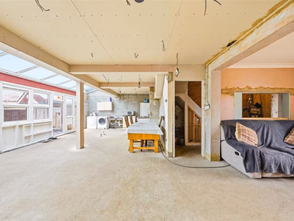
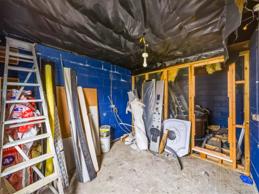
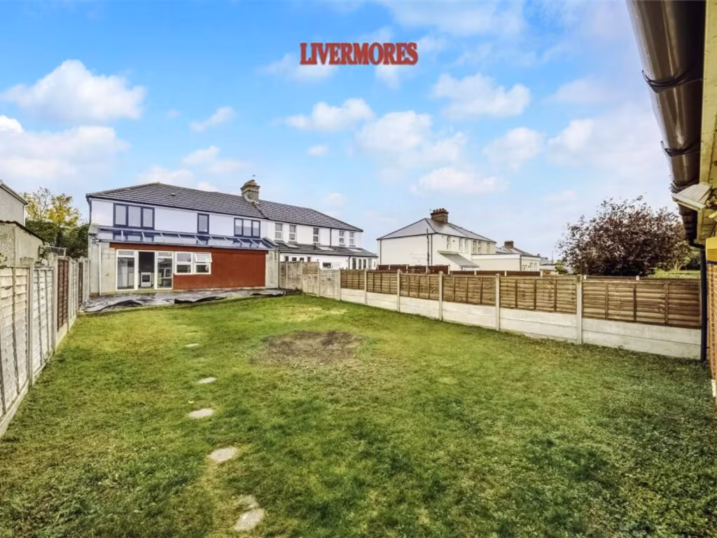
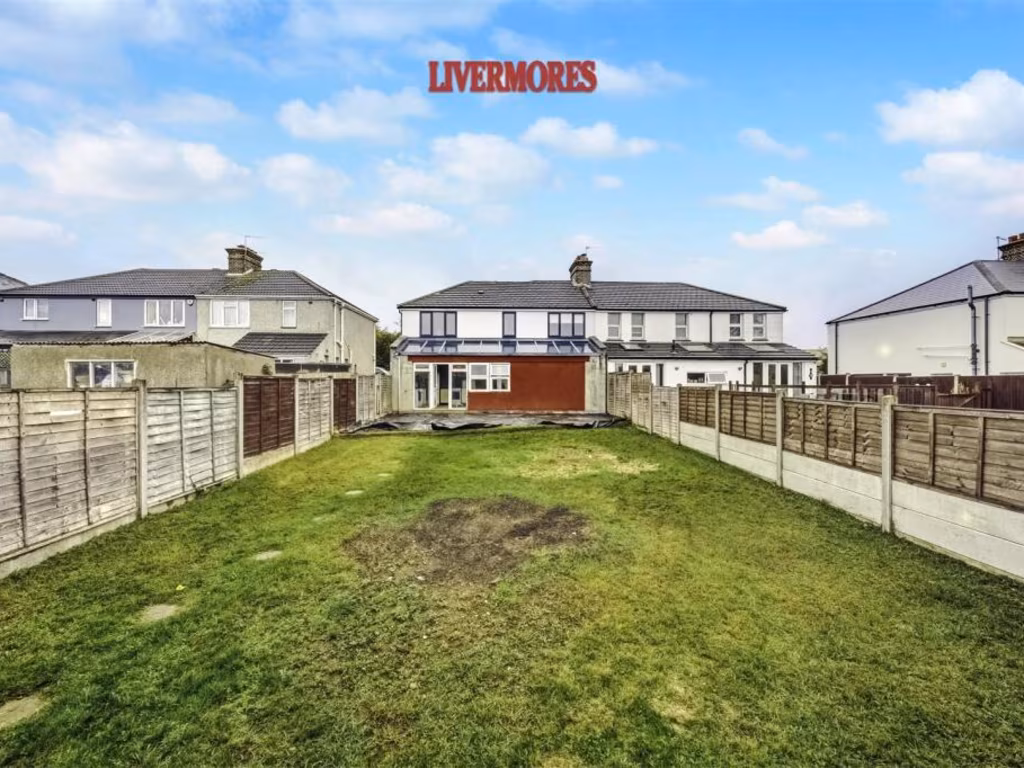
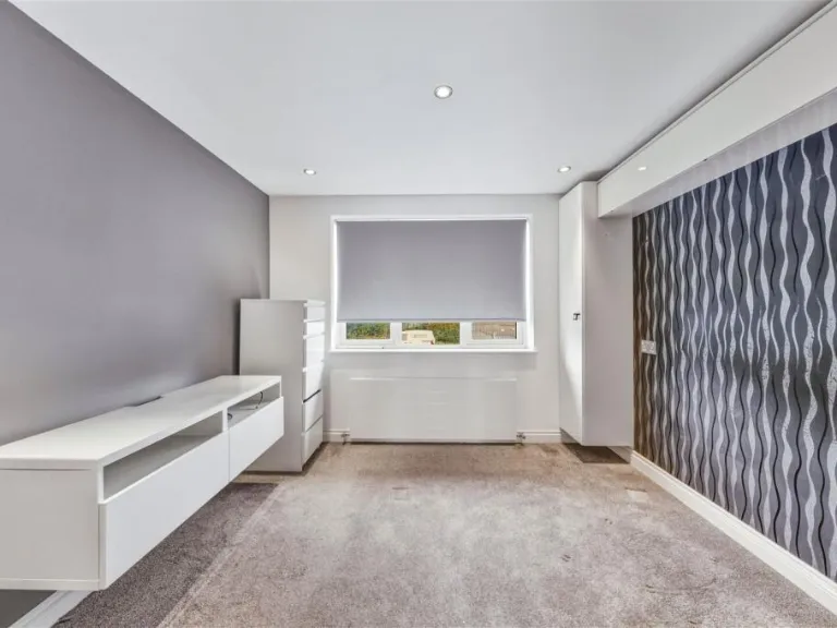
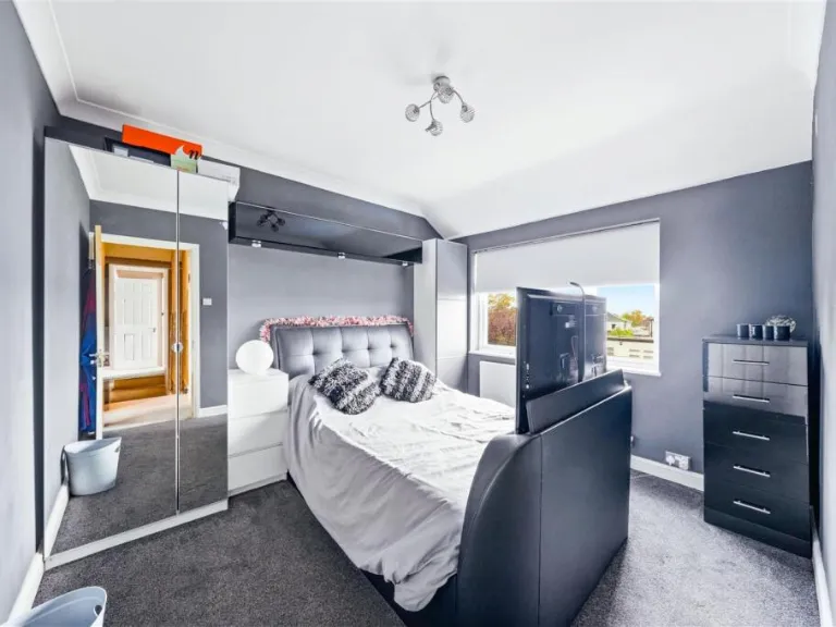
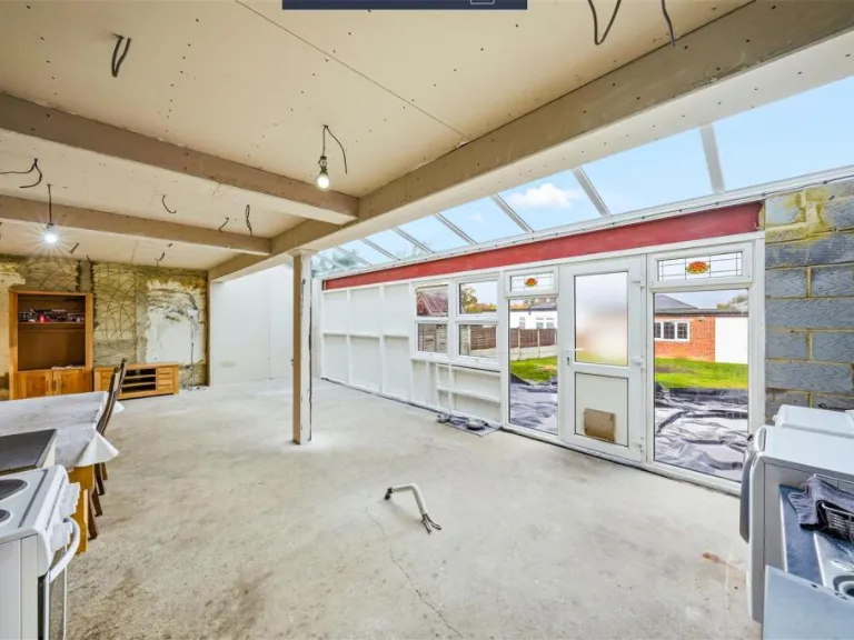
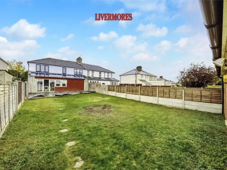
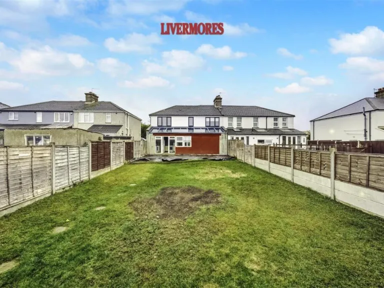
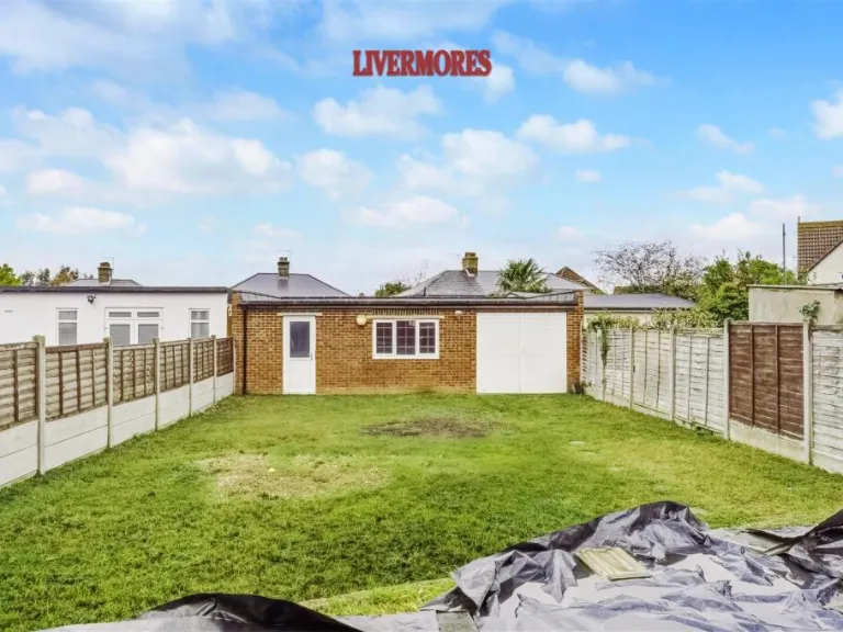
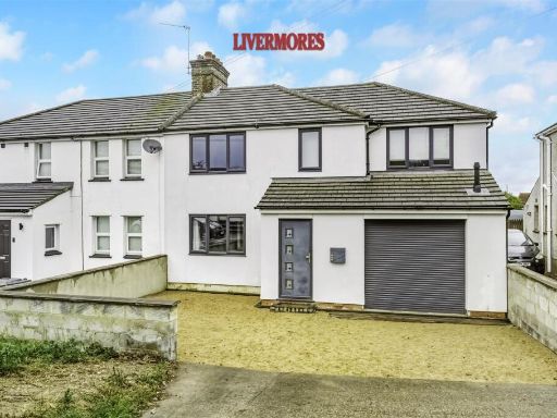
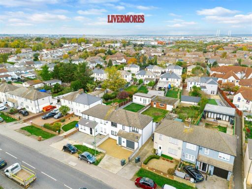
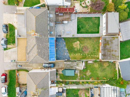
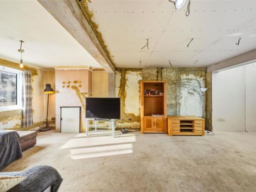
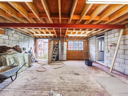
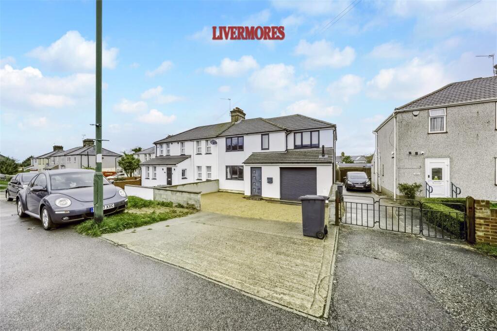
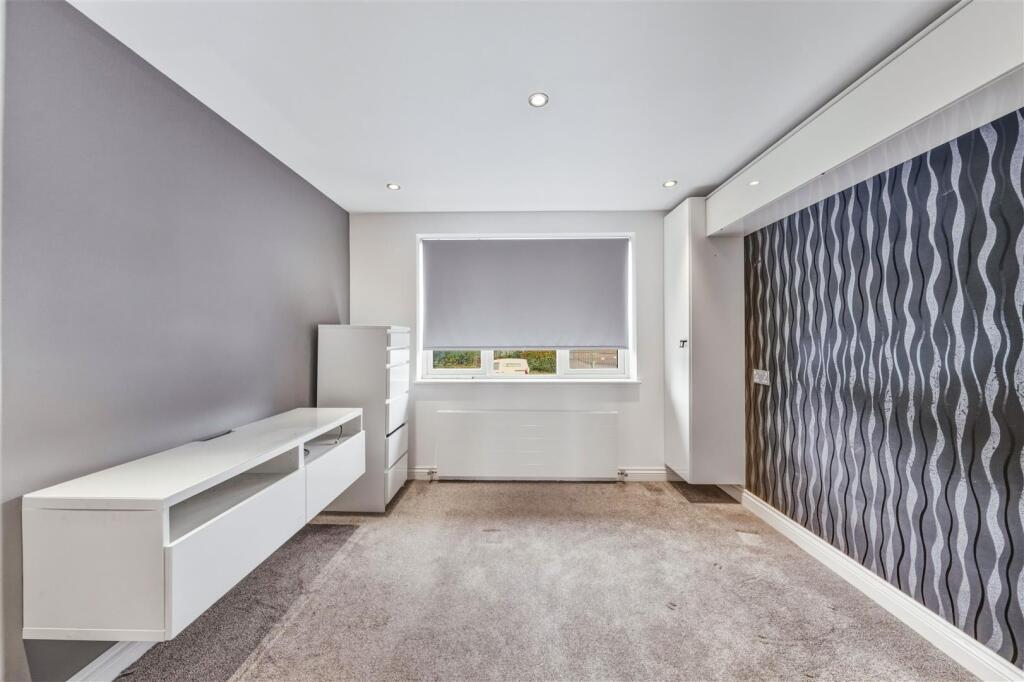
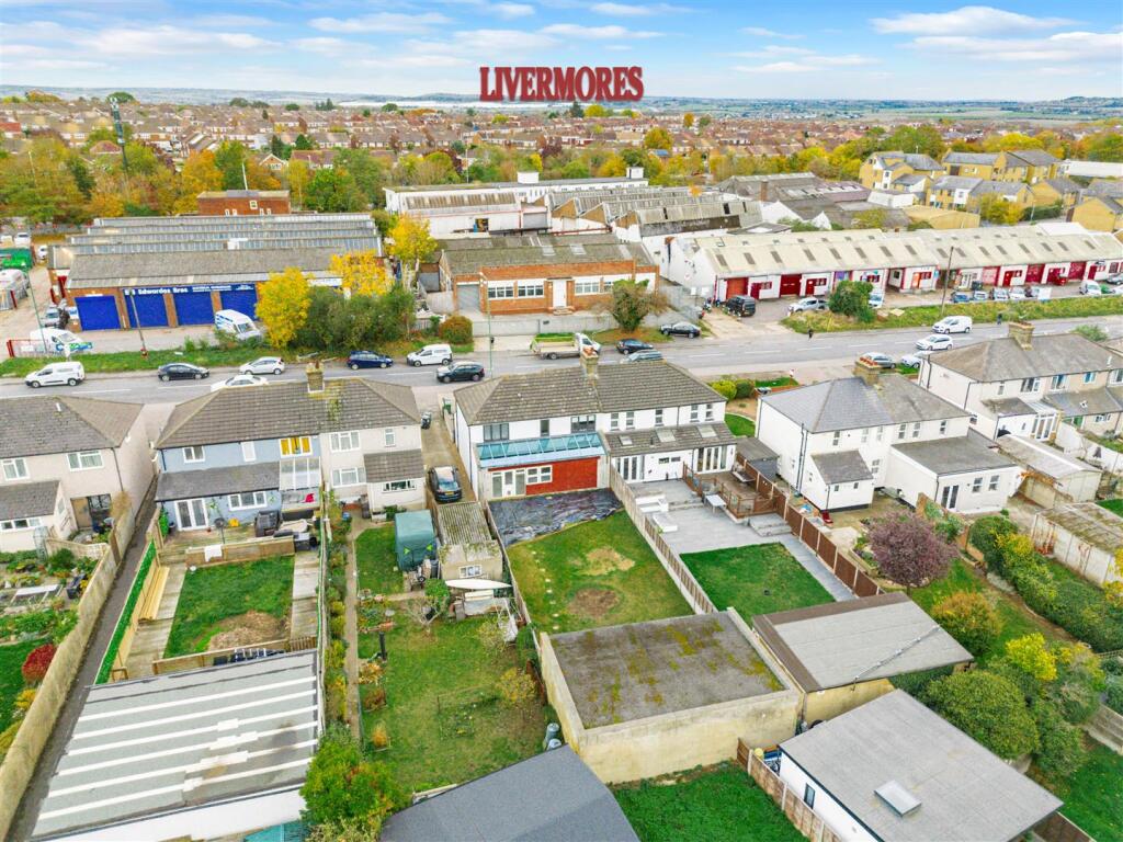
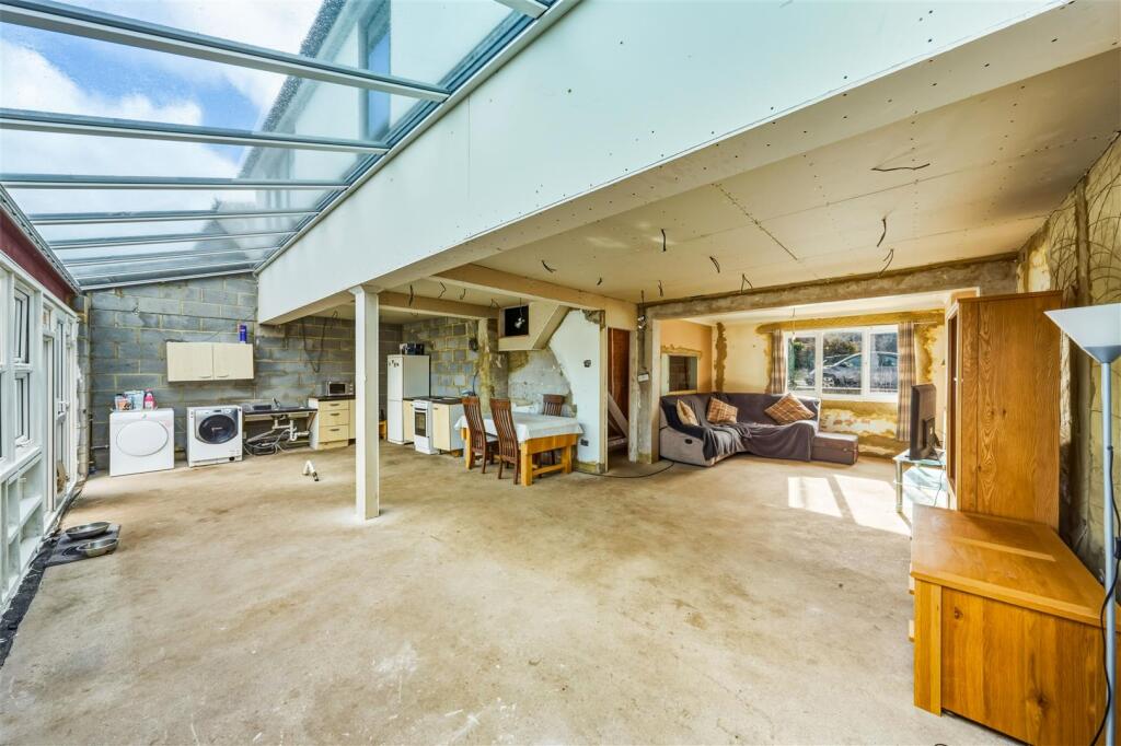
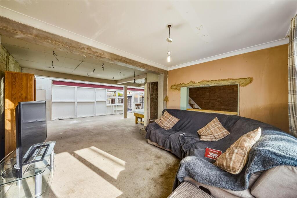
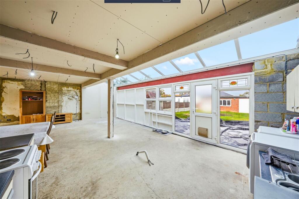
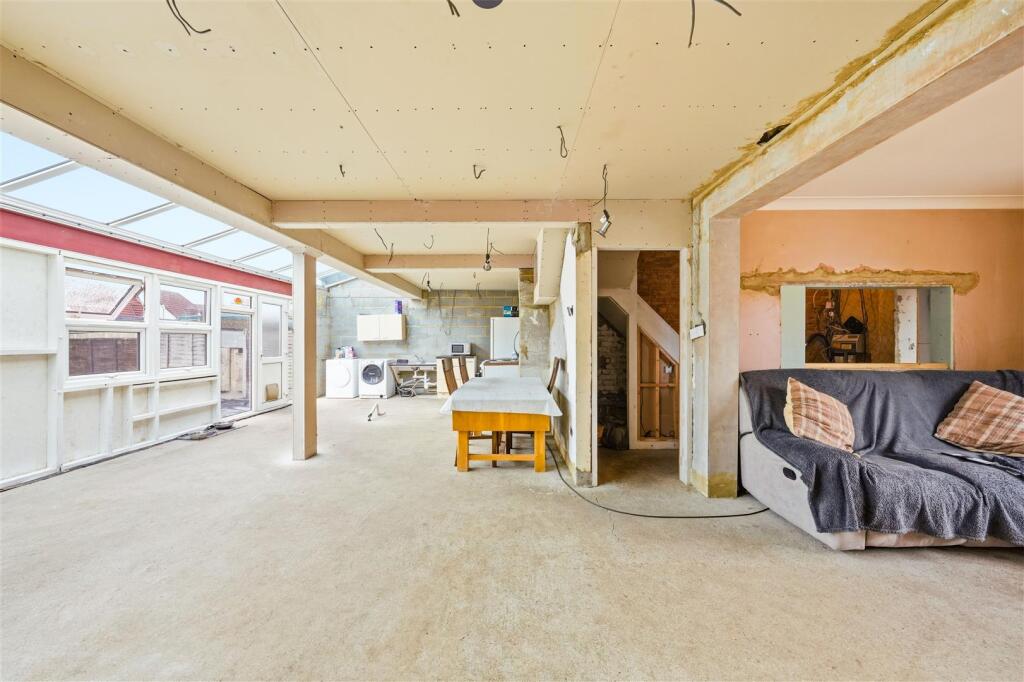
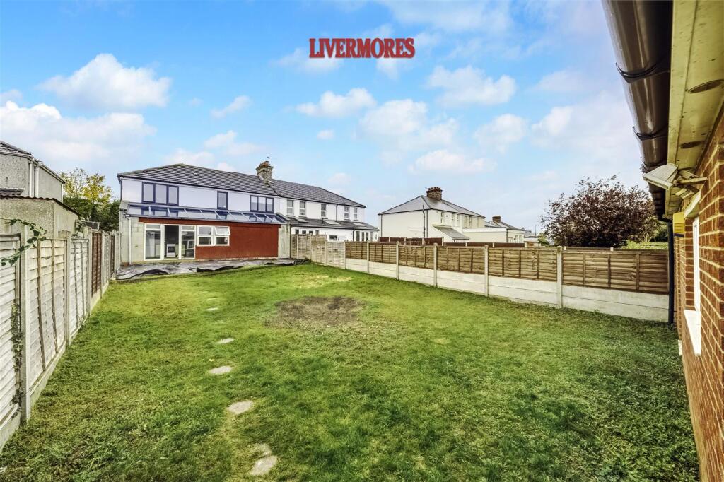
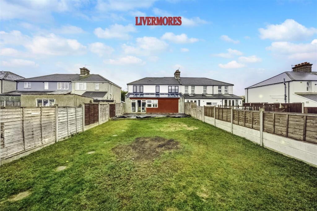
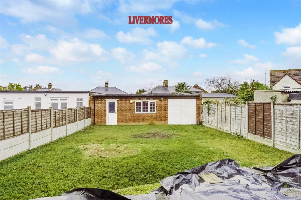
- Semi-detached four-bedroom house located in Dartford. Property appears to be an extended or remodelled traditional semi with a modernised front elevation, integral garage and a wide private driveway providing off-street parking for multiple vehicles. Accommodation likely includes ground-floor living space with first-floor bedrooms (four bedrooms advertised). Exterior presents as well maintained with low-maintenance forecourt and gated side access to rear. Overall plot size appears average for a suburban semi-detached house; front garden/drive area is large, rear garden not visible but side access suggests a usable private garden. Condition appears good with recent external finishes and modern windows/doors. Valuator notes: strong parking provision and garage add value; modernised façade reduces immediate repair risk; location in Dartford will influence market banding. No precise street or house number visible on the images.
Image Descriptions
- exterior of semi-detached house contemporary
- a modern renovated semi-detached house Contemporary
Floorplan Description
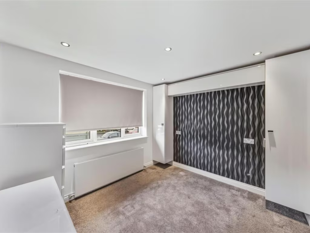
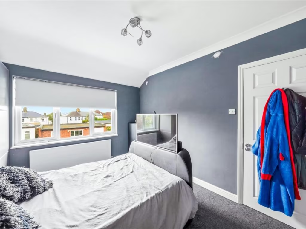
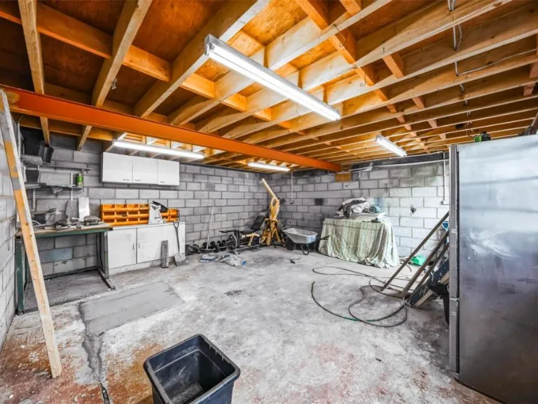
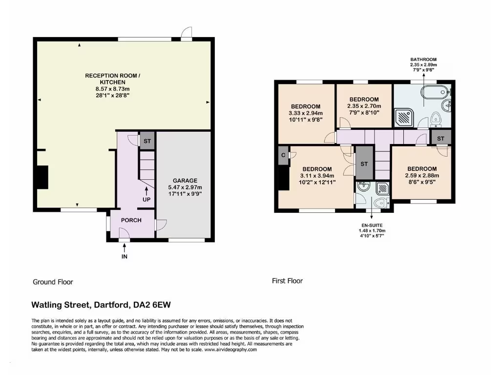
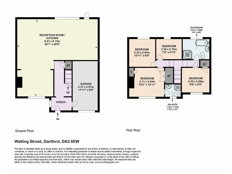
- Four-bedroom property with a large reception/kitchen and garage.
Rooms
- RECEPTION ROOM / KITCHEN: large
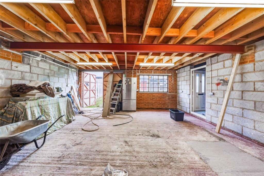
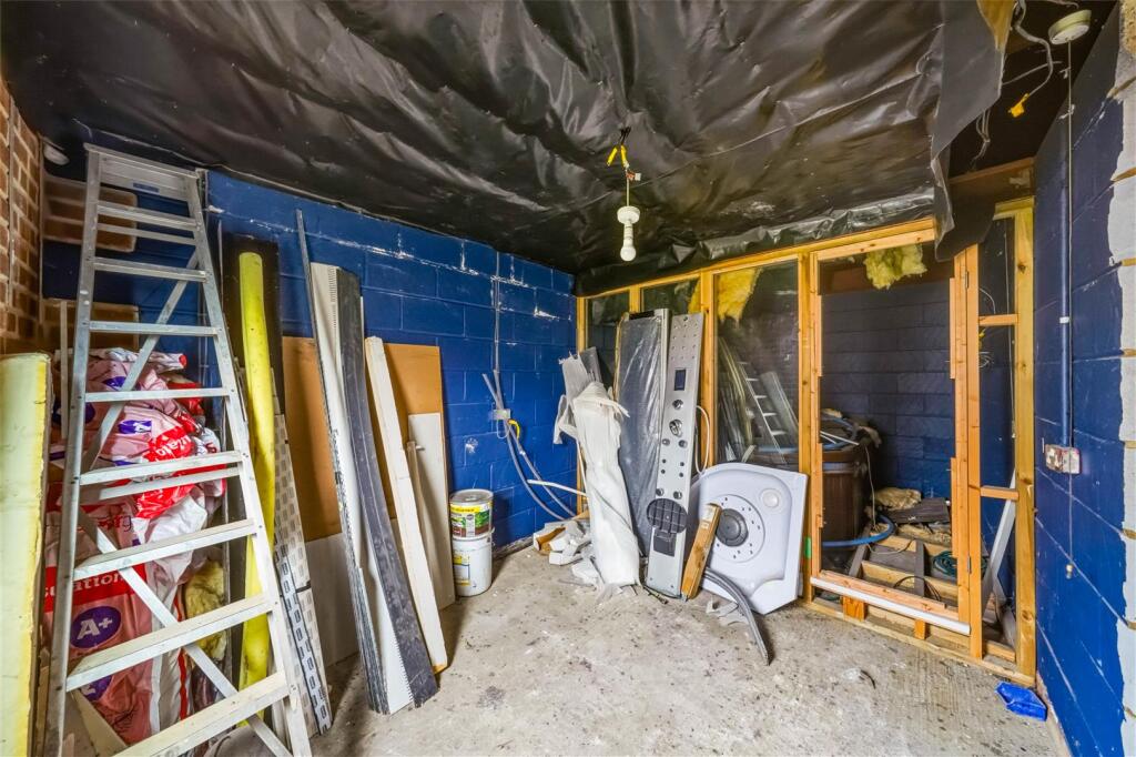
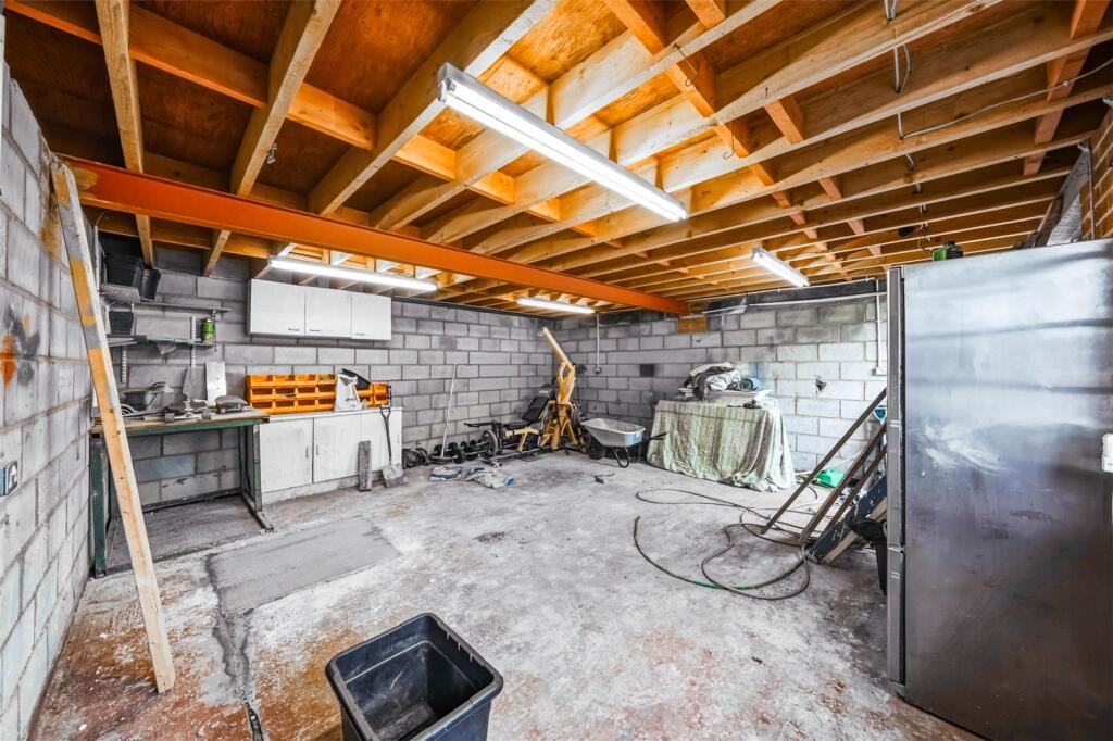
- GARAGE: average
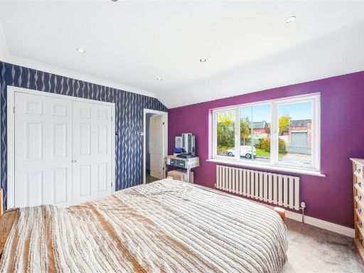
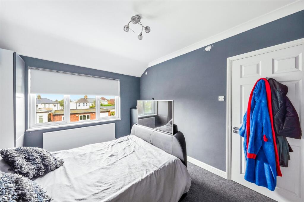
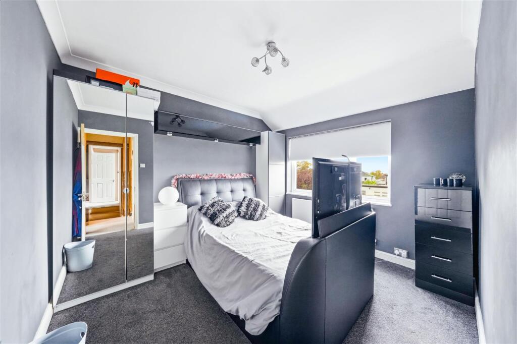
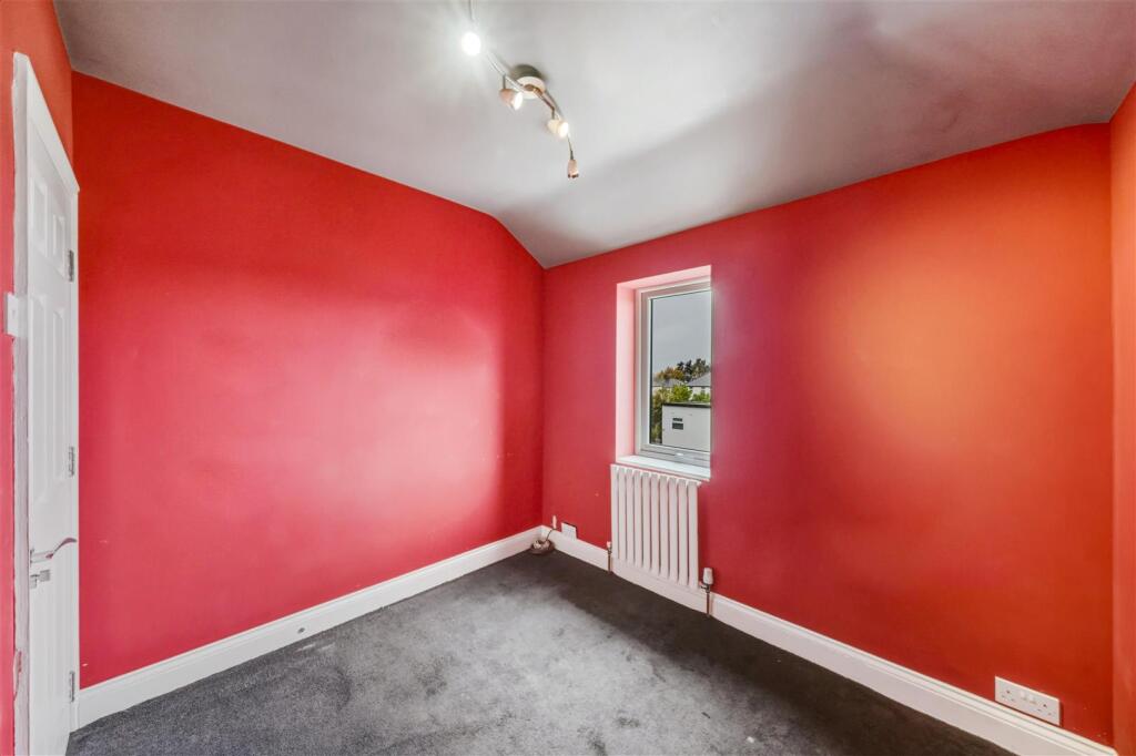
- BEDROOM: average
- BEDROOM: small
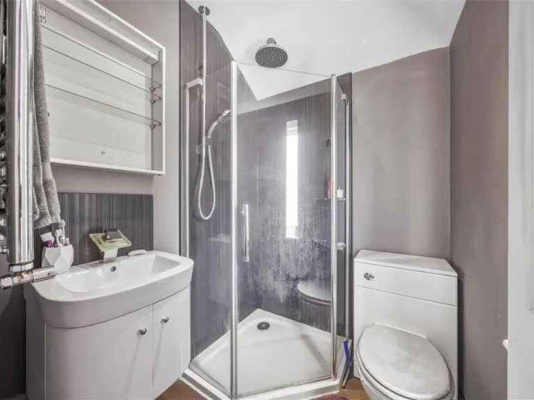
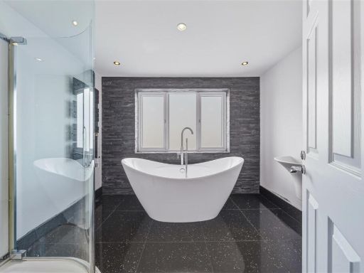
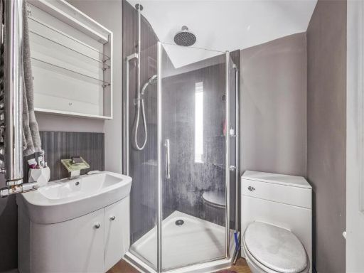
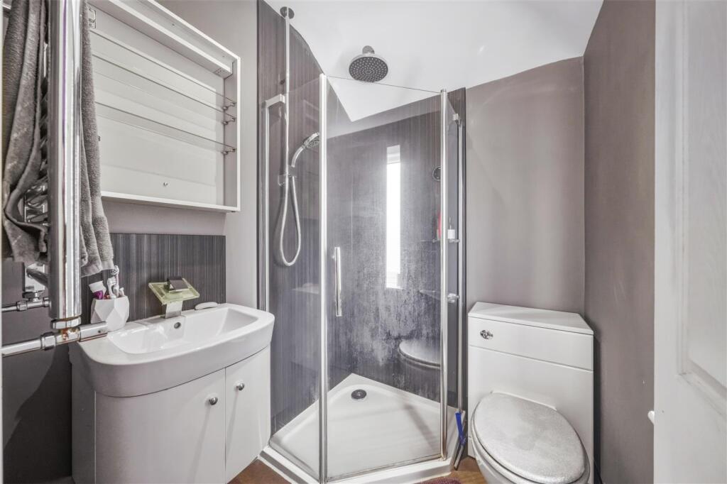
- BATHROOM: average
- BEDROOM: large
- EN-SUITE: small
- BEDROOM: small
Textual Property Features
Detected Visual Features
- semi-detached
- contemporary
- driveway
- garage
- garden
- extension potential
- modern
- brick extension
- renovated
- low-maintenance
- double glazing
- energy efficient
EPC Details
- Fully double glazed
- Cavity wall, as built, no insulation (assumed)
- Boiler and radiators, mains gas
- Low energy lighting in 82% of fixed outlets
- Suspended, no insulation (assumed)
Nearby Schools
- Greenlands Primary School
- Fleetdown Primary Academy
- Dartford Grammar School
- Our Lady's Catholic Primary School, Dartford
- Knockhall Primary School
- River Mill Primary School
- The Leigh UTC
- Cherry Orchard Primary Academy
- Dartford Science & Technology College
- The Gateway Primary Academy
- The Craylands School
- Temple Hill Primary Academy
- Horton Kirby Church of England Primary School
- Sutton-At-Hone Church of England Primary School
- Dartford Primary Academy
- Westgate Primary School
- Dartford Grammar School for Girls
- Stone Lodge School
- Dartford Bridge Community Primary School
- Purfleet Primary Academy
- Bean Primary School
- Oakfield Primary Academy
- The Leigh Academy
- Stone St Mary's CofE Primary School
- The Brent Primary School
- West Hill Primary Academy
- St Anselm's Catholic Primary School
- Holy Trinity Church of England Primary School, Dartford
- West Thurrock Academy
- Harris Academy Riverside
Nearest General Shops
- Id: 821257118
- Tags:
- Building: yes
- Building:levels: 2
- Name: The Tackle Box
- Shop: fishing
- TagsNormalized:
- Lat: 51.4390526
- Lon: 0.2474885
- FullGeoHash: u10htshnnyku
- PartitionGeoHash: u10h
- Images:
- FoodStandards: null
- Distance: 209.1
,- Id: 28094399
- Tags:
- Building: yes
- Building:colour: white
- Name: Bellegrove
- Roof:
- Shop: tiles
- TagsNormalized:
- Lat: 51.4384303
- Lon: 0.2490303
- FullGeoHash: u10htsj6df6k
- PartitionGeoHash: u10h
- Images:
- FoodStandards: null
- Distance: 126.5
,- Id: 821257152
- Tags:
- Building: yes
- Building:colour: grey
- Building:levels: 1
- Name: DA MOT Centre Ltd
- Roof:
- Colour: grey
- Levels: 1
- Material: metal
- Service: repair
- Shop: car_repair
- TagsNormalized:
- Lat: 51.4386953
- Lon: 0.2489777
- FullGeoHash: u10htsjk1eg1
- PartitionGeoHash: u10h
- Images:
- FoodStandards: null
- Distance: 115
}
Nearest Grocery shops
- Id: 448034603
- Tags:
- Addr:
- City: Dartford
- Housenumber: 183
- Postcode: DA2 6BJ
- Street: London Road
- Fhrs:
- Name: H.B. Stores
- Shop: convenience
- Source:
- TagsNormalized:
- Lat: 51.4437562
- Lon: 0.2503791
- FullGeoHash: u10httn3d70n
- PartitionGeoHash: u10h
- Images:
- FoodStandards:
- Id: 7272
- FHRSID: 7272
- LocalAuthorityBusinessID: 02890/0183/2/000
- BusinessName: H B Stores
- BusinessType: Retailers - other
- BusinessTypeID: 4613
- AddressLine1: 183 London Road
- AddressLine2: Stone
- AddressLine3: Kent
- AddressLine4: null
- PostCode: DA2 6BJ
- RatingValue: 4
- RatingKey: fhrs_4_en-GB
- RatingDate: 2021-04-13
- LocalAuthorityCode: 181
- LocalAuthorityName: Dartford
- LocalAuthorityWebSite: http://www.dartford.gov.uk/foodsafety/index.htm
- LocalAuthorityEmailAddress: eh.admin@dartford.gov.uk
- Scores:
- Hygiene: 5
- Structural: 10
- ConfidenceInManagement: 0
- NewRatingPending: false
- Geocode:
- Longitude: 0.24936000000000
- Latitude: 51.44390900000000
- Distance: 517.6
,- Id: 258081096
- Tags:
- Created_by: Potlatch 0.8a
- Shop: convenience
- TagsNormalized:
- Lat: 51.441932
- Lon: 0.2498219
- FullGeoHash: u10htstyvr0t
- PartitionGeoHash: u10h
- Images:
- FoodStandards: null
- Distance: 318.2
,- Id: 821257124
- Tags:
- Addr:
- City: Dartford
- Housenumber: 253
- Street: Watling Street
- Alt_name: K & R Convenience Store
- Alt_name2: Food Wine News
- Building: retail
- Building:levels: 2
- Name: Watling Convenience Store
- Note: Main name sign has "Food Wine News" printed in a large size, "Watling Convenience Store" in a smaller size. Another sign in the window gives the name as "K & R Convenience Store"
- Opening_hours: Mo-Sa 06:30-21:00; Su 07:00-21:00
- Paypoint: yes
- Roof:
- Shop: convenience
- TagsNormalized:
- Lat: 51.4391108
- Lon: 0.2480568
- FullGeoHash: u10htshws1k8
- PartitionGeoHash: u10h
- Images:
- FoodStandards: null
- Distance: 169.6
}
Nearest Religious buildings
- Id: 28094422
- Tags:
- Addr:
- Amenity: school
- Building: school
- Name: Stone St Mary's Church of England Primary School
- Ref:
- Source:
- Addr:
- Postcode: get-information-schools.service.gov.uk
- Wikidata: Q66231833
- TagsNormalized:
- Lat: 51.4423053
- Lon: 0.2613988
- FullGeoHash: u10htuy35hc0
- PartitionGeoHash: u10h
- Images:
- FoodStandards: null
- Distance: 834.9
,- Id: 1954891504
- Tags:
- Amenity: place_of_worship
- Name: Chapel of St Luke
- Node_id: 1954891504
- Religion: christian
- Source:
- Name: OS Open Local Important Buildings Layer
- TagsNormalized:
- place of worship
- chapel
- christian
- church
- Lat: 51.4456694
- Lon: 0.245084
- FullGeoHash: u10htt6kwzgg
- PartitionGeoHash: u10h
- Images:
- FoodStandards: null
- Distance: 821.2
,- Id: 448035732
- Tags:
- Amenity: place_of_worship
- Denomination: baptist
- Name: Stone Baptist Church
- Religion: christian
- TagsNormalized:
- place of worship
- baptist
- church
- christian
- Lat: 51.4428543
- Lon: 0.2496964
- FullGeoHash: u10htsvu6754
- PartitionGeoHash: u10h
- Images:
- FoodStandards: null
- Distance: 420.9
}
Nearest Medical buildings
- Id: 449351427
- Tags:
- Amenity: hospital
- Healthcare: hospital
- Name: Jasmine Centre
- Toilets:
- Wheelchair: yes
- TagsNormalized:
- Lat: 51.4338957
- Lon: 0.2608497
- FullGeoHash: u10htgmbnjpd
- PartitionGeoHash: u10h
- Images:
- FoodStandards: null
- Distance: 921.7
,- Id: 9273323
- Tags:
- Name: Darent Valley Hospital
- Network: Kent, London Buses
- Public_transport: stop_area
- Public_transport:version: 2
- Type: public_transport
- TagsNormalized:
- Lat: 51.4355467
- Lon: 0.259452
- FullGeoHash: u10htgscv8v7
- PartitionGeoHash: u10h
- Images:
- FoodStandards: null
- Distance: 735.6
,- Id: 161126146
- Tags:
- Amenity: hospital
- Emergency: yes
- Healthcare: hospital
- Name: Darent Valley Hospital
- Source: Bing
- Toilets:
- Wheelchair: yes
- TagsNormalized:
- Lat: 51.4347416
- Lon: 0.2571039
- FullGeoHash: u10htg7jnfy8
- PartitionGeoHash: u10h
- Images:
- FoodStandards: null
- Distance: 666.7
,- Id: 38166967
- Tags:
- Amenity: hospital
- Building: hospital
- Healthcare: hospital
- Name: Childrens Resource Centre
- TagsNormalized:
- Lat: 51.4355208
- Lon: 0.2558325
- FullGeoHash: u10htgd39k48
- PartitionGeoHash: u10h
- Images:
- FoodStandards: null
- Distance: 543.2
}
Nearest Airports
- Id: 260720166
- Tags:
- Aerodrome: international
- Aeroway: aerodrome
- Alt_name: Gatwick Airport
- Ele: 62
- Iata: LGW
- Icao: EGKK
- Internet_access: wlan
- Internet_access:fee: no
- Internet_access:ssid: Gatwick FREE Wi-Fi
- Name: London Gatwick Airport
- Operator: Gatwick Airport Limited
- Ref: LGW
- Website: https://www.gatwickairport.com/
- Wikidata: Q8703
- Wikipedia: en:Gatwick Airport
- TagsNormalized:
- airport
- international airport
- Lat: 51.1540917
- Lon: -0.1883773
- FullGeoHash: gcpg58qf4mzd
- PartitionGeoHash: gcpg
- Images:
- FoodStandards: null
- Distance: 43994.5
,- Id: 121158889
- Tags:
- Aerodrome: continental
- Aeroway: aerodrome
- Fhrs:
- Authority: City of London Corporation
- Iata: LCY
- Icao: EGLC
- Name: London City Airport
- Operator: London City Airport Limited
- Ref: LCY
- Website: https://www.londoncityairport.com/
- Wikidata: Q8982
- Wikipedia: en:London City Airport
- TagsNormalized:
- airport
- continental airport
- Lat: 51.5042658
- Lon: 0.0539987
- FullGeoHash: u10j10p64702
- PartitionGeoHash: u10j
- Images:
- FoodStandards: null
- Distance: 15419.2
,- Id: 103894219
- Tags:
- Aerodrome: international
- Aeroway: aerodrome
- Iata: SEN
- Icao: EGMC
- Name: London Southend Airport
- Old_name: Southend Municipal Airport
- Ref: SEN
- Wikidata: Q1415441
- TagsNormalized:
- airport
- international airport
- Lat: 51.5701749
- Lon: 0.6924624
- FullGeoHash: u10mru04p937
- PartitionGeoHash: u10m
- Images:
- FoodStandards: null
- Distance: 33884.1
}
Nearest Leisure Facilities
- Id: 340273908
- Tags:
- TagsNormalized:
- Lat: 51.4348422
- Lon: 0.2537911
- FullGeoHash: u10htg2v9v82
- PartitionGeoHash: u10h
- Images:
- FoodStandards: null
- Distance: 525.7
,- Id: 23843652
- Tags:
- TagsNormalized:
- Lat: 51.4393007
- Lon: 0.2457596
- FullGeoHash: u10hts4zwses
- PartitionGeoHash: u10h
- Images:
- FoodStandards: null
- Distance: 329.6
,- Id: 1075290630
- Tags:
- Leisure: playground
- Name: The Romans
- TagsNormalized:
- Lat: 51.4402263
- Lon: 0.2466255
- FullGeoHash: u10hts7t4c1q
- PartitionGeoHash: u10h
- Images:
- FoodStandards: null
- Distance: 296.4
,- Id: 23843405
- Tags:
- TagsNormalized:
- Lat: 51.4371101
- Lon: 0.2509024
- FullGeoHash: u10hteydykq3
- PartitionGeoHash: u10h
- Images:
- FoodStandards: null
- Distance: 223.2
,- Id: 549160528
- Tags:
- Leisure: playground
- Name: Jessamine Place Play Area
- Operator: Dartford Borough Council
- Surface: grass
- TagsNormalized:
- Lat: 51.4402057
- Lon: 0.2515625
- FullGeoHash: u10htsrhvv6e
- PartitionGeoHash: u10h
- Images:
- FoodStandards: null
- Distance: 143
}
Nearest Tourist attractions
- Id: 7513735173
- Tags:
- Name: Whitewall Galleries
- Tourism: gallery
- TagsNormalized:
- Lat: 51.4385019
- Lon: 0.269742
- FullGeoHash: u10hwhh6vrwp
- PartitionGeoHash: u10h
- Images:
- FoodStandards: null
- Distance: 1335.2
,- Id: 951583552
- Tags:
- TagsNormalized:
- Lat: 51.442577
- Lon: 0.2652364
- FullGeoHash: u10hwhc4srqs
- PartitionGeoHash: u10h
- Images:
- FoodStandards: null
- Distance: 1091.8
,- Id: 449351581
- Tags:
- TagsNormalized:
- Lat: 51.4309803
- Lon: 0.2493265
- FullGeoHash: u10htdtx1tx7
- PartitionGeoHash: u10h
- Images:
- FoodStandards: null
- Distance: 906.8
}
Nearest Hotels
- Id: 38096091
- Tags:
- Brand: Travelodge
- Brand:wikidata: Q9361374
- Brand:wikipedia: en:Travelodge UK
- Building: yes
- Name: Travelodge
- Tourism: hotel
- TagsNormalized:
- Lat: 51.4517838
- Lon: 0.265002
- FullGeoHash: u10hwn8bqgxv
- PartitionGeoHash: u10h
- Images:
- FoodStandards: null
- Distance: 1731.5
,- Id: 28094087
- Tags:
- Addr:
- City: Dartford
- Country: GB
- Housename: Crossways Business Park
- Postcode: DA2 6QF
- Street: Masthead Close
- Building: hotel
- Building:levels: 6
- Building:material: brick
- Contact:
- Facebook: https://www.facebook.com/doubletreedartford
- Twitter: https://twitter.com/DTDartford
- Email: reservations@doubletreedartfordbridge
- Fax: +44 1322 288 225
- Image: https://archive.org/details/Dartford-north-2021-04-24/Dartford%20%28north%29%202021-04-24/2021-04-24_16-25-18_20210424_18_45_31.jpg
- Internet_access: yes
- Name: DoubleTree by Hilton Hotel Dartford Bridge
- Operator: Hilton
- Phone: +44 1322 284 444
- Roof:
- Rooms: 179
- Smoking: no
- Stars: 4
- Tourism: hotel
- Website: https://www.hilton.com/en/hotels/gatdbdi-doubletree-dartford-bridge/
- Wheelchair: yes
- TagsNormalized:
- Lat: 51.4529425
- Lon: 0.2453855
- FullGeoHash: u10htwdxjgst
- PartitionGeoHash: u10h
- Images:
- FoodStandards: null
- Distance: 1579.3
,- Id: 821658487
- Tags:
- Amenity: pub
- Building: yes
- Building:colour: white
- Building:levels: 3
- Name: The Fulwich Hotel
- Roof:
- Toilets: yes
- Toilets:access: customers
- TagsNormalized:
- Lat: 51.4448275
- Lon: 0.2326103
- FullGeoHash: u10htm1ru4yv
- PartitionGeoHash: u10h
- Images:
- FoodStandards: null
- Distance: 1394
}
Tags
- semi-detached
- contemporary
- driveway
- garage
- garden
- extension potential
- modern
- semi-detached
- contemporary
- brick extension
- garage
- renovated
- low-maintenance
- double glazing
- energy efficient
Local Market Stats
- Average Price/sqft: £413
- Avg Income: £54200
- Rental Yield: 5.2%
- Social Housing: 11%
- Planning Success Rate: 87%
AirBnB Data
- 1km average: £80/night
- Listings in 1km: 1
Similar Properties
 4 bedroom semi-detached house for sale in Princes Road, Dartford, DA1 — £650,000 • 4 bed • 2 bath • 1639 ft²
 4 bedroom semi-detached house for sale in Vale Road, Dartford, DA1 — £550,000 • 4 bed • 2 bath • 919 ft²
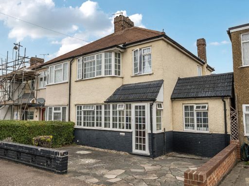 4 bedroom semi-detached house for sale in Brent Close, Dartford, Kent, DA2 — £500,000 • 4 bed • 2 bath • 1283 ft²
 3 bedroom semi-detached house for sale in Watling Street, Dartford, DA2 — £475,000 • 3 bed • 2 bath • 1076 ft²
 4 bedroom semi-detached house for sale in Brent Lane, Dartford, Kent, DA1 — £500,000 • 4 bed • 1 bath • 1551 ft²
 4 bedroom house for sale in Watling Street, Dartford, DA1 — £550,000 • 4 bed • 2 bath • 1676 ft²
Meta
- {
"@context": "https://schema.org",
"@type": "Residence",
"name": "4 bedroom semidetached house for sale in Watling Street, Da…",
"description": "",
"url": "https://propertypiper.co.uk/property/b64224f4-0091-42af-bc68-4b05a31fb8f5",
"image": "https://image-a.propertypiper.co.uk/33519e2d-2f4a-4be6-b904-3decc537b52f-1024.jpeg",
"address": {
"@type": "PostalAddress",
"streetAddress": "Watling Street, Dartford, DA2 6EW",
"postalCode": "DA2 6EW",
"addressLocality": "Dartford",
"addressRegion": "Dartford",
"addressCountry": "England"
},
"geo": {
"@type": "GeoCoordinates",
"latitude": 51.4391022,
"longitude": 0.2505035
},
"numberOfRooms": 4,
"numberOfBathroomsTotal": 2,
"floorSize": {
"@type": "QuantitativeValue",
"value": 1436,
"unitCode": "FTK"
},
"offers": {
"@type": "Offer",
"price": 525000,
"priceCurrency": "GBP",
"availability": "https://schema.org/InStock"
},
"additionalProperty": [
{
"@type": "PropertyValue",
"name": "Feature",
"value": "semi-detached"
},
{
"@type": "PropertyValue",
"name": "Feature",
"value": "contemporary"
},
{
"@type": "PropertyValue",
"name": "Feature",
"value": "driveway"
},
{
"@type": "PropertyValue",
"name": "Feature",
"value": "garage"
},
{
"@type": "PropertyValue",
"name": "Feature",
"value": "garden"
},
{
"@type": "PropertyValue",
"name": "Feature",
"value": "extension potential"
},
{
"@type": "PropertyValue",
"name": "Feature",
"value": "modern"
},
{
"@type": "PropertyValue",
"name": "Feature",
"value": "semi-detached"
},
{
"@type": "PropertyValue",
"name": "Feature",
"value": "contemporary"
},
{
"@type": "PropertyValue",
"name": "Feature",
"value": "brick extension"
},
{
"@type": "PropertyValue",
"name": "Feature",
"value": "garage"
},
{
"@type": "PropertyValue",
"name": "Feature",
"value": "renovated"
},
{
"@type": "PropertyValue",
"name": "Feature",
"value": "low-maintenance"
},
{
"@type": "PropertyValue",
"name": "Feature",
"value": "double glazing"
},
{
"@type": "PropertyValue",
"name": "Feature",
"value": "energy efficient"
}
]
}
High Res Floorplan Images
Compatible Floorplan Images
FloorplanImages Thumbnail