ME17 4HD - 3 bedroom semidetached house for sale in Wilberforce Road,…
View on Property Piper
3 bedroom semi-detached house for sale in Wilberforce Road, Coxheath, Maidstone, Kent, ME17
Property Details
- Price: £400000
- Bedrooms: 3
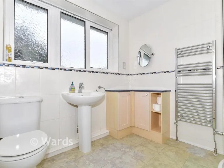
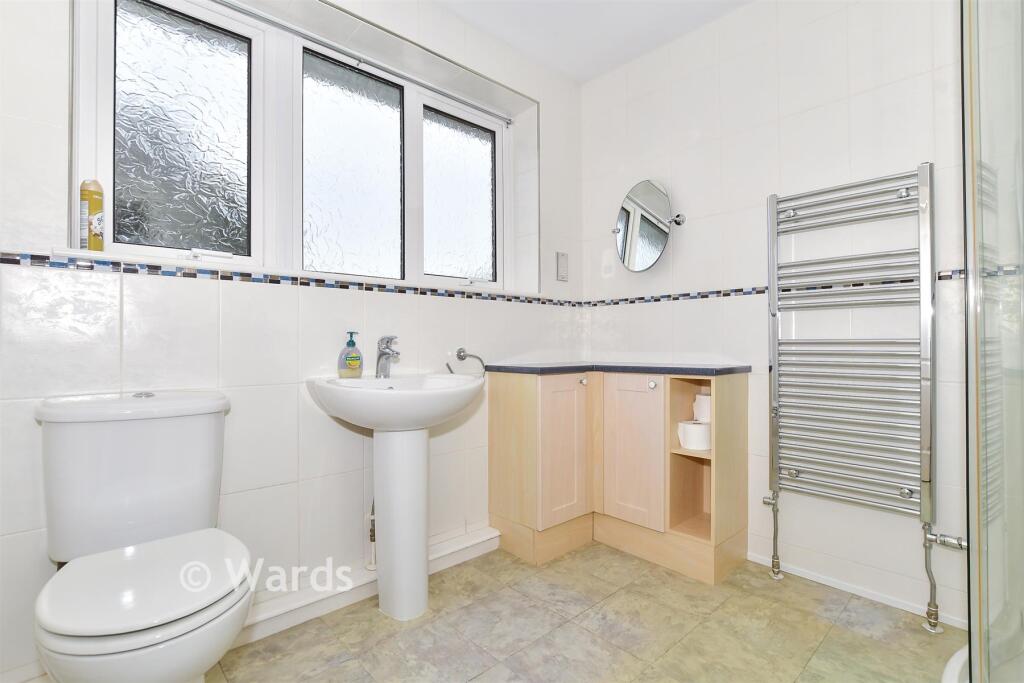
- Bathrooms: 1
- Property Type: undefined
- Property SubType: undefined
Image Descriptions
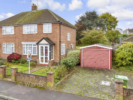
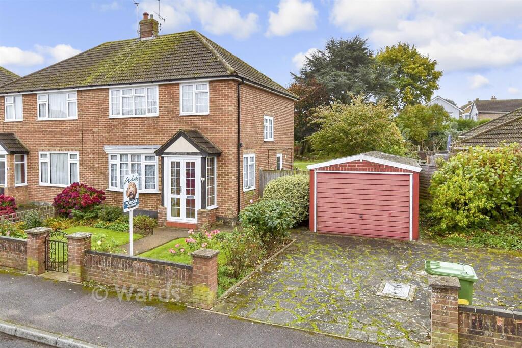
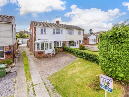
- property exterior mid-20th century suburban
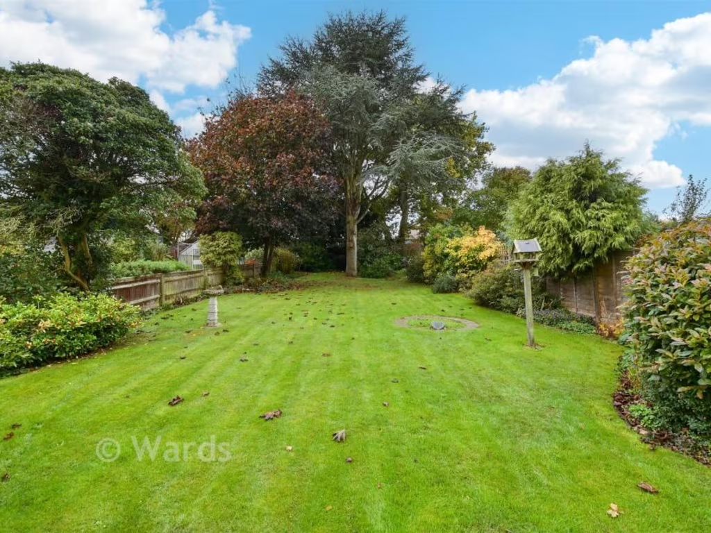
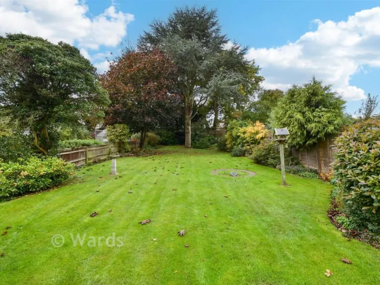
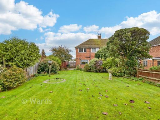
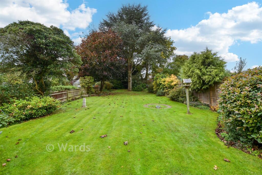
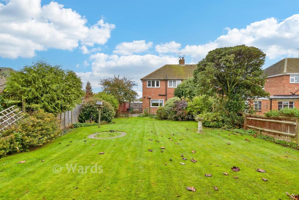
- rear garden traditional suburban
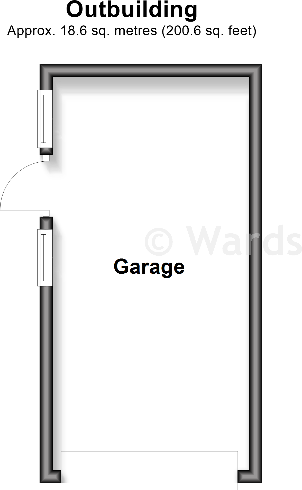
Floorplan Description
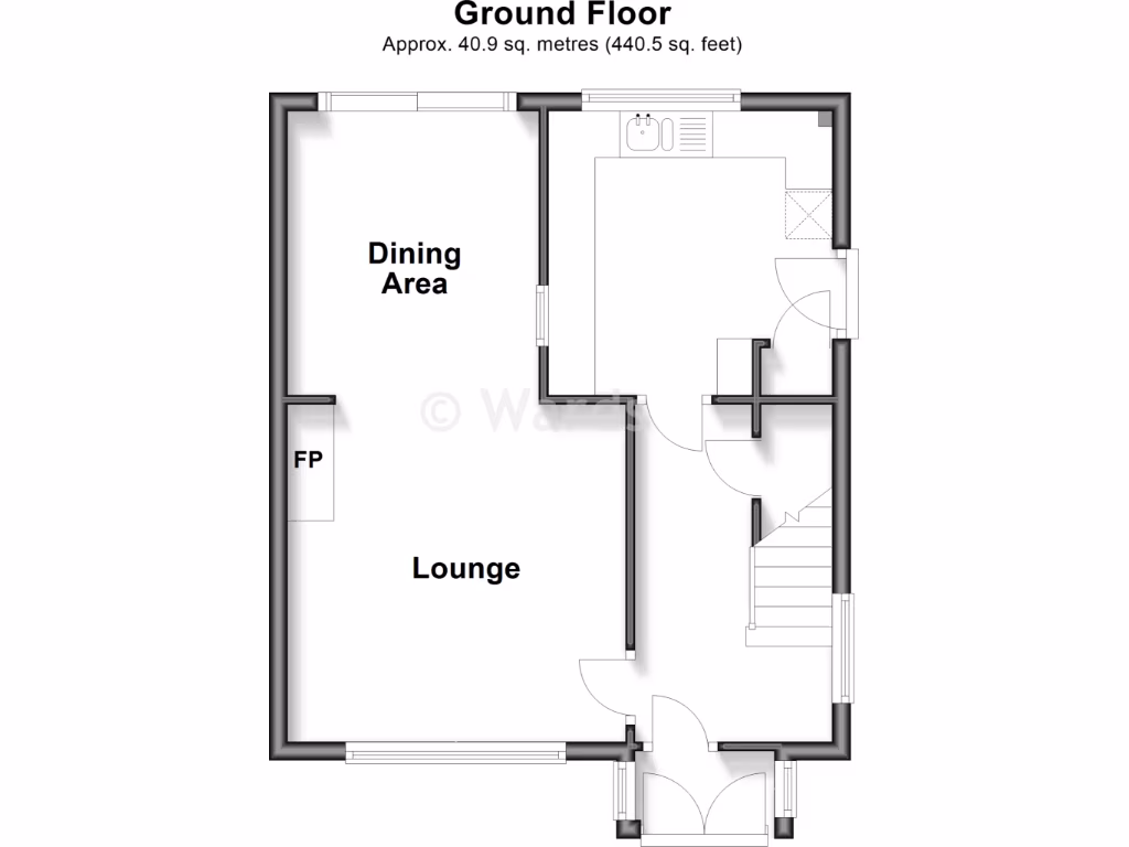
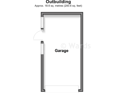
- Single labelled garage space shown on plan.
Rooms
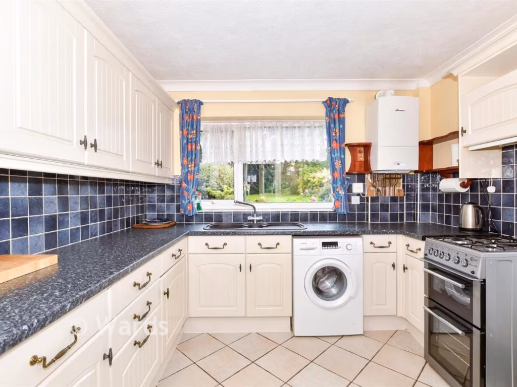
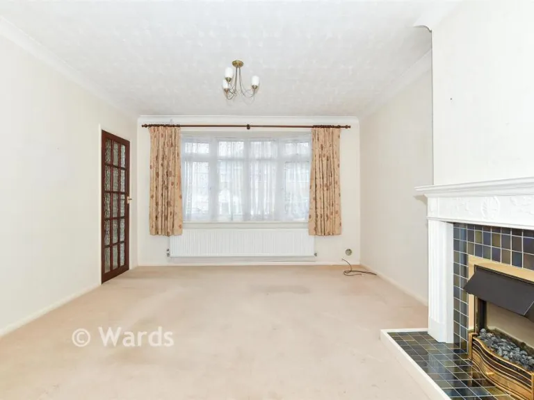
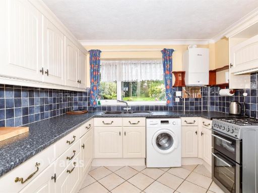
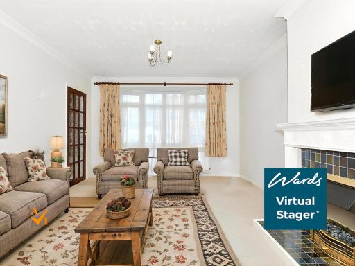
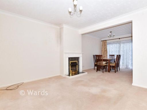
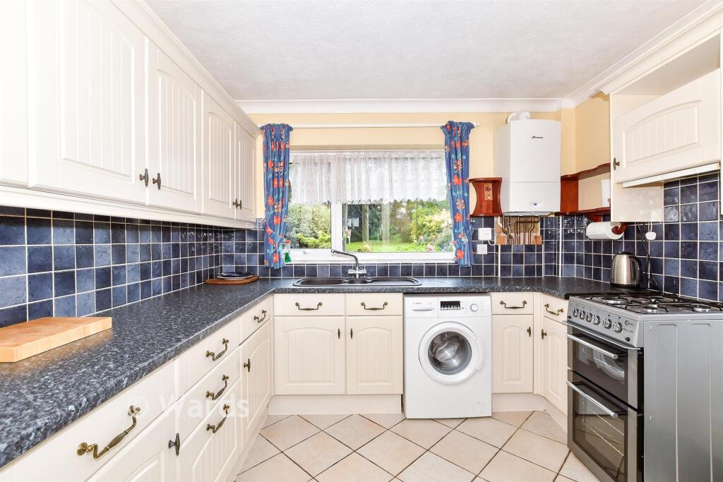
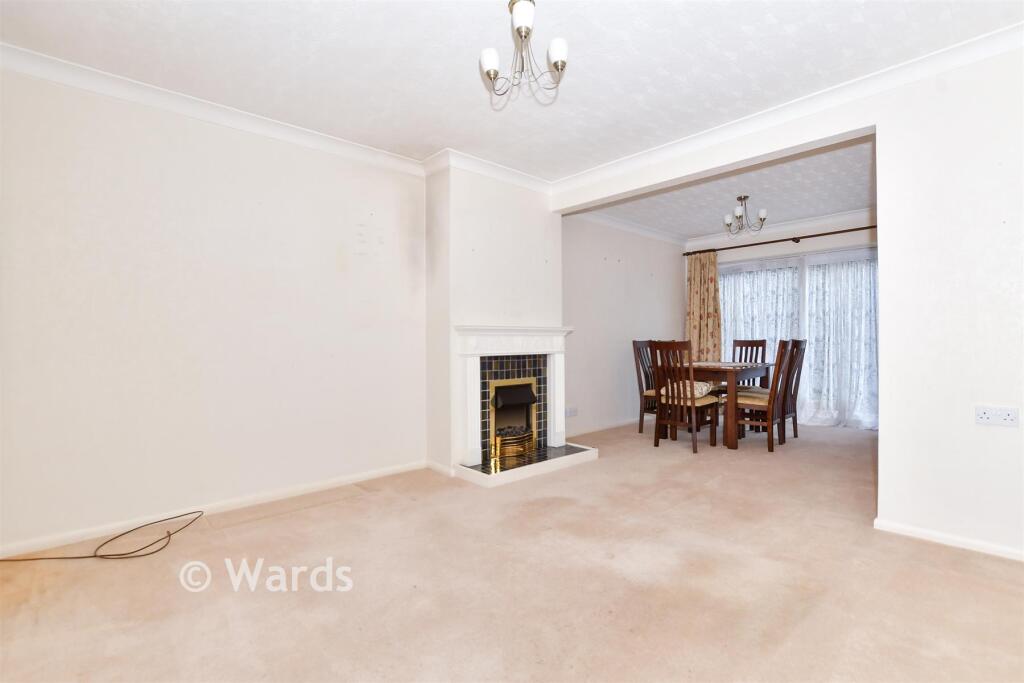
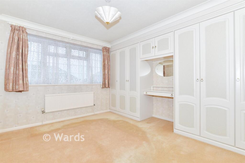
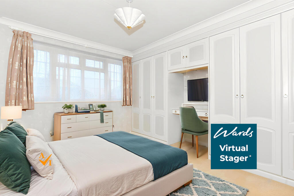
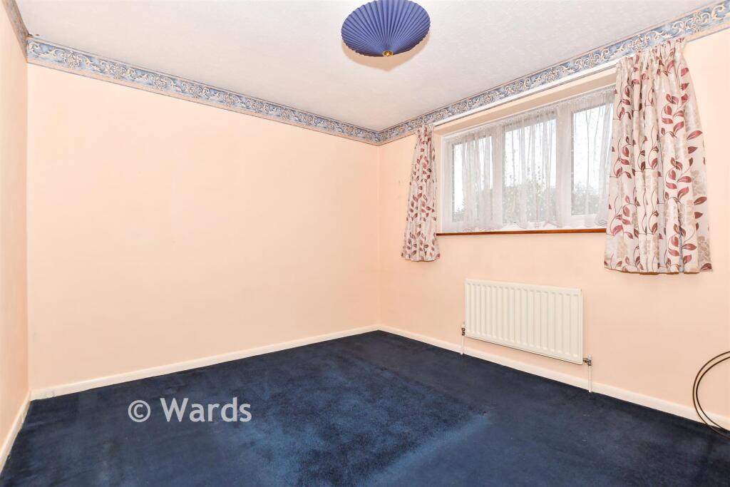
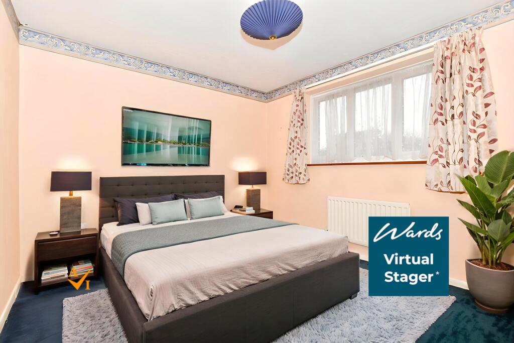
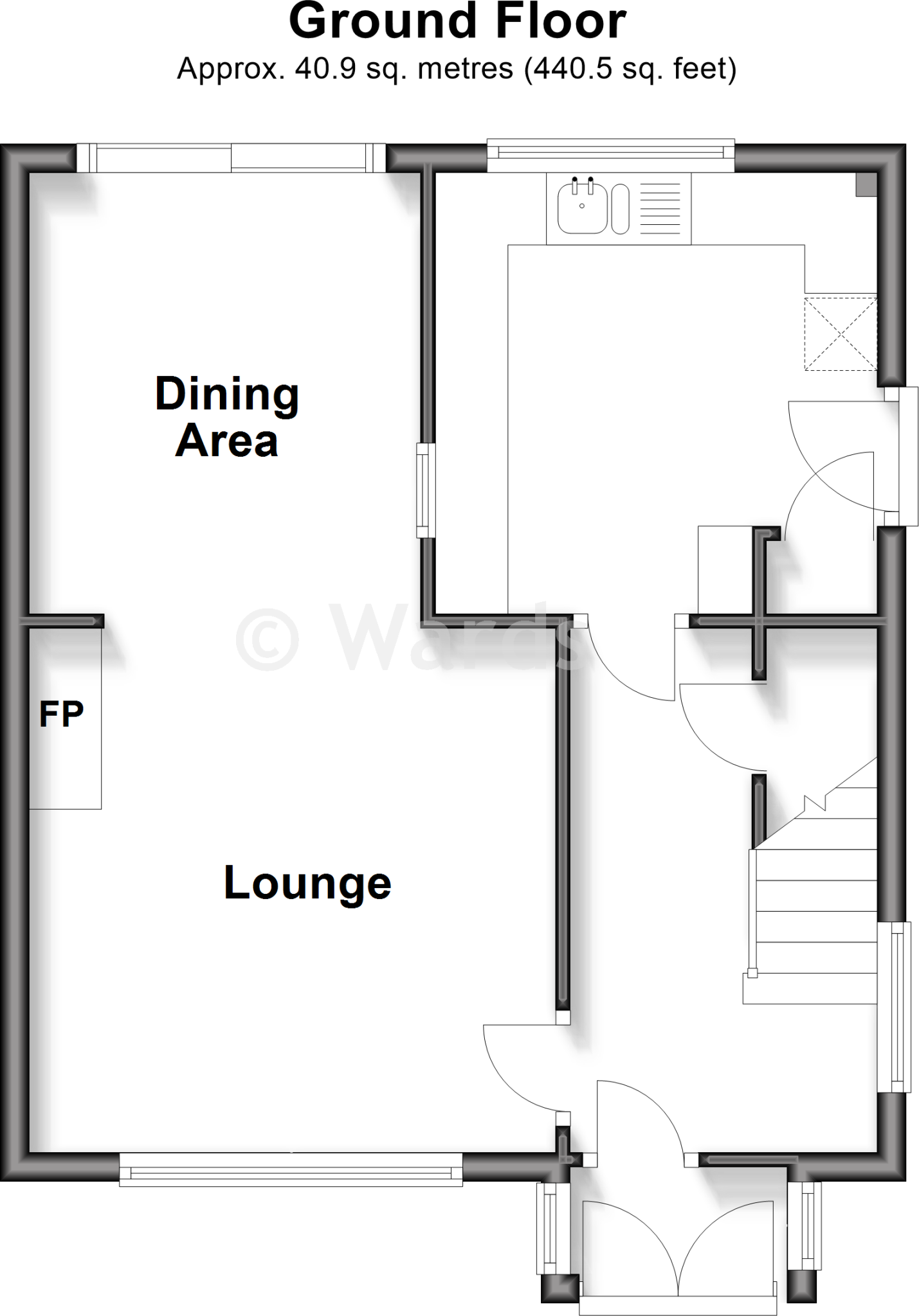
- Dining Area:
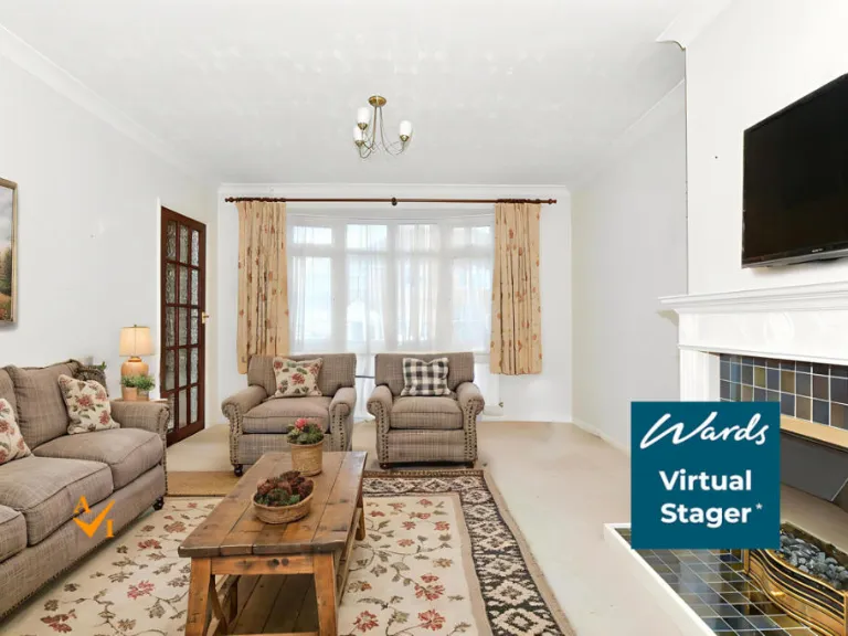
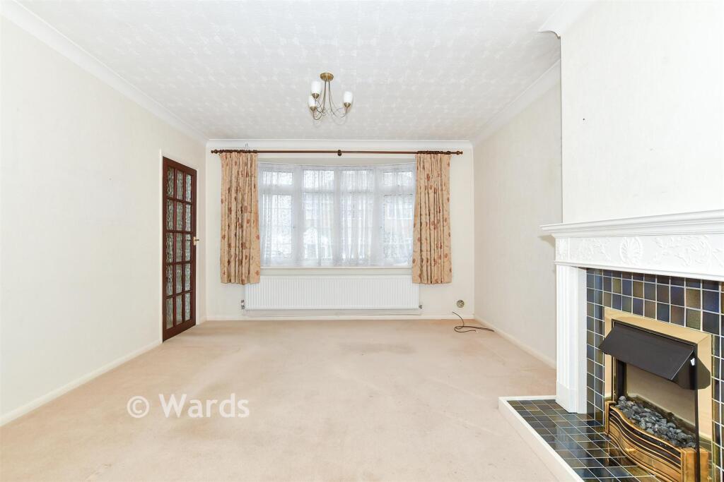
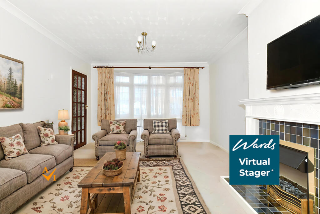
- Lounge:
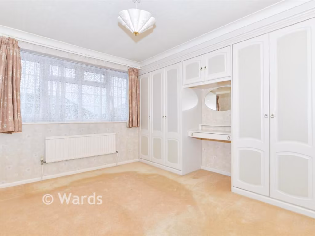
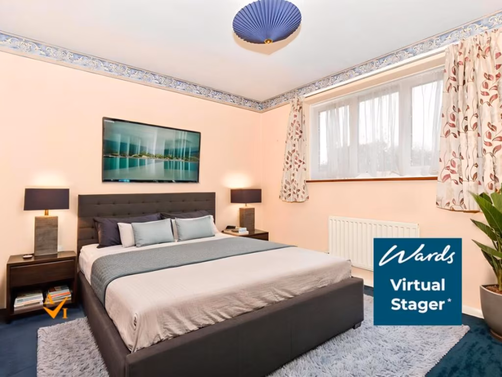
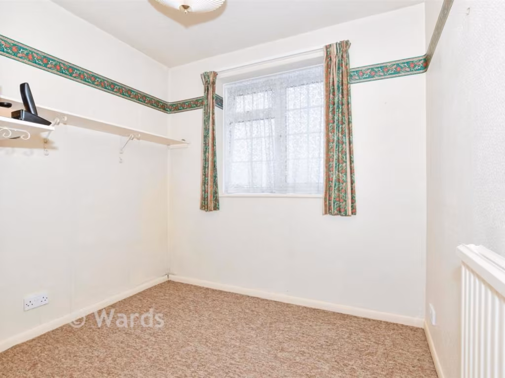
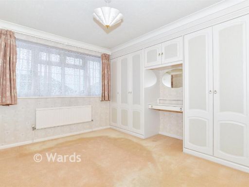
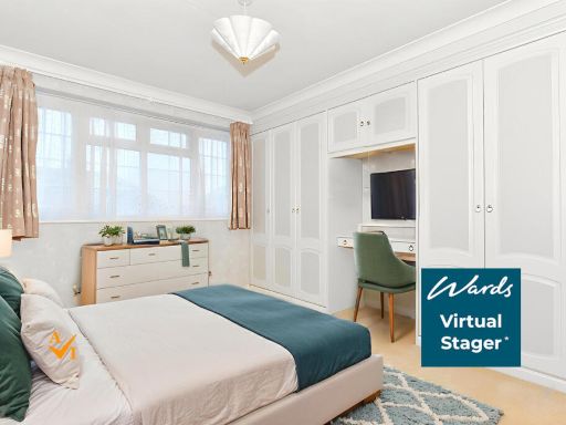
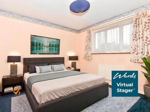
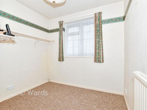
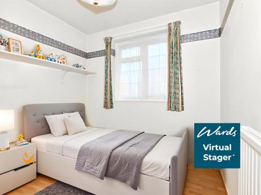
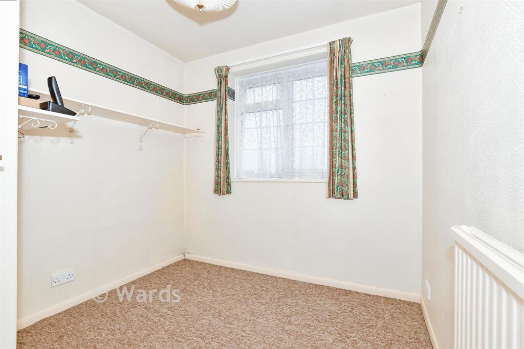
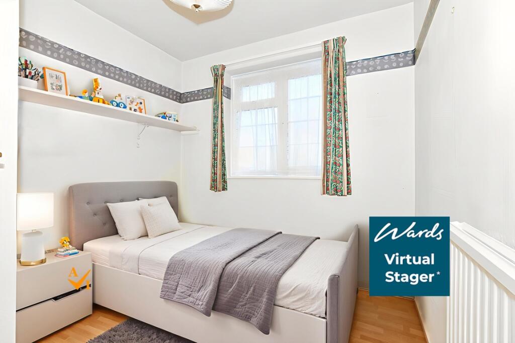
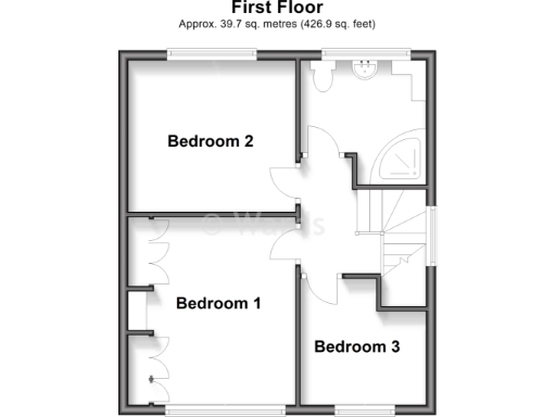
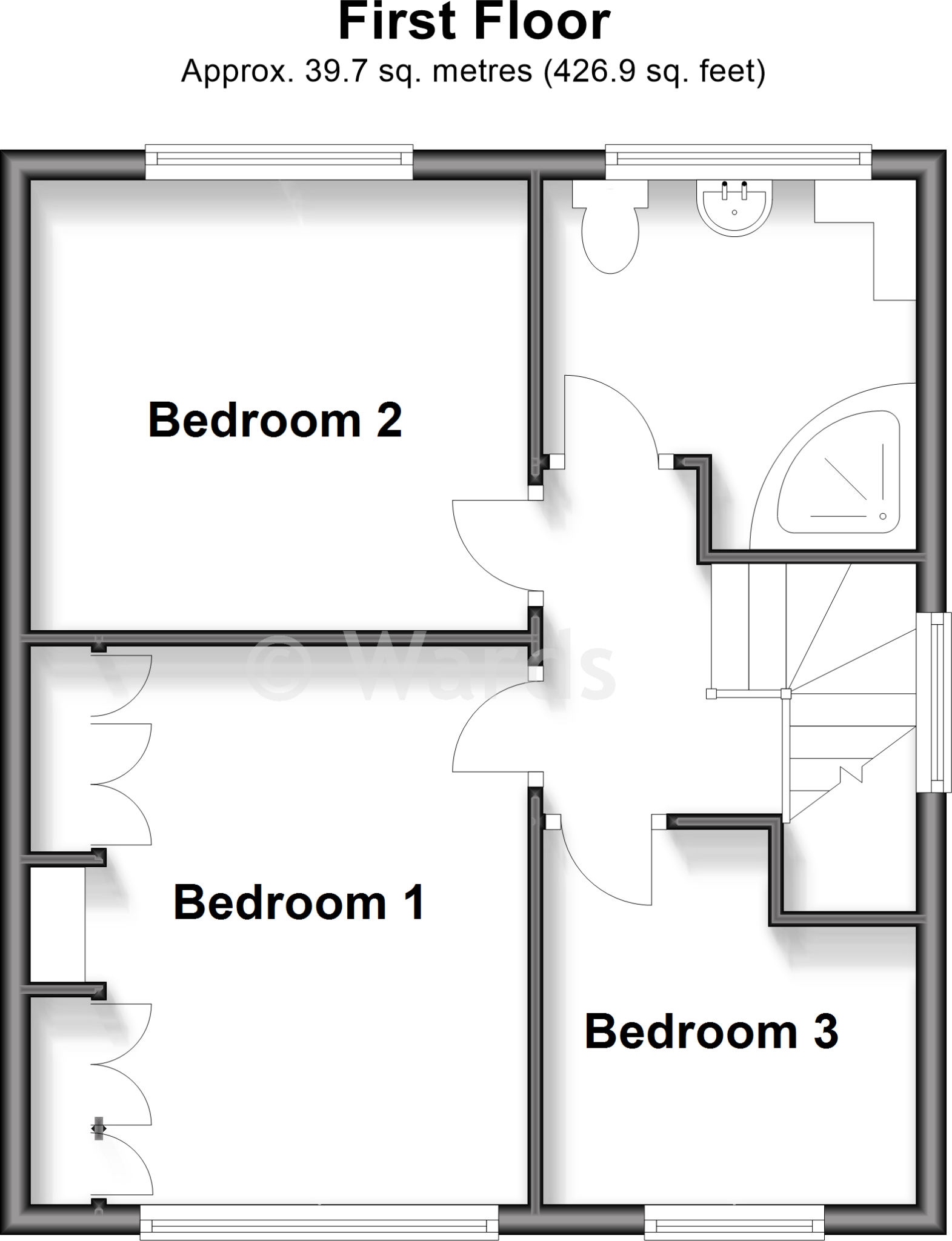
- Bedroom 2:
- Bedroom 1:
- Bedroom 3:
- Garage:
Textual Property Features
- Has Garden
- Chain Free
- Success
Detected Visual Features
- detached
- brick exterior
- porch
- garage
- garden
- suburban
- mid-20th century
- driveway
- large garden
- traditional style
- mature trees
- fence
- border planting
- lawn
EPC Details
- Fully double glazed
- Cavity wall, filled cavity
- Boiler and radiators, mains gas
- Low energy lighting in all fixed outlets
- Solid, no insulation (assumed)
Nearby Schools
- South Borough Primary School
- St Michael's Church of England Infant School Maidstone
- MEPA ACADEMY
- Brunswick House Primary School
- Maidstone Grammar School for Girls
- St Simon Stock Catholic School
- St Francis' Catholic Primary School, Maidstone
- Boughton Monchelsea Primary School
- Cornwallis Academy
- Loose Primary School
- New Line Learning Academy
- Oaks Primary Academy
- Park Way Primary School
- Maidstone Grammar School
- Coxheath Primary School
- East Farleigh Primary School
- St Helens Montessori School
- West Borough Primary School
- OneSchool Global UK - Maidstone Campus
- Tiger Primary School
- Archbishop Courtenay Primary School
- St Augustine Academy
- Jubilee Primary School
- Barming Primary School
- Maidstone, St Michael's Church of England Junior School
- Hunton Church of England Primary School
- Oakwood Park Grammar School
Nearest General Shops
- Id: 5060905405
- Tags:
- Name: Coxheath Funeralcare
- Operator: Coop
- Shop: funeral_directors
- TagsNormalized:
- funeral
- funeral directors
- shop
- Lat: 51.2324355
- Lon: 0.4950008
- FullGeoHash: u1077q86w65m
- PartitionGeoHash: u107
- Images:
- FoodStandards: null
- Distance: 455
,- Id: 5060905400
- Tags:
- Name: Angels Independent Family Funeral Service
- Shop: funeral_directors
- TagsNormalized:
- funeral
- service
- funeral directors
- shop
- Lat: 51.2324252
- Lon: 0.4950878
- FullGeoHash: u1077q8d82k0
- PartitionGeoHash: u107
- Images:
- FoodStandards: null
- Distance: 451.2
,- Id: 7750239838
- Tags:
- Addr:
- City: Coxheath
- Housename: Mace House
- Street: Heath Road
- Name: Amiga Security
- Shop: hardware
- TagsNormalized:
- Lat: 51.2326061
- Lon: 0.4952209
- FullGeoHash: u1077q8ee3zr
- PartitionGeoHash: u107
- Images:
- FoodStandards: null
- Distance: 431.1
}
Nearest Grocery shops
- Id: 4224061296
- Tags:
- Name: best-one
- Post_office: yes
- Shop: convenience
- TagsNormalized:
- Lat: 51.2318488
- Lon: 0.5315776
- FullGeoHash: u107kn7p4suf
- PartitionGeoHash: u107
- Images:
- FoodStandards: null
- Distance: 2228.4
,- Id: 579896079
- Tags:
- Brand: Londis
- Brand:wikidata: Q21008564
- Name: Londis
- Shop: convenience
- TagsNormalized:
- Lat: 51.2323287
- Lon: 0.4944629
- FullGeoHash: u1077q81cy62
- PartitionGeoHash: u107
- Images:
- FoodStandards: null
- Distance: 491.5
,- Id: 545486458
- Tags:
- Addr:
- City: Maidstone
- Country: GB
- County: Kent
- Postcode: ME17 4EH
- Street: Heath Road
- Suburb: Coxheath
- Brand: Londis
- Brand:wikidata: Q21008564
- Building: yes
- Contact:
- Phone: +44 1622 747213
- Website: http://www.londis.co.uk/
- Fhrs:
- Authority: Maidstone
- Id: 937059
- Inspectiondate: 2017-01-17
- Rating: 5
- Name: Londis
- Opening_hours: Mo-Th 07:00-20:00; Fr-Sa 07:00-21:00, Su 08:00-20:00
- Shop: convenience
- TagsNormalized:
- Lat: 51.2329387
- Lon: 0.4943156
- FullGeoHash: u1077nxvqrur
- PartitionGeoHash: u107
- Images:
- FoodStandards:
- Id: 937059
- FHRSID: 937059
- LocalAuthorityBusinessID: 16/501032/MIXED
- BusinessName: Londis (Fareways)
- BusinessType: Retailers - other
- BusinessTypeID: 4613
- AddressLine1: 103 Heath Road
- AddressLine2: Coxheath
- AddressLine3: Kent
- AddressLine4: null
- PostCode: ME17 4EH
- RatingValue: 5
- RatingKey: fhrs_5_en-GB
- RatingDate: 2022-05-10
- LocalAuthorityCode: 185
- LocalAuthorityName: Maidstone
- LocalAuthorityWebSite: http://www.maidstone.gov.uk/
- LocalAuthorityEmailAddress: EHAdmin@midkent.gov.uk
- Scores:
- Hygiene: 0
- Structural: 0
- ConfidenceInManagement: 0
- NewRatingPending: false
- Geocode:
- Longitude: 0.49310800000000
- Latitude: 51.23337500000000
- Distance: 461.2
}
Nearest Supermarkets
- Id: 55384078
- Tags:
- Addr:
- City: Maidstone
- Postcode: ME15 9NN
- Street: Sutton Road
- Alt_name: Morrisons Maidstone
- Brand: Morrisons
- Brand:wikidata: Q922344
- Brand:wikipedia: en:Morrisons
- Building: yes
- Contact:
- Website: https://my.morrisons.com/storefinder/315
- Dispensing: yes
- Name: Morrisons
- Opening_hours: Mo-Sa 07:00-23:00; Su 10:00-16:00
- Shop: supermarket
- TagsNormalized:
- Lat: 51.2463471
- Lon: 0.5471721
- FullGeoHash: u107s3n7w53p
- PartitionGeoHash: u107
- Images:
- FoodStandards: null
- Distance: 3515.4
,- Id: 447105105
- Tags:
- Addr:
- City: Tovil
- Country: GB
- Housename: Farleigh Hill Trading Estate
- Postcode: ME15 6RG
- Street: Farleigh Hill
- Unit: 1A
- Brand: Lidl
- Brand:wikidata: Q151954
- Brand:wikipedia: en:Lidl
- Building: yes
- Fhrs:
- Name: Lidl
- Opening_hours: Mo-Sa 08:00-21:00; Su 10:00-16:00
- Shop: supermarket
- TagsNormalized:
- Lat: 51.2624527
- Lon: 0.5112115
- FullGeoHash: u107esh32jfc
- PartitionGeoHash: u107
- Images:
- FoodStandards:
- Id: 721043
- FHRSID: 721043
- LocalAuthorityBusinessID: PI/000061299/MA
- BusinessName: Lidl
- BusinessType: Retailers - supermarkets/hypermarkets
- BusinessTypeID: 7840
- AddressLine1: Unit 1A
- AddressLine2: Farleigh Hill Trading Estate
- AddressLine3: Farleigh Hill
- AddressLine4: Tovil
- PostCode: ME15 6RG
- RatingValue: 5
- RatingKey: fhrs_5_en-GB
- RatingDate: 2022-08-11
- LocalAuthorityCode: 185
- LocalAuthorityName: Maidstone
- LocalAuthorityWebSite: http://www.maidstone.gov.uk/
- LocalAuthorityEmailAddress: EHAdmin@midkent.gov.uk
- Scores:
- Hygiene: 0
- Structural: 0
- ConfidenceInManagement: 0
- NewRatingPending: false
- Geocode:
- Longitude: 0.51201897859573
- Latitude: 51.26205825805660
- Distance: 3142.4
,- Id: 406187449
- Tags:
- Addr:
- City: Tovil
- Postcode: ME15 6RQ
- Street: Farleigh Hill
- Alt_name: Tesco Maidstone Tovil Superstore
- Brand: Tesco
- Brand:wikidata: Q487494
- Brand:wikipedia: en:Tesco
- Building: yes
- Contact:
- Website: https://www.tesco.com/store-locator/maidstone/farleigh-hill
- Name: Tesco
- Opening_hours: Mo-Sa 06:00-22:00 Su 10:00-16:00
- Shop: supermarket
- TagsNormalized:
- Lat: 51.26142
- Lon: 0.5103263
- FullGeoHash: u107eege7mqc
- PartitionGeoHash: u107
- Images:
- FoodStandards: null
- Distance: 3016
}
Nearest Religious buildings
- Id: 91875492
- Tags:
- Amenity: place_of_worship
- Building: church
- Denomination: anglican
- Name: St Nicholas Linton
- Religion: christian
- Source: Bing
- Wikidata: Q17545269
- TagsNormalized:
- place of worship
- church
- anglican
- christian
- Lat: 51.2235367
- Lon: 0.5112592
- FullGeoHash: u1077suq9pq6
- PartitionGeoHash: u107
- Images:
- FoodStandards: null
- Distance: 1504.3
,- Id: 865407901
- Tags:
- Amenity: place_of_worship
- Building: church
- Denomination: anglican
- Name: All Saints
- Religion: christian
- Wikidata: Q17545304
- TagsNormalized:
- place of worship
- church
- anglican
- christian
- Lat: 51.2408545
- Lon: 0.5159463
- FullGeoHash: u107e8pew7t7
- PartitionGeoHash: u107
- Images:
- FoodStandards: null
- Distance: 1283.1
,- Id: 828923619
- Tags:
- Amenity: place_of_worship
- Building: yes
- Denomination: anglican
- Name: Holy Trinity Church Coxheath
- Religion: christian
- Wikidata: Q105089755
- TagsNormalized:
- place of worship
- anglican
- church
- christian
- Lat: 51.2319054
- Lon: 0.4964857
- FullGeoHash: u1077q3x2zqe
- PartitionGeoHash: u107
- Images:
- FoodStandards: null
- Distance: 429
}
Nearest Medical buildings
- Id: 4215581694
- Tags:
- Amenity: doctors
- Name: Loose Medical Centre
- Operator: The Mote Medical Practice
- Wheelchair: yes
- TagsNormalized:
- Lat: 51.252602
- Lon: 0.5284345
- FullGeoHash: u107s42b13mr
- PartitionGeoHash: u107
- Images:
- FoodStandards: null
- Distance: 2777.9
,- Id: 4215578697
- Tags:
- Amenity: pharmacy
- Dispensing: yes
- Healthcare: pharmacy
- Level: 0
- Name: Paydens Pharmacy
- Wheelchair: yes
- TagsNormalized:
- Lat: 51.252418
- Lon: 0.5276034
- FullGeoHash: u107s40nyp1w
- PartitionGeoHash: u107
- Images:
- FoodStandards: null
- Distance: 2722.5
,- Id: 310662075
- Tags:
- Amenity: pharmacy
- Dispensing: yes
- Name: Lloyds Pharmacy
- Opening_hours: Mo-Fr 09:00-18:30; Sa 09:00-16:30
- TagsNormalized:
- Lat: 51.2330095
- Lon: 0.4938091
- FullGeoHash: u1077nxtft4v
- PartitionGeoHash: u107
- Images:
- FoodStandards: null
- Distance: 488
,- Id: 410592140
- Tags:
- Addr:
- City: Coxheath
- Housenumber: 3
- Postcode: ME17 4PS
- Street: Stockett Lane
- Amenity: doctors
- Building: yes
- Fax: +44 1622 743346
- Name: Stockett Lane Surgery
- Phone: +44 1622 745585
- Source: local knowledge
- Website: http://stockettlane.co.uk/
- TagsNormalized:
- Lat: 51.2333555
- Lon: 0.4945325
- FullGeoHash: u1077q8pgmwj
- PartitionGeoHash: u107
- Images:
- FoodStandards: null
- Distance: 425.6
}
Nearest Leisure Facilities
- Id: 1016410003
- Tags:
- TagsNormalized:
- Lat: 51.2300125
- Lon: 0.4962914
- FullGeoHash: u1077q1kkqt8
- PartitionGeoHash: u107
- Images:
- FoodStandards: null
- Distance: 619.4
,- Id: 905783579
- Tags:
- TagsNormalized:
- Lat: 51.2309195
- Lon: 0.4956948
- FullGeoHash: u1077q2cwx8f
- PartitionGeoHash: u107
- Images:
- FoodStandards: null
- Distance: 550.8
,- Id: 1016410002
- Tags:
- TagsNormalized:
- Lat: 51.2309042
- Lon: 0.4958172
- FullGeoHash: u1077q319ksp
- PartitionGeoHash: u107
- Images:
- FoodStandards: null
- Distance: 547.6
,- Id: 830301056
- Tags:
- TagsNormalized:
- Lat: 51.2330072
- Lon: 0.4969245
- FullGeoHash: u1077q9vghvb
- PartitionGeoHash: u107
- Images:
- FoodStandards: null
- Distance: 314
,- Id: 830301051
- Tags:
- TagsNormalized:
- Lat: 51.2336583
- Lon: 0.4966716
- FullGeoHash: u1077qc9tq1h
- PartitionGeoHash: u107
- Images:
- FoodStandards: null
- Distance: 279.9
}
Nearest Tourist attractions
- Id: 907788417
- Tags:
- Building: yes
- Museum: history
- Name: Museum of Carriages
- Tourism: museum
- Wikidata: Q17964487
- TagsNormalized:
- Lat: 51.2712896
- Lon: 0.5221334
- FullGeoHash: u107evshyt4g
- PartitionGeoHash: u107
- Images:
- FoodStandards: null
- Distance: 4311.3
,- Id: 311174402
- Tags:
- Addr:
- Name: Roslin Villa
- Source: photo
- Tourism: guest_house
- TagsNormalized:
- Lat: 51.2686686
- Lon: 0.5062278
- FullGeoHash: u107et0teuwb
- PartitionGeoHash: u107
- Images:
- FoodStandards: null
- Distance: 3760.1
,- Id: 670061254
- Tags:
- Access: private
- Addr:
- City: Maidstone
- Country: GB
- Postcode: ME15 0QG
- Street: Stockett Lane
- Caravans: no
- Email: warden@hamletwood.org.uk
- Name: Hamlet Wood Scout Campsite
- Phone: +44 1622 744226
- Scout: yes
- Shower: yes
- Tents: yes
- Tourism: camp_site
- Website: https://www.hamletwood.org.uk/
- TagsNormalized:
- Lat: 51.243981
- Lon: 0.499183
- FullGeoHash: u107e2emzf3v
- PartitionGeoHash: u107
- Images:
- FoodStandards: null
- Distance: 991.4
}
Nearest Train stations
- Id: 6688355478
- Tags:
- Name: Wateringbury
- Naptan:
- Network: National Rail
- Public_transport: station
- Railway: station
- Ref:
- Source: NPE
- Train: yes
- Wikipedia: en:Wateringbury railway station
- TagsNormalized:
- Lat: 51.2496596
- Lon: 0.4222989
- FullGeoHash: u10799ewbkbz
- PartitionGeoHash: u107
- Images:
- FoodStandards: null
- Distance: 5645.9
,- Id: 6692612534
- Tags:
- Name: Maidstone East
- Naptan:
- Network: National Rail
- Postal_code: ME14 1QN
- Public_transport: station
- Railway: station
- Ref:
- Wikidata: Q952299
- Wikipedia: en:Maidstone East railway station
- TagsNormalized:
- Lat: 51.2776262
- Lon: 0.5199007
- FullGeoHash: u107eyf9fd64
- PartitionGeoHash: u107
- Images:
- FoodStandards: null
- Distance: 4929.8
,- Id: 6688355481
- Tags:
- Name: Maidstone Barracks
- Naptan:
- Network: National Rail
- Postal_code: ME16 0SQ
- Public_transport: station
- Railway: station
- Ref:
- Wikidata: Q2913119
- Wikipedia: en:Maidstone Barracks railway station
- TagsNormalized:
- Lat: 51.2770433
- Lon: 0.5141731
- FullGeoHash: u107ewwqmjem
- PartitionGeoHash: u107
- Images:
- FoodStandards: null
- Distance: 4769.5
,- Id: 6688355480
- Tags:
- Name: Maidstone West
- Naptan:
- Network: National Rail
- Postal_code: ME16 8RJ
- Public_transport: station
- Railway: station
- Ref:
- Source: NPE
- Wikipedia: en:Maidstone West railway station
- TagsNormalized:
- Lat: 51.2703088
- Lon: 0.5157564
- FullGeoHash: u107etrx1yrb
- PartitionGeoHash: u107
- Images:
- FoodStandards: null
- Distance: 4068.1
,- Id: 6688355479
- Tags:
- Name: East Farleigh
- Naptan:
- Network: National Rail
- Public_transport: station
- Railway: station
- Ref:
- Source: NPE
- Train: yes
- Wikidata: Q3065808
- Wikipedia: en:East Farleigh railway station
- TagsNormalized:
- Lat: 51.2552513
- Lon: 0.4844783
- FullGeoHash: u107e48z3pm5
- PartitionGeoHash: u107
- Images:
- FoodStandards: null
- Distance: 2489.4
}
Nearest Hotels
- Id: 907770034
- Tags:
- Brand: Premier Inn
- Brand:wikidata: Q2108626
- Brand:wikipedia: en:Premier Inn
- Building: yes
- Internet_access: yes
- Internet_access:fee: customers
- Internet_access:operator: Virgin Media
- Internet_access:ssid: Premier Inn Free Wi-Fi
- Name: Premier Inn Maidstone Town Centre
- Tourism: hotel
- TagsNormalized:
- Lat: 51.2716355
- Lon: 0.5138912
- FullGeoHash: u107etwnyt95
- PartitionGeoHash: u107
- Images:
- FoodStandards: null
- Distance: 4178.4
,- Id: 603880145
- Tags:
- Name: Grange Moor Hotel
- Tourism: hotel
- TagsNormalized:
- Lat: 51.2692958
- Lon: 0.5052552
- FullGeoHash: u107emrcm33w
- PartitionGeoHash: u107
- Images:
- FoodStandards: null
- Distance: 3822.3
,- Id: 311174410
- Tags:
- Name: Grange Park Hotel
- Source: photo
- Tourism: hotel
- TagsNormalized:
- Lat: 51.2688304
- Lon: 0.5061247
- FullGeoHash: u107et0w9d9v
- PartitionGeoHash: u107
- Images:
- FoodStandards: null
- Distance: 3777.2
}
Tags
- detached
- brick exterior
- porch
- garage
- garden
- suburban
- mid-20th century
- driveway
- large garden
- traditional style
- suburban
- mature trees
- fence
- border planting
- lawn
Local Market Stats
- Average Price/sqft: £381
- Avg Income: £53800
- Rental Yield: 3.6%
- Social Housing: 6%
- Planning Success Rate: 74%
Similar Properties
 3 bedroom semi-detached house for sale in Springett Way, Coxheath, Maidstone, Kent, ME17 — £350,000 • 3 bed • 1 bath • 883 ft²
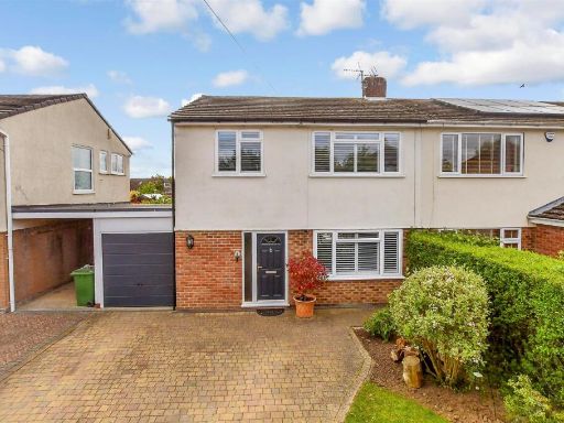 3 bedroom semi-detached house for sale in Mill Lane, Coxheath, Maidstone, Kent, ME17 — £425,000 • 3 bed • 1 bath • 1012 ft²
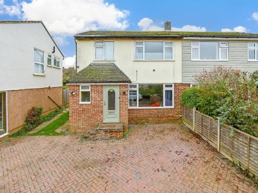 3 bedroom semi-detached house for sale in Springett Way, Coxheath, Maidstone, Kent, ME17 — £330,000 • 3 bed • 1 bath • 991 ft²
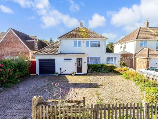 3 bedroom detached house for sale in Forstal Lane, Coxheath, Maidstone, Kent, ME17 — £600,000 • 3 bed • 2 bath • 991 ft²
 3 bedroom semi-detached house for sale in Linden Road, Coxheath, Maidstone, Kent, ME17 — £325,000 • 3 bed • 1 bath • 668 ft²
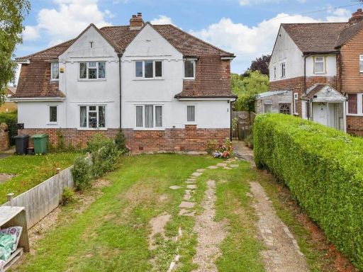 3 bedroom semi-detached house for sale in Stockett Lane, Coxheath, Maidstone, Kent, ME17 — £360,000 • 3 bed • 1 bath • 711 ft²
Meta
- {
"@context": "https://schema.org",
"@type": "Residence",
"name": "3 bedroom semidetached house for sale in Wilberforce Road,…",
"description": "",
"url": "https://propertypiper.co.uk/property/b49ba7b6-bd38-4fd4-a82f-e47bf0d472d8",
"image": "https://image-a.propertypiper.co.uk/b6e4dcc8-f3c5-4f78-9beb-1b7a2763d2fc-1024.jpeg",
"address": {
"@type": "PostalAddress",
"streetAddress": "Wilberforce Road, Coxheath, Maidstone, Kent",
"postalCode": "ME17 4HD",
"addressLocality": "Maidstone",
"addressRegion": "Maidstone and The Weald",
"addressCountry": "England"
},
"geo": {
"@type": "GeoCoordinates",
"latitude": 51.2350791,
"longitude": 0.4999898
},
"numberOfRooms": 3,
"numberOfBathroomsTotal": 1,
"floorSize": {
"@type": "QuantitativeValue",
"value": 634,
"unitCode": "FTK"
},
"offers": {
"@type": "Offer",
"price": 400000,
"priceCurrency": "GBP",
"availability": "https://schema.org/InStock"
},
"additionalProperty": [
{
"@type": "PropertyValue",
"name": "Feature",
"value": "detached"
},
{
"@type": "PropertyValue",
"name": "Feature",
"value": "brick exterior"
},
{
"@type": "PropertyValue",
"name": "Feature",
"value": "porch"
},
{
"@type": "PropertyValue",
"name": "Feature",
"value": "garage"
},
{
"@type": "PropertyValue",
"name": "Feature",
"value": "garden"
},
{
"@type": "PropertyValue",
"name": "Feature",
"value": "suburban"
},
{
"@type": "PropertyValue",
"name": "Feature",
"value": "mid-20th century"
},
{
"@type": "PropertyValue",
"name": "Feature",
"value": "driveway"
},
{
"@type": "PropertyValue",
"name": "Feature",
"value": "large garden"
},
{
"@type": "PropertyValue",
"name": "Feature",
"value": "traditional style"
},
{
"@type": "PropertyValue",
"name": "Feature",
"value": "suburban"
},
{
"@type": "PropertyValue",
"name": "Feature",
"value": "mature trees"
},
{
"@type": "PropertyValue",
"name": "Feature",
"value": "fence"
},
{
"@type": "PropertyValue",
"name": "Feature",
"value": "border planting"
},
{
"@type": "PropertyValue",
"name": "Feature",
"value": "lawn"
}
]
}
High Res Floorplan Images
Compatible Floorplan Images
FloorplanImages Thumbnail