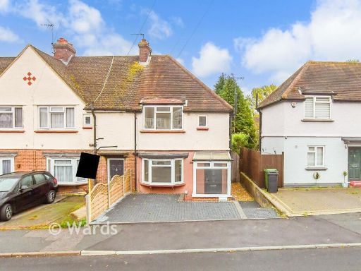
ME15 7AF - 3 bedroom end of terrace house for sale in West Park Road,…
View on Property Piper
3 bedroom end of terrace house for sale in West Park Road, Maidstone, Kent, ME15
Property Details
- Price: £325000
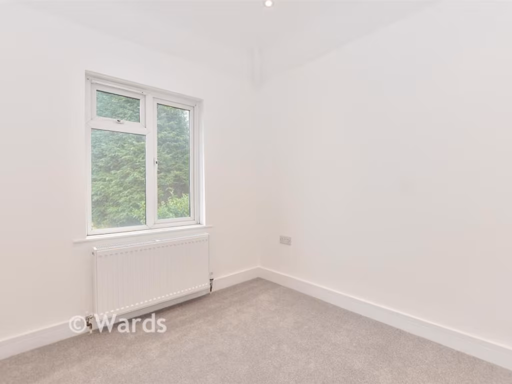
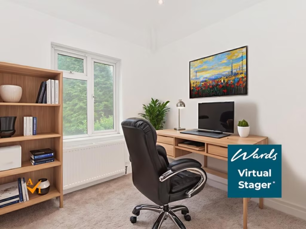
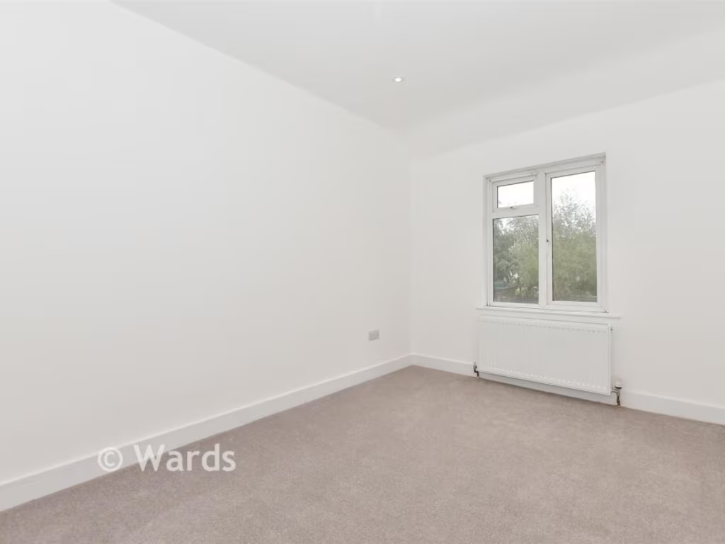
- Bedrooms: 3
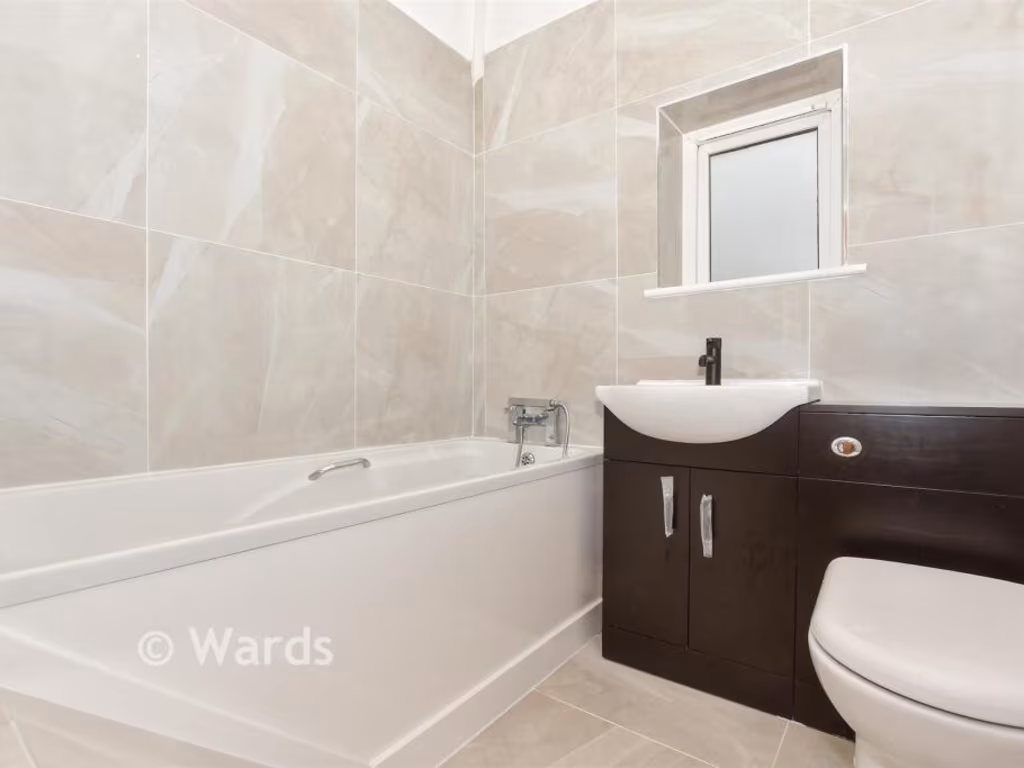
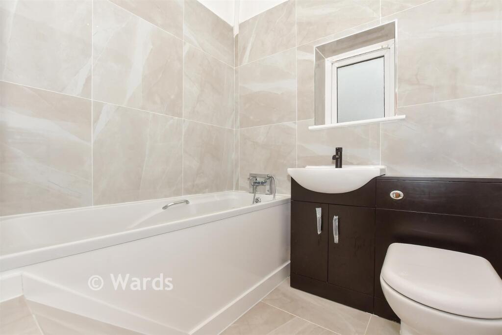
- Bathrooms: 1
- Property Type: undefined
- Property SubType: undefined
Image Descriptions
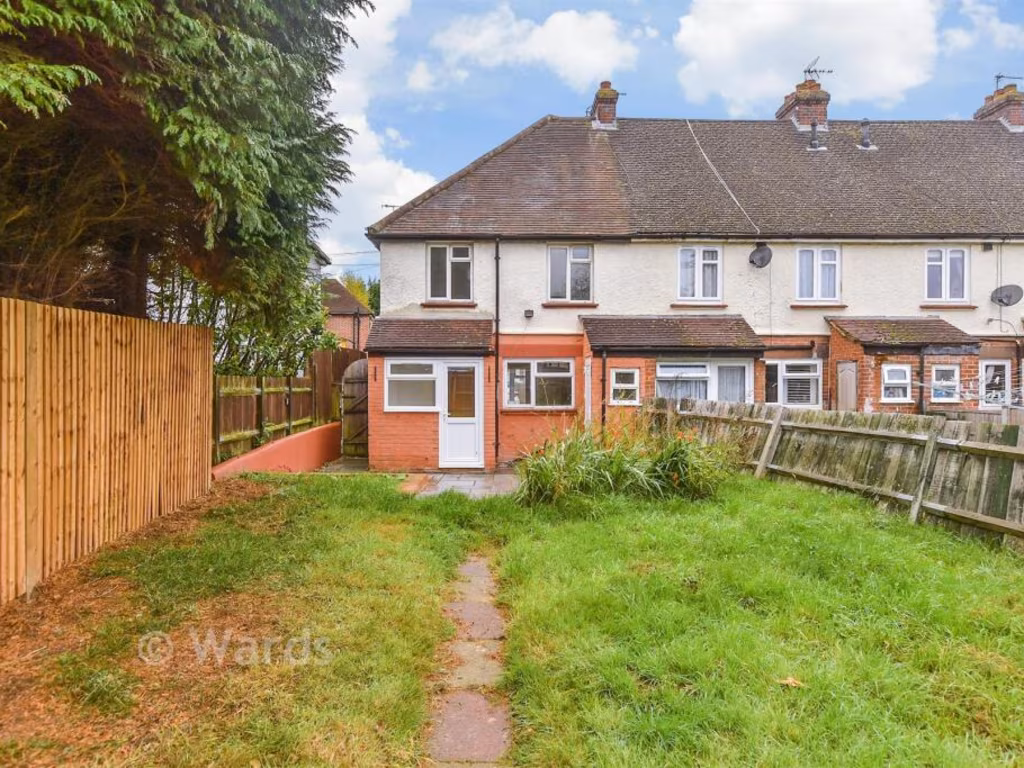
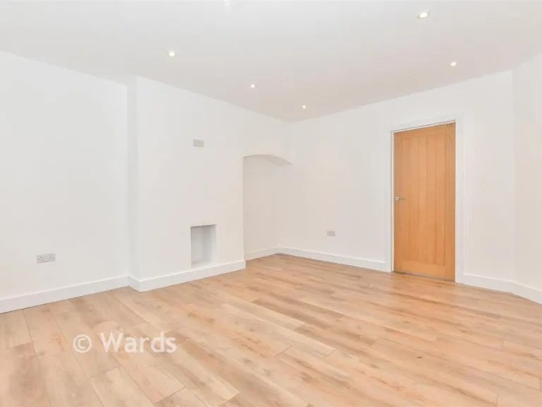
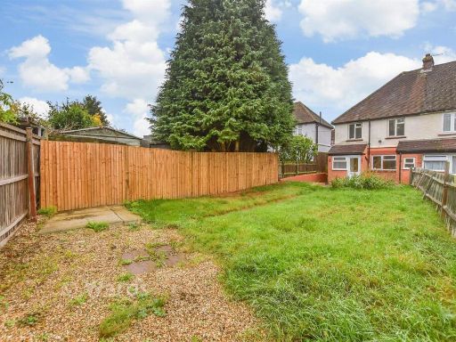
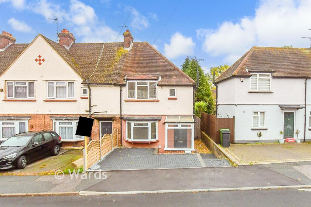
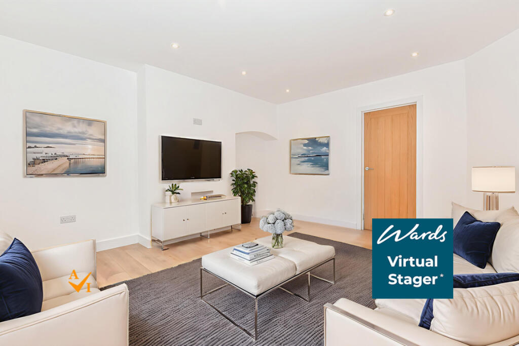
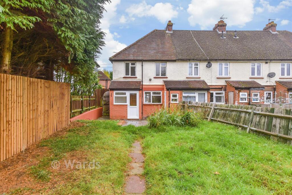
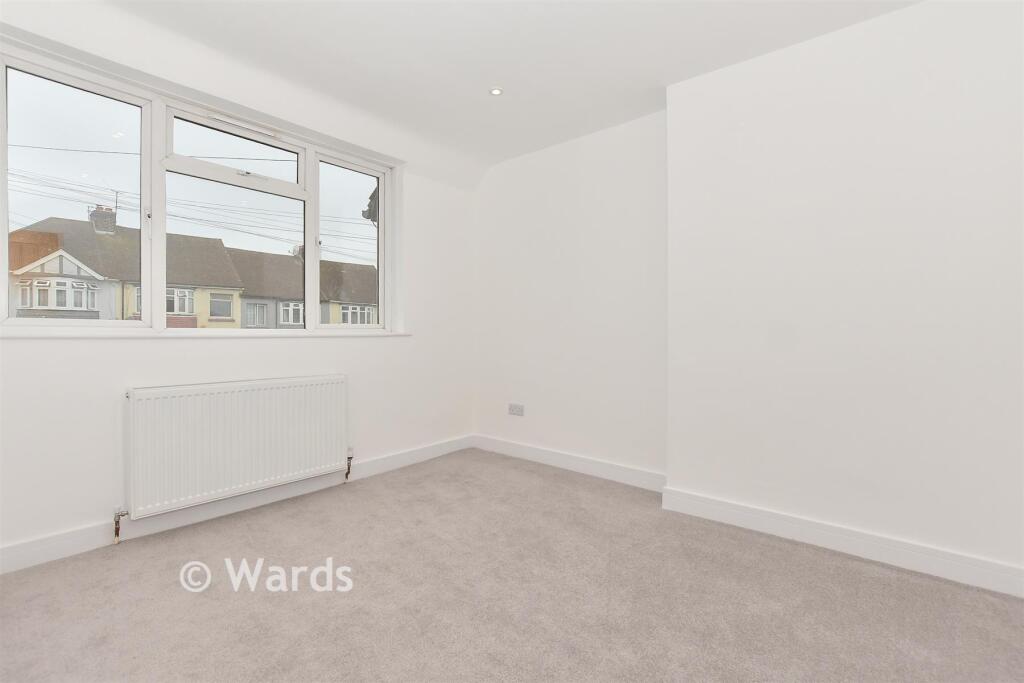
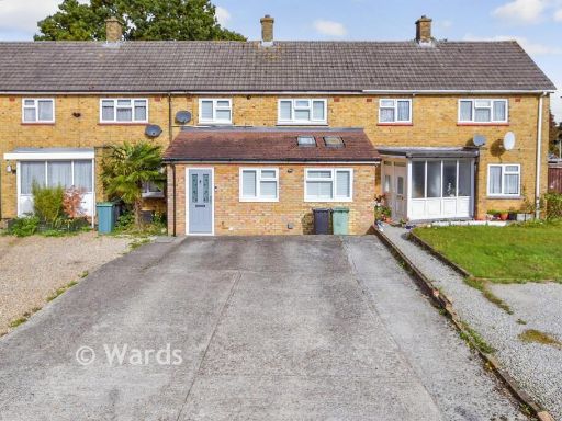
- exterior post-war
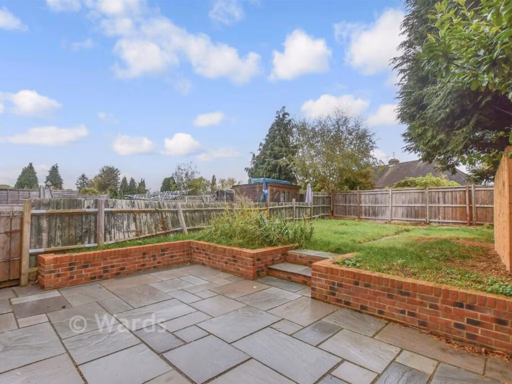
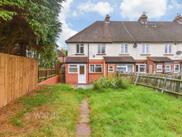
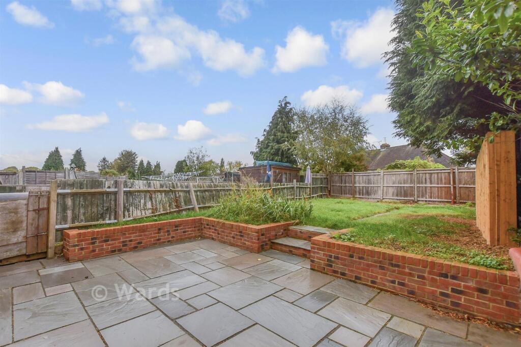
- outdoor patio
Floorplan Description
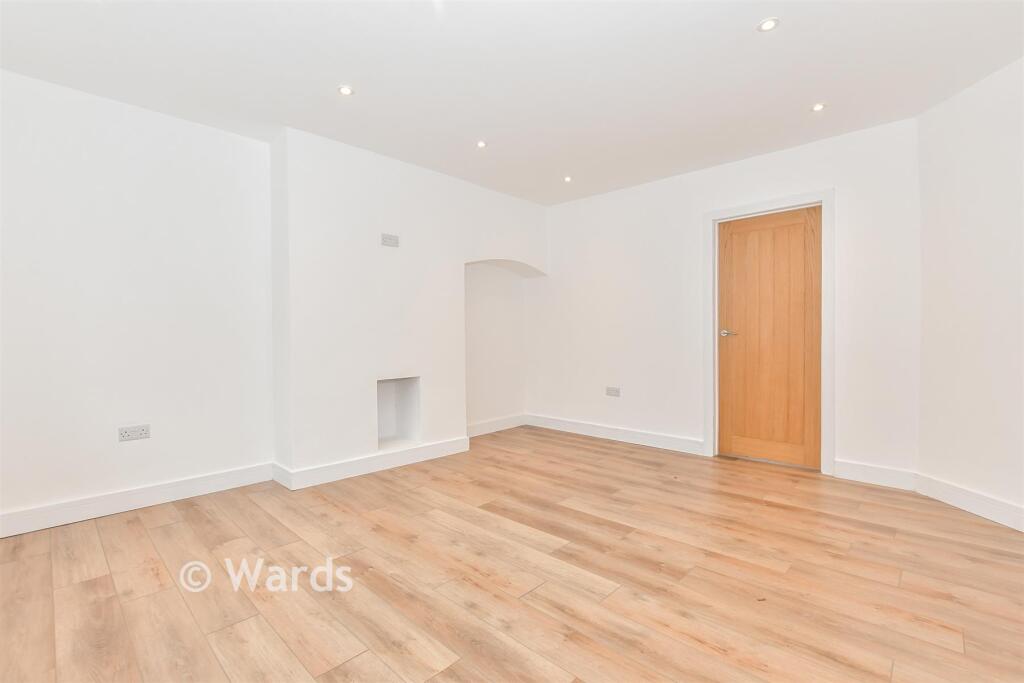
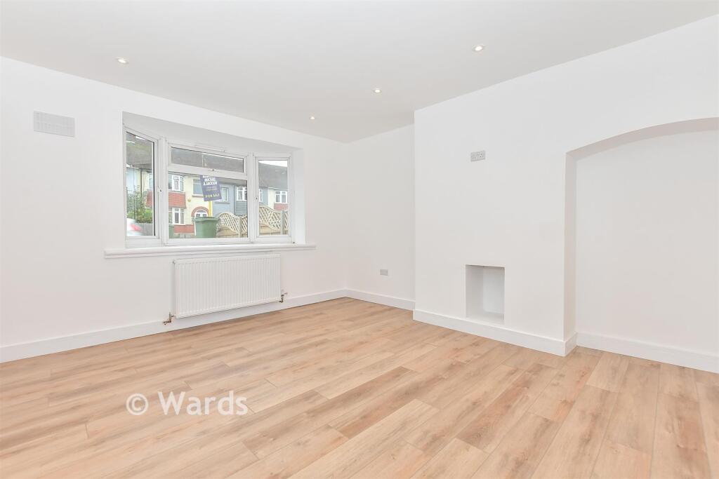
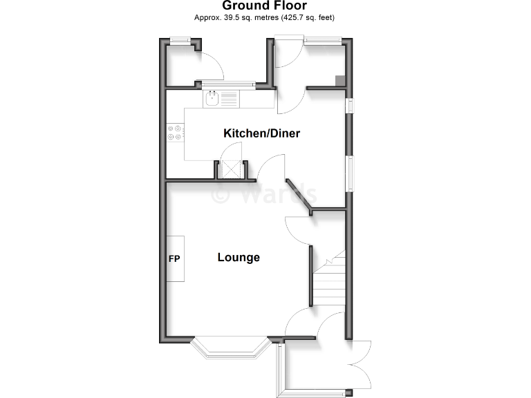
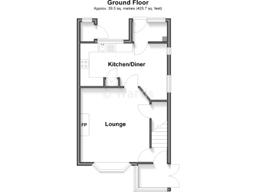
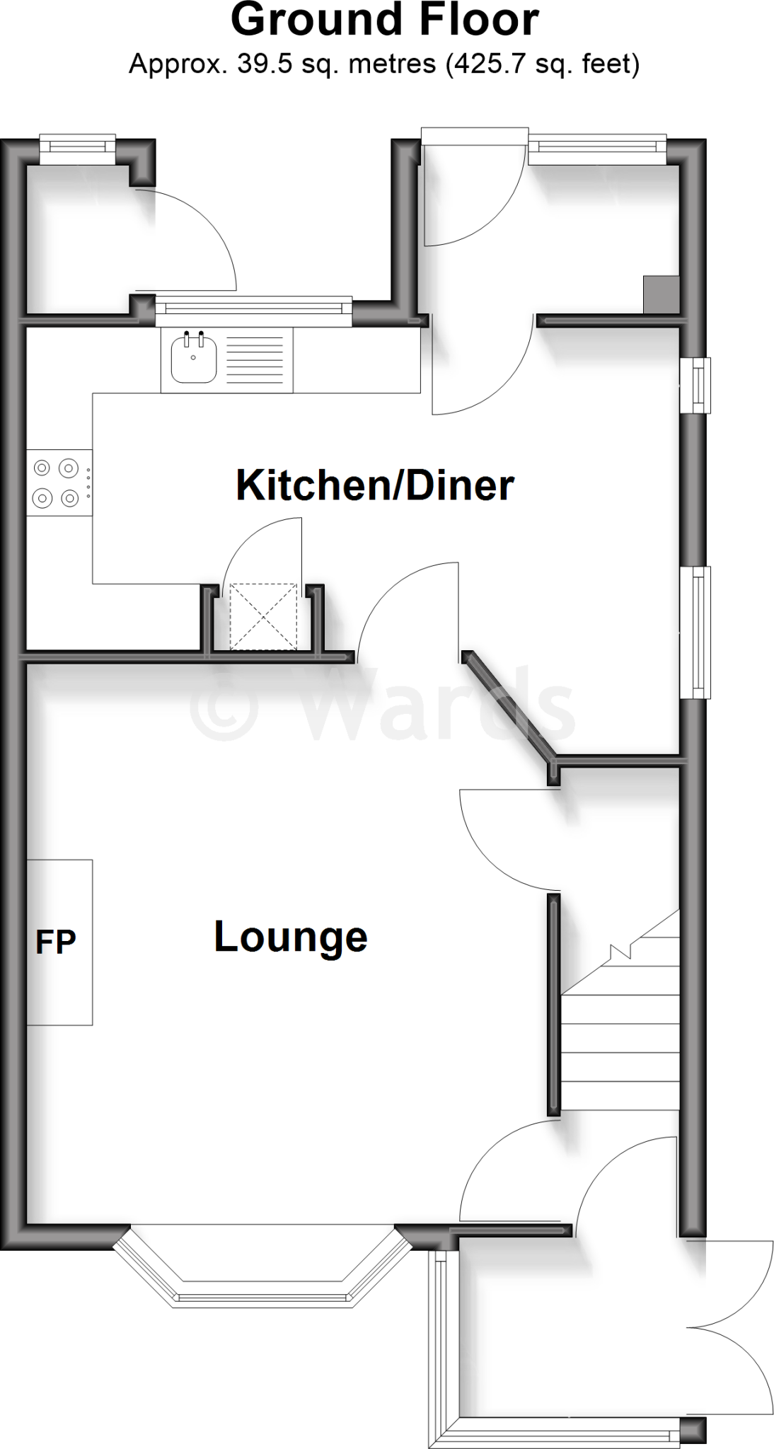
- Ground floor plan showing labelled Kitchen/Diner and Lounge.
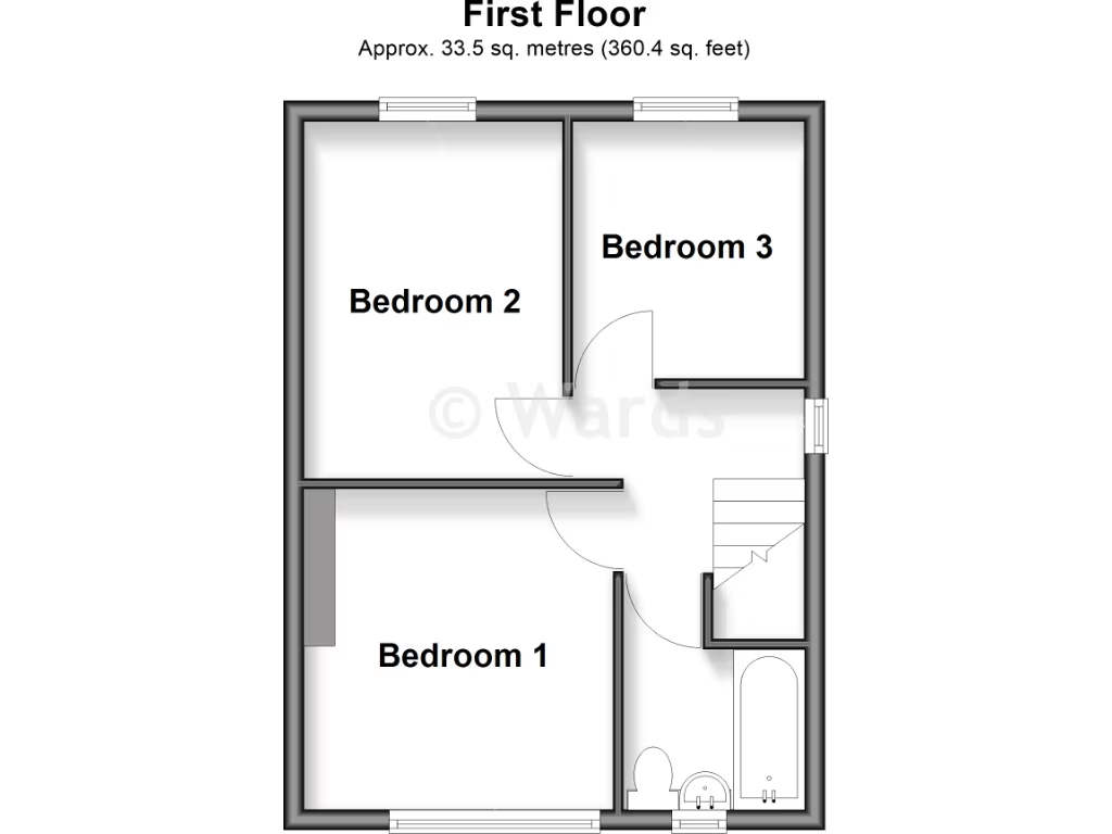
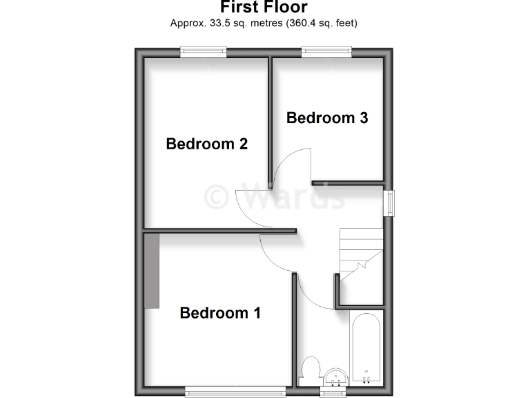
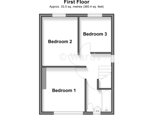
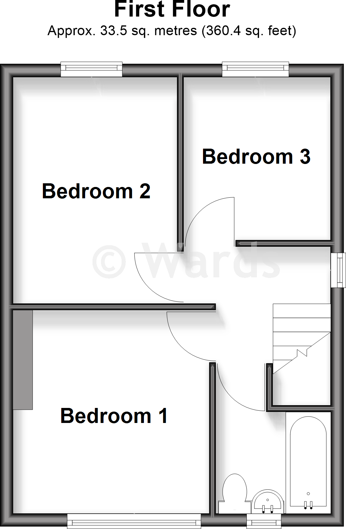
- Floorplan showing three labelled bedrooms and a bathroom/stair area.
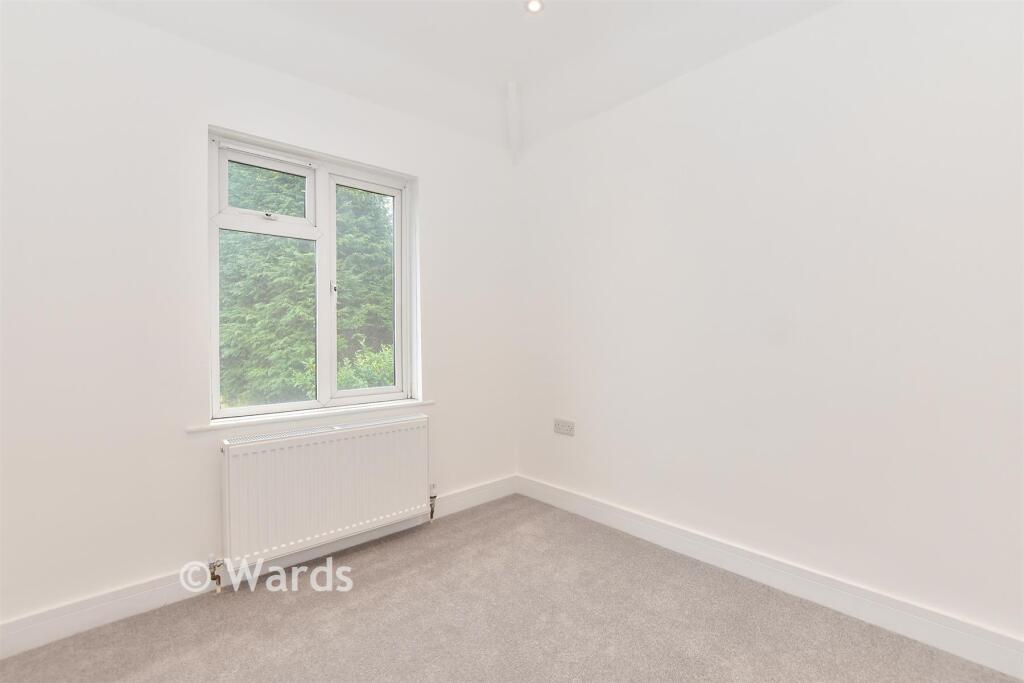
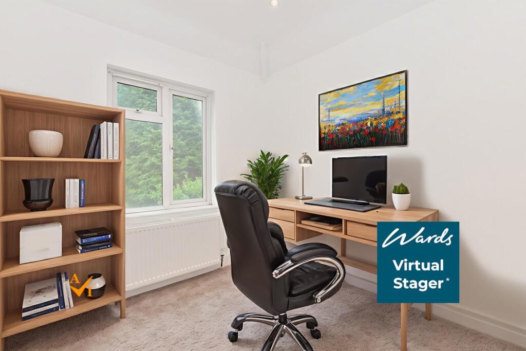
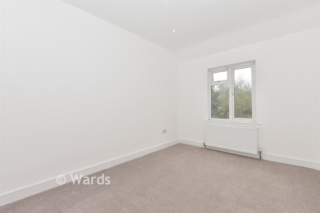
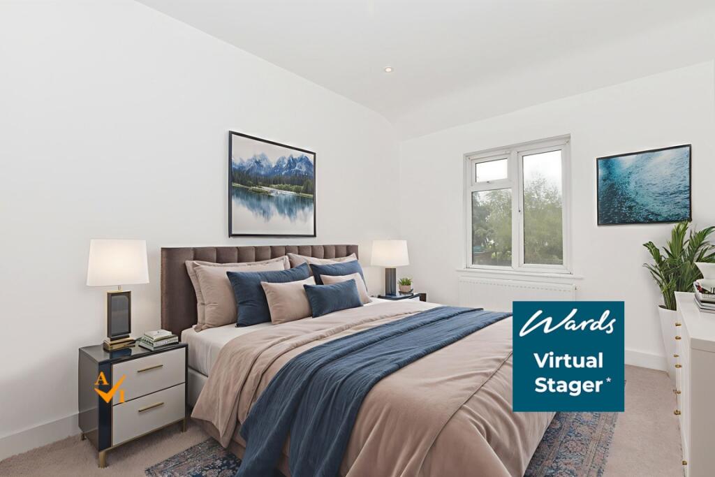
Rooms
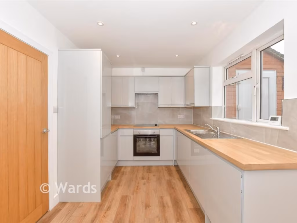
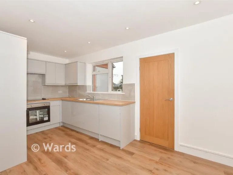
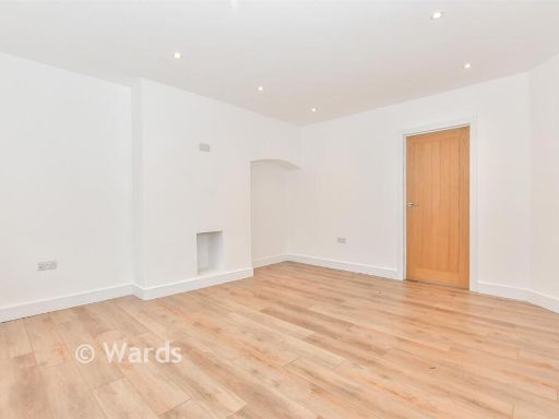
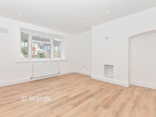
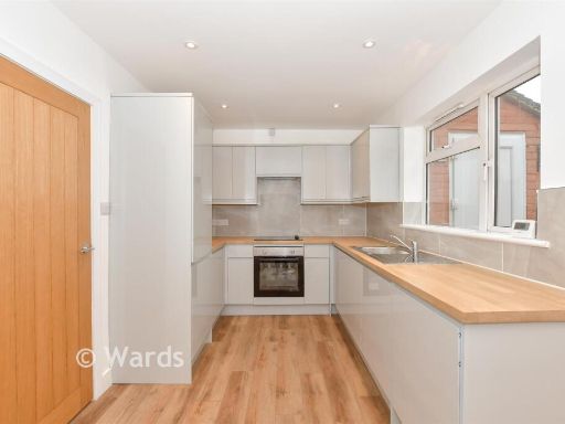
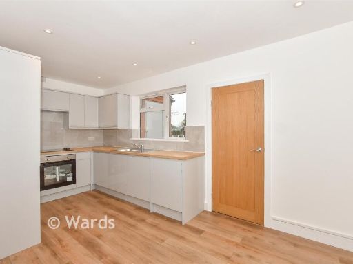
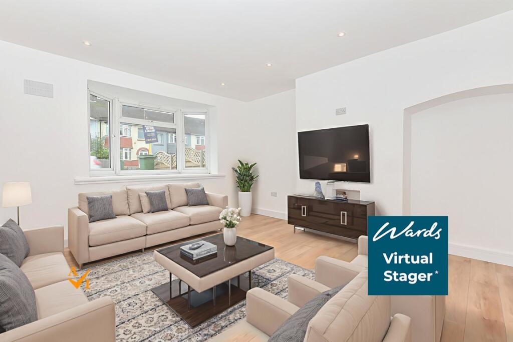
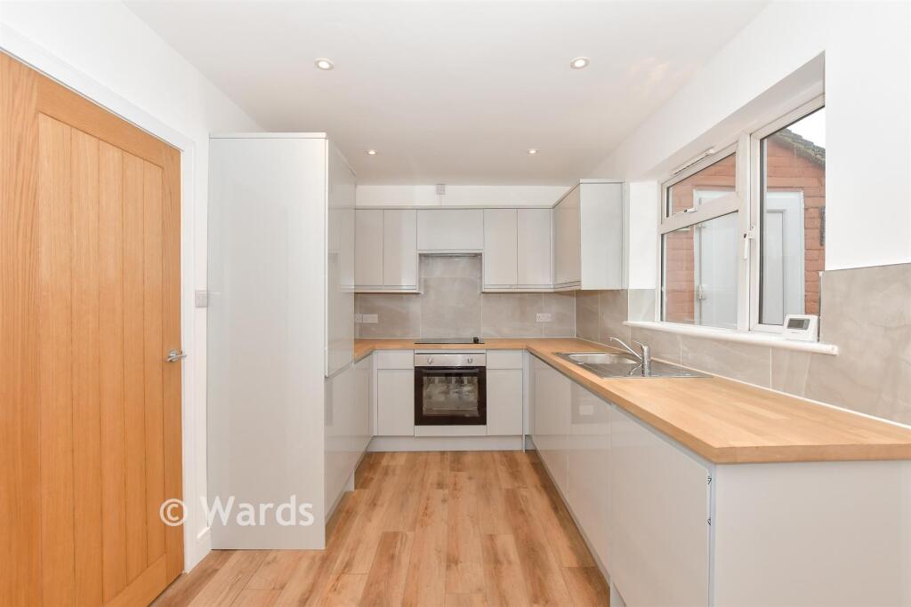
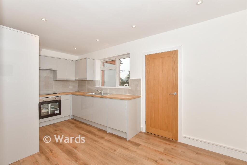
- Kitchen/Diner:
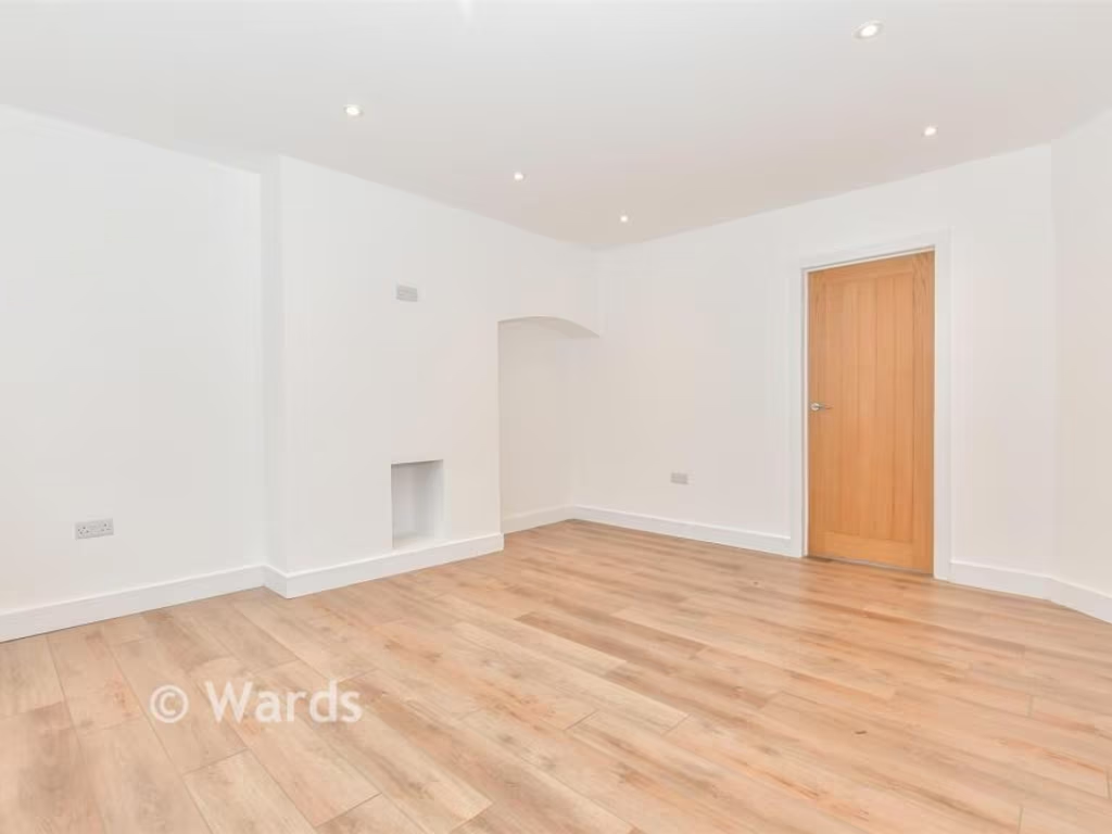
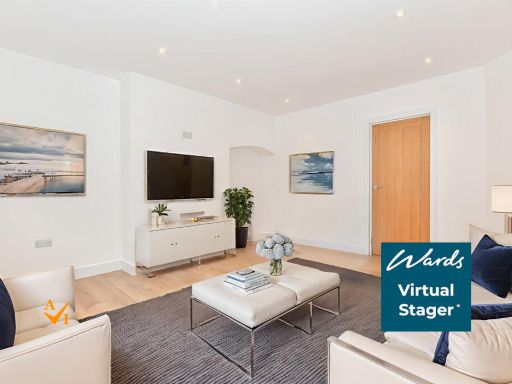
- Lounge:
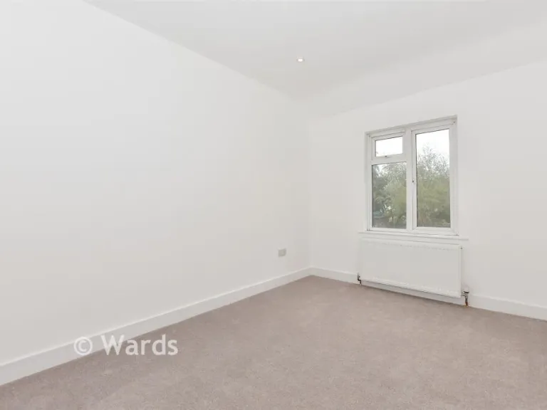
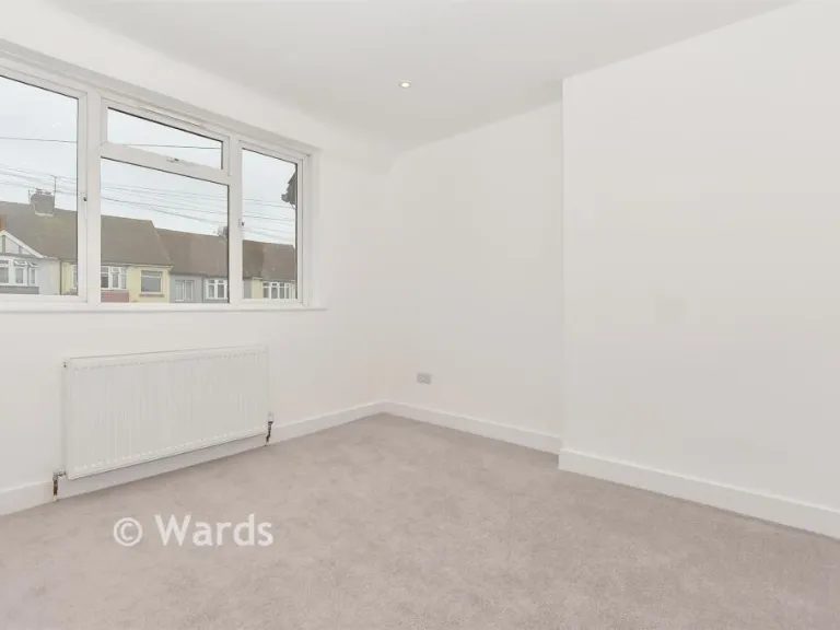
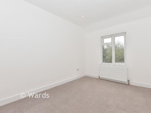
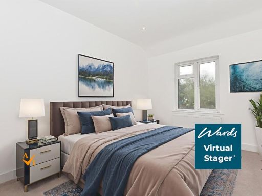
- Bedroom 1:
- Bedroom 2:
- Bedroom 3:
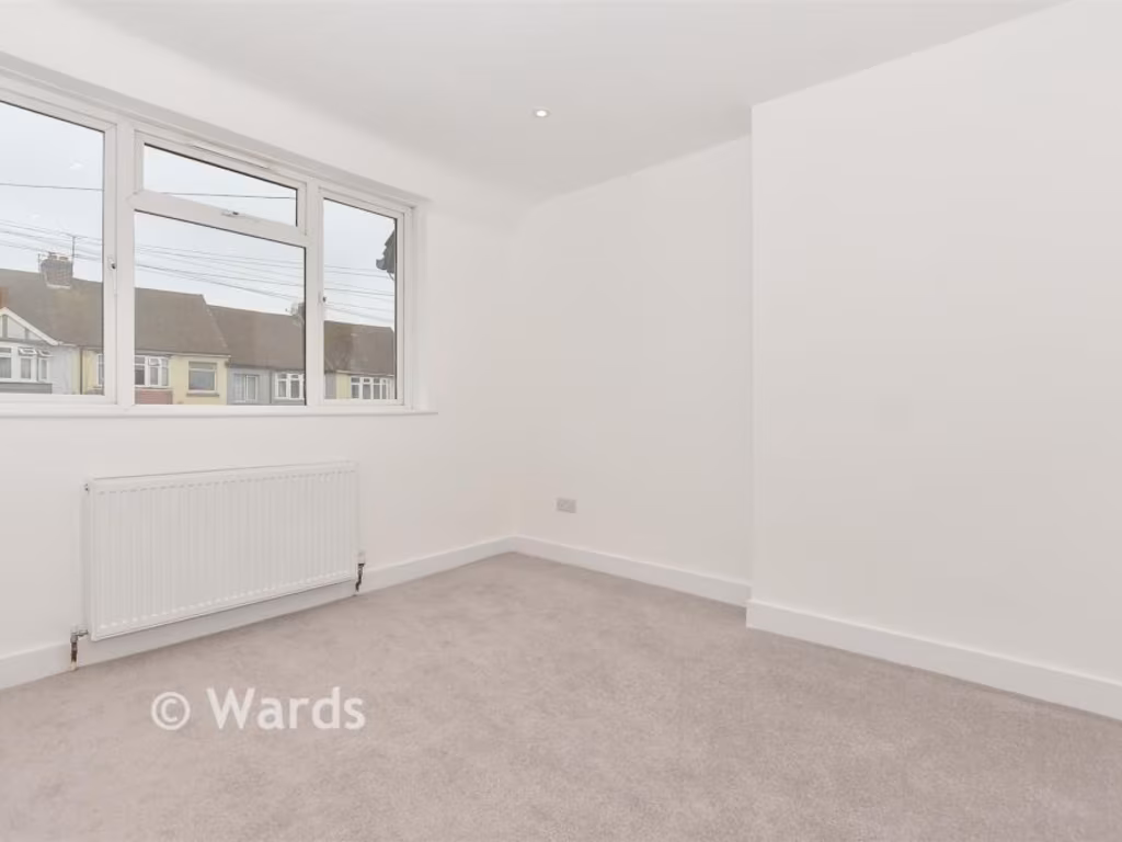
Textual Property Features
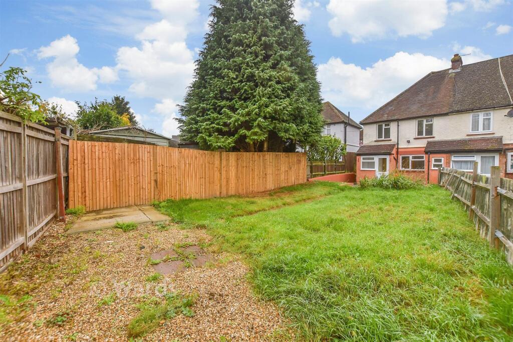
- Has Garden
- Chain Free
- Success
Detected Visual Features
- post-war
- semi-detached
- driveway
- garden
- roof
- brick
- modernization
- fixer-upper
- tiled roof
- outdoor
- patio
- landscaped
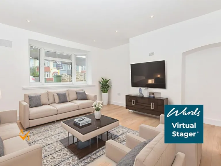
- natural lighting
- fence
- brickwork
- terrace
EPC Details
- Fully double glazed
- Cavity wall, as built, no insulation (assumed)
- Boiler and radiators, mains gas
- Low energy lighting in 89% of fixed outlets
- Suspended, no insulation (assumed)
Nearby Schools
- Molehill Primary Academy
- South Borough Primary School
- St Michael's Church of England Infant School Maidstone
- School of Science and Technology Maidstone
- Maidstone, St John's Church of England Primary School
- MEPA ACADEMY
- Brunswick House Primary School
- Maidstone Grammar School for Girls
- Loose Primary School
- Senacre Wood Primary School
- New Line Learning Academy
- Oaks Primary Academy
- Park Way Primary School
- Maidstone Grammar School
- Valley Invicta Primary School At East Borough
- St Paul's Infant School
- Sandling Primary School
- Tree Tops Primary Academy
- Tiger Primary School
- Greenfields Community Primary School
- Madginford Primary School
- Archbishop Courtenay Primary School
- Valley Park School
- Invicta Grammar School
- Maidstone, St Michael's Church of England Junior School
- North Borough Junior School
Nearest Bars And Restaurants
- Id: 311414109
- Tags:
- Amenity: pub
- Name: The Kingsley Arms
- TagsNormalized:
- Lat: 51.2692905
- Lon: 0.527102
- FullGeoHash: u107evrc627w
- PartitionGeoHash: u107
- Images:
- FoodStandards: null
- Distance: 953.2
,- Id: 53784553
- Tags:
- Amenity: cafe
- Building: yes
- TagsNormalized:
- Lat: 51.2685362
- Lon: 0.5409659
- FullGeoHash: u107sm1uv7v6
- PartitionGeoHash: u107
- Images:
- FoodStandards: null
- Distance: 803.1
,- Id: 8311854835
- Tags:
- Amenity: fast_food
- Brand: Pizza Hut Delivery
- Brand:wikidata: Q107293079
- Brand:wikipedia: en:Pizza Hut
- Cuisine: pizza
- Name: Pizza Hut Delivery
- Takeaway: yes
- TagsNormalized:
- fast food
- food
- hut
- pizza
- pizza hut
- pizza hut delivery
- takeaway
- Lat: 51.2656479
- Lon: 0.5268708
- FullGeoHash: u107euxshcrm
- PartitionGeoHash: u107
- Images:
- FoodStandards: null
- Distance: 680.6
,- Id: 8311854836
- Tags:
- Amenity: fast_food
- Cuisine: fish_and_chips
- TagsNormalized:
- Lat: 51.2656485
- Lon: 0.5269566
- FullGeoHash: u107euxsncx3
- PartitionGeoHash: u107
- Images:
- FoodStandards: null
- Distance: 675.6
,- Id: 687972842
- Tags:
- Addr:
- City: Maidstone
- Housenumber: 301
- Postcode: ME15 9PY
- Street: Loose Road
- Amenity: pub
- Fhrs:
- Name: Wheatsheaf
- Opening_hours: Mo-Th 16:00-23:00, Fr-Su 12:00-23:30
- Smoking: outside
- TagsNormalized:
- Lat: 51.2572045
- Lon: 0.5313037
- FullGeoHash: u107s54fu72y
- PartitionGeoHash: u107
- Images:
- FoodStandards: null
- Distance: 626.9
}
Nearest General Shops
- Id: 8252707718
- Tags:
- Fixme: add proper shop tag
- Operator: simmonds
- Payment:
- Shop: yes
- TagsNormalized:
- Lat: 51.2657395
- Lon: 0.5302037
- FullGeoHash: u107shdhddkx
- PartitionGeoHash: u107
- Images:
- FoodStandards: null
- Distance: 509.5
,- Id: 26772598
- Tags:
- Name: Blue Ocean Diving
- Postal_code: ME15 7AF
- Shop: scuba_diving
- TagsNormalized:
- Lat: 51.2655205
- Lon: 0.5349193
- FullGeoHash: u107shte298t
- PartitionGeoHash: u107
- Images:
- FoodStandards: null
- Distance: 355.8
,- Id: 649067673
- Tags:
- Name: Maidstone Scuba School
- Shop: scuba_diving
- TagsNormalized:
- Lat: 51.2652411
- Lon: 0.5347952
- FullGeoHash: u107sht3tts4
- PartitionGeoHash: u107
- Images:
- FoodStandards: null
- Distance: 325.2
}
Nearest Grocery shops
- Id: 880687310
- Tags:
- Addr:
- City: Maidstone
- Housenumber: 1
- Street: Loose Road
- Brand: Co-op Food
- Brand:wikidata: Q3277439
- Brand:wikipedia: en:Co-op Food
- Building: yes
- Name: Co-op Food
- Shop: convenience
- Website: https://www.coop.co.uk/store-finder/ME15-7BW/1-loose-road
- TagsNormalized:
- co-op
- co-op food
- food
- convenience
- shop
- Lat: 51.2660413
- Lon: 0.5274024
- FullGeoHash: u107sh8n36g8
- PartitionGeoHash: u107
- Images:
- FoodStandards: null
- Distance: 675.7
,- Id: 4215581693
- Tags:
- Addr:
- City: Maidstone
- Housenumber: 192
- Postcode: ME15 7UF
- Street: Loose Road
- Fhrs:
- Level: 0
- Name: South Park News
- Shop: convenience
- Source:
- Wheelchair: yes
- TagsNormalized:
- Lat: 51.2579257
- Lon: 0.53087
- FullGeoHash: u107s54x41vk
- PartitionGeoHash: u107
- Images:
- FoodStandards:
- Id: 1022971
- FHRSID: 1022971
- LocalAuthorityBusinessID: 17/500666/MIXED
- BusinessName: South Park News
- BusinessType: Retailers - other
- BusinessTypeID: 4613
- AddressLine1: South Park Post Office
- AddressLine2: 192 Loose Road
- AddressLine3: Maidstone
- AddressLine4: Kent
- PostCode: ME15 7UF
- RatingValue: 5
- RatingKey: fhrs_5_en-GB
- RatingDate: 2017-12-19
- LocalAuthorityCode: 185
- LocalAuthorityName: Maidstone
- LocalAuthorityWebSite: http://www.maidstone.gov.uk/
- LocalAuthorityEmailAddress: EHAdmin@midkent.gov.uk
- Scores:
- Hygiene: 0
- Structural: 0
- ConfidenceInManagement: 0
- NewRatingPending: false
- Geocode:
- Longitude: 0.53073400000000
- Latitude: 51.25776800000000
- Distance: 570
,- Id: 4215646189
- Tags:
- Name: West Park Mini Mart
- Shop: convenience
- Wheelchair: yes
- TagsNormalized:
- Lat: 51.262155
- Lon: 0.5347343
- FullGeoHash: u107s5vrsnqc
- PartitionGeoHash: u107
- Images:
- FoodStandards: null
- Distance: 30.5
}
Nearest Religious buildings
- Id: 766176525
- Tags:
- Amenity: place_of_worship
- Building: church
- Denomination: evangelical
- Name: The Beacon
- Religion: christian
- TagsNormalized:
- place of worship
- church
- evangelical
- christian
- Lat: 51.2525397
- Lon: 0.5444272
- FullGeoHash: u107s6hrwjfk
- PartitionGeoHash: u107
- Images:
- FoodStandards: null
- Distance: 1267.3
,- Id: 311414278
- Tags:
- Amenity: place_of_worship
- Denomination: baptist
- Name: Maidstone Baptist Church
- Religion: christian
- TagsNormalized:
- place of worship
- baptist
- church
- christian
- Lat: 51.2705398
- Lon: 0.523008
- FullGeoHash: u107evsbdcr4
- PartitionGeoHash: u107
- Images:
- FoodStandards: null
- Distance: 1241.2
,- Id: 882313462
- Tags:
- Amenity: place_of_worship
- Building: church
- Denomination: anglican
- Name: St Philip's Church
- Religion: christian
- Wikidata: Q105092614
- TagsNormalized:
- place of worship
- church
- anglican
- christian
- Lat: 51.2673353
- Lon: 0.5284496
- FullGeoHash: u107shbvcgbx
- PartitionGeoHash: u107
- Images:
- FoodStandards: null
- Distance: 723.7
}
Nearest Medical buildings
- Id: 4215581694
- Tags:
- Amenity: doctors
- Name: Loose Medical Centre
- Operator: The Mote Medical Practice
- Wheelchair: yes
- TagsNormalized:
- Lat: 51.252602
- Lon: 0.5284345
- FullGeoHash: u107s42b13mr
- PartitionGeoHash: u107
- Images:
- FoodStandards: null
- Distance: 1175.7
,- Id: 121218753
- Tags:
- Amenity: hospital
- Healthcare: hospital
- TagsNormalized:
- Lat: 51.2556929
- Lon: 0.5438074
- FullGeoHash: u107s6gfp9sj
- PartitionGeoHash: u107
- Images:
- FoodStandards: null
- Distance: 955
,- Id: 543966461
- Tags:
- Addr:
- City: Maidstone
- Housename: Bob Prowse Health Club
- Housenumber: 3
- Postcode: ME15 6AZ
- Street: Armstrong Road
- Building: yes
- Leisure: fitness_centre
- Name: Bob Prowse Health Club
- Opening_hours: Mo-Fr 06:30-22:00, Sa-Su 09:00-17:00
- Sport: weightlifting;running
- TagsNormalized:
- fitness
- fitness centre
- leisure
- health
- club
- running
- sports
- Lat: 51.2614249
- Lon: 0.5267639
- FullGeoHash: u107egze6qpw
- PartitionGeoHash: u107
- Images:
- FoodStandards: null
- Distance: 587.3
,- Id: 5257487363
- Tags:
- Addr:
- City: Maidstone
- Housename: Bob Prowse Health Club Ltd
- Housenumber: 3
- Postcode: ME15 6AZ
- Street: Armstrong Road
- Leisure: fitness_centre
- Name: Bob Prowse Health Club
- Opening_hours: Mo-Su 06:30-22:00
- Sport: weightlifting;running
- TagsNormalized:
- fitness
- fitness centre
- leisure
- health
- club
- running
- sports
- Lat: 51.2614354
- Lon: 0.5267659
- FullGeoHash: u107egzed81j
- PartitionGeoHash: u107
- Images:
- FoodStandards: null
- Distance: 587
}
Nearest Leisure Facilities
- Id: 121218823
- Tags:
- Access: private
- Leisure: pitch
- Sport: tennis
- TagsNormalized:
- Lat: 51.265537
- Lon: 0.5341043
- FullGeoHash: u107shsgmsc0
- PartitionGeoHash: u107
- Images:
- FoodStandards: null
- Distance: 363.9
,- Id: 887625343
- Tags:
- Leisure: pitch
- Lit: yes
- Sport: cricket
- Surface: artificial_turf
- TagsNormalized:
- pitch
- leisure
- cricket
- sports
- Lat: 51.2648806
- Lon: 0.5322152
- FullGeoHash: u107sh7x9d2k
- PartitionGeoHash: u107
- Images:
- FoodStandards: null
- Distance: 347.4
,- Id: 91324750
- Tags:
- Leisure: pitch
- Source: Bing
- Sport: soccer
- TagsNormalized:
- Lat: 51.2632059
- Lon: 0.5395794
- FullGeoHash: u107sk0vv45w
- PartitionGeoHash: u107
- Images:
- FoodStandards: null
- Distance: 328
,- Id: 91324754
- Tags:
- Leisure: pitch
- Source: Bing
- Sport: soccer
- TagsNormalized:
- Lat: 51.2639483
- Lon: 0.538214
- FullGeoHash: u107shrfjk97
- PartitionGeoHash: u107
- Images:
- FoodStandards: null
- Distance: 283.2
,- Id: 947878507
- Tags:
- TagsNormalized:
- Lat: 51.2614833
- Lon: 0.5348252
- FullGeoHash: u107s5v7y34d
- PartitionGeoHash: u107
- Images:
- FoodStandards: null
- Distance: 95
}
Nearest Tourist attractions
- Id: 311379094
- Tags:
- Name: Aylesbury Guest House
- Source: audio
- Tourism: guest_house
- TagsNormalized:
- Lat: 51.2743001
- Lon: 0.511617
- FullGeoHash: u107ewhw3w33
- PartitionGeoHash: u107
- Images:
- FoodStandards: null
- Distance: 2106.9
,- Id: 252113538
- Tags:
- Building: yes
- Name: Maidstone Museum
- Tourism: museum
- Wikidata: Q6735528
- Wikipedia: en:Maidstone Museum
- TagsNormalized:
- Lat: 51.2760603
- Lon: 0.5205925
- FullGeoHash: u107eye0dwmv
- PartitionGeoHash: u107
- Images:
- FoodStandards: null
- Distance: 1830.2
,- Id: 907788417
- Tags:
- Building: yes
- Museum: history
- Name: Museum of Carriages
- Tourism: museum
- Wikidata: Q17964487
- TagsNormalized:
- Lat: 51.2712896
- Lon: 0.5221334
- FullGeoHash: u107evshyt4g
- PartitionGeoHash: u107
- Images:
- FoodStandards: null
- Distance: 1343.8
}
Nearest Train stations
- Id: 6688355479
- Tags:
- Name: East Farleigh
- Naptan:
- Network: National Rail
- Public_transport: station
- Railway: station
- Ref:
- Source: NPE
- Train: yes
- Wikidata: Q3065808
- Wikipedia: en:East Farleigh railway station
- TagsNormalized:
- Lat: 51.2552513
- Lon: 0.4844783
- FullGeoHash: u107e48z3pm5
- PartitionGeoHash: u107
- Images:
- FoodStandards: null
- Distance: 3608
,- Id: 6692612517
- Tags:
- Addr:
- Postcode: ME14 4PH
- Street: Ware Street
- Name: Bearsted
- Naptan:
- Network: National Rail
- Public_transport: station
- Railway: station
- Ref:
- Wikidata: Q2513832
- Wikipedia: en:Bearsted railway station
- TagsNormalized:
- Lat: 51.2759153
- Lon: 0.577672
- FullGeoHash: u107tnkxuerm
- PartitionGeoHash: u107
- Images:
- FoodStandards: null
- Distance: 3326.3
,- Id: 6688355481
- Tags:
- Name: Maidstone Barracks
- Naptan:
- Network: National Rail
- Postal_code: ME16 0SQ
- Public_transport: station
- Railway: station
- Ref:
- Wikidata: Q2913119
- Wikipedia: en:Maidstone Barracks railway station
- TagsNormalized:
- Lat: 51.2770433
- Lon: 0.5141731
- FullGeoHash: u107ewwqmjem
- PartitionGeoHash: u107
- Images:
- FoodStandards: null
- Distance: 2189.8
,- Id: 6692612534
- Tags:
- Name: Maidstone East
- Naptan:
- Network: National Rail
- Postal_code: ME14 1QN
- Public_transport: station
- Railway: station
- Ref:
- Wikidata: Q952299
- Wikipedia: en:Maidstone East railway station
- TagsNormalized:
- Lat: 51.2776262
- Lon: 0.5199007
- FullGeoHash: u107eyf9fd64
- PartitionGeoHash: u107
- Images:
- FoodStandards: null
- Distance: 2002.8
,- Id: 6688355480
- Tags:
- Name: Maidstone West
- Naptan:
- Network: National Rail
- Postal_code: ME16 8RJ
- Public_transport: station
- Railway: station
- Ref:
- Source: NPE
- Wikipedia: en:Maidstone West railway station
- TagsNormalized:
- Lat: 51.2703088
- Lon: 0.5157564
- FullGeoHash: u107etrx1yrb
- PartitionGeoHash: u107
- Images:
- FoodStandards: null
- Distance: 1611.4
}
Nearest Hotels
- Id: 238965514
- Tags:
- Access: customers
- Amenity: parking
- Capacity:
- Fee: no
- Name: Travelodge Maidstone Central Hotel
- Park_ride: no
- Parking: surface
- Source: survey,Bing
- TagsNormalized:
- Lat: 51.2729682
- Lon: 0.5166374
- FullGeoHash: u107evbnww0b
- PartitionGeoHash: u107
- Images:
- FoodStandards: null
- Distance: 1745.9
,- Id: 238965515
- Tags:
- Addr:
- City: Maidstone
- Street: Saint Peter's Street
- Brand: Travelodge
- Brand:wikidata: Q9361374
- Brand:wikipedia: en:Travelodge UK
- Building: hotel
- Fax: +44-1622-755558
- Internet_access: yes
- Internet_access:fee: customers
- Internet_access:ssid: Travelodge WiFi
- Layer: 1
- Name: Travelodge Maidstone Central Hotel
- Phone: +44 871 984 6442
- Source: survey,Bing
- Tourism: hotel
- Url: http://www.travelodge.co.uk/hotels/414/Maidstone-Central-hotel
- TagsNormalized:
- Lat: 51.272656
- Lon: 0.5166197
- FullGeoHash: u107evbhy5gd
- PartitionGeoHash: u107
- Images:
- FoodStandards: null
- Distance: 1723.4
,- Id: 255074827
- Tags:
- Addr:
- Name: Stone Court Hotel
- Tourism: hotel
- TagsNormalized:
- Lat: 51.2715769
- Lon: 0.5247389
- FullGeoHash: u107evwne69t
- PartitionGeoHash: u107
- Images:
- FoodStandards: null
- Distance: 1255.7
}
Tags
- post-war
- semi-detached
- driveway
- garden
- roof
- brick
- modernization
- fixer-upper
- tiled roof
- outdoor
- patio
- garden
- landscaped
- natural lighting
- fence
- brickwork
- terrace
Local Market Stats
- Average Price/sqft: £359
- Avg Income: £51900
- Rental Yield: 4.3%
- Social Housing: 11%
- Planning Success Rate: 81%
Similar Properties
 3 bedroom terraced house for sale in Lancashire Road, Maidstone, Kent, ME15 — £325,000 • 3 bed • 1 bath • 770 ft²
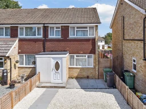 3 bedroom end of terrace house for sale in Higham Close, Maidstone, Kent, ME15 — £290,000 • 3 bed • 1 bath • 732 ft²
 3 bedroom terraced house for sale in Willington Street, Maidstone, Kent, ME15 — £330,000 • 3 bed • 1 bath • 715 ft²
 3 bedroom terraced house for sale in Queens Road, Maidstone, Kent, ME16 — £400,000 • 3 bed • 2 bath • 782 ft²
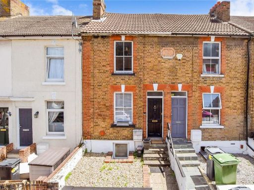 3 bedroom terraced house for sale in Melville Road, Maidstone, Kent, ME15 — £260,000 • 3 bed • 1 bath • 685 ft²
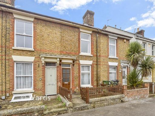 3 bedroom terraced house for sale in Allen Street, Maidstone, Kent, ME14 — £300,000 • 3 bed • 1 bath • 829 ft²
Meta
- {
"@context": "https://schema.org",
"@type": "Residence",
"name": "3 bedroom end of terrace house for sale in West Park Road,…",
"description": "",
"url": "https://propertypiper.co.uk/property/b40b4f62-ffad-4e0d-8aa0-0f4b7bb31927",
"image": "https://image-a.propertypiper.co.uk/e18f871a-21ce-4cbb-8740-e96e230af45e-1024.jpeg",
"address": {
"@type": "PostalAddress",
"streetAddress": "67 West Park Road",
"postalCode": "ME15 7AF",
"addressLocality": "Maidstone",
"addressRegion": "Faversham and Mid Kent",
"addressCountry": "England"
},
"geo": {
"@type": "GeoCoordinates",
"latitude": 51.262322160188205,
"longitude": 0.535081970986046
},
"numberOfRooms": 3,
"numberOfBathroomsTotal": 1,
"floorSize": {
"@type": "QuantitativeValue",
"value": 754,
"unitCode": "FTK"
},
"offers": {
"@type": "Offer",
"price": 325000,
"priceCurrency": "GBP",
"availability": "https://schema.org/InStock"
},
"additionalProperty": [
{
"@type": "PropertyValue",
"name": "Feature",
"value": "post-war"
},
{
"@type": "PropertyValue",
"name": "Feature",
"value": "semi-detached"
},
{
"@type": "PropertyValue",
"name": "Feature",
"value": "driveway"
},
{
"@type": "PropertyValue",
"name": "Feature",
"value": "garden"
},
{
"@type": "PropertyValue",
"name": "Feature",
"value": "roof"
},
{
"@type": "PropertyValue",
"name": "Feature",
"value": "brick"
},
{
"@type": "PropertyValue",
"name": "Feature",
"value": "modernization"
},
{
"@type": "PropertyValue",
"name": "Feature",
"value": "fixer-upper"
},
{
"@type": "PropertyValue",
"name": "Feature",
"value": "tiled roof"
},
{
"@type": "PropertyValue",
"name": "Feature",
"value": "outdoor"
},
{
"@type": "PropertyValue",
"name": "Feature",
"value": "patio"
},
{
"@type": "PropertyValue",
"name": "Feature",
"value": "garden"
},
{
"@type": "PropertyValue",
"name": "Feature",
"value": "landscaped"
},
{
"@type": "PropertyValue",
"name": "Feature",
"value": "natural lighting"
},
{
"@type": "PropertyValue",
"name": "Feature",
"value": "fence"
},
{
"@type": "PropertyValue",
"name": "Feature",
"value": "brickwork"
},
{
"@type": "PropertyValue",
"name": "Feature",
"value": "terrace"
}
]
}
High Res Floorplan Images
Compatible Floorplan Images
FloorplanImages Thumbnail