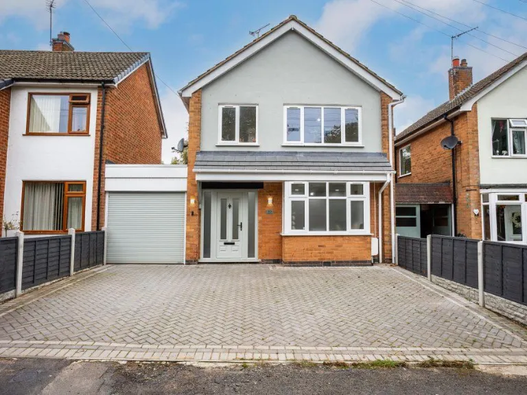
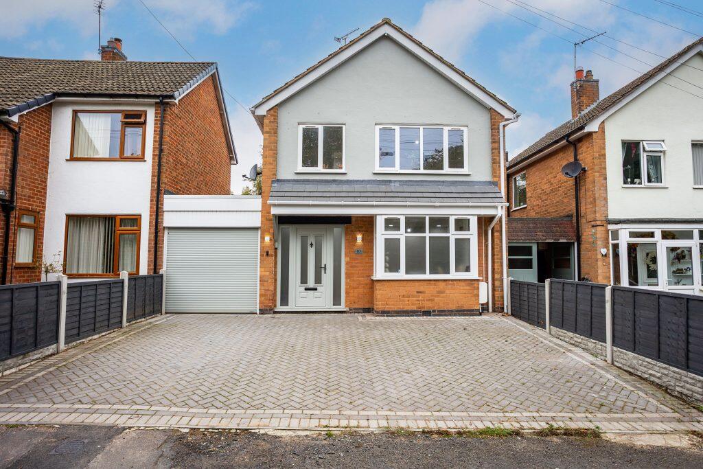
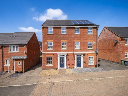
LE4 3AR - 4 bedroom link detached house for sale in Henson Close, Bir…
View on Property Piper
4 bedroom link detached house for sale in Henson Close, Birstall, LE4
Property Details
- Price: £400000
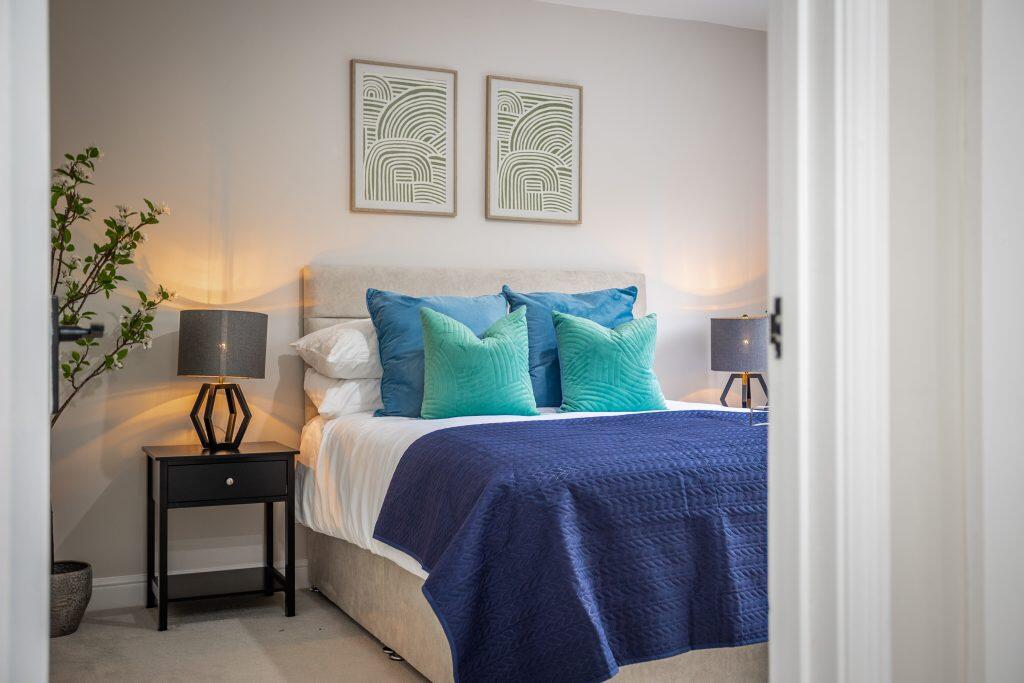
- Bedrooms: 4
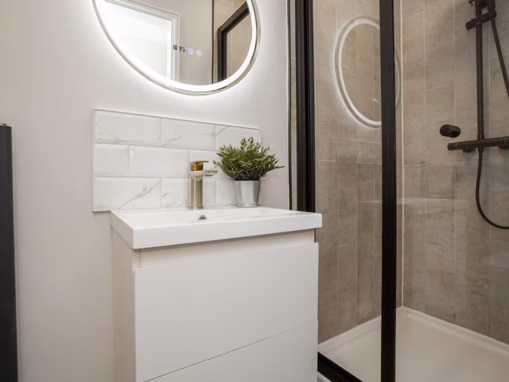
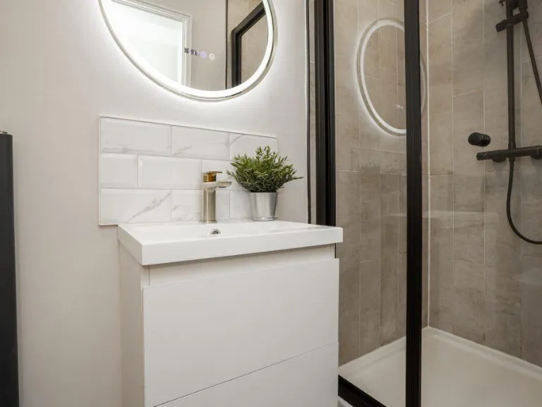
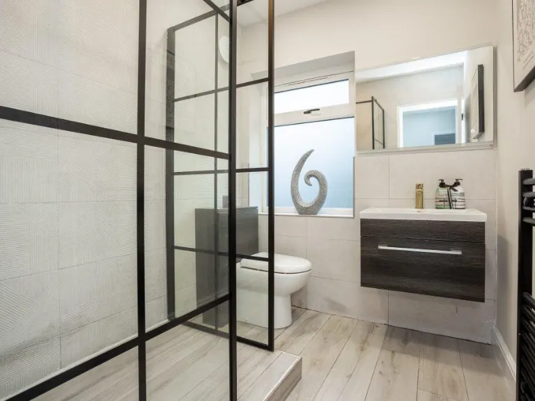
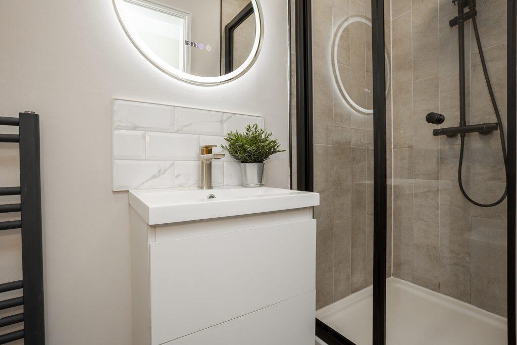
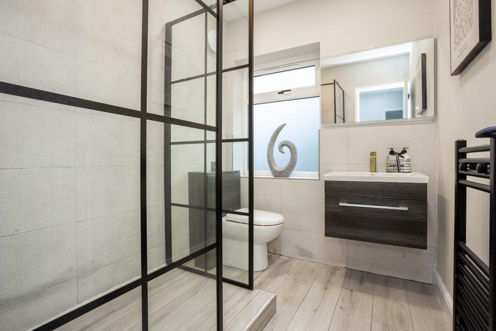
- Bathrooms: 2
- Property Type: undefined
- Property SubType: undefined
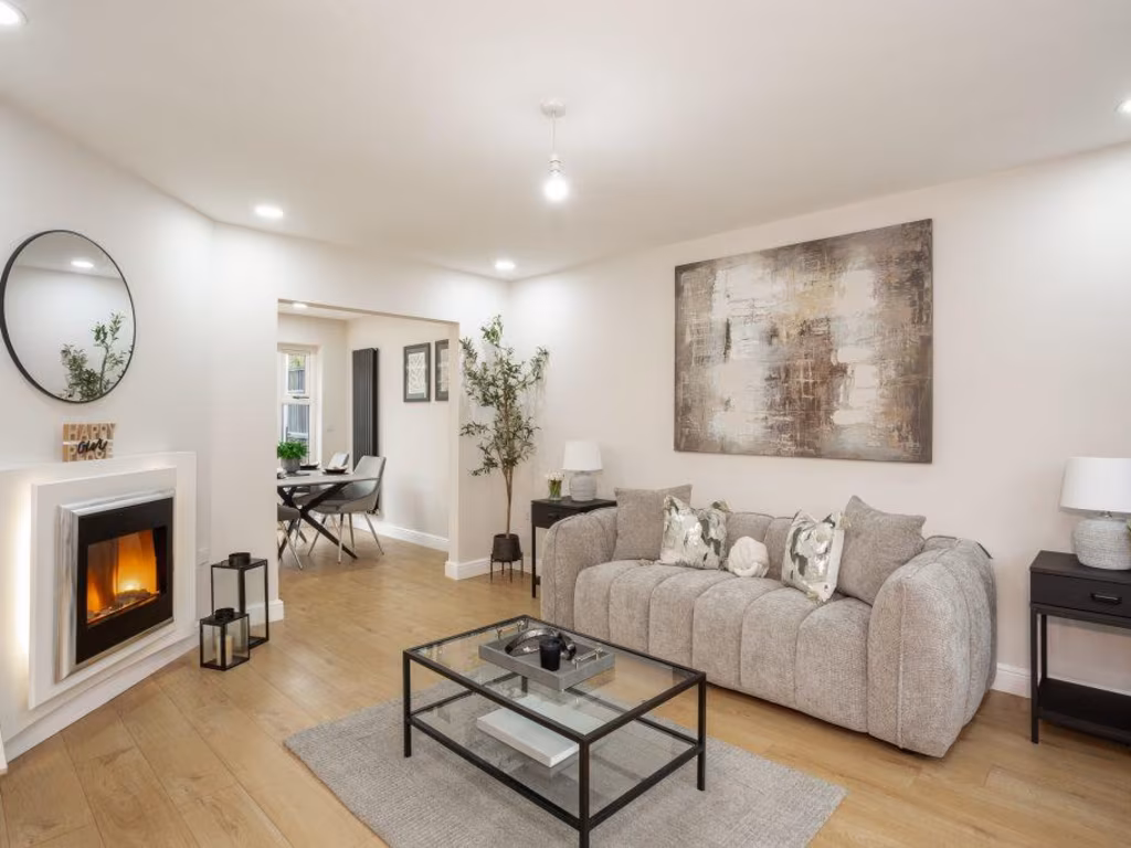
Image Descriptions
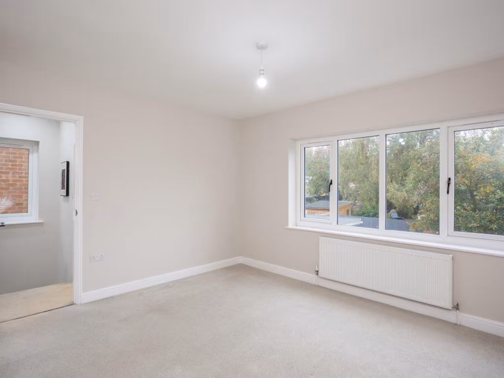
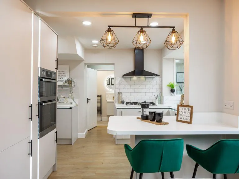
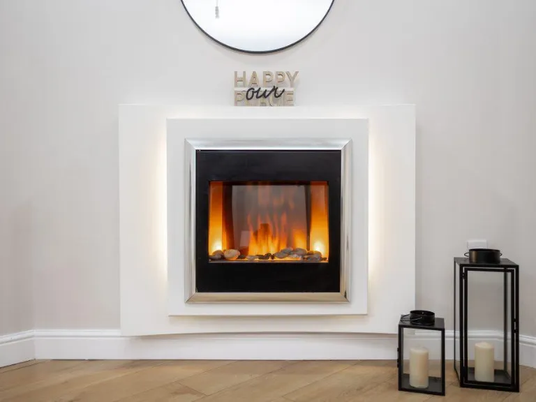
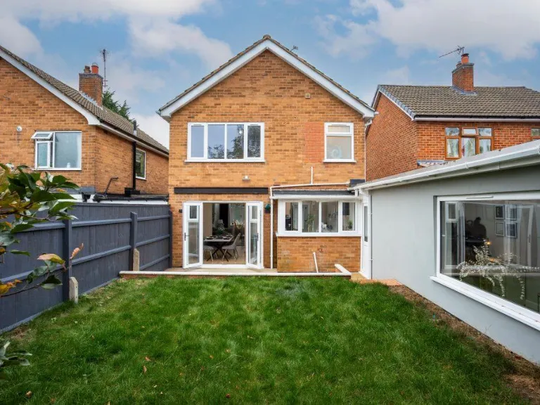
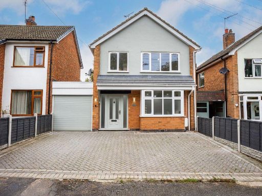
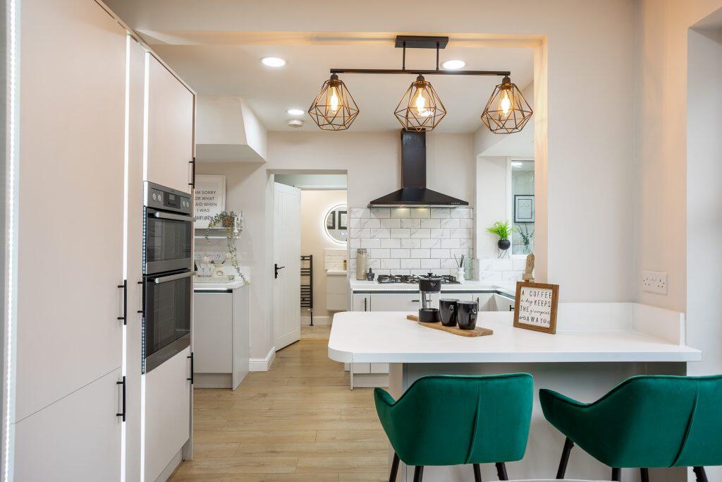
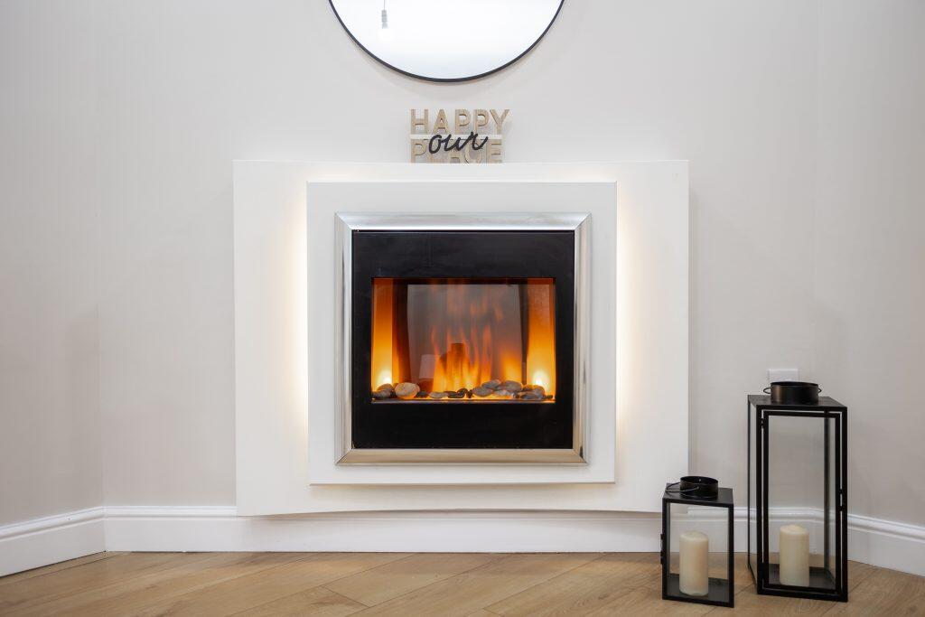
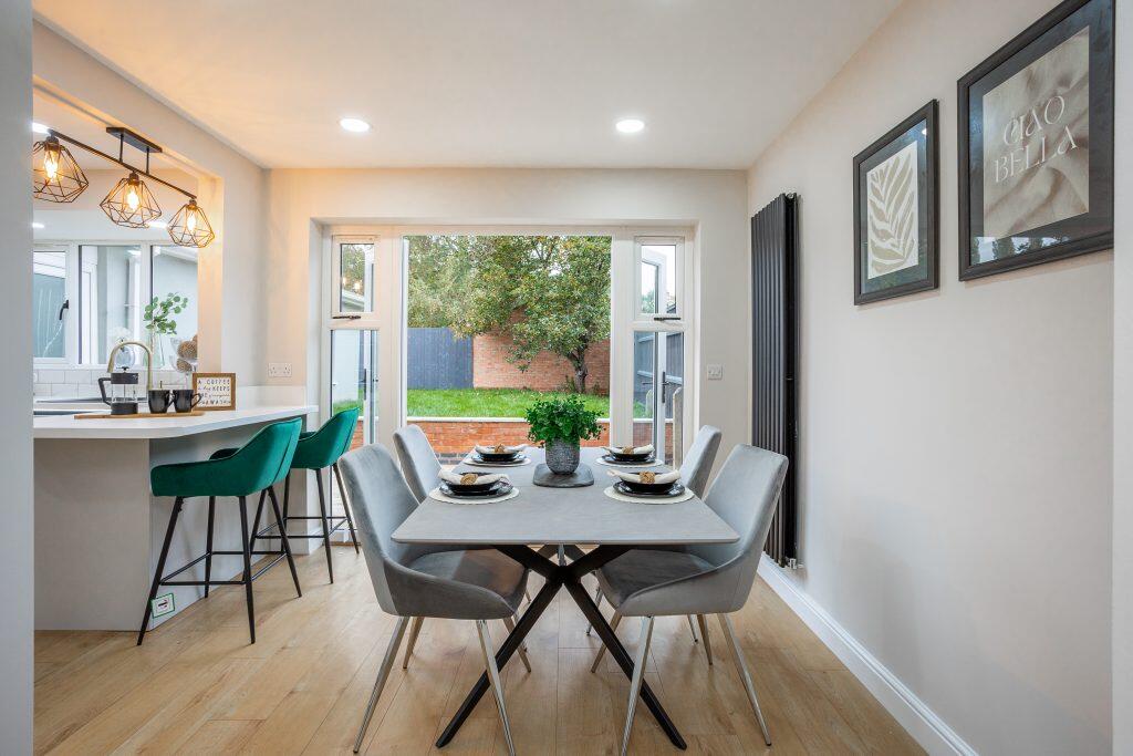
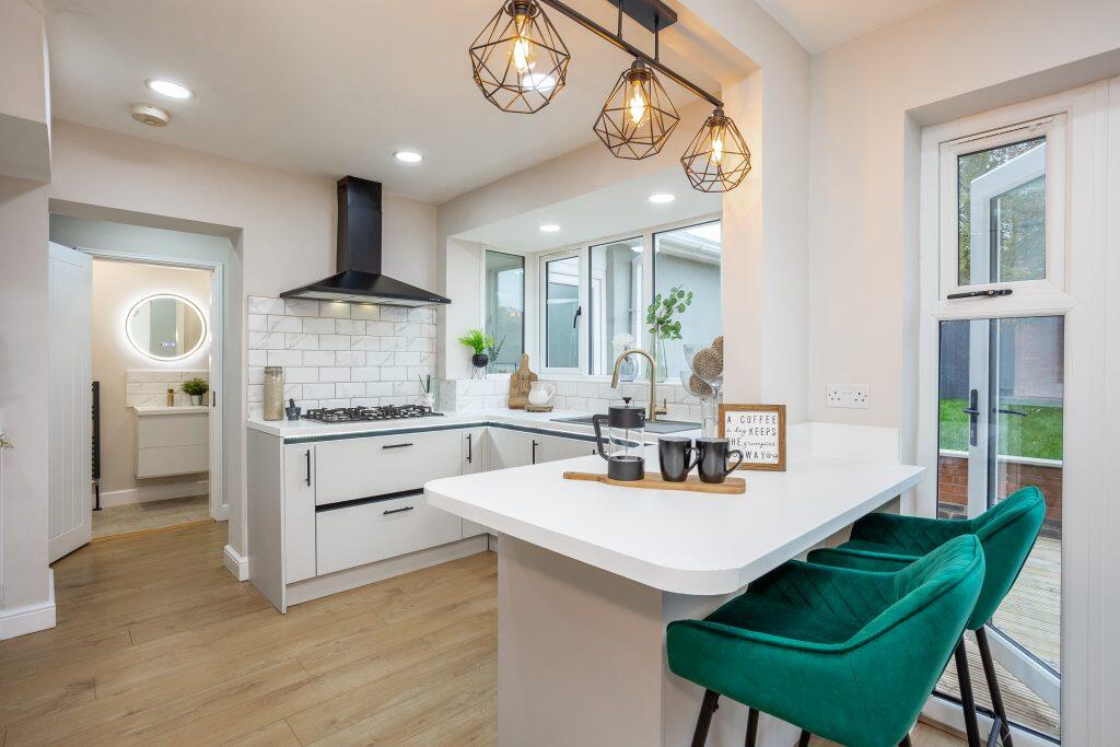
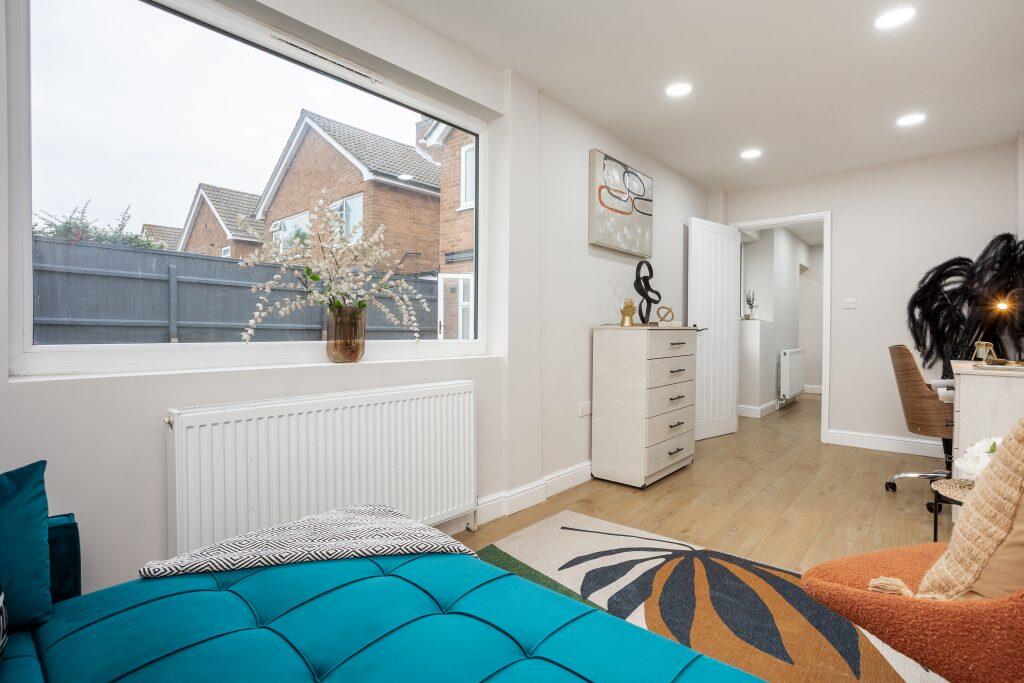
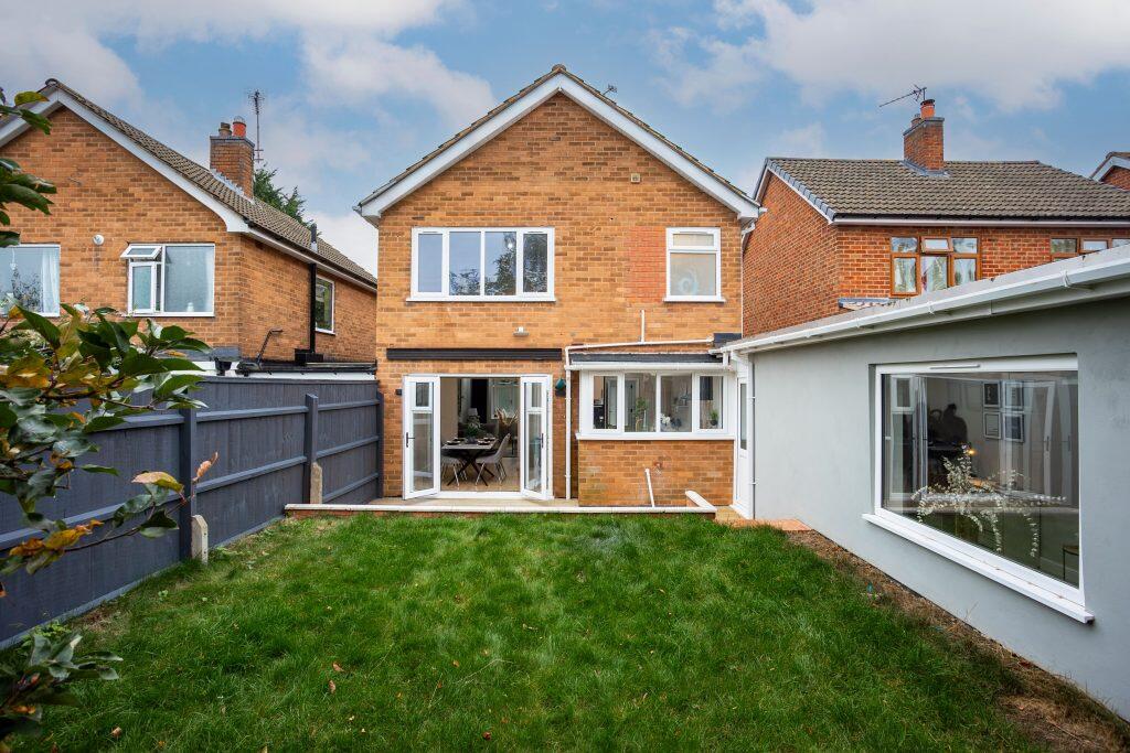
- exterior contemporary
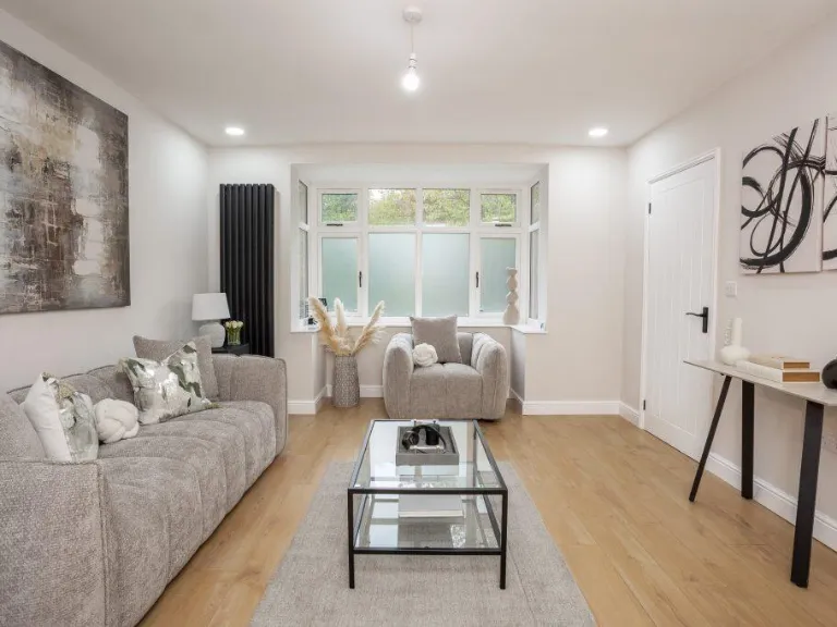
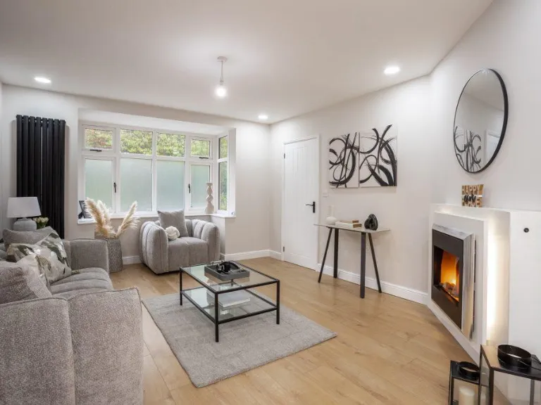
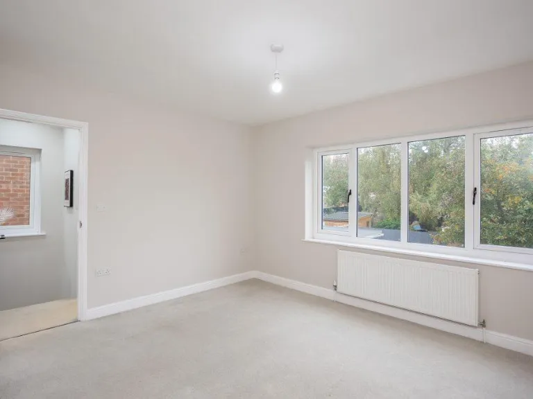
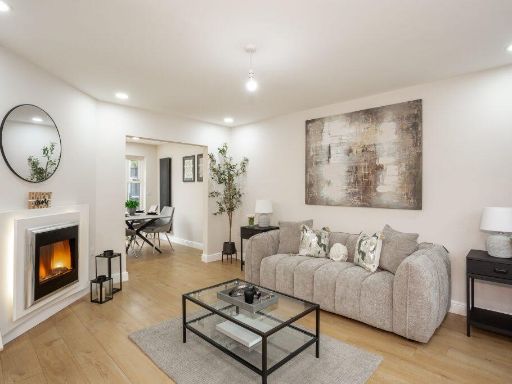
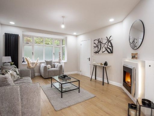
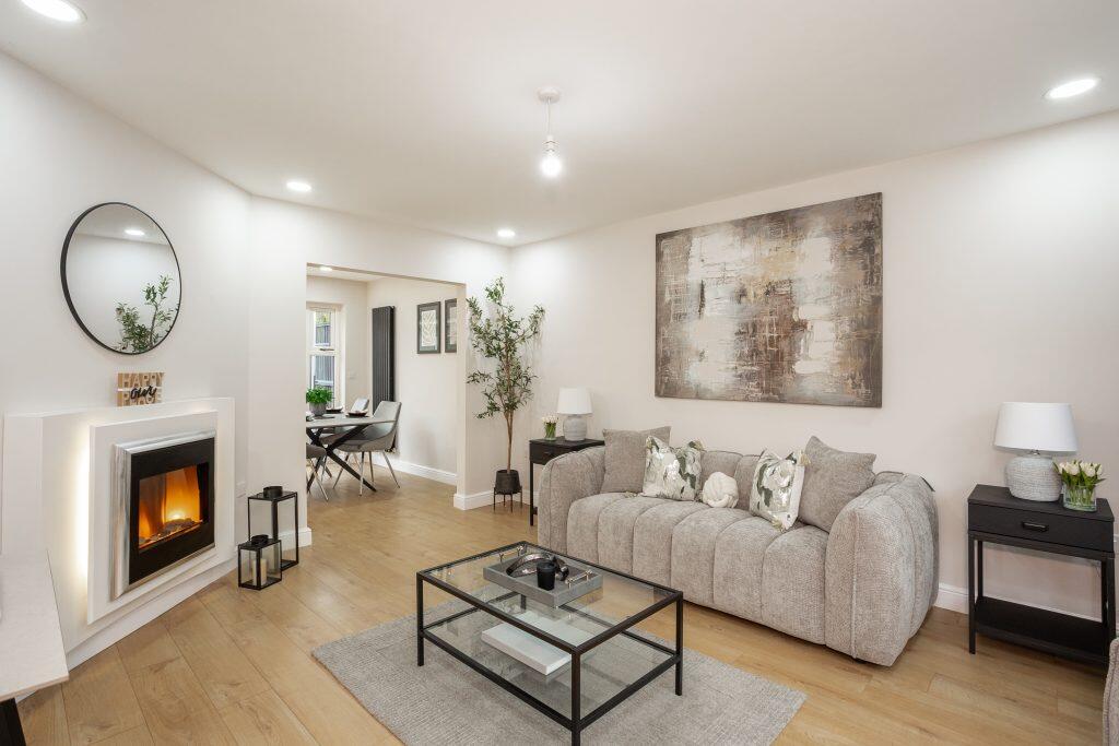
- living room modern
Floorplan Description
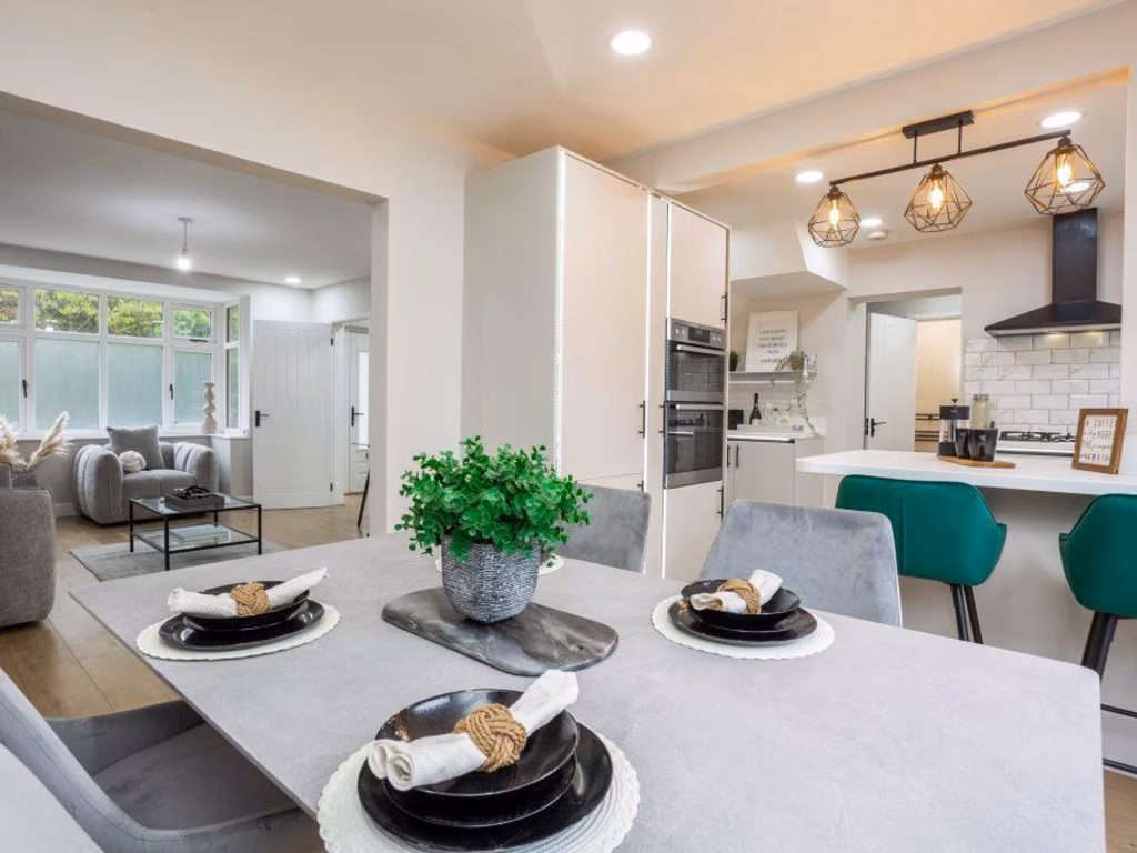
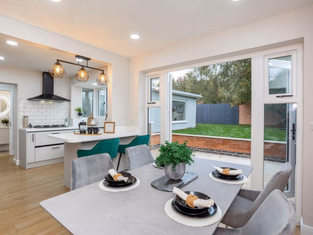
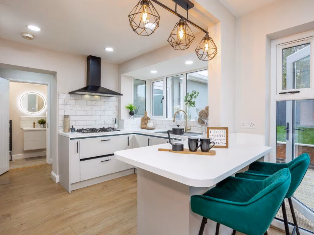
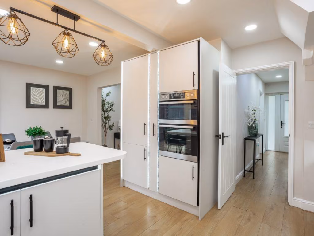
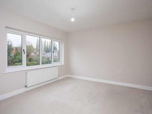
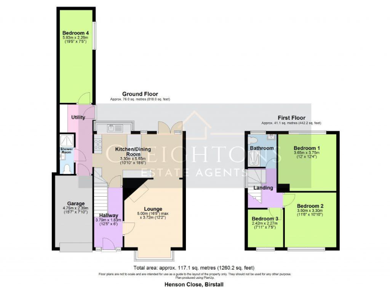
- Two-storey residence with kitchen/dining, lounge and four bedrooms (one on ground floor).
Rooms
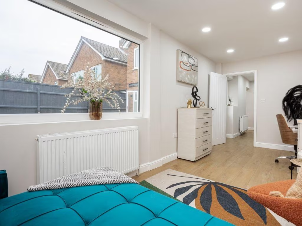
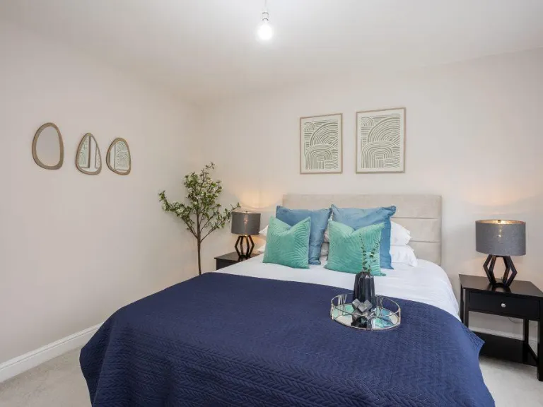
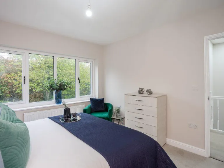
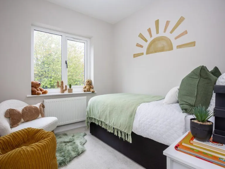
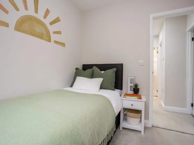
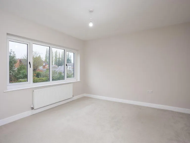
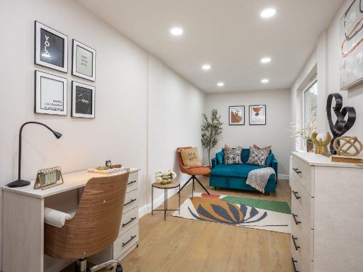
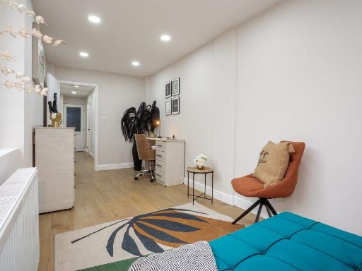
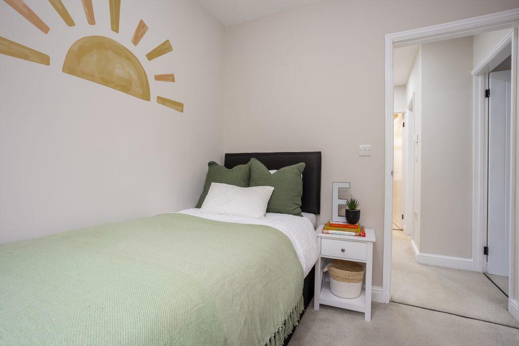
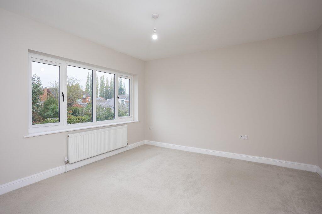
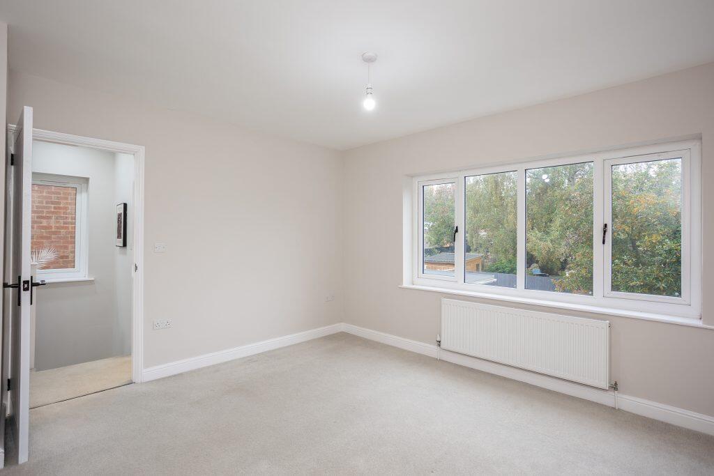
- Bedroom 4:
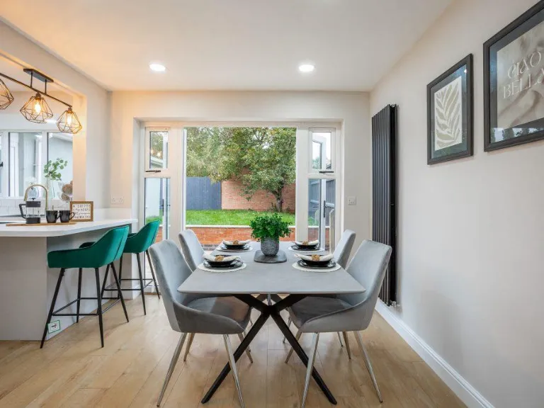
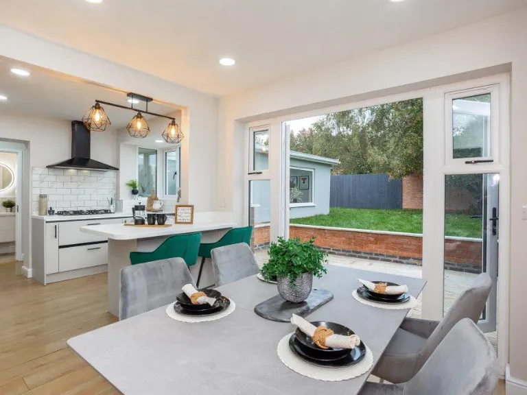
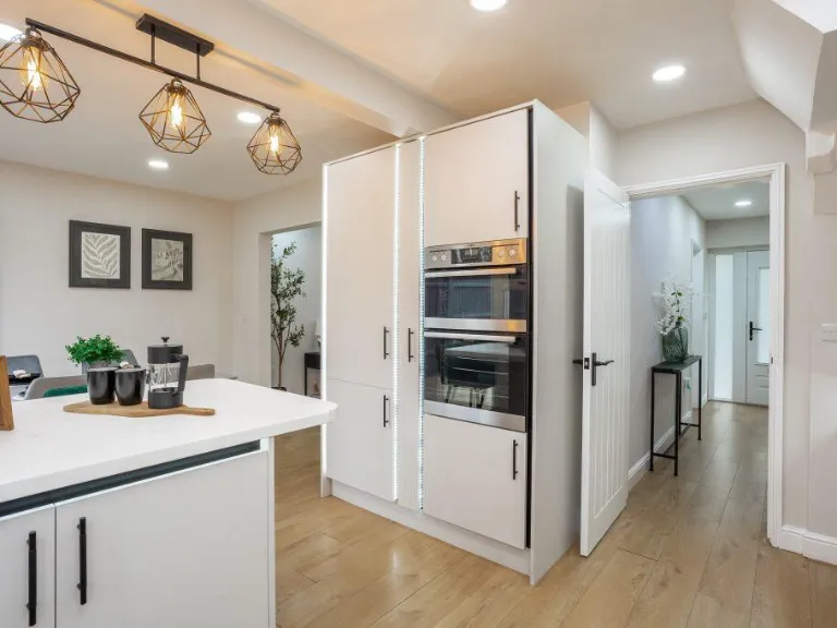
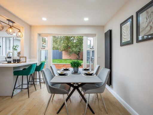
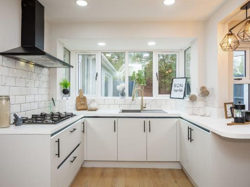
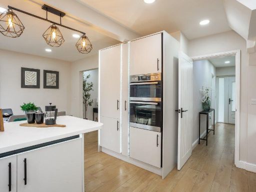
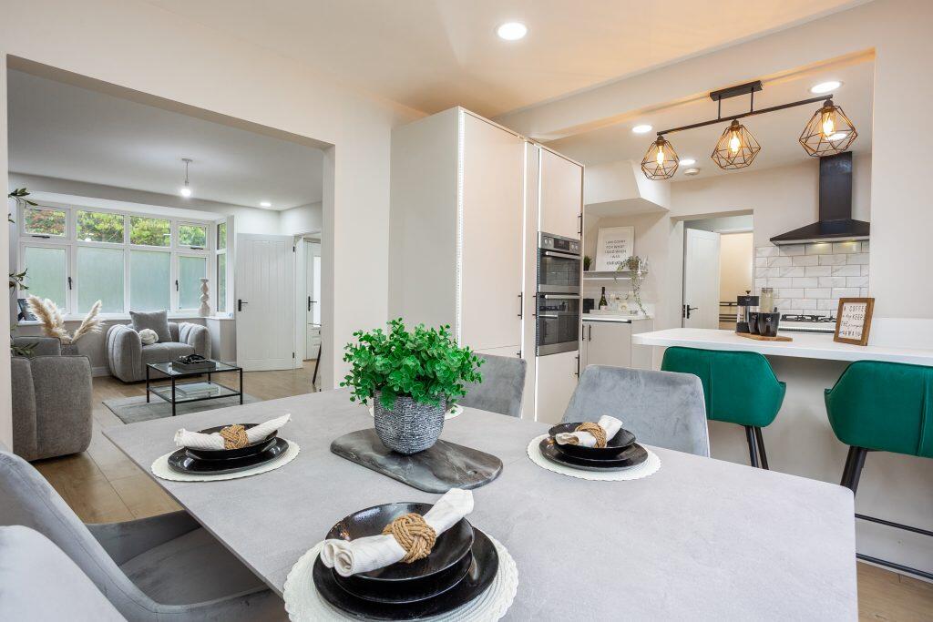
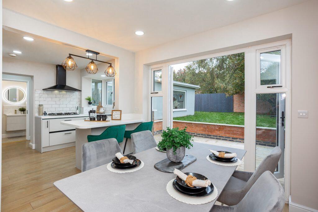
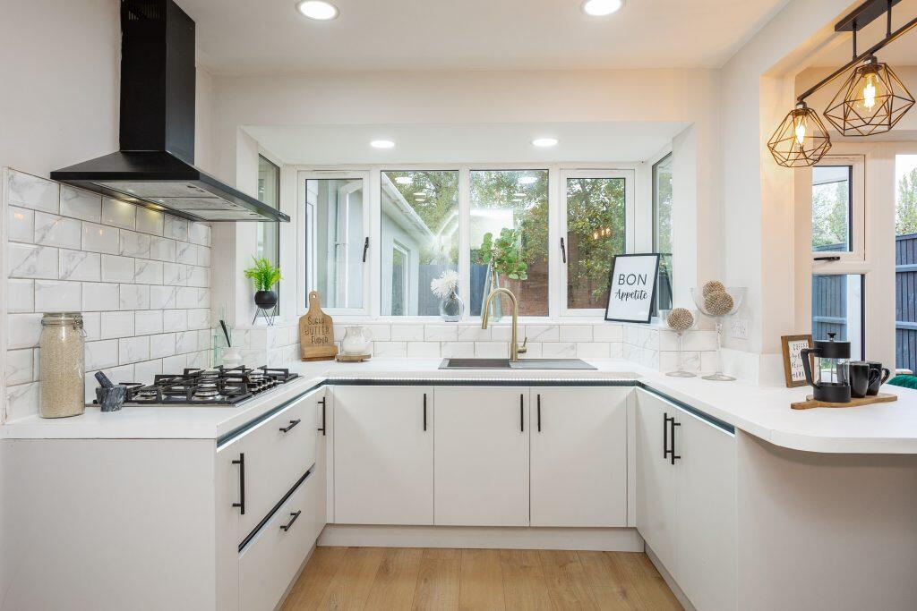
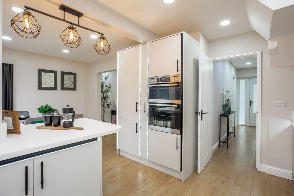
- Kitchen/Dining Room:
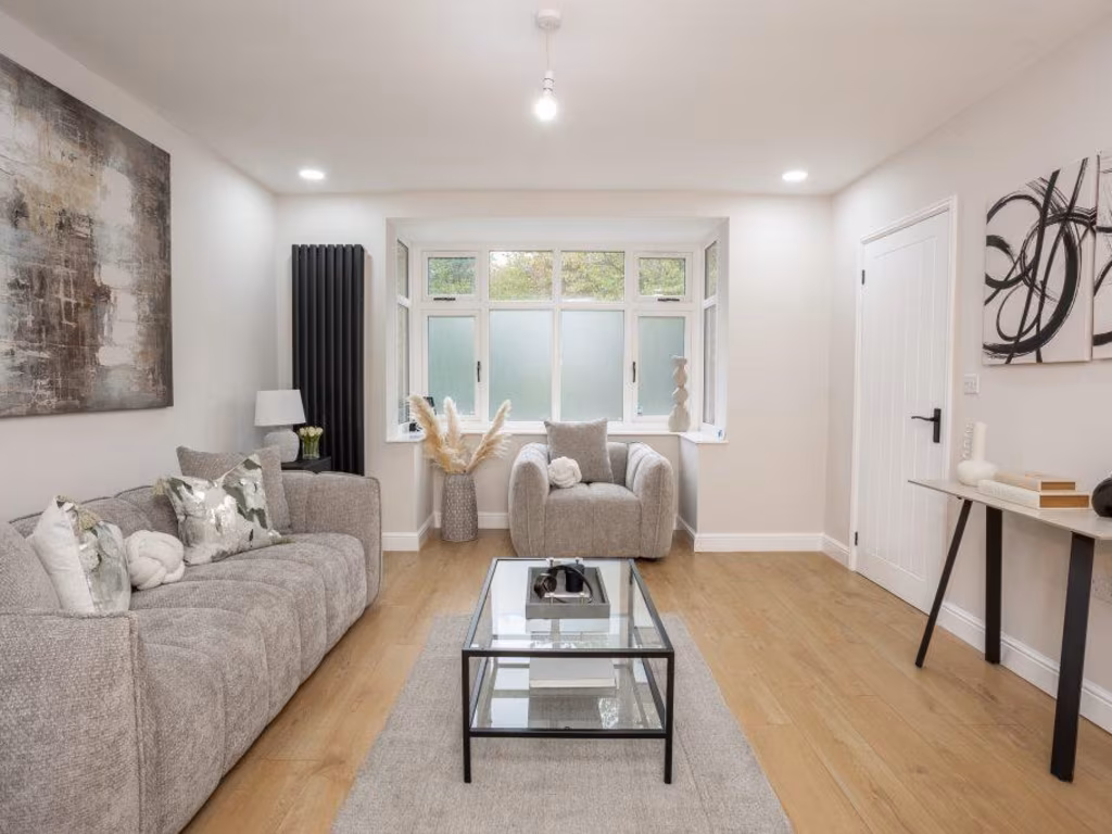
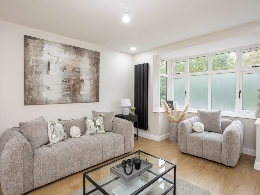
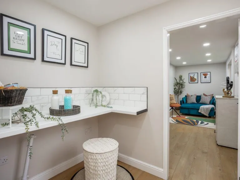
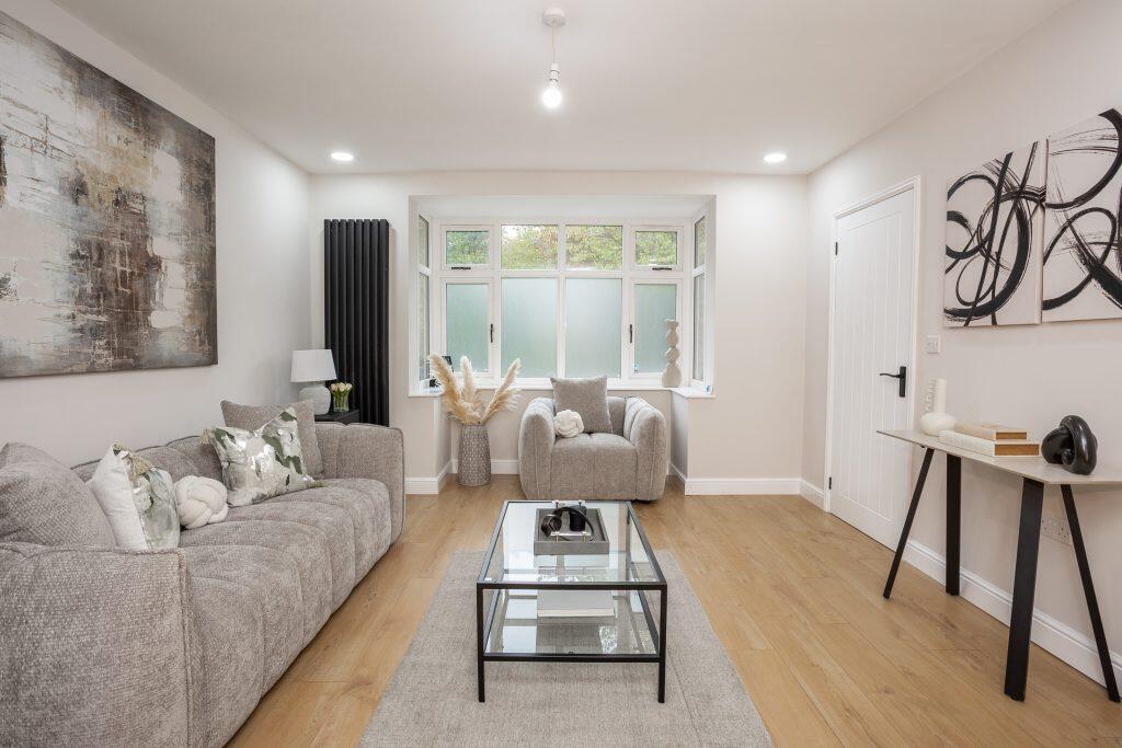
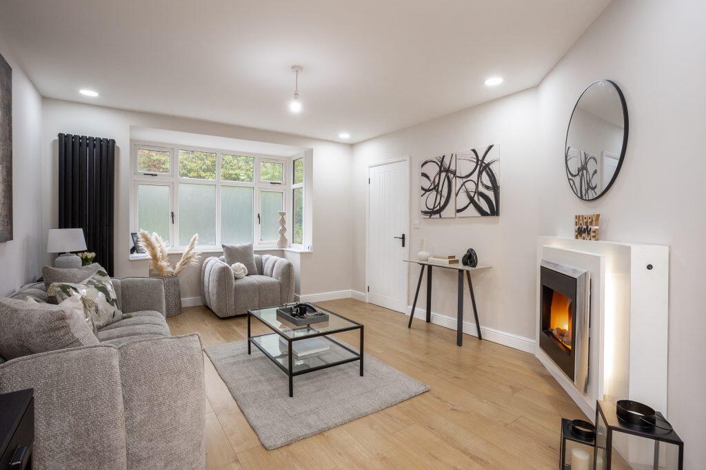
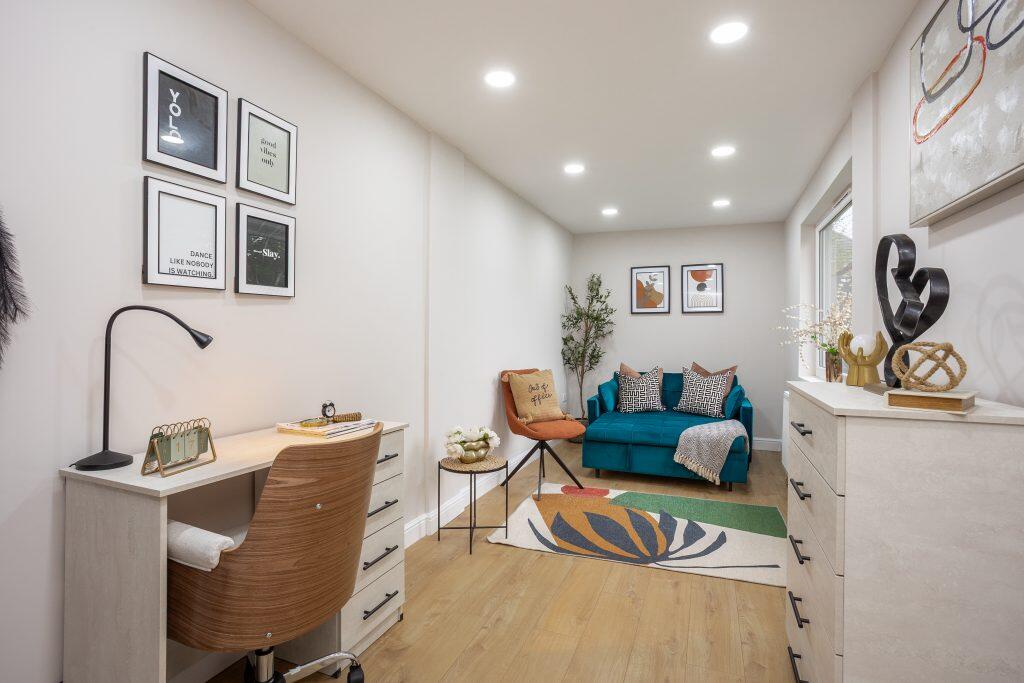
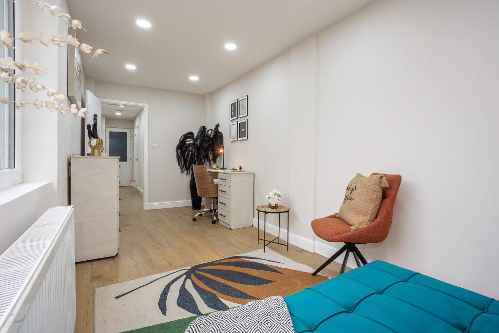
- Lounge:
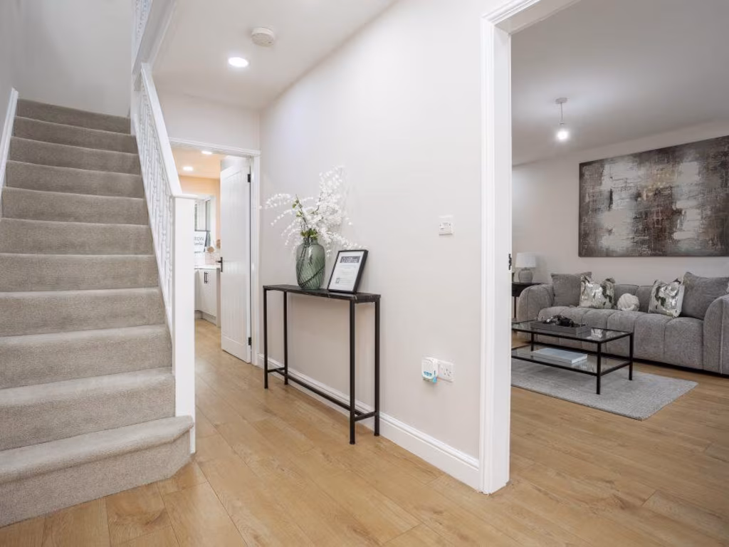
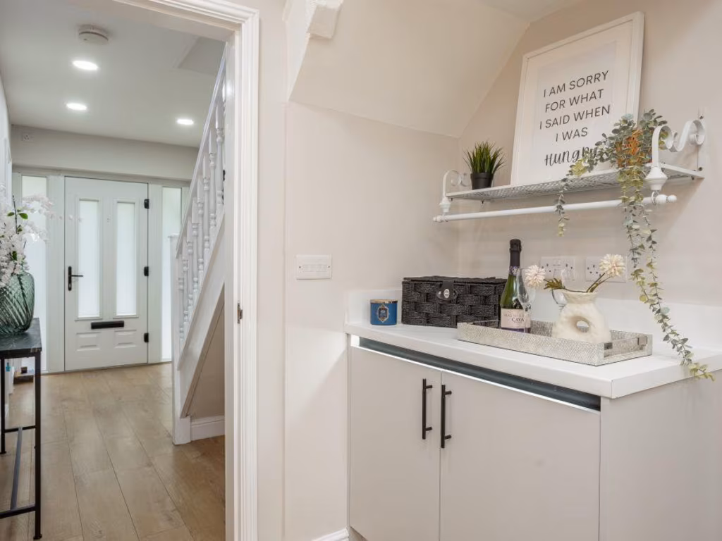
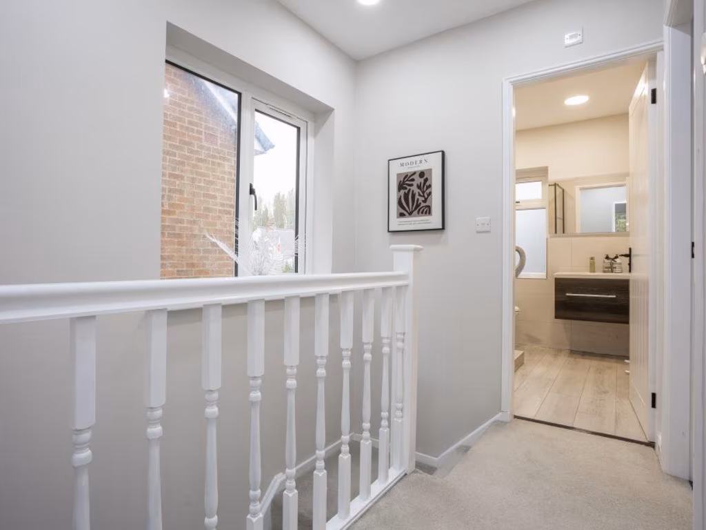
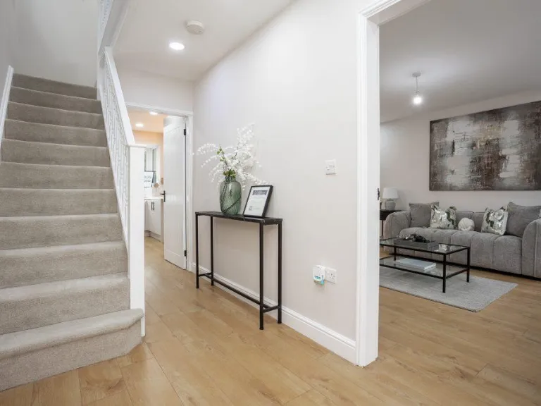
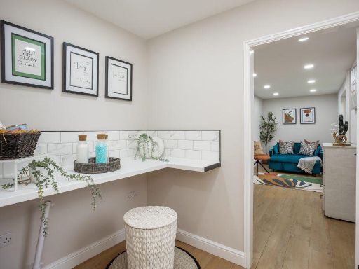
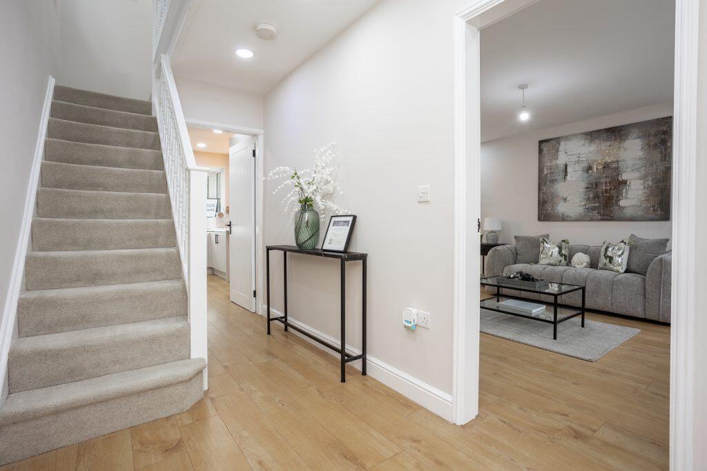
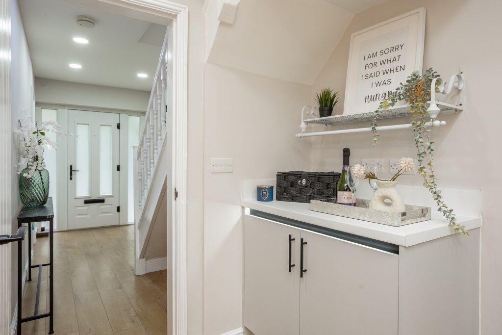
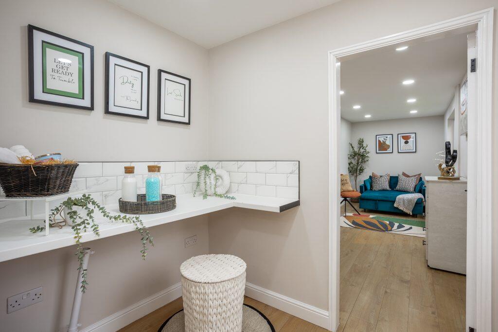
- Hallway:
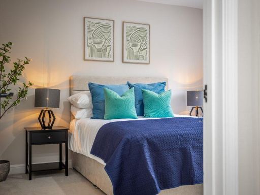
- Bedroom 1:
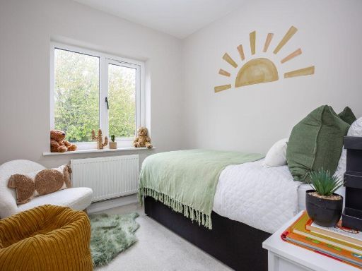
- Bedroom 2:
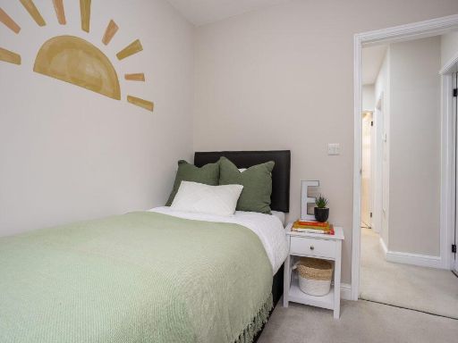
- Bedroom 3:
Textual Property Features
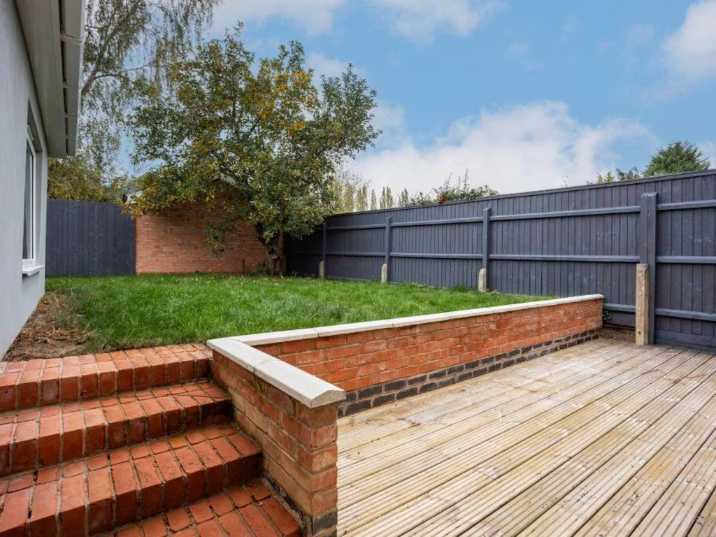
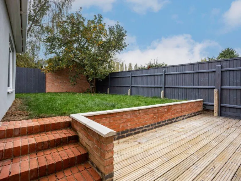
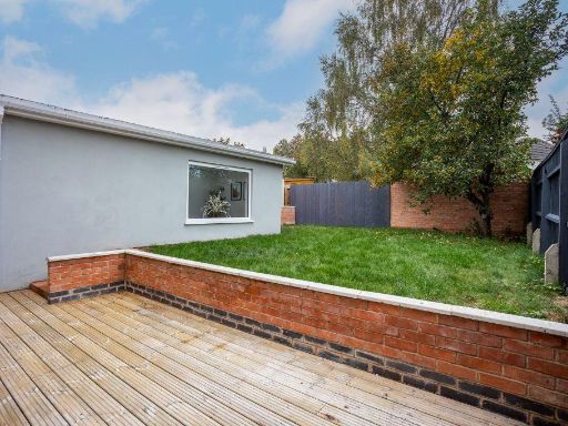
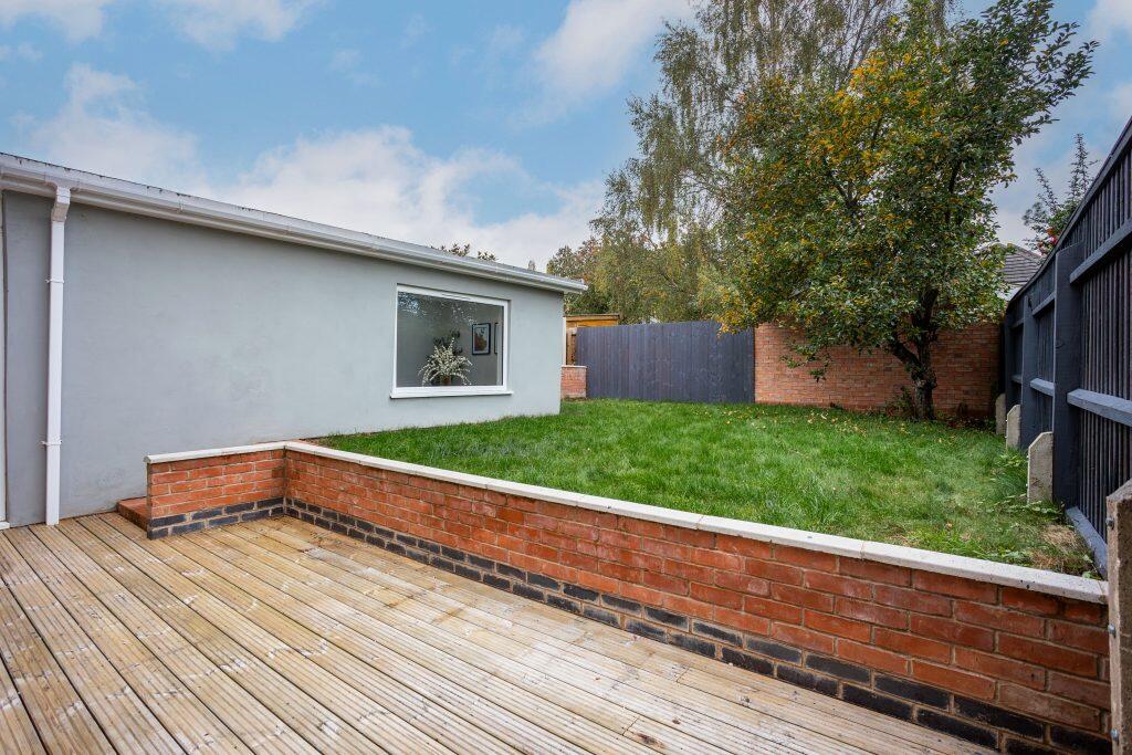
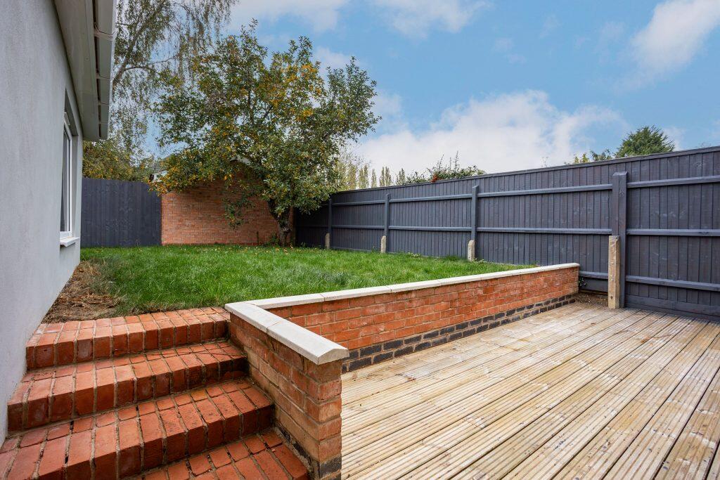
- Has Garden
- Chain Free
- Success
Detected Visual Features
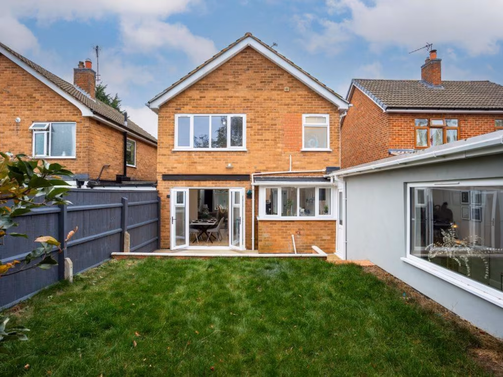
- semi-detached
- contemporary
- modern
- garage
- driveway
- two-story
- brick facade
- updated windows
- residential
- family home
- living room
- open plan
- hardwood flooring
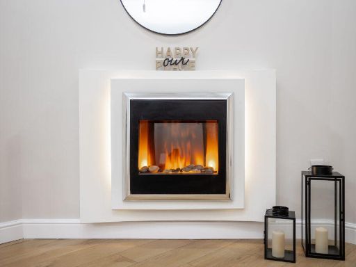
- fireplace
- bright
- neutral colors
EPC Details
- Fully double glazed
- Cavity wall, filled cavity
- Boiler and radiators, mains gas
- Low energy lighting in all fixed outlets
- Suspended, no insulation (assumed)
Nearby Schools
- Alderman Richard Hallam Primary School
- Beaumont Leys School
- Babington Academy
- Herrick Primary School
- Highcliffe Primary School and Community Centre
- Catherine Infant School
- Saint Patrick's Catholic Voluntary Academy
- Darul Uloom Leicester
- Rushey Mead Primary School
- Barley Croft Primary School
- Soar Valley College
- St Peter's CofE Primary School
- Beaumont Lodge Primary School
- Riverside Community Primary School Birstall
- Richard Hill Church of England Primary School
- Catherine Junior School
- Wyvern Primary School
- Mellor Community Primary School
- Wolsey House Primary School
- Rushey Mead Academy
- Woodstock Primary Academy
- Mowmacre Hill Primary School
- Hallam Fields, Birstall
- Slater Primary School
- Abbey Mead Primary Academy
- Glebelands Primary School
- The Cedars Academy
- Rothley Church of England Primary School
Nearest Bars And Restaurants
- Id: 533269387
- Tags:
- Addr:
- City: Leicester
- Postcode: LE4 2FL
- Street: Thurcaston Road
- Alt_name: Kentucky Fried Chicken
- Amenity: fast_food
- Brand: KFC
- Brand:wikidata: Q524757
- Brand:wikipedia: en:KFC
- Building: yes
- Contact:
- Website: https://www.kfc.co.uk/kfc-near-me/leicester-belgrave-boulevard
- Cuisine: chicken
- Drive_through: yes
- Name: KFC
- Takeaway: yes
- TagsNormalized:
- fast food
- food
- kfc
- chicken
- drive through
- takeaway
- Lat: 52.6662383
- Lon: -1.1370782
- FullGeoHash: gcr5w5s504mh
- PartitionGeoHash: gcr5
- Images:
- FoodStandards: null
- Distance: 923.3
,- Id: 3095469733
- Tags:
- Addr:
- Amenity: restaurant
- Cuisine: indian
- Name: Aroma Spice
- Not:
- Smoking: no
- TagsNormalized:
- Lat: 52.6763903
- Lon: -1.1204287
- FullGeoHash: gcr5wt2nhngg
- PartitionGeoHash: gcr5
- Images:
- FoodStandards: null
- Distance: 921.8
,- Id: 19113619
- Tags:
- Amenity: restaurant
- Name: Caffe Mocha
- TagsNormalized:
- Lat: 52.6796604
- Lon: -1.1238185
- FullGeoHash: gcr5wqj9m0kn
- PartitionGeoHash: gcr5
- Images:
- FoodStandards: null
- Distance: 893
,- Id: 236886768
- Tags:
- Amenity: cafe
- Building: yes
- Cuisine: coffee_shop
- Name: The Platform
- TagsNormalized:
- Lat: 52.6663833
- Lon: -1.1330046
- FullGeoHash: gcr5w5wgzj6t
- PartitionGeoHash: gcr5
- Images:
- FoodStandards: null
- Distance: 878.8
,- Id: 5802379846
- Tags:
- TagsNormalized:
- Lat: 52.6775762
- Lon: -1.1276669
- FullGeoHash: gcr5wmdv57yt
- PartitionGeoHash: gcr5
- Images:
- FoodStandards: null
- Distance: 545.2
}
Nearest General Shops
- Id: 3665924708
- Tags:
- TagsNormalized:
- Lat: 52.6781108
- Lon: -1.1223895
- FullGeoHash: gcr5wmy8nrtd
- PartitionGeoHash: gcr5
- Images:
- FoodStandards: null
- Distance: 870.6
,- Id: 3665924707
- Tags:
- Name: MDW Fireplaces
- Shop: fireplace
- TagsNormalized:
- Lat: 52.6782855
- Lon: -1.1225752
- FullGeoHash: gcr5wmy9605m
- PartitionGeoHash: gcr5
- Images:
- FoodStandards: null
- Distance: 869.5
,- Id: 3665924712
- Tags:
- Name: LOROS - Leicestershire & Rutland Hospice
- Operator: LOROS Charity
- Payment:
- Cash: yes
- Credit_cards: yes
- Second_hand: yes
- Shop: charity
- TagsNormalized:
- Lat: 52.6790852
- Lon: -1.1234838
- FullGeoHash: gcr5wmvvuvjz
- PartitionGeoHash: gcr5
- Images:
- FoodStandards: null
- Distance: 869.2
}
Nearest Grocery shops
- Id: 3095477151
- Tags:
- Name: Booze Stop
- Shop: convenience
- TagsNormalized:
- Lat: 52.6762896
- Lon: -1.1198051
- FullGeoHash: gcr5wt2tdshg
- PartitionGeoHash: gcr5
- Images:
- FoodStandards: null
- Distance: 959.8
,- Id: 9651303596
- Tags:
- Addr:
- Country: GB
- Housenumber: 3-7
- Postcode: LE4 2JD
- Street: Belgrave Boulevard
- Brand: Morrisons Daily
- Brand:wikidata: Q99752411
- Contact:
- Website: https://my.morrisons.com/storefinder/34313
- Fhrs:
- Name: Morrisons Daily
- Operator: McColl's
- Operator:website: https://www.mccolls.co.uk/storelocator/leicester-belgrave-boulevard/
- Operator:wikidata: Q16997477
- Shop: convenience
- TagsNormalized:
- morrisons
- morrisons daily
- convenience
- shop
- Lat: 52.6660156
- Lon: -1.1375339
- FullGeoHash: gcr5w5e9v8ch
- PartitionGeoHash: gcr5
- Images:
- FoodStandards:
- Id: 26677
- FHRSID: 26677
- LocalAuthorityBusinessID: 08/00402/CP
- BusinessName: Morrisons Daily
- BusinessType: Retailers - other
- BusinessTypeID: 4613
- AddressLine1: 3 - 7 Belgrave Boulevard
- AddressLine2: Leicester
- AddressLine3: null
- AddressLine4: null
- PostCode: LE4 2JD
- RatingValue: 5
- RatingKey: fhrs_5_en-GB
- RatingDate: 2022-07-14
- LocalAuthorityCode: 878
- LocalAuthorityName: Leicester City
- LocalAuthorityWebSite: http://www.leicester.gov.uk/food
- LocalAuthorityEmailAddress: food@leicester.gov.uk
- Scores:
- Hygiene: 0
- Structural: 5
- ConfidenceInManagement: 5
- NewRatingPending: false
- Geocode:
- Longitude: -1.13824300000000
- Latitude: 52.66624700000000
- Distance: 955.3
,- Id: 233878680
- Tags:
- Atm: yes
- Brand: Tesco Express
- Brand:wikidata: Q98456772
- Building: yes
- Contact:
- Website: https://www.tesco.com/store-locator/leicester/139-sibson-rd
- Name: Tesco Express
- Shop: convenience
- Source: Bing
- TagsNormalized:
- atm
- tesco
- tesco express
- convenience
- shop
- Lat: 52.6803767
- Lon: -1.1249915
- FullGeoHash: gcr5wqhv3vcx
- PartitionGeoHash: gcr5
- Images:
- FoodStandards: null
- Distance: 894.8
}
Nearest Religious buildings
- Id: 181867047
- Tags:
- Amenity: place_of_worship
- Building: yes
- Religion: christian
- Source: Bing
- TagsNormalized:
- place of worship
- christian
- church
- Lat: 52.675938
- Lon: -1.1182632
- FullGeoHash: gcr5wt3ewdd9
- PartitionGeoHash: gcr5
- Images:
- FoodStandards: null
- Distance: 1053.6
,- Id: 19038804
- Tags:
- Amenity: place_of_worship
- Name: Birstall Methodist Centre
- Religion: christian
- TagsNormalized:
- place of worship
- methodist
- christian
- church
- Lat: 52.6775017
- Lon: -1.119032
- FullGeoHash: gcr5wt9hswj3
- PartitionGeoHash: gcr5
- Images:
- FoodStandards: null
- Distance: 1048.7
,- Id: 181864272
- Tags:
- Amenity: place_of_worship
- Building: church
- Denomination: anglican
- Name: St James the Greater
- Religion: christian
- Source: Bing
- Wikidata: Q26643178
- TagsNormalized:
- place of worship
- church
- anglican
- christian
- Lat: 52.6741813
- Lon: -1.1195361
- FullGeoHash: gcr5wt0c2gj6
- PartitionGeoHash: gcr5
- Images:
- FoodStandards: null
- Distance: 951.6
}
Nearest Medical buildings
- Id: 533403511
- Tags:
- Addr:
- City: Leicester
- Housenumber: 2
- Postcode: LE4 2PF
- Street: Border Drive
- Amenity: doctors
- Building: yes
- Healthcare: doctor
- Phone: +44 116 216 9773
- TagsNormalized:
- doctor
- doctors
- health
- healthcare
- Lat: 52.6661185
- Lon: -1.1395517
- FullGeoHash: gcr5w5d4qs0d
- PartitionGeoHash: gcr5
- Images:
- FoodStandards: null
- Distance: 990.7
,- Id: 392557535
- Tags:
- Amenity: doctors
- Building: yes
- Healthcare: doctor
- Name: Greengate Medical Centre
- Source: bing;local_knowledge
- TagsNormalized:
- doctor
- doctors
- health
- healthcare
- Lat: 52.68103
- Lon: -1.1263914
- FullGeoHash: gcr5wq7c1pv8
- PartitionGeoHash: gcr5
- Images:
- FoodStandards: null
- Distance: 896.2
,- Id: 3665924713
- Tags:
- Amenity: pharmacy
- Brand: Boots
- Brand:wikidata: Q6123139
- Brand:wikipedia: en:Boots (company)
- Healthcare: pharmacy
- Name: Boots
- TagsNormalized:
- pharmacy
- boots
- health
- healthcare
- Lat: 52.6798177
- Lon: -1.1243973
- FullGeoHash: gcr5wqj4ptu9
- PartitionGeoHash: gcr5
- Images:
- FoodStandards: null
- Distance: 876.7
,- Id: 190133998
- Tags:
- Amenity: dentist
- Building: yes
- Healthcare: dentist
- Name: Firs Dental
- TagsNormalized:
- dentist
- health
- healthcare
- dental
- Lat: 52.6801853
- Lon: -1.1260237
- FullGeoHash: gcr5wqhh3drc
- PartitionGeoHash: gcr5
- Images:
- FoodStandards: null
- Distance: 834.2
}
Nearest Airports
- Id: 11359528
- Tags:
- Aerodrome: international
- Aerodrome:type: public
- Aeroway: aerodrome
- Iata: EMA
- Icao: EGNX
- Is_in: Castle Donington,England,UK
- Name: East Midlands Airport
- Old_name: RAF Castle Donington
- Operator: Manchester Airports Holdings Limited
- Operator:type: private
- Ref: EMA
- Type: multipolygon
- Website: https://www.eastmidlandsairport.com/
- Wikidata: Q8977
- Wikipedia: en:East Midlands Airport
- TagsNormalized:
- airport
- international airport
- Lat: 52.8281122
- Lon: -1.3322143
- FullGeoHash: gcrh99jfj1vh
- PartitionGeoHash: gcrh
- Images:
- FoodStandards: null
- Distance: 21707.3
,- Id: 2437117
- Tags:
- Aerodrome: international
- Aerodrome:type: public
- Aeroway: aerodrome
- Ele: 104
- Iata: BHX
- Icao: EGBB
- Internet_access: wlan
- Is_in: Birmingham,England,UK
- Name: Birmingham Airport
- Ref: BHX
- Type: multipolygon
- Website: https://www.birminghamairport.co.uk/
- Wikidata: Q8719
- Wikipedia: en:Birmingham Airport
- TagsNormalized:
- airport
- international airport
- Lat: 52.4543817
- Lon: -1.7468974
- FullGeoHash: gcqf2jpbym6y
- PartitionGeoHash: gcqf
- Images:
- FoodStandards: null
- Distance: 48124.9
}
Nearest Leisure Facilities
- Id: 512043775
- Tags:
- Leisure: pitch
- Sport: soccer
- TagsNormalized:
- Lat: 52.6755394
- Lon: -1.1250761
- FullGeoHash: gcr5wmk9rb4r
- PartitionGeoHash: gcr5
- Images:
- FoodStandards: null
- Distance: 594.8
,- Id: 512043781
- Tags:
- Leisure: pitch
- Sport: soccer
- TagsNormalized:
- Lat: 52.6747515
- Lon: -1.125212
- FullGeoHash: gcr5wmhsstm5
- PartitionGeoHash: gcr5
- Images:
- FoodStandards: null
- Distance: 571.3
,- Id: 160904911
- Tags:
- Leisure: pitch
- Source: Bing
- Sport: tennis
- TagsNormalized:
- Lat: 52.670992
- Lon: -1.1393305
- FullGeoHash: gcr5wh6qg8t9
- PartitionGeoHash: gcr5
- Images:
- FoodStandards: null
- Distance: 529.3
,- Id: 4806019
- Tags:
- Leisure: golf_course
- Name: Birstall Golf Club
- Source: landsat
- Website: https://www.birstallgolfclub.co.uk/
- TagsNormalized:
- golf
- golf course
- leisure
- club
- Lat: 52.6710535
- Lon: -1.1388498
- FullGeoHash: gcr5wh6xnuh0
- PartitionGeoHash: gcr5
- Images:
- FoodStandards: null
- Distance: 501.5
,- Id: 911652235
- Tags:
- Leisure: pitch
- Sport: bowls
- TagsNormalized:
- Lat: 52.6710976
- Lon: -1.1386319
- FullGeoHash: gcr5wh6z7unx
- PartitionGeoHash: gcr5
- Images:
- FoodStandards: null
- Distance: 487.7
}
Nearest Tourist attractions
- Id: 302717390
- Tags:
- Long_name: Abbey Pumping Station Museum of Science & Technology
- Name: Abbey Pumping Station
- Tourism: museum
- Wikidata: Q4664048
- TagsNormalized:
- Lat: 52.654764
- Lon: -1.1307766
- FullGeoHash: gcr5w3884zrv
- PartitionGeoHash: gcr5
- Images:
- FoodStandards: null
- Distance: 2178.4
,- Id: 20834051
- Tags:
- Name: Belgrave Hall Museum
- Tourism: museum
- Wikidata: Q4882681
- Wikipedia: en:Belgrave Hall
- TagsNormalized:
- Lat: 52.6594502
- Lon: -1.1250805
- FullGeoHash: gcr5w6kex9p0
- PartitionGeoHash: gcr5
- Images:
- FoodStandards: null
- Distance: 1747
,- Id: 160731447
- Tags:
- Source: Bing
- Tourism: caravan_site
- TagsNormalized:
- Lat: 52.6639131
- Lon: -1.119716
- FullGeoHash: gcr5we0ts8zn
- PartitionGeoHash: gcr5
- Images:
- FoodStandards: null
- Distance: 1486.9
}
Nearest Train stations
- Id: 6415345154
- Tags:
- Name: Syston
- Naptan:
- Network: National Rail
- Postal_code: LE7 2HA
- Public_transport: station
- Railway: station
- Ref:
- Wheelchair: yes
- Wikidata: Q2466439
- Wikipedia: en:Syston railway station
- TagsNormalized:
- Lat: 52.6940888
- Lon: -1.0825247
- FullGeoHash: gcr5z2etr655
- PartitionGeoHash: gcr5
- Images:
- FoodStandards: null
- Distance: 4090.1
,- Id: 26965995
- Tags:
- Addr:
- City: Rothley
- Housename: Rothley Railway Station
- Postcode: LE7 7LD
- Name: Rothley
- Naptan:
- Public_transport: station
- Railway: station
- Source: NPE
- Train: yes
- Usage: tourism
- Wikidata: Q7370489
- Wikipedia: en:Rothley railway station
- TagsNormalized:
- Lat: 52.7042808
- Lon: -1.1598113
- FullGeoHash: gcr5vde2wqn1
- PartitionGeoHash: gcr5
- Images:
- FoodStandards: null
- Distance: 3773.6
,- Id: 3069878190
- Tags:
- Public_transport: station
- Railway: station
- Train: yes
- Usage: tourism
- Wheelchair: no
- TagsNormalized:
- Lat: 52.6444735
- Lon: -1.1380655
- FullGeoHash: gcr5qpek31hu
- PartitionGeoHash: gcr5
- Images:
- FoodStandards: null
- Distance: 3327.4
,- Id: 3069843270
- Tags:
- Public_transport: station
- Railway: station
- Usage: tourism
- TagsNormalized:
- Lat: 52.6555015
- Lon: -1.1306721
- FullGeoHash: gcr5w38st2vv
- PartitionGeoHash: gcr5
- Images:
- FoodStandards: null
- Distance: 2097.4
,- Id: 1139057034
- Tags:
- Addr:
- City: Leicester
- Housename: Leicester North Railway Station
- Postcode: LE4 3BR
- Name: Leicester North
- Naptan:
- Public_transport: station
- Railway: station
- Train: yes
- Usage: tourism
- Wikidata: Q4882689
- TagsNormalized:
- Lat: 52.6678412
- Lon: -1.1332687
- FullGeoHash: gcr5w5yu2vjw
- PartitionGeoHash: gcr5
- Images:
- FoodStandards: null
- Distance: 716.1
}
Nearest Hotels
- Id: 2034481662
- Tags:
- Source: OS_OpenData_StreetView
- Tourism: hotel
- TagsNormalized:
- Lat: 52.7053622
- Lon: -1.1477906
- FullGeoHash: gcr5vfsnyx97
- PartitionGeoHash: gcr5
- Images:
- FoodStandards: null
- Distance: 3585.5
,- Id: 103425908
- Tags:
- Brand: Premier Inn
- Brand:wikidata: Q2108626
- Brand:wikipedia: en:Premier Inn
- Building: yes
- Internet_access: wlan
- Internet_access:fee: customers
- Internet_access:operator: Virgin Media
- Internet_access:ssid: Premier Inn Free Wi-Fi
- Name: Premier Inn
- Tourism: hotel
- TagsNormalized:
- Lat: 52.6509386
- Lon: -1.1693646
- FullGeoHash: gcr5t2u3zy6d
- PartitionGeoHash: gcr5
- Images:
- FoodStandards: null
- Distance: 3540.7
,- Id: 297896775
- Tags:
- Brand: Ibis Budget
- Brand:wikidata: Q1458135
- Building: yes
- Name: Ibis Budget
- Old_name: Etap Hotel
- Operator: Ibis Budget
- Source: survey
- Tourism: hotel
- TagsNormalized:
- Lat: 52.691104
- Lon: -1.1277292
- FullGeoHash: gcr5y24gfj8n
- PartitionGeoHash: gcr5
- Images:
- FoodStandards: null
- Distance: 1913.1
}
Tags
- semi-detached
- contemporary
- modern
- garage
- driveway
- two-story
- brick facade
- updated windows
- residential
- family home
- modern
- living room
- open plan
- hardwood flooring
- fireplace
- bright
- neutral colors
Local Market Stats
- Average Price/sqft: £274
- Avg Income: £36600
- Rental Yield: 4.7%
- Social Housing: 20%
- Planning Success Rate: 85%
Similar Properties
 4 bedroom semi-detached house for sale in Becks Close, Birstall, LE4 — £325,000 • 4 bed • 2 bath • 1186 ft²
 3 bedroom detached bungalow for sale in The Drive, Birstall, Leicester, LE4 — £450,000 • 3 bed • 2 bath • 1434 ft²
 4 bedroom semi-detached house for sale in Curzon Avenue, Birstall, Leicester, LE4 4AD, LE4 — £375,000 • 4 bed • 1 bath • 1375 ft²
 4 bedroom detached house for sale in Curzon Avenue, Birstall, Leicester, Leicestershire, LE4 — £525,000 • 4 bed • 3 bath • 1551 ft²
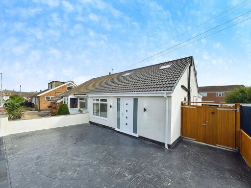 4 bedroom bungalow for sale in Keswick Close, Birstall, Leicester, Leicestershire, LE4 — £380,000 • 4 bed • 3 bath • 1279 ft²
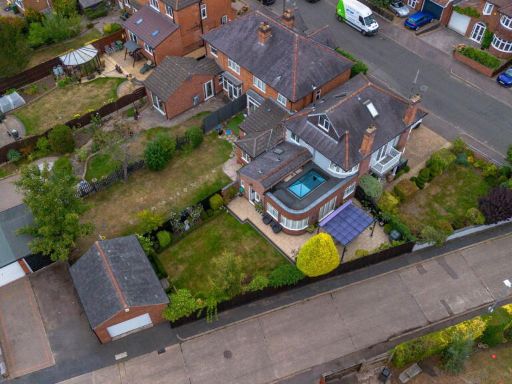 4 bedroom detached house for sale in Curzon Avenue, Birstall, Leicester, LE4 4AF, LE4 — £685,000 • 4 bed • 2 bath • 2187 ft²
Meta
- {
"@context": "https://schema.org",
"@type": "Residence",
"name": "4 bedroom link detached house for sale in Henson Close, Bir…",
"description": "",
"url": "https://propertypiper.co.uk/property/b370688d-28bd-4d50-b211-b000633e634f",
"image": "https://image-a.propertypiper.co.uk/f49580e8-90ed-4a64-8b99-d0f162ac2eed-1024.jpeg",
"address": {
"@type": "PostalAddress",
"streetAddress": "10 HENSON CLOSE BIRSTALL LEICESTER",
"postalCode": "LE4 3AR",
"addressLocality": "Charnwood",
"addressRegion": "Charnwood",
"addressCountry": "England"
},
"geo": {
"@type": "GeoCoordinates",
"latitude": 52.67427723077607,
"longitude": -1.1336488598578351
},
"numberOfRooms": 4,
"numberOfBathroomsTotal": 2,
"floorSize": {
"@type": "QuantitativeValue",
"value": 1260,
"unitCode": "FTK"
},
"offers": {
"@type": "Offer",
"price": 400000,
"priceCurrency": "GBP",
"availability": "https://schema.org/InStock"
},
"additionalProperty": [
{
"@type": "PropertyValue",
"name": "Feature",
"value": "semi-detached"
},
{
"@type": "PropertyValue",
"name": "Feature",
"value": "contemporary"
},
{
"@type": "PropertyValue",
"name": "Feature",
"value": "modern"
},
{
"@type": "PropertyValue",
"name": "Feature",
"value": "garage"
},
{
"@type": "PropertyValue",
"name": "Feature",
"value": "driveway"
},
{
"@type": "PropertyValue",
"name": "Feature",
"value": "two-story"
},
{
"@type": "PropertyValue",
"name": "Feature",
"value": "brick facade"
},
{
"@type": "PropertyValue",
"name": "Feature",
"value": "updated windows"
},
{
"@type": "PropertyValue",
"name": "Feature",
"value": "residential"
},
{
"@type": "PropertyValue",
"name": "Feature",
"value": "family home"
},
{
"@type": "PropertyValue",
"name": "Feature",
"value": "modern"
},
{
"@type": "PropertyValue",
"name": "Feature",
"value": "living room"
},
{
"@type": "PropertyValue",
"name": "Feature",
"value": "open plan"
},
{
"@type": "PropertyValue",
"name": "Feature",
"value": "hardwood flooring"
},
{
"@type": "PropertyValue",
"name": "Feature",
"value": "fireplace"
},
{
"@type": "PropertyValue",
"name": "Feature",
"value": "bright"
},
{
"@type": "PropertyValue",
"name": "Feature",
"value": "neutral colors"
}
]
}
High Res Floorplan Images
Compatible Floorplan Images
FloorplanImages Thumbnail