CT1 3ZP - 2 bedroom semidetached house for sale in Broadbank Way, Can…
View on Property Piper
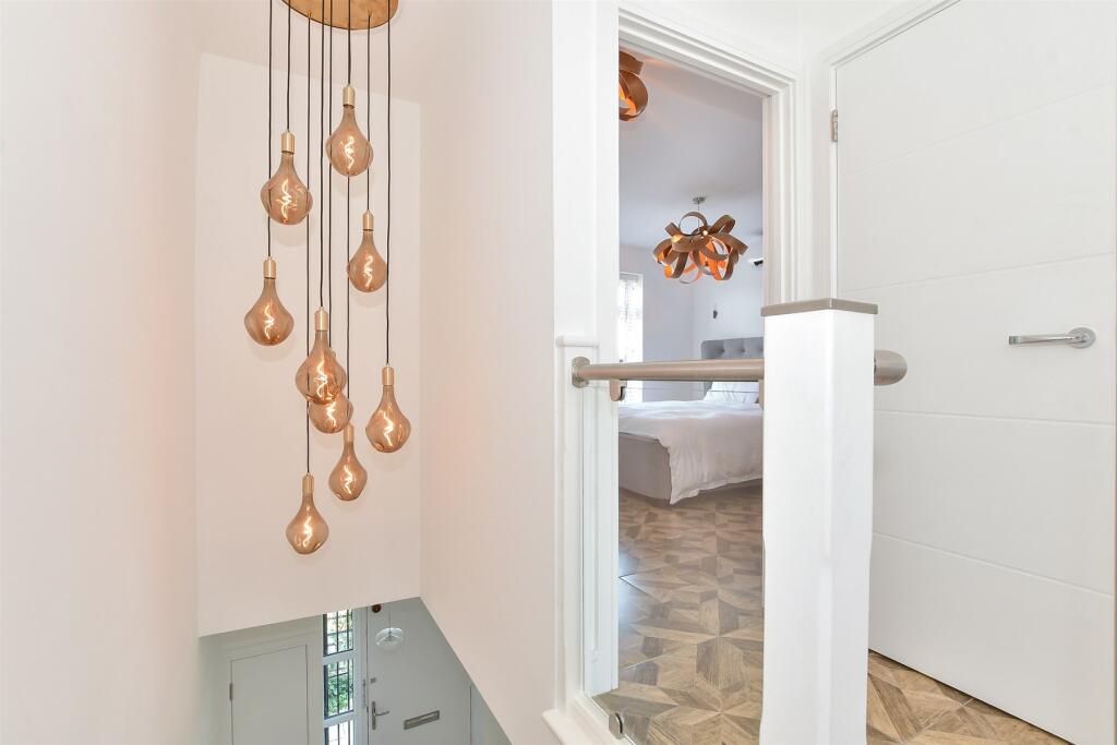
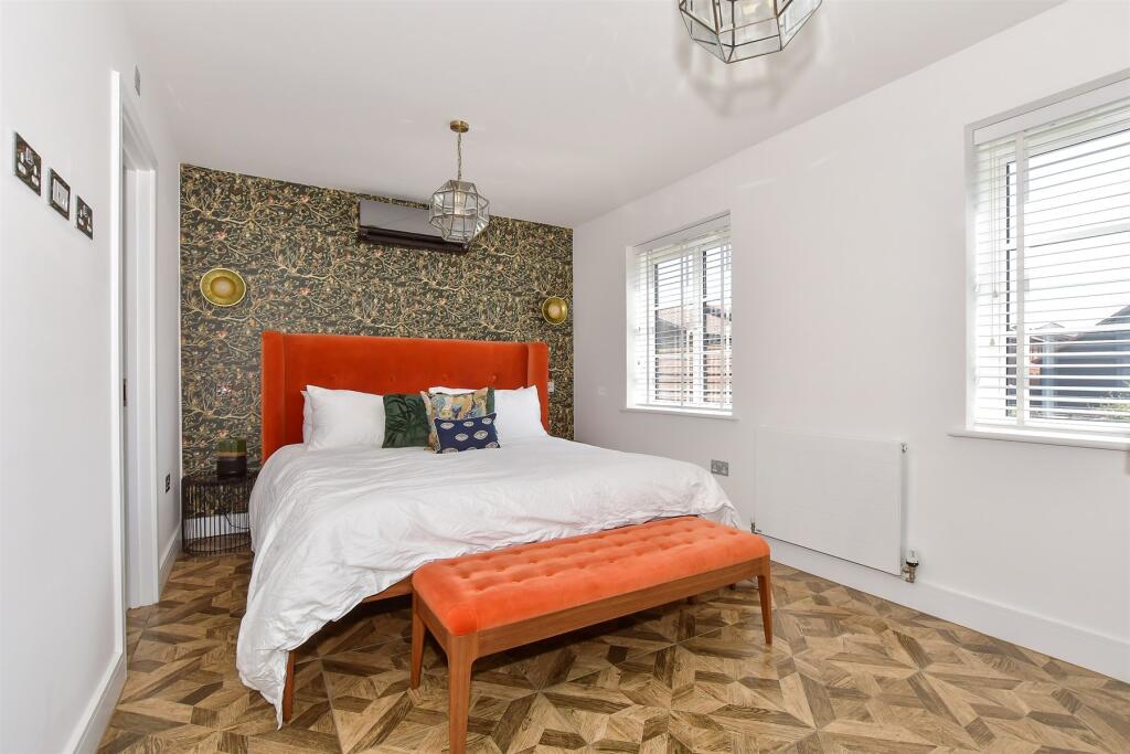
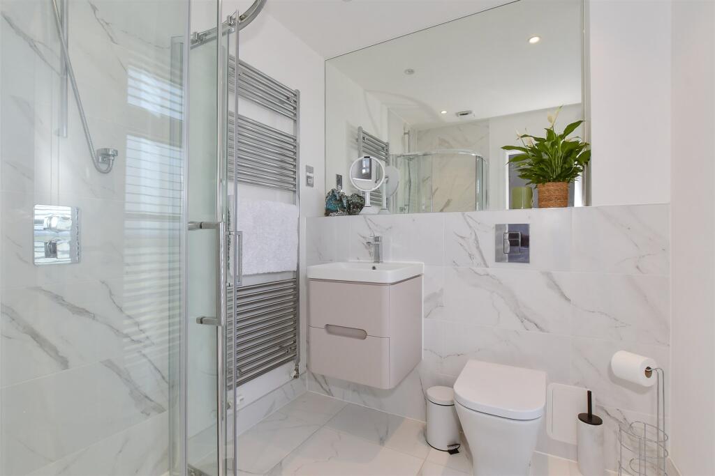
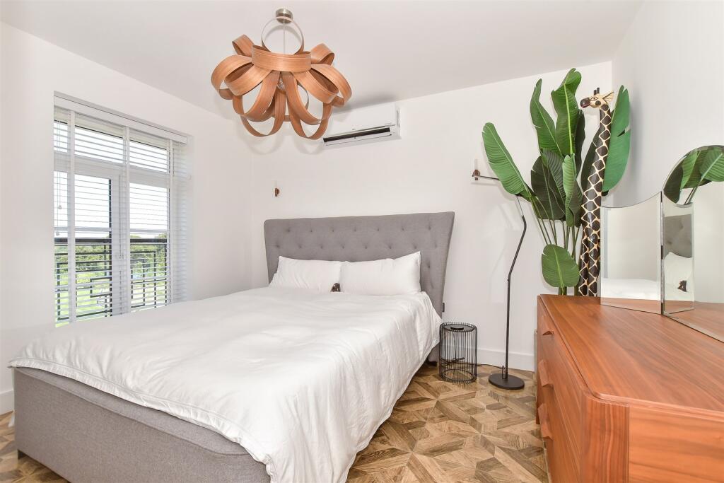
2 bedroom semi-detached house for sale in Broadbank Way, Canterbury, Kent, CT1
Property Details
- Price: £375000
- Bedrooms: 2
- Bathrooms: 2
- Property Type: undefined
- Property SubType: undefined
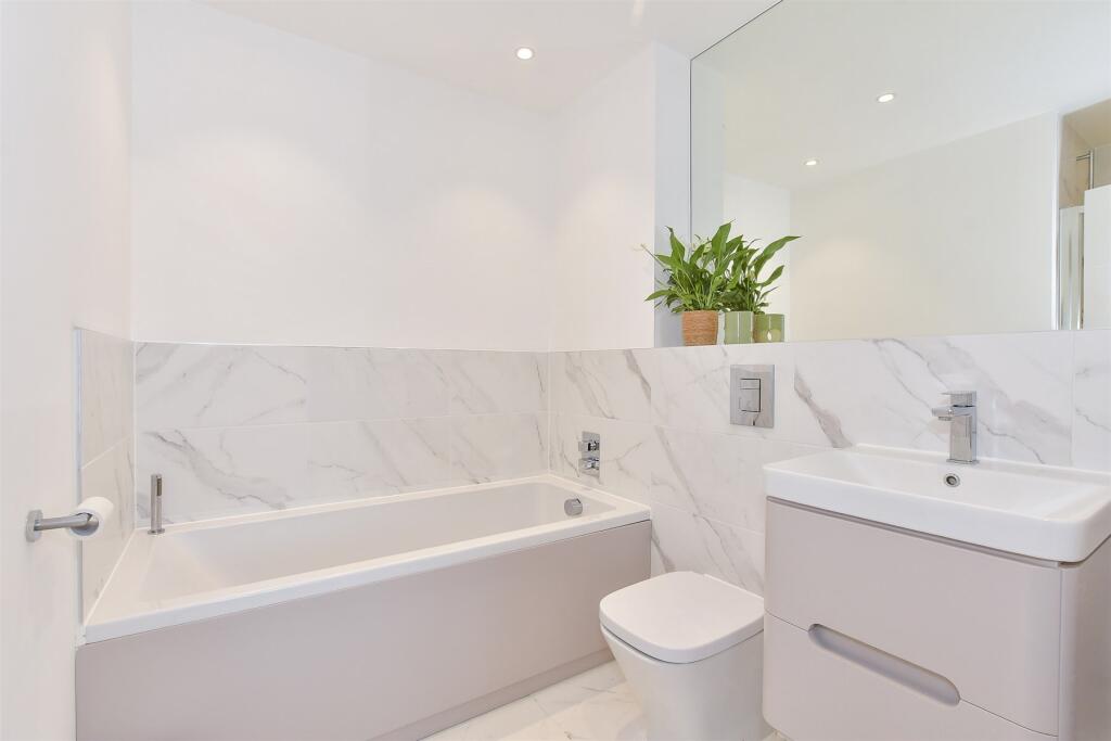
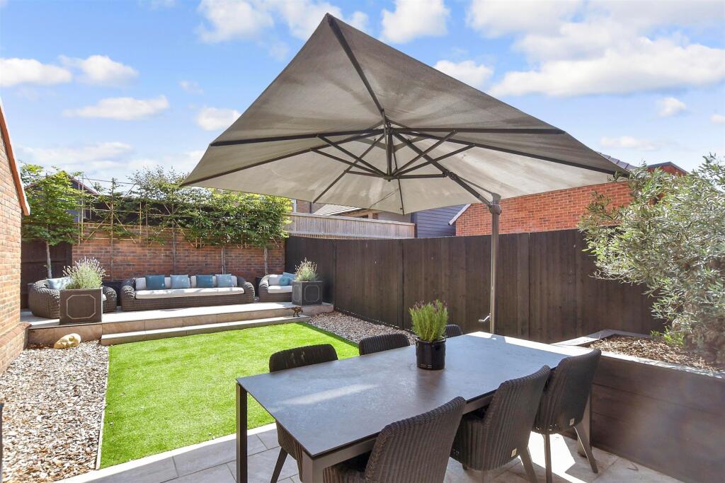
Image Descriptions
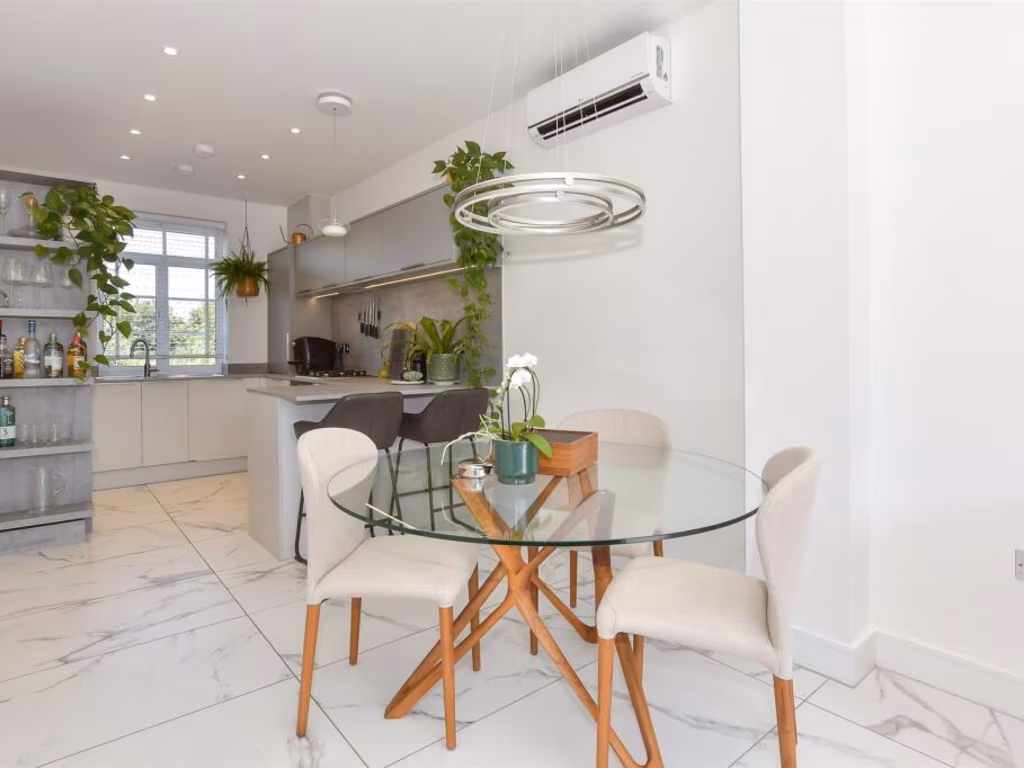
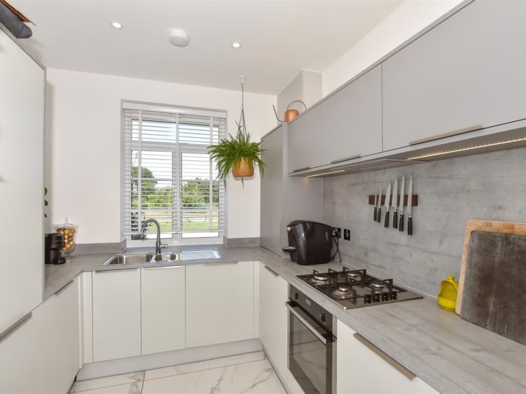
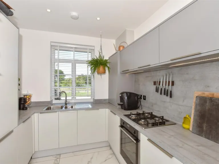
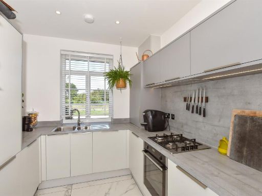
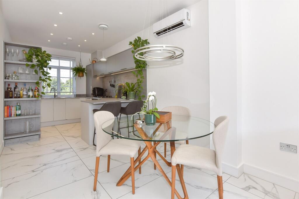
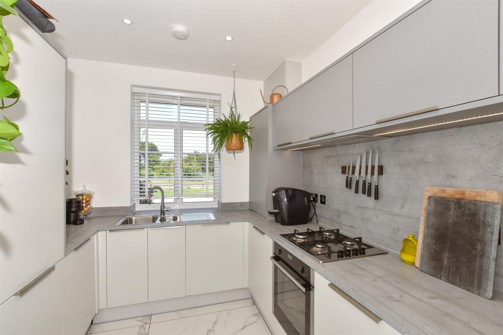
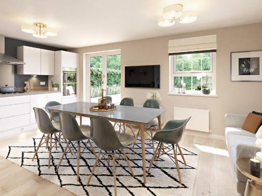
- kitchen modern
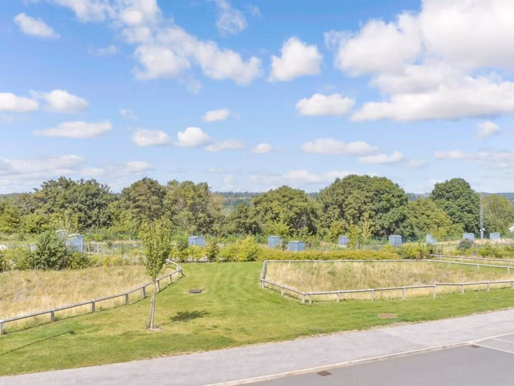
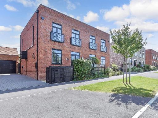
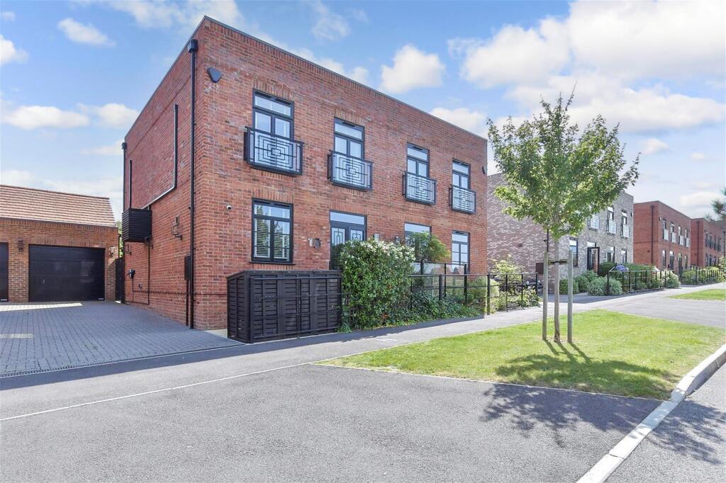
- property exterior modern
Floorplan Description
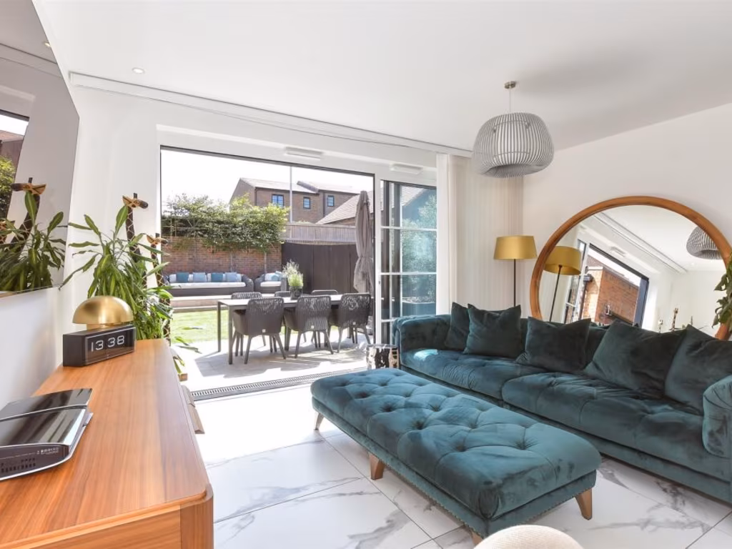
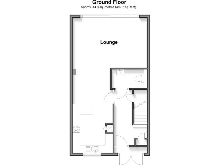
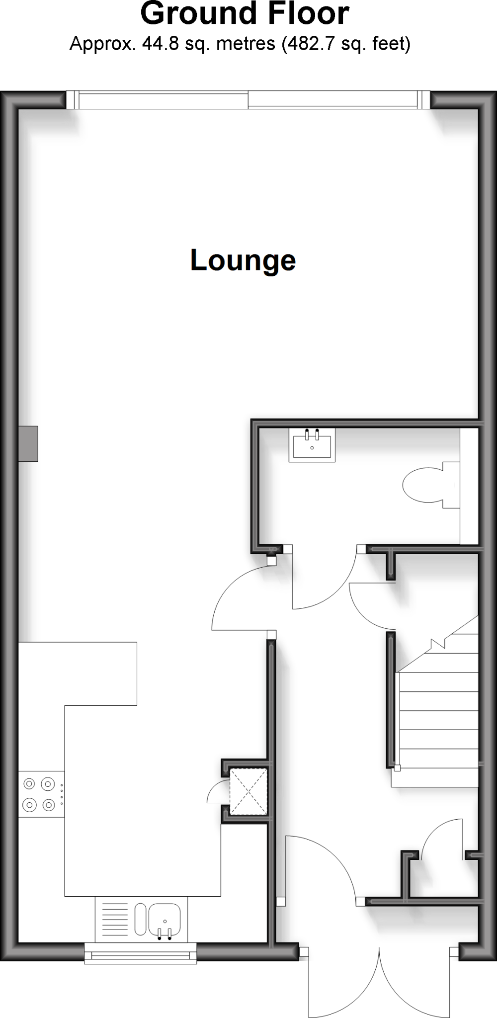
- Single-floor plan showing a labelled Lounge and additional ancillary rooms.
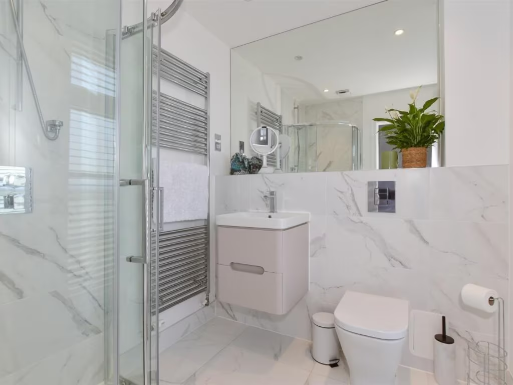
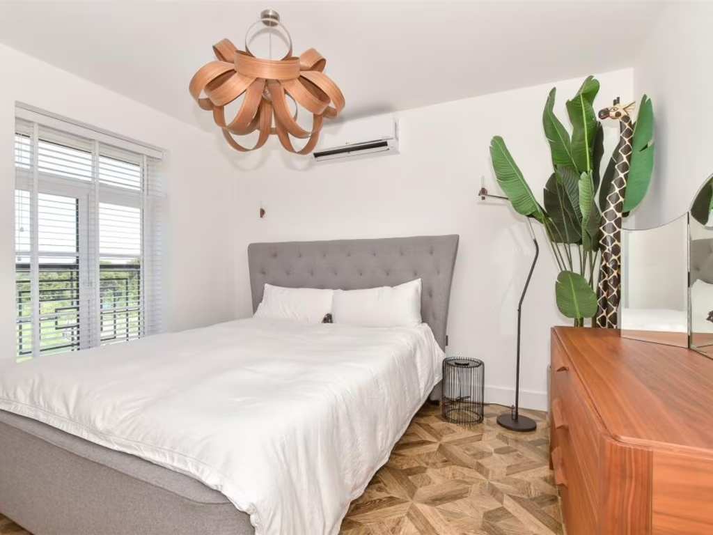
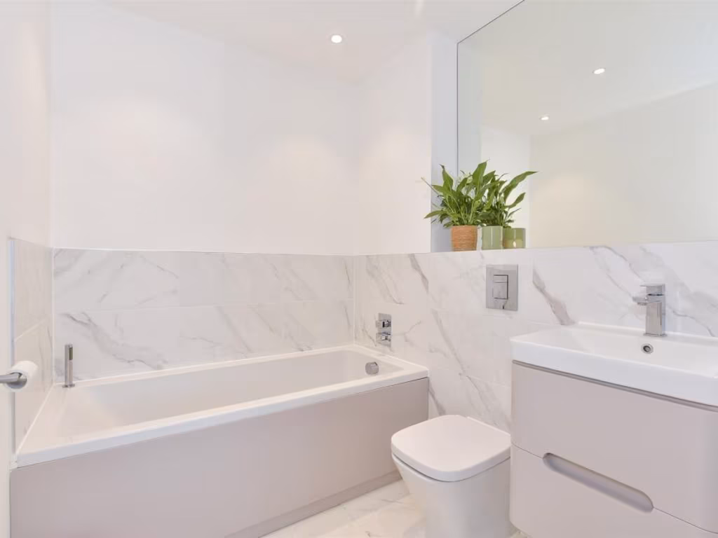
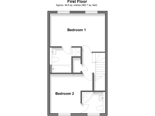
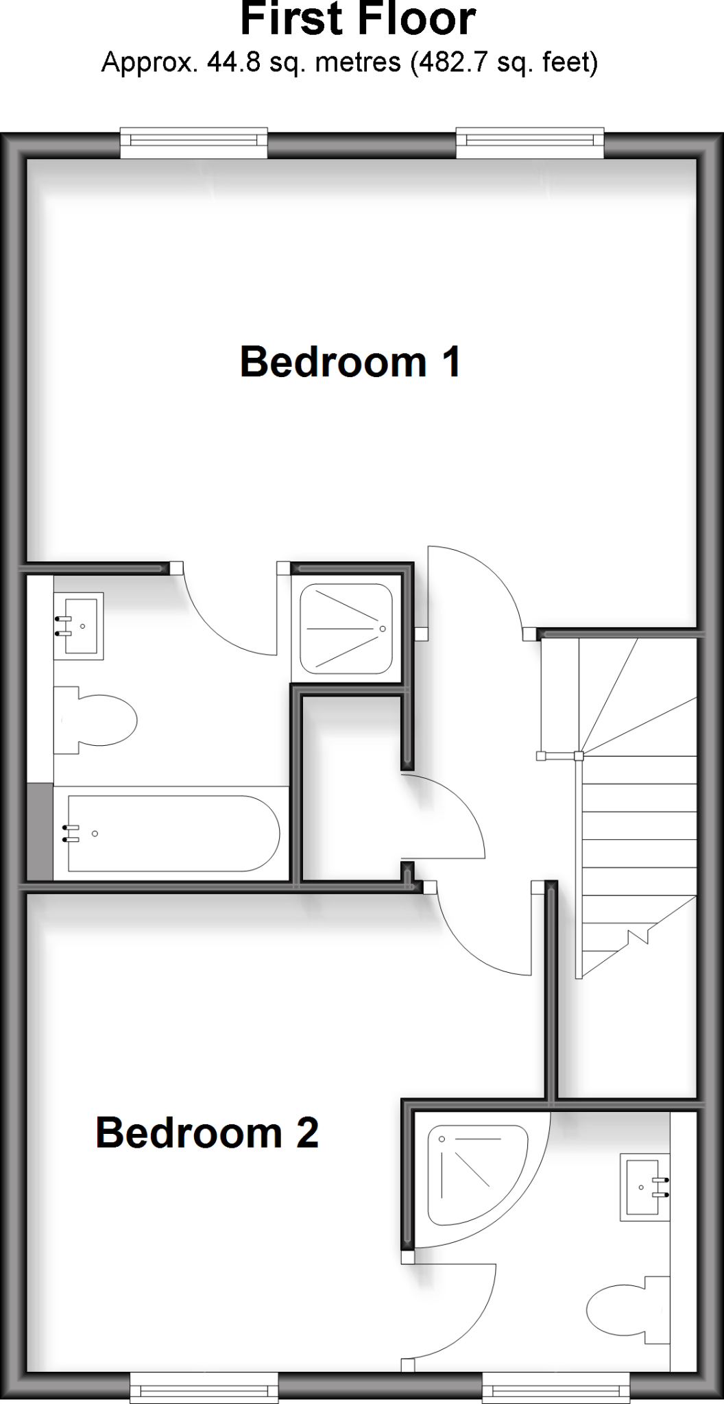
- Floorplan showing two labelled bedrooms and two bathrooms
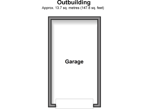
- Garage only
Rooms
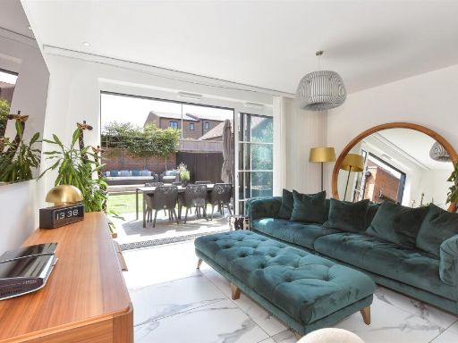
- Lounge:
- Bedroom 1:
- Bedroom 2:
- Garage:
Textual Property Features
Detected Visual Features
- modern
- kitchen
- open-plan
- high ceiling
- white countertop
- integrated appliances
- minimalist design
- energy-efficient lighting
- breakfast bar
- brick
- exterior
- two-story
- driveway
- garage
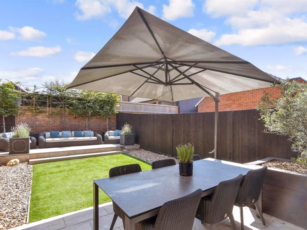
- garden
EPC Details
- High performance glazing
- Average thermal transmittance 0.26 W/m-¦K
- Boiler and underfloor heating, mains gas
- Low energy lighting in all fixed outlets
- Average thermal transmittance 0.12 W/m-¦K
Nearby Schools
- Petham Primary School
- St Stephen's Infant School
- The Canterbury Academy
- St Peter's Methodist Primary School
- St Stephen's Junior School
- Chartham Primary School
- St Anselm's Catholic School, Canterbury
- Wincheap Foundation Primary School
- Barton Manor School
- St Thomas' Catholic Primary School, Canterbury
- St Johns Church of England Primary School
- Kent College International Study Centre
- Kent College (Canterbury)
- The Archbishop's School
- Blean Primary School
- Simon Langton Grammar School for Boys
- Simon Langton Girls' Grammar School
- The Worthgate School
- Pilgrims' Way Primary School
- Barton Court Grammar School
- The Canterbury Primary School
- The King's School Canterbury
- Kent College Nursery, Infant and Junior School
- St Edmund's School Canterbury
Nearest General Shops
- Id: 614483335
- Tags:
- Building: retail
- Name: Neptune
- Ref:
- Shop: interior_decoration
- Source: survey
- Source:geometry: EA LIDAR Open Data
- TagsNormalized:
- retail
- interior decoration
- shop
- Lat: 51.2703544
- Lon: 1.0640002
- FullGeoHash: u10g8jqz3nb0
- PartitionGeoHash: u10g
- Images:
- FoodStandards: null
- Distance: 566.4
,- Id: 439776799
- Tags:
- Addr:
- City: Canterbury
- Country: GB
- County: Kent
- Housename: Former Pumping Station
- Postcode: CT1 3TT
- Street: Wincheap
- Unit: 2
- Building: retail
- Name: Dreams
- Ref:
- Shop: bed
- Website: https://www.dreams.co.uk/
- TagsNormalized:
- Lat: 51.2693734
- Lon: 1.0643665
- FullGeoHash: u10g8jr19xcj
- PartitionGeoHash: u10g
- Images:
- FoodStandards: null
- Distance: 500.2
,- Id: 439776800
- Tags:
- Addr:
- City: Canterbury
- Country: GB
- County: Kent
- Postcode: CT1 3TX
- Street: Wincheap
- Brand: Dunelm
- Brand:wikidata: Q5315020
- Brand:wikipedia: en:Dunelm Group
- Building: retail
- Contact:
- Website: https://www.dunelm.com/stores/canterbury
- Name: Dunelm
- Shop: furniture
- TagsNormalized:
- dunelm
- retail
- furniture
- shop
- Lat: 51.2691029
- Lon: 1.0639632
- FullGeoHash: u10g8jqb0jkr
- PartitionGeoHash: u10g
- Images:
- FoodStandards: null
- Distance: 459.1
}
Nearest Religious buildings
- Id: 150522360
- Tags:
- Alt_name: St Mildred's
- Amenity: place_of_worship
- Building: church
- Denomination: anglican
- Name: The Parish Church of St Mildred with St Mary de Castro
- Ref:
- Religion: christian
- Source: Bing
- Wikidata: Q17529474
- Wikipedia: en:St Mildred's Church, Canterbury
- TagsNormalized:
- place of worship
- church
- anglican
- parish
- christian
- Lat: 51.2764861
- Lon: 1.0740629
- FullGeoHash: u10g8qw55mz3
- PartitionGeoHash: u10g
- Images:
- FoodStandards: null
- Distance: 1538.3
,- Id: 107246655
- Tags:
- Amenity: place_of_worship
- Building: yes
- Denomination: anglican
- Name: St. Nicholas
- Ref:
- Religion: christian
- Source: Bing
- Wikidata: Q17557239
- TagsNormalized:
- place of worship
- anglican
- christian
- church
- Lat: 51.2703477
- Lon: 1.0544304
- FullGeoHash: u10exvrz6j82
- PartitionGeoHash: u10e
- Images:
- FoodStandards: null
- Distance: 566.5
,- Id: 699556296
- Tags:
- Amenity: place_of_worship
- Denomination: jehovahs_witness
- Name: Kingdom Hall of Jehovahs Witnesses
- Religion: christian
- TagsNormalized:
- place of worship
- jehovah
- jehovahs witness
- christian
- church
- Lat: 51.2682257
- Lon: 1.0649831
- FullGeoHash: u10g8jp7pcuy
- PartitionGeoHash: u10g
- Images:
- FoodStandards: null
- Distance: 458
}
Nearest Medical buildings
- Id: 4177775729
- Tags:
- Amenity: pharmacy
- Brand: Boots
- Brand:wikidata: Q6123139
- Brand:wikipedia: en:Boots UK
- Dispensing: yes
- Healthcare: pharmacy
- Name: Boots
- Operator: Boots
- Website: https://www.boots.com/stores/1523-canterbury-whitefrs-ct1-2tf
- TagsNormalized:
- pharmacy
- boots
- health
- healthcare
- Lat: 51.2763862
- Lon: 1.0804344
- FullGeoHash: u10g8wddxgnq
- PartitionGeoHash: u10g
- Images:
- FoodStandards: null
- Distance: 1858.1
,- Id: 984916747
- Tags:
- Amenity: doctors
- Building: yes
- Fixme: Get more accurate shape
- Name: Canterbury Medical Practice
- TagsNormalized:
- Lat: 51.2665702
- Lon: 1.085386
- FullGeoHash: u10g8sy37m67
- PartitionGeoHash: u10g
- Images:
- FoodStandards: null
- Distance: 1820.6
,- Id: 4177773552
- Tags:
- Amenity: pharmacy
- Brand:
- Dispensing: yes
- Name: Boots Pharmacy
- Operator: Boots
- Website: https://www.boots.com/stores/6505-canterbury-riverside-retail-park-ct1-3tq
- TagsNormalized:
- Lat: 51.271748
- Lon: 1.0649734
- FullGeoHash: u10g8jxrxdtd
- PartitionGeoHash: u10g
- Images:
- FoodStandards: null
- Distance: 732.5
,- Id: 4177773553
- Tags:
- Amenity: pharmacy
- Dispensing: yes
- Name: Morrisons Pharmacy
- Operator: Morrisons
- TagsNormalized:
- Lat: 51.2712596
- Lon: 1.0633674
- FullGeoHash: u10g8jwkdr80
- PartitionGeoHash: u10g
- Images:
- FoodStandards: null
- Distance: 629.2
}
Nearest Leisure Facilities
- Id: 120789926
- Tags:
- Leisure: pitch
- Sport: soccer
- TagsNormalized:
- Lat: 51.2703281
- Lon: 1.0573982
- FullGeoHash: u10g8j3zr1vh
- PartitionGeoHash: u10g
- Images:
- FoodStandards: null
- Distance: 473.1
,- Id: 1112441549
- Tags:
- Access: yes
- Leisure: pitch
- Sport: skateboard
- TagsNormalized:
- pitch
- leisure
- skateboard
- sports
- Lat: 51.2704599
- Lon: 1.0594422
- FullGeoHash: u10g8je2nf3q
- PartitionGeoHash: u10g
- Images:
- FoodStandards: null
- Distance: 470.6
,- Id: 238818295
- Tags:
- Access: yes
- Leisure: playground
- Source: local_knowledge
- TagsNormalized:
- Lat: 51.2703445
- Lon: 1.0590065
- FullGeoHash: u10g8j7pksum
- PartitionGeoHash: u10g
- Images:
- FoodStandards: null
- Distance: 457.8
,- Id: 1112441548
- Tags:
- Access: yes
- Leisure: pitch
- Sport: soccer;basketball;netball
- TagsNormalized:
- pitch
- leisure
- soccer
- basketball
- netball
- sports
- Lat: 51.270291
- Lon: 1.0594466
- FullGeoHash: u10g8j7rnfuw
- PartitionGeoHash: u10g
- Images:
- FoodStandards: null
- Distance: 451.9
,- Id: 1149377146
- Tags:
- Fixme: Adjust shape once imagery becomes available
- Leisure: playground
- TagsNormalized:
- Lat: 51.2660452
- Lon: 1.0571833
- FullGeoHash: u10g8h9y65mp
- PartitionGeoHash: u10g
- Images:
- FoodStandards: null
- Distance: 143.5
}
Nearest Train stations
- Id: 6688385697
- Tags:
- Name: Sturry
- Naptan:
- Network: National Rail
- Platforms: 2
- Public_transport: station
- Railway: station
- Ref:
- Wikidata: Q2519465
- Wikipedia: en:Sturry railway station
- TagsNormalized:
- Lat: 51.300986
- Lon: 1.1222644
- FullGeoHash: u10gce11ysuv
- PartitionGeoHash: u10g
- Images:
- FoodStandards: null
- Distance: 5844.6
,- Id: 6689773481
- Tags:
- Name: Bekesbourne
- Naptan:
- Network: National Rail
- Public_transport: station
- Railway: station
- Ref:
- Source: survey
- Wheelchair: limited
- Wikidata: Q4881599
- Wikipedia: en:Bekesbourne railway station
- TagsNormalized:
- Lat: 51.2614031
- Lon: 1.1372301
- FullGeoHash: u10g9gu576hh
- PartitionGeoHash: u10g
- Images:
- FoodStandards: null
- Distance: 5454
,- Id: 6688385698
- Tags:
- Name: Chartham
- Naptan:
- Network: National Rail
- Platforms: 2
- Public_transport: station
- Railway: station
- Ref:
- Wheelchair: yes
- Wikidata: Q2774125
- Wikipedia: en:Chartham railway station
- TagsNormalized:
- Lat: 51.2571747
- Lon: 1.0179051
- FullGeoHash: u10ex5j4wvvh
- PartitionGeoHash: u10e
- Images:
- FoodStandards: null
- Distance: 3046.3
,- Id: 3453612249
- Tags:
- Name: Canterbury West
- Naptan:
- Network: National Rail
- Operator: Southeastern
- Platforms: 2
- Public_transport: station
- Railway: station
- Ref:
- Train: yes
- Wheelchair: yes
- Wikidata: Q671106
- Wikipedia: en:Canterbury West railway station
- TagsNormalized:
- Lat: 51.2842245
- Lon: 1.0753092
- FullGeoHash: u10gb2p0282e
- PartitionGeoHash: u10g
- Images:
- FoodStandards: null
- Distance: 2292.5
,- Id: 6689773482
- Tags:
- Name: Canterbury East
- Naptan:
- Network: National Rail
- Public_transport: station
- Railway: station
- Ref:
- Wheelchair: limited
- Wikidata: Q4381574
- Wikipedia: en:Canterbury East railway station
- TagsNormalized:
- Lat: 51.274185
- Lon: 1.07582
- FullGeoHash: u10g8qpmu2ve
- PartitionGeoHash: u10g
- Images:
- FoodStandards: null
- Distance: 1454.5
}
Nearest Hotels
- Id: 197029358
- Tags:
- Addr:
- City: Canterbury
- Country: GB
- County: Kent
- Housenumber: 59
- Postcode: CT2 8JY
- Street: London Road
- Building: hotel
- Contact:
- Website: http://www.thevictoriahotel.co.uk/
- Fhrs:
- Name: Victoria Hotel
- Phone: +44 1227 459333
- Source: survey
- Source:addr:postcode: http://www.thevictoriahotel.co.uk/location.html
- Source:phone: http://www.thevictoriahotel.co.uk/location.html
- Tourism: hotel
- TagsNormalized:
- Lat: 51.2820568
- Lon: 1.0626938
- FullGeoHash: u10g8ptgds3b
- PartitionGeoHash: u10g
- Images:
- FoodStandards: null
- Distance: 1776.4
,- Id: 151706583
- Tags:
- Addr:
- City: Canterbury
- Country: GB
- County: Kent
- Housenumber: 28
- Postcode: CT1 2PT
- Street: Castle Street
- Building: yes
- Fhrs:
- Name: Castle House Hotel
- Source: Bing
- Source:addr: FHRS Open Data
- Source:addr:postcode: http://www.castlehousehotel.co.uk/location.htm
- Tourism: hotel
- Website: https://www.castlehousehotel.co.uk/
- Wikidata: Q26370711
- TagsNormalized:
- Lat: 51.2752993
- Lon: 1.075048
- FullGeoHash: u10g8qqu62tf
- PartitionGeoHash: u10g
- Images:
- FoodStandards: null
- Distance: 1493
,- Id: 318017282
- Tags:
- Addr:
- City: Canterbury
- Country: GB
- County: Kent
- Housenumber: 140
- Postcode: CT1 3RY
- Street: Wincheap
- Building: yes
- Fhrs:
- Name: Canterbury Hotel
- Tourism: hotel
- TagsNormalized:
- Lat: 51.2727436
- Lon: 1.0696558
- FullGeoHash: u10g8mfvku1j
- PartitionGeoHash: u10g
- Images:
- FoodStandards: null
- Distance: 1025.3
}
Tags
- modern
- kitchen
- open-plan
- high ceiling
- white countertop
- integrated appliances
- minimalist design
- energy-efficient lighting
- breakfast bar
- modern
- brick
- exterior
- two-story
- driveway
- garage
- garden
Local Market Stats
- Average Price/sqft: £335
- Avg Income: £49400
- Rental Yield: 4.5%
- Social Housing: 20%
- Planning Success Rate: 74%
AirBnB Data
- 1km average: £87/night
- Listings in 1km: 1
Similar Properties
 4 bedroom semi-detached house for sale in Cockering Road
Canterbury
CT1 3UJ, CT1 — £429,995 • 4 bed • 1 bath • 922 ft²
4 bedroom semi-detached house for sale in Cockering Road
Canterbury
CT1 3UJ, CT1 — £429,995 • 4 bed • 1 bath • 922 ft²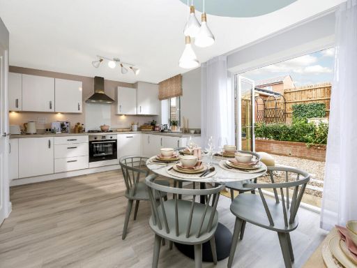 3 bedroom semi-detached house for sale in Cockering Road
Canterbury
CT1 3UJ, CT1 — £379,995 • 3 bed • 1 bath • 857 ft²
3 bedroom semi-detached house for sale in Cockering Road
Canterbury
CT1 3UJ, CT1 — £379,995 • 3 bed • 1 bath • 857 ft²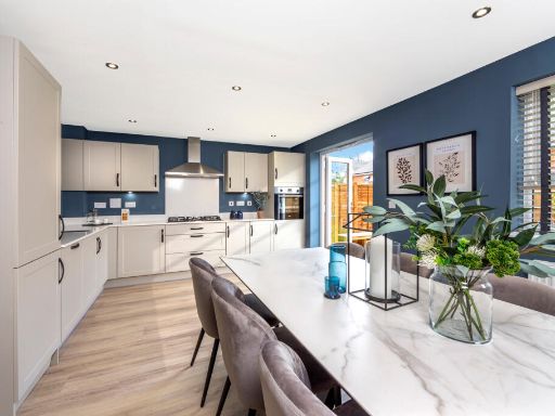 4 bedroom semi-detached house for sale in Cockering Road
Canterbury
CT1 3UJ, CT1 — £424,995 • 4 bed • 1 bath • 922 ft²
4 bedroom semi-detached house for sale in Cockering Road
Canterbury
CT1 3UJ, CT1 — £424,995 • 4 bed • 1 bath • 922 ft²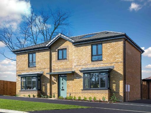 5 bedroom detached house for sale in Cockering Road
Canterbury
CT1 3UJ, CT1 — £659,995 • 5 bed • 1 bath • 1477 ft²
5 bedroom detached house for sale in Cockering Road
Canterbury
CT1 3UJ, CT1 — £659,995 • 5 bed • 1 bath • 1477 ft²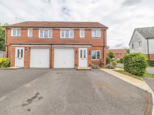 3 bedroom semi-detached house for sale in Limes Place, Upper Harbledown, Canterbury, Kent, CT2 — £375,000 • 3 bed • 2 bath • 960 ft²
 4 bedroom detached house for sale in Cockering Road
Canterbury
CT1 3UJ, CT1 — £559,995 • 4 bed • 1 bath • 1348 ft²
4 bedroom detached house for sale in Cockering Road
Canterbury
CT1 3UJ, CT1 — £559,995 • 4 bed • 1 bath • 1348 ft²
Meta
- {
"@context": "https://schema.org",
"@type": "Residence",
"name": "2 bedroom semidetached house for sale in Broadbank Way, Can…",
"description": "",
"url": "https://propertypiper.co.uk/property/b2c1809a-0ff5-43bf-9fec-e6e8dfe96c59",
"image": "https://image-a.propertypiper.co.uk/386b235e-17f3-41d0-8ec2-4d177f39e64c-1024.jpeg",
"address": {
"@type": "PostalAddress",
"streetAddress": "Broadbank Way, Canterbury, Kent",
"postalCode": "CT1 3ZP",
"addressLocality": "Canterbury",
"addressRegion": "Canterbury",
"addressCountry": "England"
},
"geo": {
"@type": "GeoCoordinates",
"latitude": 51.2662296,
"longitude": 1.0592242
},
"numberOfRooms": 2,
"numberOfBathroomsTotal": 2,
"floorSize": {
"@type": "QuantitativeValue",
"value": 721,
"unitCode": "FTK"
},
"offers": {
"@type": "Offer",
"price": 375000,
"priceCurrency": "GBP",
"availability": "https://schema.org/InStock"
},
"additionalProperty": [
{
"@type": "PropertyValue",
"name": "Feature",
"value": "modern"
},
{
"@type": "PropertyValue",
"name": "Feature",
"value": "kitchen"
},
{
"@type": "PropertyValue",
"name": "Feature",
"value": "open-plan"
},
{
"@type": "PropertyValue",
"name": "Feature",
"value": "high ceiling"
},
{
"@type": "PropertyValue",
"name": "Feature",
"value": "white countertop"
},
{
"@type": "PropertyValue",
"name": "Feature",
"value": "integrated appliances"
},
{
"@type": "PropertyValue",
"name": "Feature",
"value": "minimalist design"
},
{
"@type": "PropertyValue",
"name": "Feature",
"value": "energy-efficient lighting"
},
{
"@type": "PropertyValue",
"name": "Feature",
"value": "breakfast bar"
},
{
"@type": "PropertyValue",
"name": "Feature",
"value": "modern"
},
{
"@type": "PropertyValue",
"name": "Feature",
"value": "brick"
},
{
"@type": "PropertyValue",
"name": "Feature",
"value": "exterior"
},
{
"@type": "PropertyValue",
"name": "Feature",
"value": "two-story"
},
{
"@type": "PropertyValue",
"name": "Feature",
"value": "driveway"
},
{
"@type": "PropertyValue",
"name": "Feature",
"value": "garage"
},
{
"@type": "PropertyValue",
"name": "Feature",
"value": "garden"
}
]
}
High Res Floorplan Images
Compatible Floorplan Images
FloorplanImages Thumbnail