CH8 8RA - 4 bedroom detached house for sale in Bryn Aur, Gorsedd, Hol…
View on Property Piper
4 bedroom detached house for sale in Bryn Aur, Gorsedd, Holywell, Flintshire, CH8
Property Details
- Price: £400000
- Bedrooms: 4
- Bathrooms: 1
- Property Type: undefined
- Property SubType: undefined
Image Descriptions
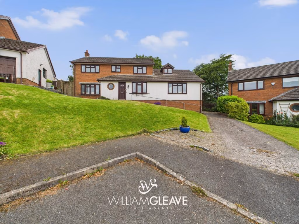
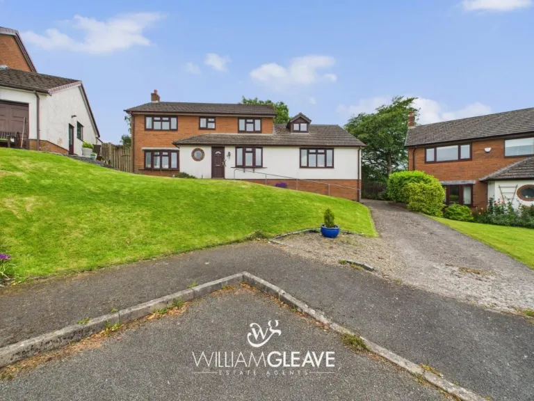
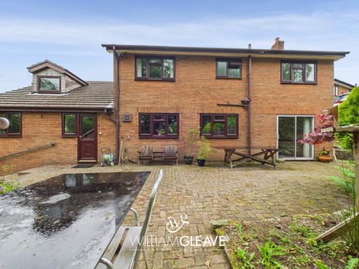
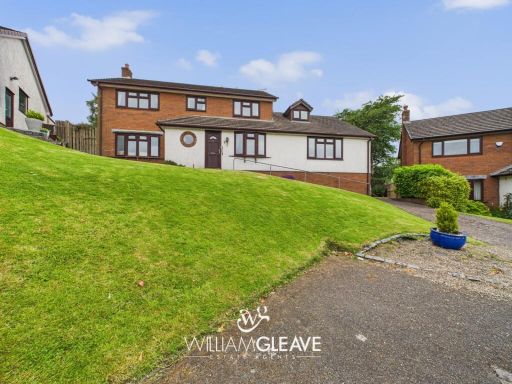
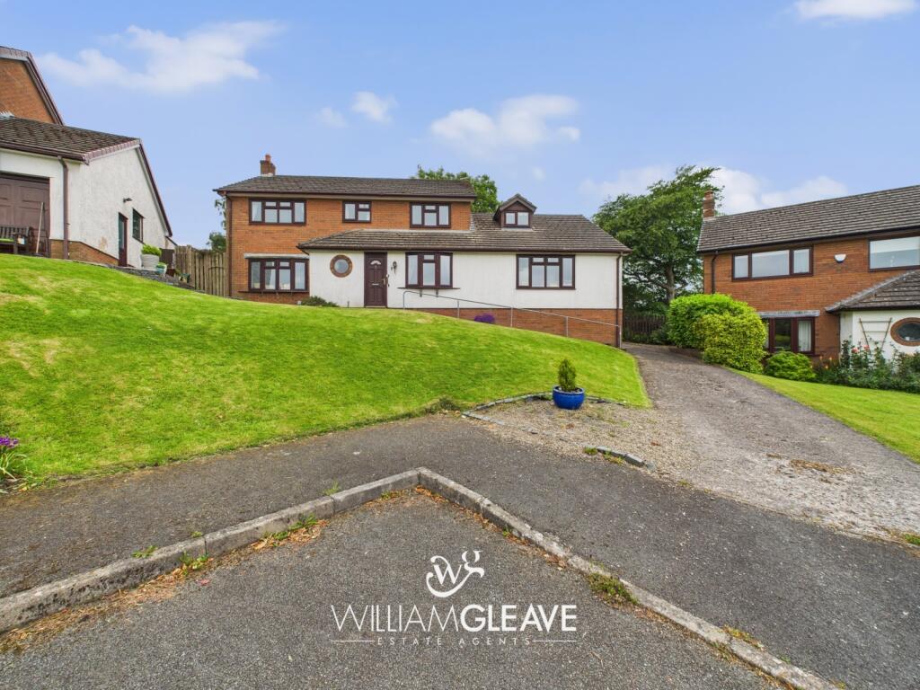
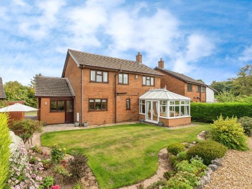
- detached house 1980s suburban
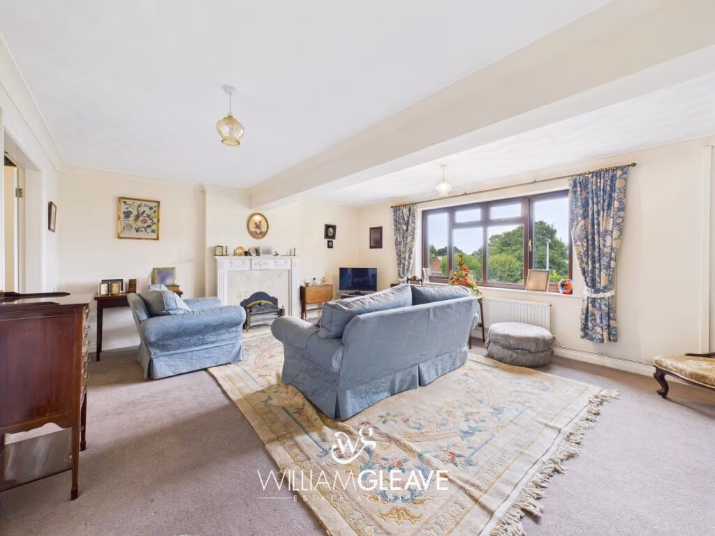
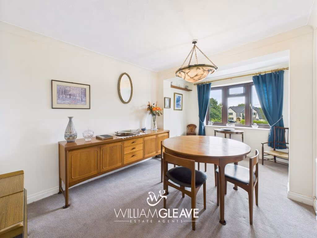
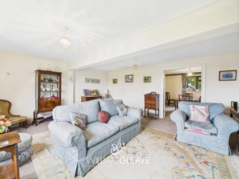
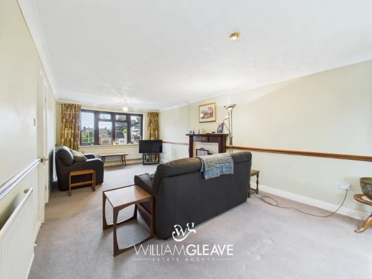
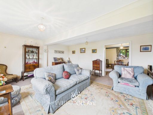
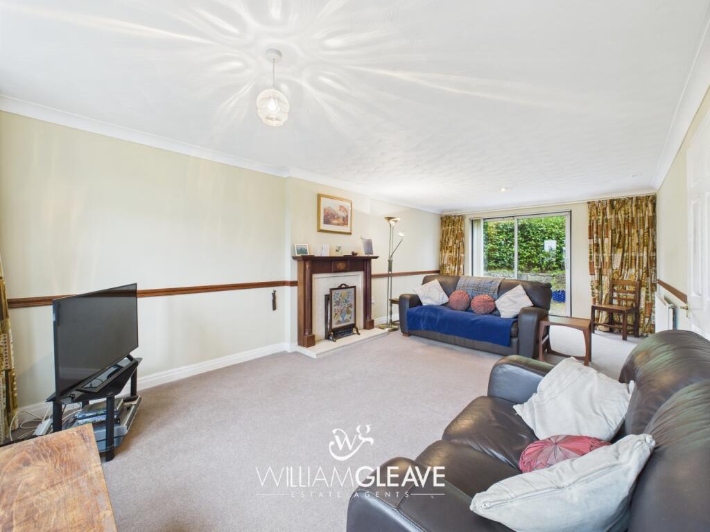
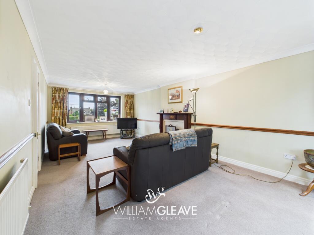
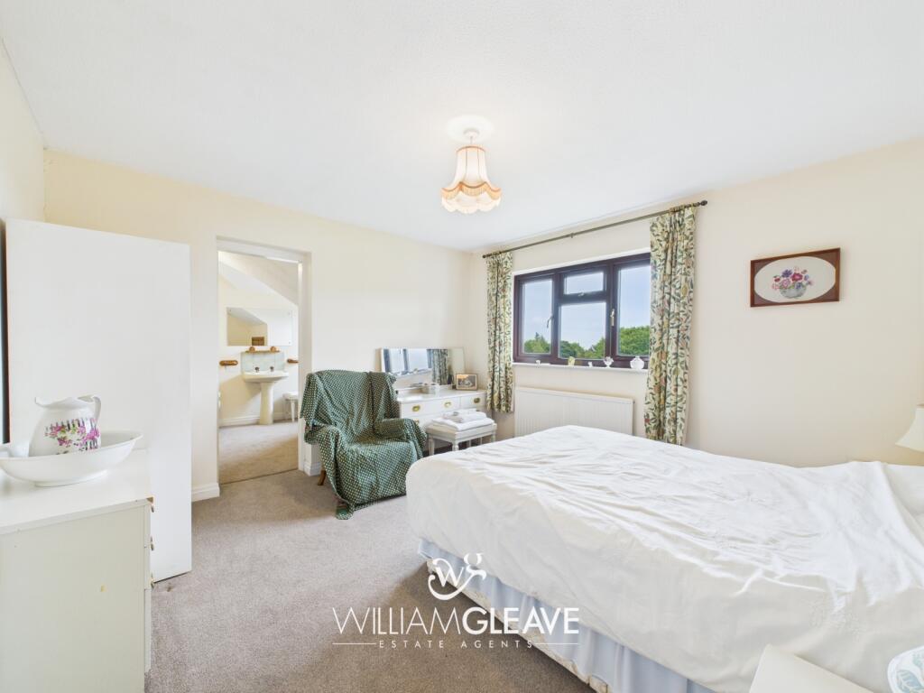
- living room 20th Century suburban
Floorplan Description
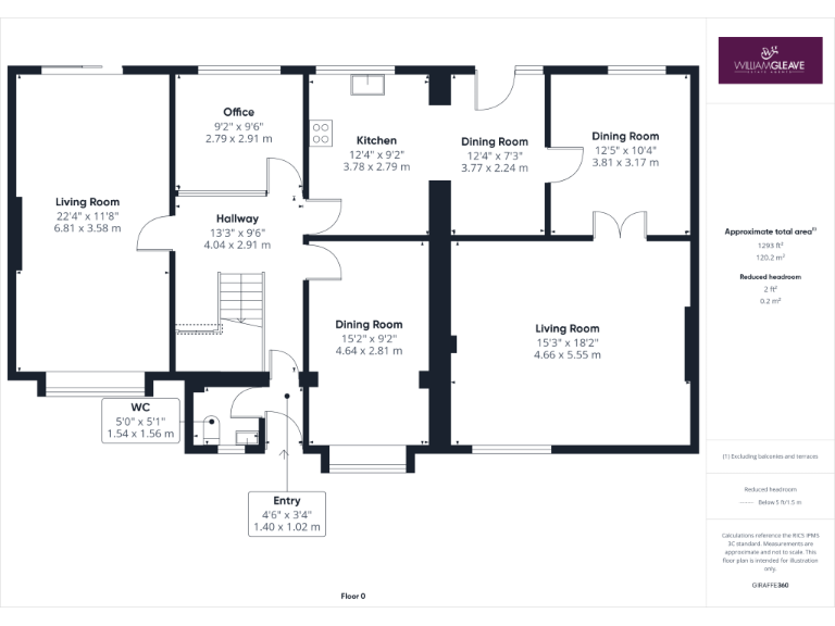
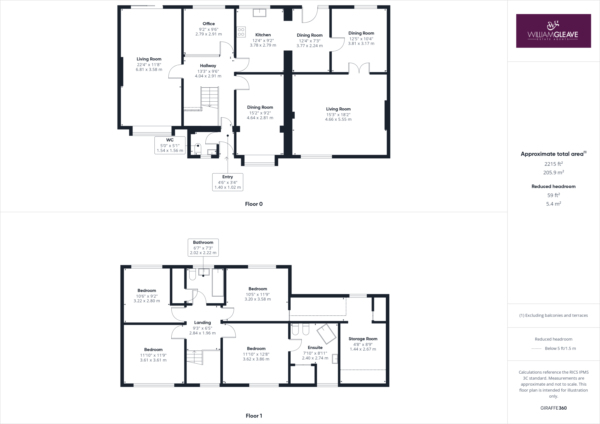
- This multi-story property features multiple living and dining rooms, several bedrooms, a kitchen, and office space, spread across two floors.
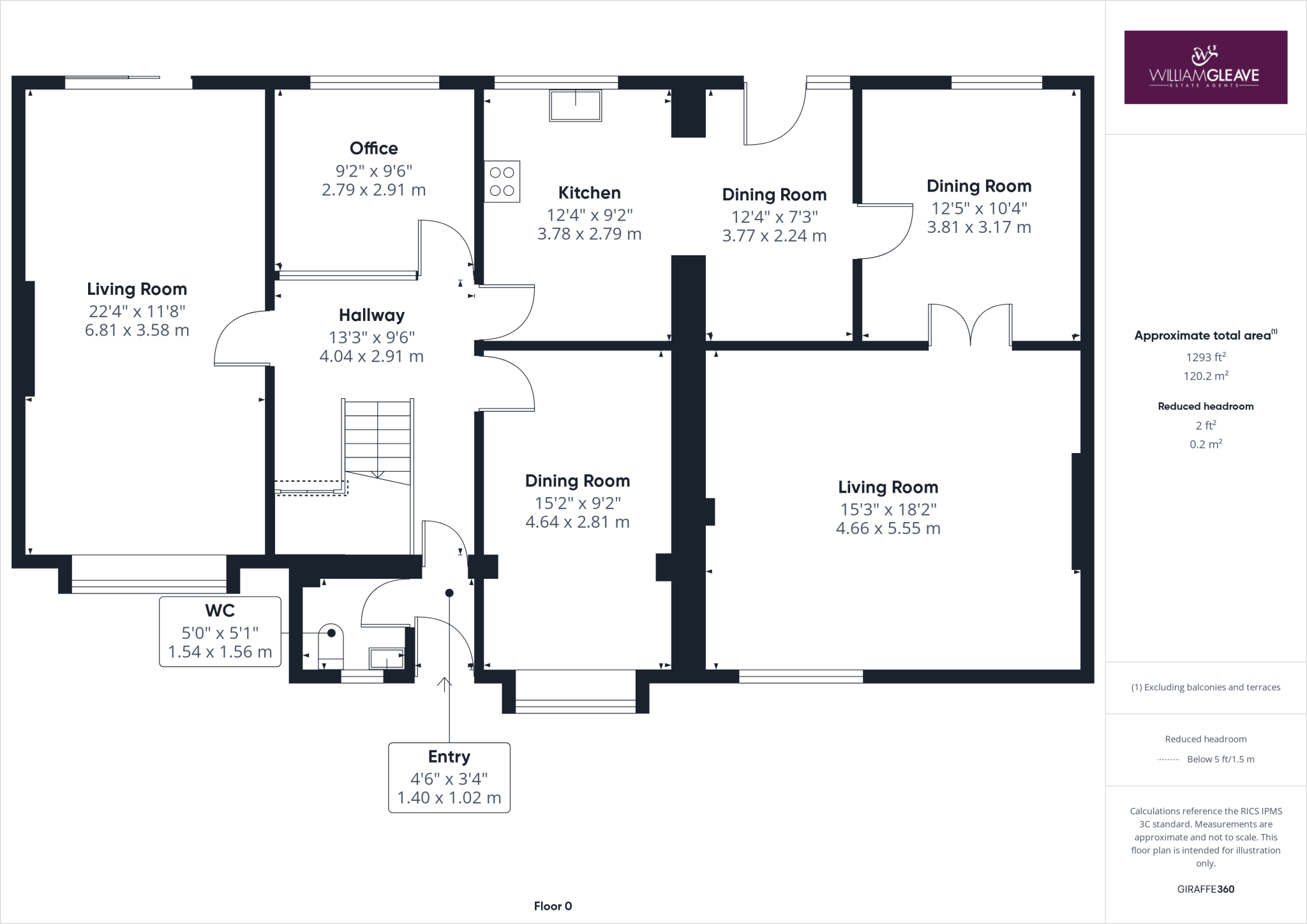
- A spacious property with multiple living and dining areas, an office, and a WC on the ground floor.
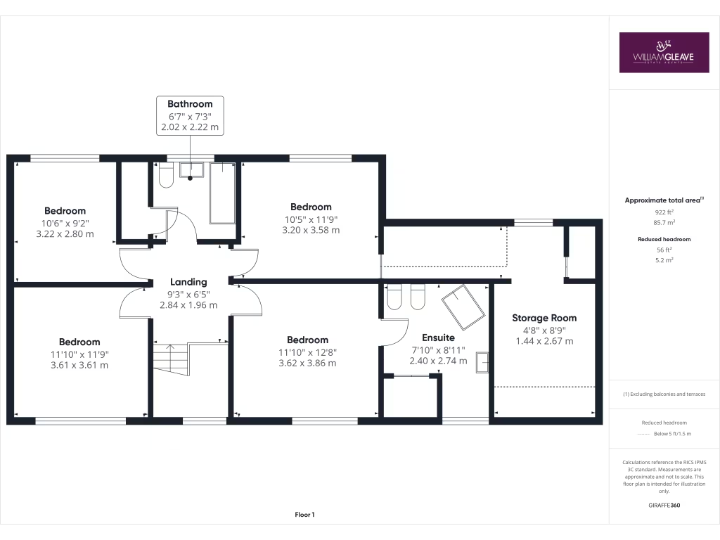
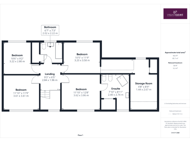
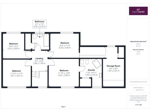
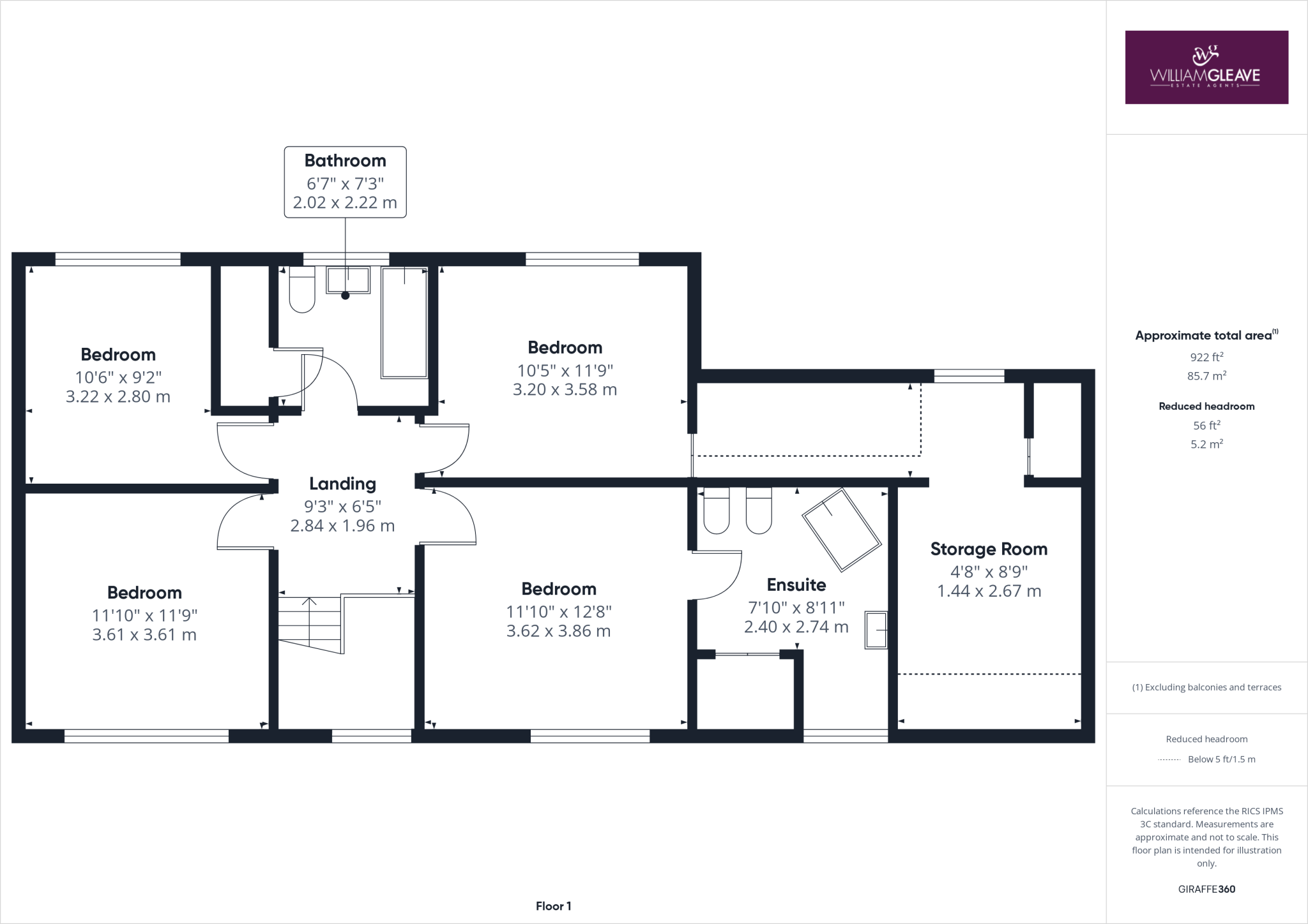
- A property with four bedrooms and multiple bathrooms on a single floor.
Rooms
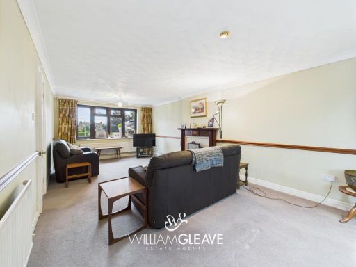
- Living Room:
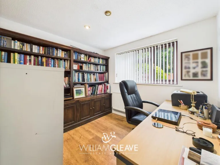
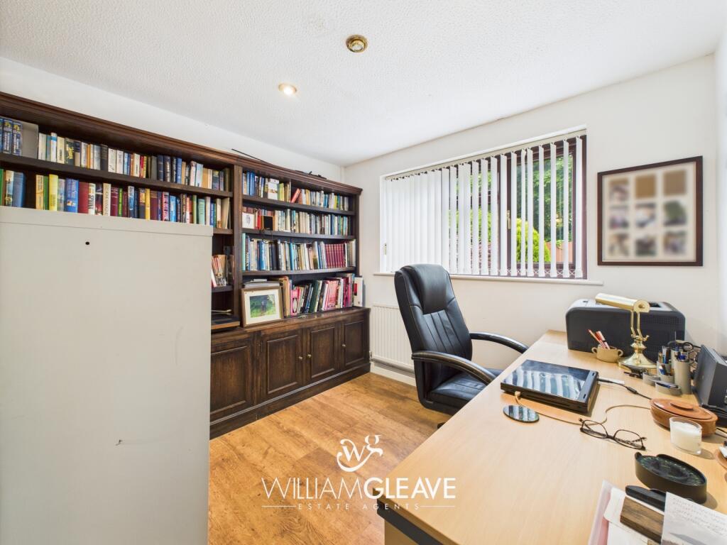
- Office:
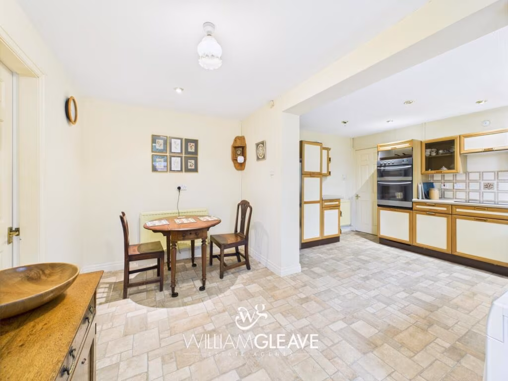
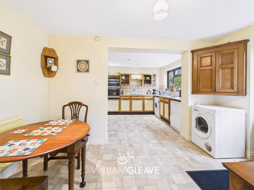
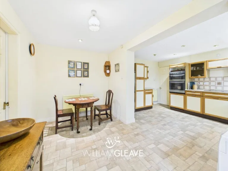
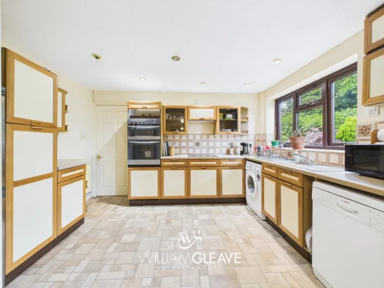
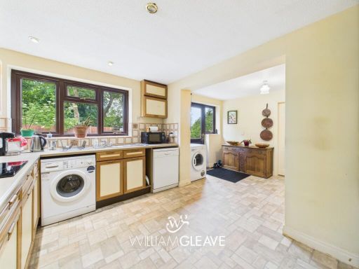
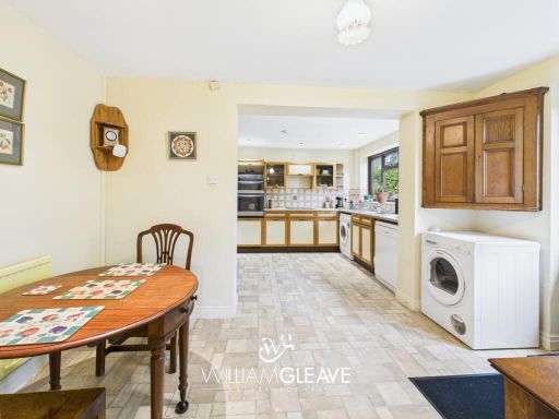
- Kitchen:
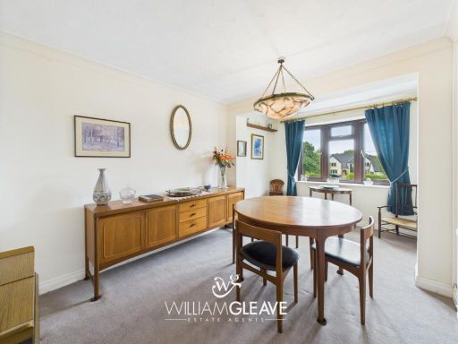
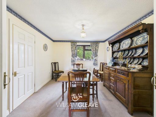
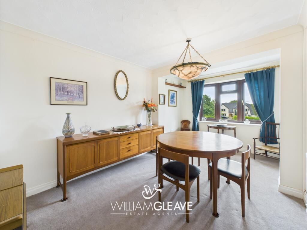
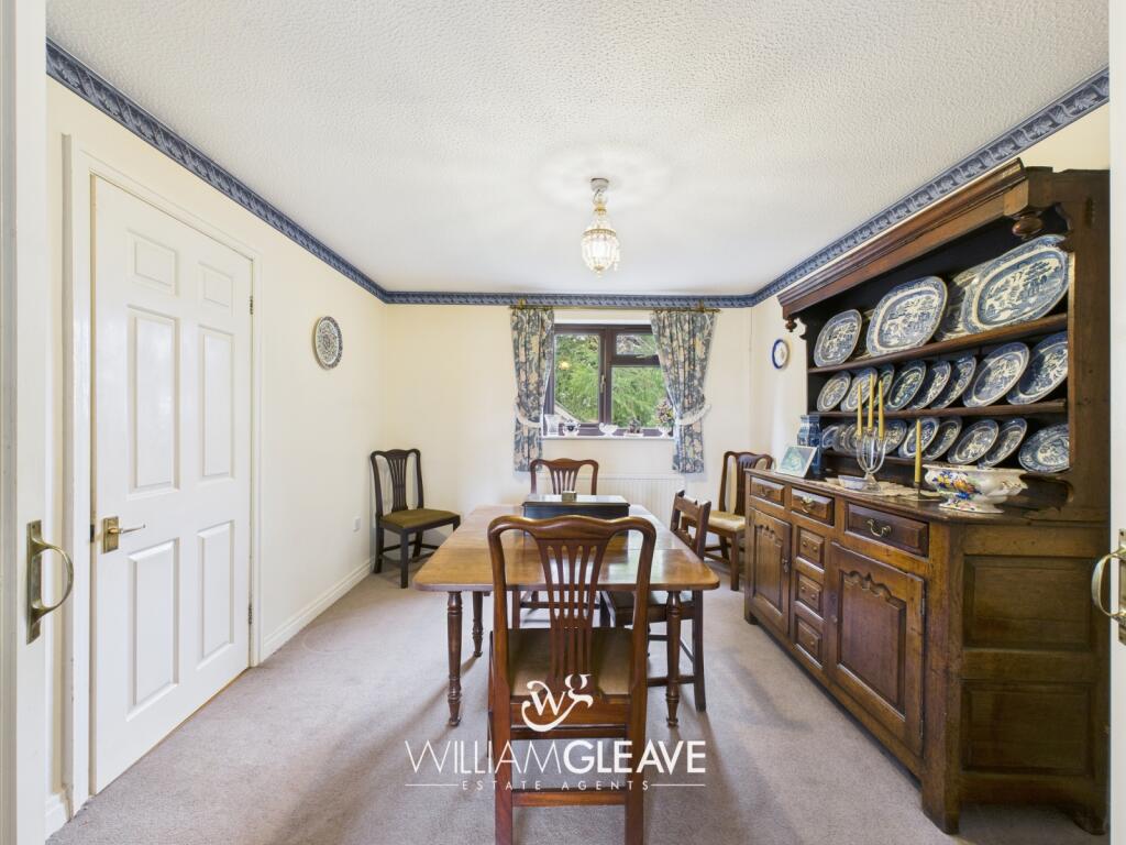
- Dining Room:
- Dining Room:
- Living Room:
- WC:
- Entry:
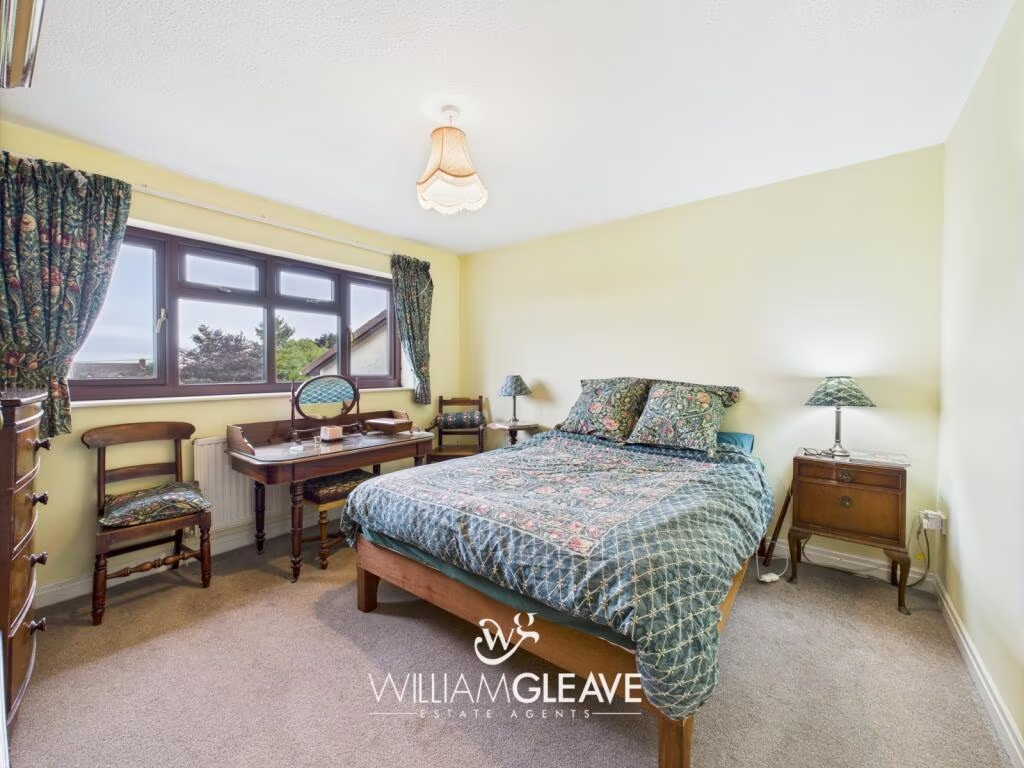
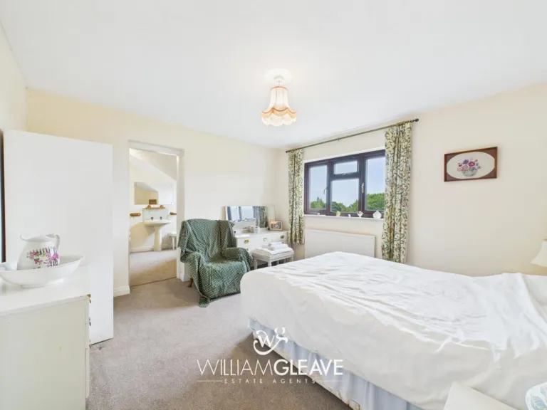
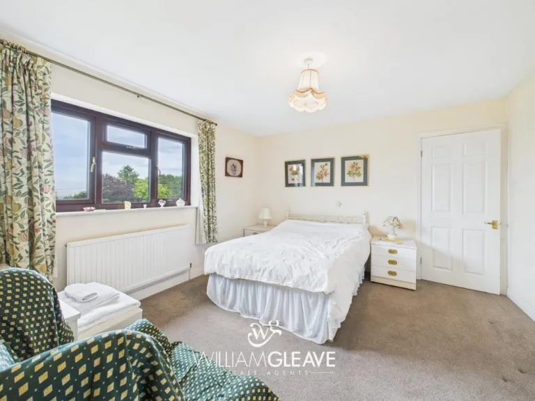
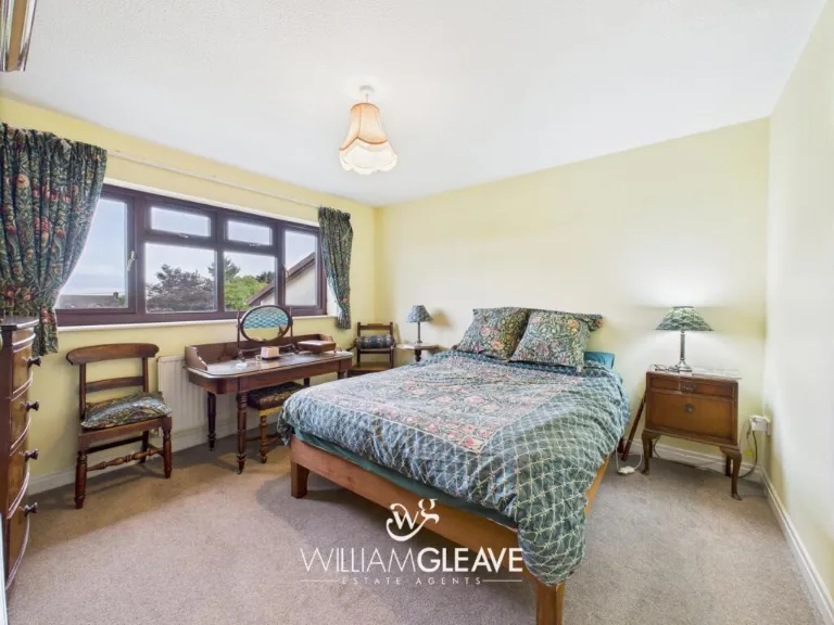
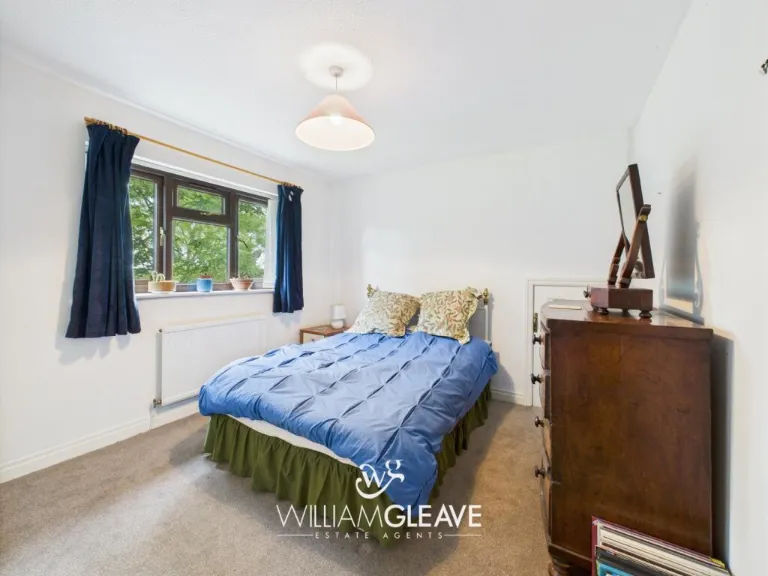
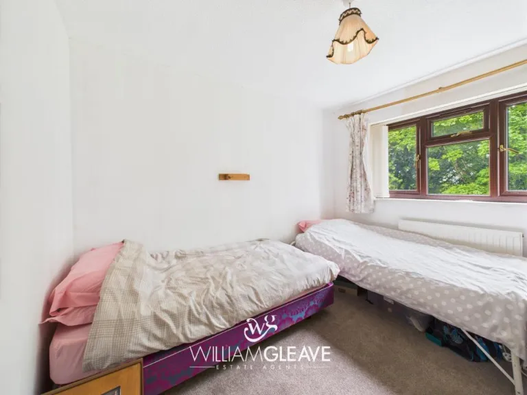
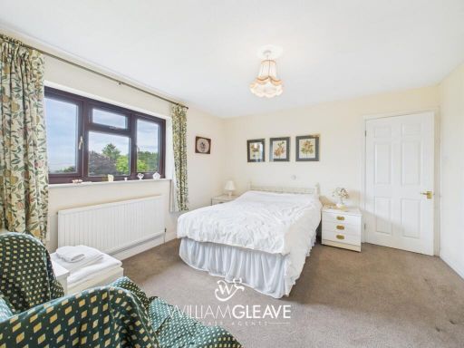
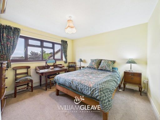
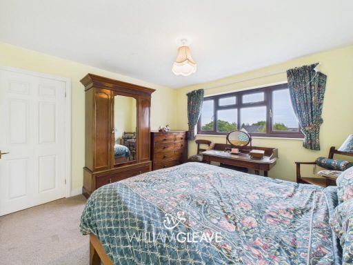
- Bedroom:
- Bedroom:
- Bedroom:
- Bedroom:
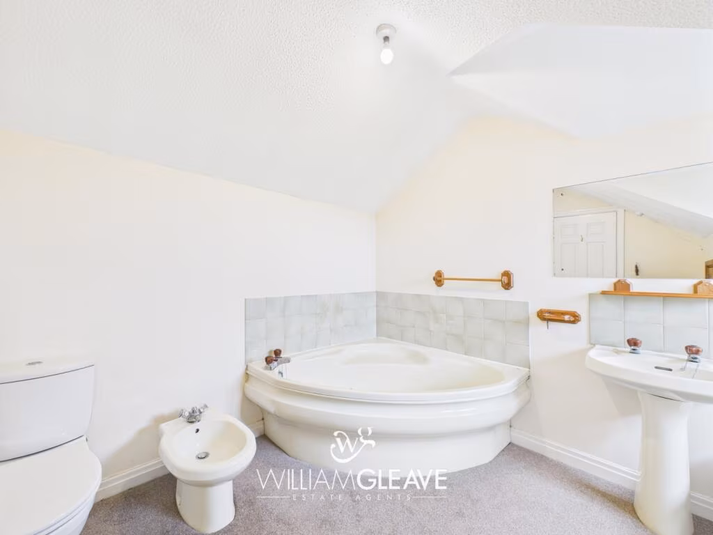
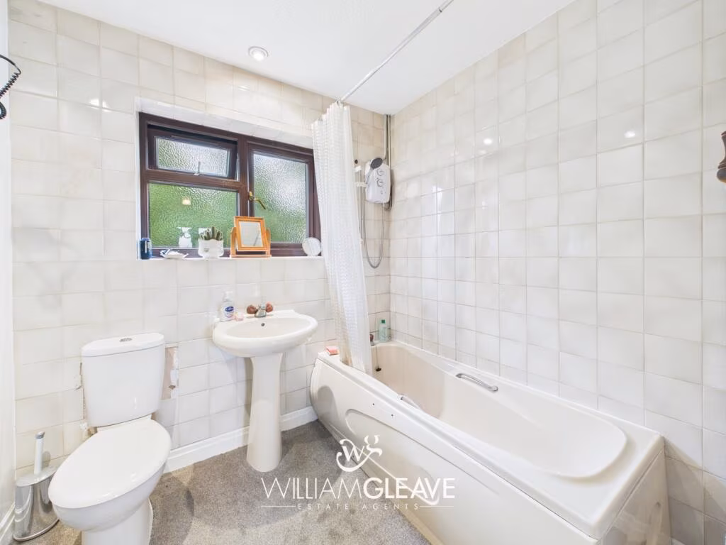
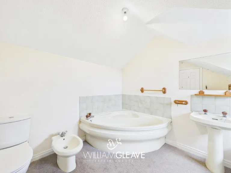
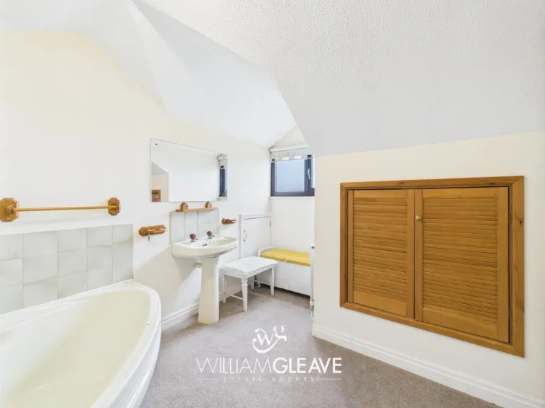
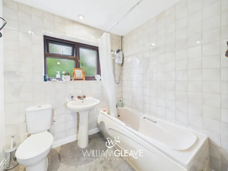
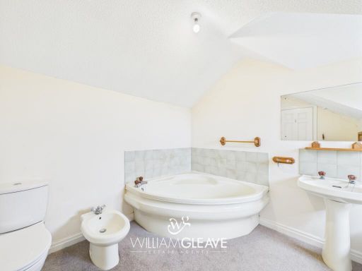
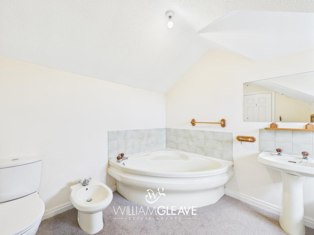
- Bathroom:
- Ensuite:
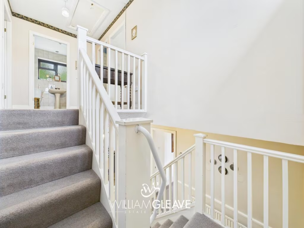
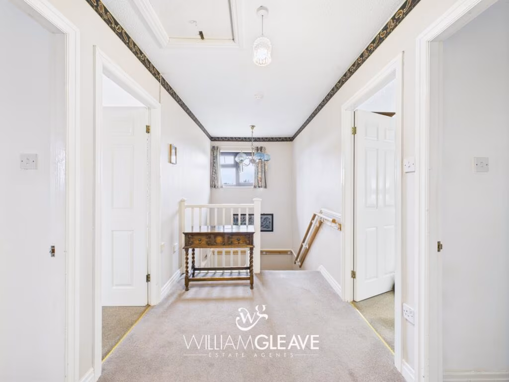
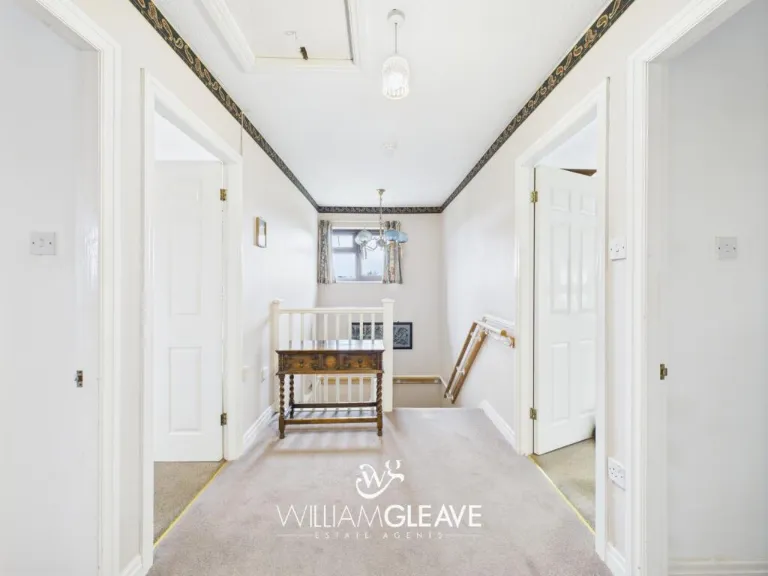
- Landing:
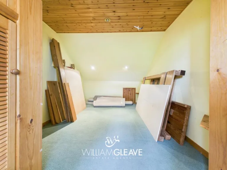
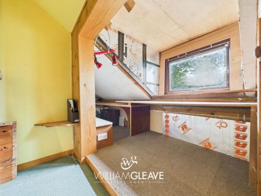
- Storage Room:
- Living Room: large
- Office: average
- Hallway: average
- Kitchen: average
- Dining Room: small
- Dining Room: average
- Living Room: large
- Dining Room: average
- Entry: small
- WC: small
- Bedroom: Average
- Bedroom: Average
- Bedroom: Large
- Bedroom: Large
- Storage Room: Small
- Bathroom: Small
- Ensuite: Average
Textual Property Features
Detected Visual Features
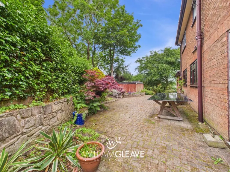
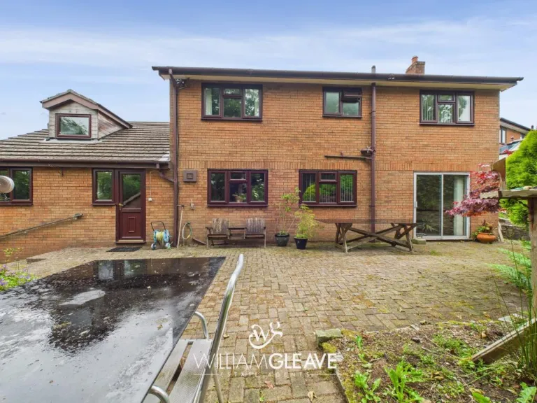
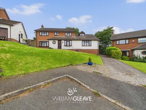
- 1980s house
- detached
- suburban
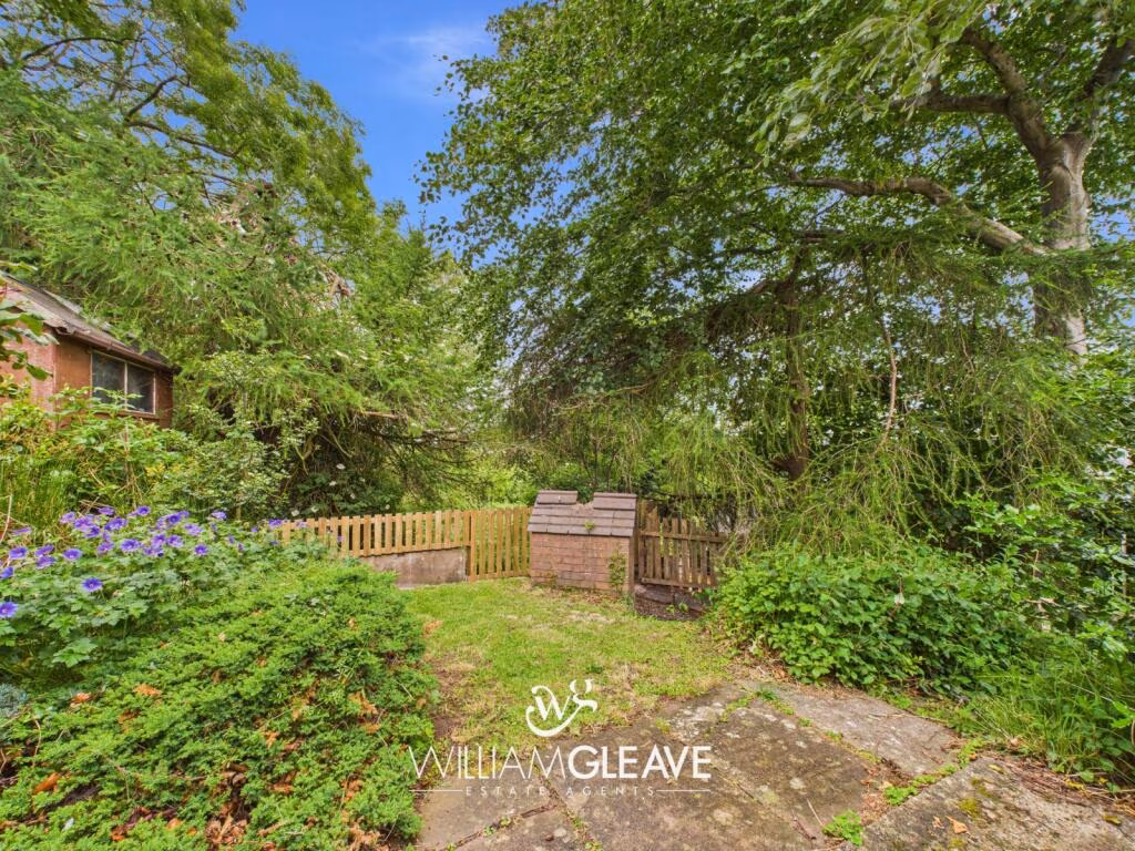
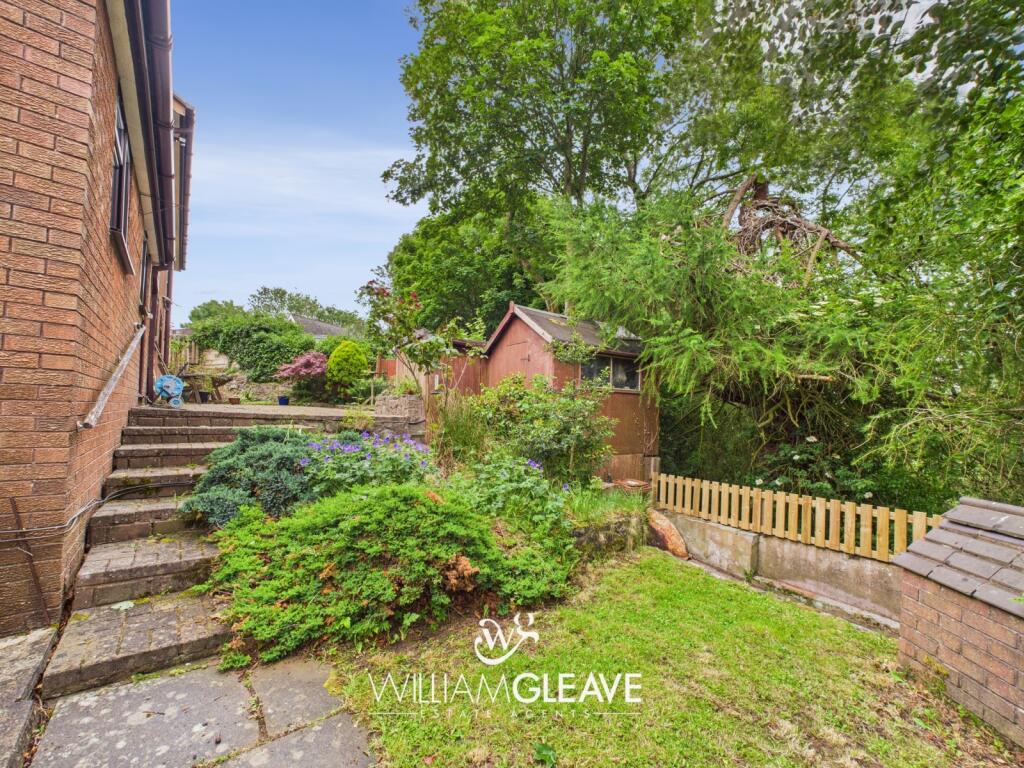
- front garden
- driveway
- brick
- garage potential
- 20th Century
- suburban house
- living room
- fireplace
- large room
- standard ceiling
- needs modernization
EPC Details
- Fully double glazed
- Cavity wall, as built, insulated (assumed)
- Boiler and radiators, LPG
- Low energy lighting in 41% of fixed outlets
- Solid, no insulation (assumed)
Nearest General Shops
- Id: 293400791
- Tags:
- Addr:
- City: Holywell
- Postcode: CH8 8RX
- Street: St. Asaph Road
- Building: commercial
- Email: contact@parkviewgarage.co.uk
- Name: Park View Garage
- Not:
- Opening_hours: Mo-Fr 09:00-17:00; Sa 09:00-12:00
- Opening_hours:covid19: same
- Payment:
- Phone: +44 1352 720205
- Ref:
- Service:
- Vehicle:
- Air_conditioning: yes
- Car_repair: yes
- Diagnostics: yes
- Inspection: yes
- Oil_change: yes
- Shop: car_repair
- Start_date: ~1970
- Website: https://www.parkviewgarage.co.uk
- TagsNormalized:
- garage
- car repair
- repair
- shop
- Lat: 53.2724913
- Lon: -3.3101065
- FullGeoHash: gcmxh9vwubjs
- PartitionGeoHash: gcmx
- Images:
- FoodStandards: null
- Distance: 2192.6
,- Id: 293400790
- Tags:
- Building: yes
- Name: A&B Caravans
- Shop: caravan
- TagsNormalized:
- Lat: 53.272599
- Lon: -3.3094688
- FullGeoHash: gcmxh9yp7u1p
- PartitionGeoHash: gcmx
- Images:
- FoodStandards: null
- Distance: 2148.7
,- Id: 1158353464
- Tags:
- Amenity: fuel
- Brand: BP
- Fuel:
- Diesel: yes
- Lpg: yes
- Octane_95: yes
- Octane_98: yes
- Name: Singing Kettle Services
- Opening_hours: 24/7
- Operator: BP
- Shop: yes
- TagsNormalized:
- Lat: 53.2738896
- Lon: -3.3059461
- FullGeoHash: gcmxhf0wvugc
- PartitionGeoHash: gcmx
- Images:
- FoodStandards: null
- Distance: 1879.4
}
Nearest Grocery shops
- Id: 3405393363
- Tags:
- Addr:
- City: Maes Pennant
- Housenumber: 65
- Postcode: CH8 9NX
- Street: Ffordd Pennant
- Fhrs:
- Name: Pennant Stores
- Operator: Premier Express
- Shop: convenience
- Source: survey
- TagsNormalized:
- Lat: 53.3070859
- Lon: -3.2581384
- FullGeoHash: gcmxmb72rc5c
- PartitionGeoHash: gcmx
- Images:
- FoodStandards:
- Id: 1039005
- FHRSID: 1039005
- LocalAuthorityBusinessID: 381620
- BusinessName: Pennant Stores
- BusinessType: Retailers - other
- BusinessTypeID: 4613
- AddressLine1: null
- AddressLine2: 63-65 Ffordd Pennant
- AddressLine3: Maes Pennant
- AddressLine4: Flintshire
- PostCode: CH8 9NX
- RatingValue: 4
- RatingKey: fhrs_4_en-GB
- RatingDate: 2019-07-23
- LocalAuthorityCode: 560
- LocalAuthorityName: Flintshire
- LocalAuthorityWebSite: http://www.flintshire.gov.uk/
- LocalAuthorityEmailAddress: food.safety@flintshire.gov.uk
- Scores:
- Hygiene: 0
- Structural: 10
- ConfidenceInManagement: 10
- NewRatingPending: false
- Geocode:
- Longitude: -3.25837440000000
- Latitude: 53.30717170000000
- Distance: 3377.2
,- Id: 904875373
- Tags:
- Brand: Londis
- Brand:wikidata: Q21008564
- Brand:wikipedia: en:Londis (United Kingdom)
- Building: yes
- Name: Londis
- Shop: convenience
- TagsNormalized:
- Lat: 53.2784362
- Lon: -3.2381204
- FullGeoHash: gcmxn7416k67
- PartitionGeoHash: gcmx
- Images:
- FoodStandards: null
- Distance: 2737.5
,- Id: 153913518
- Tags:
- Brand: Spar
- Brand:wikidata: Q610492
- Building: yes
- Name: Spar
- Shop: convenience
- TagsNormalized:
- Lat: 53.2740625
- Lon: -3.3059762
- FullGeoHash: gcmxhf0xvjj3
- PartitionGeoHash: gcmx
- Images:
- FoodStandards: null
- Distance: 1875.1
}
Nearest Religious buildings
- Id: 965448146
- Tags:
- Amenity: place_of_worship
- Building: church
- Denomination: catholic
- Name: St. David's Church
- Religion: christian
- Wikidata: Q17743494
- TagsNormalized:
- place of worship
- church
- catholic
- christian
- Lat: 53.2742514
- Lon: -3.260027
- FullGeoHash: gcmxjf615b78
- PartitionGeoHash: gcmx
- Images:
- FoodStandards: null
- Distance: 1403.9
,- Id: 291094071
- Tags:
- Amenity: place_of_worship
- Building: yes
- Denomination: methodist
- Name: Capel Sion
- Religion: christian
- TagsNormalized:
- place of worship
- methodist
- christian
- church
- Lat: 53.2828029
- Lon: -3.295825
- FullGeoHash: gcmxj5b4cdqg
- PartitionGeoHash: gcmx
- Images:
- FoodStandards: null
- Distance: 1162.3
,- Id: 293959063
- Tags:
- Amenity: place_of_worship
- Building: church
- Name: St. Paul's
- Religion: christian
- Wikidata: Q29502189
- TagsNormalized:
- place of worship
- church
- christian
- Lat: 53.2797167
- Lon: -3.2727316
- FullGeoHash: gcmxje2bgg43
- PartitionGeoHash: gcmx
- Images:
- FoodStandards: null
- Distance: 434.9
}
Nearest Medical buildings
- Id: 566347521
- Tags:
- Amenity: veterinary
- Building: yes
- Name: Caerwys Veterinary Surgery
- TagsNormalized:
- Lat: 53.24824
- Lon: -3.3079564
- FullGeoHash: gcmwutx1rp2u
- PartitionGeoHash: gcmw
- Images:
- FoodStandards: null
- Distance: 3961.8
,- Id: 313493875
- Tags:
- Addr:
- Housenumber: 65-67
- Postcode: CH8 7TF
- Street: High Street
- Amenity: pharmacy
- Brand: Boots
- Brand:wikidata: Q6123139
- Dispensing: yes
- Drive_through: no
- Fhrs:
- Healthcare: pharmacy
- Name: Fferllyfa Boots Pharmacy
- Source: survey
- Source:addr: FHRS Open Data
- TagsNormalized:
- pharmacy
- boots
- health
- healthcare
- Lat: 53.2731104
- Lon: -3.2208279
- FullGeoHash: gcmxndndm789
- PartitionGeoHash: gcmx
- Images:
- FoodStandards:
- Id: 1265219
- FHRSID: 1265219
- LocalAuthorityBusinessID: 48954
- BusinessName: Alliance Pharmacy/Boots UK Ltd
- BusinessType: Retailers - other
- BusinessTypeID: 4613
- AddressLine1: null
- AddressLine2: 65-67 High Street
- AddressLine3: Holywell
- AddressLine4: Flintshire
- PostCode: CH8 7TF
- RatingValue: Exempt
- RatingKey: fhrs_exempt_en-GB
- RatingDate: 2005-05-25
- LocalAuthorityCode: 560
- LocalAuthorityName: Flintshire
- LocalAuthorityWebSite: http://www.flintshire.gov.uk/
- LocalAuthorityEmailAddress: food.safety@flintshire.gov.uk
- Scores:
- Hygiene: null
- Structural: null
- ConfidenceInManagement: null
- NewRatingPending: false
- Geocode:
- Longitude: -3.22079100000000
- Latitude: 53.27312760000000
- Distance: 3948.8
,- Id: 3450383965
- Tags:
- Amenity: dentist
- Healthcare: dentist
- Healthcare:speciality: dentist;osteopathy
- Name: Signature Smiles
- Source: survey
- TagsNormalized:
- dentist
- health
- healthcare
- osteopathy
- Lat: 53.2730552
- Lon: -3.2214452
- FullGeoHash: gcmxndn4nck2
- PartitionGeoHash: gcmx
- Images:
- FoodStandards: null
- Distance: 3909.5
,- Id: 398060545
- Tags:
- Amenity: hospital
- Name: St Winefride's Hospice
- TagsNormalized:
- Lat: 53.2751709
- Lon: -3.2238432
- FullGeoHash: gcmxndkqr58m
- PartitionGeoHash: gcmx
- Images:
- FoodStandards: null
- Distance: 3715.3
}
Nearest Airports
- Id: 116737532
- Tags:
- Addr:
- City: Liverpool
- Country: GB
- Postcode: L24 1YD
- Street: Speke Hall Avenue
- Aerodrome: international
- Aerodrome:type: public
- Aeroway: aerodrome
- Iata: LPL
- Icao: EGGP
- Is_in: Liverpool,England,UK
- Name: Liverpool John Lennon Airport
- Old_name: Speke Airport
- Operator: Liverpool Airport plc
- Source: wikipedia
- Website: https://www.liverpoolairport.com/
- Wikidata: Q8727
- Wikipedia: en:Liverpool John Lennon Airport
- TagsNormalized:
- airport
- international airport
- Lat: 53.3357677
- Lon: -2.8518179
- FullGeoHash: gcmzrj7r7gdr
- PartitionGeoHash: gcmz
- Images:
- FoodStandards: null
- Distance: 29081.6
}
Nearest Leisure Facilities
- Id: 902858444
- Tags:
- TagsNormalized:
- Lat: 53.2801525
- Lon: -3.2842038
- FullGeoHash: gcmxj72e2s21
- PartitionGeoHash: gcmx
- Images:
- FoodStandards: null
- Distance: 337.6
,- Id: 902858442
- Tags:
- TagsNormalized:
- Lat: 53.2800001
- Lon: -3.2841948
- FullGeoHash: gcmxj72d2xyu
- PartitionGeoHash: gcmx
- Images:
- FoodStandards: null
- Distance: 333.5
,- Id: 902811496
- Tags:
- TagsNormalized:
- Lat: 53.2801485
- Lon: -3.281382
- FullGeoHash: gcmxj76e6781
- PartitionGeoHash: gcmx
- Images:
- FoodStandards: null
- Distance: 160.5
,- Id: 902811497
- Tags:
- TagsNormalized:
- Lat: 53.2802727
- Lon: -3.2811605
- FullGeoHash: gcmxj76sp6tq
- PartitionGeoHash: gcmx
- Images:
- FoodStandards: null
- Distance: 155.3
,- Id: 474061436
- Tags:
- TagsNormalized:
- Lat: 53.2796328
- Lon: -3.2772642
- FullGeoHash: gcmxj7m865qt
- PartitionGeoHash: gcmx
- Images:
- FoodStandards: null
- Distance: 134
}
Nearest Tourist attractions
- Id: 284333892
- Tags:
- TagsNormalized:
- Lat: 53.2843427
- Lon: -3.2999315
- FullGeoHash: gcmxhuj5f12t
- PartitionGeoHash: gcmx
- Images:
- FoodStandards: null
- Distance: 1477.6
,- Id: 284333890
- Tags:
- TagsNormalized:
- Lat: 53.2851071
- Lon: -3.2981454
- FullGeoHash: gcmxhuq25xus
- PartitionGeoHash: gcmx
- Images:
- FoodStandards: null
- Distance: 1403.7
,- Id: 291094205
- Tags:
- TagsNormalized:
- Lat: 53.2846951
- Lon: -3.2957079
- FullGeoHash: gcmxjh0ju7n5
- PartitionGeoHash: gcmx
- Images:
- FoodStandards: null
- Distance: 1238.7
}
Nearest Train stations
- Id: 27072504
- Tags:
- Addr:
- City: Neston
- Postcode: CH64 9SR
- Street: Ladies Walk
- Internet_access: no
- Name: Neston
- Naptan:
- Network: National Rail
- Operator: Transport for Wales
- Public_transport: station
- Railway: station
- Ref:
- Wikidata: Q2540573
- Wikipedia: en:Neston railway station
- TagsNormalized:
- Lat: 53.2917321
- Lon: -3.062958
- FullGeoHash: gcmz4m3wgfuu
- PartitionGeoHash: gcmz
- Images:
- FoodStandards: null
- Distance: 14443.3
,- Id: 10055803296
- Tags:
- Electrified: rail
- Name: Hoylake
- Naptan:
- Network: National Rail
- Operator: Merseyrail
- Public_transport: station
- Railway: station
- Ref:
- Source: npe
- Wikidata: Q2196603
- Wikipedia: en:Hoylake railway station
- TagsNormalized:
- Lat: 53.3899025
- Lon: -3.1788231
- FullGeoHash: gcmxxxm68p1t
- PartitionGeoHash: gcmx
- Images:
- FoodStandards: null
- Distance: 13974.4
,- Id: 4911481464
- Tags:
- Name: Royden Park Minature Railway
- Public_transport: station
- Railway: station
- Usage: tourism
- TagsNormalized:
- Lat: 53.3630039
- Lon: -3.1330833
- FullGeoHash: gcmz8dqw1bgv
- PartitionGeoHash: gcmz
- Images:
- FoodStandards: null
- Distance: 13437.2
,- Id: 10055803298
- Tags:
- Electrified: rail
- Name: West Kirby
- Naptan:
- Network: National Rail
- Operator: Merseyrail
- Public_transport: station
- Railway: station
- Ref:
- Wikipedia: en:West Kirby railway station
- TagsNormalized:
- Lat: 53.3734193
- Lon: -3.1837893
- FullGeoHash: gcmxxs3dsq6x
- PartitionGeoHash: gcmx
- Images:
- FoodStandards: null
- Distance: 12221
,- Id: 105712447
- Tags:
- Name: Prestatyn
- Naptan:
- Network: National Rail
- Public_transport: station
- Railway: station
- Ref:
- Source: NPE
- Wheelchair: yes
- Wikidata: Q2284492
- Wikipedia: en:Prestatyn railway station
- TagsNormalized:
- Lat: 53.3362293
- Lon: -3.4073552
- FullGeoHash: gcmx6mwf4cgb
- PartitionGeoHash: gcmx
- Images:
- FoodStandards: null
- Distance: 10596.1
}
Nearest Bus stations and stops
- Id: 5405713669
- Tags:
- Bus: yes
- Highway: bus_stop
- Public_transport: platform
- TagsNormalized:
- Lat: 53.2745996
- Lon: -3.2220579
- FullGeoHash: gcmxndmg095m
- PartitionGeoHash: gcmx
- Images:
- FoodStandards: null
- Distance: 3841.5
,- Id: 8403404595
- Tags:
- Bus: yes
- Highway: bus_stop
- Public_transport: platform
- TagsNormalized:
- Lat: 53.2778232
- Lon: -3.2237049
- FullGeoHash: gcmxndutf4p6
- PartitionGeoHash: gcmx
- Images:
- FoodStandards: null
- Distance: 3698.1
,- Id: 4015350741
- Tags:
- Bus: yes
- Highway: bus_stop
- Public_transport: platform
- Shelter: yes
- TagsNormalized:
- Lat: 53.2745394
- Lon: -3.2247959
- FullGeoHash: gcmxnd7f8vcy
- PartitionGeoHash: gcmx
- Images:
- FoodStandards: null
- Distance: 3662.3
,- Id: 4015350740
- Tags:
- Bus: yes
- Highway: bus_stop
- Public_transport: platform
- Shelter: yes
- TagsNormalized:
- Lat: 53.2744279
- Lon: -3.2248938
- FullGeoHash: gcmxnd7dn90v
- PartitionGeoHash: gcmx
- Images:
- FoodStandards: null
- Distance: 3657.8
,- Id: 8403499460
- Tags:
- Bus: yes
- Highway: bus_stop
- Public_transport: platform
- TagsNormalized:
- Lat: 53.2813848
- Lon: -3.2368478
- FullGeoHash: gcmxn7dfxfp2
- PartitionGeoHash: gcmx
- Images:
- FoodStandards: null
- Distance: 2827.8
}
Nearest Hotels
- Id: 298496259
- Tags:
- Name: Mostyn Lodge
- Phone: +44 1745 561197
- Tourism: hotel
- Wikidata: Q29503161
- TagsNormalized:
- Lat: 53.3194033
- Lon: -3.2725707
- FullGeoHash: gcmxmd8bp94m
- PartitionGeoHash: gcmx
- Images:
- FoodStandards: null
- Distance: 4463.5
,- Id: 290750713
- Tags:
- Building: yes
- Name: Lletty Hotel
- Tourism: hotel
- Wikidata: Q29480943
- TagsNormalized:
- Lat: 53.3126142
- Lon: -3.2592392
- FullGeoHash: gcmxmc68qpx5
- PartitionGeoHash: gcmx
- Images:
- FoodStandards: null
- Distance: 3919.1
,- Id: 818554708
- Tags:
- Name: Kinsale Hall
- Source: OS OpenData StreetView
- Tourism: hotel
- TagsNormalized:
- Lat: 53.2983156
- Lon: -3.2411896
- FullGeoHash: gcmxnnxv4y1u
- PartitionGeoHash: gcmx
- Images:
- FoodStandards: null
- Distance: 3286.1
}
Tags
- 1980s house
- detached
- suburban
- front garden
- driveway
- brick
- garage potential
- 20th Century
- suburban house
- living room
- fireplace
- large room
- standard ceiling
- needs modernization
Local Market Stats
- Average Price/sqft: £189
- Avg Income: £37900
- Social Housing: 7%
- Planning Success Rate: 82%
Similar Properties
 4 bedroom detached house for sale in Bryn Aur, Gorsedd, Holywell, Flintshire, CH8 — £375,000 • 4 bed • 1 bath • 1496 ft²
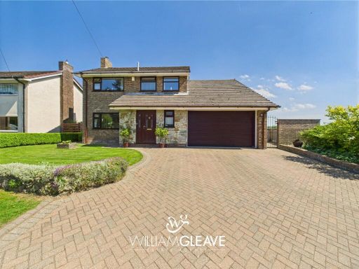 4 bedroom detached house for sale in Babell Road, Gorsedd, Holywell, Flintshire, CH8 — £450,000 • 4 bed • 2 bath • 1632 ft²
 5 bedroom detached house for sale in Druids Close, Gorsedd, Flintshire, CH8 — £515,000 • 5 bed • 3 bath • 2411 ft²
 4 bedroom detached bungalow for sale in Babell Road, Gorsedd, CH8 — £450,000 • 4 bed • 2 bath • 1804 ft²
 4 bedroom detached bungalow for sale in Holywell, Flintshire, CH8 — £395,000 • 4 bed • 2 bath • 2337 ft²
 4 bedroom detached house for sale in Pen Y Cefn Road, Caerwys, CH7 — £350,000 • 4 bed • 3 bath • 1219 ft²
Meta
- {
"@context": "https://schema.org",
"@type": "Residence",
"name": "4 bedroom detached house for sale in Bryn Aur, Gorsedd, Hol…",
"description": "",
"url": "https://propertypiper.co.uk/property/b1af84f8-8bb3-4a01-ae61-15f84013d426",
"image": "https://image-a.propertypiper.co.uk/a5f573b2-a6f5-4111-999b-7c4b2c6e3100-1024.jpeg",
"address": {
"@type": "PostalAddress",
"streetAddress": "Bryn Aur, Gorsedd, Holywell, Flintshire, CH8",
"postalCode": "CH8 8RA",
"addressLocality": "Flintshire",
"addressRegion": "Delyn",
"addressCountry": "Wales"
},
"geo": {
"@type": "GeoCoordinates",
"latitude": 53.2794618,
"longitude": -3.2792594
},
"numberOfRooms": 4,
"numberOfBathroomsTotal": 1,
"floorSize": {
"@type": "QuantitativeValue",
"value": 2215,
"unitCode": "FTK"
},
"offers": {
"@type": "Offer",
"price": 400000,
"priceCurrency": "GBP",
"availability": "https://schema.org/InStock"
},
"additionalProperty": [
{
"@type": "PropertyValue",
"name": "Feature",
"value": "1980s house"
},
{
"@type": "PropertyValue",
"name": "Feature",
"value": "detached"
},
{
"@type": "PropertyValue",
"name": "Feature",
"value": "suburban"
},
{
"@type": "PropertyValue",
"name": "Feature",
"value": "front garden"
},
{
"@type": "PropertyValue",
"name": "Feature",
"value": "driveway"
},
{
"@type": "PropertyValue",
"name": "Feature",
"value": "brick"
},
{
"@type": "PropertyValue",
"name": "Feature",
"value": "garage potential"
},
{
"@type": "PropertyValue",
"name": "Feature",
"value": "20th Century"
},
{
"@type": "PropertyValue",
"name": "Feature",
"value": "suburban house"
},
{
"@type": "PropertyValue",
"name": "Feature",
"value": "living room"
},
{
"@type": "PropertyValue",
"name": "Feature",
"value": "fireplace"
},
{
"@type": "PropertyValue",
"name": "Feature",
"value": "large room"
},
{
"@type": "PropertyValue",
"name": "Feature",
"value": "standard ceiling"
},
{
"@type": "PropertyValue",
"name": "Feature",
"value": "needs modernization"
}
]
}
High Res Floorplan Images
Compatible Floorplan Images
FloorplanImages Thumbnail