B64 5NL - 4 bedroom detached house for sale in Halesowen Road, Cradle…
View on Property Piper
4 bedroom detached house for sale in Halesowen Road, Cradley Heath, B64
Property Details
- Price: £375000
- Bedrooms: 4
- Bathrooms: 2
- Property Type: undefined
- Property SubType: undefined
Brochure Descriptions
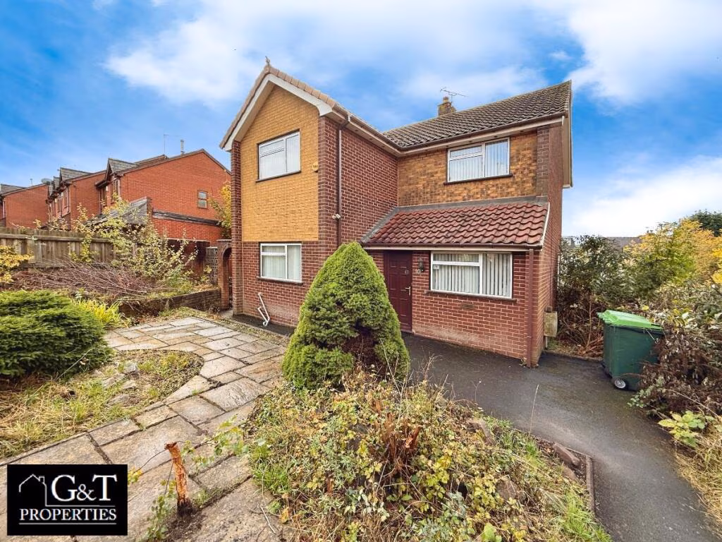
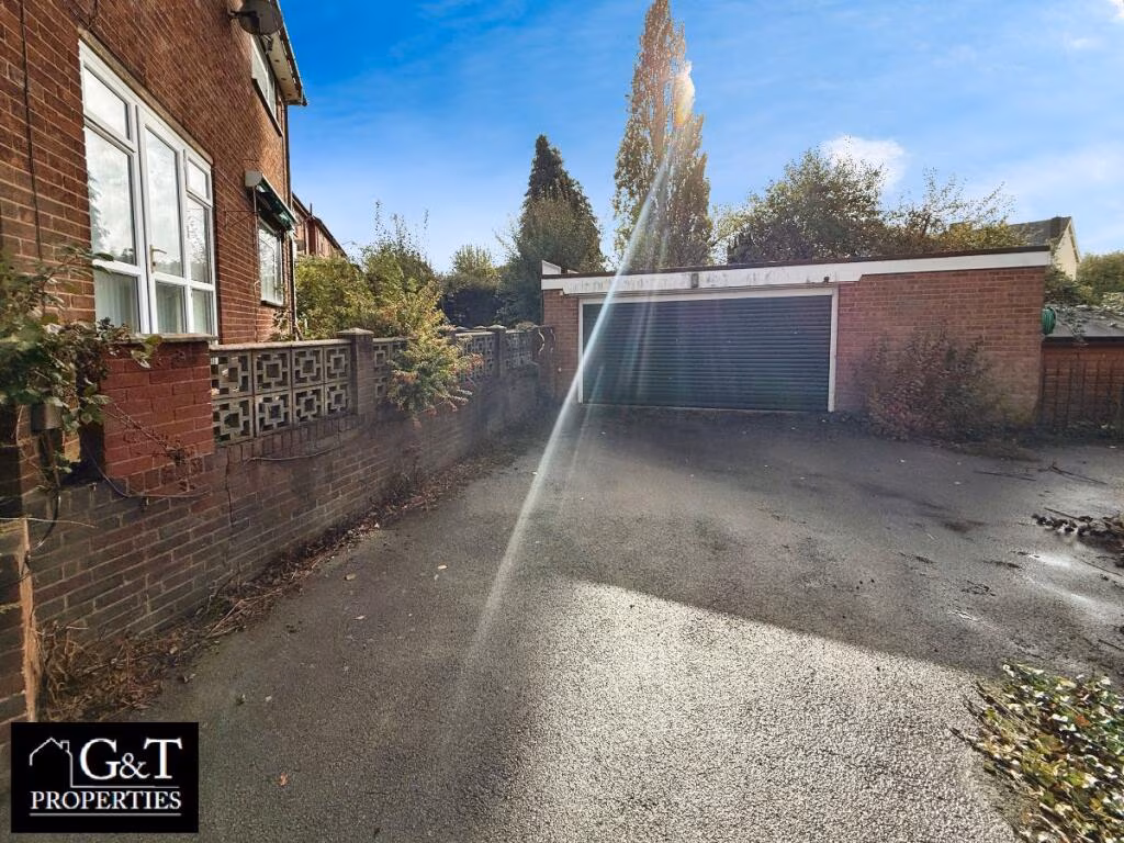
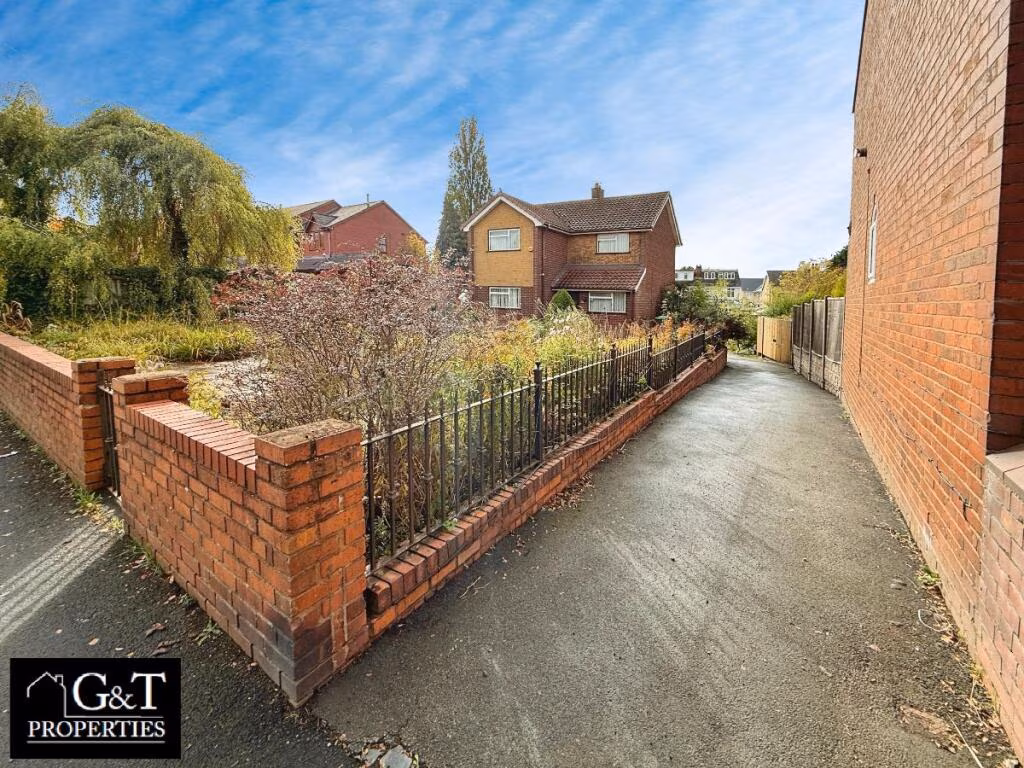
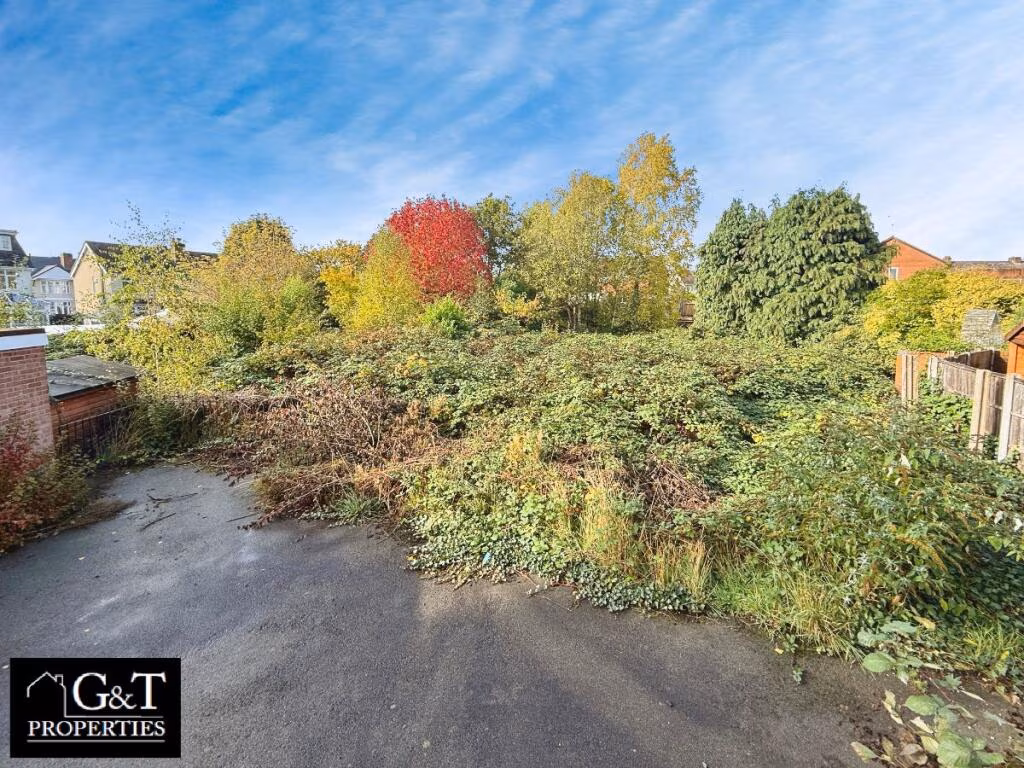
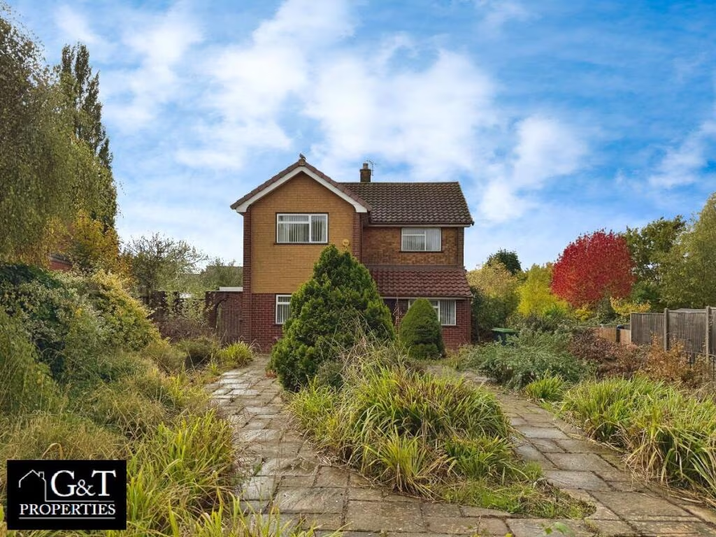
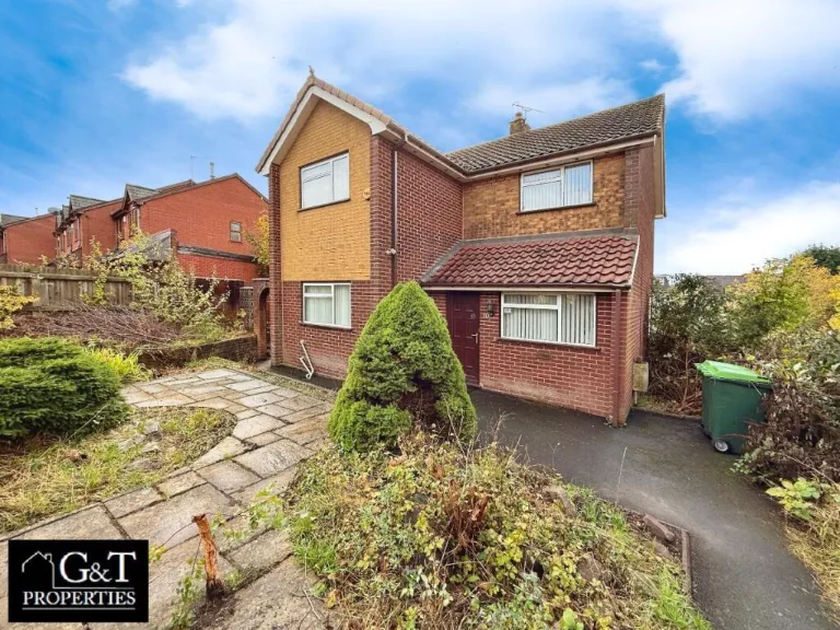
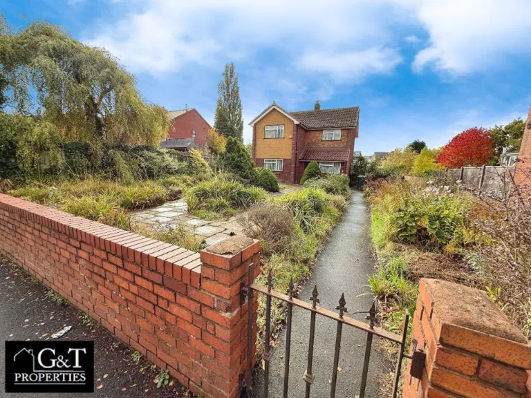
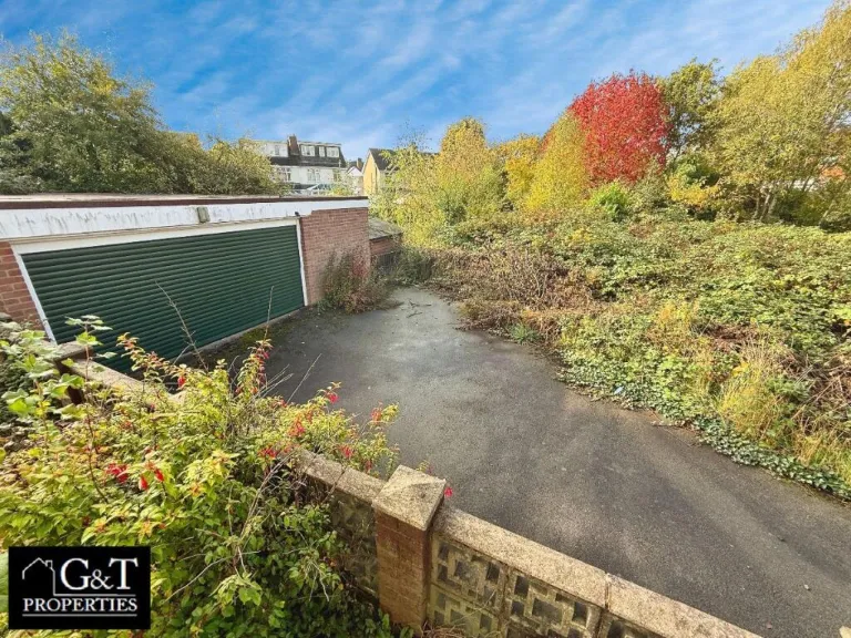
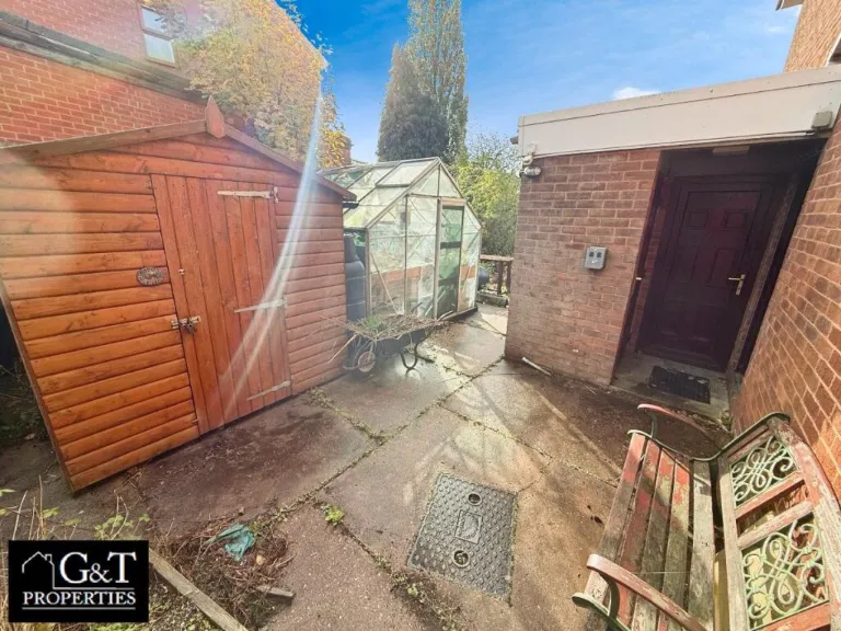
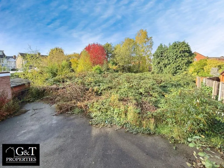
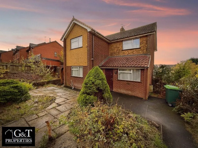
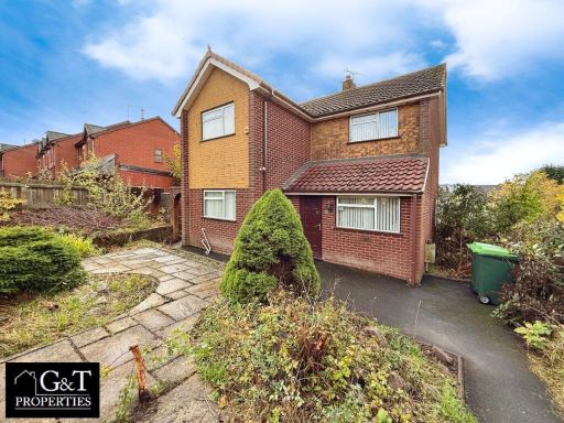
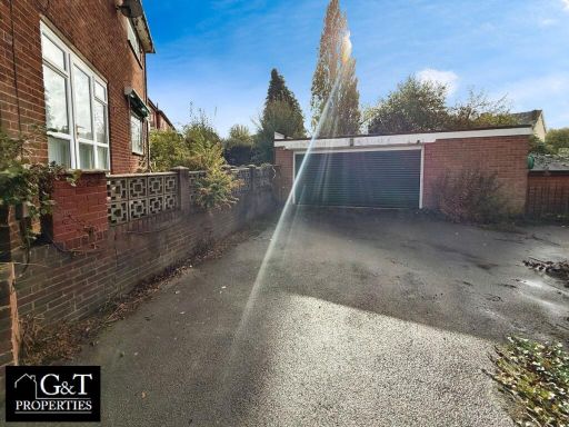
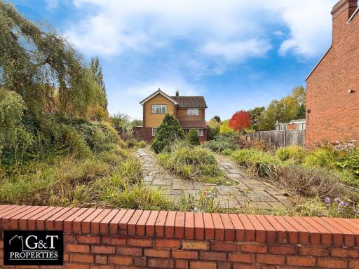
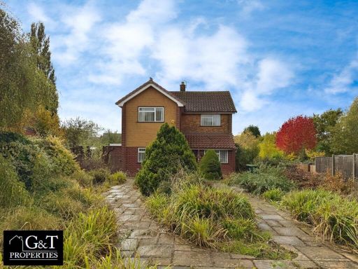
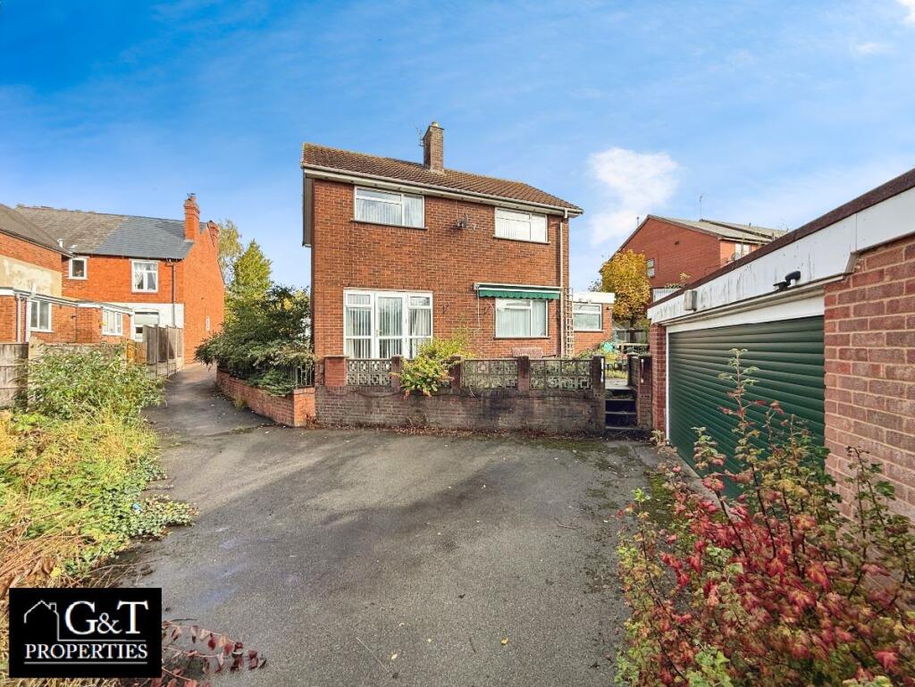
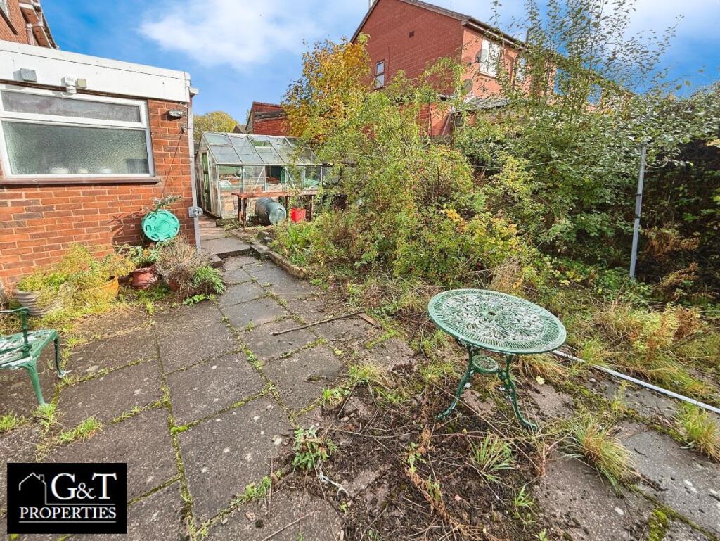
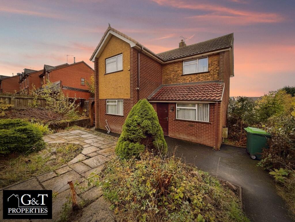
- Two-storey detached brick house in a suburban setting. Exterior comprises mixed red and buff brickwork with a tiled pitched roof and a single-storey projection/porch to the front. The property benefits from a paved front garden with mature shrubbery and an adjacent tarmac driveway offering off-street parking for one vehicle. Front garden is of small to average size with paved path and planting beds; side/ rear vegetation visible suggesting a modest private rear garden. Windows are uPVC with vertical blinds; overall condition externally appears fair but would benefit from general landscaping and cosmetic updating. Likely a family dwelling (approximately 2–4 bedrooms typical for this form), situated in a residential area with neighbouring houses close by; no exceptional views visible (typical suburban outlook). Overall plot size appears average for a semi/ detached suburban plot.
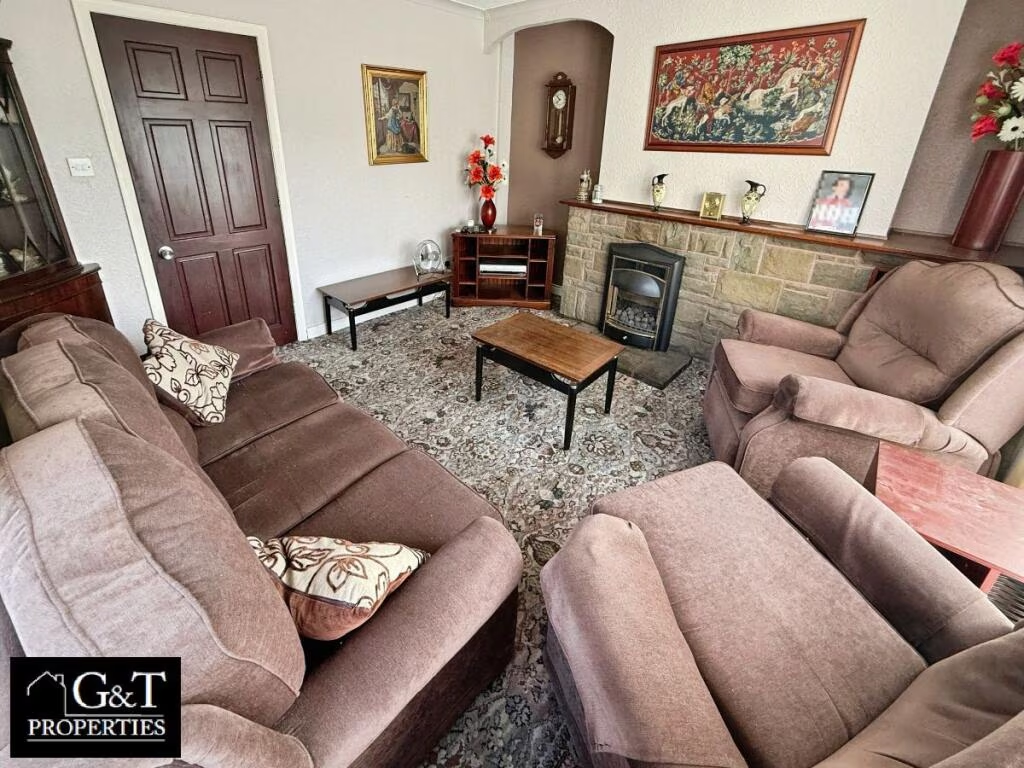
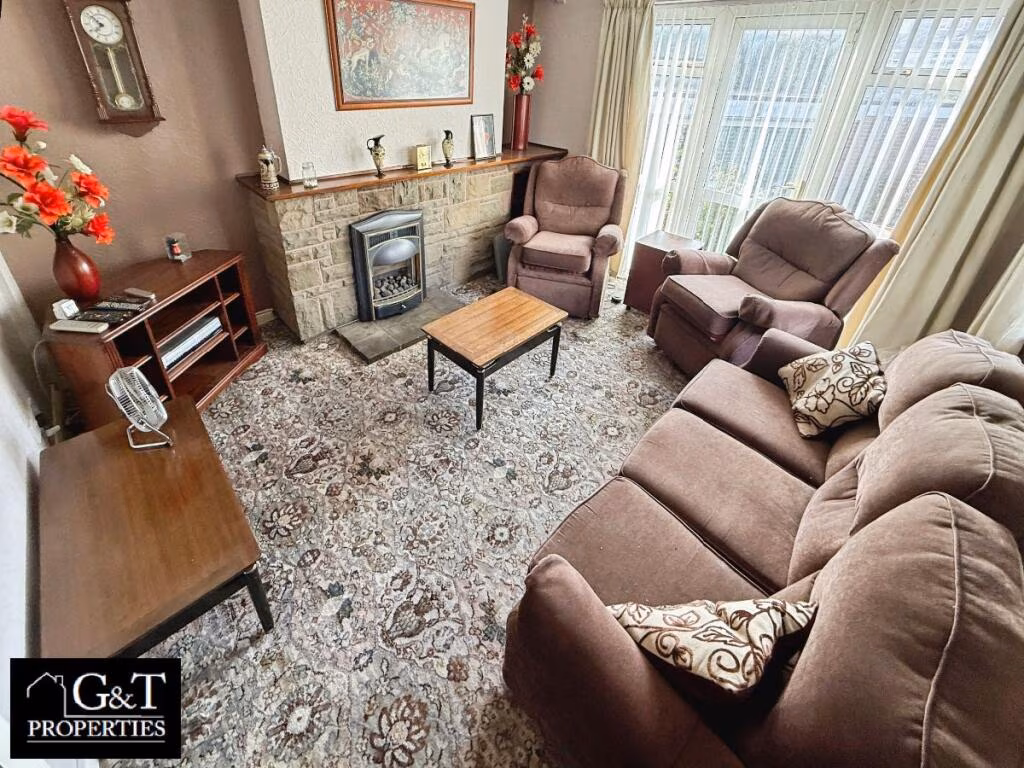
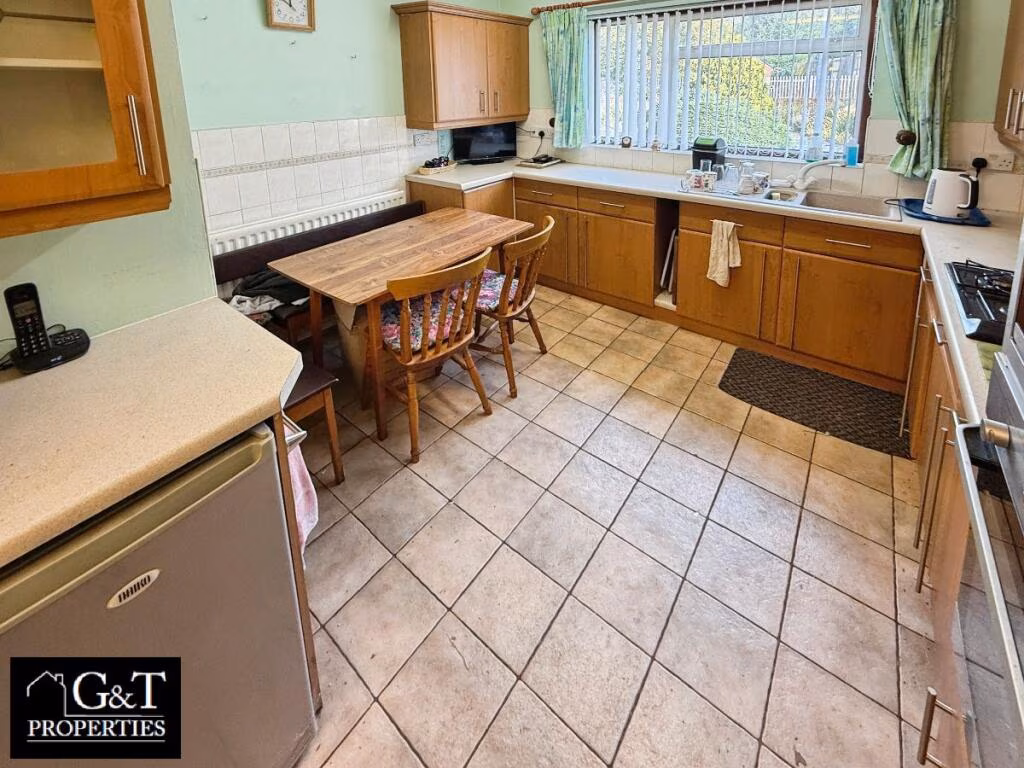
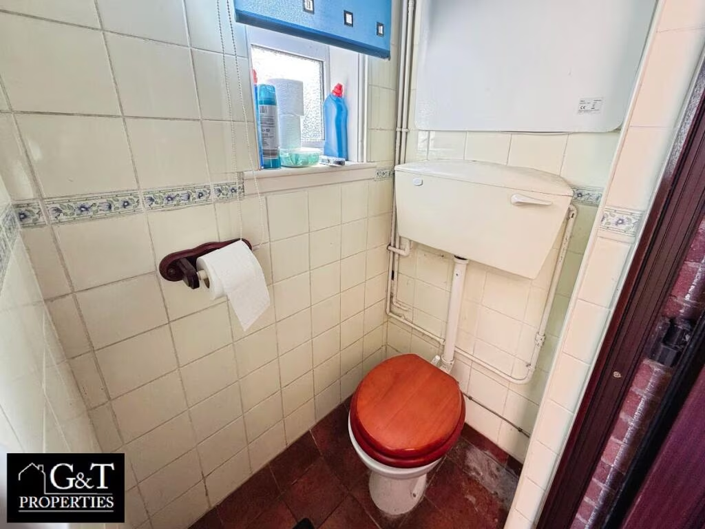
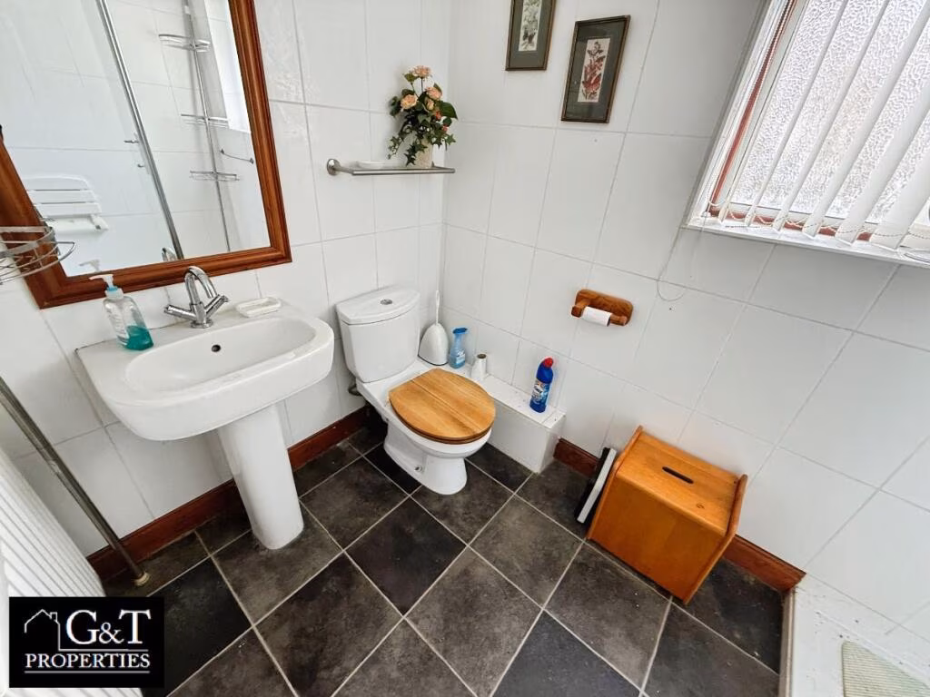
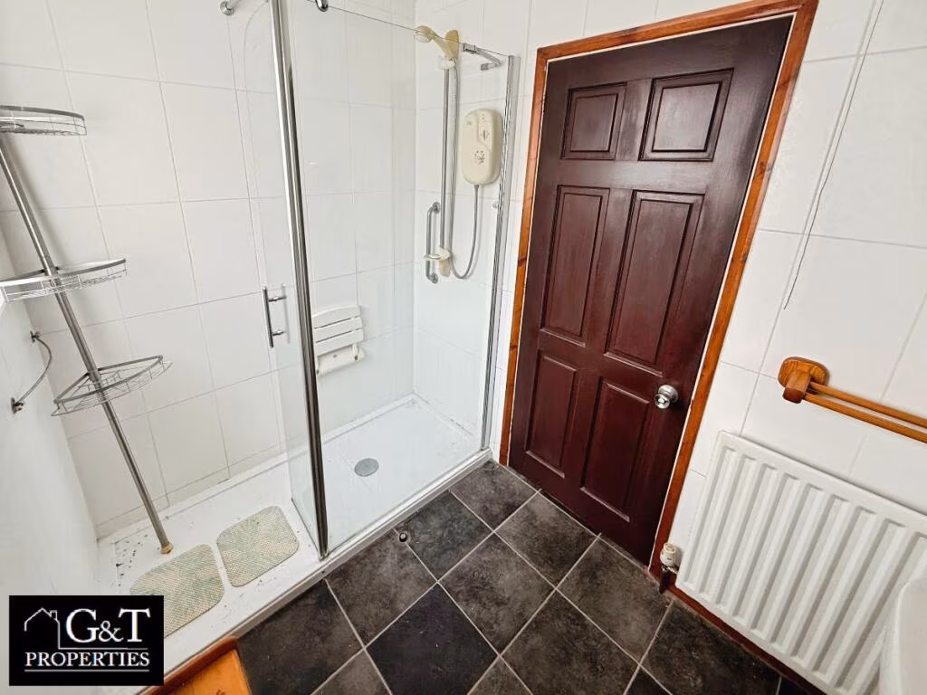
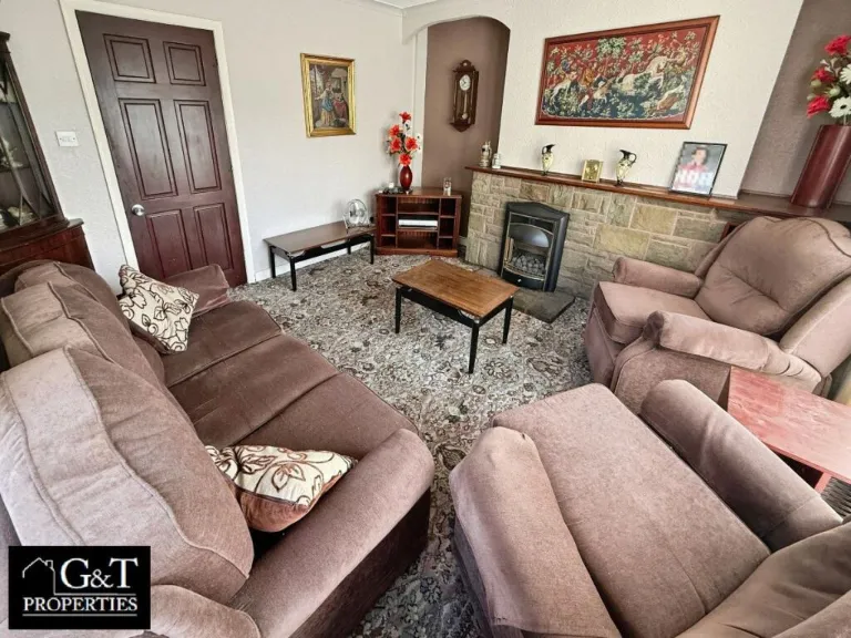
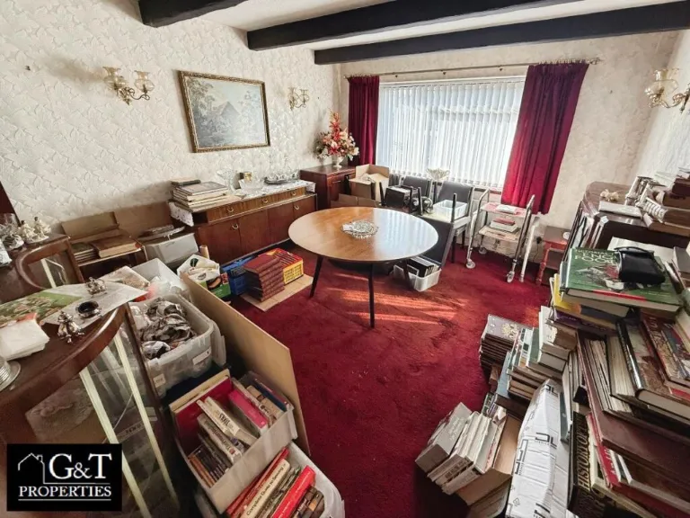
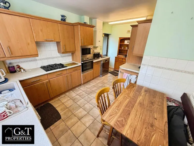
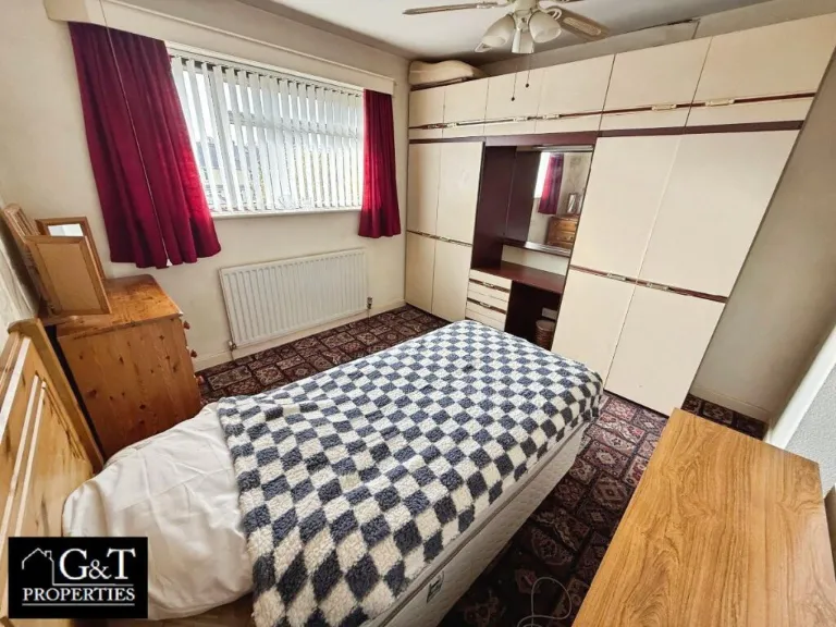
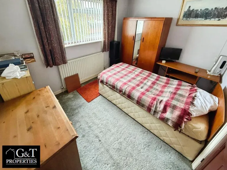
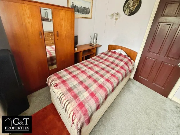
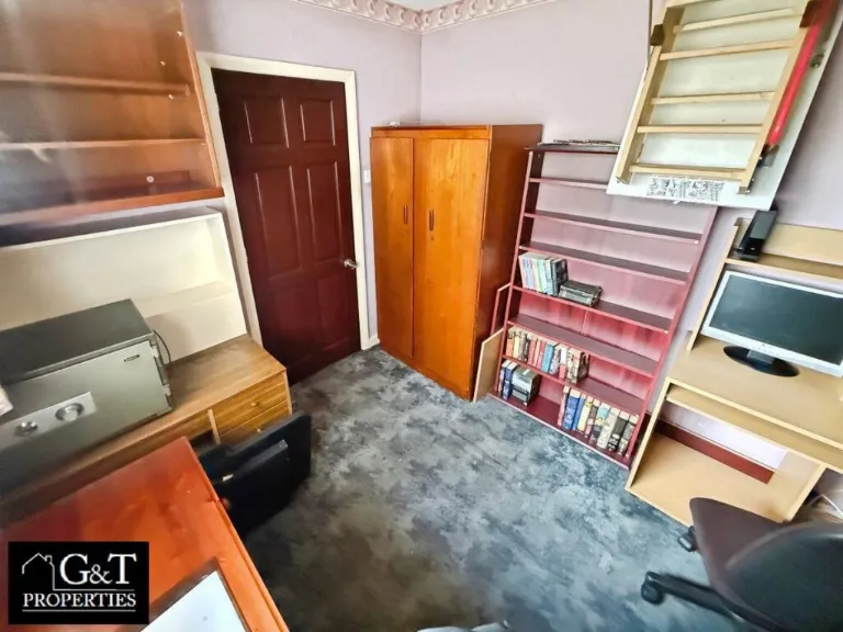
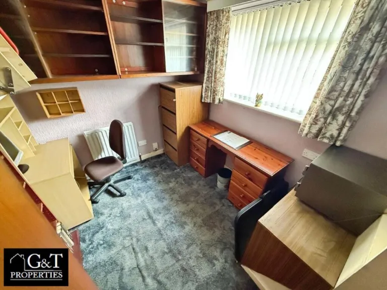
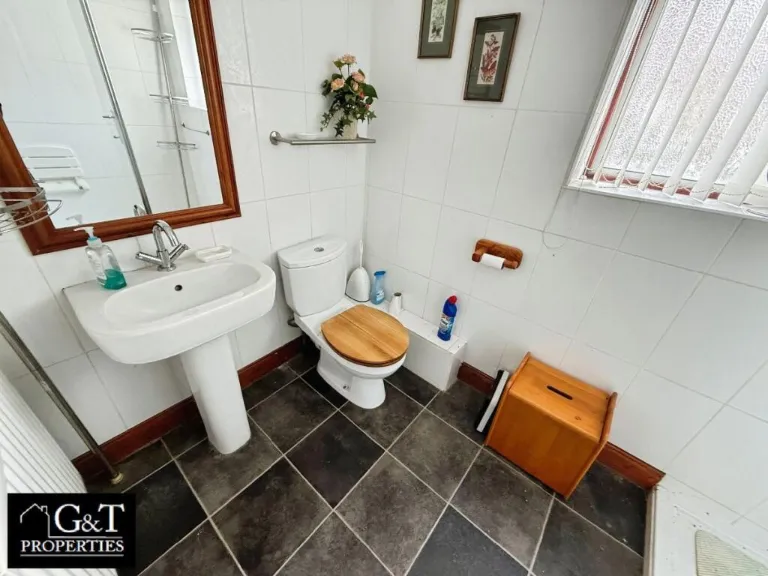
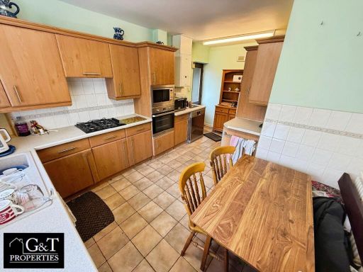
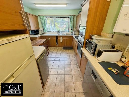
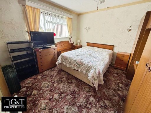
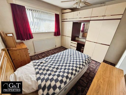
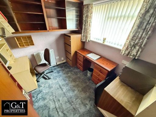
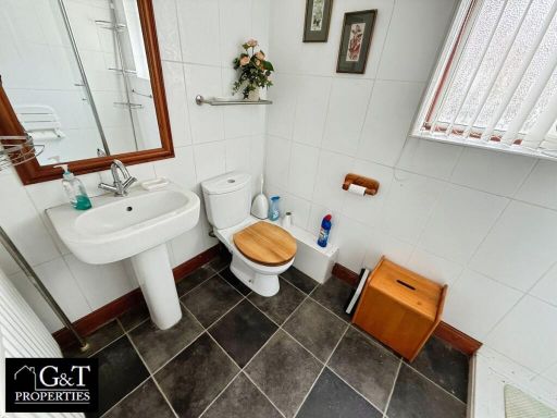
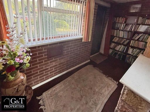
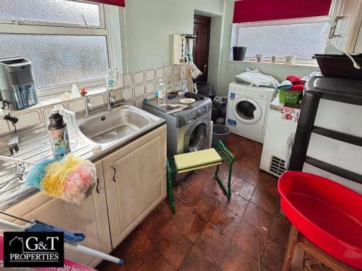
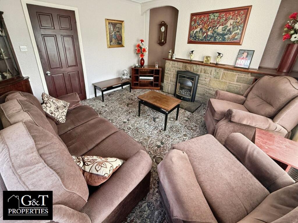
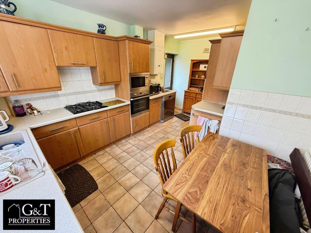
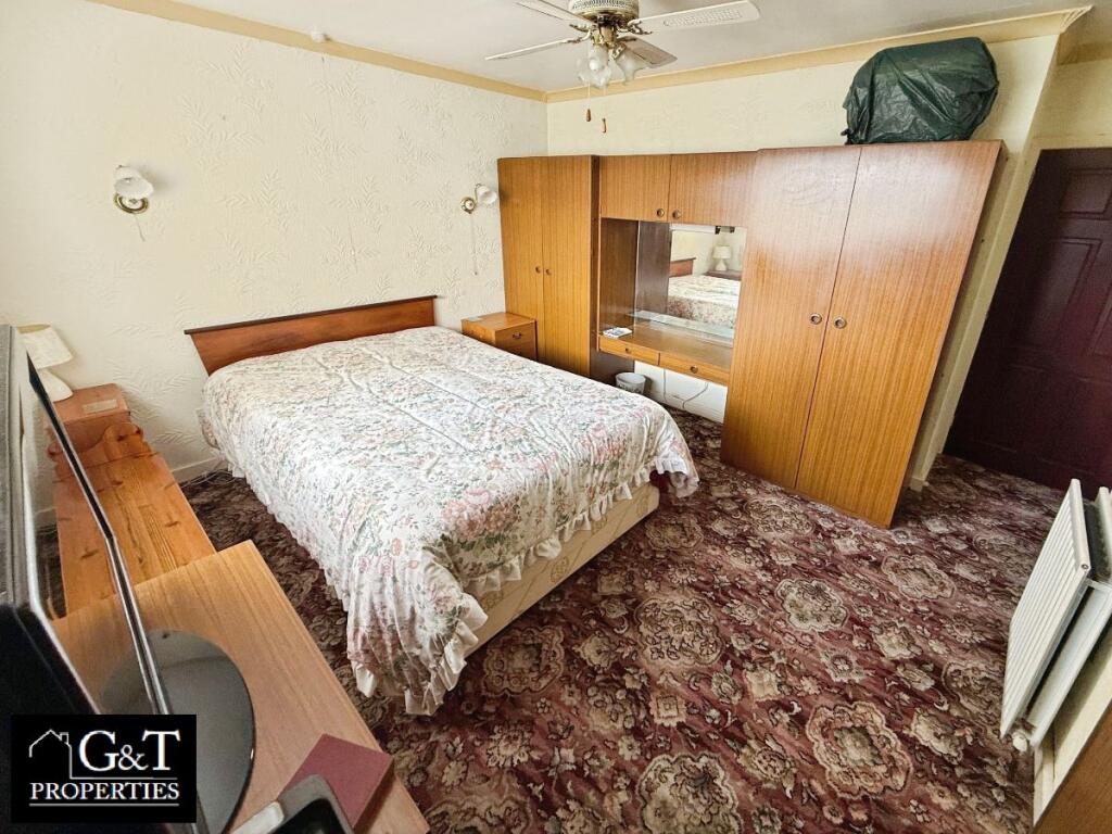
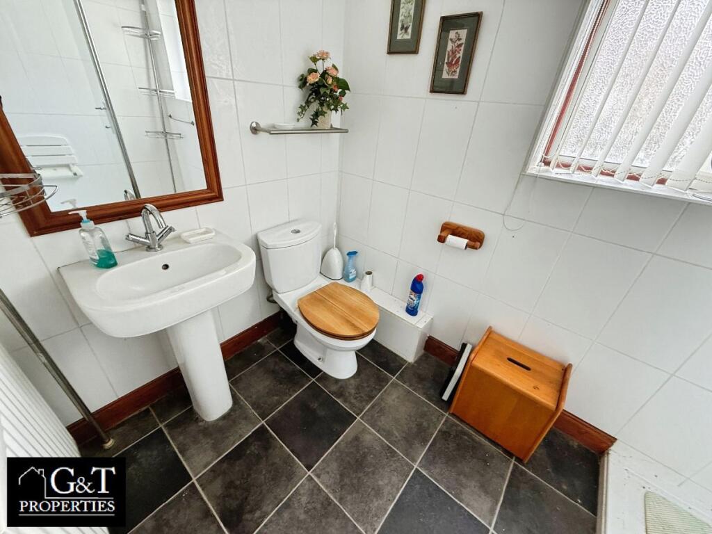
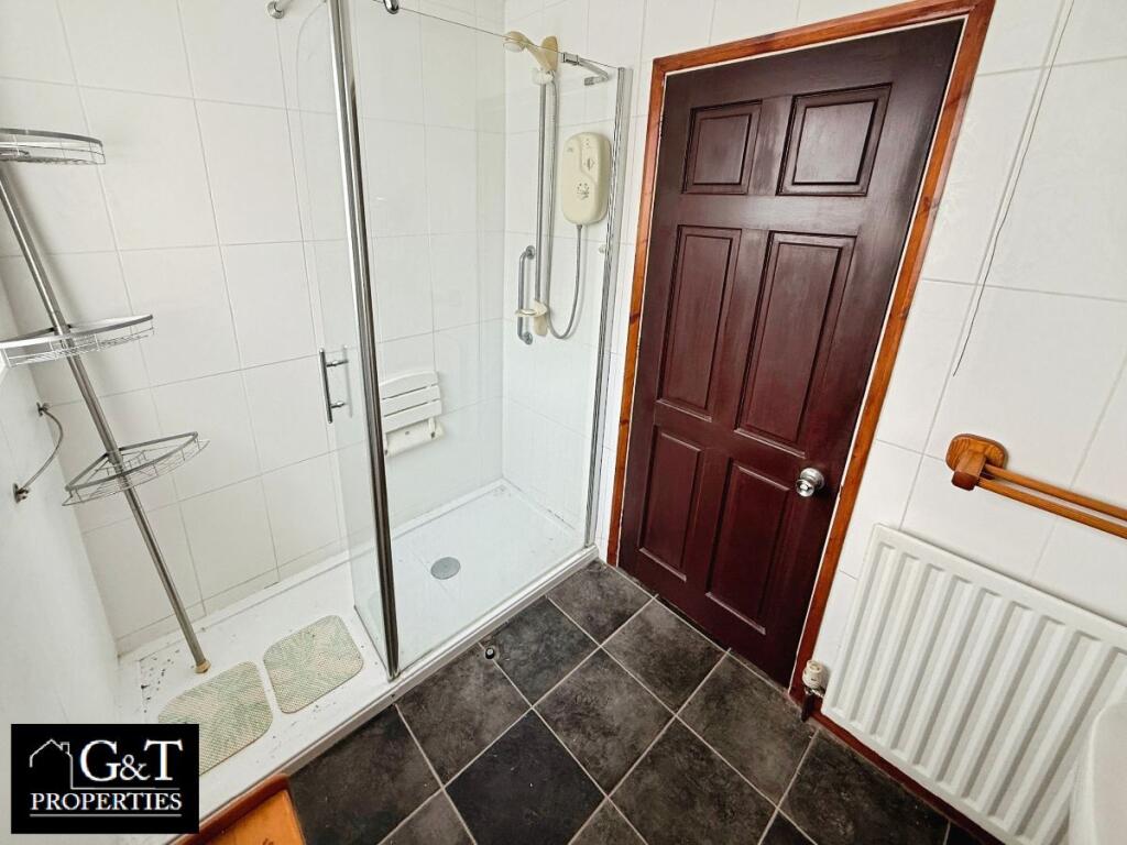
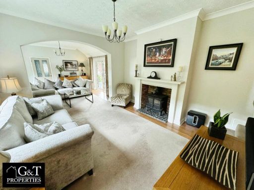
- Mid-20th century terraced/semi-detached style residential property (exact type/number of bedrooms not shown). Photographs show: a formal front lounge with fitted gas fireplace, patterned carpet and bay-style window treatment (average-sized lounge); a second reception/dining room with deep red carpet and large window, currently used for storage/office; a fitted kitchen with wooden units, tiled floor and space for a small dining table (average-sized kitchen). Overall condition appears dated and well lived-in — original/older fixtures and finishes, carpeting and joinery intact but likely in need of modernisation or cosmetic updating to achieve contemporary market expectations. No exterior/garden, bedroom or bathroom images provided, so plot size and total living area cannot be determined accurately. The property would suit an investor or buyer seeking a refurbishment project in an established residential area.
Image Descriptions
- detached house late 20th-century suburban
- detached house mid-20th century
Floorplan Description
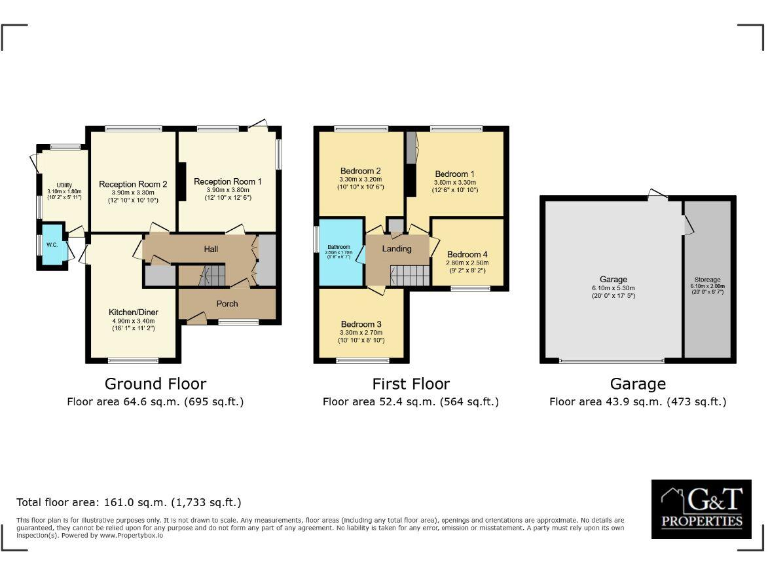
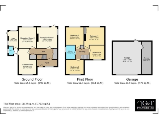
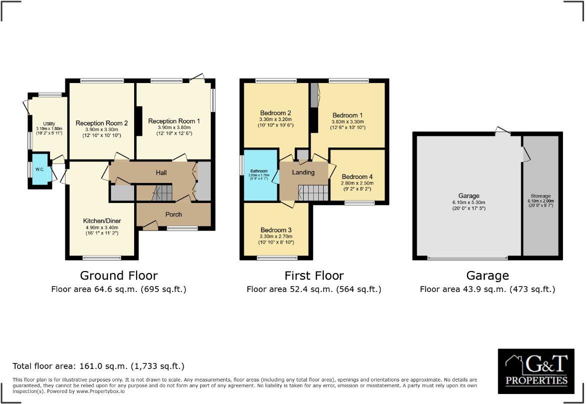
- Two-storey house (ground + first) with separate garage building.
Rooms
- Kitchen/Diner:
- Reception Room 1:
- Reception Room 2:
- Utility:
- Bedroom 1:
- Bedroom 2:
- Bedroom 3:
- Bedroom 4:
- Bathroom:
Textual Property Features
- Has Garden
- Chain Free
- Success
Detected Visual Features
- detached house
- brick exterior
- tile roof
- driveway
- suburban
- garden
- landscape
- needs gardening
- 1950s
- 1970s
- brick construction
- off-street parking
- garage
- period property
Nearby Schools
- Colley Lane Primary Academy
- Timbertree Academy
- Highfields Primary School
- Impact Independent School
- Springfield Primary School
- The Link Academy
- Sledmere Primary School
- Oakham Primary School
- Tividale Hall Primary School
- Beechwood Church of England Primary School
- Windsor High School and Sixth Form
- Cradley CofE Primary School
- Old Hill Primary School
- Corngreaves Academy
- Reddal Hill Primary School
- Northfield Road Primary School
- Kates Hill Primary School
- St Joseph's Catholic Primary School
- Temple Meadow Primary School
- Dudley Wood Primary School
- Brickhouse Primary School
- Netherton CofE Primary School
- Ormiston Forge Academy
- Netherbrook Primary School
- St Michael's Church of England High School
Nearest General Shops
- Id: 2697462018
- Tags:
- Name: Sun Trap Tanning Salon
- Shop: hairdresser
- TagsNormalized:
- tanning
- tanning salon
- hairdresser
- shop
- Lat: 52.4784997
- Lon: -2.0686495
- FullGeoHash: gcqd8cmtkvrh
- PartitionGeoHash: gcqd
- Images:
- FoodStandards: null
- Distance: 312.8
,- Id: 2697464939
- Tags:
- Name: Cozy Carpets
- Shop: carpet
- TagsNormalized:
- Lat: 52.4825444
- Lon: -2.0713237
- FullGeoHash: gcqd8f5syxm5
- PartitionGeoHash: gcqd
- Images:
- FoodStandards: null
- Distance: 172.9
,- Id: 70516846
- Tags:
- Building: retail
- Name: Scooter 2000
- Shop: motorcycle
- Source: visual survey;estimate;OS_OpenData_StreetView
- TagsNormalized:
- Lat: 52.4815692
- Lon: -2.0709113
- FullGeoHash: gcqd8cup238d
- PartitionGeoHash: gcqd
- Images:
- FoodStandards: null
- Distance: 67.5
}
Nearest Grocery shops
- Id: 2694621590
- Tags:
- Addr:
- Postcode: B64 6HU
- Street: Halesowen Road
- Fhrs:
- Name: Hazra Supermarket
- Shop: greengrocer
- Source:
- TagsNormalized:
- Lat: 52.4762791
- Lon: -2.0680111
- FullGeoHash: gcqd8cn07z7j
- PartitionGeoHash: gcqd
- Images:
- FoodStandards:
- Id: 53705
- FHRSID: 53705
- LocalAuthorityBusinessID: 12090
- BusinessName: Hazra Supermarket
- BusinessType: Retailers - other
- BusinessTypeID: 4613
- AddressLine1: 5-6 Trinity Centre
- AddressLine2: Halesowen Road
- AddressLine3: null
- AddressLine4: Cradley Heath
- PostCode: B64 6HU
- RatingValue: 3
- RatingKey: fhrs_3_en-GB
- RatingDate: 2021-08-02
- LocalAuthorityCode: 423
- LocalAuthorityName: Sandwell
- LocalAuthorityWebSite: http://www.sandwell.gov.uk/foodratings
- LocalAuthorityEmailAddress: ehts_enquiries@sandwell.gov.uk
- Scores:
- Hygiene: 10
- Structural: 10
- ConfidenceInManagement: 10
- NewRatingPending: false
- Geocode:
- Longitude: -2.06825500000000
- Latitude: 52.47684100000000
- Distance: 561.5
,- Id: 2694657815
- Tags:
- Name: Hales Convience Store and Off-License
- Shop: convenience
- TagsNormalized:
- Lat: 52.4766288
- Lon: -2.0676892
- FullGeoHash: gcqd8cn6e2eh
- PartitionGeoHash: gcqd
- Images:
- FoodStandards: null
- Distance: 530.7
,- Id: 2694631748
- Tags:
- Addr:
- Housenumber: 188
- Postcode: B64 6HU
- Street: Halesowen Road
- Fhrs:
- Name: M Sajid News and Superstore
- Shop: convenience
- Source:
- TagsNormalized:
- Lat: 52.4769865
- Lon: -2.0680889
- FullGeoHash: gcqd8cnhd531
- PartitionGeoHash: gcqd
- Images:
- FoodStandards:
- Id: 575753
- FHRSID: 575753
- LocalAuthorityBusinessID: 72743
- BusinessName: Sajid Newsagents
- BusinessType: Retailers - other
- BusinessTypeID: 4613
- AddressLine1: null
- AddressLine2: 188 Halesowen Road
- AddressLine3: null
- AddressLine4: Cradley Heath
- PostCode: B64 6HU
- RatingValue: 4
- RatingKey: fhrs_4_en-GB
- RatingDate: 2019-10-07
- LocalAuthorityCode: 423
- LocalAuthorityName: Sandwell
- LocalAuthorityWebSite: http://www.sandwell.gov.uk/foodratings
- LocalAuthorityEmailAddress: ehts_enquiries@sandwell.gov.uk
- Scores:
- Hygiene: 0
- Structural: 10
- ConfidenceInManagement: 5
- NewRatingPending: false
- Geocode:
- Longitude: -2.06825500000000
- Latitude: 52.47684100000000
- Distance: 484.5
}
Nearest Religious buildings
- Id: 267417567
- Tags:
- Amenity: place_of_worship
- Building: church
- Denomination: catholic
- Name: Our Lady of Lourdes Catholic Church
- Religion: christian
- TagsNormalized:
- place of worship
- church
- catholic
- christian
- Lat: 52.4755877
- Lon: -2.0682943
- FullGeoHash: gcqd8bvumnxc
- PartitionGeoHash: gcqd
- Images:
- FoodStandards: null
- Distance: 631.9
,- Id: 300266219
- Tags:
- Addr:
- Postcode: B64 5SA
- Street: Highgate Street
- Amenity: place_of_worship
- Building: church
- Fhrs:
- Name: St. James Wesleyan Reform Church
- Religion: christian
- Source:
- TagsNormalized:
- place of worship
- church
- christian
- Lat: 52.4778477
- Lon: -2.0633896
- FullGeoHash: gcqd9133xec5
- PartitionGeoHash: gcqd
- Images:
- FoodStandards: null
- Distance: 589
,- Id: 70478345
- Tags:
- Amenity: place_of_worship
- Building: yes
- Name: Wesley Bible Institute Church
- Religion: christian
- Source: visual survey;OS_OpenData_StreetView
- TagsNormalized:
- place of worship
- church
- christian
- Lat: 52.485276
- Lon: -2.0725319
- FullGeoHash: gcqd8fdufs84
- PartitionGeoHash: gcqd
- Images:
- FoodStandards: null
- Distance: 485.3
}
Nearest Medical buildings
- Id: 2694637238
- Tags:
- Amenity: clinic
- Healthcare: clinic
- Name: Footworks Chiropody Clinic Ltd.
- TagsNormalized:
- Lat: 52.4759175
- Lon: -2.0677311
- FullGeoHash: gcqd8byq6k5b
- PartitionGeoHash: gcqd
- Images:
- FoodStandards: null
- Distance: 605.4
,- Id: 538273171
- Tags:
- Amenity: pharmacy
- Healthcare: pharmacy
- Name: Peaches Pharamacy
- Source: survey
- TagsNormalized:
- Lat: 52.4762645
- Lon: -2.0678153
- FullGeoHash: gcqd8cn22ktn
- PartitionGeoHash: gcqd
- Images:
- FoodStandards: null
- Distance: 566.7
,- Id: 2694762532
- Tags:
- Addr:
- Postcode: B64 5JE
- Street: Reddal Hill Road
- Amenity: nursing_home
- Fhrs:
- Name: Roxburgh House Health Care
- Source:
- TagsNormalized:
- Lat: 52.4764017
- Lon: -2.0730536
- FullGeoHash: gcqd8c43nq71
- PartitionGeoHash: gcqd
- Images:
- FoodStandards:
- Id: 117378
- FHRSID: 117378
- LocalAuthorityBusinessID: 4661
- BusinessName: Roxburgh Residential Care Home - HC-One Ltd
- BusinessType: Hospitals/Childcare/Caring Premises
- BusinessTypeID: 5
- AddressLine1: Roxburgh Nursing Home
- AddressLine2: Reddal Hill Road
- AddressLine3: null
- AddressLine4: Cradley Heath
- PostCode: B64 5JE
- RatingValue: 5
- RatingKey: fhrs_5_en-GB
- RatingDate: 2022-03-03
- LocalAuthorityCode: 423
- LocalAuthorityName: Sandwell
- LocalAuthorityWebSite: http://www.sandwell.gov.uk/foodratings
- LocalAuthorityEmailAddress: ehts_enquiries@sandwell.gov.uk
- Scores:
- Hygiene: 0
- Structural: 5
- ConfidenceInManagement: 5
- NewRatingPending: false
- Geocode:
- Longitude: -2.07209800000000
- Latitude: 52.47669500000000
- Distance: 562.8
,- Id: 2697462338
- Tags:
- Amenity: dentist
- Healthcare: dentist
- Name: Mucklow Homer Dental Surgeons
- TagsNormalized:
- dentist
- health
- healthcare
- dental
- Lat: 52.4789595
- Lon: -2.0681098
- FullGeoHash: gcqd8cw01e1e
- PartitionGeoHash: gcqd
- Images:
- FoodStandards: null
- Distance: 281.5
}
Nearest Airports
- Id: 2437117
- Tags:
- Aerodrome: international
- Aerodrome:type: public
- Aeroway: aerodrome
- Ele: 104
- Iata: BHX
- Icao: EGBB
- Internet_access: wlan
- Is_in: Birmingham,England,UK
- Name: Birmingham Airport
- Ref: BHX
- Type: multipolygon
- Website: https://www.birminghamairport.co.uk/
- Wikidata: Q8719
- Wikipedia: en:Birmingham Airport
- TagsNormalized:
- airport
- international airport
- Lat: 52.4543817
- Lon: -1.7468974
- FullGeoHash: gcqf2jpbym6y
- PartitionGeoHash: gcqf
- Images:
- FoodStandards: null
- Distance: 22101.2
}
Nearest Leisure Facilities
- Id: 1131705014
- Tags:
- Leisure: playground
- Source: visual survey;estimate
- TagsNormalized:
- Lat: 52.4787029
- Lon: -2.0766978
- FullGeoHash: gcqd89ry97mb
- PartitionGeoHash: gcqd
- Images:
- FoodStandards: null
- Distance: 518.3
,- Id: 1131705013
- Tags:
- Leisure: pitch
- Sport: basketball
- TagsNormalized:
- pitch
- leisure
- basketball
- sports
- Lat: 52.4788851
- Lon: -2.076754
- FullGeoHash: gcqd89rz8j5z
- PartitionGeoHash: gcqd
- Images:
- FoodStandards: null
- Distance: 511.3
,- Id: 280813587
- Tags:
- Leisure: park
- Source: bing
- TagsNormalized:
- Lat: 52.4822885
- Lon: -2.0768633
- FullGeoHash: gcqd8dpemxdm
- PartitionGeoHash: gcqd
- Images:
- FoodStandards: null
- Distance: 469.5
,- Id: 307596782
- Tags:
- Leisure: park
- Source: bing
- TagsNormalized:
- Lat: 52.4782469
- Lon: -2.0748118
- FullGeoHash: gcqd8c35vqk0
- PartitionGeoHash: gcqd
- Images:
- FoodStandards: null
- Distance: 450
,- Id: 2697465345
- Tags:
- Leisure: sports_centre
- Name: Central House Fitness centre
- TagsNormalized:
- sports
- sports centre
- leisure
- fitness
- fitness centre
- Lat: 52.4828008
- Lon: -2.0717073
- FullGeoHash: gcqd8f5qmxpj
- PartitionGeoHash: gcqd
- Images:
- FoodStandards: null
- Distance: 210.3
}
Nearest Tourist attractions
- Id: 827739460
- Tags:
- Source: visual survey;estimate
- Tourism: picnic_site
- TagsNormalized:
- Lat: 52.4692693
- Lon: -2.1087356
- FullGeoHash: gcqd2p8rwusy
- PartitionGeoHash: gcqd
- Images:
- FoodStandards: null
- Distance: 2926.2
,- Id: 556203244
- Tags:
- Name: Haden Hill House Museum
- Source: survey
- Tourism: museum
- Wikidata: Q5637740
- TagsNormalized:
- Lat: 52.4679382
- Lon: -2.0623563
- FullGeoHash: gcqd3p6pzsed
- PartitionGeoHash: gcqd
- Images:
- FoodStandards: null
- Distance: 1562.1
,- Id: 245398147
- Tags:
- Building: yes
- Name: Cobb's Engine House
- Tourism: attraction
- TagsNormalized:
- Lat: 52.4927957
- Lon: -2.0690943
- FullGeoHash: gcqd8uj2dw77
- PartitionGeoHash: gcqd
- Images:
- FoodStandards: null
- Distance: 1296.8
}
Nearest Hotels
- Id: 146352713
- Tags:
- Addr:
- Postcode: DY5 1LE
- Street: Dudley Road
- Brand: Travelodge
- Brand:wikidata: Q9361374
- Brand:wikipedia: en:Travelodge UK
- Fhrs:
- Authority: Dudley
- Id: 500389
- Local_authority_id: PI/000019168
- Internet_access: wlan
- Internet_access:fee: customers
- Internet_access:ssid: Travelodge WiFi
- Name: Travelodge
- Source:
- Tourism: hotel
- TagsNormalized:
- Lat: 52.4896351
- Lon: -2.1179958
- FullGeoHash: gcq6xg3wr15v
- PartitionGeoHash: gcq6
- Images:
- FoodStandards: null
- Distance: 3372
,- Id: 55493030
- Tags:
- Addr:
- City: Dudley
- Place: Merry Hill
- Postcode: DY5 1UR
- Street: Level Street
- Building: yes
- Fhrs:
- Name: Copthorne Hotel Merry Hill Dudley
- Source: OS_OpenData_StreetView;survey
- Tourism: hotel
- TagsNormalized:
- Lat: 52.4849637
- Lon: -2.1153333
- FullGeoHash: gcq6xfeej4m5
- PartitionGeoHash: gcq6
- Images:
- FoodStandards: null
- Distance: 3086.5
,- Id: 361132359
- Tags:
- Name: Highfield House Hotel
- Source: survey
- Tourism: hotel
- TagsNormalized:
- Lat: 52.4750216
- Lon: -2.0478193
- FullGeoHash: gcqd92uc4m52
- PartitionGeoHash: gcqd
- Images:
- FoodStandards: null
- Distance: 1661.1
}
Tags
- detached house
- brick exterior
- tile roof
- driveway
- suburban
- garden
- landscape
- needs gardening
- detached house
- 1950s
- 1970s
- brick construction
- driveway
- off-street parking
- garage
- garden
- period property
Local Market Stats
- Average Price/sqft: £218
- Avg Income: £36100
- Rental Yield: 4.8%
- Social Housing: 24%
- Planning Success Rate: 94%
Similar Properties
 4 bedroom detached house for sale in Corngreaves Road, Cradley Heath, B64 — £450,000 • 4 bed • 2 bath • 2598 ft²
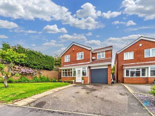 4 bedroom detached house for sale in MARTINDALE WALK, Brierley Hill, DY5 2RX, DY5 — £365,000 • 4 bed • 1 bath • 1131 ft²
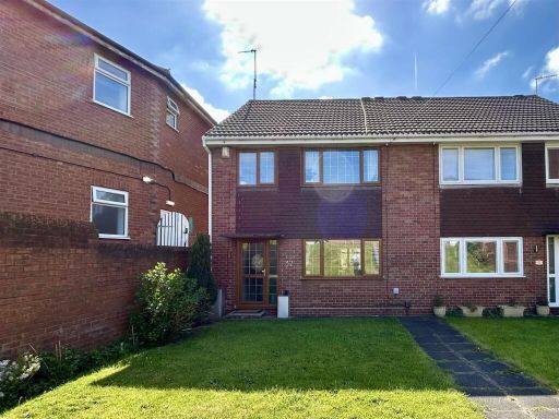 4 bedroom semi-detached house for sale in Reddal Hill Road, Cradley Heath, B64 — £300,000 • 4 bed • 2 bath • 1290 ft²
 4 bedroom detached house for sale in Quincy Rise, Brierley Hill, DY5 — £400,000 • 4 bed • 2 bath • 1103 ft²
 4 bedroom detached house for sale in The Crescent, Cradley Heath, B64 — £385,000 • 4 bed • 1 bath • 1035 ft²
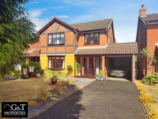 3 bedroom detached house for sale in Mere Road, Stourbridge, DY8 — £465,000 • 3 bed • 2 bath • 1414 ft²
Meta
- {
"@context": "https://schema.org",
"@type": "Residence",
"name": "4 bedroom detached house for sale in Halesowen Road, Cradle…",
"description": "",
"url": "https://propertypiper.co.uk/property/af332d32-115a-4d5e-8950-15a01af6064a",
"image": "https://image-a.propertypiper.co.uk/93a9dcfa-d613-420e-9b0e-965f5c7f461b-1024.jpeg",
"address": {
"@type": "PostalAddress",
"streetAddress": "Halesowen Road, Cradley Heath",
"postalCode": "B64 5NL",
"addressLocality": "Sandwell",
"addressRegion": "Halesowen and Rowley Regis",
"addressCountry": "England"
},
"geo": {
"@type": "GeoCoordinates",
"latitude": 52.4811523,
"longitude": -2.0701863
},
"numberOfRooms": 4,
"numberOfBathroomsTotal": 2,
"floorSize": {
"@type": "QuantitativeValue",
"value": 1259,
"unitCode": "FTK"
},
"offers": {
"@type": "Offer",
"price": 375000,
"priceCurrency": "GBP",
"availability": "https://schema.org/InStock"
},
"additionalProperty": [
{
"@type": "PropertyValue",
"name": "Feature",
"value": "detached house"
},
{
"@type": "PropertyValue",
"name": "Feature",
"value": "brick exterior"
},
{
"@type": "PropertyValue",
"name": "Feature",
"value": "tile roof"
},
{
"@type": "PropertyValue",
"name": "Feature",
"value": "driveway"
},
{
"@type": "PropertyValue",
"name": "Feature",
"value": "suburban"
},
{
"@type": "PropertyValue",
"name": "Feature",
"value": "garden"
},
{
"@type": "PropertyValue",
"name": "Feature",
"value": "landscape"
},
{
"@type": "PropertyValue",
"name": "Feature",
"value": "needs gardening"
},
{
"@type": "PropertyValue",
"name": "Feature",
"value": "detached house"
},
{
"@type": "PropertyValue",
"name": "Feature",
"value": "1950s"
},
{
"@type": "PropertyValue",
"name": "Feature",
"value": "1970s"
},
{
"@type": "PropertyValue",
"name": "Feature",
"value": "brick construction"
},
{
"@type": "PropertyValue",
"name": "Feature",
"value": "driveway"
},
{
"@type": "PropertyValue",
"name": "Feature",
"value": "off-street parking"
},
{
"@type": "PropertyValue",
"name": "Feature",
"value": "garage"
},
{
"@type": "PropertyValue",
"name": "Feature",
"value": "garden"
},
{
"@type": "PropertyValue",
"name": "Feature",
"value": "period property"
}
]
}
High Res Floorplan Images
Compatible Floorplan Images
FloorplanImages Thumbnail