ME10 1HY - 3 bedroom semidetached house for sale in Connaught Road, Si…
View on Property Piper
3 bedroom semi-detached house for sale in Connaught Road, Sittingbourne, ME10
Property Details
- Price: £300000
- Bedrooms: 3
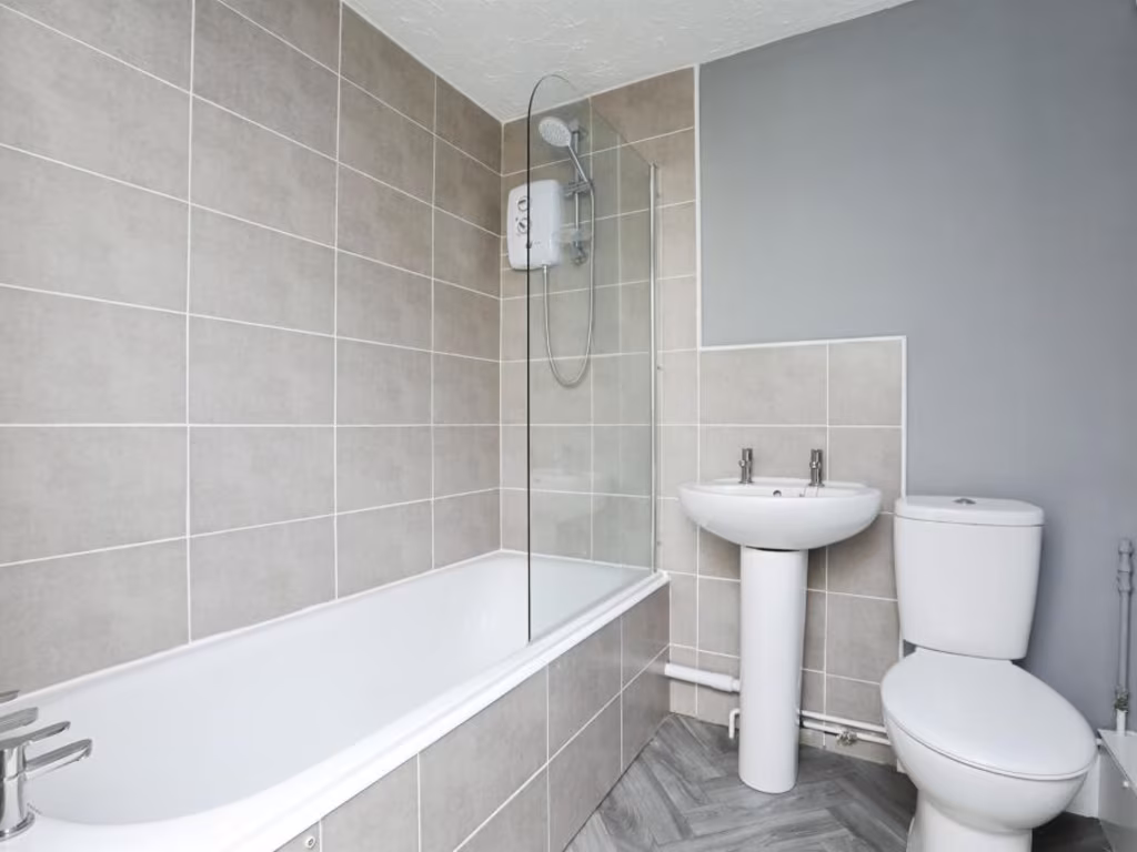
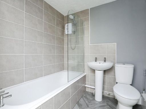
- Bathrooms: 1
- Property Type: undefined
- Property SubType: undefined
Brochure Descriptions
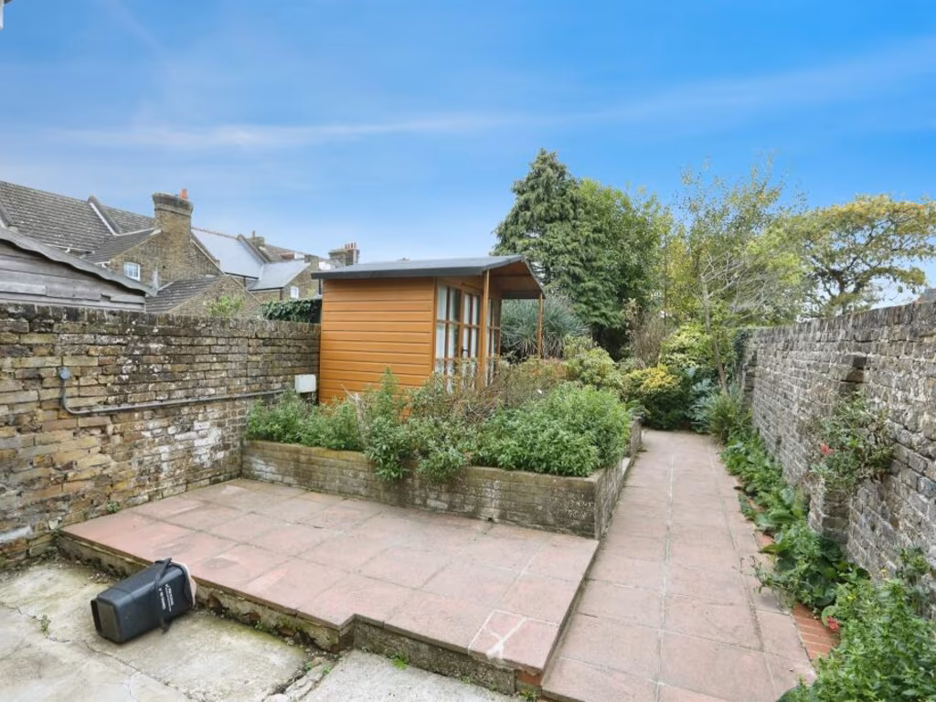
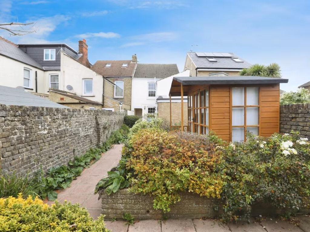
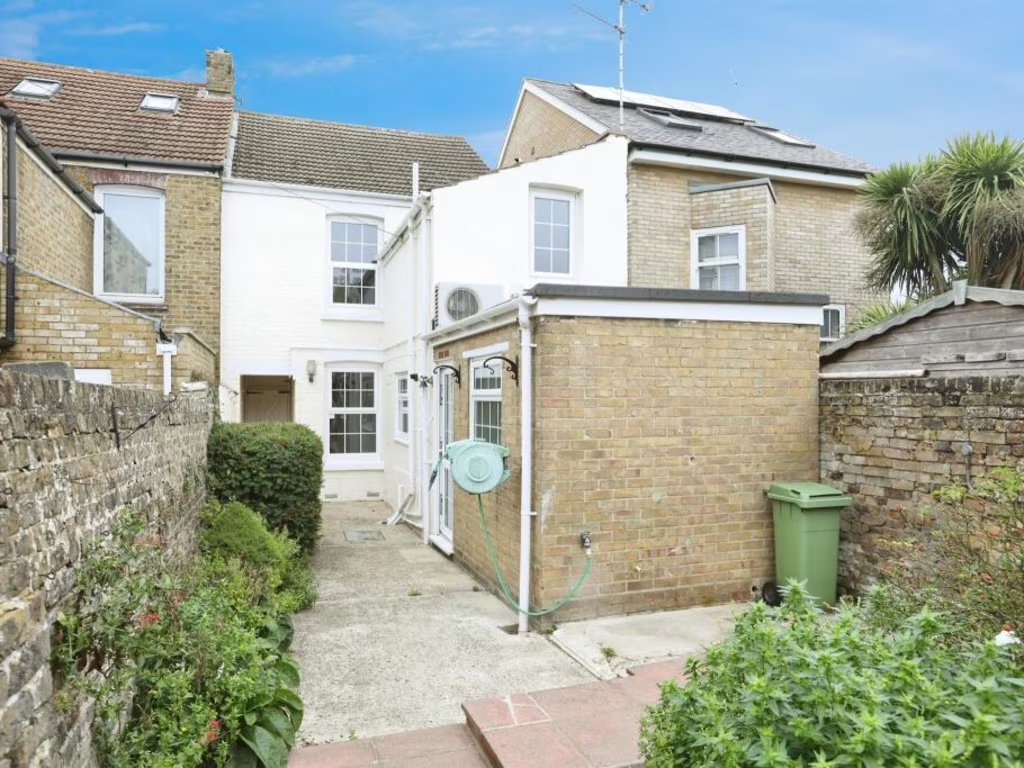
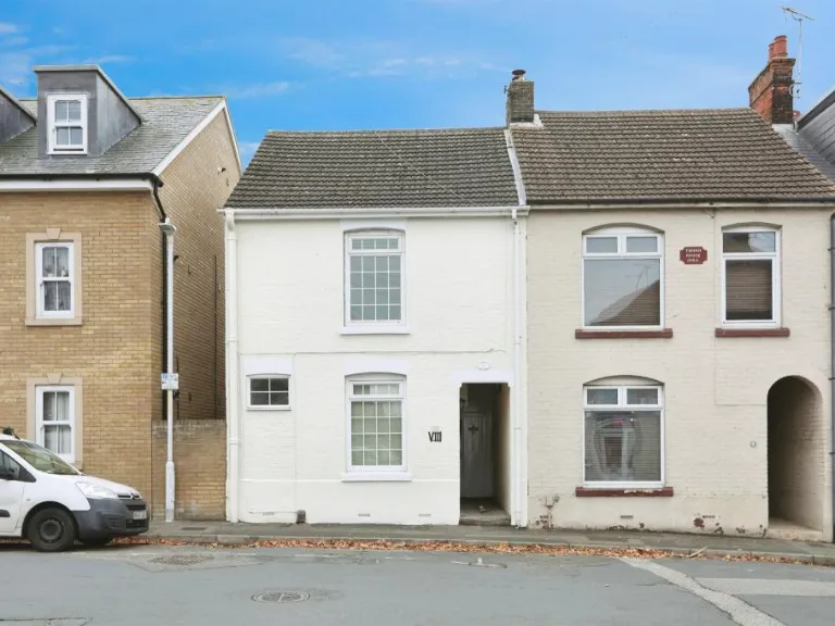
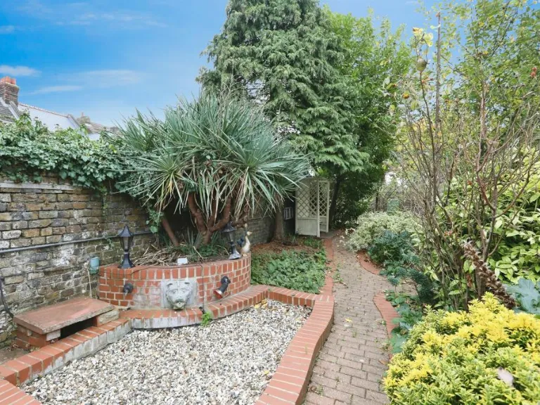
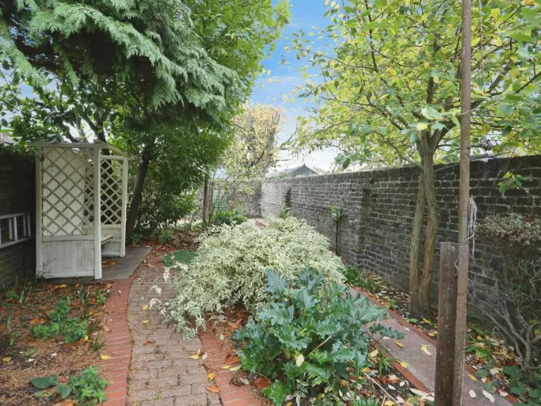
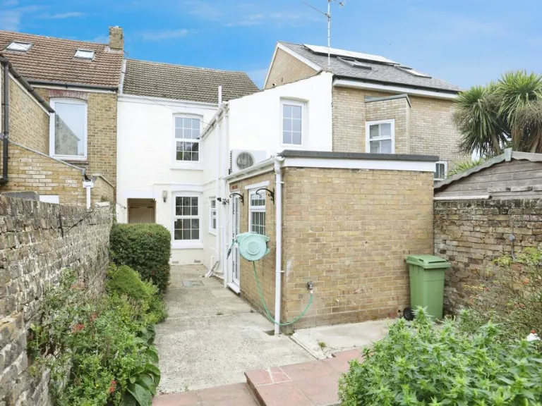
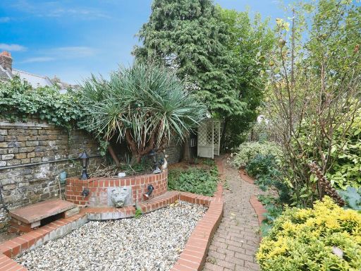
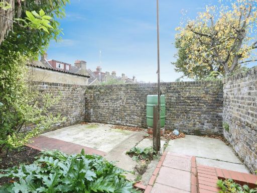
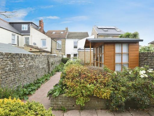
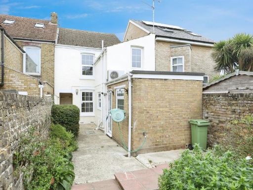
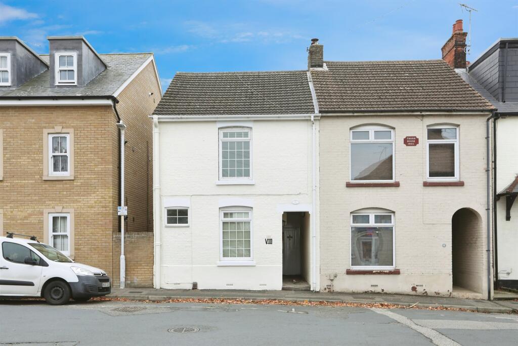
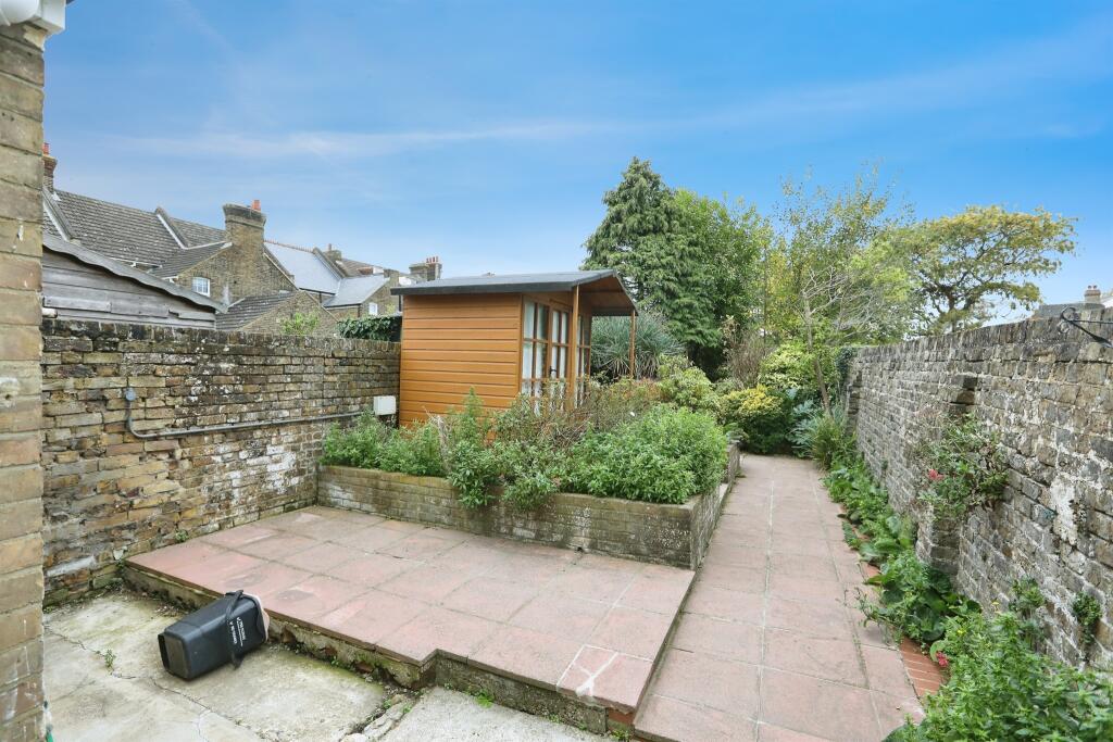
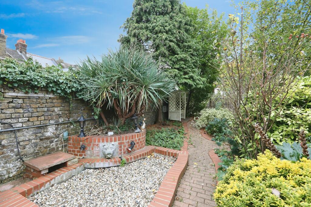
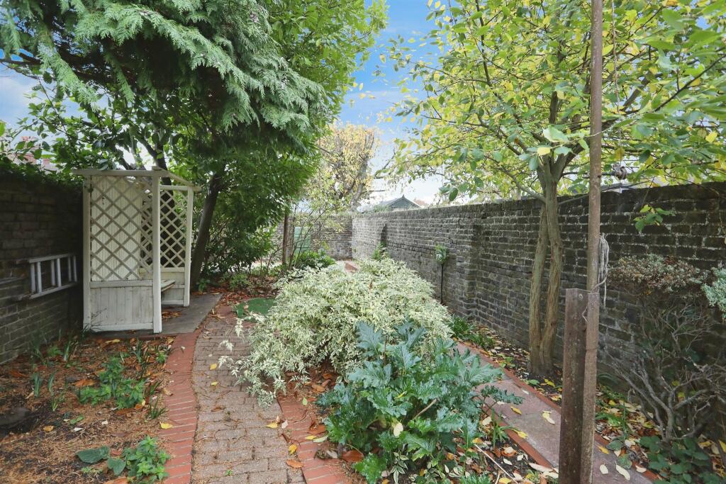
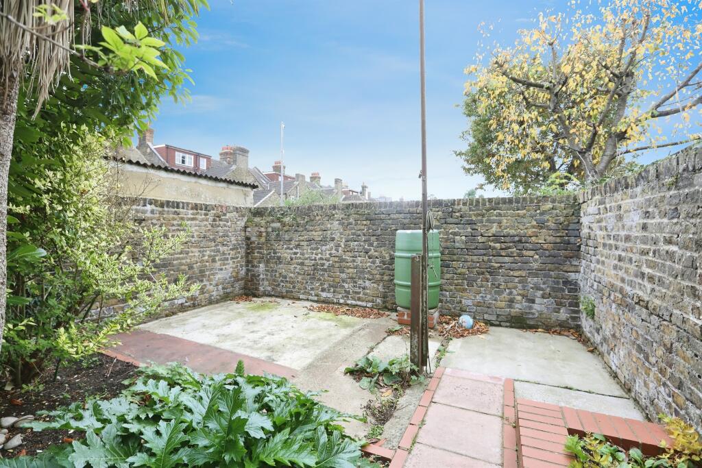
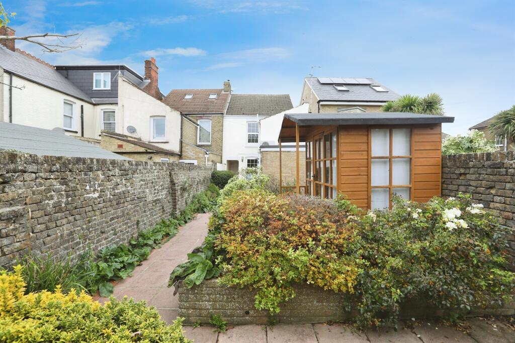
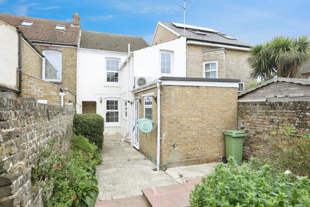
- Mid‑terraced, two‑storey period townhouse finished in painted brick. The property presents a narrow street frontage with a recessed entrance passage and sash-style windows. Roof is pitched with plain tiles and there is a neighbouring archway/through‑pass to the right. Suitable for town-centre living with on‑street parking; no private front garden visible from the frontage. Overall plot appears typical of older terrace houses in a small‑town setting — compact internal footprint and likely modest rear yard/garden (small). Good potential for refurbishment and rental income; condition externally appears fair with scope for modernisation internally. No exceptional views visible.
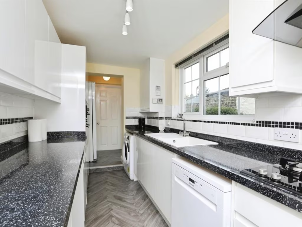
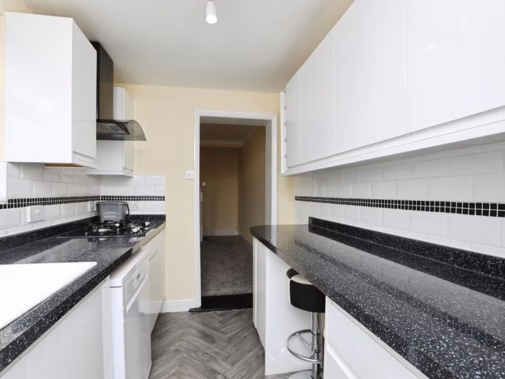
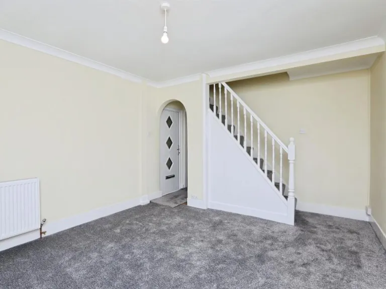
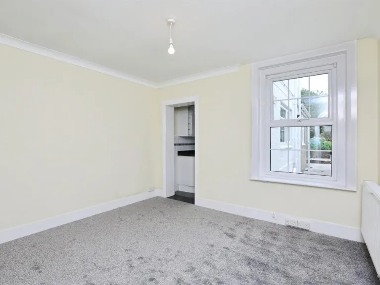
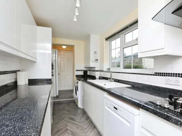
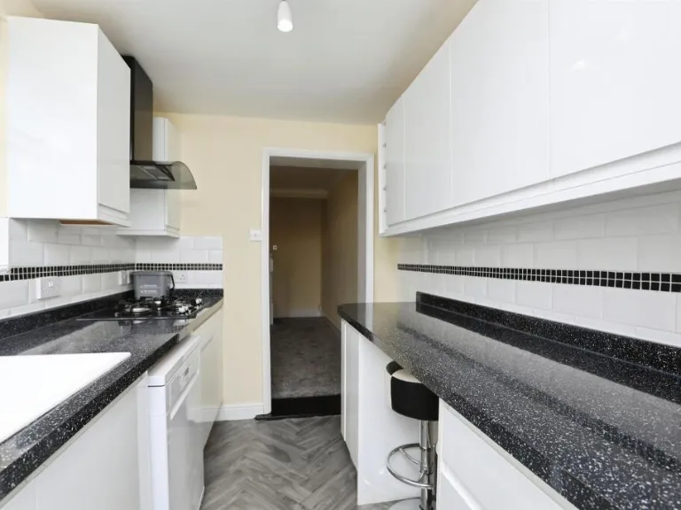
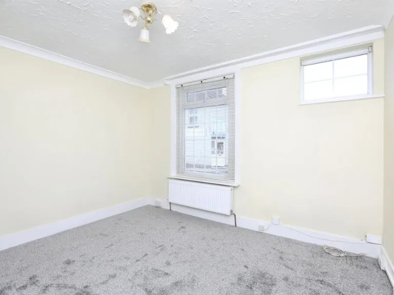
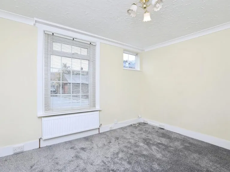
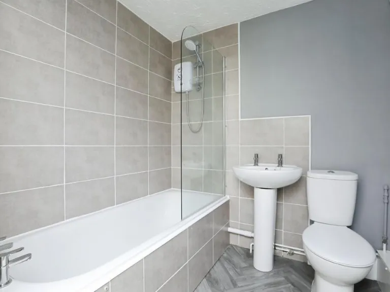
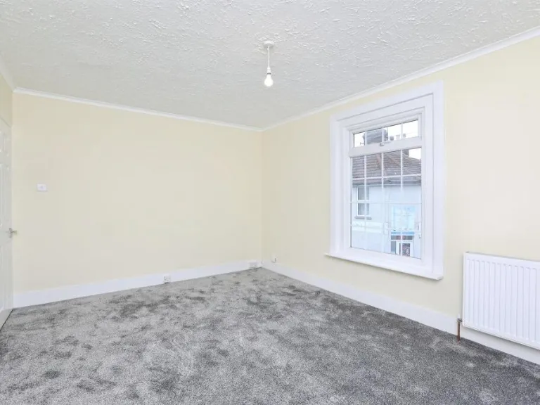
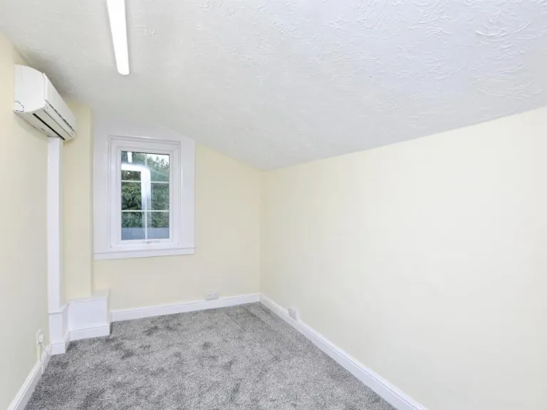
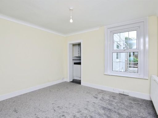
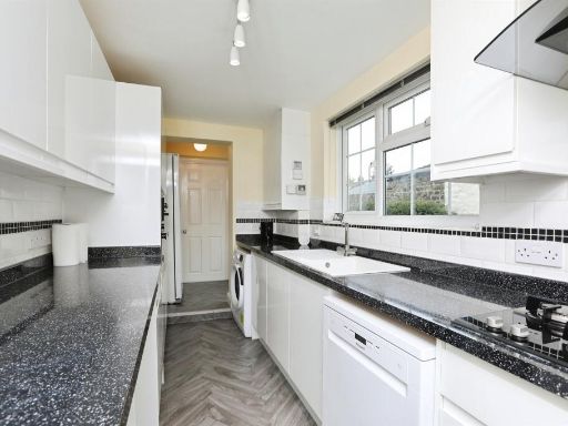
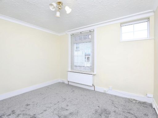
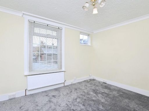
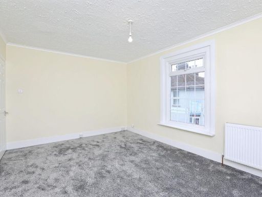
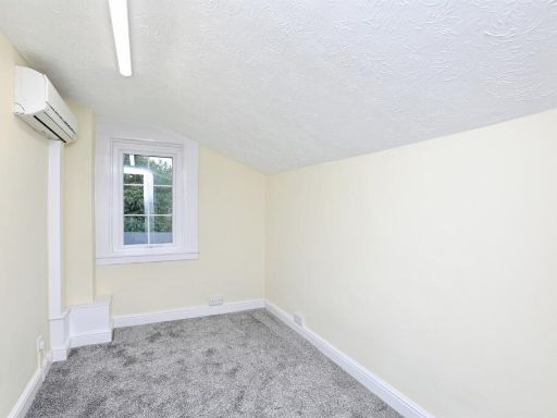
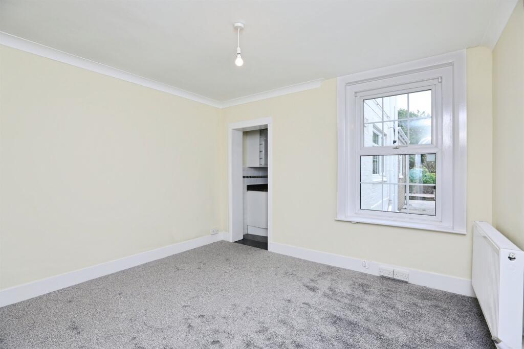
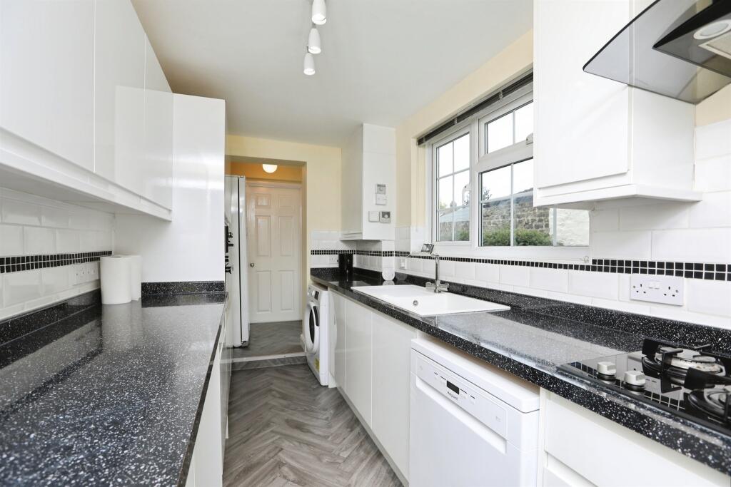
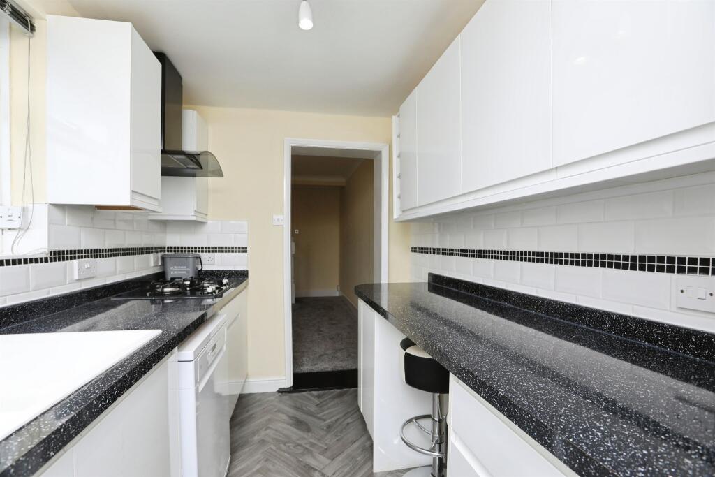
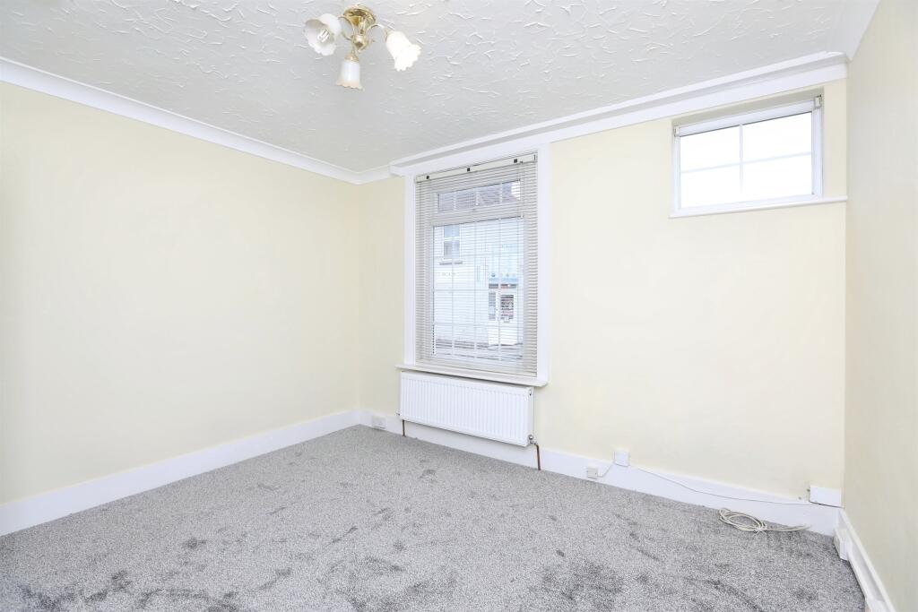
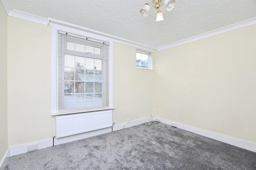
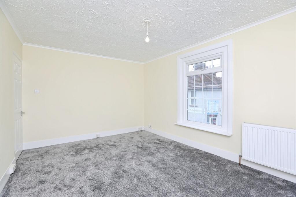
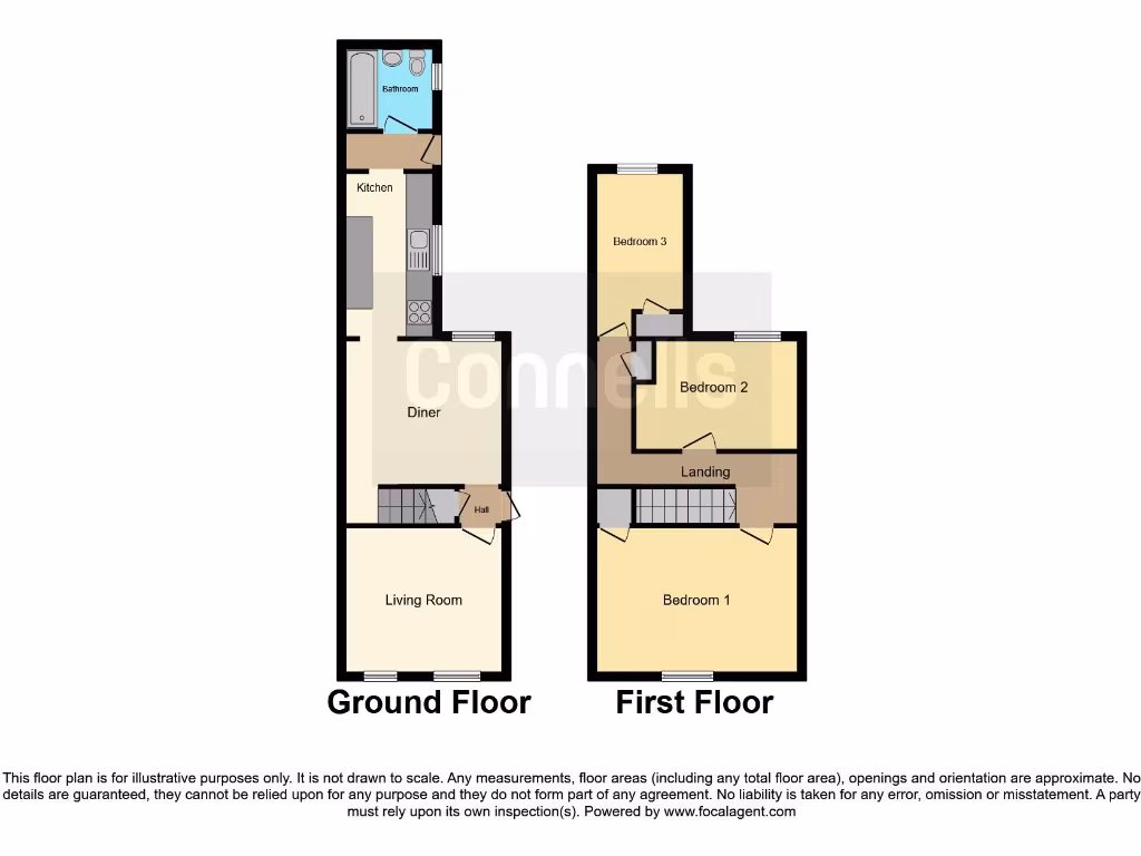
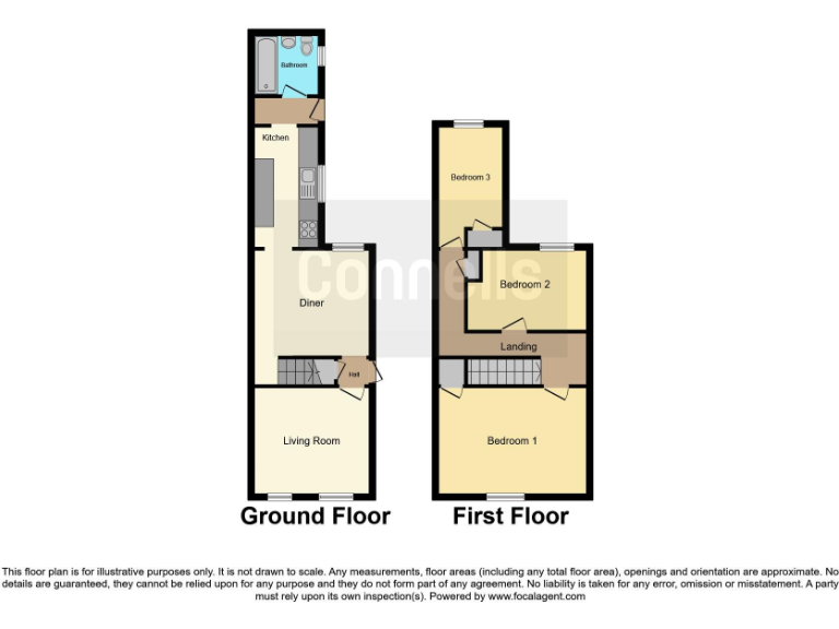
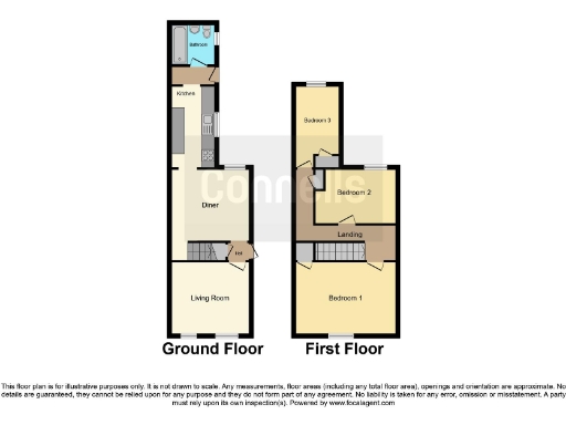
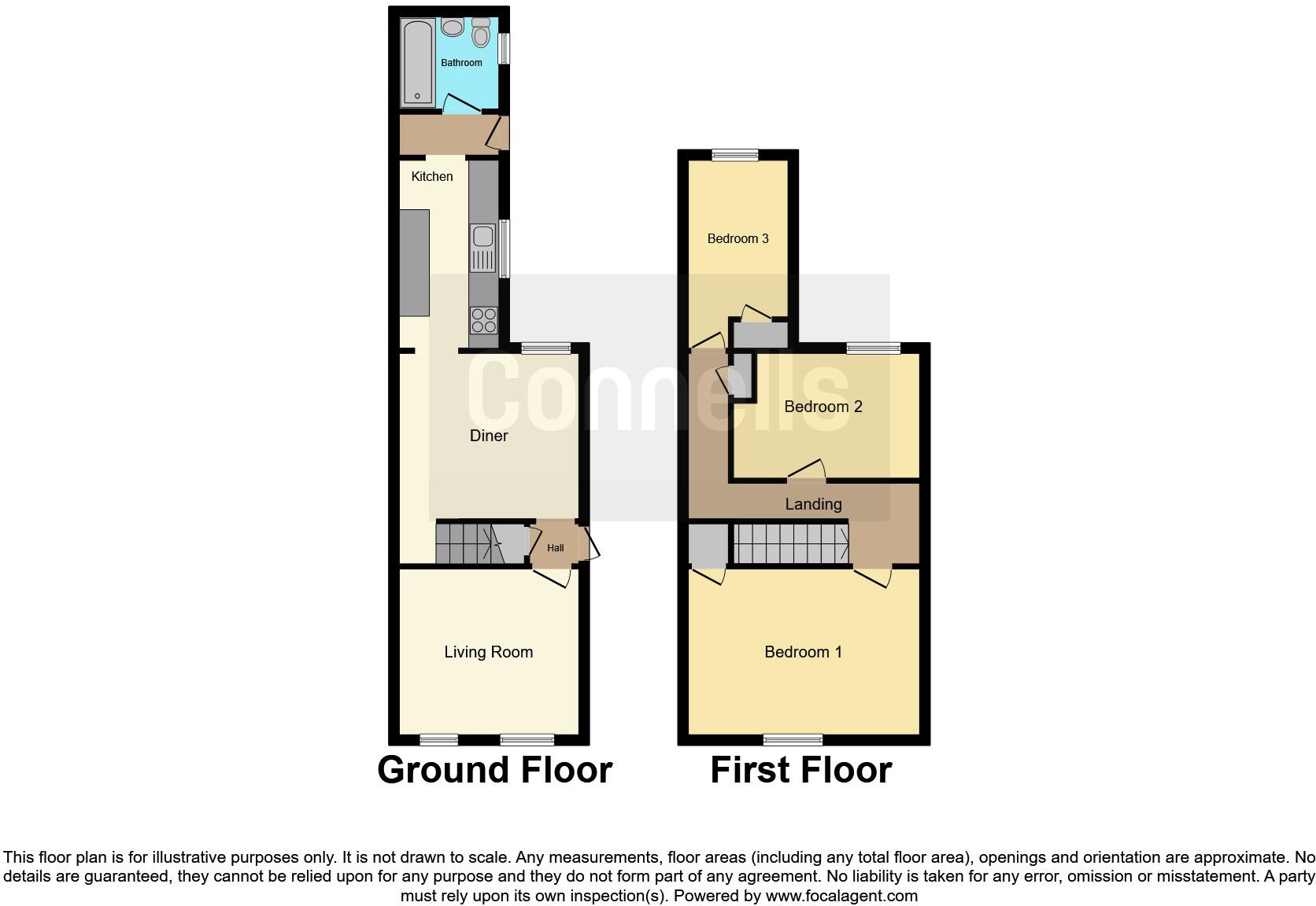
- Mid-terrace / through-house presented as a narrow, long two-storey dwelling shown on a floorplan. Ground floor: front living room, central dining area, long rear kitchen and a bathroom at the very rear. First floor: three bedrooms accessed from a central landing. Footprint indicates a compact urban family home with limited footprint but full two-storey layout. Room sizes generally small to average; overall property appears small-to-medium in total size suitable for a small family or as an investment. No clear external views (garden or street scene) are shown in the image.
Image Descriptions
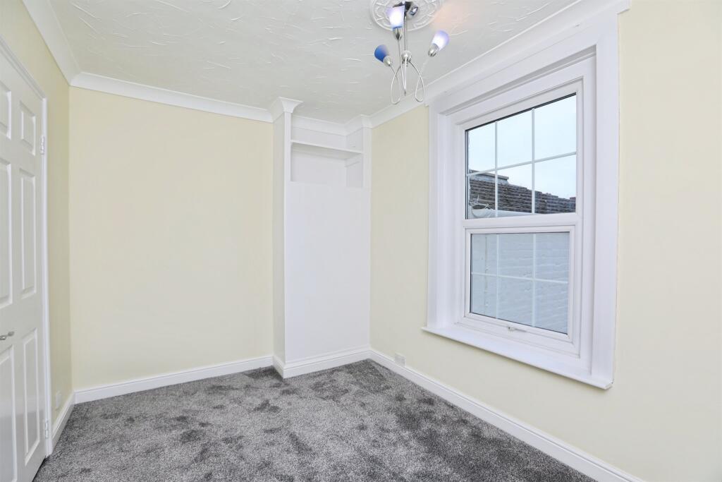
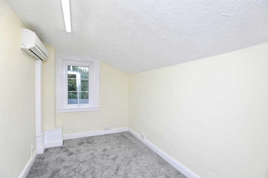
- period terraced house Victorian
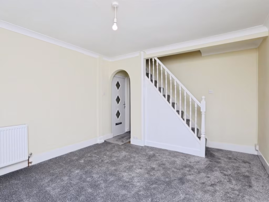
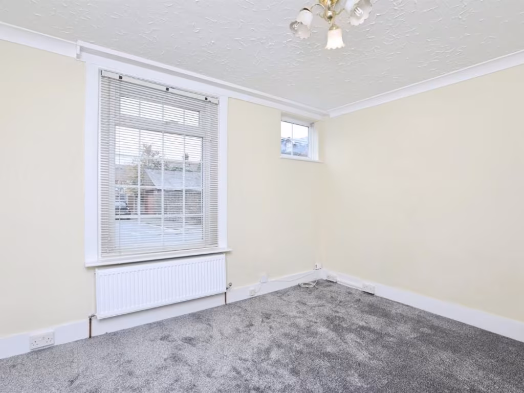
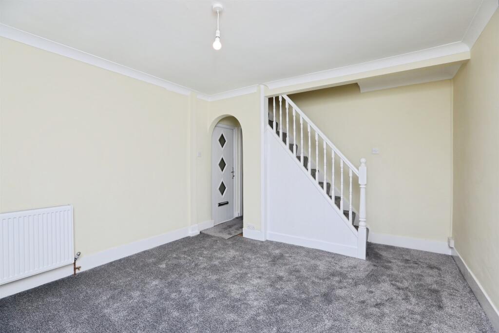
- living room modern
Floorplan Description
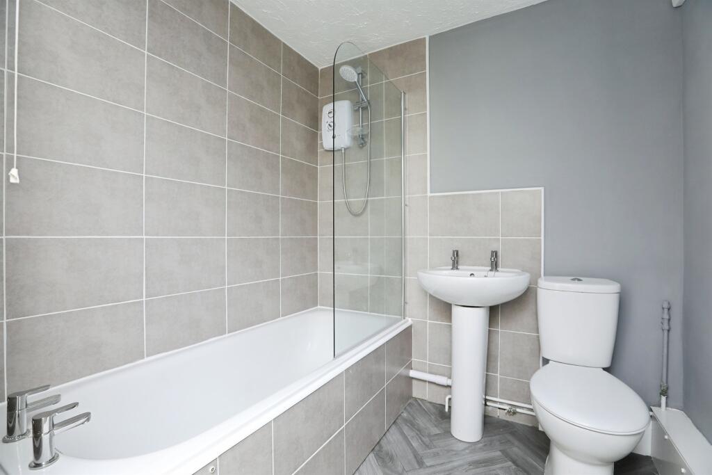
- Three-bedroom, two-floor property with living room, diner, kitchen and bathroom.
Rooms
- Living Room:
- Diner:
- Kitchen:
- Bathroom:
- Hall:
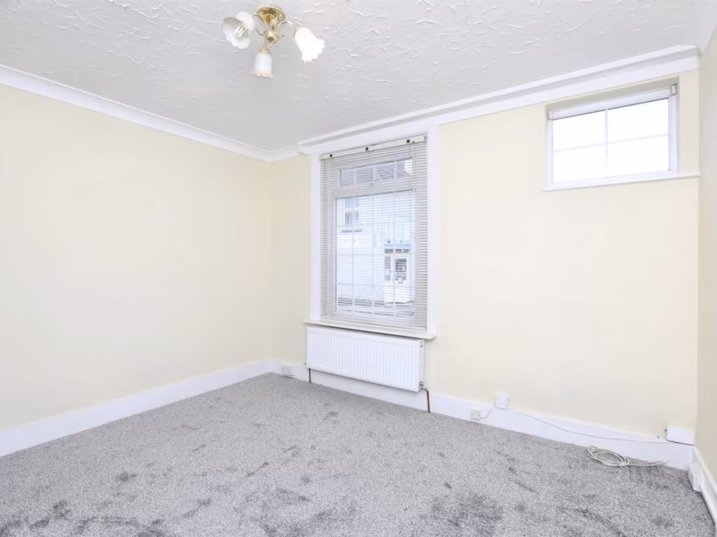
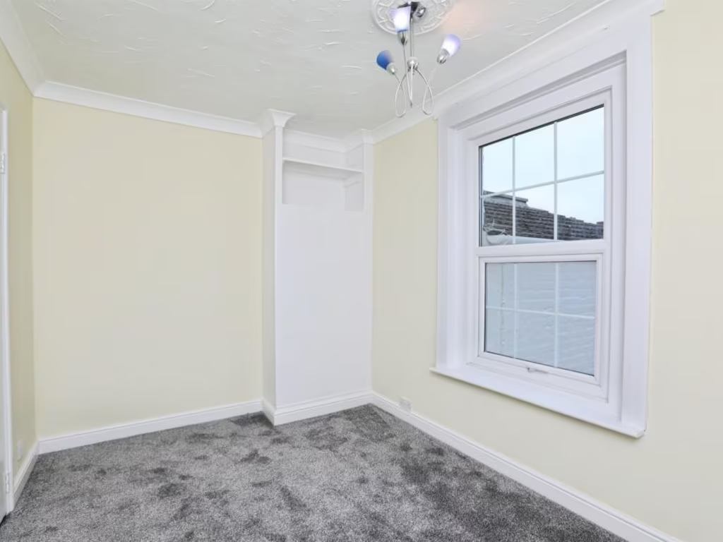
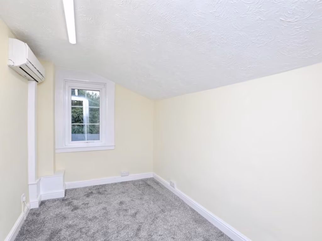
- Bedroom 1:
- Landing:
- Bedroom 2:
- Bedroom 3:
Textual Property Features
Detected Visual Features
- Victorian
- terraced house
- brickwork
- period features
- high ceilings
- small rooms
- urban
- compact
- modern
- living room
- staircase
- archway
- painted
- neutral
- clean
- bright
EPC Details
- Fully double glazed
- Solid brick, as built, no insulation (assumed)
- Boiler and radiators, mains gas
- Low energy lighting in all fixed outlets
- Suspended, no insulation (assumed)
Nearby Schools
- Minterne Junior School
- South Avenue Primary School
- Westlands School
- Grove Park Primary School
- Rodmersham School
- St Peter's Catholic Primary School
- Borden Church of England Primary School
- VTC Independent School
- Bobbing Village School
- Kemsley Primary Academy
- The Oaks Infant School
- The Sittingbourne School
- Bapchild and Tonge Church of England Primary School and Nursery
- Highsted Grammar School
- Milton Court Primary Academy
- Milstead and Frinsted Church of England Primary School
- Bredgar Church of England Primary School
- Tunstall Church of England (Aided) Primary School
- Fulston Manor School
- Canterbury Road Primary School
- Lansdowne Primary School
- Borden Grammar School
- Westlands Primary School
- Sunny Bank Primary School
- Regis Manor Primary School
- Iwade School
Nearest General Shops
- Id: 736898605
- Tags:
- Addr:
- City: Sittingbourne
- Housenumber: 14
- Postcode: ME10 1EZ
- Street: Chaucer Road
- Female: yes
- Level: 0
- Male: no
- Name: Reflections
- Shop: hairdresser
- Unisex: no
- TagsNormalized:
- Lat: 51.3350443
- Lon: 0.7248924
- FullGeoHash: u10s03rb71yg
- PartitionGeoHash: u10s
- Images:
- FoodStandards: null
- Distance: 307.6
,- Id: 1837857935
- Tags:
- Addr:
- City: Sittingbourne
- Housenumber: 23
- Postcode: ME10 1EZ
- Street: Chaucer Road
- Name: Jerry's Car & Cycle Centre
- Phone: +44 1795 479793
- Shop: bicycle
- Website: http://www.jerryscarandcyclecentre.com/
- TagsNormalized:
- Lat: 51.3348825
- Lon: 0.7251653
- FullGeoHash: u10s090p3edq
- PartitionGeoHash: u10s
- Images:
- FoodStandards: null
- Distance: 301.5
,- Id: 4940709598
- Tags:
- Female: no
- Level: 0
- Male: no
- Name: Unity Street Salon
- Shop: hairdresser
- Unisex: yes
- TagsNormalized:
- Lat: 51.3367165
- Lon: 0.7286742
- FullGeoHash: u10s09dd53df
- PartitionGeoHash: u10s
- Images:
- FoodStandards: null
- Distance: 28.8
}
Nearest Grocery shops
- Id: 57793042
- Tags:
- Brand: Holland & Barrett
- Brand:wikidata: Q5880870
- Brand:wikipedia: en:Holland & Barrett
- Building: retail
- Name: Holland & Barrett
- Organic: only
- Shop: health_food
- TagsNormalized:
- holland & barrett
- retail
- health
- health food
- food
- shop
- Lat: 51.3403957
- Lon: 0.7348617
- FullGeoHash: u10s0dpp7x2t
- PartitionGeoHash: u10s
- Images:
- FoodStandards: null
- Distance: 612.4
,- Id: 57746037
- Tags:
- Addr:
- Housenumber: 18
- Street: West Street
- Building: retail
- Name: Rob's Traditional Greengrocer
- Shop: greengrocer
- Source: knowledge
- TagsNormalized:
- retail
- greengrocer
- grocer
- shop
- Lat: 51.3406898
- Lon: 0.7326849
- FullGeoHash: u10s0dm90y1r
- PartitionGeoHash: u10s
- Images:
- FoodStandards: null
- Distance: 546
,- Id: 4940709610
- Tags:
- Addr:
- City: Sittingbourne
- Housenumber: 29
- Postcode: ME10 1EZ
- Street: Chaucer Road
- Fhrs:
- Authority: Swale
- Id: 714241
- Inspectiondate: 2014-12-04
- Rating: 5
- Level: 0
- Name: Happy Shopper
- Shop: convenience
- TagsNormalized:
- Lat: 51.3347717
- Lon: 0.7250624
- FullGeoHash: u10s03pyxpj9
- PartitionGeoHash: u10s
- Images:
- FoodStandards:
- Id: 714241
- FHRSID: 714241
- LocalAuthorityBusinessID: PI/000100068/SW
- BusinessName: Happy Shopper Food Store
- BusinessType: Retailers - other
- BusinessTypeID: 4613
- AddressLine1: 29 Chaucer Road
- AddressLine2: Sittingbourne
- AddressLine3: Kent
- AddressLine4: null
- PostCode: ME10 1EZ
- RatingValue: 5
- RatingKey: fhrs_5_en-GB
- RatingDate: 2014-12-04
- LocalAuthorityCode: 189
- LocalAuthorityName: Swale
- LocalAuthorityWebSite: http://www.swale.gov.uk
- LocalAuthorityEmailAddress: EHAdmin@MidKent.gov.uk
- Scores:
- Hygiene: 5
- Structural: 5
- ConfidenceInManagement: 5
- NewRatingPending: false
- Geocode:
- Longitude: 0.72538700000000
- Latitude: 51.33505200000000
- Distance: 314.6
}
Nearest Supermarkets
- Id: 319926842
- Tags:
- Brand: Morrisons
- Brand:wikidata: Q922344
- Brand:wikipedia: en:Morrisons
- Building: yes
- Contact:
- Website: https://my.morrisons.com/storefinder/558
- Name: Morrisons
- Operator: Morrisons
- Shop: supermarket
- TagsNormalized:
- Lat: 51.3431655
- Lon: 0.7324567
- FullGeoHash: u10s0dtre7z2
- PartitionGeoHash: u10s
- Images:
- FoodStandards: null
- Distance: 790.3
,- Id: 48230157
- Tags:
- Brand: Sainsbury's
- Brand:wikidata: Q152096
- Brand:wikipedia: en:Sainsbury's
- Building: retail
- Landuse: retail
- Name: Sainsbury's
- Shop: supermarket
- Source: knowledge
- TagsNormalized:
- sainsburys
- retail
- supermarket
- shop
- Lat: 51.3378397
- Lon: 0.7369497
- FullGeoHash: u10s0cb8s4vw
- PartitionGeoHash: u10s
- Images:
- FoodStandards: null
- Distance: 593.4
,- Id: 48379415
- Tags:
- Addr:
- Housenumber: 52
- Postcode: ME10 1AR
- Street: West Street
- Brand: Lidl
- Brand:wikidata: Q151954
- Brand:wikipedia: en:Lidl
- Building: retail
- Fhrs:
- Name: Lidl
- Operator: Lidl UK GmbH
- Shop: supermarket
- TagsNormalized:
- lidl
- retail
- supermarket
- shop
- Lat: 51.3411129
- Lon: 0.73123
- FullGeoHash: u10s0dk7wvhe
- PartitionGeoHash: u10s
- Images:
- FoodStandards:
- Id: 801884
- FHRSID: 801884
- LocalAuthorityBusinessID: 15/500321/MIXED
- BusinessName: Lidl
- BusinessType: Retailers - supermarkets/hypermarkets
- BusinessTypeID: 7840
- AddressLine1: Lidl Sittingbourne
- AddressLine2: 52 West Street
- AddressLine3: Sittingbourne
- AddressLine4: Kent
- PostCode: ME10 1AR
- RatingValue: 5
- RatingKey: fhrs_5_en-GB
- RatingDate: 2015-12-08
- LocalAuthorityCode: 189
- LocalAuthorityName: Swale
- LocalAuthorityWebSite: http://www.swale.gov.uk
- LocalAuthorityEmailAddress: EHAdmin@MidKent.gov.uk
- Scores:
- Hygiene: 0
- Structural: 5
- ConfidenceInManagement: 0
- NewRatingPending: false
- Geocode:
- Longitude: 0.73058000000000
- Latitude: 51.34102800000000
- Distance: 546.7
}
Nearest Religious buildings
- Id: 56322106
- Tags:
- Amenity: place_of_worship
- Denomination: catholic
- Name: The O'Sullivan Centre
- Religion: christian
- TagsNormalized:
- place of worship
- catholic
- christian
- church
- Lat: 51.3406637
- Lon: 0.7289748
- FullGeoHash: u10s0d6c437h
- PartitionGeoHash: u10s
- Images:
- FoodStandards: null
- Distance: 468.1
,- Id: 48216549
- Tags:
- Amenity: place_of_worship
- Building: yes
- Name: Sittingbourne Cemetery
- TagsNormalized:
- Lat: 51.3346352
- Lon: 0.7344182
- FullGeoHash: u10s09nvcjtf
- PartitionGeoHash: u10s
- Images:
- FoodStandards: null
- Distance: 446
,- Id: 48229114
- Tags:
- Addr:
- Amenity: place_of_worship
- Building: yes
- Denomination: anglican
- Name: St Mary's Church
- Religion: christian
- Source: OS_OpenData_StreetView
- Wikidata: Q105092604
- TagsNormalized:
- place of worship
- anglican
- church
- christian
- Lat: 51.3373137
- Lon: 0.7296322
- FullGeoHash: u10s09em98vh
- PartitionGeoHash: u10s
- Images:
- FoodStandards: null
- Distance: 115.2
}
Nearest Medical buildings
- Id: 706228836
- Tags:
- Amenity: hospital
- Healthcare: hospital
- Name: Sittingbourne Memorial Hospital
- TagsNormalized:
- Lat: 51.3345533
- Lon: 0.7362598
- FullGeoHash: u10s0c0jkn74
- PartitionGeoHash: u10s
- Images:
- FoodStandards: null
- Distance: 566.3
,- Id: 49731137
- Tags:
- Addr:
- Amenity: pharmacy
- Brand: Lloyds Pharmacy
- Brand:wikidata: Q6662870
- Brand:wikipedia: en:LloydsPharmacy
- Building: yes
- Dispensing: yes
- Healthcare: pharmacy
- Name: Lloyds Pharmacy
- Opening_hours: Tu-Su 08:00-15:00; Sa 08:00-12:00
- TagsNormalized:
- pharmacy
- lloyds pharmacy
- health
- healthcare
- Lat: 51.3413381
- Lon: 0.7267632
- FullGeoHash: u10s0d3hyz1g
- PartitionGeoHash: u10s
- Images:
- FoodStandards: null
- Distance: 559.1
,- Id: 60968713
- Tags:
- Addr:
- Housenumber: 9
- Street: London Road
- Amenity: doctors
- Building: yes
- Healthcare: doctor
- Source: knowledge
- TagsNormalized:
- doctor
- doctors
- health
- healthcare
- Lat: 51.3411665
- Lon: 0.7280834
- FullGeoHash: u10s0d65vx47
- PartitionGeoHash: u10s
- Images:
- FoodStandards: null
- Distance: 525.4
,- Id: 60968701
- Tags:
- Addr:
- Housenumber: 5
- Street: London Road
- Amenity: dentist
- Building: yes
- Healthcare: dentist
- Name: Chopra Associates
- TagsNormalized:
- Lat: 51.3411121
- Lon: 0.7282898
- FullGeoHash: u10s0d67dkup
- PartitionGeoHash: u10s
- Images:
- FoodStandards: null
- Distance: 518.3
}
Nearest Airports
- Id: 103894219
- Tags:
- Aerodrome: international
- Aeroway: aerodrome
- Iata: SEN
- Icao: EGMC
- Name: London Southend Airport
- Old_name: Southend Municipal Airport
- Ref: SEN
- Wikidata: Q1415441
- TagsNormalized:
- airport
- international airport
- Lat: 51.5701749
- Lon: 0.6924624
- FullGeoHash: u10mru04p937
- PartitionGeoHash: u10m
- Images:
- FoodStandards: null
- Distance: 26109.2
}
Nearest Leisure Facilities
- Id: 186651691
- Tags:
- Leisure: pitch
- Lit: no
- Sport: soccer
- Surface: grass
- TagsNormalized:
- Lat: 51.337577
- Lon: 0.7330189
- FullGeoHash: u10s09tz09fx
- PartitionGeoHash: u10s
- Images:
- FoodStandards: null
- Distance: 324.9
,- Id: 49731051
- Tags:
- TagsNormalized:
- Lat: 51.3382211
- Lon: 0.7253122
- FullGeoHash: u10s09b4ufpc
- PartitionGeoHash: u10s
- Images:
- FoodStandards: null
- Distance: 306.3
,- Id: 48019227
- Tags:
- Leisure: park
- Name: Albany Park
- TagsNormalized:
- Lat: 51.3353871
- Lon: 0.7326061
- FullGeoHash: u10s09m6qcy8
- PartitionGeoHash: u10s
- Images:
- FoodStandards: null
- Distance: 296.4
,- Id: 180306903
- Tags:
- Leisure: pitch
- Lit: no
- Sport: soccer
- Surface: grass
- TagsNormalized:
- Lat: 51.3349239
- Lon: 0.7317482
- FullGeoHash: u10s09hzdgrj
- PartitionGeoHash: u10s
- Images:
- FoodStandards: null
- Distance: 272
,- Id: 170369071
- Tags:
- Leisure: pitch
- Lit: no
- Sport: soccer
- Surface: grass
- TagsNormalized:
- Lat: 51.335758
- Lon: 0.7323304
- FullGeoHash: u10s09mk2wch
- PartitionGeoHash: u10s
- Images:
- FoodStandards: null
- Distance: 264
}
Nearest Tourist attractions
- Id: 69939548
- Tags:
- Building: yes
- Tourism: museum
- TagsNormalized:
- Lat: 51.3453609
- Lon: 0.7442443
- FullGeoHash: u10s0gjuqjhb
- PartitionGeoHash: u10s
- Images:
- FoodStandards: null
- Distance: 1465
,- Id: 2114963016
- Tags:
- Addr:
- City: Sittingbourne
- Postcode: ME10 3DL
- Email: secretary@sittingbourne-museum.co.uk
- Museum: history
- Name: Sittingbourne Heritage Museum
- Source: Local Knowledge
- Tourism: museum
- Website: https://www.sittingbourne-museum.co.uk/
- Wikidata: Q113370157
- TagsNormalized:
- Lat: 51.33878
- Lon: 0.7434355
- FullGeoHash: u10s0cvq561x
- PartitionGeoHash: u10s
- Images:
- FoodStandards: null
- Distance: 1055.8
,- Id: 60588366
- Tags:
- Addr:
- City: Sittingbourne
- Housenumber: 74
- Postcode: ME10 1NS
- Street: London Road
- Building: yes
- Fhrs:
- Authority: Swale
- Id: 771569
- Inspectiondate: 2017-04-25
- Rating: 5
- Name: The Beaumont
- Source: local_knowledge
- Tourism: guest_house
- TagsNormalized:
- Lat: 51.3425723
- Lon: 0.7213878
- FullGeoHash: u10s06tk1t1t
- PartitionGeoHash: u10s
- Images:
- FoodStandards: null
- Distance: 848.6
}
Nearest Train stations
- Id: 855651597
- Tags:
- Name: Swale
- Naptan:
- Network: National Rail
- Old_name: Kings Ferry Bridge Halt;Swale Halt
- Public_transport: station
- Railway: station
- Ref:
- Train: yes
- Wikidata: Q2191551
- Wikipedia: en:Swale railway station
- TagsNormalized:
- Lat: 51.3889653
- Lon: 0.7468492
- FullGeoHash: u10s2gpf6v7n
- PartitionGeoHash: u10s
- Images:
- FoodStandards: null
- Distance: 5973
,- Id: 4373177416
- Tags:
- Name: Warren Wood
- Public_transport: station
- Railway: station
- Usage: tourism
- TagsNormalized:
- Lat: 51.2951704
- Lon: 0.6864127
- FullGeoHash: u107zd5b48f6
- PartitionGeoHash: u107
- Images:
- FoodStandards: null
- Distance: 5451
,- Id: 90219136
- Tags:
- Name: Kemsley Down
- Network: Sittingbourne and Kemsley Light Railway
- Operator: Sittingbourne and Kemsley Light Railway
- Public_transport: station
- Railway: station
- Tourism: heritage_railway
- Train: yes
- Usage: tourism
- TagsNormalized:
- station
- railway
- tourism
- train
- Lat: 51.3618635
- Lon: 0.7567947
- FullGeoHash: u10s1nphd971
- PartitionGeoHash: u10s
- Images:
- FoodStandards: null
- Distance: 3433.4
,- Id: 2315856087
- Tags:
- Name: Sittingbourne Viaduct
- Public_transport: station
- Railway: station
- Train: yes
- Usage: tourism
- Wheelchair: no
- TagsNormalized:
- Lat: 51.345203
- Lon: 0.7336166
- FullGeoHash: u10s0en5qx84
- PartitionGeoHash: u10s
- Images:
- FoodStandards: null
- Distance: 1030.7
,- Id: 3726061852
- Tags:
- Addr:
- Postcode: ME10 3ED
- Street: St. Michaels Road
- Name: Sittingbourne
- Naptan:
- Network: National Rail
- Platforms: 3
- Public_transport: station
- Railway: station
- Ref:
- Train: yes
- Wheelchair: yes
- Wikidata: Q1919614
- Wikipedia: en:Sittingbourne railway station
- TagsNormalized:
- Lat: 51.342078
- Lon: 0.7351464
- FullGeoHash: u10s0dx361hb
- PartitionGeoHash: u10s
- Images:
- FoodStandards: null
- Distance: 768.9
}
Nearest Hotels
- Id: 957647645
- Tags:
- Brand: Premier Inn
- Brand:wikidata: Q2108626
- Brand:wikipedia: en:Premier Inn
- Contact:
- Website: https://www.premierinn.com/gb/en/hotels/england/kent/sittingbourne/sittingbourne-kent.html
- Internet_access: wlan
- Internet_access:fee: customers
- Internet_access:operator: Virgin Media
- Internet_access:ssid: Premier Inn Free Wi-Fi
- Name: Premier Inn
- Tourism: hotel
- TagsNormalized:
- Lat: 51.3509135
- Lon: 0.7063789
- FullGeoHash: u10s0h4kgb46
- PartitionGeoHash: u10s
- Images:
- FoodStandards: null
- Distance: 2233.2
,- Id: 50215002
- Tags:
- Addr:
- City: Sittingbourne
- Housenumber: 70
- Postcode: ME10 1NT
- Street: London Road
- Brand: Holiday Inn
- Brand:wikidata: Q2717882
- Brand:wikipedia: en:Holiday Inn
- Building: yes
- Fhrs:
- Authority: Swale
- Id: 836417
- Inspectiondate: 2015-12-15
- Rating: 5
- Name: The Coniston
- Source: local_knowledge
- Tourism: hotel
- TagsNormalized:
- Lat: 51.3427572
- Lon: 0.7220099
- FullGeoHash: u10s06tv0p9s
- PartitionGeoHash: u10s
- Images:
- FoodStandards: null
- Distance: 840.6
,- Id: 1065733958
- Tags:
- Addr:
- City: Sittingbourne
- Postcode: ME10 3JY
- Street: St. Michael's Road
- Brand: Travelodge
- Brand:wikidata: Q9361374
- Building: yes
- Fhrs:
- Authority: Swale
- Id: 1225090
- Local_authority_id: 20/500088/MIXED
- Internet_access: wlan
- Internet_access:fee: customers
- Internet_access:ssid: Travelodge WiFi
- Name: Travelodge Sittingbourne
- Tourism: hotel
- TagsNormalized:
- Lat: 51.3414003
- Lon: 0.7347998
- FullGeoHash: u10s0drj64dq
- PartitionGeoHash: u10s
- Images:
- FoodStandards: null
- Distance: 694
}
Tags
- Victorian
- terraced house
- brickwork
- period features
- high ceilings
- small rooms
- urban
- compact
- modern
- living room
- staircase
- archway
- painted
- neutral
- clean
- bright
Local Market Stats
- Average Price/sqft: £322
- Avg Income: £49700
- Rental Yield: 4.6%
- Social Housing: 13%
- Planning Success Rate: 85%
AirBnB Data
- 1km average: £86/night
- Listings in 1km: 2
Similar Properties
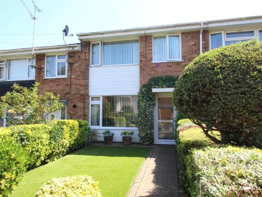 3 bedroom terraced house for sale in Heather Close, Sittingbourne, Kent, ME10 — £280,000 • 3 bed • 1 bath • 700 ft²
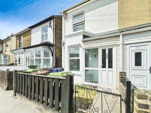 3 bedroom end of terrace house for sale in Murston Road, Sittingbourne, ME10 — £240,000 • 3 bed • 1 bath • 789 ft²
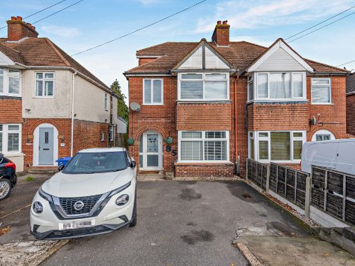 3 bedroom semi-detached house for sale in Canterbury Road, Sittingbourne, Kent, ME10 — £325,000 • 3 bed • 1 bath • 1260 ft²
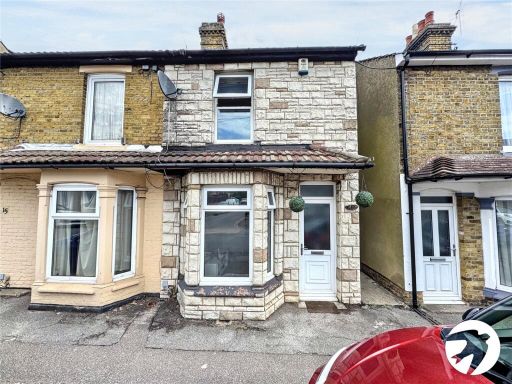 3 bedroom semi-detached house for sale in Hythe Road, Sittingbourne, Kent, ME10 — £210,000 • 3 bed • 1 bath • 732 ft²
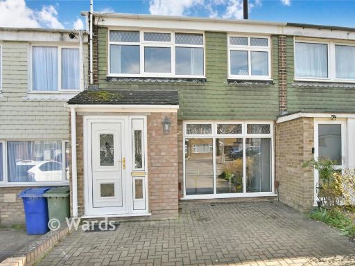 3 bedroom terraced house for sale in Lime Grove, Sittingbourne, Kent, ME10 — £259,950 • 3 bed • 1 bath • 819 ft²
 2 bedroom terraced house for sale in Regis Crescent, Sittingbourne, Kent, ME10 — £240,000 • 2 bed • 1 bath • 668 ft²
Meta
- {
"@context": "https://schema.org",
"@type": "Residence",
"name": "3 bedroom semidetached house for sale in Connaught Road, Si…",
"description": "",
"url": "https://propertypiper.co.uk/property/aab3b2cc-eafa-42b3-bf19-554577f8b2f4",
"image": "https://image-a.propertypiper.co.uk/4e4d4c7f-da13-4550-b2d3-219742f1f2a4-1024.jpeg",
"address": {
"@type": "PostalAddress",
"streetAddress": "8 Connaught Road",
"postalCode": "ME10 1HY",
"addressLocality": "Swale",
"addressRegion": "Sittingbourne and Sheppey",
"addressCountry": "England"
},
"geo": {
"@type": "GeoCoordinates",
"latitude": 51.33645754327466,
"longitude": 0.7286986272308416
},
"numberOfRooms": 3,
"numberOfBathroomsTotal": 1,
"floorSize": {
"@type": "QuantitativeValue",
"value": 915,
"unitCode": "FTK"
},
"offers": {
"@type": "Offer",
"price": 300000,
"priceCurrency": "GBP",
"availability": "https://schema.org/InStock"
},
"additionalProperty": [
{
"@type": "PropertyValue",
"name": "Feature",
"value": "Victorian"
},
{
"@type": "PropertyValue",
"name": "Feature",
"value": "terraced house"
},
{
"@type": "PropertyValue",
"name": "Feature",
"value": "brickwork"
},
{
"@type": "PropertyValue",
"name": "Feature",
"value": "period features"
},
{
"@type": "PropertyValue",
"name": "Feature",
"value": "high ceilings"
},
{
"@type": "PropertyValue",
"name": "Feature",
"value": "small rooms"
},
{
"@type": "PropertyValue",
"name": "Feature",
"value": "urban"
},
{
"@type": "PropertyValue",
"name": "Feature",
"value": "compact"
},
{
"@type": "PropertyValue",
"name": "Feature",
"value": "modern"
},
{
"@type": "PropertyValue",
"name": "Feature",
"value": "living room"
},
{
"@type": "PropertyValue",
"name": "Feature",
"value": "staircase"
},
{
"@type": "PropertyValue",
"name": "Feature",
"value": "archway"
},
{
"@type": "PropertyValue",
"name": "Feature",
"value": "painted"
},
{
"@type": "PropertyValue",
"name": "Feature",
"value": "neutral"
},
{
"@type": "PropertyValue",
"name": "Feature",
"value": "clean"
},
{
"@type": "PropertyValue",
"name": "Feature",
"value": "bright"
}
]
}
High Res Floorplan Images
Compatible Floorplan Images
FloorplanImages Thumbnail