NE31 1YF - 2 bedroom flat for sale in Victoria Road East, Hebburn, Tyn…
View on Property Piper
2 bedroom flat for sale in Victoria Road East, Hebburn, Tyne and Wear, NE31 1YF, NE31
Property Details
- Price: £25000
- Bedrooms: 2
- Bathrooms: 1
- Property Type: undefined
- Property SubType: undefined
Image Descriptions
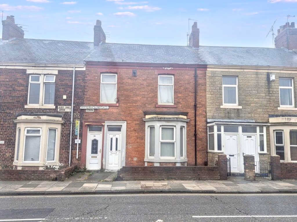
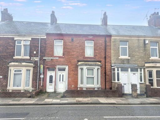
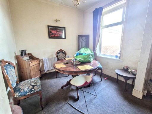
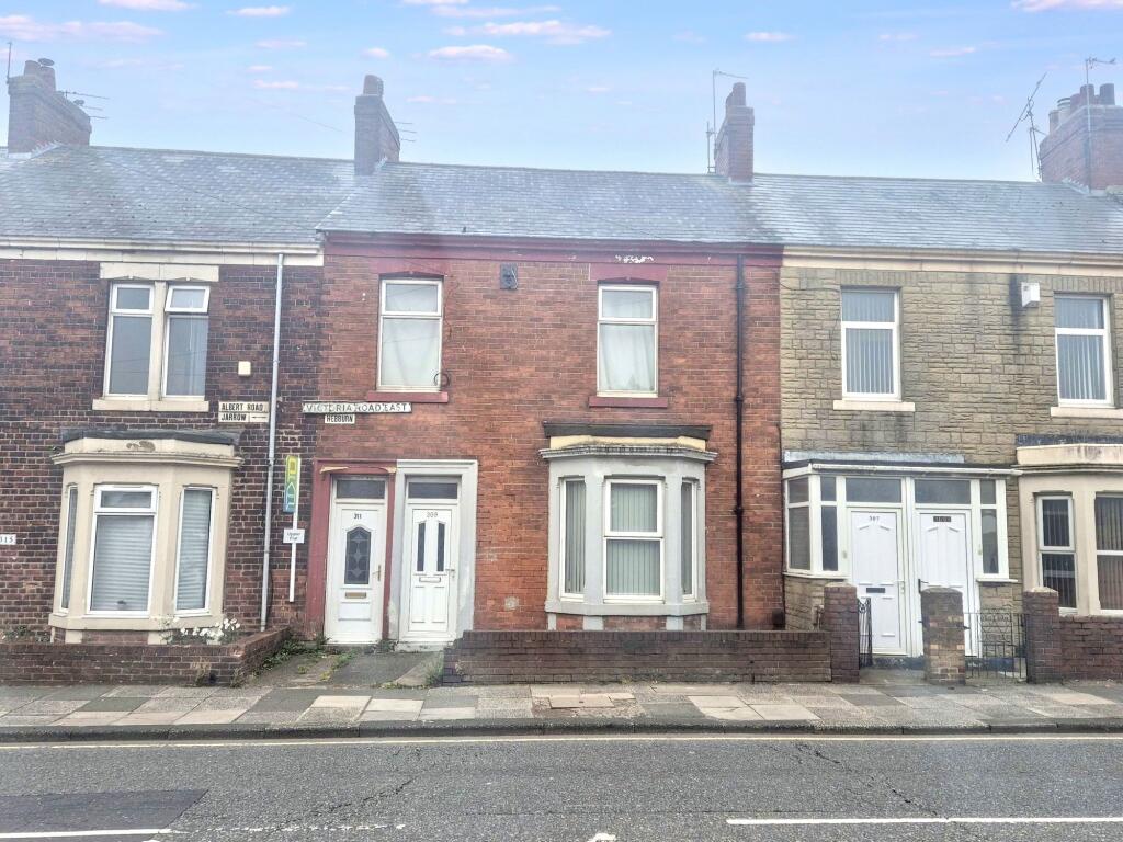
- townhouse Victorian
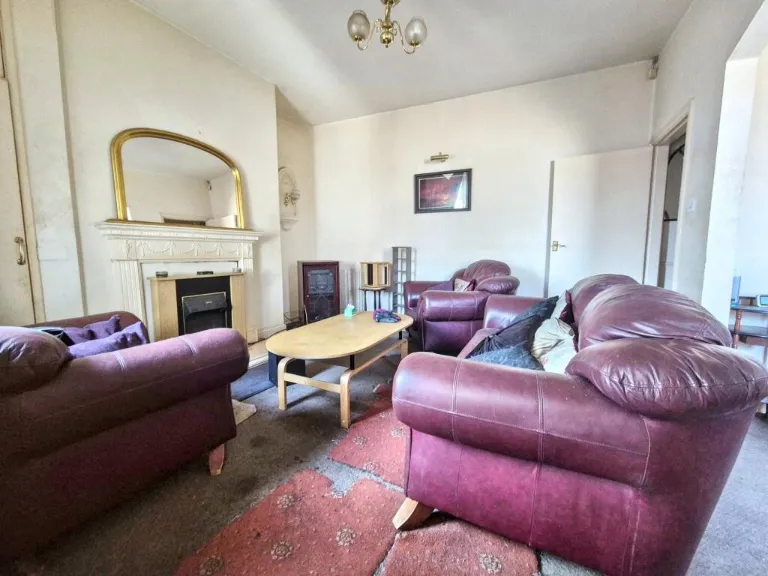
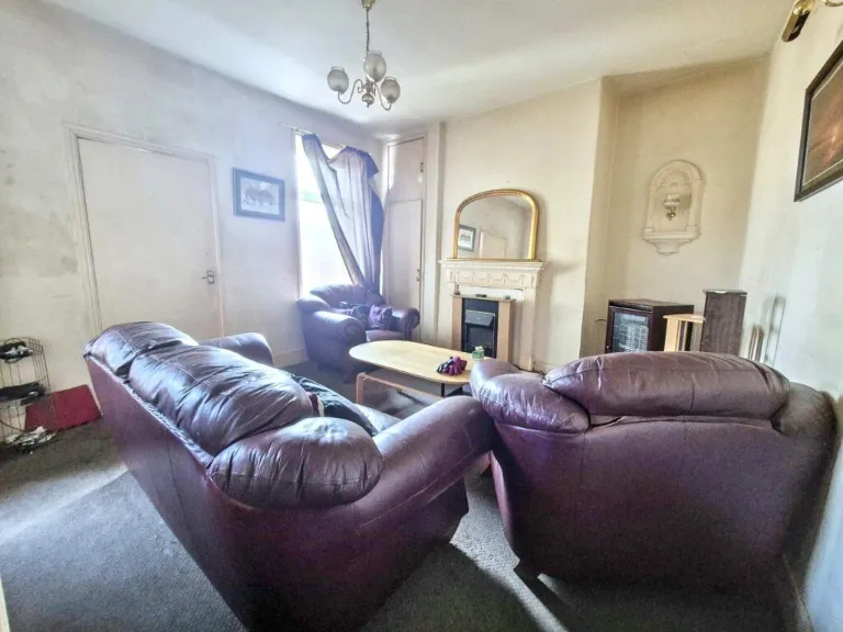
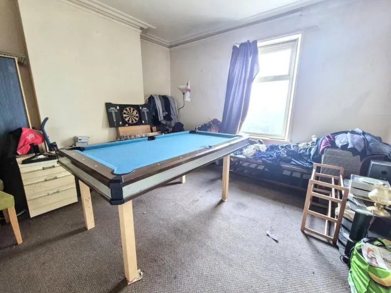
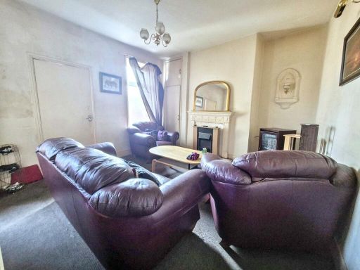
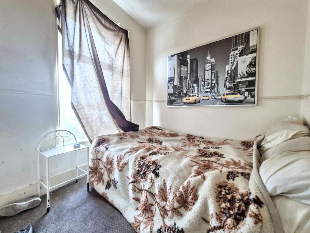
- living room Victorian
Floorplan Description
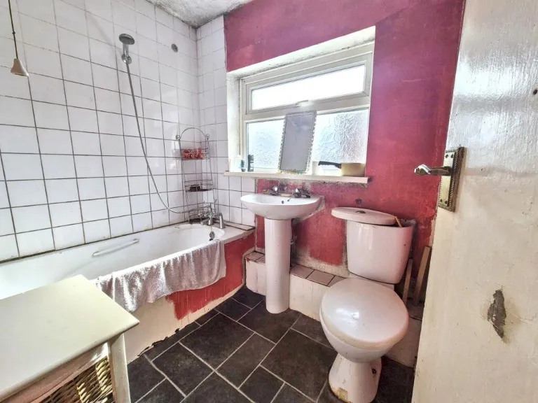
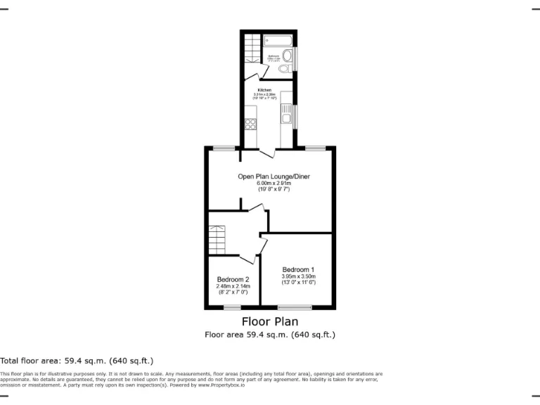
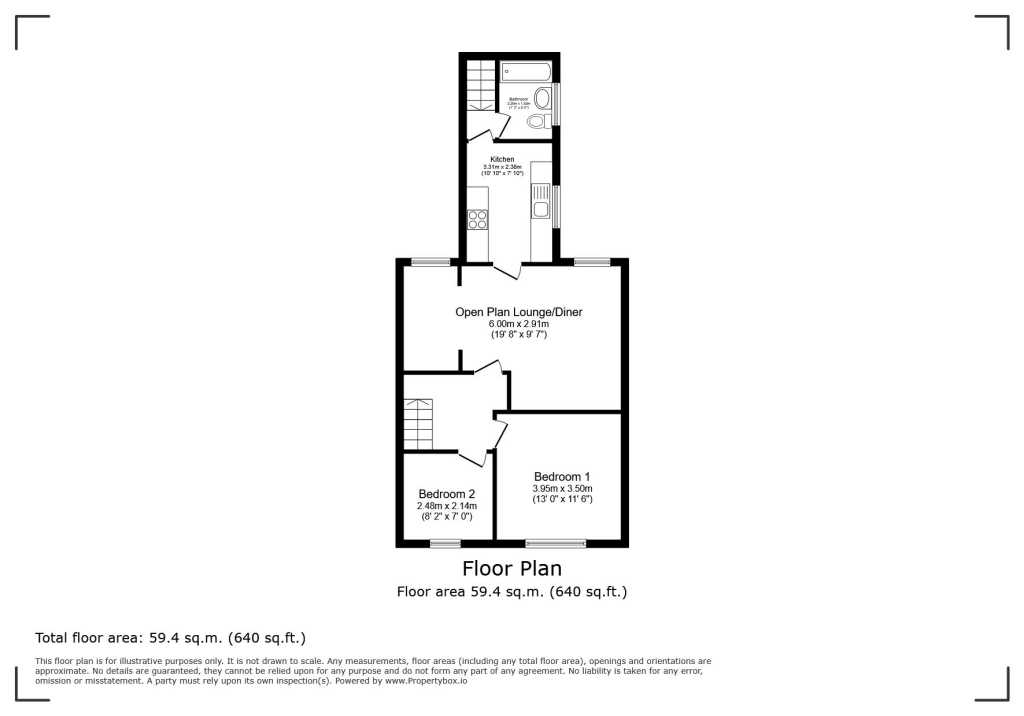
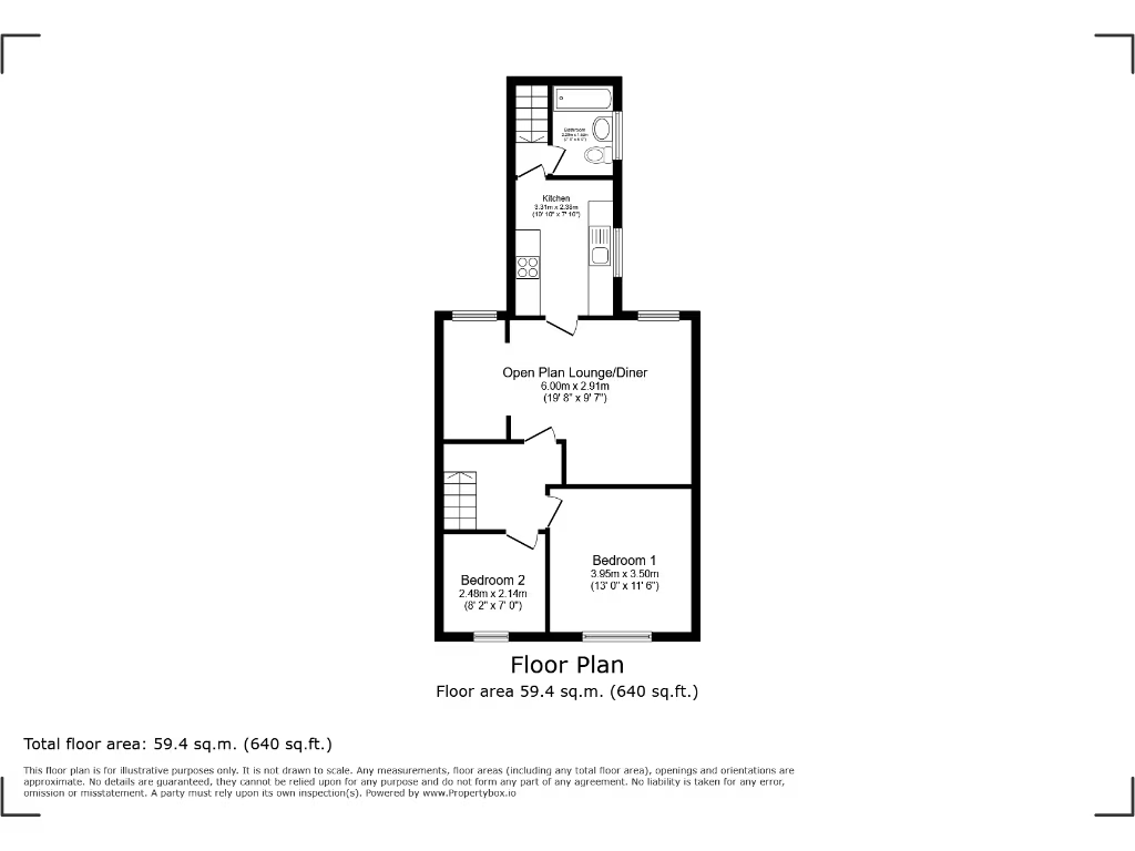
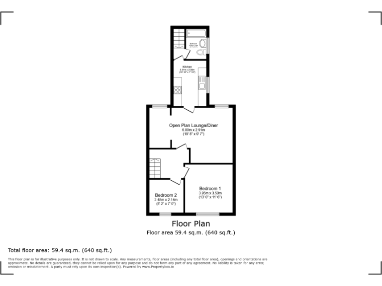
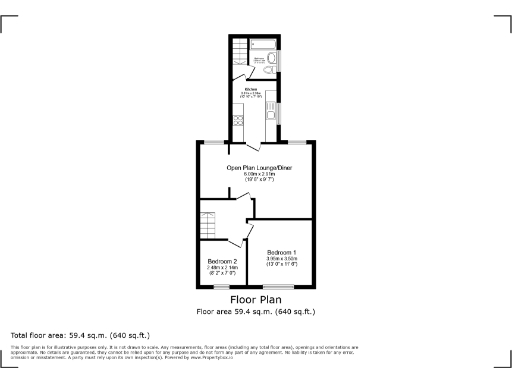
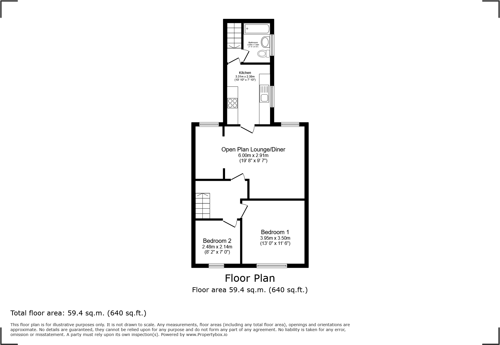
- Single-floor property with open plan lounge/diner, two bedrooms, kitchen and bathroom
Rooms
- Open Plan Lounge/Diner:
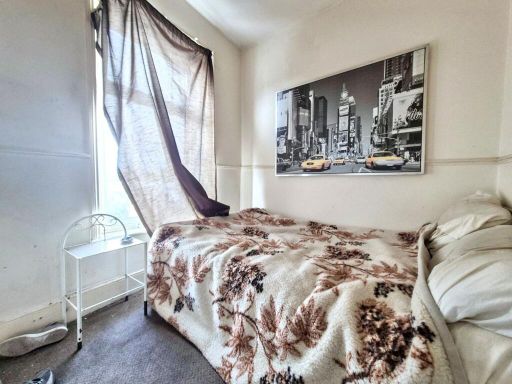
- Bedroom 1:
- Bedroom 2:
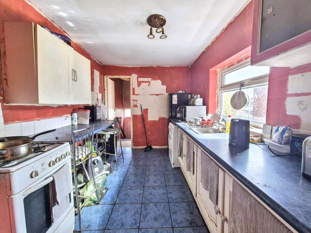
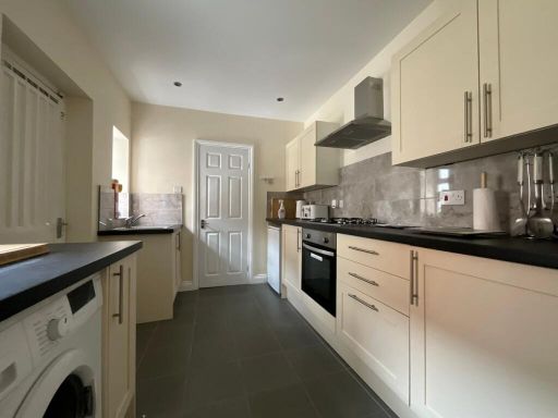
- Kitchen:
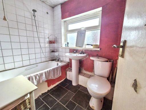
- Bathroom:
Textual Property Features
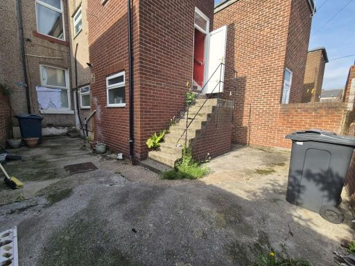
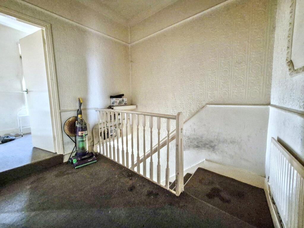
Detected Visual Features
- townhouse
- Victorian
- brick exterior
- terraced
- bay window
- chimney
- two-storey
- traditional architecture
- needs modernization
- living room
- fireplace
- high ceilings
- dated decor
- fixer-upper
EPC Details
- Fully double glazed
- Solid brick, as built, no insulation (assumed)
- Boiler and radiators, mains gas
- Low energy lighting in 83% of fixed outlets
- (another dwelling below)
Nearby Schools
- St Joseph's Catholic Primary School, Jarrow
- St Mary's Catholic Primary School
- Hebburn Lakes Primary School
- Jarrow Cross CofE Primary School
- St Aloysius Catholic Infant School, Hebburn
- Richardson Dees Primary School
- Wallsend St Peter's CofE Aided Primary School
- Burnside College
- Toner Avenue Primary School
- Simonside Primary School
- Bede Burn Primary School
- Denbigh Community Primary School
- St Aidan's Catholic Primary School, Wallsend
- St Joseph's Catholic Academy
- Hebburn Comprehensive School
- St Bede's Catholic Primary School, Jarrow
- St Oswald's CofE Aided Primary School
- Percy Main Primary School
- Churchill Community College
- St Matthew's Catholic Primary School, Jarrow
- Valley View Primary School
- St James' Catholic Primary School, Hebburn
- Jarrow School
- St Aloysius Catholic Junior School Academy
Nearest Bars And Restaurants
- Id: 437720908
- Tags:
- Addr:
- City: Hebburn
- Housenumber: 156
- Postcode: NE31 1HE
- Street: Hedgeley Road
- Amenity: fast_food
- Building: yes
- Cuisine: burger;chicken;kebab;pizza
- Delivery: yes
- Email: hello@topfellas.co.uk
- Name: Top Fellas
- Opening_hours: Mo-Sa 11:30-14:00,16:30-22:30; Su 16:30-22:00
- Phone: +44 191 424 9299
- Takeaway: yes
- Website: http://www.topfellas.co.uk/
- TagsNormalized:
- fast food
- food
- burgers
- chicken
- kebab
- pizza
- takeaway
- Lat: 54.9786524
- Lon: -1.5070611
- FullGeoHash: gcybv8w9fgtu
- PartitionGeoHash: gcyb
- Images:
- FoodStandards: null
- Distance: 448
,- Id: 223318411
- Tags:
- Addr:
- Amenity: cafe
- Building: yes
- Name: Bowling Pavilion
- TagsNormalized:
- Lat: 54.975899
- Lon: -1.4969057
- FullGeoHash: gcybvbjczd65
- PartitionGeoHash: gcyb
- Images:
- FoodStandards: null
- Distance: 297.9
,- Id: 401746339
- Tags:
- Addr:
- City: Hebburn
- Postcode: NE31 1YQ
- Street: Victoria Road East
- Amenity: pub
- Building: yes
- Name: The Clock
- Outdoor_seating: yes
- TagsNormalized:
- Lat: 54.9773426
- Lon: -1.5028363
- FullGeoHash: gcybvb3djrkn
- PartitionGeoHash: gcyb
- Images:
- FoodStandards: null
- Distance: 175.7
,- Id: 4354107392
- Tags:
- Addr:
- City: Hebburn
- Street: Frobisher Street
- Amenity: fast_food
- Delivery: yes
- Drive_through: no
- Name: Quality Pizza
- Phone: +44 191 489 2211
- Takeaway: only
- TagsNormalized:
- fast food
- food
- pizza
- takeaway
- Lat: 54.9769514
- Lon: -1.5019251
- FullGeoHash: gcybvb4rfwe3
- PartitionGeoHash: gcyb
- Images:
- FoodStandards: null
- Distance: 144.8
,- Id: 4354104471
- Tags:
- Amenity: fast_food
- Name: Paul's Fish Grill
- TagsNormalized:
- Lat: 54.9779721
- Lon: -1.4995607
- FullGeoHash: gcybvbkjcsy6
- PartitionGeoHash: gcyb
- Images:
- FoodStandards: null
- Distance: 45.2
}
Nearest General Shops
- Id: 437597051
- Tags:
- Addr:
- City: Hebburn
- Street: Albert Road
- Building: yes
- Name: The Tyre Bay
- Phone: +44 191 483 4882
- Shop: car_repair
- TagsNormalized:
- Lat: 54.9783645
- Lon: -1.499565
- FullGeoHash: gcybvbs01tgq
- PartitionGeoHash: gcyb
- Images:
- FoodStandards: null
- Distance: 74.9
,- Id: 437597049
- Tags:
- Addr:
- City: Hebburn
- Street: Albert Road
- Building: yes
- Name: JCS Car Sales
- Shop: car
- TagsNormalized:
- Lat: 54.9784038
- Lon: -1.499983
- FullGeoHash: gcybvbe8rv79
- PartitionGeoHash: gcyb
- Images:
- FoodStandards: null
- Distance: 68.8
,- Id: 4354071280
- Tags:
- Addr:
- City: Hebburn
- Street: Albert Road
- Name: Leaf
- Shop: florist
- TagsNormalized:
- Lat: 54.9774908
- Lon: -1.5010835
- FullGeoHash: gcybvb6gn5p4
- PartitionGeoHash: gcyb
- Images:
- FoodStandards: null
- Distance: 65.9
}
Nearest Grocery shops
- Id: 4355195652
- Tags:
- Addr:
- Name: Alan's Corner
- Shop: convenience
- TagsNormalized:
- Lat: 54.9799671
- Lon: -1.5054907
- FullGeoHash: gcybv8z9x88y
- PartitionGeoHash: gcyb
- Images:
- FoodStandards: null
- Distance: 414.9
,- Id: 4354071283
- Tags:
- Addr:
- City: Hebburn
- Street: Victoria Road East
- Brand: Premier
- Brand:wikidata: Q7240340
- Brand:wikipedia: en:Premier Stores
- Name: Sam’s Convenience Store
- Shop: convenience
- TagsNormalized:
- Lat: 54.9766934
- Lon: -1.5030091
- FullGeoHash: gcybvb1w3q7n
- PartitionGeoHash: gcyb
- Images:
- FoodStandards: null
- Distance: 217.3
,- Id: 4354071281
- Tags:
- Addr:
- City: Hebburn
- Street: Albert Road
- Brand: Best-one
- Brand:wikidata: Q4896532
- Brand:wikipedia: en:Best-one
- Name: Best-one
- Shop: convenience
- TagsNormalized:
- Lat: 54.9773565
- Lon: -1.5014686
- FullGeoHash: gcybvb6dm4pc
- PartitionGeoHash: gcyb
- Images:
- FoodStandards: null
- Distance: 94.7
}
Nearest Religious buildings
- Id: 4351292668
- Tags:
- Amenity: community_centre
- Name: Church Hall
- TagsNormalized:
- community centre
- church
- church hall
- Lat: 54.9811218
- Lon: -1.4928774
- FullGeoHash: gcyby10bjrvy
- PartitionGeoHash: gcyb
- Images:
- FoodStandards: null
- Distance: 595.8
,- Id: 4352345277
- Tags:
- Addr:
- City: Jarrow
- Street: Bede Burn Road
- Amenity: place_of_worship
- Name: Park Methodist Church
- Religion: christian
- TagsNormalized:
- place of worship
- church
- methodist
- christian
- Lat: 54.9760595
- Lon: -1.4941386
- FullGeoHash: gcyby004b038
- PartitionGeoHash: gcyb
- Images:
- FoodStandards: null
- Distance: 432.4
,- Id: 437591310
- Tags:
- Addr:
- City: Hebburn
- Postcode: NE31 1HR
- Street: St Oswald's Road
- Amenity: place_of_worship
- Building: church
- Denomination: anglican
- Name: St Oswalds Parish C Of E Church
- Phone: +44 191 420 2792
- Religion: christian
- Wikidata: Q105096689
- TagsNormalized:
- place of worship
- church
- anglican
- parish
- christian
- Lat: 54.9803545
- Lon: -1.5045843
- FullGeoHash: gcybvbb7u8ut
- PartitionGeoHash: gcyb
- Images:
- FoodStandards: null
- Distance: 398.9
}
Nearest Medical buildings
- Id: 12890713
- Tags:
- Addr:
- City: Jarrow
- Postcode: NE32 3UX
- Street: Wear Street
- Amenity: hospital
- Building: yes
- Emergency: no
- Name: Palmer Community Hospital
- Phone: +44 191 402 8000
- Type: multipolygon
- Website: https://www.nhs.uk/Services/hospitals/Overview/DefaultView.aspx?id=668
- TagsNormalized:
- Lat: 54.980689
- Lon: -1.4923344
- FullGeoHash: gcyby0cmdp6b
- PartitionGeoHash: gcyb
- Images:
- FoodStandards: null
- Distance: 596
,- Id: 13664005
- Tags:
- Addr:
- City: Jarrow
- Housenumber: 187
- Postcode: NE32 5AF
- Street: Albert Road
- Amenity: pharmacy
- Building: yes
- Dispensing: yes
- Drive_through: no
- Healthcare: pharmacy
- Name: Boustead Chemist
- Opening_hours: Mo-Sa 08:00-21:00
- Operator: M.D. & A.G. Burdon Ltd
- Type: multipolygon
- TagsNormalized:
- pharmacy
- health
- healthcare
- chemist
- Lat: 54.9779147
- Lon: -1.4931022
- FullGeoHash: gcyby02v84n7
- PartitionGeoHash: gcyb
- Images:
- FoodStandards: null
- Distance: 453.1
,- Id: 4352345230
- Tags:
- Addr:
- City: Jarrow
- Street: Park Road
- Amenity: pharmacy
- Name: Dinnings
- TagsNormalized:
- Lat: 54.9779942
- Lon: -1.4963805
- FullGeoHash: gcybvbqq5bcv
- PartitionGeoHash: gcyb
- Images:
- FoodStandards: null
- Distance: 244.7
,- Id: 4352345229
- Tags:
- Addr:
- City: Jarrow
- Postcode: NE32 5SE
- Street: Park Road
- Amenity: doctors
- Name: Mayfield Medical Centre
- Phone: +44 191 489 7183
- Website: https://www.mayfieldmedical.co.uk/
- TagsNormalized:
- Lat: 54.9779137
- Lon: -1.4964232
- FullGeoHash: gcybvbqmdccv
- PartitionGeoHash: gcyb
- Images:
- FoodStandards: null
- Distance: 241.3
}
Nearest Airports
- Id: 51496177
- Tags:
- Addr:
- City: Newcastle upon Tyne
- Housename: Newcastle International Airport
- Postcode: NE13 8BZ
- Street: Woolsington
- Aerodrome: international
- Aerodrome:type: public
- Aeroway: aerodrome
- Contact:
- Website: http://www.newcastleairport.com
- Ele: 81
- Iata: NCL
- Icao: EGNT
- Ifr: yes
- Name: Newcastle International Airport
- Old_name: Woolsington Aerodrome
- Operator: Newcastle International Airport Ltd
- Operator:type: private
- Phone: +44 871 882 1121
- Ref: NCL
- Size: 4500000
- Source: Bing
- Vfr: yes
- Website: https://www.newcastleairport.com/
- Wheelchair: yes
- Wikidata: Q8975
- Wikipedia: en:Newcastle International Airport
- TagsNormalized:
- airport
- international airport
- Lat: 55.0385826
- Lon: -1.6925163
- FullGeoHash: gcyc17rwcx2m
- PartitionGeoHash: gcyc
- Images:
- FoodStandards: null
- Distance: 14002.5
,- Id: 224091164
- Tags:
- Addr:
- City: Newcastle upon Tyne
- Postcode: NE13 8BZ
- Street: Woolsington
- Building: hotel
- Contact:
- Facebook: https://www.facebook.com/doubletree.newcastle
- Google_plus: https://plus.google.com/115643701064921491168/about
- Twitter: https://twitter.com/dtnewcastle_int
- Email: info@doubletree-newcastle.co.uk
- Fhrs:
- Name: DoubleTree by Hilton Hotel Newcastle International Airport
- Operator: Hilton Worldwide
- Phone: +44 1661 824266
- Rooms: 179
- Smoking: no
- Stars: 4
- Tourism: hotel
- Website: https://doubletree3.hilton.com/en/hotels/united-kingdom/doubletree-by-hilton-hotel-newcastle-international-airport-NCLNADI/index.html?WT.mc_id=zELWAKN0EMEA1DT2DMH3LocalSearch4DGGenericx6NCLNADI
- Wheelchair: yes
- TagsNormalized:
- hotel
- airport
- international airport
- tourism
- major airport
- Lat: 55.0364476
- Lon: -1.7124358
- FullGeoHash: gcyc1514937m
- PartitionGeoHash: gcyc
- Images:
- FoodStandards:
- Id: 236731
- FHRSID: 236731
- LocalAuthorityBusinessID: 11/00246/MIXED
- BusinessName: Doubletree By Hilton Hotel
- BusinessType: Hotel/bed & breakfast/guest house
- BusinessTypeID: 7842
- AddressLine1: Doubletree By Hilton Newcastle Airport
- AddressLine2: Woolsington
- AddressLine3: Newcastle Upon Tyne
- AddressLine4: null
- PostCode: NE13 8BZ
- RatingValue: 5
- RatingKey: fhrs_5_en-GB
- RatingDate: 2019-08-13
- LocalAuthorityCode: 416
- LocalAuthorityName: Newcastle Upon Tyne
- LocalAuthorityWebSite: http://www.newcastle.gov.uk/
- LocalAuthorityEmailAddress: psr@newcastle.gov.uk
- Scores:
- Hygiene: 0
- Structural: 5
- ConfidenceInManagement: 0
- NewRatingPending: false
- Geocode:
- Longitude: -1.71254240000000
- Latitude: 55.03664040000000
- Distance: 15023.1
}
Nearest Leisure Facilities
- Id: 1052498560
- Tags:
- Leisure: pitch
- Sport: soccer
- TagsNormalized:
- Lat: 54.9808413
- Lon: -1.5037129
- FullGeoHash: gcybvbcn8gwm
- PartitionGeoHash: gcyb
- Images:
- FoodStandards: null
- Distance: 405.9
,- Id: 223322077
- Tags:
- Building: yes
- Leisure: bandstand
- Name: Band stand
- Source: landsat + local knowledge
- TagsNormalized:
- Lat: 54.9752483
- Lon: -1.4961513
- FullGeoHash: gcybtzyw11h9
- PartitionGeoHash: gcyb
- Images:
- FoodStandards: null
- Distance: 383.6
,- Id: 223113890
- Tags:
- Leisure: park
- Name: West Park
- TagsNormalized:
- Lat: 54.9753313
- Lon: -1.4962738
- FullGeoHash: gcybtzyqw293
- PartitionGeoHash: gcyb
- Images:
- FoodStandards: null
- Distance: 371.5
,- Id: 437419864
- Tags:
- Leisure: pitch
- Sport: bowls
- Surface: grass
- TagsNormalized:
- Lat: 54.9756542
- Lon: -1.4964594
- FullGeoHash: gcybvbn23uwz
- PartitionGeoHash: gcyb
- Images:
- FoodStandards: null
- Distance: 337.3
,- Id: 437419863
- Tags:
- Leisure: pitch
- Sport: bowls
- Surface: grass
- TagsNormalized:
- Lat: 54.9755856
- Lon: -1.4971234
- FullGeoHash: gcybtzvzfrzv
- PartitionGeoHash: gcyb
- Images:
- FoodStandards: null
- Distance: 314.7
}
Nearest Tourist attractions
- Id: 4357297985
- Tags:
- Addr:
- City: Hebburn
- Housenumber: 6
- Postcode: NE31 1XQ
- Street: Victoria Road East
- Name: Alexandra Guest House
- Phone: +44 191 478 1105
- Tourism: guest_house
- Website: http://www.alexandraguesthouses.co.uk/hebburn/
- TagsNormalized:
- Lat: 54.9727905
- Lon: -1.5170194
- FullGeoHash: gcybtrrrdyuk
- PartitionGeoHash: gcyb
- Images:
- FoodStandards: null
- Distance: 1209.2
,- Id: 4352360482
- Tags:
- Addr:
- City: Jarrow
- Housenumber: 146
- Postcode: NE32 5AU
- Street: Bede Burn Road
- Name: Bede's Well Guest House
- Phone: +44 191 428 4794
- Tourism: guest_house
- Website: www.bedeswellguesthouse.co.uk
- TagsNormalized:
- Lat: 54.9720652
- Lon: -1.4930017
- FullGeoHash: gcybwp2g6x9j
- PartitionGeoHash: gcyb
- Images:
- FoodStandards: null
- Distance: 785.7
,- Id: 6821374478
- Tags:
- Access: yes
- Archaeological_site: well
- Historic: archaeological_site
- Name: Bede's Well
- Site_type: well
- Tourism: yes
- TagsNormalized:
- Lat: 54.9710372
- Lon: -1.5018318
- FullGeoHash: gcybtz4msb11
- PartitionGeoHash: gcyb
- Images:
- FoodStandards: null
- Distance: 758.9
}
Nearest Train stations
- Id: 4523983417
- Tags:
- Internet_access: no
- Internet_access:fee: no
- Name: Bede
- Naptan:
- Network: Tyne and Wear Metro
- Operator: Nexus
- Public_transport: station
- Railway: station
- Station: light_rail
- Wikidata: Q4879040
- Wikipedia: en:Bede Metro station
- TagsNormalized:
- Lat: 54.9742849
- Lon: -1.4656764
- FullGeoHash: gcybwxu8rm2r
- PartitionGeoHash: gcyb
- Images:
- FoodStandards: null
- Distance: 2237.5
,- Id: 4524046458
- Tags:
- Light_rail: yes
- Name: Howdon
- Naptan:
- Network: Tyne and Wear Metro
- Operator: Nexus
- Public_transport: station
- Railway: station
- Station: light_rail
- Wikidata: Q5921466
- Wikipedia: en:Howdon Metro station
- TagsNormalized:
- Lat: 54.9959066
- Lon: -1.4941598
- FullGeoHash: gcybvgxyrs19
- PartitionGeoHash: gcyb
- Images:
- FoodStandards: null
- Distance: 2050.2
,- Id: 4524045380
- Tags:
- Name: Hadrian Road
- Naptan:
- Network: Tyne and Wear Metro
- Operator: Nexus
- Public_transport: station
- Railway: station
- Station: light_rail
- Wheelchair: yes
- Wikidata: Q5638057
- Wikipedia: en:Hadrian Road Metro station
- TagsNormalized:
- Lat: 54.9922694
- Lon: -1.5159676
- FullGeoHash: gcybve015qh8
- PartitionGeoHash: gcyb
- Images:
- FoodStandards: null
- Distance: 1897.8
,- Id: 4523988187
- Tags:
- Light_rail: yes
- Name: Hebburn
- Naptan:
- Network: Tyne and Wear Metro
- Operator: Nexus
- Public_transport: station
- Railway: station
- Station: light_rail
- Wikidata: Q5695378
- Wikipedia: en:Hebburn Metro station
- TagsNormalized:
- Lat: 54.9752922
- Lon: -1.5212236
- FullGeoHash: gcybtruq2cjr
- PartitionGeoHash: gcyb
- Images:
- FoodStandards: null
- Distance: 1370.3
,- Id: 4523987433
- Tags:
- Name: Jarrow
- Naptan:
- Network: Tyne and Wear Metro
- Operator: Nexus
- Public_transport: station
- Railway: station
- Station: light_rail
- Wikidata: Q6161119
- Wikipedia: en:Jarrow Metro station
- TagsNormalized:
- Lat: 54.9795929
- Lon: -1.493592
- FullGeoHash: gcyby08rkfcn
- PartitionGeoHash: gcyb
- Images:
- FoodStandards: null
- Distance: 466.5
}
Nearest Hotels
- Id: 432347646
- Tags:
- Addr:
- City: South Shields
- Housenumber: 2
- Postcode: NE34 9PQ
- Street: Hobson Way
- Brand: Premier Inn
- Brand:wikidata: Q2108626
- Brand:wikipedia: en:Premier Inn
- Building: hotel
- Building:levels: 3
- Internet_access: wlan
- Internet_access:fee: customers
- Internet_access:operator: Virgin Media
- Internet_access:ssid: Premier Inn Free Wi-Fi
- Name: Premier Inn - South Shields Port of Tyne
- Operator: Premier Inn
- Phone: +44 871 527 8992
- Tourism: hotel
- Website: https://www.premierinn.com/gb/en/hotels/england/tyne-and-wear/south-shields/south-shields-port-of-tyne.html
- TagsNormalized:
- Lat: 54.9747757
- Lon: -1.4537435
- FullGeoHash: gcybwzv7m2fq
- PartitionGeoHash: gcyb
- Images:
- FoodStandards: null
- Distance: 2983.7
,- Id: 467151244
- Tags:
- Addr:
- City: Newcastle upon Tyne
- Postcode: NE6 3PR
- Street: Mitchell Street
- Building: hotel
- Fixme: add FHRS id
- Name: Crockets Hotel
- Tourism: hotel
- TagsNormalized:
- Lat: 54.9737724
- Lon: -1.5400385
- FullGeoHash: gcybszwt6tbj
- PartitionGeoHash: gcyb
- Images:
- FoodStandards: null
- Distance: 2581.5
,- Id: 4351075977
- Tags:
- Addr:
- City: Jarrow
- Street: High Street
- Amenity: pub
- Name: The Alexandra hotel
- TagsNormalized:
- Lat: 54.9810713
- Lon: -1.4825338
- FullGeoHash: gcyby2bryqw9
- PartitionGeoHash: gcyb
- Images:
- FoodStandards: null
- Distance: 1184.6
}
Tags
- townhouse
- Victorian
- brick exterior
- terraced
- bay window
- chimney
- two-storey
- traditional architecture
- needs modernization
- Victorian
- living room
- fireplace
- high ceilings
- dated decor
- needs modernization
- fixer-upper
Local Market Stats
- Average Price/sqft: £175
- Avg Income: £35900
- Rental Yield: 4.8%
- Social Housing: 24%
- Planning Success Rate: 100%
Similar Properties
 2 bedroom ground floor flat for sale in Victoria Road East, Hebburn, Tyne and Wear, NE31 — £55,000 • 2 bed • 1 bath
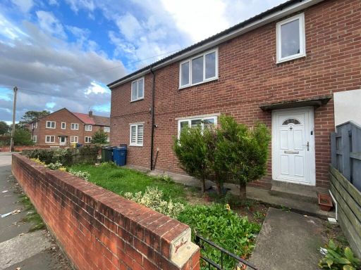 3 bedroom flat for sale in Elmfield Road, Hebburn, Tyne and Wear, NE31 2DY, NE31 — £60,000 • 3 bed • 1 bath
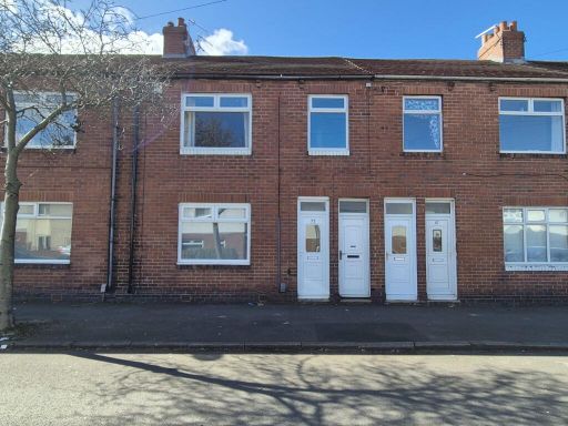 2 bedroom flat for sale in Tweed Street, Hebburn, Tyne and Wear, NE31 1XW, NE31 — £50,000 • 2 bed • 1 bath • 743 ft²
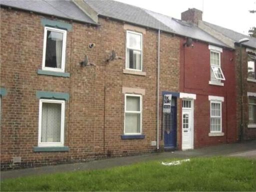 2 bedroom terraced house for sale in Parliament Street, Hebburn, Tyne and Wear, NE31 — £55,000 • 2 bed • 1 bath
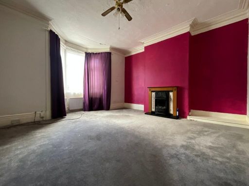 3 bedroom terraced house for sale in Hall Road, Hebburn, Tyne and Wear, NE31 — £130,000 • 3 bed • 1 bath
 2 bedroom flat for sale in Victoria Road East, Hebburn, Tyne and Wear, NE31 1YE, NE31 — £75,000 • 2 bed • 1 bath • 689 ft²
Meta
- {
"@context": "https://schema.org",
"@type": "Residence",
"name": "2 bedroom flat for sale in Victoria Road East, Hebburn, Tyn…",
"description": "",
"url": "https://propertypiper.co.uk/property/a6e4d7b3-bbd2-4fac-8b04-935d969829b9",
"image": "https://image-a.propertypiper.co.uk/ae6accf9-2b9e-46d9-85bc-a23b16fa6c03-1024.jpeg",
"address": {
"@type": "PostalAddress",
"streetAddress": "311 VICTORIA ROAD EAST HEBBURN ",
"postalCode": "NE31 1YF",
"addressLocality": "South Tyneside",
"addressRegion": "Jarrow",
"addressCountry": "England"
},
"geo": {
"@type": "GeoCoordinates",
"latitude": 54.97779775500163,
"longitude": -1.5001998446642144
},
"numberOfRooms": 2,
"numberOfBathroomsTotal": 1,
"floorSize": {
"@type": "QuantitativeValue",
"value": 640,
"unitCode": "FTK"
},
"offers": {
"@type": "Offer",
"price": 25000,
"priceCurrency": "GBP",
"availability": "https://schema.org/InStock"
},
"additionalProperty": [
{
"@type": "PropertyValue",
"name": "Feature",
"value": "townhouse"
},
{
"@type": "PropertyValue",
"name": "Feature",
"value": "Victorian"
},
{
"@type": "PropertyValue",
"name": "Feature",
"value": "brick exterior"
},
{
"@type": "PropertyValue",
"name": "Feature",
"value": "terraced"
},
{
"@type": "PropertyValue",
"name": "Feature",
"value": "bay window"
},
{
"@type": "PropertyValue",
"name": "Feature",
"value": "chimney"
},
{
"@type": "PropertyValue",
"name": "Feature",
"value": "two-storey"
},
{
"@type": "PropertyValue",
"name": "Feature",
"value": "traditional architecture"
},
{
"@type": "PropertyValue",
"name": "Feature",
"value": "needs modernization"
},
{
"@type": "PropertyValue",
"name": "Feature",
"value": "Victorian"
},
{
"@type": "PropertyValue",
"name": "Feature",
"value": "living room"
},
{
"@type": "PropertyValue",
"name": "Feature",
"value": "fireplace"
},
{
"@type": "PropertyValue",
"name": "Feature",
"value": "high ceilings"
},
{
"@type": "PropertyValue",
"name": "Feature",
"value": "dated decor"
},
{
"@type": "PropertyValue",
"name": "Feature",
"value": "needs modernization"
},
{
"@type": "PropertyValue",
"name": "Feature",
"value": "fixer-upper"
}
]
}
High Res Floorplan Images
Compatible Floorplan Images
FloorplanImages Thumbnail