BB5 5QP - 3 bedroom detached house for sale in Collingwood, Clayton L…
View on Property Piper
3 bedroom detached house for sale in Collingwood, Clayton Le Moors, Accrington, Lancashire, BB5
Property Details
- Price: £230000
- Bedrooms: 3
- Bathrooms: 2
- Property Type: undefined
- Property SubType: undefined
Image Descriptions
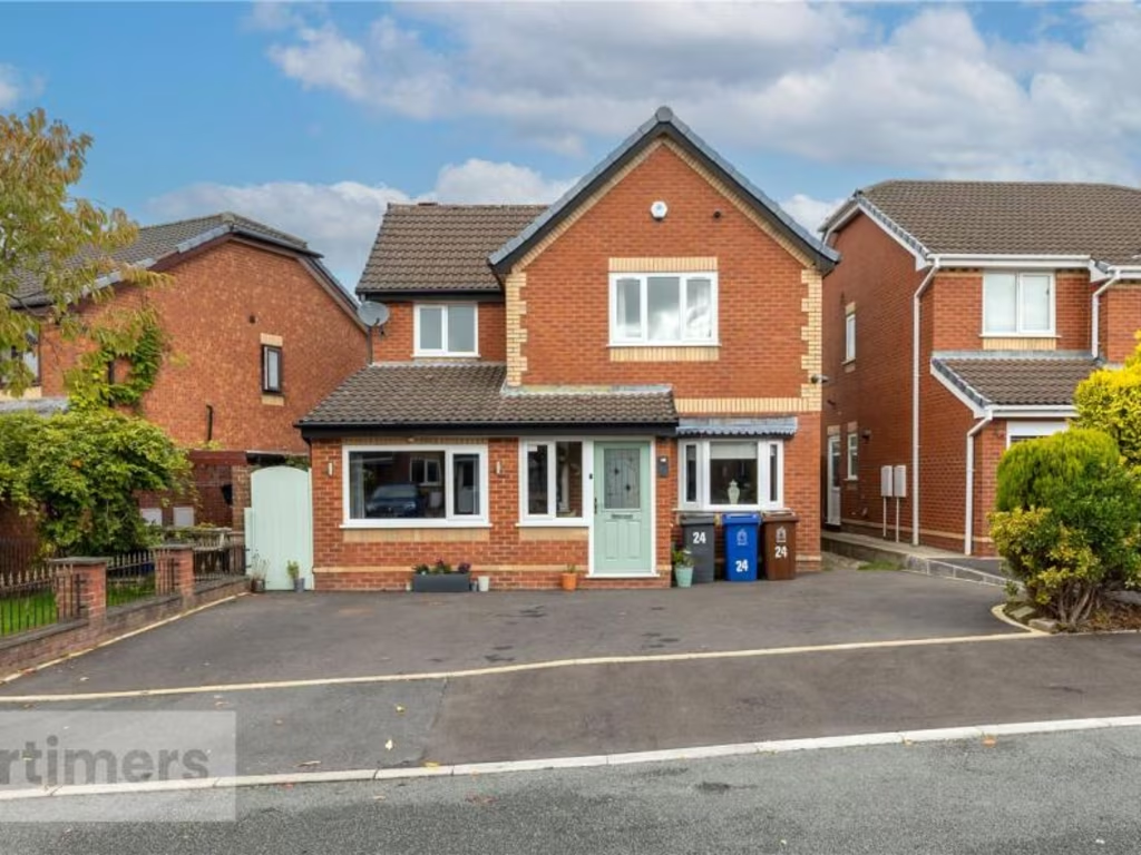
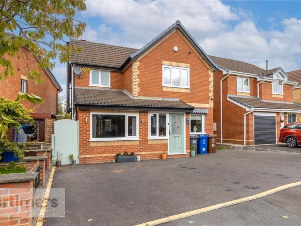
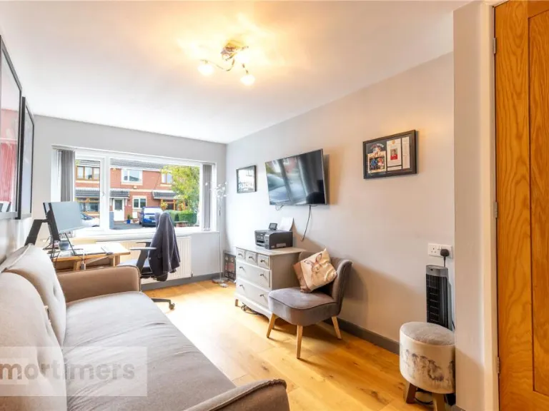
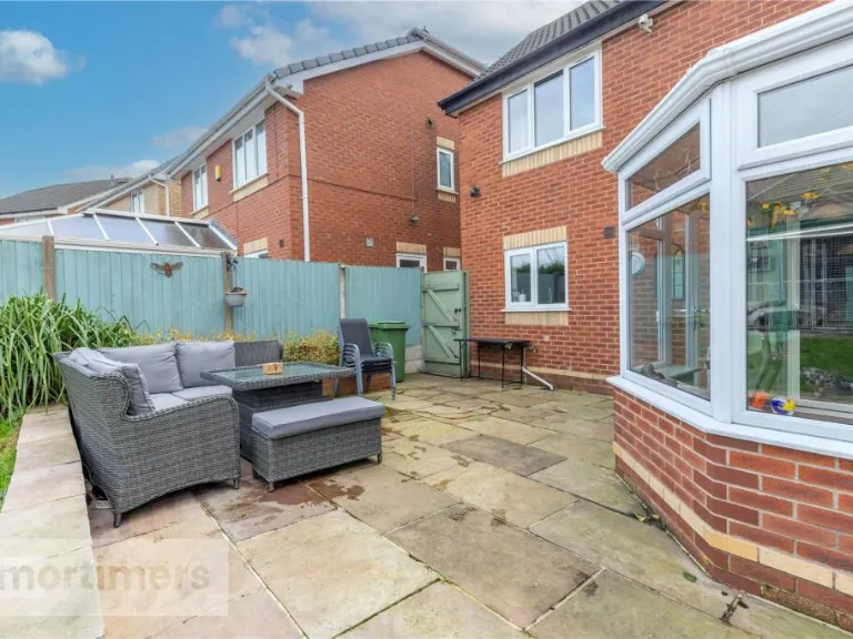
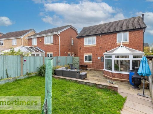
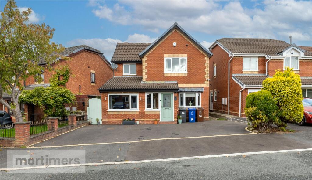
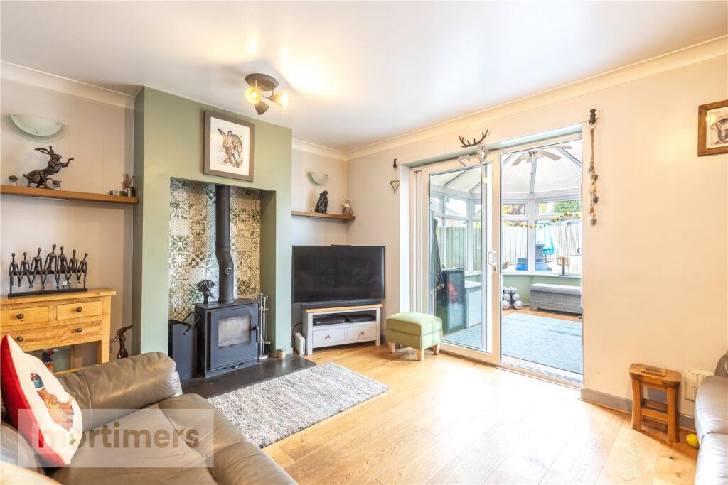
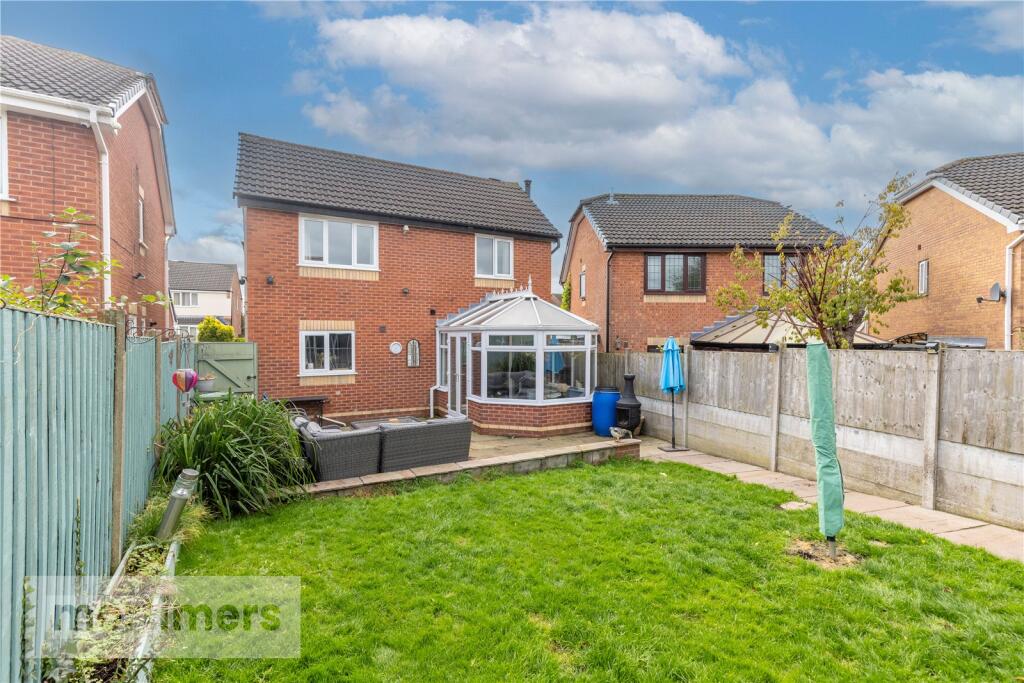
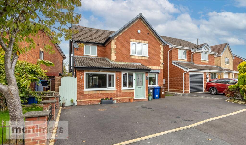
- detached house modern
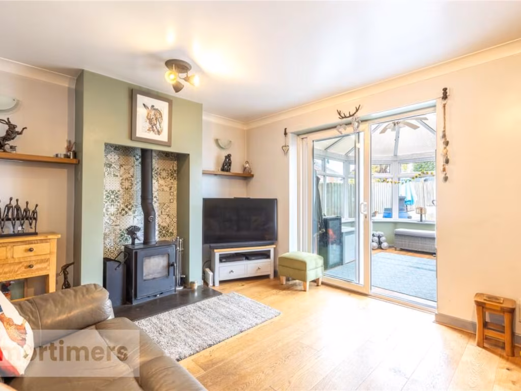
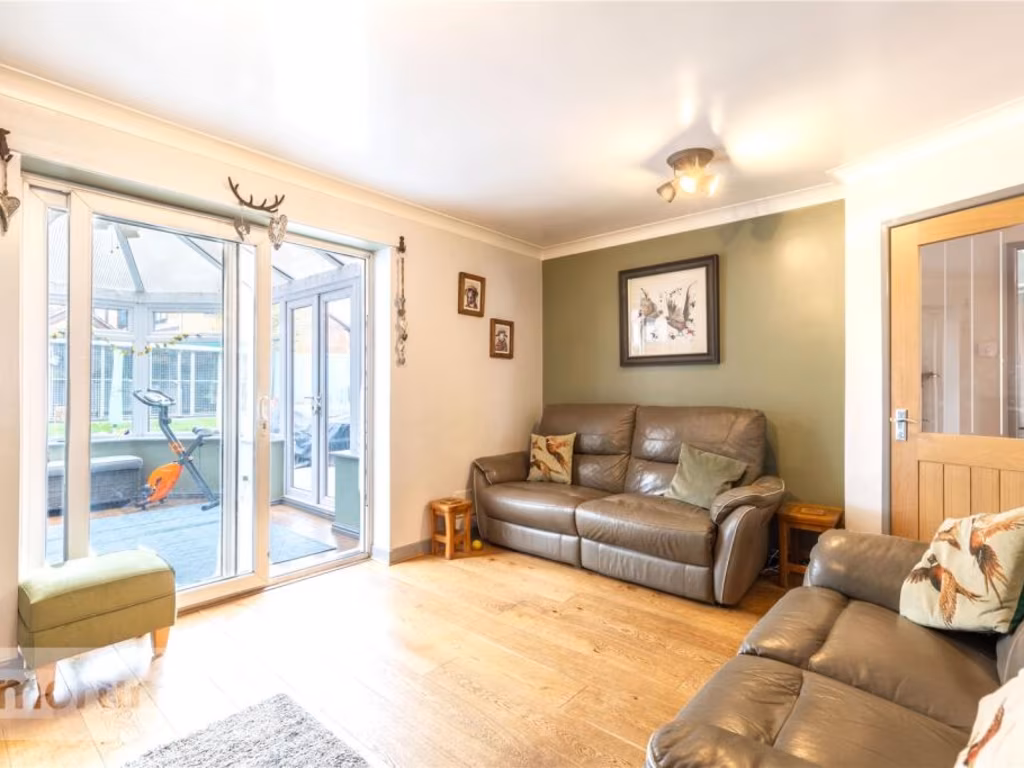
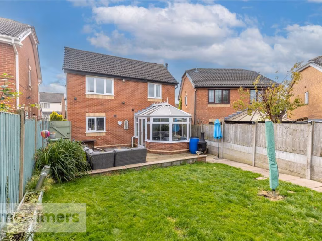
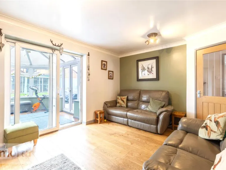
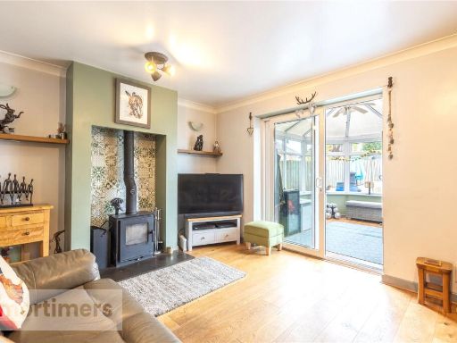
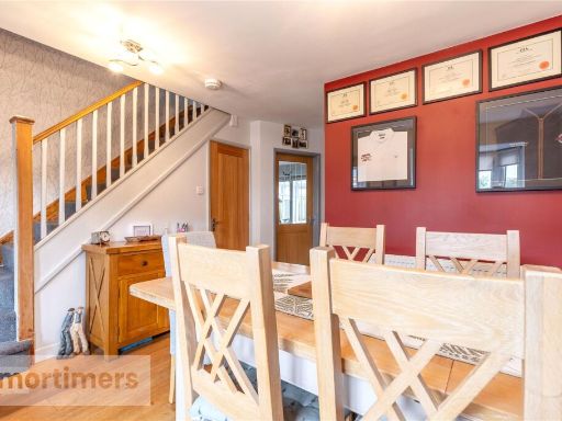
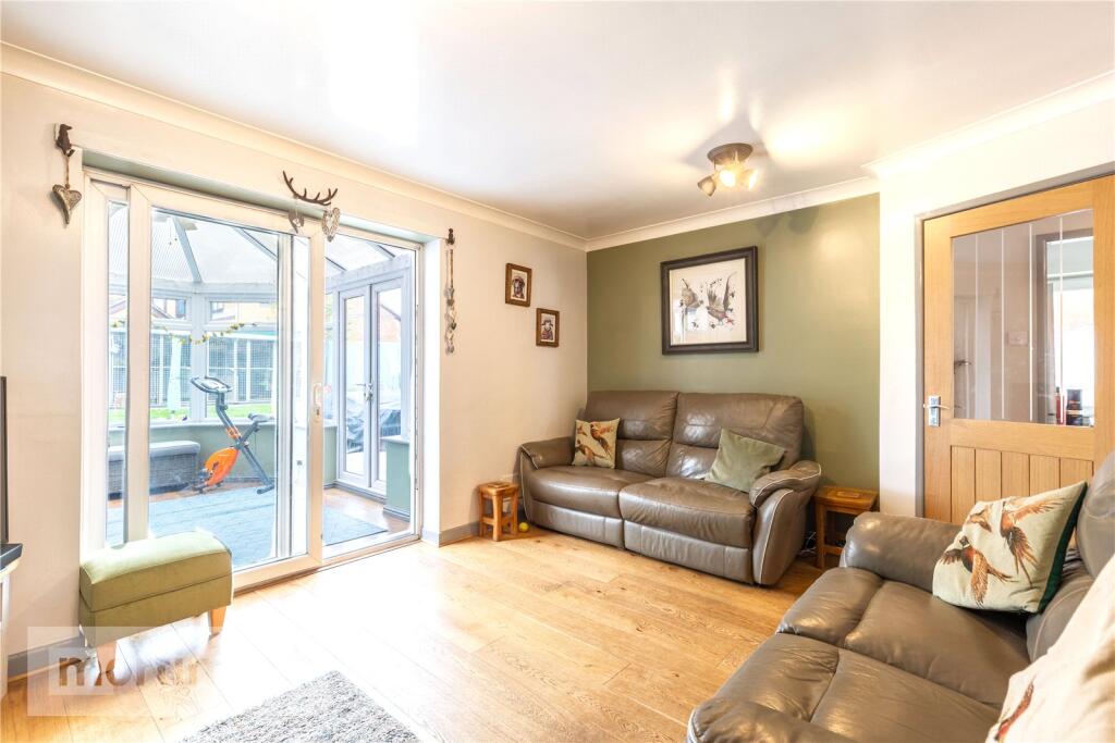
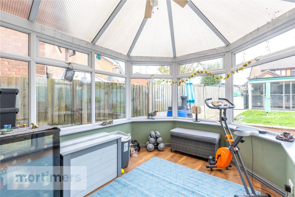
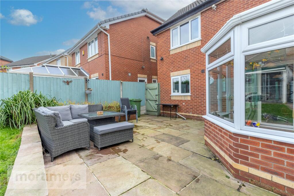
- living area with attached conservatory modern
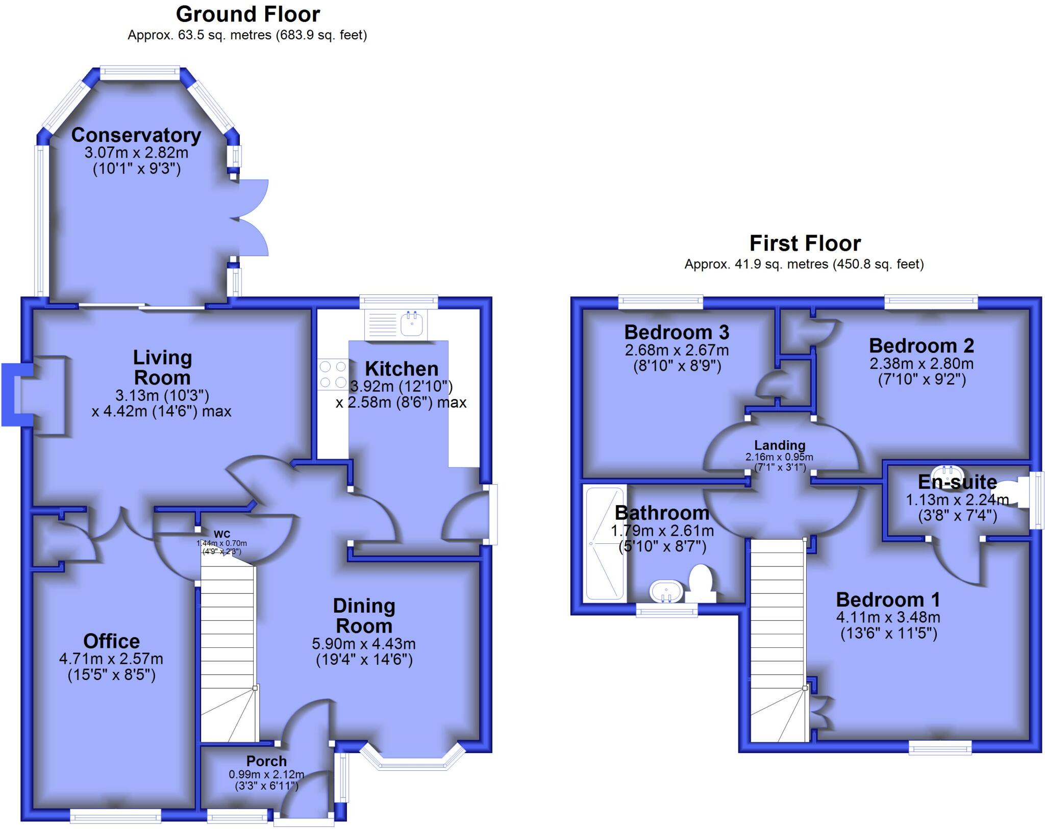
Floorplan Description
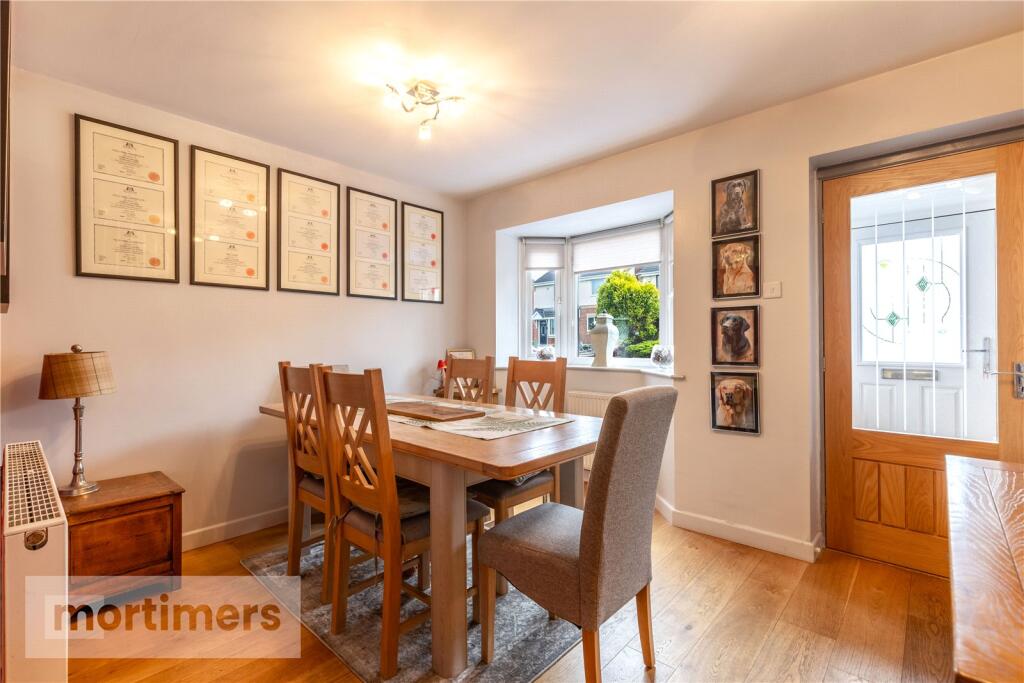
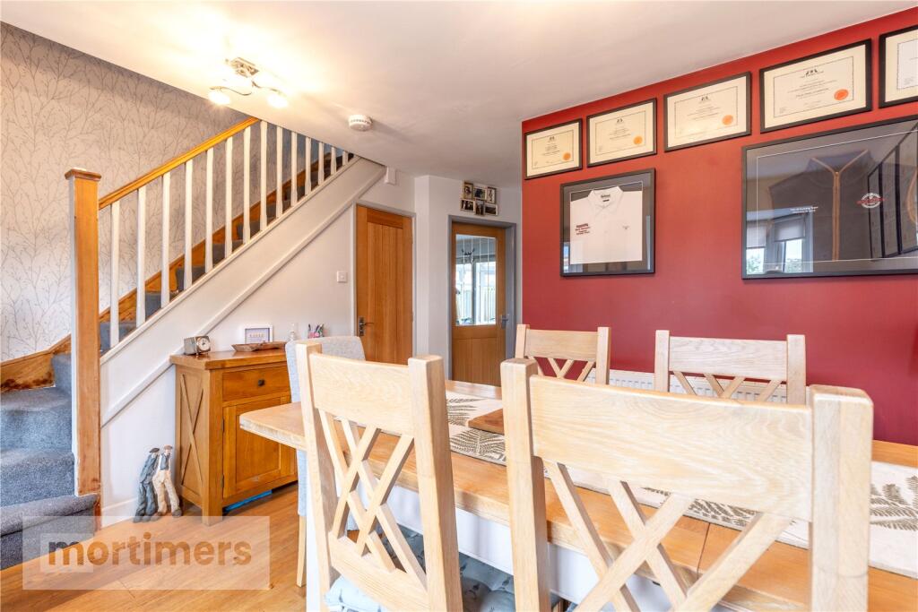
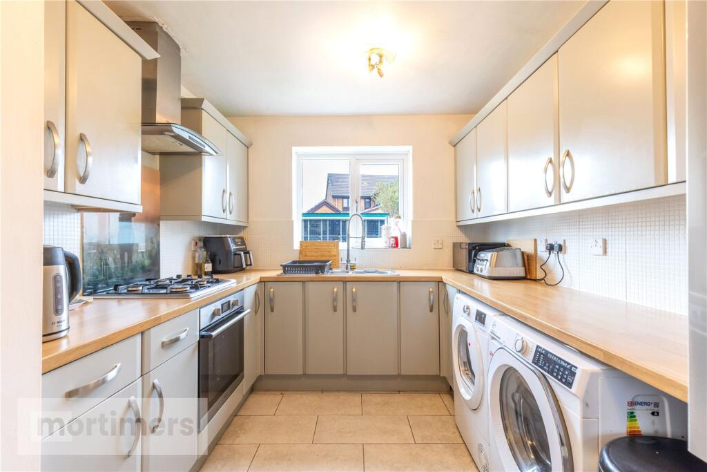
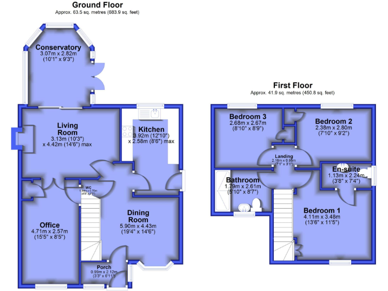
- Two-floor residential property with ground-floor living, dining, kitchen, office, conservatory and first-floor bedrooms with en-suite.
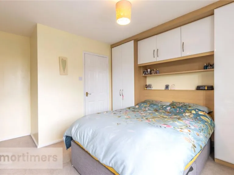
Rooms
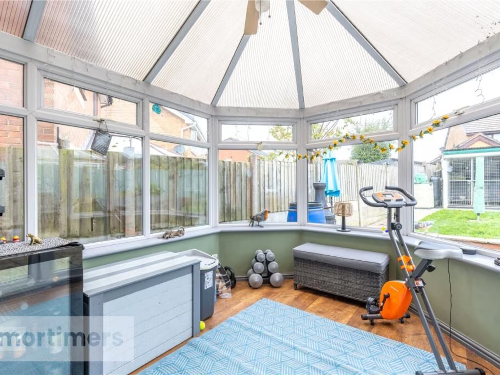
- Conservatory:
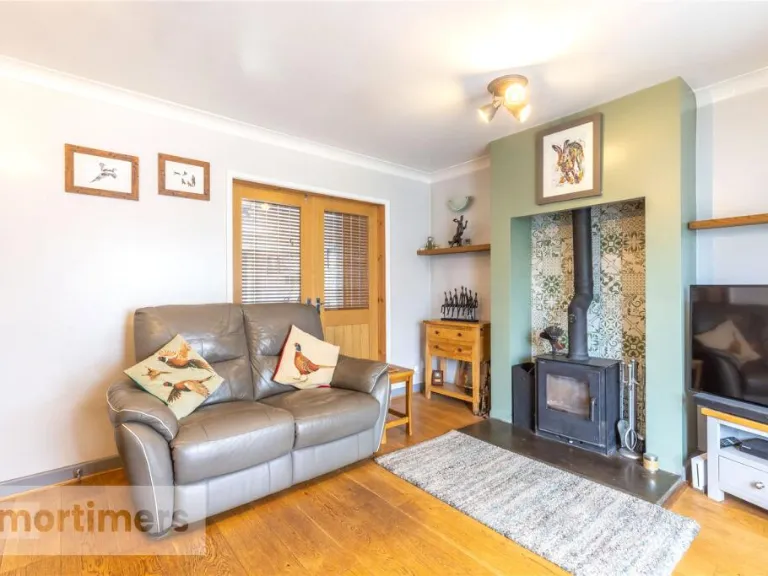
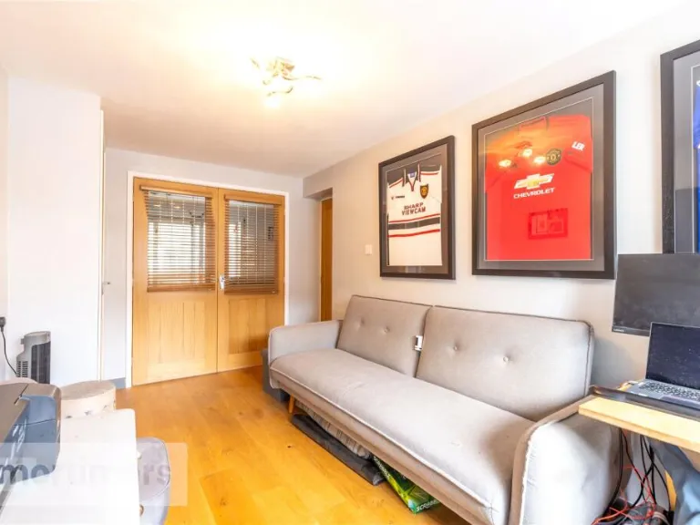
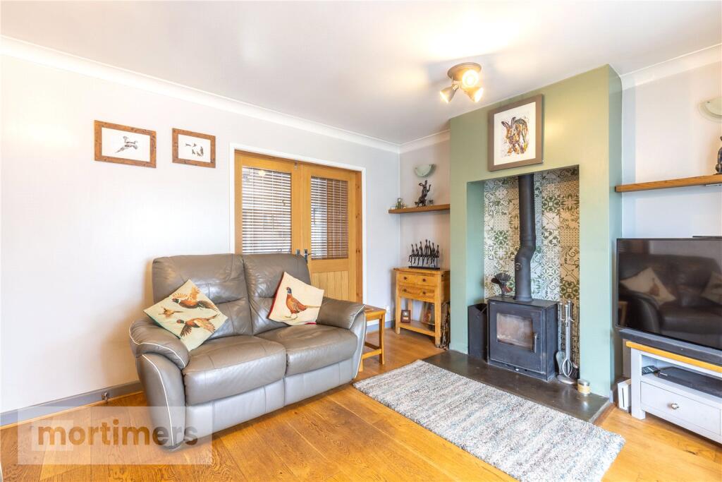
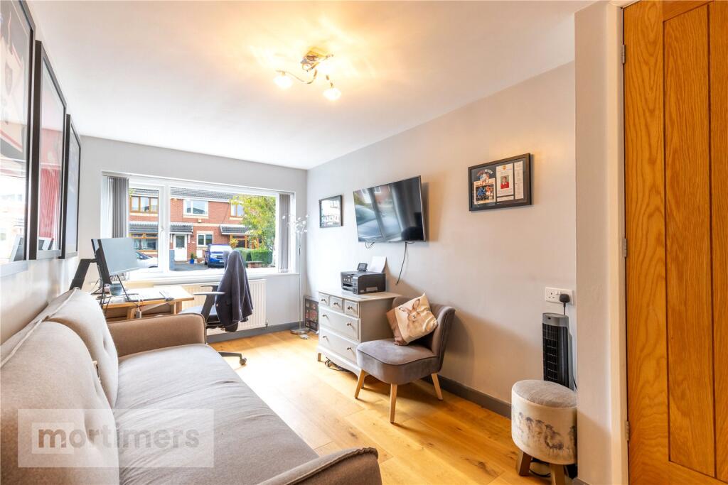
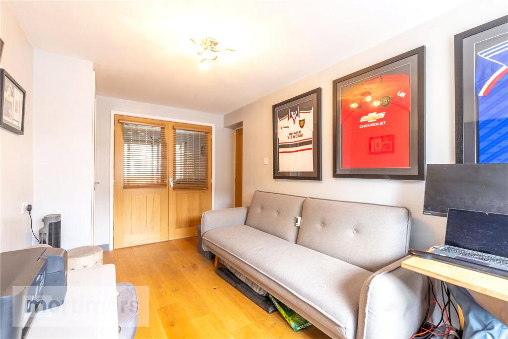
- Living Room:
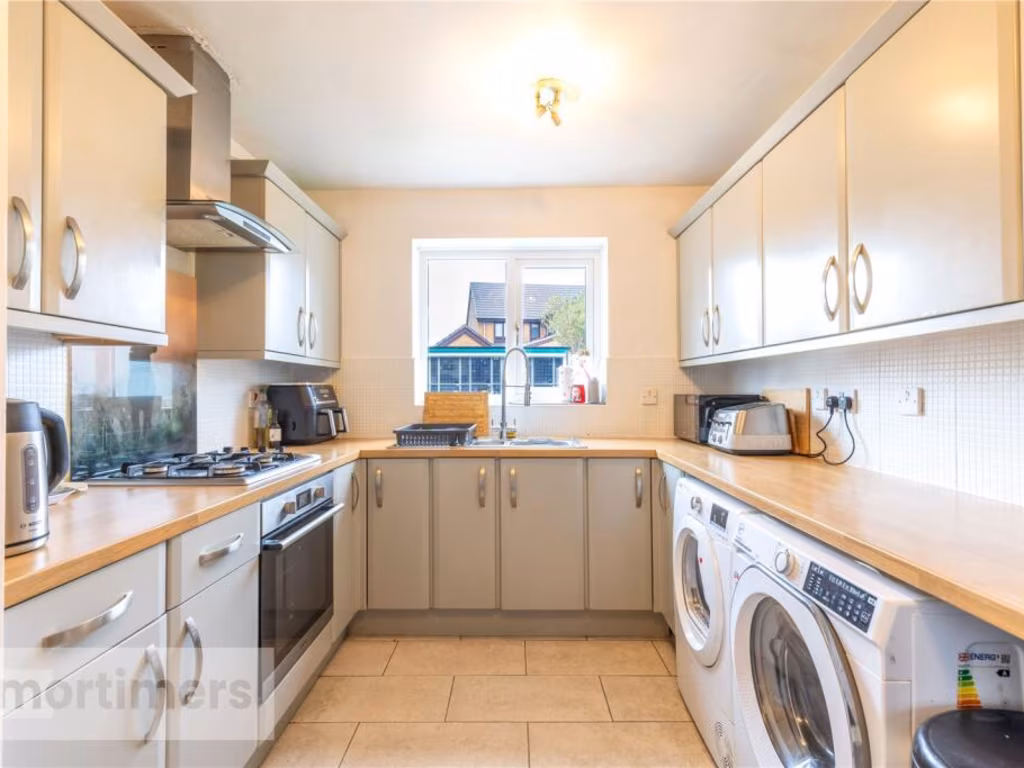
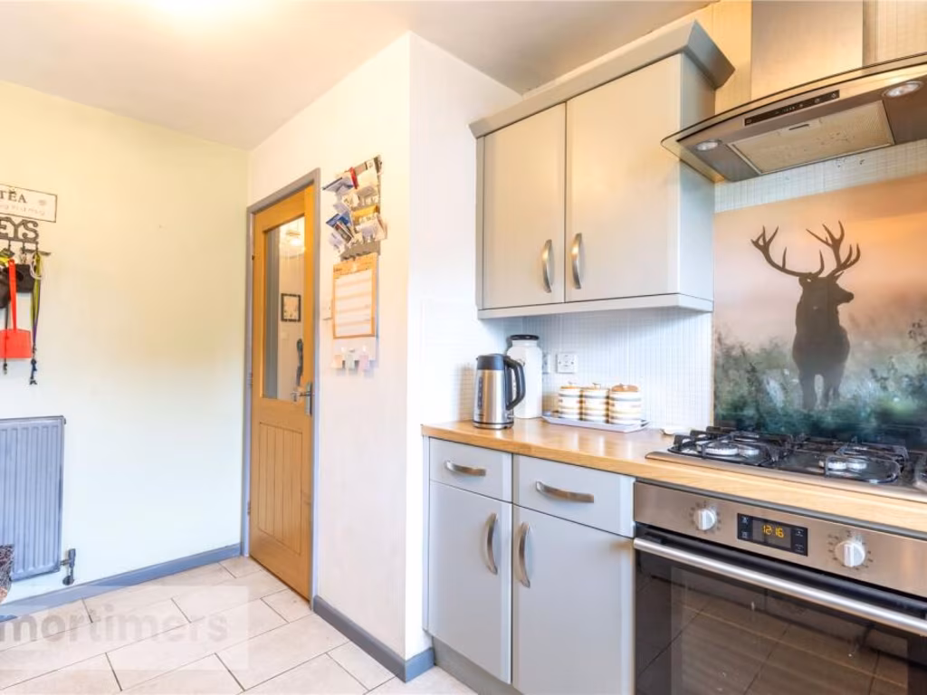
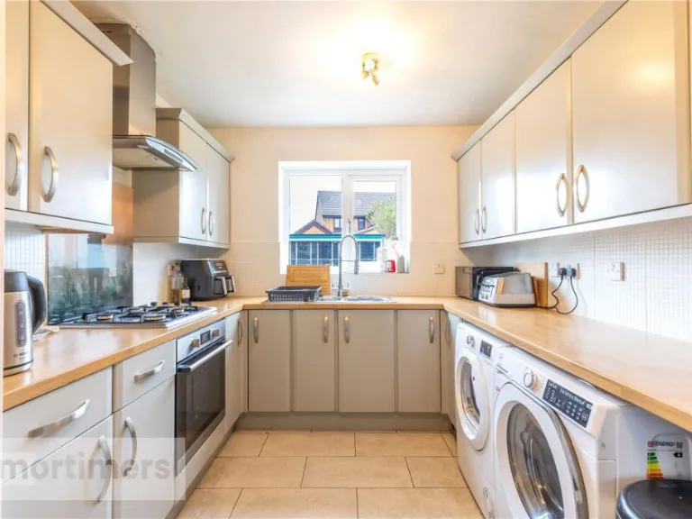
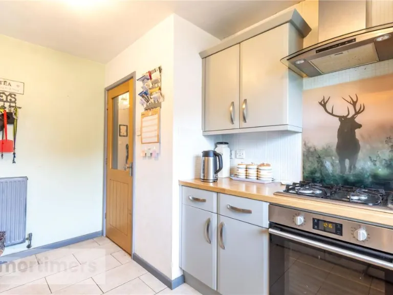
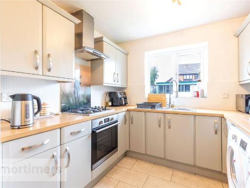
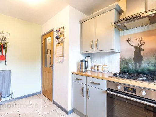
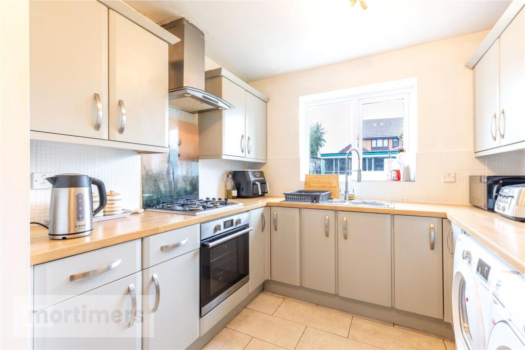
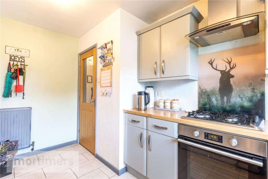
- Kitchen:
- Office:
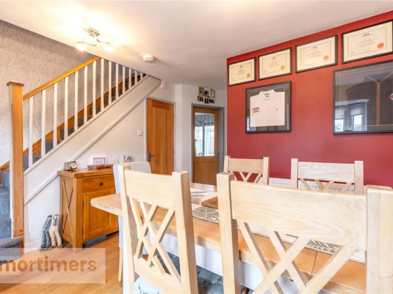
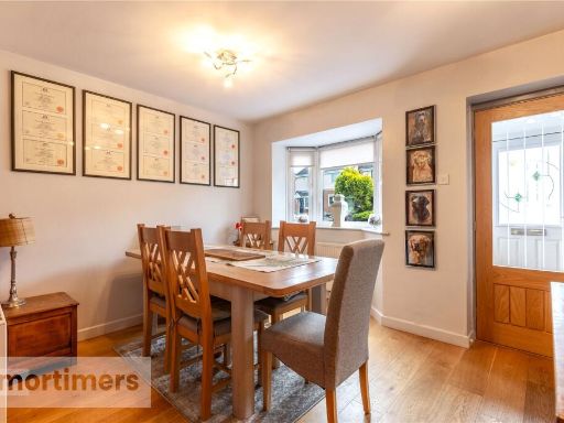
- Dining Room:
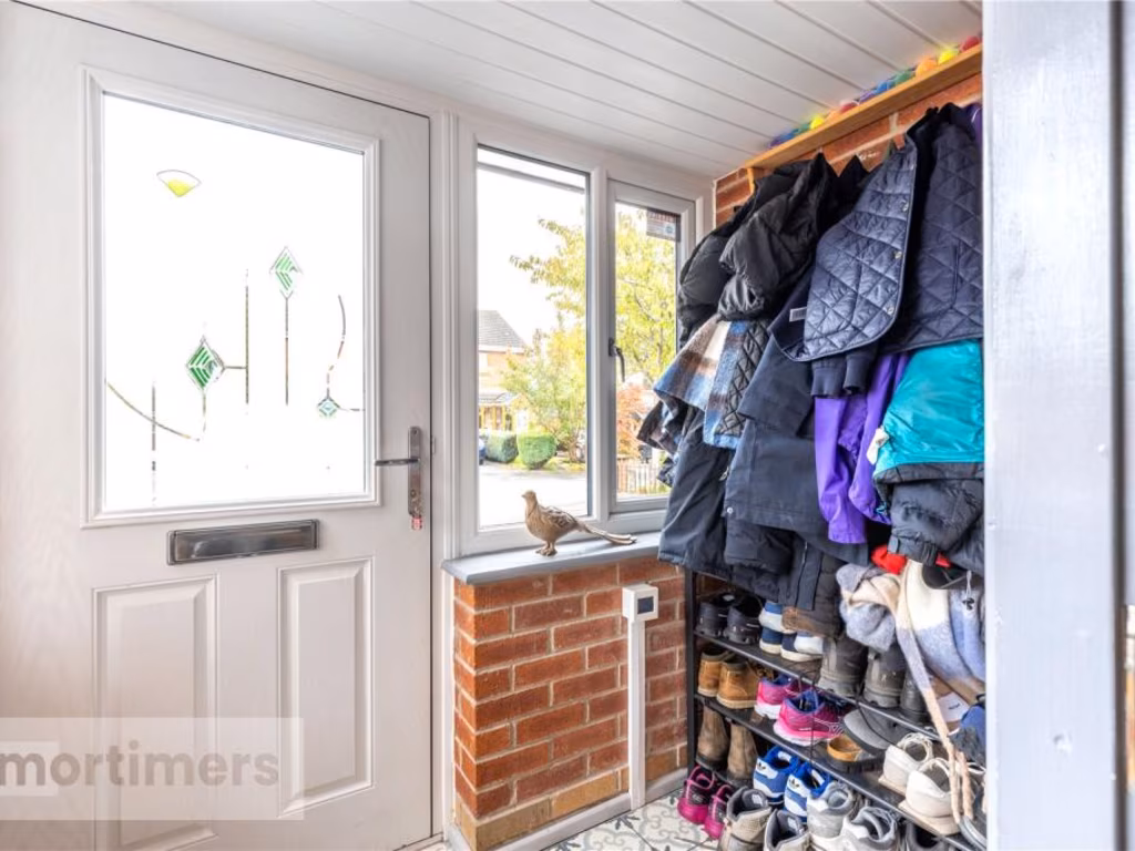
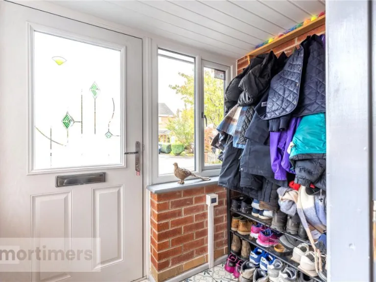
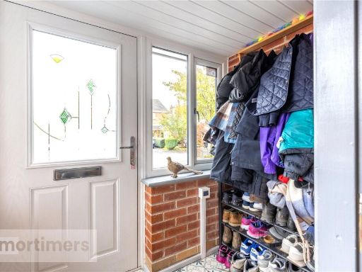
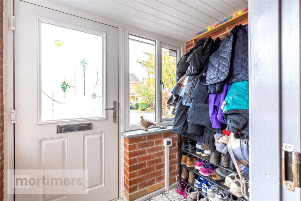
- Porch:
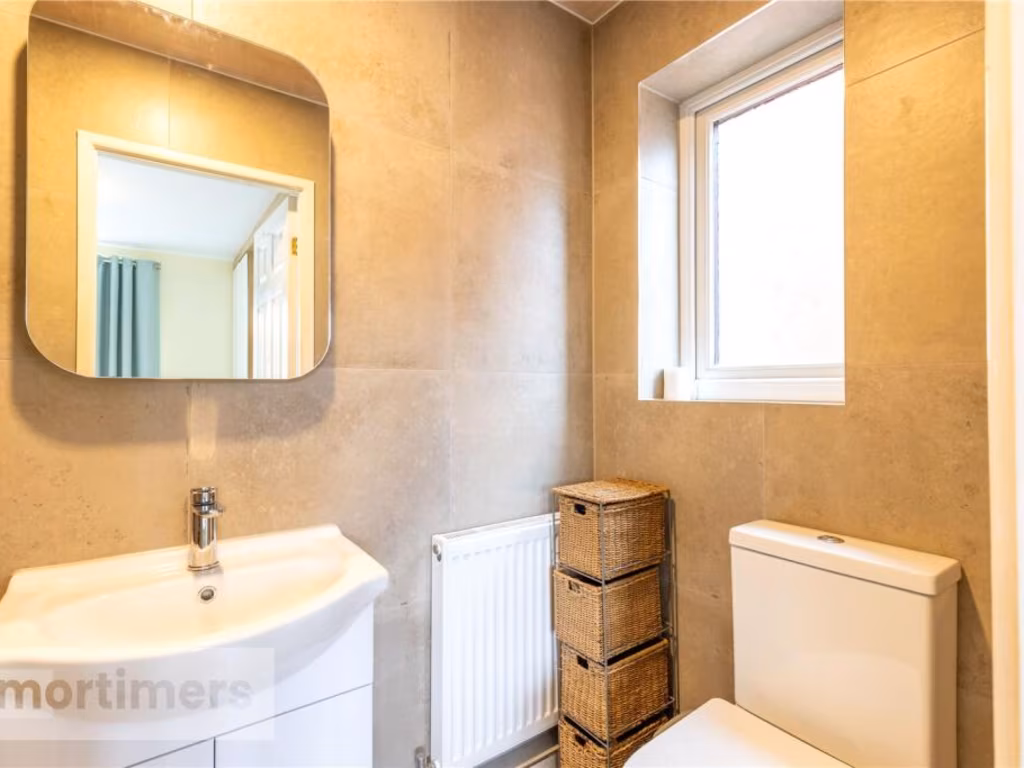
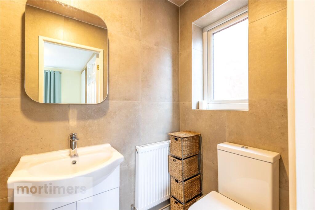
- WC:
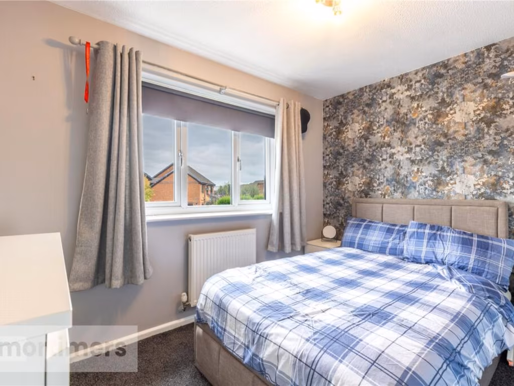
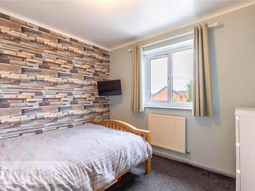
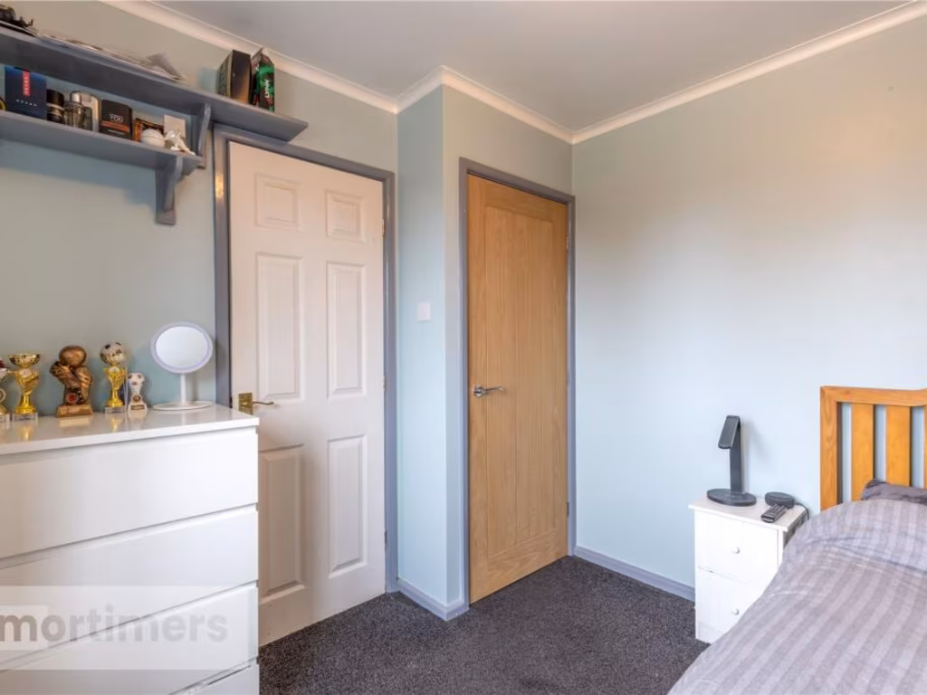
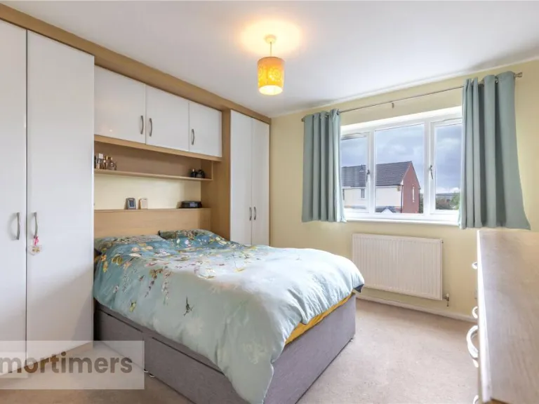
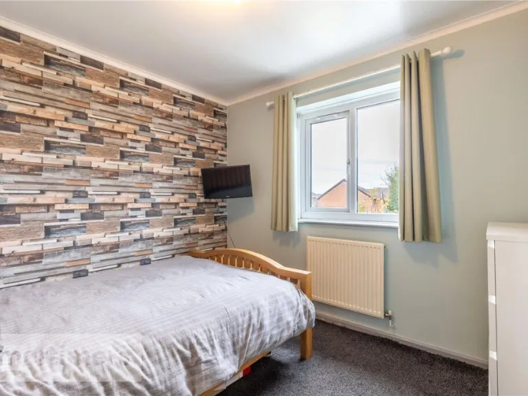
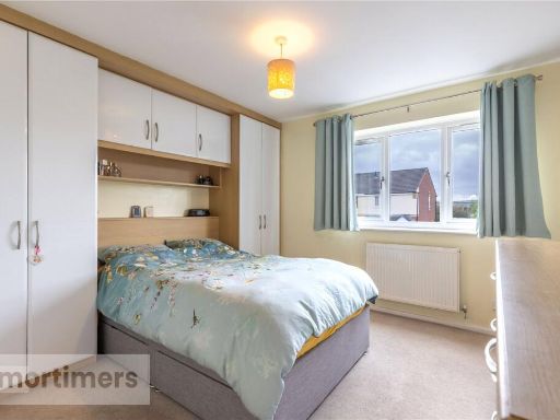
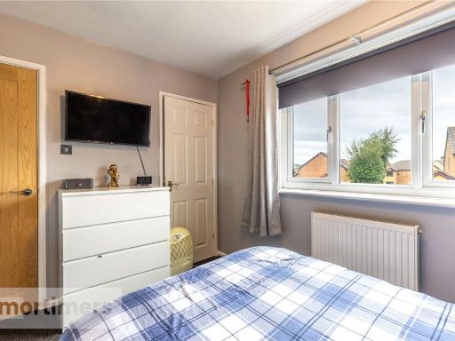
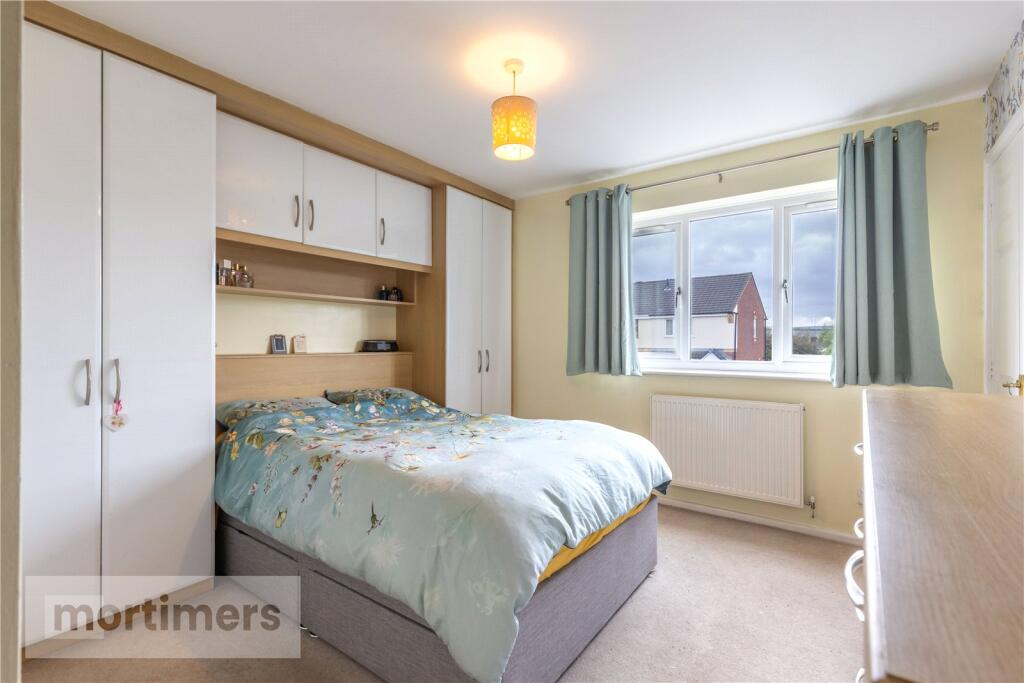
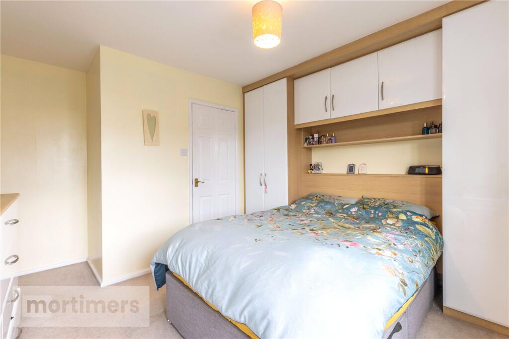
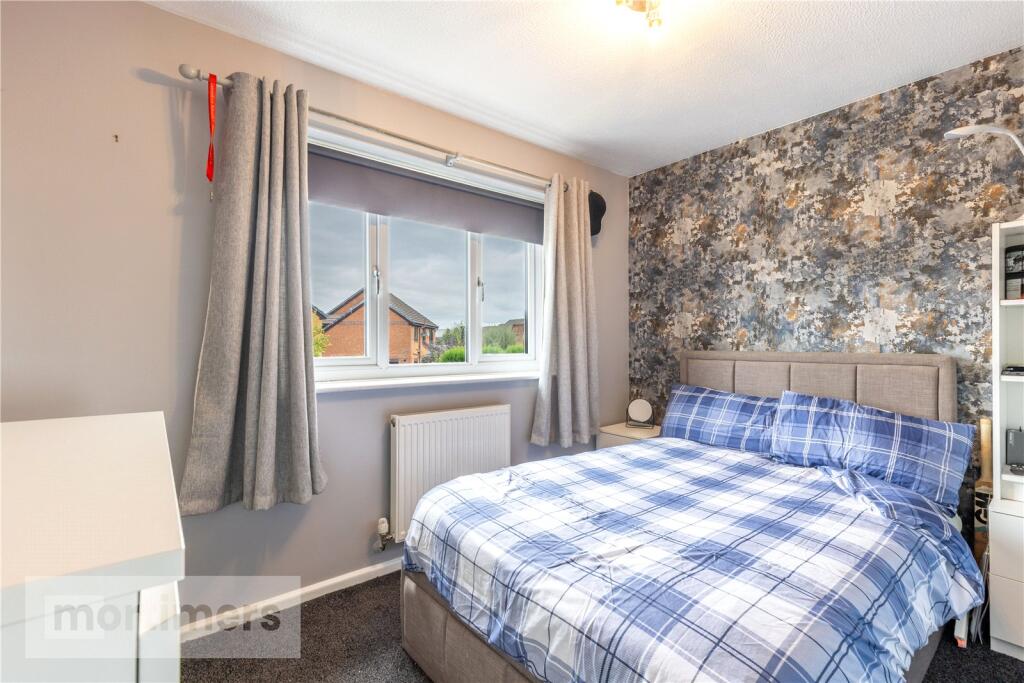
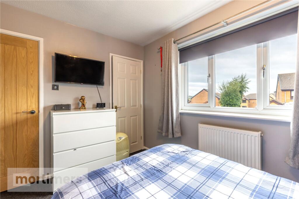
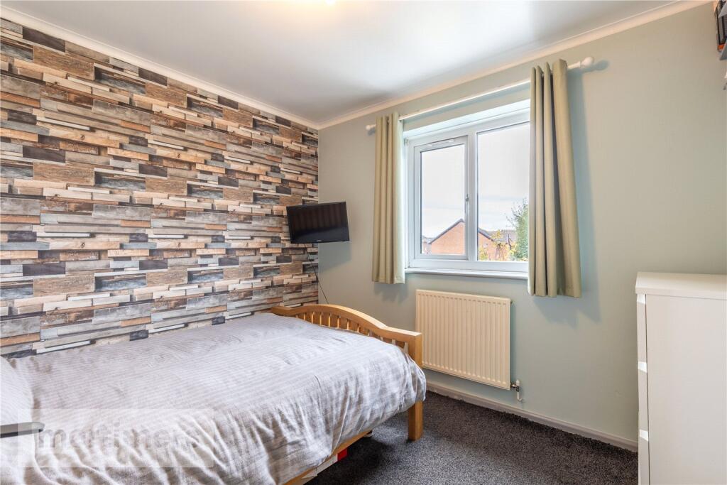
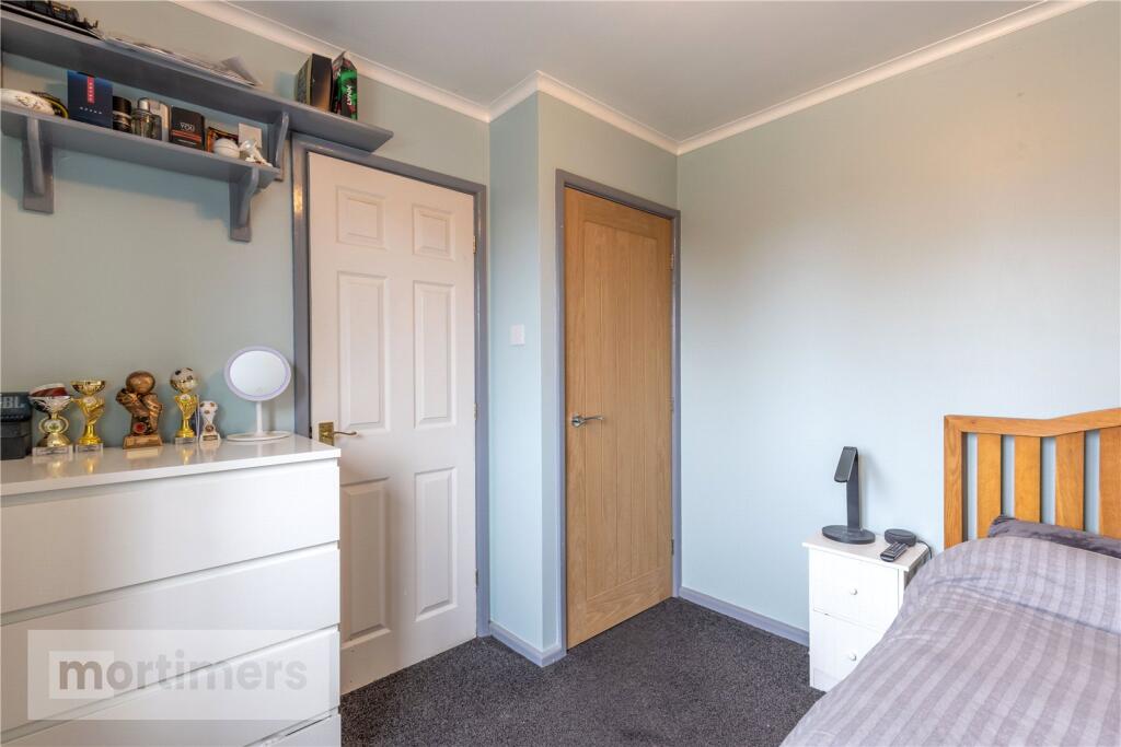
- Bedroom 3:
- Bedroom 2:
- Landing:
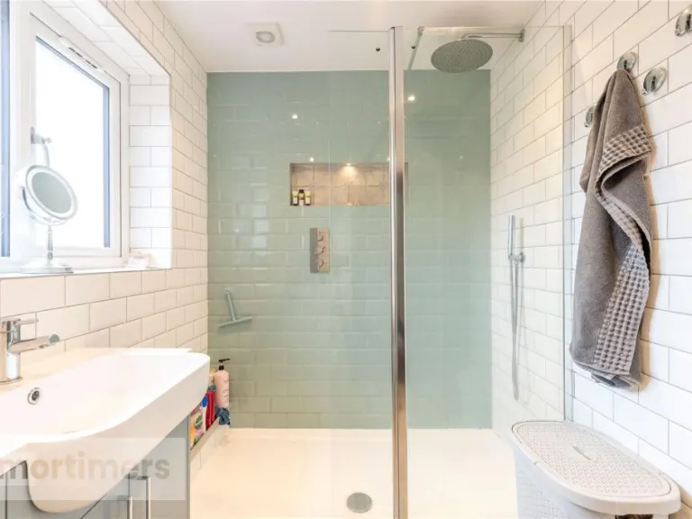
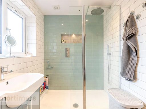
- Bathroom:
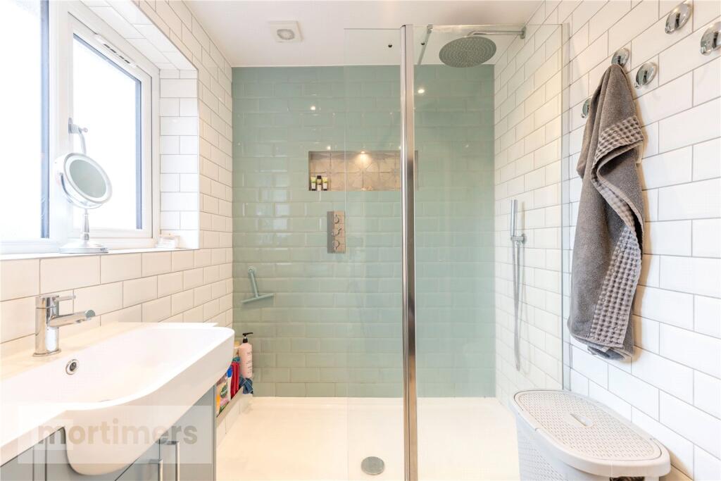
- En-suite:
- Bedroom 1:
Textual Property Features
Detected Visual Features
- detached house
- modern style
- brick exterior
- two-story
- asphalt driveway
- suburban
- residential area
- low maintenance
- wood burner
- living area
- conservatory
- double doors
- wood flooring
EPC Details
- Fully double glazed
- Cavity wall, as built, insulated (assumed)
- Boiler and radiators, mains gas
- Low energy lighting in all fixed outlets
- Solid, limited insulation (assumed)
Nearby Schools
- Mount Carmel Roman Catholic High School, Hyndburn
- Accrington Spring Hill Community Primary School
- Sacred Heart Roman Catholic Primary School, Church
- Accrington Academy
- Clayton-le-Moors Mount Pleasant Primary School
- Clayton-le-Moors All Saints' Church of England Primary School
- Oswaldtwistle Moor End Primary School
- Oswaldtwistle St Andrew's Church of England Primary School
- St Mary's Roman Catholic Primary School, Oswaldtwistle
- Rhyddings
- Oswaldtwistle St Paul's Church of England Primary School
- St Nicholas Church of England Primary School
- Accrington St Christopher's Church of England High School
- Rishton Methodist Primary School
- St Mary's Roman Catholic Primary School, Clayton-le-Moors
- Great Harwood St John's Church of England Primary School
- Oswaldtwistle West End Primary School
- Accrington Hyndburn Park Primary School
- The Hyndburn Academy
- Great Harwood Primary School
- Great Harwood St Bartholomew's Parish Church of England Voluntary Aided Primary School
- Accrington St Mary Magdalen's Church of England Primary School
- St Charles' RC School
- Rishton St Peter and St Paul's Church of England Primary School
- St Wulstan's Catholic Primary School, Great Harwood
- St Hubert's Roman Catholic Primary School, Great Harwood
Nearest General Shops
- Id: 660191073
- Tags:
- Name: Hairways
- Shop: hairdresser
- TagsNormalized:
- Lat: 53.7763242
- Lon: -2.3874838
- FullGeoHash: gcw3cttmz97j
- PartitionGeoHash: gcw3
- Images:
- FoodStandards: null
- Distance: 549.1
,- Id: 660191081
- Tags:
- Addr:
- Housenumber: 101
- Postcode: BB5 5PG
- Street: Barnes Street
- Fhrs:
- Name: B. Hodder
- Shop: butcher
- Source:
- TagsNormalized:
- Lat: 53.7765556
- Lon: -2.3884816
- FullGeoHash: gcw3ctsz0ke1
- PartitionGeoHash: gcw3
- Images:
- FoodStandards:
- Id: 85069
- FHRSID: 85069
- LocalAuthorityBusinessID: 2124
- BusinessName: Hodders Butchers
- BusinessType: Retailers - other
- BusinessTypeID: 4613
- AddressLine1: 101 Barnes Street
- AddressLine2: Clayton Le Moors
- AddressLine3: Accrington
- AddressLine4: null
- PostCode: BB5 5PG
- RatingValue: 4
- RatingKey: fhrs_4_en-GB
- RatingDate: 2023-01-26
- LocalAuthorityCode: 199
- LocalAuthorityName: Hyndburn
- LocalAuthorityWebSite: http://www.hyndburnbc.gov.uk
- LocalAuthorityEmailAddress: enquiries@hyndburnbc.gov.uk
- Scores:
- Hygiene: 0
- Structural: 5
- ConfidenceInManagement: 10
- NewRatingPending: false
- Geocode:
- Longitude: -2.38755300000000
- Latitude: 53.77638900000000
- Distance: 520.8
,- Id: 660191075
- Tags:
- Name: Stylebar
- Shop: hairdresser
- TagsNormalized:
- Lat: 53.7749187
- Lon: -2.3864846
- FullGeoHash: gcw3ctqjwgkh
- PartitionGeoHash: gcw3
- Images:
- FoodStandards: null
- Distance: 520.1
}
Nearest Grocery shops
- Id: 632879807
- Tags:
- Addr:
- Housenumber: 109-113
- Postcode: BB6 7AF
- Street: Saint Huberts Road
- Fhrs:
- Name: Ackys
- Shop: convenience
- Source:
- TagsNormalized:
- Lat: 53.783416
- Lon: -2.4051554
- FullGeoHash: gcw3cqbx5g6j
- PartitionGeoHash: gcw3
- Images:
- FoodStandards: null
- Distance: 1374.8
,- Id: 660192809
- Tags:
- Brand: Spar
- Brand:wikidata: Q610492
- Brand:wikipedia: en:SPAR (retailer)
- Name: Spar
- Shop: convenience
- TagsNormalized:
- Lat: 53.7748486
- Lon: -2.384813
- FullGeoHash: gcw3ctrmjy6d
- PartitionGeoHash: gcw3
- Images:
- FoodStandards: null
- Distance: 619.9
,- Id: 660191072
- Tags:
- Brand: Londis
- Brand:wikidata: Q21008564
- Brand:wikipedia: en:Londis (United Kingdom)
- Name: Londis
- Shop: convenience
- TagsNormalized:
- Lat: 53.7761435
- Lon: -2.3878056
- FullGeoHash: gcw3cttk8pep
- PartitionGeoHash: gcw3
- Images:
- FoodStandards: null
- Distance: 519.9
}
Nearest Religious buildings
- Id: 660191082
- Tags:
- Amenity: place_of_worship
- Denomination: baptist
- Name: Clayton Baptist Church
- Religion: christian
- TagsNormalized:
- place of worship
- baptist
- church
- christian
- Lat: 53.7780042
- Lon: -2.3878637
- FullGeoHash: gcw3ctvpwdxf
- PartitionGeoHash: gcw3
- Images:
- FoodStandards: null
- Distance: 672.6
,- Id: 338354171
- Tags:
- Amenity: place_of_worship
- Building: yes
- Denomination: methodist
- Name: Barnes Square Methodist Church
- Religion: christian
- Source: OSOpendataStreetview
- TagsNormalized:
- place of worship
- methodist
- church
- christian
- Lat: 53.7745042
- Lon: -2.3857734
- FullGeoHash: gcw3ctqepqnk
- PartitionGeoHash: gcw3
- Images:
- FoodStandards: null
- Distance: 548
,- Id: 338351156
- Tags:
- Amenity: place_of_worship
- Building: church
- Denomination: anglican
- Name: All Saints
- Religion: christian
- Source: OSOpendataStreetview
- Wikidata: Q26643939
- TagsNormalized:
- place of worship
- church
- anglican
- christian
- Lat: 53.7738522
- Lon: -2.3881878
- FullGeoHash: gcw3cthzrhw5
- PartitionGeoHash: gcw3
- Images:
- FoodStandards: null
- Distance: 375.7
}
Nearest Medical buildings
- Id: 338354172
- Tags:
- Amenity: doctors
- Building: yes
- Building:levels: 1
- Healthcare: doctor
- Name: Clayton Medical Centre
- Source: OSOpendataStreetview
- TagsNormalized:
- doctor
- doctors
- health
- healthcare
- Lat: 53.7746916
- Lon: -2.3837076
- FullGeoHash: gcw3cv2hr94f
- PartitionGeoHash: gcw3
- Images:
- FoodStandards: null
- Distance: 684.2
,- Id: 660191062
- Tags:
- Amenity: health_centre
- Healthcare: centre
- TagsNormalized:
- health
- health centre
- healthcare
- Lat: 53.7747238
- Lon: -2.3838892
- FullGeoHash: gcw3cv2h7r56
- PartitionGeoHash: gcw3
- Images:
- FoodStandards: null
- Distance: 673.7
,- Id: 660192808
- Tags:
- Addr:
- Housenumber: 36
- Postcode: BB5 5NS
- Street: Pickup Street
- Amenity: pharmacy
- Brand: Well Pharmacy
- Brand:wikidata: Q7726524
- Brand:wikipedia: en:Well Pharmacy
- Dispensing: yes
- Fhrs:
- Healthcare: pharmacy
- Name: Well Pharmacy
- Source:
- TagsNormalized:
- pharmacy
- well pharmacy
- health
- healthcare
- Lat: 53.7750647
- Lon: -2.3848082
- FullGeoHash: gcw3ctrqmyw5
- PartitionGeoHash: gcw3
- Images:
- FoodStandards: null
- Distance: 628.3
,- Id: 660191074
- Tags:
- Amenity: dentist
- Healthcare: dentist
- TagsNormalized:
- Lat: 53.7747428
- Lon: -2.3863139
- FullGeoHash: gcw3ctqkdfe7
- PartitionGeoHash: gcw3
- Images:
- FoodStandards: null
- Distance: 523.1
}
Nearest Leisure Facilities
- Id: 51730824
- Tags:
- TagsNormalized:
- Lat: 53.7759738
- Lon: -2.3912081
- FullGeoHash: gcw3ctdgbb44
- PartitionGeoHash: gcw3
- Images:
- FoodStandards: null
- Distance: 365
,- Id: 4214174
- Tags:
- Leisure: park
- Name: Mercer Park
- Source: yahoo_imagery_via_applet
- TagsNormalized:
- Lat: 53.7753976
- Lon: -2.3899522
- FullGeoHash: gcw3cte8qhdm
- PartitionGeoHash: gcw3
- Images:
- FoodStandards: null
- Distance: 360.6
,- Id: 1085641099
- Tags:
- Leisure: pitch
- Sport: skateboard
- TagsNormalized:
- pitch
- leisure
- skateboard
- sports
- Lat: 53.7746364
- Lon: -2.3901056
- FullGeoHash: gcw3ct7efwb0
- PartitionGeoHash: gcw3
- Images:
- FoodStandards: null
- Distance: 296.9
,- Id: 51728923
- Tags:
- Leisure: pitch
- Sport: tennis
- Surface: asphalt
- TagsNormalized:
- Lat: 53.7748123
- Lon: -2.3903612
- FullGeoHash: gcw3ct7kux9d
- PartitionGeoHash: gcw3
- Images:
- FoodStandards: null
- Distance: 296.1
,- Id: 203088847
- Tags:
- Leisure: pitch
- Source: Bing
- Sport: bowls
- TagsNormalized:
- Lat: 53.7732941
- Lon: -2.3897145
- FullGeoHash: gcw3ct5u5se9
- PartitionGeoHash: gcw3
- Images:
- FoodStandards: null
- Distance: 266.1
}
Nearest Tourist attractions
- Id: 1039445590
- Tags:
- Addr:
- City: Accrington
- Housenumber: 135
- Postcode: BB5 0AA
- Street: Blackburn Road
- Building: yes
- Guest_house: bed_and_breakfast
- Name: Pilkingtons Bed & Breakfast
- Phone: +44 1254 237032
- Tourism: guest_house
- TagsNormalized:
- Lat: 53.753513
- Lon: -2.3697424
- FullGeoHash: gcw3f1d2uvpf
- PartitionGeoHash: gcw3
- Images:
- FoodStandards: null
- Distance: 2685
,- Id: 51275479
- Tags:
- Name: Harwood Bar Caravan Park
- Source: yahoo
- Tourism: caravan_site
- TagsNormalized:
- Lat: 53.7899393
- Lon: -2.3804575
- FullGeoHash: gcw61b4t576n
- PartitionGeoHash: gcw6
- Images:
- FoodStandards: null
- Distance: 2070.7
,- Id: 6255984586
- Tags:
- Name: Parker
- Name:en: Parker Place.
- Tourism: apartment
- TagsNormalized:
- Lat: 53.769614
- Lon: -2.4122218
- FullGeoHash: gcw3ch7qxnt1
- PartitionGeoHash: gcw3
- Images:
- FoodStandards: null
- Distance: 1273.2
}
Nearest Train stations
- Id: 21664753
- Tags:
- Name: Langho
- Naptan:
- Network: National Rail
- Public_transport: station
- Railway: station
- Ref:
- Source: NPE
- Train: yes
- Wikipedia: en:Langho railway station
- TagsNormalized:
- Lat: 53.8048112
- Lon: -2.4488239
- FullGeoHash: gcw606bgdrb8
- PartitionGeoHash: gcw6
- Images:
- FoodStandards: null
- Distance: 5055.9
,- Id: 3715250492
- Tags:
- Name: Huncoat
- Naptan:
- Network: National Rail
- Public_transport: station
- Railway: station
- Ref:
- Source: npe
- Wikipedia: en:Huncoat railway station
- TagsNormalized:
- Lat: 53.7722434
- Lon: -2.3470472
- FullGeoHash: gcw3fsfyjbdy
- PartitionGeoHash: gcw3
- Images:
- FoodStandards: null
- Distance: 3069.9
,- Id: 3715250477
- Tags:
- Name: Accrington
- Naptan:
- Network: National Rail
- Public_transport: station
- Railway: station
- Ref:
- Source: npe
- Train: yes
- Uic_ref: 7000025
- Wikipedia: en:Accrington railway station
- TagsNormalized:
- Lat: 53.7527983
- Lon: -2.3701201
- FullGeoHash: gcw3f16hspy7
- PartitionGeoHash: gcw3
- Images:
- FoodStandards: null
- Distance: 2735.6
,- Id: 3715250482
- Tags:
- Name: Church and Oswaldtwistle
- Naptan:
- Network: National Rail
- Public_transport: station
- Railway: station
- Ref:
- Source: npe
- Train: yes
- Wheelchair: limited
- Wikipedia: en:Church & Oswaldtwistle railway station
- TagsNormalized:
- Lat: 53.7505427
- Lon: -2.3908916
- FullGeoHash: gcw3c8gp85qh
- PartitionGeoHash: gcw3
- Images:
- FoodStandards: null
- Distance: 2510
,- Id: 3715250500
- Tags:
- Name: Rishton
- Naptan:
- Network: National Rail
- Public_transport: station
- Railway: station
- Ref:
- Source: BING
- Train: yes
- Wikipedia: en:Rishton railway station
- TagsNormalized:
- Lat: 53.7638289
- Lon: -2.4201859
- FullGeoHash: gcw3bgmtj84e
- PartitionGeoHash: gcw3
- Images:
- FoodStandards: null
- Distance: 2018
}
Nearest Bus stations and stops
- Id: 3467974755
- Tags:
- Bus: yes
- Highway: bus_stop
- Name: Beech Street
- Public_transport: platform
- Shelter: no
- TagsNormalized:
- Lat: 53.7692486
- Lon: -2.3864159
- FullGeoHash: gcw3csqk86rm
- PartitionGeoHash: gcw3
- Images:
- FoodStandards: null
- Distance: 640.9
,- Id: 5005953909
- Tags:
- Bus: yes
- Highway: bus_stop
- Name: Beech Street
- Public_transport: platform
- TagsNormalized:
- Lat: 53.7689743
- Lon: -2.387515
- FullGeoHash: gcw3csm6yz7c
- PartitionGeoHash: gcw3
- Images:
- FoodStandards: null
- Distance: 610.9
,- Id: 650955664
- Tags:
- Bus: yes
- Highway: bus_stop
- Public_transport: platform
- TagsNormalized:
- Lat: 53.7773468
- Lon: -2.3889377
- FullGeoHash: gcw3ctu7v8nc
- PartitionGeoHash: gcw3
- Images:
- FoodStandards: null
- Distance: 572.4
,- Id: 672777583
- Tags:
- Bus: yes
- Highway: bus_stop
- Name: Dunkenhalgh Way
- Public_transport: platform
- TagsNormalized:
- Lat: 53.7684408
- Lon: -2.3915146
- FullGeoHash: gcw3cs4xcev6
- PartitionGeoHash: gcw3
- Images:
- FoodStandards: null
- Distance: 533.3
,- Id: 5005953910
- Tags:
- Bus: yes
- Highway: bus_stop
- Name: Dunkenhalgh Way
- Public_transport: platform
- TagsNormalized:
- Lat: 53.7683441
- Lon: -2.3935185
- FullGeoHash: gcw3cs1p6cz3
- PartitionGeoHash: gcw3
- Images:
- FoodStandards: null
- Distance: 523.8
}
Nearest Hotels
- Id: 631462691
- Tags:
- Addr:
- Housenumber: 1
- Postcode: BB6 7SN
- Street: Harwood Lane
- Amenity: pub
- Fhrs:
- Name: Park Hotel
- Source:
- TagsNormalized:
- Lat: 53.790002
- Lon: -2.3971936
- FullGeoHash: gcw612nmmr4u
- PartitionGeoHash: gcw6
- Images:
- FoodStandards: null
- Distance: 1898.3
,- Id: 631456815
- Tags:
- Addr:
- Housenumber: 2
- Postcode: BB6 7BA
- Street: Station Road
- Amenity: pub
- Fhrs:
- Name: Royal Hotel
- Source:
- TagsNormalized:
- Lat: 53.7859621
- Lon: -2.3977224
- FullGeoHash: gcw3crqjcn09
- PartitionGeoHash: gcw3
- Images:
- FoodStandards: null
- Distance: 1459.1
,- Id: 660292481
- Tags:
- Addr:
- Postcode: BB5 5RP
- Street: Whalley Road
- Fhrs:
- Name: Sparth House
- Source:
- Tourism: hotel
- TagsNormalized:
- Lat: 53.7793075
- Lon: -2.3849344
- FullGeoHash: gcw3cwpr5j81
- PartitionGeoHash: gcw3
- Images:
- FoodStandards: null
- Distance: 904.8
}
Tags
- detached house
- modern style
- brick exterior
- two-story
- asphalt driveway
- suburban
- residential area
- low maintenance
- modern style
- wood burner
- living area
- conservatory
- double doors
- wood flooring
Local Market Stats
- Average Price/sqft: £126
- Avg Income: £35300
- Rental Yield: 5.2%
- Social Housing: 7%
- Planning Success Rate: 84%
Similar Properties
 3 bedroom semi-detached house for sale in Collingwood, Clayton Le Moors, Accrington, Lancashire, BB5 — £189,000 • 3 bed • 1 bath • 819 ft²
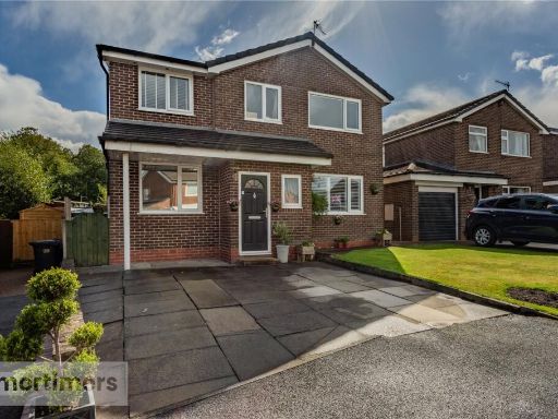 5 bedroom detached house for sale in Briggfield, Clayton Le Moors, Accrington, BB5 — £320,000 • 5 bed • 2 bath • 2024 ft²
 4 bedroom detached house for sale in Holme Lea, Clayton Le Moors, Accrington, BB5 — £299,950 • 4 bed • 2 bath • 1270 ft²
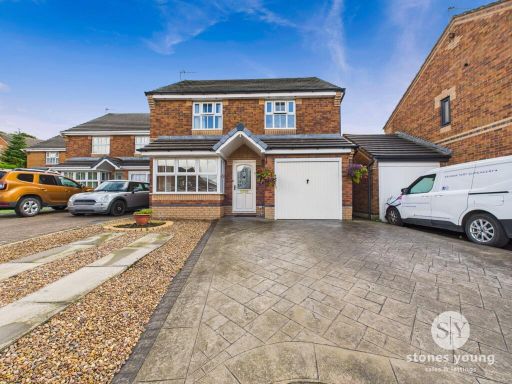 3 bedroom detached house for sale in Ringwood Close, Accrington, BB5 — £235,000 • 3 bed • 2 bath • 1153 ft²
 4 bedroom detached house for sale in Meadowside Avenue, Clayton Le Moors, Accrington, Lancashire, BB5 — £225,000 • 4 bed • 1 bath • 1057 ft²
 4 bedroom detached house for sale in Collingwood, Clayton Le Moors, BB5 — £260,000 • 4 bed • 2 bath • 1233 ft²
Meta
- {
"@context": "https://schema.org",
"@type": "Residence",
"name": "3 bedroom detached house for sale in Collingwood, Clayton L…",
"description": "",
"url": "https://propertypiper.co.uk/property/a6267d1b-cfbf-448f-8950-a022c415ad9b",
"image": "https://image-a.propertypiper.co.uk/d3185e33-b752-48dc-abd8-f8117970087f-1024.jpeg",
"address": {
"@type": "PostalAddress",
"streetAddress": "24 COLLINGWOOD CLAYTON LE MOORS ACCRINGTON",
"postalCode": "BB5 5QP",
"addressLocality": "Hyndburn",
"addressRegion": "Hyndburn",
"addressCountry": "England"
},
"geo": {
"@type": "GeoCoordinates",
"latitude": 53.77305274286272,
"longitude": -2.3937429367407144
},
"numberOfRooms": 3,
"numberOfBathroomsTotal": 2,
"floorSize": {
"@type": "QuantitativeValue",
"value": 1134,
"unitCode": "FTK"
},
"offers": {
"@type": "Offer",
"price": 230000,
"priceCurrency": "GBP",
"availability": "https://schema.org/InStock"
},
"additionalProperty": [
{
"@type": "PropertyValue",
"name": "Feature",
"value": "detached house"
},
{
"@type": "PropertyValue",
"name": "Feature",
"value": "modern style"
},
{
"@type": "PropertyValue",
"name": "Feature",
"value": "brick exterior"
},
{
"@type": "PropertyValue",
"name": "Feature",
"value": "two-story"
},
{
"@type": "PropertyValue",
"name": "Feature",
"value": "asphalt driveway"
},
{
"@type": "PropertyValue",
"name": "Feature",
"value": "suburban"
},
{
"@type": "PropertyValue",
"name": "Feature",
"value": "residential area"
},
{
"@type": "PropertyValue",
"name": "Feature",
"value": "low maintenance"
},
{
"@type": "PropertyValue",
"name": "Feature",
"value": "modern style"
},
{
"@type": "PropertyValue",
"name": "Feature",
"value": "wood burner"
},
{
"@type": "PropertyValue",
"name": "Feature",
"value": "living area"
},
{
"@type": "PropertyValue",
"name": "Feature",
"value": "conservatory"
},
{
"@type": "PropertyValue",
"name": "Feature",
"value": "double doors"
},
{
"@type": "PropertyValue",
"name": "Feature",
"value": "wood flooring"
}
]
}
High Res Floorplan Images
Compatible Floorplan Images
FloorplanImages Thumbnail