SG13 7LF - 3 bedroom end of terrace house for sale in Park Road, Hertf…
View on Property Piper
3 bedroom end of terrace house for sale in Park Road, Hertford, SG13
Property Details
- Price: £495000
- Bedrooms: 3
- Bathrooms: 1
- Property Type: undefined
- Property SubType: undefined
Brochure Descriptions
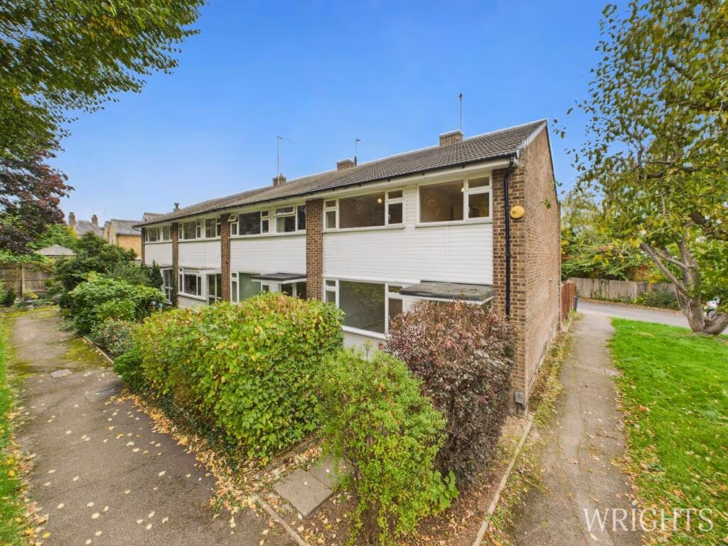
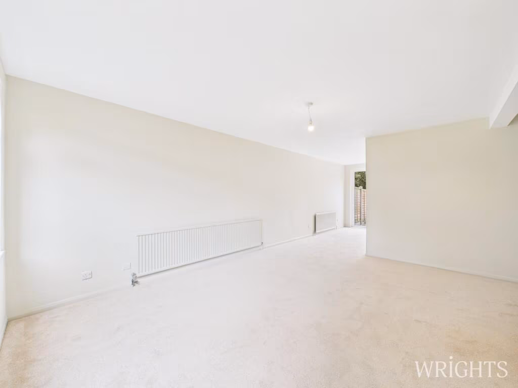
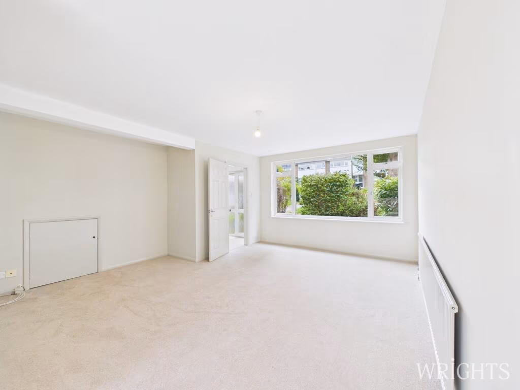
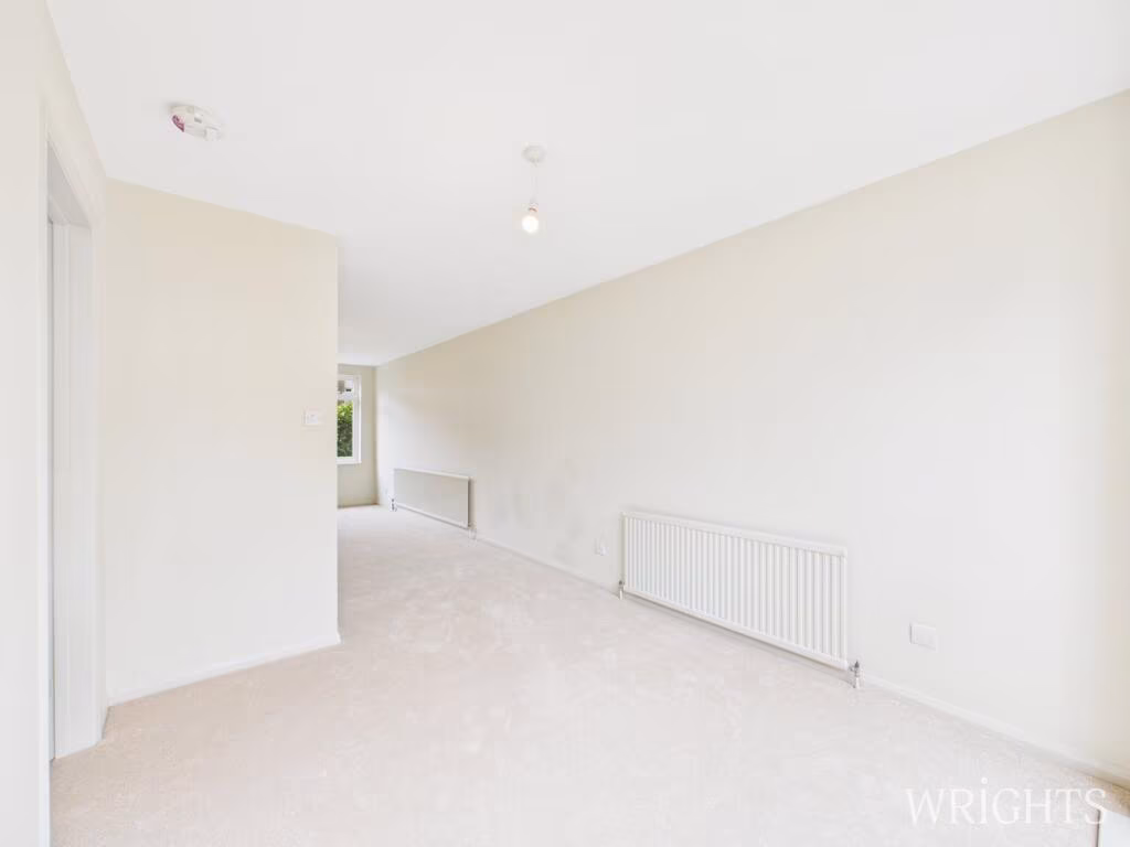
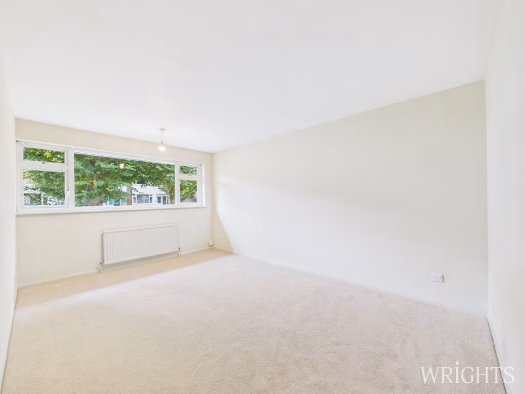
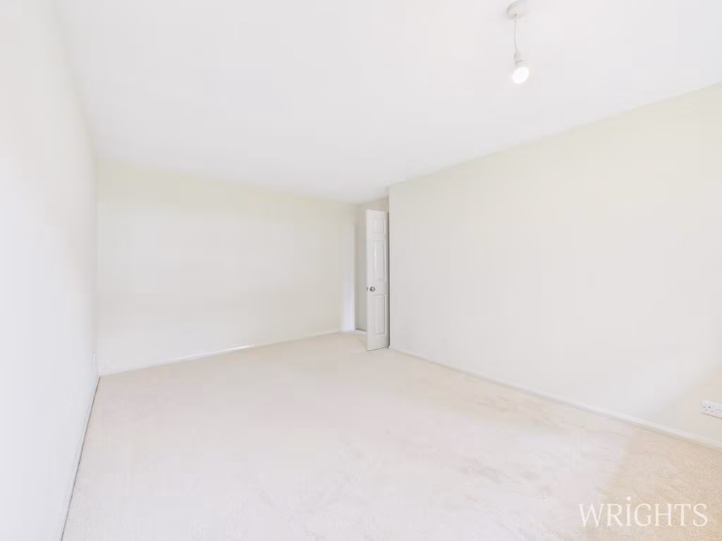
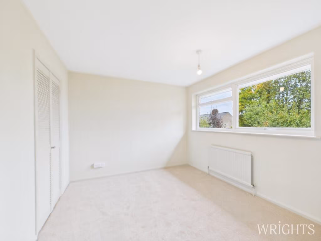
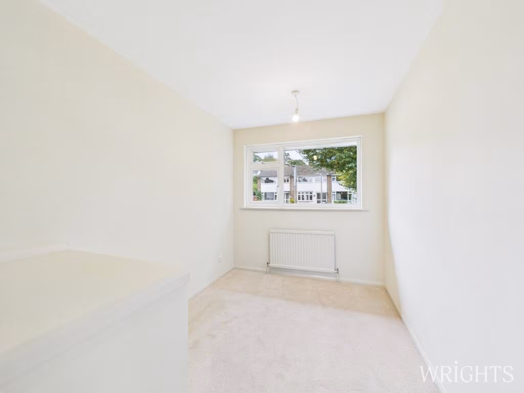
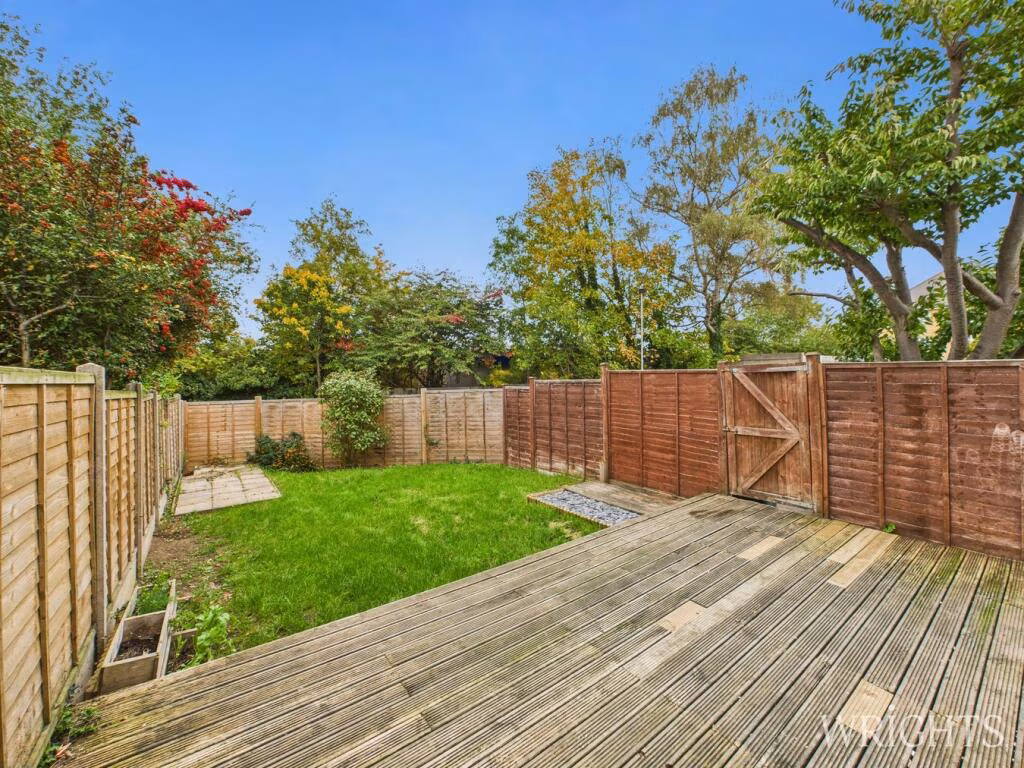
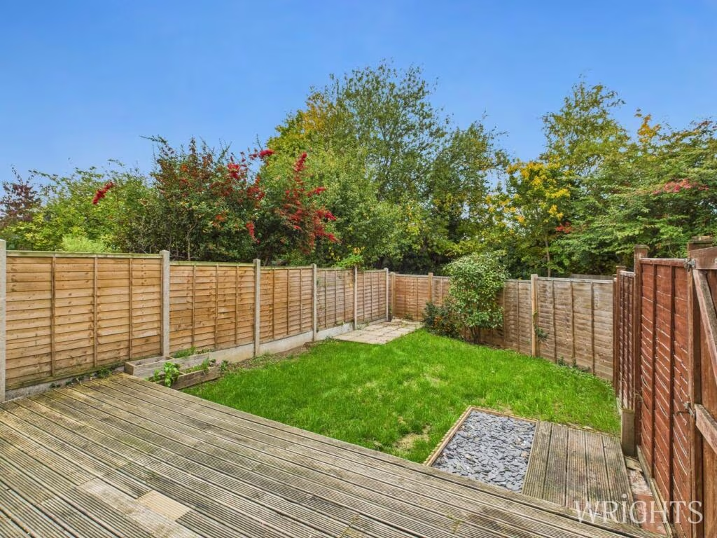
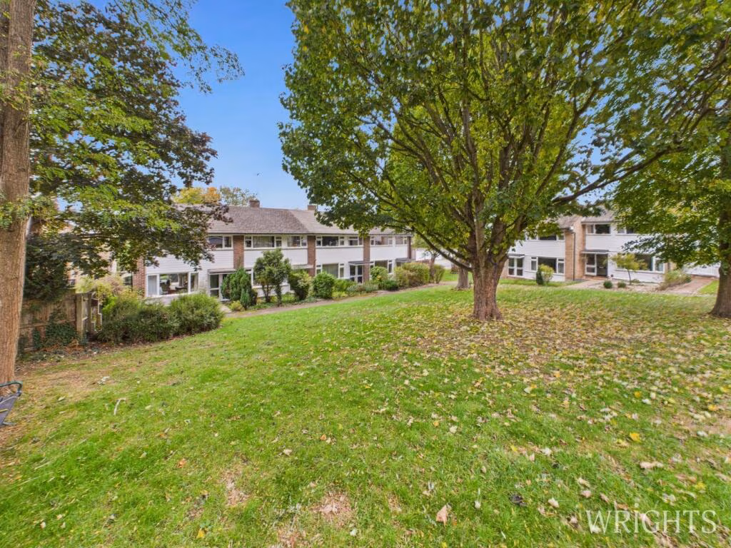
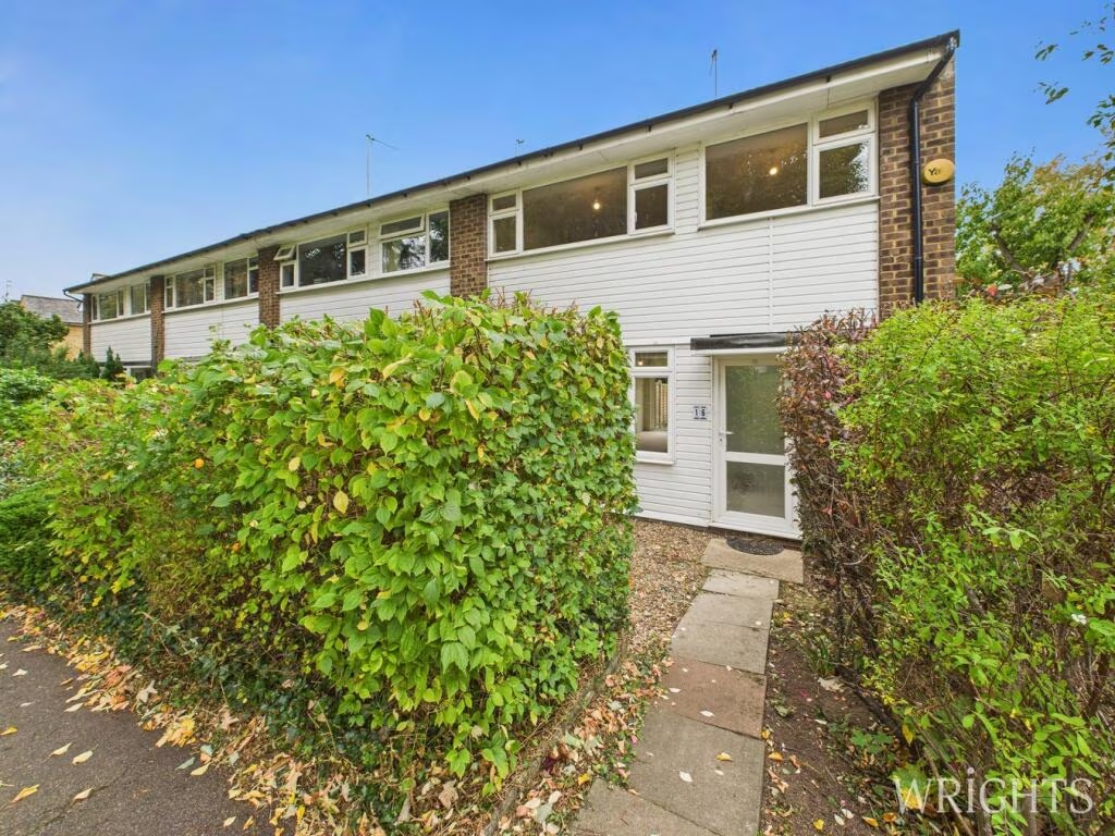
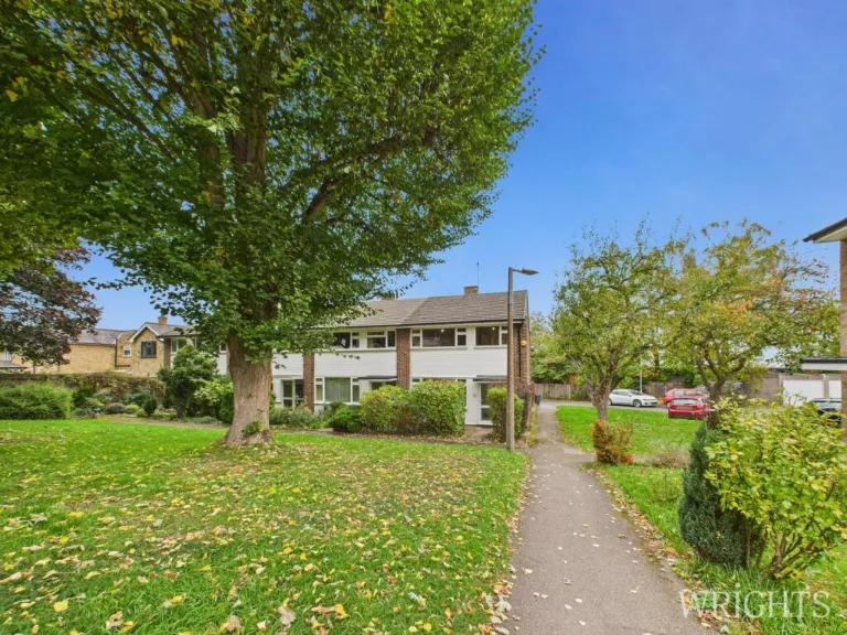
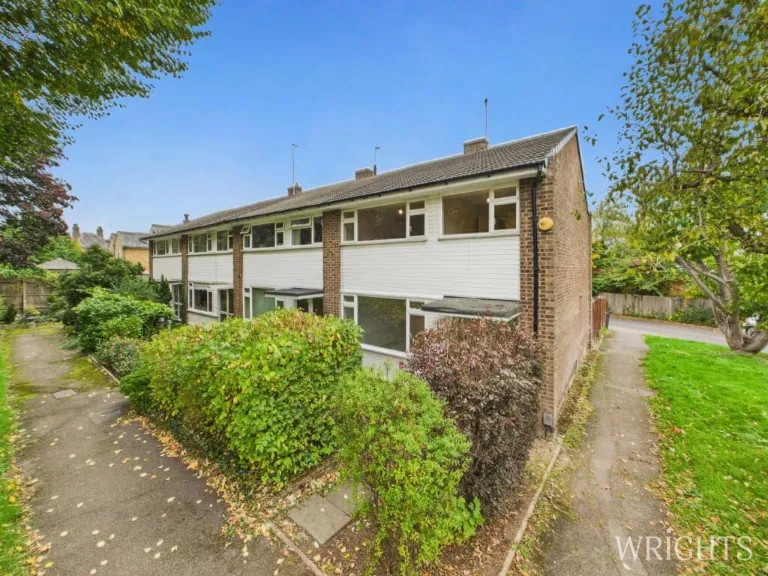
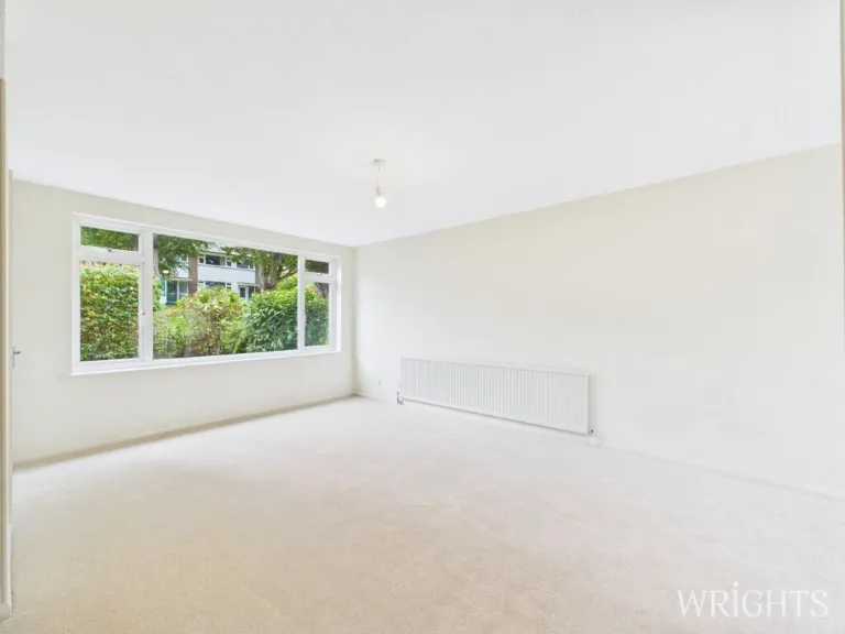
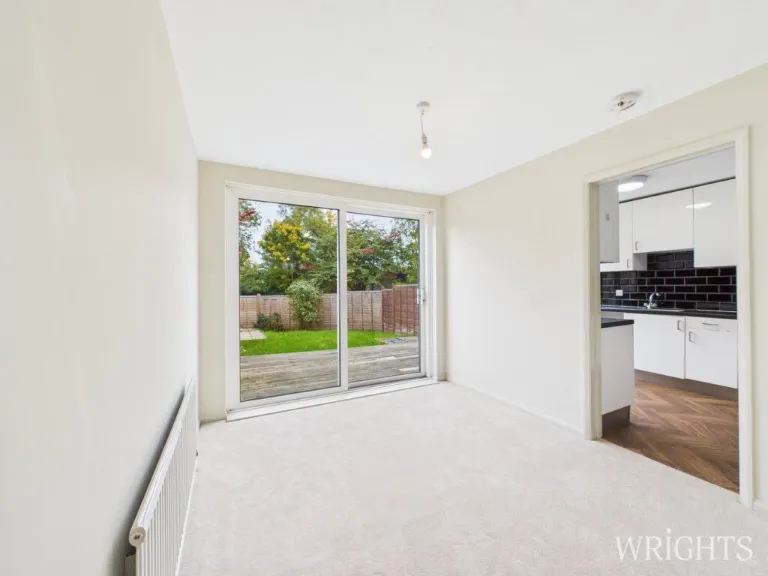
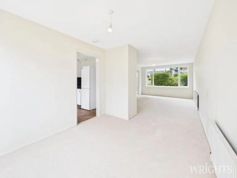
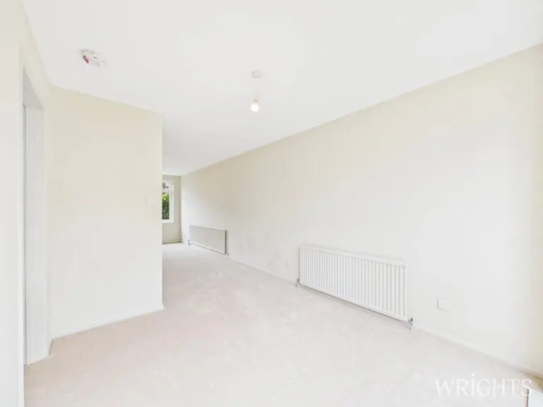
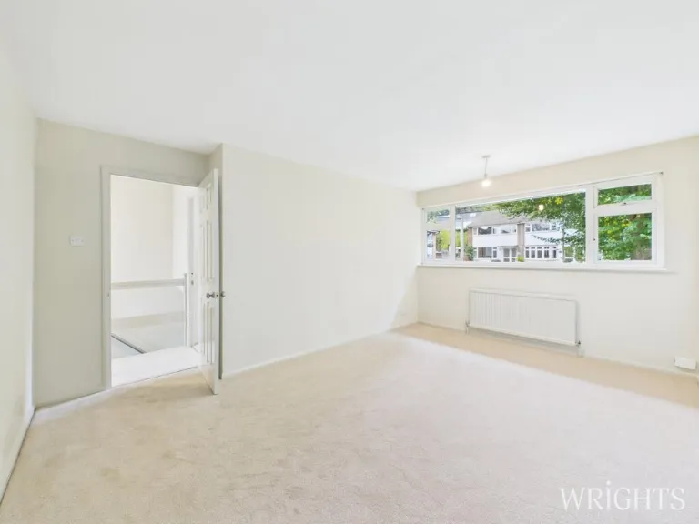
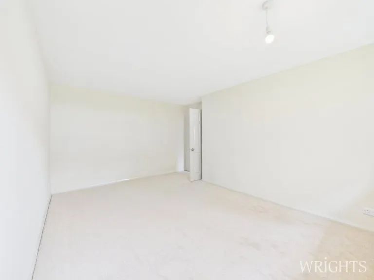
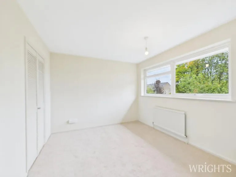
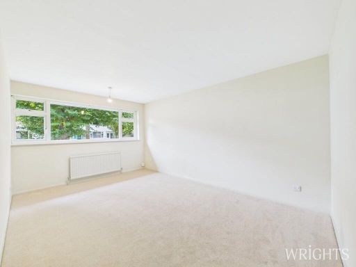
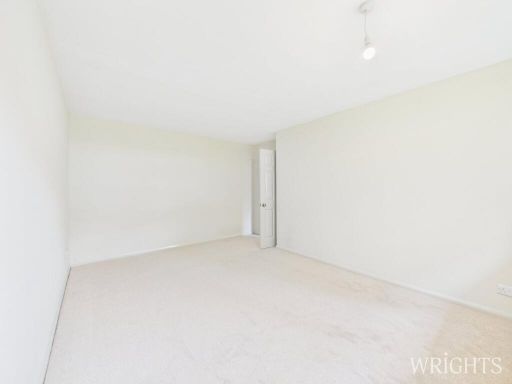
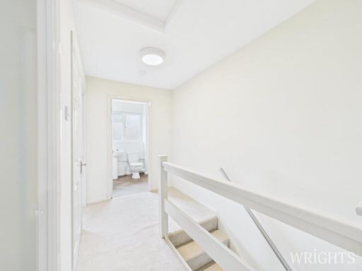
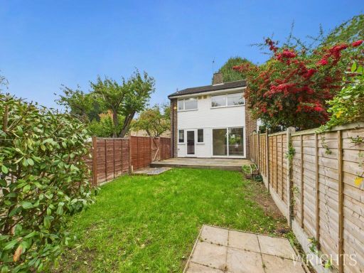
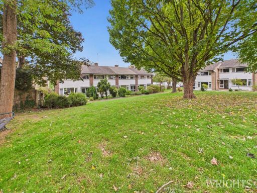
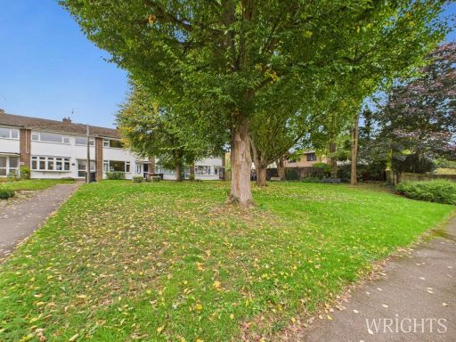
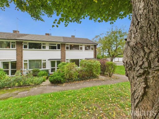
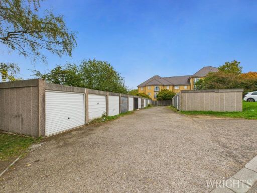
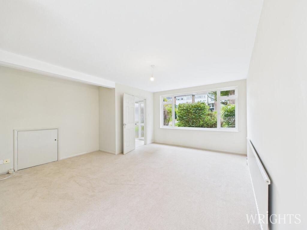
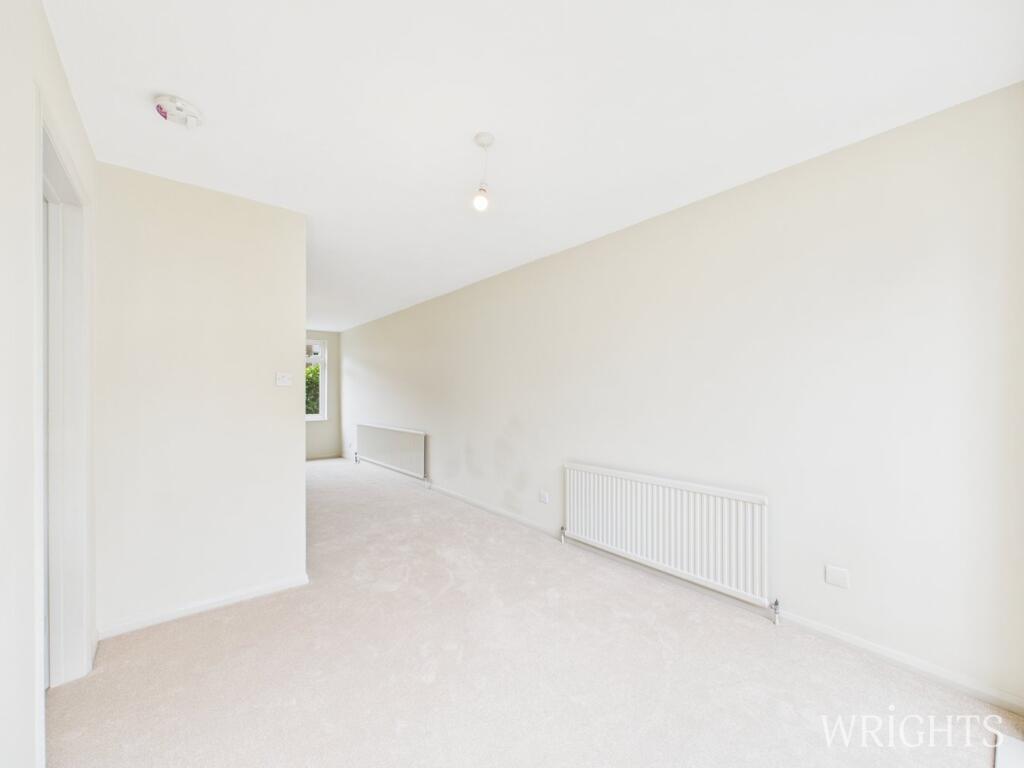
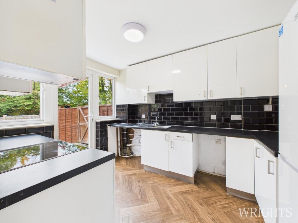
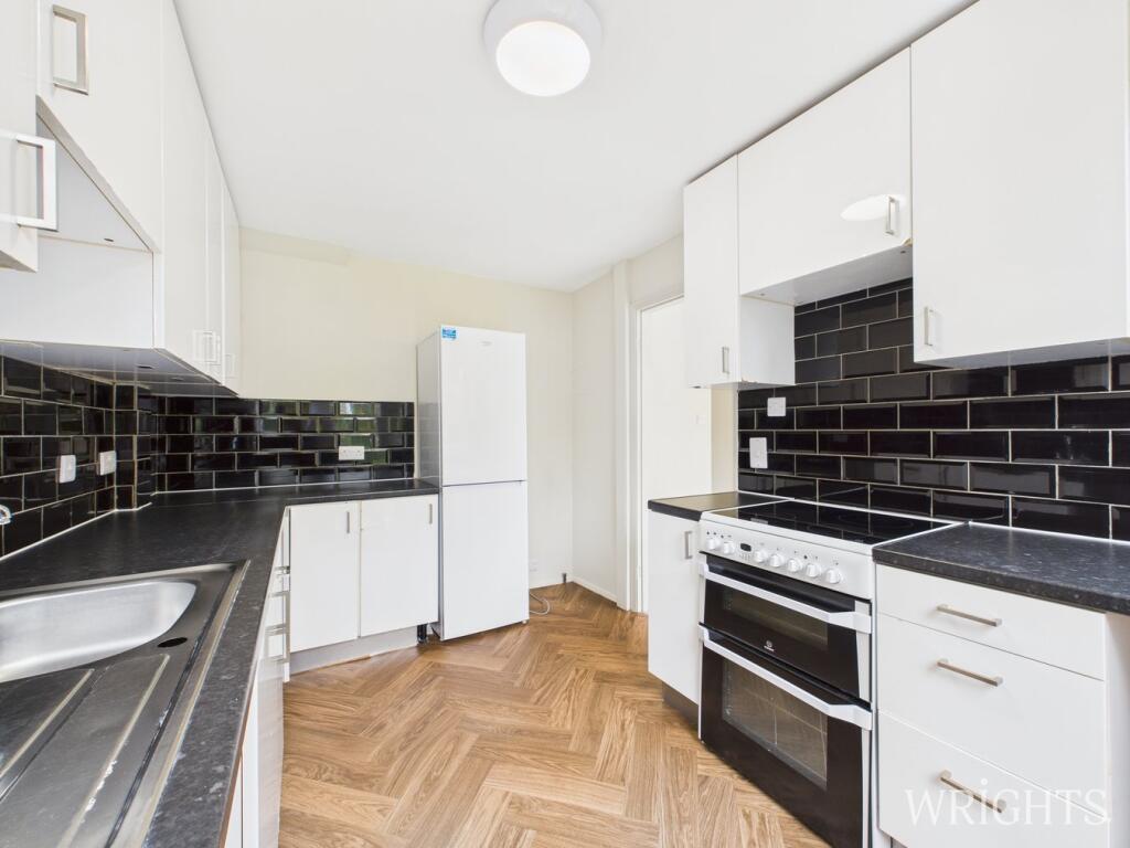
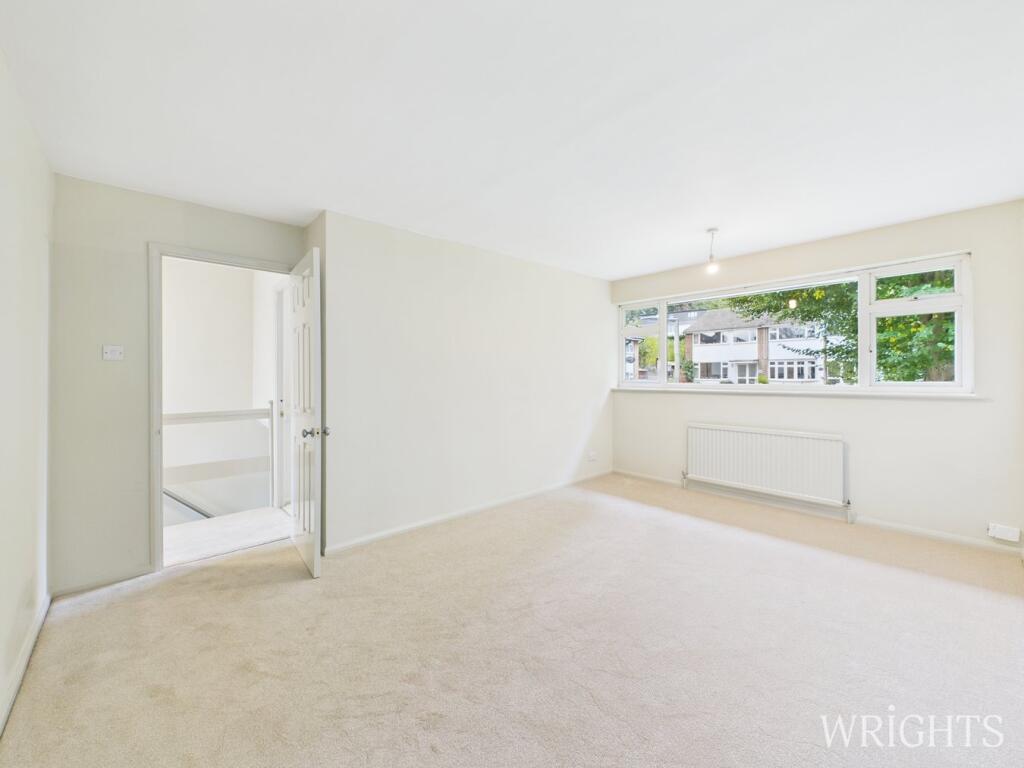
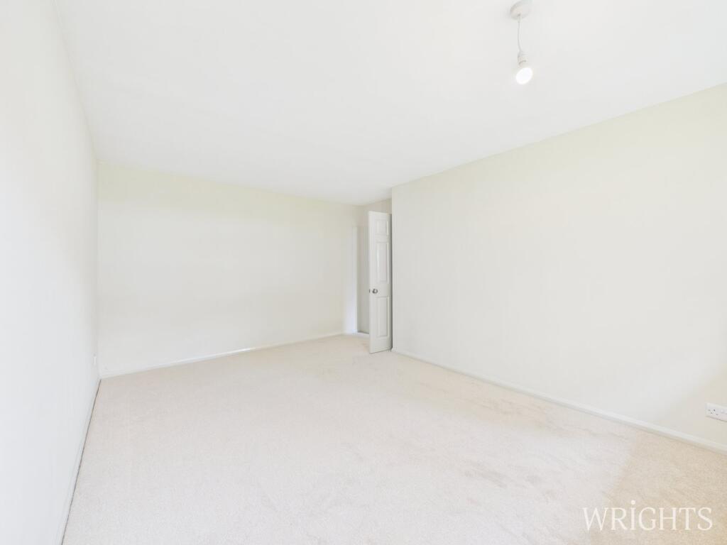
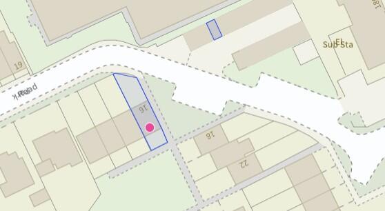
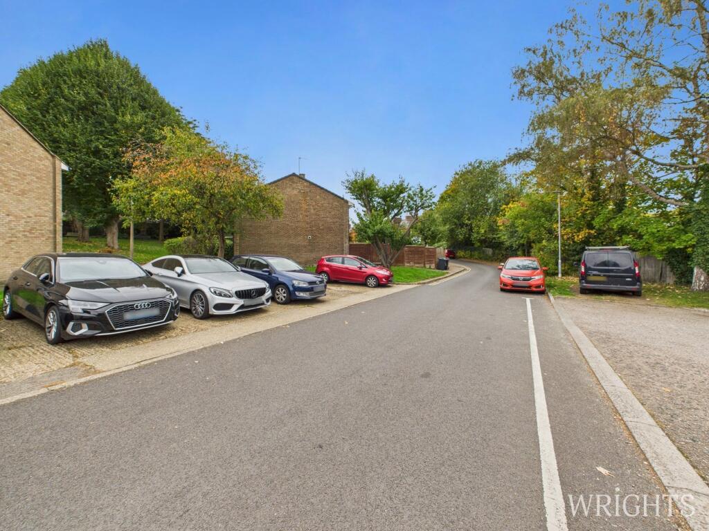
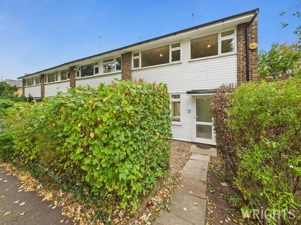
- A chain-free end-terrace flat forming part of a low-rise residential block, set directly overlooking a tranquil communal green. The property presents as recently redecorated and carpeted throughout and benefits from an allocated garage en bloc. Conveniently located a short walk from Hertford East and Hertford North mainline stations and close to the town centre, offering good local transport and amenity access. From the images the property appears to be of medium overall size for a flat, with a modest private garden/parking area to the rear and generous communal front green (large). The setting and condition indicate a straightforward, turn-key purchase suited to first-time buyers or investors seeking a low-maintenance residence in a desirable Hertford location.
Image Descriptions
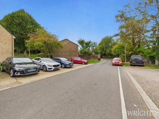
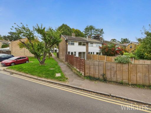
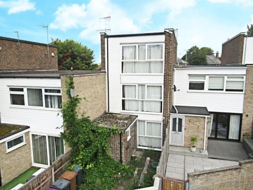
- semi-detached house post-war modern
- property exterior 1960s terraced
Floorplan Description
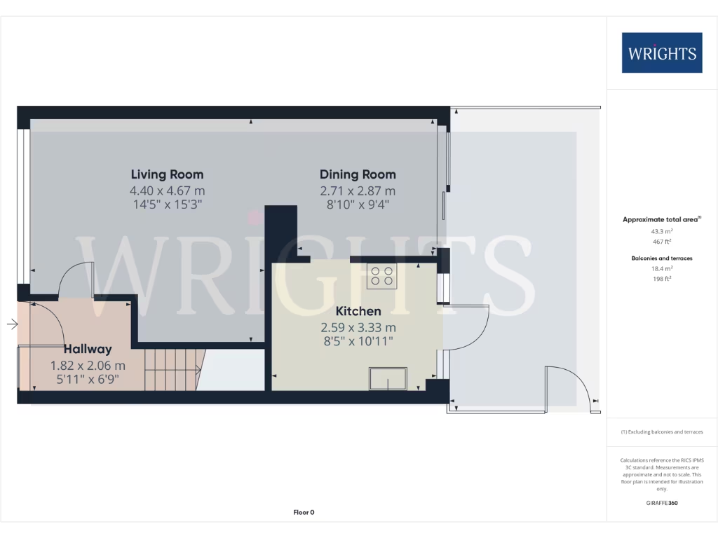
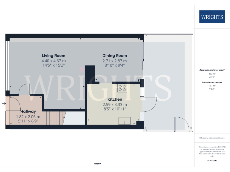
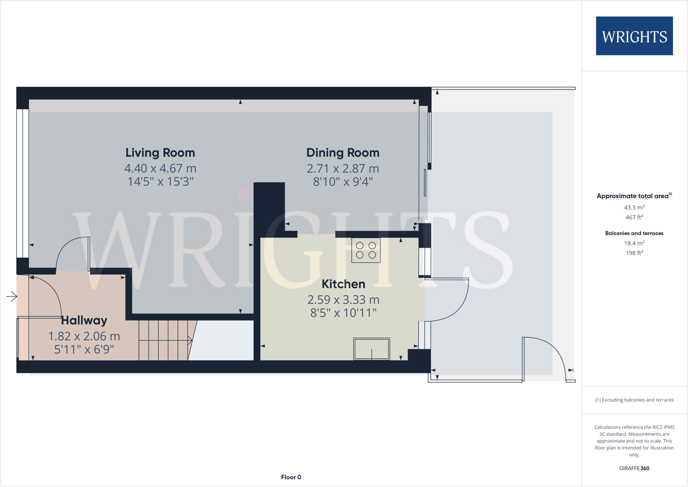
- Ground floor plan
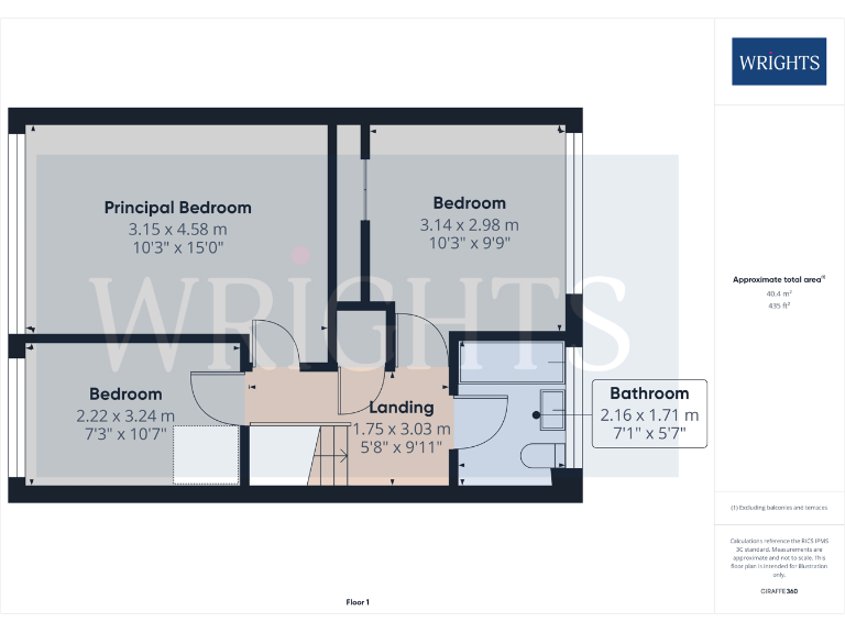
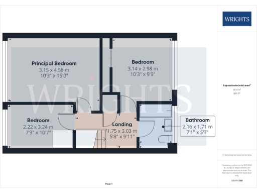
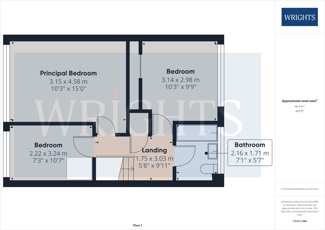
- First floor plan with three bedrooms, landing and bathroom
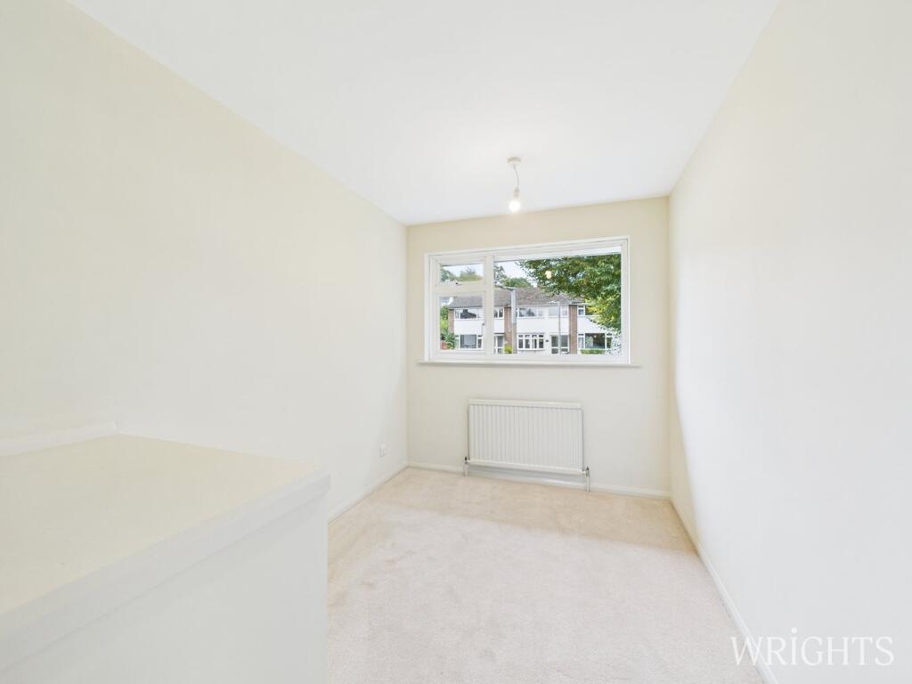
Rooms
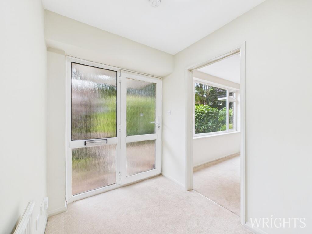
- Living Room:
- Dining Room:
- Kitchen:
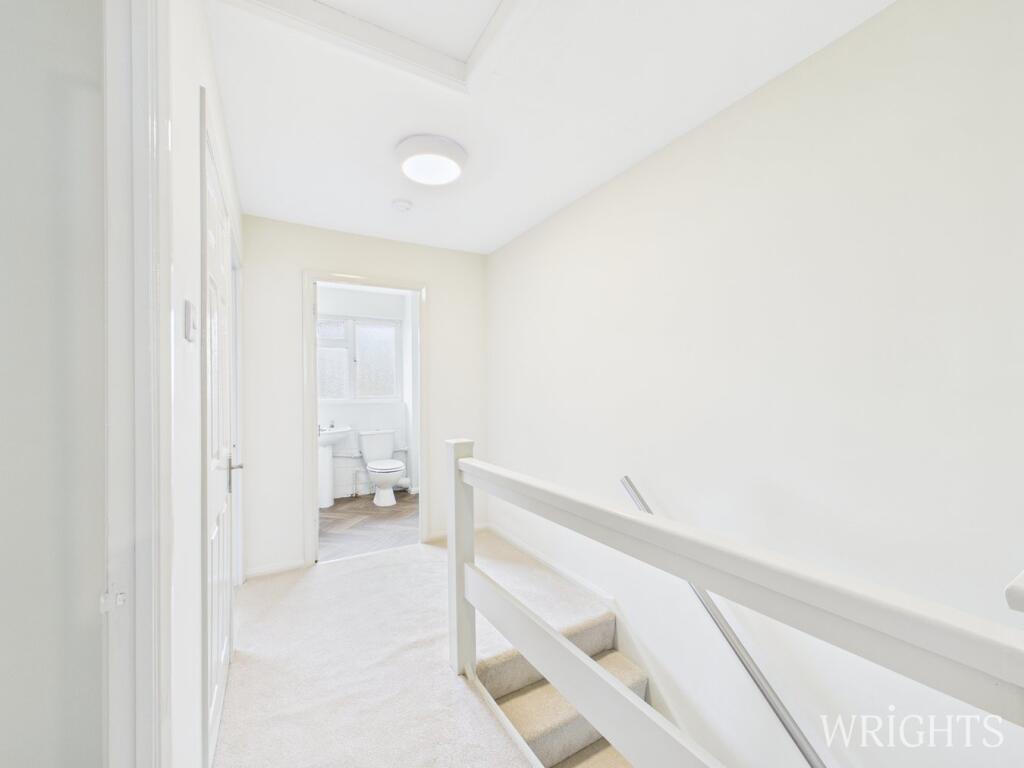
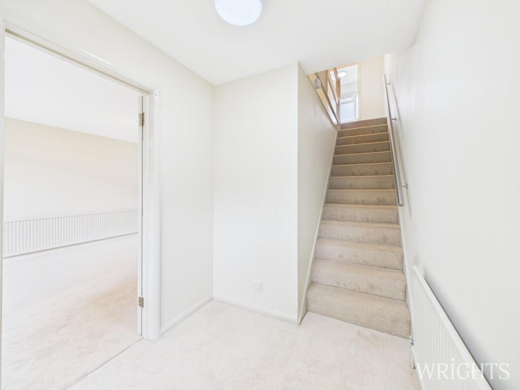
- Hallway:
- Principal Bedroom:
- Bedroom:
- Bedroom:
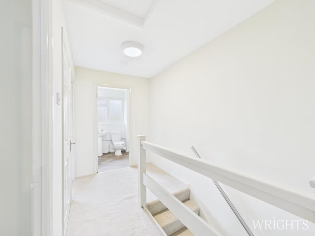
- Landing:
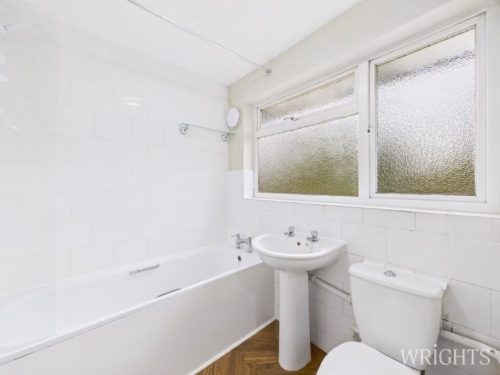
- Bathroom:
Textual Property Features
Detected Visual Features
- semi-detached
- post-war
- modern
- greenery
- garage
- garden
- family-friendly
- residential
- medium-sized
- outdoor space
- 1960s
- terraced house
- brick exterior
- two-story
- suburban
- potential for modernization
- well-kept garden
- off-street parking
EPC Details
- Fully double glazed
- Solid brick, as built, no insulation (assumed)
- Boiler and radiators, mains gas
- Low energy lighting in 75% of fixed outlets
- Suspended, no insulation (assumed)
Nearby Schools
- Roselands Primary School
- Morgans Primary School & Nursery
- Mill Mead Primary School
- Hertford St Andrew CofE Primary School
- Bengeo Primary School
- Sacred Heart Catholic Primary School
- Stapleford Primary School
- Thundridge Church of England Primary School
- Hertford Heath Primary and Nursery School
- Simon Balle All-Through School
- The Sele School
- St Joseph's Catholic Primary School (Hertford)
- Presdales School
- Christ Church CofE (VA) Primary School and Nursery
- The Chauncy School
- Richard Hale School
- Hollybush Primary School
- Kingshill Infant School
- Bayford Church of England Voluntary Controlled Primary School
- Haileybury and Imperial Service College
- St Joseph's in the Park
- Abel Smith School
- Wheatcroft Primary School
- Duncombe School
- St Catherine's Church of England Primary School
- Larkspur Academy
- St Mary's Voluntary Controlled Church of England Junior School
Nearest General Shops
- Id: 145464554
- Tags:
- Addr:
- City: Hertford
- Postcode: SG13 7RQ
- Street: Madford Retail Park, Ware Road
- Brand: Wickes
- Brand:wikidata: Q7998350
- Brand:wikipedia: en:Wickes
- Building: yes
- Contact:
- Website: https://www.wickes.co.uk/store/8453
- Designation: 8453
- Name: Wickes
- Phone: +44 1992 537678
- Shop: doityourself
- TagsNormalized:
- Lat: 51.7969803
- Lon: -0.0694799
- FullGeoHash: gcpywmm7m0bn
- PartitionGeoHash: gcpy
- Images:
- FoodStandards: null
- Distance: 102
,- Id: 362369338
- Tags:
- Brand: Pets at Home
- Brand:wikidata: Q7179258
- Brand:wikipedia: en:Pets at Home
- Building: yes
- Designation: 777
- Name: Pets at Home
- Phone: +44 8456001907
- Shop: pet
- TagsNormalized:
- Lat: 51.7967871
- Lon: -0.0693327
- FullGeoHash: gcpywmmd0kvy
- PartitionGeoHash: gcpy
- Images:
- FoodStandards: null
- Distance: 79.8
,- Id: 12391541
- Tags:
- Brand: Matalan
- Brand:wikidata: Q12061509
- Brand:wikipedia: en:Matalan
- Building: yes
- Name: Matalan
- Shop: clothes
- Source: yahoo
- TagsNormalized:
- Lat: 51.7965773
- Lon: -0.0692955
- FullGeoHash: gcpywmm8cmcd
- PartitionGeoHash: gcpy
- Images:
- FoodStandards: null
- Distance: 56.5
}
Nearest Grocery shops
- Id: 367479457
- Tags:
- Addr:
- City: Hertford
- Housenumber: 133
- Postcode: SG14 1NL
- Street: Hertingfordbury Road
- Brand: Londis
- Brand:wikidata: Q21008564
- Building: yes
- Name: Londis
- Operator: Londis
- Shop: convenience
- TagsNormalized:
- Lat: 51.795003
- Lon: -0.089523
- FullGeoHash: gcpytuyzcbqg
- PartitionGeoHash: gcpy
- Images:
- FoodStandards: null
- Distance: 1395
,- Id: 907046868
- Tags:
- Building: retail
- Building:colour: white
- Building:levels: 3
- Name: Castle Food & Wine
- Roof:
- Colour: grey
- Levels: 1
- Material: slate
- Orientation: along
- Shape: gambrel
- Shop: convenience
- TagsNormalized:
- retail
- food
- wine
- convenience
- shop
- Lat: 51.796529
- Lon: -0.079192
- FullGeoHash: gcpywjq2dsy4
- PartitionGeoHash: gcpy
- Images:
- FoodStandards: null
- Distance: 681.4
,- Id: 896200811
- Tags:
- Level: 0
- Name: Hertford Wines
- Note: Despite the name it seems to be more of a convenience store selling groceries, fruit and veg as well as alcohol
- Payzone: yes
- Shop: convenience
- TagsNormalized:
- Lat: 51.795826
- Lon: -0.0781914
- FullGeoHash: gcpywjphd1b3
- PartitionGeoHash: gcpy
- Images:
- FoodStandards: null
- Distance: 611.3
}
Nearest Supermarkets
- Id: 156971098
- Tags:
- Addr:
- Postcode: SG14 1FN
- Street: Hartham Lane
- Alt_name: Sainsbury's Hertford McMullen Brewery
- Brand: Sainsbury's
- Brand:wikidata: Q152096
- Brand:wikipedia: en:Sainsbury's
- Building: yes
- Building:levels: 1
- Building:material: brick
- Name: Sainsbury's
- Opening_hours: Mo-Sa 07:00-22:00; Su 10:30-16:30
- Phone: +44 1992 901300
- Roof:
- Shop: supermarket
- TagsNormalized:
- sainsburys
- supermarket
- shop
- Lat: 51.7990445
- Lon: -0.0800795
- FullGeoHash: gcpywjtxq1b2
- PartitionGeoHash: gcpy
- Images:
- FoodStandards: null
- Distance: 811
,- Id: 240044386
- Tags:
- Addr:
- County: Hertfordshire
- Housenumber: 140-144
- Postcode: SG14 1AJ
- Street: Fore Street
- Town: Hertford
- Alt_name: M&S Hertford Simply Food
- Brand: M&S Foodhall
- Brand:wikidata: Q714491
- Brand:wikipedia: en:Marks & Spencer
- Building: yes
- Building:levels: 2
- Building:material: brick
- Name: M&S Foodhall
- Old_name: M&S Simply Food
- Phone: +44 1992 535515
- Roof:
- Shop: supermarket
- Source: Bing
- Website: https://www.marksandspencer.com/stores/hertford-simply-food-6965
- TagsNormalized:
- m&s foodhall
- supermarket
- shop
- Lat: 51.7967011
- Lon: -0.0741884
- FullGeoHash: gcpywm3cxkcj
- PartitionGeoHash: gcpy
- Images:
- FoodStandards: null
- Distance: 342.6
,- Id: 11064049
- Tags:
- Addr:
- Postcode: SG14 1QA
- Street: Ware Road
- Alt_name: Tesco Hertford Superstore
- Brand: Tesco
- Brand:wikidata: Q487494
- Brand:wikipedia: en:Tesco
- Building: yes
- Contact:
- Website: https://www.tesco.com/store-locator/hertford/ware-rd
- Designation: 2661
- Name: Tesco
- Operator: Tesco Stores Ltd
- Phone: +44 845 6779347
- Shop: supermarket
- Wheelchair: yes
- TagsNormalized:
- Lat: 51.7985154
- Lon: -0.0720898
- FullGeoHash: gcpywmes0pju
- PartitionGeoHash: gcpy
- Images:
- FoodStandards: null
- Distance: 332.4
}
Nearest Religious buildings
- Id: 893958154
- Tags:
- Amenity: place_of_worship
- Building: yes
- Building:levels: 1
- Building:material: brick
- Denomination: quaker
- Historic: yes
- Name: Quaker Meeting House
- Religion: christian
- Roof:
- Levels: 1
- Material: roof_tiles
- Start_date: 1670
- Wikidata: Q17554095
- TagsNormalized:
- place of worship
- quaker
- quakers
- christian
- church
- Lat: 51.797248
- Lon: -0.0754697
- FullGeoHash: gcpywm3hc6ve
- PartitionGeoHash: gcpy
- Images:
- FoodStandards: null
- Distance: 443.3
,- Id: 404367921
- Tags:
- Amenity: kindergarten
- Name: Churchfields Children’s Centre
- Source: Bing;photo on centre website
- Url: http://www.hertschildrenscentres.org.uk/churchfields/
- TagsNormalized:
- Lat: 51.7952994
- Lon: -0.0732656
- FullGeoHash: gcpywm49kz95
- PartitionGeoHash: gcpy
- Images:
- FoodStandards: null
- Distance: 285.1
,- Id: 98972584
- Tags:
- Amenity: place_of_worship
- Denomination: methodist
- Name: Hertford Methodist Church
- Religion: christian
- TagsNormalized:
- place of worship
- methodist
- church
- christian
- Lat: 51.7981428
- Lon: -0.069733
- FullGeoHash: gcpywmt4p1em
- PartitionGeoHash: gcpy
- Images:
- FoodStandards: null
- Distance: 232.4
}
Nearest Airports
- Id: 121158889
- Tags:
- Aerodrome: continental
- Aeroway: aerodrome
- Fhrs:
- Authority: City of London Corporation
- Iata: LCY
- Icao: EGLC
- Name: London City Airport
- Operator: London City Airport Limited
- Ref: LCY
- Website: https://www.londoncityairport.com/
- Wikidata: Q8982
- Wikipedia: en:London City Airport
- TagsNormalized:
- airport
- continental airport
- Lat: 51.5042658
- Lon: 0.0539987
- FullGeoHash: u10j10p64702
- PartitionGeoHash: u10j
- Images:
- FoodStandards: null
- Distance: 33543.8
,- Id: 495488524
- Tags:
- Aerodrome: international
- Aerodrome:type: public
- Aeroway: aerodrome
- Alt_name: Stansted
- Iata: STN
- Icao: EGSS
- Is_in: Essex,England,UK
- Name: London Stansted Airport
- Ref: STN
- Source: Gagravarr_Airports
- Website: https://www.stanstedairport.com/
- Wikidata: Q8709
- Wikipedia: en:London Stansted Airport
- TagsNormalized:
- airport
- international airport
- Lat: 51.8869677
- Lon: 0.2429264
- FullGeoHash: u10pjt8zkxg4
- PartitionGeoHash: u10p
- Images:
- FoodStandards: null
- Distance: 23712.9
,- Id: 110273499
- Tags:
- Addr:
- Country: GB
- Postcode: LU2 9LY
- Aerodrome: international
- Aerodrome:type: public
- Aeroway: aerodrome
- Alt_name: London Luton
- Iata: LTN
- Icao: EGGW
- Name: London Luton Airport
- Website: https://www.london-luton.co.uk/
- Wikidata: Q8712
- Wikipedia: en:Luton Airport
- TagsNormalized:
- airport
- international airport
- Lat: 51.8780363
- Lon: -0.3701408
- FullGeoHash: gcpxps47rngh
- PartitionGeoHash: gcpx
- Images:
- FoodStandards: null
- Distance: 22589.5
}
Nearest Leisure Facilities
- Id: 893958152
- Tags:
- Access: private
- Leisure: garden
- Note: May be open to public on open days
- TagsNormalized:
- Lat: 51.7971692
- Lon: -0.0753916
- FullGeoHash: gcpywm3h7hpv
- PartitionGeoHash: gcpy
- Images:
- FoodStandards: null
- Distance: 435.6
,- Id: 169858289
- Tags:
- Leisure: pitch
- Sport: soccer
- TagsNormalized:
- Lat: 51.7927826
- Lon: -0.0677009
- FullGeoHash: gcpywkwdy6qw
- PartitionGeoHash: gcpy
- Images:
- FoodStandards: null
- Distance: 381.9
,- Id: 246845270
- Tags:
- Leisure: pitch
- Sport: soccer
- TagsNormalized:
- Lat: 51.7958608
- Lon: -0.0742593
- FullGeoHash: gcpywm1uv8k2
- PartitionGeoHash: gcpy
- Images:
- FoodStandards: null
- Distance: 341
,- Id: 169858277
- Tags:
- Leisure: pitch
- Sport: rugby_union
- TagsNormalized:
- pitch
- leisure
- rugby
- rugby union
- sports
- Lat: 51.7933134
- Lon: -0.0680871
- FullGeoHash: gcpywkwmvmqs
- PartitionGeoHash: gcpy
- Images:
- FoodStandards: null
- Distance: 317.8
,- Id: 169858288
- Tags:
- Leisure: pitch
- Sport: soccer
- TagsNormalized:
- Lat: 51.7939608
- Lon: -0.0685787
- FullGeoHash: gcpywky1dn04
- PartitionGeoHash: gcpy
- Images:
- FoodStandards: null
- Distance: 239.8
}
Nearest Tourist attractions
- Id: 211718618
- Tags:
- Addr:
- City: Hertford
- Housename: Tooke House
- Housenumber: 18
- Postcode: SG14 1DT
- Street: Bull Plain
- Building: yes
- Building:colour: white
- Building:levels: 2
- Email: enquiries@hertfordmuseum.org.uk
- Fee: no
- Museum: local
- Name: Hertford Museum
- Opening_hours: Tu-Sa 10:00-17:00; Su 12:00-16:00
- Phone: +44 1992 582686
- Roof:
- Colour: brown
- Levels: 1
- Material: roof_tiles
- Tourism: museum
- Website: http://www.hertfordmuseum.org/
- Wikidata: Q5744704
- TagsNormalized:
- Lat: 51.7972156
- Lon: -0.0778812
- FullGeoHash: gcpywjrk9hzd
- PartitionGeoHash: gcpy
- Images:
- FoodStandards: null
- Distance: 602.9
,- Id: 901806329
- Tags:
- Addr:
- City: Hertford
- Housenumber: 14
- Postcode: SG14 1DT
- Street: Bull Plain
- Building: yes
- Level: 0
- Name: Brothership
- Tourism: gallery
- Website: https://brothershipstudio.com
- TagsNormalized:
- Lat: 51.797026
- Lon: -0.0777658
- FullGeoHash: gcpywjr7ecmx
- PartitionGeoHash: gcpy
- Images:
- FoodStandards: null
- Distance: 591
,- Id: 4223125289
- Tags:
- Addr:
- Description: Only for staffs of Malaysia Rubber Board
- Email: general@tarrc.co.uk
- Internet_access: wlan
- Name: Hale Court
- Operator: Tun Abdul Razak Research Centre
- Tourism: hostel
- TagsNormalized:
- Lat: 51.7942386
- Lon: -0.077182
- FullGeoHash: gcpywhzg39bg
- PartitionGeoHash: gcpy
- Images:
- FoodStandards: null
- Distance: 578.3
}
Nearest Hotels
- Id: 357460682
- Tags:
- Addr:
- City: Hertford
- Housenumber: 234
- Postcode: SG14 2LB
- Street: Hertingfordbury Road
- Air_conditioning: yes
- Bar: yes
- Building:
- Description: In country inn dating from the 15th-century, this pub with guest rooms is in the quiet village of Hertingfordbury, 1.4 miles from Hertford and 6.1 miles from the A1M motorway at Hatfield.
- Email: info@whitehorsehertingfordbury.co.uk
- Internet_access: wlan
- Internet_access:fee: customers
- Name: The White Horse
- Payment:
- American_express: yes
- Cash: yes
- Contactless: yes
- Mastercard: yes
- Visa: yes
- Phone: +441992586791
- Reservation: yes
- Rooms: 7
- Smoking: outside
- Tourism: hotel
- Website: https://www.whitehorsehertingfordbury.co.uk/
- Wikidata: Q26559162
- TagsNormalized:
- Lat: 51.7916983
- Lon: -0.1066177
- FullGeoHash: gcpyts6ke8k4
- PartitionGeoHash: gcpy
- Images:
- FoodStandards: null
- Distance: 2611.3
,- Id: 896166292
- Tags:
- Addr:
- City: Hertford
- Country: GB
- Postcode: SG14 1BZ
- Street: Fore Street
- Bar: yes
- Building: yes
- Building:colour: white
- Building:levels: 3
- Email: reception@salisburyarms.co.uk
- Fax: +44 1992 552510
- Name: Salisbury Arms Hotel
- Operator:
- Phone: +44 1992 583091
- Reservation: yes
- Roof:
- Rooms: 35
- Smoking: no
- Tourism: hotel
- Website: https://www.salisburyarmshotel.co.uk/
- Wheelchair: yes
- Wikidata: Q17554133
- Wikimedia_commons: Category:Salisbury_Arms_Hotel,_Hertford
- TagsNormalized:
- Lat: 51.7959599
- Lon: -0.0775562
- FullGeoHash: gcpywjpt2f9z
- PartitionGeoHash: gcpy
- Images:
- FoodStandards: null
- Distance: 567.1
,- Id: 909286238
- Tags:
- Amenity: bar
- Building: retail
- Building:levels: 3
- Building:material: brick
- Description: "Coffee, kitchen, bar, hotel"
- Name: Cinnabar
- Roof:
- Tourism: hotel
- TagsNormalized:
- Lat: 51.796256
- Lon: -0.0757816
- FullGeoHash: gcpywm0z41vn
- PartitionGeoHash: gcpy
- Images:
- FoodStandards: null
- Distance: 445.4
}
Tags
- semi-detached
- post-war
- modern
- greenery
- garage
- garden
- family-friendly
- residential
- medium-sized
- outdoor space
- 1960s
- terraced house
- brick exterior
- two-story
- residential
- suburban
- potential for modernization
- well-kept garden
- off-street parking
Local Market Stats
- Average Price/sqft: £499
- Avg Income: £59100
- Rental Yield: 3.7%
- Social Housing: 7%
- Planning Success Rate: 27%
AirBnB Data
- 1km average: £89/night
- Listings in 1km: 2
Similar Properties
 3 bedroom terraced house for sale in Gwynns Walk, Hertford, SG13 — £425,000 • 3 bed • 2 bath • 1158 ft²
 4 bedroom town house for sale in Brewhouse Lane, Hertford, Hertfordshire, SG14 — £750,000 • 4 bed • 3 bath • 1653 ft²
 3 bedroom terraced house for sale in Clyde Terrace, Hertford, SG13 — £435,000 • 3 bed • 1 bath • 953 ft²
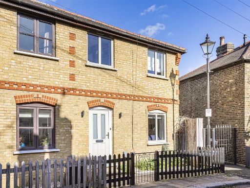 3 bedroom end of terrace house for sale in The Folly, Hertford, SG14 — £625,000 • 3 bed • 2 bath • 874 ft²
 5 bedroom end of terrace house for sale in St. Andrew Street, Hertford, SG14 — £550,000 • 5 bed • 2 bath • 1368 ft²
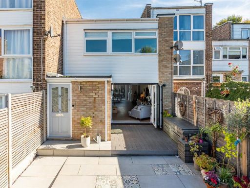 3 bedroom terraced house for sale in Gwynns Walk, Hertford, SG13 — £500,000 • 3 bed • 1 bath • 1324 ft²
Meta
- {
"@context": "https://schema.org",
"@type": "Residence",
"name": "3 bedroom end of terrace house for sale in Park Road, Hertf…",
"description": "",
"url": "https://propertypiper.co.uk/property/a4e781be-c216-4335-9fc5-13f5b191cd5c",
"image": "https://image-a.propertypiper.co.uk/cbaf33cb-3e11-43bf-b7bc-5b1361b19775-1024.jpeg",
"address": {
"@type": "PostalAddress",
"streetAddress": "16, Park Road",
"postalCode": "SG13 7LF",
"addressLocality": "East Hertfordshire",
"addressRegion": "Hertford and Stortford",
"addressCountry": "England"
},
"geo": {
"@type": "GeoCoordinates",
"latitude": 51.79606913893609,
"longitude": -0.06931172148738729
},
"numberOfRooms": 3,
"numberOfBathroomsTotal": 1,
"floorSize": {
"@type": "QuantitativeValue",
"value": 958,
"unitCode": "FTK"
},
"offers": {
"@type": "Offer",
"price": 495000,
"priceCurrency": "GBP",
"availability": "https://schema.org/InStock"
},
"additionalProperty": [
{
"@type": "PropertyValue",
"name": "Feature",
"value": "semi-detached"
},
{
"@type": "PropertyValue",
"name": "Feature",
"value": "post-war"
},
{
"@type": "PropertyValue",
"name": "Feature",
"value": "modern"
},
{
"@type": "PropertyValue",
"name": "Feature",
"value": "greenery"
},
{
"@type": "PropertyValue",
"name": "Feature",
"value": "garage"
},
{
"@type": "PropertyValue",
"name": "Feature",
"value": "garden"
},
{
"@type": "PropertyValue",
"name": "Feature",
"value": "family-friendly"
},
{
"@type": "PropertyValue",
"name": "Feature",
"value": "residential"
},
{
"@type": "PropertyValue",
"name": "Feature",
"value": "medium-sized"
},
{
"@type": "PropertyValue",
"name": "Feature",
"value": "outdoor space"
},
{
"@type": "PropertyValue",
"name": "Feature",
"value": "1960s"
},
{
"@type": "PropertyValue",
"name": "Feature",
"value": "terraced house"
},
{
"@type": "PropertyValue",
"name": "Feature",
"value": "brick exterior"
},
{
"@type": "PropertyValue",
"name": "Feature",
"value": "two-story"
},
{
"@type": "PropertyValue",
"name": "Feature",
"value": "residential"
},
{
"@type": "PropertyValue",
"name": "Feature",
"value": "suburban"
},
{
"@type": "PropertyValue",
"name": "Feature",
"value": "potential for modernization"
},
{
"@type": "PropertyValue",
"name": "Feature",
"value": "well-kept garden"
},
{
"@type": "PropertyValue",
"name": "Feature",
"value": "off-street parking"
}
]
}
High Res Floorplan Images
Compatible Floorplan Images
FloorplanImages Thumbnail