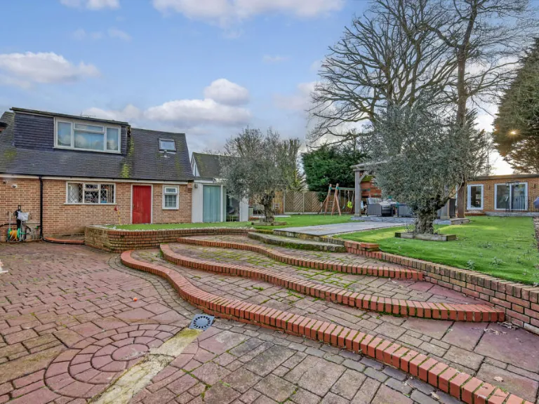
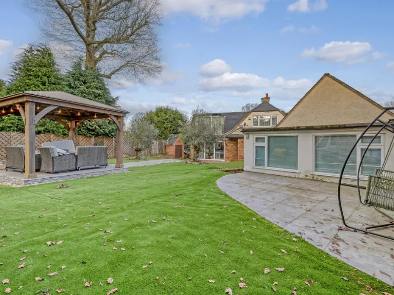
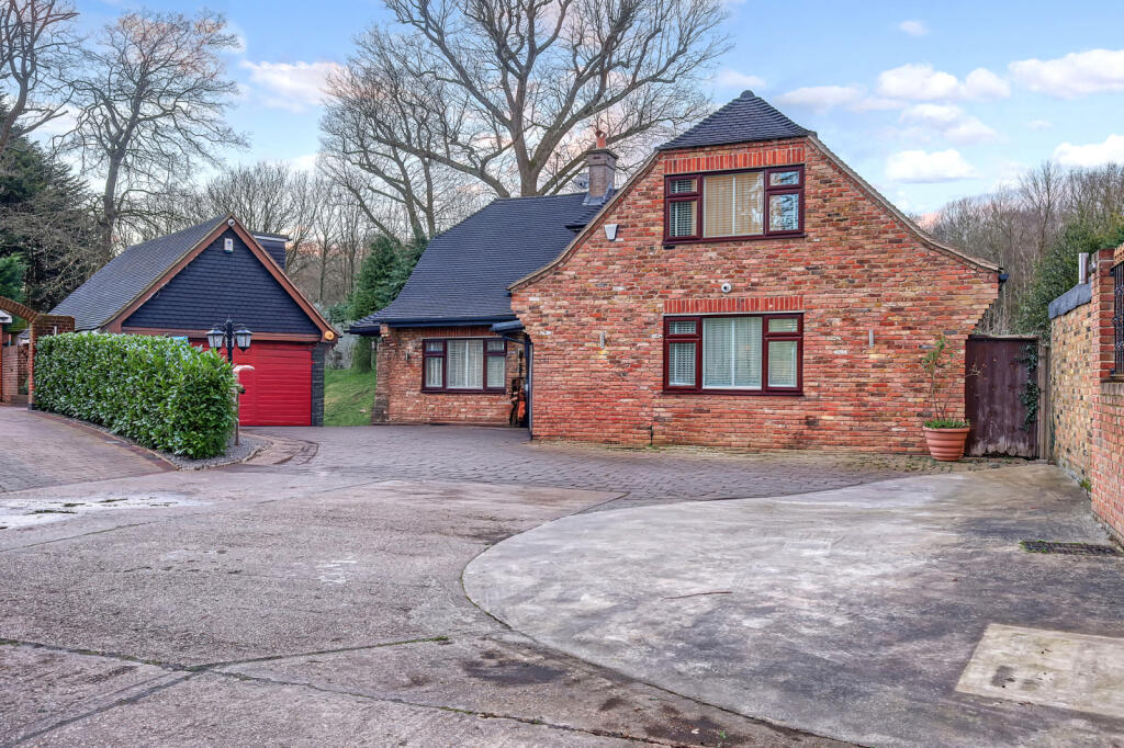
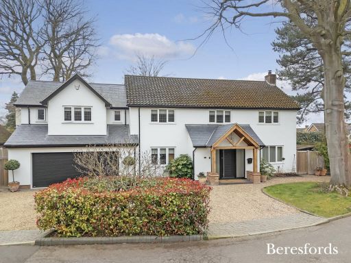
CM13 2AJ - 4 bedroom detached house for sale in The Birches, Brentwood…
View on Property Piper
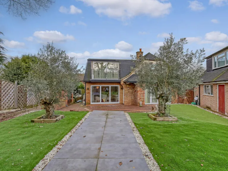
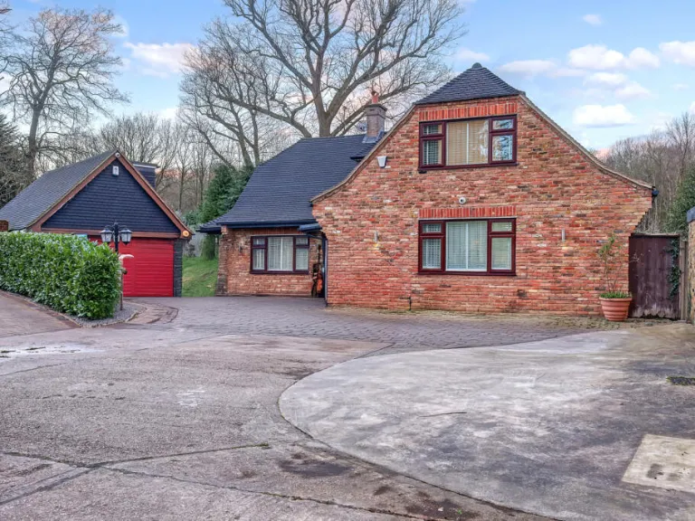
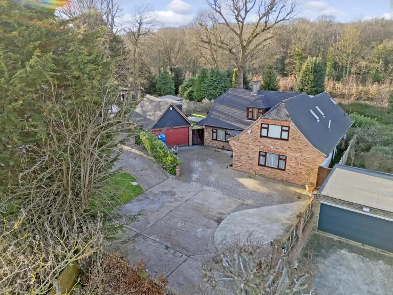
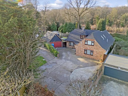
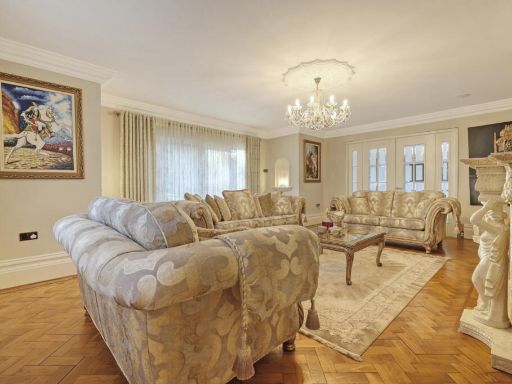
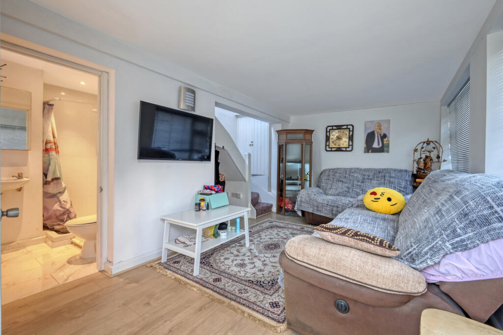
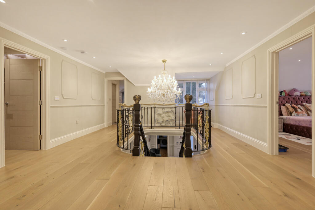
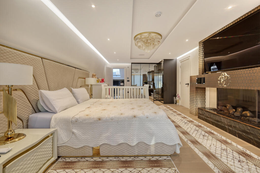
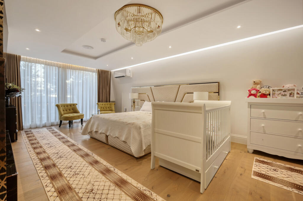
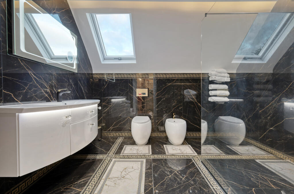
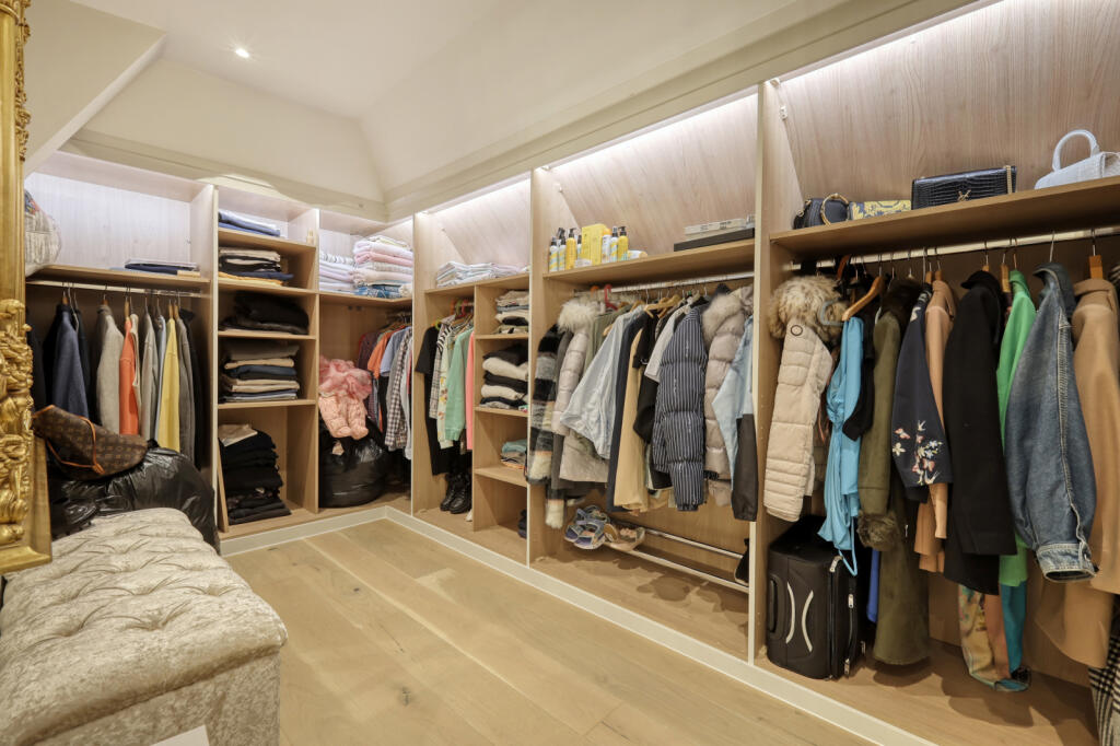
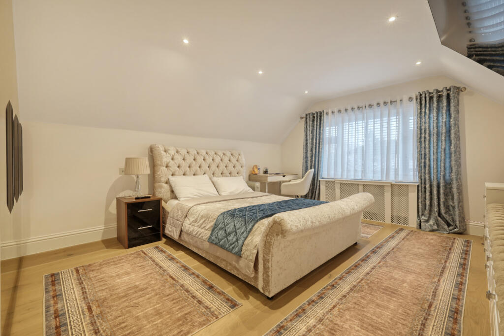
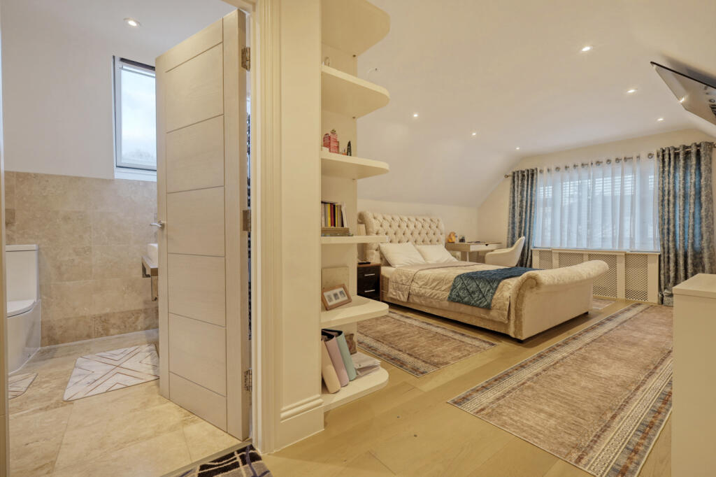
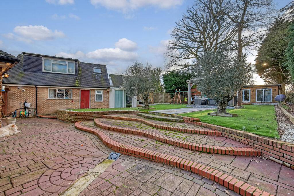
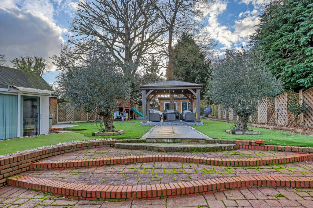
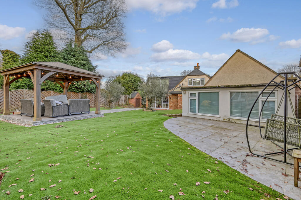
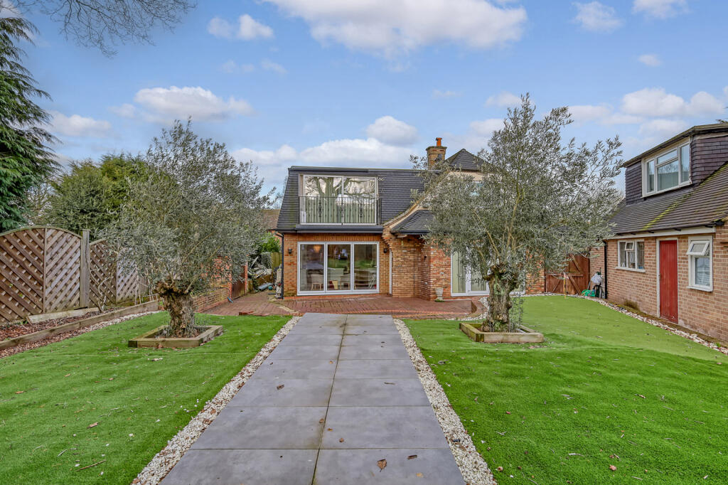
4 bedroom detached house for sale in The Birches, Brentwood, CM13
Property Details
- Price: £1450000
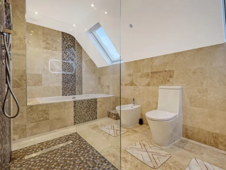
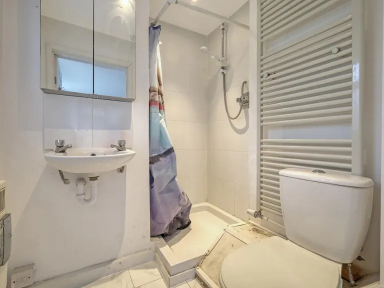
- Bedrooms: 4
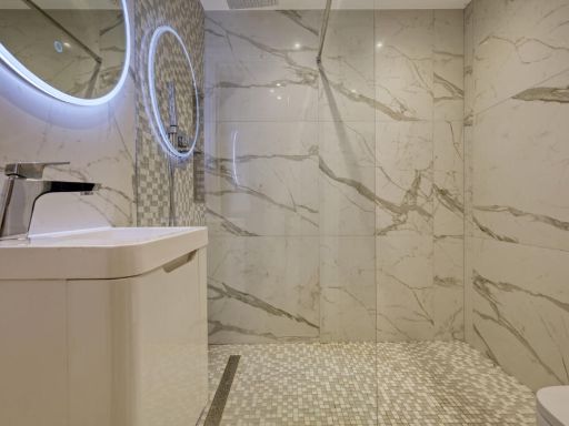
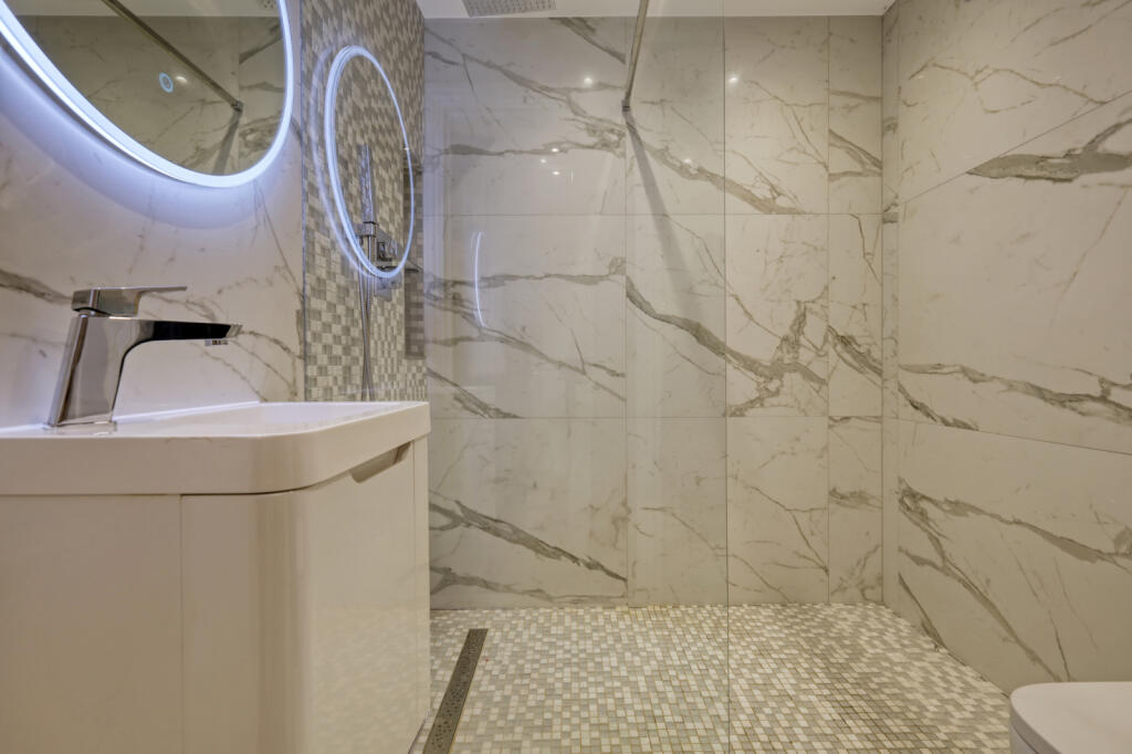
- Bathrooms: 4
- Property Type: undefined
- Property SubType: undefined
Image Descriptions
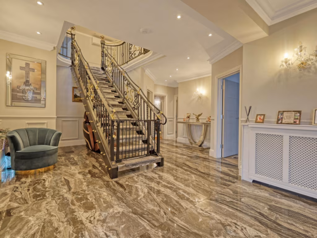
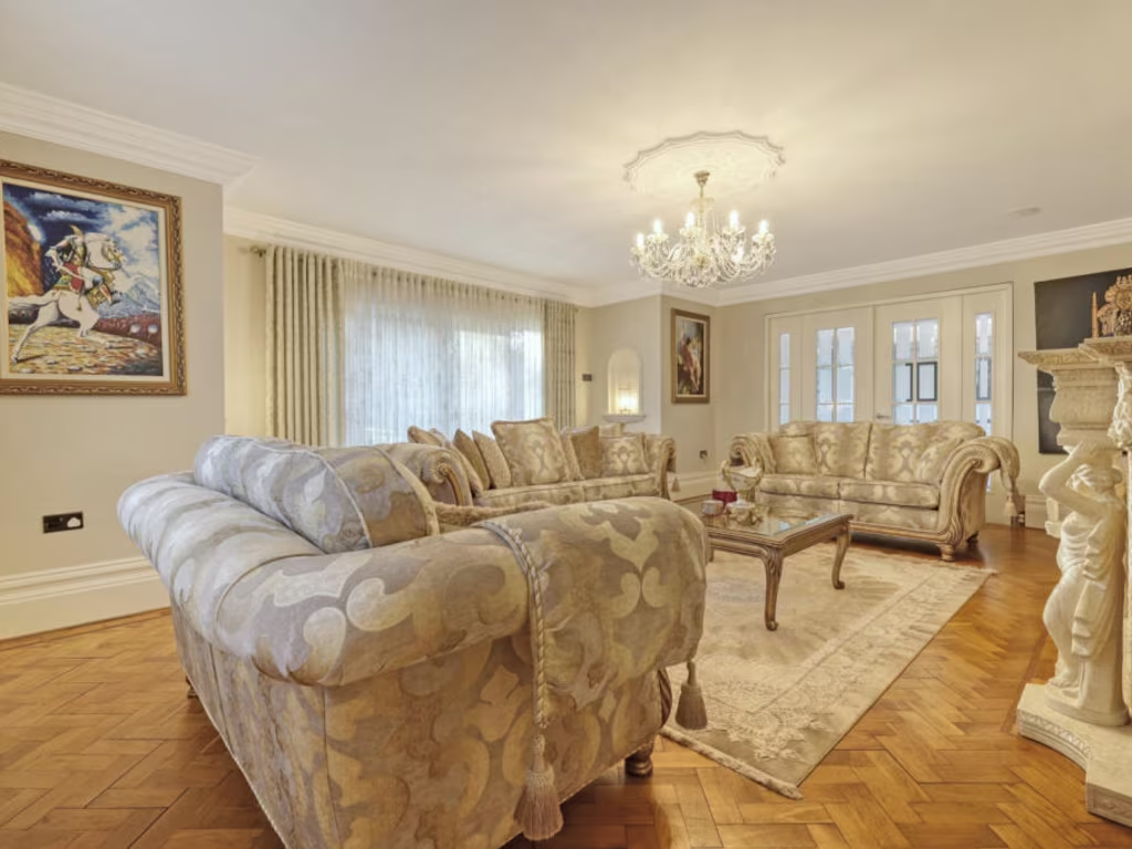
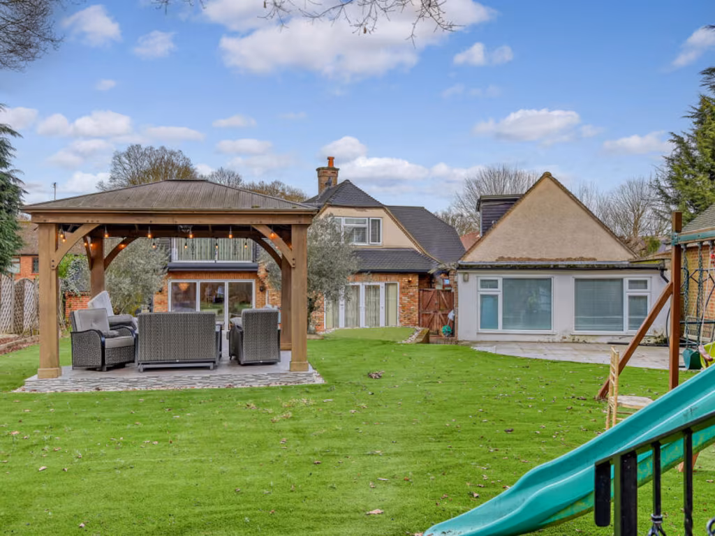
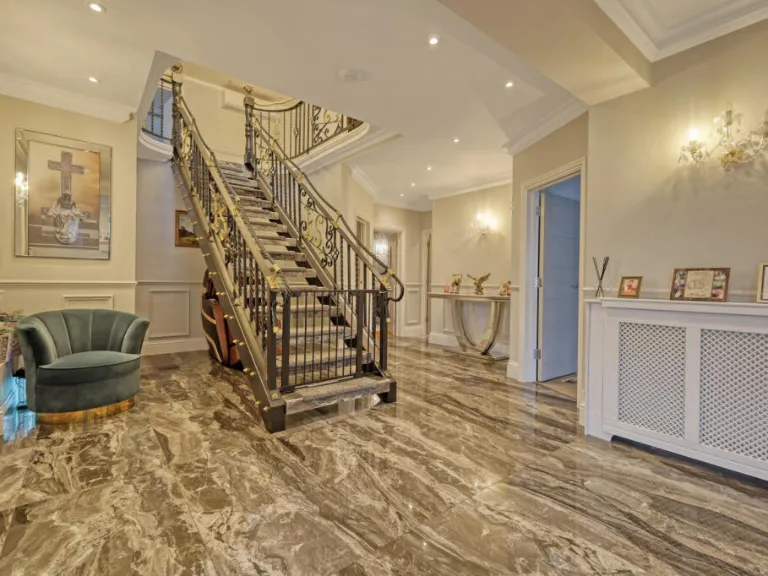
- detached house modern
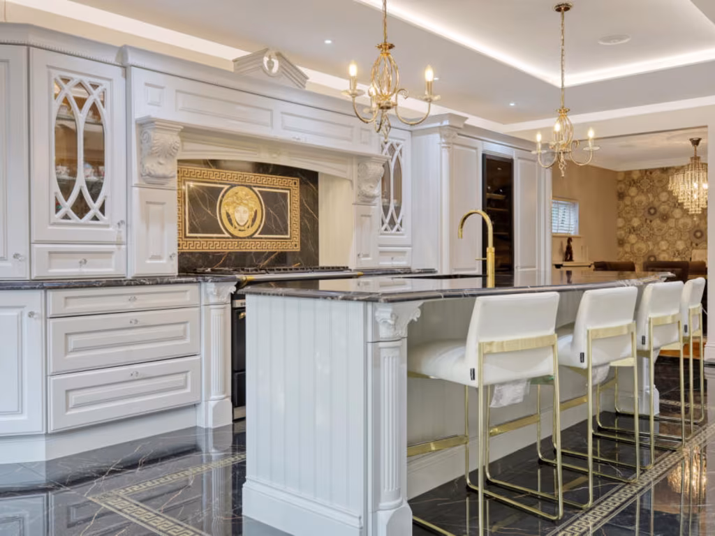
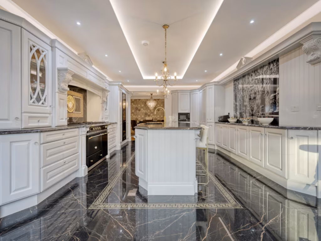
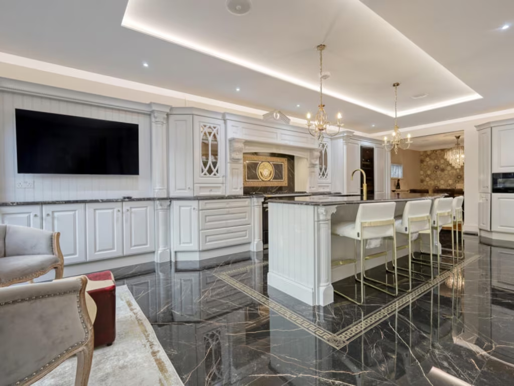
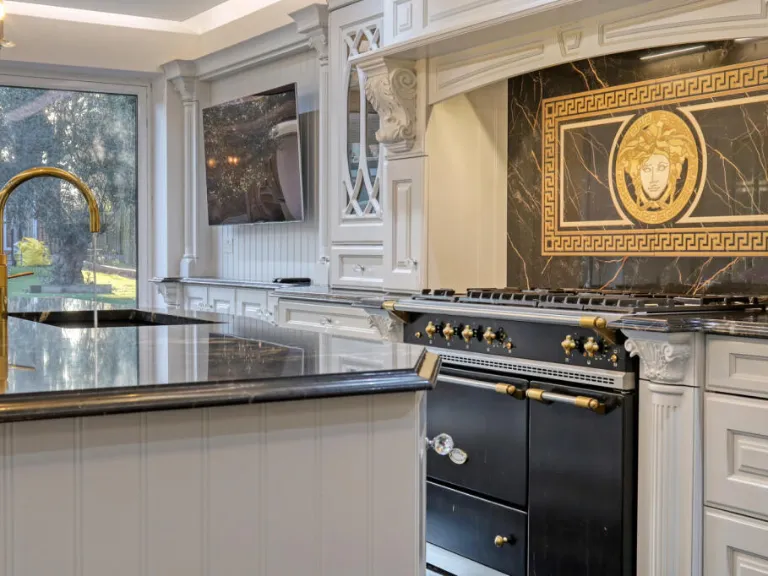
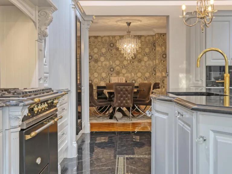
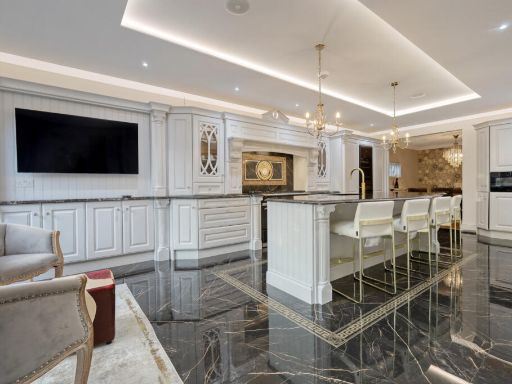
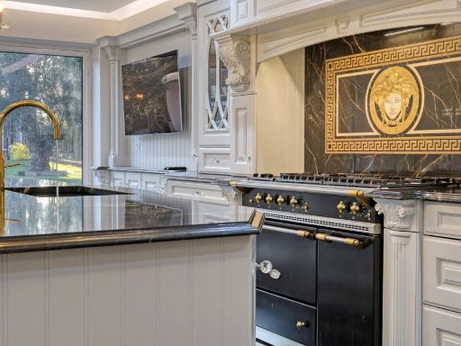
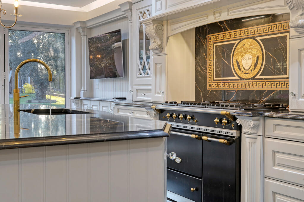
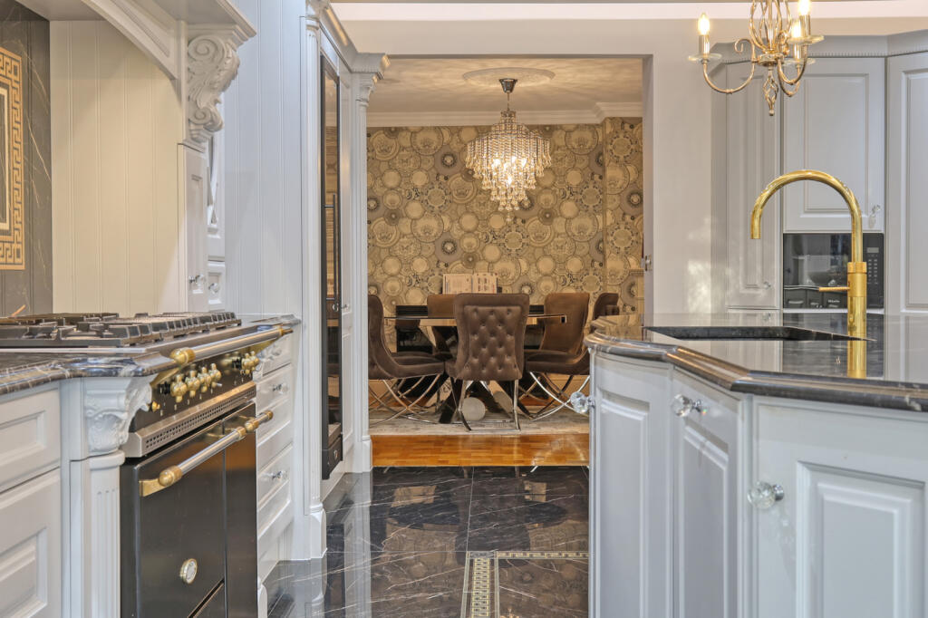
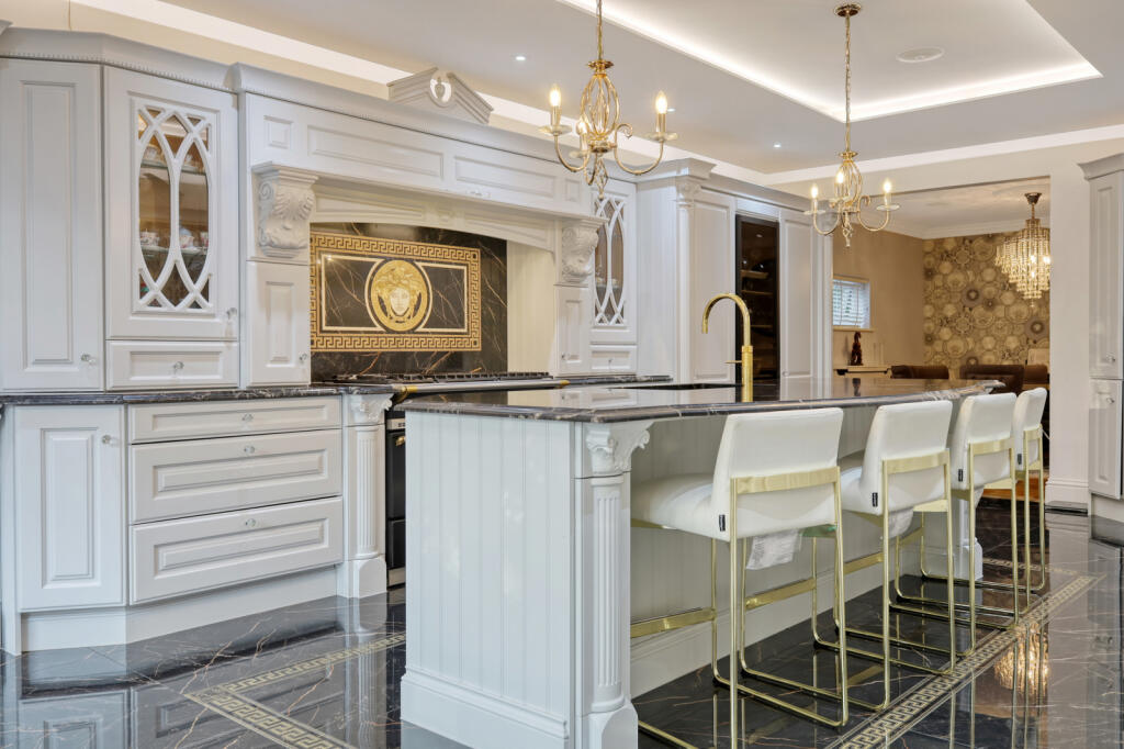
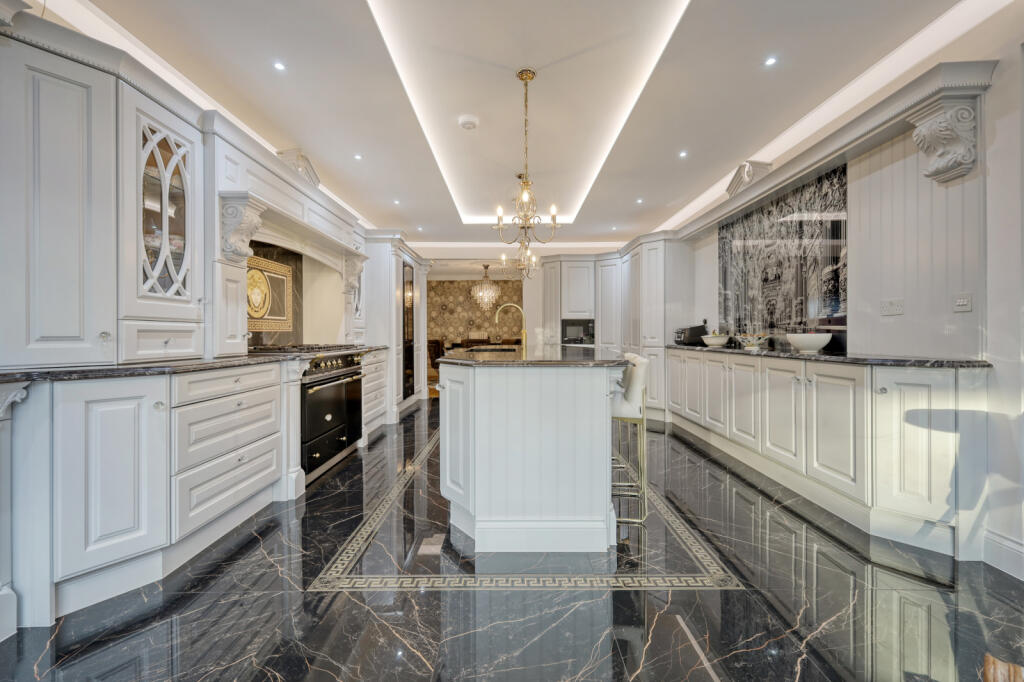
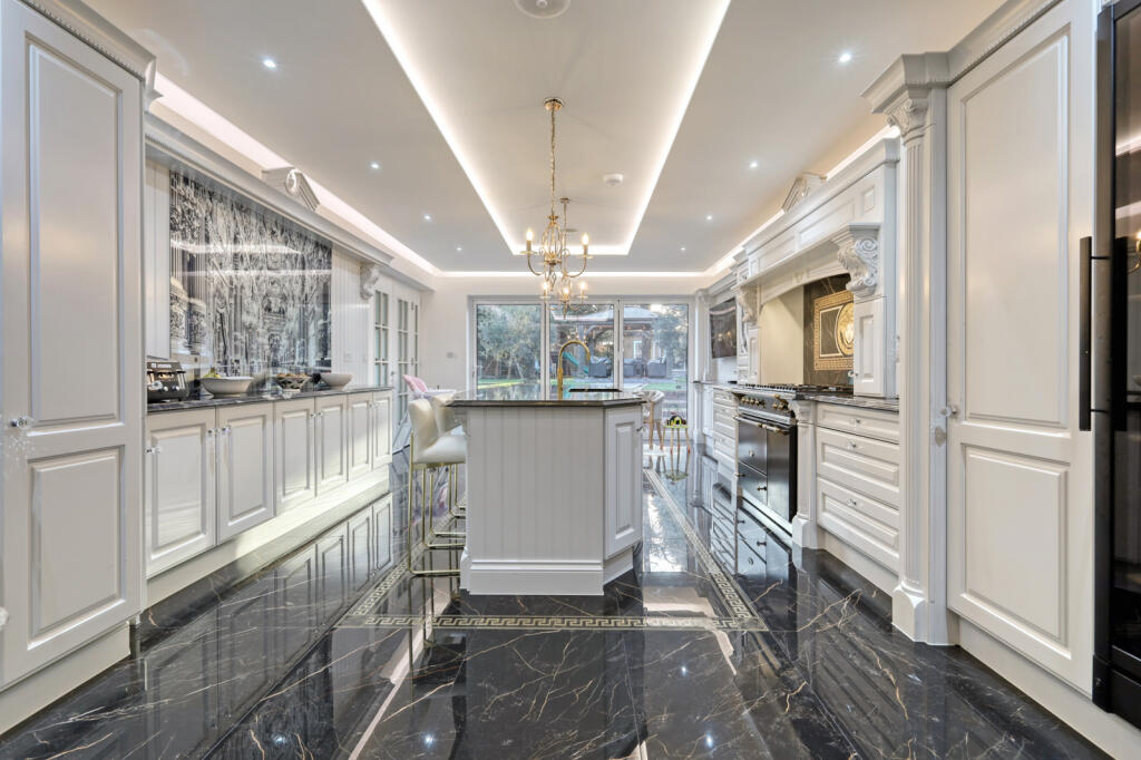
- kitchen modern classic
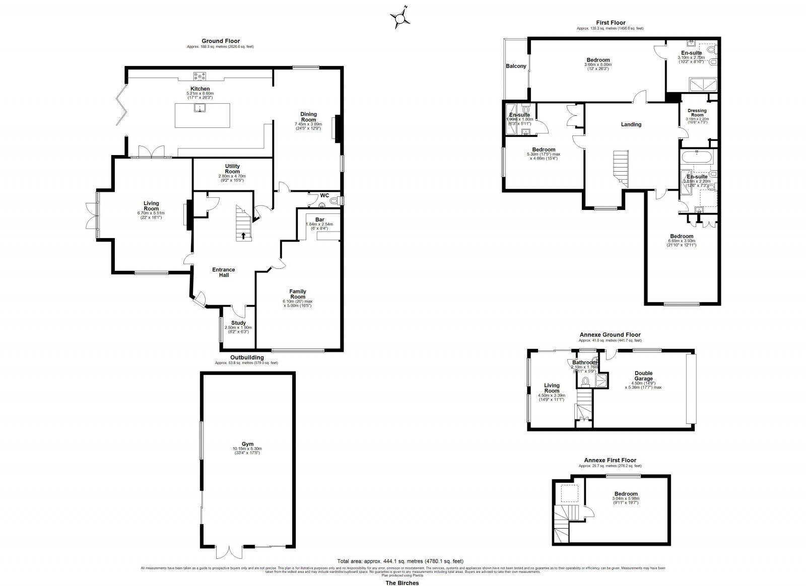
Floorplan Description
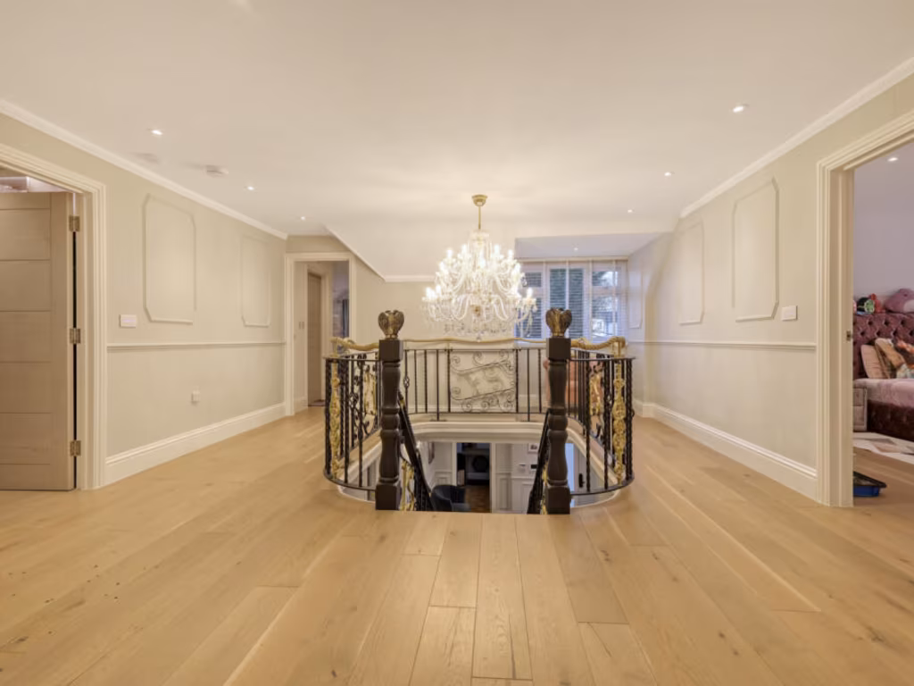
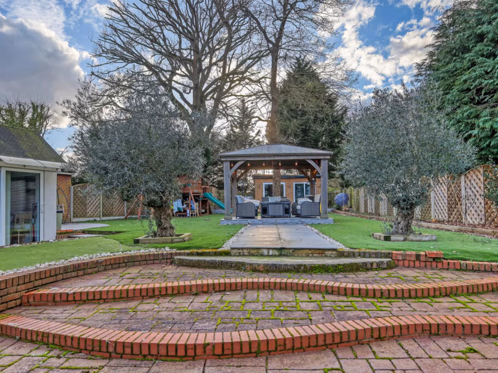
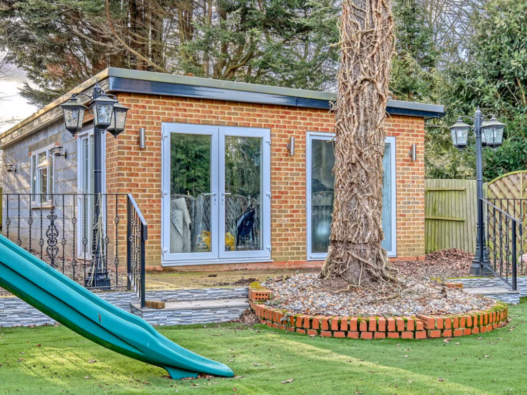
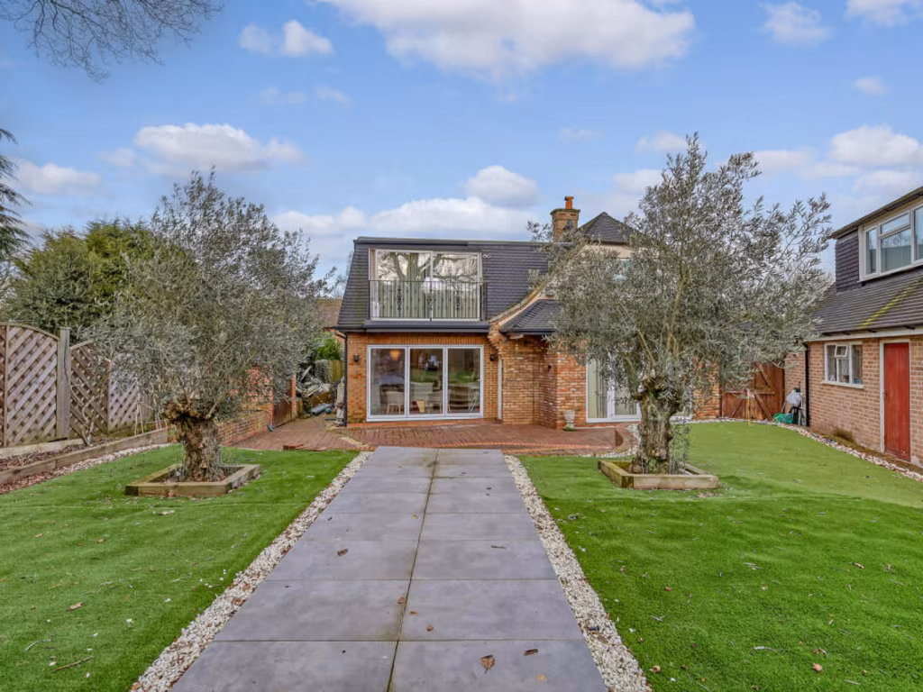
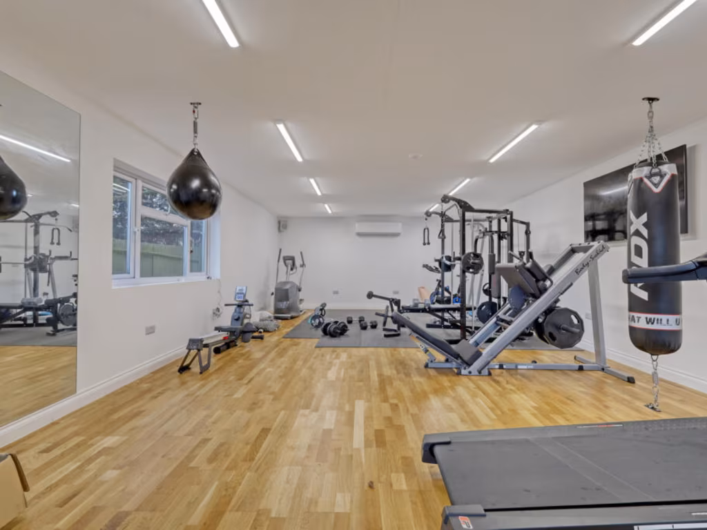
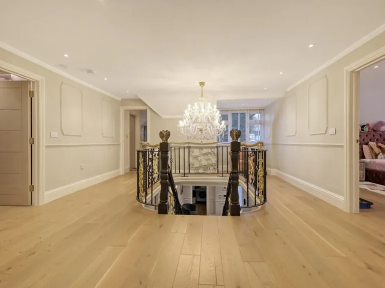
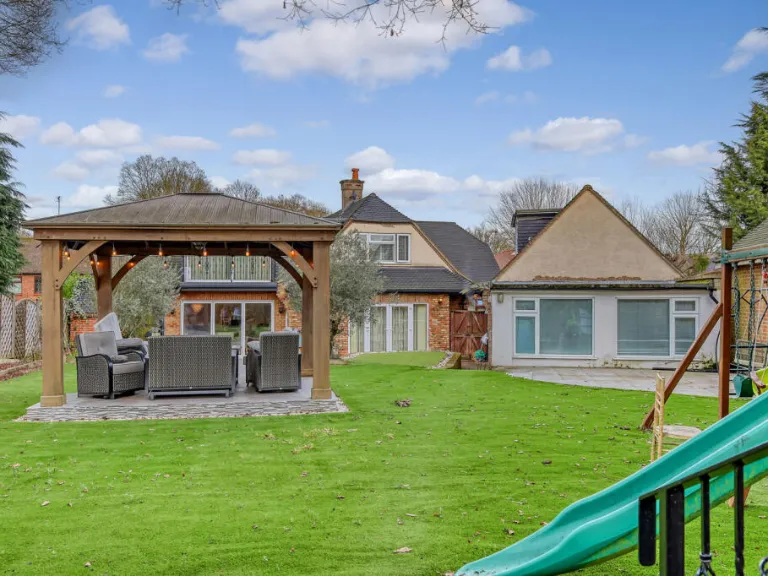
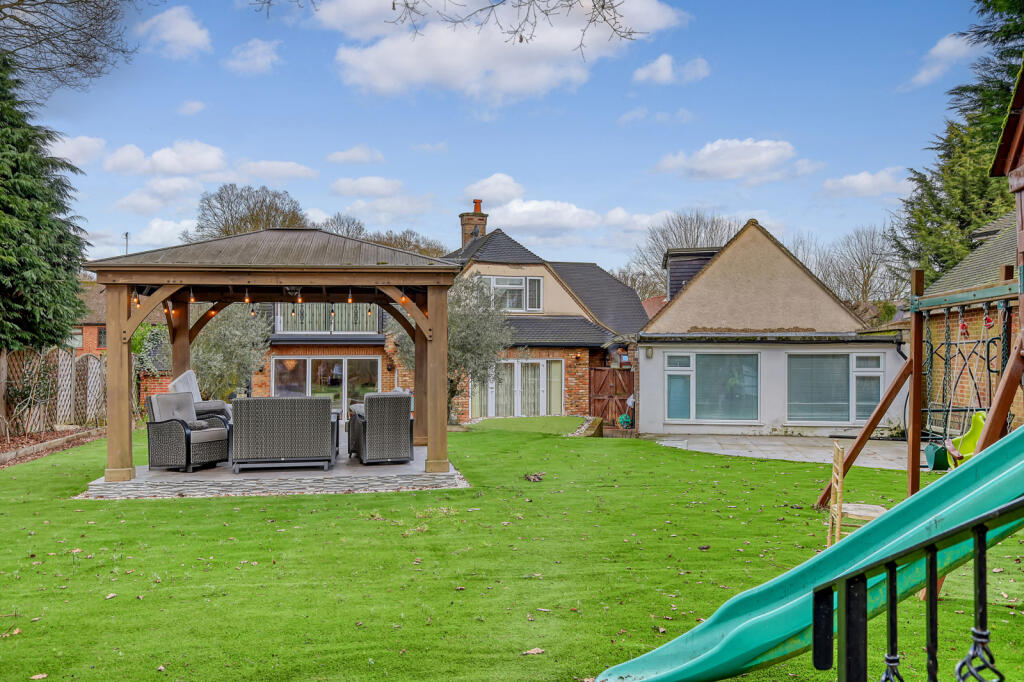
- A multi-story property featuring a main living area with additional annex and outbuilding.
Rooms
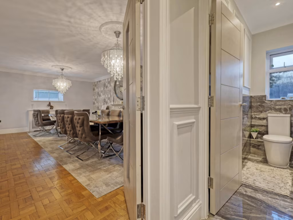
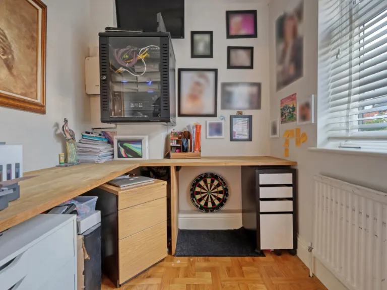
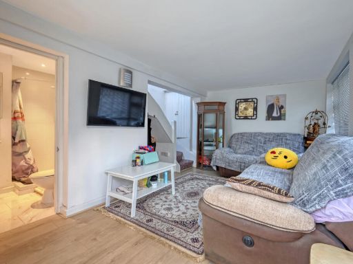
- Kitchen:
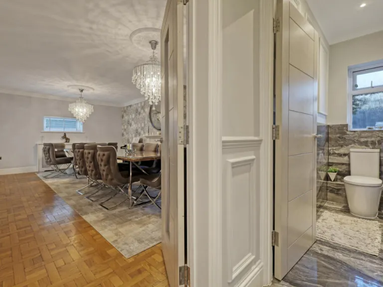
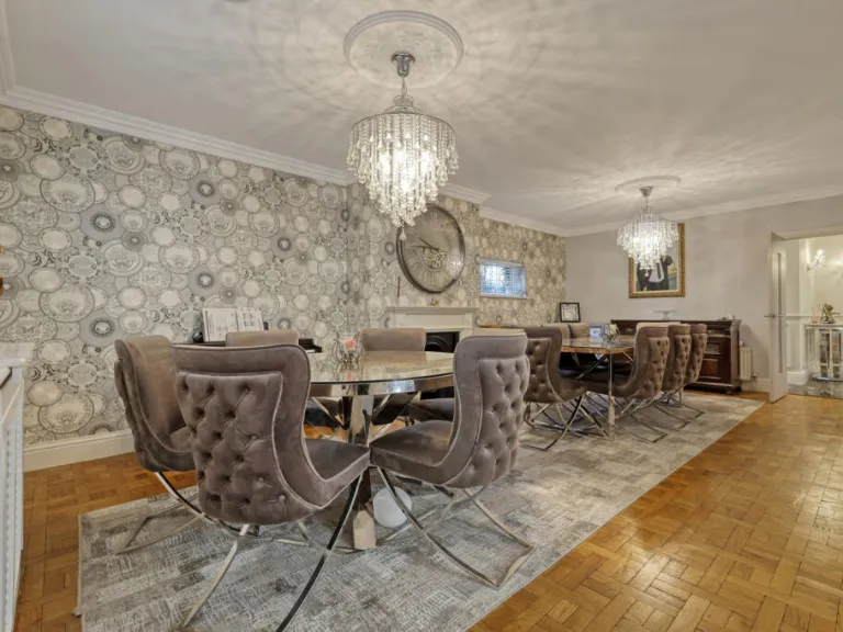
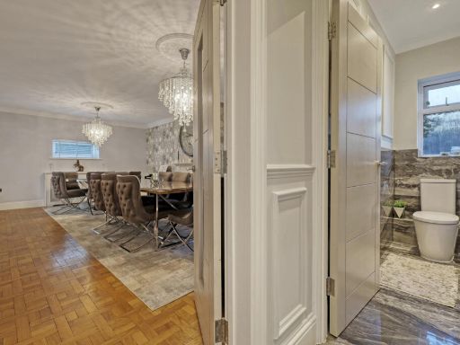
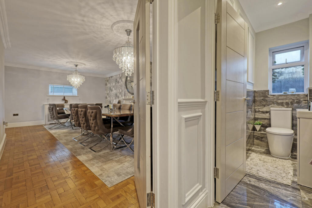
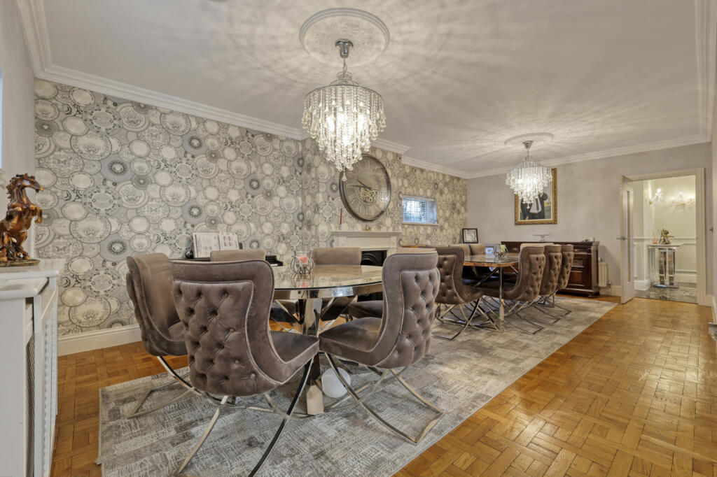
- Dining Room:
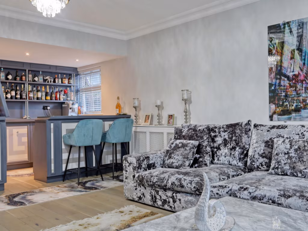
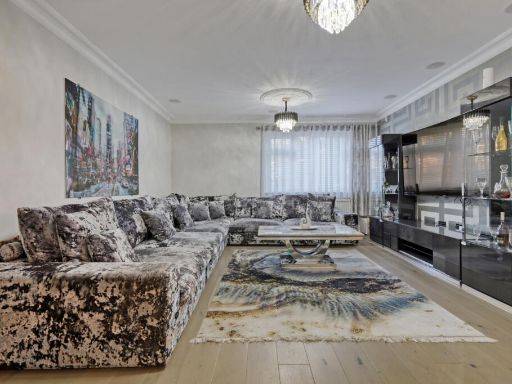
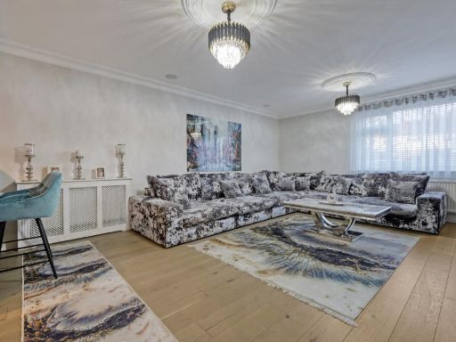
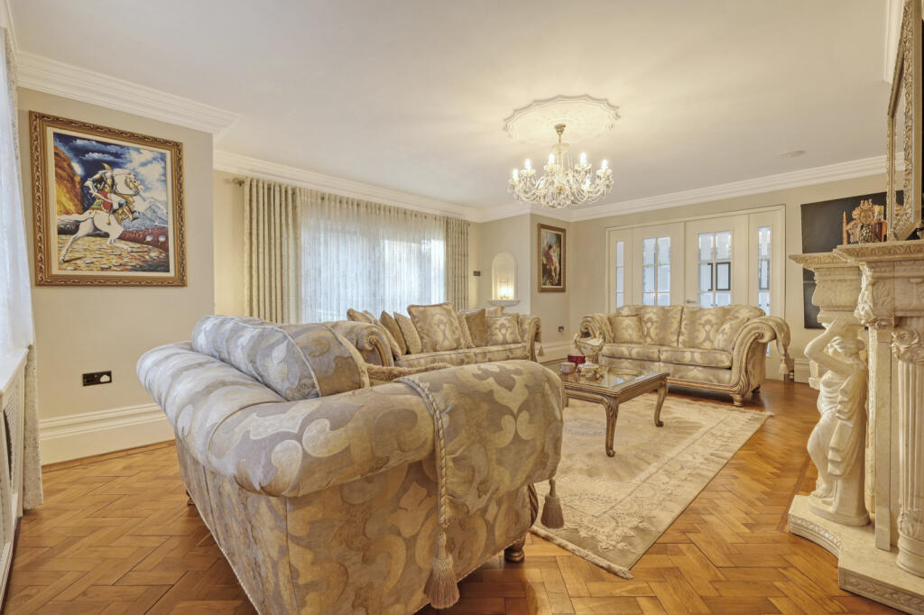
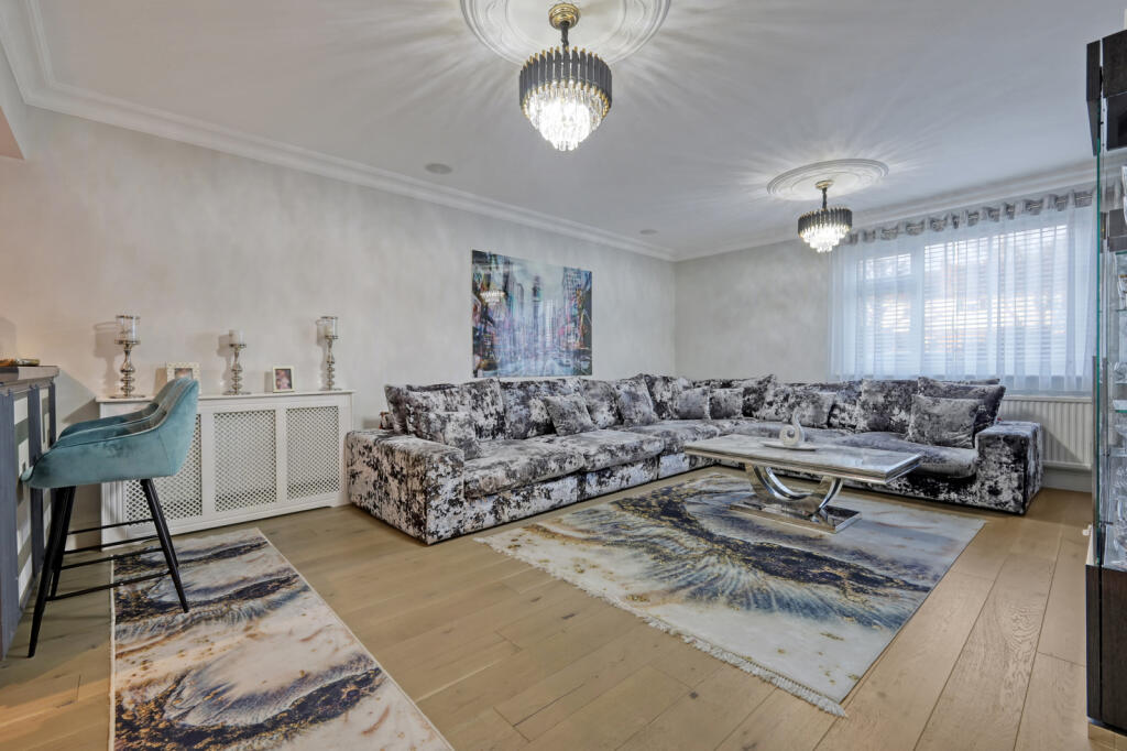
- Living Room:
- Utility Room:
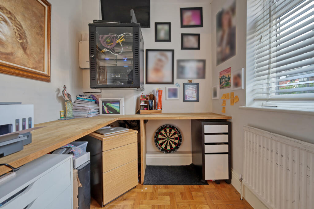
- Study:
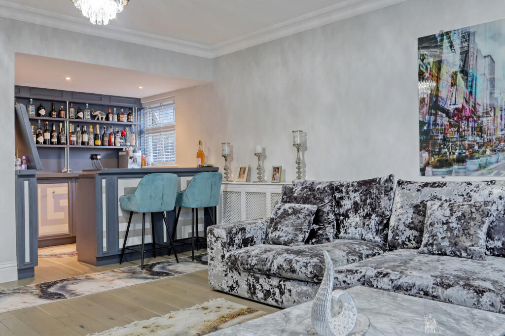
- Family Room:
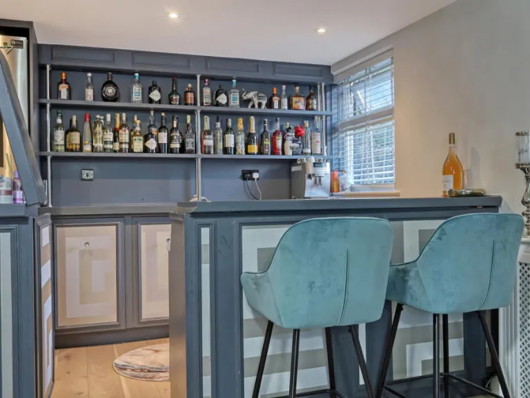
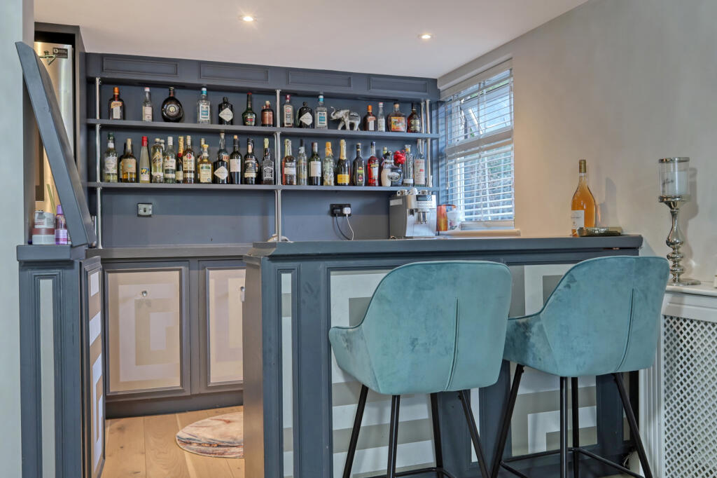
- Bar:
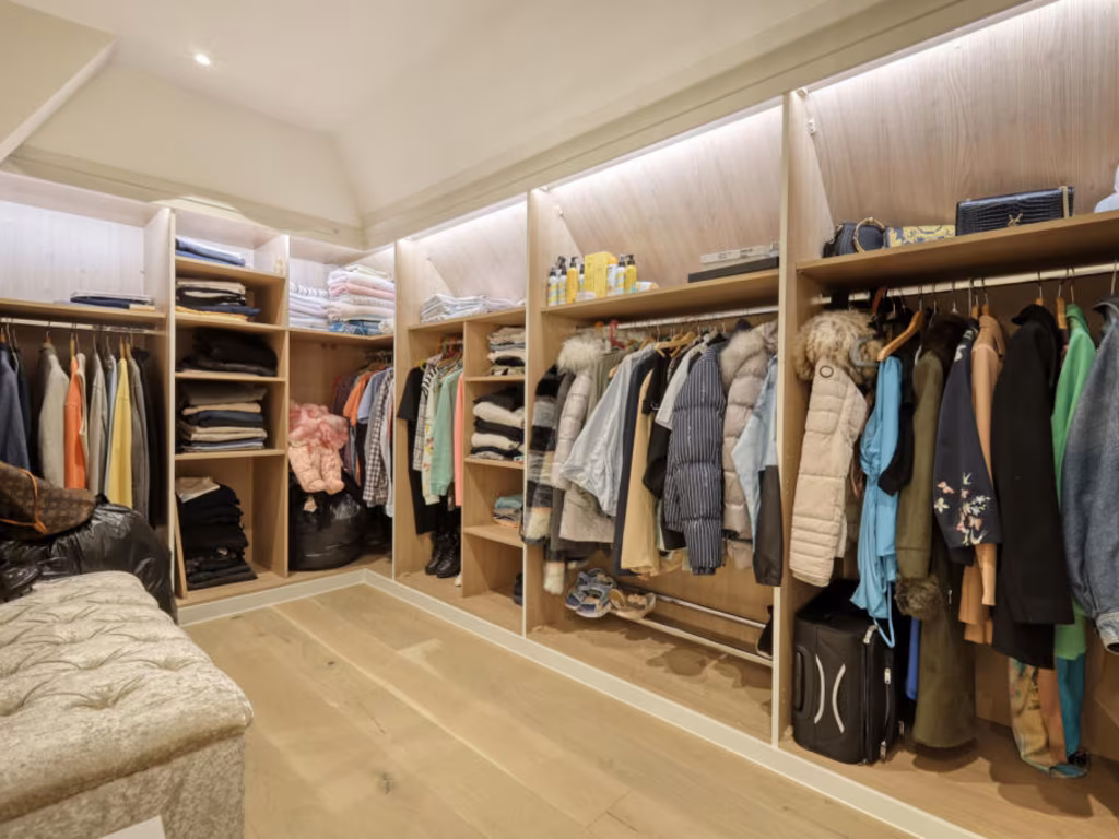
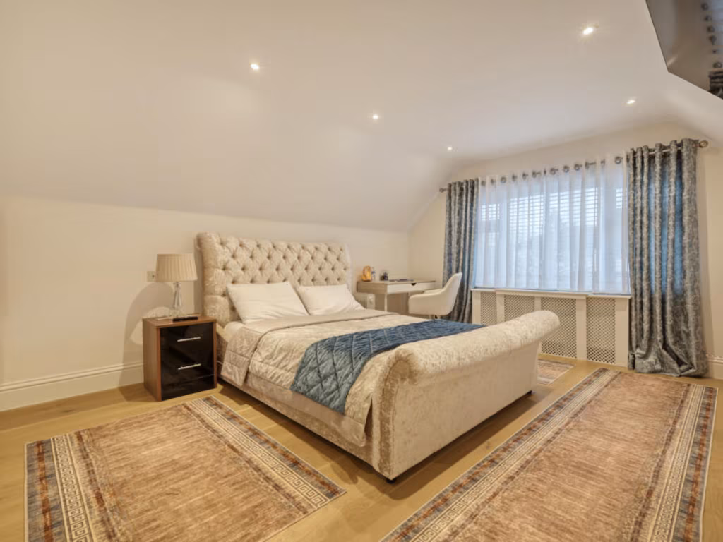
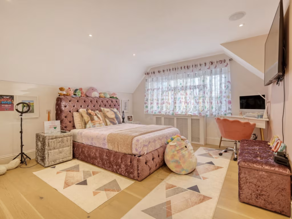
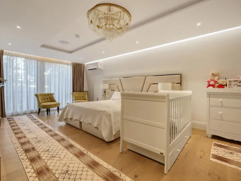
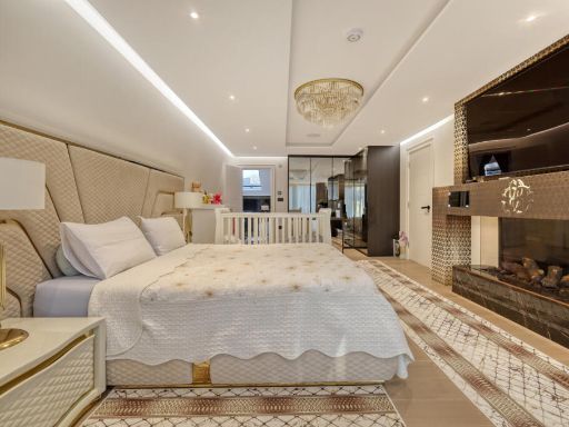
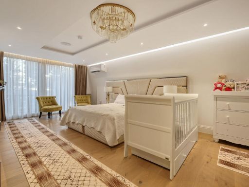
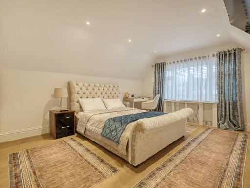
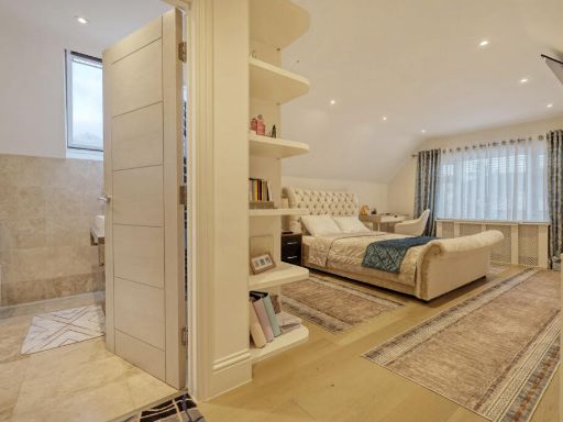
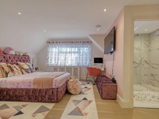
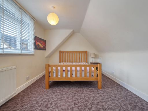
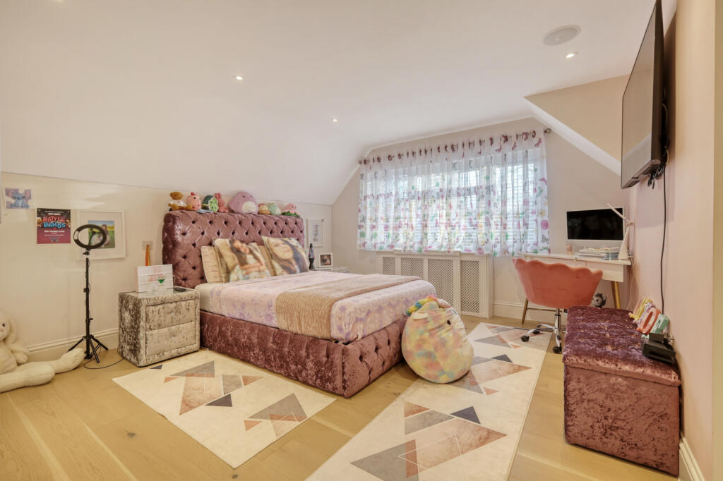
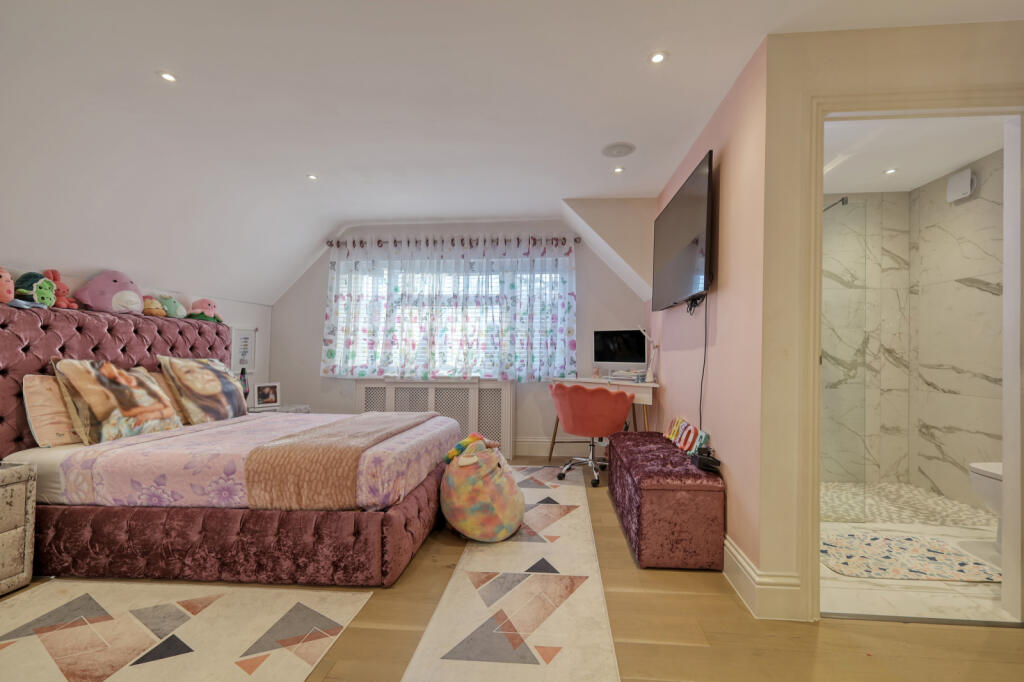
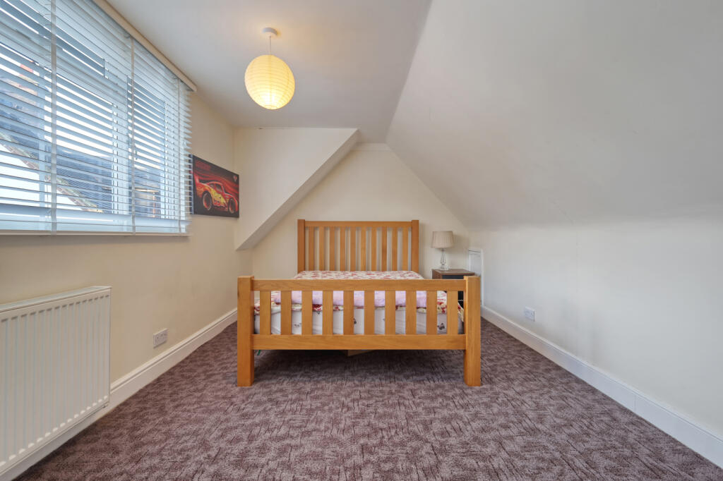
- Bedroom:
- Bedroom:
- Bedroom:
- Bedroom:
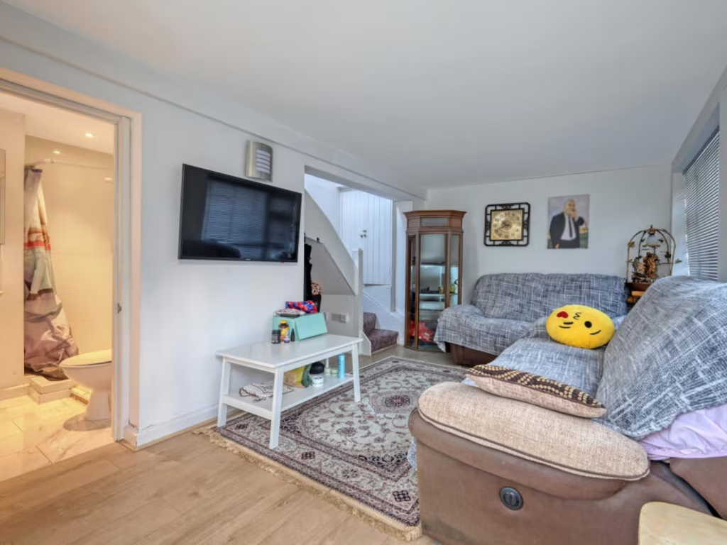
- Living Room (Annexe):
- Bedroom (Annexe):
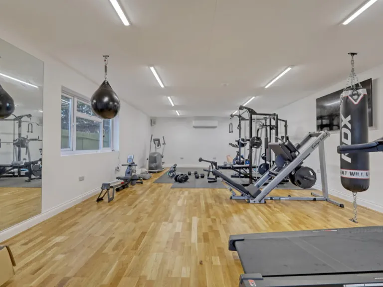
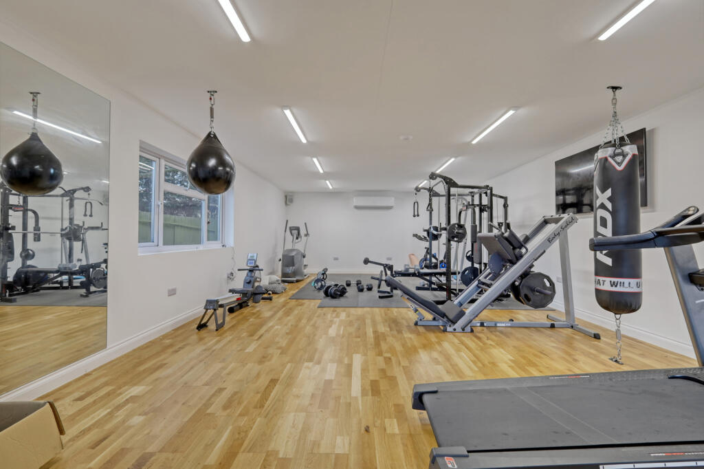
- Gym (Outbuilding):
- Double Garage (Annexe):
Textual Property Features
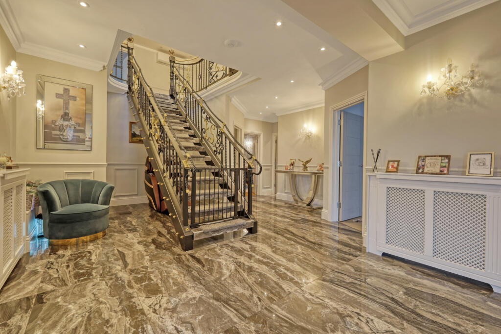
Detected Visual Features
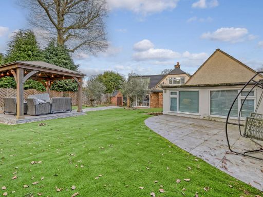
- modern house
- detached
- brick exterior
- pitched roof
- garage
- garden
- driveway
- suburban
- well-maintained
- residential area
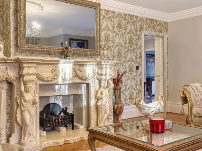
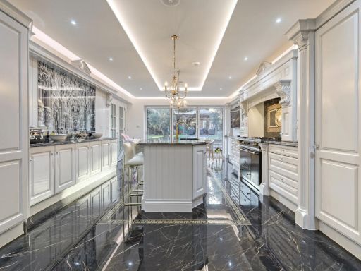
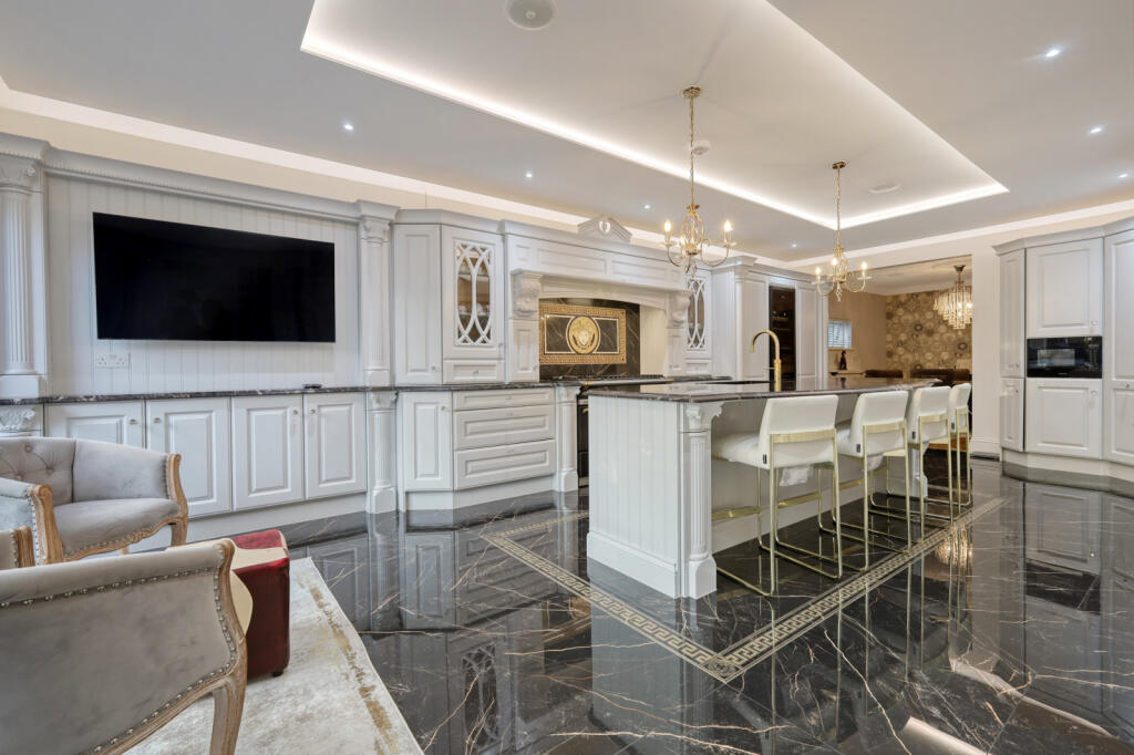
- modern classic
- high ceiling
- large kitchen
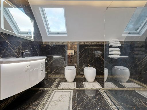
- luxury finishes
- marble flooring
- island
- chandeliers
- built-in appliances
- open plan
Nearby Schools
- West Horndon Primary School
- Ingrave Johnstone Church of England Voluntary Aided Primary School
- Warley Primary School
- Brentwood School
- St Joseph the Worker Catholic Primary School
- Larchwood Primary School
- Woodlands School
- Brentwood County High School
- Hogarth Primary School
- Brentwood Ursuline Convent High School
- St Helen's Catholic Junior School
- Willowbrook Primary School
- Hutton All Saints' Church of England Primary School
- Long Ridings Primary School
- St Martin's School Brentwood
- St Thomas of Canterbury Church of England Aided Primary School, Brentwood
- Becket Keys Church of England Free School
- St Helen's Catholic Infant School
- Shenfield St. Mary's Church of England Primary School
- Ursuline Preparatory School
- Holly Trees Primary School
- St Peter's Church of England Voluntary Aided Primary School, South Weald
- Woodlands School Hutton Manor
- Shenfield High School
- Bentley St Paul's Church of England Primary School
- Mountnessing Church of England Primary School
- Doddinghurst Infant School
- Doddinghurst Church of England Junior School
Nearest General Shops
- Id: 501703154
- Tags:
- Building: shop
- Name: Crown Barbers
- Shop: hairdresser
- Source:
- TagsNormalized:
- Lat: 51.6119437
- Lon: 0.3273126
- FullGeoHash: u10jx7wm6gtu
- PartitionGeoHash: u10j
- Images:
- FoodStandards: null
- Distance: 808.7
,- Id: 501703155
- Tags:
- Building: shop
- Name: Blush Hair & Beauty
- Shop: hairdresser
- Source:
- TagsNormalized:
- Lat: 51.6119114
- Lon: 0.3272555
- FullGeoHash: u10jx7wm1te7
- PartitionGeoHash: u10j
- Images:
- FoodStandards: null
- Distance: 806
,- Id: 501760511
- Tags:
- Addr:
- City: Brentwood
- Housenumber: 70
- Postcode: CM13 2DP
- Street: Orchard Avenue
- Building: shop
- Name: New Look
- Shop: hairdresser
- Source:
- TagsNormalized:
- Lat: 51.6161818
- Lon: 0.3217261
- FullGeoHash: u10jxk6q0c8m
- PartitionGeoHash: u10j
- Images:
- FoodStandards: null
- Distance: 463.3
}
Nearest Grocery shops
- Id: 501703148
- Tags:
- Amenity: fast_food
- Building: shop
- Cuisine: chicken;fish_and_chips;kebab;grill
- Name: Tommy Tucker's
- Source:
- TagsNormalized:
- fast food
- food
- shop
- chicken
- fish
- kebab
- grill
- Lat: 51.6121369
- Lon: 0.3276545
- FullGeoHash: u10jx7ww6zsu
- PartitionGeoHash: u10j
- Images:
- FoodStandards: null
- Distance: 825.9
,- Id: 501703151
- Tags:
- Building: shop
- Name: A&S Supermarket
- Shop: convenience
- Source:
- TagsNormalized:
- Lat: 51.6120237
- Lon: 0.3274541
- FullGeoHash: u10jx7wmy4x3
- PartitionGeoHash: u10j
- Images:
- FoodStandards: null
- Distance: 815.8
,- Id: 501760485
- Tags:
- Addr:
- City: Brentwood
- Housenumber: 116
- Postcode: CM13 2DP
- Street: Orchard Avenue
- Building: retail
- Name: KSD News, Food & Wine
- Shop: convenience
- Source:
- TagsNormalized:
- retail
- food
- wine
- convenience
- shop
- Lat: 51.6161185
- Lon: 0.3223922
- FullGeoHash: u10jxk6v8mch
- PartitionGeoHash: u10j
- Images:
- FoodStandards: null
- Distance: 499.3
}
Nearest Supermarkets
- Id: 851847846
- Tags:
- Brand: Lidl
- Brand:wikidata: Q151954
- Brand:wikipedia: en:Lidl
- Building: yes
- Name: Lidl
- Shop: supermarket
- TagsNormalized:
- Lat: 51.605772
- Lon: 0.2243121
- FullGeoHash: u10jt4e36v5h
- PartitionGeoHash: u10j
- Images:
- FoodStandards: null
- Distance: 6400.2
,- Id: 1428201890
- Tags:
- Brand: Co-op Food
- Brand:wikidata: Q3277439
- Brand:wikipedia: en:Co-op Food
- Name: Co-op Food
- Operator: The Co-operative Group
- Operator:wikidata: Q117202
- Shop: supermarket
- TagsNormalized:
- co-op
- co-op food
- food
- supermarket
- shop
- Lat: 51.630841
- Lon: 0.3288155
- FullGeoHash: u10jxrp7myqe
- PartitionGeoHash: u10j
- Images:
- FoodStandards: null
- Distance: 2074.1
,- Id: 147247984
- Tags:
- Addr:
- City: Brentwood
- Housenumber: 51
- Postcode: CM14 4WQ
- Street: William Hunter Way
- Branch: Brentwood Superstore
- Brand: Sainsbury's
- Brand:wikidata: Q152096
- Brand:wikipedia: en:Sainsbury's
- Building: yes
- Name: Sainsbury's
- Opening_hours: Mo-Sa 08:00-21:00; Su 10:00-16:00
- Phone: +441277264758
- Shop: supermarket
- TagsNormalized:
- sainsburys
- supermarket
- shop
- Lat: 51.6222311
- Lon: 0.3026374
- FullGeoHash: u10jwvs37cqg
- PartitionGeoHash: u10j
- Images:
- FoodStandards: null
- Distance: 1305.9
}
Nearest Religious buildings
- Id: 198166444
- Tags:
- Amenity: place_of_worship
- Name: Brentwood School Chapel
- Religion: christian
- TagsNormalized:
- place of worship
- chapel
- school
- christian
- church
- Lat: 51.6201772
- Lon: 0.3068651
- FullGeoHash: u10jwvpmq6rp
- PartitionGeoHash: u10j
- Images:
- FoodStandards: null
- Distance: 938.9
,- Id: 157027875
- Tags:
- Alt_name: Brentwood Cathedral
- Amenity: place_of_worship
- Building: yes
- Denomination: catholic
- Name: Cathedral Church of St Mary and St Helen
- Religion: christian
- Wheelchair: yes
- Wikidata: Q1356731
- TagsNormalized:
- place of worship
- catholic
- cathedral
- church
- christian
- Lat: 51.6196805
- Lon: 0.3064704
- FullGeoHash: u10jwvp4mmbu
- PartitionGeoHash: u10j
- Images:
- FoodStandards: null
- Distance: 918.4
,- Id: 146255200
- Tags:
- Amenity: place_of_worship
- Building: yes
- Denomination: anglican
- Name: St Stephen, Ingrave
- Religion: christian
- Wikidata: Q105083644
- TagsNormalized:
- place of worship
- anglican
- christian
- church
- Lat: 51.6121627
- Lon: 0.3255236
- FullGeoHash: u10jx7tn9hry
- PartitionGeoHash: u10j
- Images:
- FoodStandards: null
- Distance: 683.4
}
Nearest Medical buildings
- Id: 1632646284
- Tags:
- Addr:
- Housenumber: 27
- Postcode: CM15 8AG
- Street: Shenfield Road
- Amenity: pharmacy
- Healthcare: pharmacy
- Name: Burntwood Pharmacy
- TagsNormalized:
- Lat: 51.6221728
- Lon: 0.3074853
- FullGeoHash: u10jwvxbuymx
- PartitionGeoHash: u10j
- Images:
- FoodStandards: null
- Distance: 1088.7
,- Id: 170991726
- Tags:
- Amenity: hospital
- Building: yes
- Emergency: no
- Healthcare: hospital
- Name: Nuffield Hospital
- TagsNormalized:
- hospital
- health
- healthcare
- nuffield
- Lat: 51.6233508
- Lon: 0.3128283
- FullGeoHash: u10jxjezc6jd
- PartitionGeoHash: u10j
- Images:
- FoodStandards: null
- Distance: 1068.4
,- Id: 228077510
- Tags:
- Amenity: doctors
- Building: yes
- Healthcare: doctor
- Name: The New Surgery
- TagsNormalized:
- doctor
- doctors
- health
- healthcare
- surgery
- Lat: 51.6217551
- Lon: 0.3072185
- FullGeoHash: u10jwvrww8we
- PartitionGeoHash: u10j
- Images:
- FoodStandards: null
- Distance: 1060.5
,- Id: 122850042
- Tags:
- Amenity: hospital
- Emergency: no
- Healthcare: hospital
- Name: Brentwood Community Hospital
- TagsNormalized:
- Lat: 51.6233407
- Lon: 0.3160083
- FullGeoHash: u10jxjwpg80y
- PartitionGeoHash: u10j
- Images:
- FoodStandards: null
- Distance: 1043.7
}
Nearest Airports
- Id: 103894219
- Tags:
- Aerodrome: international
- Aeroway: aerodrome
- Iata: SEN
- Icao: EGMC
- Name: London Southend Airport
- Old_name: Southend Municipal Airport
- Ref: SEN
- Wikidata: Q1415441
- TagsNormalized:
- airport
- international airport
- Lat: 51.5701749
- Lon: 0.6924624
- FullGeoHash: u10mru04p937
- PartitionGeoHash: u10m
- Images:
- FoodStandards: null
- Distance: 26454.1
,- Id: 121158889
- Tags:
- Aerodrome: continental
- Aeroway: aerodrome
- Fhrs:
- Authority: City of London Corporation
- Iata: LCY
- Icao: EGLC
- Name: London City Airport
- Operator: London City Airport Limited
- Ref: LCY
- Website: https://www.londoncityairport.com/
- Wikidata: Q8982
- Wikipedia: en:London City Airport
- TagsNormalized:
- airport
- continental airport
- Lat: 51.5042658
- Lon: 0.0539987
- FullGeoHash: u10j10p64702
- PartitionGeoHash: u10j
- Images:
- FoodStandards: null
- Distance: 21839.4
}
Nearest Leisure Facilities
- Id: 200204812
- Tags:
- Leisure: pitch
- Sport: bowls
- TagsNormalized:
- Lat: 51.6104325
- Lon: 0.3146623
- FullGeoHash: u10jx5mhs1vj
- PartitionGeoHash: u10j
- Images:
- FoodStandards: null
- Distance: 403.2
,- Id: 839838627
- Tags:
- TagsNormalized:
- miniature golf
- golf
- leisure
- Lat: 51.6107423
- Lon: 0.3141895
- FullGeoHash: u10jx5ky35st
- PartitionGeoHash: u10j
- Images:
- FoodStandards: null
- Distance: 379.7
,- Id: 200205123
- Tags:
- TagsNormalized:
- Lat: 51.6112004
- Lon: 0.3136366
- FullGeoHash: u10jx5s3h306
- PartitionGeoHash: u10j
- Images:
- FoodStandards: null
- Distance: 348.8
,- Id: 200205122
- Tags:
- Leisure: pitch
- Sport: skateboard
- TagsNormalized:
- pitch
- leisure
- skateboard
- sports
- Lat: 51.6115305
- Lon: 0.3129154
- FullGeoHash: u10jx5efgqwe
- PartitionGeoHash: u10j
- Images:
- FoodStandards: null
- Distance: 345.9
,- Id: 501760196
- Tags:
- TagsNormalized:
- Lat: 51.614473
- Lon: 0.3207221
- FullGeoHash: u10jxk1s175s
- PartitionGeoHash: u10j
- Images:
- FoodStandards: null
- Distance: 327.3
}
Nearest Tourist attractions
- Id: 7348116
- Tags:
- Addr:
- City: Brentwood
- Postcode: CM13 2DP
- Street: Orchard Avenue
- Alt_name: Thriftwood
- Group_only: no
- Internet_access: wlan
- Name: Thriftwood Scout Camp
- Scout: yes
- Tents: yes
- Tourism: camp_site
- Type: multipolygon
- Website: http://www.thriftwood.org.uk/
- TagsNormalized:
- Lat: 51.6174121
- Lon: 0.3282121
- FullGeoHash: u10jxkwvpzh8
- PartitionGeoHash: u10j
- Images:
- FoodStandards: null
- Distance: 923.2
,- Id: 918377868
- Tags:
- Group_only: yes
- Tourism: camp_site
- TagsNormalized:
- Lat: 51.6097413
- Lon: 0.3248618
- FullGeoHash: u10jx7k89c4d
- PartitionGeoHash: u10j
- Images:
- FoodStandards: null
- Distance: 767.6
,- Id: 839838612
- Tags:
- TagsNormalized:
- Lat: 51.6109422
- Lon: 0.3118325
- FullGeoHash: u10jx57pd0zn
- PartitionGeoHash: u10j
- Images:
- FoodStandards: null
- Distance: 444.1
}
Nearest Hotels
- Id: 10011408053
- Tags:
- Addr:
- Housenumber: 75-77
- Street: Rose Valey
- Name: Brentwood Guest House
- Phone: +441277262713
- Tourism: hotel
- TagsNormalized:
- Lat: 51.6143559
- Lon: 0.3014918
- FullGeoHash: u10jwu5e3m29
- PartitionGeoHash: u10j
- Images:
- FoodStandards: null
- Distance: 1006.6
,- Id: 10702725978
- Tags:
- Addr:
- Housenumber: 7775
- Street: Rose Valey
- Name: Brentwood Guest House
- Tourism: hotel
- TagsNormalized:
- Lat: 51.6143559
- Lon: 0.3014918
- FullGeoHash: u10jwu5e3m29
- PartitionGeoHash: u10j
- Images:
- FoodStandards: null
- Distance: 1006.6
,- Id: 10702749009
- Tags:
- Addr:
- Housenumber: 7775
- Street: Rose Valey
- Name: Brentwood Guest House
- Tourism: hotel
- TagsNormalized:
- Lat: 51.6143559
- Lon: 0.3014918
- FullGeoHash: u10jwu5e3m29
- PartitionGeoHash: u10j
- Images:
- FoodStandards: null
- Distance: 1006.6
}
Tags
- modern house
- detached
- brick exterior
- pitched roof
- garage
- garden
- driveway
- suburban
- well-maintained
- residential area
- modern classic
- high ceiling
- large kitchen
- luxury finishes
- marble flooring
- island
- chandeliers
- built-in appliances
- open plan
Local Market Stats
- Average Price/sqft: £486
- Avg Income: £58200
- Rental Yield: 3.9%
- Social Housing: 5%
- Planning Success Rate: 79%
AirBnB Data
- 1km average: £100/night
- Listings in 1km: 1
Similar Properties
 5 bedroom detached house for sale in Lakeside Crescent, Brentwood, CM14 — £1,625,000 • 5 bed • 5 bath • 3993 ft²
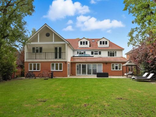 7 bedroom detached house for sale in Widworthy Hayes, Hutton Mount, Brentwood, CM13 — £3,000,000 • 7 bed • 6 bath • 1437 ft²
 4 bedroom detached house for sale in Riseway, Brentwood, Essex, CM15 — £1,000,000 • 4 bed • 3 bath • 1940 ft²
 5 bedroom detached house for sale in Glanthams Close, Shenfield, CM15 — £2,950,000 • 5 bed • 3 bath • 5200 ft²
 4 bedroom detached house for sale in Spurgate, Hutton, Brentwood, CM13 — £1,850,000 • 4 bed • 4 bath • 3550 ft²
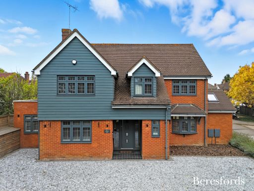 5 bedroom detached house for sale in Warwick Place, Brentwood, CM14 — £1,100,000 • 5 bed • 3 bath • 2562 ft²
Meta
- {
"@context": "https://schema.org",
"@type": "Residence",
"name": "4 bedroom detached house for sale in The Birches, Brentwood…",
"description": "",
"url": "https://propertypiper.co.uk/property/a2de86d3-cb31-485f-b051-ea32fc7d1c17",
"image": "https://image-a.propertypiper.co.uk/5a824b65-58e9-4369-8e13-c8af8b08093b-1024.jpeg",
"address": {
"@type": "PostalAddress",
"streetAddress": "2 THE BIRCHES BRENTWOOD",
"postalCode": "CM13 2AJ",
"addressLocality": "Brentwood",
"addressRegion": "Brentwood and Ongar",
"addressCountry": "England"
},
"geo": {
"@type": "GeoCoordinates",
"latitude": 51.613954131734154,
"longitude": 0.31605622145619433
},
"numberOfRooms": 4,
"numberOfBathroomsTotal": 4,
"floorSize": {
"@type": "QuantitativeValue",
"value": 4781,
"unitCode": "FTK"
},
"offers": {
"@type": "Offer",
"price": 1450000,
"priceCurrency": "GBP",
"availability": "https://schema.org/InStock"
},
"additionalProperty": [
{
"@type": "PropertyValue",
"name": "Feature",
"value": "modern house"
},
{
"@type": "PropertyValue",
"name": "Feature",
"value": "detached"
},
{
"@type": "PropertyValue",
"name": "Feature",
"value": "brick exterior"
},
{
"@type": "PropertyValue",
"name": "Feature",
"value": "pitched roof"
},
{
"@type": "PropertyValue",
"name": "Feature",
"value": "garage"
},
{
"@type": "PropertyValue",
"name": "Feature",
"value": "garden"
},
{
"@type": "PropertyValue",
"name": "Feature",
"value": "driveway"
},
{
"@type": "PropertyValue",
"name": "Feature",
"value": "suburban"
},
{
"@type": "PropertyValue",
"name": "Feature",
"value": "well-maintained"
},
{
"@type": "PropertyValue",
"name": "Feature",
"value": "residential area"
},
{
"@type": "PropertyValue",
"name": "Feature",
"value": "modern classic"
},
{
"@type": "PropertyValue",
"name": "Feature",
"value": "high ceiling"
},
{
"@type": "PropertyValue",
"name": "Feature",
"value": "large kitchen"
},
{
"@type": "PropertyValue",
"name": "Feature",
"value": "luxury finishes"
},
{
"@type": "PropertyValue",
"name": "Feature",
"value": "marble flooring"
},
{
"@type": "PropertyValue",
"name": "Feature",
"value": "island"
},
{
"@type": "PropertyValue",
"name": "Feature",
"value": "chandeliers"
},
{
"@type": "PropertyValue",
"name": "Feature",
"value": "built-in appliances"
},
{
"@type": "PropertyValue",
"name": "Feature",
"value": "open plan"
}
]
}
High Res Floorplan Images
Compatible Floorplan Images
FloorplanImages Thumbnail