HG5 0LZ - 4 bedroom detached house for sale in Boroughbridge Road, Kn…
View on Property Piper
4 bedroom detached house for sale in Boroughbridge Road,
Knaresborough,
HG5 0LZ, HG5
Property Details
- Price: £393000
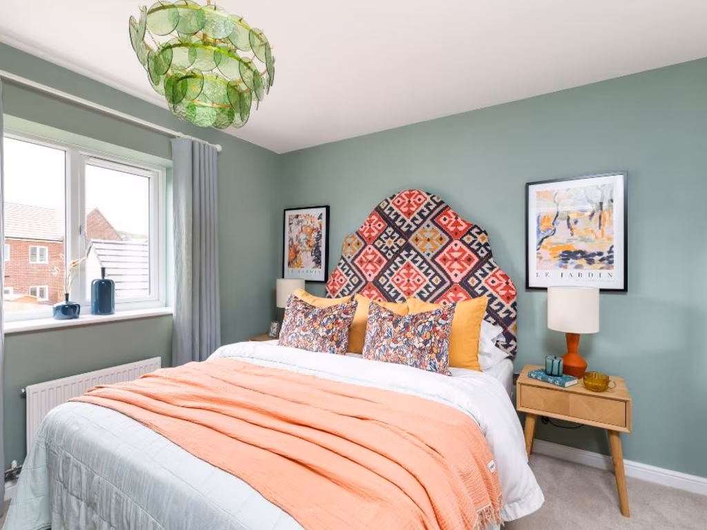
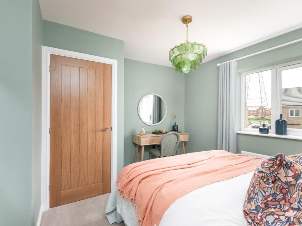
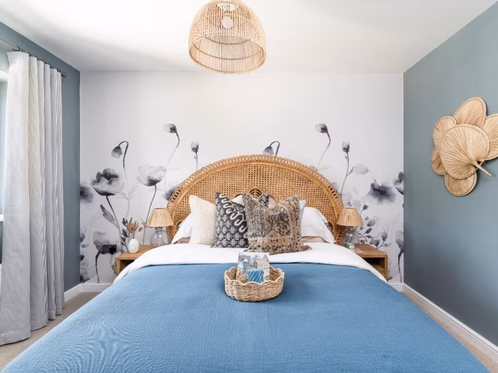
- Bedrooms: 4
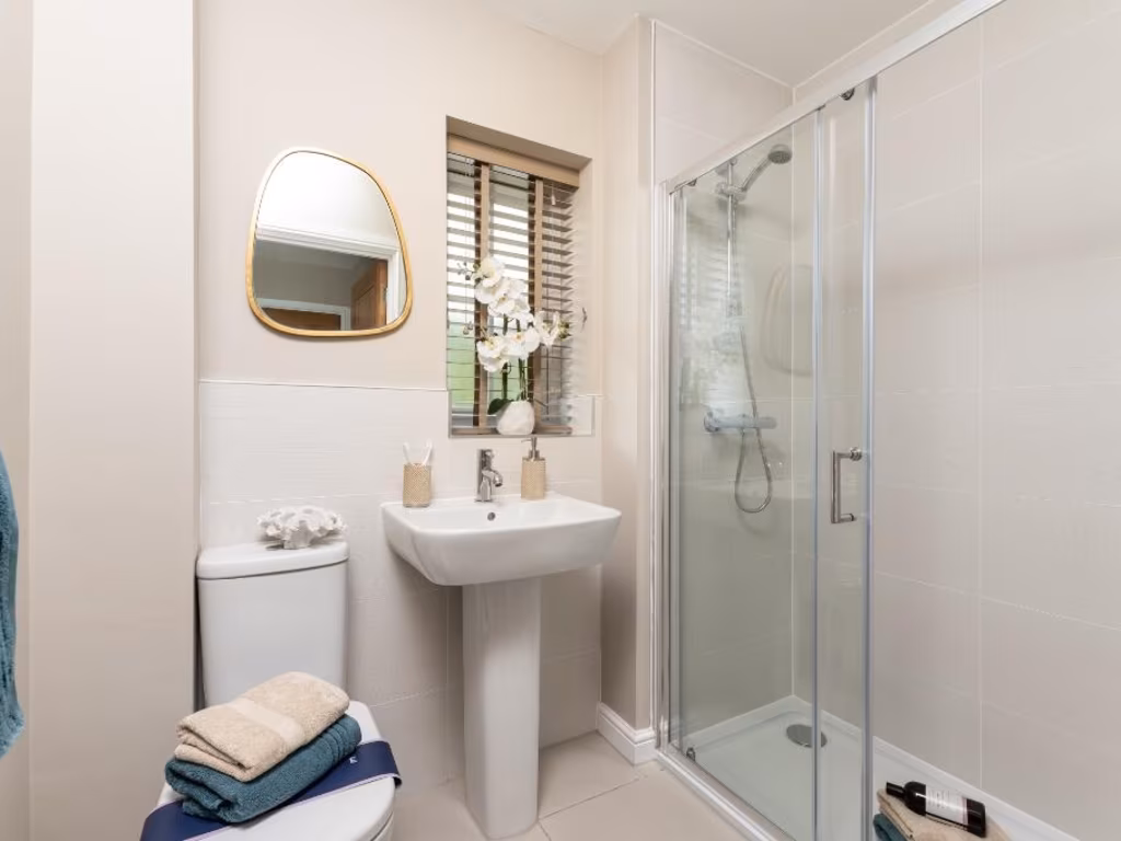
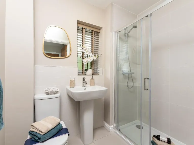
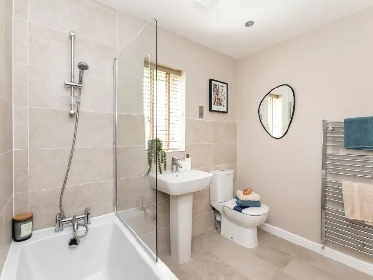
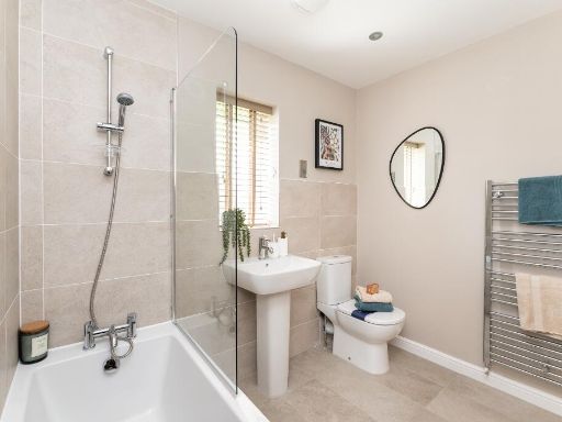
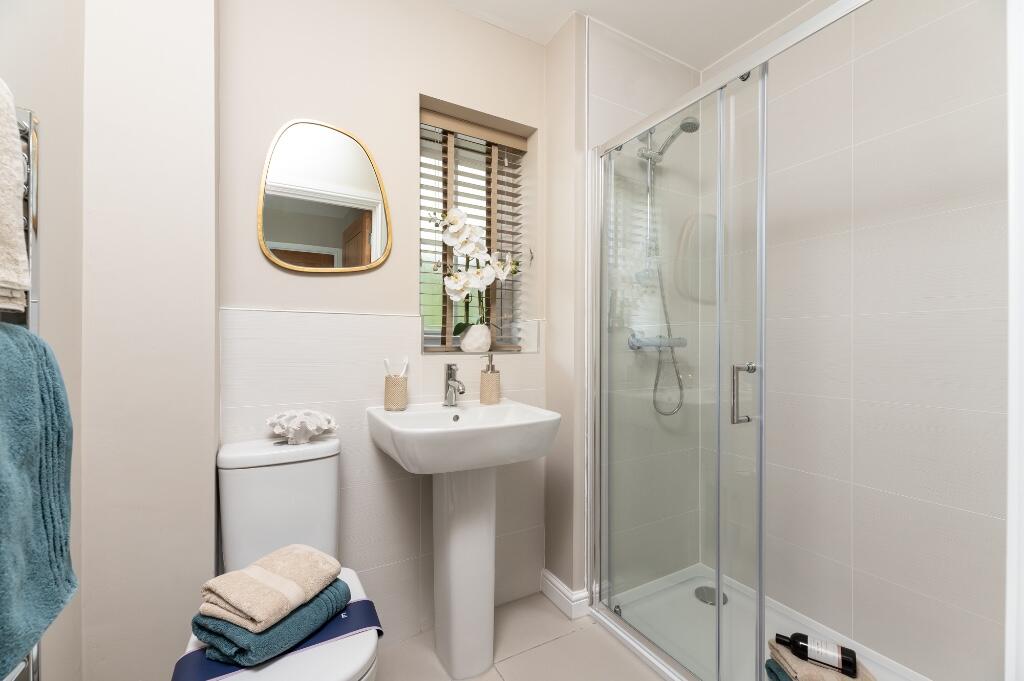
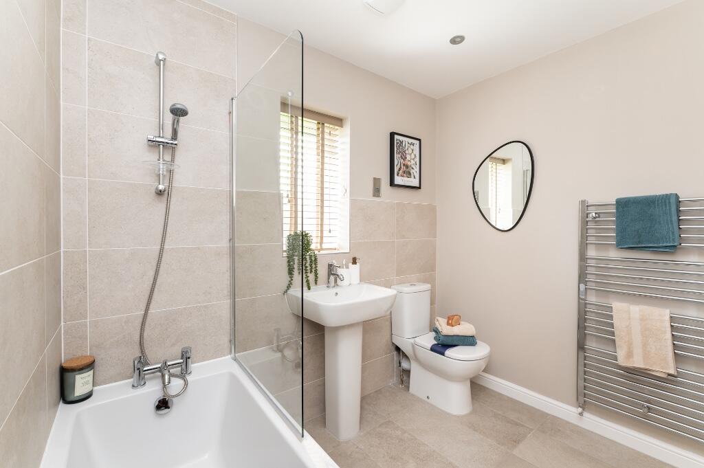
- Bathrooms: 2
- Property Type: undefined
- Property SubType: undefined
Brochure Descriptions
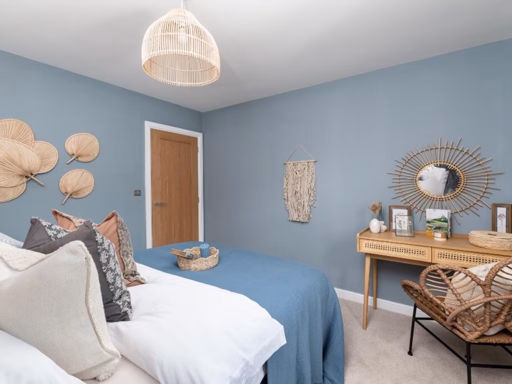
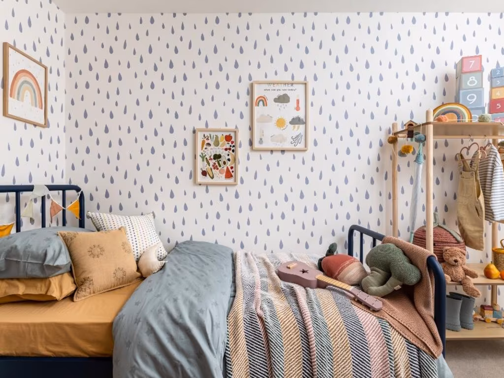
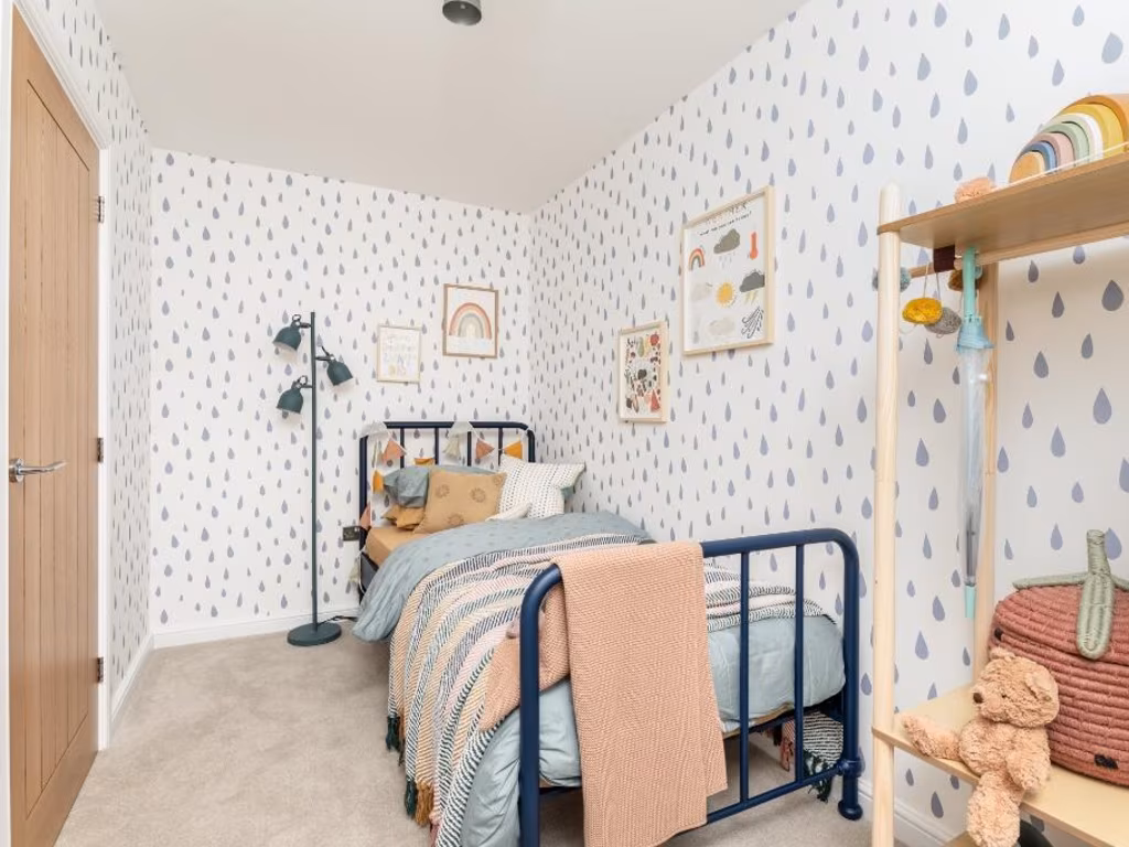
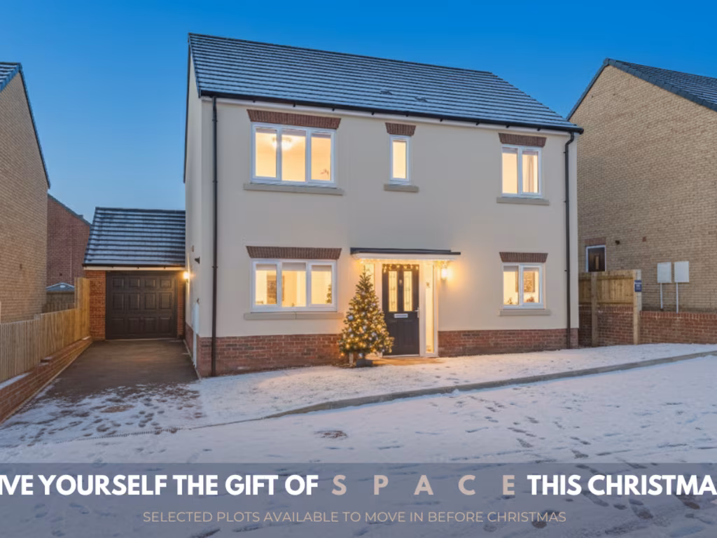
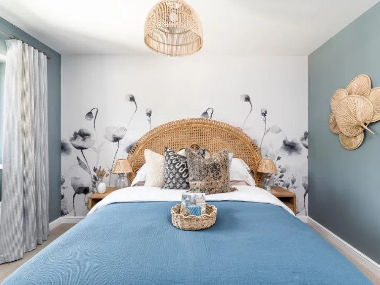
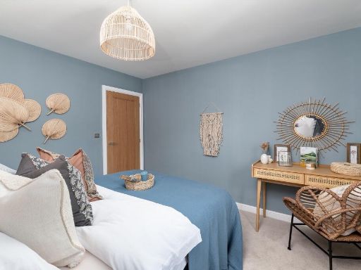
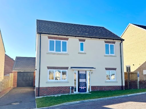
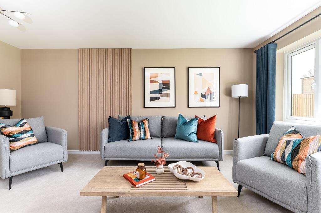
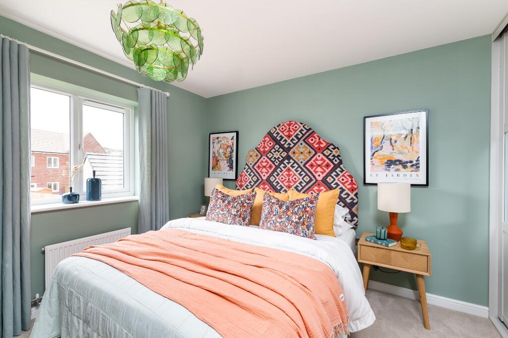
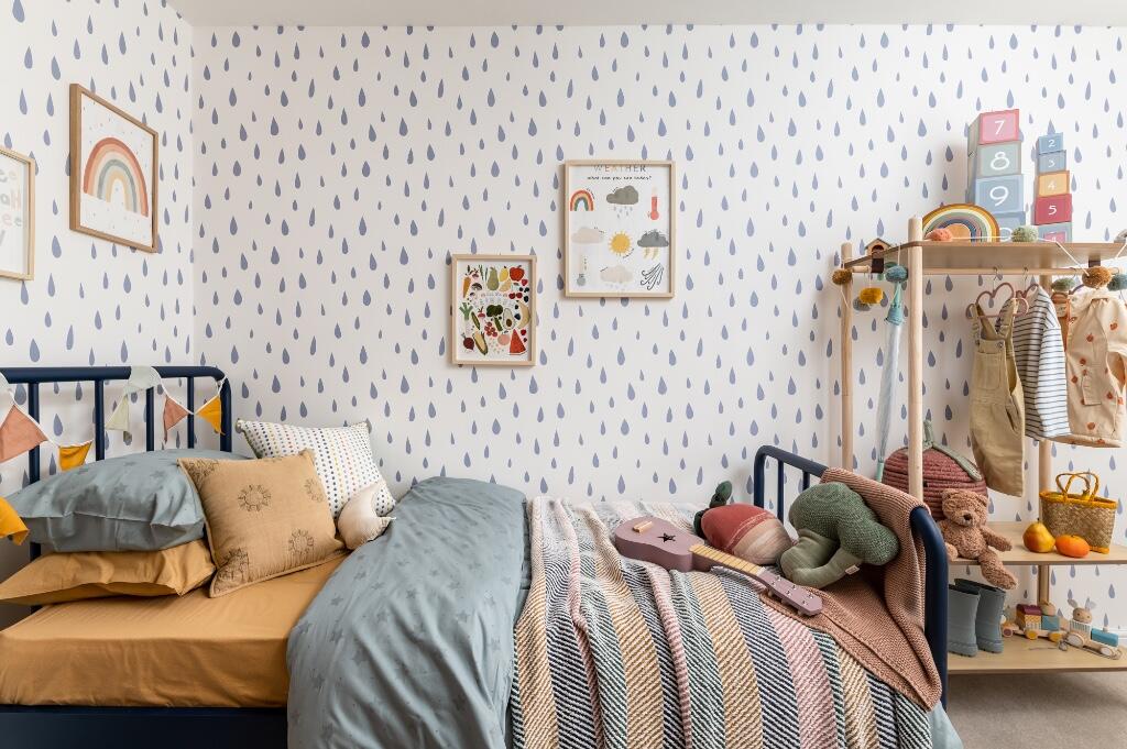
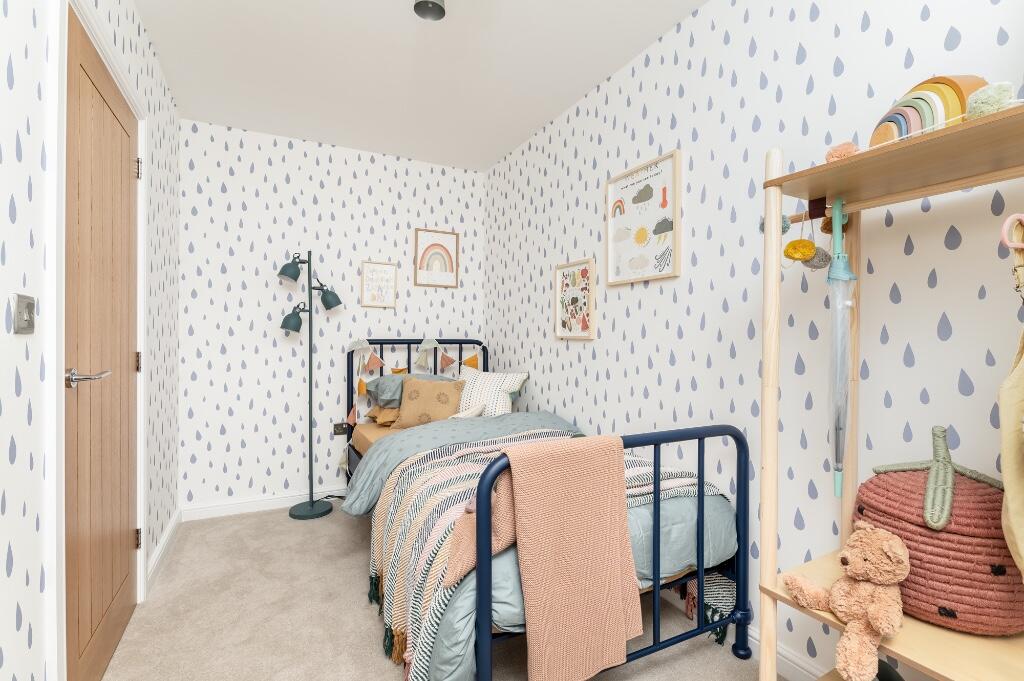
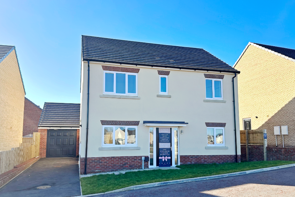
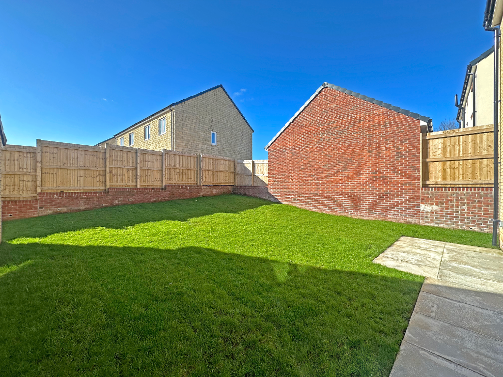
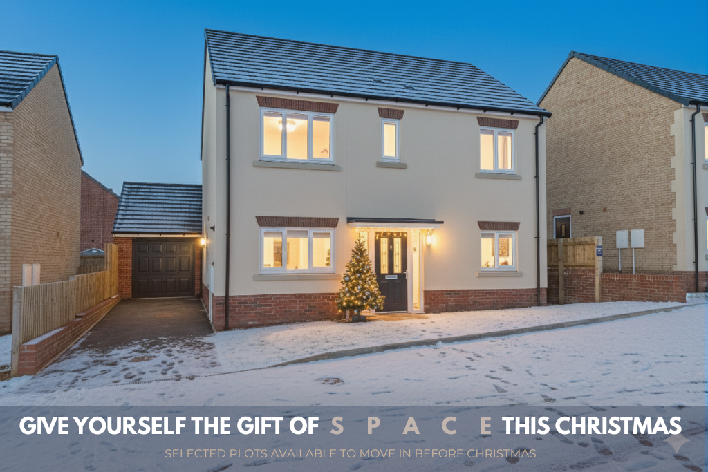
- The property consists of modern detached family homes located in a newly developed residential area known as Castle Locke in Knaresborough. The houses appear to be double-storey constructions with brick facades and pitched, tiled roofs. Each house has its own driveway and integrated garage. The overall property sizes are generous, with medium to large landscaped front gardens and spacious paved driveways that can accommodate multiple vehicles. The setting includes wide open grassy communal areas and mature greenery around the development, suggesting a pleasant suburban environment. There are no exceptional natural views apparent, but the area looks peaceful and well maintained, ideal for families.
- Castle Locke is a residential property development situated on Boroughbridge Road, Knaresborough. The name suggests a new, possibly modern housing development, likely in a suburban or semi-rural location. The property benefits from good access to the road network in Knaresborough. The brochure does not provide imagery or direct details of views, garden size, or number of rooms.
Image Descriptions
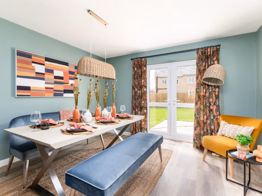
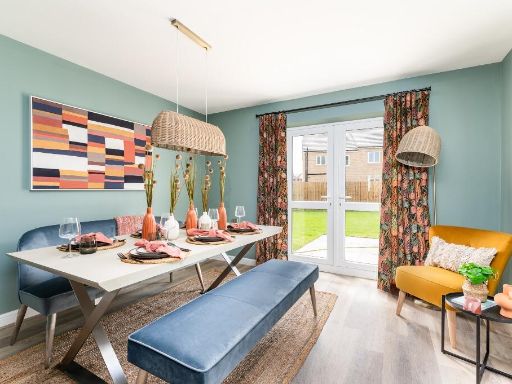
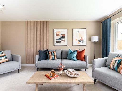
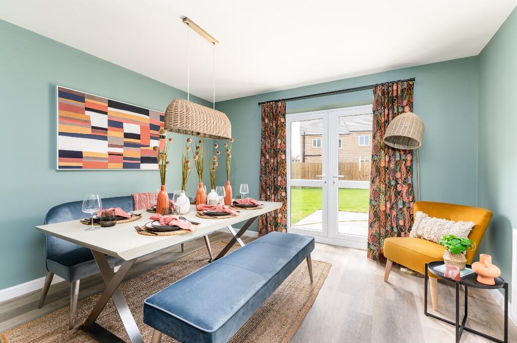
- dining room modern
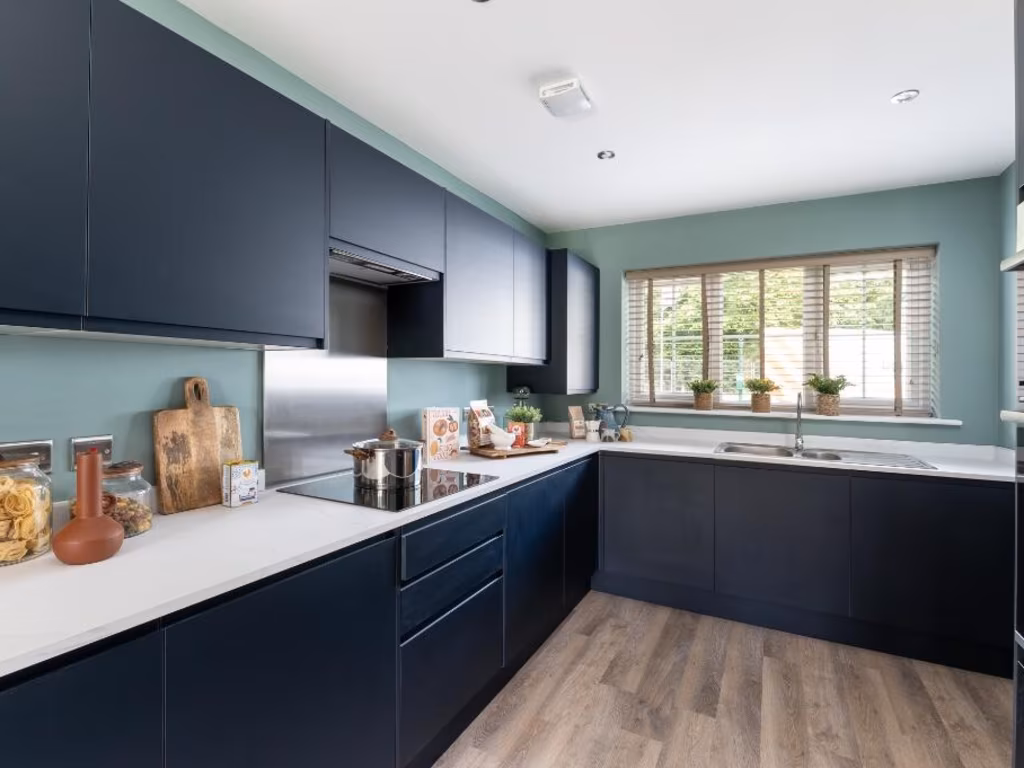
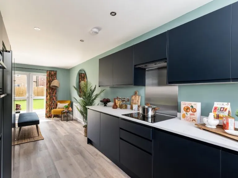
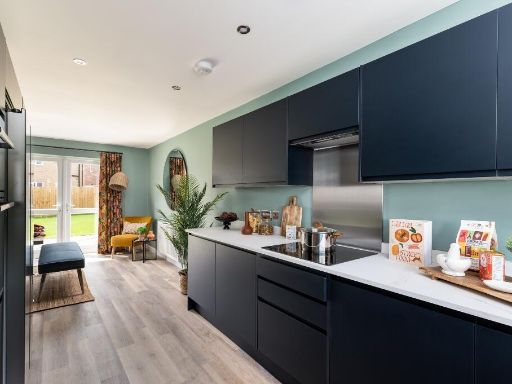
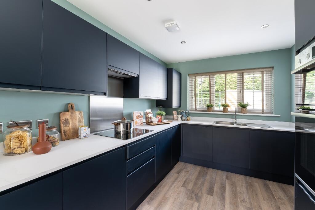
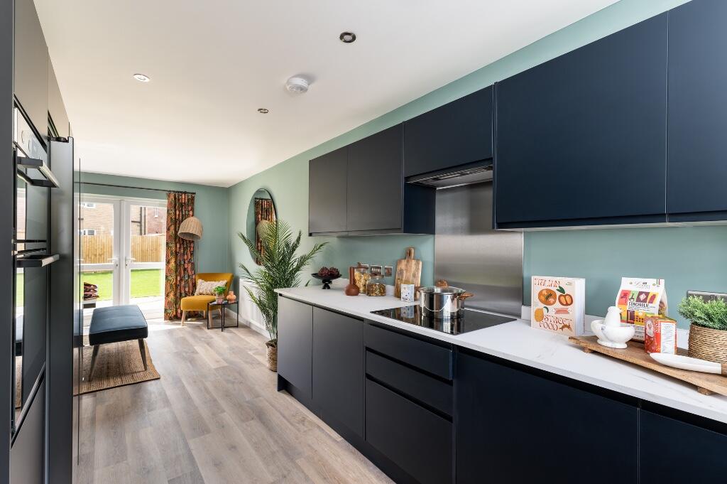
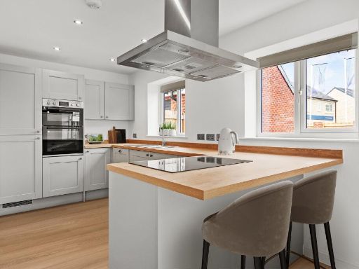
- kitchen modern
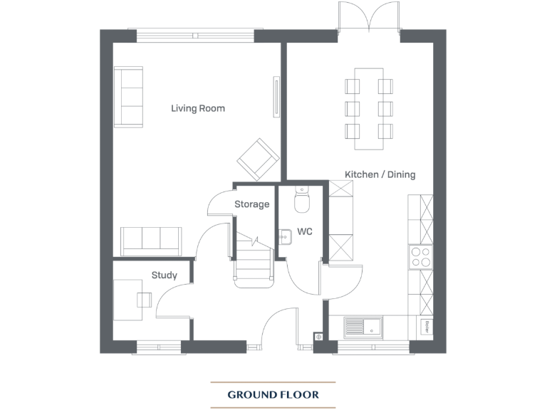
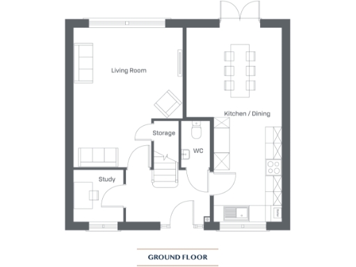
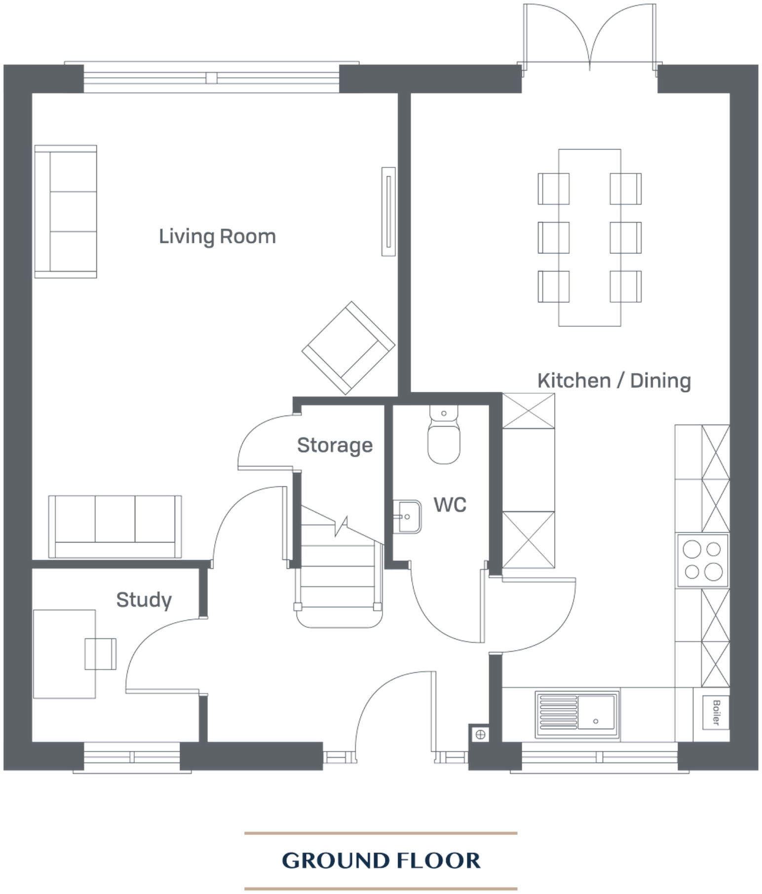
Floorplan Description
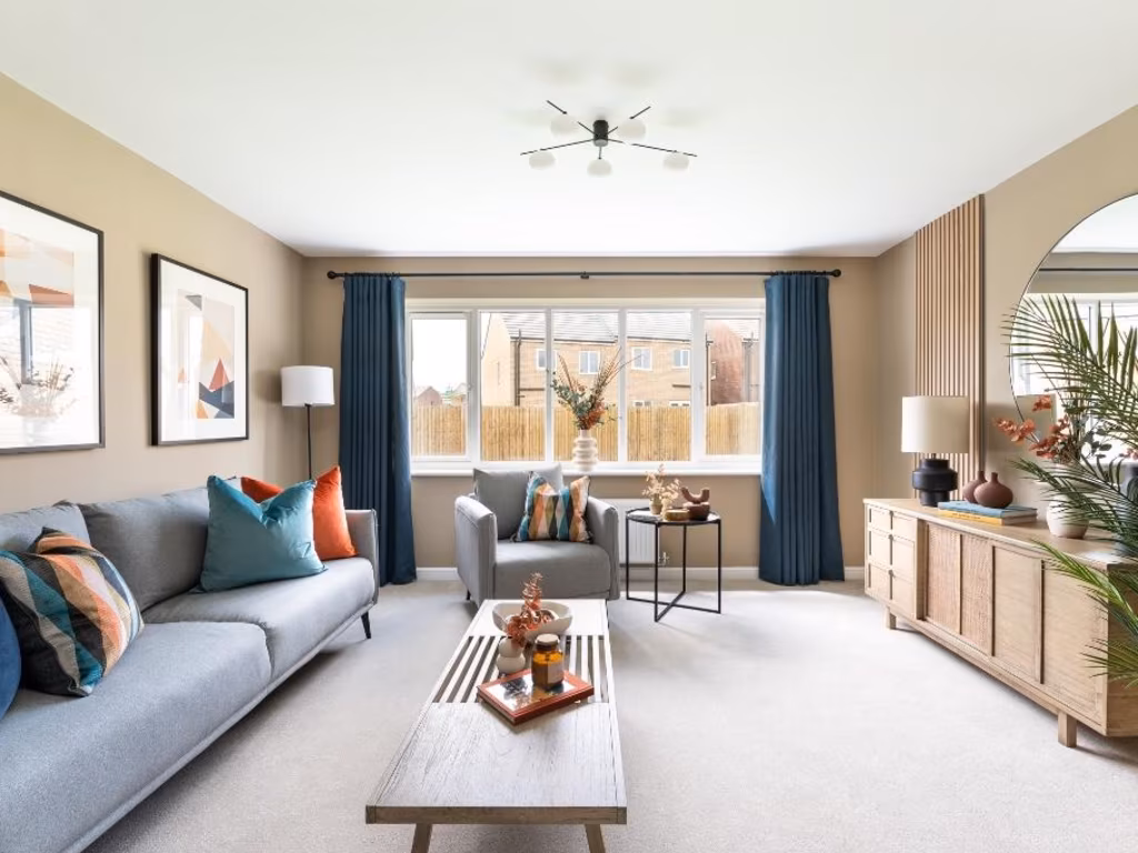
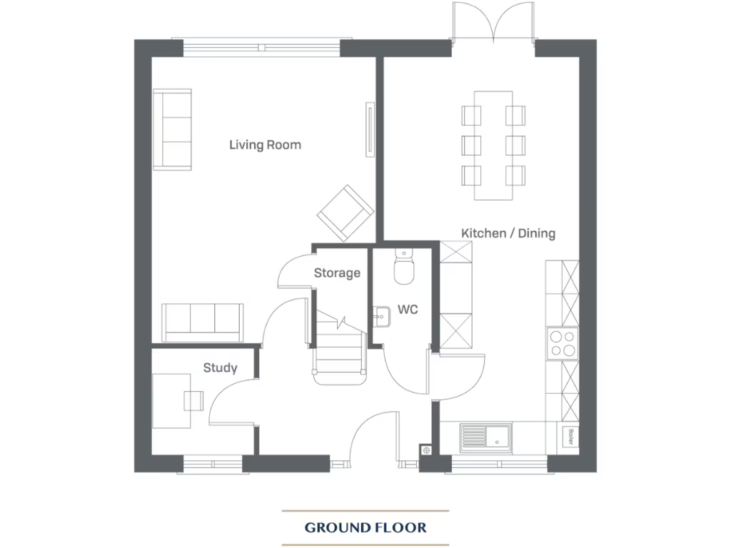
- A ground floor layout featuring a large living room, kitchen/dining area, study, storage, and WC.
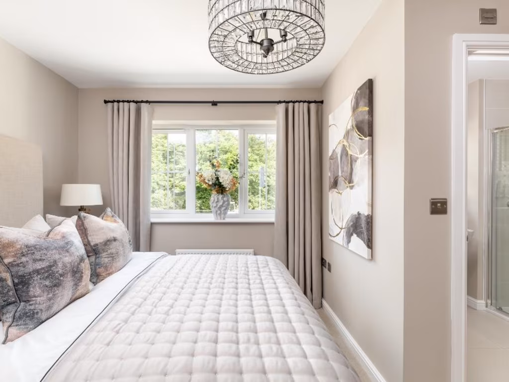
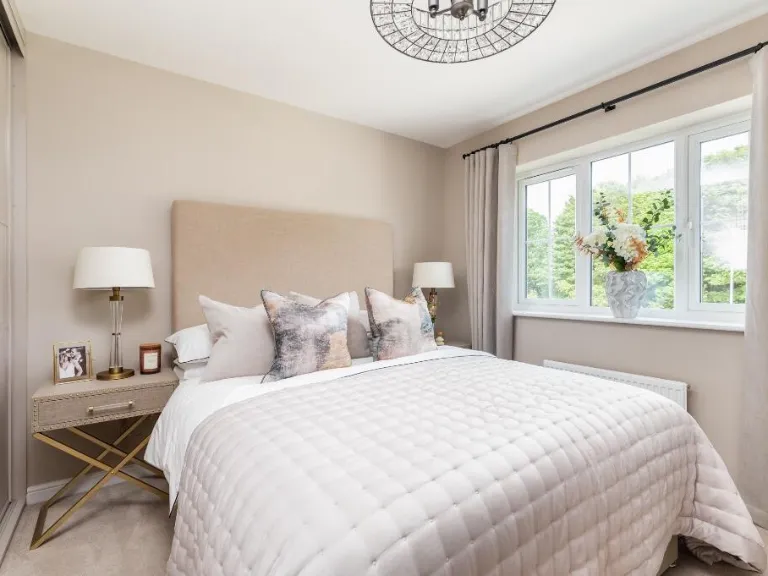
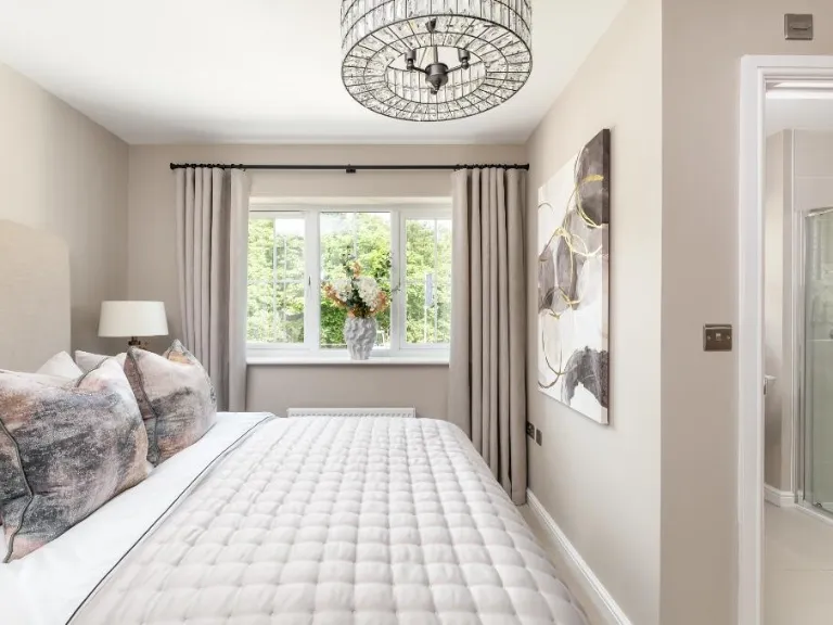
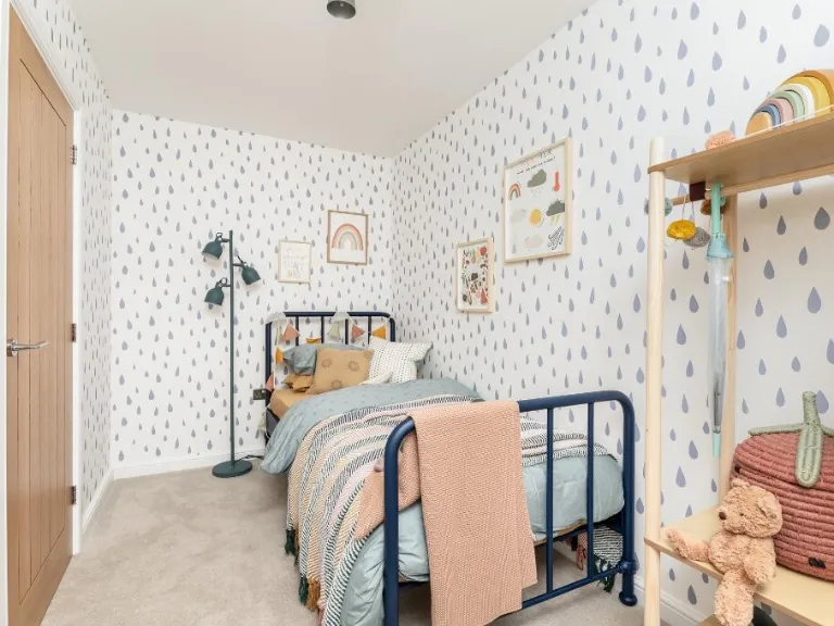
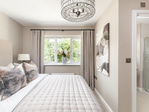
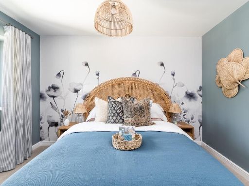
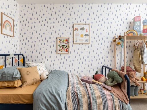
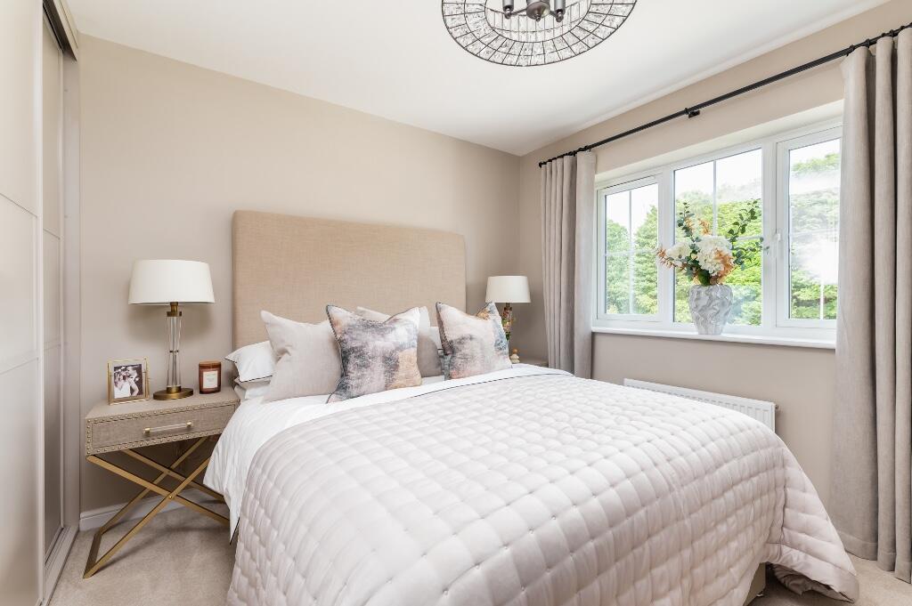
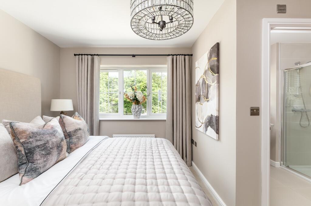
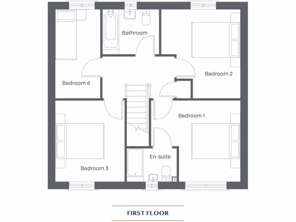
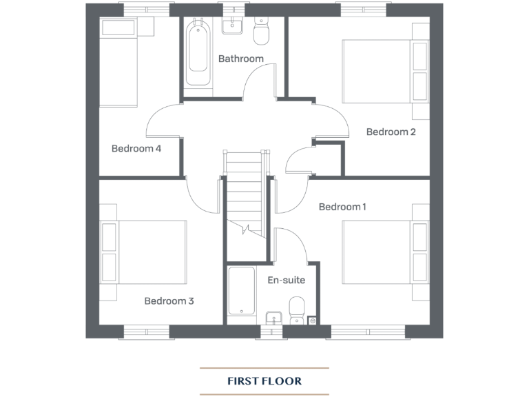
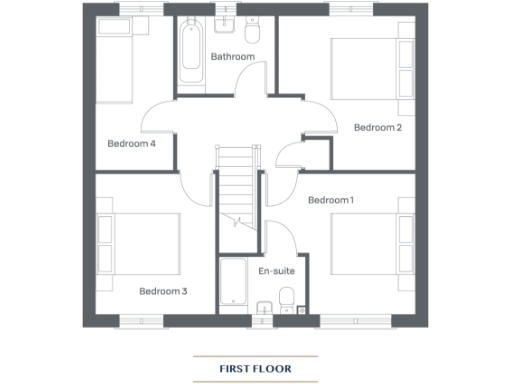
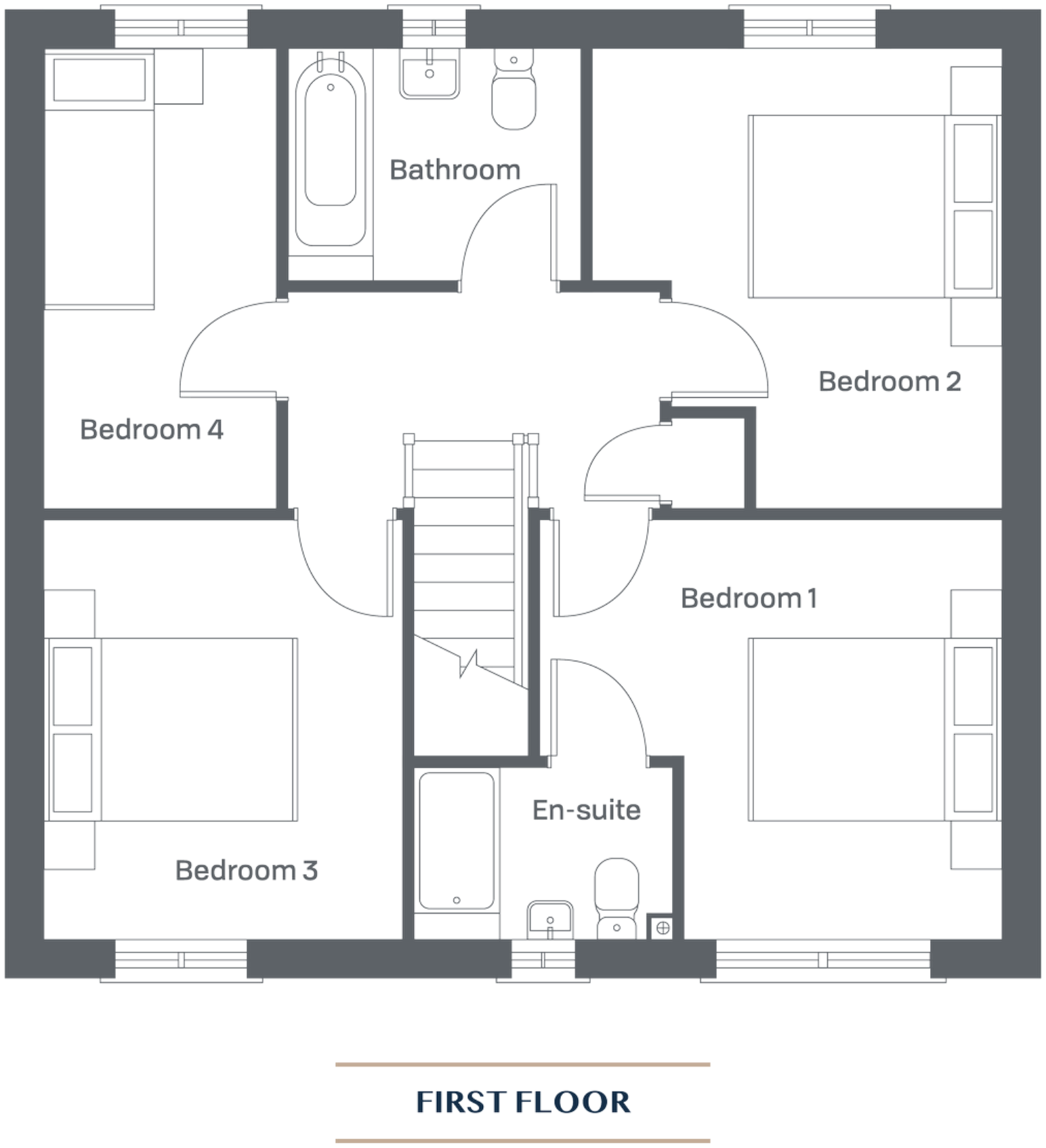
- A first floor with four bedrooms, one bathroom, and an en-suite.
Rooms
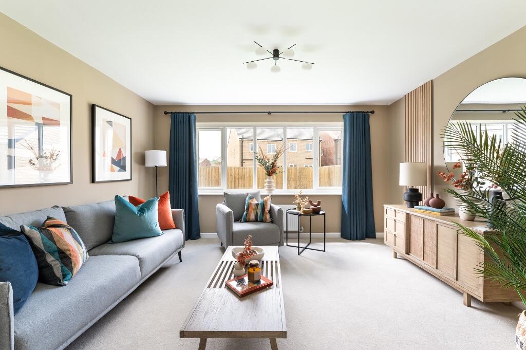
- Living Room: large
- Kitchen/Dining: average
- Study: small
- WC: small
- Storage: small
- Bedroom 1:
- Bedroom 2:
- Bedroom 3:
- Bedroom 4:
- Bathroom:
- En-suite:
Textual Property Features
- Is New Build
- Has Garden
- Success
Detected Visual Features
- modern
- dining room
- French doors
- garden access
- natural light
- entertaining space
- contemporary
- bright
- mid-century style
- modern kitchen
- black cabinetry
- large window
- laminate flooring
- open layout
- renovated
Nearby Schools
- St Robert's Catholic Primary School, A Voluntary Academy
- Richard Taylor Church of England Primary School
- St Mary's Primary School Knaresborough, A Voluntary Catholic Academy
- Meadowside Academy
- Scotton Lingerfield Primary School
- Roecliffe CofE Primary School
- Bishop Monkton Church of England Primary School
- Spofforth Church of England Controlled Primary School
- Follifoot Church of England Primary School
- Oatlands Community Junior School
- Oatlands Infant School
- St John Fisher Catholic Academy
- Harrogate High School
- Harrogate, Grove Road Community Primary School
- Harrogate, Bilton Grange Primary School
- Staveley Community Primary School
- Burton Leonard Church of England Primary School
- Hookstone Chase Primary School
- King James's School
- Knaresborough St John's Church of England Primary School
- St Aidan's Church of England High School
- St Peter's Church of England Primary School
- Goldsborough Church of England Primary School
- Starbeck Primary Academy
- Aspin Park Academy
- Willow Tree Community Primary School
Nearest Bars And Restaurants
- Id: 3543021656
- Tags:
- Amenity: fast_food
- Cuisine: fish_and_chips
- Name: Chain Lane Fisheries
- TagsNormalized:
- fast food
- food
- fish
- fisheries
- Lat: 54.0112798
- Lon: -1.4559667
- FullGeoHash: gcwgqb7y9829
- PartitionGeoHash: gcwg
- Images:
- FoodStandards: null
- Distance: 1105.1
,- Id: 3543021652
- Tags:
- Amenity: fast_food
- Name: Chilli Hut
- TagsNormalized:
- Lat: 54.0113318
- Lon: -1.4560096
- FullGeoHash: gcwgqb7ybd08
- PartitionGeoHash: gcwg
- Images:
- FoodStandards: null
- Distance: 1098.7
,- Id: 1692852247
- Tags:
- Amenity: fast_food
- Cuisine: fish_and_chips
- TagsNormalized:
- Lat: 54.0136641
- Lon: -1.4680583
- FullGeoHash: gcwgq8furub2
- PartitionGeoHash: gcwg
- Images:
- FoodStandards: null
- Distance: 879.4
,- Id: 1692852636
- Tags:
- Amenity: fast_food
- Cuisine: sandwich
- TagsNormalized:
- Lat: 54.0144759
- Lon: -1.463926
- FullGeoHash: gcwgq9n10h1e
- PartitionGeoHash: gcwg
- Images:
- FoodStandards: null
- Distance: 699.9
,- Id: 1692852654
- Tags:
- Amenity: fast_food
- Cuisine: chinese
- TagsNormalized:
- Lat: 54.0145339
- Lon: -1.4639961
- FullGeoHash: gcwgq9jcqqvm
- PartitionGeoHash: gcwg
- Images:
- FoodStandards: null
- Distance: 694.6
}
Nearest General Shops
- Id: 160077441
- Tags:
- Building: yes
- Name: Knaresborough Kitchens
- Shop: furniture
- Source: Bing
- TagsNormalized:
- Lat: 54.0096334
- Lon: -1.4689067
- FullGeoHash: gcwgq84kgvru
- PartitionGeoHash: gcwg
- Images:
- FoodStandards: null
- Distance: 1310.7
,- Id: 160077434
- Tags:
- Building: yes
- Name: Woodwards
- Shop: furniture
- Source: Bing
- TagsNormalized:
- Lat: 54.0098719
- Lon: -1.468992
- FullGeoHash: gcwgq84q61b5
- PartitionGeoHash: gcwg
- Images:
- FoodStandards: null
- Distance: 1288
,- Id: 3543021653
- Tags:
- Name: Abbey Electrical
- Shop: electrical
- TagsNormalized:
- Lat: 54.0114043
- Lon: -1.456082
- FullGeoHash: gcwgqb7xnzd8
- PartitionGeoHash: gcwg
- Images:
- FoodStandards: null
- Distance: 1089.5
}
Nearest Grocery shops
- Id: 3543021654
- Tags:
- Brand: Premier
- Brand:wikidata: Q7240340
- Name: Premier
- Shop: convenience
- TagsNormalized:
- Lat: 54.0114578
- Lon: -1.4561303
- FullGeoHash: gcwgqb7xt9qx
- PartitionGeoHash: gcwg
- Images:
- FoodStandards: null
- Distance: 1082.8
,- Id: 1692852225
- Tags:
- TagsNormalized:
- Lat: 54.0136061
- Lon: -1.4680392
- FullGeoHash: gcwgq8gh01yw
- PartitionGeoHash: gcwg
- Images:
- FoodStandards: null
- Distance: 884.5
,- Id: 1692852594
- Tags:
- TagsNormalized:
- Lat: 54.0143599
- Lon: -1.4638019
- FullGeoHash: gcwgq9n06yqp
- PartitionGeoHash: gcwg
- Images:
- FoodStandards: null
- Distance: 710.9
}
Nearest Supermarkets
- Id: 680691943
- Tags:
- Addr:
- Postcode: HG5 0DH
- Street: Chain Lane
- Town: Knaresborough
- Brand: Lidl
- Brand:wikidata: Q151954
- Brand:wikipedia: en:Lidl
- Building: yes
- Facebook: https://www.facebook.com/Lidl-GB-1446945318718079/
- Name: Lidl
- Shop: supermarket
- TagsNormalized:
- Lat: 54.0069569
- Lon: -1.4536474
- FullGeoHash: gcwgnztmrd3y
- PartitionGeoHash: gcwg
- Images:
- FoodStandards: null
- Distance: 1608.8
,- Id: 2109829401
- Tags:
- Brand: Sainsbury's
- Brand:wikidata: Q152096
- Brand:wikipedia: en:Sainsbury's
- Name: Sainsbury's
- Note: Can't seem to find FHRS listing for this store.
- Shop: supermarket
- Website: https://stores.sainsburys.co.uk/4745/knaresborough-local
- TagsNormalized:
- sainsburys
- supermarket
- shop
- Lat: 54.0076316
- Lon: -1.4654088
- FullGeoHash: gcwgnxucm80p
- PartitionGeoHash: gcwg
- Images:
- FoodStandards: null
- Distance: 1465.8
,- Id: 1692851823
- Tags:
- Brand: Co-op Food
- Brand:wikidata: Q3277439
- Brand:wikipedia: en:Co-op Food
- Name: Co-op Food
- Shop: supermarket
- TagsNormalized:
- co-op
- co-op food
- food
- supermarket
- shop
- Lat: 54.0129751
- Lon: -1.4681777
- FullGeoHash: gcwgq8fbkur6
- PartitionGeoHash: gcwg
- Images:
- FoodStandards: null
- Distance: 951
}
Nearest Religious buildings
- Id: 541618659
- Tags:
- Amenity: place_of_worship
- Building: yes
- Denomination: anglican
- Name: Saint John the Baptist
- Religion: christian
- Wikidata: Q17538227
- TagsNormalized:
- place of worship
- anglican
- baptist
- christian
- church
- Lat: 54.0095568
- Lon: -1.4717972
- FullGeoHash: gcwgq80k2xh7
- PartitionGeoHash: gcwg
- Images:
- FoodStandards: null
- Distance: 1397.3
,- Id: 4374721875
- Tags:
- Amenity: place_of_worship
- Denomination: catholic
- Name: St Mary's Church
- Religion: christian
- TagsNormalized:
- place of worship
- catholic
- church
- christian
- Lat: 54.0108078
- Lon: -1.472517
- FullGeoHash: gcwgq2rezb7d
- PartitionGeoHash: gcwg
- Images:
- FoodStandards: null
- Distance: 1301.4
,- Id: 167251918
- Tags:
- Amenity: place_of_worship
- Denomination: methodist
- Name: Park Grove Methodist Church
- Religion: christian
- TagsNormalized:
- place of worship
- methodist
- church
- christian
- Lat: 54.0184357
- Lon: -1.4670823
- FullGeoHash: gcwgq9g8nw20
- PartitionGeoHash: gcwg
- Images:
- FoodStandards: null
- Distance: 428.6
}
Nearest Medical buildings
- Id: 1786671637
- Tags:
- Amenity: dentist
- Healthcare: dentist
- Name: Oasis
- TagsNormalized:
- Lat: 54.0090528
- Lon: -1.4683703
- FullGeoHash: gcwgq84c83pt
- PartitionGeoHash: gcwg
- Images:
- FoodStandards: null
- Distance: 1359.4
,- Id: 164190530
- Tags:
- Addr:
- City: Knaresborough
- Housenumber: 1
- Postcode: HG5 0UB
- Street: Ash Tree Road
- Amenity: doctors
- Building: yes
- Healthcare: doctor
- Name: Beech House Surgery
- Opening_hours: Mo-Fr 08:00-18:00 open "Calls between 13:00 and 14:00 are handled by out-of-hours service", Mo 18:30-19:30 open, Th 07:00-08:00 open; PH off; Sa 07:30-12:15 unknown "Once a month morning clinic. Ring reception for details"
- Source: Bing;local knowledge
- TagsNormalized:
- doctor
- doctors
- health
- healthcare
- surgery
- Lat: 54.0107918
- Lon: -1.4650555
- FullGeoHash: gcwgq8m5ttr6
- PartitionGeoHash: gcwg
- Images:
- FoodStandards: null
- Distance: 1116
,- Id: 165803474
- Tags:
- Addr:
- City: Knaresborough
- Housenumber: 21
- Postcode: HG5 0JY
- Street: Stockwell Road
- Amenity: doctors
- Building: yes
- Healthcare: doctor
- Name: Stockwell Surgery
- TagsNormalized:
- doctor
- doctors
- health
- healthcare
- surgery
- Lat: 54.0119936
- Lon: -1.4667595
- FullGeoHash: gcwgq8efwj2g
- PartitionGeoHash: gcwg
- Images:
- FoodStandards: null
- Distance: 1016
,- Id: 157047657
- Tags:
- Amenity: dentist
- Building: yes
- Healthcare: dentist
- TagsNormalized:
- Lat: 54.0137567
- Lon: -1.4674932
- FullGeoHash: gcwgq8gkuyjc
- PartitionGeoHash: gcwg
- Images:
- FoodStandards: null
- Distance: 853.3
}
Nearest Airports
- Id: 11519546
- Tags:
- Addr:
- City: Leeds
- Postcode: LS19 7TU
- Aerodrome: international
- Aerodrome:type: public
- Aeroway: aerodrome
- Iata: LBA
- Icao: EGNM
- Name: Leeds Bradford Airport
- Operator: Leeds Bradford Airport Limited
- Operator:type: private
- Ref: LBA
- Type: multipolygon
- Website: https://www.leedsbradfordairport.co.uk/
- Wikidata: Q8699
- Wikipedia: en:Leeds Bradford Airport
- TagsNormalized:
- airport
- international airport
- Lat: 53.8667047
- Lon: -1.660138
- FullGeoHash: gcwf6nph7cx3
- PartitionGeoHash: gcwf
- Images:
- Q8699-1
- Q8699-2
- Q8699-3
- Q8699-4
- FoodStandards: null
- Distance: 21485.7
}
Nearest Leisure Facilities
- Id: 420028073
- Tags:
- TagsNormalized:
- Lat: 54.0142943
- Lon: -1.460659
- FullGeoHash: gcwgqc02h4m8
- PartitionGeoHash: gcwg
- Images:
- FoodStandards: null
- Distance: 707.9
,- Id: 420028075
- Tags:
- Leisure: pitch
- Lit: no
- Sport: skateboard
- TagsNormalized:
- pitch
- leisure
- skateboard
- sports
- Lat: 54.0145633
- Lon: -1.4593249
- FullGeoHash: gcwgqc13ek2k
- PartitionGeoHash: gcwg
- Images:
- FoodStandards: null
- Distance: 692.2
,- Id: 148772008
- Tags:
- Landuse: village_green
- Leisure: park
- Name: Old Scriven
- TagsNormalized:
- village green
- leisure
- scrivens
- Lat: 54.0208015
- Lon: -1.4700892
- FullGeoHash: gcwgqd1tbrq0
- PartitionGeoHash: gcwg
- Images:
- FoodStandards: null
- Distance: 548.9
,- Id: 678749761
- Tags:
- Leisure: park
- Name: Pastures
- TagsNormalized:
- Lat: 54.0224162
- Lon: -1.4616535
- FullGeoHash: gcwgqdrxmh21
- PartitionGeoHash: gcwg
- Images:
- FoodStandards: null
- Distance: 198.5
,- Id: 890778448
- Tags:
- Barrier: fence
- Leisure: playground
- TagsNormalized:
- Lat: 54.0220467
- Lon: -1.4631576
- FullGeoHash: gcwgqdqt1zqs
- PartitionGeoHash: gcwg
- Images:
- FoodStandards: null
- Distance: 184.2
}
Nearest Tourist attractions
- Id: 2111045940
- Tags:
- TagsNormalized:
- Lat: 54.0107212
- Lon: -1.4805128
- FullGeoHash: gcwgq23gm81t
- PartitionGeoHash: gcwg
- Images:
- FoodStandards: null
- Distance: 1651.2
,- Id: 105194408
- Tags:
- Building: yes
- Name: Tudor Courthouse Museum
- Tourism: museum
- TagsNormalized:
- Lat: 54.0066953
- Lon: -1.4691142
- FullGeoHash: gcwgnxd5z1tn
- PartitionGeoHash: gcwg
- Images:
- FoodStandards: null
- Distance: 1623.8
,- Id: 165818644
- Tags:
- Name: Henshaws Arts and Crafts Centre
- Tourism: attraction
- TagsNormalized:
- Lat: 54.0116445
- Lon: -1.4747717
- FullGeoHash: gcwgq2w0ek69
- PartitionGeoHash: gcwg
- Images:
- FoodStandards: null
- Distance: 1314.9
}
Nearest Bus stations and stops
- Id: 8602312893
- Tags:
- Bus: yes
- Highway: bus_stop
- Public_transport: platform
- TagsNormalized:
- Lat: 54.0056527
- Lon: -1.4509663
- FullGeoHash: gcwgnzrmwp34
- PartitionGeoHash: gcwg
- Images:
- FoodStandards: null
- Distance: 1807
,- Id: 9959774311
- Tags:
- Bus: yes
- Departures_board: timetable
- Highway: bus_stop
- Name: Princess Drive
- Public_transport: platform
- Shelter: no
- TagsNormalized:
- Lat: 54.00551
- Lon: -1.4559437
- FullGeoHash: gcwgnz7ufh9x
- PartitionGeoHash: gcwg
- Images:
- FoodStandards: null
- Distance: 1722.9
,- Id: 9959774310
- Tags:
- Bus: yes
- Departures_board: timetable
- Highway: bus_stop
- Name: Princess Drive
- Public_transport: platform
- Shelter: yes
- TagsNormalized:
- Lat: 54.0056109
- Lon: -1.4559464
- FullGeoHash: gcwgnz7v3zx9
- PartitionGeoHash: gcwg
- Images:
- FoodStandards: null
- Distance: 1711.9
,- Id: 9959774309
- Tags:
- Bus: yes
- Departures_board: timetable
- Highway: bus_stop
- Name: Knaresborough Swimming Pool
- Public_transport: platform
- Shelter: yes
- TagsNormalized:
- Lat: 54.0057922
- Lon: -1.4613118
- FullGeoHash: gcwgnxryscqg
- PartitionGeoHash: gcwg
- Images:
- FoodStandards: null
- Distance: 1650.2
,- Id: 8149541224
- Tags:
- Bus: yes
- Highway: bus_stop
- Name: High Bridge
- Public_transport: platform
- Shelter: yes
- TagsNormalized:
- Lat: 54.008536
- Lon: -1.4753876
- FullGeoHash: gcwgnrvwsbz6
- PartitionGeoHash: gcwg
- Images:
- FoodStandards: null
- Distance: 1615.5
}
Nearest Hotels
- Id: 7843154789
- Tags:
- Accessibility: Grounds and garders open to public, house hotelcustomers only
- Description: Jacobean stately home, now a hotel
- Historic: house
- Name: Goldsborough Hall
- Tourism: hotel
- Website: www.goldsboroughhall.com
- Wikidata: Q5580294
- Wikipedia: en:Goldsborough Hall
- TagsNormalized:
- Lat: 53.9990651
- Lon: -1.4163309
- FullGeoHash: gcwgpy0xm574
- PartitionGeoHash: gcwg
- Images:
- FoodStandards: null
- Distance: 3812.6
,- Id: 3718570738
- Tags:
- Amenity: restaurant
- Name: The General Tarleton
- Tourism: hotel
- TagsNormalized:
- restaurant
- general
- hotel
- tourism
- Lat: 54.041204
- Lon: -1.4369529
- FullGeoHash: gcwgrmcsudd6
- PartitionGeoHash: gcwg
- Images:
- FoodStandards: null
- Distance: 2800.6
,- Id: 207760506
- Tags:
- Building: yes
- Name: Dower House Hotel
- Source: Bing
- Tourism: hotel
- TagsNormalized:
- Lat: 54.0113183
- Lon: -1.4726709
- FullGeoHash: gcwgq2rwsr2z
- PartitionGeoHash: gcwg
- Images:
- FoodStandards: null
- Distance: 1259.8
}
Tags
- modern
- dining room
- French doors
- garden access
- natural light
- entertaining space
- contemporary
- bright
- mid-century style
- modern kitchen
- black cabinetry
- large window
- laminate flooring
- open layout
- bright
- contemporary
- renovated
Local Market Stats
- Average Price/sqft: £319
- Avg Income: £47100
- Rental Yield: 4.1%
- Social Housing: 3%
- Planning Success Rate: 89%
AirBnB Data
- 1km average: £77/night
- Listings in 1km: 1
Similar Properties
 4 bedroom detached house for sale in Boroughbridge Road,
Knaresborough,
HG5 0LZ, HG5 — £416,500 • 4 bed • 2 bath • 1315 ft²
4 bedroom detached house for sale in Boroughbridge Road,
Knaresborough,
HG5 0LZ, HG5 — £416,500 • 4 bed • 2 bath • 1315 ft²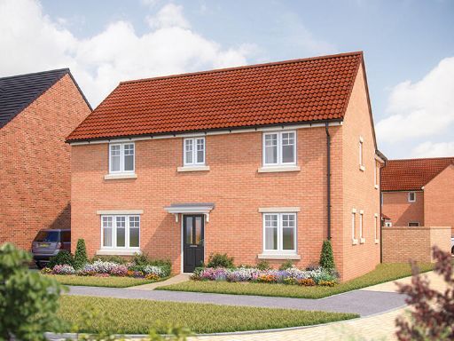 4 bedroom detached house for sale in York Road,
Knaresborough,
HG5 — £519,950 • 4 bed • 1 bath
4 bedroom detached house for sale in York Road,
Knaresborough,
HG5 — £519,950 • 4 bed • 1 bath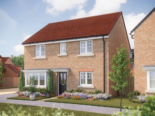 4 bedroom detached house for sale in York Road,
Knaresborough,
HG5 — £489,950 • 4 bed • 1 bath
4 bedroom detached house for sale in York Road,
Knaresborough,
HG5 — £489,950 • 4 bed • 1 bath 4 bedroom detached house for sale in York Road,
Knaresborough,
HG5 — £489,950 • 4 bed • 1 bath
4 bedroom detached house for sale in York Road,
Knaresborough,
HG5 — £489,950 • 4 bed • 1 bath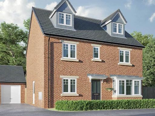 5 bedroom detached house for sale in York Road,
Knaresborough,
HG5 — £549,950 • 5 bed • 1 bath • 1272 ft²
5 bedroom detached house for sale in York Road,
Knaresborough,
HG5 — £549,950 • 5 bed • 1 bath • 1272 ft²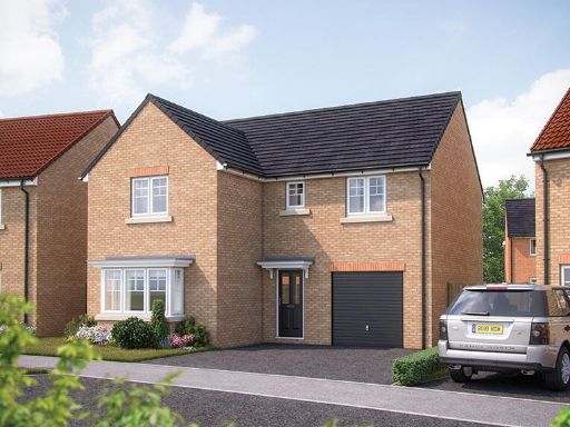 4 bedroom detached house for sale in York Road,
Knaresborough,
HG5 — £459,950 • 4 bed • 1 bath
4 bedroom detached house for sale in York Road,
Knaresborough,
HG5 — £459,950 • 4 bed • 1 bath
Meta
- {
"@context": "https://schema.org",
"@type": "Residence",
"name": "4 bedroom detached house for sale in Boroughbridge Road, Kn…",
"description": "",
"url": "https://propertypiper.co.uk/property/a22dc176-488c-4c6b-9bb9-06a152b24c6b",
"image": "https://image-a.propertypiper.co.uk/485c6eef-aa40-472f-871d-f40d54acd8fb-1024.jpeg",
"address": {
"@type": "PostalAddress",
"streetAddress": "PICCADILLY MOTORS, BOROUGHBRIDGE ROAD",
"postalCode": "HG5 0LZ",
"addressLocality": "Harrogate",
"addressRegion": "Harrogate and Knaresborough",
"addressCountry": "England"
},
"geo": {
"@type": "GeoCoordinates",
"latitude": 54.020631571868066,
"longitude": -1.461691032985878
},
"numberOfRooms": 4,
"numberOfBathroomsTotal": 2,
"floorSize": {
"@type": "QuantitativeValue",
"value": 1242,
"unitCode": "FTK"
},
"offers": {
"@type": "Offer",
"price": 393000,
"priceCurrency": "GBP",
"availability": "https://schema.org/InStock"
},
"additionalProperty": [
{
"@type": "PropertyValue",
"name": "Feature",
"value": "modern"
},
{
"@type": "PropertyValue",
"name": "Feature",
"value": "dining room"
},
{
"@type": "PropertyValue",
"name": "Feature",
"value": "French doors"
},
{
"@type": "PropertyValue",
"name": "Feature",
"value": "garden access"
},
{
"@type": "PropertyValue",
"name": "Feature",
"value": "natural light"
},
{
"@type": "PropertyValue",
"name": "Feature",
"value": "entertaining space"
},
{
"@type": "PropertyValue",
"name": "Feature",
"value": "contemporary"
},
{
"@type": "PropertyValue",
"name": "Feature",
"value": "bright"
},
{
"@type": "PropertyValue",
"name": "Feature",
"value": "mid-century style"
},
{
"@type": "PropertyValue",
"name": "Feature",
"value": "modern kitchen"
},
{
"@type": "PropertyValue",
"name": "Feature",
"value": "black cabinetry"
},
{
"@type": "PropertyValue",
"name": "Feature",
"value": "large window"
},
{
"@type": "PropertyValue",
"name": "Feature",
"value": "laminate flooring"
},
{
"@type": "PropertyValue",
"name": "Feature",
"value": "open layout"
},
{
"@type": "PropertyValue",
"name": "Feature",
"value": "bright"
},
{
"@type": "PropertyValue",
"name": "Feature",
"value": "contemporary"
},
{
"@type": "PropertyValue",
"name": "Feature",
"value": "renovated"
}
]
}
High Res Floorplan Images
Compatible Floorplan Images
FloorplanImages Thumbnail