GL6 8HD - 3 bedroom detached bungalow for sale in The Ridge, Bussage,…
View on Property Piper
3 bedroom detached bungalow for sale in The Ridge, Bussage, GL6
Property Details
- Price: £450000
- Bedrooms: 3
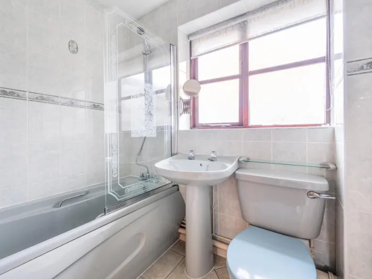
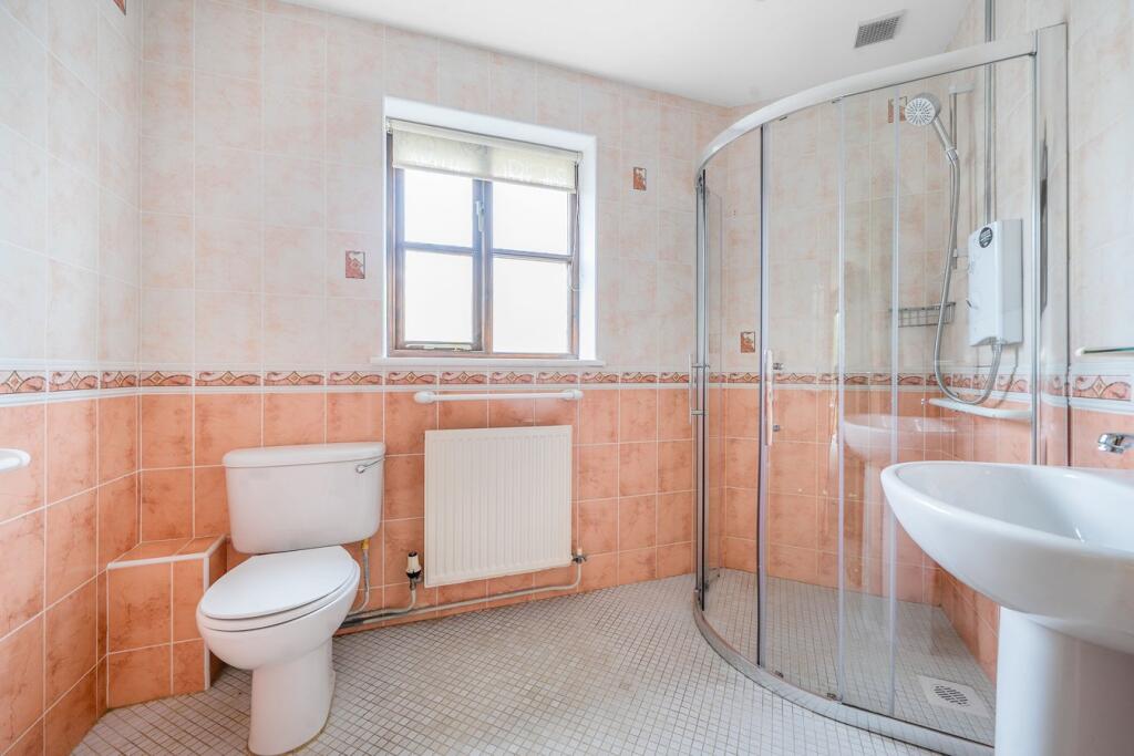
- Bathrooms: 2
- Property Type: undefined
- Property SubType: undefined
Image Descriptions
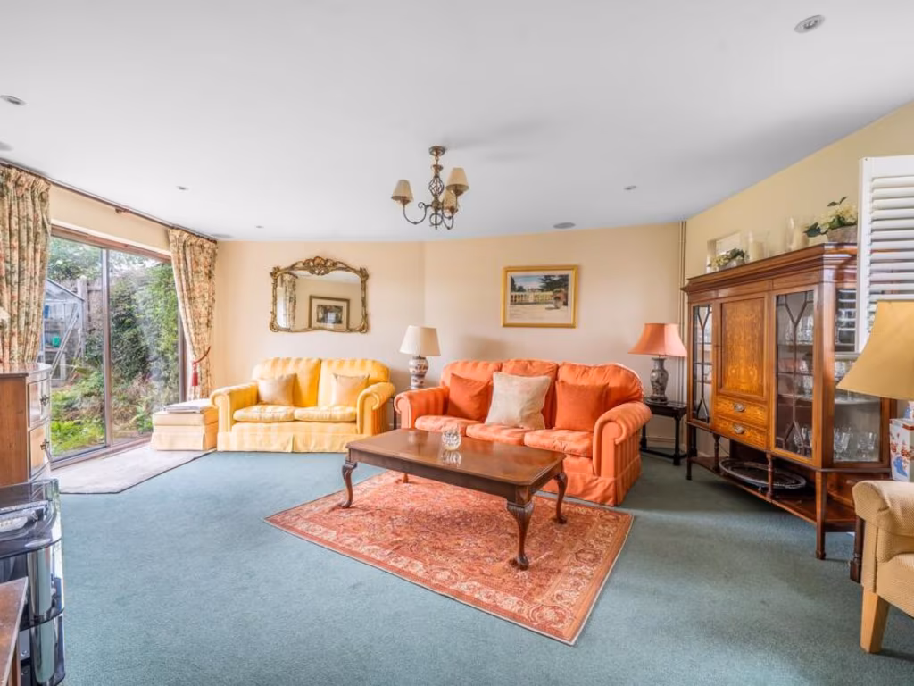
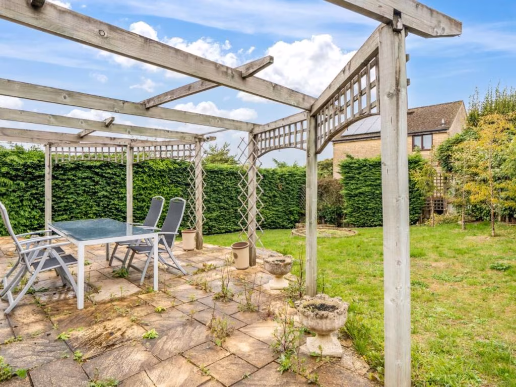
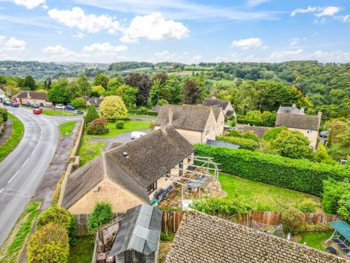
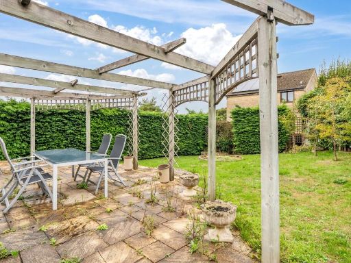
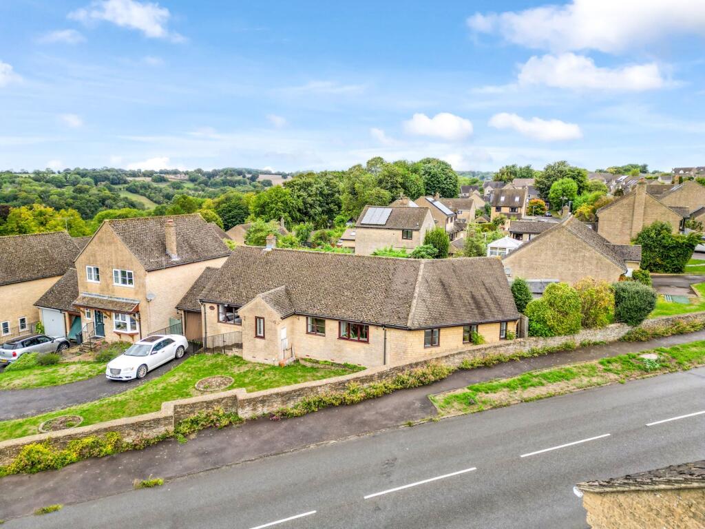
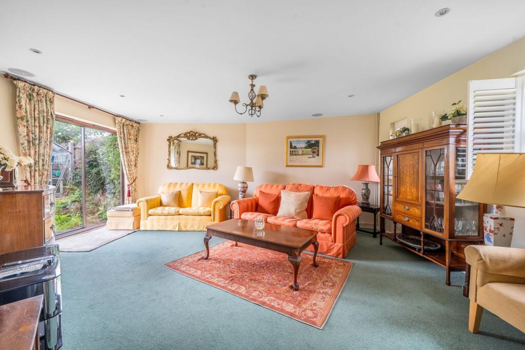
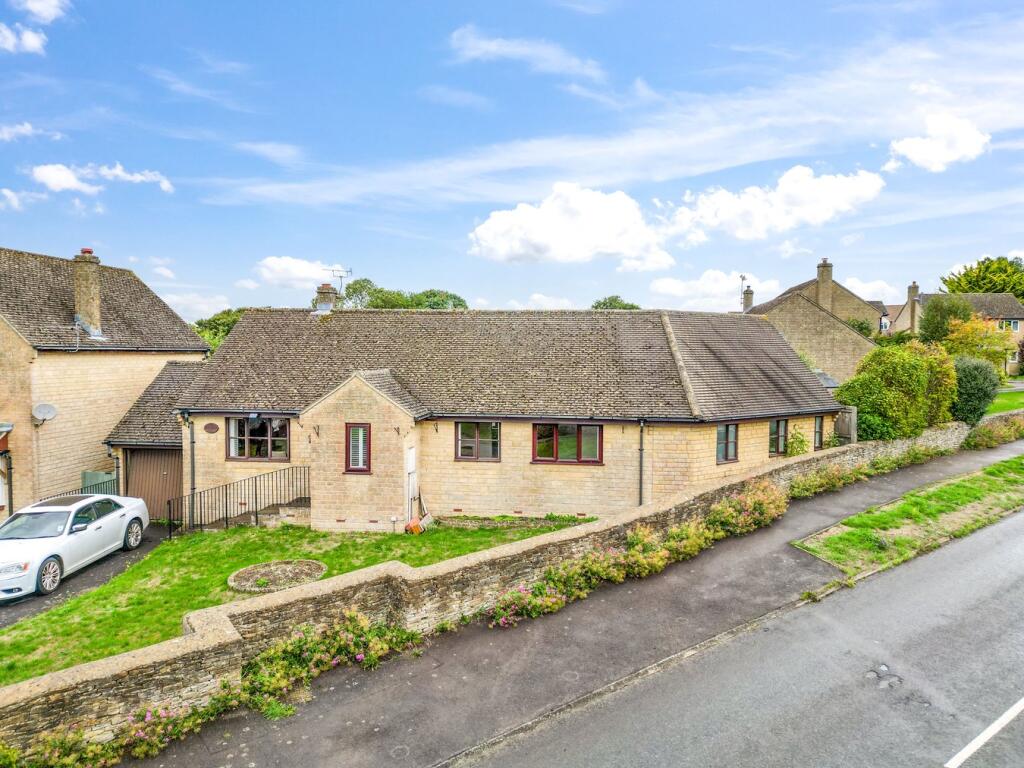
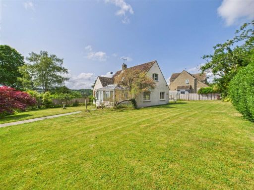
- detached bungalow contemporary bungalow
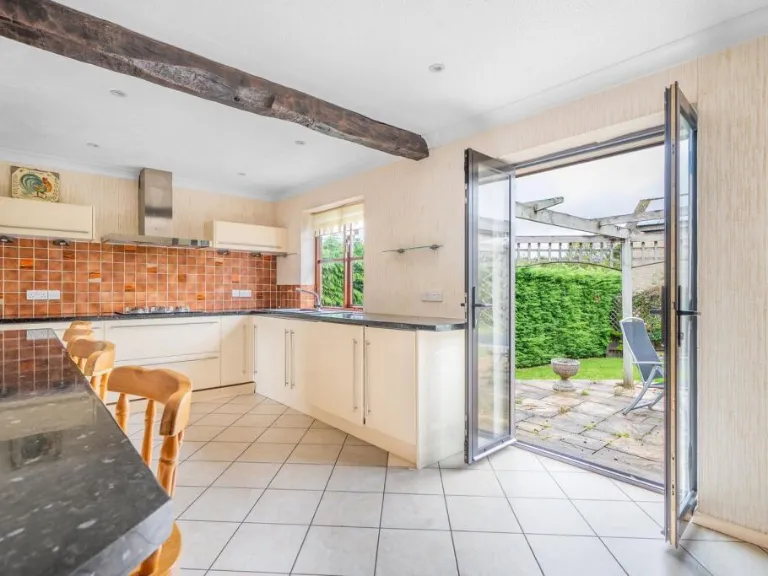
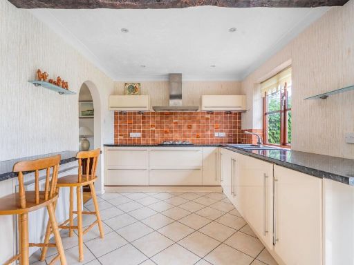
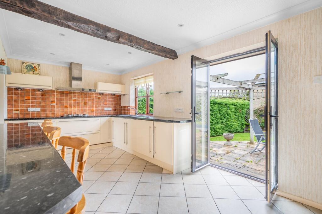
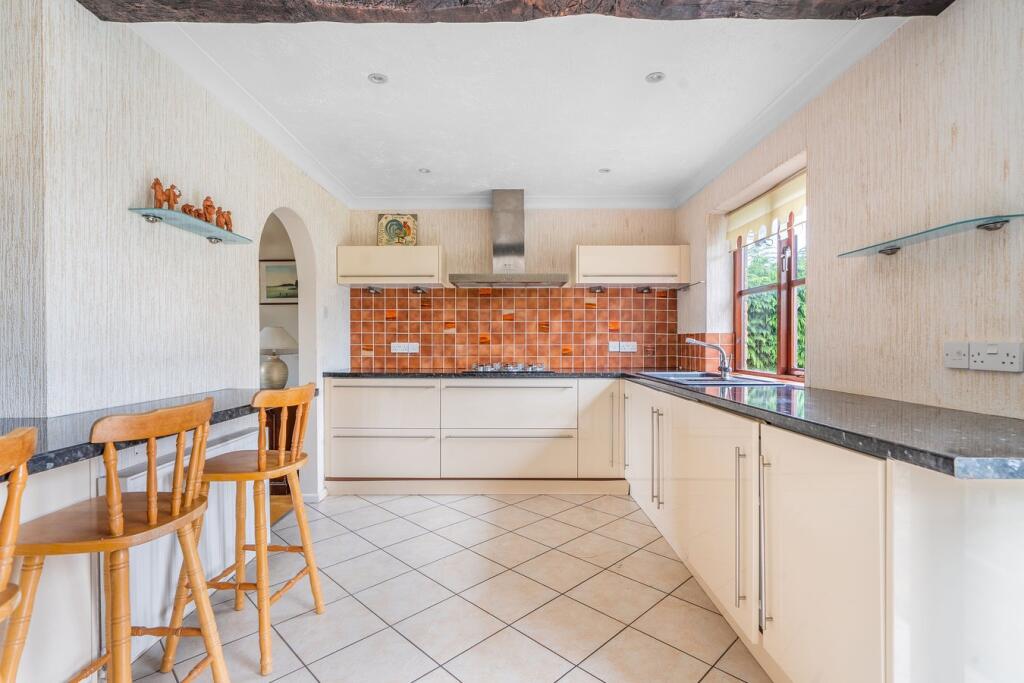
- kitchen with patio access modern rustic
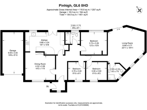
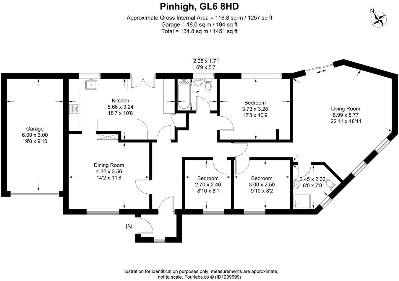
Rooms
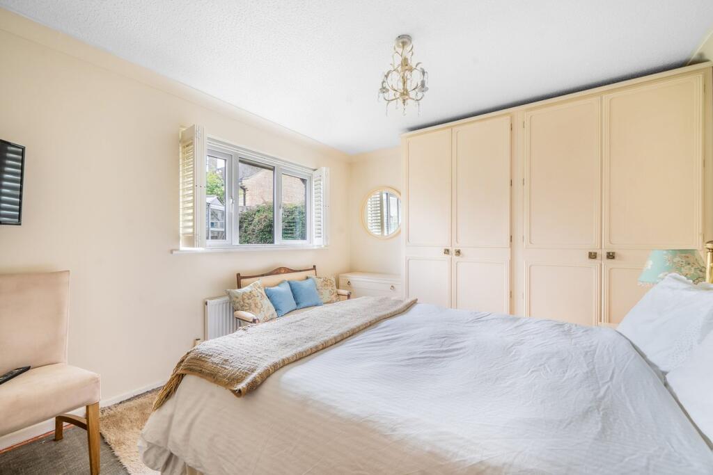
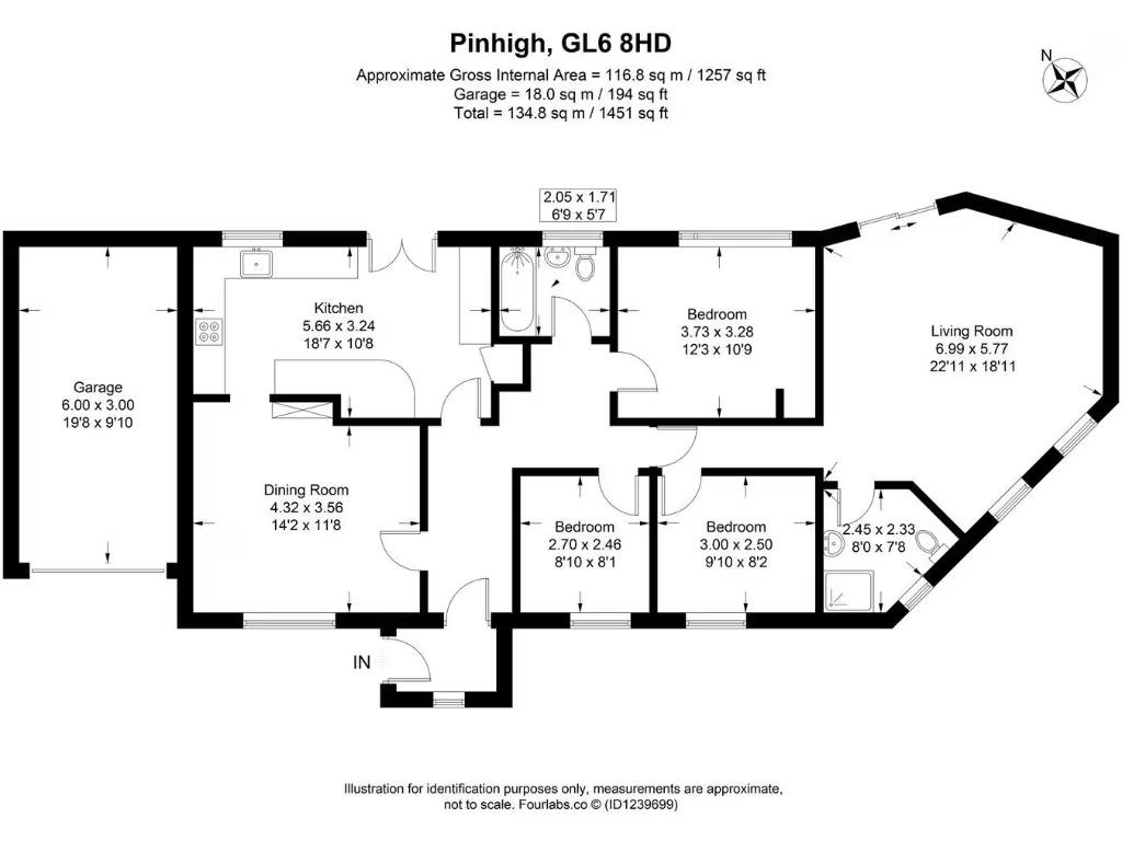
- Kitchen:
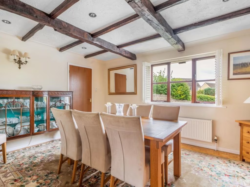
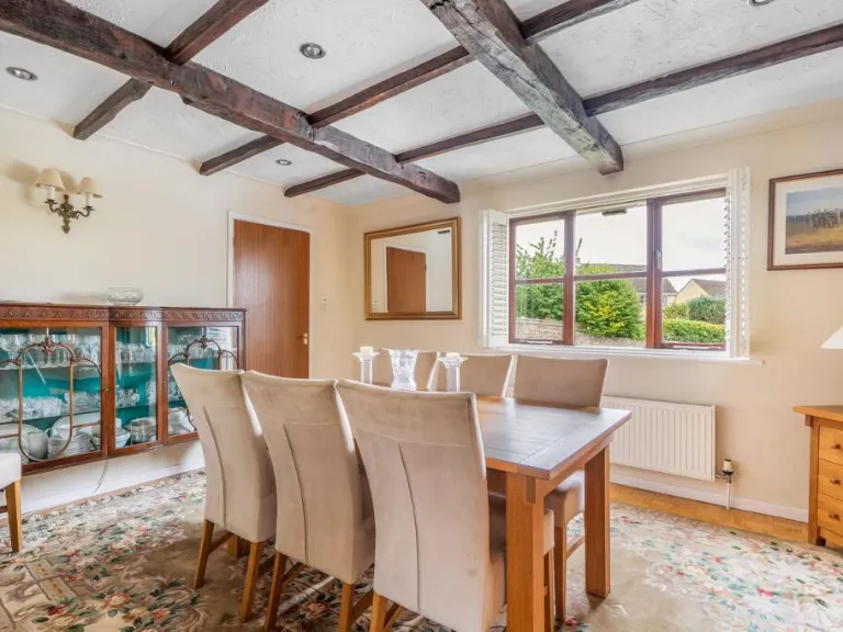
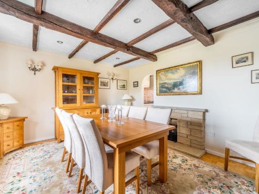
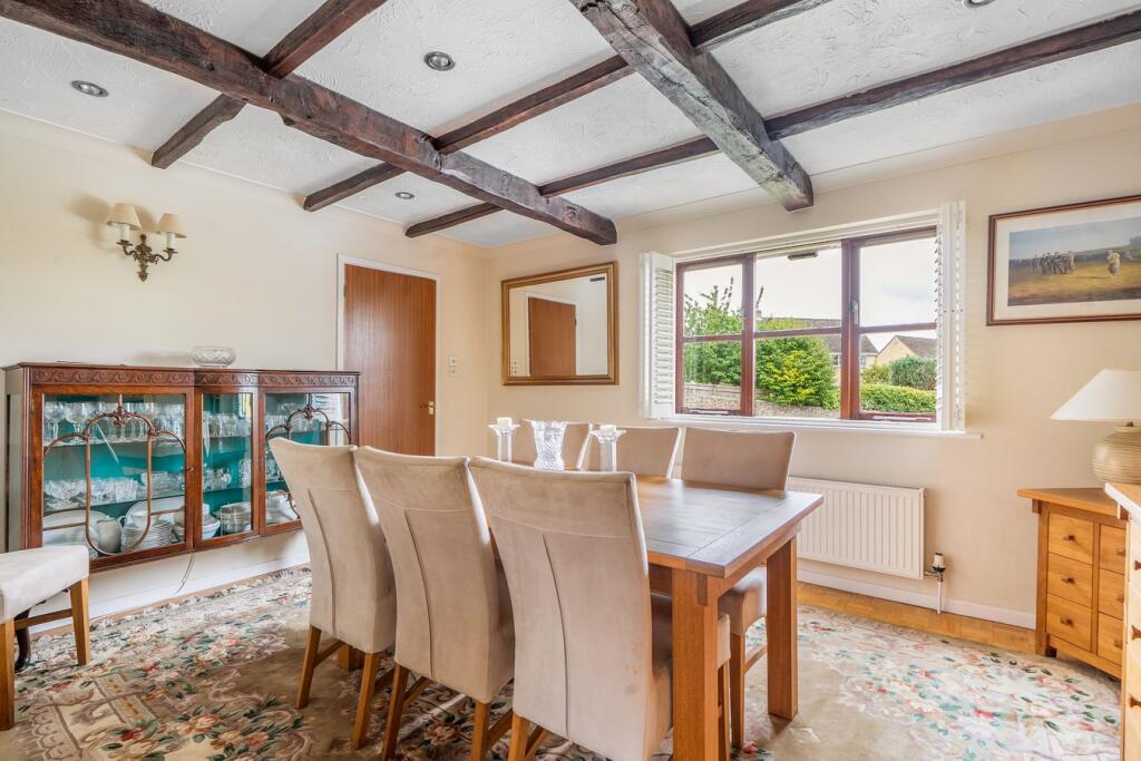
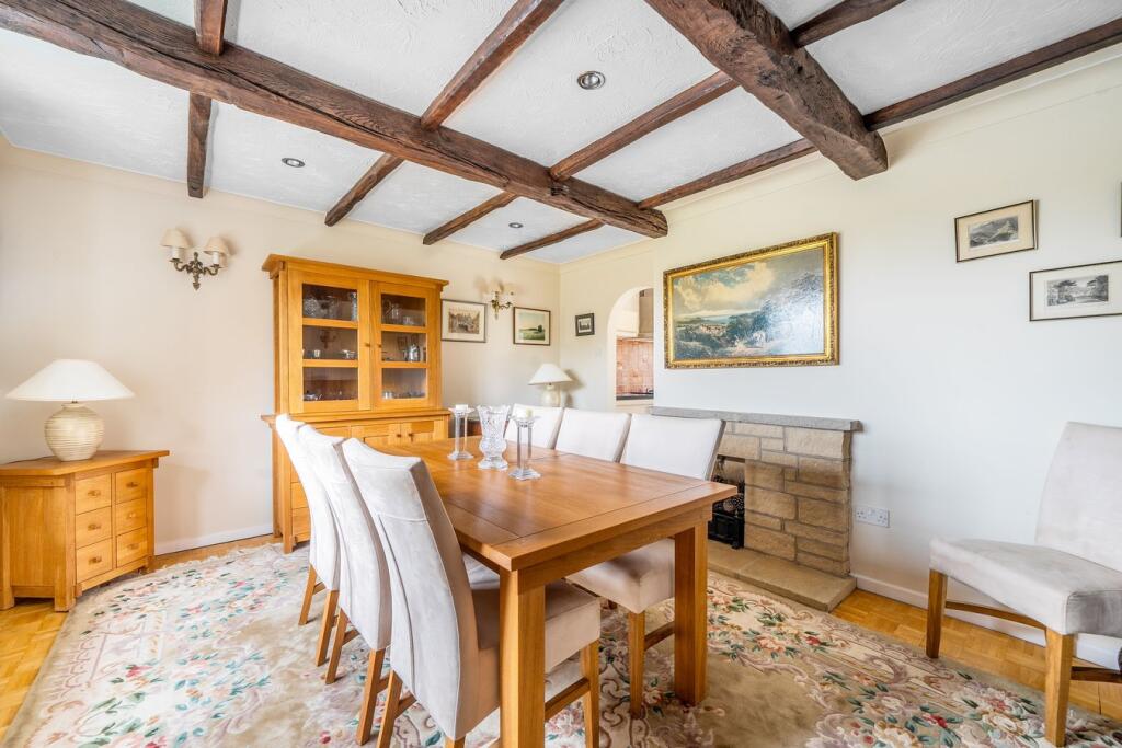
- Dining Room:
- Garage:
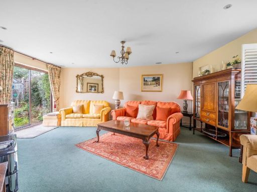
- Living Room:
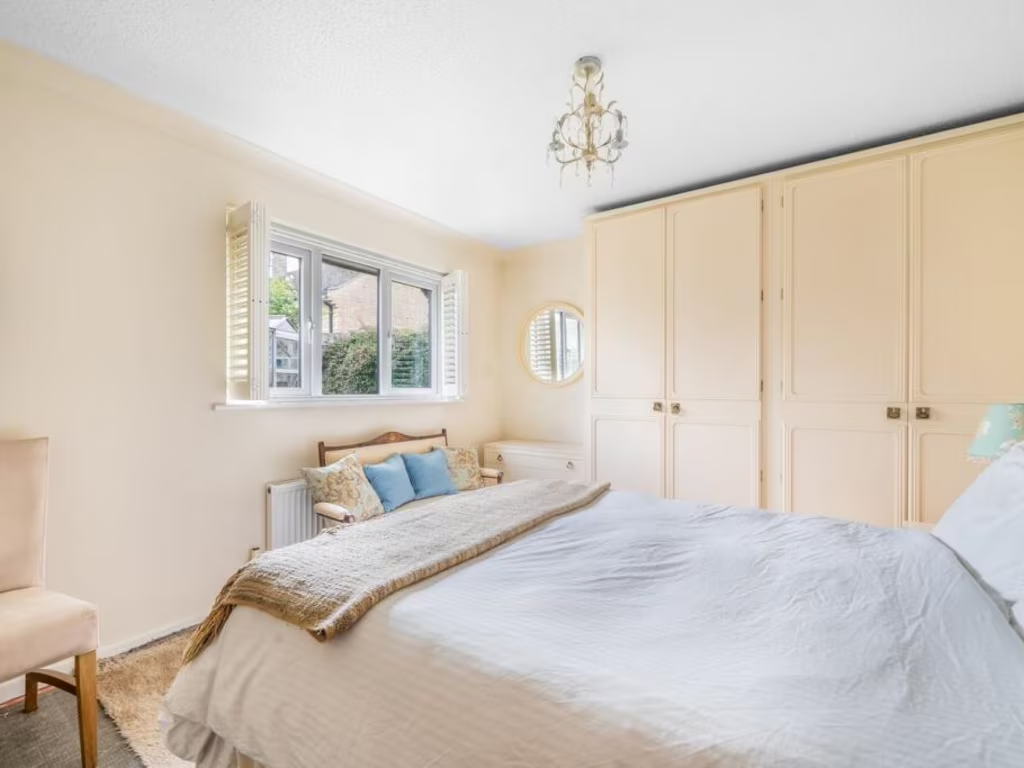
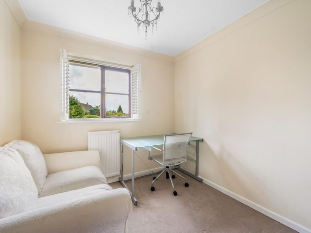
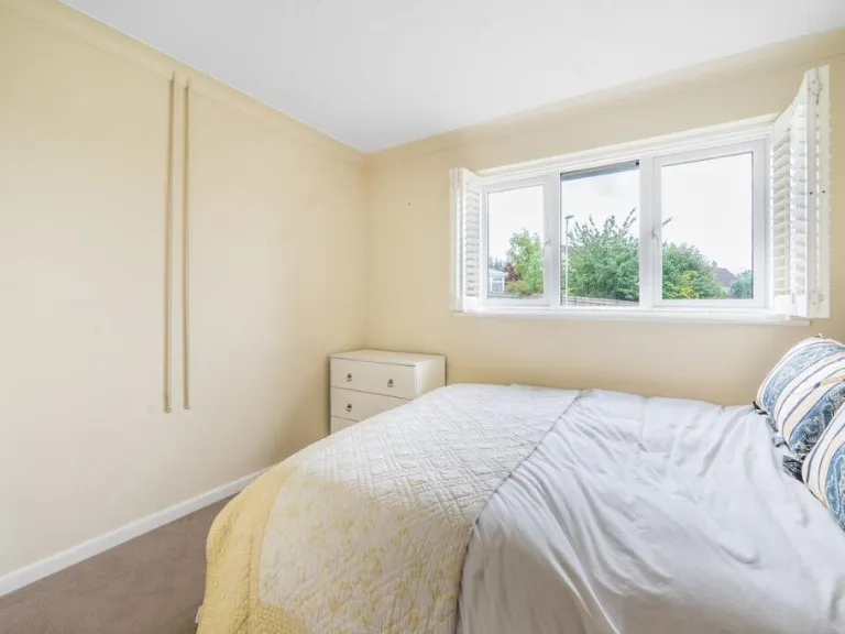
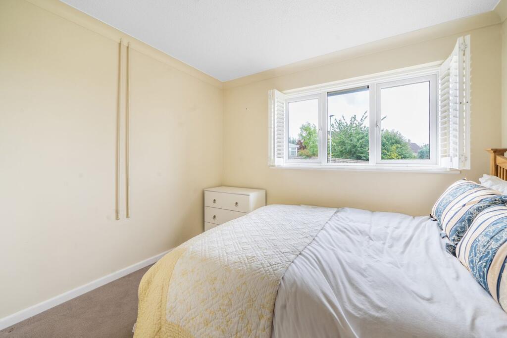
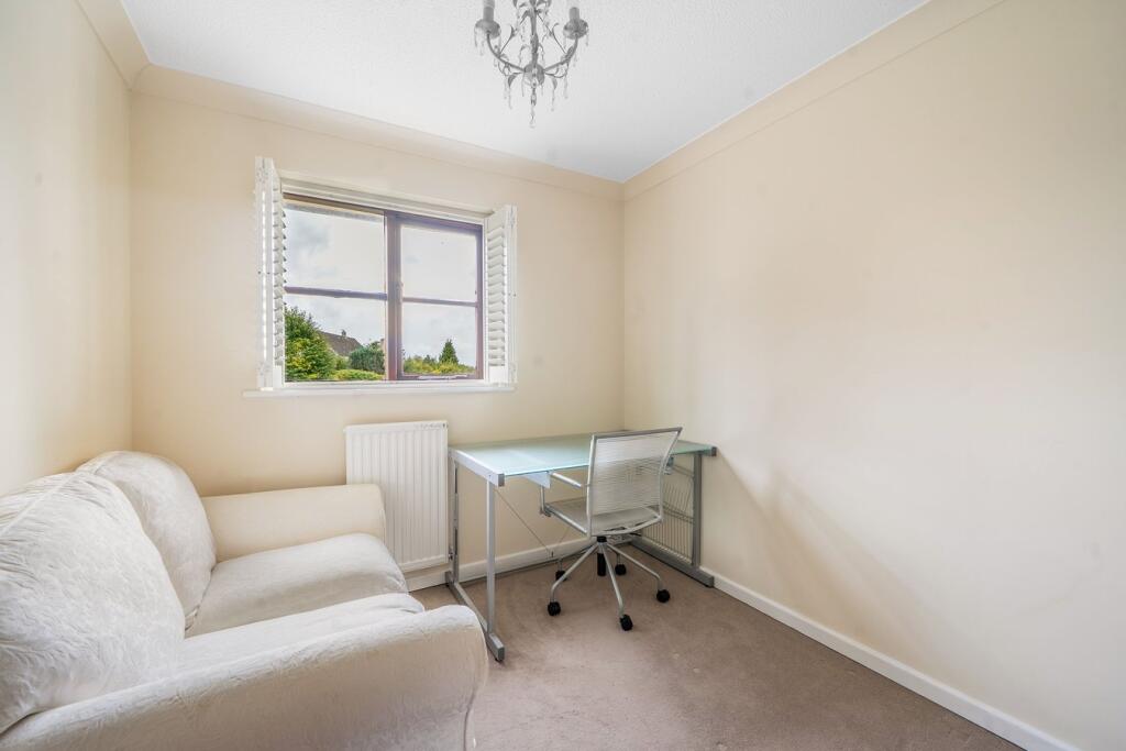
- Bedroom:
- Bedroom:
- Bedroom:
- :
- :
Textual Property Features
Detected Visual Features
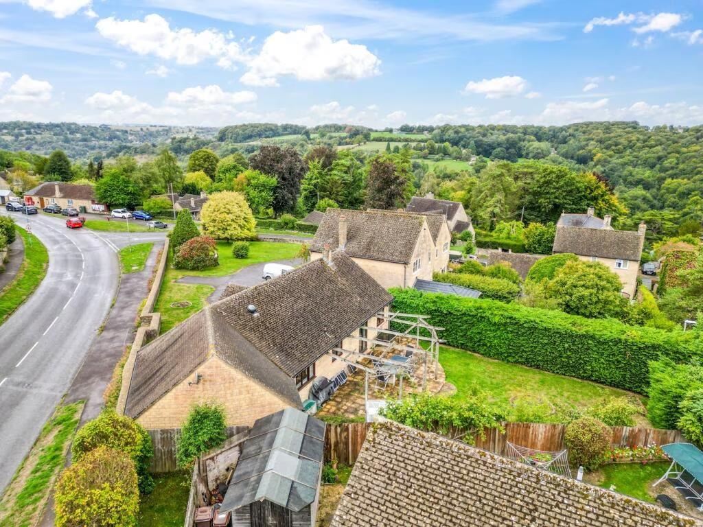
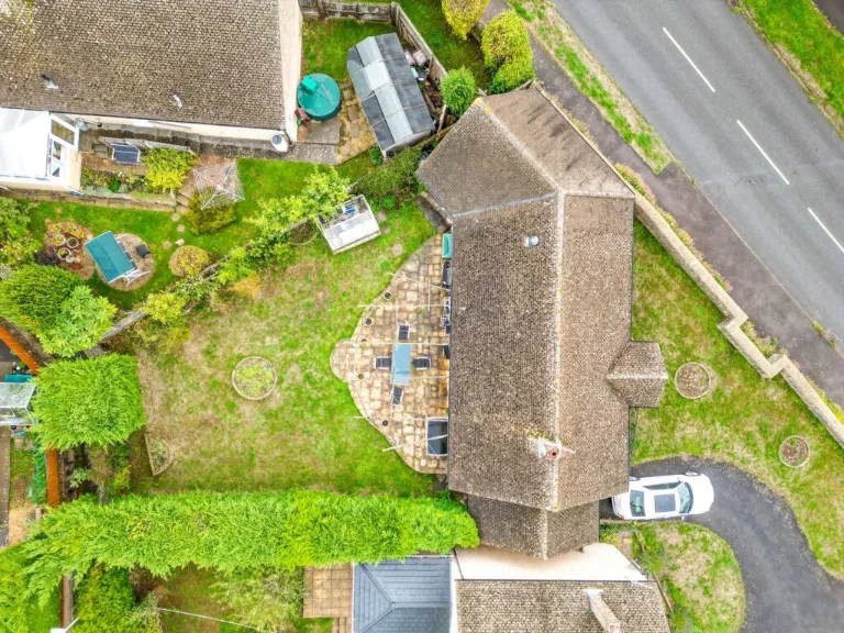
- detached
- bungalow
- single-story
- modern
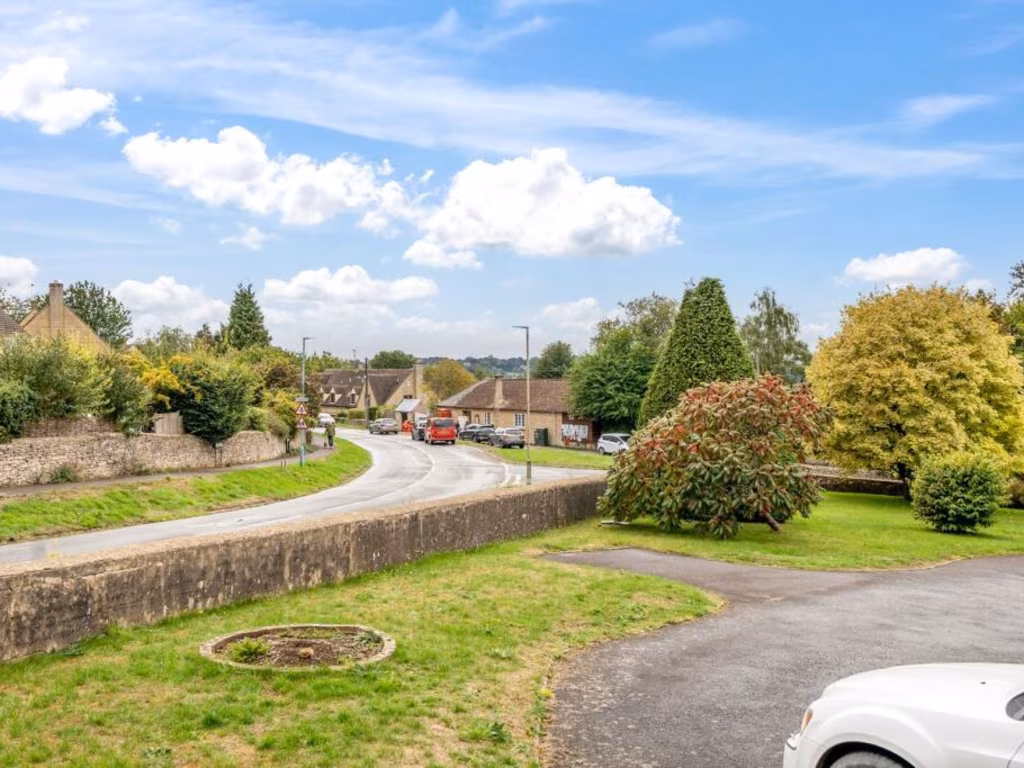
- suburban
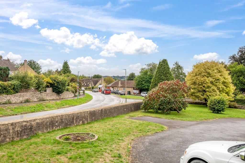
- rural view
- garage
- off-street parking
- countryside
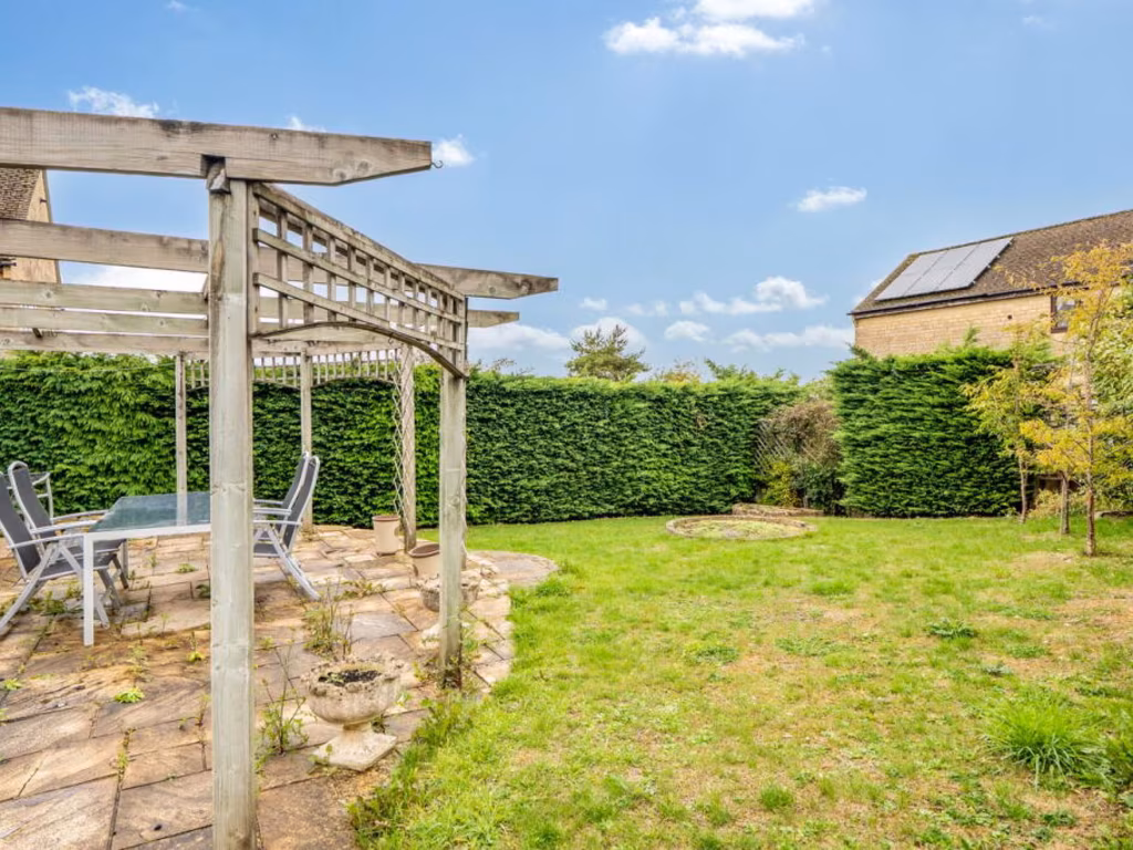
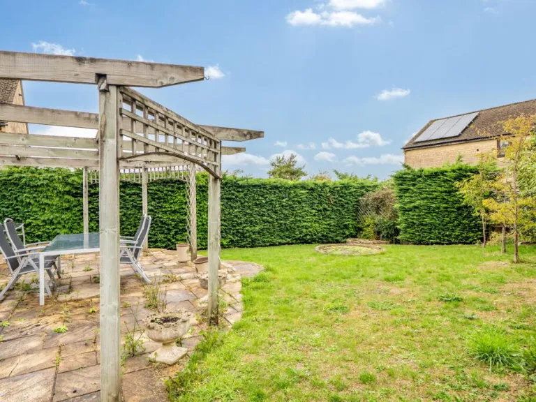
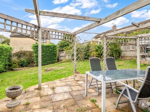
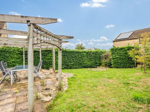
- garden
- well-maintained
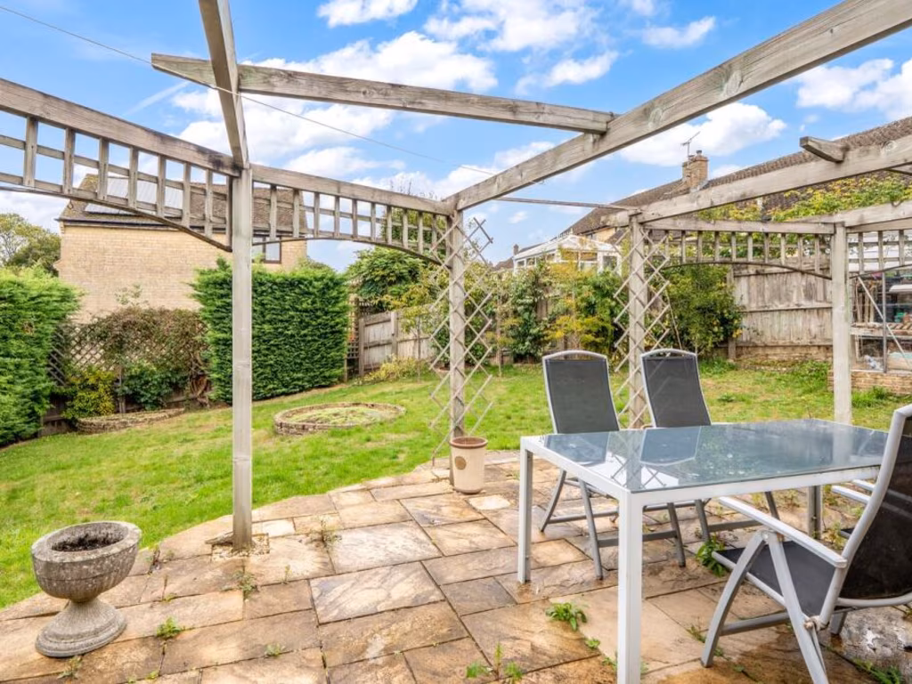
- kitchen
- rustic
- exposed beams
- tiled floor
- patio
- french doors
- natural light
- outdoor access
- breakfast bar
- neutral colors
- modern appliances
- dated tiles
EPC Details
- Fully double glazed
- Cavity wall, filled cavity
- Boiler and radiators, mains gas
- Low energy lighting in all fixed outlets
- Solid, no insulation (assumed)
Nearby Schools
- Nailsworth Church of England Primary School
- Minchinhampton Primary Academy
- Thrupp School
- Gastrells Community Primary School
- Bussage Church of England Primary School
- Eastcombe Primary School
- Stroud High School
- Archway School
- Bisley Blue Coat Church of England Primary School
- Callowell Primary School
- Sheepscombe Primary School
- The Acorn School
- Amberley Parochial School
- Chalford Hill Primary School
- Rodborough Community Primary School
- Stroud Valley Community Primary School
- Marling School
- Uplands Community Primary School
- Whiteshill Primary School
- Avening Primary School
- Beaudesert Park School
- Brimscombe Church of England (VA) Primary School
- Woodchester Endowed Church of England Aided Primary School
- Oakridge Parochial School
- Thomas Keble School
- The Rosary Catholic Primary School
- The Croft Primary School
Nearest General Shops
- Id: 345682815
- Tags:
- Building: yes
- Name: Eastcombe Stores
- Shop: yes
- TagsNormalized:
- Lat: 51.7378073
- Lon: -2.1592224
- FullGeoHash: gcnqqfedw6r4
- PartitionGeoHash: gcnq
- Images:
- FoodStandards: null
- Distance: 1110.5
,- Id: 222303380
- Tags:
- Building: yes
- Name: Cutting Shed
- Phone: +441453883510
- Shop: hairdresser
- TagsNormalized:
- Lat: 51.727096
- Lon: -2.1537614
- FullGeoHash: gcnqqbxsjtx4
- PartitionGeoHash: gcnq
- Images:
- FoodStandards: null
- Distance: 1056.3
,- Id: 286506220
- Tags:
- Building: commercial
- Name: Toadsmoor Garage
- Shop: car_repair
- TagsNormalized:
- garage
- car repair
- repair
- shop
- Lat: 51.7336916
- Lon: -2.1740616
- FullGeoHash: gcnqq9bfsen5
- PartitionGeoHash: gcnq
- Images:
- FoodStandards: null
- Distance: 588.8
}
Nearest Grocery shops
- Id: 3849991459
- Tags:
- Addr:
- City: Minchinhampton
- Housenumber: 22
- Postcode: GL6 9BN
- Street: High Street
- Name: W and B Stores
- Shop: convenience
- TagsNormalized:
- Lat: 51.7052173
- Lon: -2.1860837
- FullGeoHash: gcnqnk8hsx1g
- PartitionGeoHash: gcnq
- Images:
- FoodStandards: null
- Distance: 2974
,- Id: 1948846198
- Tags:
- Addr:
- City: Stroud
- Country: GB
- Housename: Gordon Terrace
- Postcode: GL5 2QE
- Street: London Road
- Unit: 3,4
- Village: Brimscombe
- Fhrs:
- Name: Brimscombe Newsagents
- Shop: convenience
- TagsNormalized:
- Lat: 51.7204071
- Lon: -2.1915664
- FullGeoHash: gcnqnpkjhy9t
- PartitionGeoHash: gcnq
- Images:
- FoodStandards:
- Id: 154441
- FHRSID: 154441
- LocalAuthorityBusinessID: CP0911
- BusinessName: Brimscombe Newsagents
- BusinessType: Retailers - other
- BusinessTypeID: 4613
- AddressLine1: 3 - 4 Gordon Terrace
- AddressLine2: London Road
- AddressLine3: Brimscombe
- AddressLine4: Stroud
- PostCode: GL5 2QE
- RatingValue: 4
- RatingKey: fhrs_4_en-GB
- RatingDate: 2021-12-08
- LocalAuthorityCode: 128
- LocalAuthorityName: Stroud
- LocalAuthorityWebSite: http://www.stroud.gov.uk
- LocalAuthorityEmailAddress: environmental.health@stroud.gov.uk
- Scores:
- Hygiene: 5
- Structural: 5
- ConfidenceInManagement: 10
- NewRatingPending: false
- Geocode:
- Longitude: -2.19157100000000
- Latitude: 51.72042800000000
- Distance: 1890.5
,- Id: 1664136812
- Tags:
- TagsNormalized:
- Lat: 51.7378161
- Lon: -2.1592378
- FullGeoHash: gcnqqfedw5gw
- PartitionGeoHash: gcnq
- Images:
- FoodStandards: null
- Distance: 1110.7
}
Nearest Religious buildings
- Id: 286963839
- Tags:
- Addr:
- City: Eastcombe
- Street: Dr Crouch's Road
- Amenity: place_of_worship
- Building: church
- Denomination: anglican
- Name: St Augustine of Canterbury
- Religion: christian
- Wikidata: Q105097202
- TagsNormalized:
- place of worship
- church
- anglican
- christian
- Lat: 51.7364116
- Lon: -2.1615455
- FullGeoHash: gcnqqf642q4u
- PartitionGeoHash: gcnq
- Images:
- FoodStandards: null
- Distance: 892.3
,- Id: 275577760
- Tags:
- Addr:
- Amenity: school
- Isced:
- Name: Bussage Church of England Primary School
- Ref:
- Wikidata: Q66162562
- TagsNormalized:
- Lat: 51.7325247
- Lon: -2.162822
- FullGeoHash: gcnqqc95f9e4
- PartitionGeoHash: gcnq
- Images:
- FoodStandards: null
- Distance: 506.6
,- Id: 275547155
- Tags:
- Amenity: place_of_worship
- Building: church
- Denomination: anglican
- Name: Saint Michael & All Angels Church, Bussage
- Religion: christian
- Wikidata: Q26383543
- TagsNormalized:
- place of worship
- church
- anglican
- christian
- Lat: 51.7301243
- Lon: -2.171572
- FullGeoHash: gcnqq94tydne
- PartitionGeoHash: gcnq
- Images:
- FoodStandards: null
- Distance: 215.8
}
Nearest Leisure Facilities
- Id: 275807216
- Tags:
- Leisure: pitch
- Name: Bussage Skate Park
- Sport: skateboard
- Surface: concrete
- TagsNormalized:
- pitch
- leisure
- skateboard
- sports
- Lat: 51.7264921
- Lon: -2.1679734
- FullGeoHash: gcnqq8t2dt1b
- PartitionGeoHash: gcnq
- Images:
- FoodStandards: null
- Distance: 353.6
,- Id: 283976741
- Tags:
- Leisure: pitch
- Sport: soccer
- TagsNormalized:
- Lat: 51.7266133
- Lon: -2.1686974
- FullGeoHash: gcnqq8sc3ew5
- PartitionGeoHash: gcnq
- Images:
- FoodStandards: null
- Distance: 338.2
,- Id: 275488986
- Tags:
- Leisure: park
- Name: Bussage Park
- TagsNormalized:
- Lat: 51.726751
- Lon: -2.1683981
- FullGeoHash: gcnqq8t40tm0
- PartitionGeoHash: gcnq
- Images:
- FoodStandards: null
- Distance: 322.8
,- Id: 221457769
- Tags:
- Leisure: playground
- Name: Bussage Park playground
- TagsNormalized:
- Lat: 51.7275004
- Lon: -2.1689136
- FullGeoHash: gcnqq8sws8uz
- PartitionGeoHash: gcnq
- Images:
- FoodStandards: null
- Distance: 240.8
,- Id: 275577773
- Tags:
- Access: private
- Leisure: pitch
- Sport: tennis
- Surface: asphalt
- TagsNormalized:
- Lat: 51.7308849
- Lon: -2.1706351
- FullGeoHash: gcnqq976hxch
- PartitionGeoHash: gcnq
- Images:
- FoodStandards: null
- Distance: 199.4
}
Nearest Tourist attractions
- Id: 287340475
- Tags:
- TagsNormalized:
- Lat: 51.7344056
- Lon: -2.136812
- FullGeoHash: gcnqr3unb8jq
- PartitionGeoHash: gcnq
- Images:
- FoodStandards: null
- Distance: 2247.5
,- Id: 1664136786
- Tags:
- TagsNormalized:
- Lat: 51.730515
- Lon: -2.14324
- FullGeoHash: gcnqr1r24fum
- PartitionGeoHash: gcnq
- Images:
- FoodStandards: null
- Distance: 1744.5
,- Id: 9588318997
- Tags:
- Name: RMC: The cave
- Tourism: museum
- Website: https://www.rmcretro.com/
- TagsNormalized:
- Lat: 51.7205915
- Lon: -2.1590646
- FullGeoHash: gcnqnz7y61h9
- PartitionGeoHash: gcnq
- Images:
- FoodStandards: null
- Distance: 1200.2
}
Nearest Train stations
- Id: 262378746
- Tags:
- Name: Lydney Junction
- Naptan:
- Public_transport: station
- Railway: station
- Usage: tourism
- Wheelchair: no
- TagsNormalized:
- Lat: 51.7155121
- Lon: -2.5307606
- FullGeoHash: gcnnnqt0tn0n
- PartitionGeoHash: gcnn
- Images:
- FoodStandards: null
- Distance: 25000.5
,- Id: 15825263
- Tags:
- Name: Cheltenham Racecourse
- Naptan:
- Operator: Gloucestershire and Warwickshire Steam Railway
- Public_transport: station
- Railway: station
- Source: npe
- Usage: tourism
- Wikidata: Q5090223
- Wikipedia: en:Cheltenham Racecourse railway station
- TagsNormalized:
- Lat: 51.9243306
- Lon: -2.0678139
- FullGeoHash: gcnx2uw30ky0
- PartitionGeoHash: gcnx
- Images:
- FoodStandards: null
- Distance: 22726.8
,- Id: 7154294070
- Tags:
- Addr:
- City: Cheltenham
- Postcode: GL51 8NP
- Street: Queens Road
- Name: Cheltenham Spa
- Naptan:
- Network: National Rail
- Old_name: Cheltenham Spa (Lansdown)
- Operator: First Great Western
- Public_transport: station
- Railway: station
- Ref:
- Source: Bing
- Wheelchair: yes
- Wikipedia: en:Cheltenham Spa railway station
- TagsNormalized:
- Lat: 51.8969882
- Lon: -2.1001222
- FullGeoHash: gcnx0pw9zeg3
- PartitionGeoHash: gcnx
- Images:
- FoodStandards: null
- Distance: 19191.9
,- Id: 6646199707
- Tags:
- Name: Gloucester
- Naptan:
- Network: National Rail
- Operator: Great Western Railway
- Postal_code: GL1 1DE
- Public_transport: station
- Railway: station
- Ref:
- Wheelchair: yes
- Wikipedia: en:Gloucester railway station
- TagsNormalized:
- Lat: 51.8655109
- Lon: -2.2382438
- FullGeoHash: gcnrj1f4mpur
- PartitionGeoHash: gcnr
- Images:
- FoodStandards: null
- Distance: 15849.1
,- Id: 21362353
- Tags:
- Name: Kemble
- Naptan:
- Network: National Rail
- Public_transport: station
- Railway: station
- Ref:
- Source: survey
- Wheelchair: yes
- Wikidata: Q1877761
- Wikipedia: en:Kemble railway station
- TagsNormalized:
- Lat: 51.6767954
- Lon: -2.0230749
- FullGeoHash: gcntczqz4uy5
- PartitionGeoHash: gcnt
- Images:
- FoodStandards: null
- Distance: 11619.7
}
Nearest Bus stations and stops
- Id: 5876471372
- Tags:
- Bus: yes
- Highway: bus_stop
- Public_transport: platform
- TagsNormalized:
- Lat: 51.7553568
- Lon: -2.141197
- FullGeoHash: gcnqrmbbf3zb
- PartitionGeoHash: gcnq
- Images:
- FoodStandards: null
- Distance: 3422.1
,- Id: 5876471371
- Tags:
- Bus: yes
- Highway: bus_stop
- Public_transport: platform
- TagsNormalized:
- Lat: 51.7534457
- Lon: -2.1395367
- FullGeoHash: gcnqrm6j9jtb
- PartitionGeoHash: gcnq
- Images:
- FoodStandards: null
- Distance: 3314.4
,- Id: 5876471370
- Tags:
- Bus: yes
- Highway: bus_stop
- Public_transport: platform
- TagsNormalized:
- Lat: 51.754437
- Lon: -2.1435144
- FullGeoHash: gcnqrjx5kqrf
- PartitionGeoHash: gcnq
- Images:
- FoodStandards: null
- Distance: 3249.9
,- Id: 5876471369
- Tags:
- Bus: yes
- Highway: bus_stop
- Public_transport: platform
- TagsNormalized:
- Lat: 51.7530262
- Lon: -2.1410448
- FullGeoHash: gcnqrm2gnp36
- PartitionGeoHash: gcnq
- Images:
- FoodStandards: null
- Distance: 3215.1
,- Id: 5982970373
- Tags:
- Bench: no
- Bus: yes
- Highway: bus_stop
- Name: Oakridge Lynch near The Cresent
- Operator: Cotswold Green
- Passenger_information_display: no
- Public_transport: bus_stop
- Shelter: no
- Source: survey
- TagsNormalized:
- Lat: 51.7316657
- Lon: -2.1253355
- FullGeoHash: gcnqr9kqu16y
- PartitionGeoHash: gcnq
- Images:
- FoodStandards: null
- Distance: 2983.3
}
Nearest Hotels
- Id: 517795830
- Tags:
- Addr:
- Building: yes
- Name:
- Tourism: hotel
- TagsNormalized:
- Lat: 51.744859
- Lon: -2.2188778
- FullGeoHash: gcnqmeb78kug
- PartitionGeoHash: gcnq
- Images:
- FoodStandards: null
- Distance: 3857.1
,- Id: 670103924
- Tags:
- Addr:
- City: Stroud
- Housenumber: 30
- Postcode: GL5 2AJ
- Street: London Road
- Fhrs:
- Name: London Hotel
- Tourism: hotel
- TagsNormalized:
- Lat: 51.742711
- Lon: -2.2148992
- FullGeoHash: gcnqme7pjh7m
- PartitionGeoHash: gcnq
- Images:
- FoodStandards: null
- Distance: 3507.5
,- Id: 339263297
- Tags:
- Addr:
- Amenity: pub
- Fhrs:
- Name: The Bear of Rodborough
- Tourism: hotel
- TagsNormalized:
- Lat: 51.7224368
- Lon: -2.2133335
- FullGeoHash: gcnqjxu3194c
- PartitionGeoHash: gcnq
- Images:
- FoodStandards: null
- Distance: 3188.4
}
Tags
- detached
- bungalow
- single-story
- modern
- suburban
- rural view
- garage
- off-street parking
- countryside
- garden
- well-maintained
- kitchen
- modern
- rustic
- exposed beams
- tiled floor
- patio
- french doors
- natural light
- outdoor access
- breakfast bar
- neutral colors
- modern appliances
- dated tiles
Local Market Stats
- Average Price/sqft: £386
- Avg Income: £52100
- Rental Yield: 3.3%
- Social Housing: 4%
- Planning Success Rate: 22%
AirBnB Data
- 1km average: £107/night
- Listings in 1km: 2
Similar Properties
 4 bedroom detached house for sale in Bussage, Stroud, Gloucestershire, GL6 — £625,000 • 4 bed • 2 bath • 1598 ft²
 3 bedroom detached house for sale in The Ridge, Bussage, Stroud, Gloucestershire, GL6 — £425,000 • 3 bed • 1 bath • 862 ft²
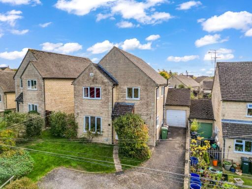 4 bedroom detached house for sale in The Ridge, Bussage, Stroud, GL6 — £450,000 • 4 bed • 2 bath • 1343 ft²
 3 bedroom terraced house for sale in Farriers Croft, Bussage, GL6 — £260,000 • 3 bed • 2 bath • 1045 ft²
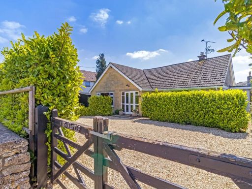 3 bedroom bungalow for sale in Cirencester Road, Minchinhampton, Stroud, Gloucestershire, GL6 — £670,000 • 3 bed • 1 bath • 1606 ft²
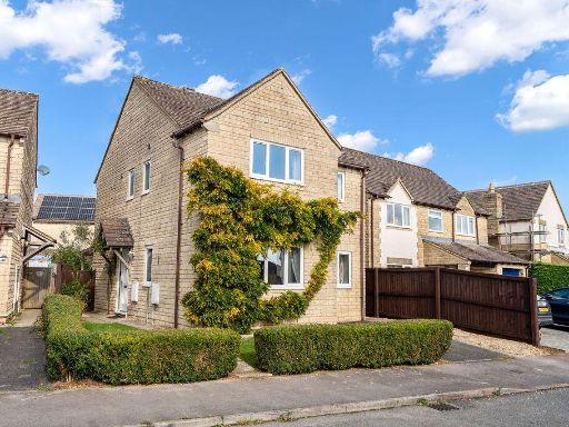 4 bedroom detached house for sale in Stonecote Ridge, Bussage, Stroud, GL6 8JY, GL6 — £400,000 • 4 bed • 2 bath • 1117 ft²
Meta
- {
"@context": "https://schema.org",
"@type": "Residence",
"name": "3 bedroom detached bungalow for sale in The Ridge, Bussage,…",
"description": "",
"url": "https://propertypiper.co.uk/property/a0f8a9e4-1a29-4f78-a745-14b76ce94fb9",
"image": "https://image-a.propertypiper.co.uk/08c9392f-f6ee-419b-afb2-5f043abeb2b9-1024.jpeg",
"address": {
"@type": "PostalAddress",
"streetAddress": "Pinhigh, The Ridge, Bussage, STROUD",
"postalCode": "GL6 8HD",
"addressLocality": "Stroud",
"addressRegion": "Stroud",
"addressCountry": "England"
},
"geo": {
"@type": "GeoCoordinates",
"latitude": 51.729652965769965,
"longitude": -2.1685320658459957
},
"numberOfRooms": 3,
"numberOfBathroomsTotal": 2,
"floorSize": {
"@type": "QuantitativeValue",
"value": 1257,
"unitCode": "FTK"
},
"offers": {
"@type": "Offer",
"price": 450000,
"priceCurrency": "GBP",
"availability": "https://schema.org/InStock"
},
"additionalProperty": [
{
"@type": "PropertyValue",
"name": "Feature",
"value": "detached"
},
{
"@type": "PropertyValue",
"name": "Feature",
"value": "bungalow"
},
{
"@type": "PropertyValue",
"name": "Feature",
"value": "single-story"
},
{
"@type": "PropertyValue",
"name": "Feature",
"value": "modern"
},
{
"@type": "PropertyValue",
"name": "Feature",
"value": "suburban"
},
{
"@type": "PropertyValue",
"name": "Feature",
"value": "rural view"
},
{
"@type": "PropertyValue",
"name": "Feature",
"value": "garage"
},
{
"@type": "PropertyValue",
"name": "Feature",
"value": "off-street parking"
},
{
"@type": "PropertyValue",
"name": "Feature",
"value": "countryside"
},
{
"@type": "PropertyValue",
"name": "Feature",
"value": "garden"
},
{
"@type": "PropertyValue",
"name": "Feature",
"value": "well-maintained"
},
{
"@type": "PropertyValue",
"name": "Feature",
"value": "kitchen"
},
{
"@type": "PropertyValue",
"name": "Feature",
"value": "modern"
},
{
"@type": "PropertyValue",
"name": "Feature",
"value": "rustic"
},
{
"@type": "PropertyValue",
"name": "Feature",
"value": "exposed beams"
},
{
"@type": "PropertyValue",
"name": "Feature",
"value": "tiled floor"
},
{
"@type": "PropertyValue",
"name": "Feature",
"value": "patio"
},
{
"@type": "PropertyValue",
"name": "Feature",
"value": "french doors"
},
{
"@type": "PropertyValue",
"name": "Feature",
"value": "natural light"
},
{
"@type": "PropertyValue",
"name": "Feature",
"value": "outdoor access"
},
{
"@type": "PropertyValue",
"name": "Feature",
"value": "breakfast bar"
},
{
"@type": "PropertyValue",
"name": "Feature",
"value": "neutral colors"
},
{
"@type": "PropertyValue",
"name": "Feature",
"value": "modern appliances"
},
{
"@type": "PropertyValue",
"name": "Feature",
"value": "dated tiles"
}
]
}
High Res Floorplan Images
Compatible Floorplan Images
FloorplanImages Thumbnail