PH1 2SY - 3 bedroom detached house for sale in Hermitage Drive, Perth…
View on Property Piper
3 bedroom detached house for sale in Hermitage Drive, Perth, PH1
Property Details
- Price: £249950
- Bedrooms: 3
- Bathrooms: 1
- Property Type: undefined
- Property SubType: undefined
Brochure Descriptions
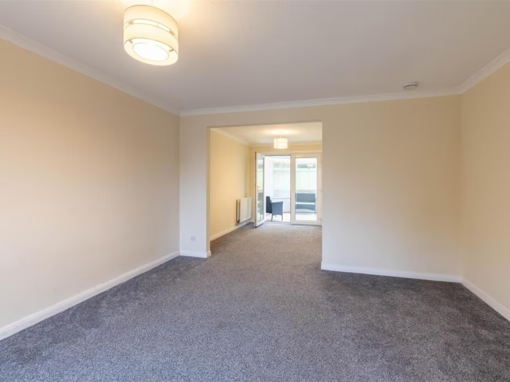
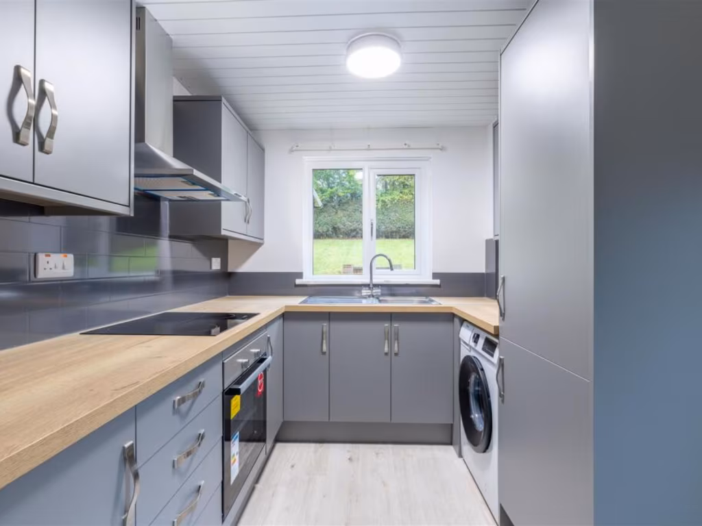
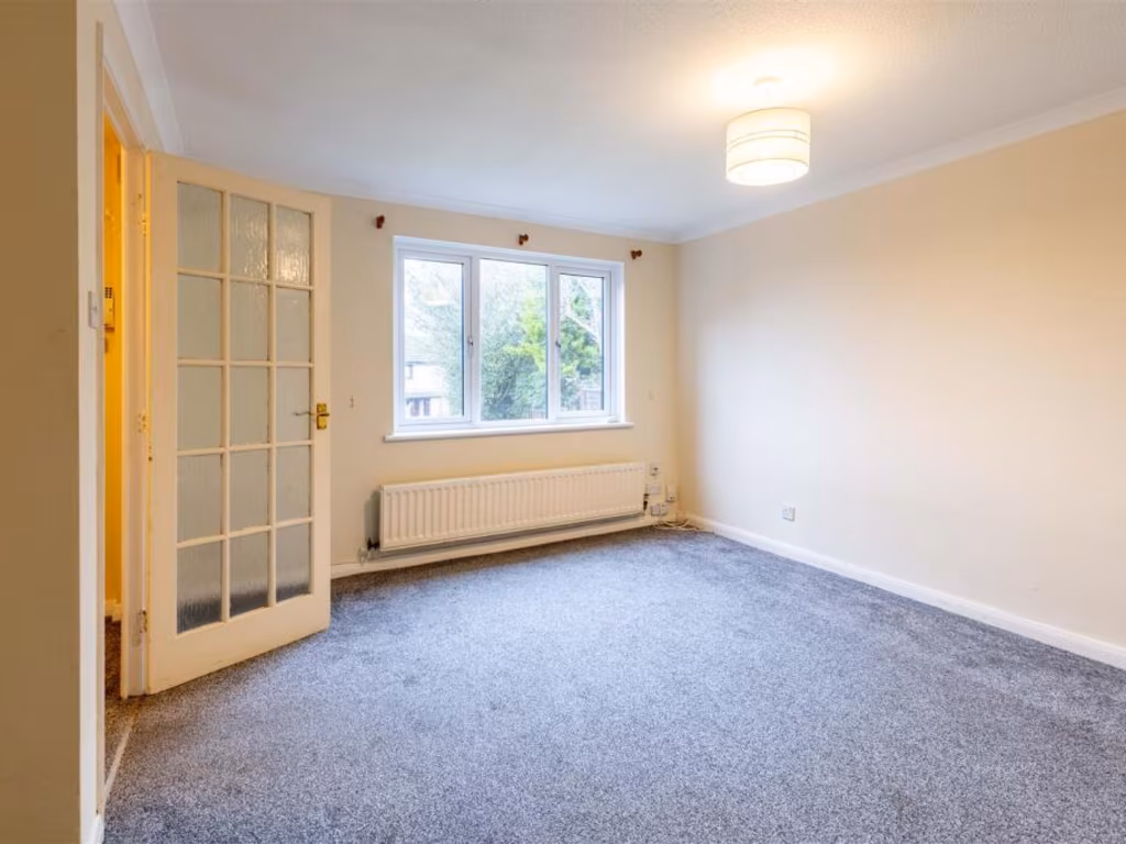
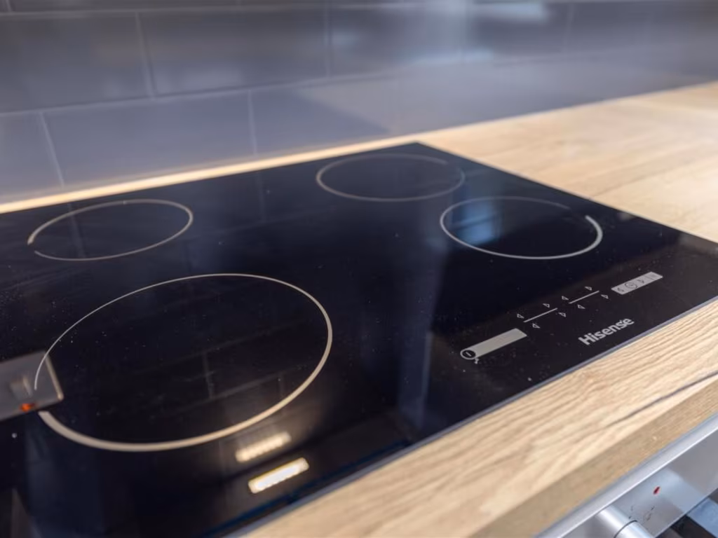
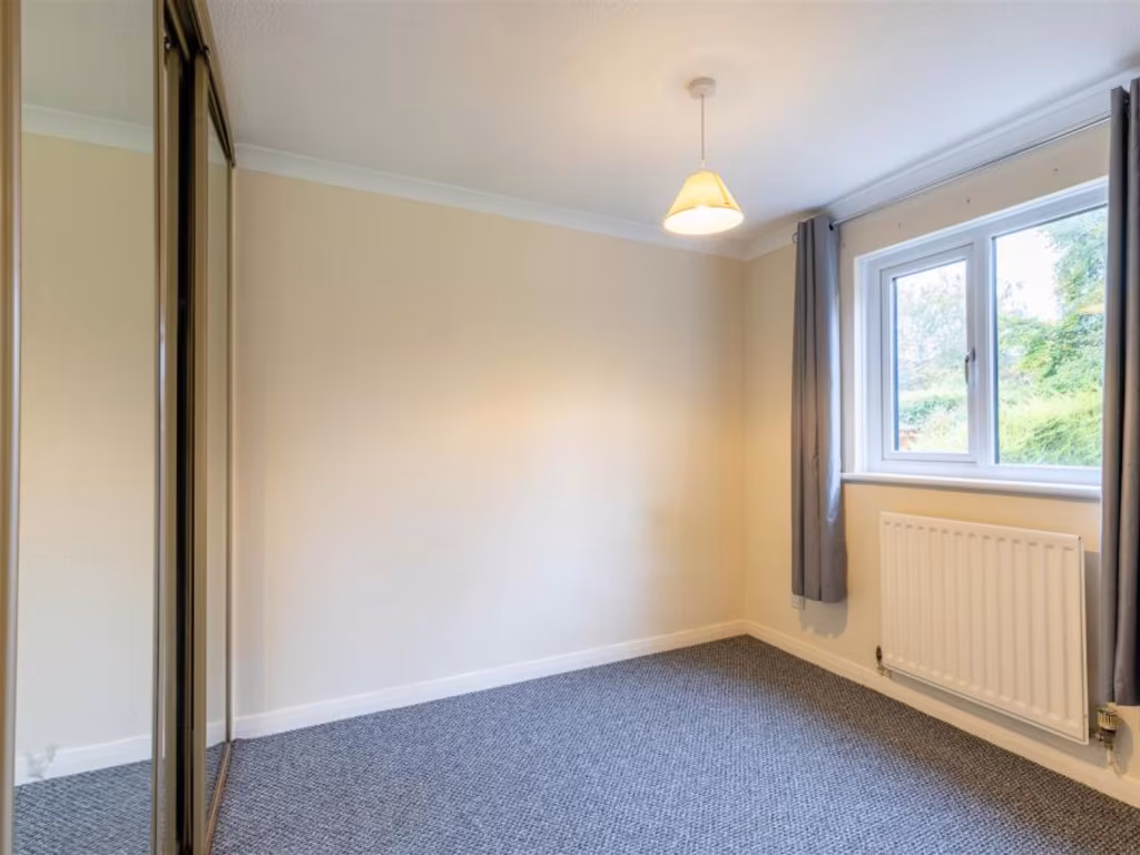
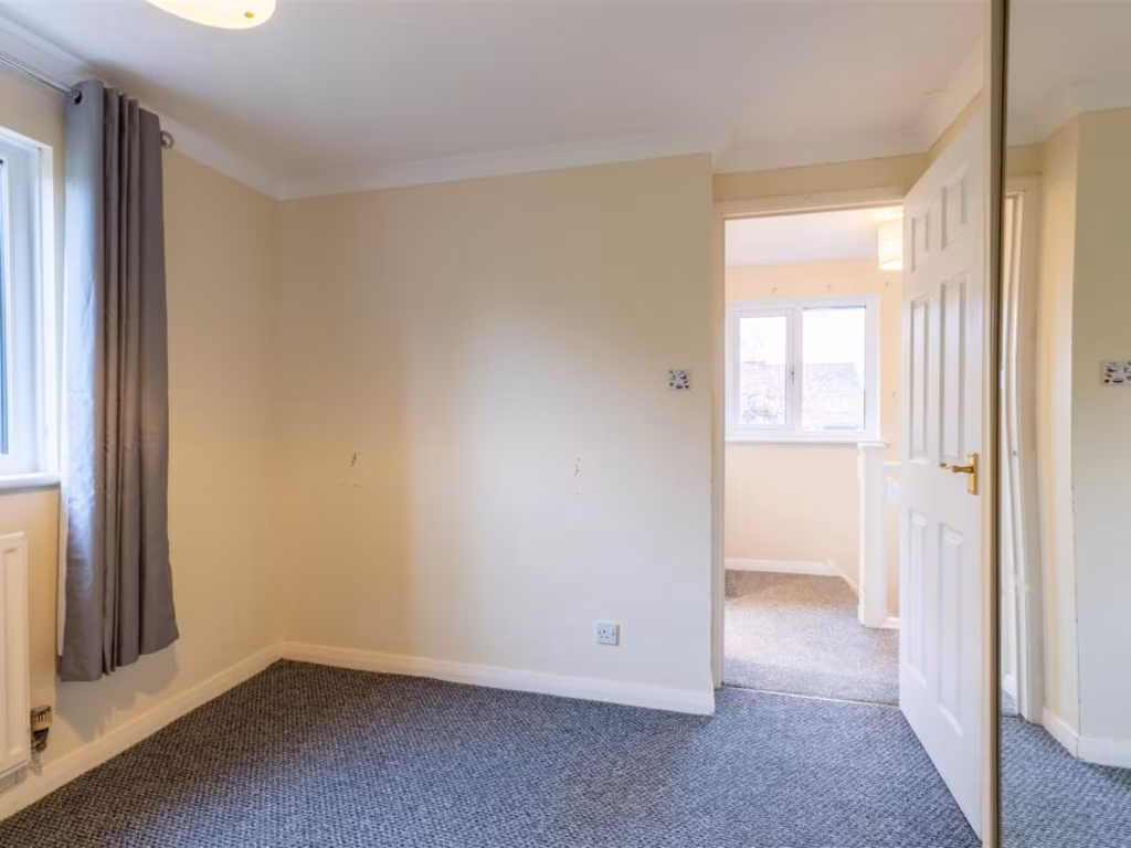
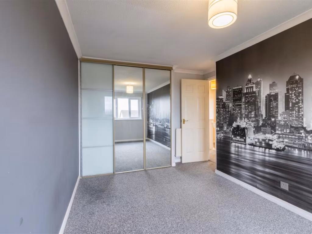
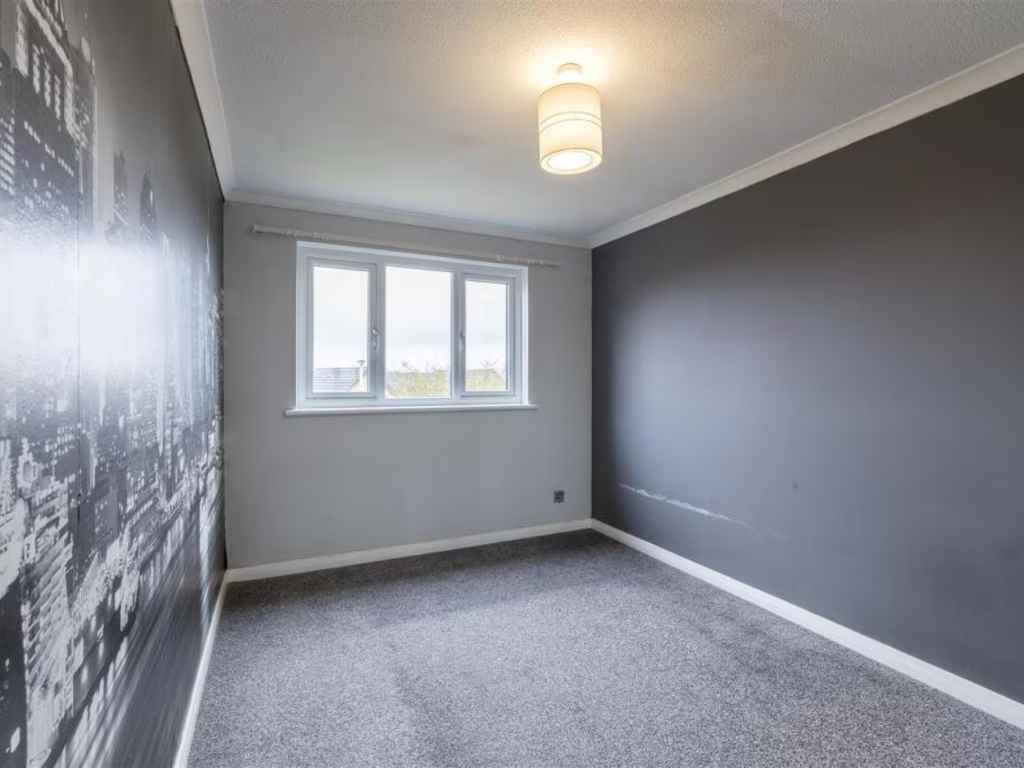
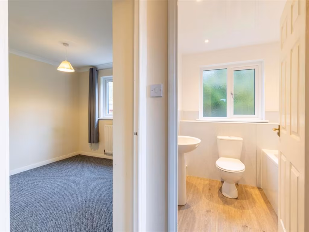
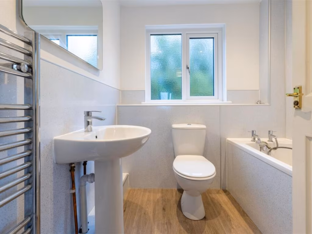
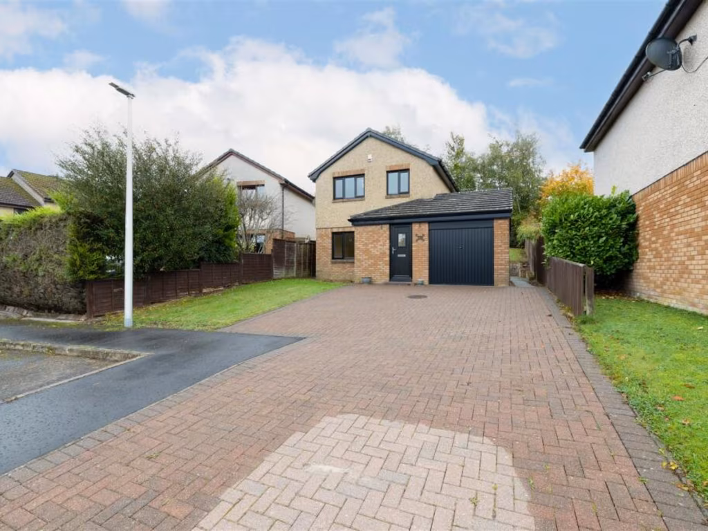
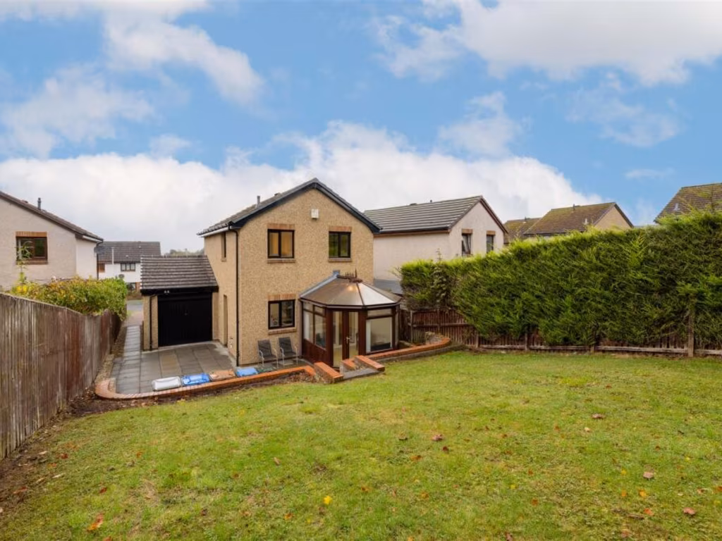
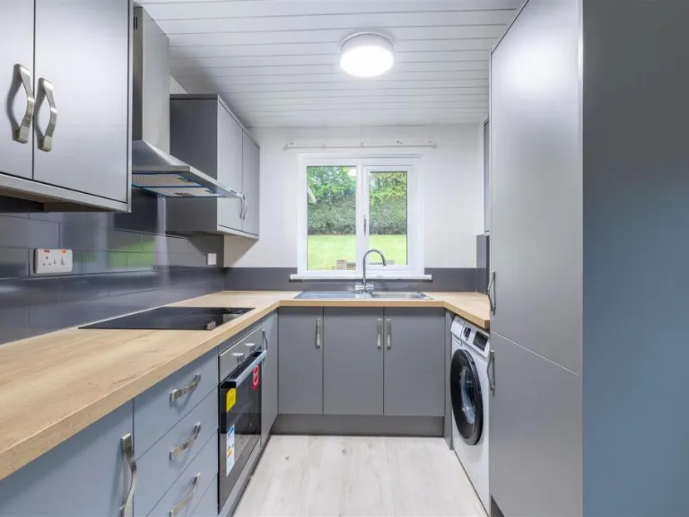
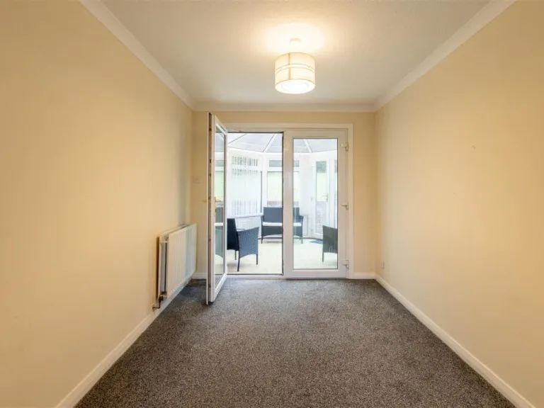
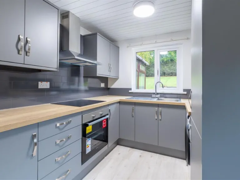
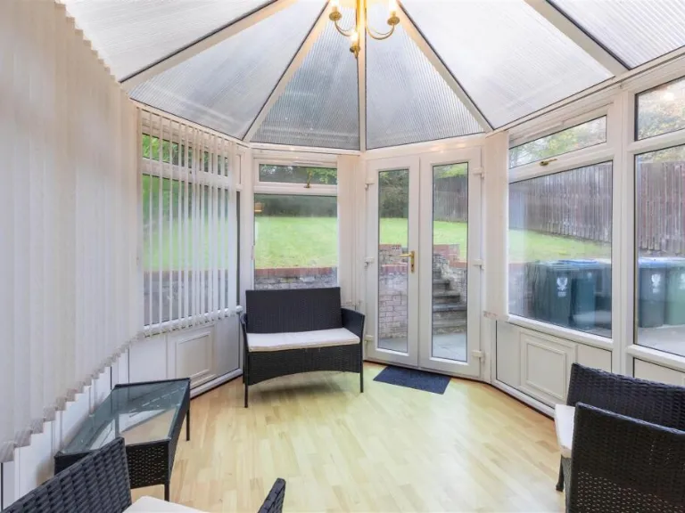
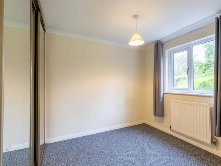
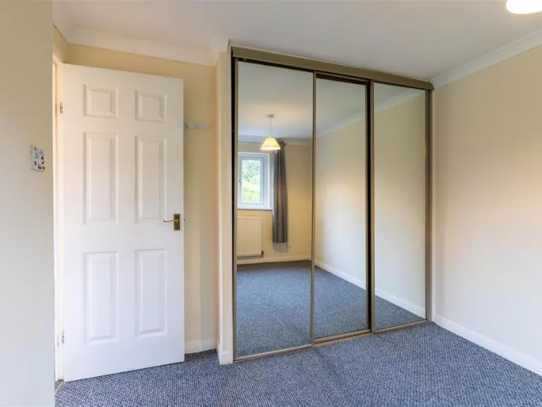
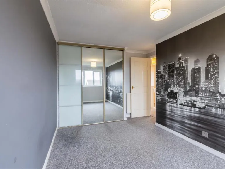
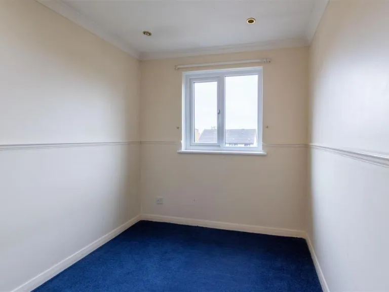
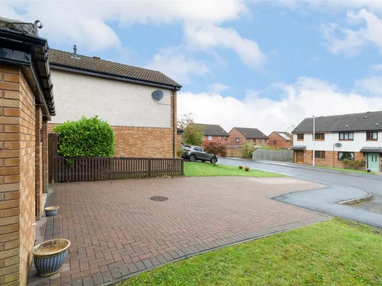
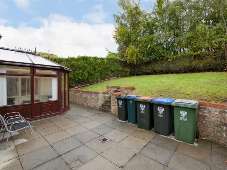
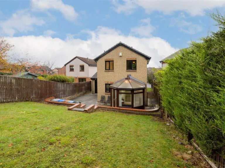
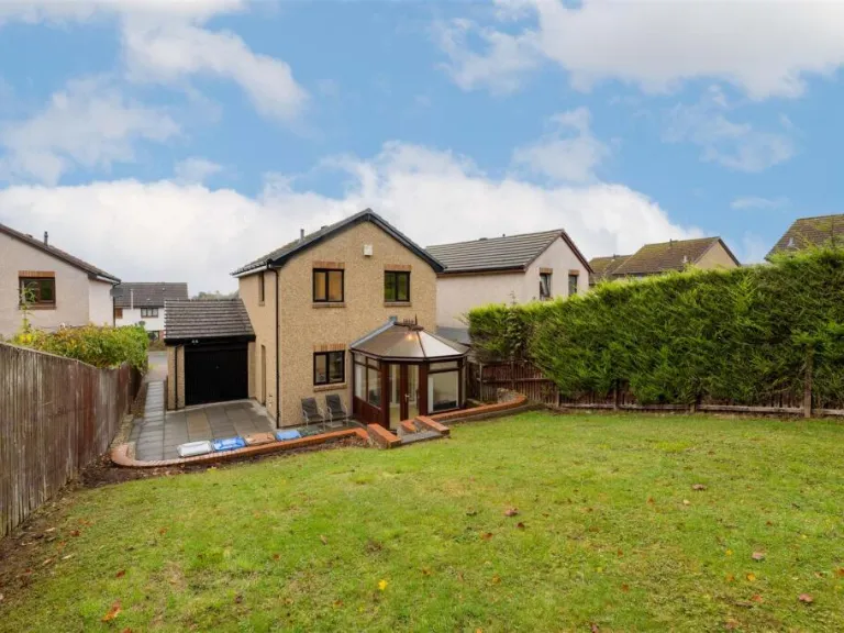
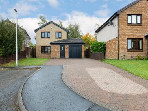
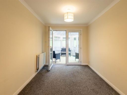
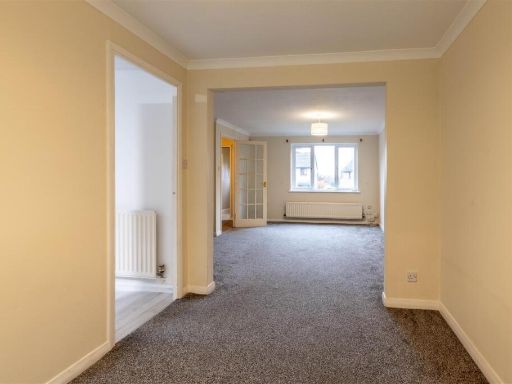
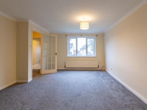
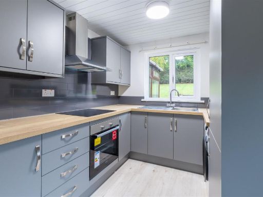
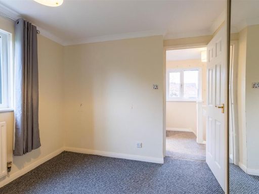
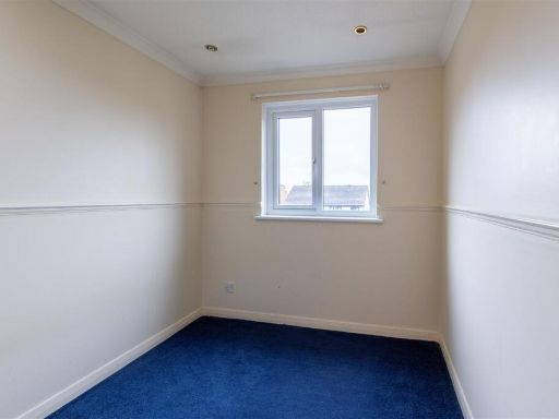
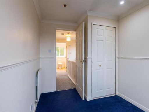
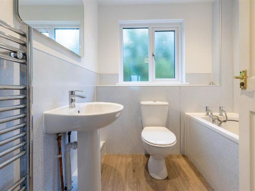
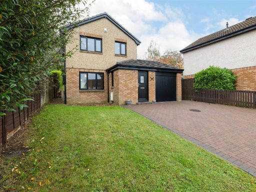
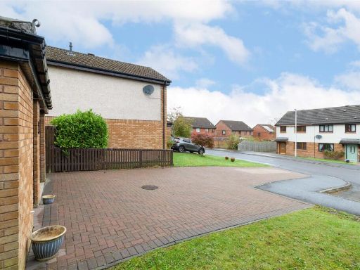
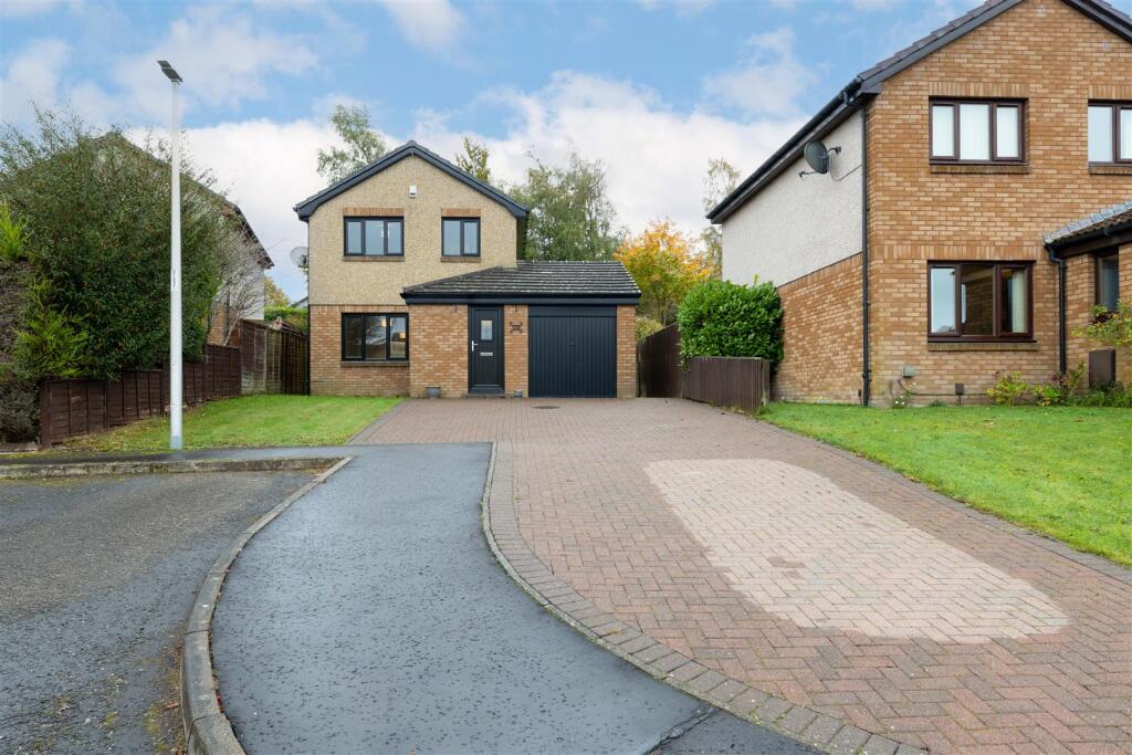
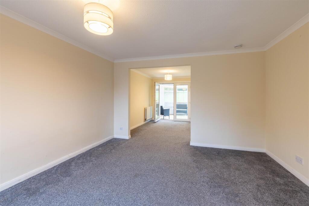
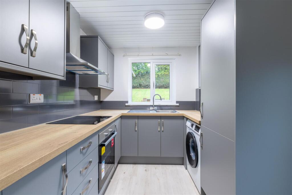
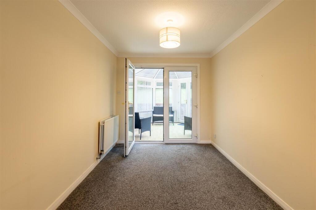
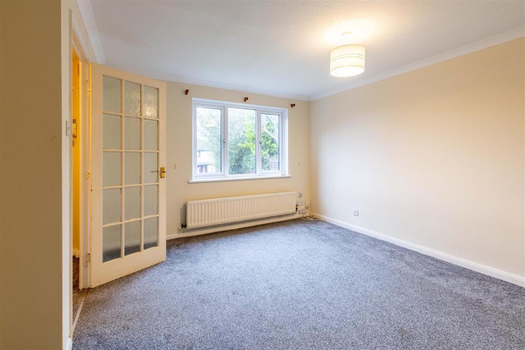
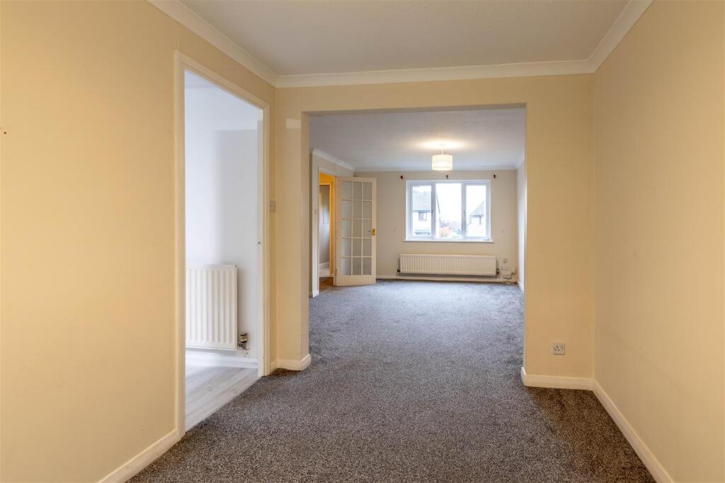
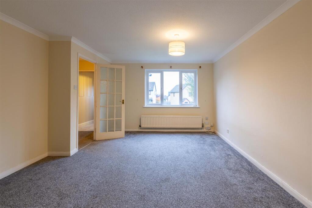
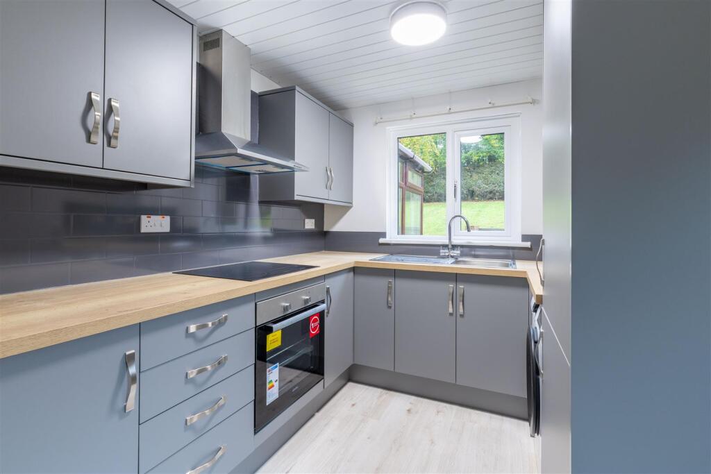
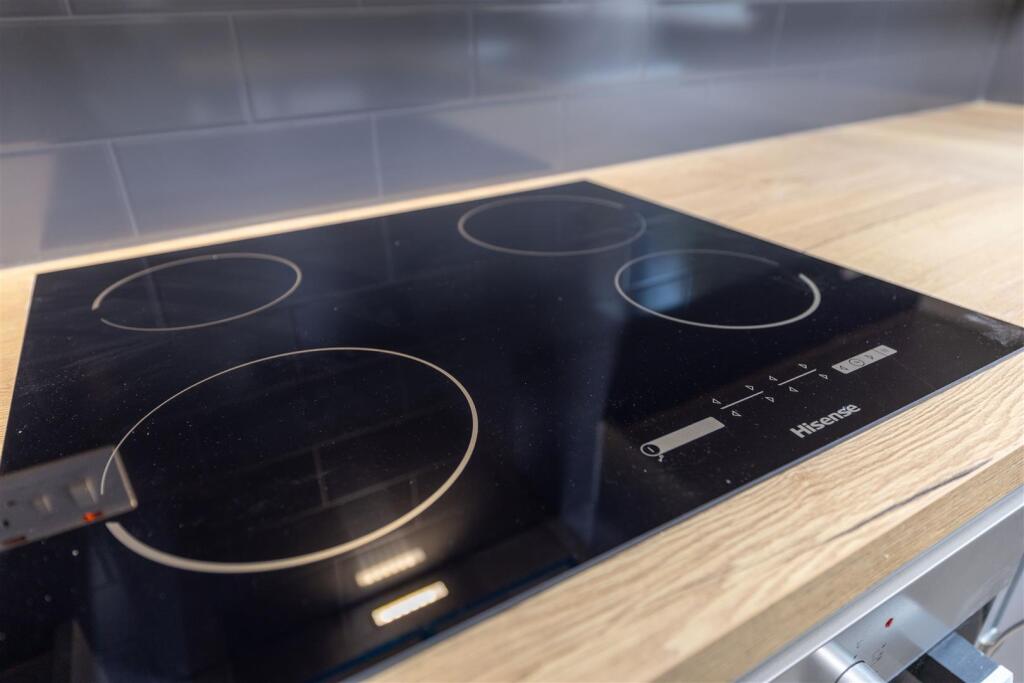
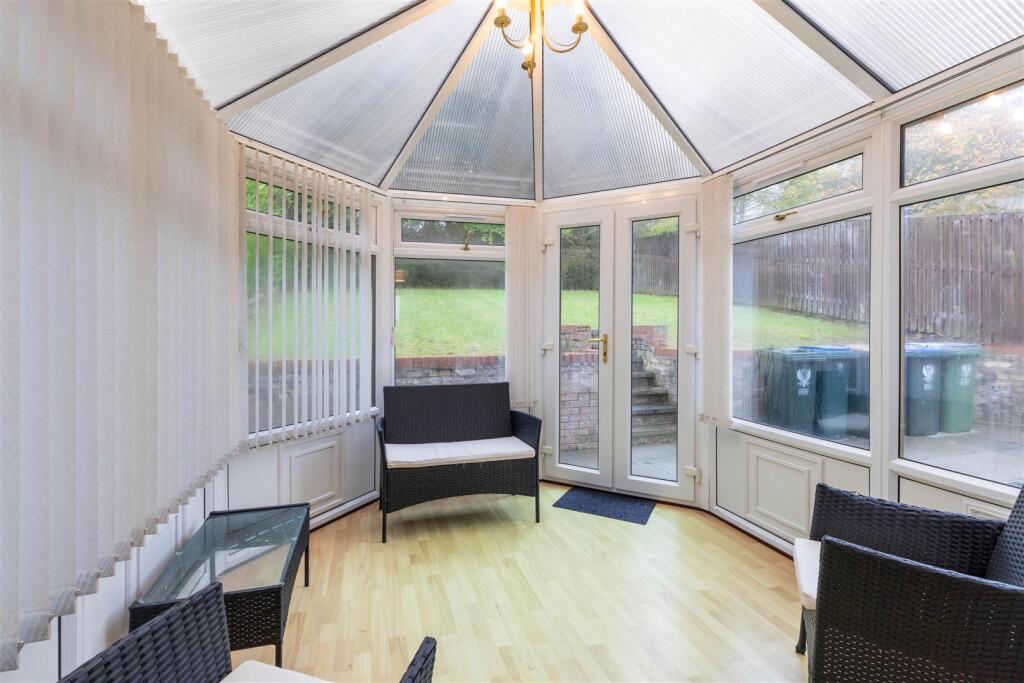
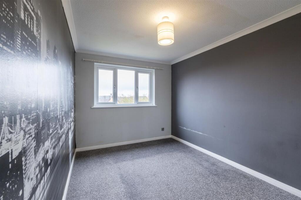
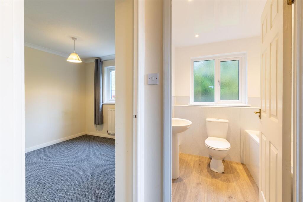
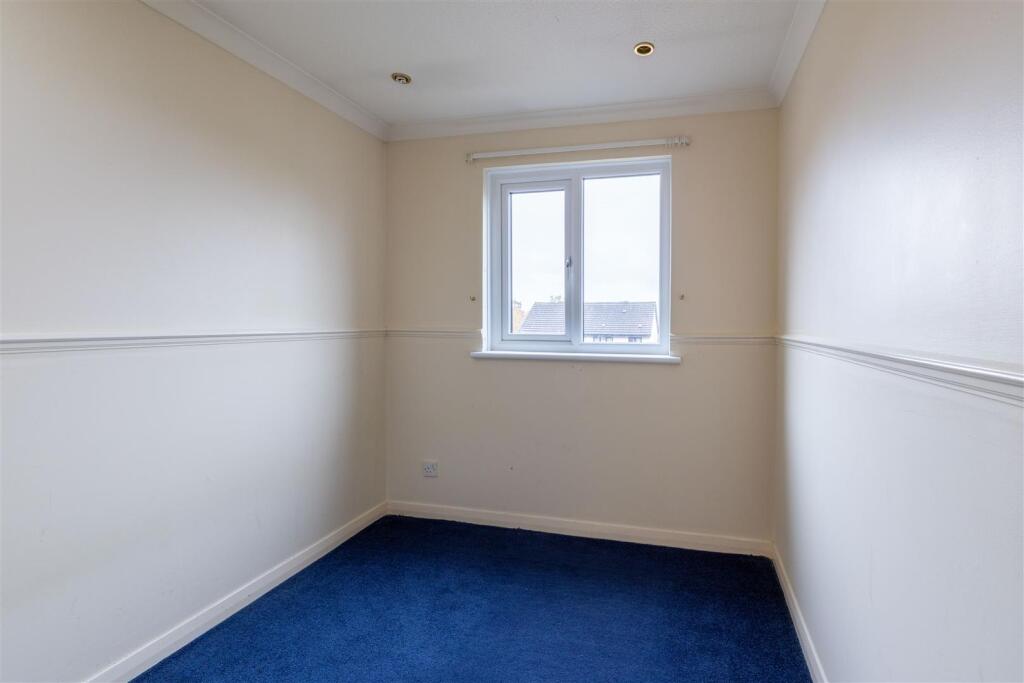
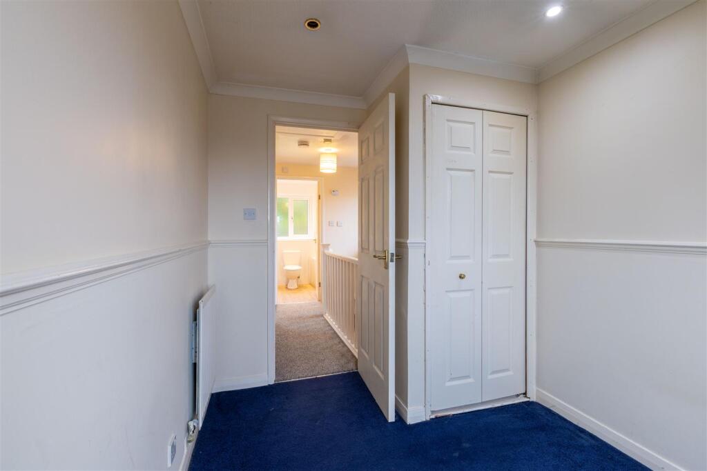
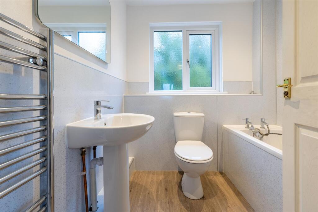
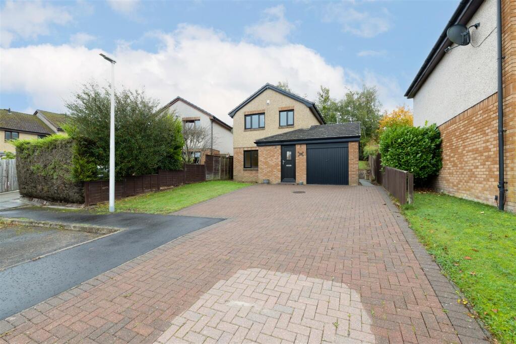
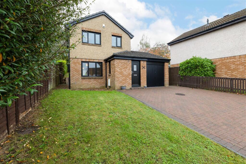
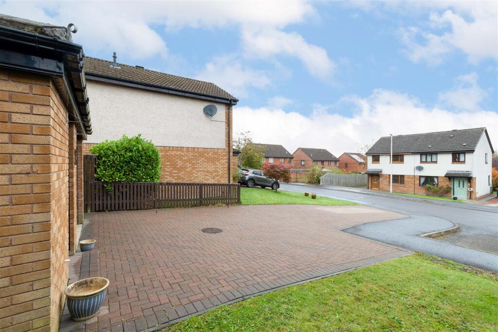
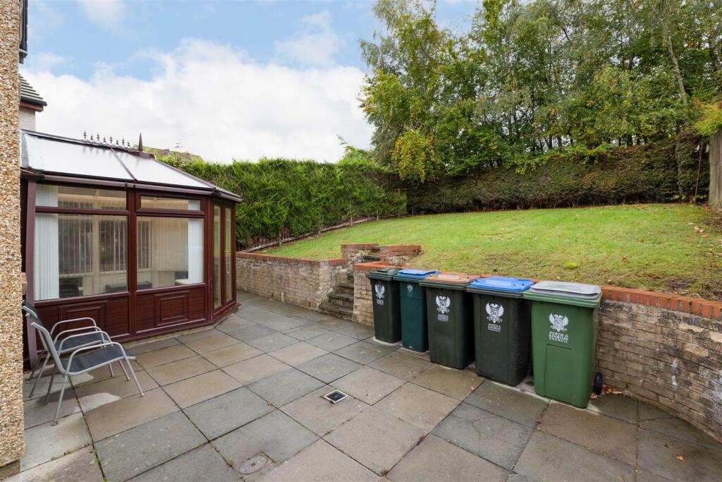
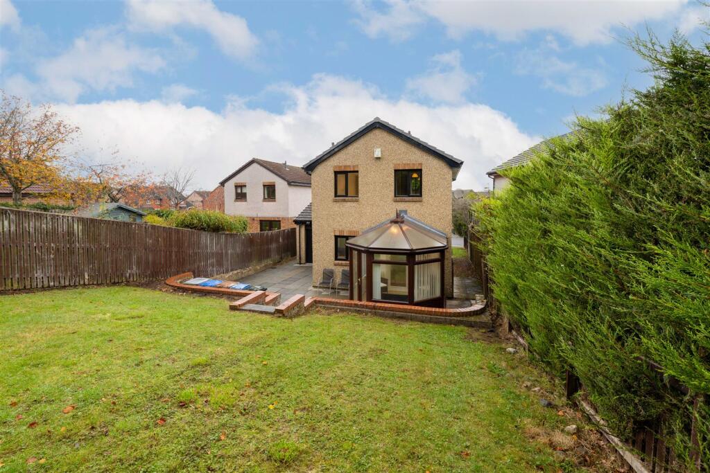
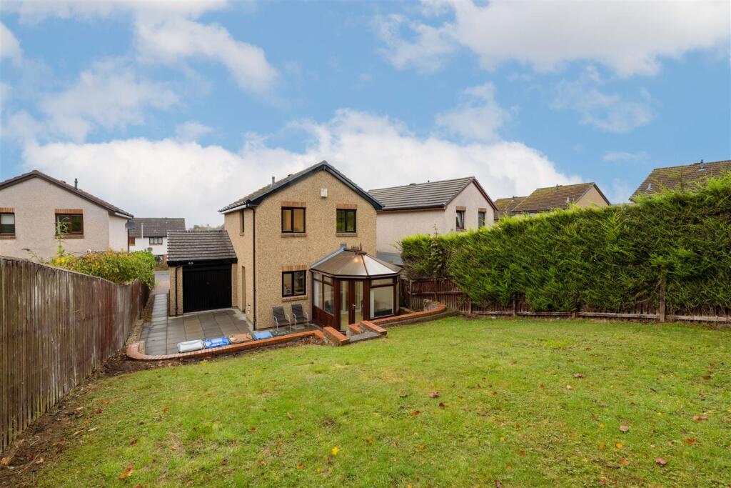
- Two-storey detached family house situated on a substantial corner/through plot. Accommodation configured over ground and first floor comprises a bright front-facing living room flowing to a dining area, a newly fitted modern kitchen with integrated appliances, a conservatory providing direct access to the private rear garden, a ground-floor WC and a contemporary family bathroom upstairs serving three well-proportioned bedrooms. Externally the property benefits from a private block-paved driveway leading to an attached garage, off-street parking for multiple vehicles and a rear garden that is mainly lawn with a patio area — suitable for outdoor dining and family use. Recent upgrades noted (new kitchen, new windows/doors, new facias/soffits/guttering) and an EPC rating indicated as C. Overall plot size is sizable, internal living space appears average for a three-bedroom detached home and the property is described as an ideal family home with easy access to local amenities and transport links.
- Mid‑terrace/semi‑detached style two‑storey family house (as shown on the floorplan) arranged over ground and first floors. Accommodation includes an entrance vestibule, living room, separate dining room leading to a conservatory, fitted kitchen, and an attached garage on the ground floor; three bedrooms and a family bathroom at first floor. The property benefits from a conservatory at the rear and a small to average rear garden. Overall internal living area is typical of a three‑bedroom suburban house (average size). The condition appears tidy but basic — neutral decoration, new(er) kitchen fittings shown, carpets in living areas and heating via radiators. Energy performance indicators on the brochure show fairly good ratings (mid 70s). Suitable for owner‑occupation or as a buy‑to‑let; broadly average plot size for the area with modest external amenity space.
Image Descriptions
- detached house modern
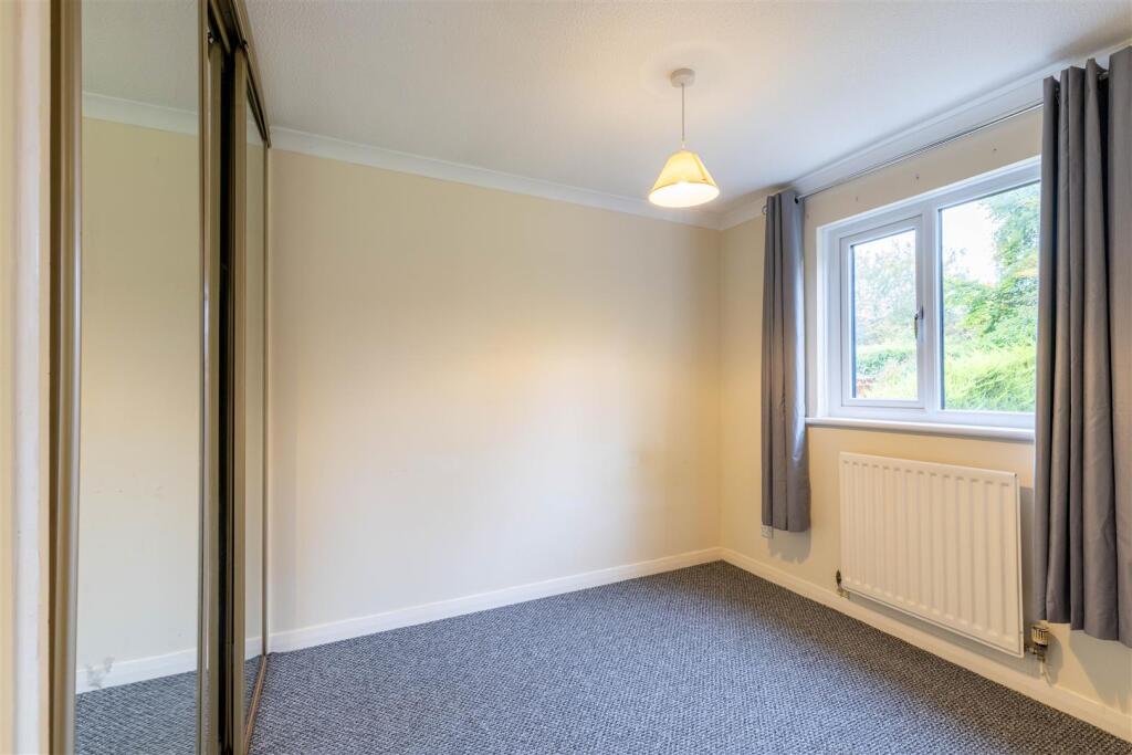
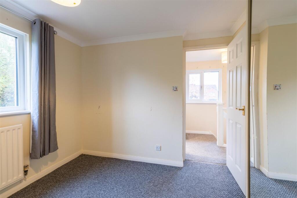
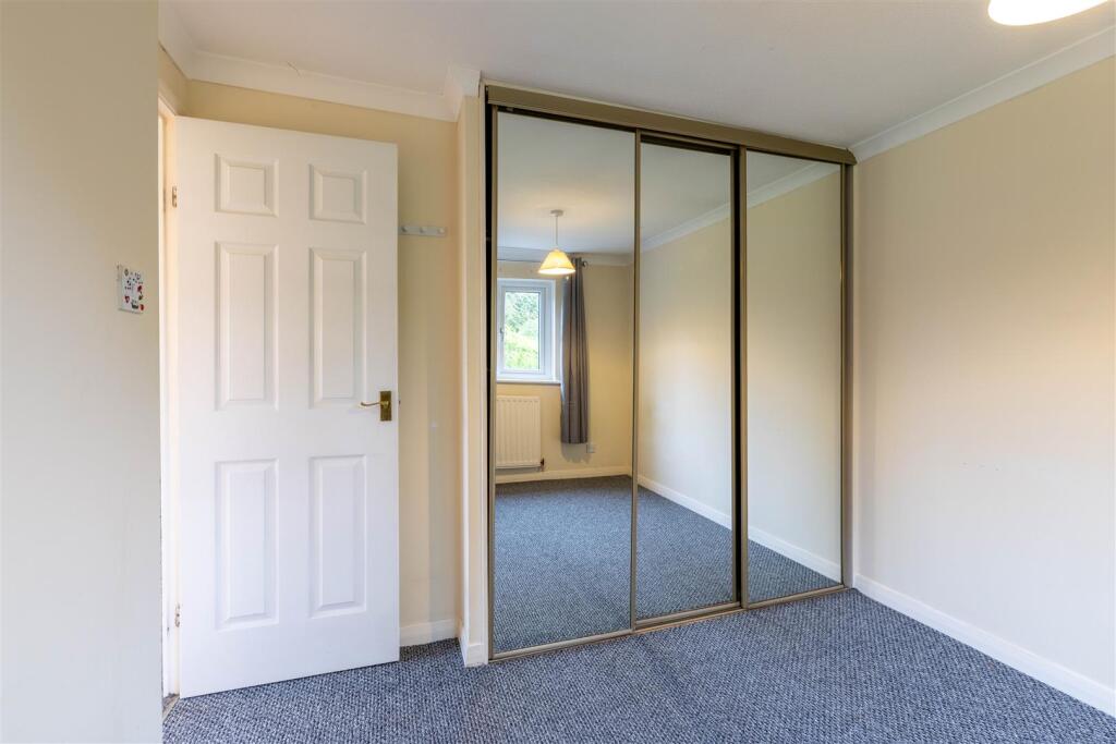
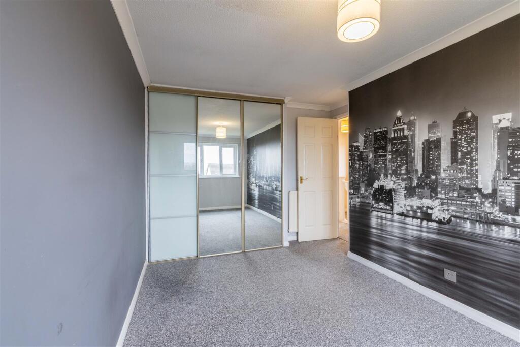
- living room modern
Floorplan Description
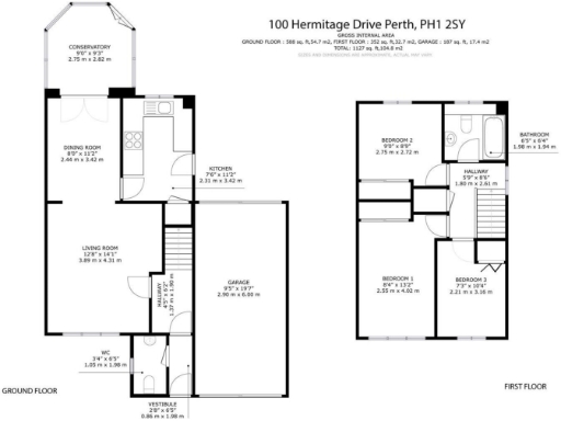
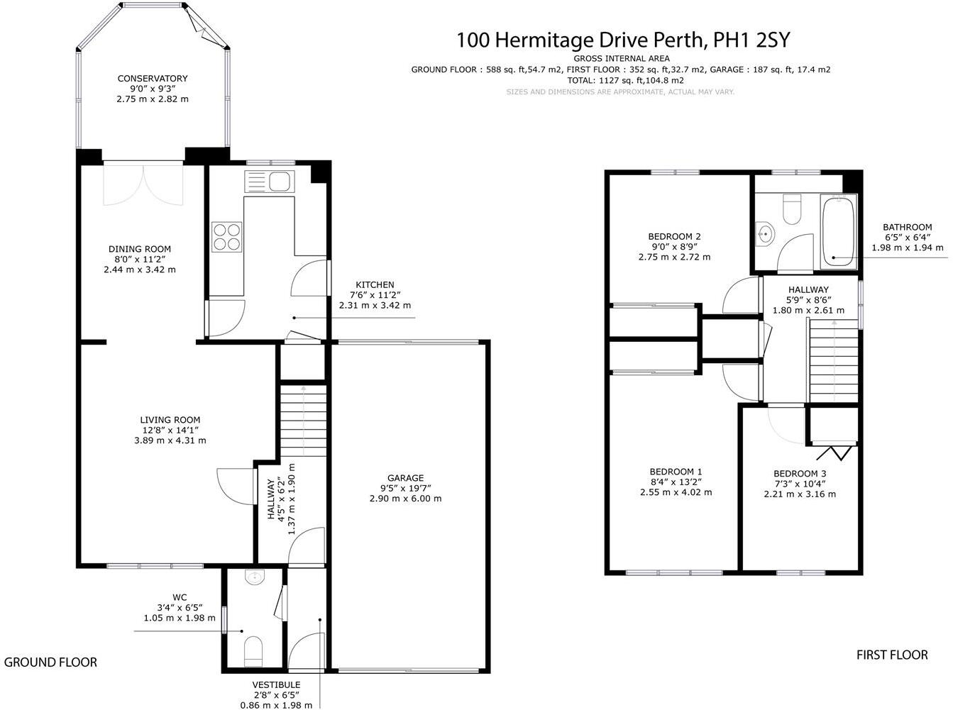
- Two-storey house with garage (garage excluded from internal area).
Rooms
- CONSERVATORY:
- DINING ROOM:
- KITCHEN:
- LIVING ROOM:
- HALLWAY:
- WC:
- VESTIBULE:
- BEDROOM 2:
- BATHROOM:
- HALLWAY:
- BEDROOM 1:
- BEDROOM 3:
Textual Property Features
Detected Visual Features
- detached house
- modern
- garage
- block driveway
- manicured lawn
- residential area
- two-story
- modern living room
- neutral colors
- carpet flooring
- standard ceiling height
- medium room size
- double door
- conservatory
- potential damp
Nearest General Shops
- Id: 3510219459
- Tags:
- Addr:
- City: Perth
- Housenumber: 189
- Postcode: PH1 2DP
- Street: Rannoch Road
- Fixme: This store is not on the McColls store finder. It appears to have changed to 'Shop Local Letham'. Needs a survey.
https://www.facebook.com/profile.php?id=100078133382066
- Name: Shop Local Letham
- Shop: newsagent
- TagsNormalized:
- Lat: 56.4016851
- Lon: -3.4707653
- FullGeoHash: gfj8c58etk1u
- PartitionGeoHash: gfj8
- Images:
- FoodStandards: null
- Distance: 590.1
,- Id: 3510219443
- Tags:
- Addr:
- City: Perth
- Housenumber: 199
- Postcode: PH1 2DP
- Street: Rannoch Road
- Fhrs:
- Name: Bayne's
- Shop: bakery
- TagsNormalized:
- Lat: 56.4017607
- Lon: -3.4714463
- FullGeoHash: gfj8c58hj6np
- PartitionGeoHash: gfj8
- Images:
- FoodStandards:
- Id: 801759
- FHRSID: 801759
- LocalAuthorityBusinessID: R115P3199R/1
- BusinessName: Bayne's Bakers
- BusinessType: Takeaway/sandwich shop
- BusinessTypeID: 7844
- AddressLine1: null
- AddressLine2: 199 Rannoch Road
- AddressLine3: Perth
- AddressLine4: null
- PostCode: PH1 2DP
- RatingValue: Pass
- RatingKey: fhis_pass_en-GB
- RatingDate: 2022-10-31
- LocalAuthorityCode: 786
- LocalAuthorityName: Perth and Kinross
- LocalAuthorityWebSite: http://www.pkc.gov.uk/Business+and+trade/Health+and+safety/Health+and+safety+-+food/Food+hygiene/Food+hygiene+information/Food+Hygiene+Information.htm
- LocalAuthorityEmailAddress: ES@pkc.gov.uk
- Scores:
- Hygiene: null
- Structural: null
- ConfidenceInManagement: null
- NewRatingPending: false
- Geocode:
- Longitude: -3.47100300000000
- Latitude: 56.40185100000000
- Distance: 552.5
,- Id: 7154652107
- Tags:
- Beauty: tanning
- Shop: beauty
- TagsNormalized:
- Lat: 56.4019945
- Lon: -3.4728932
- FullGeoHash: gfj8bgxj7tz4
- PartitionGeoHash: gfj8
- Images:
- FoodStandards: null
- Distance: 478.9
}
Nearest Grocery shops
- Id: 4527134162
- Tags:
- Addr:
- City: Perth
- Postcode: PH1 2PW
- Street: Tulloch Square
- Fhrs:
- Name: The Co-operative Food
- Shop: convenience
- TagsNormalized:
- the co-operative food
- food
- convenience
- shop
- Lat: 56.4105434
- Lon: -3.4623719
- FullGeoHash: gfj8cjnz0zkq
- PartitionGeoHash: gfj8
- Images:
- FoodStandards: null
- Distance: 1579.1
,- Id: 801784965
- Tags:
- Addr:
- Building: yes
- Name: Tainsh Grocers
- Operator: Tainsh Grocers
- Shop: convenience
- TagsNormalized:
- Lat: 56.4002108
- Lon: -3.4603354
- FullGeoHash: gfj8c727036f
- PartitionGeoHash: gfj8
- Images:
- FoodStandards: null
- Distance: 1208.6
,- Id: 1280568879
- Tags:
- Addr:
- City: Perth
- Housenumber: 12
- Postcode: PH1 1QZ
- Street: West Mains Avenue
- Brand: Co-op Food
- Brand:wikidata: Q3277439
- Brand:wikipedia: en:Co-op Food
- Fhrs:
- Name: Co-op Food
- Operator: The Co-operative Group
- Operator:wikidata: Q117202
- Shop: convenience
- TagsNormalized:
- co-op
- co-op food
- food
- convenience
- shop
- Lat: 56.3978144
- Lon: -3.4814957
- FullGeoHash: gfj8bfbv568e
- PartitionGeoHash: gfj8
- Images:
- FoodStandards: null
- Distance: 282.2
}
Nearest Religious buildings
- Id: 56271995
- Tags:
- Addr:
- Postcode: PH1 2JP
- Street: Struan Road
- Amenity: place_of_worship
- Building: yes
- Denomination: catholic
- Name: Our Lady of Lourdes
- Religion: christian
- TagsNormalized:
- place of worship
- catholic
- christian
- church
- Lat: 56.4044442
- Lon: -3.47283
- FullGeoHash: gfj8bup5tnqr
- PartitionGeoHash: gfj8
- Images:
- FoodStandards: null
- Distance: 644.3
,- Id: 621207832
- Tags:
- Addr:
- City: Perth
- Postcode: PH1 1LH
- Street: Burghmuir Street
- Amenity: place_of_worship
- Building: yes
- Denomination: mormon
- Name: The Church of Jesus Christ of Latter-day Saints
- Religion: christian
- TagsNormalized:
- place of worship
- mormon
- church
- christian
- Lat: 56.3986104
- Lon: -3.4701637
- FullGeoHash: gfj8c511eqfr
- PartitionGeoHash: gfj8
- Images:
- FoodStandards: null
- Distance: 629.4
,- Id: 55886208
- Tags:
- Addr:
- City: Perth
- Housenumber: 14
- Postcode: PH1 1QQ
- Street: Almond View
- Amenity: place_of_worship
- Building: church
- Denomination: baptist
- Name: Perth Baptist Church
- Religion: christian
- Website: https://perthbaptistchurch.org.uk/
- TagsNormalized:
- place of worship
- church
- baptist
- christian
- Lat: 56.3970661
- Lon: -3.4821439
- FullGeoHash: gfj8bfb2spj7
- PartitionGeoHash: gfj8
- Images:
- FoodStandards: null
- Distance: 374.1
}
Nearest Medical buildings
- Id: 737241671
- Tags:
- TagsNormalized:
- Lat: 56.3962678
- Lon: -3.4524378
- FullGeoHash: gfj8c6wh067c
- PartitionGeoHash: gfj8
- Images:
- FoodStandards: null
- Distance: 1750.4
,- Id: 59453979
- Tags:
- Addr:
- City: Perth
- Postcode: PH1 1NX
- Amenity: hospital
- Emergency: yes
- Fhrs:
- Healthcare: hospital
- Name: Perth Royal Infirmary
- Source: GPS, OS_OpenData_StreetView, NHS Website
- Wikidata: Q7170888
- Wikipedia: en:Perth Royal Infirmary
- TagsNormalized:
- Lat: 56.39617
- Lon: -3.4548306
- FullGeoHash: gfj8c6s7885d
- PartitionGeoHash: gfj8
- Images:
- FoodStandards:
- Id: 924277
- FHRSID: 924277
- LocalAuthorityBusinessID: R128P3TAYM/1
- BusinessName: Perth Royal Infirmary
- BusinessType: Hospitals/Childcare/Caring Premises
- BusinessTypeID: 5
- AddressLine1: Perth Royal Infirmary
- AddressLine2: Taymount Terrace
- AddressLine3: Perth
- AddressLine4: null
- PostCode: PH1 1NX
- RatingValue: Pass
- RatingKey: fhis_pass_en-GB
- RatingDate: 2022-06-29
- LocalAuthorityCode: 786
- LocalAuthorityName: Perth and Kinross
- LocalAuthorityWebSite: http://www.pkc.gov.uk/Business+and+trade/Health+and+safety/Health+and+safety+-+food/Food+hygiene/Food+hygiene+information/Food+Hygiene+Information.htm
- LocalAuthorityEmailAddress: ES@pkc.gov.uk
- Scores:
- Hygiene: null
- Structural: null
- ConfidenceInManagement: null
- NewRatingPending: false
- Geocode:
- Longitude: -3.45296900000000
- Latitude: 56.39634900000000
- Distance: 1611.2
,- Id: 6944016964
- Tags:
- Amenity: dentist
- Healthcare: dentist
- Name: Broxden Dental Centre
- TagsNormalized:
- dentist
- health
- healthcare
- dental
- Lat: 56.39122
- Lon: -3.4863587
- FullGeoHash: gfj8b9tq9vqd
- PartitionGeoHash: gfj8
- Images:
- FoodStandards: null
- Distance: 1073.9
,- Id: 1280560560
- Tags:
- Addr:
- Amenity: pharmacy
- Brand: Well Pharmacy
- Brand:wikidata: Q7726524
- Brand:wikipedia: en:Well Pharmacy
- Dispensing: yes
- Healthcare: pharmacy
- Name: Well Pharmacy
- TagsNormalized:
- pharmacy
- well pharmacy
- health
- healthcare
- Lat: 56.4016998
- Lon: -3.4709018
- FullGeoHash: gfj8c58ednuh
- PartitionGeoHash: gfj8
- Images:
- FoodStandards: null
- Distance: 582.5
}
Nearest Leisure Facilities
- Id: 1013377961
- Tags:
- TagsNormalized:
- Lat: 56.3995013
- Lon: -3.4728898
- FullGeoHash: gfj8bgpngv19
- PartitionGeoHash: gfj8
- Images:
- FoodStandards: null
- Distance: 443.1
,- Id: 3510219456
- Tags:
- TagsNormalized:
- Lat: 56.4015797
- Lon: -3.4859167
- FullGeoHash: gfj8beteh280
- PartitionGeoHash: gfj8
- Images:
- FoodStandards: null
- Distance: 396.1
,- Id: 342989766
- Tags:
- TagsNormalized:
- Lat: 56.4023451
- Lon: -3.4823316
- FullGeoHash: gfj8bg8prz1m
- PartitionGeoHash: gfj8
- Images:
- FoodStandards: null
- Distance: 278.3
,- Id: 950163708
- Tags:
- TagsNormalized:
- Lat: 56.4023187
- Lon: -3.4822572
- FullGeoHash: gfj8bg8r3d2b
- PartitionGeoHash: gfj8
- Images:
- FoodStandards: null
- Distance: 273.4
,- Id: 950163385
- Tags:
- TagsNormalized:
- Lat: 56.4000262
- Lon: -3.4786494
- FullGeoHash: gfj8bg6cvwgj
- PartitionGeoHash: gfj8
- Images:
- FoodStandards: null
- Distance: 84.1
}
Nearest Tourist attractions
- Id: 3488098674
- Tags:
- Name: Perth Youth Hostel
- Note: only open summer months
- Operator: SYHA
- Phone: +44 1738 877800
- Tourism: hostel
- Website: https://www.syha.org.uk/where-to-stay/lowlands/perth.aspx
- TagsNormalized:
- Lat: 56.4051593
- Lon: -3.4593674
- FullGeoHash: gfj8ck0zygu9
- PartitionGeoHash: gfj8
- Images:
- FoodStandards: null
- Distance: 1382.4
,- Id: 59464569
- Tags:
- Addr:
- City: Perth
- Housename: Huntingtower Castle
- Postcode: PH1 3JT
- Street: Crieff Road
- Alt_name: Ruthven Castle
- Building: yes
- Castle_type: defensive
- Historic: castle
- Name: Huntingtower Castle
- Name:it: Castello di Huntingtower
- Name:pt: Castelo Huntingtower
- Phone: +44 1738 627231
- Source: OS_OpenData_StreetView
- Tourism: attraction
- Wikidata: Q2475039
- Wikipedia: en:Huntingtower Castle
- TagsNormalized:
- Lat: 56.4094577
- Lon: -3.4881863
- FullGeoHash: gfj8bt5bzm5f
- PartitionGeoHash: gfj8
- Images:
- FoodStandards: null
- Distance: 1145.8
,- Id: 128888649
- Tags:
- Fee: yes
- Name: Noah's Ark Caravan Park
- Power_supply: yes
- Tents: yes
- Tourism: caravan_site
- Website: https://www.noahsarkcaravanpark.co.uk/
- TagsNormalized:
- Lat: 56.3980271
- Lon: -3.4904475
- FullGeoHash: gfj8bdfq6dm8
- PartitionGeoHash: gfj8
- Images:
- FoodStandards: null
- Distance: 688.5
}
Nearest Bus stations and stops
- Id: 8011244570
- Tags:
- Bus: yes
- Highway: bus_stop
- Name: Upper Rannoch Roundabout (opp)
- Public_transport: platform
- Ref: 73725326
- TagsNormalized:
- Lat: 56.4018385
- Lon: -3.4758712
- FullGeoHash: gfj8bgsuw2dx
- PartitionGeoHash: gfj8
- Images:
- FoodStandards: null
- Distance: 310.9
,- Id: 8010965994
- Tags:
- Bus: yes
- Highway: bus_stop
- Name: Upper Rannoch Roundabout (at)
- Public_transport: platform
- Ref: 73723232
- TagsNormalized:
- Lat: 56.401799
- Lon: -3.4764251
- FullGeoHash: gfj8bgss33ms
- PartitionGeoHash: gfj8
- Images:
- FoodStandards: null
- Distance: 281.1
,- Id: 8038208785
- Tags:
- Bus: yes
- Highway: bus_stop
- Name: Campsie Road
- Public_transport: platform
- TagsNormalized:
- Lat: 56.3993442
- Lon: -3.4759032
- FullGeoHash: gfj8bghvvxf8
- PartitionGeoHash: gfj8
- Images:
- FoodStandards: null
- Distance: 268.4
,- Id: 8040327119
- Tags:
- Bus: yes
- Highway: bus_stop
- Name: Campsie Road
- Public_transport: platform
- TagsNormalized:
- Lat: 56.3992204
- Lon: -3.4762385
- FullGeoHash: gfj8bghtmb8w
- PartitionGeoHash: gfj8
- Images:
- FoodStandards: null
- Distance: 254.9
,- Id: 8016689119
- Tags:
- Bus: yes
- Highway: bus_stop
- Name: Soutar Crescent
- Public_transport: platform
- TagsNormalized:
- Lat: 56.3980426
- Lon: -3.4812513
- FullGeoHash: gfj8bfcn2vnu
- PartitionGeoHash: gfj8
- Images:
- FoodStandards: null
- Distance: 253.3
}
Nearest Hotels
- Id: 56676652
- Tags:
- Addr:
- City: Perth
- Housenumber: 200
- Postcode: PH1 3AQ
- Street: Dunkeld Road
- Brand: Holiday Inn Express
- Brand:wikidata: Q5880423
- Brand:wikipedia: en:Holiday Inn Express
- Building: hotel
- Building:levels: 3
- Fhrs:
- Name: Holiday Inn Express
- Not:
- Toilets:
- Tourism: hotel
- Wheelchair: yes
- TagsNormalized:
- Lat: 56.4162594
- Lon: -3.4621443
- FullGeoHash: gfj8cnqbw0yp
- PartitionGeoHash: gfj8
- Images:
- FoodStandards: null
- Distance: 2094.9
,- Id: 56251730
- Tags:
- Addr:
- City: Perth
- Postcode: PH2 0PX
- Building: yes
- Name: Travelodge
- Operator: Travelodge
- Tourism: hotel
- TagsNormalized:
- Lat: 56.3877987
- Lon: -3.4829675
- FullGeoHash: gfj8b9pf8zx1
- PartitionGeoHash: gfj8
- Images:
- FoodStandards: null
- Distance: 1392.2
,- Id: 59464573
- Tags:
- Brand: Travelodge
- Brand:wikidata: Q9361374
- Brand:wikipedia: en:Travelodge UK
- Building: yes
- Name: Travelodge
- Tourism: hotel
- TagsNormalized:
- Lat: 56.4064184
- Lon: -3.4861961
- FullGeoHash: gfj8bsmrjwxb
- PartitionGeoHash: gfj8
- Images:
- FoodStandards: null
- Distance: 789.4
}
Tags
- detached house
- modern
- garage
- block driveway
- manicured lawn
- residential area
- two-story
- modern living room
- neutral colors
- carpet flooring
- standard ceiling height
- medium room size
- double door
- conservatory
- potential damp
Local Market Stats
- Average Price/sqft: £188
- Rental Yield: 4.9%
- Planning Success Rate: 100%
Similar Properties
 3 bedroom semi-detached house for sale in Ritchie Place, Perth, PH1 — £199,950 • 3 bed • 1 bath • 778 ft²
 3 bedroom terraced house for sale in Langside Road, Perth, PH1 — £160,000 • 3 bed • 1 bath • 1009 ft²
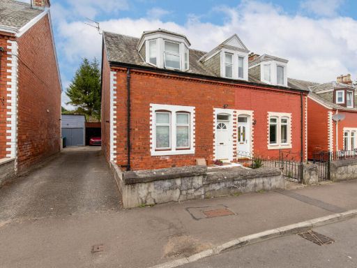 3 bedroom semi-detached house for sale in Unity Terrace, Perth, PH1 — £240,000 • 3 bed • 1 bath • 1391 ft²
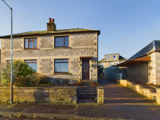 3 bedroom semi-detached house for sale in 6 Pitheavlis Crescent, Perth, PH2 0JY, PH2 — £225,000 • 3 bed • 1 bath • 768 ft²
 3 bedroom semi-detached house for sale in Glasgow Road, Perth, PH2 — £295,000 • 3 bed • 1 bath • 1313 ft²
 3 bedroom detached house for sale in Malvern Terrace, Perth, PH1 — £220,000 • 3 bed • 2 bath • 1184 ft²
Meta
- {
"@context": "https://schema.org",
"@type": "Residence",
"name": "3 bedroom detached house for sale in Hermitage Drive, Perth…",
"description": "",
"url": "https://propertypiper.co.uk/property/a0d376d5-bbae-4ea8-ad27-4ab07e36d168",
"image": "https://image-a.propertypiper.co.uk/aa8b3f40-e83e-4a3e-8a6c-5cd97edcd5a5-1024.jpeg",
"address": {
"@type": "PostalAddress",
"streetAddress": "100, HERMITAGE DRIVE, PERTH",
"postalCode": "PH1 2SY",
"addressLocality": "Perth and Kinross",
"addressRegion": "Perth and North Perthshire",
"addressCountry": "Scotland"
},
"geo": {
"@type": "GeoCoordinates",
"latitude": 56.4002088,
"longitude": -3.479976
},
"numberOfRooms": 3,
"numberOfBathroomsTotal": 1,
"floorSize": {
"@type": "QuantitativeValue",
"value": 940,
"unitCode": "FTK"
},
"offers": {
"@type": "Offer",
"price": 249950,
"priceCurrency": "GBP",
"availability": "https://schema.org/InStock"
},
"additionalProperty": [
{
"@type": "PropertyValue",
"name": "Feature",
"value": "detached house"
},
{
"@type": "PropertyValue",
"name": "Feature",
"value": "modern"
},
{
"@type": "PropertyValue",
"name": "Feature",
"value": "garage"
},
{
"@type": "PropertyValue",
"name": "Feature",
"value": "block driveway"
},
{
"@type": "PropertyValue",
"name": "Feature",
"value": "manicured lawn"
},
{
"@type": "PropertyValue",
"name": "Feature",
"value": "residential area"
},
{
"@type": "PropertyValue",
"name": "Feature",
"value": "two-story"
},
{
"@type": "PropertyValue",
"name": "Feature",
"value": "modern living room"
},
{
"@type": "PropertyValue",
"name": "Feature",
"value": "neutral colors"
},
{
"@type": "PropertyValue",
"name": "Feature",
"value": "carpet flooring"
},
{
"@type": "PropertyValue",
"name": "Feature",
"value": "standard ceiling height"
},
{
"@type": "PropertyValue",
"name": "Feature",
"value": "medium room size"
},
{
"@type": "PropertyValue",
"name": "Feature",
"value": "double door"
},
{
"@type": "PropertyValue",
"name": "Feature",
"value": "conservatory"
},
{
"@type": "PropertyValue",
"name": "Feature",
"value": "potential damp"
}
]
}
High Res Floorplan Images
Compatible Floorplan Images
FloorplanImages Thumbnail