DY8 3TT - 5 bedroom detached house for sale in Bowling Green Road, St…
View on Property Piper
5 bedroom detached house for sale in Bowling Green Road, Stourbridge, DY8 3TT, DY8
Property Details
- Price: £595000
- Bedrooms: 5
- Bathrooms: 3
- Property Type: undefined
- Property SubType: undefined
Brochure Descriptions
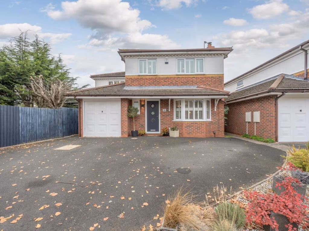
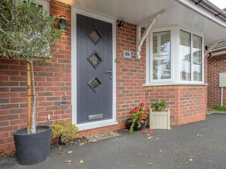
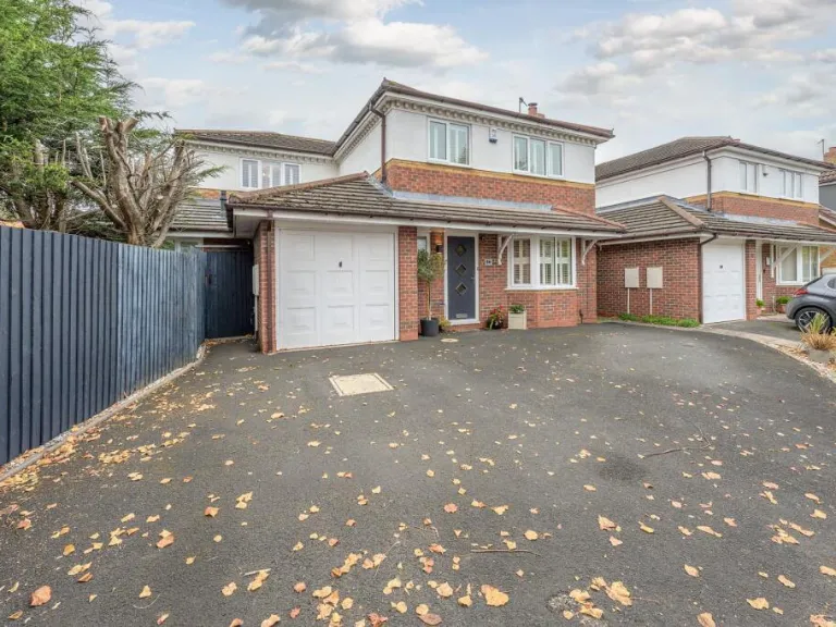
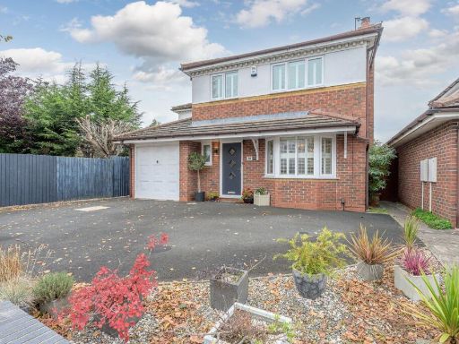
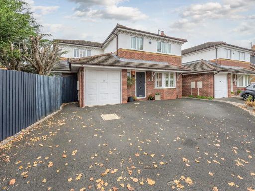
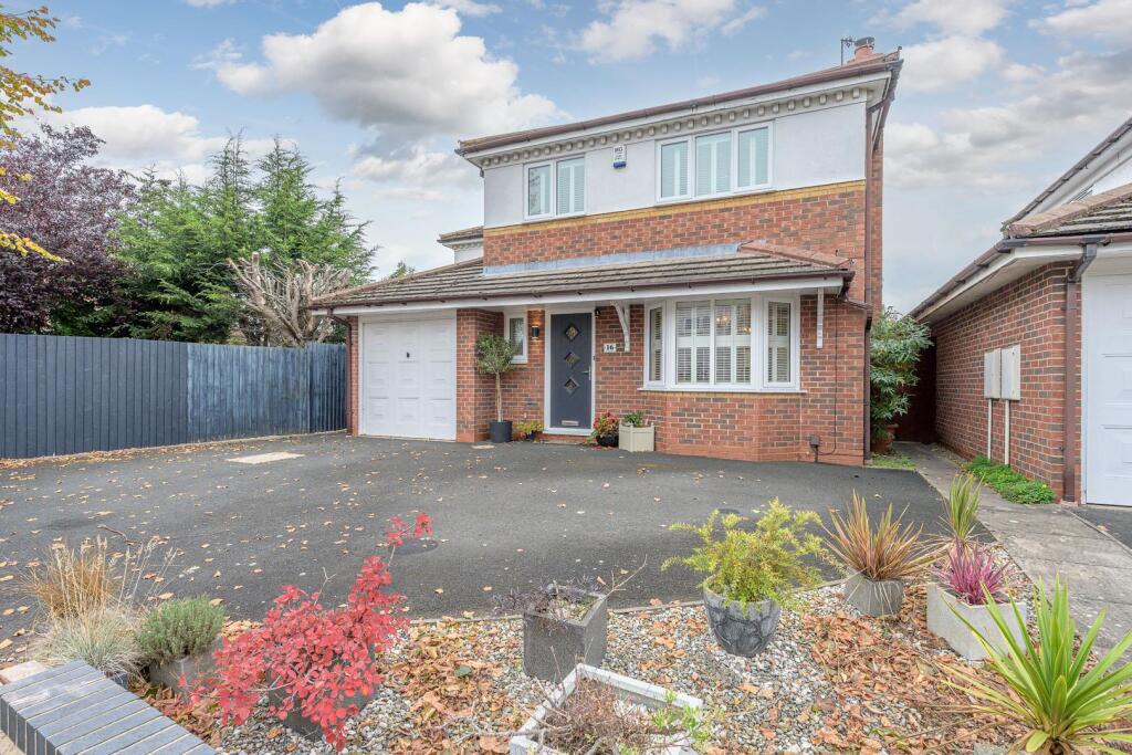
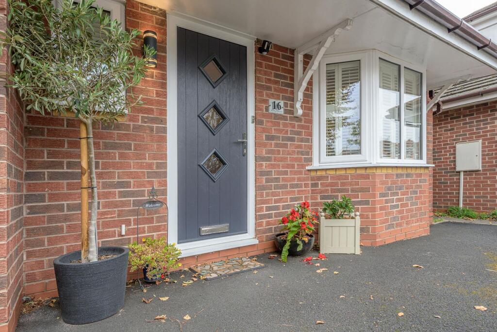
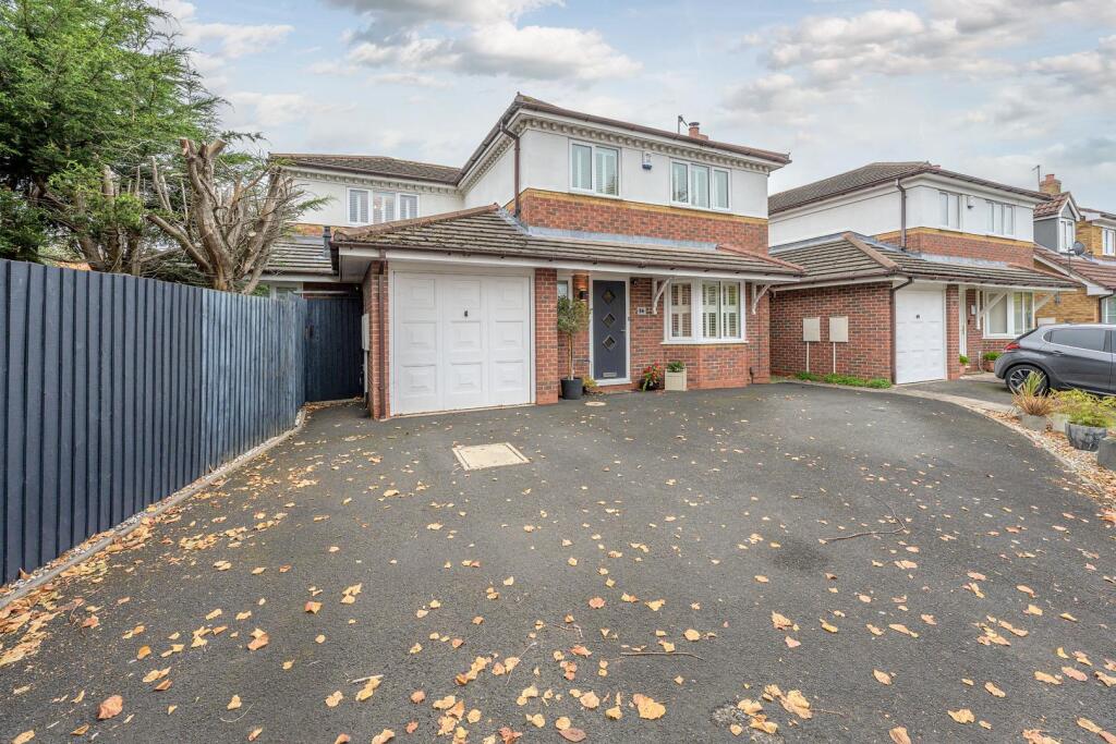
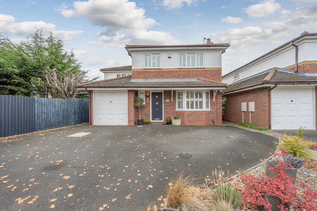
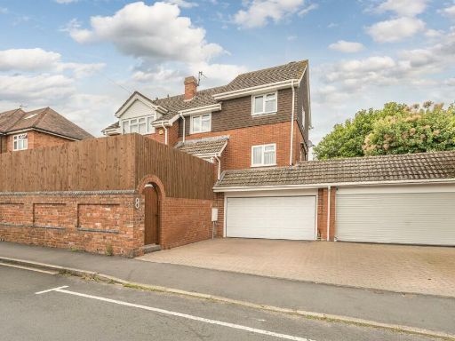
- Detached two-storey suburban family house with integral single garage and large front driveway providing multiple off-street parking spaces. Red-brick construction with rendered upper storey and a covered entrance porch. Bay window to the front reception room and modern front door with adjacent small planted forecourt featuring low-maintenance landscaping. Property footprint and elevation suggest a medium-sized family home (likely 3–4 bedrooms) in good external condition. Front garden area is small/low-maintenance; overall plot appears average for a suburban detached property. No notable long-distance views (street-facing), neighbouring properties close on both sides. Ideal for family occupancy or investment; curb appeal and parking are strong positives.
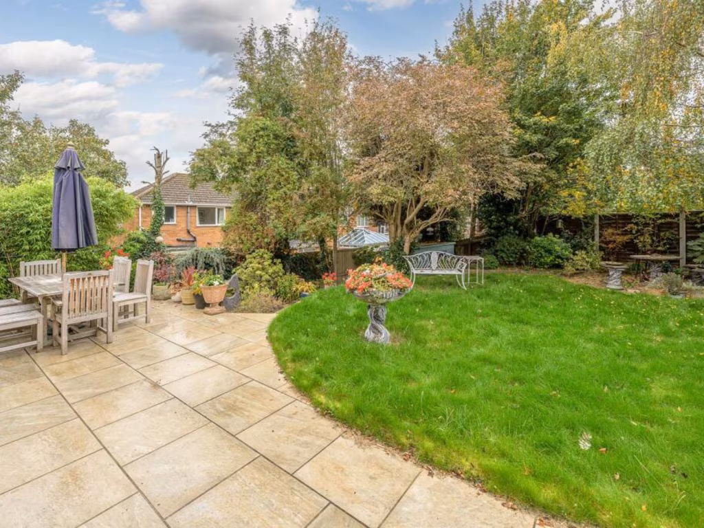
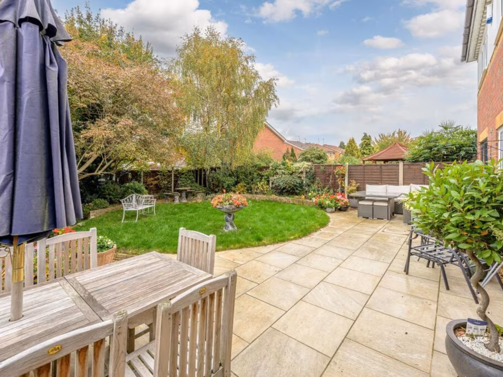
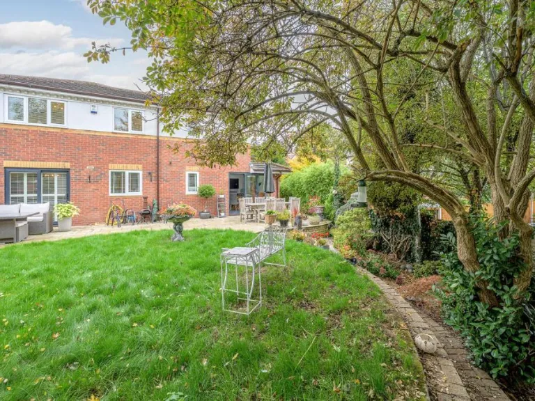
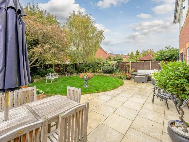
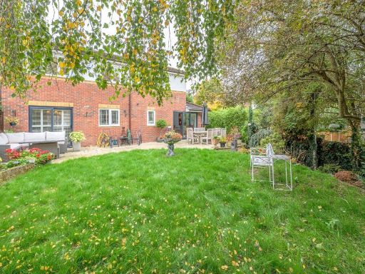
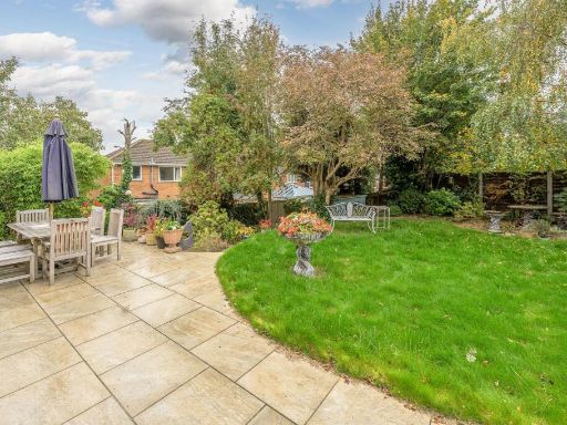
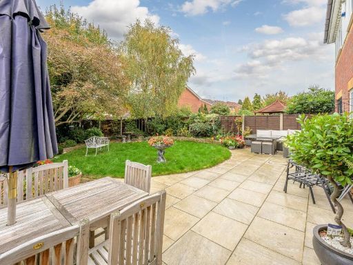
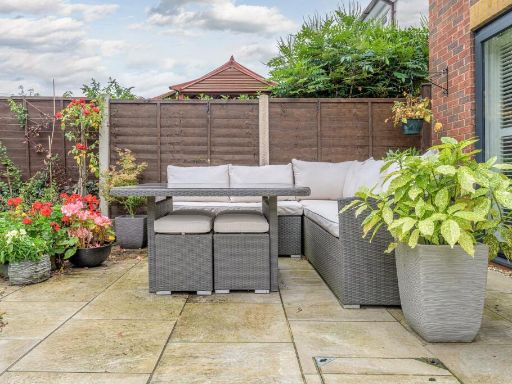
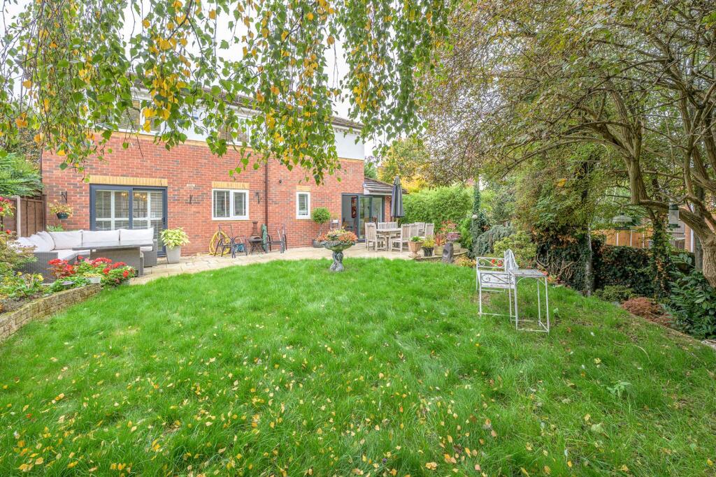
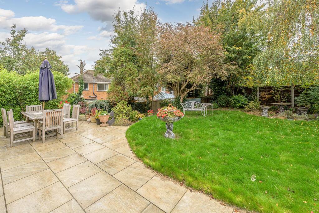
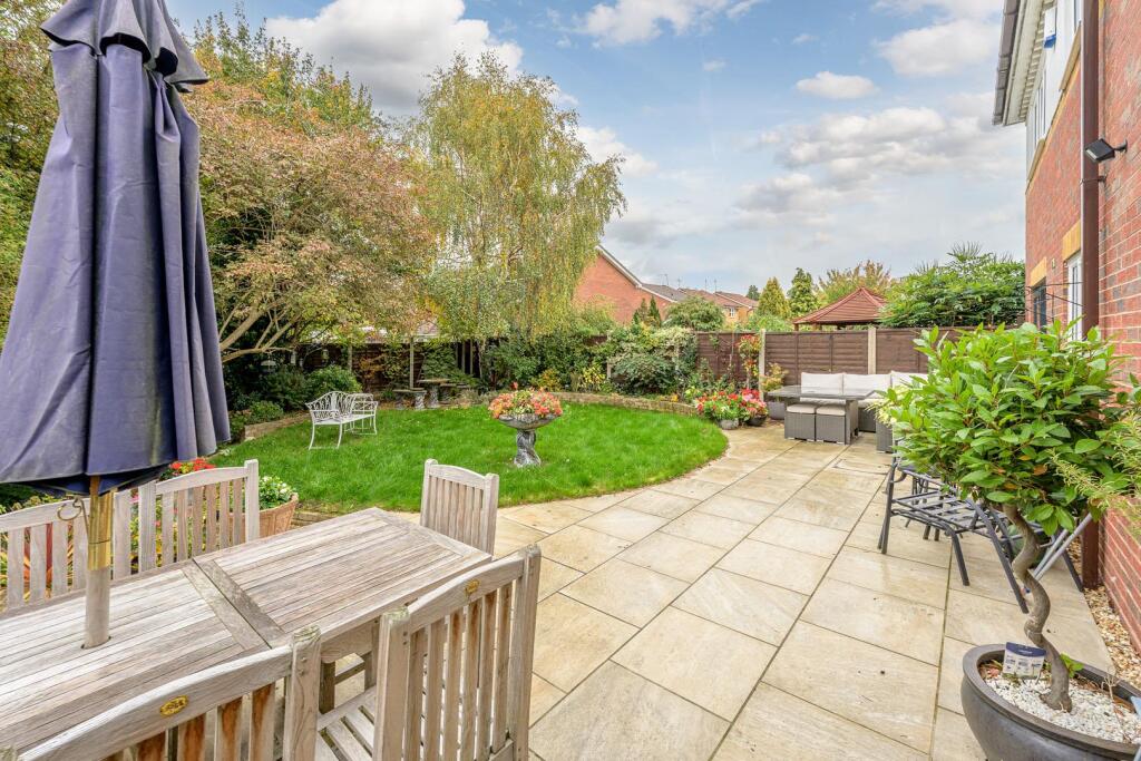
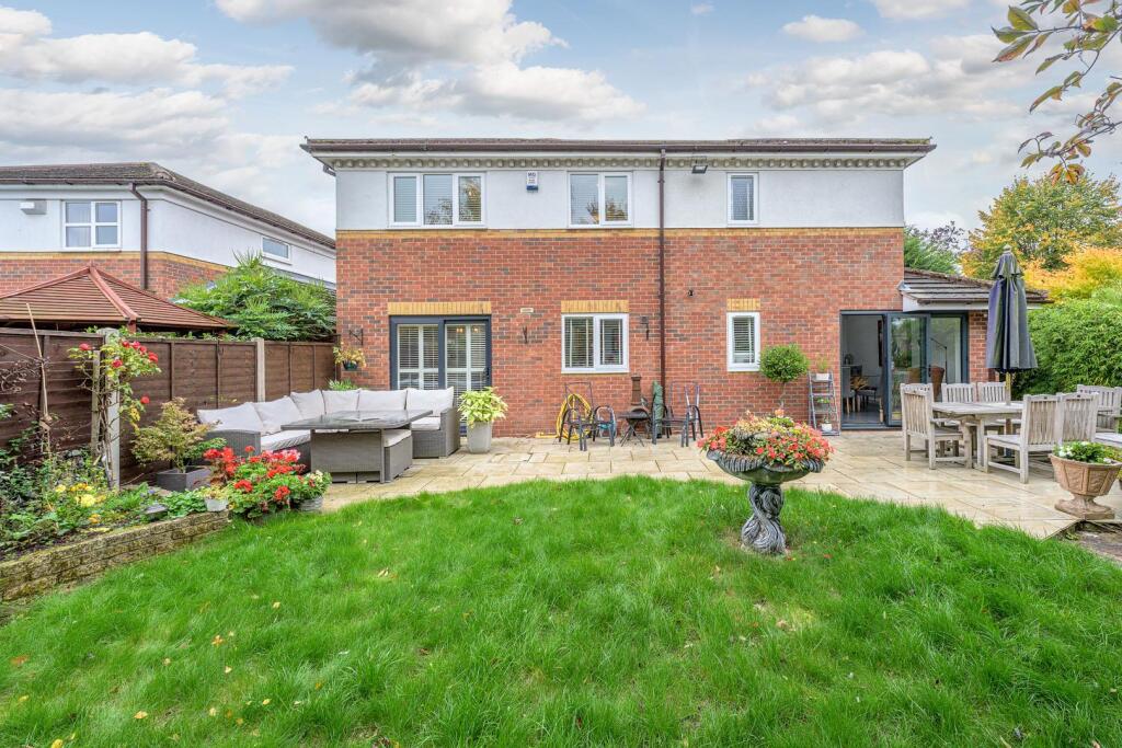
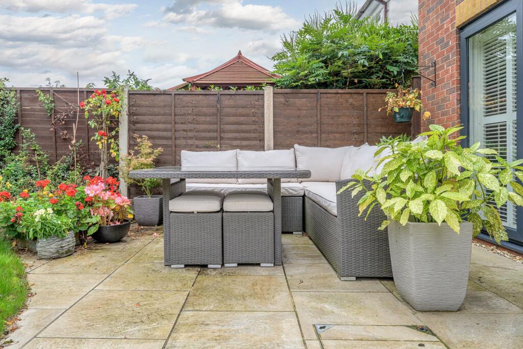
- Well-maintained rear garden presenting a paved patio area flowing to an established lawn with mature trees and shrub borders. The outdoor space is private and of a generous proportion for a suburban plot (garden size: large), offering a level paved dining terrace suitable for outdoor entertaining and a curved lawn area with specimen planting and decorative features. The setting overlooks neighbouring residential properties and benefits from good screening by mature planting, providing privacy and an attractive outlook. In valuation terms this garden would add positive amenity value to a family home, improving usable external living space and overall curb appeal. Interior condition and total property footprint cannot be determined from this image.
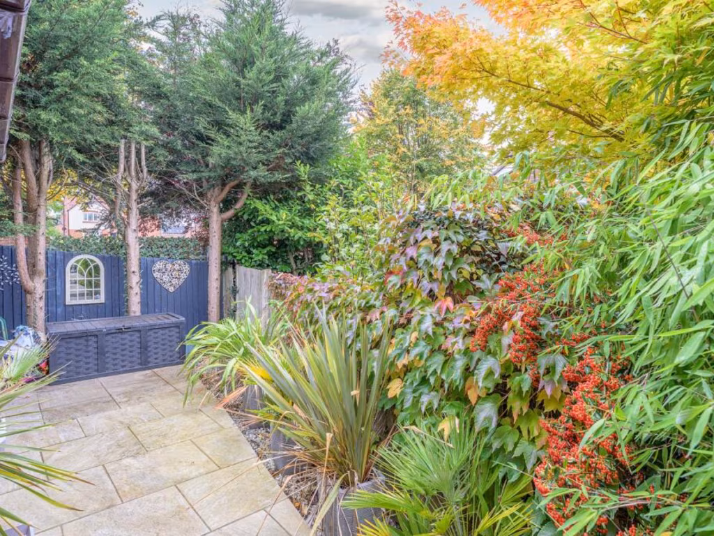
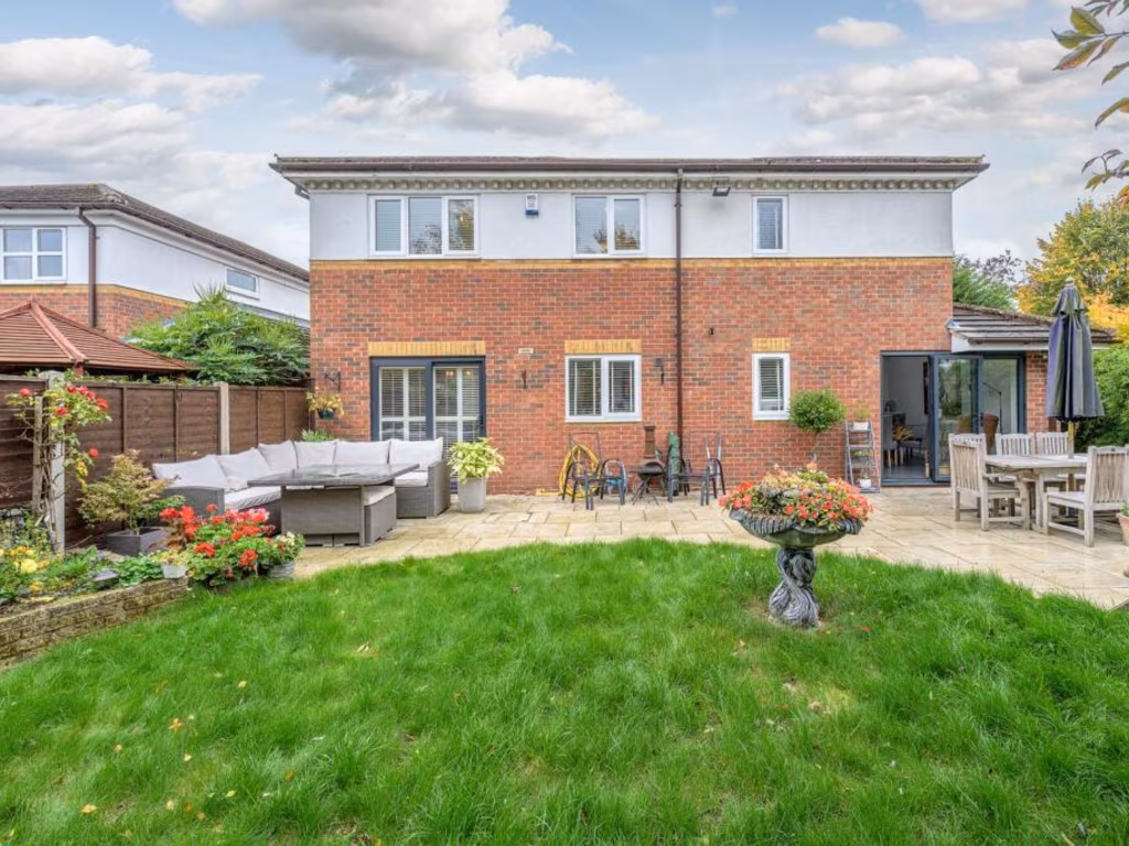
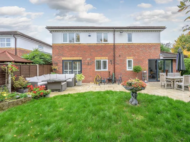
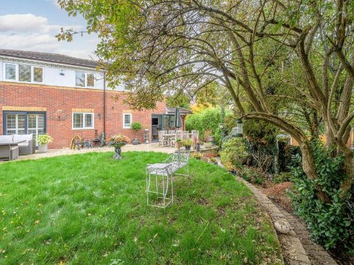
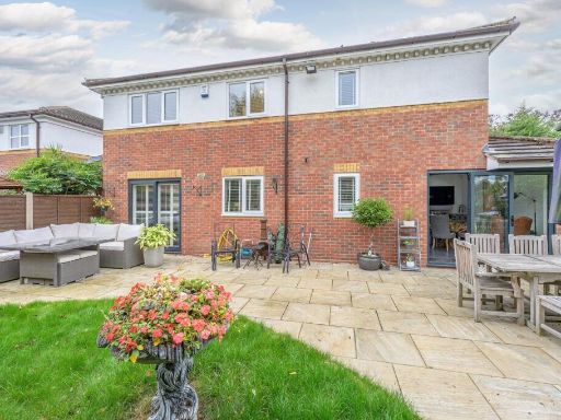
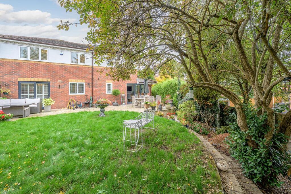
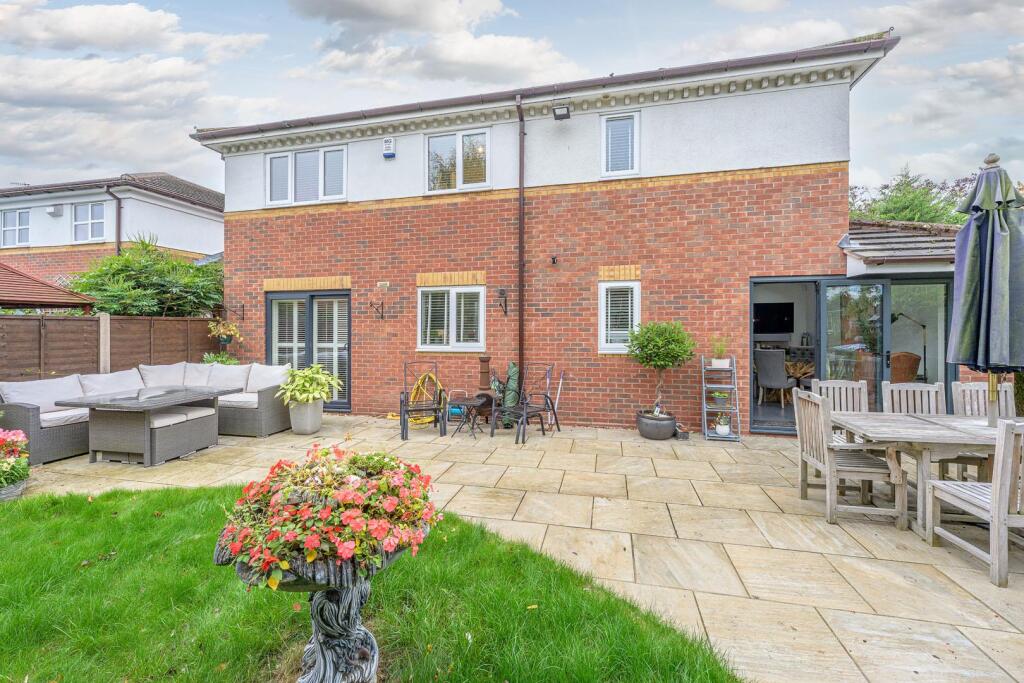
- Detached two-storey brick and rendered house viewed from the rear. The property appears to have a modern extension with large glazed sliding/bi-fold doors and multiple rear access points (French doors and a patio door). External finish is red brick to the ground floor with white render to the first floor. The rear outdoor space includes a large paved patio area directly off the house, landscaped lawn of small-to-average size and planted borders; patio is large enough for multiple seating and dining zones. Windows are UPVC with fitted shutters/blinds visible. Overall impression: a well-maintained suburban family house with generous rear hardstanding/patio and a modest lawn — suitable for outdoor entertaining. The plot and garden read as medium in size; the house appears to be an average-to-large family home in terms of internal footprint (cannot be measured accurately from images). No specific street address or agent contact details are visible in the image.
Image Descriptions
- detached house with driveway Modern
- back garden Mid-20th Century
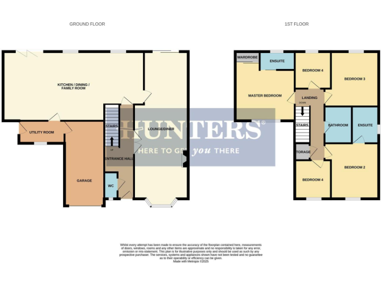
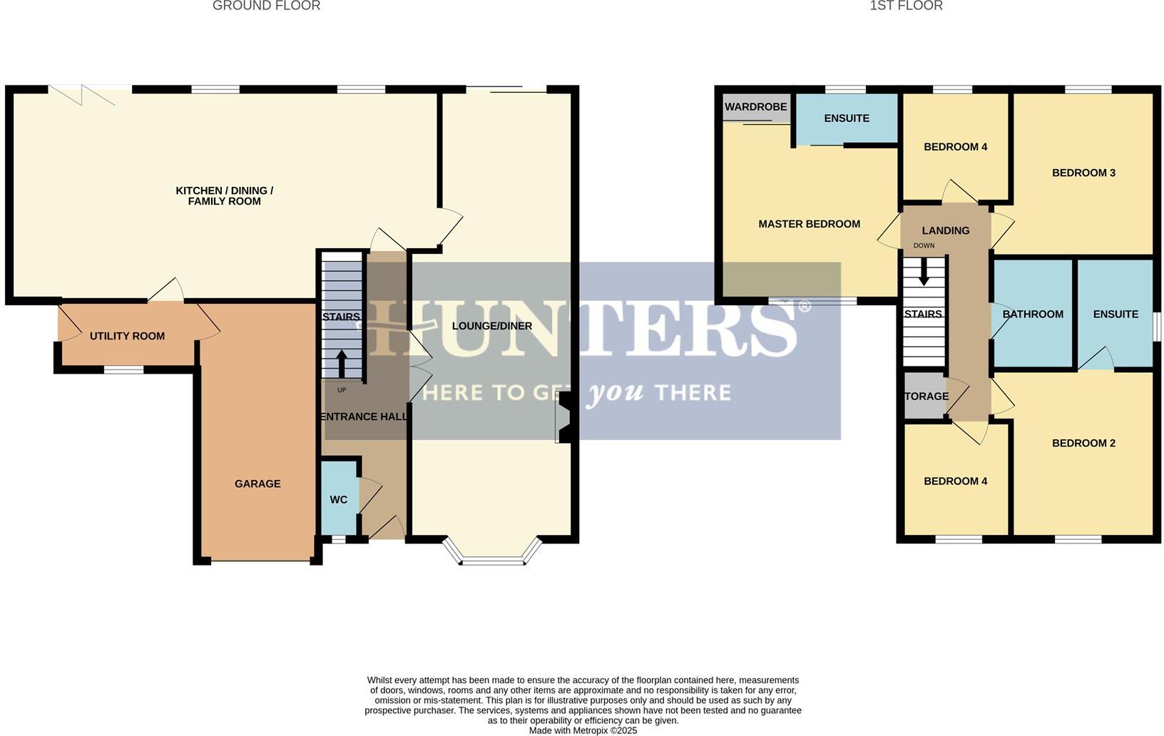
Rooms
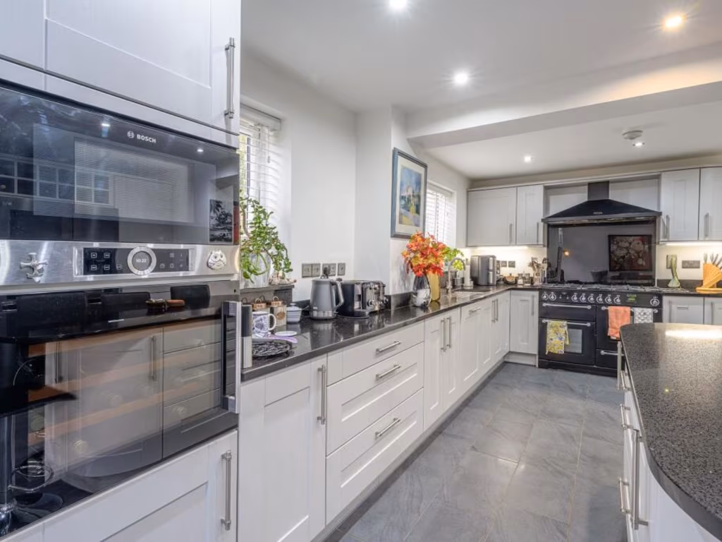
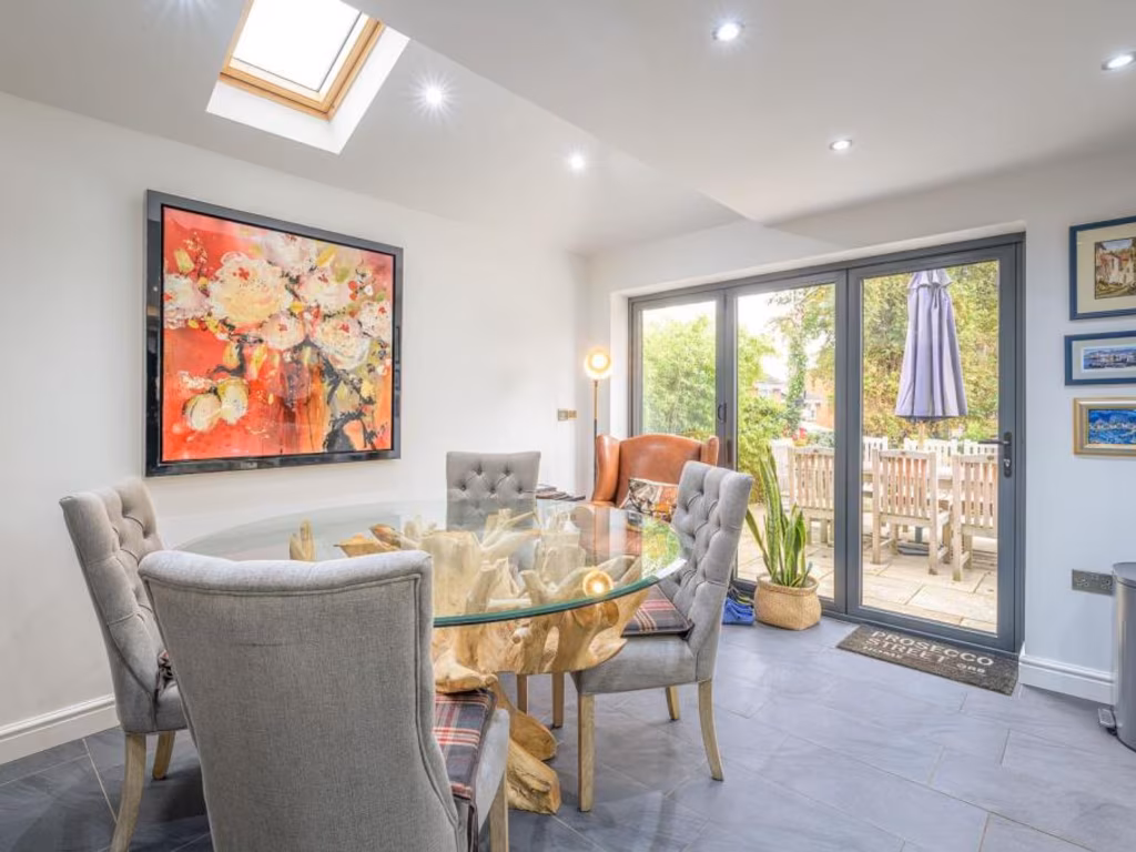
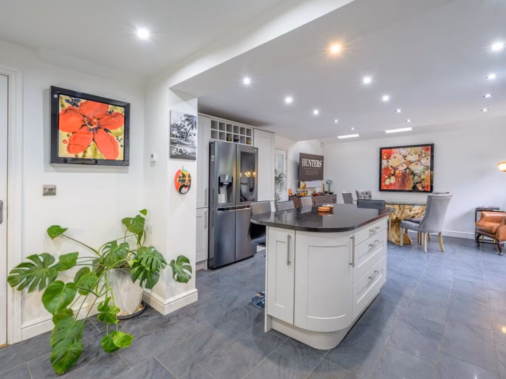
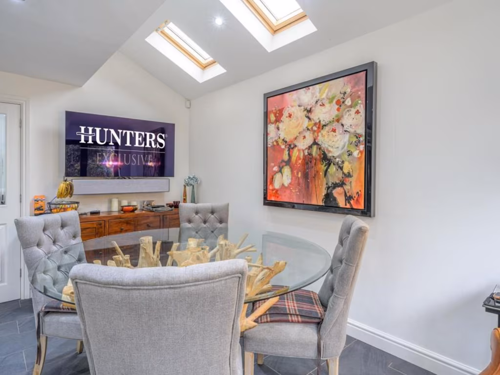
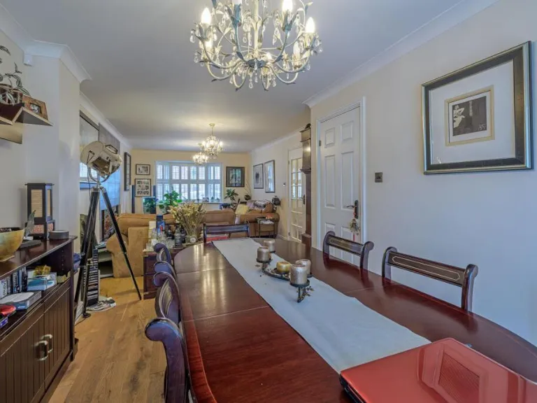
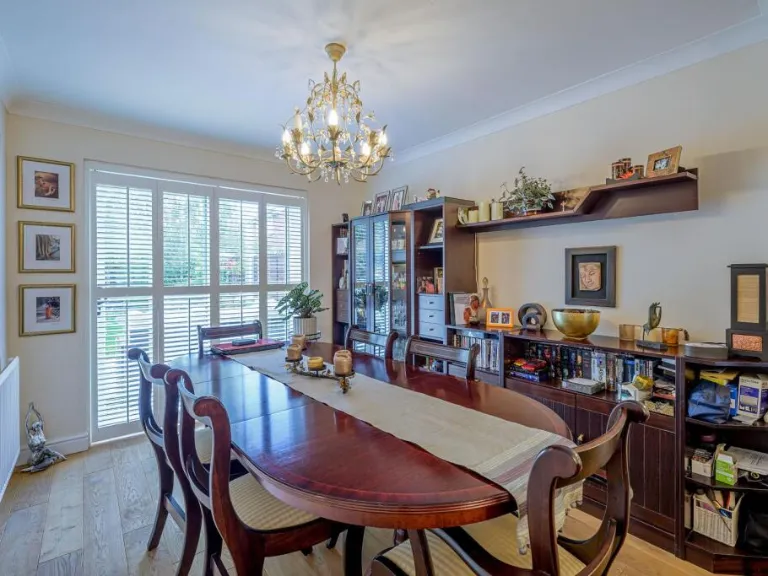
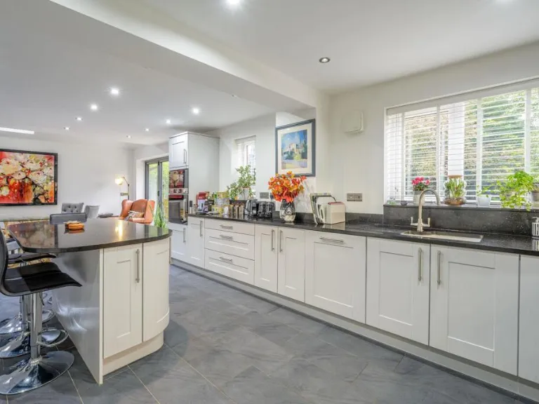
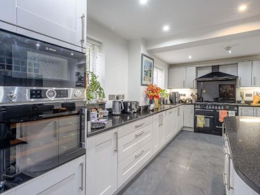
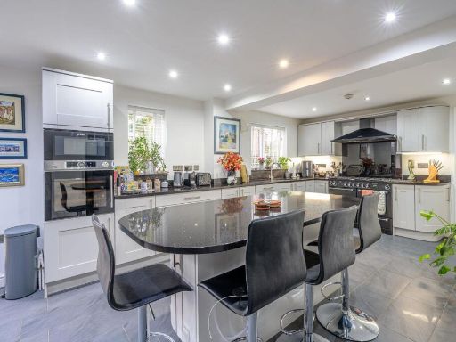
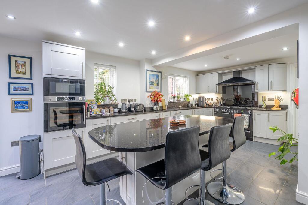
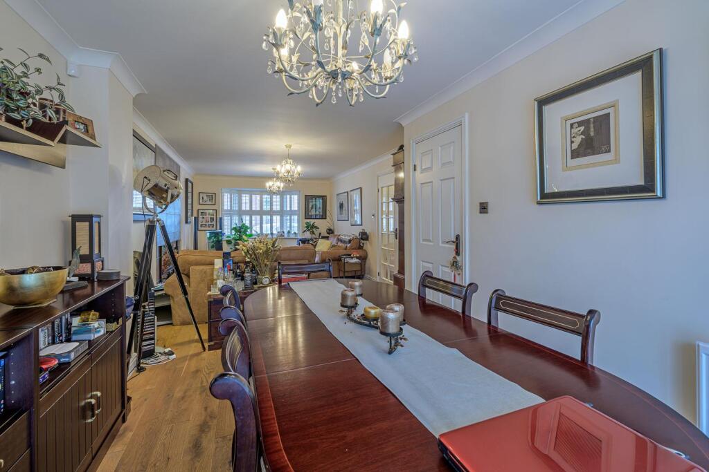
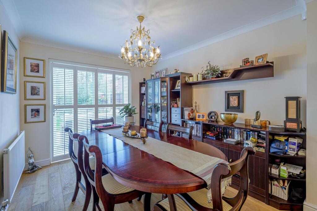
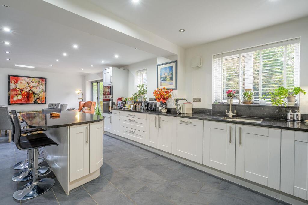
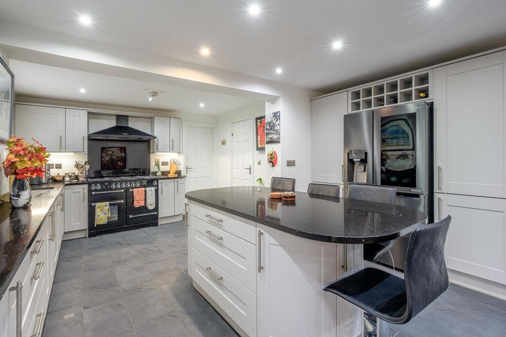
- KITCHEN / DINING / FAMILY ROOM:
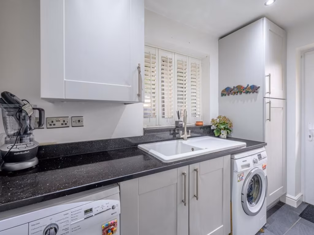
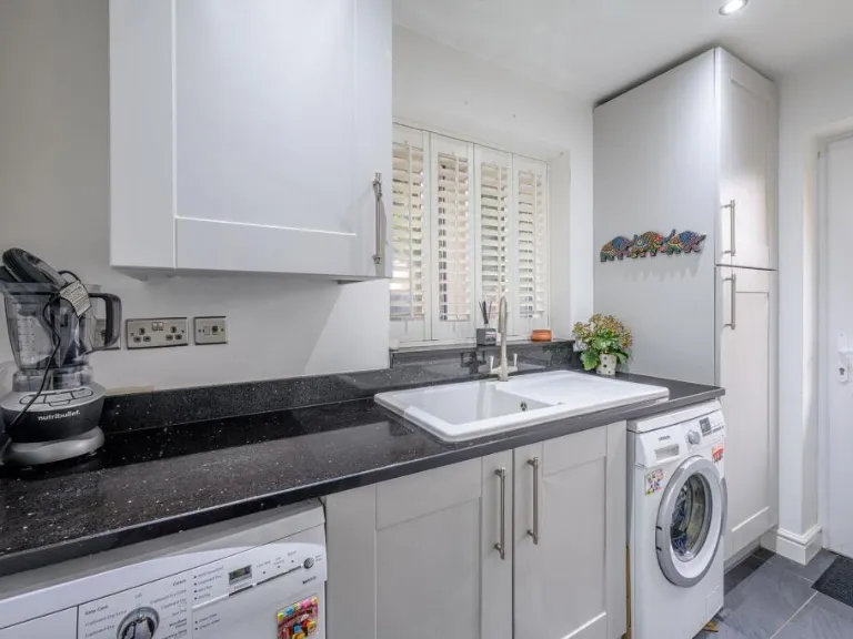
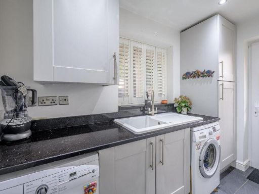
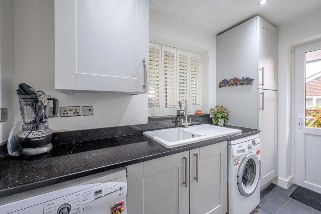
- UTILITY ROOM:
- GARAGE:
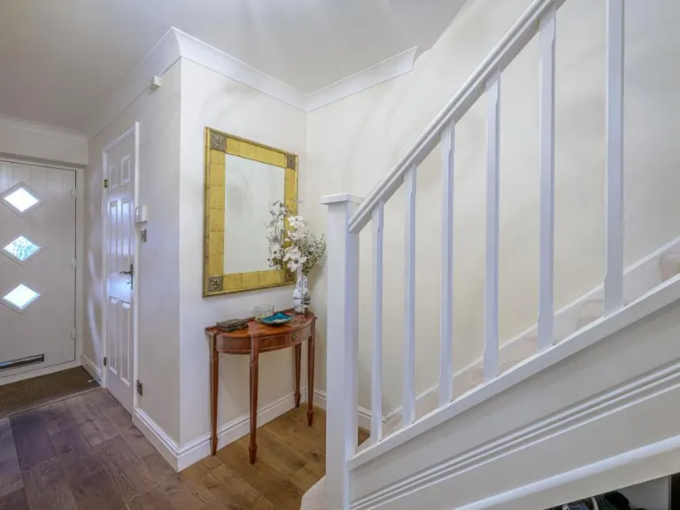
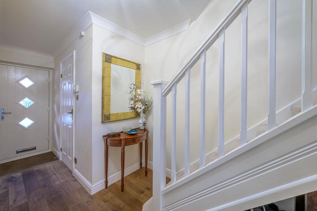
- STAIRS:
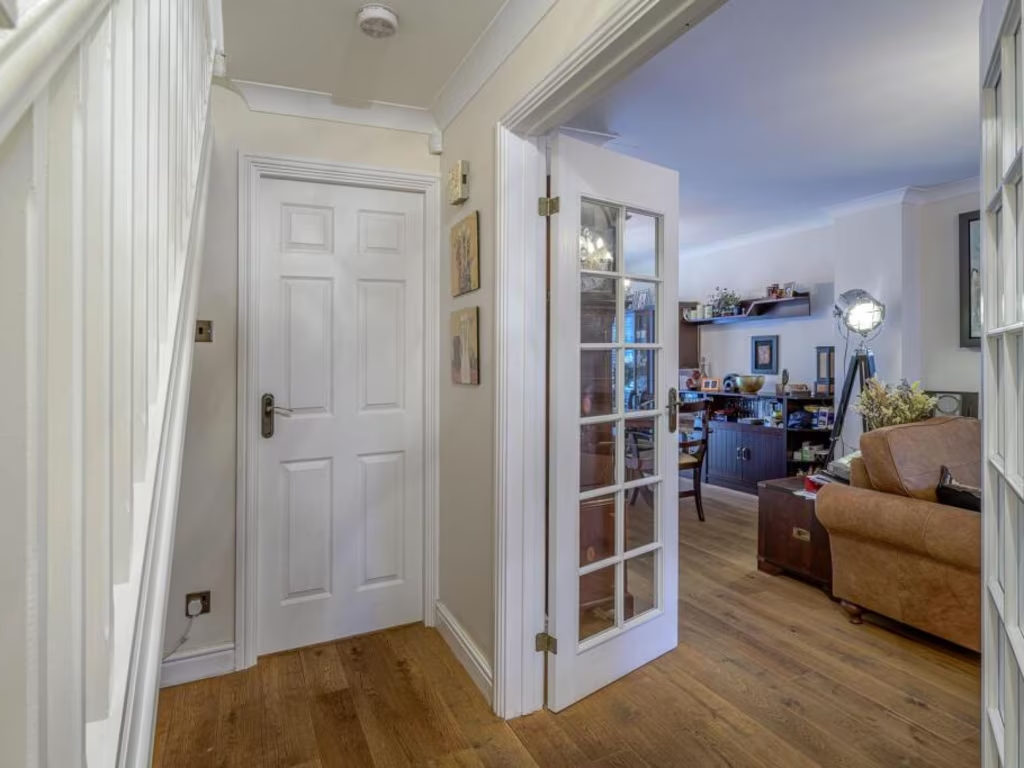
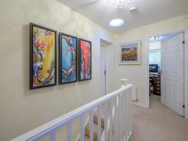
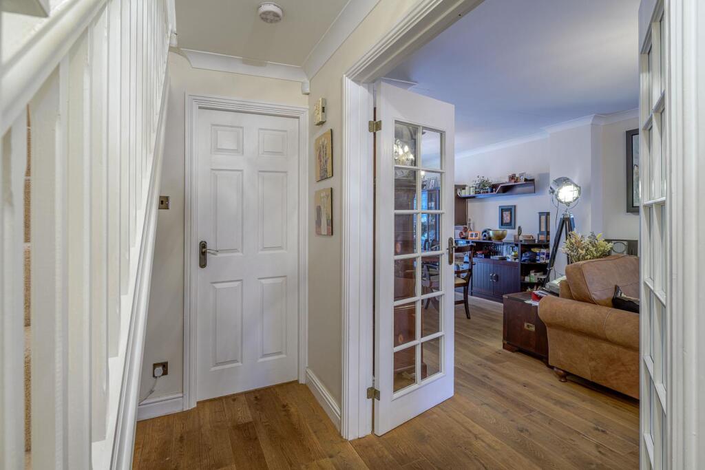
- ENTRANCE HALL:
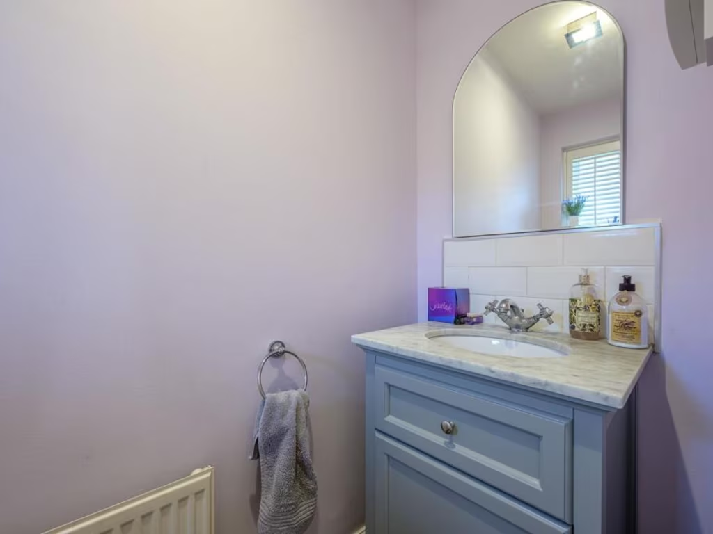
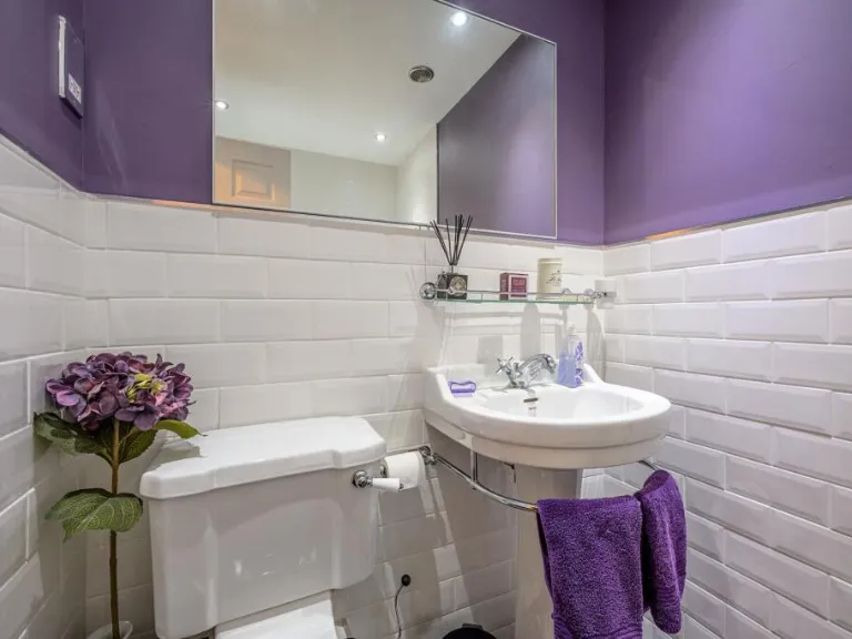
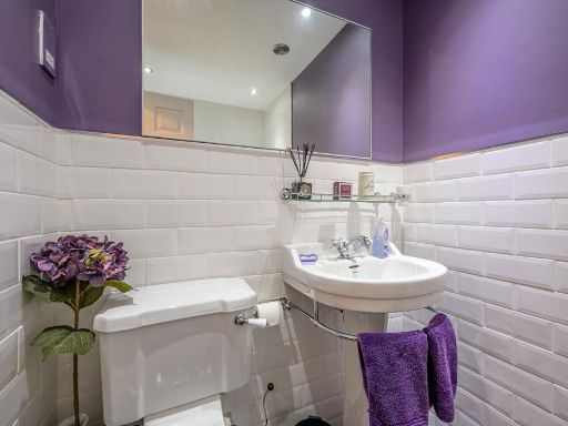
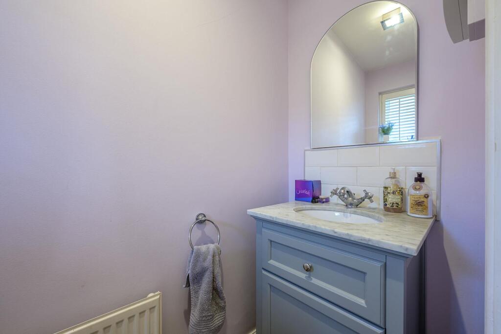
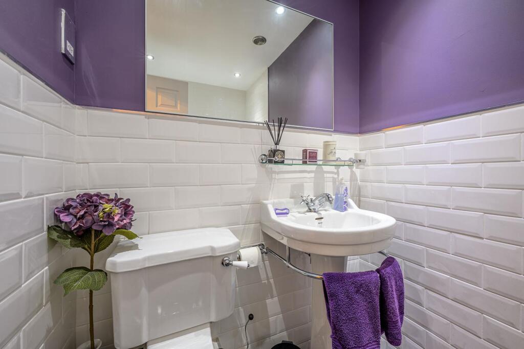
- WC:
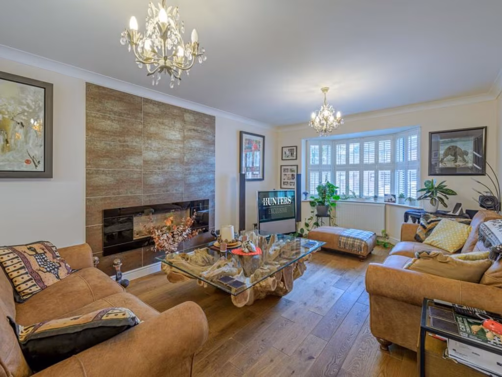
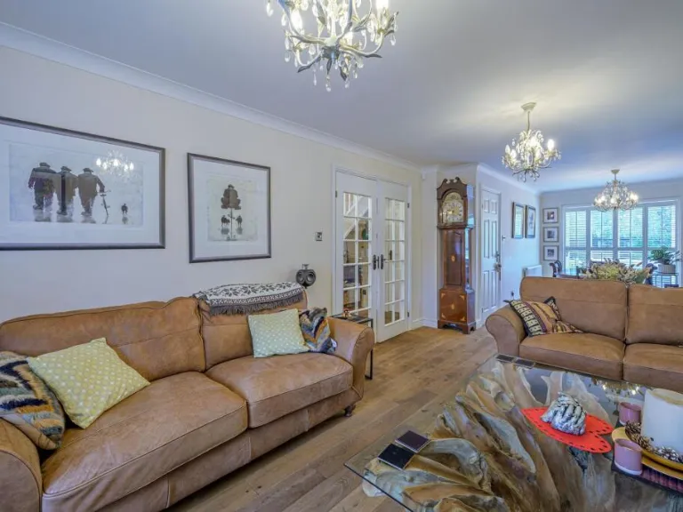
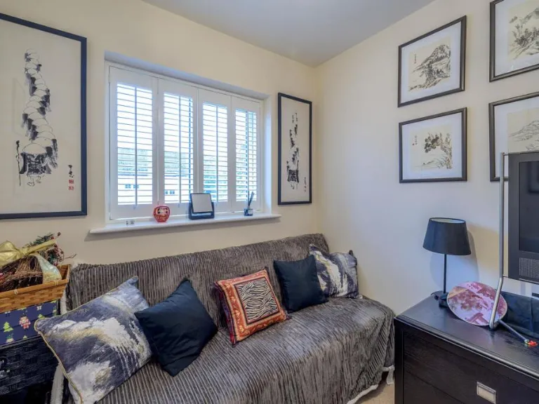
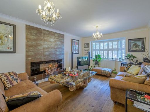
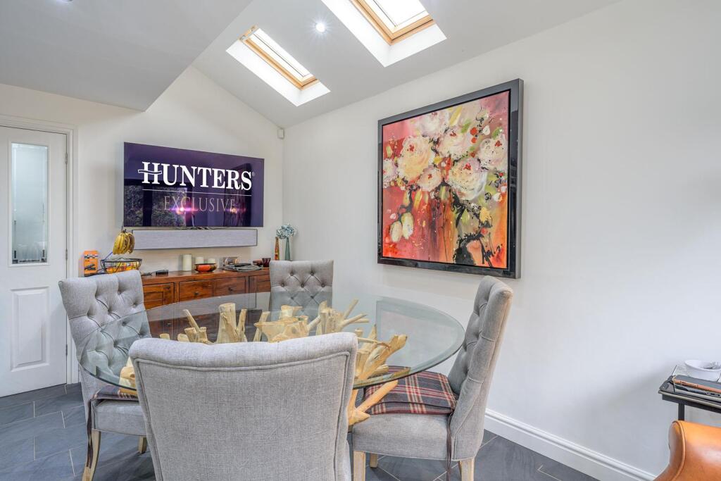
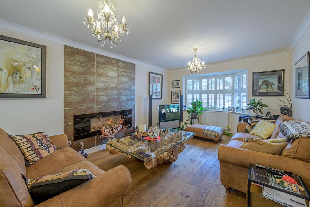
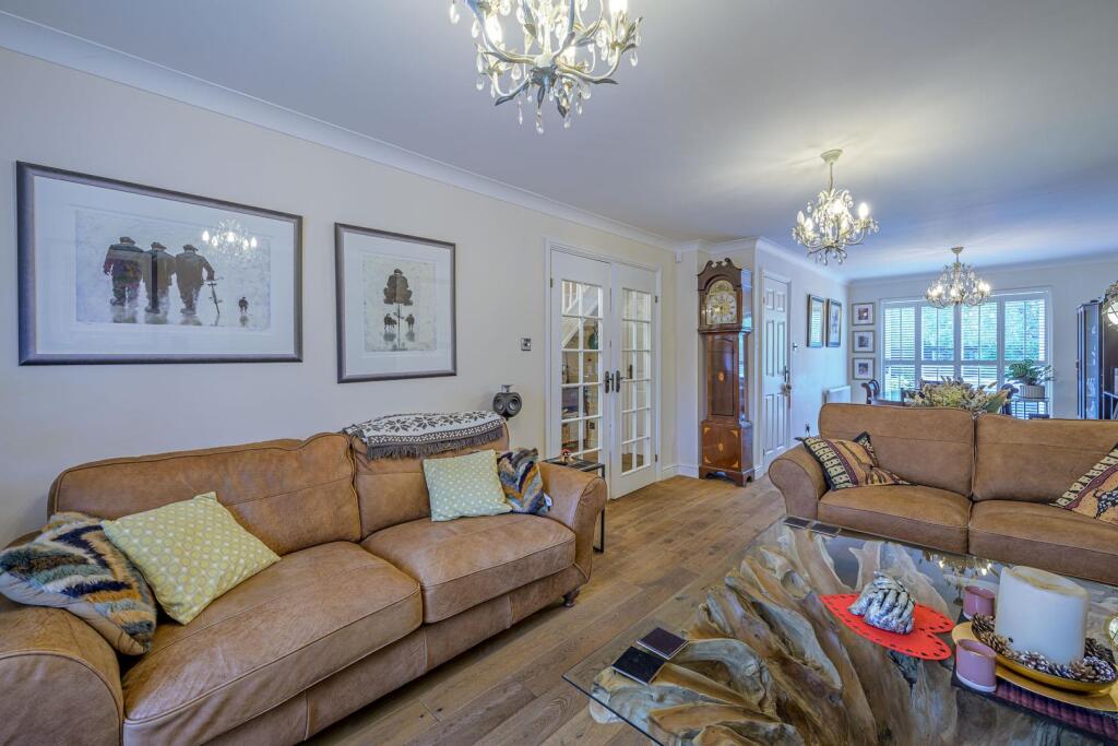
- LOUNGE/DINER:
- WARDROBE:
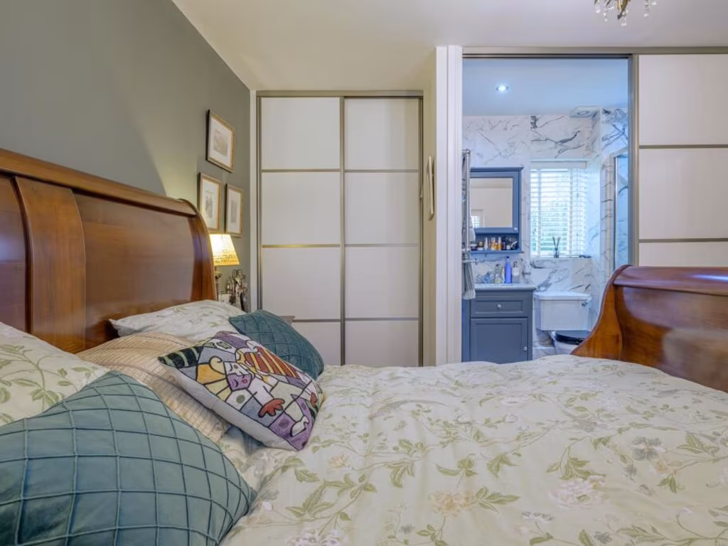
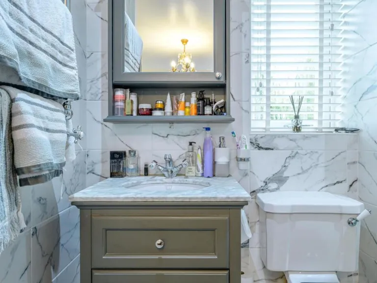
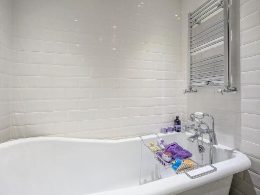
- ENSUITE:
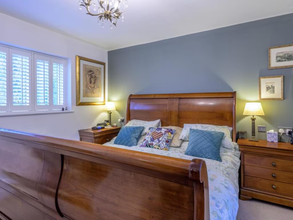
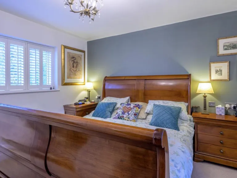
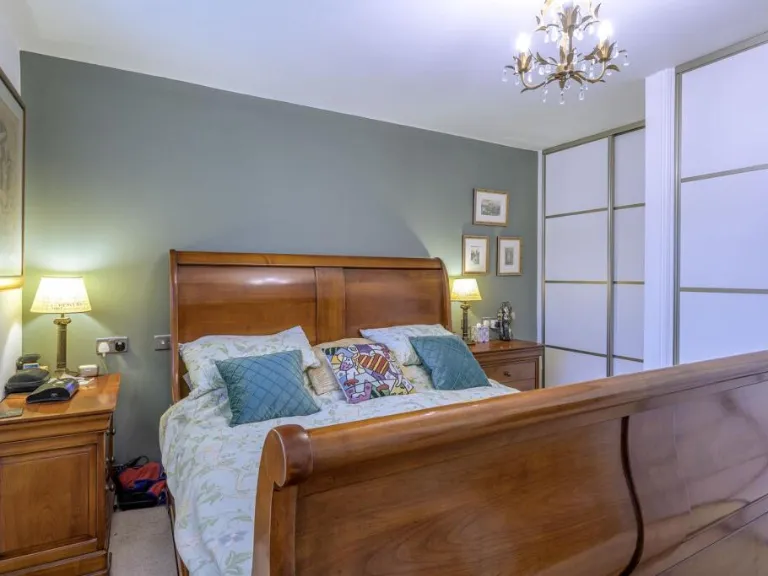
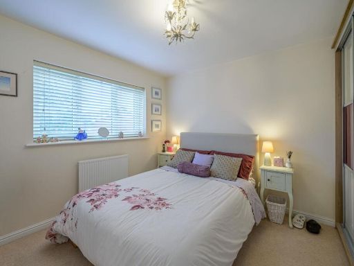
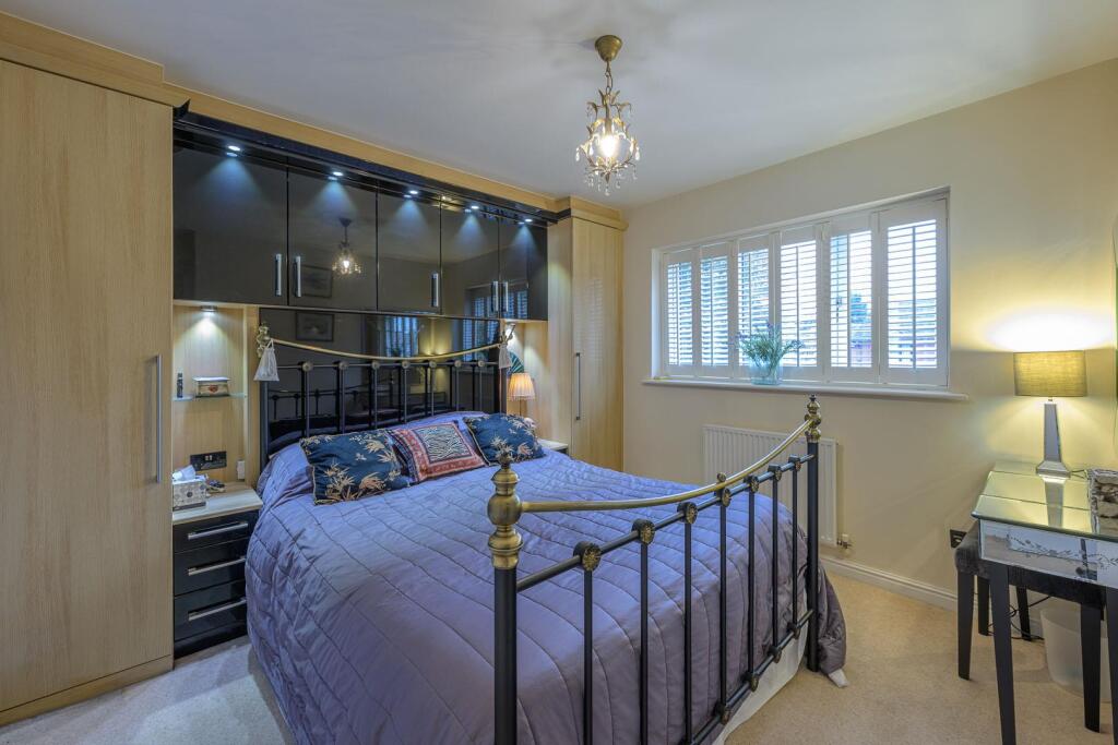
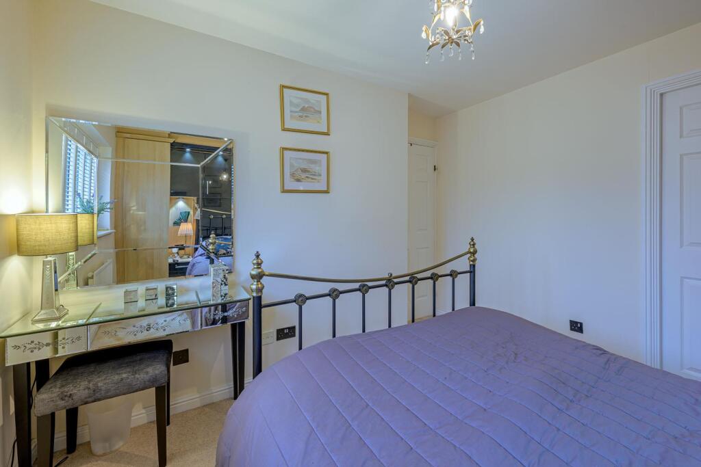
- MASTER BEDROOM:
- BEDROOM 4:
- BEDROOM 3:
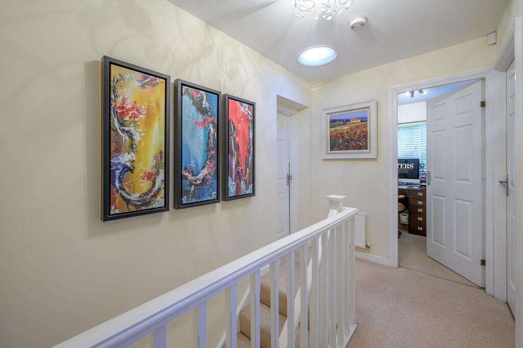
- LANDING:
- STAIRS:
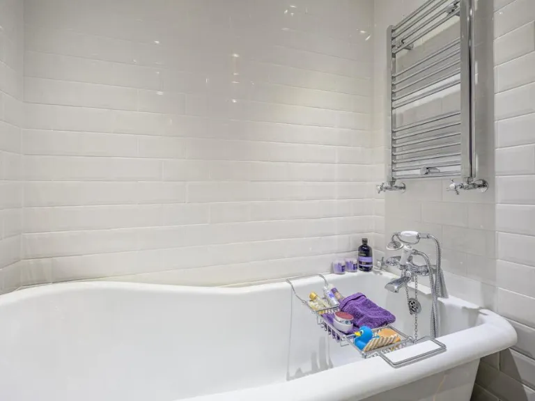
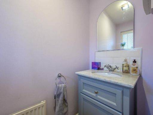
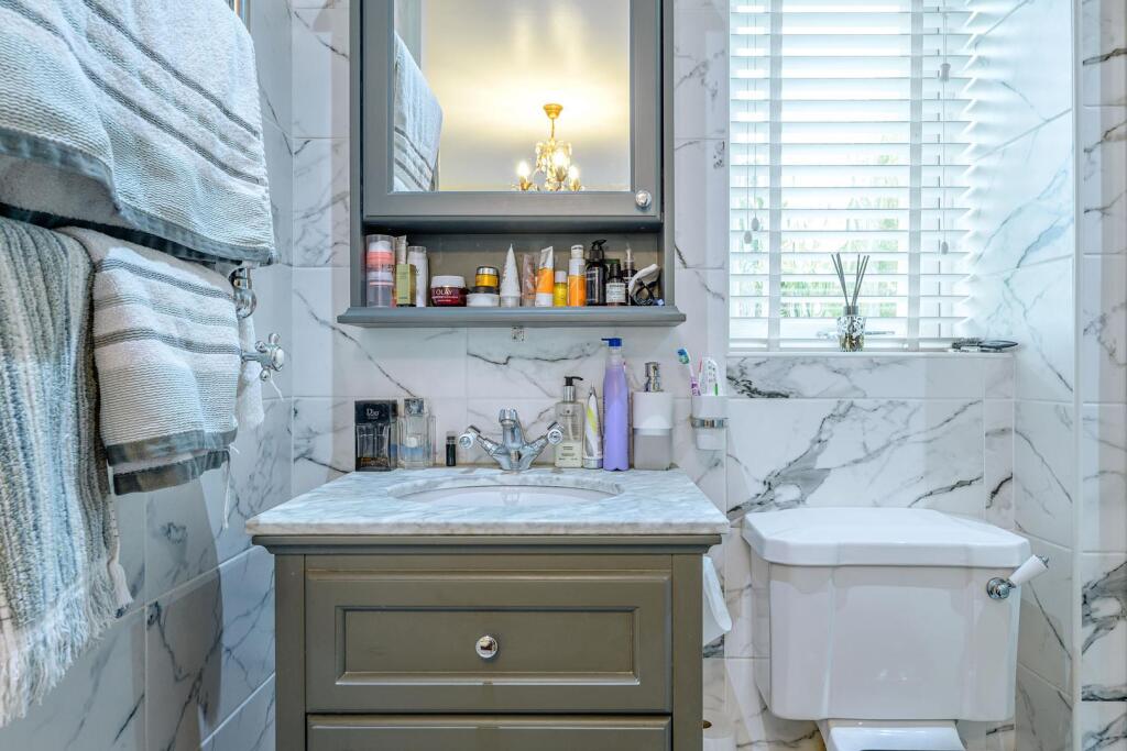
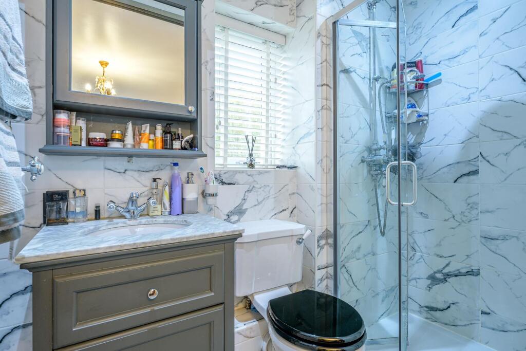
- BATHROOM:
- ENSUITE:
- STORAGE:
- BEDROOM 2:
- BEDROOM 4:
- WARDROBE:
Textual Property Features
Detected Visual Features
- modern
- brick exterior
- two-story
- detached house
- garage
- driveway
- garden
- family home
- lawn
- outdoor seating
- backyard
- shrubs
- trees
- landscaping
- patio
- suburban
EPC Details
- Fully double glazed
- Cavity wall, as built, insulated (assumed)
- Boiler and radiators, mains gas
- Low energy lighting in 89% of fixed outlets
- Solid, limited insulation (assumed)
Nearby Schools
- Rufford Primary School
- The Ridge Primary School
- Peters Hill Primary School
- Brook Primary School
- Glynne Primary School
- Hagley Catholic High School
- Amblecote Primary School
- Fairhaven Primary School
- Dingle Community Primary School
- The Crestwood School
- Haybridge High School and Sixth Form
- Ham Dingle Primary Academy
- Oldswinford C of E Primary School
- Old Swinford Hospital
- Redhill School
- Ridgewood High School
- St James's CofE Primary School
- The Wordsley School
- Pedmore CE Primary School
- St Joseph's RC Primary School
- Elmfield Rudolf Steiner School Limited
- The Pedmore High School
- Greenfield Primary School
- Ashwood Park Primary School
- Belle Vue Primary School
- Bromley Hills Primary School
Nearest General Shops
- Id: 1125914547
- Tags:
- Addr:
- City: Stourbridge
- Housenumber: 49b
- Postcode: DY8 3XS
- Street: Clifton Street
- Building: yes
- Male: yes
- Name: J&R's Gents Stylists
- Phone: +44 1384 376677
- Shop: hairdresser
- TagsNormalized:
- Lat: 52.4530986
- Lon: -2.1560431
- FullGeoHash: gcq6quy12w38
- PartitionGeoHash: gcq6
- Images:
- FoodStandards: null
- Distance: 369.9
,- Id: 1125914546
- Tags:
- Addr:
- City: Stourbridge
- Housenumber: 16
- Postcode: DY8 3XS
- Street: Clifton Street
- Beauty: nails
- Building: yes
- Name: Stourbridge Nail Studio
- Phone: +44 1384 376677
- Shop: beauty
- TagsNormalized:
- Lat: 52.4531568
- Lon: -2.1555454
- FullGeoHash: gcq6quy3u1hu
- PartitionGeoHash: gcq6
- Images:
- FoodStandards: null
- Distance: 368
,- Id: 384838389
- Tags:
- Addr:
- City: Stourbridge
- Housenumber: 49
- Postcode: DY8 3XS
- Street: Clifton Street
- Building: residential
- Name: Washeteria & Duvet Centre
- Self_service: yes
- Shop: laundry
- Source: bing;survey
- TagsNormalized:
- Lat: 52.4531482
- Lon: -2.1560226
- FullGeoHash: gcq6quy19p90
- PartitionGeoHash: gcq6
- Images:
- FoodStandards: null
- Distance: 364.5
}
Nearest Grocery shops
- Id: 2830817304
- Tags:
- Brand: Spar
- Brand:wikidata: Q610492
- Brand:wikipedia: en:SPAR (retailer)
- Name: Spar
- Shop: convenience
- TagsNormalized:
- Lat: 52.4560868
- Lon: -2.1427197
- FullGeoHash: gcq6rjrdz526
- PartitionGeoHash: gcq6
- Images:
- FoodStandards: null
- Distance: 935.9
,- Id: 1172972174
- Tags:
- Addr:
- Housenumber: 117
- Postcode: DY8 2AD
- Street: Worcester Street
- Brand: One Stop
- Brand:wikidata: Q65954217
- Fhrs:
- Name: One Stop
- Shop: convenience
- Source:
- TagsNormalized:
- Lat: 52.4503974
- Lon: -2.1521401
- FullGeoHash: gcq6rh2cew8p
- PartitionGeoHash: gcq6
- Images:
- FoodStandards:
- Id: 501588
- FHRSID: 501588
- LocalAuthorityBusinessID: PI/000069262
- BusinessName: One Stop Stores Limited
- BusinessType: Retailers - other
- BusinessTypeID: 4613
- AddressLine1: 117 Worcester Street
- AddressLine2: Stourbridge
- AddressLine3: null
- AddressLine4: null
- PostCode: DY8 2AD
- RatingValue: 5
- RatingKey: fhrs_5_en-GB
- RatingDate: 2019-10-24
- LocalAuthorityCode: 409
- LocalAuthorityName: Dudley
- LocalAuthorityWebSite: http://www.dudley.gov.uk
- LocalAuthorityEmailAddress: Food.DUE@dudley.gov.uk
- Scores:
- Hygiene: null
- Structural: null
- ConfidenceInManagement: null
- NewRatingPending: false
- Geocode:
- Longitude: -2.15207000000000
- Latitude: 52.45032200000000
- Distance: 731.8
,- Id: 1131594872
- Tags:
- Brand: Co-op Food
- Brand:wikidata: Q3277439
- Brand:wikipedia: en:Co-op Food
- Name: Co-op Food
- Shop: convenience
- TagsNormalized:
- co-op
- co-op food
- food
- convenience
- shop
- Lat: 52.451271
- Lon: -2.1583711
- FullGeoHash: gcq6qukqf39f
- PartitionGeoHash: gcq6
- Images:
- FoodStandards: null
- Distance: 585.3
}
Nearest Religious buildings
- Id: 387441465
- Tags:
- Amenity: place_of_worship
- Building: church
- Denomination: methodist
- Name: Wollaston Methodist Church
- Religion: christian
- TagsNormalized:
- place of worship
- church
- methodist
- christian
- Lat: 52.4586573
- Lon: -2.1631173
- FullGeoHash: gcq6qvbcgdqz
- PartitionGeoHash: gcq6
- Images:
- FoodStandards: null
- Distance: 511.9
,- Id: 280780568
- Tags:
- Amenity: place_of_worship
- Building: yes
- Denomination: anglican
- Name: St James
- Religion: christian
- Source: bing
- Wikidata: Q26340226
- TagsNormalized:
- place of worship
- anglican
- christian
- church
- Lat: 52.4602322
- Lon: -2.1606402
- FullGeoHash: gcq6qy4ej2jf
- PartitionGeoHash: gcq6
- Images:
- FoodStandards: null
- Distance: 508.2
,- Id: 27853358
- Tags:
- Amenity: place_of_worship
- Building: yes
- Denomination: quaker
- Religion: christian
- TagsNormalized:
- place of worship
- quaker
- quakers
- christian
- church
- Lat: 52.4585313
- Lon: -2.1499268
- FullGeoHash: gcq6rjf3p542
- PartitionGeoHash: gcq6
- Images:
- FoodStandards: null
- Distance: 505.2
}
Nearest Medical buildings
- Id: 9613116064
- Tags:
- Addr:
- City: Stourbridge
- Housenumber: 160
- Postcode: DY8 1TS
- Street: Lower High Street
- Amenity: hospital
- Email: reception@stourcotedentalpractice.co.uk
- Healthcare: hospital
- Healthcare:speciality: dentist
- Name: Stourcote Dental Practice
- Operator: Tri-Dental
- Operator:type: private
- Phone: +44 1384 394215
- Website: https://www.stourcotedentalpractice.co.uk/
- TagsNormalized:
- hospital
- health
- healthcare
- dentist
- dental
- Lat: 52.4586422
- Lon: -2.1485961
- FullGeoHash: gcq6rjg3wpdt
- PartitionGeoHash: gcq6
- Images:
- FoodStandards: null
- Distance: 591.5
,- Id: 280780570
- Tags:
- Amenity: dentist
- Building: yes
- Healthcare: dentist
- Source: bing
- TagsNormalized:
- Lat: 52.460432
- Lon: -2.1615952
- FullGeoHash: gcq6qy1upjmf
- PartitionGeoHash: gcq6
- Images:
- FoodStandards: null
- Distance: 563.8
,- Id: 884159067
- Tags:
- Amenity: clinic
- Building: yes
- Healthcare: clinic
- Name: Stourside Hospital
- Note: Have marked general footprint of car park and building, but further tracing of car park and building as distinct will be needed when satellite imagery becomes available.
- Operator: Ramsay Health Care
- Operator:type: private
- TagsNormalized:
- clinic
- health
- healthcare
- hospital
- Lat: 52.4604308
- Lon: -2.1530998
- FullGeoHash: gcq6rn0hjjh7
- PartitionGeoHash: gcq6
- Images:
- FoodStandards: null
- Distance: 503.4
,- Id: 321833912
- Tags:
- Amenity: doctors
- Building: yes
- Healthcare: doctor
- Heritage: 2
- Heritage:operator: Historic England
- Listed_status: Grade II
- Name: Lion Health
- Source: bing
- TagsNormalized:
- doctor
- doctors
- health
- healthcare
- Lat: 52.4607898
- Lon: -2.1564754
- FullGeoHash: gcq6qyjwq2p2
- PartitionGeoHash: gcq6
- Images:
- FoodStandards: null
- Distance: 486.7
}
Nearest Leisure Facilities
- Id: 120731485
- Tags:
- Leisure: park
- Name: Swan Pool Park
- TagsNormalized:
- Lat: 52.4543752
- Lon: -2.1627678
- FullGeoHash: gcq6qv10gu72
- PartitionGeoHash: gcq6
- Images:
- FoodStandards: null
- Distance: 480
,- Id: 896205459
- Tags:
- Leisure: playground
- Source: bing, survey
- TagsNormalized:
- Lat: 52.4541541
- Lon: -2.1625411
- FullGeoHash: gcq6qucr95h3
- PartitionGeoHash: gcq6
- Images:
- FoodStandards: null
- Distance: 479
,- Id: 321824526
- Tags:
- Addr:
- City: Stourbridge
- Housenumber: Units 1-3
- Postcode: DY8 1UN
- Street: Bradley Road
- Building: yes
- Leisure: fitness_centre
- Name: The Fitness Factory
- Source: bing
- TagsNormalized:
- fitness
- fitness centre
- leisure
- Lat: 52.460408
- Lon: -2.1539862
- FullGeoHash: gcq6qyps02z7
- PartitionGeoHash: gcq6
- Images:
- FoodStandards: null
- Distance: 476.3
,- Id: 118754017
- Tags:
- Leisure: park
- Name: Greenfield Gardens
- TagsNormalized:
- Lat: 52.4541988
- Lon: -2.151461
- FullGeoHash: gcq6rhcrg767
- PartitionGeoHash: gcq6
- Images:
- FoodStandards: null
- Distance: 422.1
,- Id: 384947269
- Tags:
- Access: private
- Leisure: swimming_pool
- Source: bing
- TagsNormalized:
- swimming
- swimming pool
- pool
- leisure
- Lat: 52.4558151
- Lon: -2.1591108
- FullGeoHash: gcq6qv7c30dm
- PartitionGeoHash: gcq6
- Images:
- FoodStandards: null
- Distance: 187.6
}
Nearest Tourist attractions
- Id: 5862312486
- Tags:
- Addr:
- Postcode: DY8 4FB
- Street: High Street
- Email: simon@bruntnell-Astley.com
- Name: Bruntnell-Astley Glass Gallery
- Phone: +447850395193
- Tourism: attraction
- Website: http://www.bruntnell-Astley.com
- TagsNormalized:
- Lat: 52.4759536
- Lon: -2.1580751
- FullGeoHash: gcq6wbuw94y8
- PartitionGeoHash: gcq6
- Images:
- FoodStandards: null
- Distance: 2175.4
,- Id: 150357855
- Tags:
- Source: visual survey;bing
- Tourism: attraction
- TagsNormalized:
- Lat: 52.4669324
- Lon: -2.1540759
- FullGeoHash: gcq6qzr6n3hd
- PartitionGeoHash: gcq6
- Images:
- FoodStandards: null
- Distance: 1181.4
,- Id: 27853367
- Tags:
- HE_ref: 1251214
- Addr:
- Housenumber: 2
- Postcode: DY8 4LU
- Street: Canal Street
- Building: public
- Fhrs:
- Heritage: 2
- Heritage:operator: Historic England
- Listed_status: Grade II
- Name: Bonded Warehouse
- Source: visual survey;bing
- Source:addr: FHRS Open Data
- Tourism: attraction
- Wikidata: Q26543198
- TagsNormalized:
- warehouse
- attraction
- tourism
- Lat: 52.460985
- Lon: -2.1497183
- FullGeoHash: gcq6rn4x7umv
- PartitionGeoHash: gcq6
- Images:
- FoodStandards:
- Id: 500227
- FHRSID: 500227
- LocalAuthorityBusinessID: PI/000010802
- BusinessName: The Bonded Warehouse
- BusinessType: Pub/bar/nightclub
- BusinessTypeID: 7843
- AddressLine1: 2 Canal Street
- AddressLine2: Amblecote
- AddressLine3: Stourbridge
- AddressLine4: null
- PostCode: DY8 4LU
- RatingValue: 5
- RatingKey: fhrs_5_en-GB
- RatingDate: 2008-01-21
- LocalAuthorityCode: 409
- LocalAuthorityName: Dudley
- LocalAuthorityWebSite: http://www.dudley.gov.uk
- LocalAuthorityEmailAddress: Food.DUE@dudley.gov.uk
- Scores:
- Hygiene: 5
- Structural: 5
- ConfidenceInManagement: 5
- NewRatingPending: false
- Geocode:
- Longitude: -2.14957500000000
- Latitude: 52.46081700000000
- Distance: 686.3
}
Nearest Train stations
- Id: 21281285
- Tags:
- Name: Cradley Heath
- Naptan:
- Network: National Rail
- Public_transport: station
- Railway: station
- Ref:
- Source: NPE
- West_midlands_fare_zone: 5
- Wikidata: Q1924927
- Wikipedia: en:Cradley Heath railway station
- TagsNormalized:
- Lat: 52.4694408
- Lon: -2.0906252
- FullGeoHash: gcqd2rv8susv
- PartitionGeoHash: gcqd
- Images:
- FoodStandards: null
- Distance: 4693.6
,- Id: 21281240
- Tags:
- Name: Hagley
- Naptan:
- Network: National Rail
- Public_transport: station
- Railway: station
- Ref:
- Source: NPE
- Wikidata: Q2763246
- Wikipedia: en:Hagley railway station
- TagsNormalized:
- Lat: 52.4224267
- Lon: -2.1465358
- FullGeoHash: gcq6pphyy0dg
- PartitionGeoHash: gcq6
- Images:
- FoodStandards: null
- Distance: 3839.2
,- Id: 21281283
- Tags:
- Name: Lye
- Naptan:
- Network: National Rail
- Public_transport: station
- Railway: station
- Ref:
- Source: NPE
- West_midlands_fare_zone: 5
- Wikidata: Q2044178
- Wikipedia: en:Lye railway station
- TagsNormalized:
- Lat: 52.4599417
- Lon: -2.1160497
- FullGeoHash: gcq6ry51k3yv
- PartitionGeoHash: gcq6
- Images:
- FoodStandards: null
- Distance: 2770.2
,- Id: 21281257
- Tags:
- Name: Stourbridge Junction
- Naptan:
- Network: National Rail
- Public_transport: station
- Railway: station
- Ref:
- Source: NPE
- West_midlands_fare_zone: 5
- Wikidata: Q2045806
- Wikipedia: en:Stourbridge Junction railway station
- TagsNormalized:
- Lat: 52.4476157
- Lon: -2.1340314
- FullGeoHash: gcq6r7y192ny
- PartitionGeoHash: gcq6
- Images:
- FoodStandards: null
- Distance: 1811
,- Id: 21281267
- Tags:
- Name: Stourbridge Town
- Naptan:
- Network: National Rail
- Public_transport: station
- Railway: station
- Ref:
- Source: NPE
- West_midlands_fare_zone: 5
- Wikidata: Q2746016
- Wikipedia: en:Stourbridge Town railway station
- TagsNormalized:
- Lat: 52.4556424
- Lon: -2.1419647
- FullGeoHash: gcq6rm22287r
- PartitionGeoHash: gcq6
- Images:
- FoodStandards: null
- Distance: 990.1
}
Nearest Hotels
- Id: 1826932573
- Tags:
- Name: Dunsley Hall
- Tourism: hotel
- TagsNormalized:
- Lat: 52.4560087
- Lon: -2.2098255
- FullGeoHash: gcq6mtqf7kf8
- PartitionGeoHash: gcq6
- Images:
- FoodStandards: null
- Distance: 3612
,- Id: 705992803
- Tags:
- Brand: Premier Inn
- Brand:wikidata: Q2108626
- Brand:wikipedia: en:Premier Inn
- Building: yes
- Internet_access: wlan
- Internet_access:fee: customers
- Internet_access:operator: Virgin Media
- Internet_access:ssid: Premier Inn Free Wi-Fi
- Name: Premier Inn
- Tourism: hotel
- TagsNormalized:
- Lat: 52.4575842
- Lon: -2.1409961
- FullGeoHash: gcq6rm8gx4mw
- PartitionGeoHash: gcq6
- Images:
- FoodStandards: null
- Distance: 1060
,- Id: 2026517
- Tags:
- Addr:
- Postcode: DY8 1DW
- Street: High Street
- Building: yes
- Fhrs:
- Name: The Talbot Hotel
- Tourism: hotel
- Type: multipolygon
- Website: http://www.thetalbot-hotel.co.uk/
- Wikidata: Q26627023
- TagsNormalized:
- Lat: 52.4570133
- Lon: -2.146694
- FullGeoHash: gcq6rjsb62hc
- PartitionGeoHash: gcq6
- Images:
- FoodStandards: null
- Distance: 669.3
}
Tags
- modern
- brick exterior
- two-story
- detached house
- garage
- driveway
- garden
- family home
- garden
- lawn
- brick exterior
- outdoor seating
- backyard
- shrubs
- trees
- landscaping
- patio
- family home
- suburban
Local Market Stats
- Average Price/sqft: £265
- Avg Income: £41400
- Rental Yield: 3.5%
- Social Housing: 8%
- Planning Success Rate: 90%
Similar Properties
 4 bedroom detached house for sale in Witton Street, Stourbridge, DY8 3YE, DY8 — £500,000 • 4 bed • 2 bath • 1156 ft²
 3 bedroom detached house for sale in Lawn Street, Stourbridge, DY8 3UQ, DY8 — £530,000 • 3 bed • 2 bath • 926 ft²
 4 bedroom detached house for sale in Cranbourne Road, Stourbridge, DY8 1QZ, DY8 — £450,000 • 4 bed • 2 bath • 1577 ft²
 5 bedroom detached house for sale in Longlands avenue, Stourbridge, DY8 — £500,000 • 5 bed • 3 bath • 1314 ft²
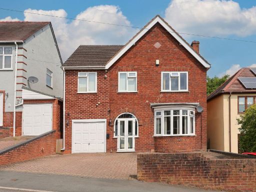 5 bedroom detached house for sale in Coney Green, Stourbridge, DY8 1LA, DY8 — £360,000 • 5 bed • 1 bath • 1206 ft²
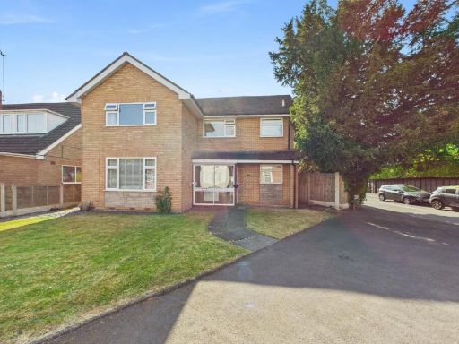 4 bedroom detached house for sale in Heath Street, Stourbridge, DY8 1SB, DY8 — £514,500 • 4 bed • 3 bath • 1292 ft²
Meta
- {
"@context": "https://schema.org",
"@type": "Residence",
"name": "5 bedroom detached house for sale in Bowling Green Road, St…",
"description": "",
"url": "https://propertypiper.co.uk/property/9fafb256-c745-4184-a12d-12f37903f747",
"image": "https://image-a.propertypiper.co.uk/f968e34d-9676-414a-bfc0-0eaebd7a77f0-1024.jpeg",
"address": {
"@type": "PostalAddress",
"streetAddress": "16 Bowling Green Road",
"postalCode": "DY8 3TT",
"addressLocality": "Dudley",
"addressRegion": "Stourbridge",
"addressCountry": "England"
},
"geo": {
"@type": "GeoCoordinates",
"latitude": 52.45641247980007,
"longitude": -2.1565221121649745
},
"numberOfRooms": 5,
"numberOfBathroomsTotal": 3,
"floorSize": {
"@type": "QuantitativeValue",
"value": 1454,
"unitCode": "FTK"
},
"offers": {
"@type": "Offer",
"price": 595000,
"priceCurrency": "GBP",
"availability": "https://schema.org/InStock"
},
"additionalProperty": [
{
"@type": "PropertyValue",
"name": "Feature",
"value": "modern"
},
{
"@type": "PropertyValue",
"name": "Feature",
"value": "brick exterior"
},
{
"@type": "PropertyValue",
"name": "Feature",
"value": "two-story"
},
{
"@type": "PropertyValue",
"name": "Feature",
"value": "detached house"
},
{
"@type": "PropertyValue",
"name": "Feature",
"value": "garage"
},
{
"@type": "PropertyValue",
"name": "Feature",
"value": "driveway"
},
{
"@type": "PropertyValue",
"name": "Feature",
"value": "garden"
},
{
"@type": "PropertyValue",
"name": "Feature",
"value": "family home"
},
{
"@type": "PropertyValue",
"name": "Feature",
"value": "garden"
},
{
"@type": "PropertyValue",
"name": "Feature",
"value": "lawn"
},
{
"@type": "PropertyValue",
"name": "Feature",
"value": "brick exterior"
},
{
"@type": "PropertyValue",
"name": "Feature",
"value": "outdoor seating"
},
{
"@type": "PropertyValue",
"name": "Feature",
"value": "backyard"
},
{
"@type": "PropertyValue",
"name": "Feature",
"value": "shrubs"
},
{
"@type": "PropertyValue",
"name": "Feature",
"value": "trees"
},
{
"@type": "PropertyValue",
"name": "Feature",
"value": "landscaping"
},
{
"@type": "PropertyValue",
"name": "Feature",
"value": "patio"
},
{
"@type": "PropertyValue",
"name": "Feature",
"value": "family home"
},
{
"@type": "PropertyValue",
"name": "Feature",
"value": "suburban"
}
]
}
High Res Floorplan Images
Compatible Floorplan Images
FloorplanImages Thumbnail