WV5 9AS - 3 bedroom semidetached house for sale in 12 Strathmore Cres…
View on Property Piper
3 bedroom semi-detached house for sale in 12 Strathmore Crescent, Wombourne, Wolverhampton, WV5
Property Details
- Price: £315000
- Bedrooms: 3
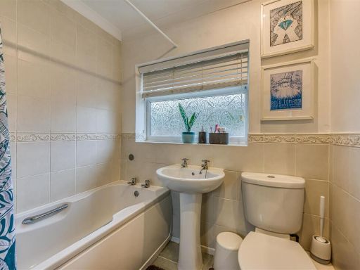
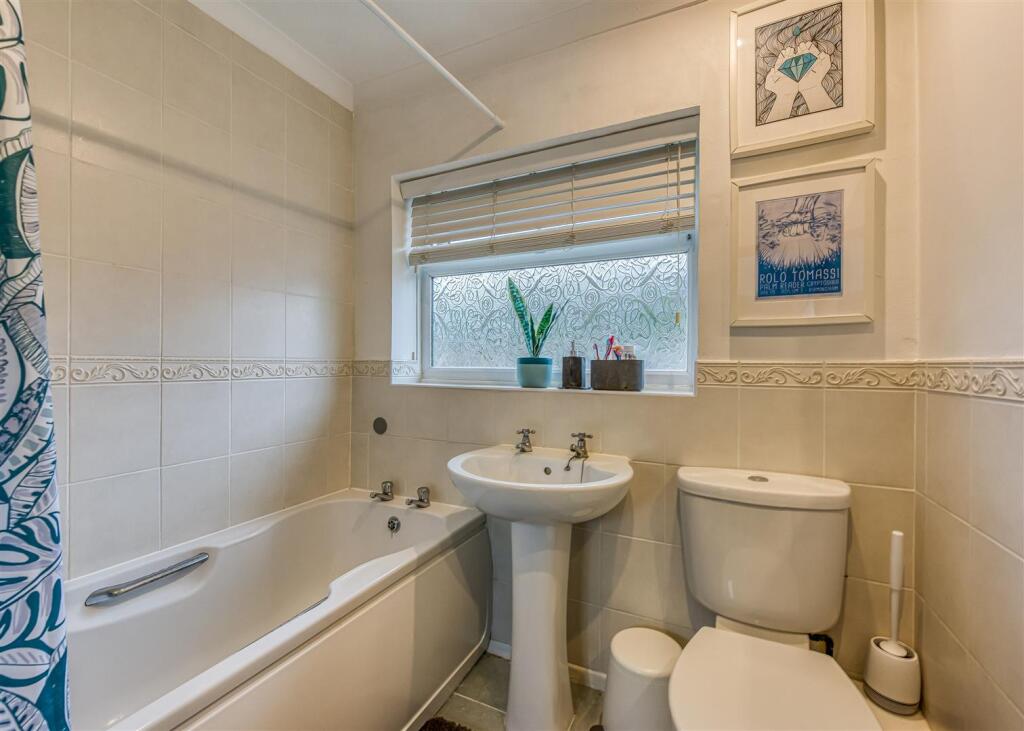
- Bathrooms: 1
- Property Type: undefined
- Property SubType: undefined
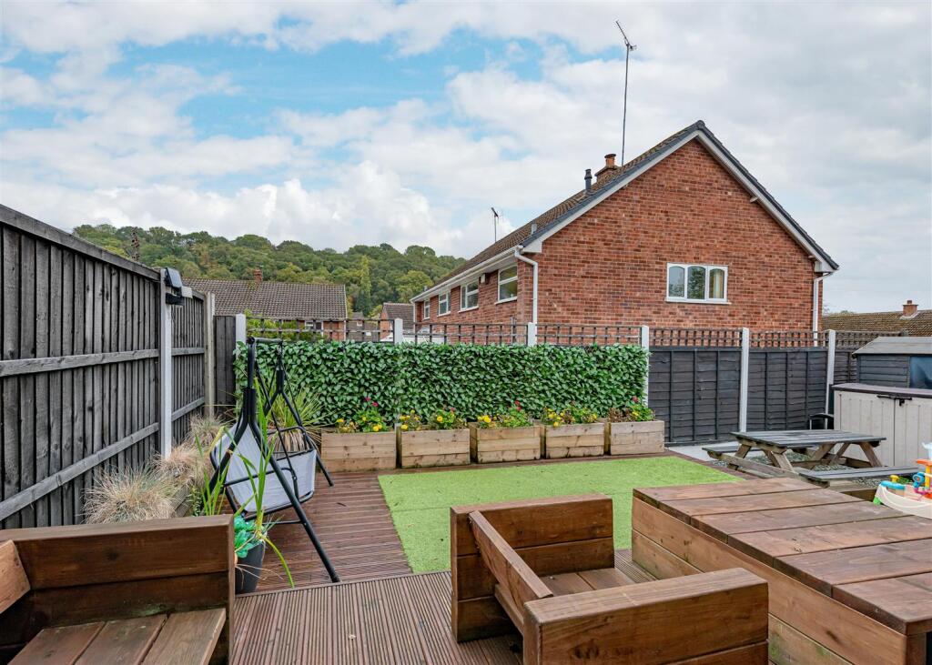
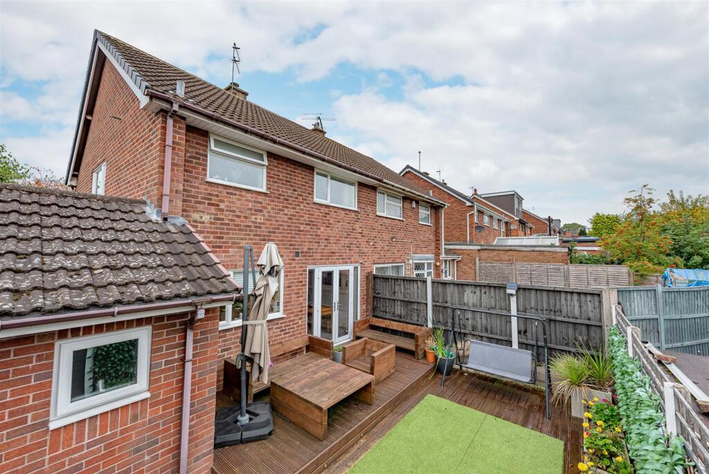
Image Descriptions
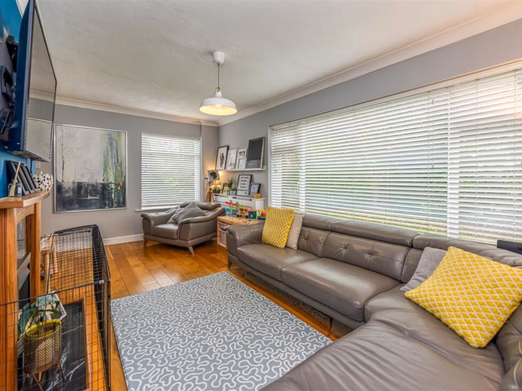
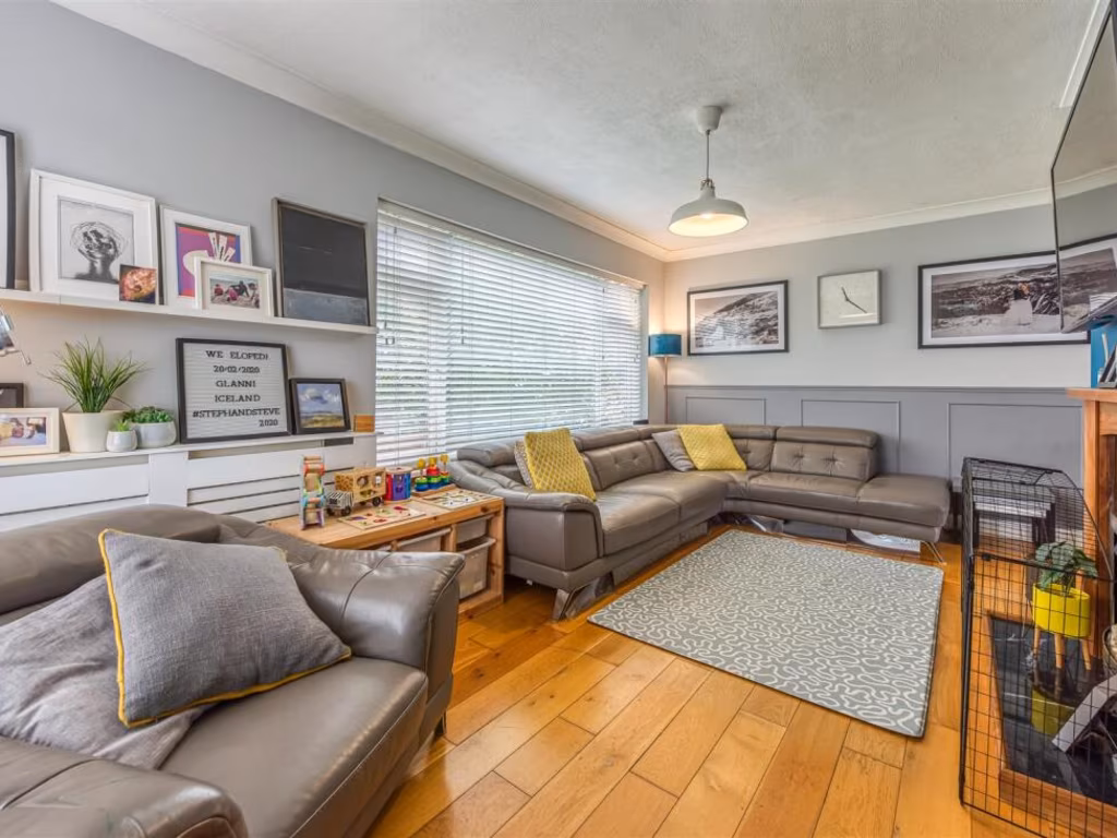
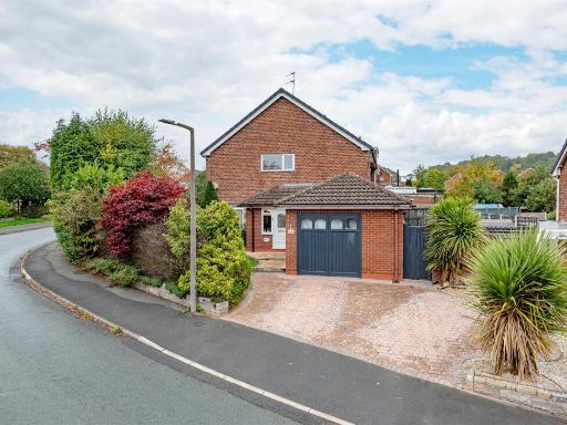
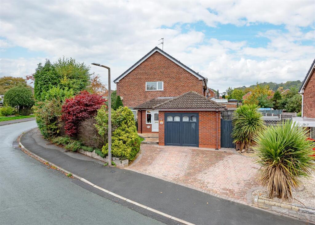
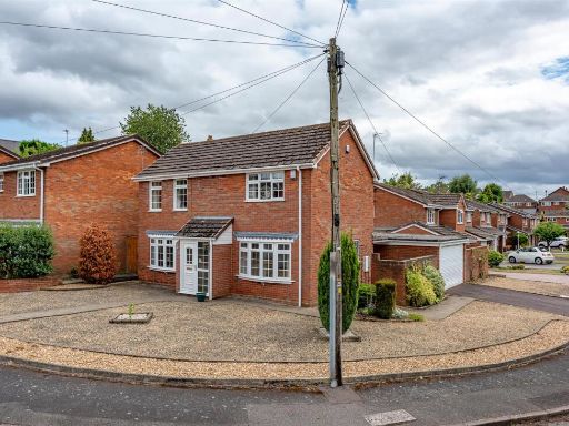
- detached house modern
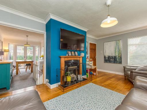
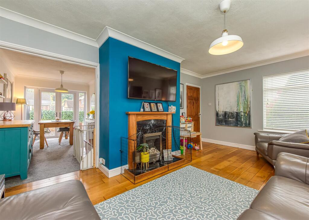
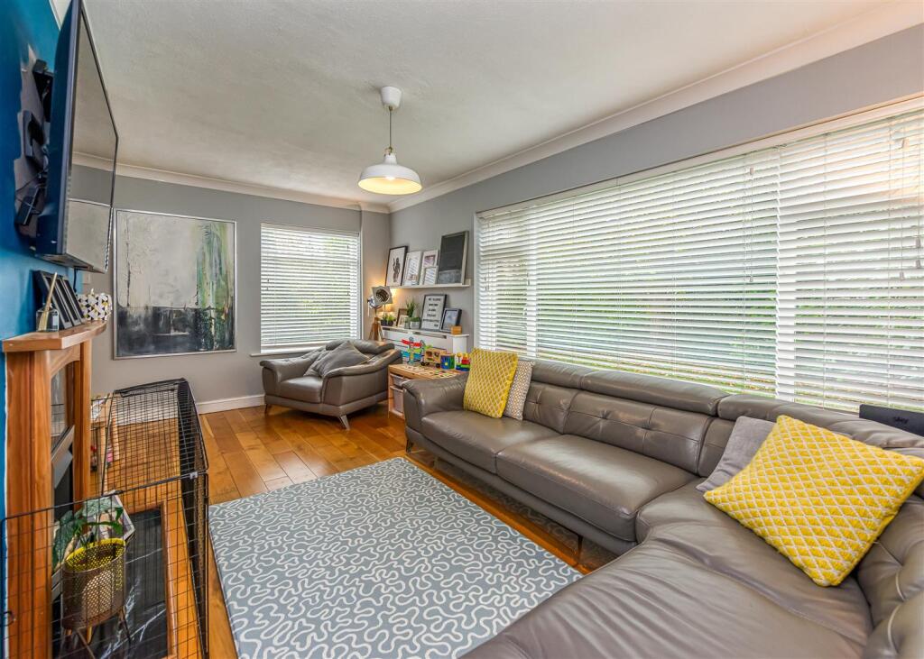
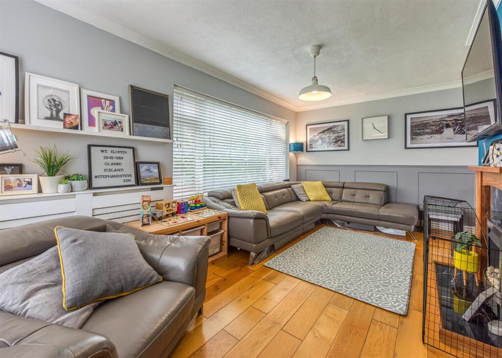
- living area modern
Floorplan Description
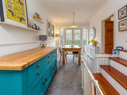
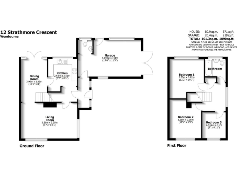
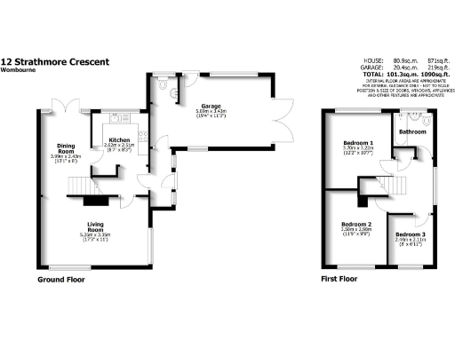
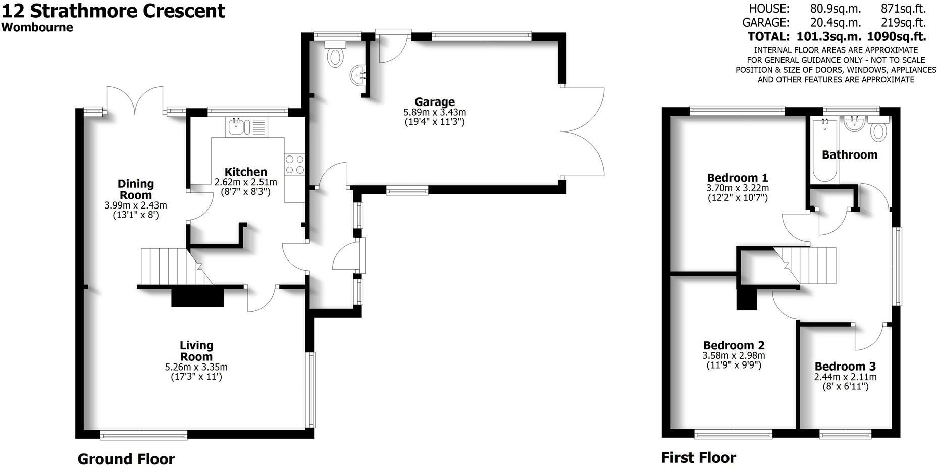
- Detached house with ground floor living, dining, kitchen and first floor three bedrooms
Rooms
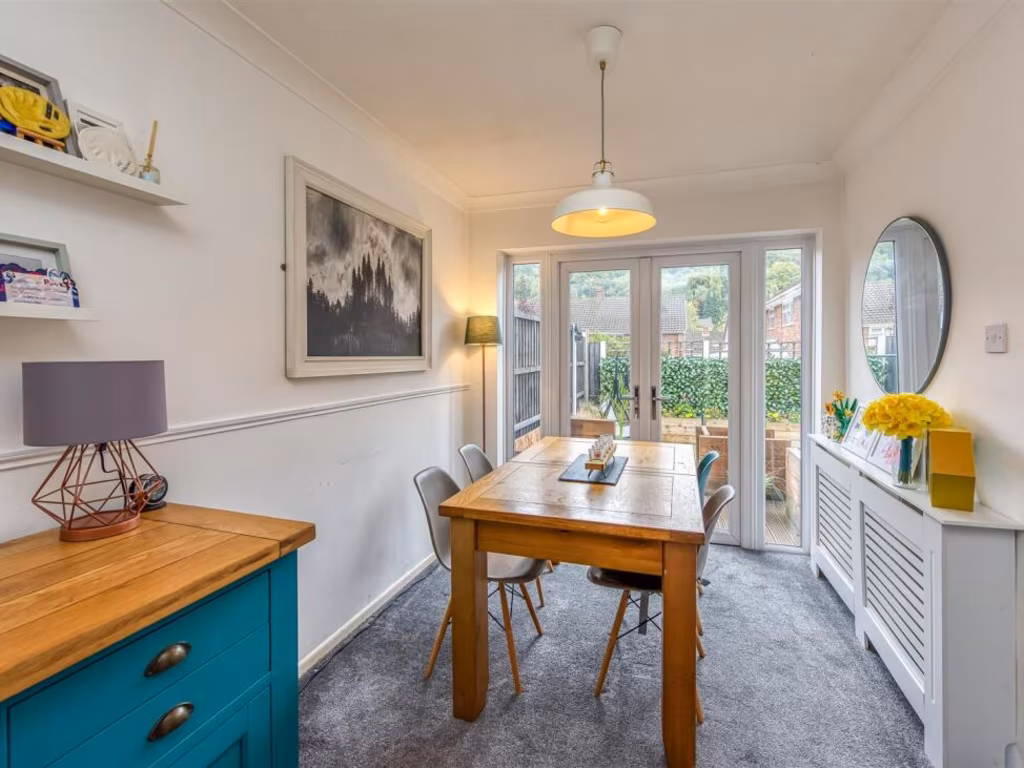
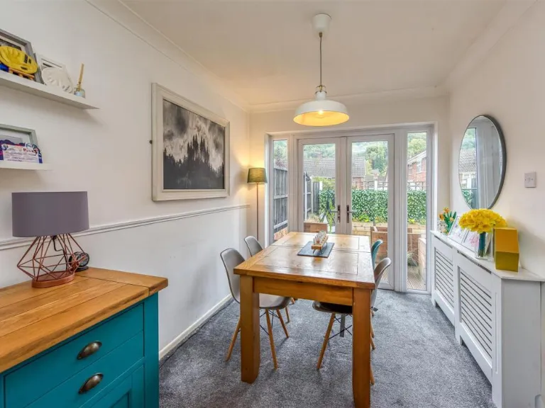
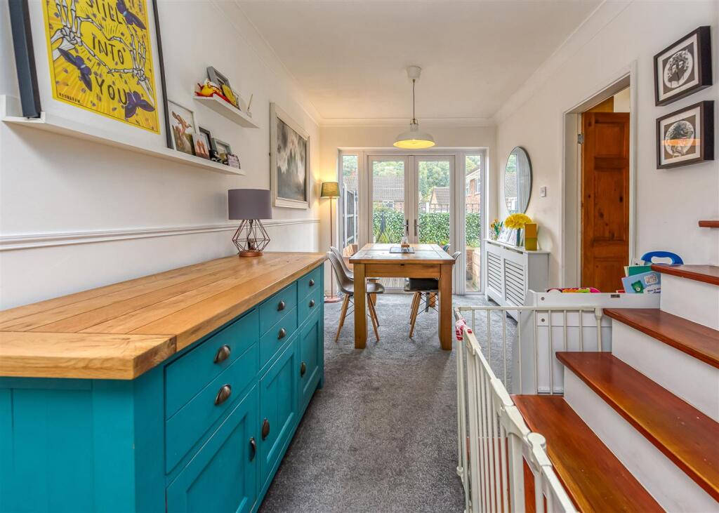
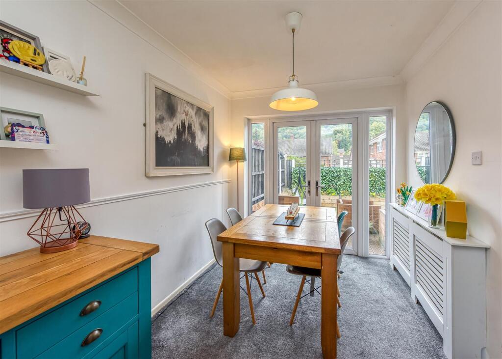
- Dining Room:
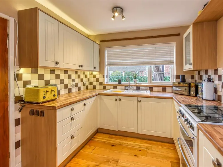
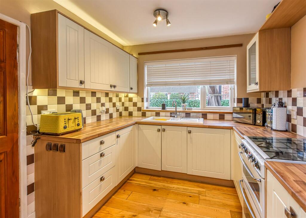
- Kitchen:
- Living Room:
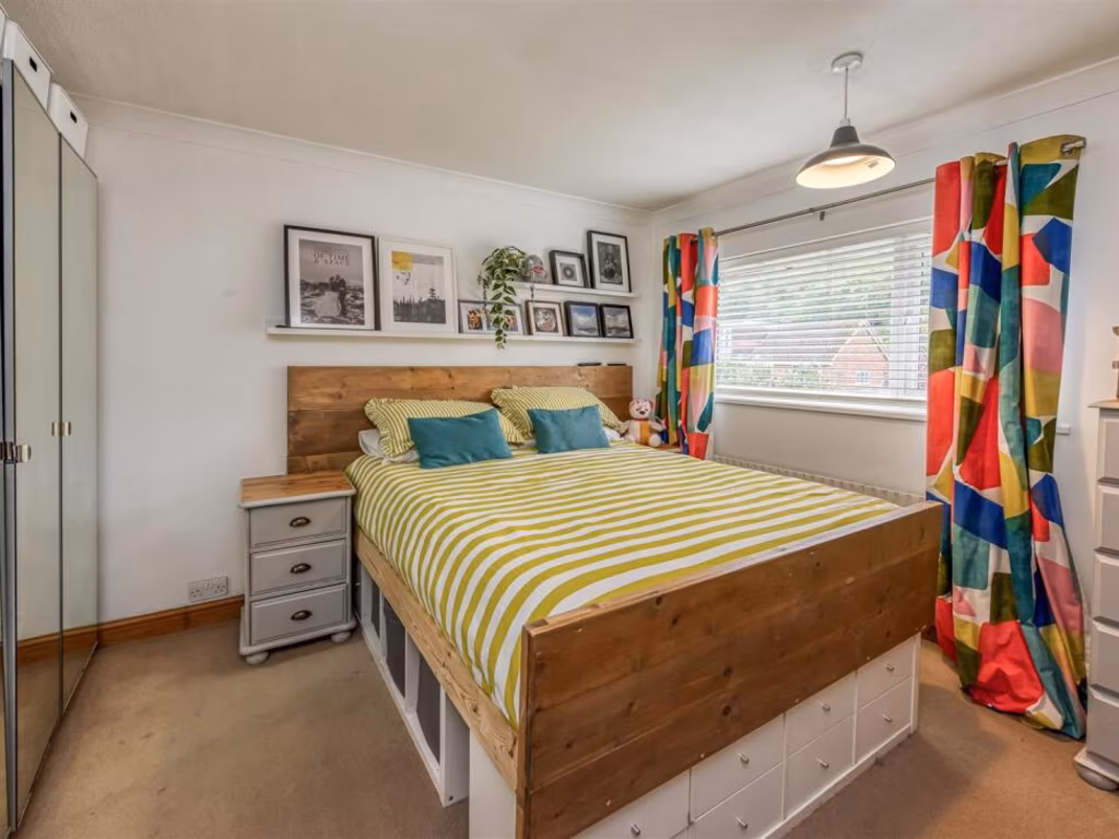
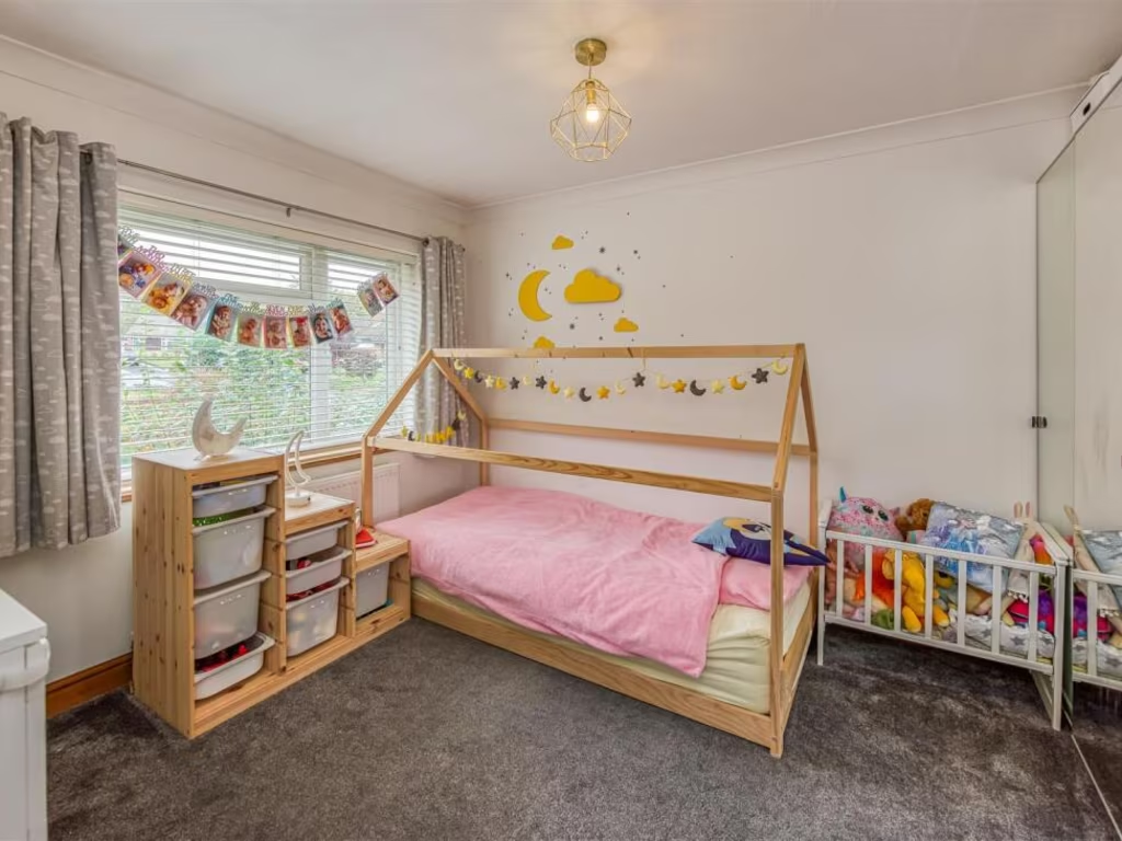
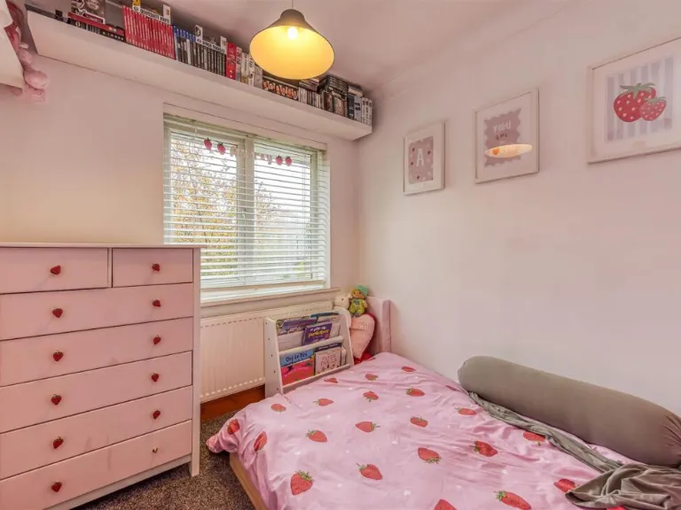
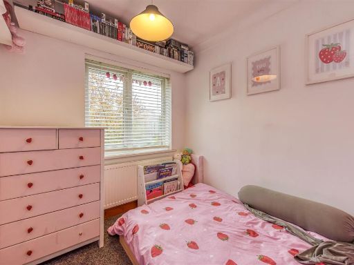
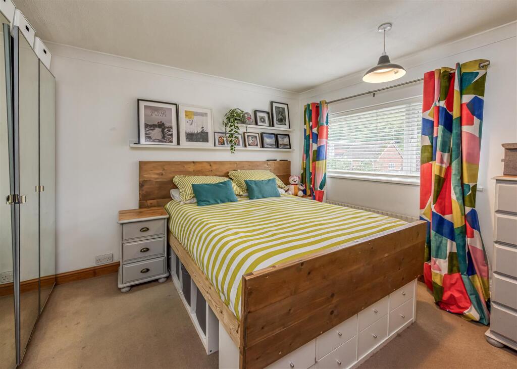
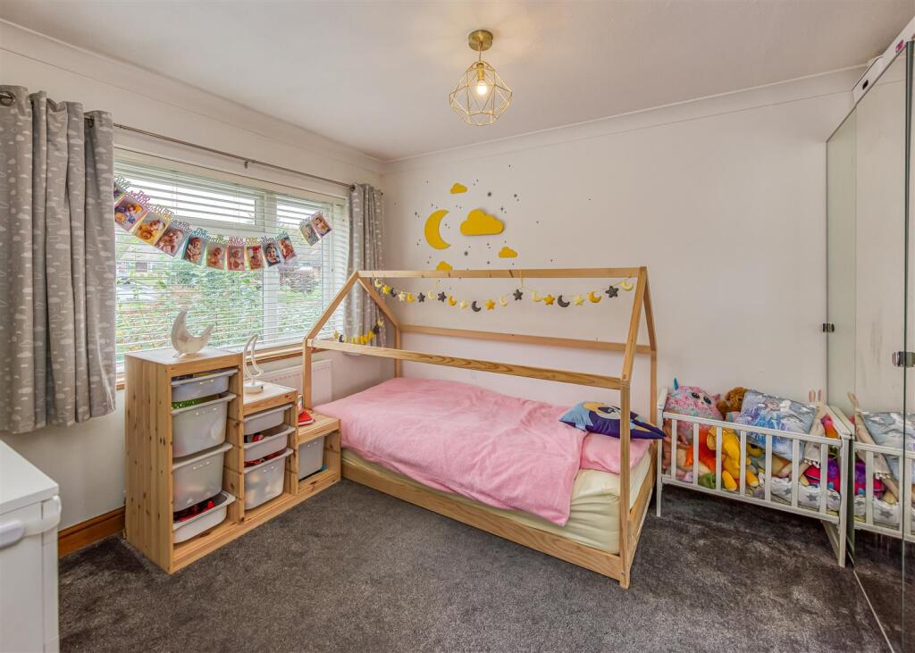
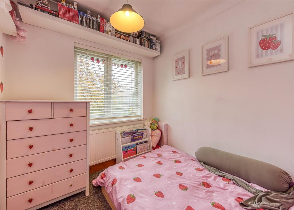
- Bedroom 1:
- Bedroom 2:
- Bedroom 3:
Textual Property Features
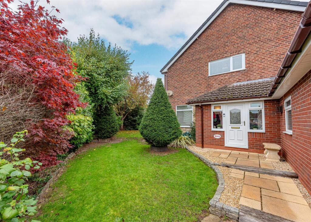
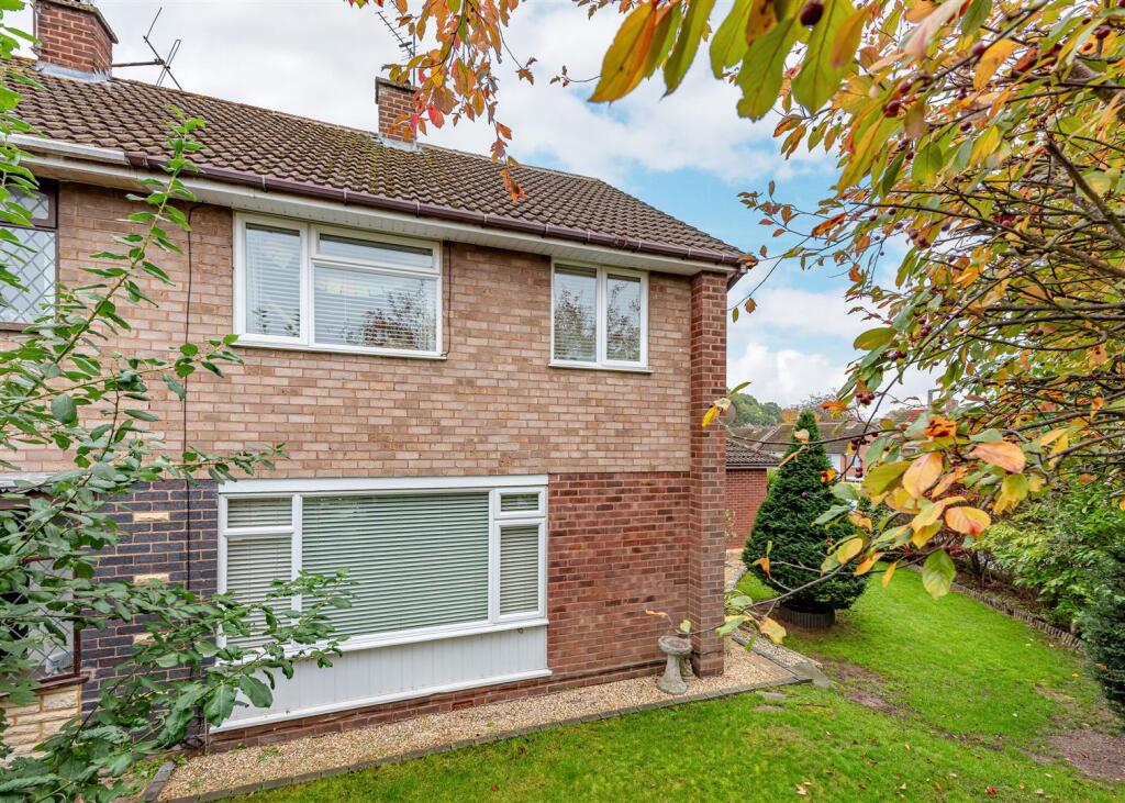
Detected Visual Features
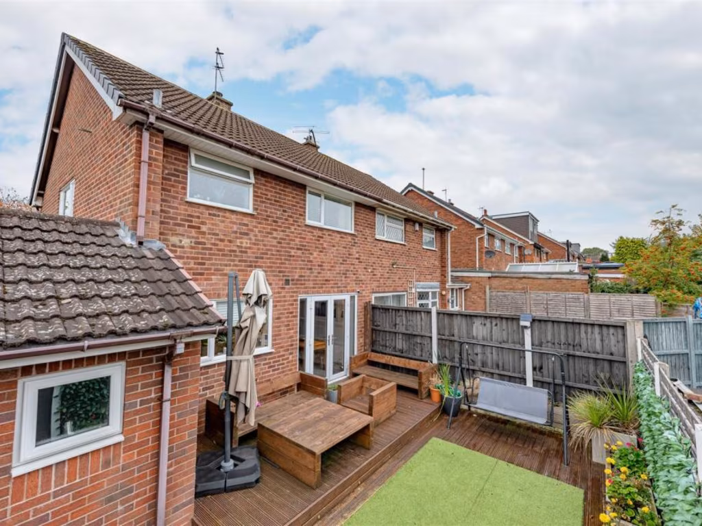
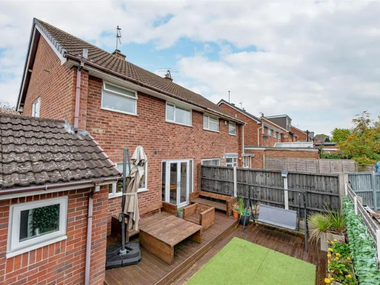
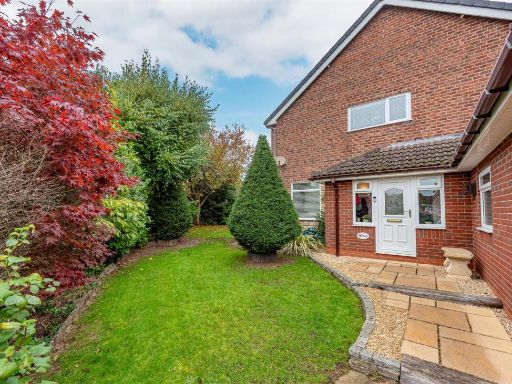
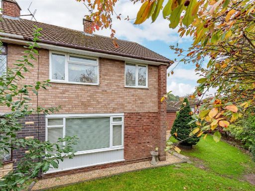
- detached house
- garage
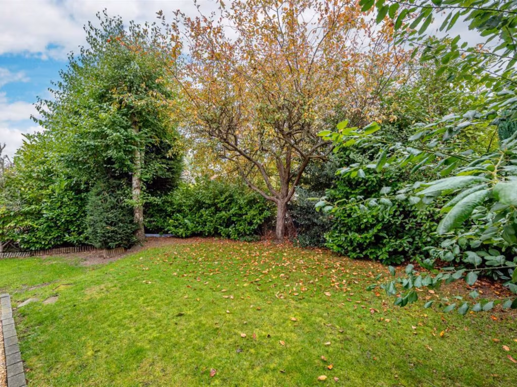
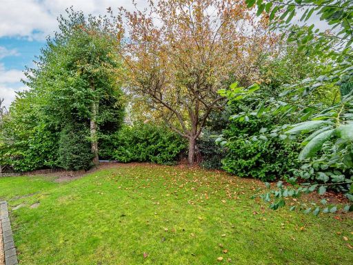
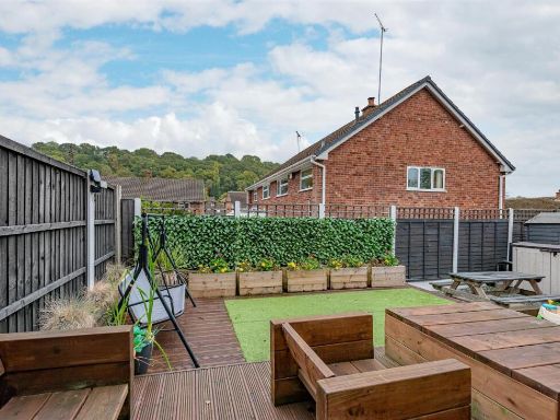
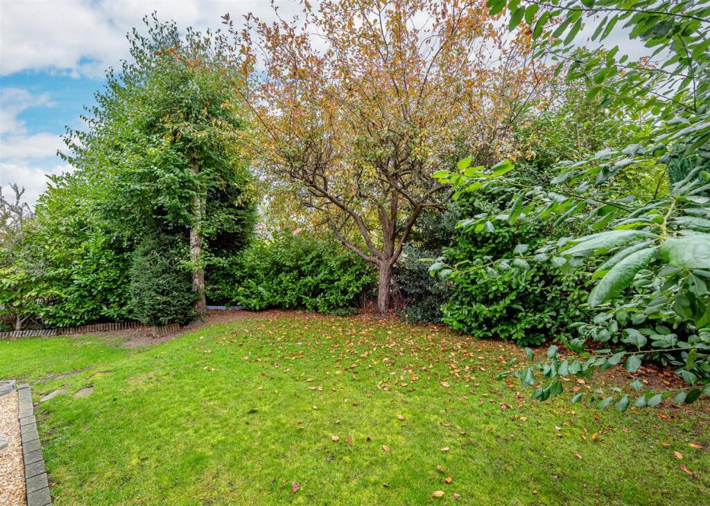
- garden
- modern
- brick exterior
- driveway
- living room
- fireplace
- wood flooring
- pendant lighting
- open plan
- blue accent wall
- natural light
- indoor plant
EPC Details
- Fully double glazed
- Cavity wall, filled cavity
- Boiler and radiators, mains gas
- Low energy lighting in 63% of fixed outlets
- Solid, no insulation (assumed)
Nearby Schools
- Summerhill School
- St Mary's CofE Primary School
- Maidensbridge Primary School
- Blakeley Heath Primary School
- All Saints' CofE Primary School
- Springdale Primary School
- Woodfield Primary School
- Smestow Academy
- Dawley Brook Primary School
- St Benedict Biscop CofE Primary School
- Highfields School
- Bhylls Acre Primary School
- Westacre Infant School
- Christ Church (Church of England) Infant and Nursery School
- St Edmund's Catholic Academy
- Church of the Ascension CofE Primary School
- St John's CofE (C) Primary School
- Westfield Primary School
- Castlecroft Primary School
- St Bernadette's Catholic Primary School
- Wombourne High School
- St Bartholomew's Church of England Primary School
- Warstones Primary School
- St Michael's Catholic Primary Academy and Nursery
- Uplands Junior School
Nearest Bars And Restaurants
- Id: 1510712018
- Tags:
- Amenity: fast_food
- Cuisine: fish_and_chips
- Name: Wombourne Fish Bar
- Toilets:
- Wheelchair: limited
- TagsNormalized:
- Lat: 52.5356507
- Lon: -2.1859026
- FullGeoHash: gcq6y7b62g0g
- PartitionGeoHash: gcq6
- Images:
- FoodStandards: null
- Distance: 1024.9
,- Id: 698235306
- Tags:
- Amenity: pub
- Building: yes
- Name: Mount Pleasant
- Source: bing
- TagsNormalized:
- Lat: 52.5363903
- Lon: -2.1982295
- FullGeoHash: gcq6vgzq9scr
- PartitionGeoHash: gcq6
- Images:
- FoodStandards: null
- Distance: 1010.9
,- Id: 196216293
- Tags:
- Addr:
- City: Wombourne
- Housenumber: 1
- Postcode: WV5 9EY
- Street: Station Road
- Amenity: pub
- Building: yes
- Name: The New Inn at Wombourne
- Operator: Marston's
- Phone: +44 1902892037
- Toilets:
- Wheelchair: yes
- Wheelchair:description: great food and Great wheelchair access
- TagsNormalized:
- Lat: 52.5371325
- Lon: -2.1877451
- FullGeoHash: gcq6yhnfvz74
- PartitionGeoHash: gcq6
- Images:
- FoodStandards: null
- Distance: 830.3
,- Id: 1515967101
- Tags:
- Amenity: fast_food
- Cuisine: chinese
- Name: Golden Valley (Sam's Chinese)
- TagsNormalized:
- Lat: 52.5394236
- Lon: -2.1867544
- FullGeoHash: gcq6yhx8kfmt
- PartitionGeoHash: gcq6
- Images:
- FoodStandards: null
- Distance: 616.3
,- Id: 160822951
- Tags:
- Amenity: cafe
- Building: yes
- Historic:
- Name: The Railway Café
- Source: visual survey;bing
- TagsNormalized:
- Lat: 52.5432136
- Lon: -2.1926977
- FullGeoHash: gcq6yj5q6kyj
- PartitionGeoHash: gcq6
- Images:
- FoodStandards: null
- Distance: 171
}
Nearest General Shops
- Id: 186696383
- Tags:
- Name: Whitecross Garden Centre
- Shop: garden_centre
- TagsNormalized:
- Lat: 52.5543981
- Lon: -2.1928014
- FullGeoHash: gcq6yp5r81bg
- PartitionGeoHash: gcq6
- Images:
- FoodStandards: null
- Distance: 1125.5
,- Id: 196216298
- Tags:
- Addr:
- City: Wombourne
- Postcode: WV5 9JD
- Street: Windmill Bank
- Building: yes
- Name: Boxley's Butchers
- Shop: butcher
- TagsNormalized:
- Lat: 52.5361899
- Lon: -2.1865125
- FullGeoHash: gcq6y5zv6xd5
- PartitionGeoHash: gcq6
- Images:
- FoodStandards: null
- Distance: 954.8
,- Id: 1510658847
- Tags:
- Name: Windmill Bakery
- Shop: bakery
- TagsNormalized:
- Lat: 52.5364402
- Lon: -2.1866458
- FullGeoHash: gcq6y5zwzqq8
- PartitionGeoHash: gcq6
- Images:
- FoodStandards: null
- Distance: 925.6
}
Nearest Grocery shops
- Id: 1510654653
- Tags:
- TagsNormalized:
- Lat: 52.535973
- Lon: -2.1849285
- FullGeoHash: gcq6y7buprpj
- PartitionGeoHash: gcq6
- Images:
- FoodStandards: null
- Distance: 1015.9
,- Id: 231740193
- Tags:
- Brand: Spar
- Brand:wikidata: Q610492
- Brand:wikipedia: en:SPAR (retailer)
- Building: retail
- Name: Spar
- Shop: convenience
- Source: Bing
- Wheelchair: yes
- TagsNormalized:
- spar
- retail
- convenience
- shop
- Lat: 52.5358997
- Lon: -2.1864288
- FullGeoHash: gcq6y5zgu988
- PartitionGeoHash: gcq6
- Images:
- FoodStandards: null
- Distance: 987.2
,- Id: 698235308
- Tags:
- Building: yes
- Name: Co-operative Food
- Shop: supermarket
- Source: bing
- TagsNormalized:
- Lat: 52.5373587
- Lon: -2.1862867
- FullGeoHash: gcq6yhpurc6r
- PartitionGeoHash: gcq6
- Images:
- FoodStandards: null
- Distance: 838.2
}
Nearest Religious buildings
- Id: 137762109
- Tags:
- Amenity: place_of_worship
- Building: church
- Denomination: roman_catholic
- Name: St. Bernadettes
- Religion: christian
- TagsNormalized:
- place of worship
- church
- catholic
- roman catholic
- christian
- Lat: 52.5335067
- Lon: -2.1884631
- FullGeoHash: gcq6y5qmv57t
- PartitionGeoHash: gcq6
- Images:
- FoodStandards: null
- Distance: 1216.2
,- Id: 230493902
- Tags:
- Amenity: place_of_worship
- Building: yes
- Denomination: methodist
- Religion: christian
- TagsNormalized:
- place of worship
- methodist
- christian
- church
- Lat: 52.5349416
- Lon: -2.1830364
- FullGeoHash: gcq6y7dq5wfj
- PartitionGeoHash: gcq6
- Images:
- FoodStandards: null
- Distance: 1174.5
,- Id: 71513358
- Tags:
- Amenity: place_of_worship
- Building: church
- Denomination: anglican
- Name: St Benedict Biscop
- Religion: christian
- Source: GPS Survey
- Wikidata: Q26525946
- TagsNormalized:
- place of worship
- church
- anglican
- christian
- Lat: 52.5363359
- Lon: -2.1832042
- FullGeoHash: gcq6y7fnrduf
- PartitionGeoHash: gcq6
- Images:
- FoodStandards: null
- Distance: 1033.2
}
Nearest Leisure Facilities
- Id: 275875227
- Tags:
- Landuse: meadow
- Source: bing
- Sport: equestrian
- TagsNormalized:
- Lat: 52.5493161
- Lon: -2.1943155
- FullGeoHash: gcq6yn61uwxb
- PartitionGeoHash: gcq6
- Images:
- FoodStandards: null
- Distance: 598
,- Id: 5715488
- Tags:
- Designation: local_nature_reserve
- Leisure: nature_reserve
- Name: South Staffordshire Railway Walk Local Nature Reserve
- Operator: South Staffordshire Council
- Protect_class: 4
- Source: wikipedia
- Type: multipolygon
- Wikidata: Q7568538
- Wikipedia: en:South_Staffordshire_Railway_Walk
- TagsNormalized:
- Lat: 52.545109
- Lon: -2.1852976
- FullGeoHash: gcq6ym89qyk0
- PartitionGeoHash: gcq6
- Images:
- FoodStandards: null
- Distance: 393.1
,- Id: 1510443224
- Tags:
- TagsNormalized:
- Lat: 52.5426733
- Lon: -2.192144
- FullGeoHash: gcq6yj5er24y
- PartitionGeoHash: gcq6
- Images:
- FoodStandards: null
- Distance: 201.3
,- Id: 186695863
- Tags:
- TagsNormalized:
- Lat: 52.5430103
- Lon: -2.1898532
- FullGeoHash: gcq6yjjmhxp1
- PartitionGeoHash: gcq6
- Images:
- FoodStandards: null
- Distance: 165.8
,- Id: 1974373673
- Tags:
- TagsNormalized:
- Lat: 52.5429157
- Lon: -2.1903359
- FullGeoHash: gcq6yjjh9mrh
- PartitionGeoHash: gcq6
- Images:
- FoodStandards: null
- Distance: 163.8
}
Nearest Tourist attractions
- Id: 1729159141
- Tags:
- Source: survey
- Tourism: picnic_site
- TagsNormalized:
- Lat: 52.5521883
- Lon: -2.1993686
- FullGeoHash: gcq6vyy6wvzy
- PartitionGeoHash: gcq6
- Images:
- FoodStandards: null
- Distance: 1041.4
,- Id: 1729155106
- Tags:
- Source: survey
- Tourism: picnic_site
- TagsNormalized:
- Lat: 52.5413231
- Lon: -2.1965135
- FullGeoHash: gcq6yhbe3s8b
- PartitionGeoHash: gcq6
- Images:
- FoodStandards: null
- Distance: 502.8
,- Id: 1729159123
- Tags:
- Source: survey
- Tourism: picnic_site
- TagsNormalized:
- Lat: 52.5441
- Lon: -2.1929839
- FullGeoHash: gcq6yj75ef0t
- PartitionGeoHash: gcq6
- Images:
- FoodStandards: null
- Distance: 138.6
}
Nearest Train stations
- Id: 3711941418
- Tags:
- Name: Codsall
- Naptan:
- Network: National Rail
- Public_transport: station
- Railway: station
- Ref:
- Wikidata: Q2455479
- Wikipedia: en:Codsall railway station
- TagsNormalized:
- Lat: 52.6274199
- Lon: -2.2016755
- FullGeoHash: gcq7musbcnpg
- PartitionGeoHash: gcq7
- Images:
- FoodStandards: null
- Distance: 9266.6
,- Id: 3711941417
- Tags:
- Name: Bilbrook
- Naptan:
- Network: National Rail
- Public_transport: station
- Railway: station
- Ref:
- Wikidata: Q2786231
- Wikipedia: en:Bilbrook railway station
- TagsNormalized:
- Lat: 52.6239645
- Lon: -2.1873052
- FullGeoHash: gcq7q5zkb1gp
- PartitionGeoHash: gcq7
- Images:
- FoodStandards: null
- Distance: 8857.6
,- Id: 21137911
- Tags:
- Name: Tipton
- Naptan:
- Network: National Rail
- Public_transport: station
- Railway: station
- Ref:
- Source: NPE
- West_midlands_fare_zone: 5
- Wikidata: Q2660685
- Wikipedia: en:Tipton railway station
- TagsNormalized:
- Lat: 52.5305353
- Lon: -2.0658086
- FullGeoHash: gcqdbfzsx1t2
- PartitionGeoHash: gcqd
- Images:
- FoodStandards: null
- Distance: 8603.2
,- Id: 8183358952
- Tags:
- Name: Coseley
- Naptan:
- Network: National Rail
- Public_transport: station
- Railway: station
- Ref:
- West_midlands_fare_zone: 5
- Wikidata: Q2239840
- Wikipedia: en:Coseley railway station
- TagsNormalized:
- Lat: 52.5453191
- Lon: -2.0858098
- FullGeoHash: gcqdbt94tj7m
- PartitionGeoHash: gcqd
- Images:
- FoodStandards: null
- Distance: 7112.1
,- Id: 6634567442
- Tags:
- Name: Wolverhampton
- Naptan:
- Network: National Rail
- Old_name: Wolverhampton High Level
- Public_transport: station
- Railway: station
- Ref:
- West_midlands_fare_zone: 5
- Wheelchair: yes
- Wikidata: Q2361188
- Wikipedia: en:Wolverhampton railway station
- TagsNormalized:
- Lat: 52.5879884
- Lon: -2.120242
- FullGeoHash: gcq7pv254z8c
- PartitionGeoHash: gcq7
- Images:
- FoodStandards: null
- Distance: 6812.7
}
Nearest Hotels
- Id: 355114182
- Tags:
- Building: yes
- Name: Barons Court Hotel
- Source: bing
- Tourism: hotel
- TagsNormalized:
- Lat: 52.5679465
- Lon: -2.1324902
- FullGeoHash: gcq7p3xnmrkp
- PartitionGeoHash: gcq7
- Images:
- FoodStandards: null
- Distance: 4745.8
,- Id: 204771033
- Tags:
- Addr:
- City: Wolverhampton
- Housename: Ramada by Wyndham Park Hall
- Postcode: WV4 5AJ
- Street: Park Drive
- Brand: Ramada
- Brand:wikidata: Q1502859
- Brand:wikipedia: en:Ramada
- Building: hotel
- Name: Ramada by Wyndham Park Hall
- Source: visual survey;bing
- Tourism: hotel
- Wikidata: Q26497541
- TagsNormalized:
- Lat: 52.5608197
- Lon: -2.1295834
- FullGeoHash: gcq7p83kcngw
- PartitionGeoHash: gcq7
- Images:
- FoodStandards: null
- Distance: 4537.1
,- Id: 267262265
- Tags:
- Building: hotel
- Name: Regal Hotel
- Source: bing
- Source:name: Naptan
- Tourism: hotel
- TagsNormalized:
- Lat: 52.51972
- Lon: -2.1778373
- FullGeoHash: gcq6y2yjs9qv
- PartitionGeoHash: gcq6
- Images:
- FoodStandards: null
- Distance: 2877.9
}
Tags
- detached house
- garage
- garden
- modern
- brick exterior
- driveway
- modern
- living room
- fireplace
- wood flooring
- pendant lighting
- open plan
- blue accent wall
- natural light
- indoor plant
Local Market Stats
- Average Price/sqft: £307
- Avg Income: £42800
- Rental Yield: 3.2%
- Social Housing: 7%
- Planning Success Rate: 81%
Similar Properties
 3 bedroom detached house for sale in 5 Churchward Grove, Wolverhampton, WV5 — £435,000 • 3 bed • 1 bath • 980 ft²
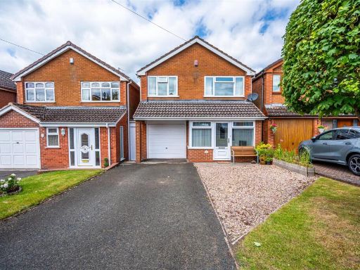 3 bedroom detached house for sale in 5 Banbery Drive, Wombourne, Wolverhampton, WV5 — £325,000 • 3 bed • 1 bath • 1153 ft²
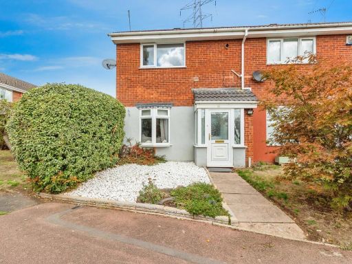 2 bedroom semi-detached house for sale in Brookside Close, Wombourne, Wolverhampton, Staffordshire, WV5 — £245,000 • 2 bed • 1 bath • 650 ft²
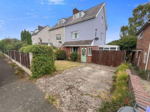 4 bedroom semi-detached house for sale in Hazel Grove, Wolverhampton, WV5 — £243,000 • 4 bed • 1 bath
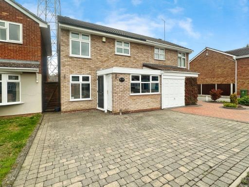 3 bedroom semi-detached house for sale in Brookside Close, Wolverhampton, WV5 — £240,000 • 3 bed • 1 bath • 739 ft²
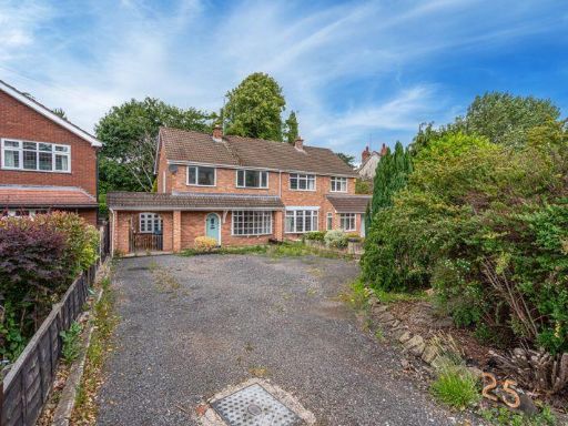 3 bedroom semi-detached house for sale in Common Road, Wombourne, Wolverhampton, WV5 — £300,000 • 3 bed • 1 bath • 1149 ft²
Meta
- {
"@context": "https://schema.org",
"@type": "Residence",
"name": "3 bedroom semidetached house for sale in 12 Strathmore Cres…",
"description": "",
"url": "https://propertypiper.co.uk/property/9d5c56d2-6e63-436d-ac46-3d00f47eb042",
"image": "https://image-a.propertypiper.co.uk/a5301b1b-aa9b-44a7-b8b5-1dd0063c89f1-1024.jpeg",
"address": {
"@type": "PostalAddress",
"streetAddress": "12 STRATHMORE CRESCENT WOMBOURNE WOLVERHAMPTON",
"postalCode": "WV5 9AS",
"addressLocality": "South Staffordshire",
"addressRegion": "South Staffordshire",
"addressCountry": "England"
},
"geo": {
"@type": "GeoCoordinates",
"latitude": 52.54433735235328,
"longitude": -2.190971348206562
},
"numberOfRooms": 3,
"numberOfBathroomsTotal": 1,
"floorSize": {
"@type": "QuantitativeValue",
"value": 871,
"unitCode": "FTK"
},
"offers": {
"@type": "Offer",
"price": 315000,
"priceCurrency": "GBP",
"availability": "https://schema.org/InStock"
},
"additionalProperty": [
{
"@type": "PropertyValue",
"name": "Feature",
"value": "detached house"
},
{
"@type": "PropertyValue",
"name": "Feature",
"value": "garage"
},
{
"@type": "PropertyValue",
"name": "Feature",
"value": "garden"
},
{
"@type": "PropertyValue",
"name": "Feature",
"value": "modern"
},
{
"@type": "PropertyValue",
"name": "Feature",
"value": "brick exterior"
},
{
"@type": "PropertyValue",
"name": "Feature",
"value": "driveway"
},
{
"@type": "PropertyValue",
"name": "Feature",
"value": "modern"
},
{
"@type": "PropertyValue",
"name": "Feature",
"value": "living room"
},
{
"@type": "PropertyValue",
"name": "Feature",
"value": "fireplace"
},
{
"@type": "PropertyValue",
"name": "Feature",
"value": "wood flooring"
},
{
"@type": "PropertyValue",
"name": "Feature",
"value": "pendant lighting"
},
{
"@type": "PropertyValue",
"name": "Feature",
"value": "open plan"
},
{
"@type": "PropertyValue",
"name": "Feature",
"value": "blue accent wall"
},
{
"@type": "PropertyValue",
"name": "Feature",
"value": "natural light"
},
{
"@type": "PropertyValue",
"name": "Feature",
"value": "indoor plant"
}
]
}
High Res Floorplan Images
Compatible Floorplan Images
FloorplanImages Thumbnail