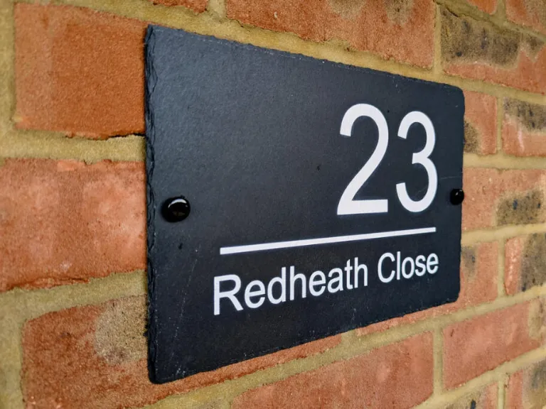
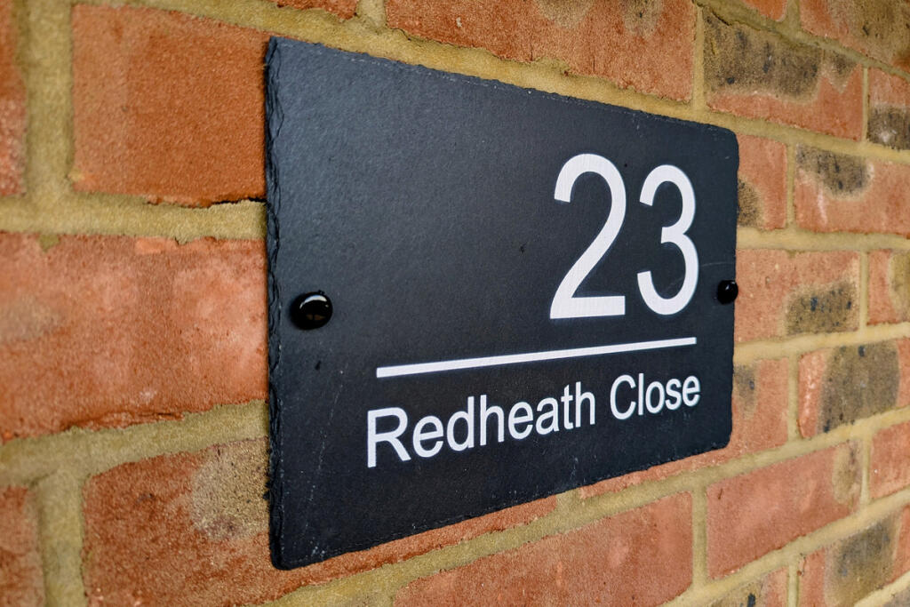
WD25 7AH - 4 bedroom semidetached house for sale in Redheath Close, Wa…
View on Property Piper
4 bedroom semi-detached house for sale in Redheath Close, Watford, WD25
Property Details
- Price: £680000
- Bedrooms: 4
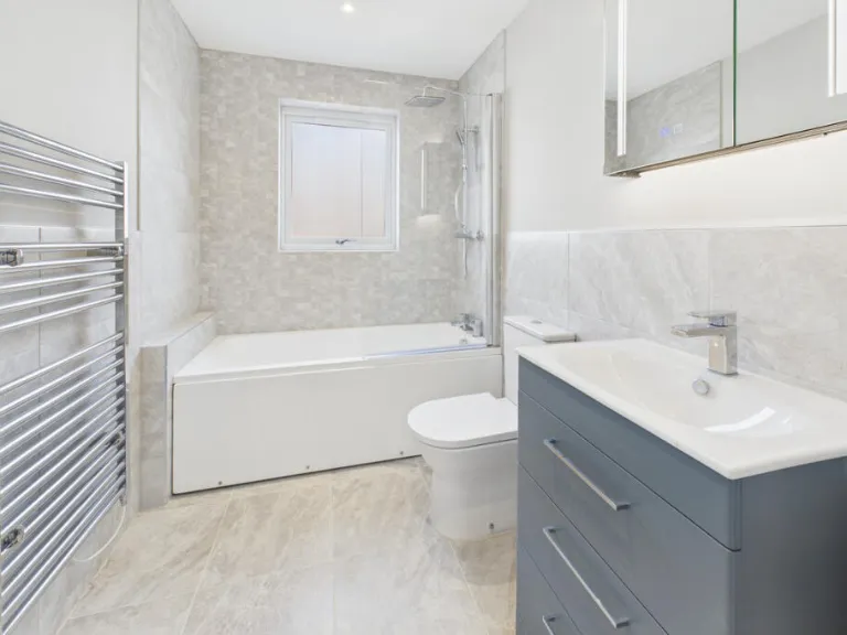
- Bathrooms: 2
- Property Type: undefined
- Property SubType: undefined
Image Descriptions
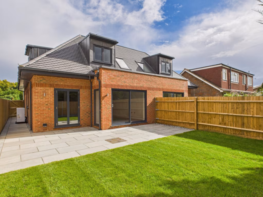
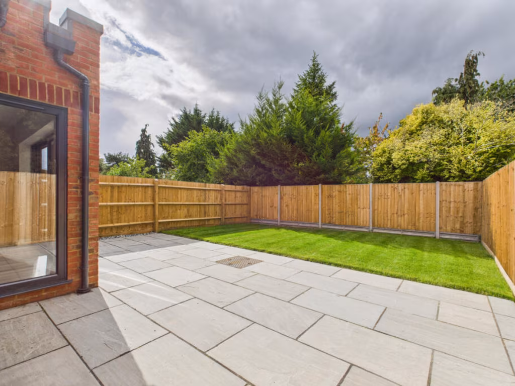
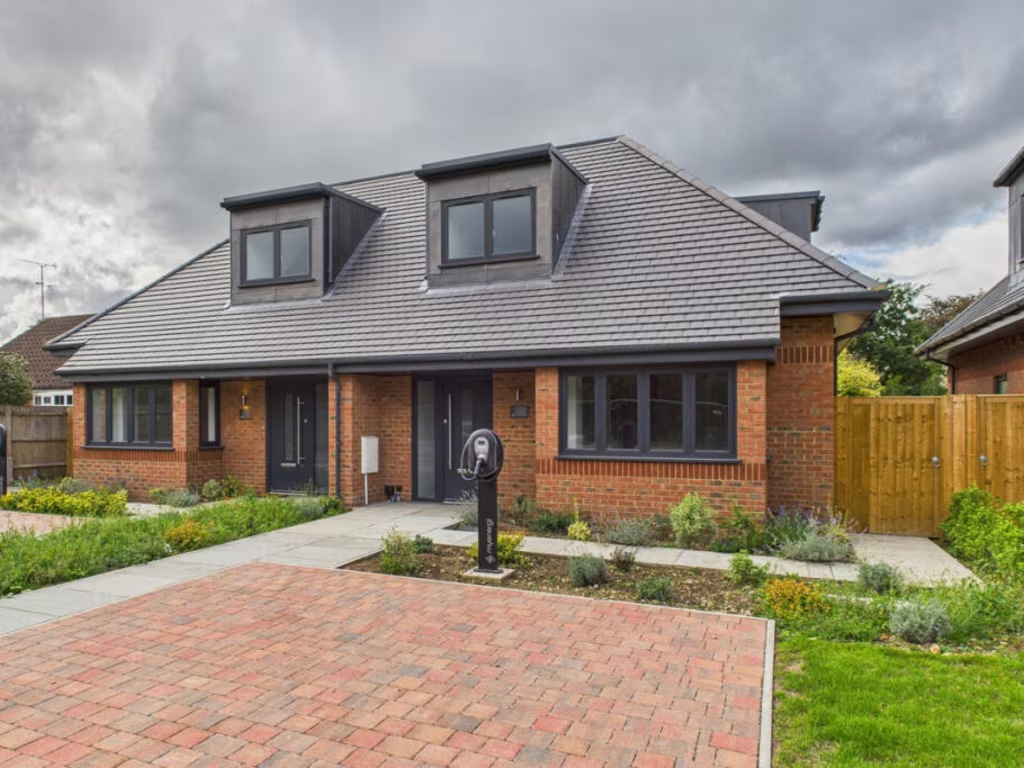
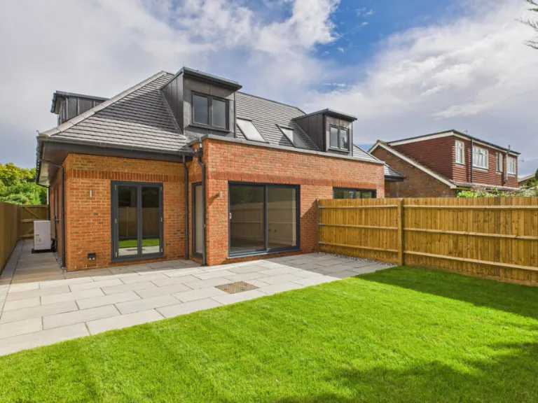
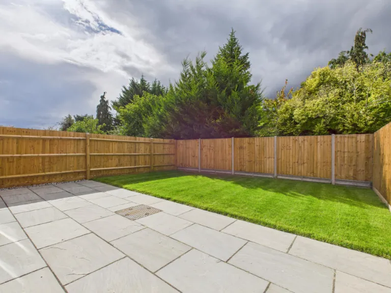
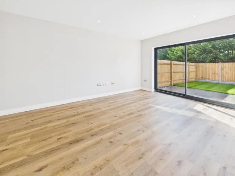
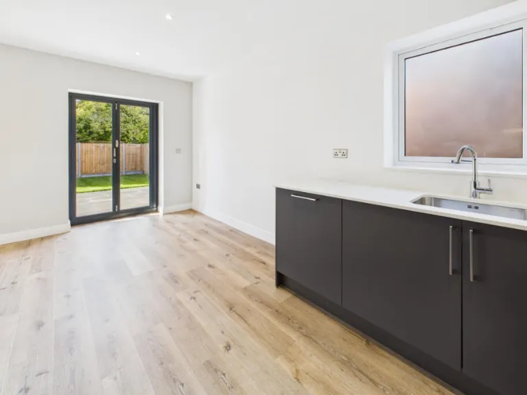
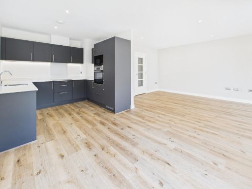
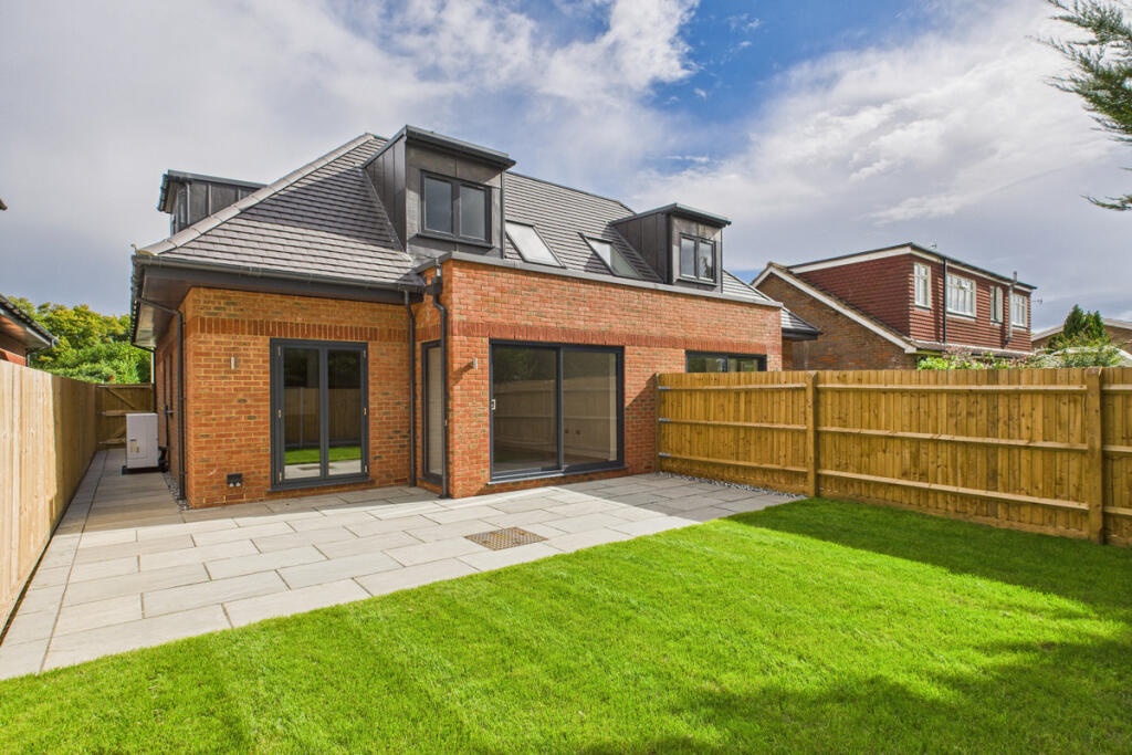
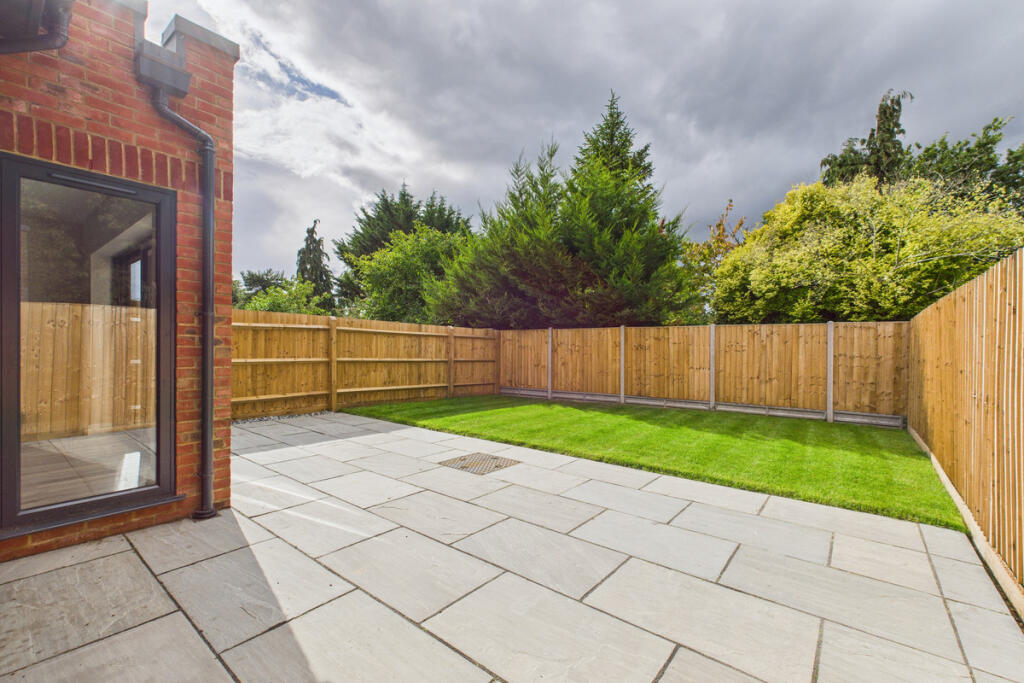
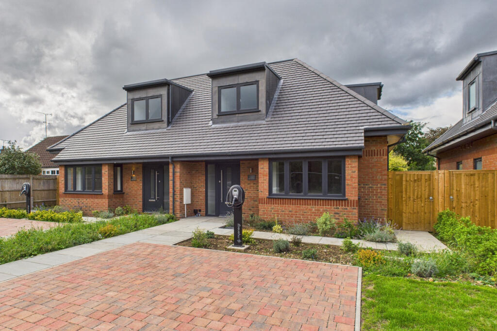
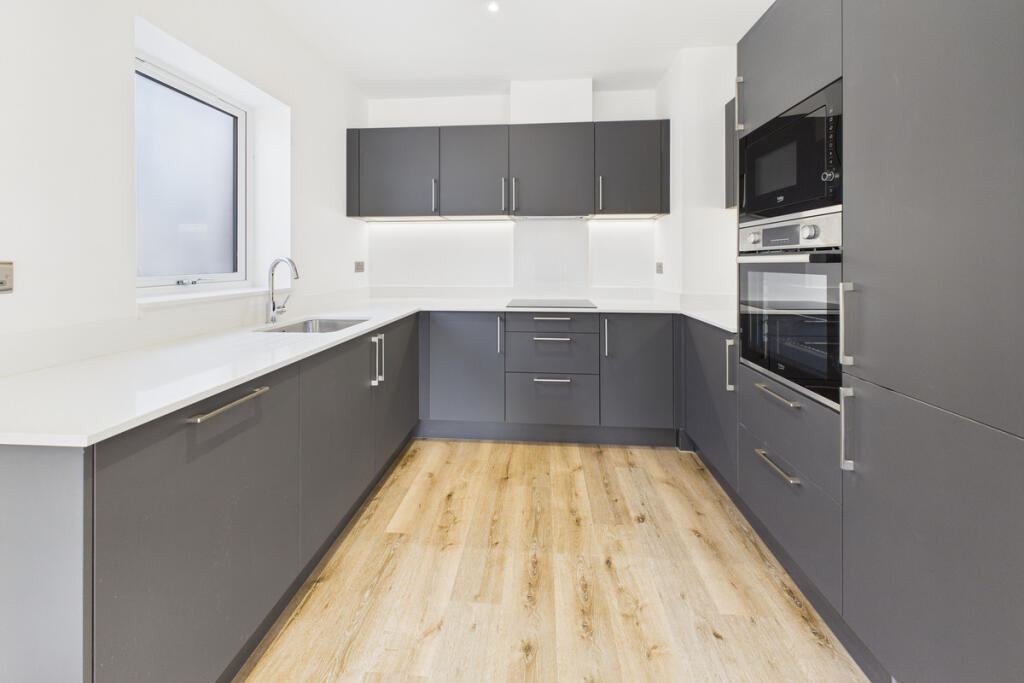
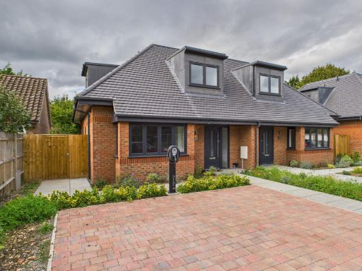
- rear view of modern semi-detached house Modern
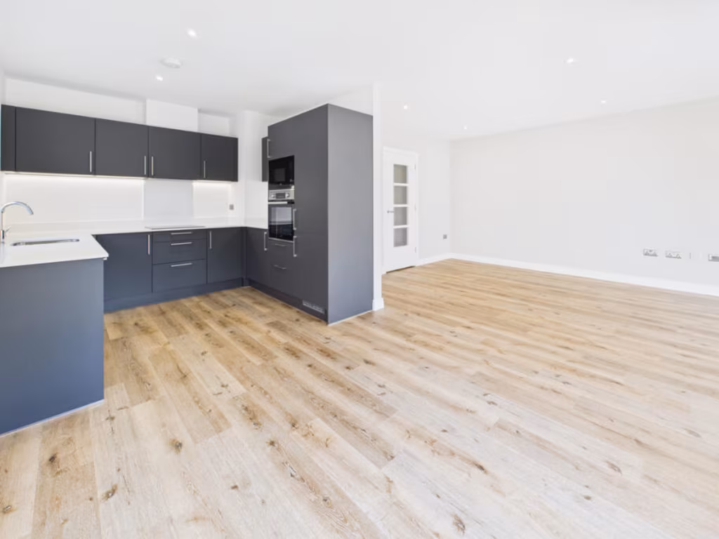
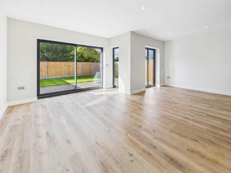
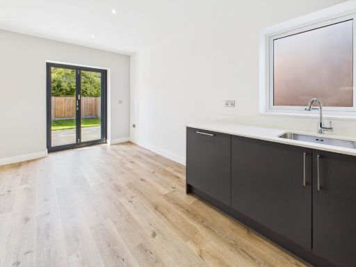
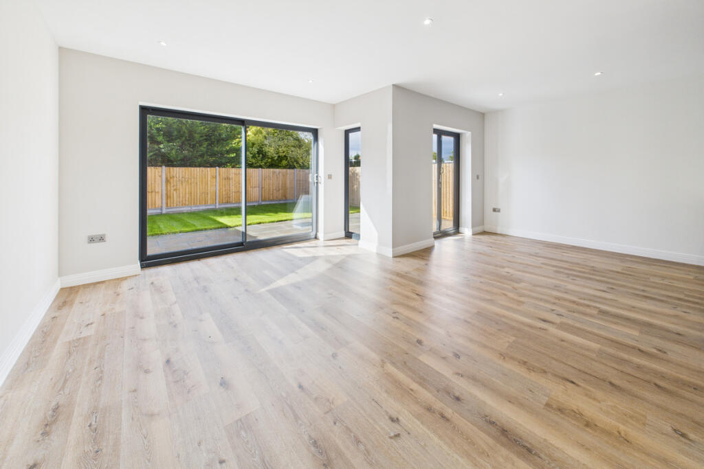
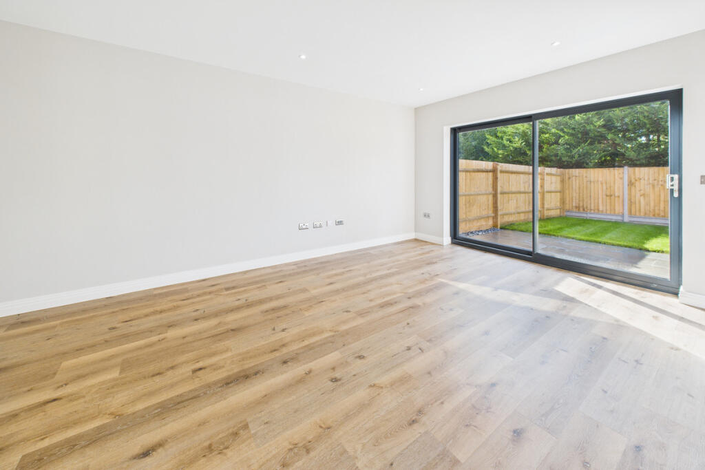
- living area modern
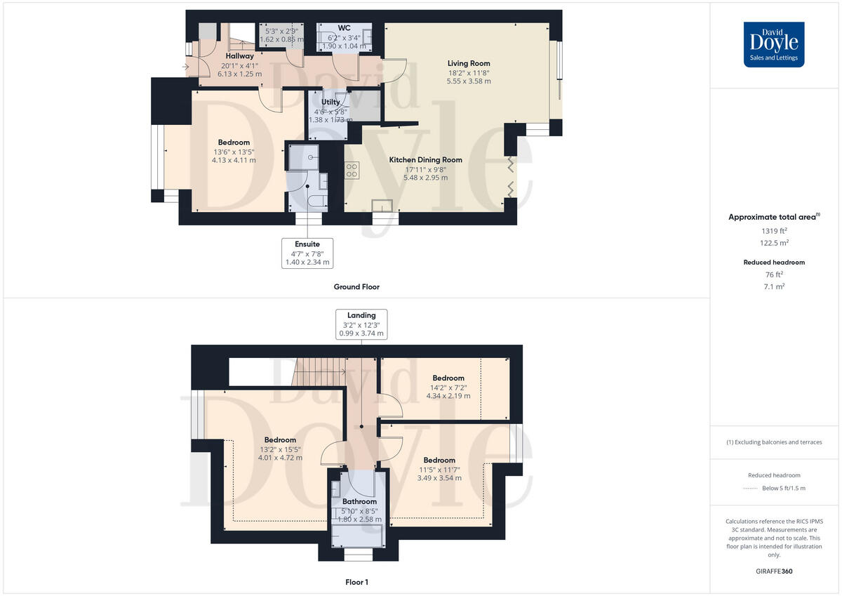
Floorplan Description
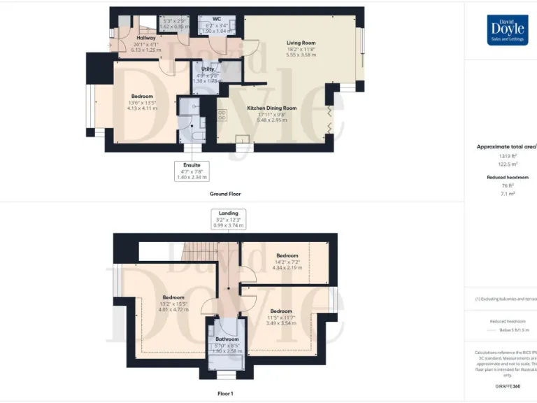
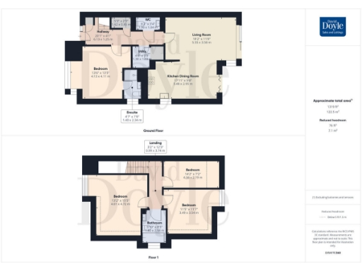
- Two-storey residential property floorplan.
Rooms
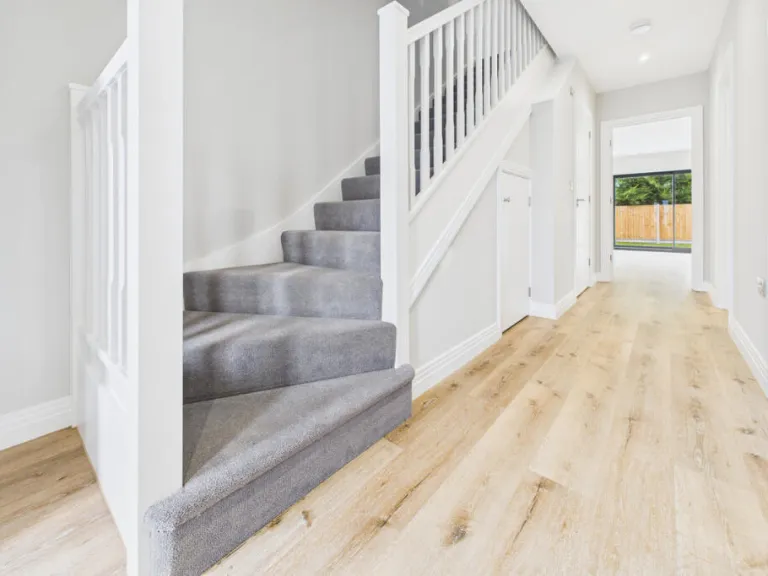
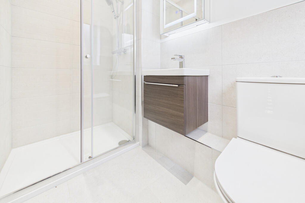
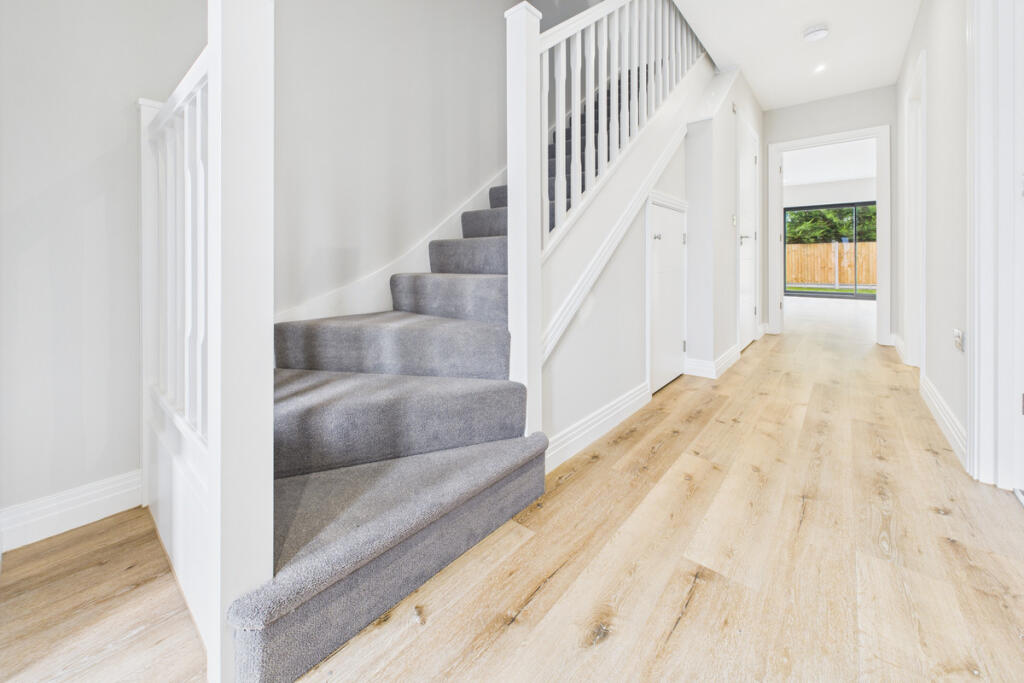
- Hallway:
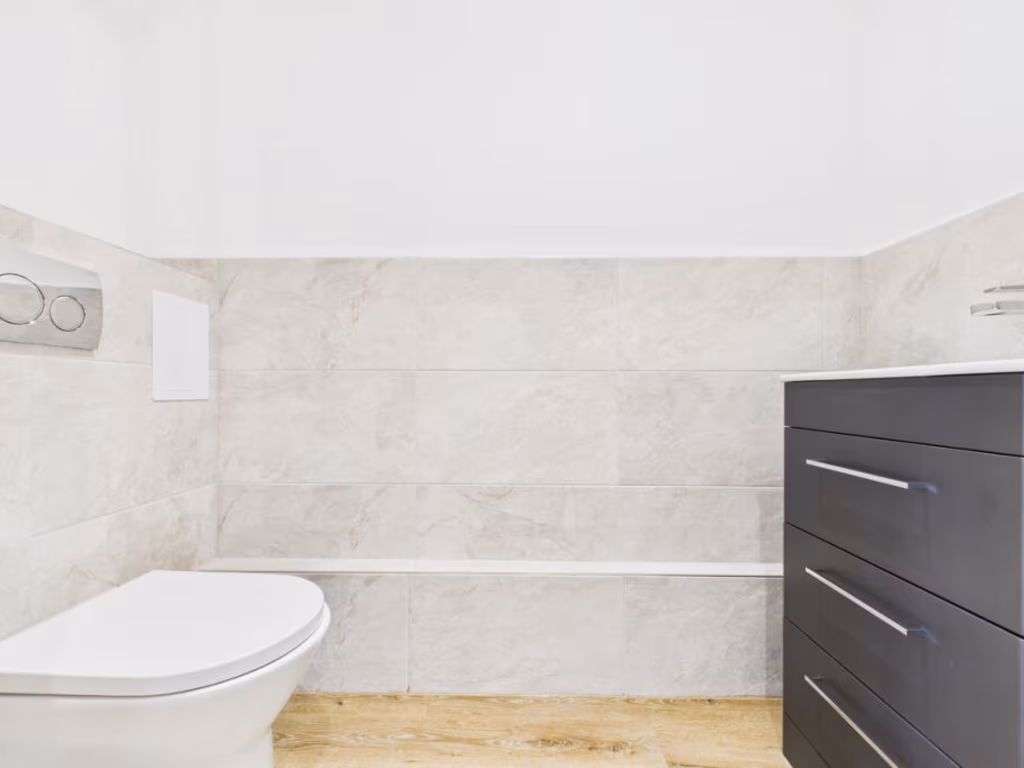
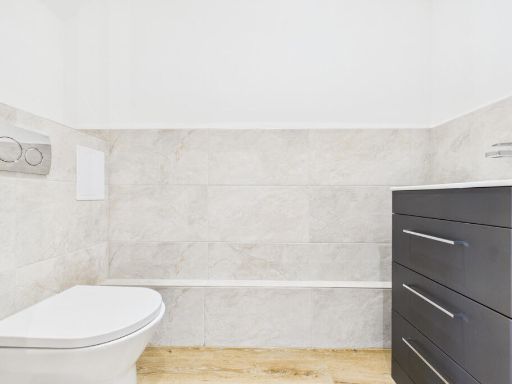
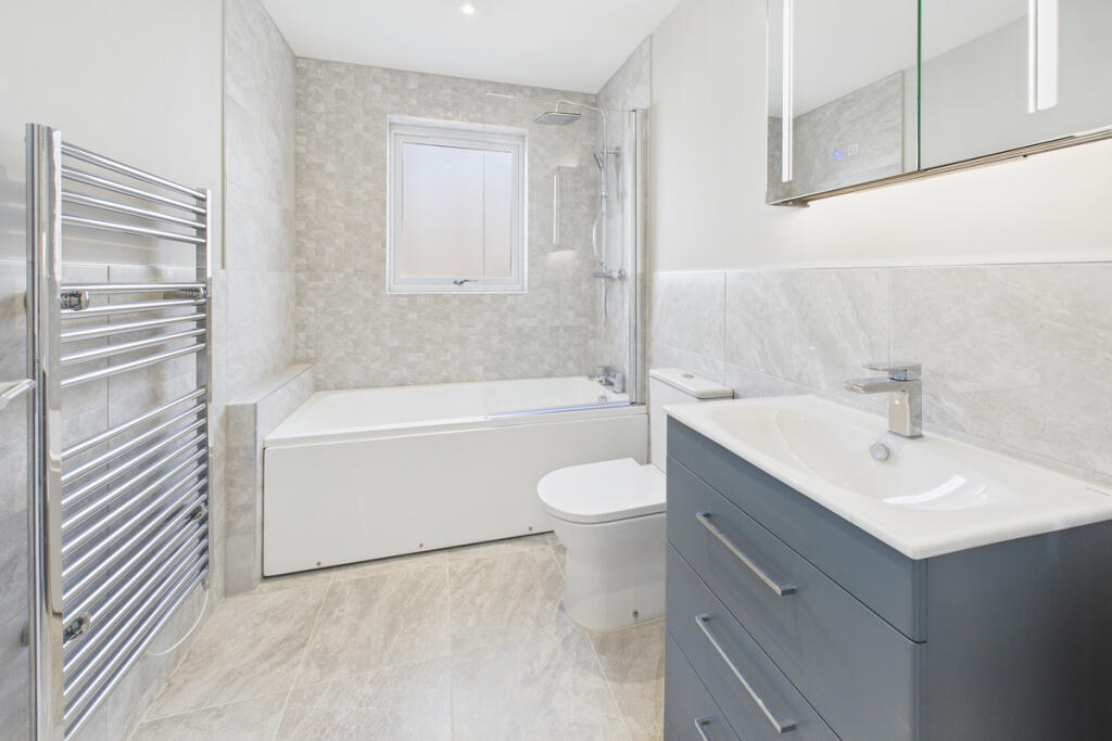
- WC:
- Living Room:
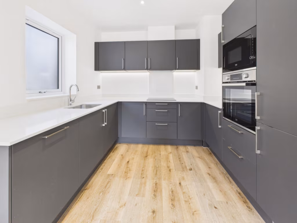
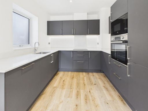
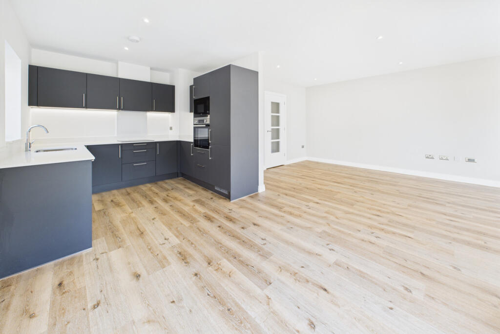
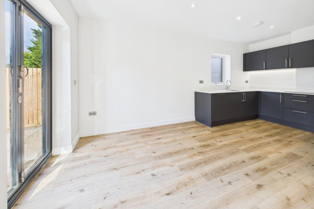
- Kitchen Dining Room:
- Utility:
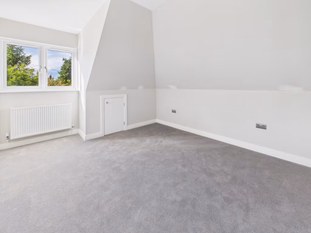
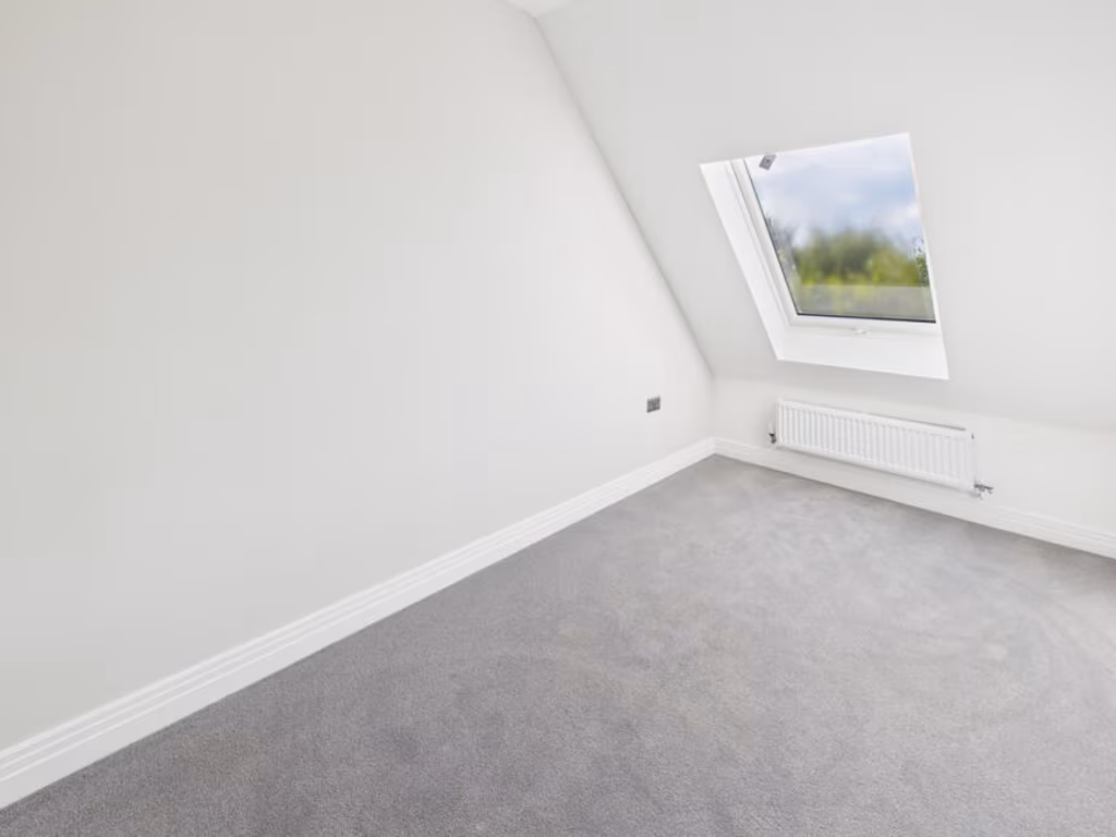
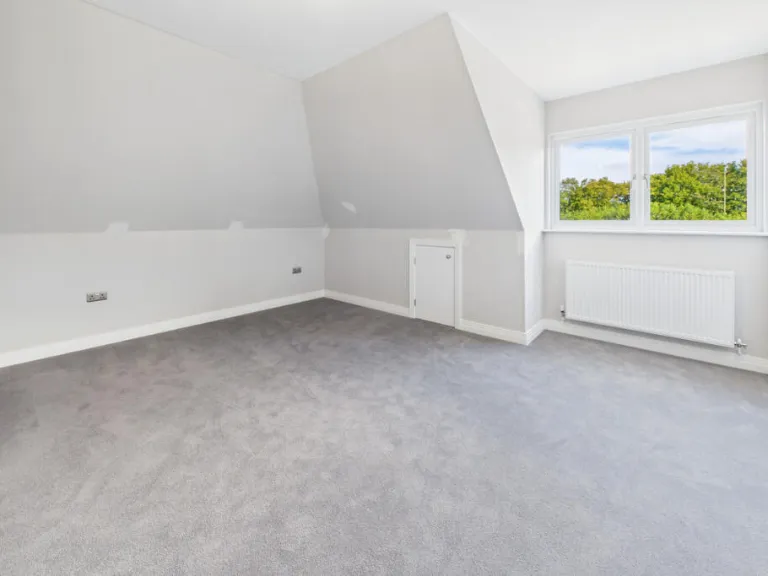
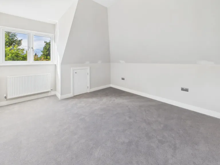
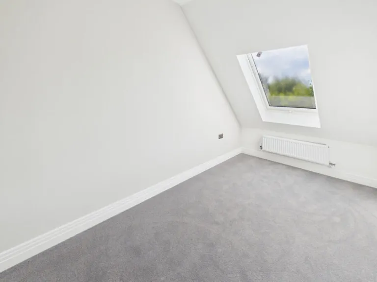
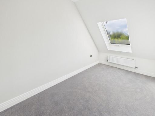
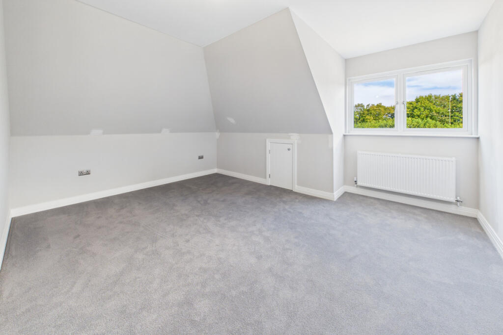
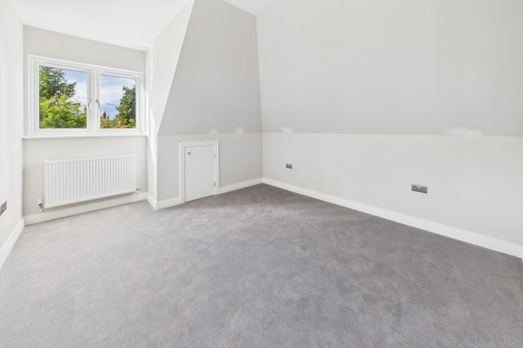
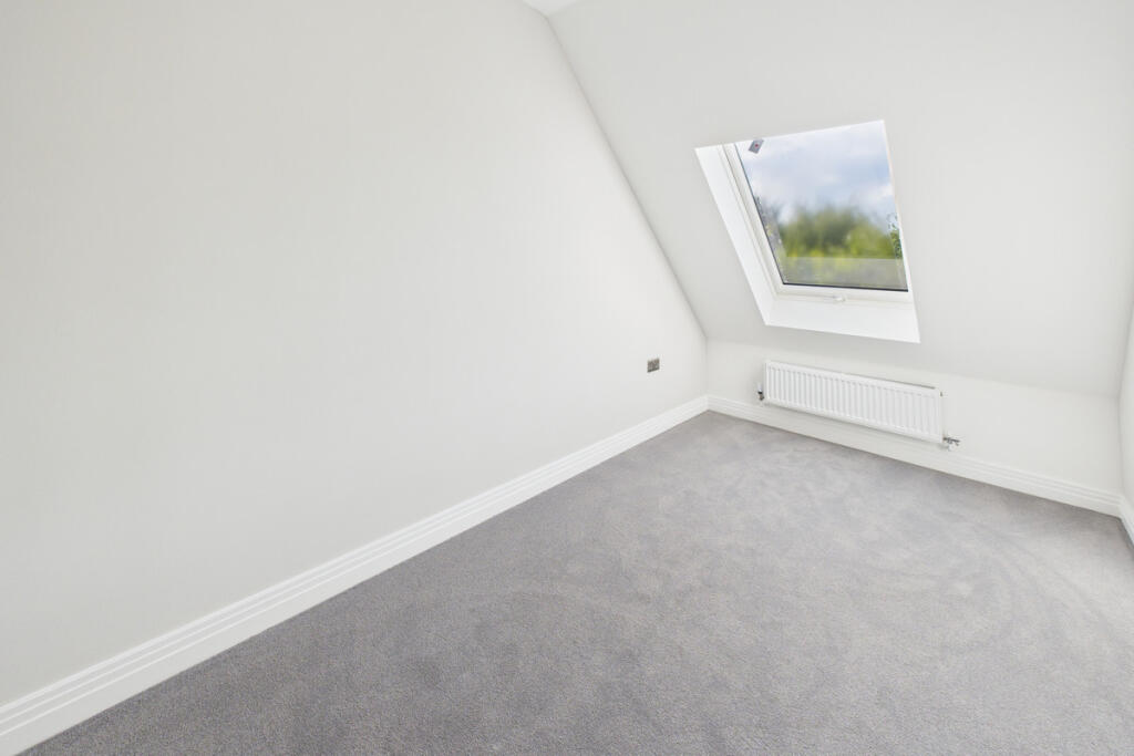
- Bedroom:
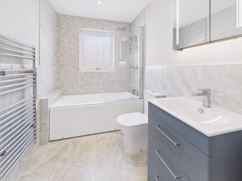
- Ensuite:
- Landing:
- Bedroom:
- Bedroom:
- Bedroom:
- Bathroom:
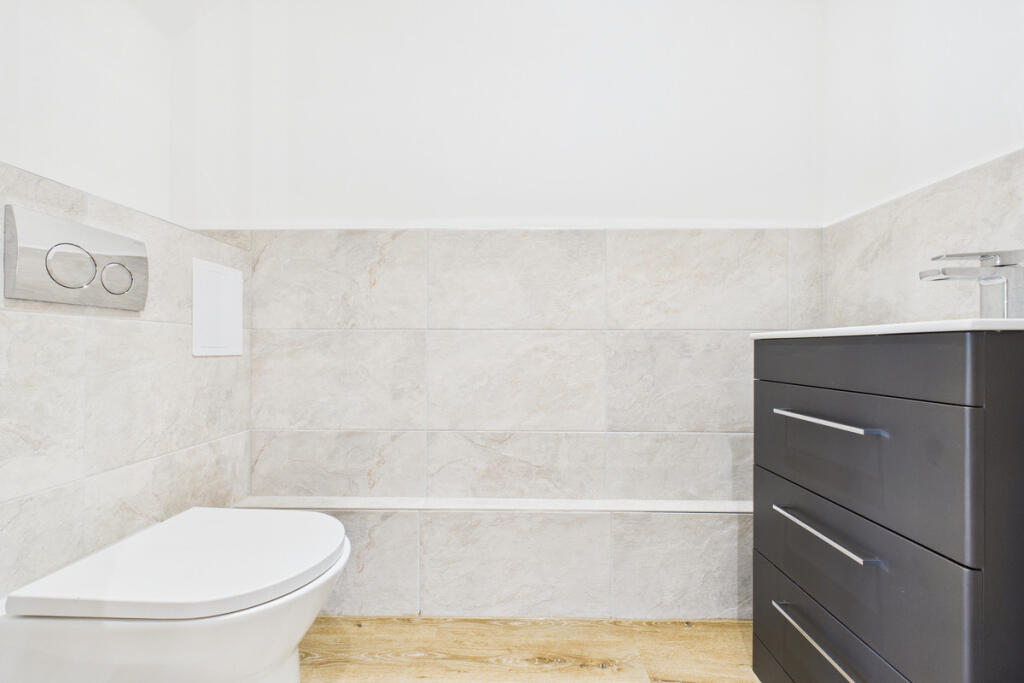
Textual Property Features
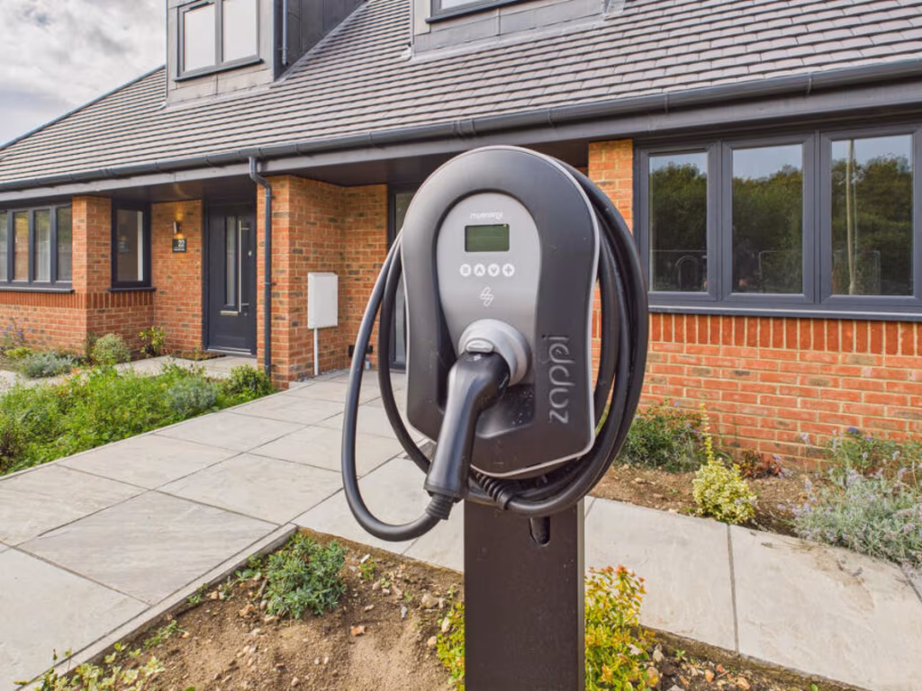
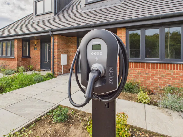
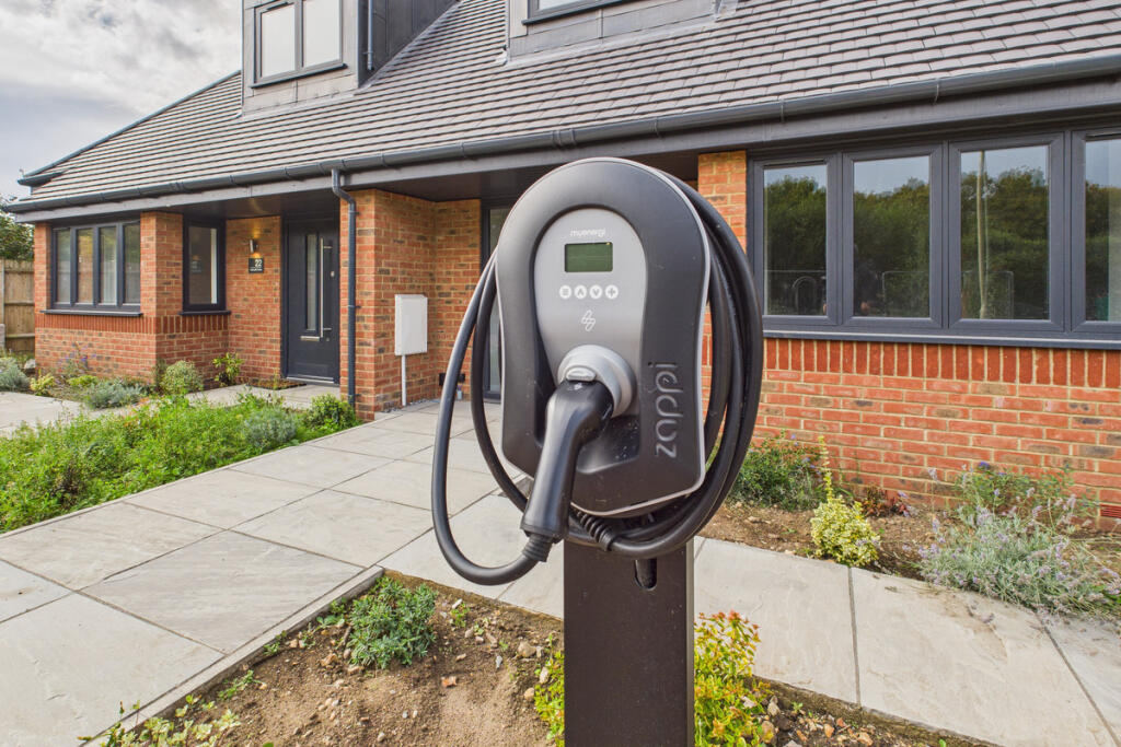
- Is New Build
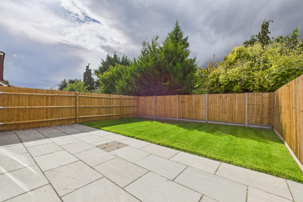
- Has Garden
- Success
Detected Visual Features
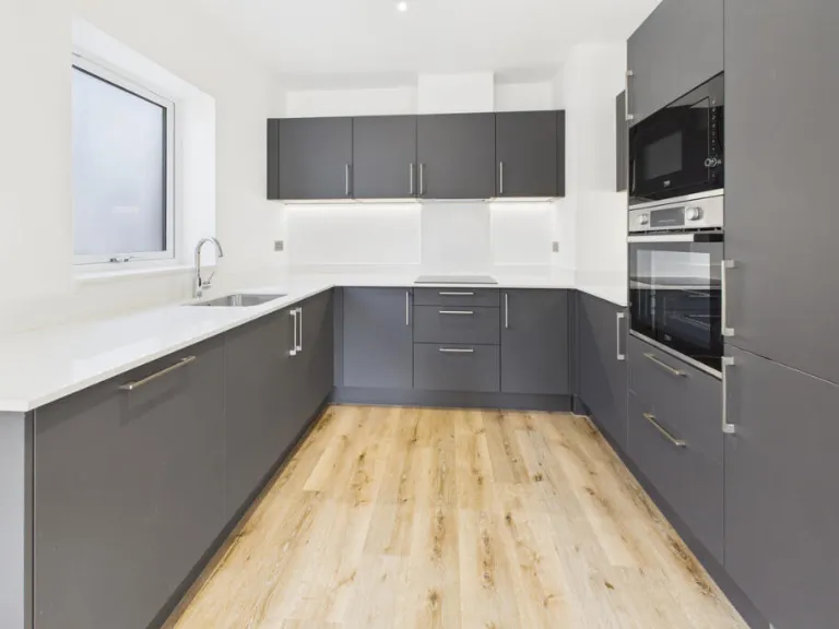
- modern
- semi-detached
- brick exterior
- dormer windows
- slate roof
- patio
- lawn
- fence
- garden
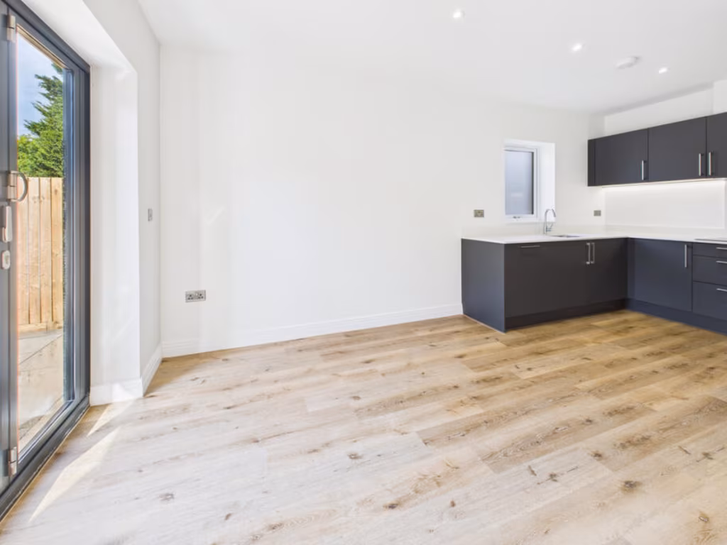
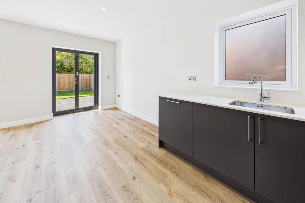
- natural light
- large living area
- sliding glass doors
- wood flooring
- garden access
- bright
- spacious
EPC Details
- Fully double glazed
- Cavity wall, as built, no insulation (assumed)
- Boiler and radiators, mains gas
- Low energy lighting in 50% of fixed outlets
- Solid, no insulation (assumed)
Nearby Schools
- Lanchester Primary School
- Cassiobury Junior School
- Nascot Wood Junior School
- Cherry Tree Primary School
- The Grove Academy
- Stanborough Secondary School
- Leavesden JMI School
- St Paul's Church of England Primary School, Langleybury
- Abbots Langley School
- Nascot Wood Infant and Nursery School
- Parkgate Junior School
- Beechfield School
- Parkgate Infants' and Nursery School
- Stanborough Primary School
- Kingsway Junior School
- St Catherine of Siena Catholic Primary School
- Bedmond Academy
- Cassiobury Infant and Nursery School
- Knutsford Primary Academy
- Holy Rood Catholic Primary School
- Alban Wood Primary School and Nursery
- Tanners Wood Junior Mixed and Infant School
- Saint Michael's Catholic High School
- Divine Saviour Roman Catholic Primary School
- Parmiter's School
- The Orchard Primary School
- Kingsway Infants' School
- Future Academies Watford
Nearest Bars And Restaurants
- Id: 1668346269
- Tags:
- Amenity: fast_food
- Cuisine: italian
- TagsNormalized:
- Lat: 51.6824716
- Lon: -0.418518
- FullGeoHash: gcpwn2x0pyfr
- PartitionGeoHash: gcpw
- Images:
- FoodStandards: null
- Distance: 842.7
,- Id: 1668346275
- Tags:
- Amenity: fast_food
- Cuisine: chinese
- Name: Dragon Garden
- TagsNormalized:
- Lat: 51.6827619
- Lon: -0.4182772
- FullGeoHash: gcpwn2x3vmjg
- PartitionGeoHash: gcpw
- Images:
- FoodStandards: null
- Distance: 807.5
,- Id: 1668346277
- Tags:
- TagsNormalized:
- Lat: 51.6828985
- Lon: -0.4181293
- FullGeoHash: gcpwn2xd8ys4
- PartitionGeoHash: gcpw
- Images:
- FoodStandards: null
- Distance: 789.3
,- Id: 8156230803
- Tags:
- Amenity: cafe
- Name: Chocolate Frog Café
- TagsNormalized:
- Lat: 51.6908253
- Lon: -0.4189054
- FullGeoHash: gcpwn6nbyu1r
- PartitionGeoHash: gcpw
- Images:
- FoodStandards: null
- Distance: 650.9
,- Id: 8156230793
- Tags:
- Amenity: cafe
- Name: Backlot Café
- TagsNormalized:
- Lat: 51.6911604
- Lon: -0.4175213
- FullGeoHash: gcpwn6pfz49w
- PartitionGeoHash: gcpw
- Images:
- FoodStandards: null
- Distance: 587.6
}
Nearest General Shops
- Id: 4393145189
- Tags:
- Name: Studio Shop
- Opening_hours: We 09:30-10:00
- Shop: gift
- TagsNormalized:
- Lat: 51.6906726
- Lon: -0.4182859
- FullGeoHash: gcpwn3zrvpz2
- PartitionGeoHash: gcpw
- Images:
- FoodStandards: null
- Distance: 605.1
,- Id: 8156230796
- Tags:
- Name: Creature Shop
- Tourism: attraction
- TagsNormalized:
- Lat: 51.6907597
- Lon: -0.4173131
- FullGeoHash: gcpwnd00ebhb
- PartitionGeoHash: gcpw
- Images:
- FoodStandards: null
- Distance: 551.3
,- Id: 103685484
- Tags:
- Addr:
- Housenumber: 150
- Postcode: WD25 7QX
- Street: Haines Way
- Brand: Costcutter
- Brand:wikidata: Q5175072
- Building: yes
- Fixme: resurvey
- Name: Costcutter
- Shop: supermarket
- Source: previously placed nodes; website; bing
- Website: http://www.costcutter.com/
- TagsNormalized:
- Lat: 51.6926572
- Lon: -0.4082592
- FullGeoHash: gcpwndqewcez
- PartitionGeoHash: gcpw
- Images:
- FoodStandards: null
- Distance: 520.7
}
Nearest Grocery shops
- Id: 4536301415
- Tags:
- Addr:
- City: Leavesden
- Place: Abbotswood Park
- Postcode: WD25 7LS
- Street: Cunningham Way
- Contact:
- Name: Co-operative Food
- Opening_hours: 07:00-22:00
- Operator: Co-operative Group Limited
- Shop: convenience
- Source: survey
- Website: https://www.coop.co.uk/
- TagsNormalized:
- Lat: 51.694891
- Lon: -0.4133111
- FullGeoHash: gcpwndg094hu
- PartitionGeoHash: gcpw
- Images:
- FoodStandards: null
- Distance: 771.2
,- Id: 9399613614
- Tags:
- Addr:
- Housenumber: 89,91
- Postcode: WD25 0EL
- Street: North Approach
- Brand: Tesco Express
- Brand:wikidata: Q98456772
- Contact:
- Website: https://www.tesco.com/store-locator/london/89-91-north-approach
- Fhrs:
- Name: Tesco Express
- Shop: convenience
- TagsNormalized:
- tesco
- tesco express
- convenience
- shop
- Lat: 51.6910201
- Lon: -0.4015275
- FullGeoHash: gcpwnf5d58x3
- PartitionGeoHash: gcpw
- Images:
- FoodStandards:
- Id: 1214753
- FHRSID: 1214753
- LocalAuthorityBusinessID: 20/00001/FOOD2
- BusinessName: Tesco Express
- BusinessType: Retailers - supermarkets/hypermarkets
- BusinessTypeID: 7840
- AddressLine1: 89 - 91 North Approach
- AddressLine2: Watford
- AddressLine3: null
- AddressLine4: null
- PostCode: WD25 0EL
- RatingValue: 5
- RatingKey: fhrs_5_en-GB
- RatingDate: 2020-03-05
- LocalAuthorityCode: 163
- LocalAuthorityName: Watford
- LocalAuthorityWebSite: http://www.watford.gov.uk/foodhygieneratings
- LocalAuthorityEmailAddress: envhealth@watford.gov.uk
- Scores:
- Hygiene: 0
- Structural: 0
- ConfidenceInManagement: 0
- NewRatingPending: false
- Geocode:
- Longitude: -0.40099400000000
- Latitude: 51.69114100000000
- Distance: 693.2
,- Id: 1197028948
- Tags:
- TagsNormalized:
- Lat: 51.6925474
- Lon: -0.4081146
- FullGeoHash: gcpwndqffjr8
- PartitionGeoHash: gcpw
- Images:
- FoodStandards: null
- Distance: 512.2
}
Nearest Supermarkets
- Id: 10282641060
- Tags:
- Brand: Co-op Food
- Brand:wikidata: Q3277439
- Shop: supermarket
- TagsNormalized:
- co-op
- co-op food
- food
- supermarket
- shop
- Lat: 51.6803651
- Lon: -0.3797172
- FullGeoHash: gcpwp257zyq6
- PartitionGeoHash: gcpw
- Images:
- FoodStandards: null
- Distance: 2292
,- Id: 134079742
- Tags:
- Addr:
- City: Watford
- Postcode: WD25 9JS
- Street: Cow Lane
- Alt_name: Sainsbury's Dome Roundabout Superstore
- Brand: Sainsbury's
- Brand:wikidata: Q152096
- Brand:wikipedia: en:Sainsbury's
- Building: retail
- Name: Sainsbury's
- Opening_hours: Mo-Sa 07:00-23:00; Su 10:00-16:00; May 29 08:00-19:00
- Opening_hours:url: https://stores.sainsburys.co.uk/0601/dome-roundabout
- Phone: +44 1923 889110
- Shop: supermarket
- Website: https://stores.sainsburys.co.uk/0601/dome-roundabout
- Wheelchair: yes
- TagsNormalized:
- sainsburys
- retail
- supermarket
- shop
- Lat: 51.6813486
- Lon: -0.3880434
- FullGeoHash: gcpwp0m3tvtu
- PartitionGeoHash: gcpw
- Images:
- FoodStandards: null
- Distance: 1723.4
,- Id: 134073999
- Tags:
- Addr:
- City: Watford
- Country: GB
- Housename: Odhams Industrial Estate
- Postcode: WD24 7RT
- Street: St Albans Road
- Alt_name: ASDA Watfrod Supercentre
- Brand: Asda
- Brand:wikidata: Q297410
- Brand:wikipedia: en:Asda
- Building: retail
- Contact:
- Facebook: https://www.facebook.com/asda/
- Phone: +44 1923 250380
- Twitter: @asda
- Website: https://storelocator.asda.com/east-of-england/watford/odhams-industrial-estate-st-albans-road
- Diet:
- Name: Asda
- Opening_hours: Mo 06:00-24:00; Tu-Fr 00:00-24:00; Sa 00:00-22:00; Su 10:00-16:00
- Opening_hours:url: http://storelocator.asda.com/store/watford-supercentre
- Operator: Asda Stores Ltd
- Shop: supermarket
- Toilets: yes
- Toilets:access: customers
- Toilets:wheelchair: yes
- Wheelchair: yes
- TagsNormalized:
- asda
- retail
- halal
- supermarket
- shop
- Lat: 51.6794455
- Lon: -0.3899997
- FullGeoHash: gcptzpun86gh
- PartitionGeoHash: gcpt
- Images:
- FoodStandards: null
- Distance: 1713.9
}
Nearest Religious buildings
- Id: 152752718
- Tags:
- Amenity: place_of_worship
- Name: North Jamia Watford Mosque
- Religion: muslim
- TagsNormalized:
- place of worship
- mosque
- muslim
- Lat: 51.6824823
- Lon: -0.4018654
- FullGeoHash: gcpwnbe27bgr
- PartitionGeoHash: gcpw
- Images:
- FoodStandards: null
- Distance: 868.5
,- Id: 787462527
- Tags:
- Amenity: place_of_worship
- Building: church
- Denomination: anglican
- Name: St Mark
- Religion: christian
- Wikidata: Q105085013
- TagsNormalized:
- place of worship
- church
- anglican
- christian
- Lat: 51.6807289
- Lon: -0.4105475
- FullGeoHash: gcpwn8jn1d1s
- PartitionGeoHash: gcpw
- Images:
- FoodStandards: null
- Distance: 828.7
,- Id: 2612899517
- Tags:
- Amenity: place_of_worship
- Denomination: baptist
- Name: Kingswood Baptist Church
- Religion: christian
- TagsNormalized:
- place of worship
- baptist
- church
- christian
- Lat: 51.6891533
- Lon: -0.4072688
- FullGeoHash: gcpwn9xrjuw3
- PartitionGeoHash: gcpw
- Images:
- FoodStandards: null
- Distance: 246.4
}
Nearest Medical buildings
- Id: 2443307702
- Tags:
- Addr:
- Housenumber: 9
- Postcode: WD5 0BT
- Street: Katherine Place
- Amenity: veterinary
- Contact:
- Phone: +44 1923 681261
- Website: http://www.parkveterinary.co.uk/
- Name: Park Vetertinary Clinic
- TagsNormalized:
- Lat: 51.7008995
- Lon: -0.4037709
- FullGeoHash: gcpwngcgx6nw
- PartitionGeoHash: gcpw
- Images:
- FoodStandards: null
- Distance: 1487.9
,- Id: 4939214939
- Tags:
- Amenity: dentist
- Healthcare: dentist
- Name: The Dental Practice
- TagsNormalized:
- dentist
- health
- healthcare
- dental
- Lat: 51.6780497
- Lon: -0.3966502
- FullGeoHash: gcptyzxnmqsn
- PartitionGeoHash: gcpt
- Images:
- FoodStandards: null
- Distance: 1476
,- Id: 2448373151
- Tags:
- Addr:
- Housenumber: 55
- Postcode: WD25 7NY
- Street: The Brow
- Amenity: pharmacy
- Contact:
- Name: Brow Pharmacy
- Opening_hours: Mo-Fr 09:00-13:00,14:00-18:00
- TagsNormalized:
- Lat: 51.6968814
- Lon: -0.3985897
- FullGeoHash: gcpwngju0jjv
- PartitionGeoHash: gcpw
- Images:
- FoodStandards: null
- Distance: 1267.9
,- Id: 1668346271
- Tags:
- TagsNormalized:
- Lat: 51.6829771
- Lon: -0.418046
- FullGeoHash: gcpwn2xe4v4r
- PartitionGeoHash: gcpw
- Images:
- FoodStandards: null
- Distance: 779
}
Nearest Airports
- Id: 110273499
- Tags:
- Addr:
- Country: GB
- Postcode: LU2 9LY
- Aerodrome: international
- Aerodrome:type: public
- Aeroway: aerodrome
- Alt_name: London Luton
- Iata: LTN
- Icao: EGGW
- Name: London Luton Airport
- Website: https://www.london-luton.co.uk/
- Wikidata: Q8712
- Wikipedia: en:Luton Airport
- TagsNormalized:
- airport
- international airport
- Lat: 51.8780363
- Lon: -0.3701408
- FullGeoHash: gcpxps47rngh
- PartitionGeoHash: gcpx
- Images:
- FoodStandards: null
- Distance: 21292.5
}
Nearest Leisure Facilities
- Id: 970459048
- Tags:
- TagsNormalized:
- Lat: 51.691907
- Lon: -0.4121375
- FullGeoHash: gcpwnd5zhtbh
- PartitionGeoHash: gcpw
- Images:
- FoodStandards: null
- Distance: 429.7
,- Id: 870407260
- Tags:
- TagsNormalized:
- Lat: 51.685666
- Lon: -0.4061167
- FullGeoHash: gcpwnc06bf3r
- PartitionGeoHash: gcpw
- Images:
- FoodStandards: null
- Distance: 410.8
,- Id: 219475195
- Tags:
- TagsNormalized:
- Lat: 51.6860631
- Lon: -0.4058985
- FullGeoHash: gcpwnc0mjukp
- PartitionGeoHash: gcpw
- Images:
- FoodStandards: null
- Distance: 394.1
,- Id: 962328139
- Tags:
- TagsNormalized:
- Lat: 51.6896707
- Lon: -0.4122283
- FullGeoHash: gcpwn9gf4mh2
- PartitionGeoHash: gcpw
- Images:
- FoodStandards: null
- Distance: 204.8
,- Id: 962328140
- Tags:
- TagsNormalized:
- Lat: 51.689639
- Lon: -0.4122736
- FullGeoHash: gcpwn9gccr4e
- PartitionGeoHash: gcpw
- Images:
- FoodStandards: null
- Distance: 203.8
}
Nearest Tourist attractions
- Id: 8156230795
- Tags:
- Name: Diagon Alley
- Tourism: attraction
- TagsNormalized:
- Lat: 51.6906635
- Lon: -0.4173953
- FullGeoHash: gcpwn9bpcypd
- PartitionGeoHash: gcpw
- Images:
- FoodStandards: null
- Distance: 550.8
,- Id: 9877574117
- Tags:
- Addr:
- Housenumber: 3 Stubbs Court
- Street: Dodd Road
- Tourism: apartment
- TagsNormalized:
- Lat: 51.6834751
- Lon: -0.4086642
- FullGeoHash: gcpwn8wqj6jc
- PartitionGeoHash: gcpw
- Images:
- FoodStandards: null
- Distance: 538.1
,- Id: 3122095385
- Tags:
- Addr:
- City: Leavesden
- Housename: Warner Bros. Studio Tour London
- Postcode: WD25 7LR
- Street: Studio Tour Drive
- Name: Warner Bros. Studio Tour London - The Making of Harry Potter
- Phone: +44 845 084 0900
- Tourism: attraction
- Website: https://www.wbstudiotour.co.uk/
- Wheelchair: yes
- Wikidata: Q27924395
- Wikipedia: en:Warner Bros. Studio Tour London – The Making of Harry Potter
- TagsNormalized:
- Lat: 51.6888588
- Lon: -0.4177057
- FullGeoHash: gcpwn3xv6v8h
- PartitionGeoHash: gcpw
- Images:
- FoodStandards: null
- Distance: 503.7
}
Nearest Hotels
- Id: 211183860
- Tags:
- Addr:
- Housenumber: 28
- Postcode: WD4 8RF
- Street: Bridge Road
- Building: yes
- Email: kingslodge@hotmail.co.uk
- Fax: +44 1923 268915
- Fixme: resurvey
- Listed_status: Grade II*
- Name: The Kings Lodge
- Note: check postcode, housenumber and listed status
- Tourism: hotel
- Website: http://www.kingslodge.uk.com/
- TagsNormalized:
- Lat: 51.6934105
- Lon: -0.4338031
- FullGeoHash: gcpwn4kpgwhu
- PartitionGeoHash: gcpw
- Images:
- FoodStandards: null
- Distance: 1709.5
,- Id: 331901333
- Tags:
- Addr:
- City: Watford
- Housenumber: 859
- Postcode: WD25 0LH
- Street: St Albans Road
- Brand: Premier Inn
- Brand:wikidata: Q2108626
- Brand:wikipedia: en:Premier Inn
- Contact:
- Website: https://www.premierinn.com/gb/en/hotels/england/hertfordshire/watford/watford-north.html
- Internet_access: wlan
- Internet_access:fee: customers
- Internet_access:operator: Virgin Media
- Internet_access:ssid: Premier Inn Free Wi-Fi
- Name: Premier Inn Watford North
- Operator: Premier Inn
- Tourism: hotel
- TagsNormalized:
- Lat: 51.6919039
- Lon: -0.386765
- FullGeoHash: gcpwp4nr5tr1
- PartitionGeoHash: gcpw
- Images:
- FoodStandards: null
- Distance: 1686.4
,- Id: 88831893
- Tags:
- Addr:
- Postcode: WD4 8PN
- Street: Essex Lane
- Building: yes
- Email: hunreception@deverevenues.co.uk
- Name: Hunton Park Hotel
- Operator: De Vere
- Tourism: hotel
- Website: http://www.deverevenues.co.uk/en/venues/hunton-park/
- Wikidata: Q5945718
- Wikipedia: en:Hunton Park
- TagsNormalized:
- Lat: 51.6929916
- Lon: -0.4253017
- FullGeoHash: gcpwn66m9b04
- PartitionGeoHash: gcpw
- Images:
- FoodStandards: null
- Distance: 1153.1
}
Tags
- modern
- semi-detached
- brick exterior
- dormer windows
- slate roof
- patio
- lawn
- fence
- garden
- natural light
- modern
- large living area
- sliding glass doors
- natural light
- wood flooring
- garden access
- bright
- spacious
Local Market Stats
- Average Price/sqft: £482
- Avg Income: £52500
- Rental Yield: 3.7%
- Social Housing: 15%
- Planning Success Rate: 76%
AirBnB Data
- 1km average: £110/night
- Listings in 1km: 3
Similar Properties
 4 bedroom semi-detached house for sale in Redheath Close, Watford, WD25 — £680,000 • 4 bed • 2 bath • 1316 ft²
 4 bedroom bungalow for sale in Redheath Close, Watford, WD25 — £700,000 • 4 bed • 2 bath • 1510 ft²
 4 bedroom bungalow for sale in Redheath Close, Watford, WD25 — £700,000 • 4 bed • 2 bath • 1510 ft²
 3 bedroom semi-detached house for sale in Parnell Close, Abbots Langley, WD5 — £675,000 • 3 bed • 2 bath • 931 ft²
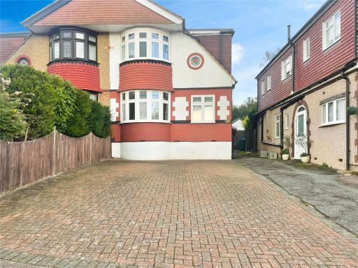 4 bedroom semi-detached house for sale in Spring Gardens, Watford, Hertfordshire, WD25 — £660,000 • 4 bed • 2 bath • 1446 ft²
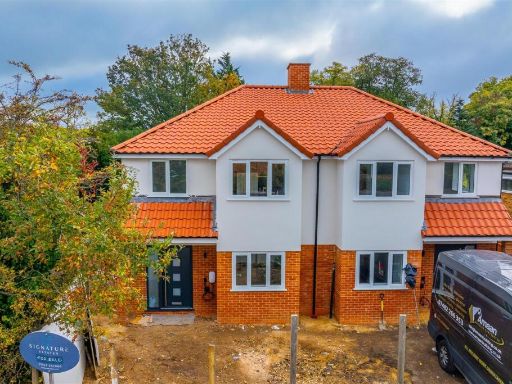 3 bedroom house for sale in Woodmere Avenue, Watford, WD24 — £650,000 • 3 bed • 2 bath • 1291 ft²
Meta
- {
"@context": "https://schema.org",
"@type": "Residence",
"name": "4 bedroom semidetached house for sale in Redheath Close, Wa…",
"description": "",
"url": "https://propertypiper.co.uk/property/9ae4cde6-915f-4cfc-8c88-8b8abe4a335a",
"image": "https://image-a.propertypiper.co.uk/ff1aca18-c04e-4f65-ad45-35c72a00736d-1024.jpeg",
"address": {
"@type": "PostalAddress",
"streetAddress": "Redheath Close, Watford, WD25",
"postalCode": "WD25 7AH",
"addressLocality": "Watford",
"addressRegion": "Watford",
"addressCountry": "England"
},
"geo": {
"@type": "GeoCoordinates",
"latitude": 51.6881814,
"longitude": -0.4104811
},
"numberOfRooms": 4,
"numberOfBathroomsTotal": 2,
"floorSize": {
"@type": "QuantitativeValue",
"value": 1248,
"unitCode": "FTK"
},
"offers": {
"@type": "Offer",
"price": 680000,
"priceCurrency": "GBP",
"availability": "https://schema.org/InStock"
},
"additionalProperty": [
{
"@type": "PropertyValue",
"name": "Feature",
"value": "modern"
},
{
"@type": "PropertyValue",
"name": "Feature",
"value": "semi-detached"
},
{
"@type": "PropertyValue",
"name": "Feature",
"value": "brick exterior"
},
{
"@type": "PropertyValue",
"name": "Feature",
"value": "dormer windows"
},
{
"@type": "PropertyValue",
"name": "Feature",
"value": "slate roof"
},
{
"@type": "PropertyValue",
"name": "Feature",
"value": "patio"
},
{
"@type": "PropertyValue",
"name": "Feature",
"value": "lawn"
},
{
"@type": "PropertyValue",
"name": "Feature",
"value": "fence"
},
{
"@type": "PropertyValue",
"name": "Feature",
"value": "garden"
},
{
"@type": "PropertyValue",
"name": "Feature",
"value": "natural light"
},
{
"@type": "PropertyValue",
"name": "Feature",
"value": "modern"
},
{
"@type": "PropertyValue",
"name": "Feature",
"value": "large living area"
},
{
"@type": "PropertyValue",
"name": "Feature",
"value": "sliding glass doors"
},
{
"@type": "PropertyValue",
"name": "Feature",
"value": "natural light"
},
{
"@type": "PropertyValue",
"name": "Feature",
"value": "wood flooring"
},
{
"@type": "PropertyValue",
"name": "Feature",
"value": "garden access"
},
{
"@type": "PropertyValue",
"name": "Feature",
"value": "bright"
},
{
"@type": "PropertyValue",
"name": "Feature",
"value": "spacious"
}
]
}
High Res Floorplan Images
Compatible Floorplan Images
FloorplanImages Thumbnail