WA3 6UJ - 3 bedroom detached bungalow for sale in Inglewood Close, Go…
View on Property Piper
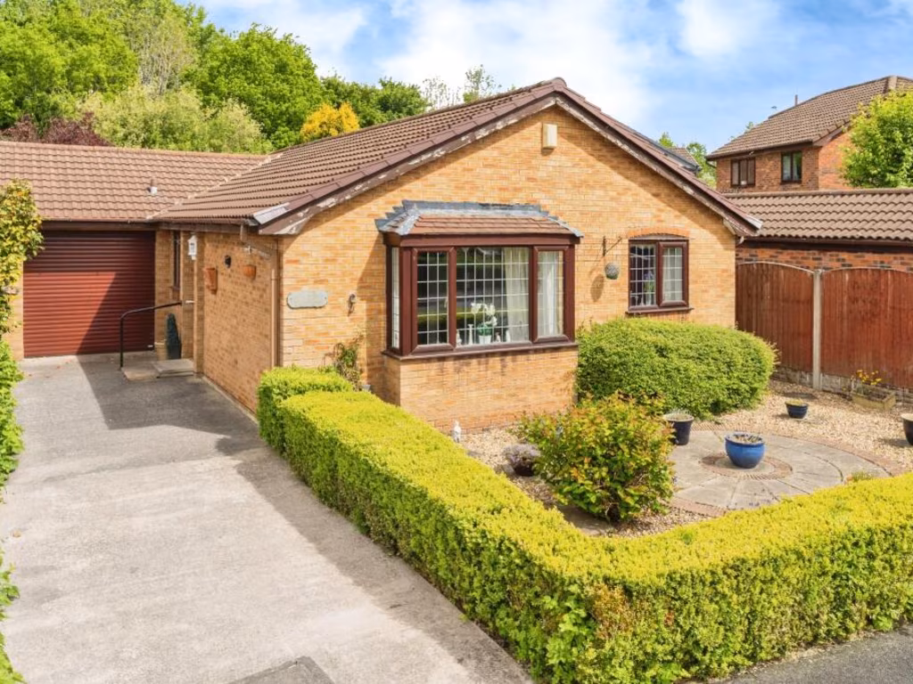
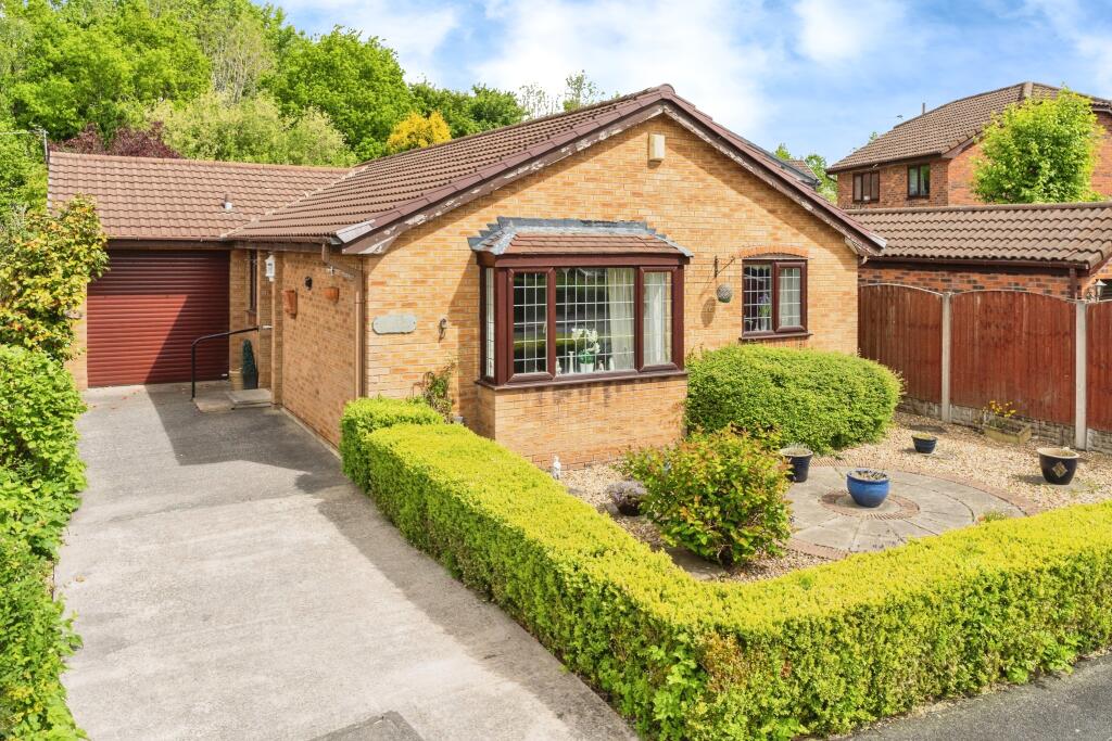
3 bedroom detached bungalow for sale in Inglewood Close, Gorse Covert, Birchwood, WA3
Property Details
- Price: £280000
- Bedrooms: 3
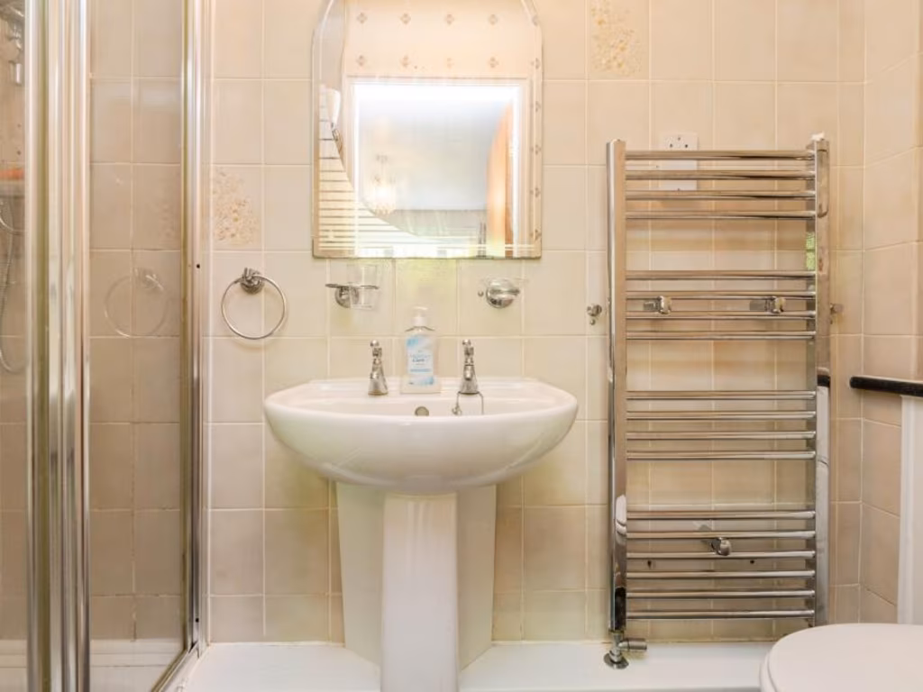
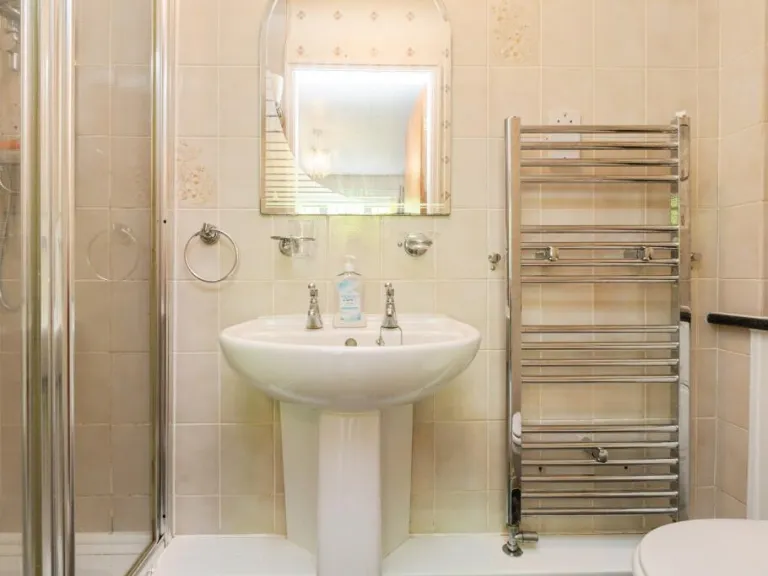
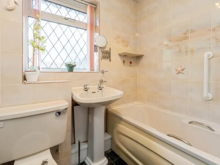
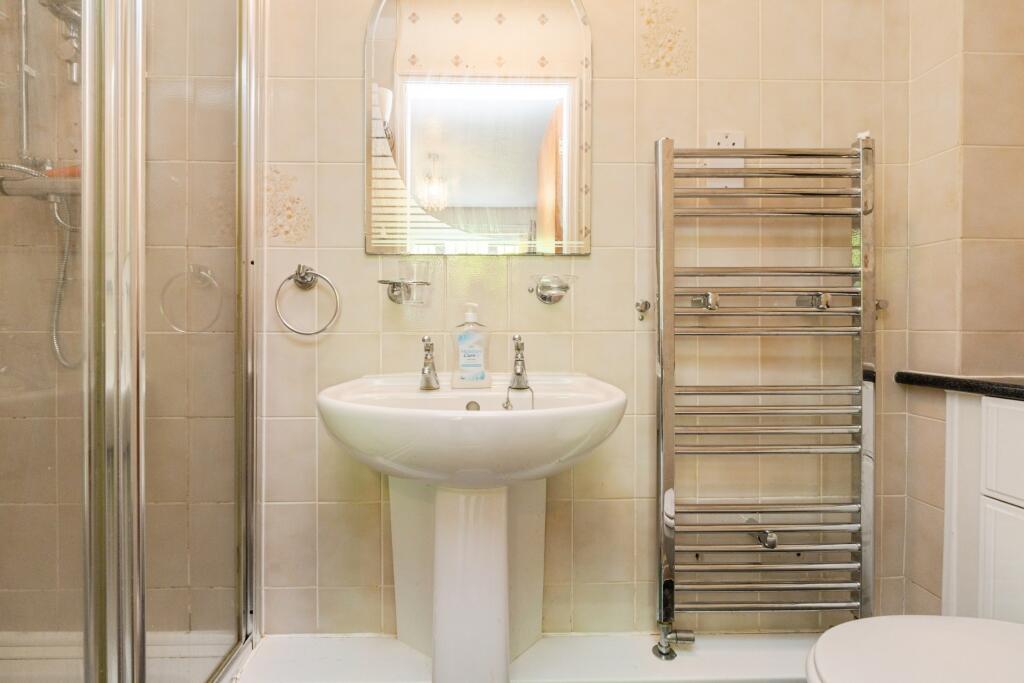
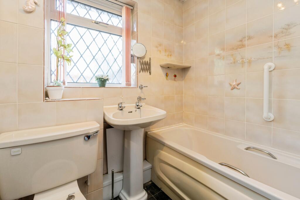
- Bathrooms: 2
- Property Type: undefined
- Property SubType: undefined
Image Descriptions
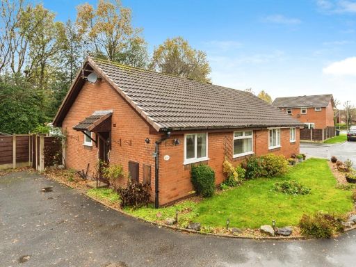
- single-family bungalow modern
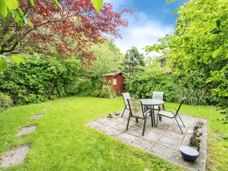
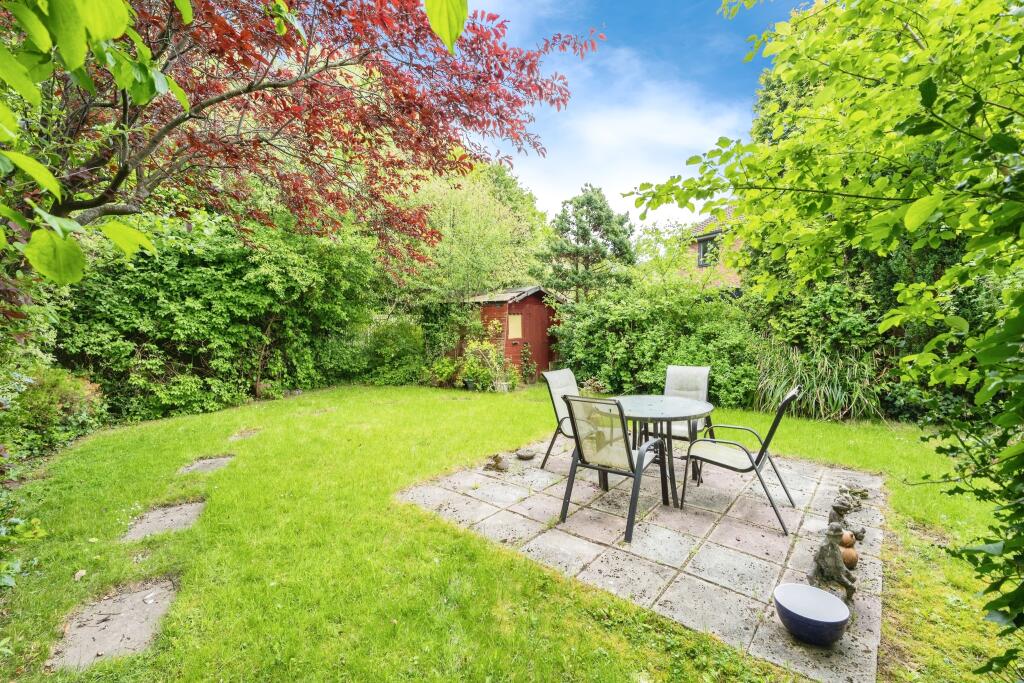
- back garden
Floorplan Description
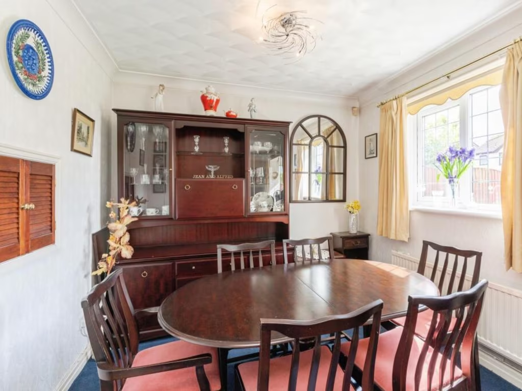
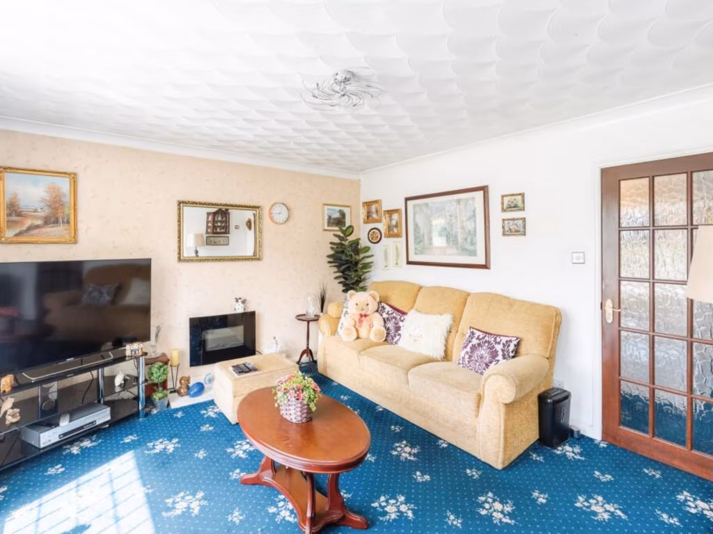
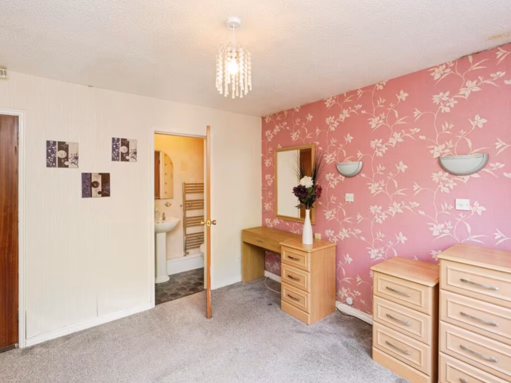
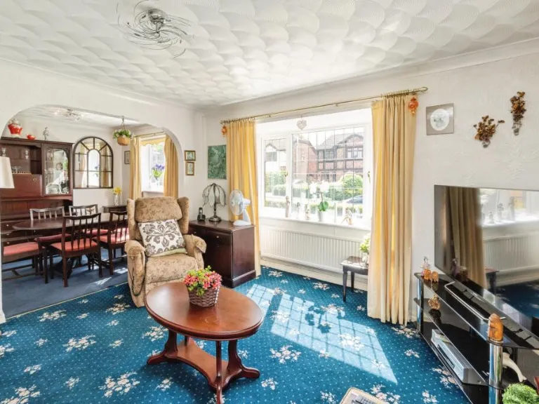
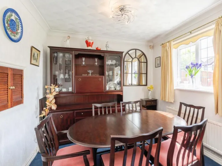
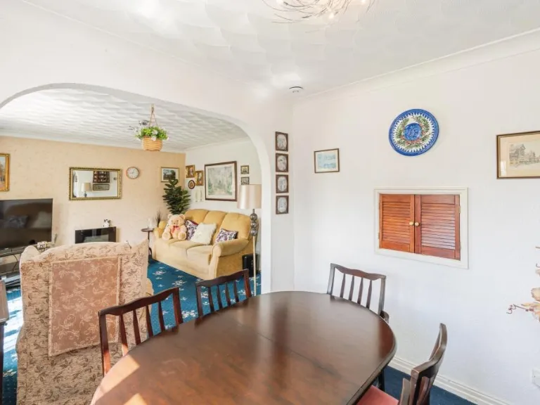
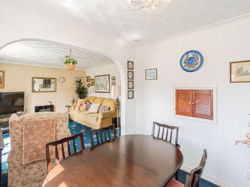
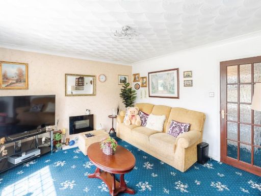
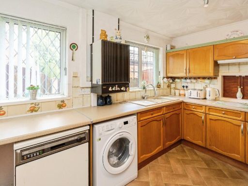
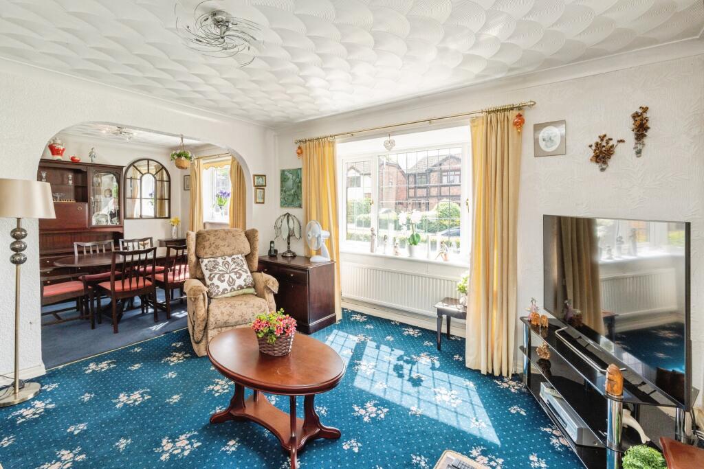
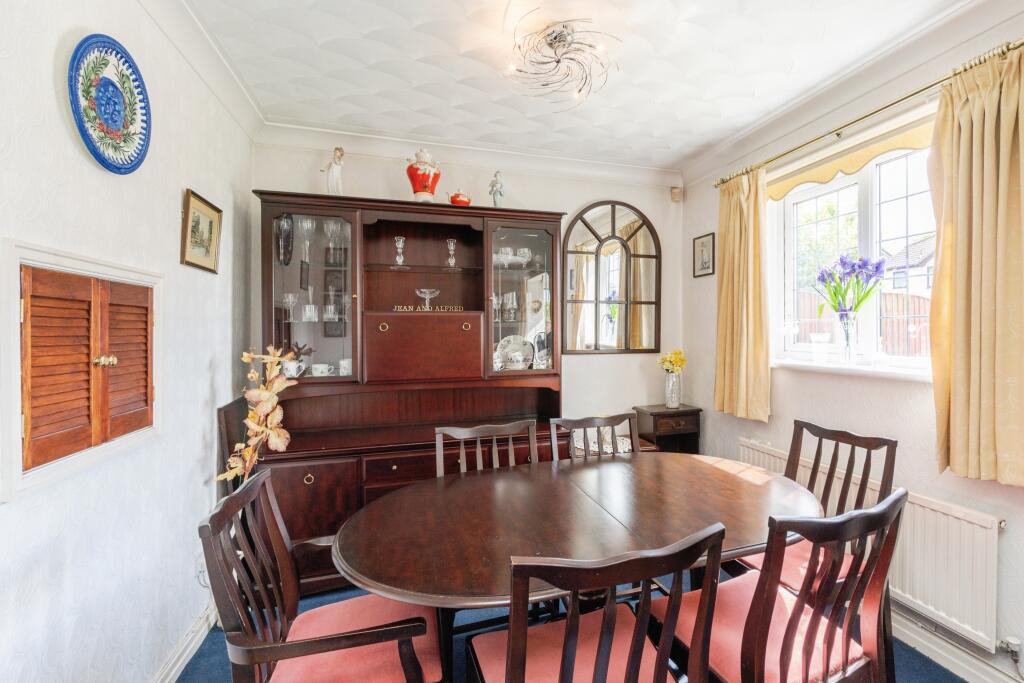
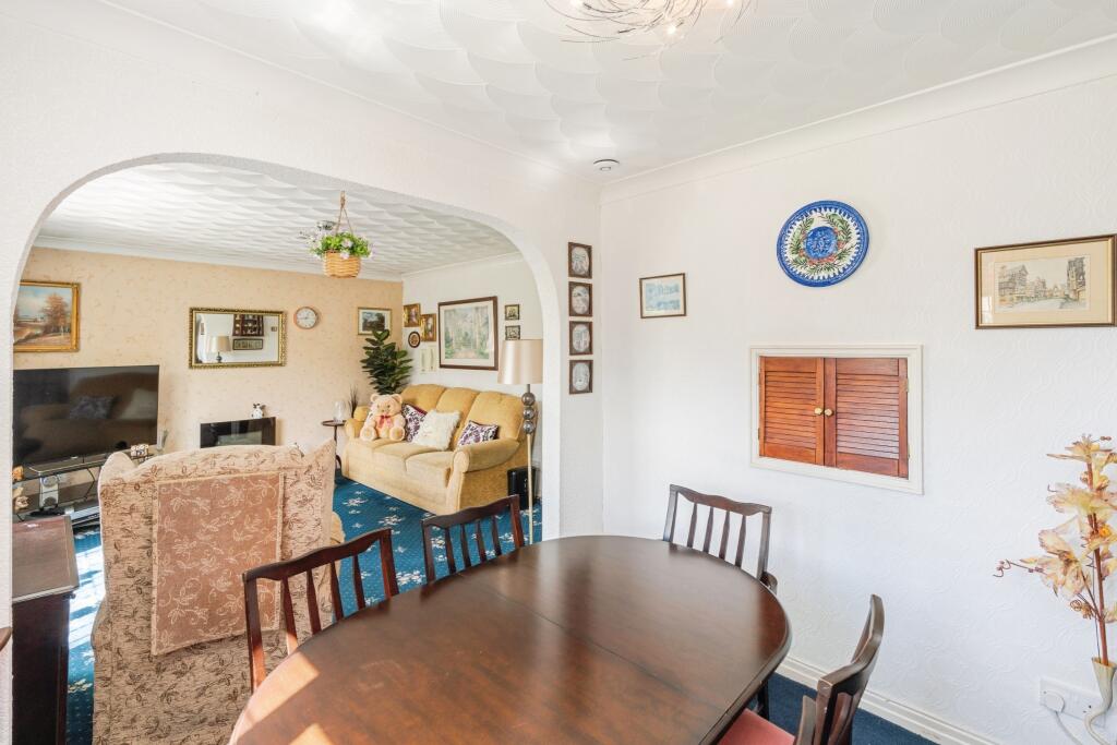
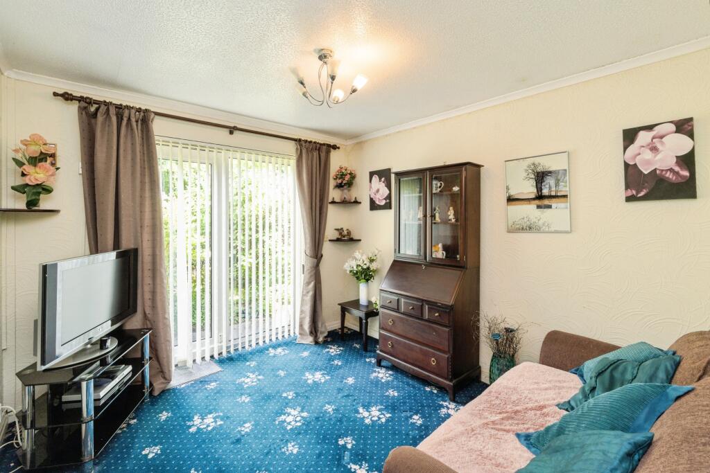
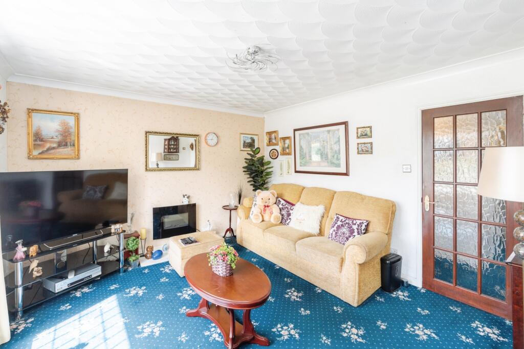
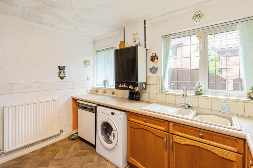
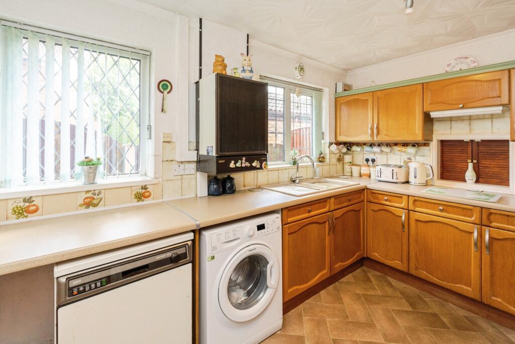
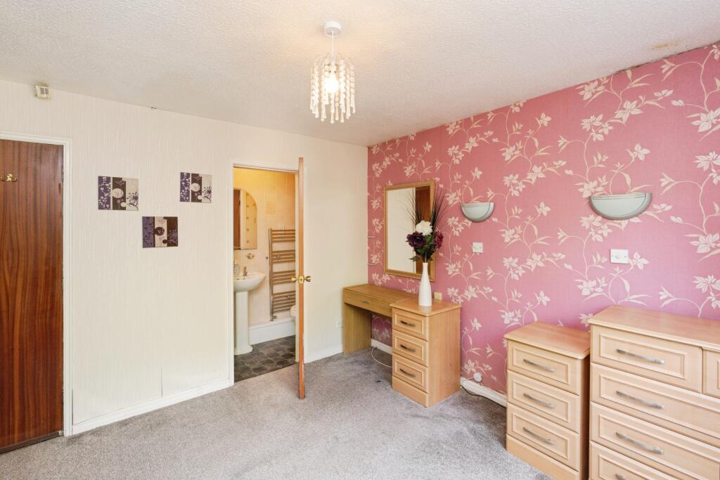
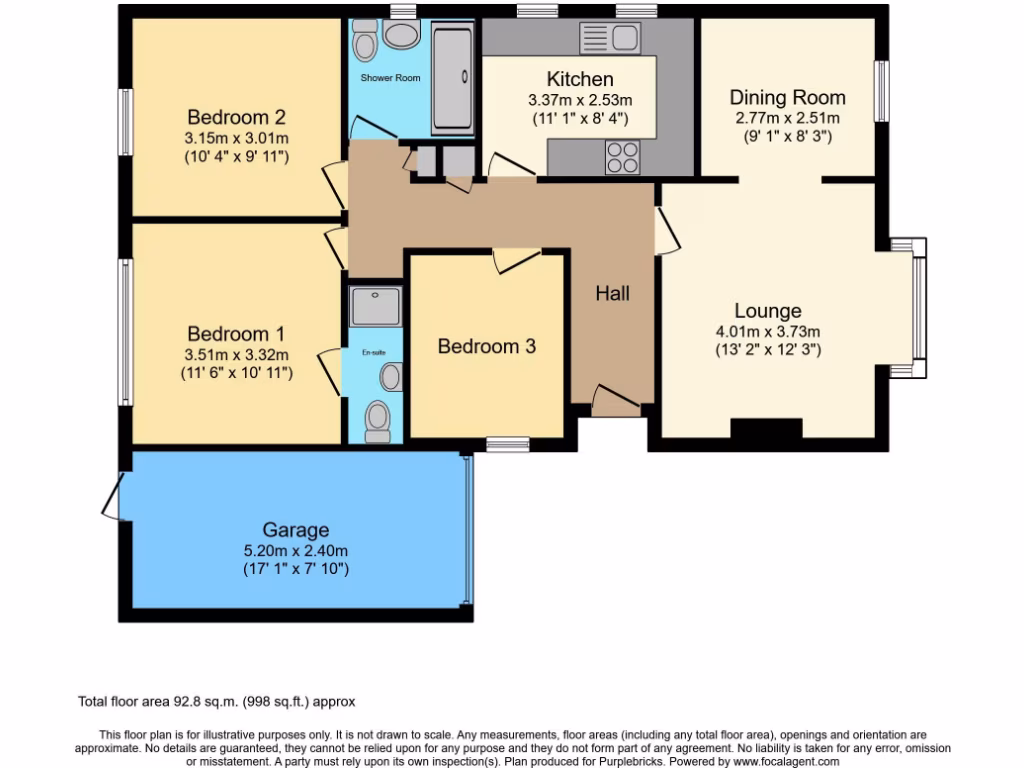
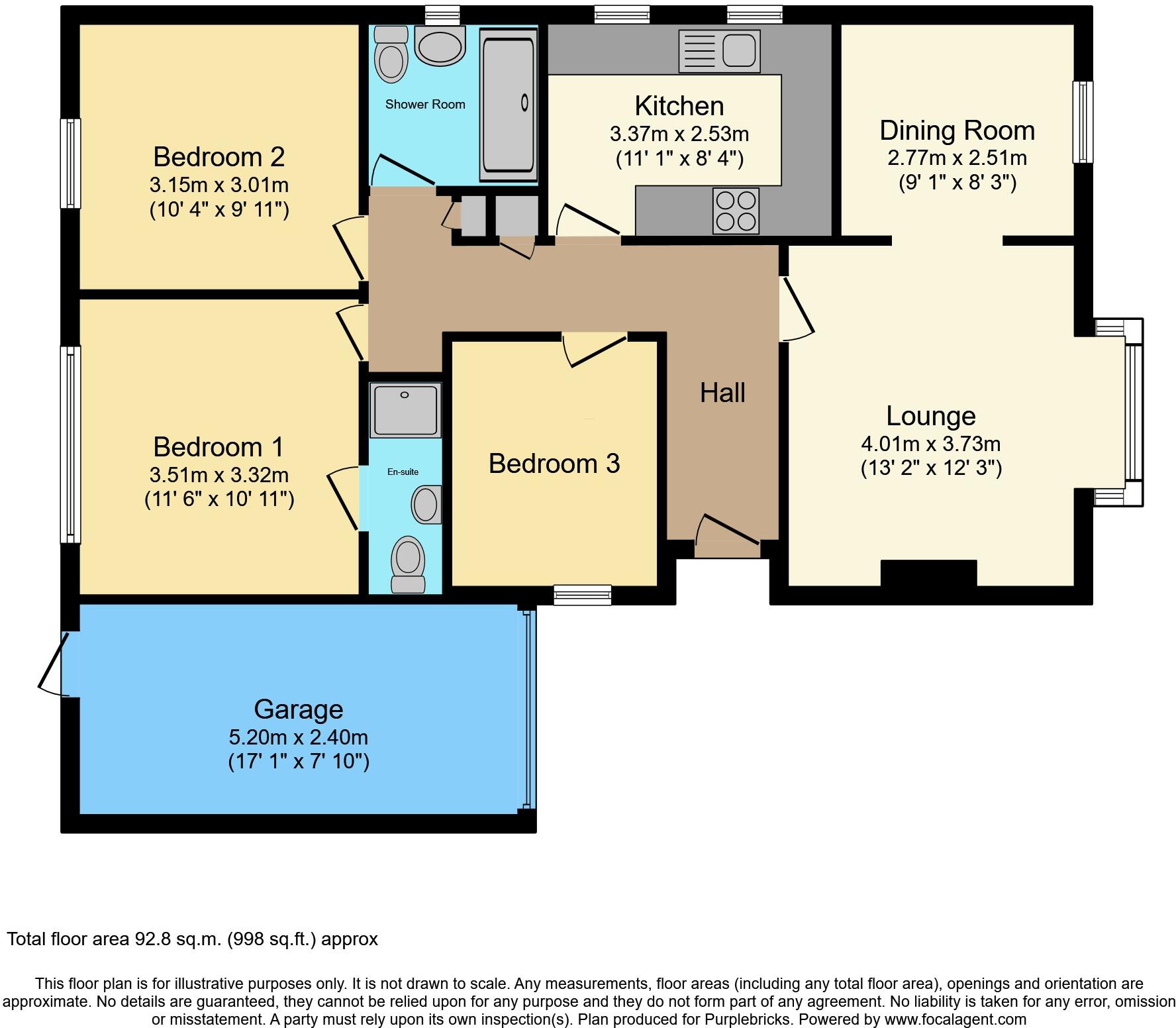
- A single-story property with three bedrooms, a kitchen, a dining room, a lounge, and a garage.
Rooms
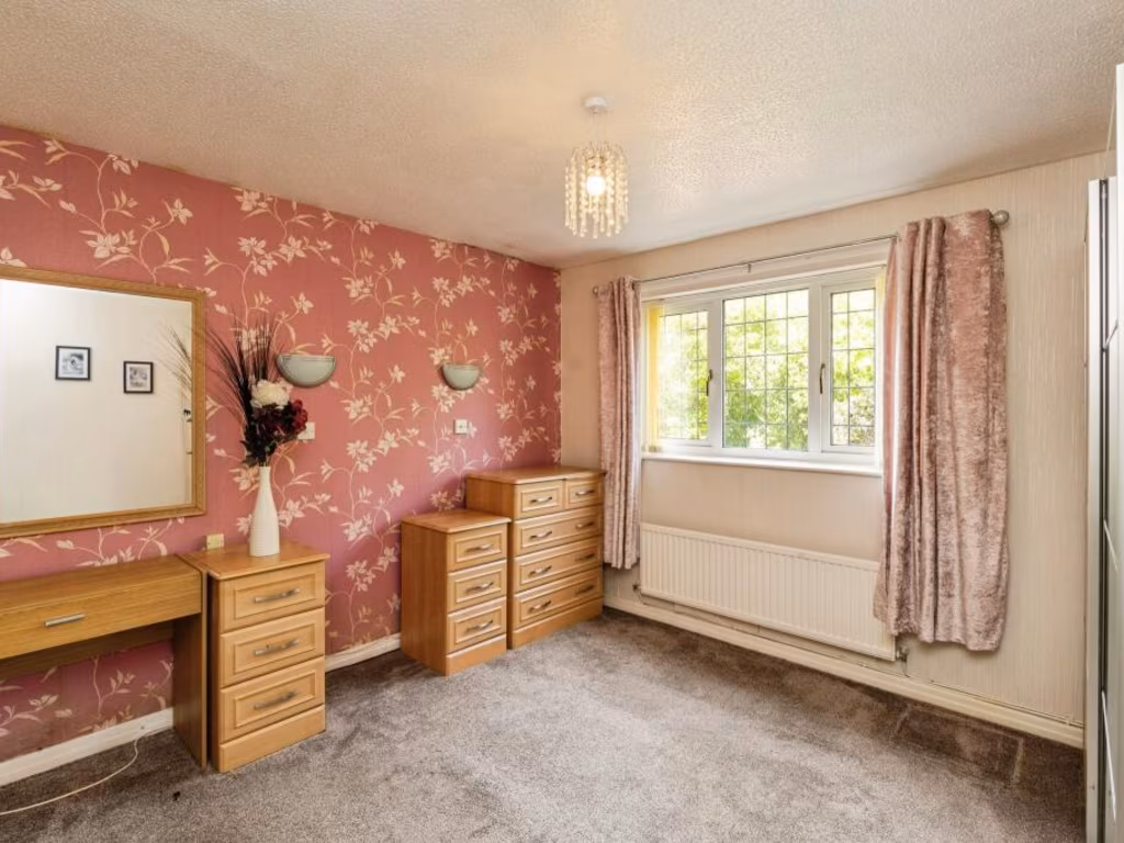
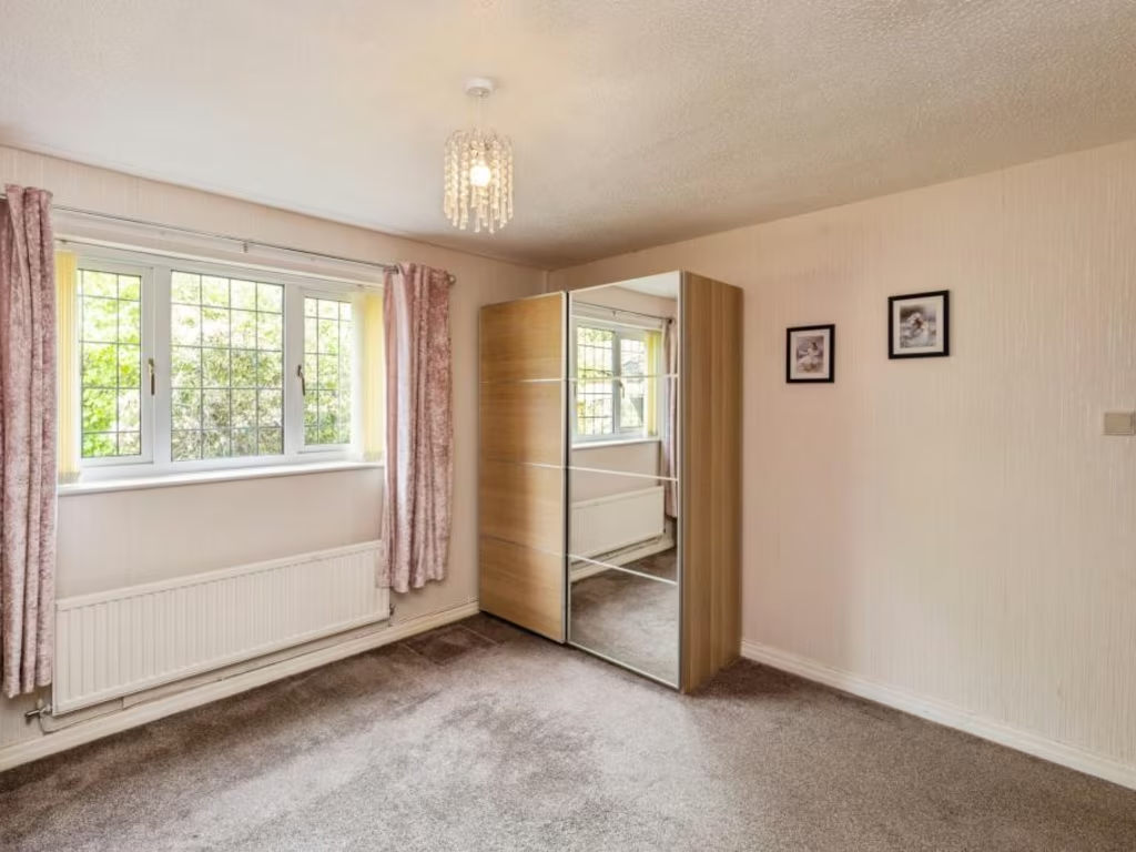
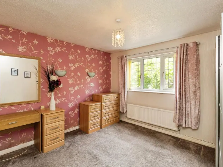
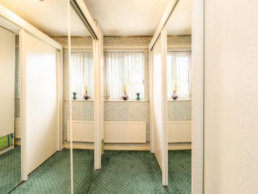
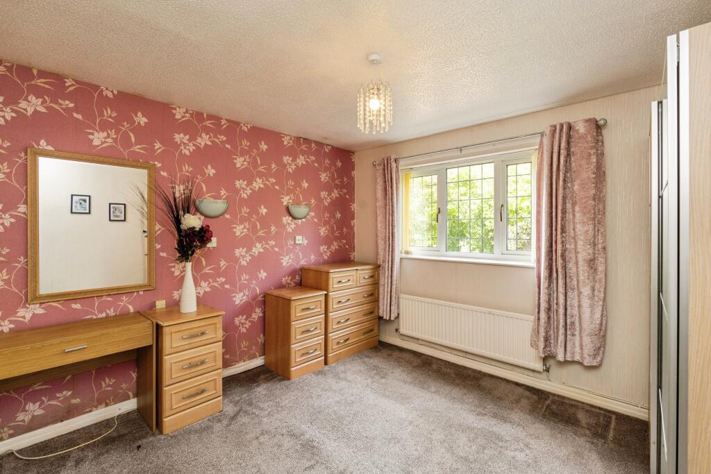
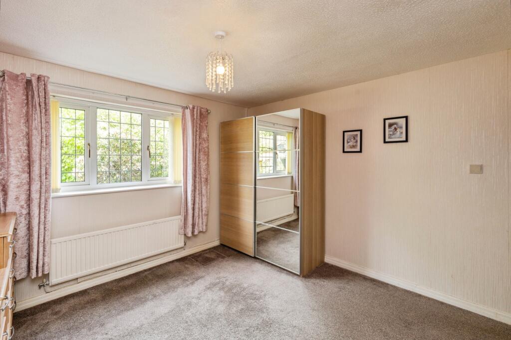
- Bedroom 1: average
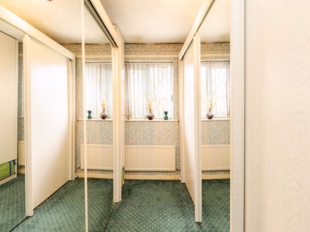
- Bedroom 2: small
- Bedroom 3: small
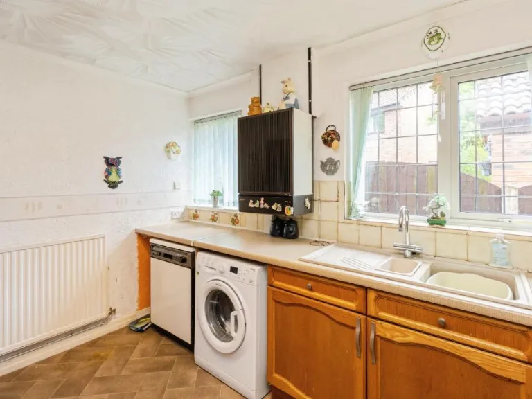
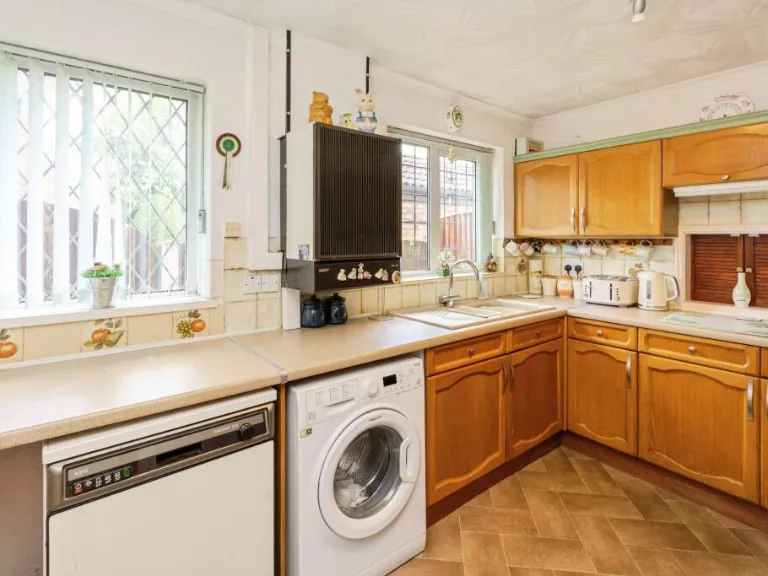
- Kitchen: small
- Dining Room: small
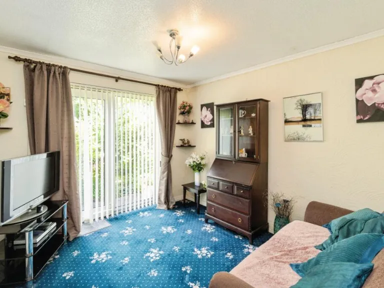
- Lounge: average
Textual Property Features
- Has Garden
- Chain Free
- Success
Detected Visual Features
- single-family home
- bungalow
- modern style
- brick construction
- bay window
- tile roof
- driveway
- landscaped garden
- garden
- lawn
- patio
- shed
- outdoor space
- landscaped
- greenery
EPC Details
- Single glazed
- Cavity wall, as built, insulated (assumed)
- Boiler and radiators, mains gas
- Low energy lighting in 67% of fixed outlets
- Solid, no insulation (assumed)
Nearby Schools
- Forest Gate Academy
- Glazebury Church of England Primary School
- Bedford Hall Methodist Primary School
- St Peter's Catholic Primary School
- Culcheth High School
- St Helen's Church of England Primary School
- St Mary's CofE Primary School
- Birchwood CofE Primary School
- Croft Primary School
- St Lewis Catholic Primary School
- Ravenbank Primary School
- Statham Primary School
- Thelwall Community Junior School
- Gorse Covert Primary School
- Newchurch Community Primary School
- Twiss Green Community Primary School
- Cherry Tree School
- Woolston Community Primary School
- Woolston CofE Aided Primary School
- King's Leadership Academy Warrington
- Birchwood Community High School
Nearest General Shops
- Id: 2631825648
- Tags:
- Name: Ace Mobile Mechanics
- Shop: car_repair
- TagsNormalized:
- Lat: 53.4248885
- Lon: -2.51611
- FullGeoHash: gcqpytxyd3h3
- PartitionGeoHash: gcqp
- Images:
- FoodStandards: null
- Distance: 1370.3
,- Id: 709684278
- Tags:
- Addr:
- City: Warrington
- Housename: RTC Direct Ltd
- Housenumber: 711
- Postcode: WA3 6DE
- Street: Cavendish Avenue
- Suburb: Birchwood
- Building: yes
- Email: sales@rtcdirect.co.uk
- Name: RTC
- Phone: +44 800 989 0063
- Shop: candles
- Website: https://www.rtcdirect.co.uk/
- TagsNormalized:
- Lat: 53.4270939
- Lon: -2.5176726
- FullGeoHash: gcqpywnemupj
- PartitionGeoHash: gcqp
- Images:
- FoodStandards: null
- Distance: 1357.2
,- Id: 139458542
- Tags:
- Addr:
- City: Warrington
- Housenumber: 11
- Postcode: WA3 6PN
- Street: Ravenhurst Court
- Suburb: Birchwood
- Building: yes
- Description: Van interior fitting
- Email: info@sortimo.co.uk
- Name: Sortimo
- Phone: +44 1925 831636
- Shop: car_repair
- Website: https://www.mysortimo.co.uk/en_UK/
- TagsNormalized:
- Lat: 53.4261357
- Lon: -2.5164321
- FullGeoHash: gcqpytztfcs1
- PartitionGeoHash: gcqp
- Images:
- FoodStandards: null
- Distance: 1322.9
}
Nearest Religious buildings
- Id: 1161268652
- Tags:
- Amenity: place_of_worship
- Denomination: methodist
- Name: Glazebrook Methodist Church
- Node_id: 1161268652
- Religion: christian
- Source:
- Name: OS Open Local Important Buildings Layer
- TagsNormalized:
- place of worship
- methodist
- church
- christian
- Lat: 53.4298199
- Lon: -2.4623954
- FullGeoHash: gcqpzywgq02f
- PartitionGeoHash: gcqp
- Images:
- FoodStandards: null
- Distance: 2393.2
,- Id: 421480846
- Tags:
- Amenity: place_of_worship
- Building: church
- Denomination: anglican
- Name: Newchurch Parish Church
- Religion: christian
- Wikidata: Q105099742
- TagsNormalized:
- place of worship
- church
- anglican
- parish
- christian
- Lat: 53.4505161
- Lon: -2.5110182
- FullGeoHash: gcw0nf7ec43h
- PartitionGeoHash: gcw0
- Images:
- FoodStandards: null
- Distance: 2294.7
,- Id: 31551554
- Tags:
- Addr:
- Postcode: WA3 6QG
- Street: Admirals Road
- Amenity: place_of_worship
- Building: church
- Denomination: anglican
- Name: Church of the Transfiguration
- Religion: christian
- TagsNormalized:
- place of worship
- church
- anglican
- christian
- Lat: 53.4182976
- Lon: -2.5153445
- FullGeoHash: gcqpyu82hhrj
- PartitionGeoHash: gcqp
- Images:
- FoodStandards: null
- Distance: 1828.1
}
Nearest Medical buildings
- Id: 2675939028
- Tags:
- Addr:
- City: Warrington
- Street: Jackson Avenue
- Suburb: Culcheth
- Amenity: clinic
- Healthcare: clinic
- Name: Culcheth Clinic
- Wheelchair: yes
- TagsNormalized:
- Lat: 53.4521857
- Lon: -2.5219382
- FullGeoHash: gcw0ndetd9de
- PartitionGeoHash: gcw0
- Images:
- FoodStandards: null
- Distance: 2796.9
,- Id: 5214536525
- Tags:
- Amenity: pharmacy
- Brand: Well Pharmacy
- Brand:wikidata: Q7726524
- Brand:wikipedia: en:Well Pharmacy
- Healthcare: pharmacy
- Name: Well Pharmacy
- TagsNormalized:
- pharmacy
- well pharmacy
- health
- healthcare
- Lat: 53.4142977
- Lon: -2.5276422
- FullGeoHash: gcqpy7z2vdv2
- PartitionGeoHash: gcqp
- Images:
- FoodStandards: null
- Distance: 2704.6
,- Id: 35609247
- Tags:
- Amenity: dentist
- Building: yes
- Healthcare: dentist
- Name: Birchwood Dental Practice
- TagsNormalized:
- dentist
- health
- healthcare
- dental
- Lat: 53.4151318
- Lon: -2.5264325
- FullGeoHash: gcqpyebm9y72
- PartitionGeoHash: gcqp
- Images:
- FoodStandards: null
- Distance: 2582.5
,- Id: 13543960
- Tags:
- Amenity: doctors
- Building: yes
- Healthcare: doctor
- Name: Birchwood Health Centre
- Type: multipolygon
- TagsNormalized:
- doctor
- doctors
- health
- healthcare
- health centre
- Lat: 53.415486
- Lon: -2.5265148
- FullGeoHash: gcqpyebpzbq1
- PartitionGeoHash: gcqp
- Images:
- FoodStandards: null
- Distance: 2559.2
}
Nearest Airports
- Id: 1224469
- Tags:
- Addr:
- City: Manchester
- Country: GB
- Postcode: M90 1QX
- Aerodrome: international
- Aeroway: aerodrome
- Arp: yes
- Atis: 128.175
- Iata: MAN
- Icao: EGCC
- Name: Manchester Airport
- Note: rough sketched outline referring to Yahoo imagery - true boundary is where?
- Old_name: Ringway
- Operator: Manchester Airport PLC
- Size: 18720000
- Source:
- Tower_frequency: 118.625,119.400
- Type: multipolygon
- Website: https://www.manchesterairport.co.uk/
- Wikidata: Q8694
- Wikipedia: en:Manchester Airport
- TagsNormalized:
- airport
- international airport
- Lat: 53.3503197
- Lon: -2.2798822
- FullGeoHash: gcqrs05u4ukt
- PartitionGeoHash: gcqr
- Images:
- FoodStandards: null
- Distance: 17061.5
,- Id: 116737532
- Tags:
- Addr:
- City: Liverpool
- Country: GB
- Postcode: L24 1YD
- Street: Speke Hall Avenue
- Aerodrome: international
- Aerodrome:type: public
- Aeroway: aerodrome
- Iata: LPL
- Icao: EGGP
- Is_in: Liverpool,England,UK
- Name: Liverpool John Lennon Airport
- Old_name: Speke Airport
- Operator: Liverpool Airport plc
- Source: wikipedia
- Website: https://www.liverpoolairport.com/
- Wikidata: Q8727
- Wikipedia: en:Liverpool John Lennon Airport
- TagsNormalized:
- airport
- international airport
- Lat: 53.3357677
- Lon: -2.8518179
- FullGeoHash: gcmzrj7r7gdr
- PartitionGeoHash: gcmz
- Images:
- FoodStandards: null
- Distance: 25731.7
}
Nearest Leisure Facilities
- Id: 1149321525
- Tags:
- Leisure: pitch
- Sport: soccer
- TagsNormalized:
- Lat: 53.4265986
- Lon: -2.5104502
- FullGeoHash: gcqpyy5bqrbd
- PartitionGeoHash: gcqp
- Images:
- FoodStandards: null
- Distance: 951.6
,- Id: 4709776795
- Tags:
- TagsNormalized:
- Lat: 53.4273379
- Lon: -2.5103655
- FullGeoHash: gcqpyyhhb1xu
- PartitionGeoHash: gcqp
- Images:
- FoodStandards: null
- Distance: 904.3
,- Id: 1149321847
- Tags:
- TagsNormalized:
- Lat: 53.4272843
- Lon: -2.5100254
- FullGeoHash: gcqpyyhk2ptk
- PartitionGeoHash: gcqp
- Images:
- FoodStandards: null
- Distance: 887.6
,- Id: 1149321848
- Tags:
- Leisure: fitness_station
- Sport: fitness
- TagsNormalized:
- fitness
- fitness station
- station
- leisure
- sports
- Lat: 53.4271999
- Lon: -2.5098639
- FullGeoHash: gcqpyyh7gzvv
- PartitionGeoHash: gcqp
- Images:
- FoodStandards: null
- Distance: 883.2
,- Id: 975313150
- Tags:
- Leisure: park
- Name: Gorse Covert Mounds
- TagsNormalized:
- Lat: 53.4329681
- Lon: -2.4982856
- FullGeoHash: gcqpzphv9epn
- PartitionGeoHash: gcqp
- Images:
- FoodStandards: null
- Distance: 187
}
Nearest Tourist attractions
- Id: 1029299343
- Tags:
- TagsNormalized:
- Lat: 53.4097085
- Lon: -2.4633076
- FullGeoHash: gcqpzfyq0g29
- PartitionGeoHash: gcqp
- Images:
- FoodStandards: null
- Distance: 3343.1
,- Id: 1789140638
- Tags:
- Name: Holly Bank Caravan Park
- Source: ACSI
- Tourism: camp_site
- TagsNormalized:
- Lat: 53.40944
- Lon: -2.46428
- FullGeoHash: gcqpzfvsd15x
- PartitionGeoHash: gcqp
- Images:
- FoodStandards: null
- Distance: 3320.4
,- Id: 9469577972
- Tags:
- Amenity: clock
- Artwork_type: installation
- Name: The Millennium Garden
- Tourism: artwork
- TagsNormalized:
- Lat: 53.4522067
- Lon: -2.5193827
- FullGeoHash: gcw0ndtmwjs0
- PartitionGeoHash: gcw0
- Images:
- FoodStandards: null
- Distance: 2708.3
}
Nearest Train stations
- Id: 9068669816
- Tags:
- Name: Whitehead Lane
- Public_transport: station
- Railway: station
- Usage: tourism
- TagsNormalized:
- Lat: 53.4945115
- Lon: -2.4435015
- FullGeoHash: gcw226ksn79n
- PartitionGeoHash: gcw2
- Images:
- FoodStandards: null
- Distance: 7914.9
,- Id: 6414583140
- Tags:
- Name: Flixton
- Naptan:
- Network: National Rail
- Opening_hours: Mo-Fr 06:25-13:45
- Operator: Northern Rail
- Platforms: 2
- Public_transport: station
- Railway: station
- Ref:
- Train: yes
- Wheelchair: limited
- Wikidata: Q2623299
- Wikipedia: en:Flixton railway station
- TagsNormalized:
- Lat: 53.4437085
- Lon: -2.3839554
- FullGeoHash: gcw21c0h1v65
- PartitionGeoHash: gcw2
- Images:
- FoodStandards: null
- Distance: 7707.7
,- Id: 6414583152
- Tags:
- Addr:
- Postcode: WA2 7TT
- Street: Winwick Street
- Name: Warrington Central
- Naptan:
- Network: National Rail
- Operator: Northern Rail
- Public_transport: station
- Railway: station
- Ref:
- Source: NPE
- Wikidata: Q2746238
- Wikipedia: en:Warrington Central railway station
- TagsNormalized:
- Lat: 53.3919402
- Lon: -2.5924167
- FullGeoHash: gcqptp8q8741
- PartitionGeoHash: gcqp
- Images:
- FoodStandards: null
- Distance: 7612.1
,- Id: 6414583147
- Tags:
- Name: Irlam
- Naptan:
- Network: National Rail
- Public_transport: station
- Railway: station
- Ref:
- Source: NPE
- Train: yes
- Wheelchair: no
- Wikidata: Q2539964
- Wikipedia: en:Irlam railway station
- TagsNormalized:
- Lat: 53.4342044
- Lon: -2.4328454
- FullGeoHash: gcqrbxkky9du
- PartitionGeoHash: gcqr
- Images:
- FoodStandards: null
- Distance: 4357.2
,- Id: 6414583148
- Tags:
- Name: Birchwood
- Naptan:
- Network: National Rail
- Public_transport: station
- Railway: station
- Ref:
- Wikidata: Q1846262
- Wikipedia: en:Birchwood railway station
- TagsNormalized:
- Lat: 53.4127822
- Lon: -2.5251395
- FullGeoHash: gcqpye90pbr8
- PartitionGeoHash: gcqp
- Images:
- FoodStandards: null
- Distance: 2714
}
Nearest Bus stations and stops
- Id: 1705726383
- Tags:
- Bus: yes
- Highway: bus_stop
- Name: Spar
- Public_transport: platform
- Shelter: no
- TagsNormalized:
- Lat: 53.428851
- Lon: -2.5054295
- FullGeoHash: gcqpyyrte78q
- PartitionGeoHash: gcqp
- Images:
- FoodStandards: null
- Distance: 536.8
,- Id: 1705726392
- Tags:
- Bench: no
- Bus: yes
- Highway: bus_stop
- Name: Arden Close
- Public_transport: platform
- Shelter: yes
- TagsNormalized:
- Lat: 53.4300044
- Lon: -2.5045882
- FullGeoHash: gcqpzn8hqfex
- PartitionGeoHash: gcqp
- Images:
- FoodStandards: null
- Distance: 431.9
,- Id: 1705726377
- Tags:
- Bus: yes
- Highway: bus_stop
- Name: Ringwood Close
- Public_transport: platform
- Shelter: yes
- TagsNormalized:
- Lat: 53.4281683
- Lon: -2.5002311
- FullGeoHash: gcqpzn73skkw
- PartitionGeoHash: gcqp
- Images:
- FoodStandards: null
- Distance: 366.8
,- Id: 1705726378
- Tags:
- Bus: yes
- Highway: bus_stop
- Name: Hamsterley Close
- Public_transport: platform
- TagsNormalized:
- Lat: 53.4308201
- Lon: -2.5020334
- FullGeoHash: gcqpznf146u8
- PartitionGeoHash: gcqp
- Images:
- FoodStandards: null
- Distance: 244
,- Id: 1705726393
- Tags:
- Bus: yes
- Highway: bus_stop
- Name: Inglewood Close
- Public_transport: platform
- Shelter: yes
- TagsNormalized:
- Lat: 53.43026
- Lon: -2.4987141
- FullGeoHash: gcqpznsmzdre
- PartitionGeoHash: gcqp
- Images:
- FoodStandards: null
- Distance: 115.9
}
Nearest Hotels
- Id: 60947300
- Tags:
- Addr:
- Postcode: WA1 4GB
- Street: Manchester Road
- Brand: Premier Inn
- Brand:wikidata: Q2108626
- Brand:wikipedia: en:Premier Inn
- Building: yes
- Fhrs:
- Internet_access: wlan
- Internet_access:fee: customers
- Internet_access:operator: Virgin Media
- Internet_access:ssid: Premier Inn Free Wi-Fi
- Name: Premier Inn
- Tourism: hotel
- TagsNormalized:
- Lat: 53.3975969
- Lon: -2.5138304
- FullGeoHash: gcqpyb9rx980
- PartitionGeoHash: gcqp
- Images:
- FoodStandards: null
- Distance: 3882.8
,- Id: 60947299
- Tags:
- Addr:
- City: Warrington
- Postcode: WA1 4PX
- Street: Woolston Grange Avenue
- Suburb: Woolston
- Brand: Holiday Inn
- Brand:wikidata: Q2717882
- Brand:wikipedia: en:Holiday Inn
- Building: yes
- Fhrs:
- Name: Holiday Inn
- Tourism: hotel
- TagsNormalized:
- Lat: 53.3990734
- Lon: -2.5139194
- FullGeoHash: gcqpyc12jkvb
- PartitionGeoHash: gcqp
- Images:
- FoodStandards: null
- Distance: 3726.3
,- Id: 60305166
- Tags:
- Addr:
- City: Warrington
- Housename: Birchwood Business Park
- Postcode: WA3 6ZN
- Street: Aston Avenue
- Air_conditioning: yes
- Bar: yes
- Brand: Penta Hotels
- Building: yes
- Email: info.warrington@pentahotels.com
- Fhrs:
- Internet_access: wlan
- Name: Pentahotel Warrington
- Phone: +44 1925 847 050
- Tourism: hotel
- Website: https://www.pentahotels.com/hotels-destinations/united-kingdom/warrington
- TagsNormalized:
- Lat: 53.4228373
- Lon: -2.5204944
- FullGeoHash: gcqpytkds4xj
- PartitionGeoHash: gcqp
- Images:
- FoodStandards: null
- Distance: 1737.6
}
Tags
- single-family home
- bungalow
- modern style
- brick construction
- bay window
- tile roof
- driveway
- landscaped garden
- garden
- lawn
- patio
- shed
- outdoor space
- landscaped
- greenery
Local Market Stats
- Average Price/sqft: £244
- Avg Income: £43400
- Rental Yield: 4%
- Social Housing: 6%
- Planning Success Rate: 81%
Similar Properties
 2 bedroom bungalow for sale in Flaxley Close, Birchwood, Warrington, Cheshire, WA3 — £220,000 • 2 bed • 1 bath • 619 ft²
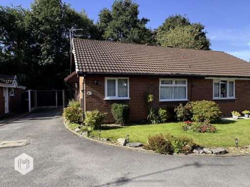 2 bedroom bungalow for sale in Flaxley Close, Birchwood, Warrington, Cheshire, WA3 6TN, WA3 — £220,000 • 2 bed • 1 bath • 582 ft²
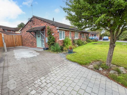 2 bedroom bungalow for sale in Woolmer Close, Birchwood, Warrington, Cheshire, WA3 6TT, WA3 — £230,000 • 2 bed • 1 bath • 434 ft²
 3 bedroom detached house for sale in Fisherfield Drive, Birchwood, Warrington, Cheshire, WA3 — £280,000 • 3 bed • 1 bath • 933 ft²
 3 bedroom semi-detached house for sale in Dunley Close, Birchwood, Warrington, Cheshire, WA3 — £240,000 • 3 bed • 1 bath • 811 ft²
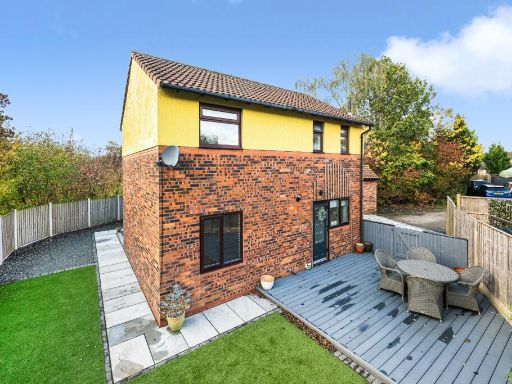 3 bedroom detached house for sale in Birchwood, Warrington, Cheshire, WA3 — £320,000 • 3 bed • 1 bath • 1055 ft²
Meta
- {
"@context": "https://schema.org",
"@type": "Residence",
"name": "3 bedroom detached bungalow for sale in Inglewood Close, Go…",
"description": "",
"url": "https://propertypiper.co.uk/property/9ac9e86b-806f-456e-afd2-84b89719e86b",
"image": "https://image-a.propertypiper.co.uk/0e77df40-79ab-4049-9f0d-276304240f1b-1024.jpeg",
"address": {
"@type": "PostalAddress",
"streetAddress": "Inglewood Close, Gorse Covert, Birchwood, WA3",
"postalCode": "WA3 6UJ",
"addressLocality": "Warrington",
"addressRegion": "Warrington North",
"addressCountry": "England"
},
"geo": {
"@type": "GeoCoordinates",
"latitude": 53.4312887,
"longitude": -2.4984355
},
"numberOfRooms": 3,
"numberOfBathroomsTotal": 2,
"floorSize": {
"@type": "QuantitativeValue",
"value": 998,
"unitCode": "FTK"
},
"offers": {
"@type": "Offer",
"price": 280000,
"priceCurrency": "GBP",
"availability": "https://schema.org/InStock"
},
"additionalProperty": [
{
"@type": "PropertyValue",
"name": "Feature",
"value": "single-family home"
},
{
"@type": "PropertyValue",
"name": "Feature",
"value": "bungalow"
},
{
"@type": "PropertyValue",
"name": "Feature",
"value": "modern style"
},
{
"@type": "PropertyValue",
"name": "Feature",
"value": "brick construction"
},
{
"@type": "PropertyValue",
"name": "Feature",
"value": "bay window"
},
{
"@type": "PropertyValue",
"name": "Feature",
"value": "tile roof"
},
{
"@type": "PropertyValue",
"name": "Feature",
"value": "driveway"
},
{
"@type": "PropertyValue",
"name": "Feature",
"value": "landscaped garden"
},
{
"@type": "PropertyValue",
"name": "Feature",
"value": "garden"
},
{
"@type": "PropertyValue",
"name": "Feature",
"value": "lawn"
},
{
"@type": "PropertyValue",
"name": "Feature",
"value": "patio"
},
{
"@type": "PropertyValue",
"name": "Feature",
"value": "shed"
},
{
"@type": "PropertyValue",
"name": "Feature",
"value": "outdoor space"
},
{
"@type": "PropertyValue",
"name": "Feature",
"value": "landscaped"
},
{
"@type": "PropertyValue",
"name": "Feature",
"value": "greenery"
}
]
}
High Res Floorplan Images
Compatible Floorplan Images
FloorplanImages Thumbnail