ST16 3XU - 2 bedroom flat for sale in St. Georges Parkway, Stafford, S…
View on Property Piper
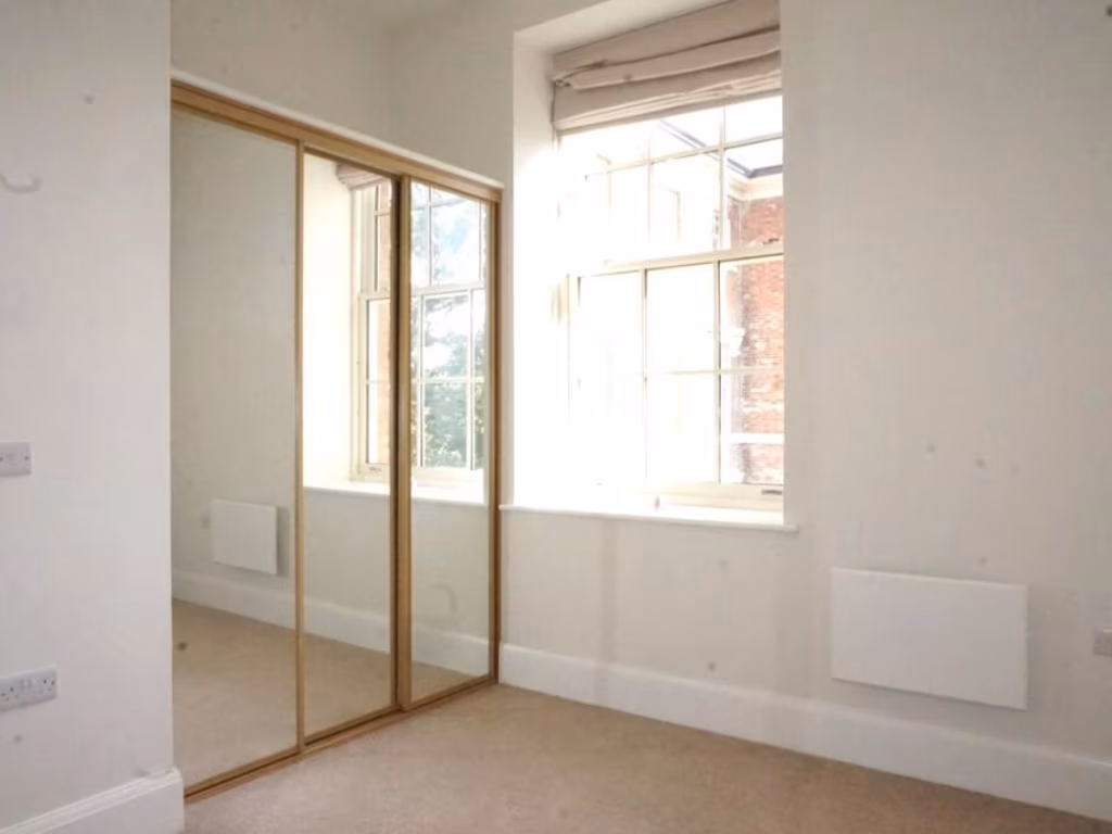
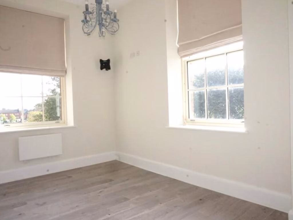
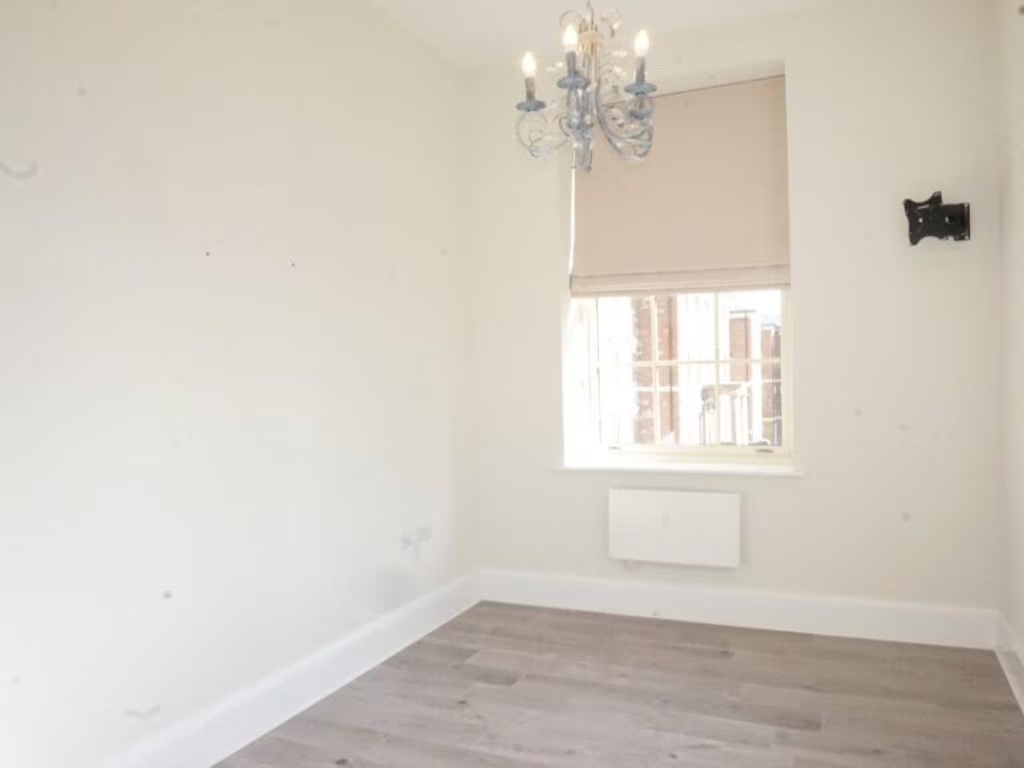
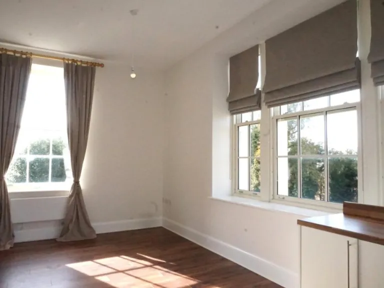
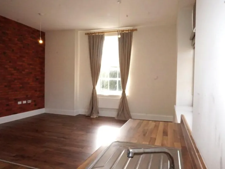
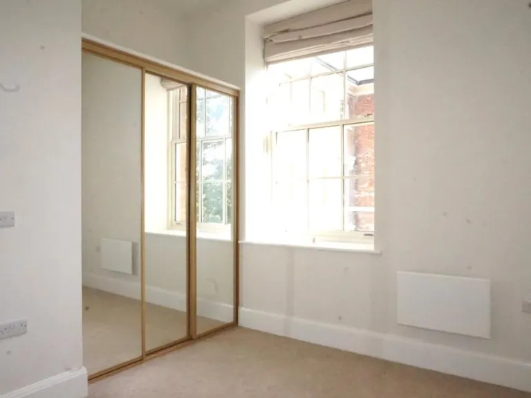
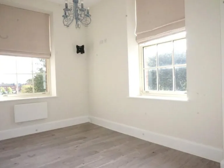
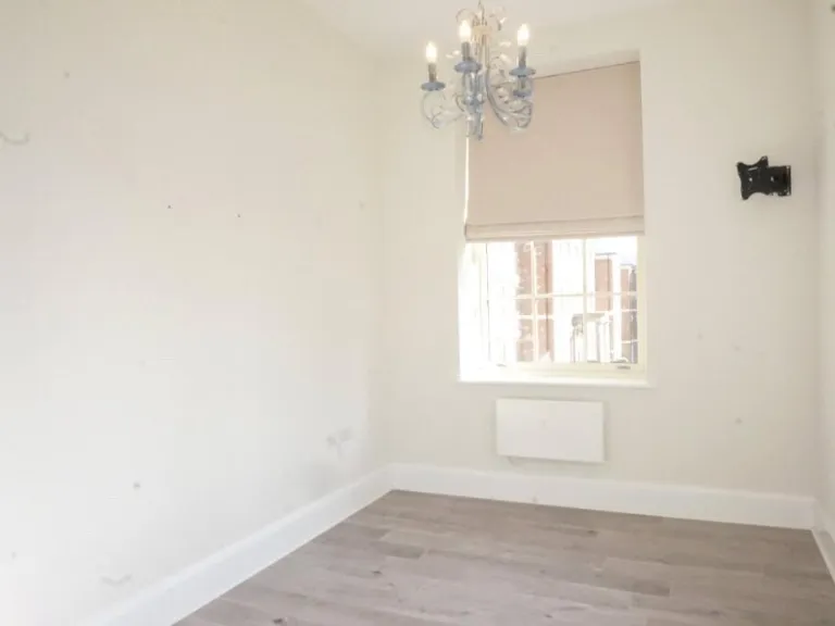
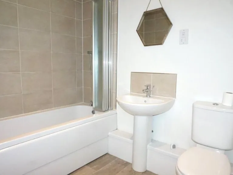
2 bedroom flat for sale in St. Georges Parkway, Stafford, Staffordshire, ST16
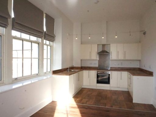
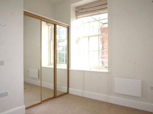
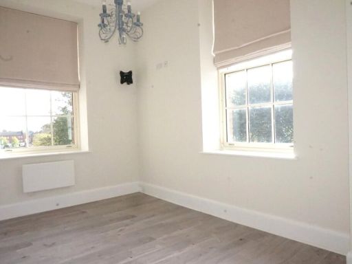
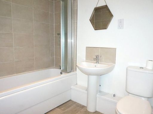
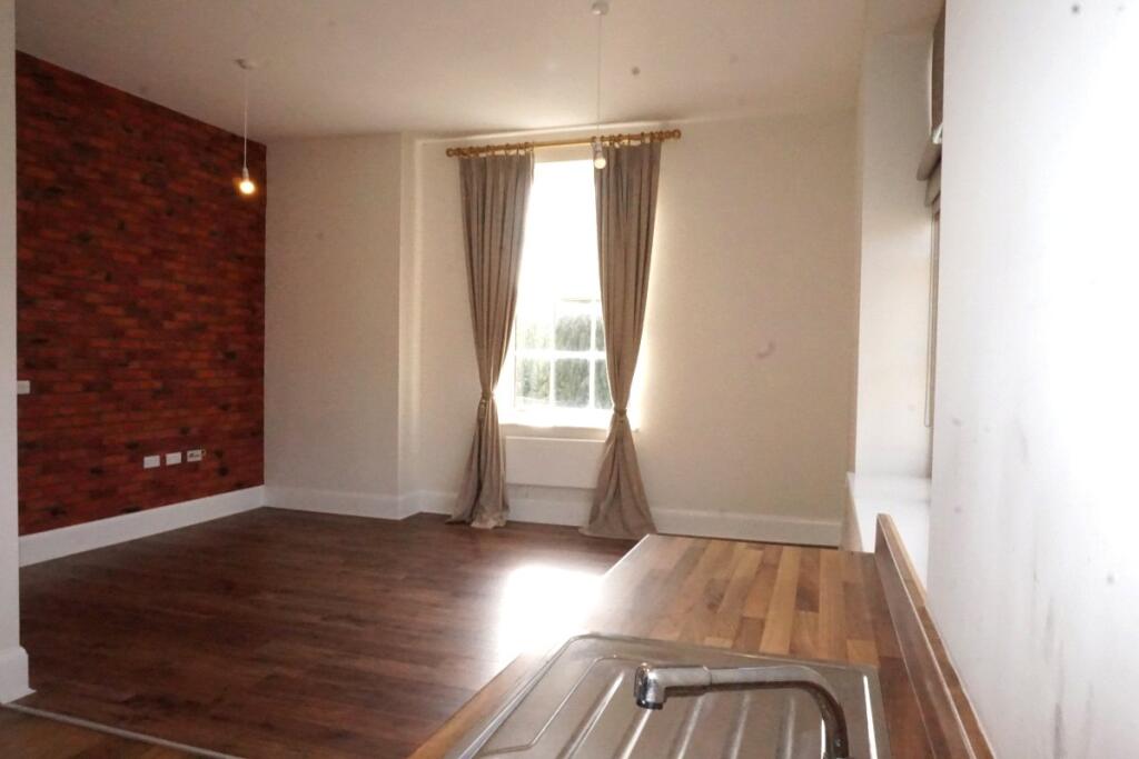
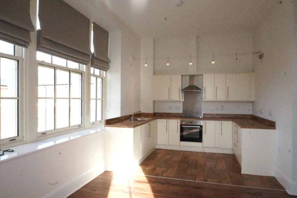
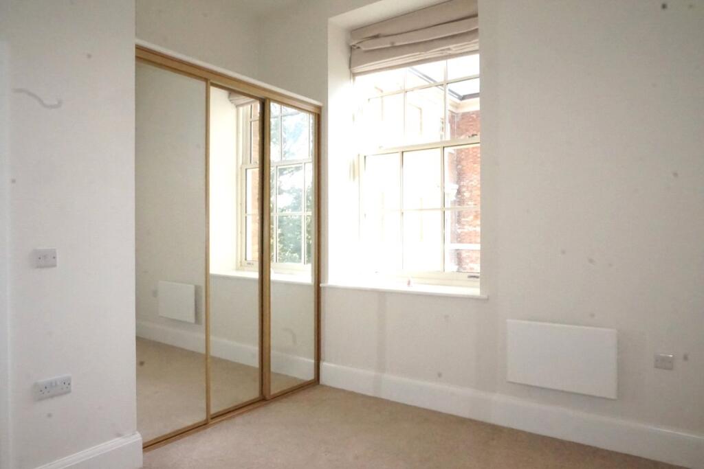
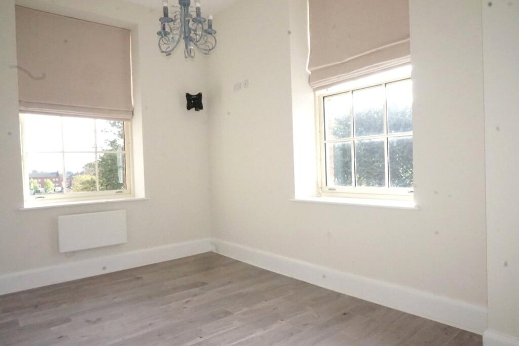
Property Details
- Price: £195000
- Bedrooms: 2
- Bathrooms: 1
- Property Type: undefined
- Property SubType: undefined
Image Descriptions
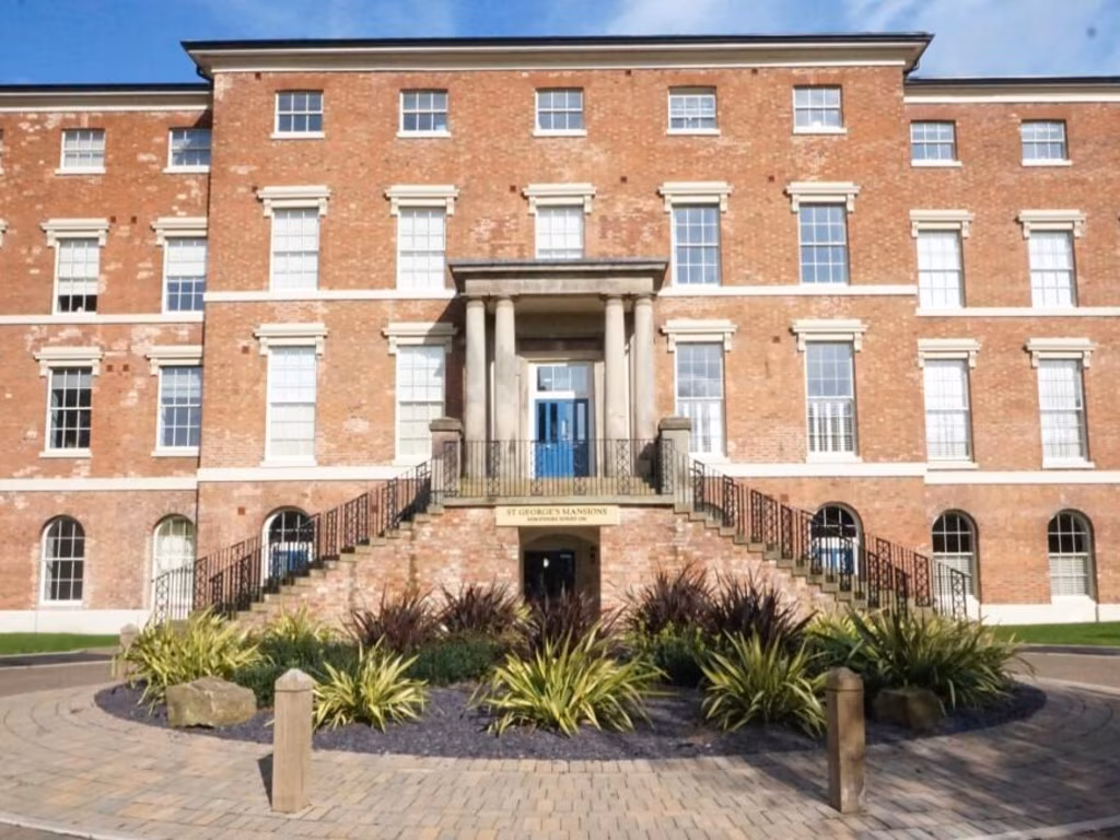
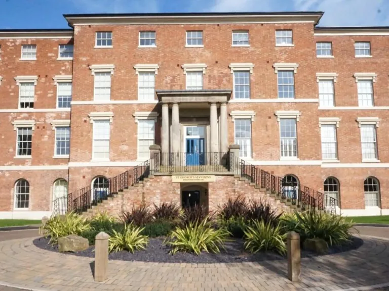
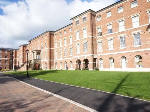
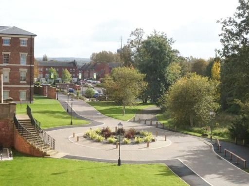
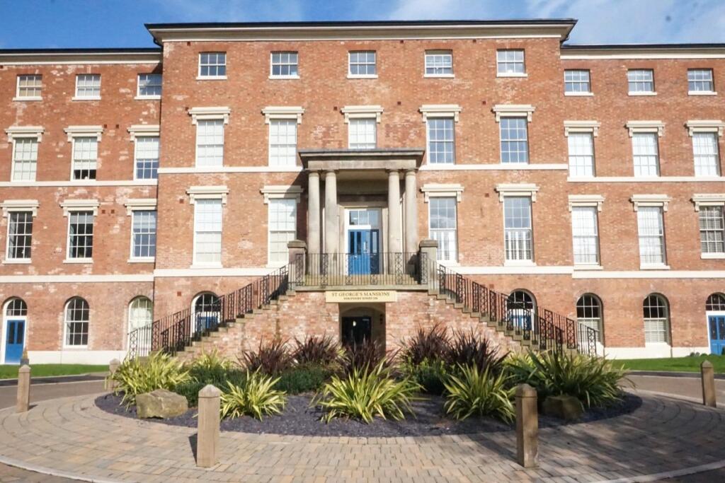
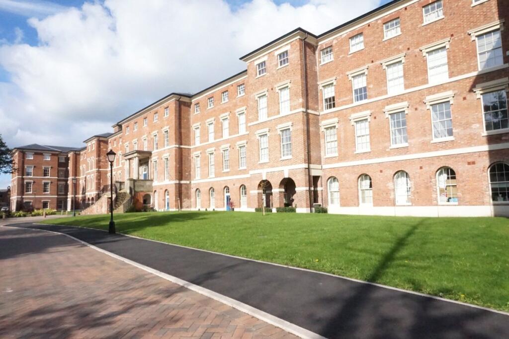
- building Georgian
- a large Georgian-style apartment complex Georgian
Textual Property Features
- Is Listed Building
- Chain Free
- Success
Detected Visual Features
- Georgian architecture
- historic building
- red brick
- multi-story
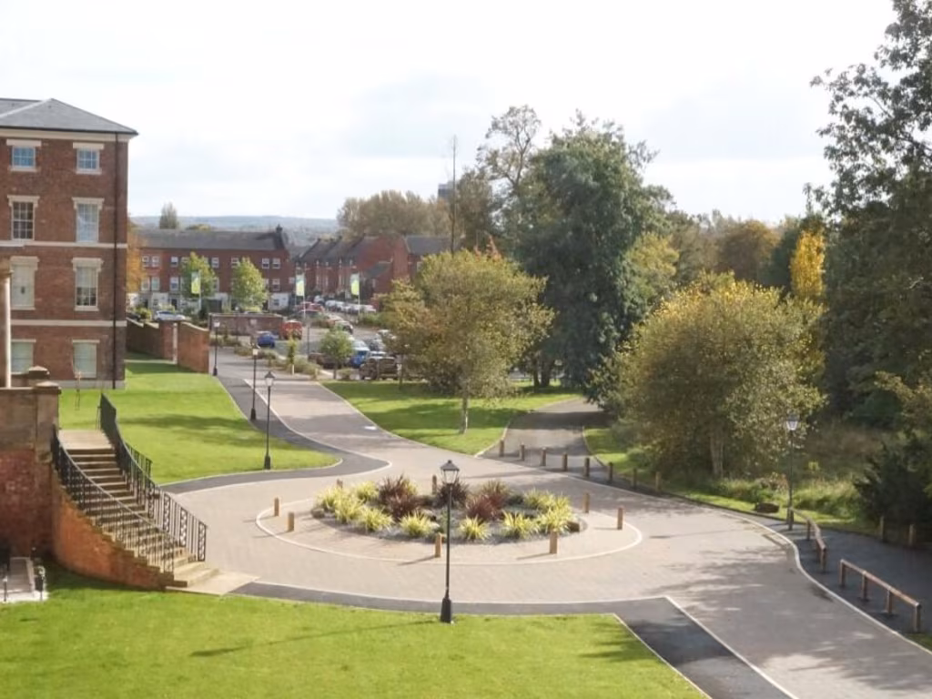
- landscape stairs
- sandstone columns
- large windows
- traditional design
- period property
- brick facade
- arched windows
- historical building
- apartment complex
EPC Details
- High performance glazing
- Average thermal transmittance 0.28 W/m-¦K
- Room heaters, electric
- Low energy lighting in 83% of fixed outlets
- Average thermal transmittance 0.25 W/m-¦K
Nearby Schools
- Barnfields Primary School
- Flash Ley Primary School
- Blessed Mother Teresa's Catholic Primary School
- St Paul's CofE (C) Primary School
- Veritas Primary Academy
- Stafford Grammar School
- Oakridge Primary School
- Stafford Manor High School
- St Anne's Catholic Primary School
- Castlechurch Primary School
- King Edward VI High School
- Bailey Street Alternative Provision Academy
- St John's CofE Primary Academy
- The Weston Road Academy
- St Austin's Catholic Primary School and Nursery
- Burton Manor Primary School
- Silkmore Primary Academy
- Rowley Park Primary Academy
- Leasowes Primary School
- Blessed William Howard Catholic School
- St Leonard's Primary School
- John Wheeldon Primary Academy
- St Patrick's Catholic Primary School
- Tillington Manor Primary School
- Sir Graham Balfour High School
- Parkside Primary School
Nearest General Shops
- Id: 8707629168
- Tags:
- Brand: B&M Bargains
- Brand:wikidata: Q4836931
- Brand:wikipedia: en:B&M
- Contact:
- Website: https://www.bmstores.co.uk/stores/stafford-kingsmead-602
- Name: B&M Bargains
- Shop: variety_store
- TagsNormalized:
- Lat: 52.8088346
- Lon: -2.1159178
- FullGeoHash: gcqkrve1z832
- PartitionGeoHash: gcqk
- Images:
- FoodStandards: null
- Distance: 316.5
,- Id: 97992858
- Tags:
- Area: yes
- Name: Priory Garden Centre
- Shop: garden_centre
- TagsNormalized:
- Lat: 52.8139374
- Lon: -2.1156063
- FullGeoHash: gcqkry7rqz98
- PartitionGeoHash: gcqk
- Images:
- FoodStandards: null
- Distance: 255.1
,- Id: 549048662
- Tags:
- TagsNormalized:
- Lat: 52.8126364
- Lon: -2.118638
- FullGeoHash: gcqkry1rbhvp
- PartitionGeoHash: gcqk
- Images:
- FoodStandards: null
- Distance: 251.8
}
Nearest Grocery shops
- Id: 927158251
- Tags:
- Building: yes
- Shop: convenience
- TagsNormalized:
- Lat: 52.8122205
- Lon: -2.1219809
- FullGeoHash: gcqkrwnv6r2q
- PartitionGeoHash: gcqk
- Images:
- FoodStandards: null
- Distance: 455.9
,- Id: 4185146475
- Tags:
- Addr:
- Housenumber: 7-8
- Postcode: ST16 3BS
- Street: Marston Road
- Fhrs:
- Name: Polski Sklep Stafford
- Shop: convenience
- Source:
- Website: https://www.facebook.com/Polski-Sklep-Stafford-478113382352378/timeline
- TagsNormalized:
- Lat: 52.8138673
- Lon: -2.1190591
- FullGeoHash: gcqkry2zn67n
- PartitionGeoHash: gcqk
- Images:
- FoodStandards: null
- Distance: 354.6
,- Id: 903224555
- Tags:
- Addr:
- City: Stafford
- Housenumber: 24
- Postcode: ST16 3AX
- Street: Browning Street
- Building: yes
- Shop: convenience
- TagsNormalized:
- Lat: 52.8133073
- Lon: -2.1192663
- FullGeoHash: gcqkry2gcd09
- PartitionGeoHash: gcqk
- Images:
- FoodStandards: null
- Distance: 325.9
}
Nearest Supermarkets
- Id: 59692574
- Tags:
- Addr:
- Postcode: ST16 2TF
- Street: Chell Road
- Alt_name: Sainsbury's Stafford Superstore
- Brand: Sainsbury's
- Brand:wikidata: Q152096
- Brand:wikipedia: en:Sainsbury's
- Building: yes
- Name: Sainsbury's
- Operator: Sainsburys
- Shop: supermarket
- Source: OS OpenData StreetView
- TagsNormalized:
- sainsburys
- supermarket
- shop
- Lat: 52.8086731
- Lon: -2.1215066
- FullGeoHash: gcqkrtx0v64j
- PartitionGeoHash: gcqk
- Images:
- FoodStandards: null
- Distance: 534.7
,- Id: 72925426
- Tags:
- Addr:
- Housename: Madford Retail Park
- Postcode: ST16 2QY
- Street: Foregate Street
- Alt_name: LIDL Stafford
- Brand: Lidl
- Brand:wikidata: Q151954
- Brand:wikipedia: en:Lidl
- Building: yes
- Fhrs:
- Name: Lidl
- Shop: supermarket
- TagsNormalized:
- Lat: 52.8108141
- Lon: -2.122592
- FullGeoHash: gcqkrtymk128
- PartitionGeoHash: gcqk
- Images:
- FoodStandards:
- Id: 1194984
- FHRSID: 1194984
- LocalAuthorityBusinessID: 1000
- BusinessName: Lidl Foodstores
- BusinessType: Retailers - supermarkets/hypermarkets
- BusinessTypeID: 7840
- AddressLine1: Lidl, Madford Retail Park
- AddressLine2: Foregate Street
- AddressLine3: Stafford
- AddressLine4: Staffordshire
- PostCode: ST16 2DL
- RatingValue: 5
- RatingKey: fhrs_5_en-GB
- RatingDate: 2018-10-15
- LocalAuthorityCode: 292
- LocalAuthorityName: Stafford
- LocalAuthorityWebSite: http://www.staffordbc.gov.uk
- LocalAuthorityEmailAddress: ehtechsupport@staffordbc.gov.uk
- Scores:
- Hygiene: 0
- Structural: 5
- ConfidenceInManagement: 0
- NewRatingPending: false
- Geocode:
- Longitude: -2.12068610000000
- Latitude: 52.81061160000000
- Distance: 501.4
,- Id: 8707629167
- Tags:
- Brand: ALDI
- Brand:wikidata: Q41171672
- Brand:wikipedia: en:Aldi
- Contact:
- Website: https://stores.aldi.co.uk/stafford/5-kingsmead-retail-park
- Name: ALDI
- Shop: supermarket
- TagsNormalized:
- Lat: 52.8091028
- Lon: -2.1155389
- FullGeoHash: gcqkrvee267b
- PartitionGeoHash: gcqk
- Images:
- FoodStandards: null
- Distance: 284.2
}
Nearest Religious buildings
- Id: 80353787
- Tags:
- Amenity: place_of_worship
- Building: yes
- Denomination: jehovahs_witness
- Religion: christian
- TagsNormalized:
- place of worship
- jehovah
- jehovahs witness
- christian
- church
- Lat: 52.8110941
- Lon: -2.1201915
- FullGeoHash: gcqkrvbngvqx
- PartitionGeoHash: gcqk
- Images:
- FoodStandards: null
- Distance: 337.1
,- Id: 80353775
- Tags:
- Amenity: place_of_worship
- Building: yes
- Denomination: Religious Society of Friends
- Name: Quaker Meeting House
- Religion: christian
- TagsNormalized:
- place of worship
- religious
- quaker
- christian
- church
- Lat: 52.811008
- Lon: -2.1198658
- FullGeoHash: gcqkrvbq7t3m
- PartitionGeoHash: gcqk
- Images:
- FoodStandards: null
- Distance: 317.6
,- Id: 549048592
- Tags:
- Amenity: place_of_worship
- Denomination: elim_pentecostal
- Name: Stafford Elim Christian Centre
- Religion: christian
- TagsNormalized:
- place of worship
- pentecostal
- christian
- church
- Lat: 52.8119563
- Lon: -2.1195605
- FullGeoHash: gcqkry0efwjn
- PartitionGeoHash: gcqk
- Images:
- FoodStandards: null
- Distance: 290.8
}
Nearest Leisure Facilities
- Id: 98211695
- Tags:
- TagsNormalized:
- Lat: 52.8134903
- Lon: -2.1156353
- FullGeoHash: gcqkry7kyh5v
- PartitionGeoHash: gcqk
- Images:
- FoodStandards: null
- Distance: 205.8
,- Id: 930111138
- Tags:
- TagsNormalized:
- Lat: 52.8102504
- Lon: -2.1133173
- FullGeoHash: gcqkrvv4h0hq
- PartitionGeoHash: gcqk
- Images:
- FoodStandards: null
- Distance: 203.5
,- Id: 97992855
- Tags:
- Barrier: fence
- Leisure: playground
- Name: Sandyford Street
- TagsNormalized:
- Lat: 52.8134527
- Lon: -2.1153579
- FullGeoHash: gcqkry7sst4u
- PartitionGeoHash: gcqk
- Images:
- FoodStandards: null
- Distance: 200.2
,- Id: 558617866
- Tags:
- TagsNormalized:
- Lat: 52.8104538
- Lon: -2.1145255
- FullGeoHash: gcqkrvu5pype
- PartitionGeoHash: gcqk
- Images:
- FoodStandards: null
- Distance: 142.3
,- Id: 930111136
- Tags:
- TagsNormalized:
- Lat: 52.8105908
- Lon: -2.1143545
- FullGeoHash: gcqkrvu7gzxh
- PartitionGeoHash: gcqk
- Images:
- FoodStandards: null
- Distance: 133
}
Nearest Tourist attractions
- Id: 931038690
- Tags:
- Building: yes
- Tourism: zoo
- Zoo: aviary
- TagsNormalized:
- Lat: 52.8042639
- Lon: -2.1189163
- FullGeoHash: gcqkru9p1sjr
- PartitionGeoHash: gcqk
- Images:
- FoodStandards: null
- Distance: 857.6
,- Id: 217786968
- Tags:
- Building: yes
- Name: Ancient High House
- Source: Bing
- Tourism: museum
- Wikidata: Q4752857
- Wikipedia: en:Ancient High House
- TagsNormalized:
- Lat: 52.8062878
- Lon: -2.1171581
- FullGeoHash: gcqkrv46fts8
- PartitionGeoHash: gcqk
- Images:
- FoodStandards: null
- Distance: 610
,- Id: 127091724
- Tags:
- Building: yes
- Heritage: 2
- Heritage:operator: Historic England
- Listed_status: Grade II*
- Name: Shire Hall
- Operator: Staffordshire County Council
- Ref:
- Source: Bing;survey
- Start_date: 1798
- Tourism: museum
- Website: https://www.staffordshire.gov.uk/leisure/museumandgalleries/shirehallgalleries/home.aspx
- Wikidata: Q7498359
- Wikipedia: en:Shire Hall, Stafford
- TagsNormalized:
- Lat: 52.8072494
- Lon: -2.1167767
- FullGeoHash: gcqkrv68e8bb
- PartitionGeoHash: gcqk
- Images:
- FoodStandards: null
- Distance: 500.1
}
Nearest Hotels
- Id: 54587048
- Tags:
- Brand: Premier Inn
- Brand:wikidata: Q2108626
- Brand:wikipedia: en:Premier Inn
- Building: yes
- Internet_access: wlan
- Internet_access:fee: customers
- Internet_access:operator: Virgin Media
- Internet_access:ssid: Premier Inn Free Wi-Fi
- Name: Premier Inn Stafford North Hurricane
- Source: OS_OpenData_StreetView
- Tourism: hotel
- TagsNormalized:
- Lat: 52.8327445
- Lon: -2.1333722
- FullGeoHash: gcqkx3yt0c6k
- PartitionGeoHash: gcqk
- Images:
- FoodStandards: null
- Distance: 2642.2
,- Id: 328385593
- Tags:
- Addr:
- Postcode: ST17 4ER
- Street: Lichfield Road
- Brand: Travelodge
- Brand:wikidata: Q9361374
- Brand:wikipedia: en:Travelodge UK
- Building: yes
- Fhrs:
- Internet_access: wlan
- Internet_access:fee: customers
- Internet_access:ssid: Travelodge WiFi
- Name: Travelodge
- Source:
- Tourism: hotel
- TagsNormalized:
- Lat: 52.7998563
- Lon: -2.1099019
- FullGeoHash: gcqkrgzt7wx5
- PartitionGeoHash: gcqk
- Images:
- FoodStandards: null
- Distance: 1360.3
,- Id: 166534942
- Tags:
- Addr:
- Housenumber: 46
- Postcode: ST16 2JA
- Street: Greengate Street
- Building: yes
- Diet:
- Gluten_free: yes
- Vegan: yes
- Vegetarian: yes
- Fhrs:
- Internet_access: wlan
- Name: Swan Hotel
- Tourism: hotel
- Website: https://www.theswanstafford.co.uk
- TagsNormalized:
- gluten free
- vegan
- vegetarian
- hotel
- tourism
- Lat: 52.8060178
- Lon: -2.1172486
- FullGeoHash: gcqkrv432e1j
- PartitionGeoHash: gcqk
- Images:
- FoodStandards: null
- Distance: 640.7
}
Tags
- Georgian architecture
- historic building
- red brick
- multi-story
- landscape stairs
- sandstone columns
- large windows
- traditional design
- period property
- Georgian architecture
- brick facade
- arched windows
- historical building
- apartment complex
Local Market Stats
- Average Price/sqft: £228
- Avg Income: £44800
- Rental Yield: 4.1%
- Social Housing: 12%
- Planning Success Rate: 32%
AirBnB Data
- 1km average: £90/night
- Listings in 1km: 6
Similar Properties
 2 bedroom apartment for sale in 49 St. Georges Mansions, St Georges Parkway, Stafford, ST16 — £150,000 • 2 bed • 1 bath • 625 ft²
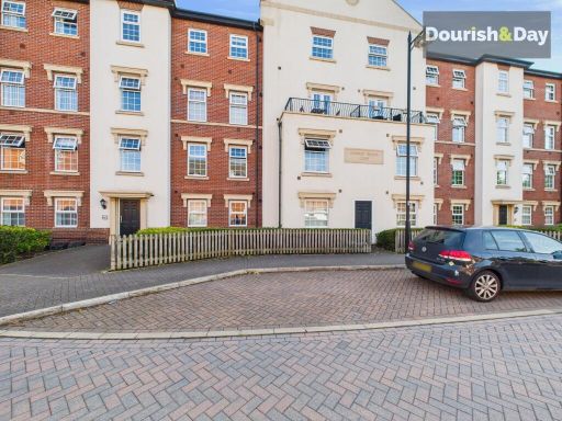 2 bedroom apartment for sale in St. Georges Parkway, Stafford, ST16 — £155,000 • 2 bed • 2 bath • 678 ft²
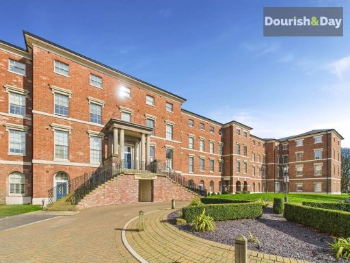 2 bedroom apartment for sale in St. Georges Parkway, Stafford, ST16 — £180,000 • 2 bed • 2 bath • 749 ft²
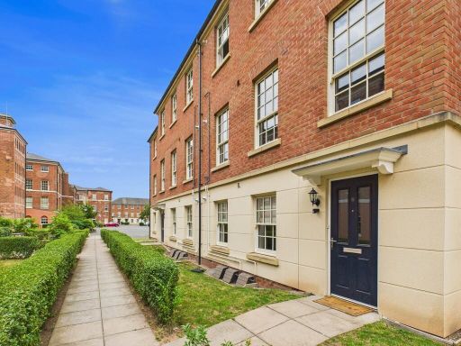 2 bedroom ground floor flat for sale in Tower Place, Stafford, ST16 — £155,000 • 2 bed • 1 bath • 587 ft²
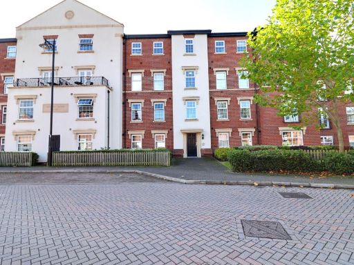 2 bedroom apartment for sale in St. Georges Parkway, Stafford, ST16 — £142,000 • 2 bed • 2 bath • 679 ft²
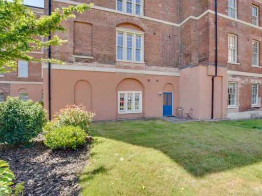 1 bedroom apartment for sale in 29 St Georges Mansions, St Georges Parkway, Stafford, ST16 — £150,000 • 1 bed • 1 bath • 505 ft²
Meta
- {
"@context": "https://schema.org",
"@type": "Residence",
"name": "2 bedroom flat for sale in St. Georges Parkway, Stafford, S…",
"description": "",
"url": "https://propertypiper.co.uk/property/96d6976c-5432-4c6c-9274-ca8e5b4e24c4",
"image": "https://image-a.propertypiper.co.uk/d006d7a1-e91d-4ca6-8479-5563df700af9-1024.jpeg",
"address": {
"@type": "PostalAddress",
"streetAddress": "90, ST GEORGES MANSIONS, ST GEORGES PARKWAY",
"postalCode": "ST16 3XU",
"addressLocality": "Stafford",
"addressRegion": "Stafford",
"addressCountry": "England"
},
"geo": {
"@type": "GeoCoordinates",
"latitude": 52.81165308271631,
"longitude": -2.1152625597809225
},
"numberOfRooms": 2,
"numberOfBathroomsTotal": 1,
"offers": {
"@type": "Offer",
"price": 195000,
"priceCurrency": "GBP",
"availability": "https://schema.org/InStock"
},
"additionalProperty": [
{
"@type": "PropertyValue",
"name": "Feature",
"value": "Georgian architecture"
},
{
"@type": "PropertyValue",
"name": "Feature",
"value": "historic building"
},
{
"@type": "PropertyValue",
"name": "Feature",
"value": "red brick"
},
{
"@type": "PropertyValue",
"name": "Feature",
"value": "multi-story"
},
{
"@type": "PropertyValue",
"name": "Feature",
"value": "landscape stairs"
},
{
"@type": "PropertyValue",
"name": "Feature",
"value": "sandstone columns"
},
{
"@type": "PropertyValue",
"name": "Feature",
"value": "large windows"
},
{
"@type": "PropertyValue",
"name": "Feature",
"value": "traditional design"
},
{
"@type": "PropertyValue",
"name": "Feature",
"value": "period property"
},
{
"@type": "PropertyValue",
"name": "Feature",
"value": "Georgian architecture"
},
{
"@type": "PropertyValue",
"name": "Feature",
"value": "brick facade"
},
{
"@type": "PropertyValue",
"name": "Feature",
"value": "arched windows"
},
{
"@type": "PropertyValue",
"name": "Feature",
"value": "historical building"
},
{
"@type": "PropertyValue",
"name": "Feature",
"value": "apartment complex"
}
]
}