SS3 9SP - 3 bedroom end of terrace house for sale in Blackgate Road,…
View on Property Piper
3 bedroom end of terrace house for sale in Blackgate Road, Shoeburyness, SS3
Property Details
- Price: £425000
- Bedrooms: 3
- Bathrooms: 2
- Property Type: undefined
- Property SubType: undefined
Image Descriptions
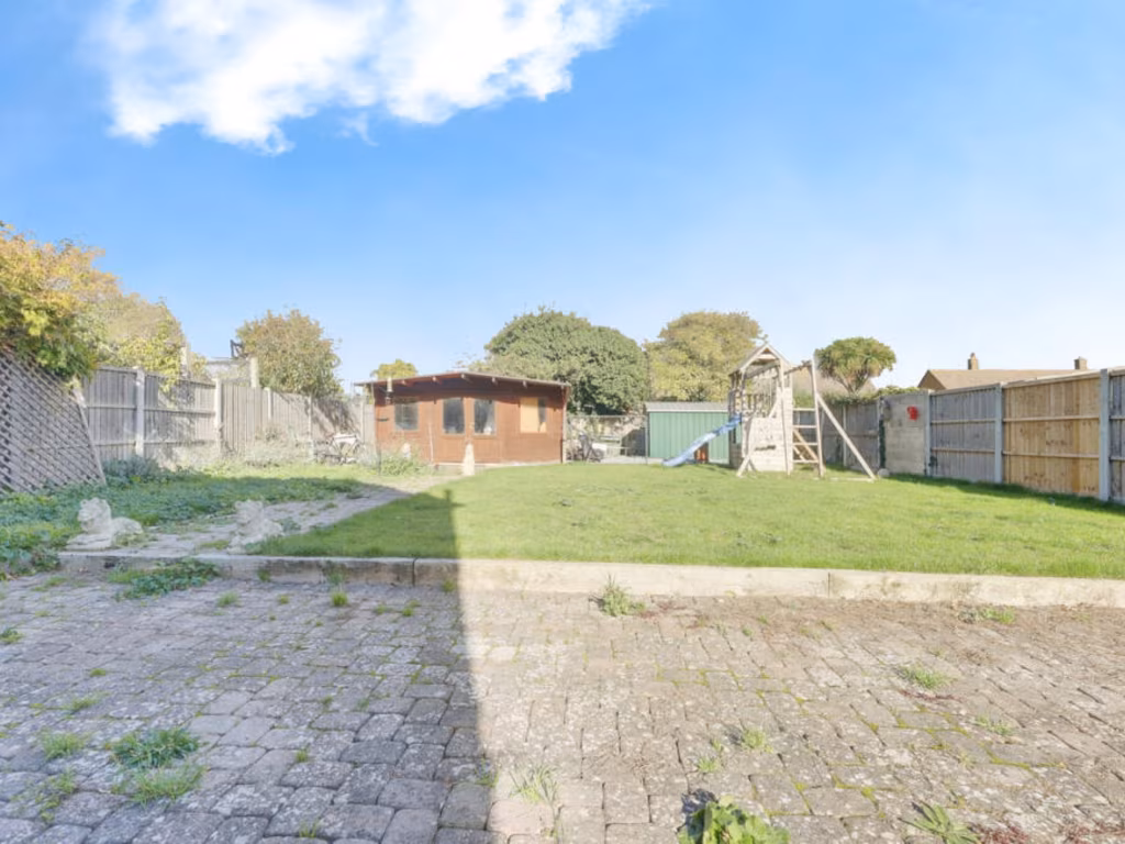
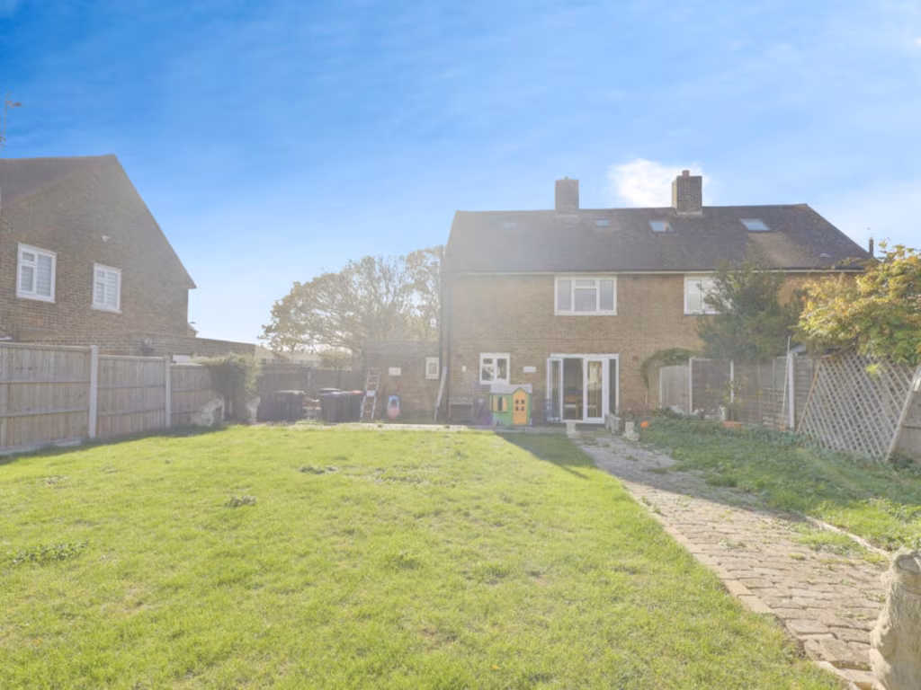
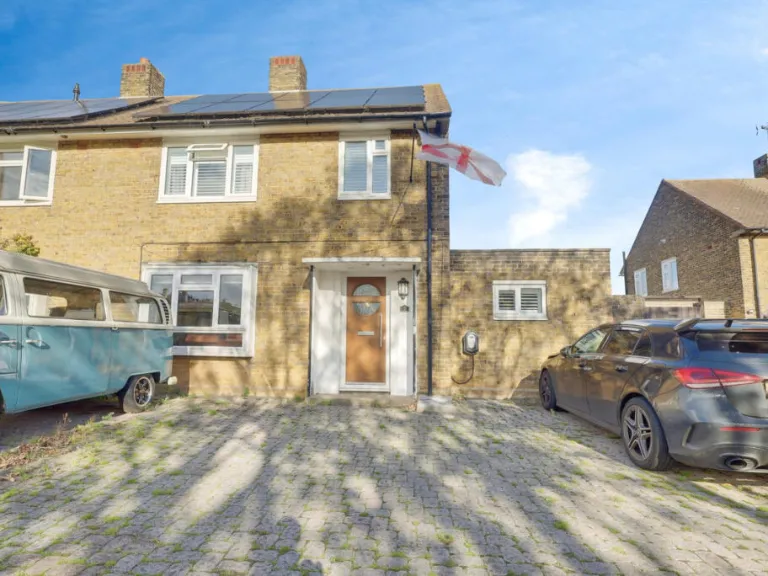
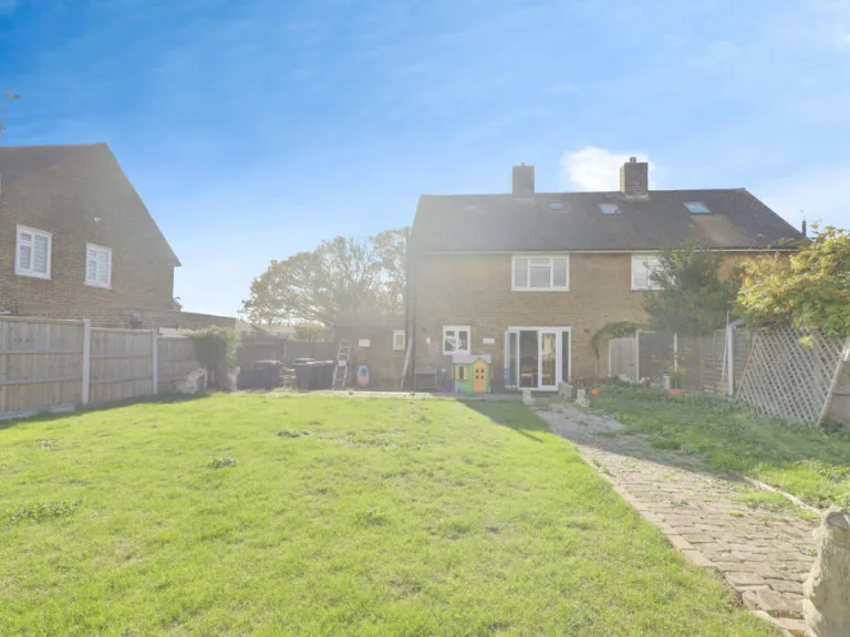
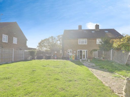
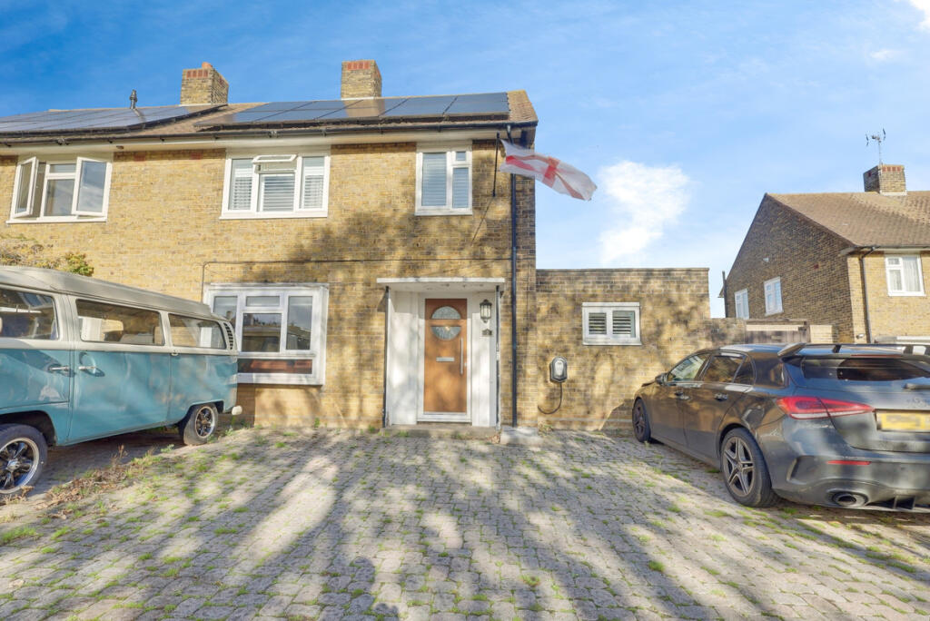
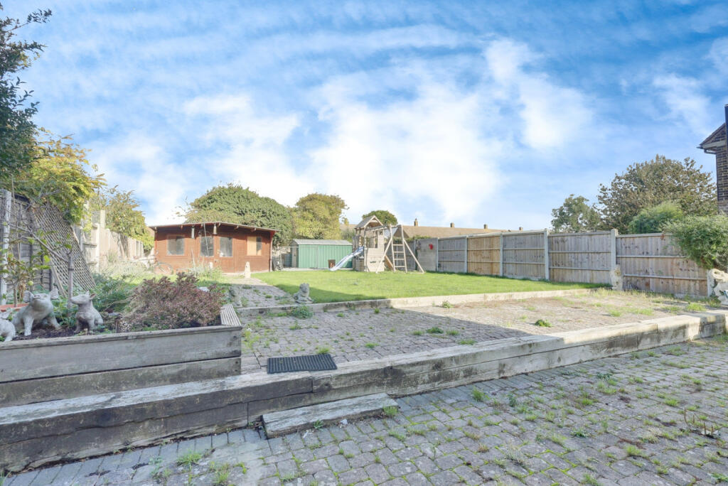
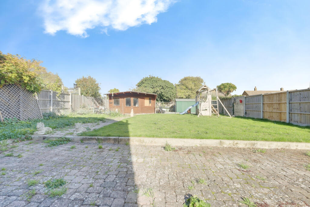
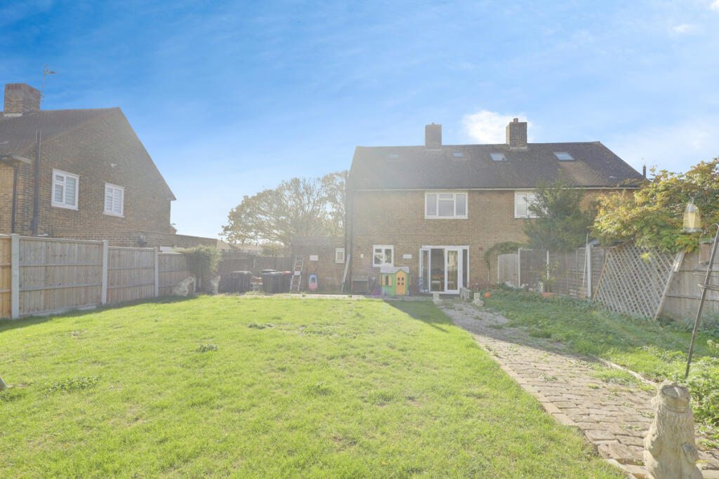
- detached house exterior with driveway mid-20th-century suburban
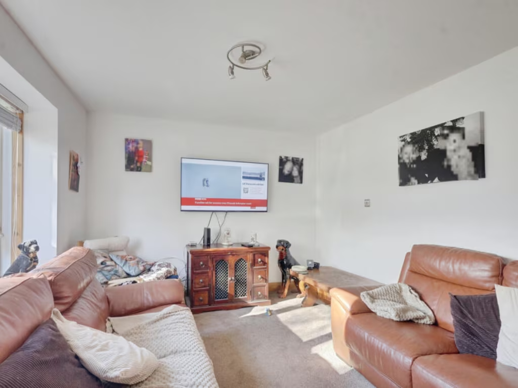
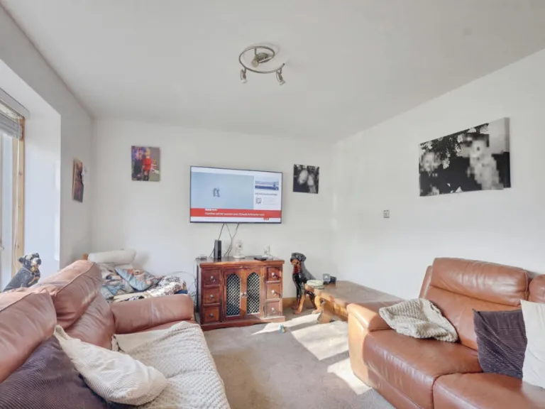
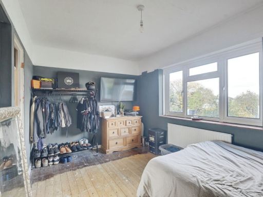
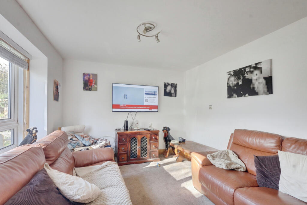
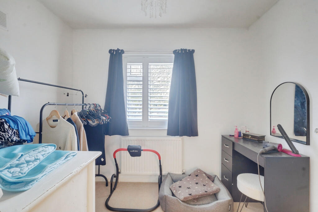
- living room contemporary
Floorplan Description
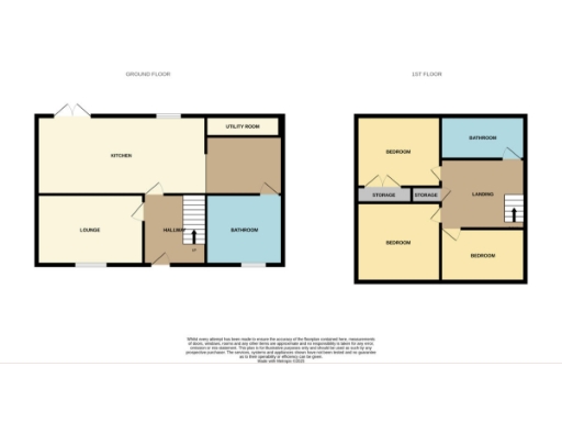
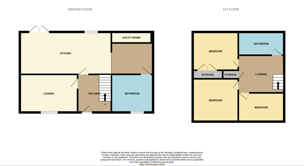
- Two-storey property plan showing ground floor with kitchen, lounge, utility and bathroom, and first floor with three bedrooms and a bathroom.
Rooms
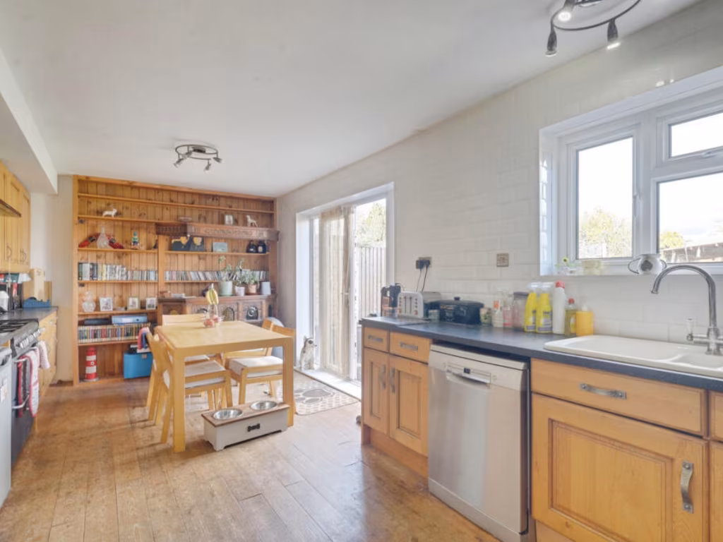
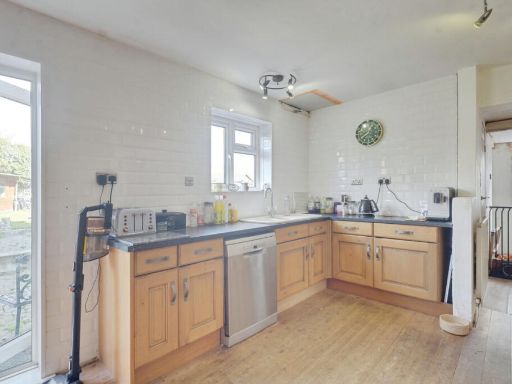
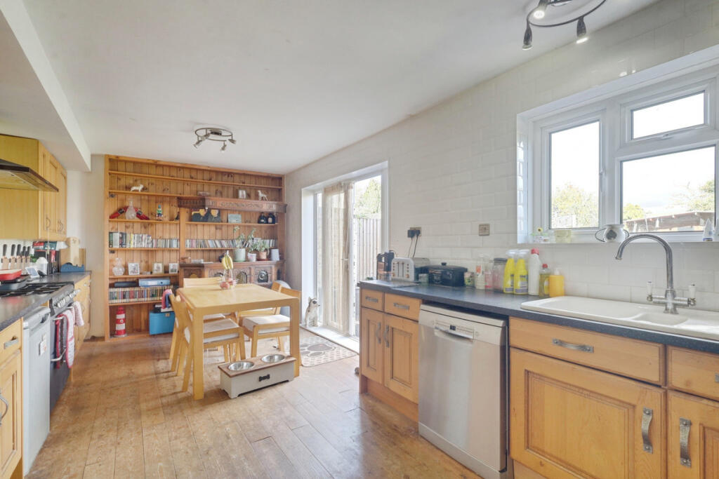
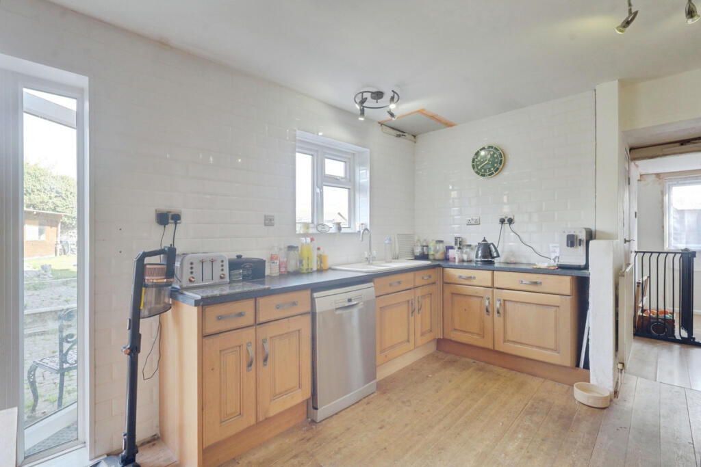
- KITCHEN:
- UTILITY ROOM:
- LOUNGE:
- HALLWAY:
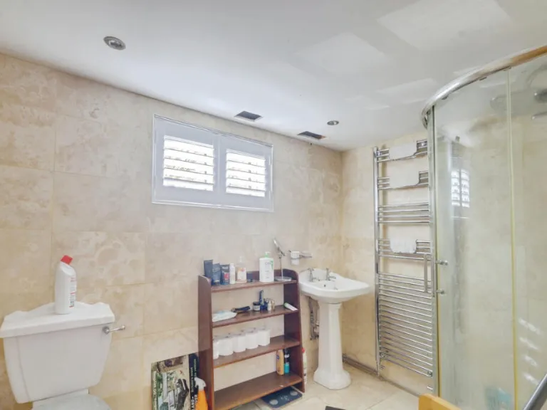
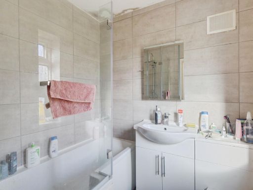
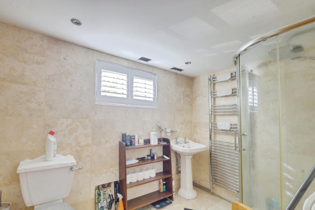
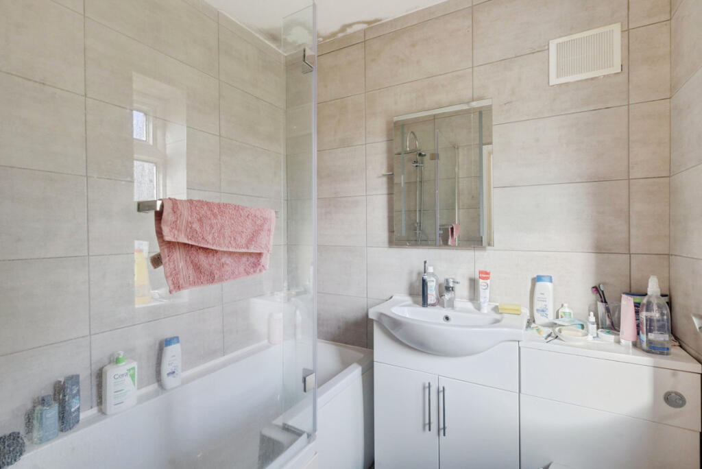
- BATHROOM:
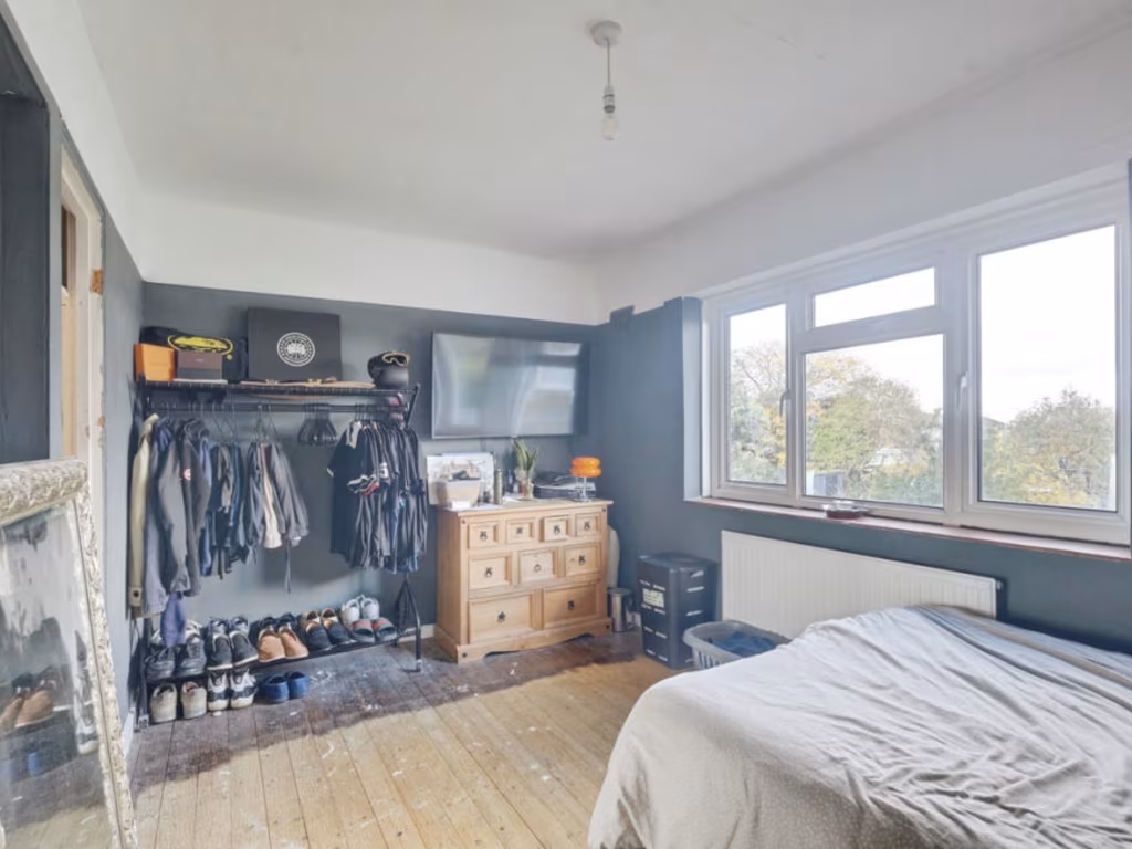
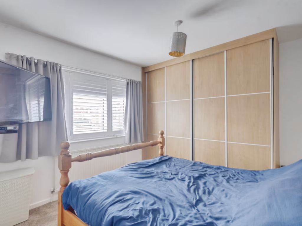
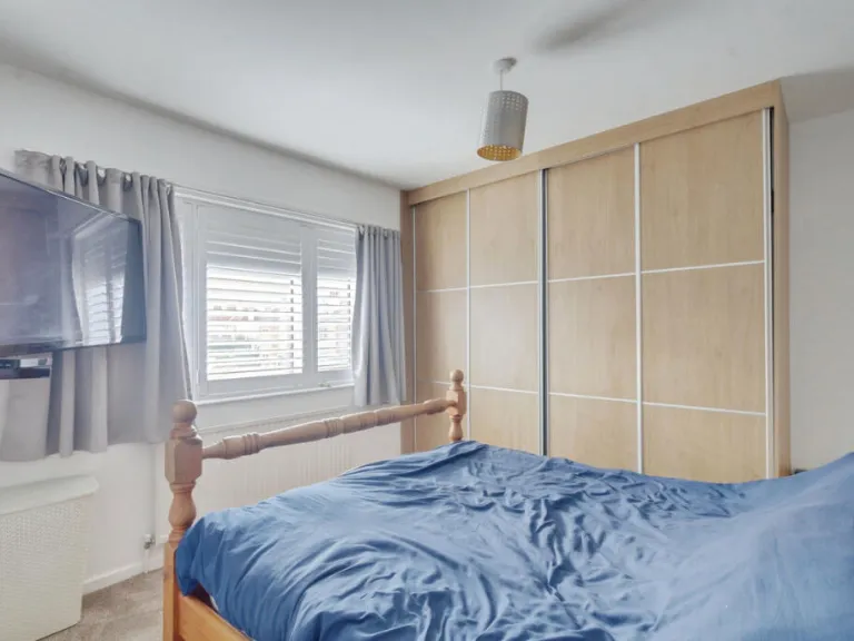
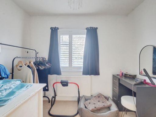
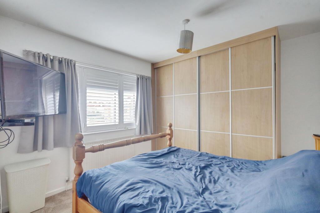
- BEDROOM:
- BEDROOM:
- BEDROOM:
- BATHROOM:
- LANDING:
- STORAGE:
- STORAGE:
Textual Property Features
Detected Visual Features
- detached house
- mid-century
- suburban
- solar panels
- driveway
- brick exterior
- dated
- needs modernization
- living room
- standard ceiling
- contemporary style
- medium size room
Nearby Schools
- Porters Grange Primary School and Nursery
- Southchurch High School
- Hamstel Infant School and Nursery
- Thorpe Hall School
- Alleyn Court Preparatory School
- Victory Park Academy
- Shoeburyness High School
- Greenways Primary School
- Friars Primary School and Nursery
- Bournes Green Junior School
- Bournes Green Infant School
- Temple Sutton Primary School
- Great Wakering Primary Academy
- Hinguar Community Primary School
- Richmond Avenue Primary and Nursery School
- Sacred Heart Catholic Primary School
- St Helen's Catholic Primary School
- St Mary's, Prittlewell, CofE Primary School
- Bournemouth Park Academy
- Hamstel Junior School
- Barling Magna Primary Academy
- Thorpedene Primary School
- St George's Catholic Primary School
- Southend High School for Girls
- Southend YMCA Community School
- Cecil Jones Academy
- Stambridge Primary School
Nearest Bars And Restaurants
- Id: 1147372324
- Tags:
- Amenity: pub
- Building: yes
- Name: Castle Inn
- TagsNormalized:
- Lat: 51.5607305
- Lon: 0.7885624
- FullGeoHash: u10t3fq5nbf9
- PartitionGeoHash: u10t
- Images:
- FoodStandards: null
- Distance: 2972
,- Id: 4116795163
- Tags:
- Addr:
- Housenumber: 34
- Postcode: SS1 3PA
- Street: Barnstable Road
- Amenity: cafe
- Fhrs:
- Name: Firing Imaginations Pottery Painting Cafe
- Source: survey
- Source:addr: FHRS Open Data
- TagsNormalized:
- Lat: 51.538305
- Lon: 0.7605553
- FullGeoHash: u10t1q3b6hrh
- PartitionGeoHash: u10t
- Images:
- FoodStandards: null
- Distance: 2762.2
,- Id: 4318505935
- Tags:
- Addr:
- City: Thorpe Bay, Southend-on-Sea
- Housenumber: 132
- Postcode: SS1 3ES
- Street: The Broadway
- Amenity: cafe
- Name: Cafe Ciao
- TagsNormalized:
- Lat: 51.5357046
- Lon: 0.7610507
- FullGeoHash: u10t1mf1jz8s
- PartitionGeoHash: u10t
- Images:
- FoodStandards: null
- Distance: 2704.5
,- Id: 735875119
- Tags:
- Amenity: pub
- Name: The Anchor
- TagsNormalized:
- Lat: 51.5529367
- Lon: 0.8087778
- FullGeoHash: u10t62uvtguq
- PartitionGeoHash: u10t
- Images:
- FoodStandards: null
- Distance: 2083.2
,- Id: 7494280718
- Tags:
- Amenity: cafe
- Brand: Asda
- Brand:wikidata: Q297410
- Brand:wikipedia: en:Asda
- Contact:
- Phone: +44 1702 382500
- Website: https://storelocator.asda.com/east-of-england/shoeburyness/north-shoebury-road/cafe
- Cuisine: coffee_shop
- Drinking_water:
- Drinking_water:refill:network: Refill
- Fixme: Location not accurate
- Internet_access: wlan
- Internet_access:fee: no
- Name: Asda Café
- Opening_hours:
- Operator: Asda Stores Ltd
- Outdoor_seating: no
- Takeaway: yes
- TagsNormalized:
- Lat: 51.5391487
- Lon: 0.7809842
- FullGeoHash: u10t1y2tq38j
- PartitionGeoHash: u10t
- Images:
- FoodStandards: null
- Distance: 1403
}
Nearest General Shops
- Id: 4116795146
- Tags:
- Addr:
- Housenumber: 40
- Postcode: SS1 3PA
- Street: Barnstable Road
- Name: Silvers
- Shop: hairdresser
- Source: survey
- TagsNormalized:
- Lat: 51.5382783
- Lon: 0.7608047
- FullGeoHash: u10t1q600p3j
- PartitionGeoHash: u10t
- Images:
- FoodStandards: null
- Distance: 2744.7
,- Id: 4116795147
- Tags:
- Addr:
- Housenumber: 42
- Postcode: SS1 3PA
- Street: Barnstable Road
- Dance:
- Leisure: dance
- Name: Just Ballet
- Shop: dance
- Source: survey
- Website: https://www.justballet.co.uk/
- TagsNormalized:
- Lat: 51.5382616
- Lon: 0.7609013
- FullGeoHash: u10t1q604k31
- PartitionGeoHash: u10t
- Images:
- FoodStandards: null
- Distance: 2737.9
,- Id: 409802717
- Tags:
- Addr:
- Housenumber: 44
- Postcode: SS1 3PA
- Street: Barnstable Road
- Building: retail
- Fhrs:
- Name: Shakti Newsagent
- Shop: newsagent
- Source: survey
- Source:geometry: Bing
- Source:postcode: FHRS Open Data
- TagsNormalized:
- Lat: 51.5382401
- Lon: 0.7610684
- FullGeoHash: u10t1q60n0m9
- PartitionGeoHash: u10t
- Images:
- FoodStandards:
- Id: 513331
- FHRSID: 513331
- LocalAuthorityBusinessID: 13/00125/NEWS
- BusinessName: Shakti News
- BusinessType: Retailers - other
- BusinessTypeID: 4613
- AddressLine1: 44 Barnstaple Road
- AddressLine2: Thorpe Bay
- AddressLine3: Essex
- AddressLine4: null
- PostCode: SS1 3PA
- RatingValue: 4
- RatingKey: fhrs_4_en-GB
- RatingDate: 2019-05-15
- LocalAuthorityCode: 893
- LocalAuthorityName: Southend-On-Sea
- LocalAuthorityWebSite: http://www.southend.gov.uk
- LocalAuthorityEmailAddress: EnvironmentalHealth@southend.gov.uk
- Scores:
- Hygiene: 0
- Structural: 0
- ConfidenceInManagement: 10
- NewRatingPending: false
- Geocode:
- Longitude: 0.76103300000000
- Latitude: 51.53822500000000
- Distance: 2726.1
}
Nearest Grocery shops
- Id: 694692832
- Tags:
- Brand: Sainsbury's Local
- Brand:wikidata: Q13218434
- Building: retail
- Name: Sainsbury's Local
- Shop: convenience
- TagsNormalized:
- sainsburys
- sainsburys local
- retail
- convenience
- shop
- Lat: 51.5294779
- Lon: 0.7864939
- FullGeoHash: u10t1ussywuk
- PartitionGeoHash: u10t
- Images:
- FoodStandards: null
- Distance: 1125.1
,- Id: 8309664793
- Tags:
- Brand: McColl's
- Brand:wikidata: Q16997477
- Brand:wikipedia: en:McColl's
- Contact:
- Website: https://www.mccolls.co.uk/storelocator/shoeburyness-the-renown/
- Name: McColl's
- Shop: convenience
- TagsNormalized:
- Lat: 51.5394234
- Lon: 0.7938411
- FullGeoHash: u10t4n6ncufu
- PartitionGeoHash: u10t
- Images:
- FoodStandards: null
- Distance: 657.7
,- Id: 172204983
- Tags:
- Building: yes
- Shop: convenience
- TagsNormalized:
- Lat: 51.5312045
- Lon: 0.7966459
- FullGeoHash: u10t4hup50y0
- PartitionGeoHash: u10t
- Images:
- FoodStandards: null
- Distance: 485.2
}
Nearest Religious buildings
- Id: 702919812
- Tags:
- Amenity: place_of_worship
- Name: Garrison Church of St Peter and St Paul
- Source: OS-OpenData_StreetView
- TagsNormalized:
- place of worship
- church
- garrison
- paul
- Lat: 51.5286414
- Lon: 0.7888097
- FullGeoHash: u10t1uw2hdgn
- PartitionGeoHash: u10t
- Images:
- FoodStandards: null
- Distance: 1054.5
,- Id: 148269353
- Tags:
- Amenity: place_of_worship
- Denomination: anglican
- Name: St Peters, South Shoebury
- Religion: christian
- Wikidata: Q105083733
- TagsNormalized:
- place of worship
- anglican
- christian
- church
- Lat: 51.530355
- Lon: 0.7930218
- FullGeoHash: u10t4hc6ndru
- PartitionGeoHash: u10t
- Images:
- FoodStandards: null
- Distance: 712.5
,- Id: 389738714
- Tags:
- Amenity: place_of_worship
- Denomination: baptist
- Name: Friars Baptist Church
- Religion: christian
- TagsNormalized:
- place of worship
- baptist
- church
- christian
- Lat: 51.5392303
- Lon: 0.7927811
- FullGeoHash: u10t4n3mc0uk
- PartitionGeoHash: u10t
- Images:
- FoodStandards: null
- Distance: 693.6
}
Nearest Medical buildings
- Id: 902053803
- Tags:
- Amenity: hospital
- Healthcare: hospital
- Name: Wellesley Hospital
- Operator: Spire Healthcare
- Ref:
- Website: https://www.spirehealthcare.com/spire-wellesley-hospital/
- Wheelchair: yes
- TagsNormalized:
- Lat: 51.5541559
- Lon: 0.7272361
- FullGeoHash: u10t291s9z4w
- PartitionGeoHash: u10t
- Images:
- FoodStandards: null
- Distance: 5473.1
,- Id: 265088711
- Tags:
- Amenity: dentist
- Building: yes
- Healthcare: dentist
- TagsNormalized:
- Lat: 51.5307397
- Lon: 0.7462806
- FullGeoHash: u10t0uzkmd55
- PartitionGeoHash: u10t
- Images:
- FoodStandards: null
- Distance: 3755
,- Id: 1782979609
- Tags:
- Amenity: clinic
- Healthcare: clinic
- Name: Thorpdene clinic
- TagsNormalized:
- Lat: 51.5360184
- Lon: 0.7693859
- FullGeoHash: u10t1tb5pfps
- PartitionGeoHash: u10t
- Images:
- FoodStandards: null
- Distance: 2129.9
,- Id: 7494280719
- Tags:
- Amenity: pharmacy
- Brand: Asda
- Brand:wikidata: Q297410
- Brand:wikipedia: en:Asda
- Contact:
- Phone: +44 1702 382510
- Website: https://storelocator.asda.com/east-of-england/shoeburyness/north-shoebury-road/pharmacy
- Dispensing: yes
- Drive_through: no
- Fixme: Location not accurate
- Healthcare: pharmacy
- Name: Asda
- Opening_hours:
- Covid19: Mo-We, Sa 08:30-20:00; Th 08:30-21:00; Fr 09:00-18:00; Su 10:00-16:00
- Operator: Asda Stores Ltd
- TagsNormalized:
- pharmacy
- asda
- health
- healthcare
- Lat: 51.5391787
- Lon: 0.7811826
- FullGeoHash: u10t1y2v6z7b
- PartitionGeoHash: u10t
- Images:
- FoodStandards: null
- Distance: 1391.1
}
Nearest Airports
- Id: 103894219
- Tags:
- Aerodrome: international
- Aeroway: aerodrome
- Iata: SEN
- Icao: EGMC
- Name: London Southend Airport
- Old_name: Southend Municipal Airport
- Ref: SEN
- Wikidata: Q1415441
- TagsNormalized:
- airport
- international airport
- Lat: 51.5701749
- Lon: 0.6924624
- FullGeoHash: u10mru04p937
- PartitionGeoHash: u10m
- Images:
- FoodStandards: null
- Distance: 8410
}
Nearest Leisure Facilities
- Id: 836908816
- Tags:
- TagsNormalized:
- Lat: 51.5287181
- Lon: 0.7975782
- FullGeoHash: u10t4hsb8cm2
- PartitionGeoHash: u10t
- Images:
- FoodStandards: null
- Distance: 719.5
,- Id: 432871944
- Tags:
- TagsNormalized:
- swimming
- swimming area
- leisure
- Lat: 51.5289457
- Lon: 0.7992778
- FullGeoHash: u10t4hw1be8w
- PartitionGeoHash: u10t
- Images:
- FoodStandards: null
- Distance: 674.7
,- Id: 1418099807
- Tags:
- TagsNormalized:
- Lat: 51.53144
- Lon: 0.8027652
- FullGeoHash: u10t4m083u9j
- PartitionGeoHash: u10t
- Images:
- FoodStandards: null
- Distance: 434.6
,- Id: 553348947
- Tags:
- Leisure: park
- Name: East Beach
- TagsNormalized:
- Lat: 51.5313409
- Lon: 0.8004974
- FullGeoHash: u10t4hyzufnn
- PartitionGeoHash: u10t
- Images:
- FoodStandards: null
- Distance: 406.5
,- Id: 694692830
- Tags:
- TagsNormalized:
- Lat: 51.5364913
- Lon: 0.7948891
- FullGeoHash: u10t4jfvf623
- PartitionGeoHash: u10t
- Images:
- FoodStandards: null
- Distance: 399.4
}
Nearest Tourist attractions
- Id: 28813775
- Tags:
- Gauge: 918
- Layer: 1
- Name: Southend Pier Railway
- Oneway: yes
- Railway: light_rail
- Tourism: attraction
- TagsNormalized:
- Lat: 51.5240931
- Lon: 0.7187406
- FullGeoHash: u10t07emeg5g
- PartitionGeoHash: u10t
- Images:
- FoodStandards: null
- Distance: 5759.4
,- Id: 30726754
- Tags:
- Area: yes
- Floating: no
- Foot: permissive
- Layer: 1
- Man_made: pier
- Mooring: commercial
- Name: Southend Pier
- Tourism: attraction
- Wikidata: Q6273174
- Wikipedia: en:Southend Pier
- TagsNormalized:
- Lat: 51.5238563
- Lon: 0.7195932
- FullGeoHash: u10t07eupwzw
- PartitionGeoHash: u10t
- Images:
- FoodStandards: null
- Distance: 5707.4
,- Id: 117690305
- Tags:
- Building: yes
- Name: Sea Life Adventure Aquarium
- Tourism: aquarium
- TagsNormalized:
- Lat: 51.5316759
- Lon: 0.7260765
- FullGeoHash: u10t0t09yb9u
- PartitionGeoHash: u10t
- Images:
- FoodStandards: null
- Distance: 5135.8
}
Nearest Bus stations and stops
- Id: 7726155149
- Tags:
- Highway: bus_stop
- Name: Southchurch Avenue turn
- Naptan:
- AtcoCode: 15800005
- NaptanCode: soadadwd
- Verified: no
- Public_transport: platform
- Source: naptan
- TagsNormalized:
- Lat: 51.5326774
- Lon: 0.7977853
- FullGeoHash: u10t4jhzterf
- PartitionGeoHash: u10t
- Images:
- FoodStandards: null
- Distance: 304.2
,- Id: 1831353815
- Tags:
- Highway: bus_stop
- Name: Southchurch Avenue turn
- Naptan:
- AtcoCode: 15800004
- NaptanCode: soadgapa
- Verified: no
- Public_transport: platform
- Source: naptan
- TagsNormalized:
- Lat: 51.5331738
- Lon: 0.7980275
- FullGeoHash: u10t4jm47ru7
- PartitionGeoHash: u10t
- Images:
- FoodStandards: null
- Distance: 249
,- Id: 1831386417
- Tags:
- Highway: bus_stop
- Public_transport: platform
- TagsNormalized:
- Lat: 51.5358056
- Lon: 0.7995472
- FullGeoHash: u10t4jy1yf3x
- PartitionGeoHash: u10t
- Images:
- FoodStandards: null
- Distance: 99.4
,- Id: 7726587129
- Tags:
- Highway: bus_stop
- Name: Blackgate Road
- Naptan:
- AtcoCode: 15800007
- NaptanCode: soadgapd
- Verified: no
- Public_transport: platform
- Source: naptan
- TagsNormalized:
- Lat: 51.5353725
- Lon: 0.7994216
- FullGeoHash: u10t4jwp7cez
- PartitionGeoHash: u10t
- Images:
- FoodStandards: null
- Distance: 65.2
,- Id: 7726155150
- Tags:
- Highway: bus_stop
- Name: Blackgate Road
- Naptan:
- AtcoCode: 15800006
- NaptanCode: soadadwg
- Verified: no
- Public_transport: platform
- Source: naptan
- TagsNormalized:
- Lat: 51.5352626
- Lon: 0.7995014
- FullGeoHash: u10t4jwnttpr
- PartitionGeoHash: u10t
- Images:
- FoodStandards: null
- Distance: 53.3
}
Nearest Hotels
- Id: 10702746514
- Tags:
- Name: The Hope Hotel
- Phone: 0172467413
- Tourism: hotel
- TagsNormalized:
- Lat: 51.533068
- Lon: 0.7203636
- FullGeoHash: u10t0mk9csnh
- PartitionGeoHash: u10t
- Images:
- FoodStandards: null
- Distance: 5521.8
,- Id: 265088714
- Tags:
- Brand: Premier Inn
- Brand:wikidata: Q2108626
- Brand:wikipedia: en:Premier Inn
- Building: yes
- Internet_access: wlan
- Internet_access:fee: customers
- Internet_access:operator: Virgin Media
- Internet_access:ssid: Premier Inn Free Wi-Fi
- Name: Premier Inn
- Operator: Premier Inn
- Tourism: hotel
- TagsNormalized:
- Lat: 51.5309621
- Lon: 0.745049
- FullGeoHash: u10t0uyt8gsf
- PartitionGeoHash: u10t
- Images:
- FoodStandards: null
- Distance: 3836.5
,- Id: 179649631
- Tags:
- Addr:
- Housenumber: 10-12
- Postcode: SS1 3BG
- Street: Thorpe Bay Esplanade
- Amenity: restaurant
- Building: yes
- Name: Roslin Beach Hotel
- Phone: +44 1702 586 375
- Tourism: hotel
- Website: https://www.roslinhotel.com/
- TagsNormalized:
- restaurant
- beach
- hotel
- tourism
- Lat: 51.5302967
- Lon: 0.7480217
- FullGeoHash: u10t1hb9wpt3
- PartitionGeoHash: u10t
- Images:
- FoodStandards: null
- Distance: 3642.3
}
Tags
- detached house
- mid-century
- suburban
- solar panels
- driveway
- brick exterior
- dated
- needs modernization
- living room
- standard ceiling
- contemporary style
- medium size room
Local Market Stats
- Average Price/sqft: £363
- Avg Income: £43200
- Rental Yield: 3.4%
- Social Housing: 9%
- Planning Success Rate: 47%
Similar Properties
 3 bedroom terraced house for sale in Shoebury Avenue, Shoeburyness, Southend-on-Sea, Essex, SS3 — £325,000 • 3 bed • 1 bath • 877 ft²
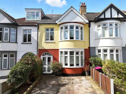 3 bedroom terraced house for sale in Sandringham Road, Southchurch Park Area, Essex, SS1 — £485,000 • 3 bed • 1 bath • 1466 ft²
 4 bedroom detached house for sale in Leitrim Avenue, Sought After Position, South Shoebury, Essex, SS3 — £650,000 • 4 bed • 3 bath • 1579 ft²
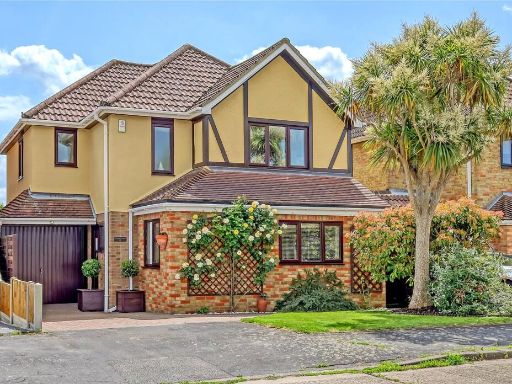 4 bedroom detached house for sale in Victoria Drive, Great Wakering, Essex, SS3 — £587,500 • 4 bed • 2 bath • 1524 ft²
 3 bedroom semi-detached house for sale in Wakering Road, Shoeburyness, SS3 — £425,000 • 3 bed • 2 bath • 941 ft²
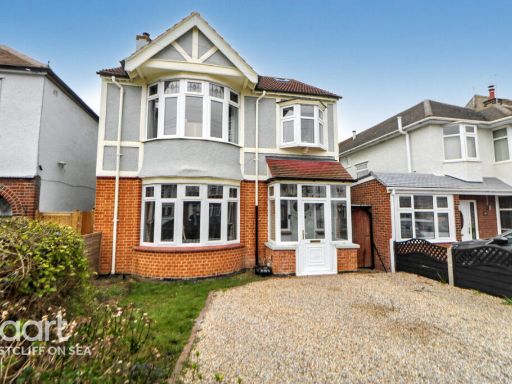 5 bedroom detached house for sale in High Street, Shoeburyness, SS3 — £475,000 • 5 bed • 3 bath • 1582 ft²
Meta
- {
"@context": "https://schema.org",
"@type": "Residence",
"name": "3 bedroom end of terrace house for sale in Blackgate Road,…",
"description": "",
"url": "https://propertypiper.co.uk/property/96d31d61-87c3-496e-a9b0-aa59a51d592d",
"image": "https://image-a.propertypiper.co.uk/7ebca669-0d51-41ad-b17f-d4924e525d87-1024.jpeg",
"address": {
"@type": "PostalAddress",
"streetAddress": "7 BLACKGATE ROAD SHOEBURYNESS SOUTHEND-ON-SEA",
"postalCode": "SS3 9SP",
"addressLocality": "Southend-on-Sea",
"addressRegion": "Rochford and Southend East",
"addressCountry": "England"
},
"geo": {
"@type": "GeoCoordinates",
"latitude": 51.5349898,
"longitude": 0.8001349
},
"numberOfRooms": 3,
"numberOfBathroomsTotal": 2,
"floorSize": {
"@type": "QuantitativeValue",
"value": 891,
"unitCode": "FTK"
},
"offers": {
"@type": "Offer",
"price": 425000,
"priceCurrency": "GBP",
"availability": "https://schema.org/InStock"
},
"additionalProperty": [
{
"@type": "PropertyValue",
"name": "Feature",
"value": "detached house"
},
{
"@type": "PropertyValue",
"name": "Feature",
"value": "mid-century"
},
{
"@type": "PropertyValue",
"name": "Feature",
"value": "suburban"
},
{
"@type": "PropertyValue",
"name": "Feature",
"value": "solar panels"
},
{
"@type": "PropertyValue",
"name": "Feature",
"value": "driveway"
},
{
"@type": "PropertyValue",
"name": "Feature",
"value": "brick exterior"
},
{
"@type": "PropertyValue",
"name": "Feature",
"value": "dated"
},
{
"@type": "PropertyValue",
"name": "Feature",
"value": "needs modernization"
},
{
"@type": "PropertyValue",
"name": "Feature",
"value": "living room"
},
{
"@type": "PropertyValue",
"name": "Feature",
"value": "standard ceiling"
},
{
"@type": "PropertyValue",
"name": "Feature",
"value": "contemporary style"
},
{
"@type": "PropertyValue",
"name": "Feature",
"value": "medium size room"
}
]
}
High Res Floorplan Images
Compatible Floorplan Images
FloorplanImages Thumbnail