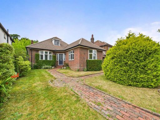
CR2 9AY - 2 bedroom bungalow for sale in Blacksmiths Hill, Sanderstea…
View on Property Piper
2 bedroom bungalow for sale in Blacksmiths Hill, Sanderstead, Surrey, CR2 9AY, CR2
Property Details
- Price: £650000
- Bedrooms: 2
- Bathrooms: 2
- Property Type: undefined
- Property SubType: undefined
Image Descriptions
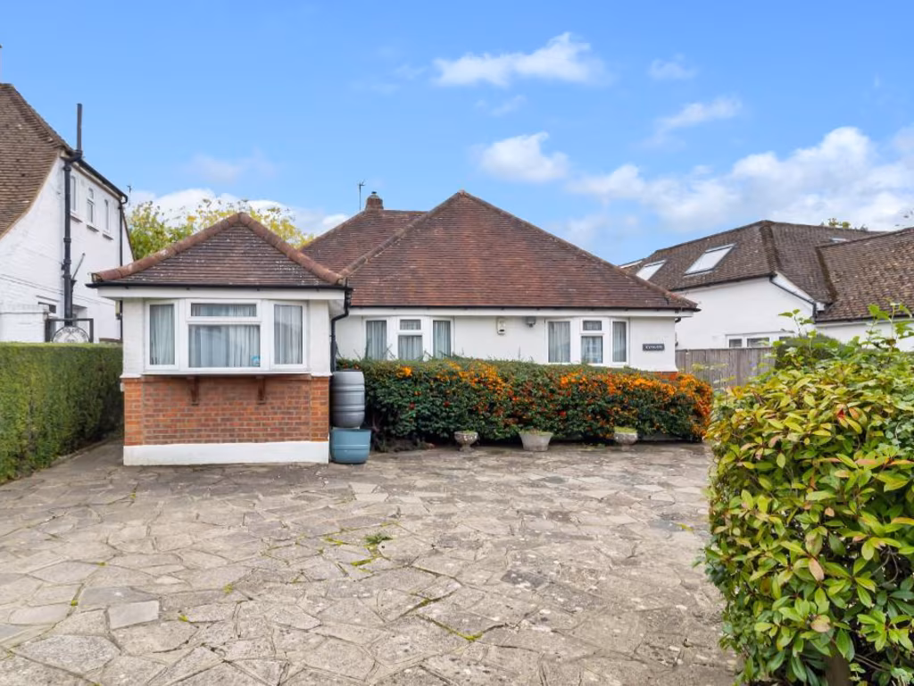
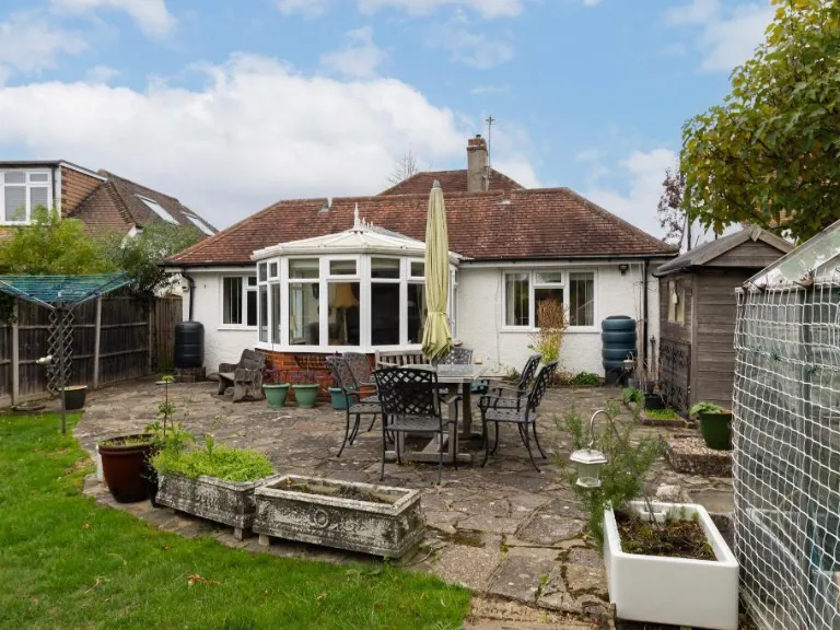
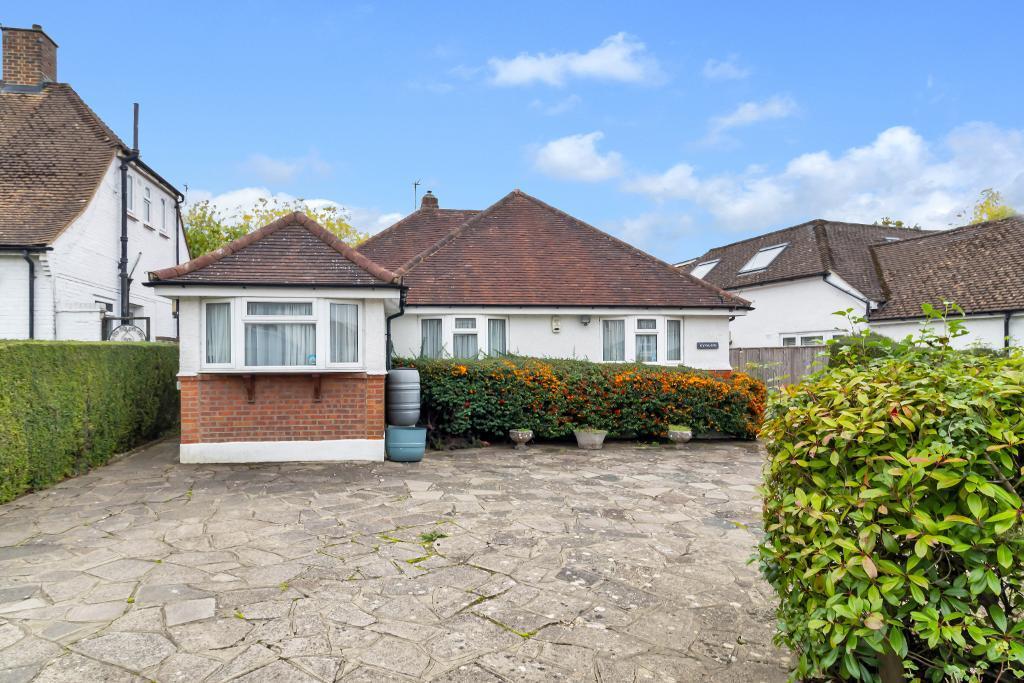
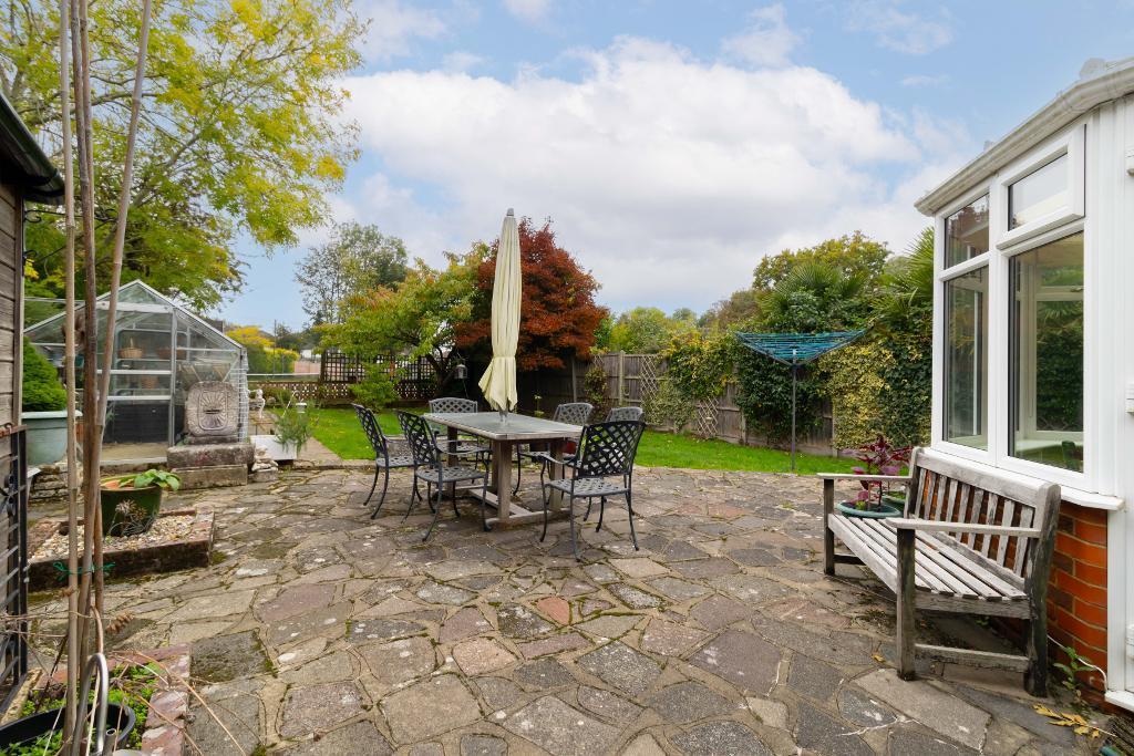
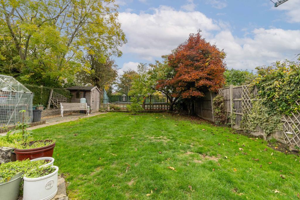
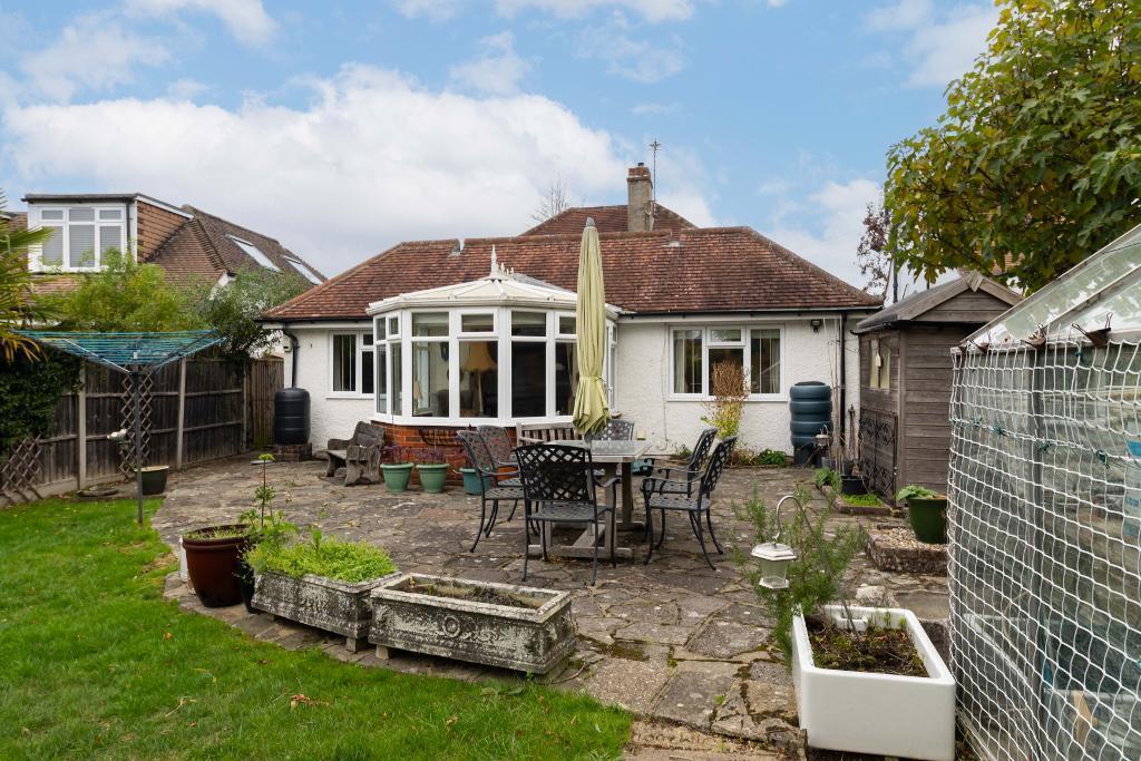
- exterior Bungalow
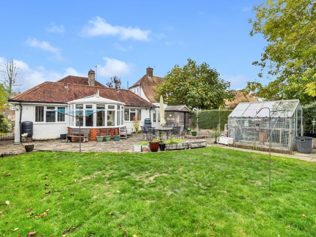
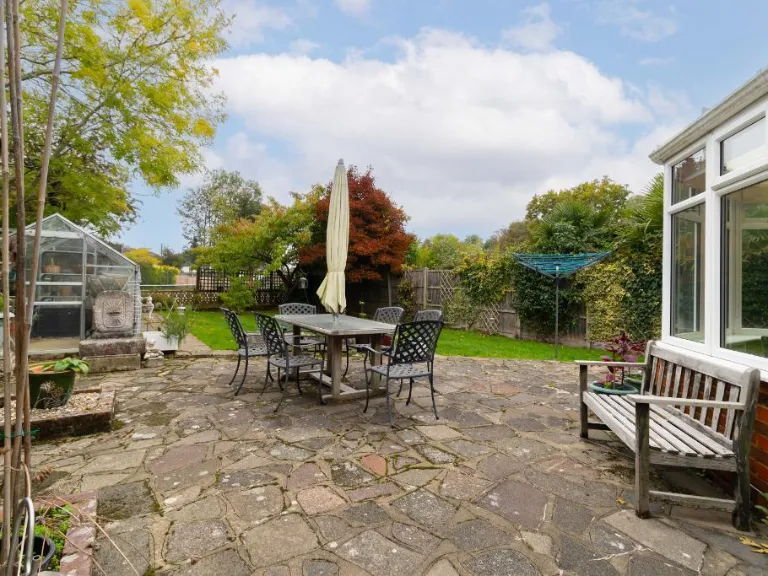
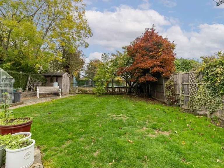
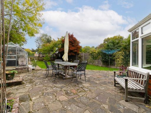
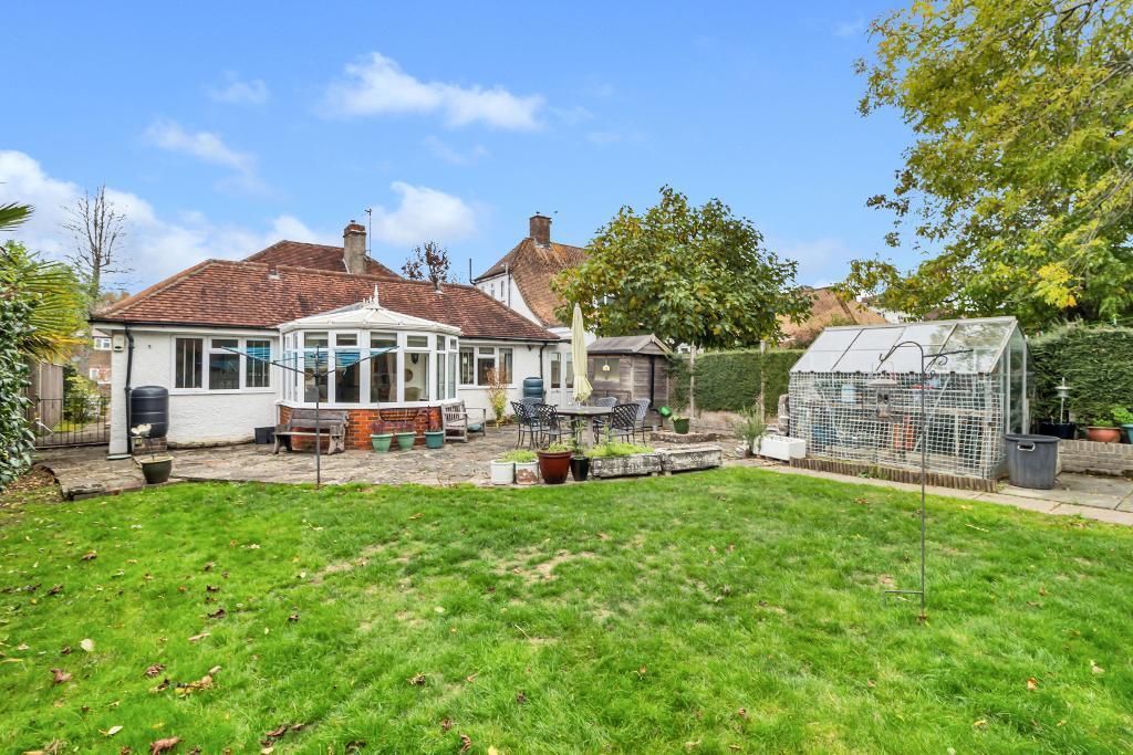
- backyard traditional bungalow
Floorplan Description
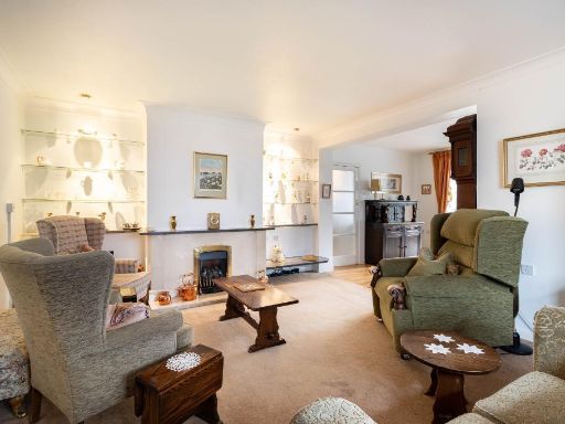
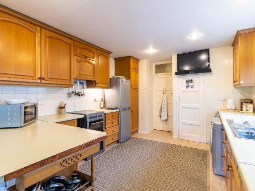
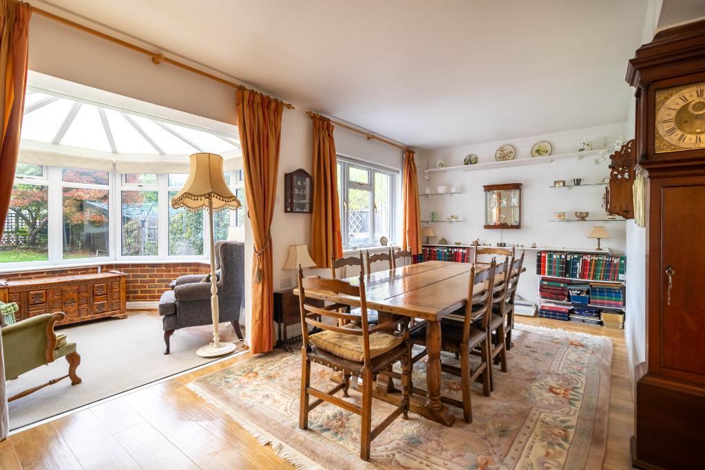
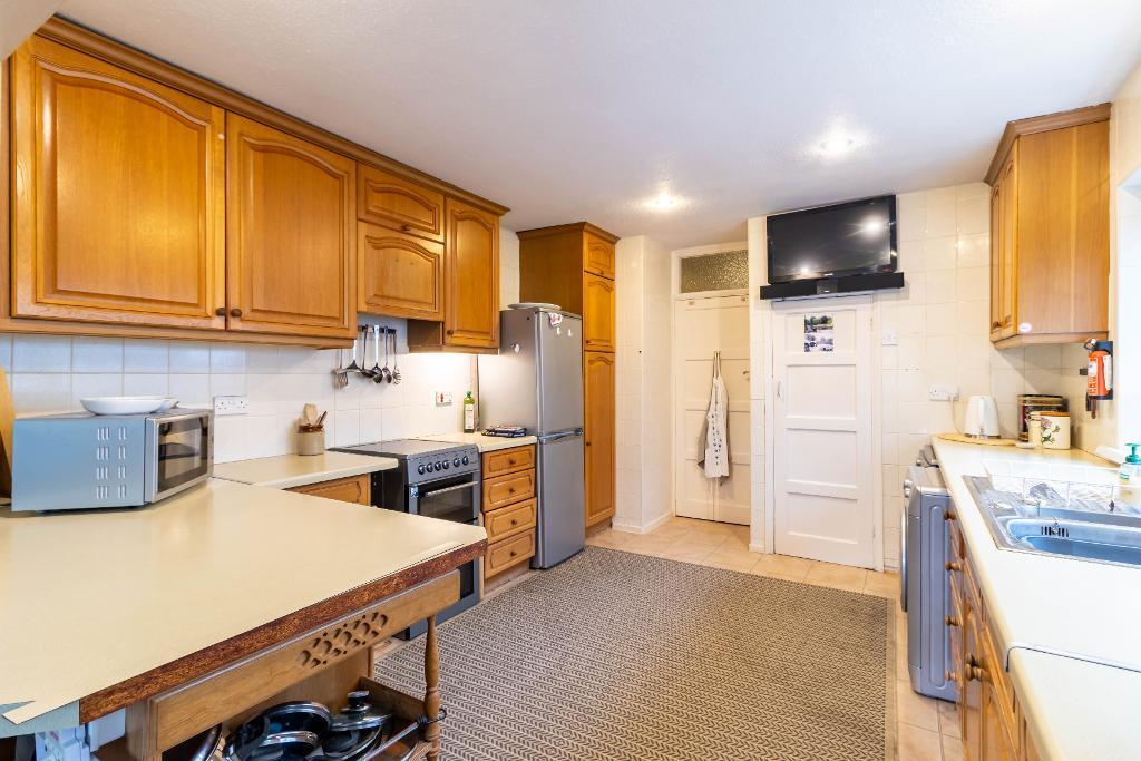
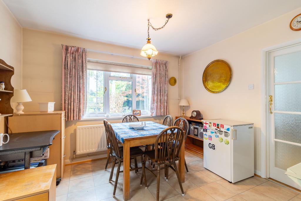
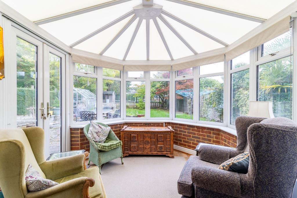
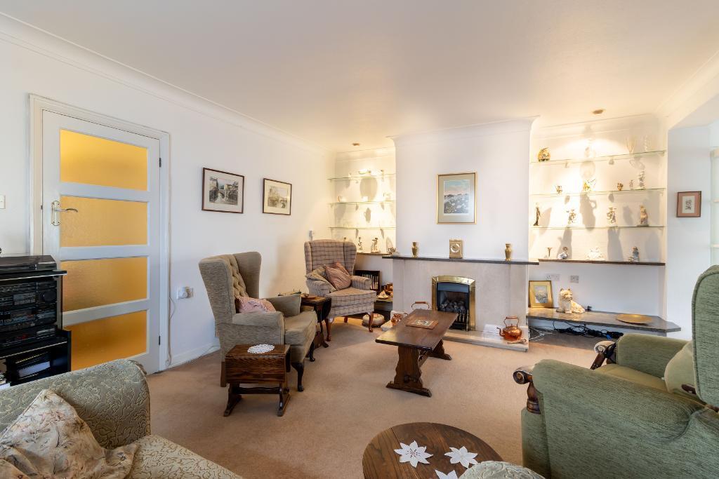
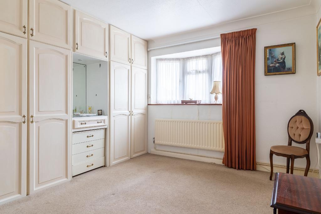
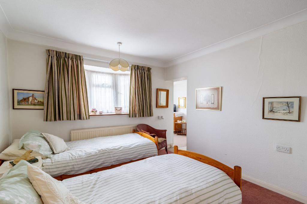
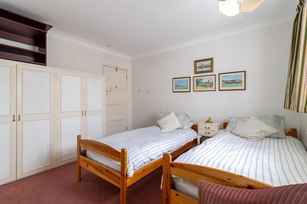
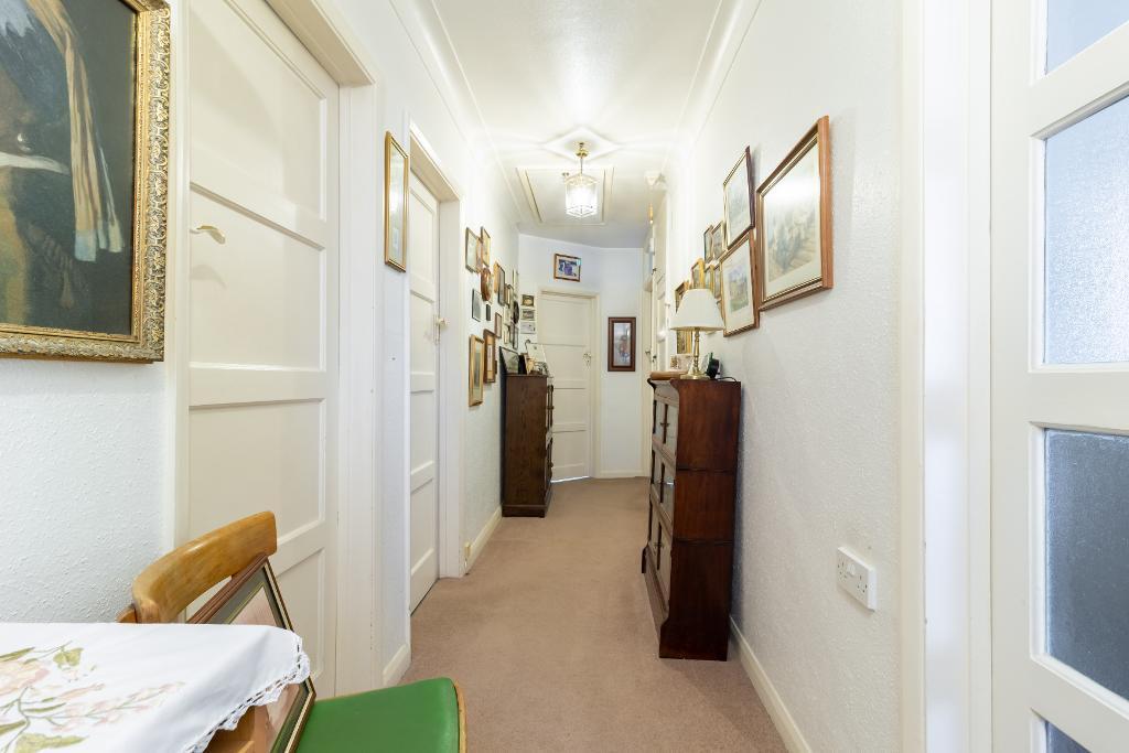
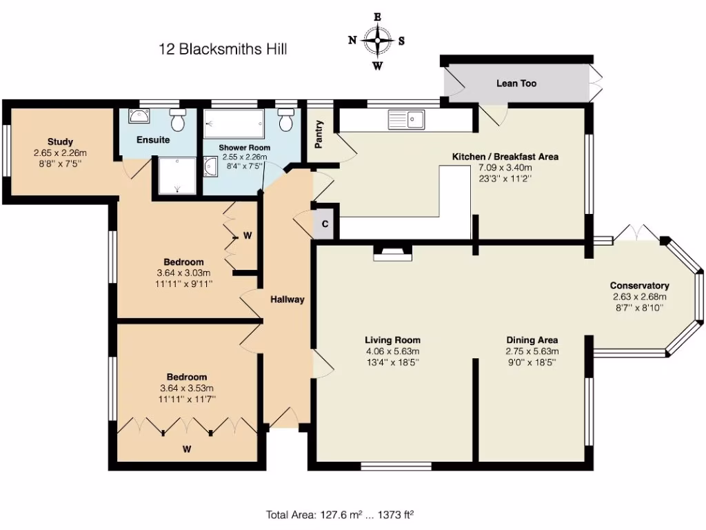
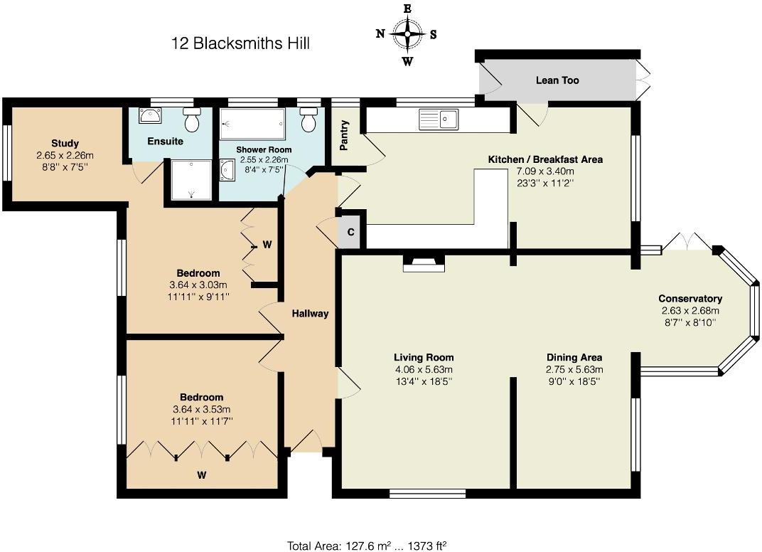
- Single-storey residence with living/dining suite, kitchen/breakfast area, two bedrooms, study and conservatory.
Rooms
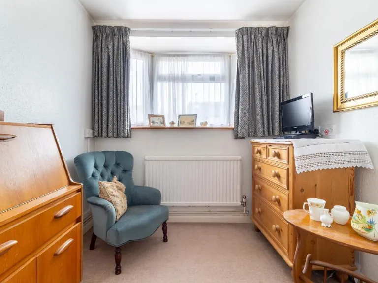
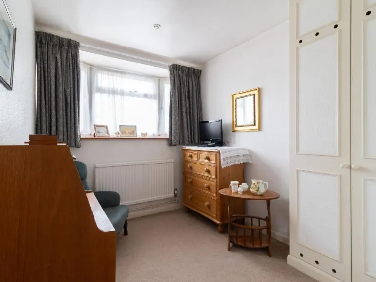
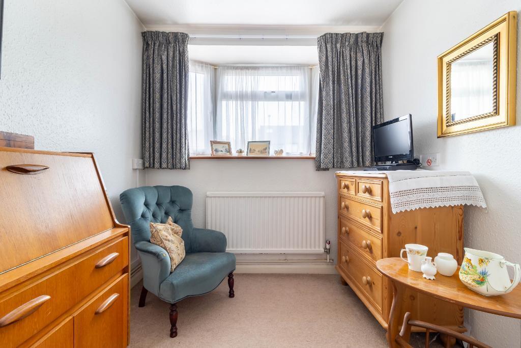
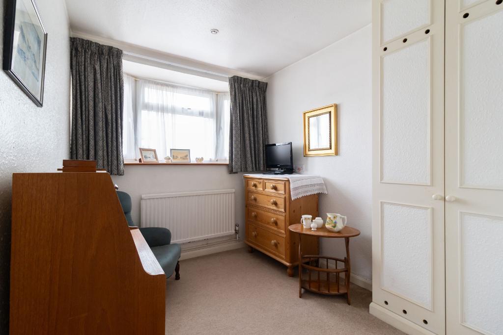
- Study:
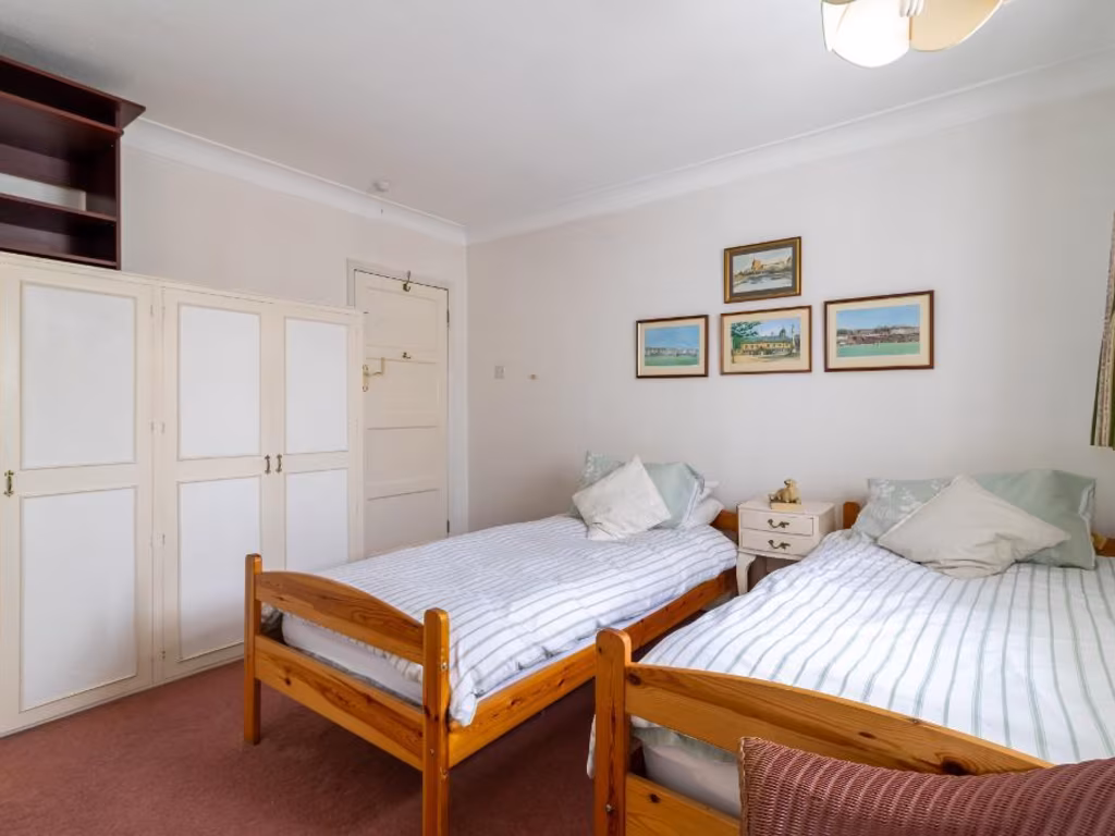
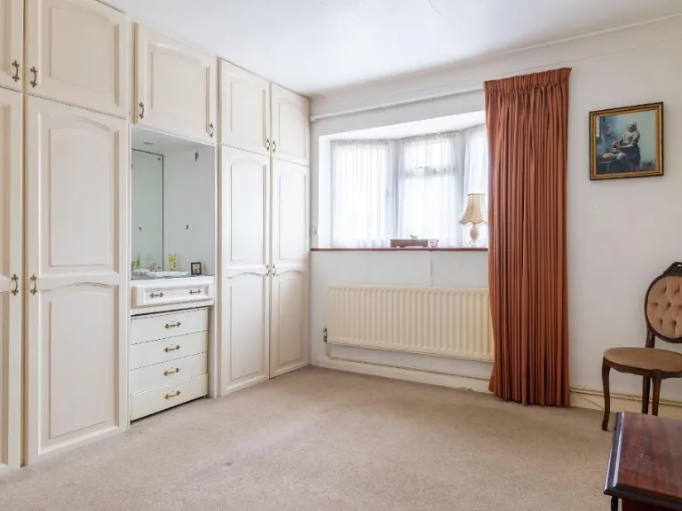
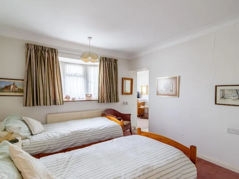
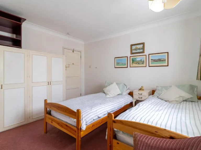
- Bedroom:
- Bedroom:
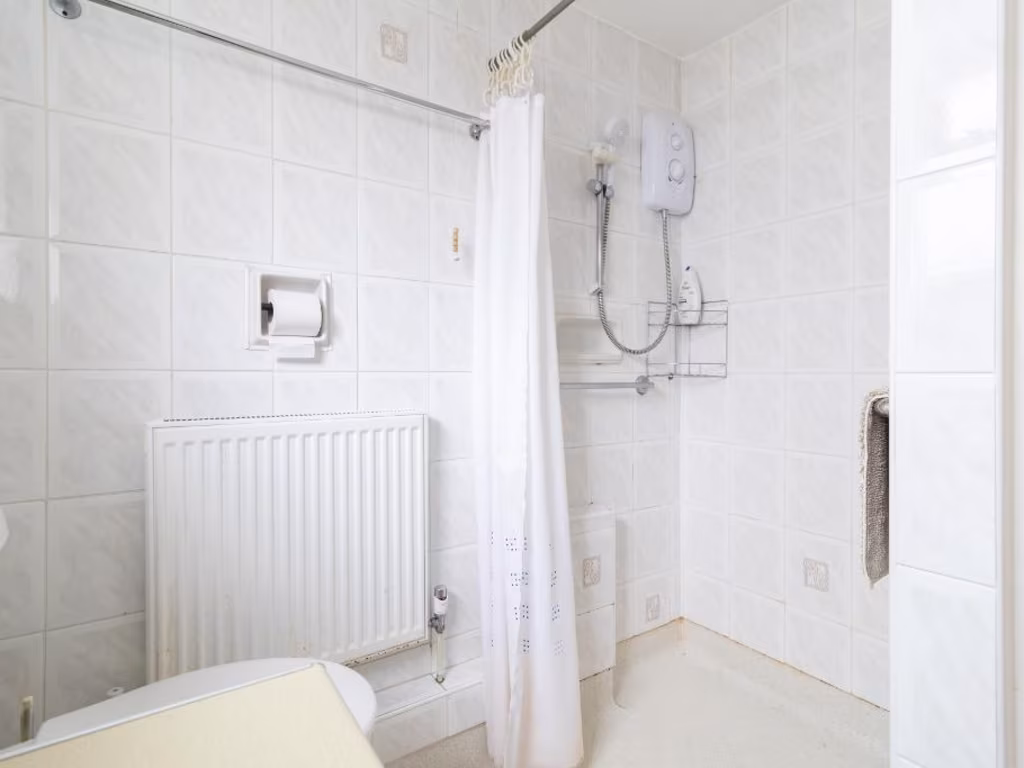
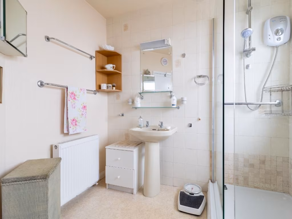
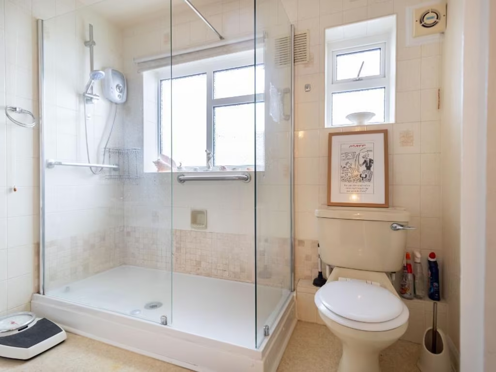
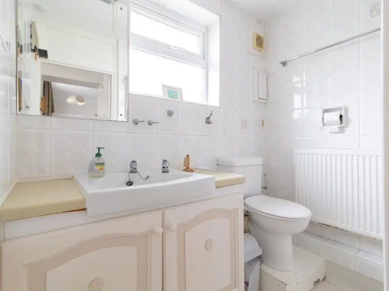
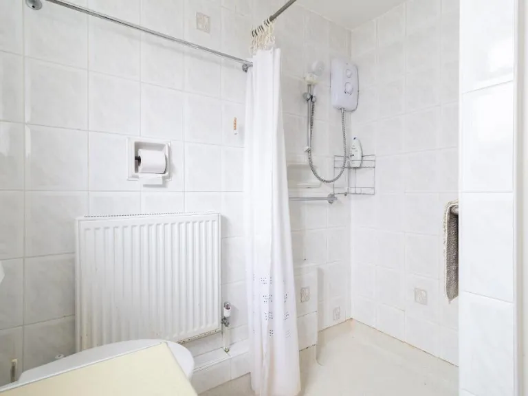
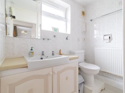
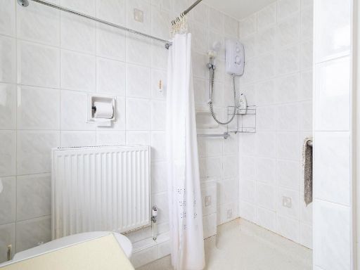
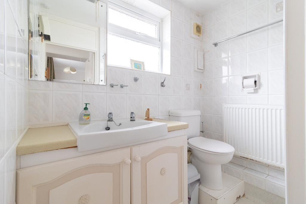
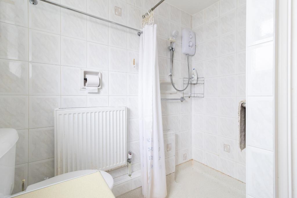
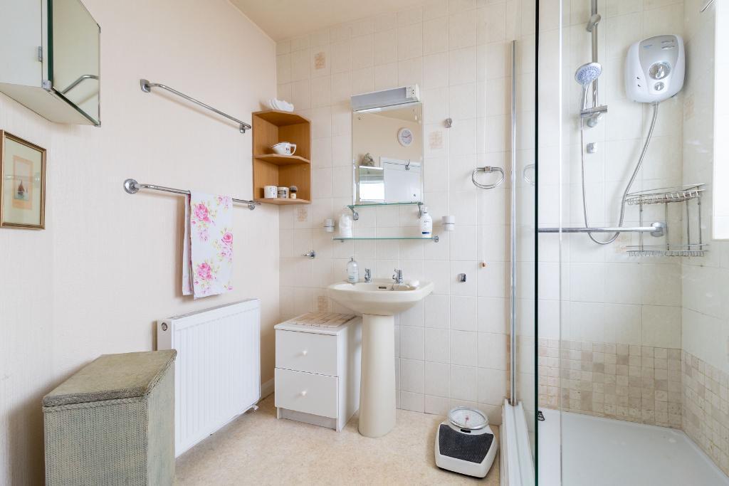
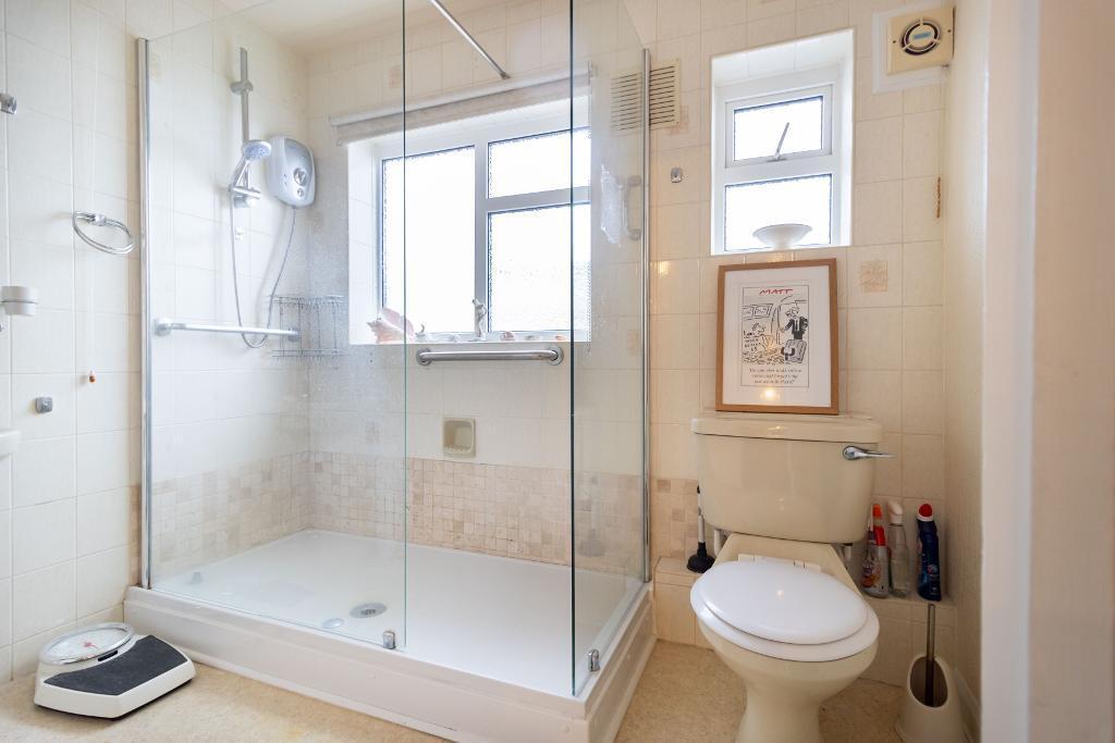
- Shower Room:
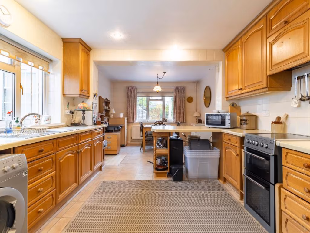
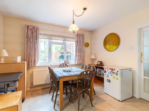
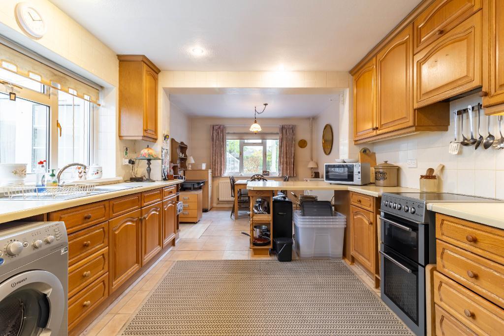
- Kitchen / Breakfast Area:
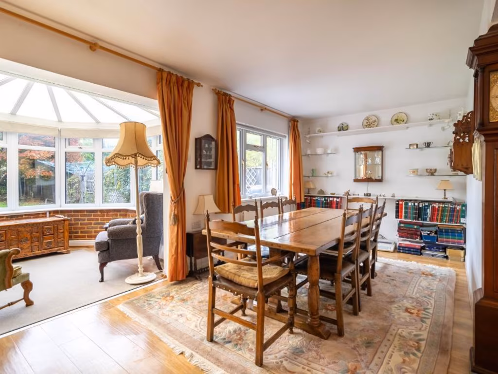
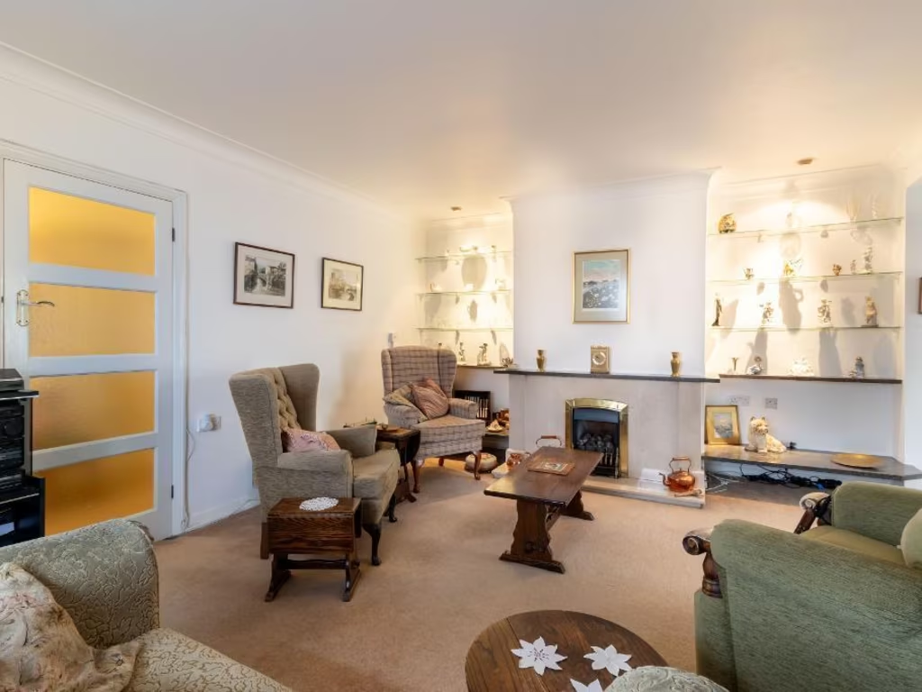
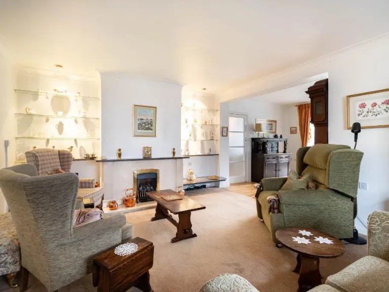
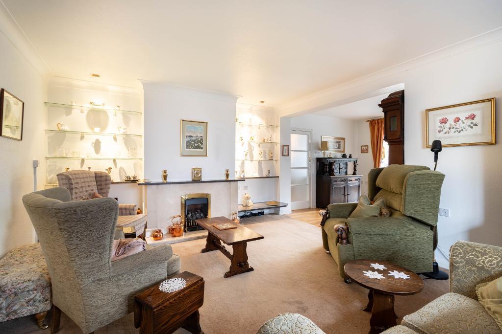
- Living Room:
- Dining Area:
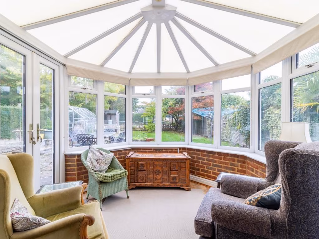
- Conservatory:
Textual Property Features
Detected Visual Features
- bungalow
- single-story
- paved driveway
- suburban
- detached
- pitched roof
- brickwork
- garden
- quiet neighborhood
- traditional bungalow
- conservatory
- patio
- greenhouse
- rural
- outdoor space
- family-friendly
Nearby Schools
- Marden Lodge Primary School and Nursery
- Hamsey Green Primary
- Harris Primary Academy Kenley
- Selsdon Primary and Nursery School
- Whyteleafe Primary School
- Croydon High School
- Forestdale Primary School
- Purley Oaks Primary School
- St Peter's Primary School
- Royal Russell School
- Coombe Wood School
- Warlingham Village Primary School
- Kenley Primary School
- Warlingham School
- Atwood Primary School
- Greenvale Primary School
- Ridgeway Primary School
- The Quest Academy
- OneSchool Global Kenley Campus
- Riddlesdown Collegiate
- Gresham Primary School
- Courtwood Primary School
- Quest Primary School
- Harris Primary Academy Haling Park
Nearest General Shops
- Id: 6434102567
- Tags:
- Addr:
- City: South Croydon
- Housenumber: 334
- Postcode: CR2 9BX
- Street: Limpsfield Road
- Name: The Hair Boutique
- Shop: hairdresser
- Source: survey
- TagsNormalized:
- Lat: 51.3197191
- Lon: -0.0651167
- FullGeoHash: gcpgyw2x49j2
- PartitionGeoHash: gcpg
- Images:
- FoodStandards: null
- Distance: 1284.9
,- Id: 6434102565
- Tags:
- Addr:
- City: South Croydon
- Housenumber: 330
- Postcode: CR2 9BX
- Street: Limpsfield Road
- Name: The Card Shop
- Shop: gift
- Source: survey
- TagsNormalized:
- Lat: 51.3198616
- Lon: -0.0652079
- FullGeoHash: gcpgyw2xbe96
- PartitionGeoHash: gcpg
- Images:
- FoodStandards: null
- Distance: 1268
,- Id: 6434102563
- Tags:
- Addr:
- City: South Croydon
- Housenumber: 326
- Postcode: CR2 9BX
- Street: Limpsfield Road
- Beauty: nails
- Name: The Nail Studio
- Shop: beauty
- Source: survey
- TagsNormalized:
- Lat: 51.3199689
- Lon: -0.0652776
- FullGeoHash: gcpgyw82qzt6
- PartitionGeoHash: gcpg
- Images:
- FoodStandards: null
- Distance: 1255.2
}
Nearest Grocery shops
- Id: 471540918
- Tags:
- Addr:
- City: South Croydon
- Housenumber: 351
- Postcode: CR2 9BY
- Street: Limpsfield Road
- Village: Hamsey Green
- Atm: yes
- Brand: The Co-operative Food
- Brand:wikidata: Q3277439
- Brand:wikipedia: en:Co-op Food
- Name: The Co-operative Food
- Opening_hours: Mo-Sa 07:00-22:00; Su 08:00-22:00
- Shop: convenience
- Source: survey
- TagsNormalized:
- atm
- the co-operative food
- food
- convenience
- shop
- Lat: 51.3196742
- Lon: -0.0643698
- FullGeoHash: gcpgyw3nu0dm
- PartitionGeoHash: gcpg
- Images:
- FoodStandards: null
- Distance: 1304.8
,- Id: 5810014002
- Tags:
- Addr:
- City: South Croydon
- Housenumber: 5
- Postcode: CR2 9LA
- Street: Limpsfield Road
- Fhrs:
- Authority: Croydon
- Id: 859650;983277
- Name: Cook
- Not:
- Shop: convenience
- Source:
- Source:addr:housenumber: survey
- TagsNormalized:
- Lat: 51.3346161
- Lon: -0.0769298
- FullGeoHash: gcpun1pvz6hb
- PartitionGeoHash: gcpu
- Images:
- FoodStandards: null
- Distance: 630.8
,- Id: 204867663
- Tags:
- Addr:
- City: South Croydon
- Housenumber: 81
- Postcode: CR2 9LE
- Street: Limpsfield Road
- Village: Sanderstead
- Brand: Shell
- Brand:wikidata: Q110716465
- Building: retail
- Fhrs:
- Authority: Croydon
- Id: 293472
- Name: Shell
- Opening_hours: 24/7
- Operator: Shell
- Phone: +44 20 8657 9600
- Ref:
- Shop: convenience
- TagsNormalized:
- shell
- retail
- convenience
- shop
- Lat: 51.3323426
- Lon: -0.075471
- FullGeoHash: gcpun2c096hw
- PartitionGeoHash: gcpu
- Images:
- FoodStandards: null
- Distance: 405.3
}
Nearest Religious buildings
- Id: 201482
- Tags:
- Name: Sanderstead / All Saints Church
- Naptan:
- StopAreaCode: 490G00011894
- StopAreaType: GPBS
- Verified: no
- Network: London Buses
- Operator: Transport for London
- Public_transport: stop_area
- Public_transport:version: 2
- Type: public_transport
- TagsNormalized:
- Lat: 51.3362269
- Lon: -0.0762869
- FullGeoHash: gcpun32rnqk3
- PartitionGeoHash: gcpu
- Images:
- FoodStandards: null
- Distance: 735.2
,- Id: 612366396
- Tags:
- Addr:
- City: South Croydon
- Postcode: CR2 9EF
- Street: Limpsfield Road
- Amenity: place_of_worship
- Building: church
- Denomination: methodist
- Fhrs:
- Authority: Croydon
- Id: 4740
- Name: Sanderstead Methodist Church
- Not:
- Religion: christian
- Source: survey
- Source:addr:postcode: http://www.sandersteadmethodist.org.uk/smchome/postcode/
- Source:not:addr:postcode: fhrs
- TagsNormalized:
- place of worship
- church
- methodist
- christian
- Lat: 51.328518
- Lon: -0.0741708
- FullGeoHash: gcpun21fr9q0
- PartitionGeoHash: gcpu
- Images:
- FoodStandards: null
- Distance: 379.7
,- Id: 5752062674
- Tags:
- Amenity: place_of_worship
- Building: church
- Denomination: catholic
- Name: The Catholic Church of the Holy Family
- Religion: christian
- TagsNormalized:
- place of worship
- church
- catholic
- christian
- Lat: 51.3306049
- Lon: -0.074501
- FullGeoHash: gcpun23y2n21
- PartitionGeoHash: gcpu
- Images:
- FoodStandards: null
- Distance: 302.8
}
Nearest Medical buildings
- Id: 461962121
- Tags:
- Amenity: pharmacy
- Brand: Lloyds Pharmacy
- Brand:wikidata: Q6662870
- Brand:wikipedia: en:LloydsPharmacy
- Dispensing: yes
- Healthcare: pharmacy
- Name: Lloyds Pharmacy
- Opening_hours: Mo-Fr 09:00-18:00; Sa 09:00-17:30; Su off
- Source: survey
- TagsNormalized:
- pharmacy
- lloyds pharmacy
- health
- healthcare
- Lat: 51.3201155
- Lon: -0.064773
- FullGeoHash: gcpgyw8c6dvv
- PartitionGeoHash: gcpg
- Images:
- FoodStandards: null
- Distance: 1249.5
,- Id: 6434102557
- Tags:
- Addr:
- City: South Croydon
- Housenumber: 52
- Postcode: CR2 0HA
- Street: Sanderstead Hill
- Amenity: dentist
- Healthcare: dentist
- Name: Sanderstead Hill Dental Surgery
- Source: survey;code-point open
- TagsNormalized:
- dentist
- health
- healthcare
- dental
- surgery
- Lat: 51.3377297
- Lon: -0.0822636
- FullGeoHash: gcpun1spgn7y
- PartitionGeoHash: gcpu
- Images:
- FoodStandards: null
- Distance: 1137.8
,- Id: 201481
- Tags:
- Name: Sanderstead Clinic
- Naptan:
- StopAreaCode: 490G00011895
- StopAreaType: GPBS
- Verified: no
- Network: London Buses
- Operator: Transport for London
- Public_transport: stop_area
- Public_transport:version: 2
- Type: public_transport
- TagsNormalized:
- Lat: 51.3353557
- Lon: -0.0794982
- FullGeoHash: gcpun1q45ecu
- PartitionGeoHash: gcpu
- Images:
- FoodStandards: null
- Distance: 820.6
,- Id: 5752071469
- Tags:
- Addr:
- City: South Croydon
- Housenumber: 37
- Postcode: CR2 9LA
- Street: Limpsfield Road
- Amenity: pharmacy
- Dispensing: yes
- Healthcare: pharmacy
- Name: Medipharm
- Opening_hours: Mo-Fr 09:00-18:00; Sa 09:00-13:00; Su off
- Website: https://dejurepharmacy.co.uk/medipharm-pharmacy
- TagsNormalized:
- Lat: 51.3336533
- Lon: -0.0764456
- FullGeoHash: gcpun3024ww1
- PartitionGeoHash: gcpu
- Images:
- FoodStandards: null
- Distance: 537.4
}
Nearest Airports
- Id: 260720166
- Tags:
- Aerodrome: international
- Aeroway: aerodrome
- Alt_name: Gatwick Airport
- Ele: 62
- Iata: LGW
- Icao: EGKK
- Internet_access: wlan
- Internet_access:fee: no
- Internet_access:ssid: Gatwick FREE Wi-Fi
- Name: London Gatwick Airport
- Operator: Gatwick Airport Limited
- Ref: LGW
- Website: https://www.gatwickairport.com/
- Wikidata: Q8703
- Wikipedia: en:Gatwick Airport
- TagsNormalized:
- airport
- international airport
- Lat: 51.1540917
- Lon: -0.1883773
- FullGeoHash: gcpg58qf4mzd
- PartitionGeoHash: gcpg
- Images:
- FoodStandards: null
- Distance: 21306.5
,- Id: 121158889
- Tags:
- Aerodrome: continental
- Aeroway: aerodrome
- Fhrs:
- Authority: City of London Corporation
- Iata: LCY
- Icao: EGLC
- Name: London City Airport
- Operator: London City Airport Limited
- Ref: LCY
- Website: https://www.londoncityairport.com/
- Wikidata: Q8982
- Wikipedia: en:London City Airport
- TagsNormalized:
- airport
- continental airport
- Lat: 51.5042658
- Lon: 0.0539987
- FullGeoHash: u10j10p64702
- PartitionGeoHash: u10j
- Images:
- FoodStandards: null
- Distance: 21119.1
,- Id: 14001268
- Tags:
- Access: yes
- Aerodrome: international
- Aerodrome:type: public
- Aeroway: aerodrome
- Alt_name: London Heathrow
- Alt_name_2: London Heathrow Airport
- Ele: 25
- Iata: LHR
- Icao: EGLL
- Int_name: Heathrow Airport
- Name: London Heathrow Airport
- Note: area still approx
- Old_name: London Airport
- Operator: Heathrow Airport Limited
- Rank_aci:
- Ref: LHR
- Short_name: Heathrow
- Type: multipolygon
- Website: https://www.heathrow.com/
- Wikidata: Q8691
- Wikipedia: en:Heathrow Airport
- TagsNormalized:
- airport
- international airport
- Lat: 51.4677522
- Lon: -0.4547736
- FullGeoHash: gcpsv9kv7h2h
- PartitionGeoHash: gcps
- Images:
- FoodStandards: null
- Distance: 30719.8
}
Nearest Leisure Facilities
- Id: 264387831
- Tags:
- TagsNormalized:
- Lat: 51.3270416
- Lon: -0.0665233
- FullGeoHash: gcpgyrz99yh9
- PartitionGeoHash: gcpg
- Images:
- FoodStandards: null
- Distance: 491.8
,- Id: 259393721
- Tags:
- Created_by: Potlatch 0.5d
- Leisure: pitch
- Sport: tennis
- TagsNormalized:
- Lat: 51.3302119
- Lon: -0.070668
- FullGeoHash: gcpun2ks1m40
- PartitionGeoHash: gcpu
- Images:
- FoodStandards: null
- Distance: 78
,- Id: 259393725
- Tags:
- Created_by: Potlatch 0.5d
- Leisure: pitch
- Sport: tennis
- TagsNormalized:
- Lat: 51.330274
- Lon: -0.0704725
- FullGeoHash: gcpun2kstbeg
- PartitionGeoHash: gcpu
- Images:
- FoodStandards: null
- Distance: 66.3
,- Id: 259393723
- Tags:
- Created_by: Potlatch 0.5d
- Leisure: pitch
- Sport: tennis
- TagsNormalized:
- Lat: 51.3303451
- Lon: -0.0702533
- FullGeoHash: gcpun2kufvz7
- PartitionGeoHash: gcpu
- Images:
- FoodStandards: null
- Distance: 55.1
,- Id: 259393720
- Tags:
- Created_by: Potlatch 0.5d
- Leisure: pitch
- Sport: tennis
- TagsNormalized:
- Lat: 51.330404
- Lon: -0.0700664
- FullGeoHash: gcpun2kvr2fd
- PartitionGeoHash: gcpu
- Images:
- FoodStandards: null
- Distance: 48.6
}
Nearest Tourist attractions
- Id: 818497872
- Tags:
- TagsNormalized:
- Lat: 51.3561249
- Lon: -0.0556141
- FullGeoHash: gcpuntpe05e1
- PartitionGeoHash: gcpu
- Images:
- FoodStandards: null
- Distance: 2987.9
,- Id: 5833490106
- Tags:
- Addr:
- City: South Croydon
- Housenumber: 105
- Postcode: CR2 0PJ
- Street: Sanderstead Road
- Name: Paolo Francis Gallery
- Tourism: gallery
- TagsNormalized:
- Lat: 51.3509052
- Lon: -0.09642
- FullGeoHash: gcpuju1u9q81
- PartitionGeoHash: gcpu
- Images:
- FoodStandards: null
- Distance: 2882.2
,- Id: 330719154
- Tags:
- Name: Bears Wood Scout Campsite
- Natural: wood
- Scout: yes
- Source: OS VectorMap District
- Tourism: camp_site
- TagsNormalized:
- Lat: 51.3399925
- Lon: -0.0347347
- FullGeoHash: gcpup4ntns7b
- PartitionGeoHash: gcpu
- Images:
- FoodStandards: null
- Distance: 2663.2
}
Nearest Hotels
- Id: 111827859
- Tags:
- Addr:
- City: South Croydon
- Postcode: CR2 8YA
- Street: Addington Road
- Building: yes
- Fhrs:
- Authority: Croydon
- Id: 370613
- Name: Selsdon Park Hotel
- Operator: Principal Hotel
- Stairs: 4
- Tourism: hotel
- Wikidata: Q7448800
- TagsNormalized:
- Lat: 51.3392591
- Lon: -0.0615696
- FullGeoHash: gcpund50v7d3
- PartitionGeoHash: gcpu
- Images:
- FoodStandards: null
- Distance: 1110.5
,- Id: 111827858
- Tags:
- Amenity: parking
- Name: Selsdon Park Hotel
- TagsNormalized:
- Lat: 51.3396483
- Lon: -0.0628276
- FullGeoHash: gcpund470h07
- PartitionGeoHash: gcpu
- Images:
- FoodStandards: null
- Distance: 1104.3
,- Id: 190126019
- Tags:
- Amenity: parking
- Name: Selsdon Park Hotel
- TagsNormalized:
- Lat: 51.3391665
- Lon: -0.0621866
- FullGeoHash: gcpund48qfq3
- PartitionGeoHash: gcpu
- Images:
- FoodStandards: null
- Distance: 1079.2
}
Tags
- bungalow
- single-story
- paved driveway
- suburban
- detached
- pitched roof
- brickwork
- garden
- quiet neighborhood
- traditional bungalow
- conservatory
- patio
- greenhouse
- garden
- single-story
- rural
- outdoor space
- family-friendly
Local Market Stats
- Average Price/sqft: £474
- Avg Income: £60900
- Rental Yield: 3.9%
- Social Housing: 9%
- Planning Success Rate: 73%
Similar Properties
 3 bedroom detached bungalow for sale in Addington Road, South Croydon, CR2 — £650,000 • 3 bed • 1 bath • 1351 ft²
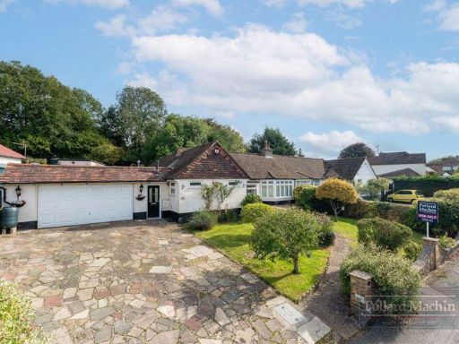 3 bedroom semi-detached bungalow for sale in Sanderstead Court Avenue, Sanderstead, CR2 — £700,000 • 3 bed • 1 bath • 1249 ft²
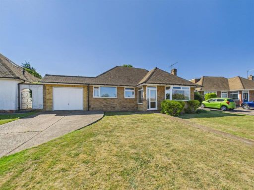 3 bedroom detached bungalow for sale in Days Acre, South Croydon, CR2 — £670,000 • 3 bed • 1 bath • 1031 ft²
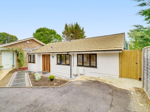 3 bedroom semi-detached bungalow for sale in Croham Mount, Sanderstead , CR2 — £600,000 • 3 bed • 2 bath • 1312 ft²
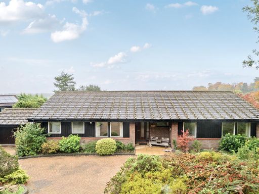 4 bedroom bungalow for sale in Westview Road, Warlingham, CR6 — £900,000 • 4 bed • 2 bath • 1706 ft²
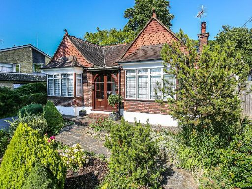 3 bedroom bungalow for sale in Purley Oaks Road, South Croydon, Surrey, CR2 0NY, CR2 — £749,950 • 3 bed • 1 bath • 1356 ft²
Meta
- {
"@context": "https://schema.org",
"@type": "Residence",
"name": "2 bedroom bungalow for sale in Blacksmiths Hill, Sanderstea…",
"description": "",
"url": "https://propertypiper.co.uk/property/96d1033c-6a2e-428f-b900-2244958b6480",
"image": "https://image-a.propertypiper.co.uk/cbf12c0a-d99c-43ed-8063-bf8a579ca492-1024.jpeg",
"address": {
"@type": "PostalAddress",
"streetAddress": "\n 12 Blacksmiths Hill,SOUTH CROYDON,CR2 9AY\n ",
"postalCode": "CR2 9AY",
"addressLocality": "Croydon",
"addressRegion": "Croydon South",
"addressCountry": "England"
},
"geo": {
"@type": "GeoCoordinates",
"latitude": 51.3308368,
"longitude": -0.070159
},
"numberOfRooms": 2,
"numberOfBathroomsTotal": 2,
"floorSize": {
"@type": "QuantitativeValue",
"value": 1373,
"unitCode": "FTK"
},
"offers": {
"@type": "Offer",
"price": 650000,
"priceCurrency": "GBP",
"availability": "https://schema.org/InStock"
},
"additionalProperty": [
{
"@type": "PropertyValue",
"name": "Feature",
"value": "bungalow"
},
{
"@type": "PropertyValue",
"name": "Feature",
"value": "single-story"
},
{
"@type": "PropertyValue",
"name": "Feature",
"value": "paved driveway"
},
{
"@type": "PropertyValue",
"name": "Feature",
"value": "suburban"
},
{
"@type": "PropertyValue",
"name": "Feature",
"value": "detached"
},
{
"@type": "PropertyValue",
"name": "Feature",
"value": "pitched roof"
},
{
"@type": "PropertyValue",
"name": "Feature",
"value": "brickwork"
},
{
"@type": "PropertyValue",
"name": "Feature",
"value": "garden"
},
{
"@type": "PropertyValue",
"name": "Feature",
"value": "quiet neighborhood"
},
{
"@type": "PropertyValue",
"name": "Feature",
"value": "traditional bungalow"
},
{
"@type": "PropertyValue",
"name": "Feature",
"value": "conservatory"
},
{
"@type": "PropertyValue",
"name": "Feature",
"value": "patio"
},
{
"@type": "PropertyValue",
"name": "Feature",
"value": "greenhouse"
},
{
"@type": "PropertyValue",
"name": "Feature",
"value": "garden"
},
{
"@type": "PropertyValue",
"name": "Feature",
"value": "single-story"
},
{
"@type": "PropertyValue",
"name": "Feature",
"value": "rural"
},
{
"@type": "PropertyValue",
"name": "Feature",
"value": "outdoor space"
},
{
"@type": "PropertyValue",
"name": "Feature",
"value": "family-friendly"
}
]
}
High Res Floorplan Images
Compatible Floorplan Images
FloorplanImages Thumbnail