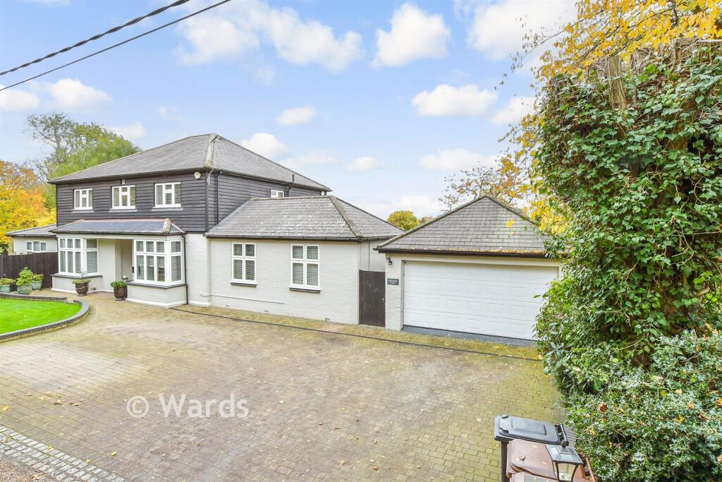
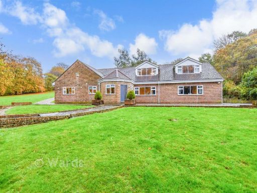
ME3 7NU - 5 bedroom detached house for sale in Dillywood Lane, Higham…
View on Property Piper
5 bedroom detached house for sale in Dillywood Lane, Higham, Rochester, Kent, ME3
Property Details
- Price: £1056500
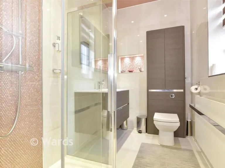
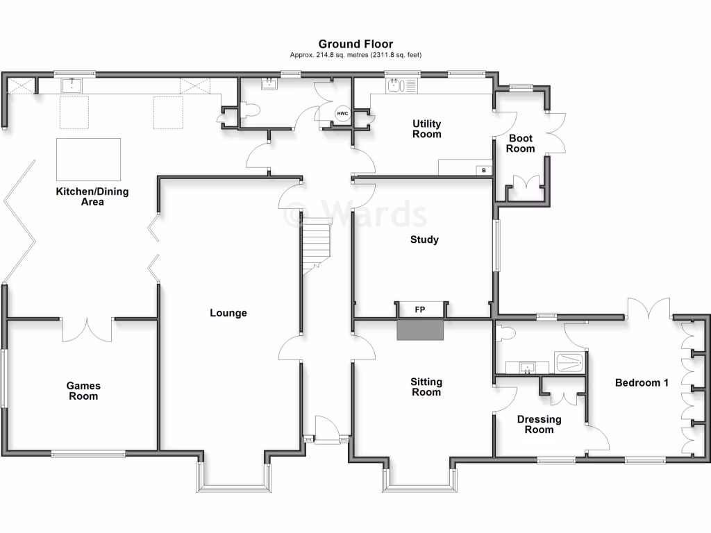
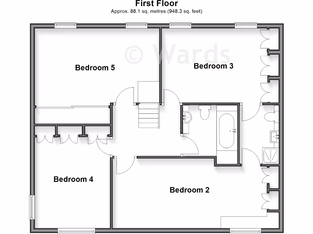
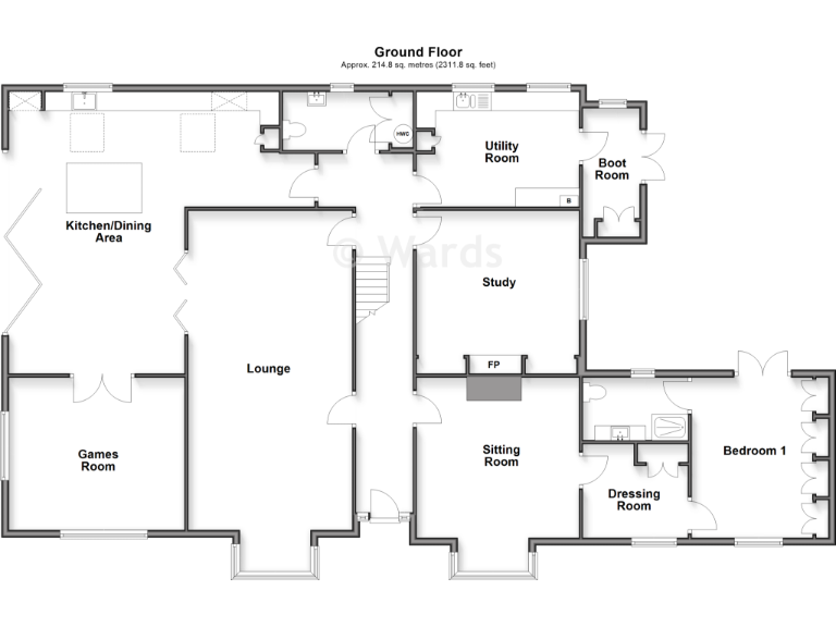
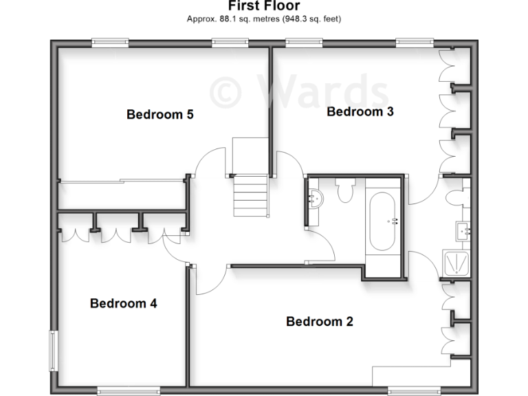
- Bedrooms: 5
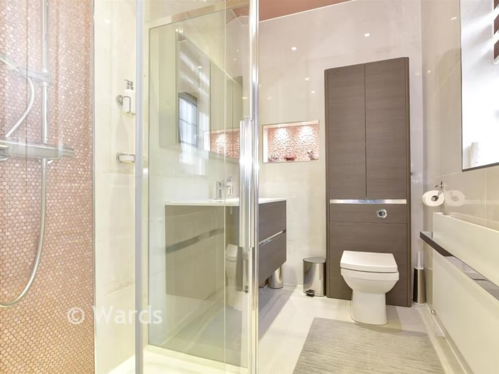
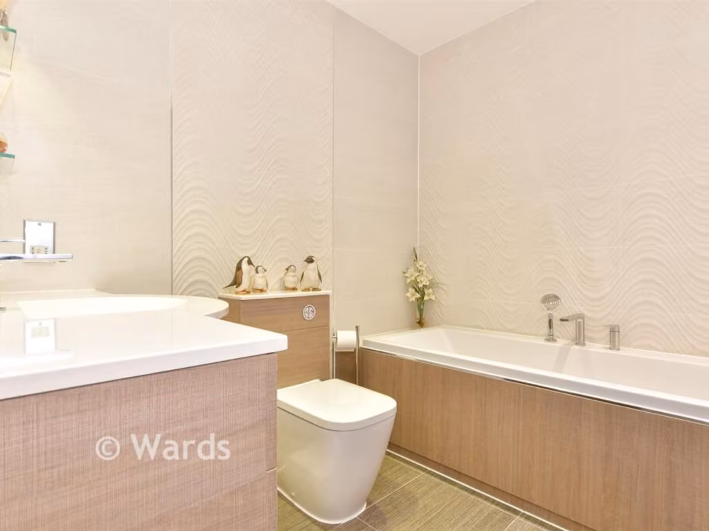
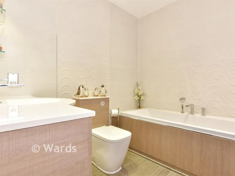
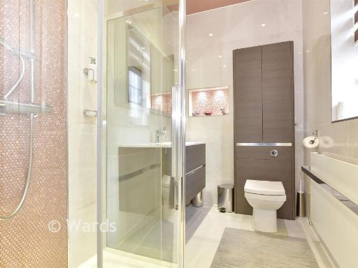
- Bathrooms: 3
- Property Type: undefined
- Property SubType: undefined
Image Descriptions
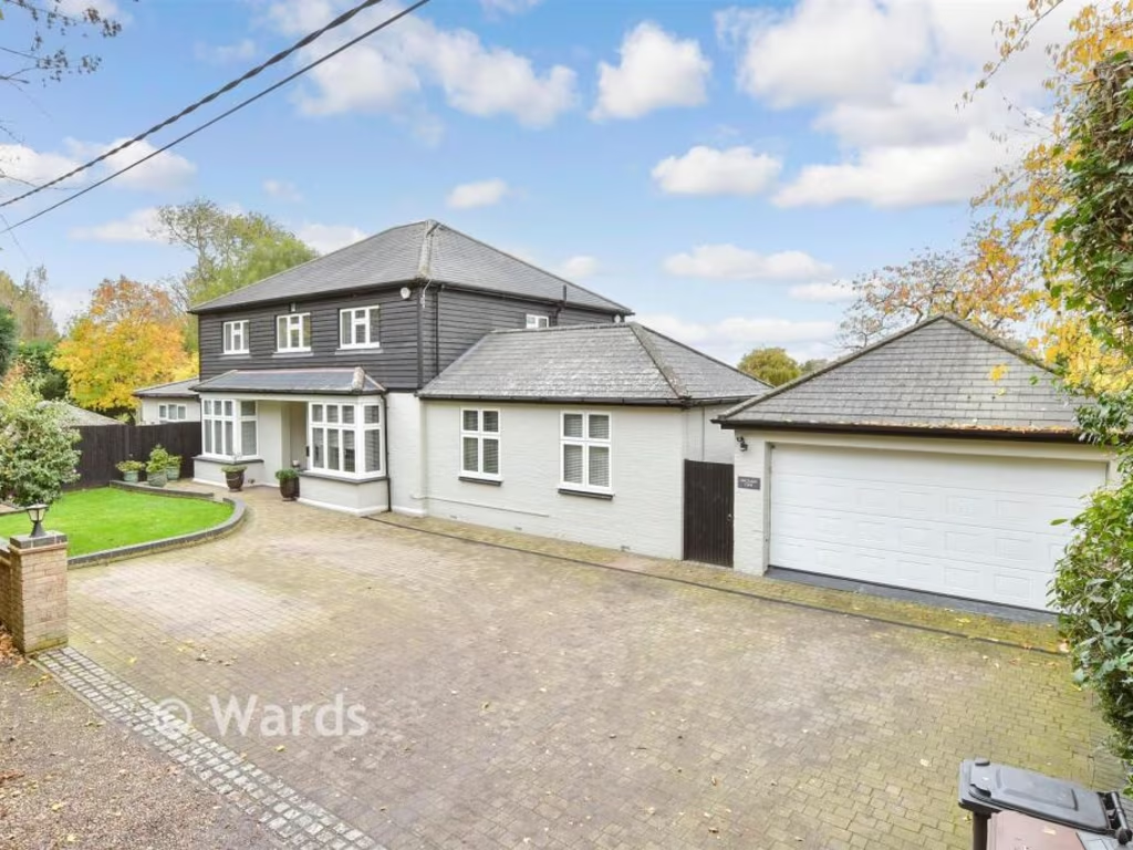
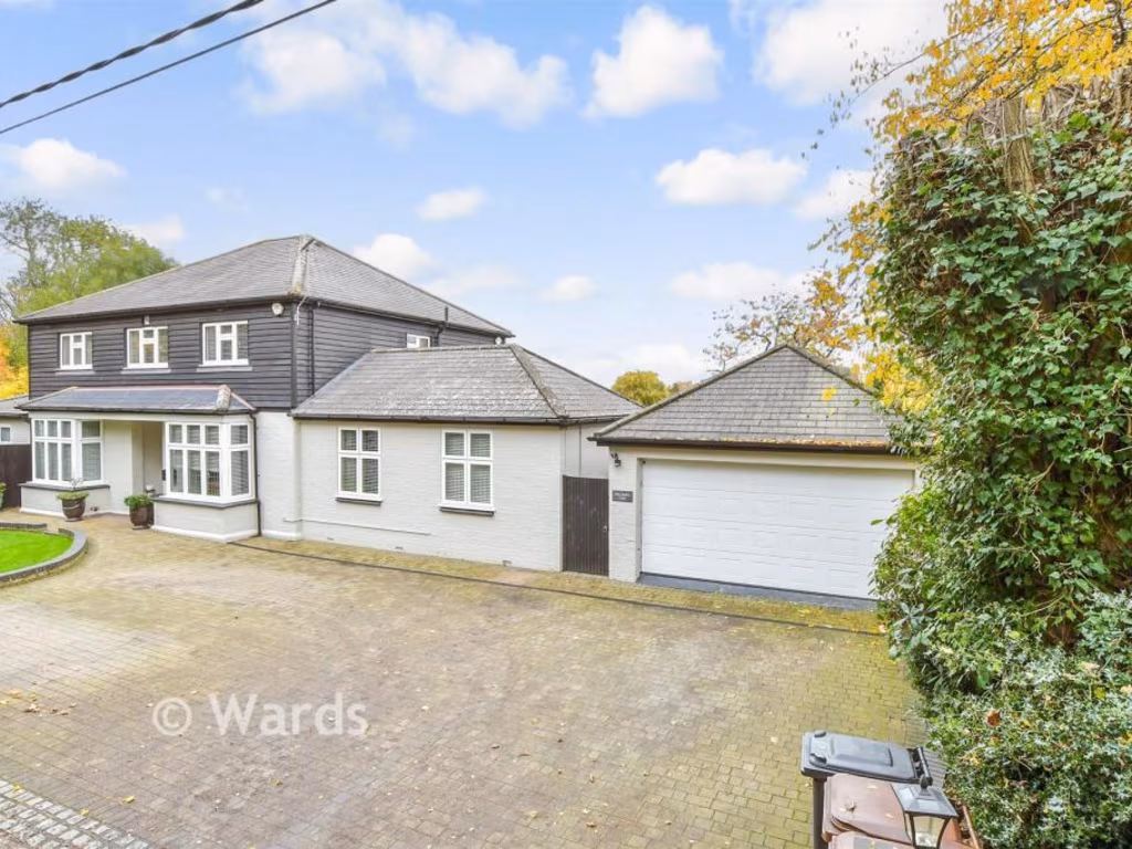
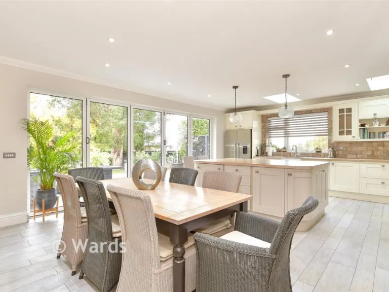
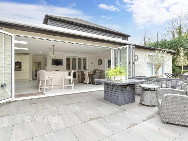
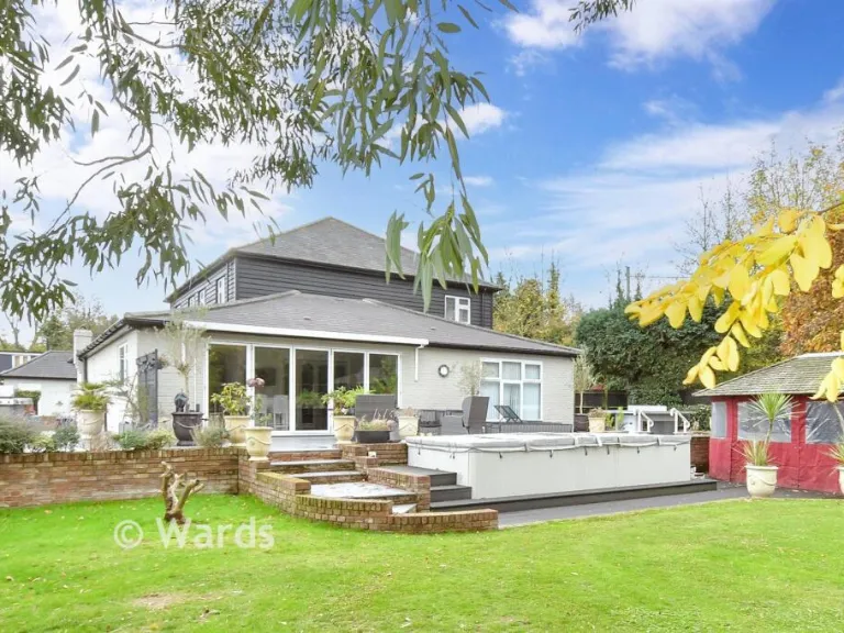
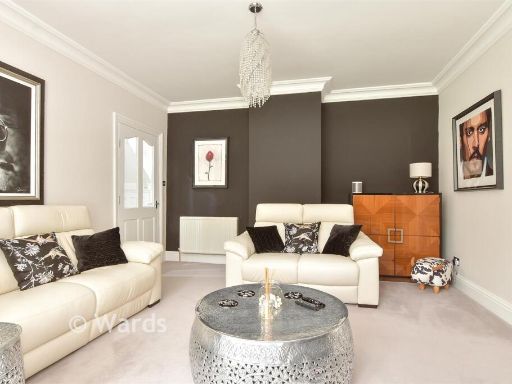
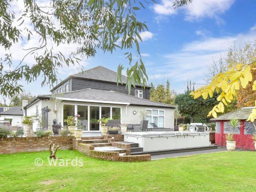
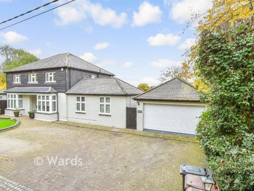
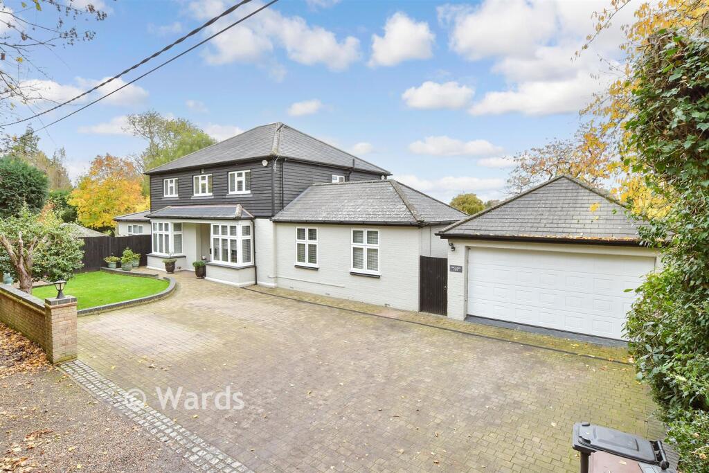
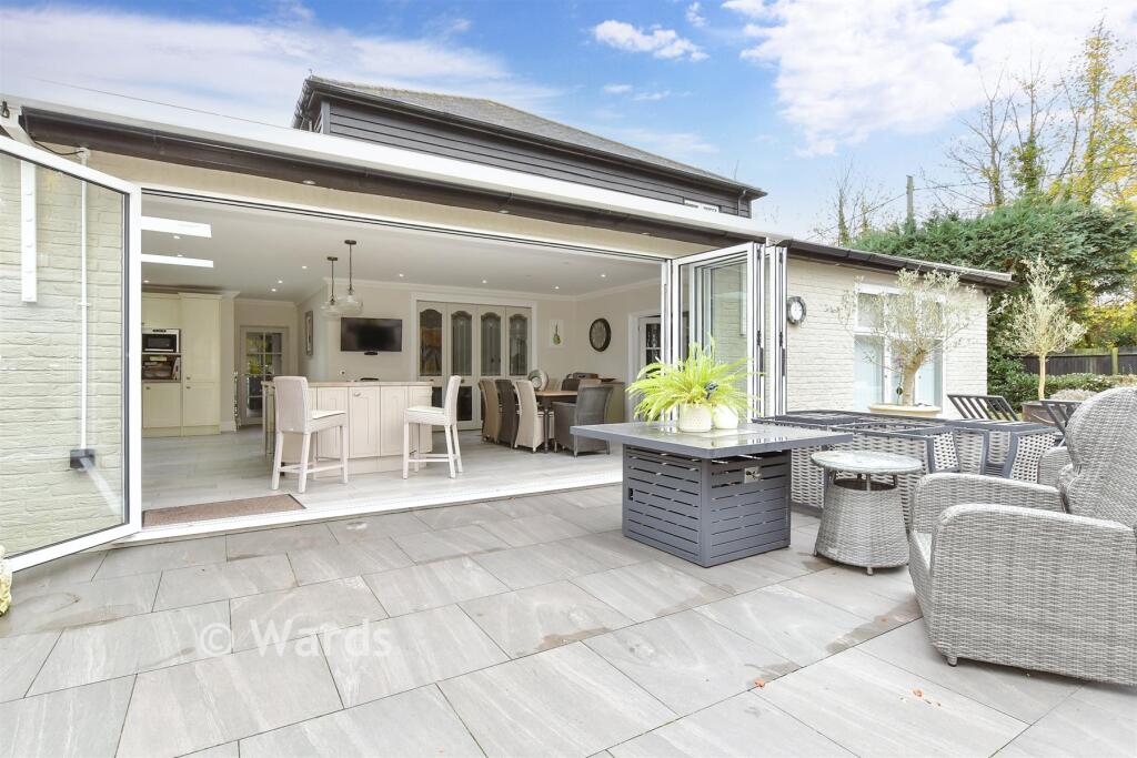
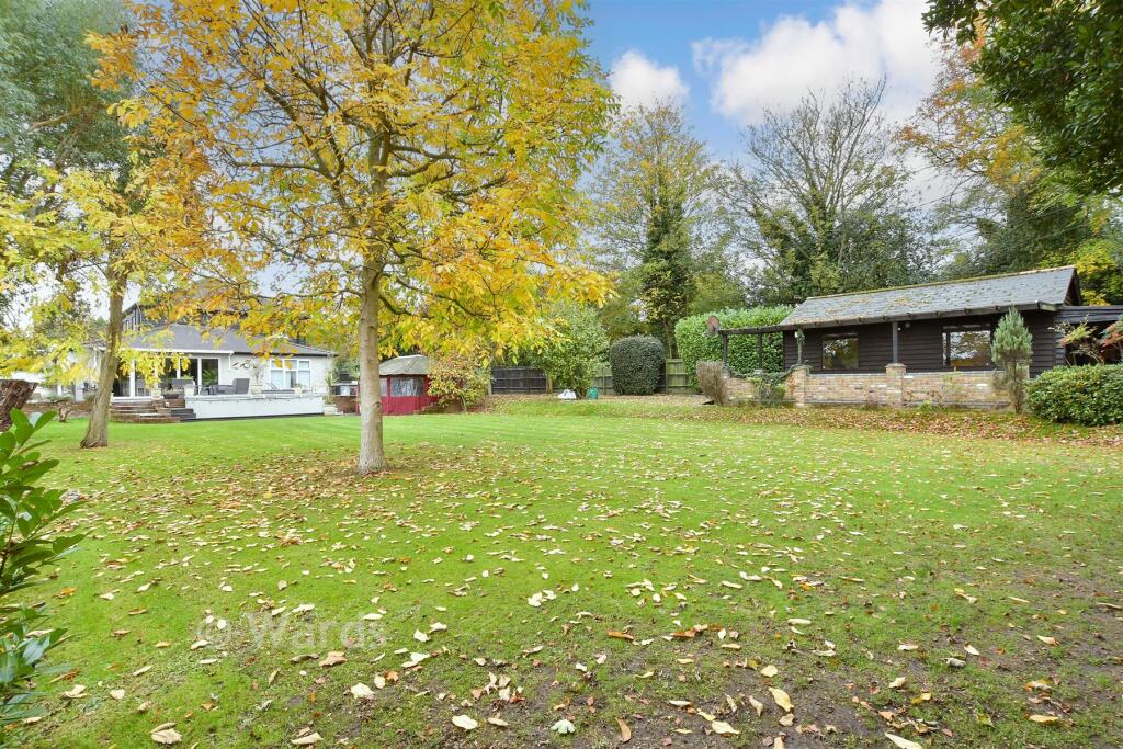
- detached house modern
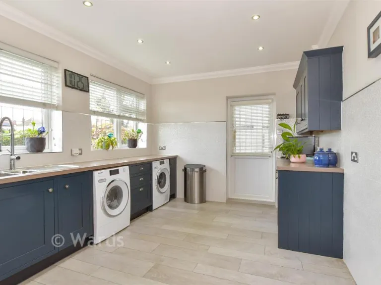
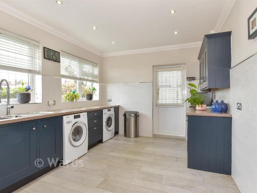
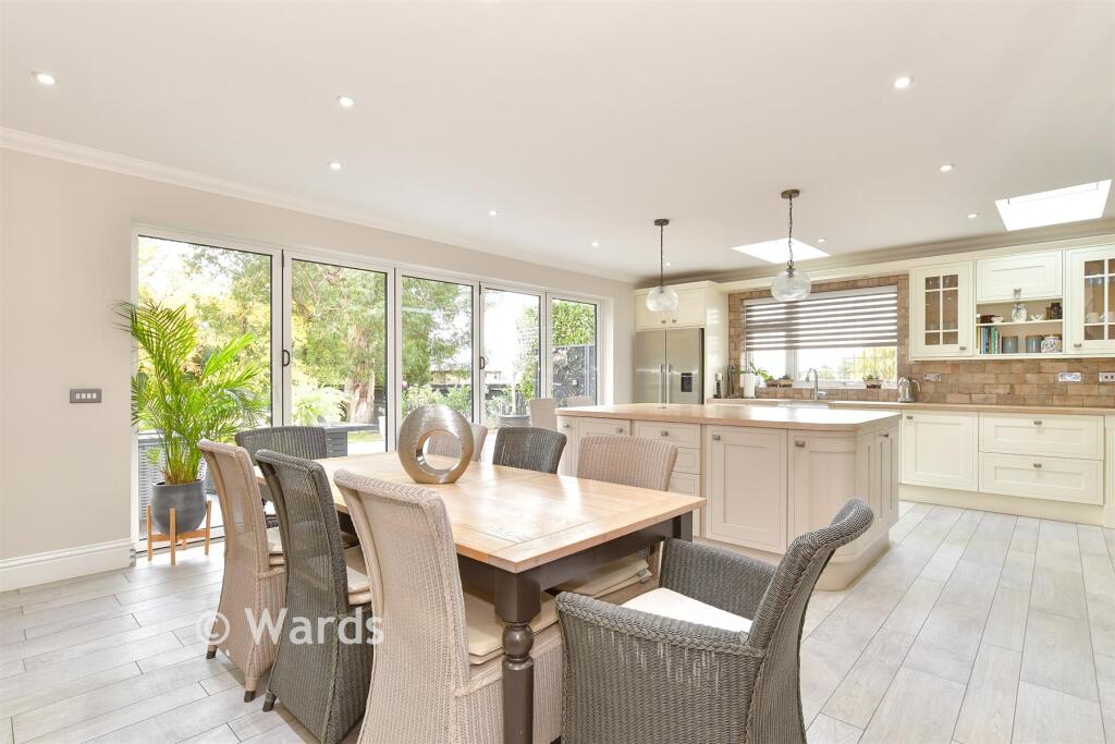
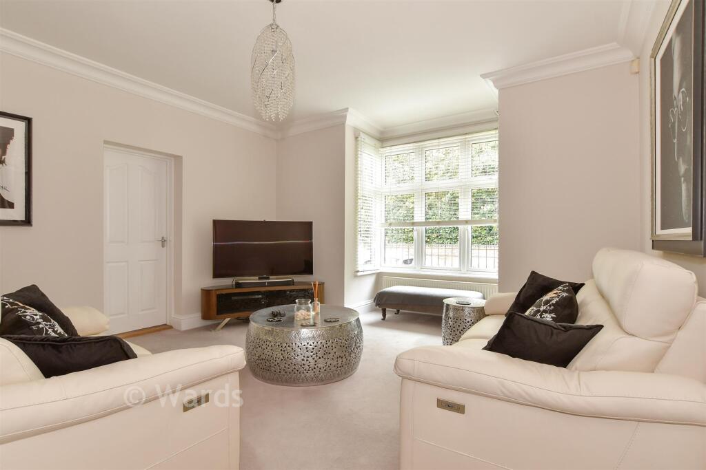
- kitchen and dining area modern
Rooms
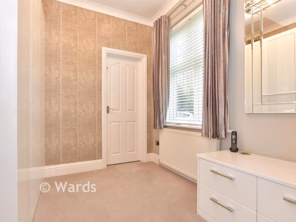
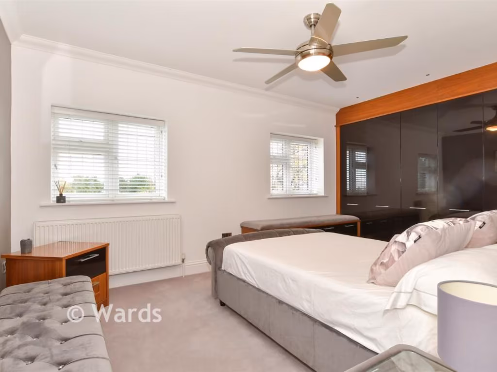
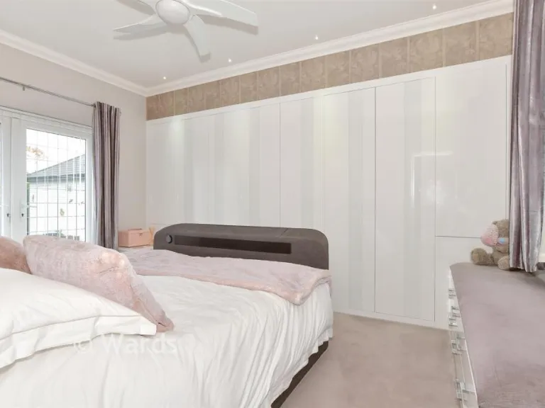
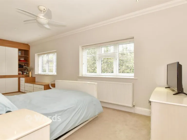
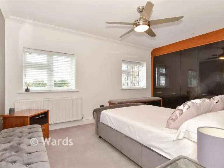
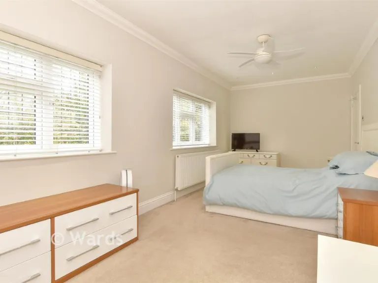
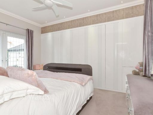
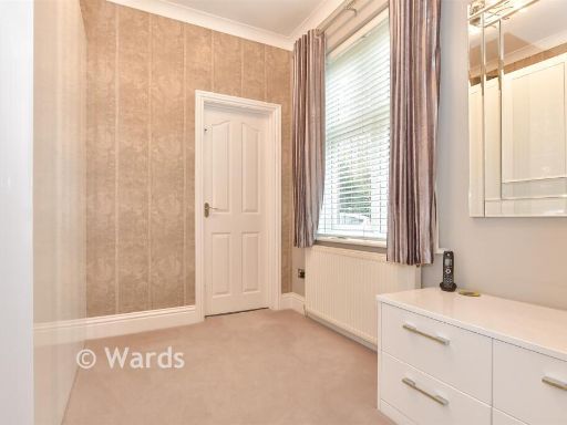
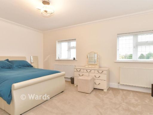
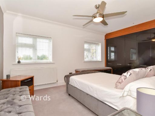
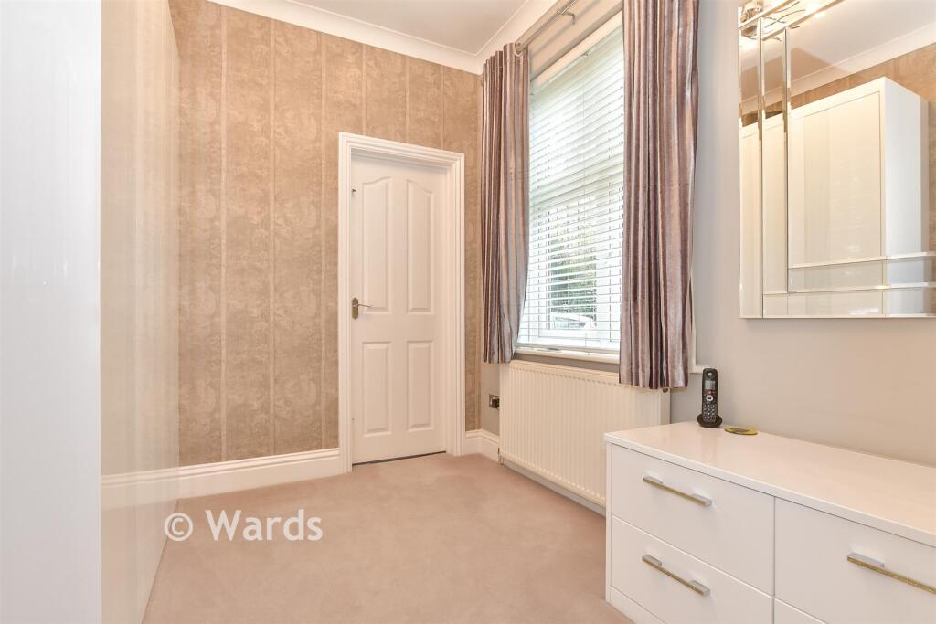
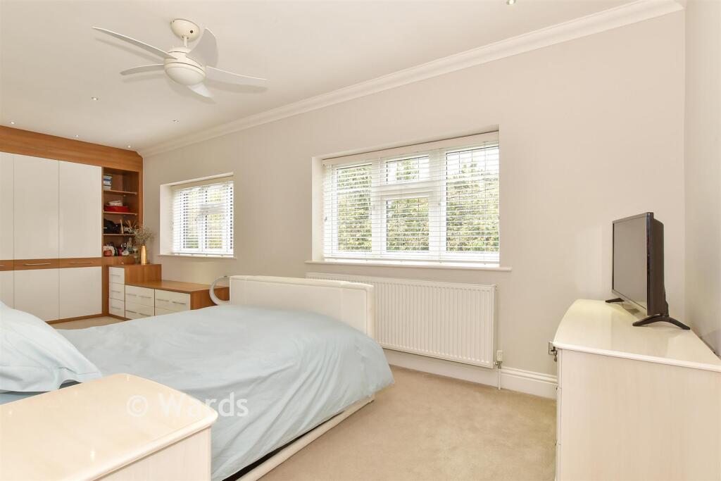
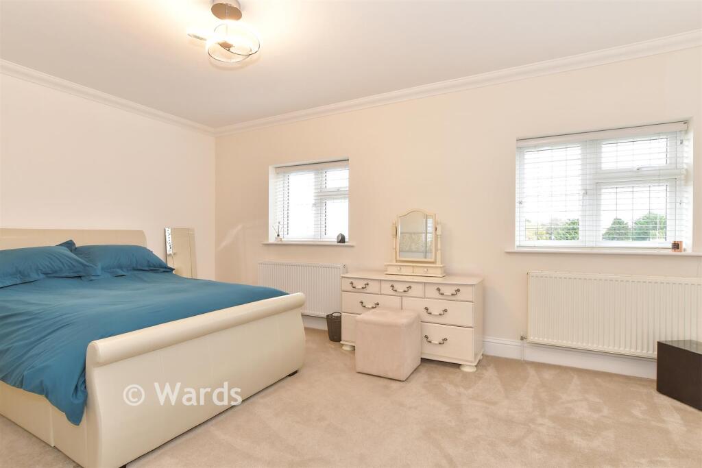
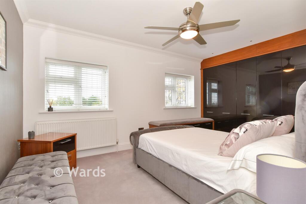
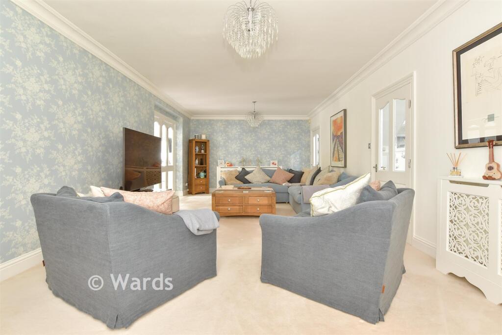
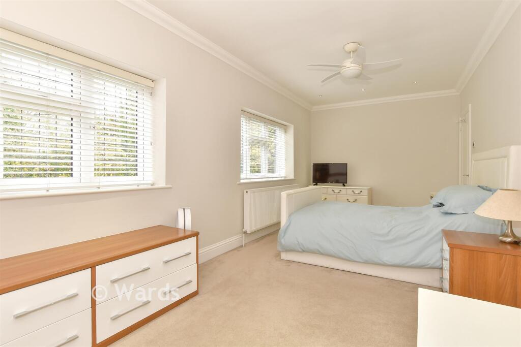
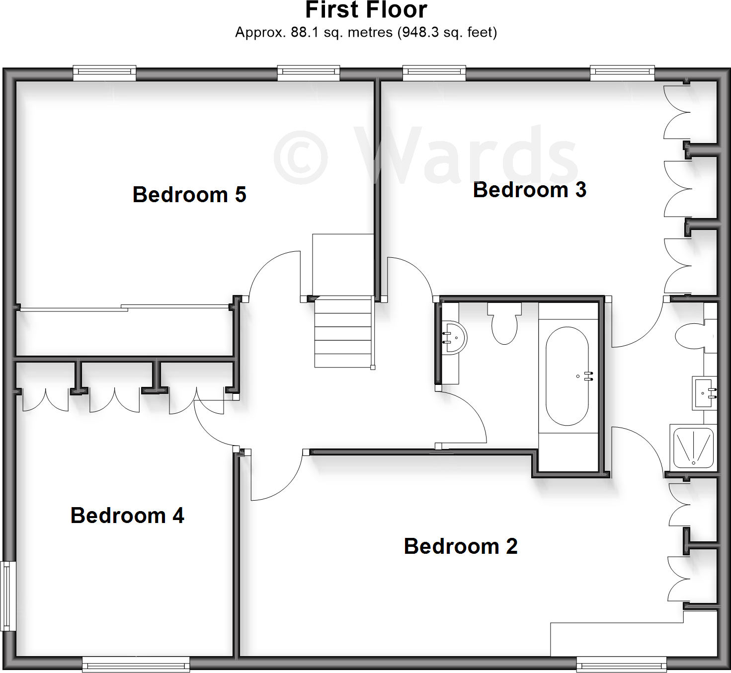
- Bedroom 5:
- Bedroom 3:
- Bedroom 4:
- Bedroom 2:
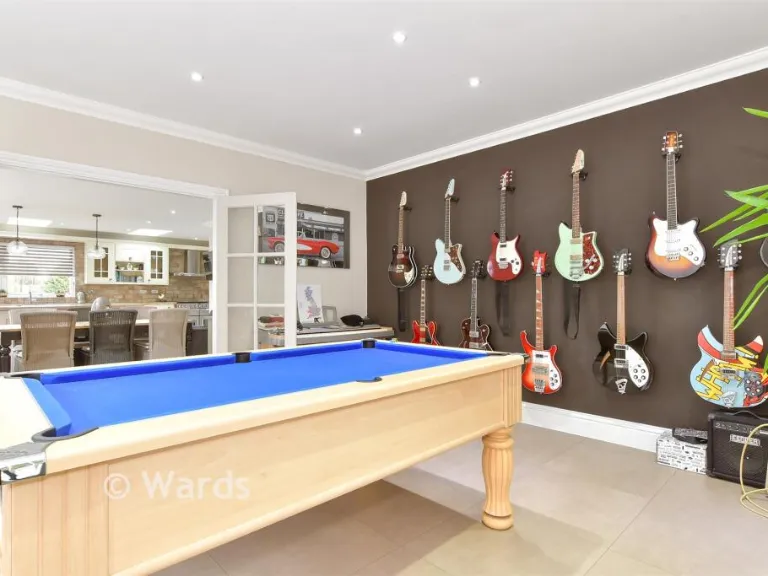
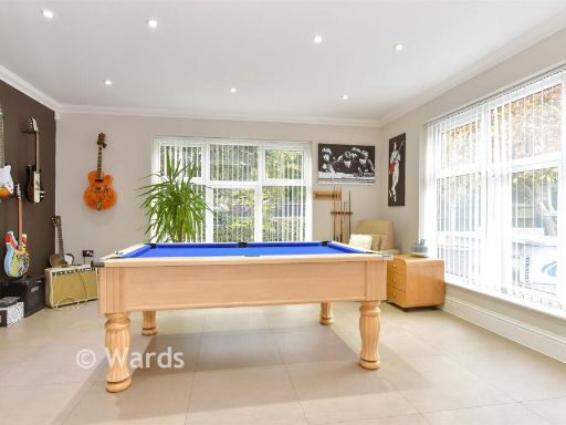
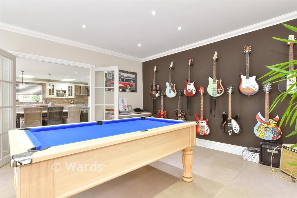
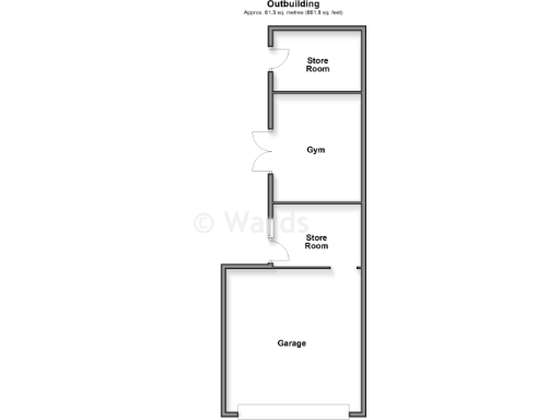
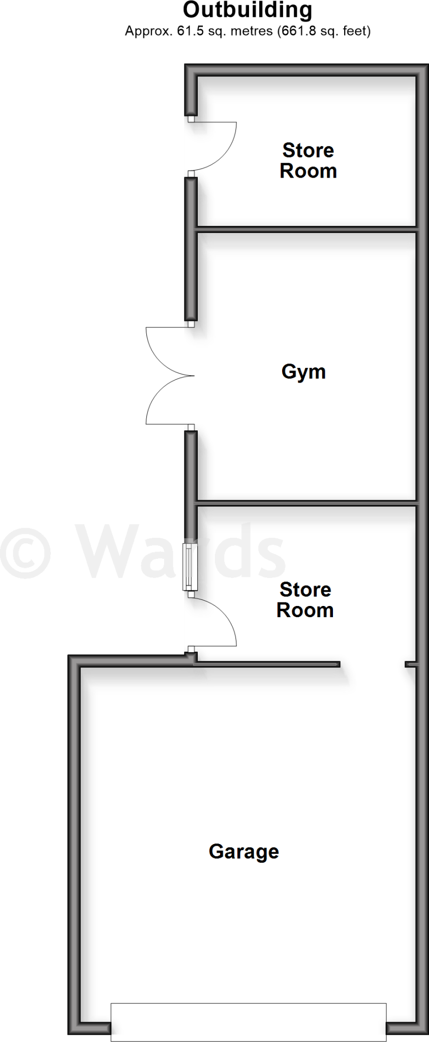
- Store Room:
- Gym:
- Store Room:
- Garage:
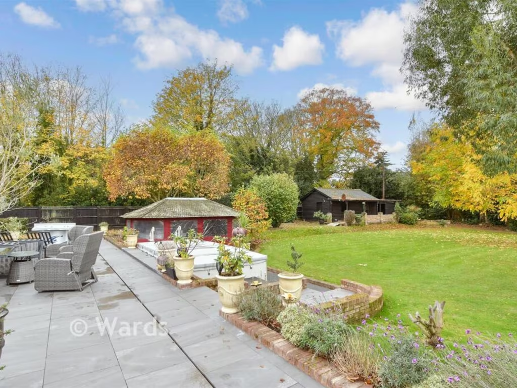
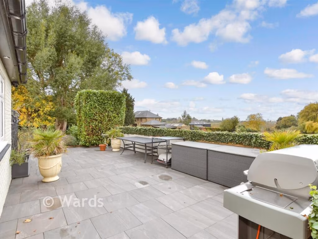
Textual Property Features
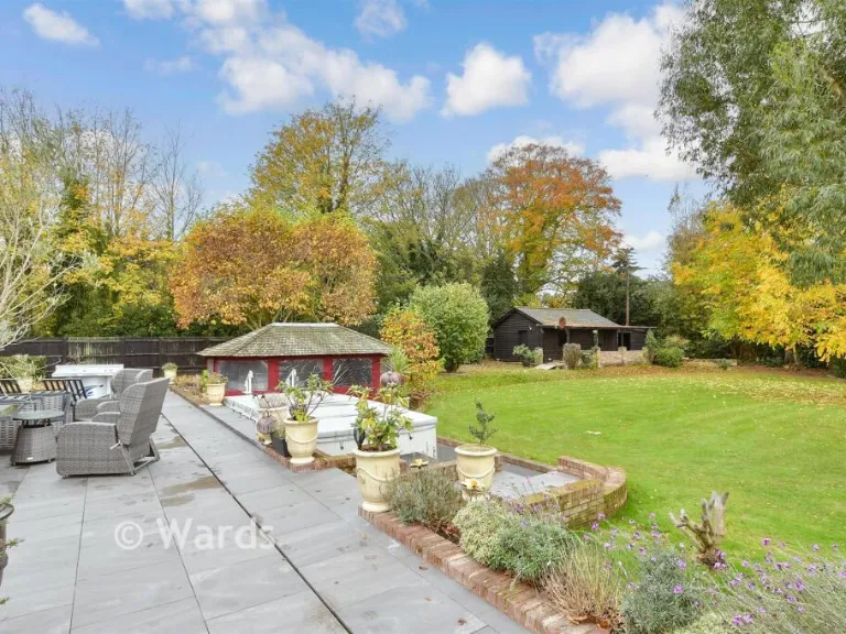
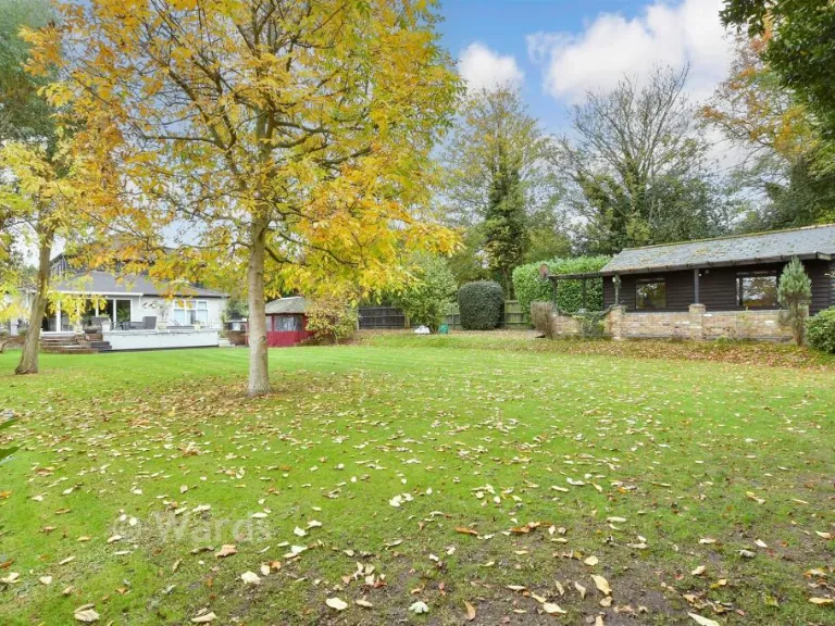
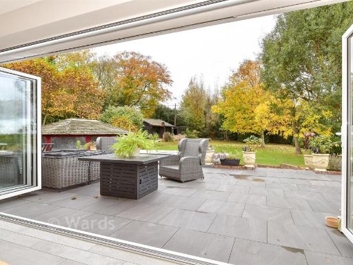
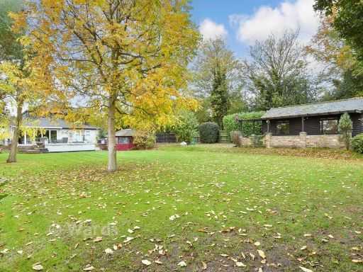
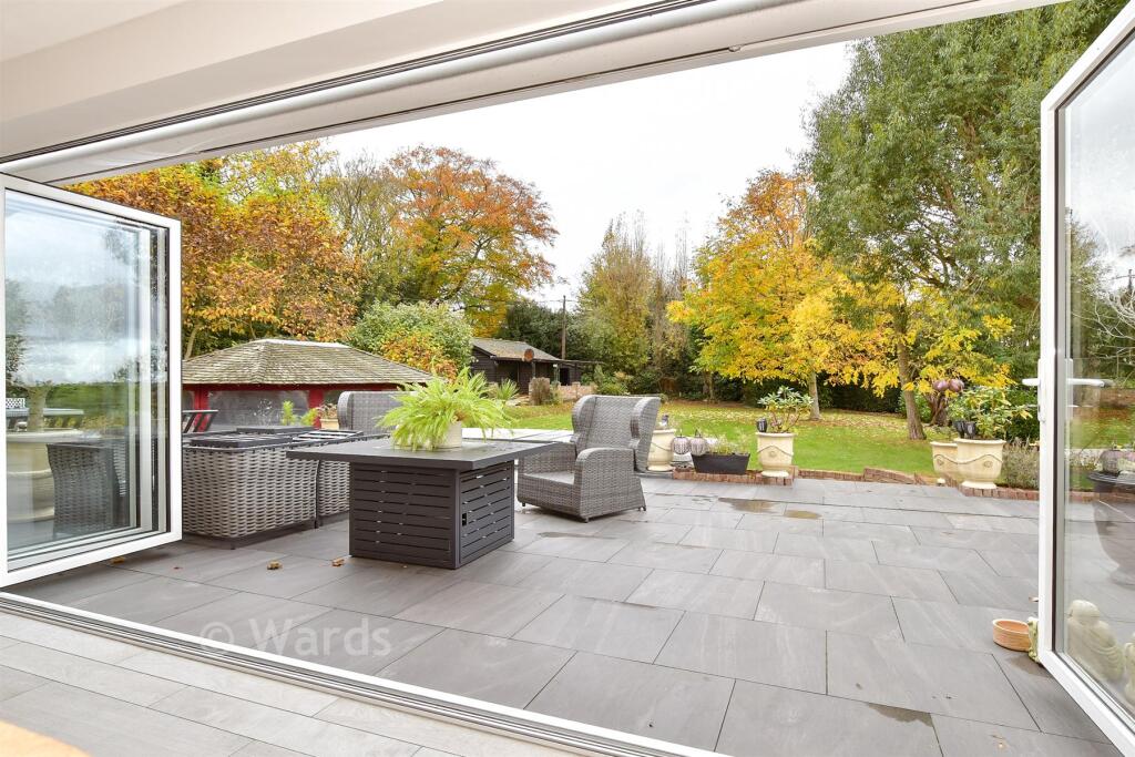
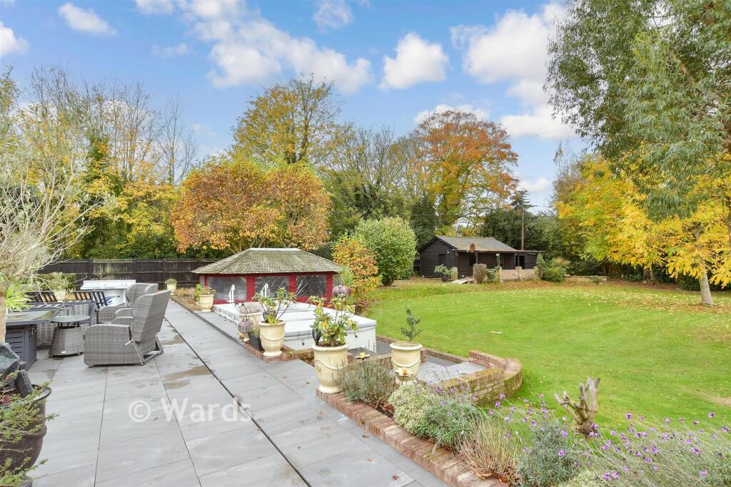
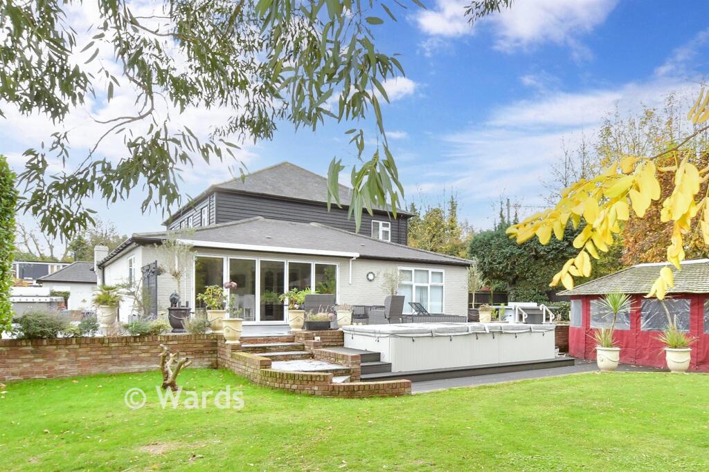
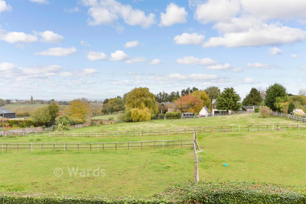
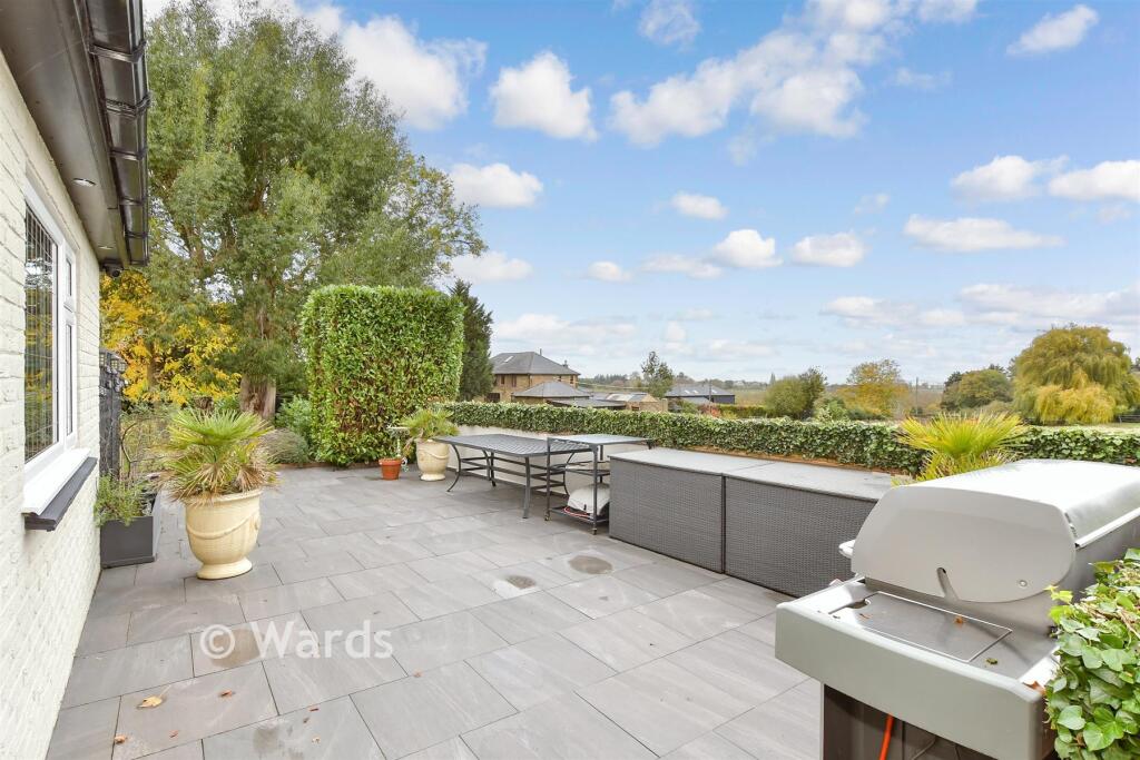
- Has Garden
- Is Retirement
- Success
Detected Visual Features
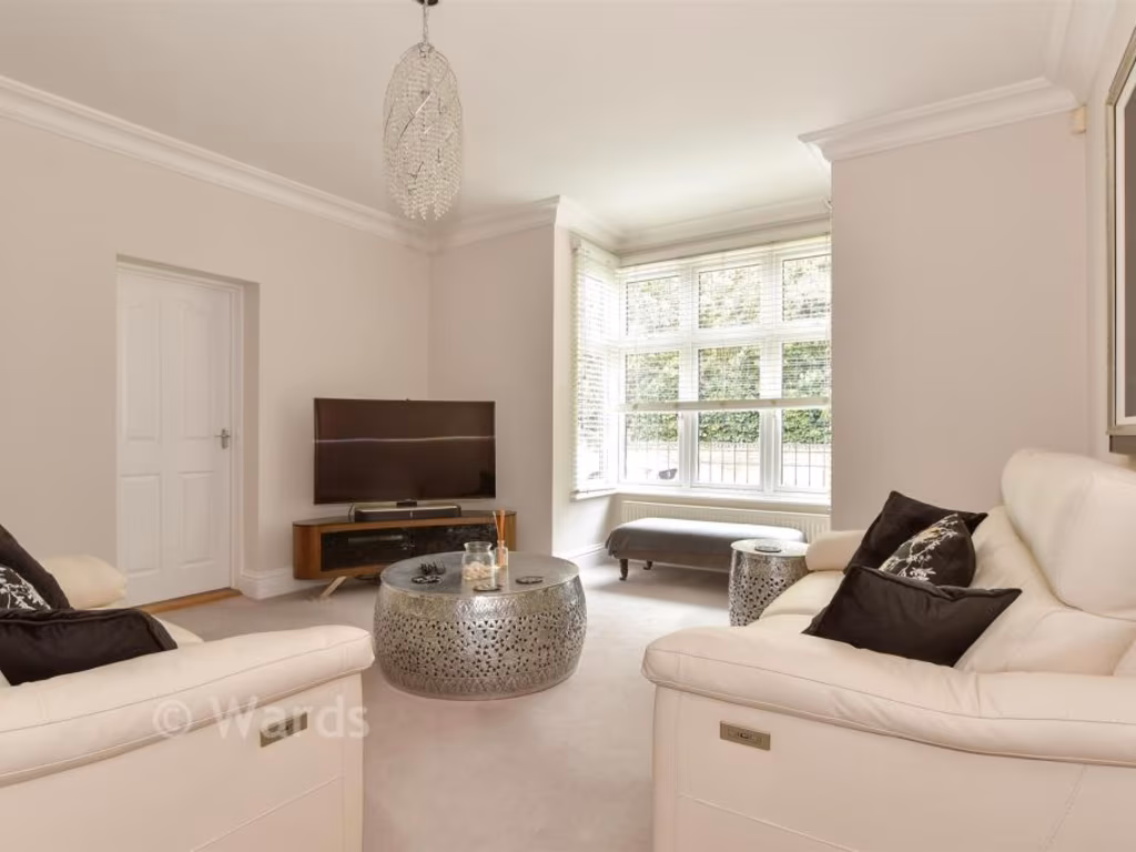
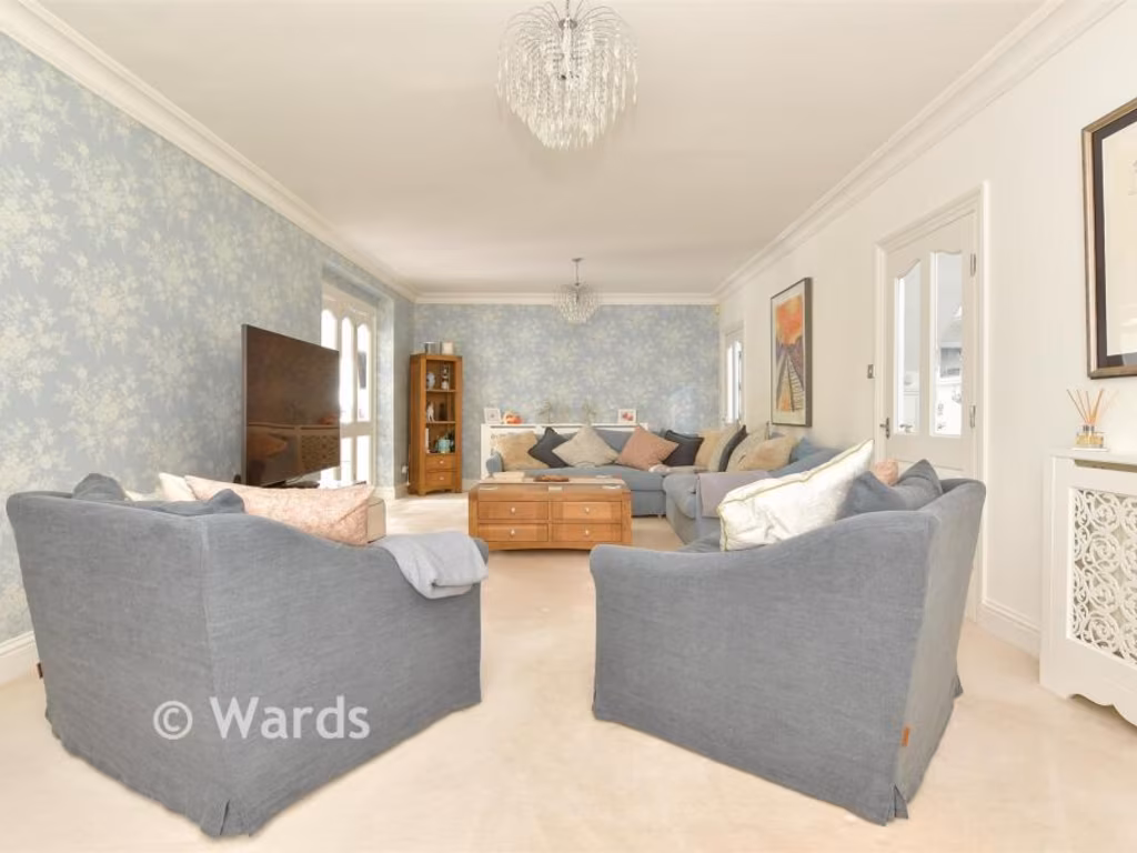
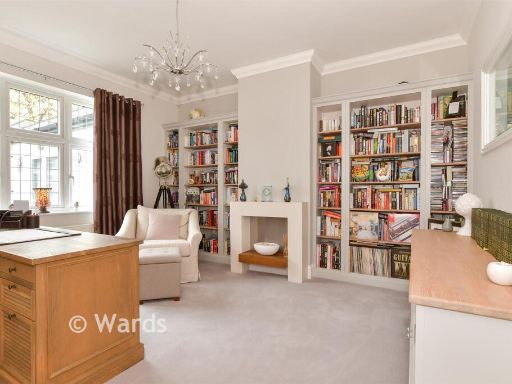
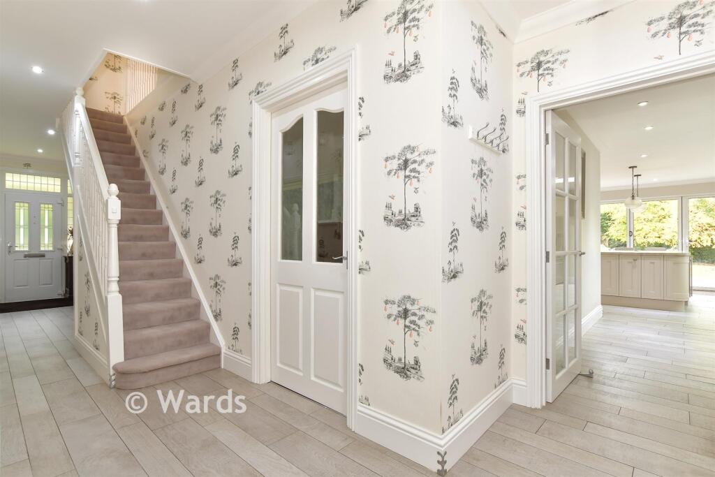
- modern design
- detached
- two-story
- garage
- driveway
- brick
- white exterior
- landscaped garden
- residential
- family home
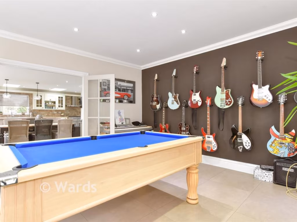
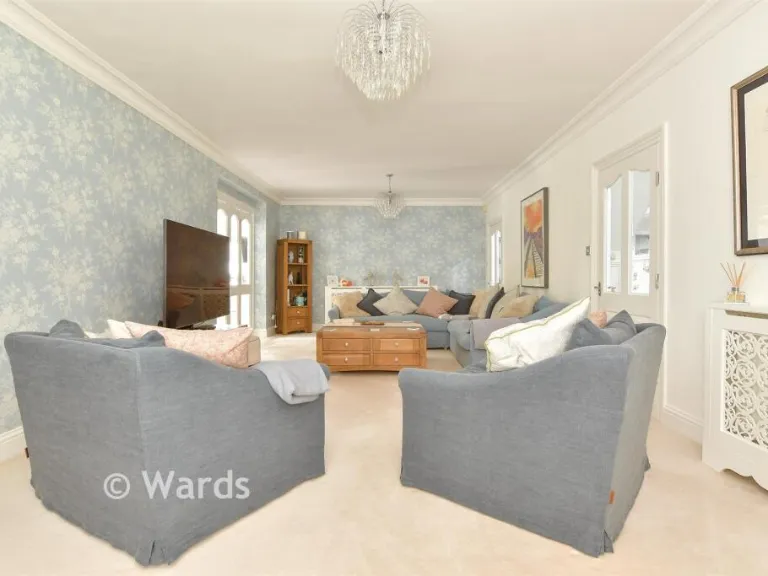
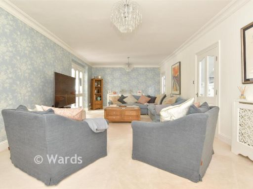
- modern
- kitchen
- dining area
- open plan
- natural light
- renovated
- well-maintained
- garden access
EPC Details
- Fully double glazed
- Cavity wall, filled cavity
- Boiler and radiators, mains gas
- Low energy lighting in all fixed outlets
- Suspended, no insulation (assumed)
Nearby Schools
- St Peter's Infant School
- St Andrew's School (Rochester)
- The Pilgrim School (A Church of England Primary With Nursery)
- Elaine Primary School
- Bligh Primary School (Infants)
- King's School, Rochester
- Wainscott Primary School
- Cuxton Community Junior School
- Cuxton Community Infant School
- Bligh Primary School (Juniors)
- Strood Academy
- St Nicholas Cecv Primary School
- Higham Primary School
- Rochester Independent College
- Cliffe Woods Primary School
- St William of Perth Roman Catholic Primary School
- All Faiths Children's Academy
- Gordons Children's Academy, Junior
- Gordons Children's Academy, Infant
- Temple Mill Primary School
- St Margaret's at Troy Town CofE Voluntary Controlled Primary School
- Rochester Riverside Church of England Primary School
- Hilltop Primary Academy
- Cedar Children's Academy
- Gad's Hill School
- Shorne Church of England Primary School
Nearest General Shops
- Id: 670266601
- Tags:
- Building: yes
- Shop: car_repair
- TagsNormalized:
- Lat: 51.3976807
- Lon: 0.483898
- FullGeoHash: u10k7h8m5whe
- PartitionGeoHash: u10k
- Images:
- FoodStandards: null
- Distance: 1388.2
,- Id: 117619339
- Tags:
- Addr:
- Building: yes
- Name: Haircare
- Shop: hairdresser
- Source: survey
- Source:shape: Bing
- TagsNormalized:
- Lat: 51.4162356
- Lon: 0.4601969
- FullGeoHash: u10kd2p17358
- PartitionGeoHash: u10k
- Images:
- FoodStandards: null
- Distance: 1260.2
,- Id: 4509083434
- Tags:
- Addr:
- City: Gravesend
- Housenumber: 21
- Postcode: ME3 7AJ
- Street: Forge Lane
- Fhrs:
- Name: Acme Wines
- Shop: alcohol
- Source: ratings.food.gov.uk
- TagsNormalized:
- Lat: 51.4143973
- Lon: 0.4590689
- FullGeoHash: u10k6rwq946d
- PartitionGeoHash: u10k
- Images:
- FoodStandards:
- Id: 124294
- FHRSID: 124294
- LocalAuthorityBusinessID: 528102102
- BusinessName: Acme Wines
- BusinessType: Retailers - other
- BusinessTypeID: 4613
- AddressLine1: 21 Forge Lane
- AddressLine2: Gravesend
- AddressLine3: Kent
- AddressLine4: null
- PostCode: ME3 7AJ
- RatingValue: 5
- RatingKey: fhrs_5_en-GB
- RatingDate: 2020-03-11
- LocalAuthorityCode: 184
- LocalAuthorityName: Gravesham
- LocalAuthorityWebSite: http://www.gravesham.gov.uk/
- LocalAuthorityEmailAddress: hygiene.ratingscheme@gravesham.gov.uk
- Scores:
- Hygiene: 0
- Structural: 0
- ConfidenceInManagement: 0
- NewRatingPending: false
- Geocode:
- Longitude: 0.45919700000000
- Latitude: 51.41361300000000
- Distance: 1183.8
}
Nearest Grocery shops
- Id: 4579468996
- Tags:
- Addr:
- City: Rochester
- Housenumber: 18
- Postcode: ME3 7AS
- Street: Forge Lane
- Subdistrict: Higham
- Alt_name: Meadows
- Fhrs:
- Name: Lifestyles Express
- Shop: convenience
- Source: ratings.food.gov.uk
- TagsNormalized:
- Lat: 51.414863
- Lon: 0.459127
- FullGeoHash: u10k6ry363ju
- PartitionGeoHash: u10k
- Images:
- FoodStandards: null
- Distance: 1212.1
,- Id: 126449033
- Tags:
- Building: yes
- Name: The Co-operative
- Shop: convenience
- Source:
- TagsNormalized:
- Lat: 51.3987012
- Lon: 0.4700459
- FullGeoHash: u10k6sy70u7e
- PartitionGeoHash: u10k
- Images:
- FoodStandards: null
- Distance: 1058.4
,- Id: 118083282
- Tags:
- Addr:
- City: Rochester
- Country: GB
- County: Kent
- Postcode: ME2 3PW
- Street: Gravesend Road
- Brand: Tesco Express
- Brand:wikidata: Q98456772
- Building: yes
- Contact:
- Website: https://www.tesco.com/store-locator/strood/gravesend-rd
- Fhrs:
- Name: Tesco Express
- Old_name: Whitegates Service Station
- Shop: convenience
- Source: survey
- Source:addr: FHRS Open Data
- Source:shape: Bing
- TagsNormalized:
- tesco
- tesco express
- convenience
- shop
- Lat: 51.4027561
- Lon: 0.4805038
- FullGeoHash: u10k6vtfu81x
- PartitionGeoHash: u10k
- Images:
- FoodStandards:
- Id: 778621
- FHRSID: 778621
- LocalAuthorityBusinessID: PI/000147466
- BusinessName: Tesco
- BusinessType: Retailers - other
- BusinessTypeID: 4613
- AddressLine1: Tesco Express
- AddressLine2: Westgate Service Station
- AddressLine3: Gravesend Road
- AddressLine4: Strood
- PostCode: ME2 3PW
- RatingValue: 5
- RatingKey: fhrs_5_en-GB
- RatingDate: 2015-07-10
- LocalAuthorityCode: 896
- LocalAuthorityName: Medway
- LocalAuthorityWebSite: http://www.medway.gov.uk/
- LocalAuthorityEmailAddress: foodandsafety@medway.gov.uk
- Scores:
- Hygiene: 0
- Structural: 0
- ConfidenceInManagement: 0
- NewRatingPending: false
- Geocode:
- Longitude: 0.48038199543953
- Latitude: 51.40272521972660
- Distance: 796.7
}
Nearest Religious buildings
- Id: 770641997
- Tags:
- Amenity: place_of_worship
- Denomination: congregational
- Name: Higham Congregational Church
- Religion: christian
- Source: OS_OpenData_StreetView
- TagsNormalized:
- place of worship
- congregational
- church
- christian
- Lat: 51.4170223
- Lon: 0.4609011
- FullGeoHash: u10kd2ptgg8v
- PartitionGeoHash: u10k
- Images:
- FoodStandards: null
- Distance: 1293
,- Id: 881973771
- Tags:
- Amenity: place_of_worship
- Building: church
- Denomination: anglican
- Name: St. John's Church
- Religion: christian
- Source: OS_OpenData_StreetView
- Wikidata: Q26303011
- TagsNormalized:
- place of worship
- church
- anglican
- christian
- Lat: 51.4163219
- Lon: 0.46174
- FullGeoHash: u10kd801z347
- PartitionGeoHash: u10k
- Images:
- FoodStandards: null
- Distance: 1195.9
,- Id: 126799942
- Tags:
- Addr:
- City: Rochester
- Country: GB
- Housenumber: 101
- Street: Rede Court Road
- Amenity: place_of_worship
- Building: yes
- Denomination: evangelical
- Name: Waterford House Evangelical Free Church
- Religion: christian
- Source: survey
- Source:shape: Bing
- TagsNormalized:
- place of worship
- evangelical
- church
- christian
- Lat: 51.3997601
- Lon: 0.4730282
- FullGeoHash: u10k6v03q3g2
- PartitionGeoHash: u10k
- Images:
- FoodStandards: null
- Distance: 923.6
}
Nearest Medical buildings
- Id: 441023871
- Tags:
- TagsNormalized:
- Lat: 51.397636
- Lon: 0.4936418
- FullGeoHash: u10k7hxkyty1
- PartitionGeoHash: u10k
- Images:
- FoodStandards: null
- Distance: 1854
,- Id: 624692264
- Tags:
- Addr:
- Amenity: pharmacy
- Dispensing: yes
- Name: Bryant Road Pharmacy
- TagsNormalized:
- Lat: 51.397718
- Lon: 0.490332
- FullGeoHash: u10k7htj3t44
- PartitionGeoHash: u10k
- Images:
- FoodStandards: null
- Distance: 1674.7
,- Id: 117619097
- Tags:
- Amenity: pharmacy
- Building: yes
- Dispensing: yes
- Name: Marshlands
- Source: survey
- Source:shape: Bing
- TagsNormalized:
- Lat: 51.416028
- Lon: 0.4601244
- FullGeoHash: u10kd2p01dm9
- PartitionGeoHash: u10k
- Images:
- FoodStandards: null
- Distance: 1247.2
,- Id: 108009761
- Tags:
- Addr:
- City: Gravesend
- Country: GB
- Street: Hermitage Road
- Amenity: doctors
- Building: yes
- Name: Highcliffe Medical Practice
- Source: local_knowledge
- Source:shape: Bing
- TagsNormalized:
- Lat: 51.4157463
- Lon: 0.4606466
- FullGeoHash: u10k6rzqmvg1
- PartitionGeoHash: u10k
- Images:
- FoodStandards: null
- Distance: 1199.5
}
Nearest Airports
- Id: 103894219
- Tags:
- Aerodrome: international
- Aeroway: aerodrome
- Iata: SEN
- Icao: EGMC
- Name: London Southend Airport
- Old_name: Southend Municipal Airport
- Ref: SEN
- Wikidata: Q1415441
- TagsNormalized:
- airport
- international airport
- Lat: 51.5701749
- Lon: 0.6924624
- FullGeoHash: u10mru04p937
- PartitionGeoHash: u10m
- Images:
- FoodStandards: null
- Distance: 23585.2
,- Id: 121158889
- Tags:
- Aerodrome: continental
- Aeroway: aerodrome
- Fhrs:
- Authority: City of London Corporation
- Iata: LCY
- Icao: EGLC
- Name: London City Airport
- Operator: London City Airport Limited
- Ref: LCY
- Website: https://www.londoncityairport.com/
- Wikidata: Q8982
- Wikipedia: en:London City Airport
- TagsNormalized:
- airport
- continental airport
- Lat: 51.5042658
- Lon: 0.0539987
- FullGeoHash: u10j10p64702
- PartitionGeoHash: u10j
- Images:
- FoodStandards: null
- Distance: 30925.6
}
Nearest Leisure Facilities
- Id: 544120669
- Tags:
- Access: yes
- Leisure: playground
- Surface: woodchips
- TagsNormalized:
- Lat: 51.404298
- Lon: 0.4867378
- FullGeoHash: u10k7jf7tzdj
- PartitionGeoHash: u10k
- Images:
- FoodStandards: null
- Distance: 1054.3
,- Id: 319166669
- Tags:
- TagsNormalized:
- swimming
- swimming pool
- pool
- leisure
- Lat: 51.4144967
- Lon: 0.4623584
- FullGeoHash: u10k6x8xjsz7
- PartitionGeoHash: u10k
- Images:
- FoodStandards: null
- Distance: 1017.3
,- Id: 316121657
- Tags:
- Leisure: pitch
- Sport: tennis
- TagsNormalized:
- Lat: 51.4124558
- Lon: 0.4600778
- FullGeoHash: u10k6rr5286u
- PartitionGeoHash: u10k
- Images:
- FoodStandards: null
- Distance: 1007.8
,- Id: 670266613
- Tags:
- Leisure: pitch
- Sport: basketball
- TagsNormalized:
- pitch
- leisure
- basketball
- sports
- Lat: 51.4018865
- Lon: 0.4792186
- FullGeoHash: u10k6vkvww5k
- PartitionGeoHash: u10k
- Images:
- FoodStandards: null
- Distance: 819.1
,- Id: 1056410792
- Tags:
- TagsNormalized:
- swimming
- swimming pool
- pool
- leisure
- Lat: 51.4018025
- Lon: 0.4772832
- FullGeoHash: u10k6v7t1w2p
- PartitionGeoHash: u10k
- Images:
- FoodStandards: null
- Distance: 762.9
}
Nearest Tourist attractions
- Id: 3174519
- Tags:
- Addr:
- Building: yes
- Castle_type: defensive
- Historic: castle
- Name: Rochester Castle
- Operator: English Heritage
- Ruins: yes
- Tourism: attraction
- Type: multipolygon
- Website: https://www.english-heritage.org.uk/visit/places/rochester-castle/
- Wikidata: Q1125527
- Wikipedia: en:Rochester Castle
- TagsNormalized:
- Lat: 51.3899935
- Lon: 0.5014843
- FullGeoHash: u10k77m0mmjg
- PartitionGeoHash: u10k
- Images:
- FoodStandards: null
- Distance: 2828.5
,- Id: 7047931842
- Tags:
- Name: Tank
- Tourism: attraction
- TagsNormalized:
- Lat: 51.399007
- Lon: 0.5103655
- FullGeoHash: u10k7sgsumk5
- PartitionGeoHash: u10k
- Images:
- FoodStandards: null
- Distance: 2794.4
,- Id: 4509088659
- Tags:
- Addr:
- City: Rochester
- Housename: North Leigh
- Postcode: ME3 7DX
- Street: Gravesend Road
- Subdistrict: Higham
- Fhrs:
- Name: Chestnuts Bed & Breakfast
- Source: ratings.food.gov.uk
- Tourism: guest_house
- TagsNormalized:
- Lat: 51.4146909
- Lon: 0.4509126
- FullGeoHash: u10k6rb2710c
- PartitionGeoHash: u10k
- Images:
- FoodStandards: null
- Distance: 1686.7
}
Nearest Train stations
- Id: 6688385686
- Tags:
- Name: Cuxton
- Naptan:
- Network: National Rail
- Public_transport: station
- Railway: station
- Ref:
- Train: yes
- Wheelchair: yes
- Wikidata: Q2456141
- Wikipedia: en:Cuxton railway station
- TagsNormalized:
- Lat: 51.373911
- Lon: 0.461982
- FullGeoHash: u10k6826szns
- PartitionGeoHash: u10k
- Images:
- FoodStandards: null
- Distance: 3871
,- Id: 6689800306
- Tags:
- Name: Rochester
- Naptan:
- Network: National Rail
- Public_transport: station
- Railway: station
- Ref:
- Wikidata: Q2106217
- Wikipedia: en:Rochester railway station
- TagsNormalized:
- Lat: 51.3892066
- Lon: 0.5072941
- FullGeoHash: u10k7e17uf3v
- PartitionGeoHash: u10k
- Images:
- FoodStandards: null
- Distance: 3182.3
,- Id: 6688385687
- Tags:
- Name: Strood
- Naptan:
- Network: National Rail
- Public_transport: station
- Railway: station
- Ref:
- Wheelchair: yes
- Wikipedia: en:Strood railway station
- TagsNormalized:
- Lat: 51.3965972
- Lon: 0.5002689
- FullGeoHash: u10k7kkqch5s
- PartitionGeoHash: u10k
- Images:
- FoodStandards: null
- Distance: 2293.4
,- Id: 30091651
- Tags:
- Name: Higham
- Naptan:
- Network: National Rail
- Public_transport: station
- Railway: station
- Ref:
- Source: survey
- Wikidata: Q1883622
- Wikipedia: en:Higham railway station (Kent)
- TagsNormalized:
- Lat: 51.426953
- Lon: 0.4660183
- FullGeoHash: u10kd9grenb7
- PartitionGeoHash: u10k
- Images:
- FoodStandards: null
- Distance: 2152.1
,- Id: 294925033
- Tags:
- Building: train_station
- Public_transport: station
- TagsNormalized:
- station
- train
- train station
- Lat: 51.4265473
- Lon: 0.4663702
- FullGeoHash: u10kd9gt75nz
- PartitionGeoHash: u10k
- Images:
- FoodStandards: null
- Distance: 2102.8
}
Nearest Hotels
- Id: 668375520
- Tags:
- Building: yes
- Building:colour: brown
- Building:levels: 3
- Building:material: brick
- Name: The Royal Victoria and Bull Hotel
- Roof:
- Tourism: hotel
- Wikidata: Q17551327
- TagsNormalized:
- Lat: 51.3908101
- Lon: 0.5023598
- FullGeoHash: u10k77mv1v6e
- PartitionGeoHash: u10k
- Images:
- FoodStandards: null
- Distance: 2808.8
,- Id: 486363699
- Tags:
- Disused:
- Accommodation: B&B
- Amenity: pub
- Name: South Eastern Hotel (Closed)
- Tourism: hotel
- TagsNormalized:
- Lat: 51.3978611
- Lon: 0.5009347
- FullGeoHash: u10k7ksy0xgb
- PartitionGeoHash: u10k
- Images:
- FoodStandards: null
- Distance: 2258.1
,- Id: 4972556550
- Tags:
- Name: RBS Hotel
- Tourism: hotel
- TagsNormalized:
- Lat: 51.3987052
- Lon: 0.4965335
- FullGeoHash: u10k7kce4j45
- PartitionGeoHash: u10k
- Images:
- FoodStandards: null
- Distance: 1948.3
}
Tags
- modern design
- detached
- two-story
- garage
- driveway
- brick
- white exterior
- landscaped garden
- residential
- family home
- modern
- kitchen
- dining area
- open plan
- natural light
- renovated
- well-maintained
- garden access
Local Market Stats
- Average Price/sqft: £356
- Avg Income: £48400
- Rental Yield: 4.5%
- Social Housing: 7%
- Planning Success Rate: 58%
AirBnB Data
- 1km average: £60/night
- Listings in 1km: 1
Similar Properties
 5 bedroom detached bungalow for sale in Maidstone Road, Borden, Sittingbourne, Kent, ME9 — £924,500 • 5 bed • 3 bath • 3725 ft²
 5 bedroom detached house for sale in Oak Tree Close, Eastchurch, Sheerness, Kent, ME12 — £545,000 • 5 bed • 4 bath • 3467 ft²
 5 bedroom detached house for sale in The Street, Hartlip, Sittingbourne, Kent, ME9 — £825,500 • 5 bed • 2 bath • 2980 ft²
 3 bedroom link detached house for sale in Ward View, Chatham, Kent, ME5 — £248,000 • 3 bed • 2 bath • 998 ft²
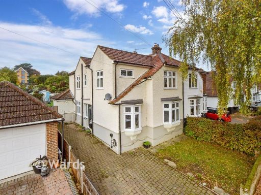 4 bedroom semi-detached house for sale in Little Buckland Avenue, Maidstone, Kent, ME16 — £353,500 • 4 bed • 1 bath • 1378 ft²
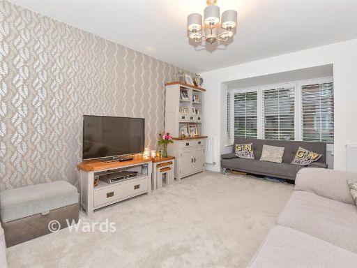 4 bedroom detached house for sale in Collier Street, Yalding, Maidstone, Kent, ME18 — £396,500 • 4 bed • 3 bath • 1037 ft²
Meta
- {
"@context": "https://schema.org",
"@type": "Residence",
"name": "5 bedroom detached house for sale in Dillywood Lane, Higham…",
"description": "",
"url": "https://propertypiper.co.uk/property/92f4e24d-749d-4ebe-bf38-4731d55d19e6",
"image": "https://image-a.propertypiper.co.uk/8540a3e5-2e33-4f3c-83fb-bc615f230e78-1024.jpeg",
"address": {
"@type": "PostalAddress",
"streetAddress": "ORCHARD VIEW GRAVESEND ROAD HIGHAM ROCHESTER",
"postalCode": "ME3 7NU",
"addressLocality": "Gravesham",
"addressRegion": "Gravesham",
"addressCountry": "England"
},
"geo": {
"@type": "GeoCoordinates",
"latitude": 51.408064551852746,
"longitude": 0.4727887069746322
},
"numberOfRooms": 5,
"numberOfBathroomsTotal": 3,
"floorSize": {
"@type": "QuantitativeValue",
"value": 3316,
"unitCode": "FTK"
},
"offers": {
"@type": "Offer",
"price": 1056500,
"priceCurrency": "GBP",
"availability": "https://schema.org/InStock"
},
"additionalProperty": [
{
"@type": "PropertyValue",
"name": "Feature",
"value": "modern design"
},
{
"@type": "PropertyValue",
"name": "Feature",
"value": "detached"
},
{
"@type": "PropertyValue",
"name": "Feature",
"value": "two-story"
},
{
"@type": "PropertyValue",
"name": "Feature",
"value": "garage"
},
{
"@type": "PropertyValue",
"name": "Feature",
"value": "driveway"
},
{
"@type": "PropertyValue",
"name": "Feature",
"value": "brick"
},
{
"@type": "PropertyValue",
"name": "Feature",
"value": "white exterior"
},
{
"@type": "PropertyValue",
"name": "Feature",
"value": "landscaped garden"
},
{
"@type": "PropertyValue",
"name": "Feature",
"value": "residential"
},
{
"@type": "PropertyValue",
"name": "Feature",
"value": "family home"
},
{
"@type": "PropertyValue",
"name": "Feature",
"value": "modern"
},
{
"@type": "PropertyValue",
"name": "Feature",
"value": "kitchen"
},
{
"@type": "PropertyValue",
"name": "Feature",
"value": "dining area"
},
{
"@type": "PropertyValue",
"name": "Feature",
"value": "open plan"
},
{
"@type": "PropertyValue",
"name": "Feature",
"value": "natural light"
},
{
"@type": "PropertyValue",
"name": "Feature",
"value": "renovated"
},
{
"@type": "PropertyValue",
"name": "Feature",
"value": "well-maintained"
},
{
"@type": "PropertyValue",
"name": "Feature",
"value": "garden access"
}
]
}
High Res Floorplan Images
Compatible Floorplan Images
FloorplanImages Thumbnail