SR2 7SE - 4 bedroom terraced house for sale in Holmlands Park North,…
View on Property Piper
4 bedroom terraced house for sale in Holmlands Park North, Ashbrooke, Sunderland, SR2
Property Details
- Price: £320000
- Bedrooms: 4
- Bathrooms: 2
- Property Type: undefined
- Property SubType: undefined
Brochure Descriptions
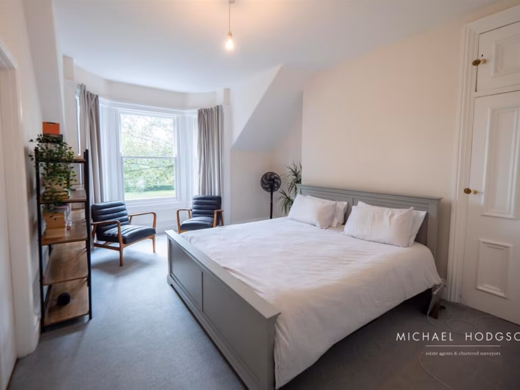
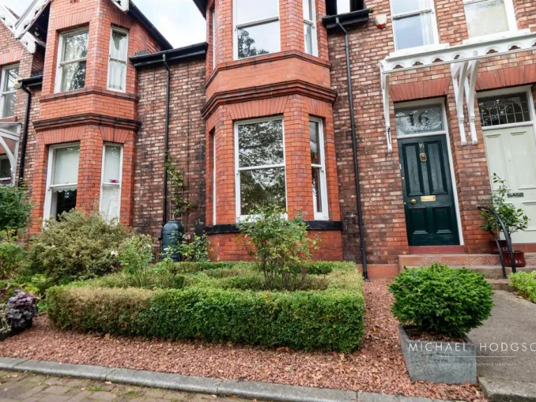
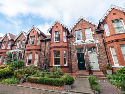
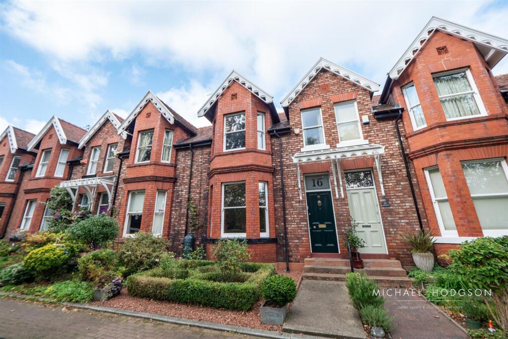
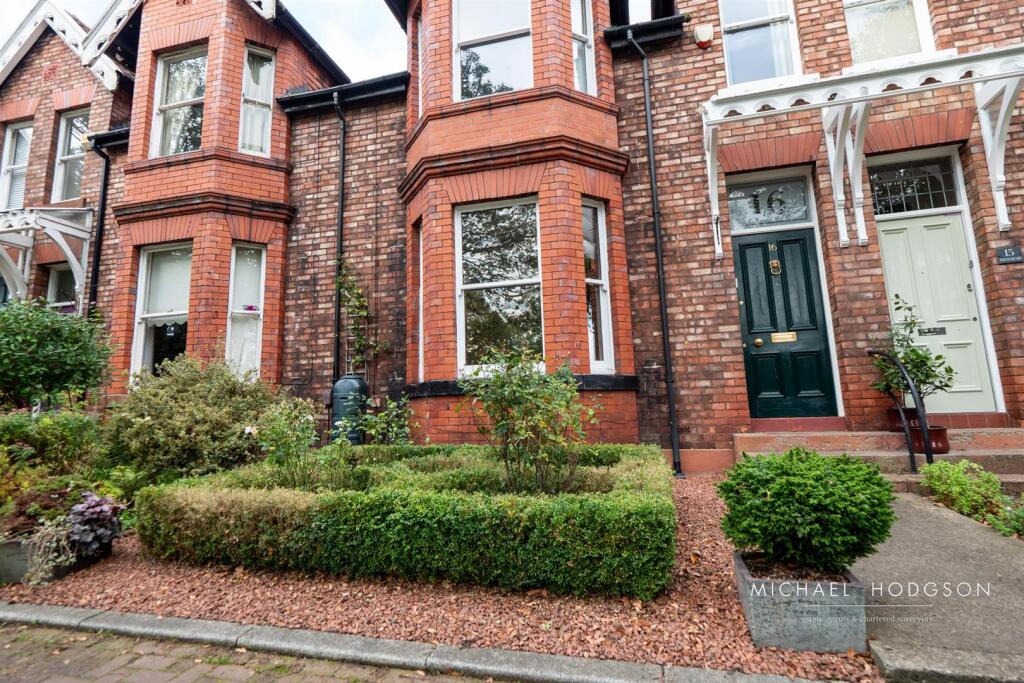
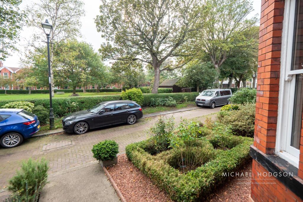
- Late-Victorian/Edwardian red-brick terraced house, mid-terrace with a bay window to the ground floor and a tall first-floor window within a gabled dormer. Traditional architectural detailing (decorative bargeboards and brick string courses) suggests period character. Property has a small, neatly landscaped front garden with low hedging and mixed shrubs — garden size: small. Street-facing aspect with similar adjoining terraces on either side; likely located in an established residential neighbourhood. Property appears to be a two-storey (plus attic) family house of average plot width typical of terraced housing. Overall property footprint and garden indicate a modest-to-average sized urban dwelling suitable for a small family or as a buy-to-let. No exceptional views (sea/river/woodland/city skyline) are visible from the images provided.
- No residential property details or photographs are shown on this image — it is a branded cover/back page for the estate agent (Michael Hodgson) containing agent contact details and legal text. There is no information about the property for sale (no external or internal images, no room descriptions, no view or garden information). Unable to describe room sizes, garden size or overall property size from this image.
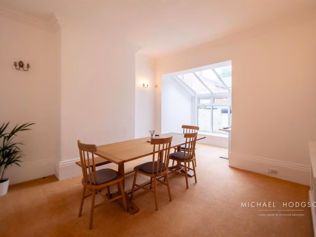
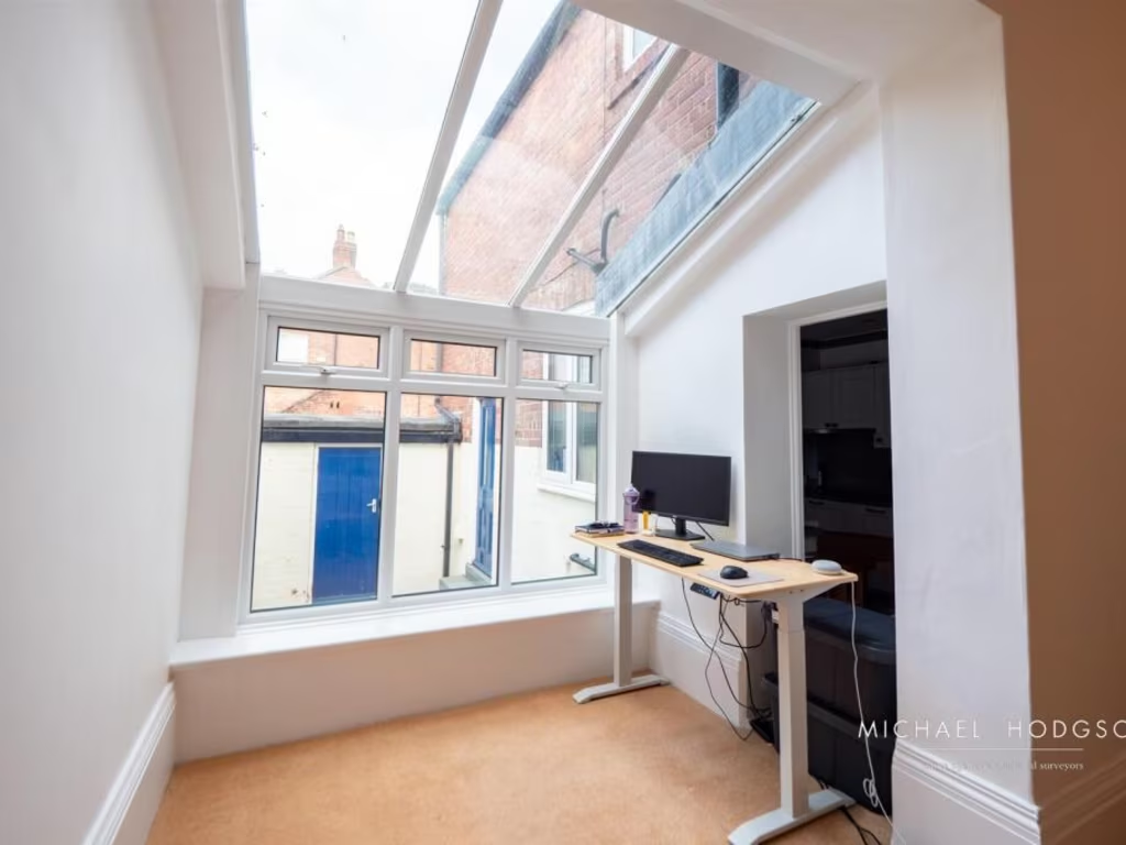
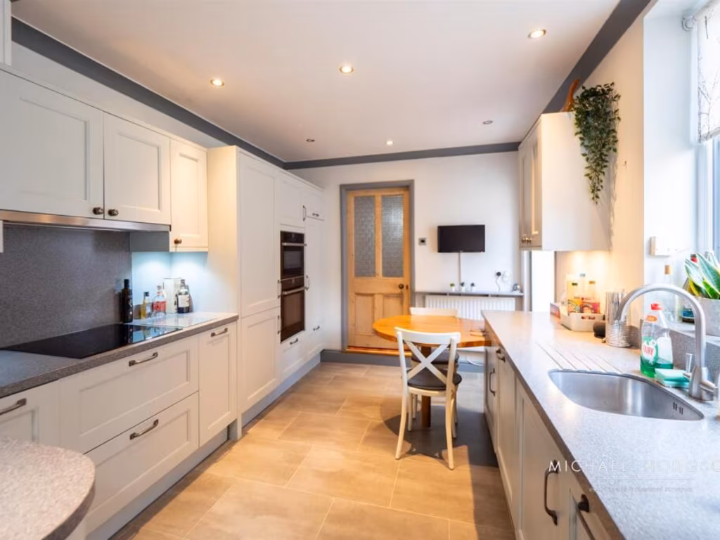
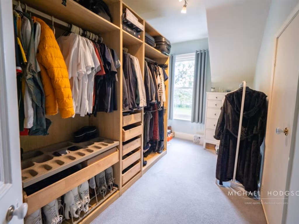
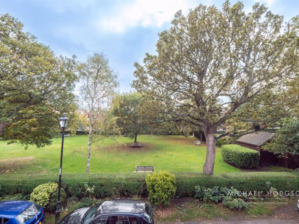
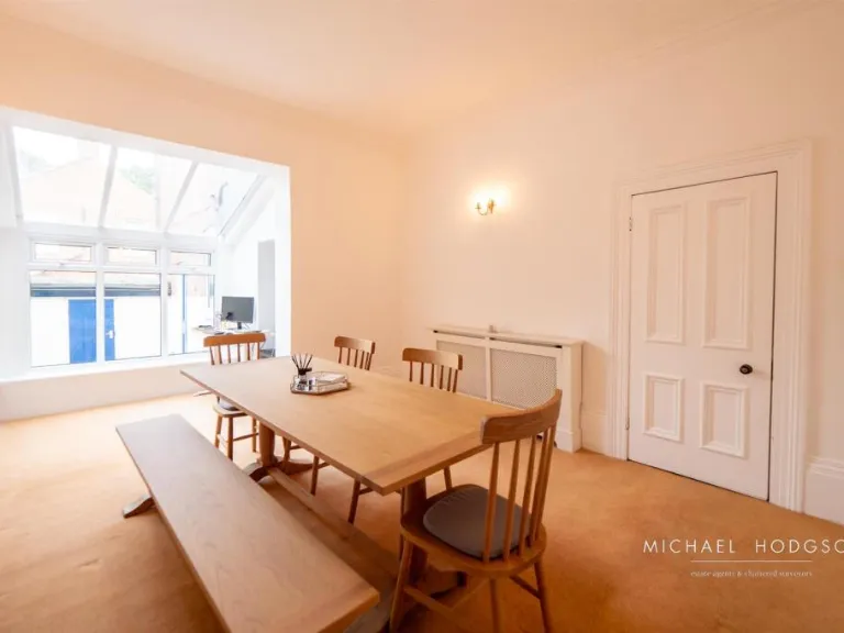
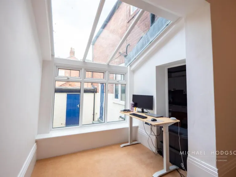
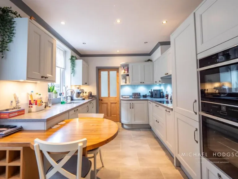
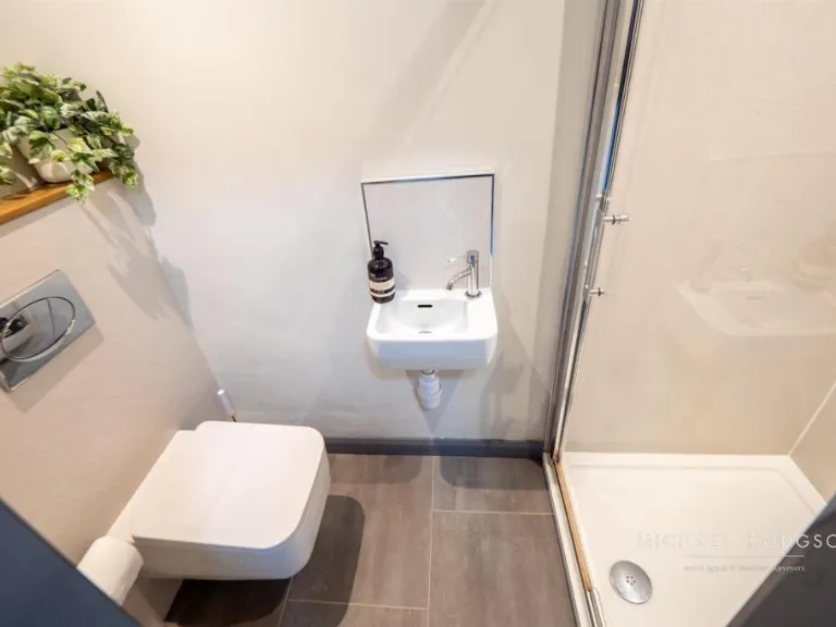
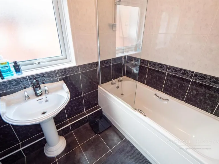
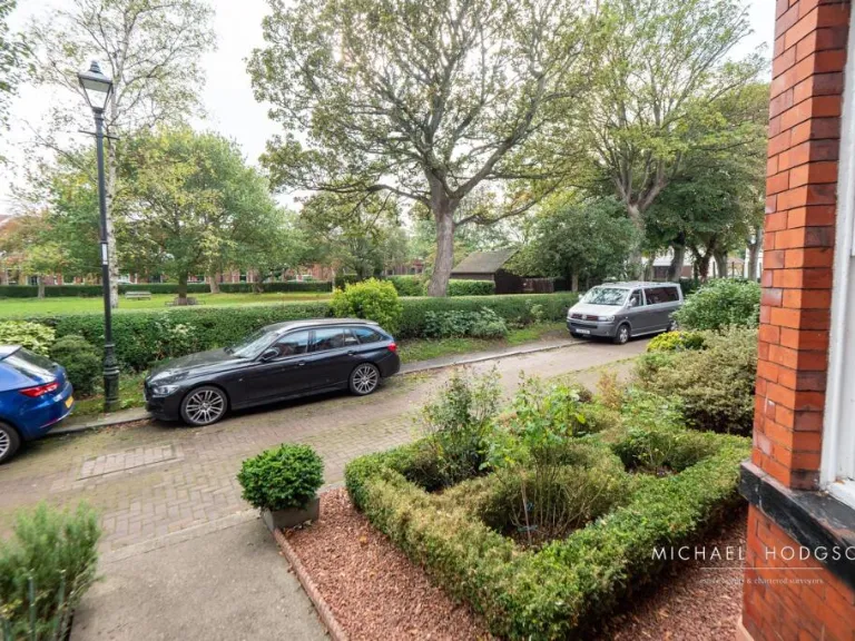
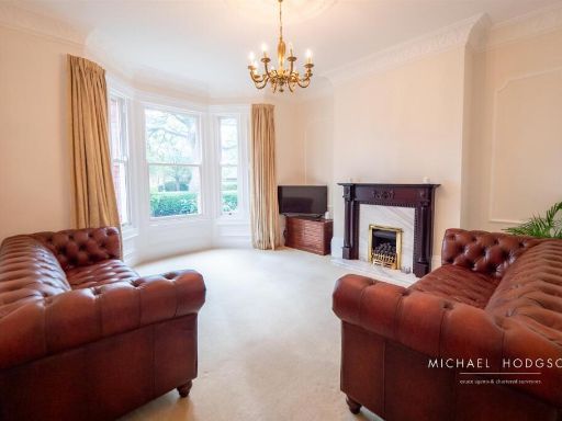
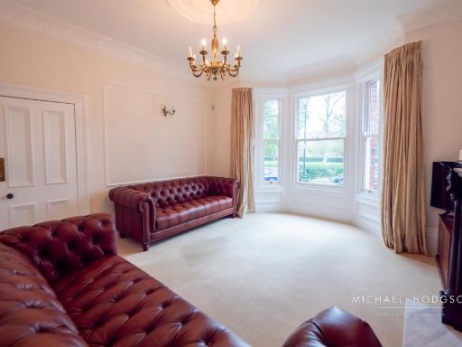
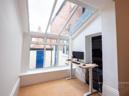
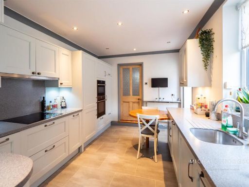
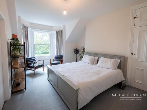
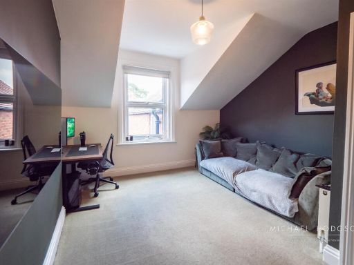
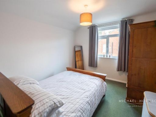
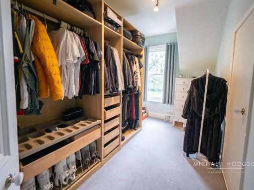
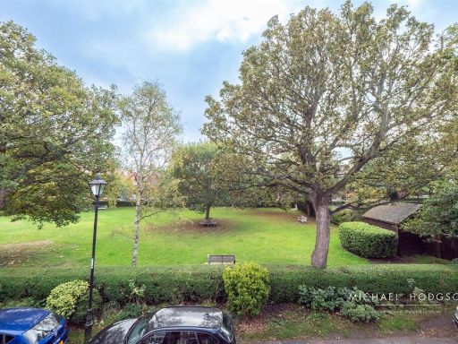
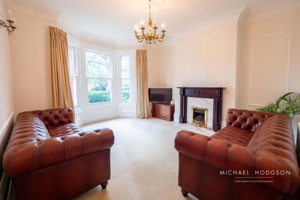
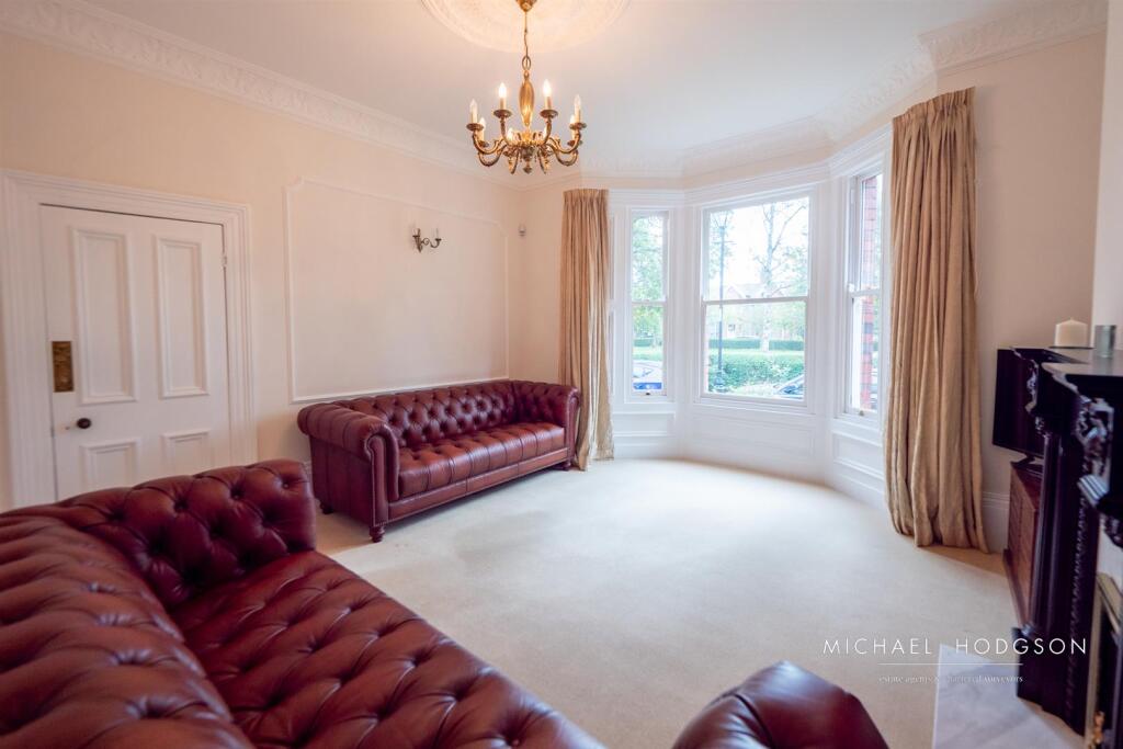
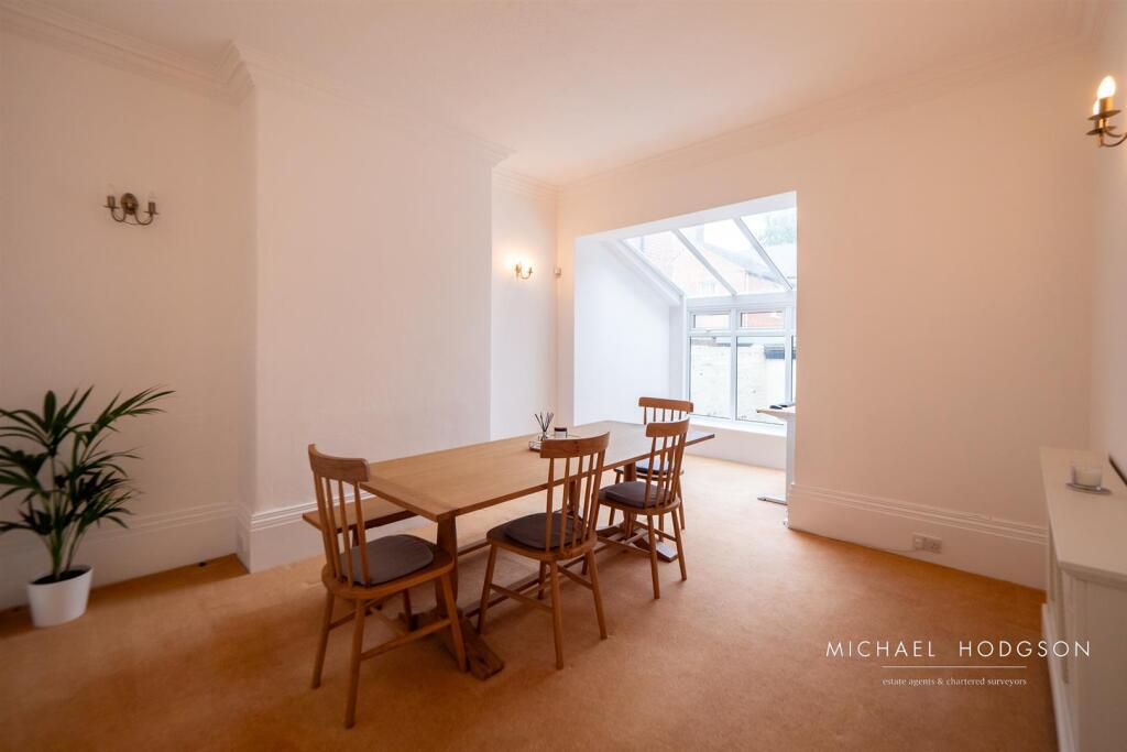
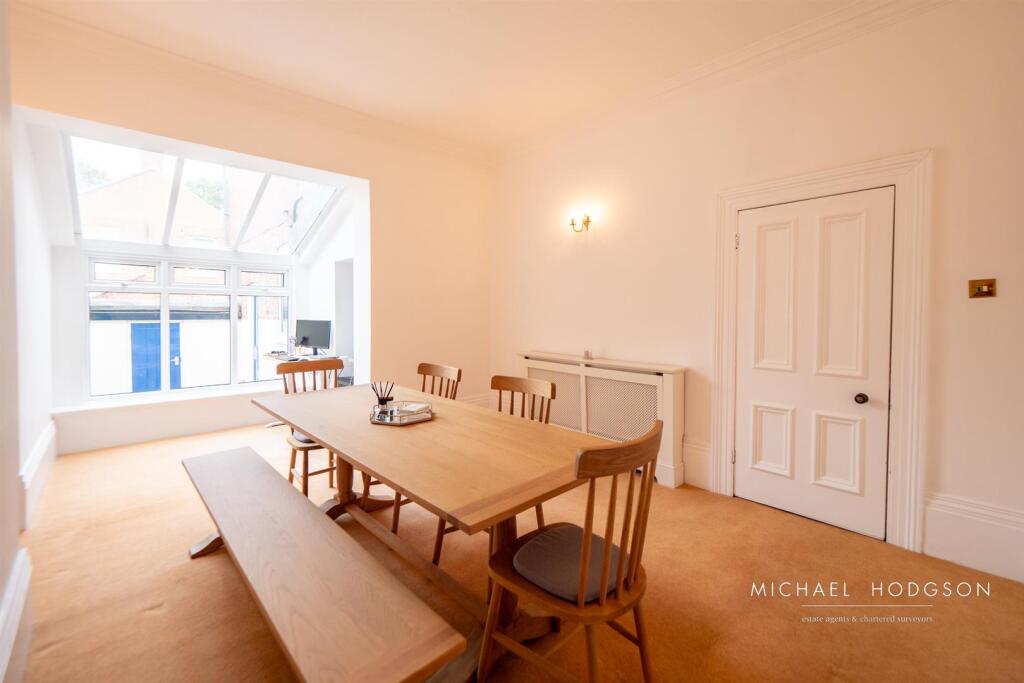
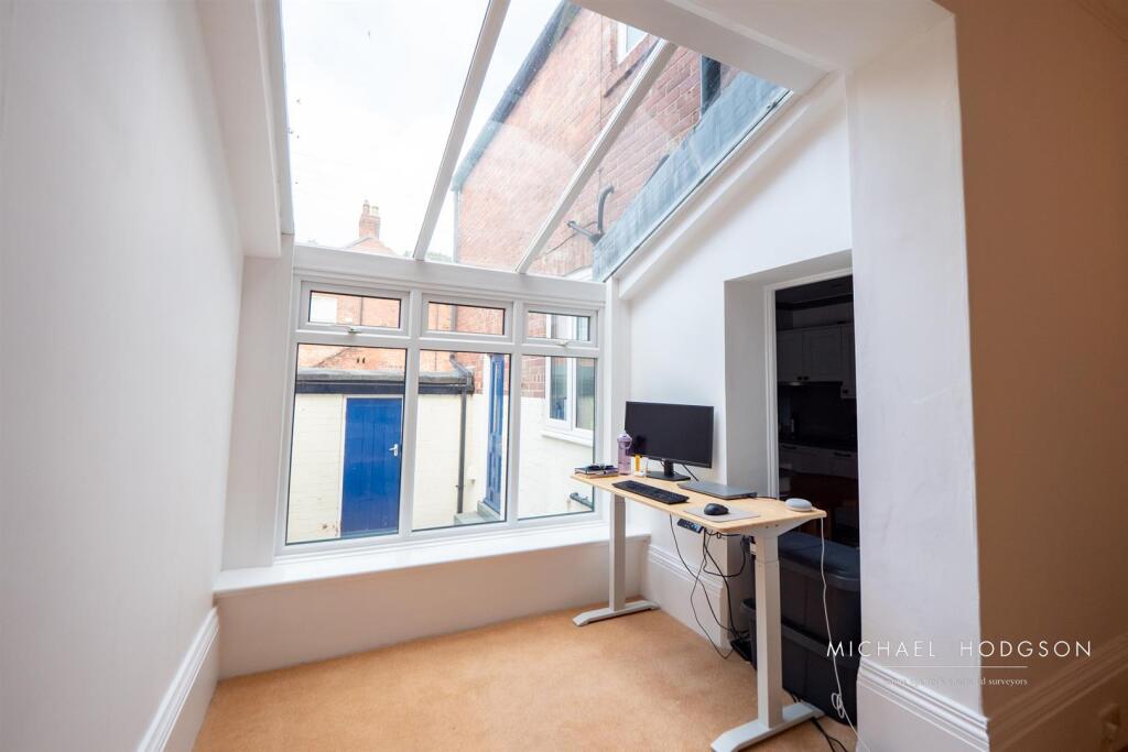
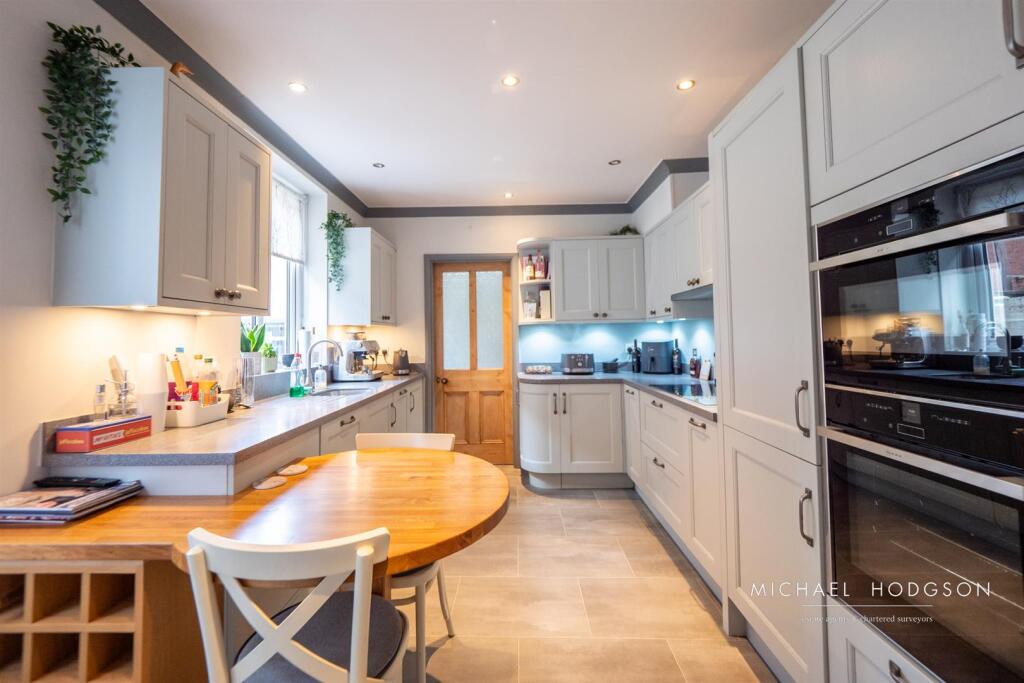
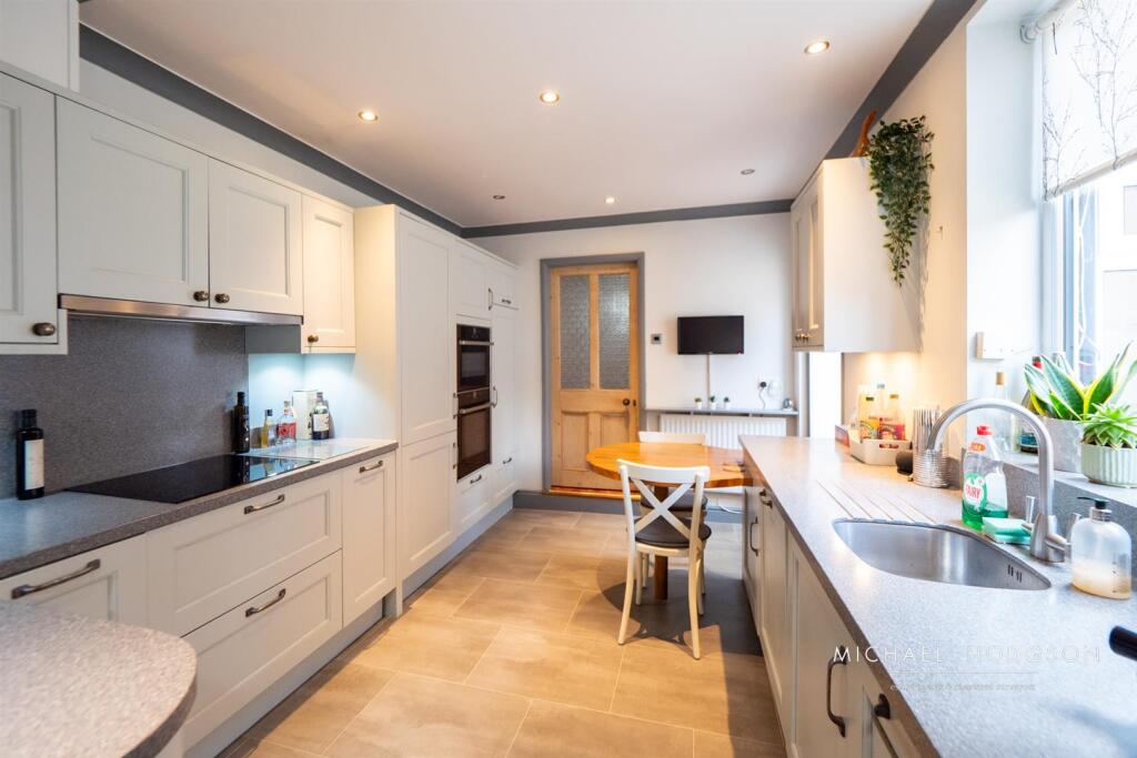
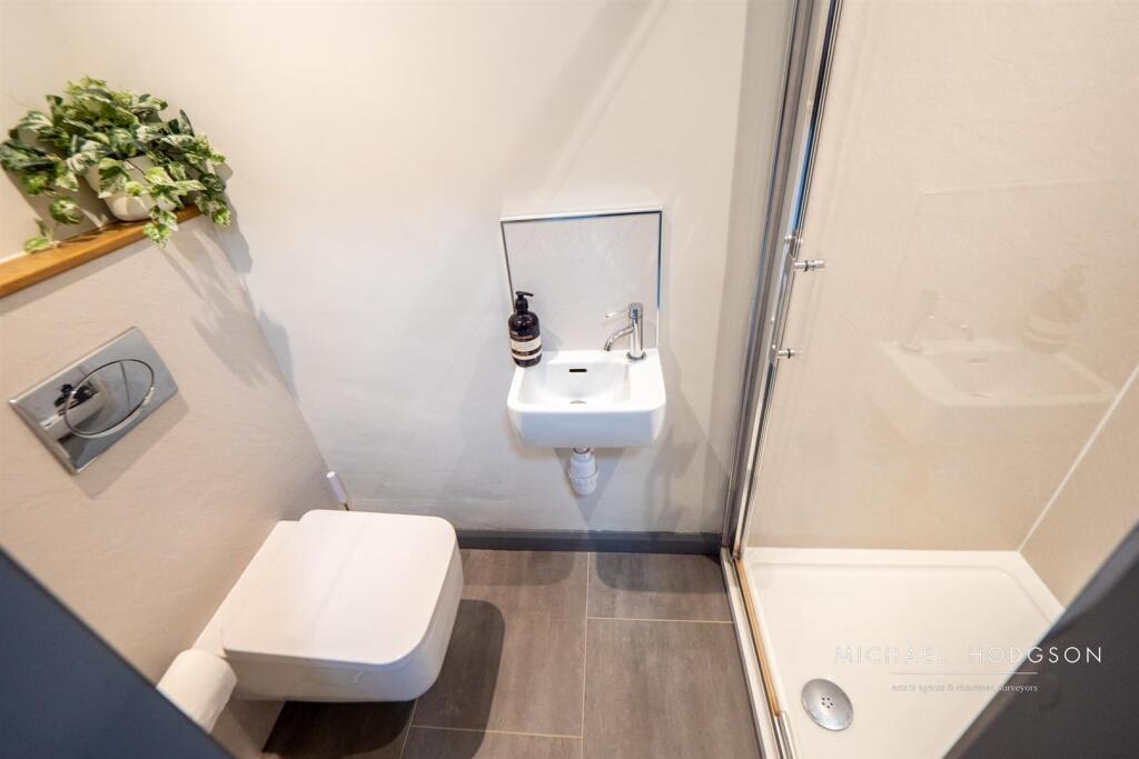
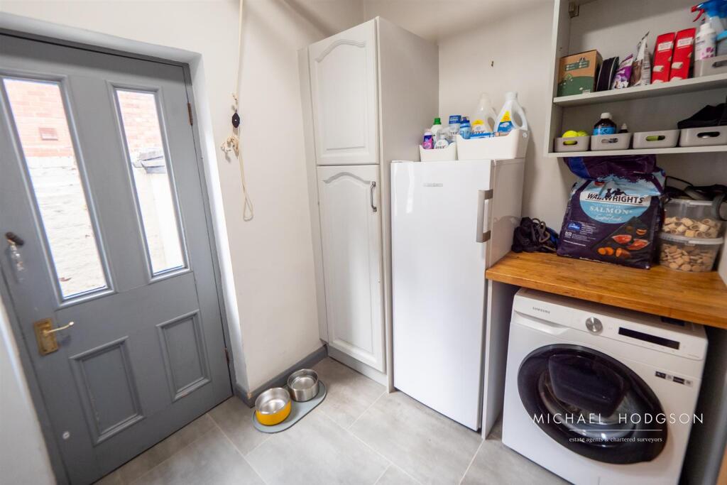
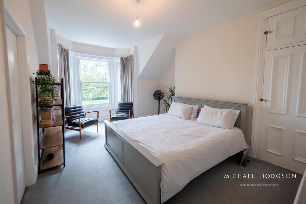
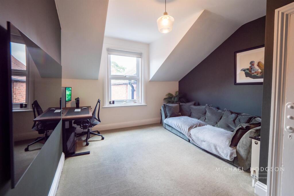
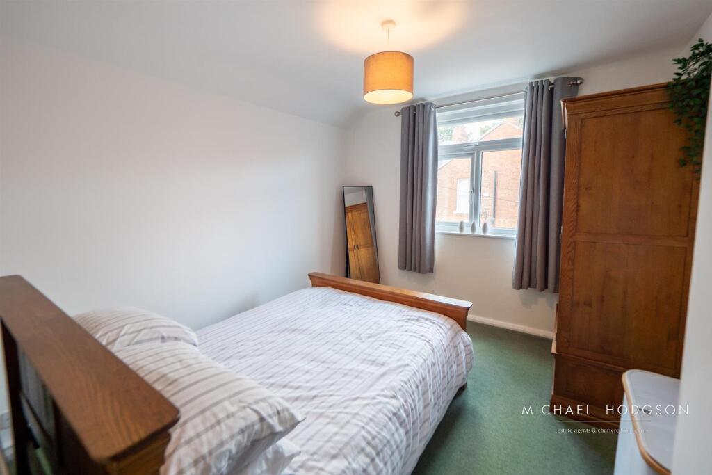
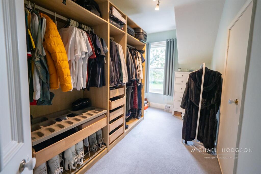
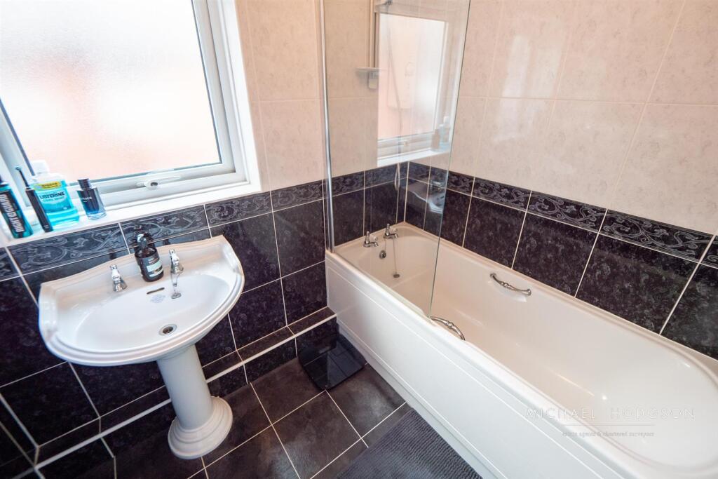
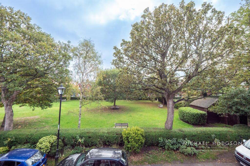
- Period mid-terraced residence situated on the highly regarded Holmlands Park North in Sunderland. The presentation shows a well-proportioned sitting room with a large bay window and period detailing, a spacious breakfast/kitchen and separate dining/sitting room, plus ground-floor shower room/WC. The first floor provides multiple double bedrooms (advertised as four) and a main bathroom. Externally the property benefits from a small front courtyard garden and an inner courtyard with access to a double-width garage; the development also offers landscaped communal gardens and a residents’ tennis court. Overall impression: a mid-to-large sized family home with attractive period features, flexible living space and good external amenity for the location. Viewing recommended to confirm exact room sizes and internal condition.
Image Descriptions
- Victorian terraced house exterior Victorian
- living room Victorian
Textual Property Features
Detected Visual Features
- Victorian
- terraced house
- brick facade
- bay windows
- period property
- historical
- residential
- urban
- gabled roof
- red brick
- central location
- high ceilings
- large room
- decorative fireplace
- ornate cornicing
- chandelier
- classic design
- potential for modernization
EPC Details
- Fully double glazed
- Cavity wall, filled cavity
- Boiler and radiators, mains gas
- Low energy lighting in 65% of fixed outlets
- Suspended, no insulation (assumed)
Nearby Schools
- Venerable Bede Church of England Academy
- Hill View Infant Academy
- Hopespring Sunderland
- Grangetown Primary School
- St Aidan's Catholic Academy
- St Mary's Catholic Primary School, Sunderland
- Barnes Infant Academy
- Argyle House School
- St Leonard's Catholic Primary School, Silksworth
- Plains Farm Academy
- Richard Avenue Primary School
- Barnes Junior School
- Diamond Hall Infant Academy
- Beacon of Light School
- Southmoor Academy
- St Joseph's Catholic Primary School, Sunderland
- New Silksworth Academy Junior
- New Silksworth Academy Infant
- Hill View Junior Academy
- Valley Road Academy
- Thornhill Academy
- St Anthony's Girls' Catholic Academy
- Hudson Road Primary School
- Diamond Hall Junior Academy
- Dame Dorothy Primary School
- Grange Park Primary School
Nearest General Shops
- Id: 10167596712
- Tags:
- Brand: Dignity
- Name: Thomas Downey Funeral Directors
- Shop: funeral_directors
- Website: https://www.dignityfunerals.co.uk/funeral-directors/locations/england/tyne---wear/sunderland/1-eden-terrace
- TagsNormalized:
- funeral
- funeral directors
- shop
- Lat: 54.9000369
- Lon: -1.3980854
- FullGeoHash: gcz024jzyhxu
- PartitionGeoHash: gcz0
- Images:
- FoodStandards: null
- Distance: 734.6
,- Id: 8890739895
- Tags:
- Name: Saints
- Shop: hairdresser
- TagsNormalized:
- Lat: 54.8931436
- Lon: -1.4003354
- FullGeoHash: gcz020ur9zdh
- PartitionGeoHash: gcz0
- Images:
- FoodStandards: null
- Distance: 664.1
,- Id: 392711364
- Tags:
- Addr:
- City: Sunderland
- Housenumber: 11-12
- Postcode: SR2 7BT
- Street: Belvedere Road
- Fhrs:
- Name: Dhillons
- Shop: newsagent
- Source:
- TagsNormalized:
- Lat: 54.8996638
- Lon: -1.3862257
- FullGeoHash: gcz026ntdx54
- PartitionGeoHash: gcz0
- Images:
- FoodStandards:
- Id: 651824
- FHRSID: 651824
- LocalAuthorityBusinessID: 001160-1
- BusinessName: Dhillons - Londis
- BusinessType: Retailers - other
- BusinessTypeID: 4613
- AddressLine1: 12
- AddressLine2: 11
- AddressLine3: Belvedere Road
- AddressLine4: Sunderland
- PostCode: SR2 7BT
- RatingValue: 5
- RatingKey: fhrs_5_en-GB
- RatingDate: 2020-02-05
- LocalAuthorityCode: 429
- LocalAuthorityName: Sunderland
- LocalAuthorityWebSite: http://www.sunderland.gov.uk
- LocalAuthorityEmailAddress: public.health@sunderland.gov.uk
- Scores:
- Hygiene: 0
- Structural: 0
- ConfidenceInManagement: 0
- NewRatingPending: false
- Geocode:
- Longitude: -1.38632030000000
- Latitude: 54.89956990000000
- Distance: 579.3
}
Nearest Religious buildings
- Id: 62194157
- Tags:
- Amenity: place_of_worship
- Building: yes
- Denomination: latter-day_saints
- Name: The Church of Jesus Christ of Latter-day Saints
- Religion: christian
- Source: OS Open data
- TagsNormalized:
- place of worship
- church
- christian
- Lat: 54.8907306
- Lon: -1.3877059
- FullGeoHash: gcz022t98jg6
- PartitionGeoHash: gcz0
- Images:
- FoodStandards: null
- Distance: 514.9
,- Id: 330243204
- Tags:
- Amenity: place_of_worship
- Building: church
- Denomination: methodist
- Name: St. John's Methodist Church
- Religion: christian
- TagsNormalized:
- place of worship
- church
- methodist
- christian
- Lat: 54.8961441
- Lon: -1.3847609
- FullGeoHash: gcz023x9hwzq
- PartitionGeoHash: gcz0
- Images:
- FoodStandards: null
- Distance: 386.3
,- Id: 772180112
- Tags:
- Amenity: place_of_worship
- Building: yes
- Denomination: lutheran
- Name: St Timothy's (Lutheran)
- Religion: christian
- TagsNormalized:
- place of worship
- christian
- church
- Lat: 54.892397
- Lon: -1.3890433
- FullGeoHash: gcz022ue2uqn
- PartitionGeoHash: gcz0
- Images:
- FoodStandards: null
- Distance: 311.8
}
Nearest Medical buildings
- Id: 731635860
- Tags:
- Amenity: hospital
- Healthcare: hospital
- Name: Sunderland Children's Centre
- TagsNormalized:
- Lat: 54.8927253
- Lon: -1.4057641
- FullGeoHash: gcz020bm73dm
- PartitionGeoHash: gcz0
- Images:
- FoodStandards: null
- Distance: 1010
,- Id: 3860597083
- Tags:
- Amenity: pharmacy
- Brand: Boots
- Brand:wikidata: Q6123139
- Brand:wikipedia: en:Boots UK
- Healthcare: pharmacy
- Name: Boots
- TagsNormalized:
- pharmacy
- boots
- health
- healthcare
- Lat: 54.9034506
- Lon: -1.3848674
- FullGeoHash: gcz026zef2bp
- PartitionGeoHash: gcz0
- Images:
- FoodStandards: null
- Distance: 999
,- Id: 62192828
- Tags:
- Addr:
- City: Sunderland
- Country: GB
- Postcode: SR2 9HP
- Street: Queen Alexandra Road
- Amenity: hospital
- Building: yes
- Contact:
- Phone: +44 191 565 6256
- Website: https://www.stsft.nhs.uk/services/sunderland-eye-infirmary/
- Healthcare: hospital
- Name: Sunderland Eye Infirmary
- Source: OS Open data
- Wikidata: Q30282223
- TagsNormalized:
- Lat: 54.8892497
- Lon: -1.3810852
- FullGeoHash: gcz0286343u0
- PartitionGeoHash: gcz0
- Images:
- FoodStandards: null
- Distance: 884.4
,- Id: 2756625917
- Tags:
- Amenity: doctors
- Healthcare: doctor
- Name: Park Lane Practice
- Operator: NHS
- TagsNormalized:
- doctor
- doctors
- health
- healthcare
- Lat: 54.9013105
- Lon: -1.3845915
- FullGeoHash: gcz026rz2dj9
- PartitionGeoHash: gcz0
- Images:
- FoodStandards: null
- Distance: 790.1
}
Nearest Airports
- Id: 51496177
- Tags:
- Addr:
- City: Newcastle upon Tyne
- Housename: Newcastle International Airport
- Postcode: NE13 8BZ
- Street: Woolsington
- Aerodrome: international
- Aerodrome:type: public
- Aeroway: aerodrome
- Contact:
- Website: http://www.newcastleairport.com
- Ele: 81
- Iata: NCL
- Icao: EGNT
- Ifr: yes
- Name: Newcastle International Airport
- Old_name: Woolsington Aerodrome
- Operator: Newcastle International Airport Ltd
- Operator:type: private
- Phone: +44 871 882 1121
- Ref: NCL
- Size: 4500000
- Source: Bing
- Vfr: yes
- Website: https://www.newcastleairport.com/
- Wheelchair: yes
- Wikidata: Q8975
- Wikipedia: en:Newcastle International Airport
- TagsNormalized:
- airport
- international airport
- Lat: 55.0385826
- Lon: -1.6925163
- FullGeoHash: gcyc17rwcx2m
- PartitionGeoHash: gcyc
- Images:
- FoodStandards: null
- Distance: 25025.5
,- Id: 224091164
- Tags:
- Addr:
- City: Newcastle upon Tyne
- Postcode: NE13 8BZ
- Street: Woolsington
- Building: hotel
- Contact:
- Facebook: https://www.facebook.com/doubletree.newcastle
- Google_plus: https://plus.google.com/115643701064921491168/about
- Twitter: https://twitter.com/dtnewcastle_int
- Email: info@doubletree-newcastle.co.uk
- Fhrs:
- Name: DoubleTree by Hilton Hotel Newcastle International Airport
- Operator: Hilton Worldwide
- Phone: +44 1661 824266
- Rooms: 179
- Smoking: no
- Stars: 4
- Tourism: hotel
- Website: https://doubletree3.hilton.com/en/hotels/united-kingdom/doubletree-by-hilton-hotel-newcastle-international-airport-NCLNADI/index.html?WT.mc_id=zELWAKN0EMEA1DT2DMH3LocalSearch4DGGenericx6NCLNADI
- Wheelchair: yes
- TagsNormalized:
- hotel
- airport
- international airport
- tourism
- major airport
- Lat: 55.0364476
- Lon: -1.7124358
- FullGeoHash: gcyc1514937m
- PartitionGeoHash: gcyc
- Images:
- FoodStandards:
- Id: 236731
- FHRSID: 236731
- LocalAuthorityBusinessID: 11/00246/MIXED
- BusinessName: Doubletree By Hilton Hotel
- BusinessType: Hotel/bed & breakfast/guest house
- BusinessTypeID: 7842
- AddressLine1: Doubletree By Hilton Newcastle Airport
- AddressLine2: Woolsington
- AddressLine3: Newcastle Upon Tyne
- AddressLine4: null
- PostCode: NE13 8BZ
- RatingValue: 5
- RatingKey: fhrs_5_en-GB
- RatingDate: 2019-08-13
- LocalAuthorityCode: 416
- LocalAuthorityName: Newcastle Upon Tyne
- LocalAuthorityWebSite: http://www.newcastle.gov.uk/
- LocalAuthorityEmailAddress: psr@newcastle.gov.uk
- Scores:
- Hygiene: 0
- Structural: 5
- ConfidenceInManagement: 0
- NewRatingPending: false
- Geocode:
- Longitude: -1.71254240000000
- Latitude: 55.03664040000000
- Distance: 25873.1
}
Nearest Leisure Facilities
- Id: 367567574
- Tags:
- Leisure: pitch
- Source: Bing
- Sport: tennis
- TagsNormalized:
- Lat: 54.8944283
- Lon: -1.3873395
- FullGeoHash: gcz023jz0xhe
- PartitionGeoHash: gcz0
- Images:
- FoodStandards: null
- Distance: 214.8
,- Id: 732482373
- Tags:
- Leisure: pitch
- Sport: soccer
- TagsNormalized:
- Lat: 54.8945349
- Lon: -1.3933257
- FullGeoHash: gcz0231rv4vp
- PartitionGeoHash: gcz0
- Images:
- FoodStandards: null
- Distance: 189.9
,- Id: 912699841
- Tags:
- Leisure: pitch
- Sport: bowls
- TagsNormalized:
- Lat: 54.8943316
- Lon: -1.3879527
- FullGeoHash: gcz023jqdm56
- PartitionGeoHash: gcz0
- Images:
- FoodStandards: null
- Distance: 182.9
,- Id: 732472171
- Tags:
- Leisure: track
- Sport: running
- TagsNormalized:
- track
- leisure
- running
- sports
- Lat: 54.8961058
- Lon: -1.3922777
- FullGeoHash: gcz023d0vxfd
- PartitionGeoHash: gcz0
- Images:
- FoodStandards: null
- Distance: 161.4
,- Id: 330245516
- Tags:
- TagsNormalized:
- Lat: 54.8947938
- Lon: -1.3882242
- FullGeoHash: gcz023m1k530
- PartitionGeoHash: gcz0
- Images:
- FoodStandards: null
- Distance: 149.2
}
Nearest Tourist attractions
- Id: 8868405843
- Tags:
- Name: Pigment And Toil
- Tourism: gallery
- TagsNormalized:
- Lat: 54.9059667
- Lon: -1.3852377
- FullGeoHash: gcz027r63w5c
- PartitionGeoHash: gcz0
- Images:
- FoodStandards: null
- Distance: 1257.4
,- Id: 8777061308
- Tags:
- TagsNormalized:
- Lat: 54.8947223
- Lon: -1.4094826
- FullGeoHash: gcybrcm8utvt
- PartitionGeoHash: gcyb
- Images:
- FoodStandards: null
- Distance: 1214
,- Id: 30977185
- Tags:
- Addr:
- City: Sunderland
- Postcode: SR1 1PP
- Street: Burdon Road
- Building: yes
- Name: Sunderland Museum and Winter Gardens
- Opening_hours: Mo-Sa 10:00-17:00; Su 14:00-17:00
- Operator: Sunderland City Council
- Phone: +44 191 553 2323
- Tourism: museum
- Website: https://www.sunderland.gov.uk/index.aspx?articleid=8208
- Wikidata: Q7639734
- Wikipedia: en:Sunderland Museum and Winter Gardens
- TagsNormalized:
- Lat: 54.904131
- Lon: -1.3803401
- FullGeoHash: gcz02dfzexzf
- PartitionGeoHash: gcz0
- Images:
- FoodStandards: null
- Distance: 1198.8
}
Nearest Hotels
- Id: 774694067
- Tags:
- Addr:
- City: Sunderland
- Housenumber: 34
- Postcode: SR1 1EE
- Street: Norfolk Street
- Amenity: social_facility
- Building: yes
- Fhrs:
- Name: Norfolk Hotel
- Social_facility: shelter
- Social_facility:for: homeless
- Source:
- TagsNormalized:
- Lat: 54.905367
- Lon: -1.3768398
- FullGeoHash: gcz02ejqvq1z
- PartitionGeoHash: gcz0
- Images:
- FoodStandards: null
- Distance: 1440.1
,- Id: 732472173
- Tags:
- Addr:
- City: Sunderland
- Housenumber: 1-3
- Postcode: SR1 3QD
- Street: Hind Street
- Brand: Premier Inn
- Brand:wikidata: Q2108626
- Brand:wikipedia: en:Premier Inn
- Building: yes
- Fhrs:
- Name: Premier Inn
- Source:
- Tourism: hotel
- TagsNormalized:
- Lat: 54.9059898
- Lon: -1.3913188
- FullGeoHash: gcz0276fefmd
- PartitionGeoHash: gcz0
- Images:
- FoodStandards: null
- Distance: 1215.1
,- Id: 457101680
- Tags:
- Addr:
- City: Sunderland
- Postcode: SR1 3PY
- Street: Low Row
- Brand: Travelodge
- Brand:wikidata: Q9361374
- Brand:wikipedia: en:Travelodge UK
- Building: yes
- Fhrs:
- Authority: Sunderland
- Id: 652574
- Local_authority_id: 002454-1
- Name: Travelodge
- Source:
- Tourism: hotel
- TagsNormalized:
- Lat: 54.9051795
- Lon: -1.3894874
- FullGeoHash: gcz027hjye71
- PartitionGeoHash: gcz0
- Images:
- FoodStandards: null
- Distance: 1125.8
}
Tags
- Victorian
- terraced house
- brick facade
- bay windows
- period property
- historical
- residential
- urban
- gabled roof
- red brick
- central location
- Victorian
- bay windows
- high ceilings
- large room
- decorative fireplace
- ornate cornicing
- chandelier
- classic design
- potential for modernization
Local Market Stats
- Average Price/sqft: £136
- Avg Income: £36300
- Rental Yield: 4.6%
- Social Housing: 17%
- Planning Success Rate: 93%
AirBnB Data
- 1km average: £110/night
- Listings in 1km: 2
Similar Properties
 5 bedroom terraced house for sale in Brookside Gardens, Ashbrooke, Sunderland, SR2 — £355,000 • 5 bed • 1 bath • 1885 ft²
 4 bedroom terraced house for sale in Otto Terrace, Thornhill, SR2 — £210,000 • 4 bed • 1 bath • 1615 ft²
 4 bedroom cottage for sale in Ennerdale, Ashbrooke, Sunderland, SR2 — £149,950 • 4 bed • 1 bath • 679 ft²
 4 bedroom terraced house for sale in Otto Terrace, Thornhill, SR2 — £140,750 • 4 bed • 1 bath • 1145 ft²
 3 bedroom terraced house for sale in Ennerdale, Ashbrooke, Sunderland, SR2 — £160,000 • 3 bed • 1 bath • 1174 ft²
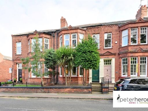 4 bedroom terraced house for sale in The Westlands, High Barnes, Sunderland, SR4 — £250,000 • 4 bed • 1 bath • 1775 ft²
Meta
- {
"@context": "https://schema.org",
"@type": "Residence",
"name": "4 bedroom terraced house for sale in Holmlands Park North,…",
"description": "",
"url": "https://propertypiper.co.uk/property/8fb77cf1-3739-411d-844c-cba5ea98aaef",
"image": "https://image-a.propertypiper.co.uk/7ca77415-21a9-4961-8688-4970a1a6afbd-1024.jpeg",
"address": {
"@type": "PostalAddress",
"streetAddress": "16 HOLMLANDS PARK NORTH SUNDERLAND",
"postalCode": "SR2 7SE",
"addressLocality": "Sunderland",
"addressRegion": "Sunderland Central",
"addressCountry": "England"
},
"geo": {
"@type": "GeoCoordinates",
"latitude": 54.89507205201203,
"longitude": -1.390506741447612
},
"numberOfRooms": 4,
"numberOfBathroomsTotal": 2,
"floorSize": {
"@type": "QuantitativeValue",
"value": 1615,
"unitCode": "FTK"
},
"offers": {
"@type": "Offer",
"price": 320000,
"priceCurrency": "GBP",
"availability": "https://schema.org/InStock"
},
"additionalProperty": [
{
"@type": "PropertyValue",
"name": "Feature",
"value": "Victorian"
},
{
"@type": "PropertyValue",
"name": "Feature",
"value": "terraced house"
},
{
"@type": "PropertyValue",
"name": "Feature",
"value": "brick facade"
},
{
"@type": "PropertyValue",
"name": "Feature",
"value": "bay windows"
},
{
"@type": "PropertyValue",
"name": "Feature",
"value": "period property"
},
{
"@type": "PropertyValue",
"name": "Feature",
"value": "historical"
},
{
"@type": "PropertyValue",
"name": "Feature",
"value": "residential"
},
{
"@type": "PropertyValue",
"name": "Feature",
"value": "urban"
},
{
"@type": "PropertyValue",
"name": "Feature",
"value": "gabled roof"
},
{
"@type": "PropertyValue",
"name": "Feature",
"value": "red brick"
},
{
"@type": "PropertyValue",
"name": "Feature",
"value": "central location"
},
{
"@type": "PropertyValue",
"name": "Feature",
"value": "Victorian"
},
{
"@type": "PropertyValue",
"name": "Feature",
"value": "bay windows"
},
{
"@type": "PropertyValue",
"name": "Feature",
"value": "high ceilings"
},
{
"@type": "PropertyValue",
"name": "Feature",
"value": "large room"
},
{
"@type": "PropertyValue",
"name": "Feature",
"value": "decorative fireplace"
},
{
"@type": "PropertyValue",
"name": "Feature",
"value": "ornate cornicing"
},
{
"@type": "PropertyValue",
"name": "Feature",
"value": "chandelier"
},
{
"@type": "PropertyValue",
"name": "Feature",
"value": "classic design"
},
{
"@type": "PropertyValue",
"name": "Feature",
"value": "potential for modernization"
}
]
}