DN3 3NG - 3 bedroom detached bungalow for sale in 2 Chapel Lane, Bran…
View on Property Piper
3 bedroom detached bungalow for sale in 2 Chapel Lane, Branton, Doncaster, DN3
Property Details
- Price: £249900
- Bedrooms: 3
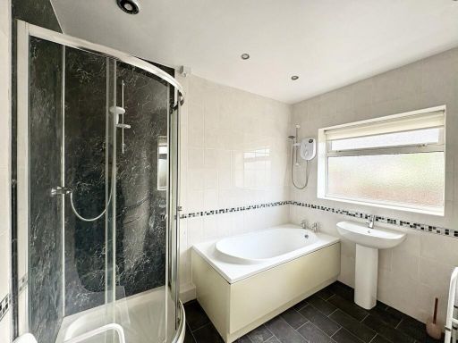
- Bathrooms: 1
- Property Type: undefined
- Property SubType: undefined
Brochure Descriptions
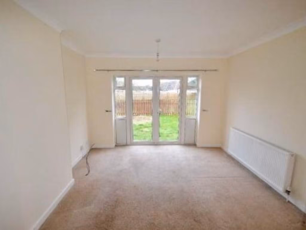
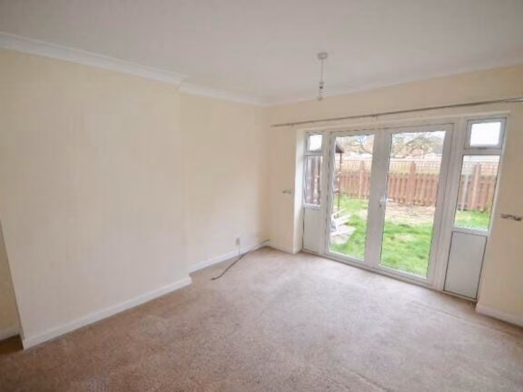
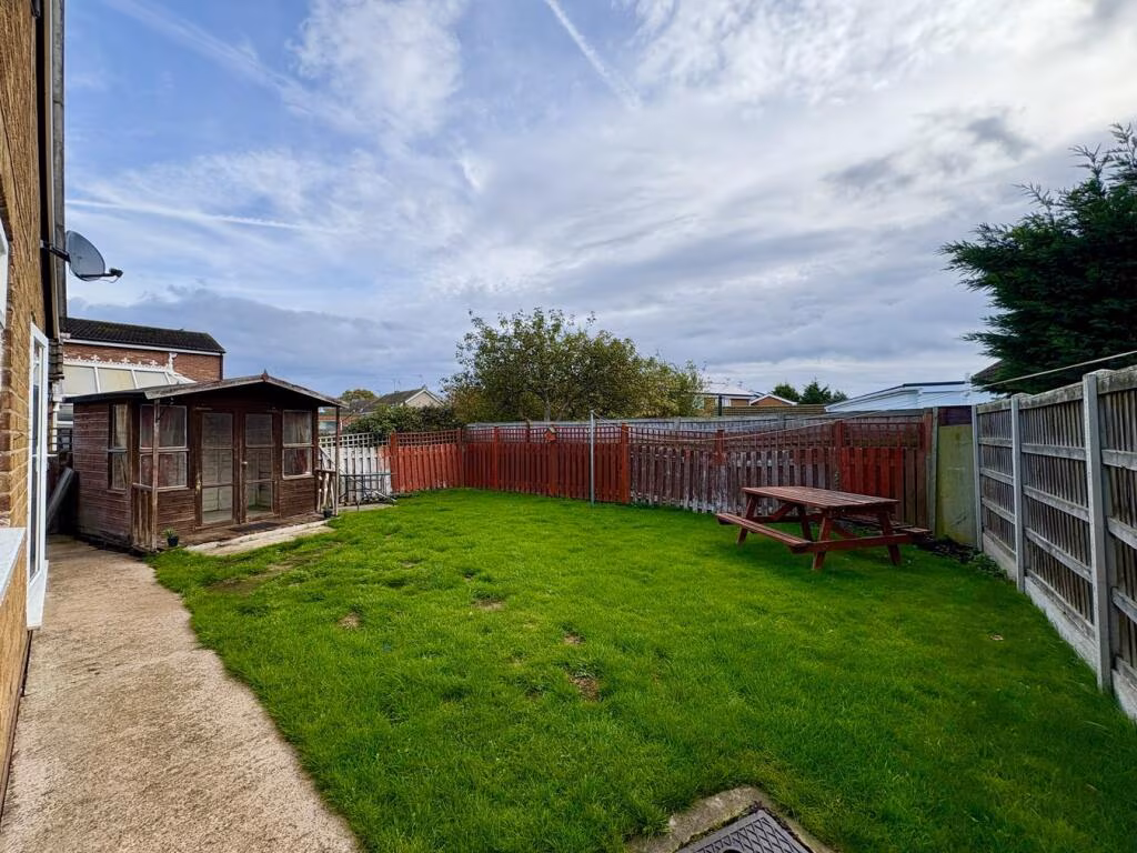
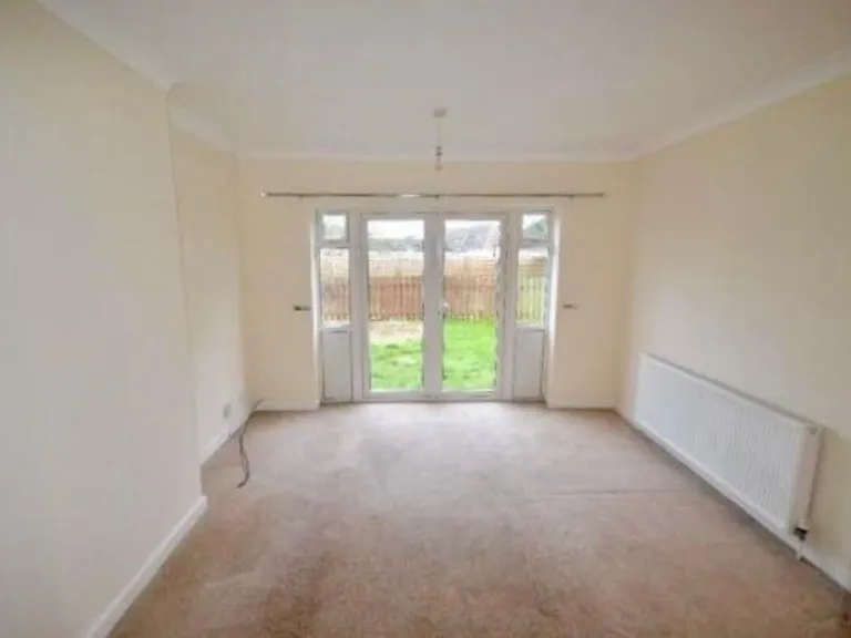
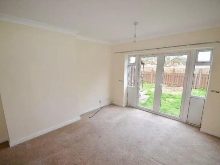
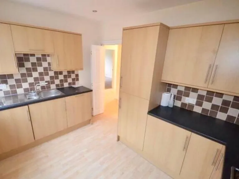
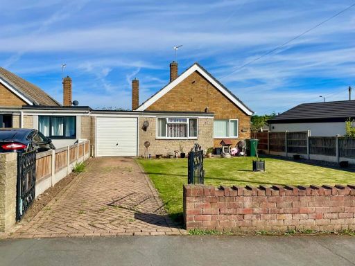
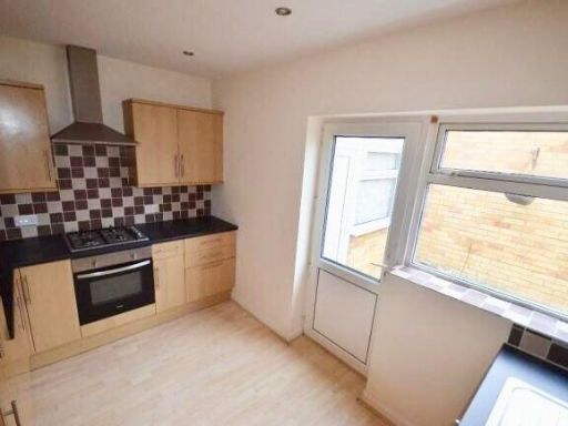
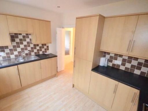
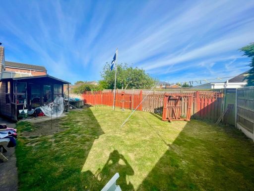
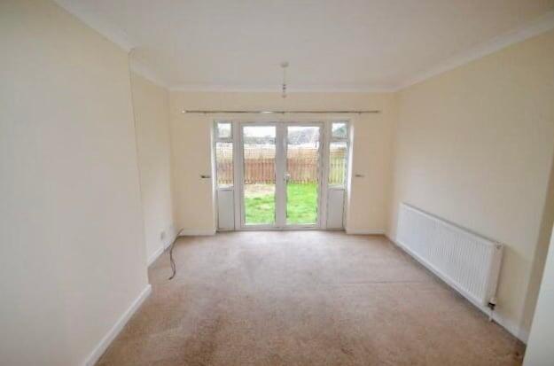
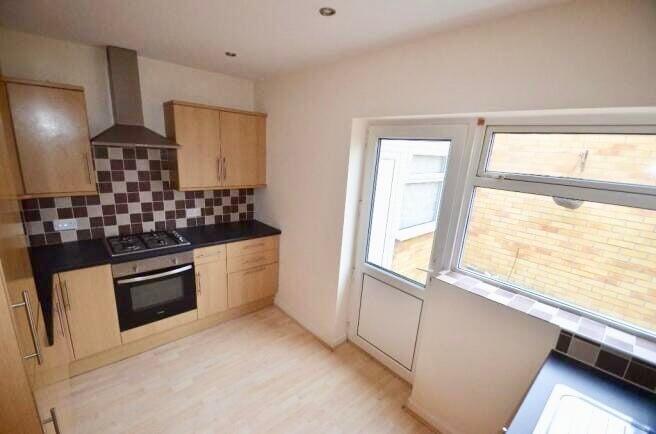
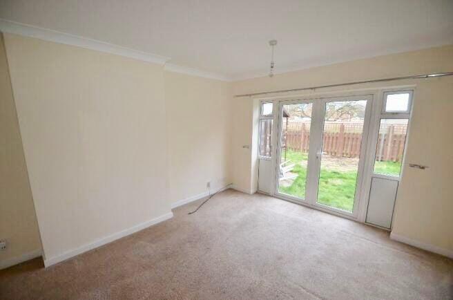
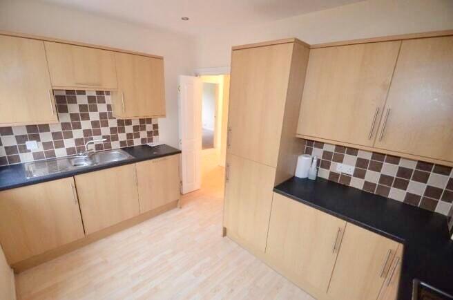
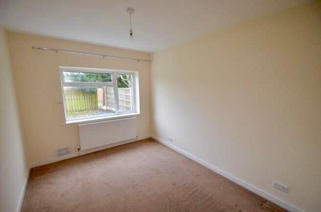
- This property is a detached bungalow featuring a spacious and well-maintained exterior with a block paved driveway and a front garden. Three bedrooms are included, with ample natural light illuminating the space through French doors leading to the garden, providing a pleasant rear aspect. The kitchen is modern, fitted with integrated appliances, promising functionality and convenience. The living area is large and suitable for both lounge and dining activities, also opening up to the outdoor garden area. This property includes a sizeable garage suitable for two cars, and the surrounding environment suggests a neighborhood rather than an open scenic view.
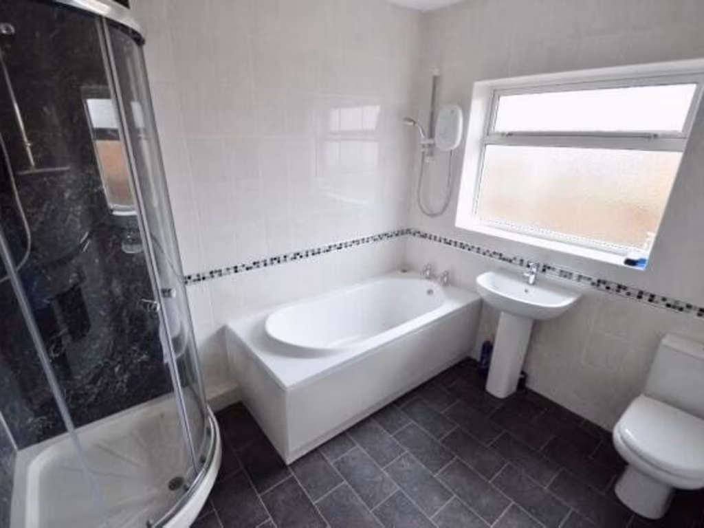
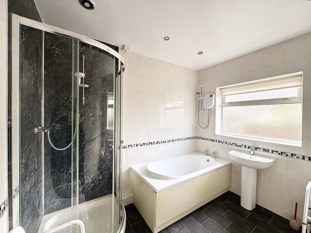
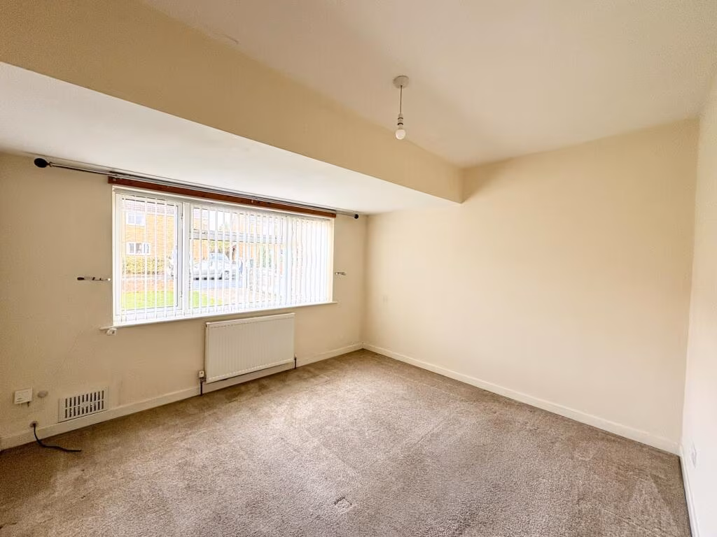
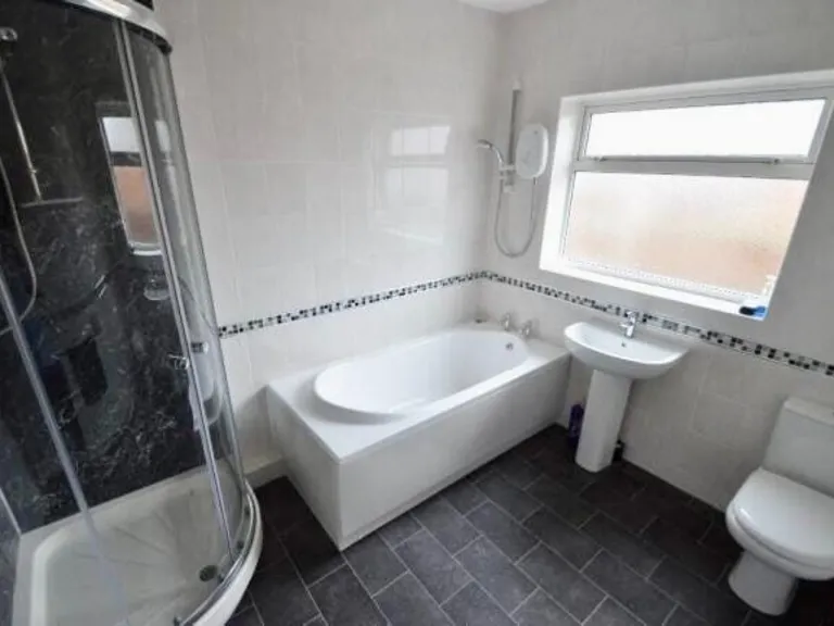
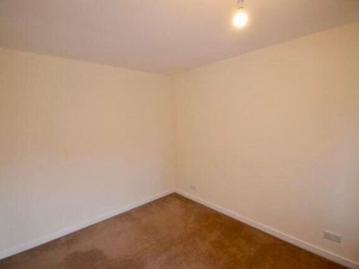
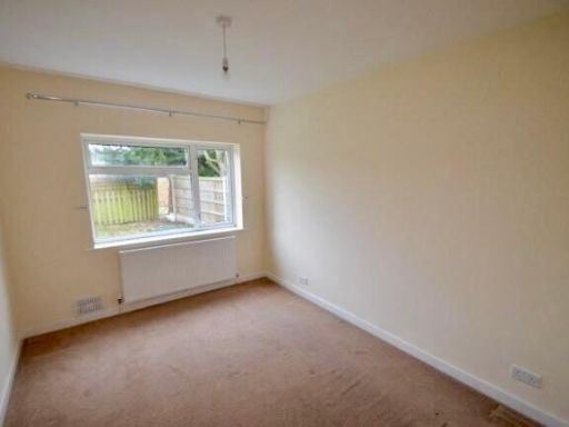
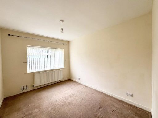
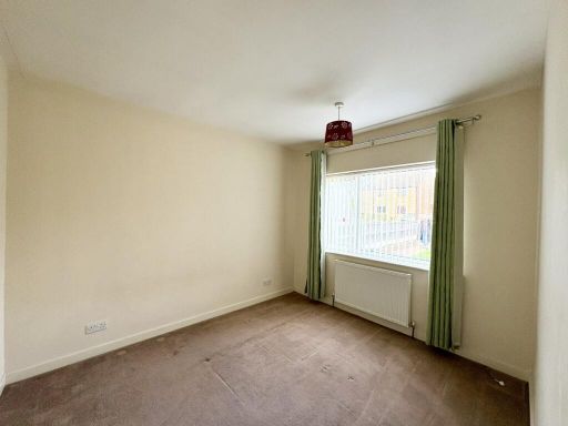
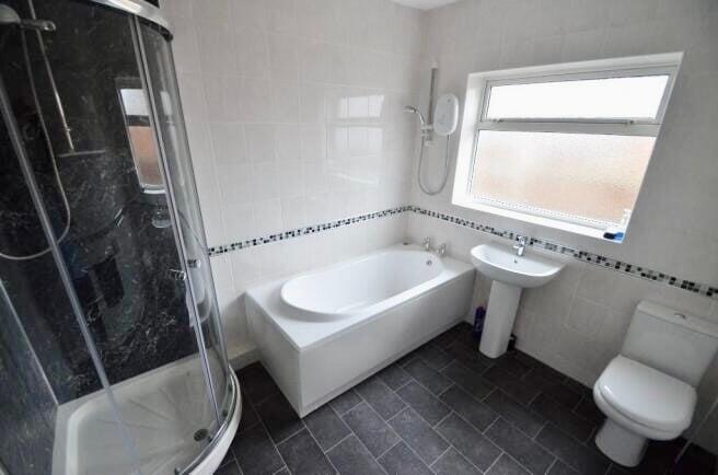
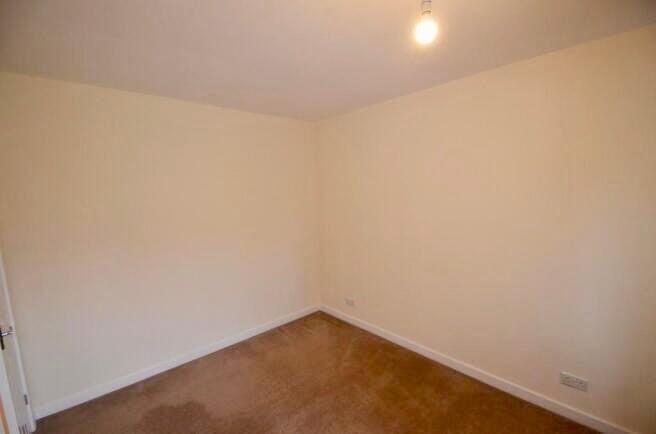
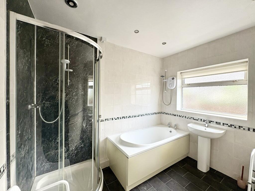
- This property is a three-bedroom detached bungalow located in the sought-after village of Branton, Doncaster. The bungalow is arranged to offer spacious living areas including a lounge/dining room with French doors that open to a medium-sized garden. The accommodation comprises an entrance hall leading to three bedrooms, a family bathroom with both shower and bath facilities, and a kitchen fitted with modern integrated appliances. The bungalow includes a spacious driveway with parking capacity for at least two cars, alongside a garage with power and lighting. Overall, the property is presented in good condition with tasteful interior finishes such as tiled splashbacks and carpet throughout most rooms. The garden offers a simple yet serene outdoor experience. This dwelling is ideally situated for access to local amenities and offers a well-integrated residential setting.
Image Descriptions
- single-family house mid-20th century bungalow
- living room modern
Floorplan Description
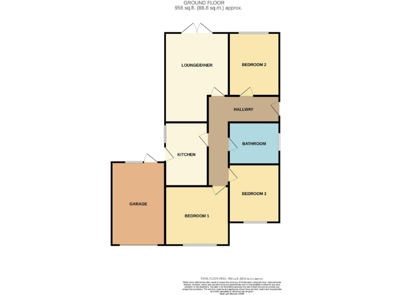
- A single story property with a lounge, kitchen, bathroom, and three bedrooms.
Rooms
- Lounge/Diner:
- Bedroom 1:
- Bedroom 2:
- Bedroom 3:
- Kitchen:
- Bathroom:
Textual Property Features
- Has Garden
- Chain Free
- Success
Detected Visual Features
- bungalow
- detached
- single-storey
- mid-20th century
- brick
- garage
- driveway
- garden
- lawn
- fencing
- modern
- living room
- large windows
- natural light
- garden access
- french doors
EPC Details
- Fully double glazed
- Cavity wall, filled cavity
- Boiler and radiators, mains gas
- Low energy lighting in 25% of fixed outlets
- Suspended, no insulation (assumed)
Nearby Schools
- Hatchell Wood Primary Academy
- Auckley School
- Branton St Wilfrid's Church of England Primary School
- Hawthorn Primary School
- The Hayfield School
- Bessacarr Primary
- Southfield Primary
- Edenthorpe Hall Primary Academy
- St Oswald's CofE Academy
- St Wilfrid's Academy, Doncaster
- The McAuley Catholic High School
- Tranmoor Primary
- Armthorpe Shaw Wood Academy
- Dunsville Primary School
- Rossington All Saints Academy
- Grange Lane Infant Academy
- Pheasant Bank Academy
- Willow Primary School
- Outwood Academy Danum
- Our Lady of Sorrows Catholic Voluntary Academy
- Armthorpe Academy
- Hungerhill School
- Canon Popham CofE Primary Academy
- Kirk Sandall Junior School
- St Joseph's School, a Catholic Voluntary Academy
- Rossington St Michael's CofE Primary School
- Hill House School
- Hayfield Lane Primary School
Nearest Bars And Restaurants
- Id: 415257436
- Tags:
- Amenity: cafe
- Building: yes
- Name: Safari Café
- TagsNormalized:
- Lat: 53.5044867
- Lon: -1.0411426
- FullGeoHash: gcx22k1y5x5z
- PartitionGeoHash: gcx2
- Images:
- FoodStandards: null
- Distance: 583.2
,- Id: 4163033189
- Tags:
- TagsNormalized:
- Lat: 53.504643
- Lon: -1.0401563
- FullGeoHash: gcx22k4x4s75
- PartitionGeoHash: gcx2
- Images:
- FoodStandards: null
- Distance: 529.3
,- Id: 415257419
- Tags:
- Amenity: restaurant
- Building: yes
- Name: Tsavo Bakehouse
- TagsNormalized:
- Lat: 53.5045325
- Lon: -1.0396897
- FullGeoHash: gcx22k4ymrz0
- PartitionGeoHash: gcx2
- Images:
- FoodStandards: null
- Distance: 522.1
,- Id: 4081284304
- Tags:
- Amenity: fast_food
- Name: Burger Jim
- TagsNormalized:
- Lat: 53.5074617
- Lon: -1.0431056
- FullGeoHash: gcx22k8rtcu1
- PartitionGeoHash: gcx2
- Images:
- FoodStandards: null
- Distance: 518.5
,- Id: 4081284305
- Tags:
- Amenity: cafe
- Cuisine: coffee_shop
- Name: Badger
- TagsNormalized:
- Lat: 53.5074712
- Lon: -1.0430063
- FullGeoHash: gcx22k8x85w4
- PartitionGeoHash: gcx2
- Images:
- FoodStandards: null
- Distance: 511.9
}
Nearest General Shops
- Id: 265141053
- Tags:
- Landuse: industrial
- Name: Branton Farm Nurseries
- Shop: garden_centre
- TagsNormalized:
- industrial
- farm
- nurseries
- garden centre
- shop
- Lat: 53.5084614
- Lon: -1.0465935
- FullGeoHash: gcx22hvvks5m
- PartitionGeoHash: gcx2
- Images:
- FoodStandards: null
- Distance: 736.2
,- Id: 415257434
- Tags:
- TagsNormalized:
- Lat: 53.5041163
- Lon: -1.0414674
- FullGeoHash: gcx22k1sh41t
- PartitionGeoHash: gcx2
- Images:
- FoodStandards: null
- Distance: 628.6
,- Id: 406001817
- Tags:
- Building: yes
- Name: Attenborough Cars
- Shop: car
- TagsNormalized:
- Lat: 53.507405
- Lon: -1.0423518
- FullGeoHash: gcx22k8zprnp
- PartitionGeoHash: gcx2
- Images:
- FoodStandards: null
- Distance: 471.6
}
Nearest Grocery shops
- Id: 291760730
- Tags:
- Created_by: Potlatch 0.10b
- Name: The Co-operative
- Shop: convenience
- TagsNormalized:
- Lat: 53.50107
- Lon: -1.0676648
- FullGeoHash: gcx0rewd3d73
- PartitionGeoHash: gcx0
- Images:
- FoodStandards: null
- Distance: 2284.3
,- Id: 4081274554
- Tags:
- Addr:
- Name: The Co-operative Food
- Operator: The Co-operative Group
- Shop: supermarket
- TagsNormalized:
- the co-operative food
- food
- shop
- Lat: 53.4903312
- Lon: -1.0225746
- FullGeoHash: gcx229x7u23n
- PartitionGeoHash: gcx2
- Images:
- FoodStandards: null
- Distance: 2192.5
,- Id: 4081284301
- Tags:
- Brand: Costcutter
- Brand:wikidata: Q5175072
- Name: Costcutter
- Shop: convenience
- TagsNormalized:
- costcutter
- convenience
- shop
- Lat: 53.5074712
- Lon: -1.0428266
- FullGeoHash: gcx22k8xs7s4
- PartitionGeoHash: gcx2
- Images:
- FoodStandards: null
- Distance: 500.3
}
Nearest Supermarkets
- Id: 694021929
- Tags:
- Brand: ALDI
- Brand:wikidata: Q41171672
- Brand:wikipedia: en:Aldi
- Building: yes
- Contact:
- Website: https://stores.aldi.co.uk/armthorpe/church-street
- Name: Aldi
- Shop: supermarket
- TagsNormalized:
- Lat: 53.5347233
- Lon: -1.0552596
- FullGeoHash: gcx0xcxw6etr
- PartitionGeoHash: gcx0
- Images:
- FoodStandards: null
- Distance: 3196.4
,- Id: 285978526
- Tags:
- Brand: Co-op Food
- Brand:wikidata: Q3277439
- Brand:wikipedia: en:Co-op Food
- Name: Co-op Food
- Operator: The Co-operative Group
- Operator:wikidata: Q117202
- Shop: supermarket
- TagsNormalized:
- co-op
- co-op food
- food
- supermarket
- shop
- Lat: 53.5084044
- Lon: -1.0754941
- FullGeoHash: gcx0rsbv51t3
- PartitionGeoHash: gcx0
- Images:
- FoodStandards: null
- Distance: 2647.4
,- Id: 941443832
- Tags:
- Addr:
- City: Doncaster
- Postcode: DN9 3NB
- Street: Anson Grove
- Suburb: Auckley
- Brand: Co-op Food
- Brand:wikidata: Q3277439
- Brand:wikipedia: en:Co-op Food
- Building: yes
- Name: Co-op Food
- Opening_hours: Mo-Su 07:00-22:00
- Operator: The Co-operative Group
- Operator:wikidata: Q117202
- Payment:
- Cash: yes
- Credit_cards: yes
- Debit_cards: yes
- Phone: +44 1302 772374
- Shop: supermarket
- Website: https://www.coop.co.uk/store-finder/DN9-3NB/hayfield-lane?utm_source=gmb&utm_medium=organic&utm_campaign=gmb-Auckley-Hayfield-Lane-Doncaster
- TagsNormalized:
- co-op
- co-op food
- food
- supermarket
- shop
- Lat: 53.4903144
- Lon: -1.0226836
- FullGeoHash: gcx229x79trf
- PartitionGeoHash: gcx2
- Images:
- FoodStandards: null
- Distance: 2191.4
}
Nearest Religious buildings
- Id: 265055399
- Tags:
- Name: Church Plantation
- Natural: wood
- TagsNormalized:
- Lat: 53.5068539
- Lon: -1.0713332
- FullGeoHash: gcx0rseuh0s0
- PartitionGeoHash: gcx0
- Images:
- FoodStandards: null
- Distance: 2379.3
,- Id: 699912071
- Tags:
- Amenity: place_of_worship
- Building: yes
- Denomination: anglican
- Name: St Wilfred's Cantley
- Religion: christian
- Wikidata: Q17537703
- Wikipedia: en:St Wilfrid's Church, Cantley
- TagsNormalized:
- place of worship
- anglican
- christian
- church
- Lat: 53.5060357
- Lon: -1.0689599
- FullGeoHash: gcx0rsmx5rvx
- PartitionGeoHash: gcx0
- Images:
- FoodStandards: null
- Distance: 2232.2
,- Id: 835459964
- Tags:
- Amenity: place_of_worship
- Building: church
- Denomination: anglican
- Name: St Saviour
- Religion: christian
- Wikidata: Q26444447
- TagsNormalized:
- place of worship
- church
- anglican
- christian
- Lat: 53.4993026
- Lon: -1.0187663
- FullGeoHash: gcx22g60j0bf
- PartitionGeoHash: gcx2
- Images:
- FoodStandards: null
- Distance: 1504.8
}
Nearest Airports
- Id: 100889514
- Tags:
- Addr:
- Aerodrome: international
- Aerodrome:type: public
- Area: yes
- Cities_served: Doncaster, Sheffield
- Closest_town: Doncaster
- Disused:
- Ele: 17
- Iata: DSA
- Icao: EGCN
- Ifr: yes
- Is_in: Finningley
- Name: Doncaster Sheffield Airport
- Old_iata: FNY
- Old_icao: EGXI
- Old_name: RAF Finningley
- Old_operator: Royal Air Force
- Old_type: military
- Operator: Doncaster Sheffield Airport Limited/Peel Airports
- Source: wikipedia
- Tower_frequency: 128.775
- Vfr: yes
- Website: https://www.robinhoodairport.com/
- Wikidata: Q8996
- Wikipedia: en:Robin Hood Airport Doncaster Sheffield
- TagsNormalized:
- airport
- international airport
- Lat: 53.4761577
- Lon: -1.0054086
- FullGeoHash: gcx21p5chq34
- PartitionGeoHash: gcx2
- Images:
- FoodStandards: null
- Distance: 4109
}
Nearest Leisure Facilities
- Id: 4162822461
- Tags:
- TagsNormalized:
- picnic
- picnic table
- leisure
- Lat: 53.5026825
- Lon: -1.0409237
- FullGeoHash: gcx227f58wzh
- PartitionGeoHash: gcx2
- Images:
- FoodStandards: null
- Distance: 740.7
,- Id: 4162822462
- Tags:
- TagsNormalized:
- picnic
- picnic table
- leisure
- Lat: 53.5033424
- Lon: -1.0399911
- FullGeoHash: gcx227fxw3ym
- PartitionGeoHash: gcx2
- Images:
- FoodStandards: null
- Distance: 646.8
,- Id: 415233418
- Tags:
- Leisure: playground
- Name: Adventure Playground
- TagsNormalized:
- Lat: 53.5031475
- Lon: -1.0375366
- FullGeoHash: gcx227uqrtsd
- PartitionGeoHash: gcx2
- Images:
- FoodStandards: null
- Distance: 610.5
,- Id: 306842881
- Tags:
- TagsNormalized:
- Lat: 53.5124163
- Lon: -1.0308673
- FullGeoHash: gcx22t9k7j3t
- PartitionGeoHash: gcx2
- Images:
- FoodStandards: null
- Distance: 531.1
,- Id: 415257418
- Tags:
- Building: yes
- Leisure: playground
- Name: Monkey Playhouse
- TagsNormalized:
- Lat: 53.5048393
- Lon: -1.0401214
- FullGeoHash: gcx22k6872vq
- PartitionGeoHash: gcx2
- Images:
- FoodStandards: null
- Distance: 510.4
}
Nearest Tourist attractions
- Id: 415257425
- Tags:
- TagsNormalized:
- Lat: 53.5023408
- Lon: -1.0374906
- FullGeoHash: gcx227u98xny
- PartitionGeoHash: gcx2
- Images:
- FoodStandards: null
- Distance: 697.7
,- Id: 415257431
- Tags:
- TagsNormalized:
- Lat: 53.5030591
- Lon: -1.0373742
- FullGeoHash: gcx227utgmje
- PartitionGeoHash: gcx2
- Images:
- FoodStandards: null
- Distance: 617.8
,- Id: 415257420
- Tags:
- TagsNormalized:
- Lat: 53.5042079
- Lon: -1.039785
- FullGeoHash: gcx22k4ue720
- PartitionGeoHash: gcx2
- Images:
- FoodStandards: null
- Distance: 556.2
}
Nearest Hotels
- Id: 3214075124
- Tags:
- Name: Self Catering
- Tourism: hotel
- TagsNormalized:
- Lat: 53.4725313
- Lon: -1.0388994
- FullGeoHash: gcx20q7kpfk3
- PartitionGeoHash: gcx2
- Images:
- FoodStandards: null
- Distance: 4005.7
,- Id: 270002681
- Tags:
- Amenity: pub
- Building: yes
- Name: Punch's Hotel
- TagsNormalized:
- Lat: 53.5023992
- Lon: -1.0811097
- FullGeoHash: gcx0r7uf0644
- PartitionGeoHash: gcx0
- Images:
- FoodStandards: null
- Distance: 3094.1
,- Id: 216204243
- Tags:
- Addr:
- City: Doncaster
- Housename: Ramada Encore Doncaster Sheffield Airport
- Postcode: DN9 3GP
- Street: First Avenue
- Village: Auckley
- Brand: Ramada
- Brand:wikidata: Q1502859
- Brand:wikipedia: en:Ramada
- Building: yes
- Fhrs:
- Name: Ramada
- Operator: Ramada
- Tourism: hotel
- TagsNormalized:
- Lat: 53.4841139
- Lon: -1.014089
- FullGeoHash: gcx22bmxd12q
- PartitionGeoHash: gcx2
- Images:
- FoodStandards: null
- Distance: 3057.7
}
Tags
- bungalow
- detached
- single-storey
- mid-20th century
- brick
- garage
- driveway
- garden
- lawn
- fencing
- modern
- living room
- large windows
- natural light
- garden access
- french doors
Local Market Stats
- Average Price/sqft: £197
- Avg Income: £39100
- Rental Yield: 4.7%
- Social Housing: 13%
- Planning Success Rate: 100%
Similar Properties
 3 bedroom detached bungalow for sale in Alliss Road, Branton, Doncaster, DN3 — £249,950 • 3 bed • 1 bath • 868 ft²
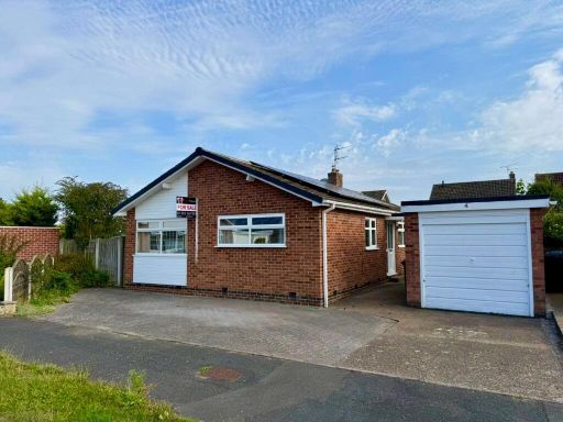 3 bedroom bungalow for sale in Kingston Close, Branton, Doncaster, DN3 — £308,000 • 3 bed • 1 bath • 990 ft²
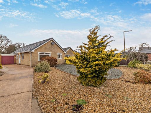 3 bedroom detached bungalow for sale in The Close, Branton, Doncaster, DN3 — £335,000 • 3 bed • 2 bath • 1150 ft²
 3 bedroom bungalow for sale in Whiphill Top Lane, Branton, Doncaster, DN3 — £600,000 • 3 bed • 2 bath
 3 bedroom semi-detached house for sale in Lillford Road, Branton, Doncaster, DN3 — £179,995 • 3 bed • 1 bath • 625 ft²
 2 bedroom semi-detached bungalow for sale in Poplar Close, Branton, Doncaster, DN3 — £195,000 • 2 bed • 1 bath • 579 ft²
Meta
- {
"@context": "https://schema.org",
"@type": "Residence",
"name": "3 bedroom detached bungalow for sale in 2 Chapel Lane, Bran…",
"description": "",
"url": "https://propertypiper.co.uk/property/8f52aa59-525d-4436-8c67-92aae7372dc9",
"image": "https://image-a.propertypiper.co.uk/d5814757-3c4b-4745-824d-c43665751798-1024.jpeg",
"address": {
"@type": "PostalAddress",
"streetAddress": "2, Chapel Lane, Branton",
"postalCode": "DN3 3NG",
"addressLocality": "Doncaster",
"addressRegion": "Don Valley",
"addressCountry": "England"
},
"geo": {
"@type": "GeoCoordinates",
"latitude": 53.50849764298037,
"longitude": -1.0354603817184835
},
"numberOfRooms": 3,
"numberOfBathroomsTotal": 1,
"floorSize": {
"@type": "QuantitativeValue",
"value": 956,
"unitCode": "FTK"
},
"offers": {
"@type": "Offer",
"price": 249900,
"priceCurrency": "GBP",
"availability": "https://schema.org/InStock"
},
"additionalProperty": [
{
"@type": "PropertyValue",
"name": "Feature",
"value": "bungalow"
},
{
"@type": "PropertyValue",
"name": "Feature",
"value": "detached"
},
{
"@type": "PropertyValue",
"name": "Feature",
"value": "single-storey"
},
{
"@type": "PropertyValue",
"name": "Feature",
"value": "mid-20th century"
},
{
"@type": "PropertyValue",
"name": "Feature",
"value": "brick"
},
{
"@type": "PropertyValue",
"name": "Feature",
"value": "garage"
},
{
"@type": "PropertyValue",
"name": "Feature",
"value": "driveway"
},
{
"@type": "PropertyValue",
"name": "Feature",
"value": "garden"
},
{
"@type": "PropertyValue",
"name": "Feature",
"value": "lawn"
},
{
"@type": "PropertyValue",
"name": "Feature",
"value": "fencing"
},
{
"@type": "PropertyValue",
"name": "Feature",
"value": "modern"
},
{
"@type": "PropertyValue",
"name": "Feature",
"value": "living room"
},
{
"@type": "PropertyValue",
"name": "Feature",
"value": "large windows"
},
{
"@type": "PropertyValue",
"name": "Feature",
"value": "natural light"
},
{
"@type": "PropertyValue",
"name": "Feature",
"value": "garden access"
},
{
"@type": "PropertyValue",
"name": "Feature",
"value": "french doors"
}
]
}
High Res Floorplan Images
Compatible Floorplan Images
FloorplanImages Thumbnail