S21 1JQ - 4 bedroom detached house for sale in Gongoozlers Walk, Kill…
View on Property Piper
4 bedroom detached house for sale in Gongoozlers Walk, Killamarsh, S21
Property Details
- Price: £414950
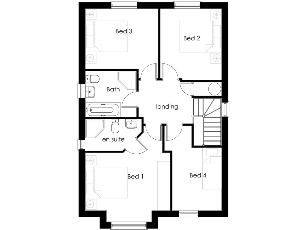
- Bedrooms: 4
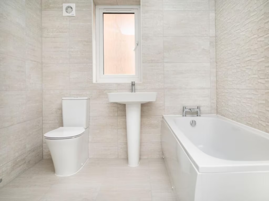
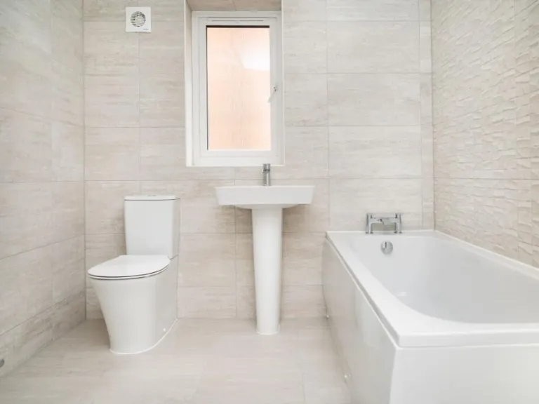
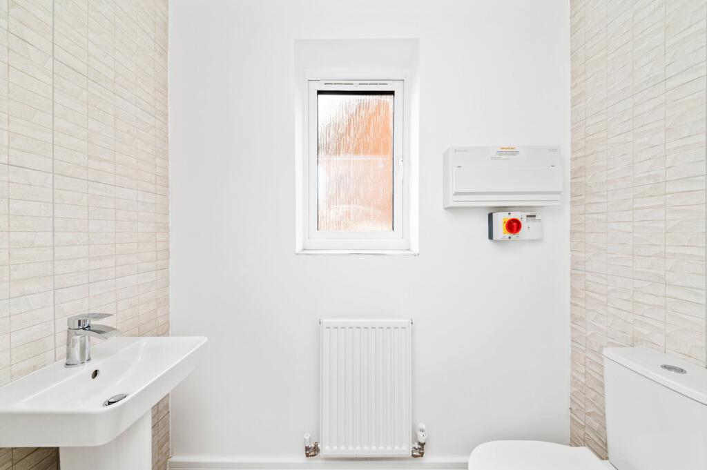
- Bathrooms: 2
- Property Type: undefined
- Property SubType: undefined
Image Descriptions
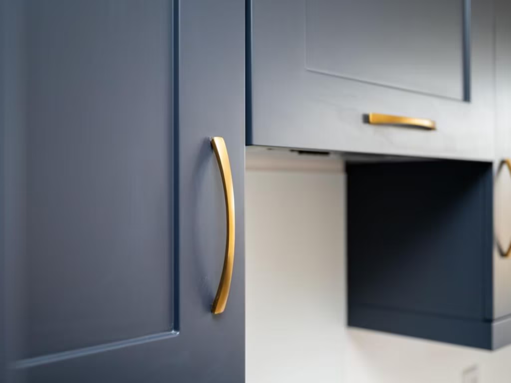
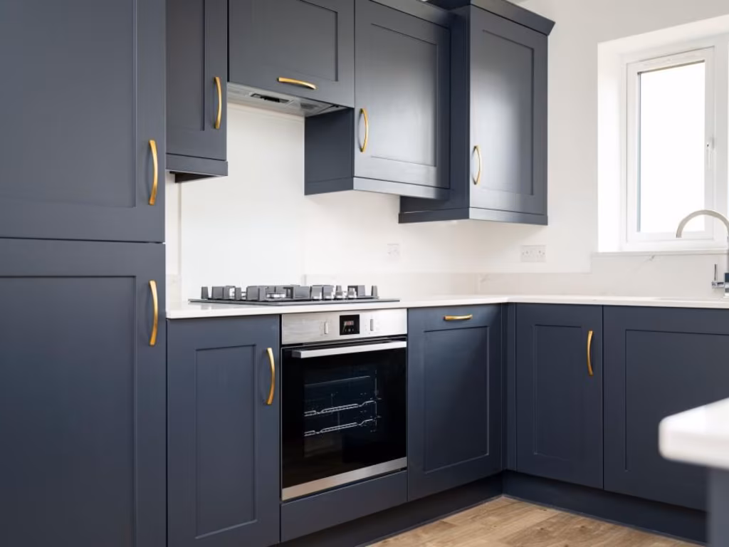
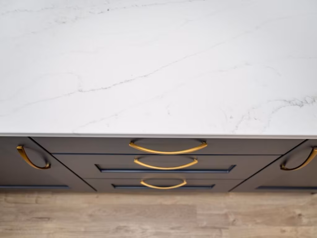
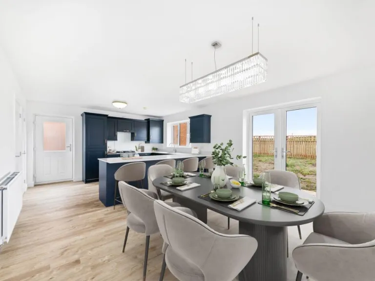
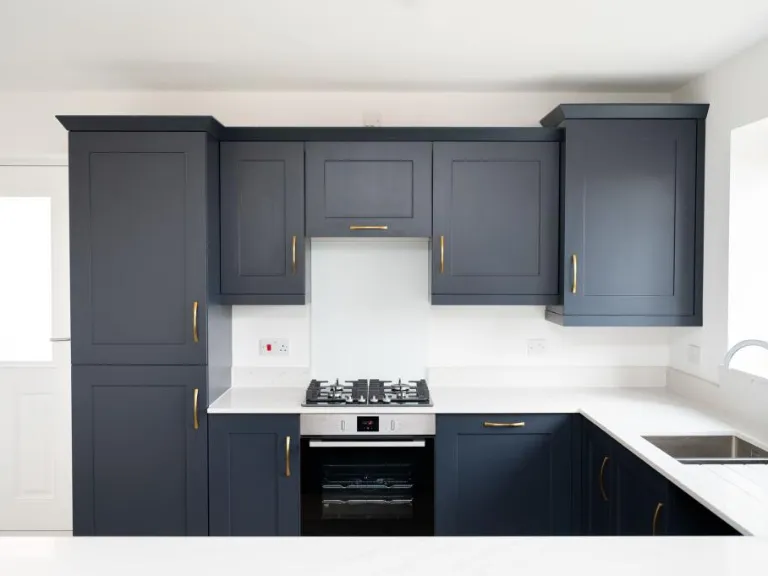
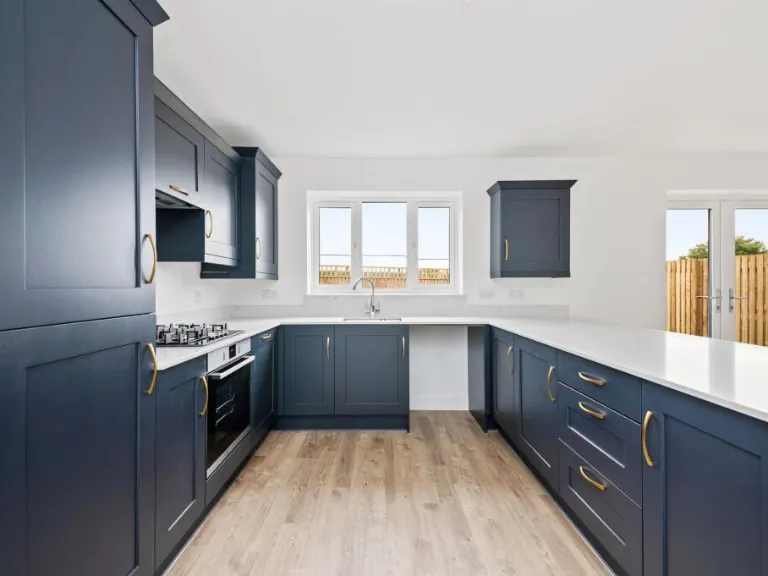
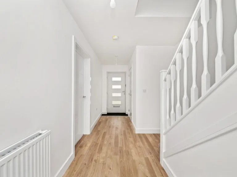
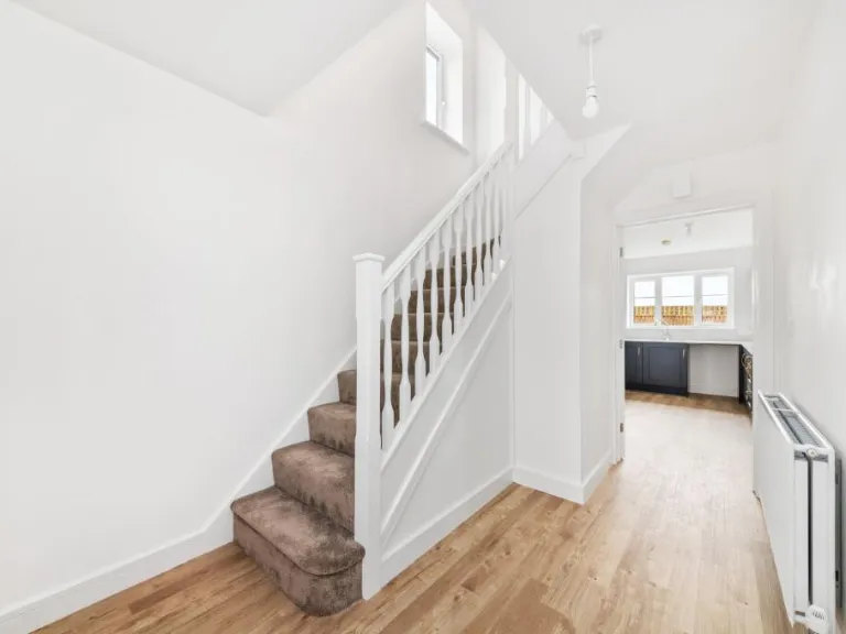
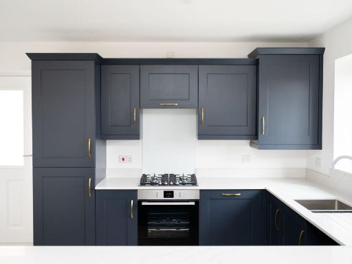
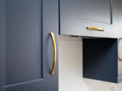
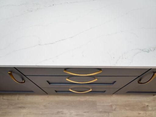
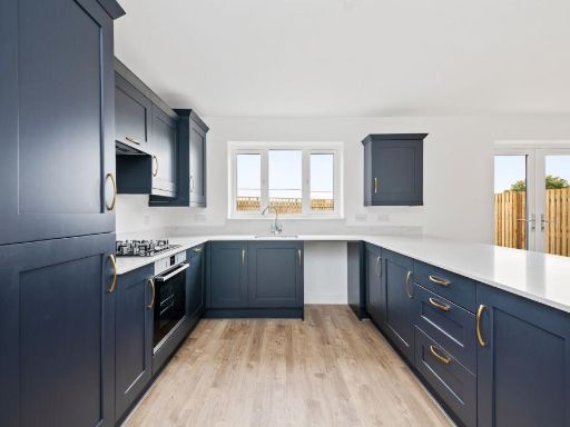
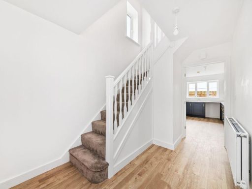
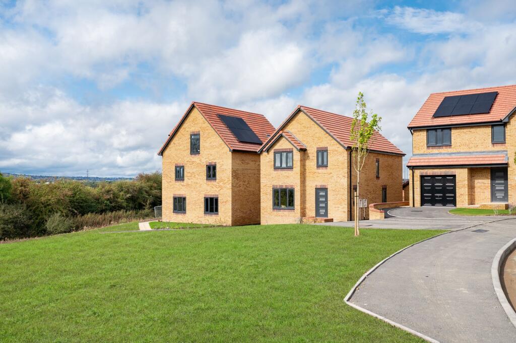
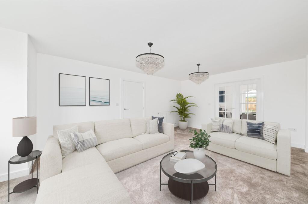
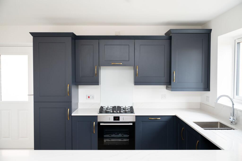
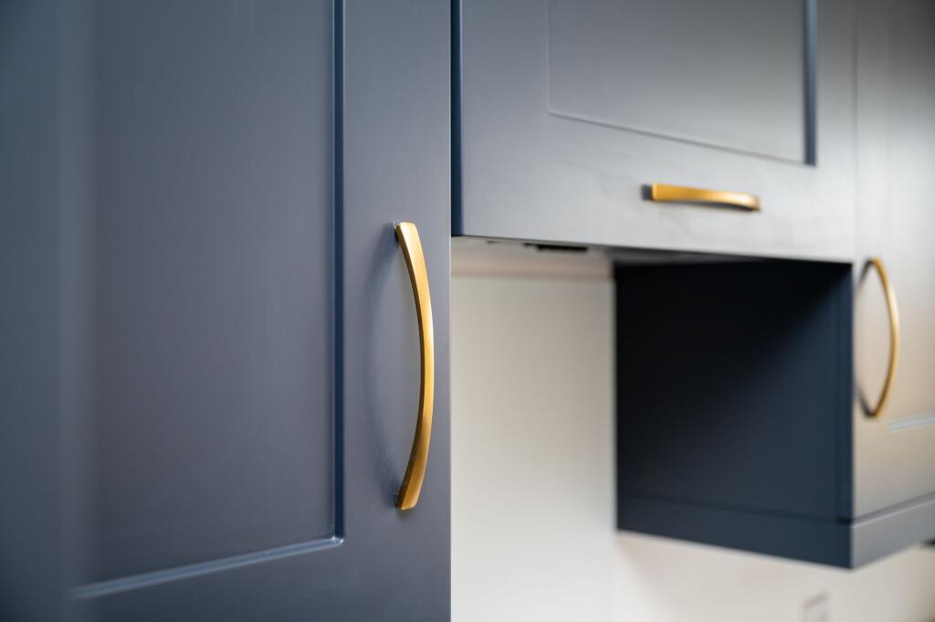
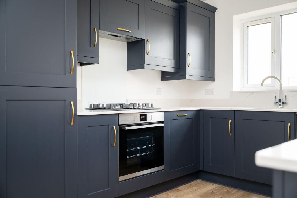
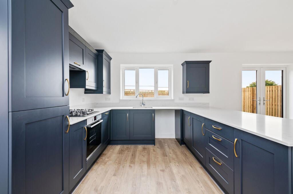
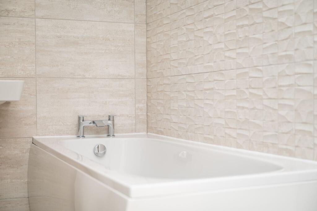
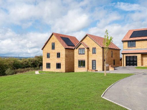
- newly constructed houses modern
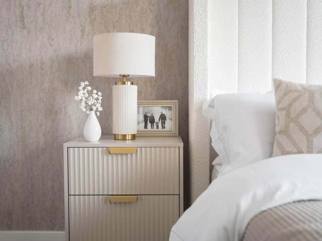
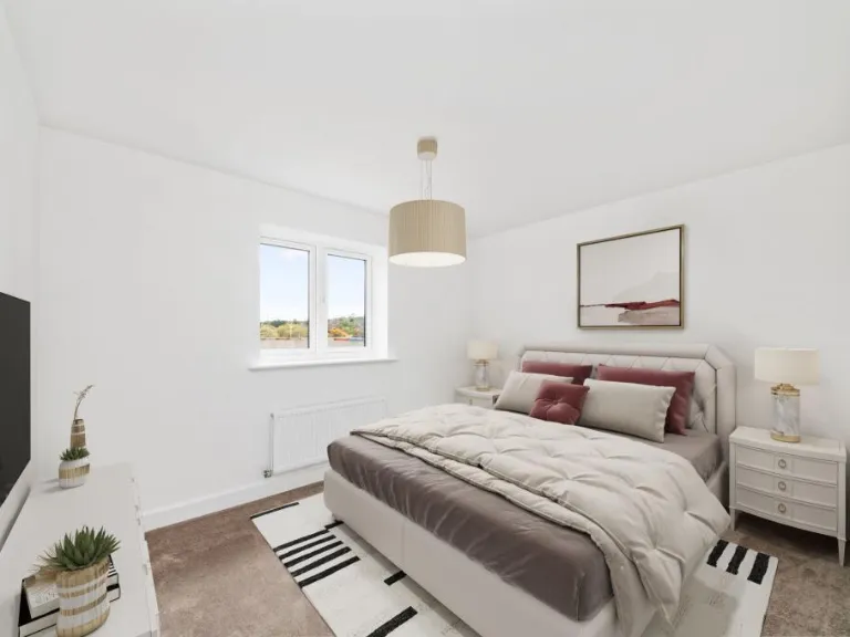
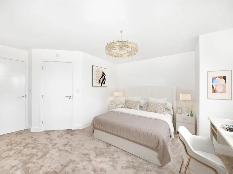
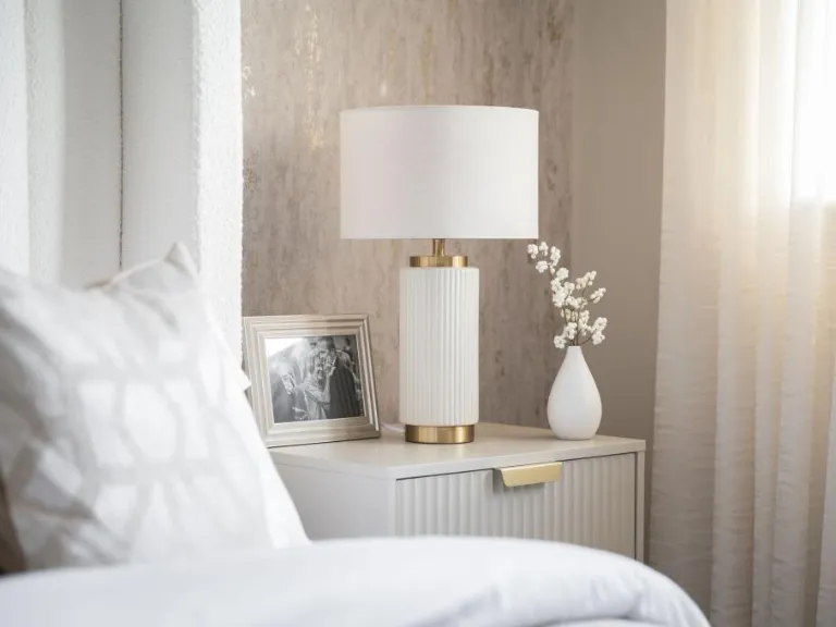
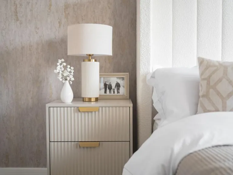
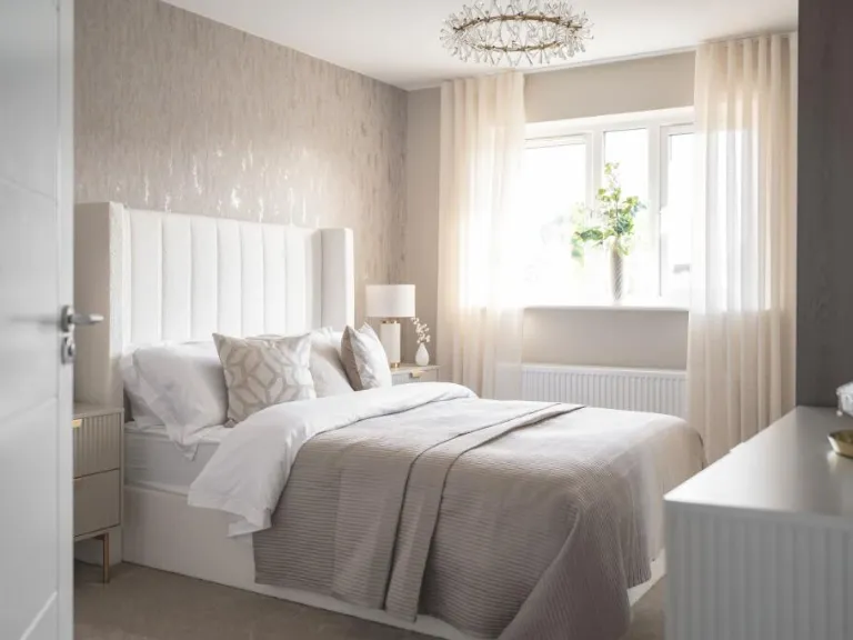
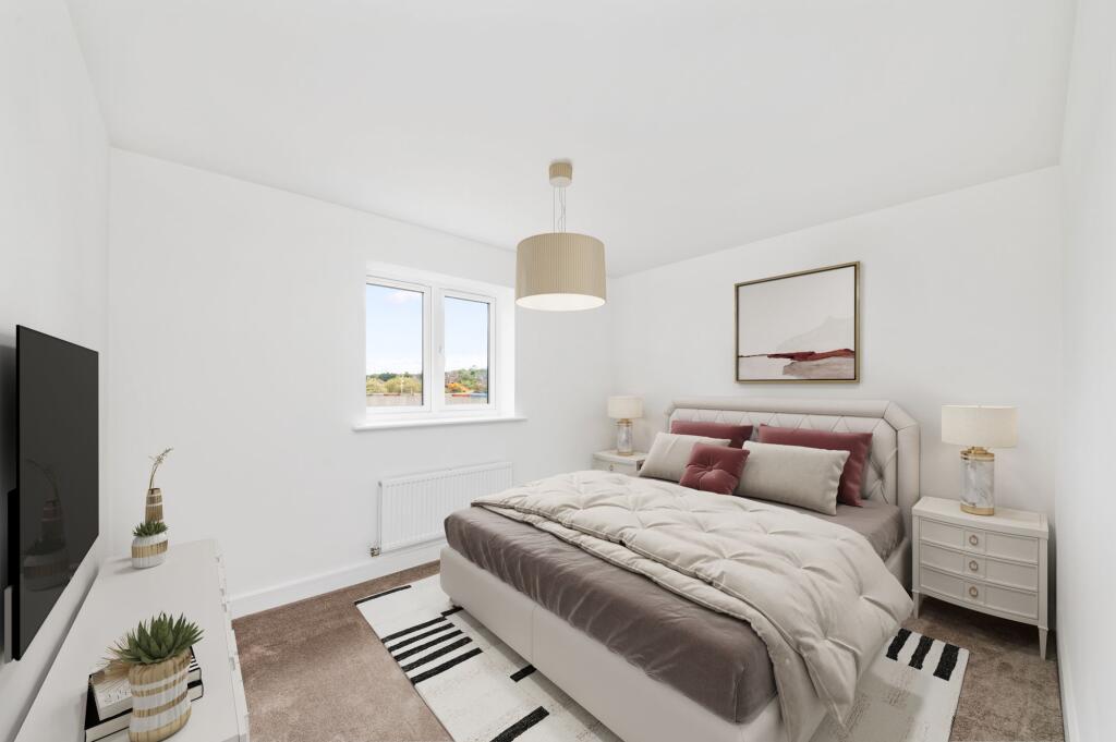
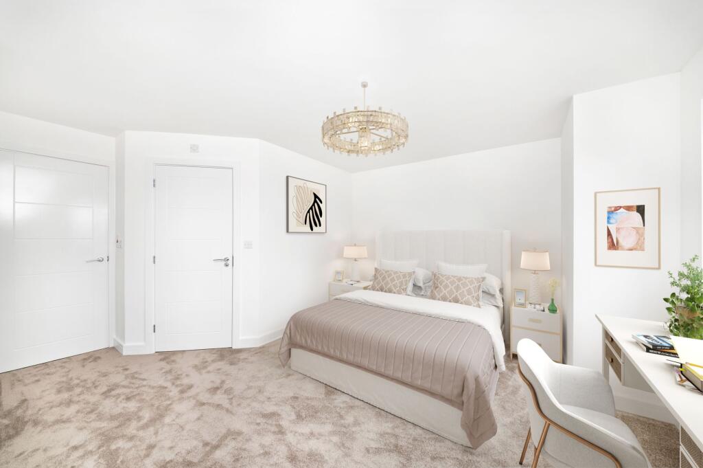
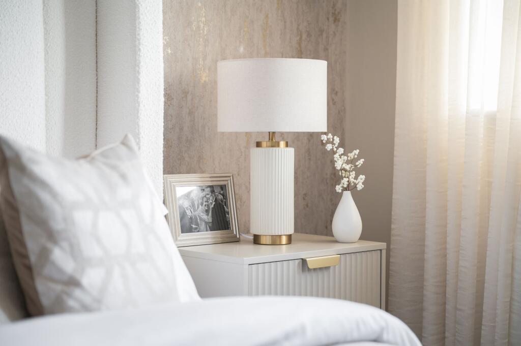
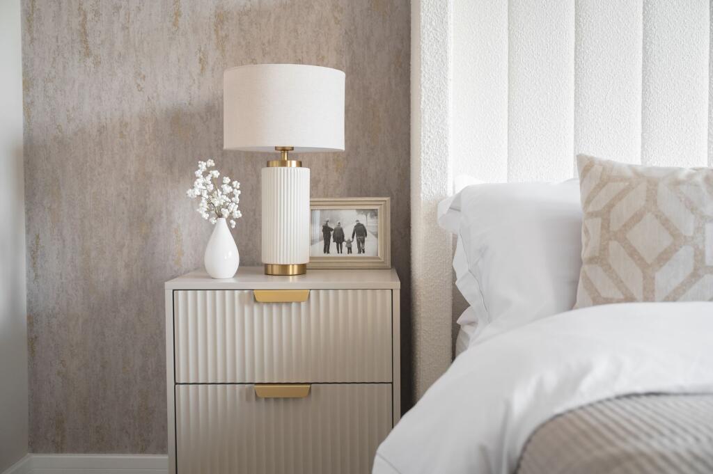
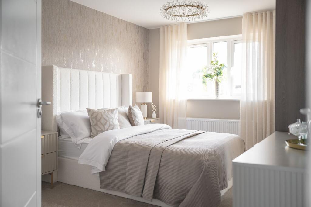
- modern bedroom contemporary
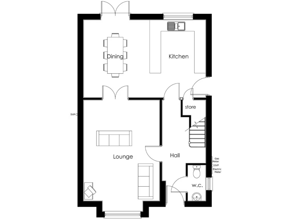
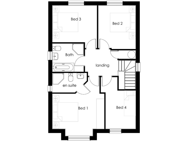
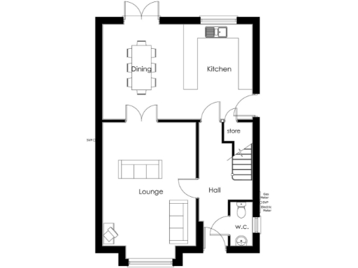
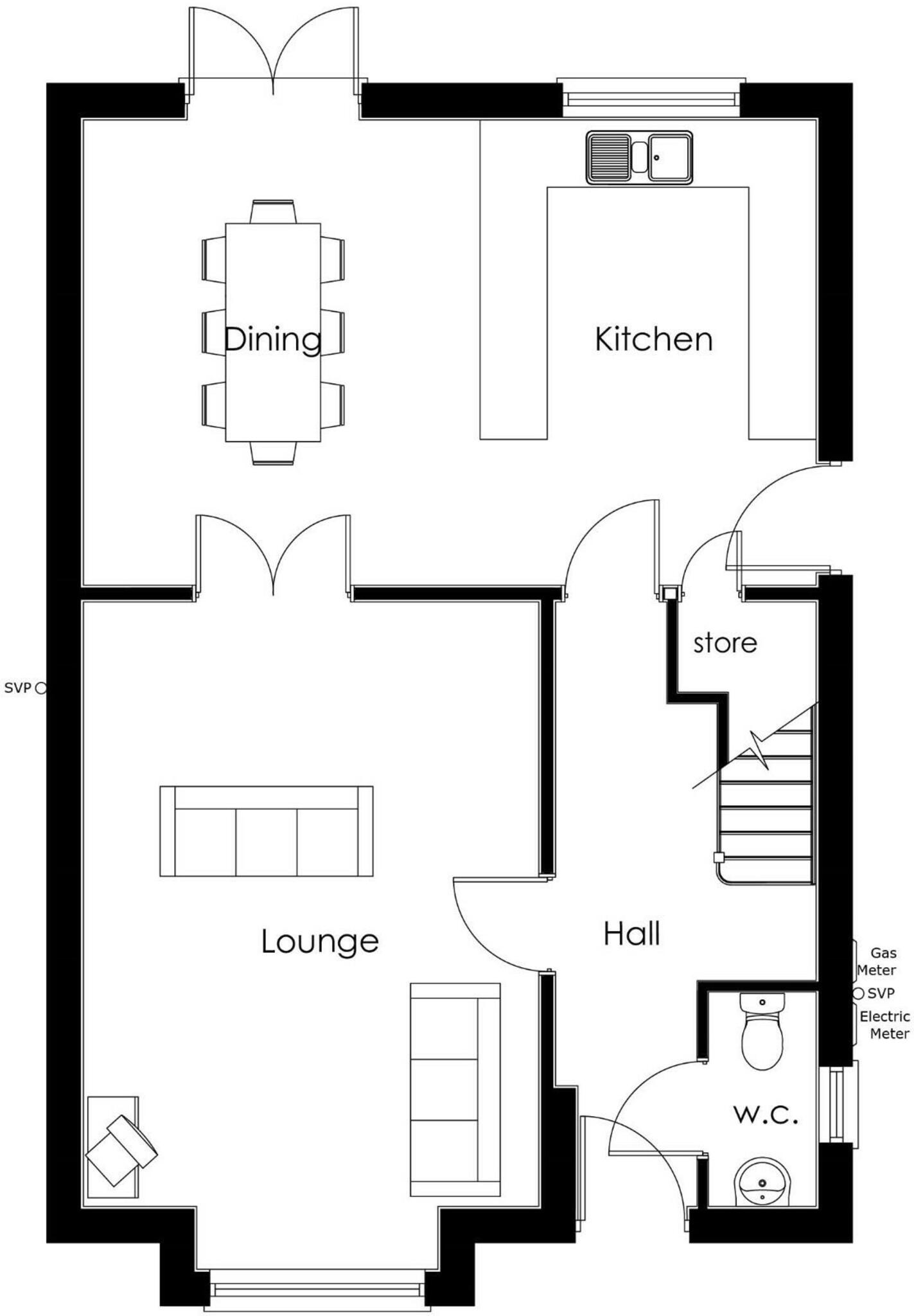
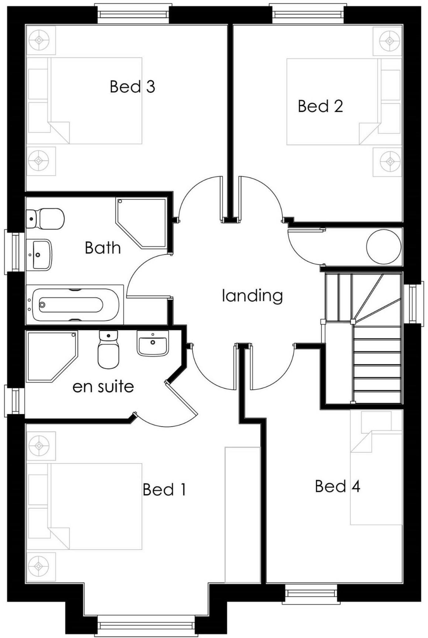
Floorplan Description
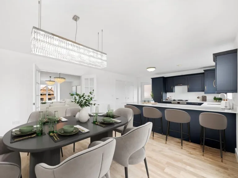
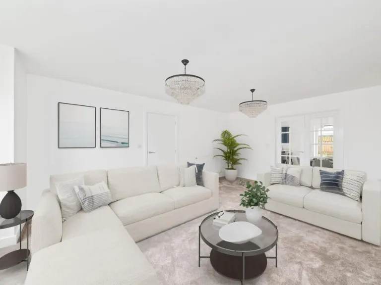
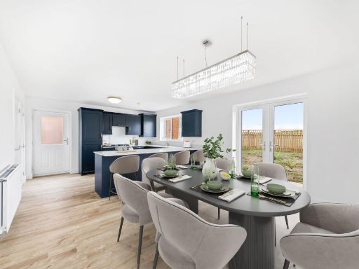
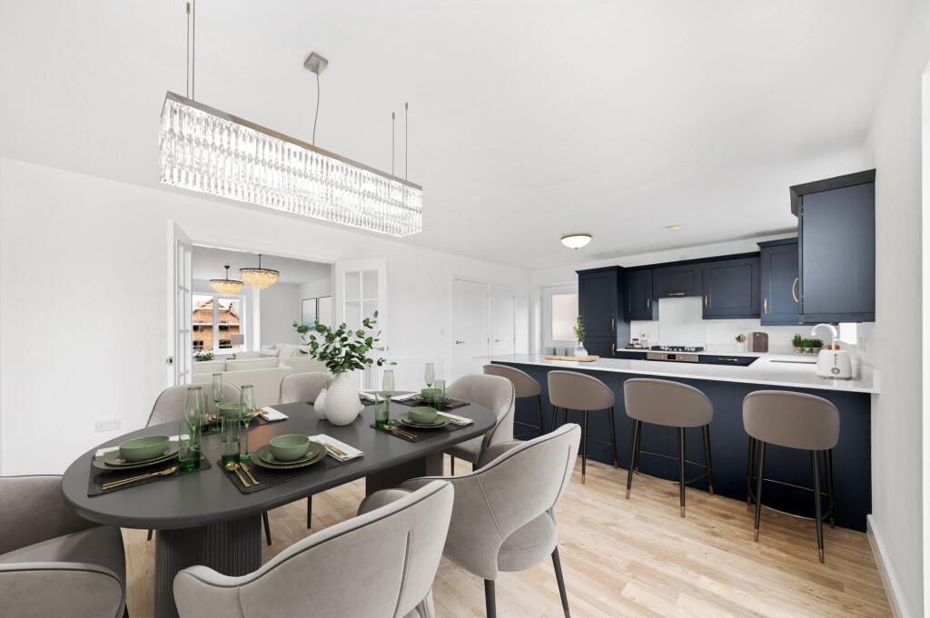
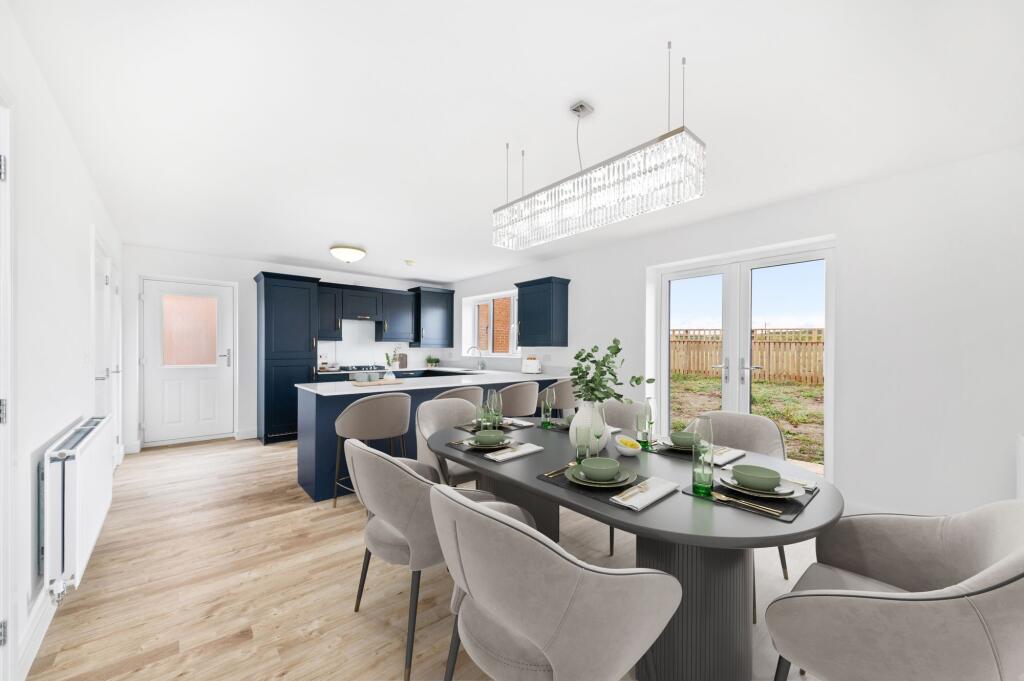
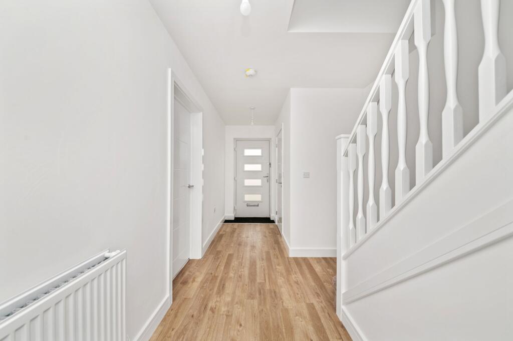
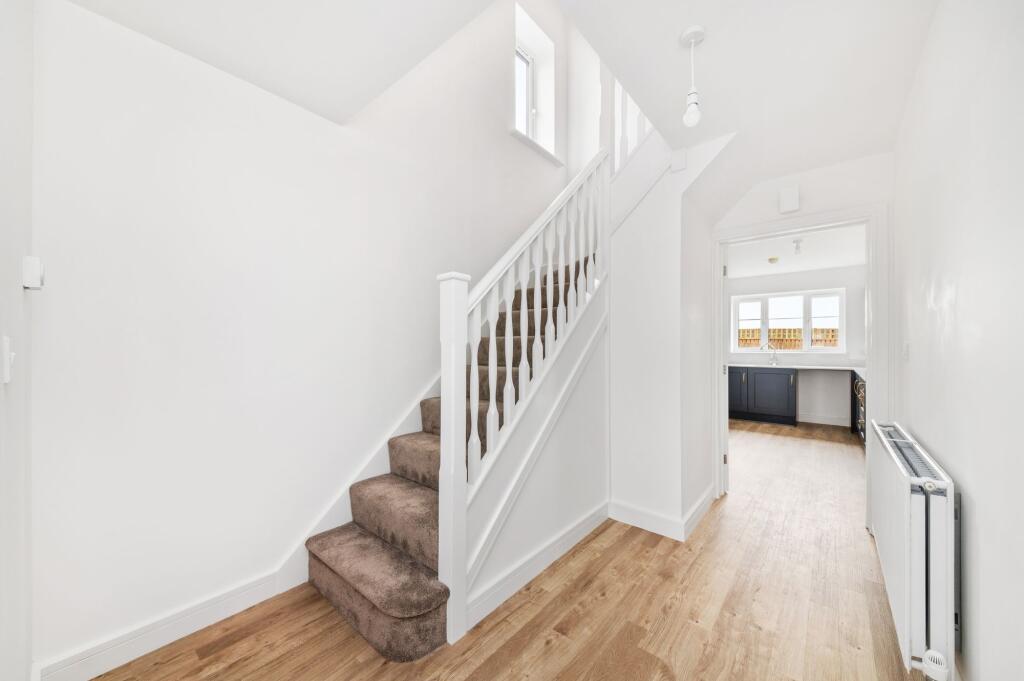
- Ground floor plan showing Dining, Kitchen, Lounge, Hall, store and W.C.
Rooms
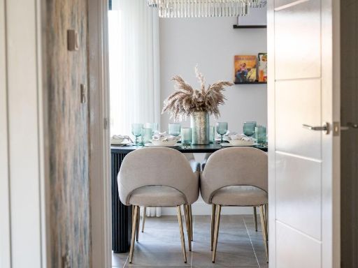
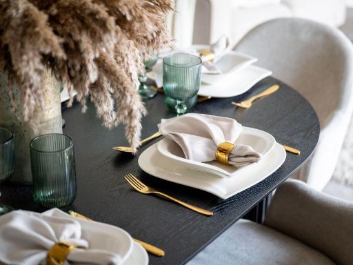
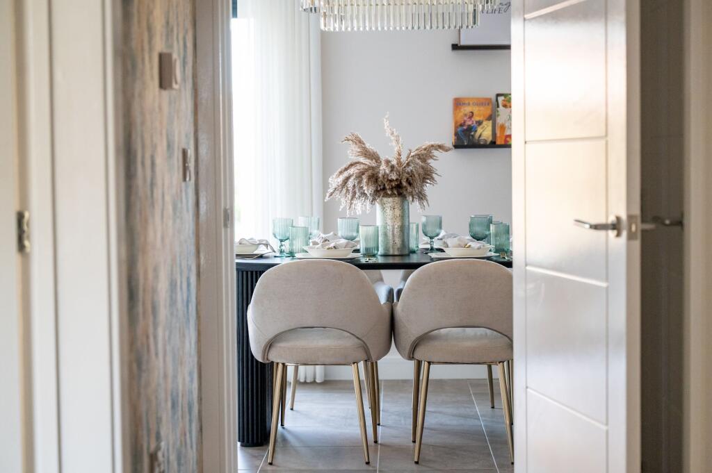
- Dining:
- Kitchen:
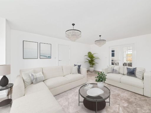
- Lounge:
- Hall:
- store:
- W.C.:
Textual Property Features
Detected Visual Features
- modern
- newly constructed
- detached house
- two-story
- solar panels
- brick
- asphalt driveway
- outdoor space
- family home
- energy efficient
- bedroom
- contemporary
- clean lines
- lamp light fixture
- neutral colors
- white walls
Nearby Schools
- Barlborough Primary School
- St Giles CofE Primary School
- Kiveton Park Meadows Junior School
- Aston All Saints CofE (A) Primary School
- Swallownest Primary School
- Immaculate Conception Catholic Primary
- Halfway Junior School
- Killamarsh Junior School
- Shortbrook Primary School
- Waterthorpe Infant School
- Beighton Nursery Infant School
- Reignhead Primary School
- Aston Lodge Primary School
- Renishaw Primary School
- Mount St Mary's College
- Kiveton Park Infant School
- Aston Fence Junior and Infant School
- Barlborough Hall School
- Killamarsh Infant School
- Halfway Nursery Infant School
- Emmanuel Anglican/Methodist Junior School
- Westfield School
- Wales Primary School
- Wales High School
- Brook House Junior
- Aston Hall Junior and Infant School
- Springwood Junior Academy
- Aston Academy
- Aughton Junior Academy
Nearest Bars And Restaurants
- Id: 2361871946
- Tags:
- Amenity: cafe
- Name: Cable Cafe
- TagsNormalized:
- Lat: 53.3333472
- Lon: -1.3216068
- FullGeoHash: gcrp3vj9k2d8
- PartitionGeoHash: gcrp
- Images:
- FoodStandards: null
- Distance: 1051.1
,- Id: 422802528
- Tags:
- Amenity: cafe
- Building: yes
- Name: Norwood Cottage Tea Rooms
- Note: Not sure whether it's just for fishing people or not
- Source: View from north
- TagsNormalized:
- Lat: 53.3237387
- Lon: -1.2971864
- FullGeoHash: gcrp67r3m37e
- PartitionGeoHash: gcrp
- Images:
- FoodStandards: null
- Distance: 891.1
,- Id: 335030353
- Tags:
- Amenity: pub
- Description:
- Ele: 58
- Landuse: retail
- Name: The Crown Inn
- Outdoor_seating: yes
- Real_ale: 2, may vary
- Sky: yes
- TagsNormalized:
- Lat: 53.3233161
- Lon: -1.3087455
- FullGeoHash: gcrp65pnb48d
- PartitionGeoHash: gcrp
- Images:
- FoodStandards: null
- Distance: 547.3
,- Id: 422810698
- Tags:
- Amenity: fast_food
- Building: yes
- Cuisine: sandwich
- Name: Sandwich Junction
- TagsNormalized:
- Lat: 53.3259527
- Lon: -1.3038759
- FullGeoHash: gcrp67dw1qpd
- PartitionGeoHash: gcrp
- Images:
- FoodStandards: null
- Distance: 387.8
,- Id: 335028259
- Tags:
- Amenity: pub
- Landuse: retail
- TagsNormalized:
- Lat: 53.3269331
- Lon: -1.3131514
- FullGeoHash: gcrp65ggckg6
- PartitionGeoHash: gcrp
- Images:
- FoodStandards: null
- Distance: 353.1
}
Nearest General Shops
- Id: 299920009
- Tags:
- Building: yes
- Name: Cortons Cuts
- Pet_grooming: dog
- Shop: pet_grooming
- TagsNormalized:
- Lat: 53.3407548
- Lon: -1.2735526
- FullGeoHash: gcrp7n2skj6k
- PartitionGeoHash: gcrp
- Images:
- FoodStandards: null
- Distance: 2694.8
,- Id: 299921261
- Tags:
- Brand: William Hill
- Brand:wikidata: Q4053147
- Building: yes
- Name: William Hill
- Shop: bookmaker
- TagsNormalized:
- william hill
- bookmaker
- shop
- Lat: 53.3411538
- Lon: -1.2744964
- FullGeoHash: gcrp6yrywpf8
- PartitionGeoHash: gcrp
- Images:
- FoodStandards: null
- Distance: 2665
,- Id: 6372237359
- Tags:
- Brand: The Co-operative Funeralcare
- Brand:wikidata: Q7726521
- Name: The Co-operative Funeralcare
- Operator: The Co-operative Group
- Shop: funeral_directors
- TagsNormalized:
- funeral
- the co-operative funeralcare
- funeral directors
- shop
- Lat: 53.3246731
- Lon: -1.3183499
- FullGeoHash: gcrp652n8px1
- PartitionGeoHash: gcrp
- Images:
- FoodStandards: null
- Distance: 776
}
Nearest Grocery shops
- Id: 582257132
- Tags:
- TagsNormalized:
- Lat: 53.3184487
- Lon: -1.3179964
- FullGeoHash: gcrp64262rnx
- PartitionGeoHash: gcrp
- Images:
- FoodStandards: null
- Distance: 1264.1
,- Id: 358627571
- Tags:
- Addr:
- City: Killamarsh
- Housenumber: 53
- Postcode: S21 1AL
- Street: Bridge Street
- Building: yes
- Fhrs:
- Name: The Co-operative Food
- Operator: The Co-operative Group
- Shop: supermarket
- TagsNormalized:
- the co-operative food
- food
- shop
- Lat: 53.324027
- Lon: -1.3165452
- FullGeoHash: gcrp6536fr0e
- PartitionGeoHash: gcrp
- Images:
- FoodStandards:
- Id: 351251
- FHRSID: 351251
- LocalAuthorityBusinessID: PI/000100174
- BusinessName: Co-operative Food
- BusinessType: Retailers - supermarkets/hypermarkets
- BusinessTypeID: 7840
- AddressLine1: 53 Bridge Street
- AddressLine2: Killamarsh
- AddressLine3: Sheffield
- AddressLine4: null
- PostCode: S21 1AL
- RatingValue: 5
- RatingKey: fhrs_5_en-GB
- RatingDate: 2021-08-09
- LocalAuthorityCode: 068
- LocalAuthorityName: North East Derbyshire
- LocalAuthorityWebSite: http://www.ne-derbyshire.gov.uk/
- LocalAuthorityEmailAddress: envhealth@ne-derbyshire.gov.uk
- Scores:
- Hygiene: 5
- Structural: 5
- ConfidenceInManagement: 5
- NewRatingPending: false
- Geocode:
- Longitude: -1.31620900000000
- Latitude: 53.32362000000000
- Distance: 720.1
,- Id: 6145978115
- Tags:
- Brand: Nisa Local
- Brand:wikidata: Q16999069
- Name: Nisa Local
- Shop: convenience
- TagsNormalized:
- nisa
- nisa local
- convenience
- shop
- Lat: 53.3268451
- Lon: -1.3035643
- FullGeoHash: gcrp67fg2u2j
- PartitionGeoHash: gcrp
- Images:
- FoodStandards: null
- Distance: 350.1
}
Nearest Supermarkets
- Id: 1039453251
- Tags:
- Brand: Sainsbury's
- Brand:wikidata: Q152096
- Brand:wikipedia: en:Sainsbury's
- Name: Sainsbury's
- Shop: supermarket
- TagsNormalized:
- sainsburys
- supermarket
- shop
- Lat: 53.3416996
- Lon: -1.3498857
- FullGeoHash: gcrp3q91cms2
- PartitionGeoHash: gcrp
- Images:
- FoodStandards: null
- Distance: 3141.4
,- Id: 71213950
- Tags:
- Addr:
- City: Sheffield
- Postcode: S20 8GN
- Street: Oxclose Park Road North
- Brand: Morrisons
- Brand:wikidata: Q922344
- Brand:wikipedia: en:Morrisons
- Building: supermarket
- Name: Morrisons
- Shop: supermarket
- Website: https://my.morrisons.com/storefinder/101
- TagsNormalized:
- Lat: 53.3251595
- Lon: -1.3431174
- FullGeoHash: gcrp37tcx45n
- PartitionGeoHash: gcrp
- Images:
- FoodStandards: null
- Distance: 2337.5
,- Id: 680548259
- Tags:
- Addr:
- City: Killamarsh
- Housenumber: 7
- Postcode: S21 1FY
- Street: Parkside Shopping Centre
- Brand: ALDI
- Brand:wikidata: Q41171672
- Brand:wikipedia: en:Aldi
- Building: yes
- Contact:
- Website: https://stores.aldi.co.uk/killamarsh/7-parkside-shopping-centre
- Fhrs:
- Name: Aldi
- Shop: supermarket
- TagsNormalized:
- Lat: 53.3246207
- Lon: -1.3163701
- FullGeoHash: gcrp653qqmg2
- PartitionGeoHash: gcrp
- Images:
- FoodStandards:
- Id: 510490
- FHRSID: 510490
- LocalAuthorityBusinessID: PI/000124095
- BusinessName: Aldi
- BusinessType: Retailers - supermarkets/hypermarkets
- BusinessTypeID: 7840
- AddressLine1: 7 Parkside Shopping Centre
- AddressLine2: Killamarsh
- AddressLine3: Sheffield
- AddressLine4: null
- PostCode: S21 1FY
- RatingValue: 5
- RatingKey: fhrs_5_en-GB
- RatingDate: 2022-09-27
- LocalAuthorityCode: 068
- LocalAuthorityName: North East Derbyshire
- LocalAuthorityWebSite: http://www.ne-derbyshire.gov.uk/
- LocalAuthorityEmailAddress: envhealth@ne-derbyshire.gov.uk
- Scores:
- Hygiene: 0
- Structural: 0
- ConfidenceInManagement: 0
- NewRatingPending: false
- Geocode:
- Longitude: -1.31675000000000
- Latitude: 53.32452200000000
- Distance: 669.7
}
Nearest Religious buildings
- Id: 365506275
- Tags:
- Amenity: place_of_worship
- Building: yes
- Denomination: gospel
- Name: Beighton Gospel Hall
- Religion: christian
- TagsNormalized:
- place of worship
- christian
- church
- Lat: 53.342777
- Lon: -1.3376822
- FullGeoHash: gcrp3wcbjwrg
- PartitionGeoHash: gcrp
- Images:
- FoodStandards: null
- Distance: 2534.3
,- Id: 834820829
- Tags:
- Amenity: place_of_worship
- Building: church
- Denomination: anglican
- Name: St John the Baptist
- Religion: christian
- Wikidata: Q17534795
- TagsNormalized:
- place of worship
- church
- anglican
- baptist
- christian
- Lat: 53.338917
- Lon: -1.2842466
- FullGeoHash: gcrp6y0cdyu3
- PartitionGeoHash: gcrp
- Images:
- FoodStandards: null
- Distance: 1990.6
,- Id: 422804489
- Tags:
- Amenity: place_of_worship
- Building: church
- Denomination: anglican
- Name: St Giles
- Note: FIXME check position and update other details
- Religion: christian
- Source: View from south;Bing
- Wikidata: Q17546285
- TagsNormalized:
- place of worship
- church
- anglican
- christian
- Lat: 53.323615
- Lon: -1.3090939
- FullGeoHash: gcrp65q8xfkc
- PartitionGeoHash: gcrp
- Images:
- FoodStandards: null
- Distance: 516
}
Nearest Medical buildings
- Id: 372916019
- Tags:
- Addr:
- Housename: Sothall Pharmacy
- Housenumber: 26
- Postcode: S20 1HQ
- Street: Eckington Road
- Amenity: pharmacy
- Dispensing: yes
- Healthcare: pharmacy
- Name: Sothall Pharmacy
- Website: https://www.nhs.uk/Services/pharmacies/Overview/DefaultView.aspx?id=4040
- TagsNormalized:
- Lat: 53.3385512
- Lon: -1.3402783
- FullGeoHash: gcrp3tbp9685
- PartitionGeoHash: gcrp
- Images:
- FoodStandards: null
- Distance: 2413.8
,- Id: 365648844
- Tags:
- Amenity: pharmacy
- Building: yes
- Healthcare: pharmacy
- Name: Sothall Pharmacy
- TagsNormalized:
- Lat: 53.3385463
- Lon: -1.3402785
- FullGeoHash: gcrp3tbp91xy
- PartitionGeoHash: gcrp
- Images:
- FoodStandards: null
- Distance: 2413.5
,- Id: 6154412516
- Tags:
- Amenity: pharmacy
- Dispensing: yes
- Healthcare: pharmacy
- Name: Lloyds Pharmacy
- TagsNormalized:
- pharmacy
- health
- healthcare
- lloyds pharmacy
- Lat: 53.3409909
- Lon: -1.2843764
- FullGeoHash: gcrp6y2tzc7s
- PartitionGeoHash: gcrp
- Images:
- FoodStandards: null
- Distance: 2129.8
,- Id: 4696385389
- Tags:
- Amenity: doctors
- Healthcare: doctor
- Name: Killamarsh doctors and chemist
- Name:en: Killamarsh doctors and chemist
- TagsNormalized:
- doctor
- doctors
- health
- healthcare
- chemist
- Lat: 53.3249683
- Lon: -1.319656
- FullGeoHash: gcrp3gx03y94
- PartitionGeoHash: gcrp
- Images:
- FoodStandards: null
- Distance: 837
}
Nearest Airports
- Id: 100889514
- Tags:
- Addr:
- Aerodrome: international
- Aerodrome:type: public
- Area: yes
- Cities_served: Doncaster, Sheffield
- Closest_town: Doncaster
- Disused:
- Ele: 17
- Iata: DSA
- Icao: EGCN
- Ifr: yes
- Is_in: Finningley
- Name: Doncaster Sheffield Airport
- Old_iata: FNY
- Old_icao: EGXI
- Old_name: RAF Finningley
- Old_operator: Royal Air Force
- Old_type: military
- Operator: Doncaster Sheffield Airport Limited/Peel Airports
- Source: wikipedia
- Tower_frequency: 128.775
- Vfr: yes
- Website: https://www.robinhoodairport.com/
- Wikidata: Q8996
- Wikipedia: en:Robin Hood Airport Doncaster Sheffield
- TagsNormalized:
- airport
- international airport
- Lat: 53.4761577
- Lon: -1.0054086
- FullGeoHash: gcx21p5chq34
- PartitionGeoHash: gcx2
- Images:
- FoodStandards: null
- Distance: 25956.7
}
Nearest Leisure Facilities
- Id: 335040409
- Tags:
- TagsNormalized:
- Lat: 53.3257939
- Lon: -1.3061331
- FullGeoHash: gcrp678vkbkx
- PartitionGeoHash: gcrp
- Images:
- FoodStandards: null
- Distance: 306.7
,- Id: 335029277
- Tags:
- TagsNormalized:
- Lat: 53.3288101
- Lon: -1.3126148
- FullGeoHash: gcrp6hhnvfer
- PartitionGeoHash: gcrp
- Images:
- FoodStandards: null
- Distance: 293.8
,- Id: 335029278
- Tags:
- TagsNormalized:
- Lat: 53.3280851
- Lon: -1.3126407
- FullGeoHash: gcrp6hh4t784
- PartitionGeoHash: gcrp
- Images:
- FoodStandards: null
- Distance: 288.9
,- Id: 335029281
- Tags:
- TagsNormalized:
- Lat: 53.3289711
- Lon: -1.3113602
- FullGeoHash: gcrp6hjpg0dz
- PartitionGeoHash: gcrp
- Images:
- FoodStandards: null
- Distance: 219.4
,- Id: 335029279
- Tags:
- TagsNormalized:
- Lat: 53.3283913
- Lon: -1.3109123
- FullGeoHash: gcrp6hjkms8v
- PartitionGeoHash: gcrp
- Images:
- FoodStandards: null
- Distance: 174.5
}
Nearest Tourist attractions
- Id: 8108150165
- Tags:
- TagsNormalized:
- Lat: 53.3405606
- Lon: -1.3209165
- FullGeoHash: gcrp3yq5k3jm
- PartitionGeoHash: gcrp
- Images:
- FoodStandards: null
- Distance: 1606.8
,- Id: 8425727185
- Tags:
- TagsNormalized:
- Lat: 53.3190915
- Lon: -1.3116337
- FullGeoHash: gcrp64kyhxp1
- PartitionGeoHash: gcrp
- Images:
- FoodStandards: null
- Distance: 1040.1
,- Id: 8425727186
- Tags:
- TagsNormalized:
- Lat: 53.3194233
- Lon: -1.3118695
- FullGeoHash: gcrp64s8phzj
- PartitionGeoHash: gcrp
- Images:
- FoodStandards: null
- Distance: 1007.7
}
Nearest Train stations
- Id: 102031003
- Tags:
- Building: train_station
- Name: Barrow Hill Roundhouse
- Railway: turntable
- Tourism: attraction
- Wikidata: Q4863884
- Wikipedia: en:Barrow Hill Engine Shed
- TagsNormalized:
- station
- train
- train station
- railway
- attraction
- tourism
- Lat: 53.2744292
- Lon: -1.381839
- FullGeoHash: gcrp0d3f0c6h
- PartitionGeoHash: gcrp
- Images:
- FoodStandards: null
- Distance: 7724.7
,- Id: 1716256015
- Tags:
- Name: Roundhouse Halt
- Public_transport: station
- Railway: station
- Usage: tourism
- Website: https://www.barrowhill.org/
- TagsNormalized:
- Lat: 53.2746594
- Lon: -1.3813376
- FullGeoHash: gcrp0d65ks21
- PartitionGeoHash: gcrp
- Images:
- FoodStandards: null
- Distance: 7683.8
,- Id: 3157353528
- Tags:
- Name: Woodhouse
- Naptan:
- Network: National Rail
- Operator: Northern Rail
- Public_transport: station
- Railway: station
- Ref:
- Source: wikipedia
- Wikidata: Q2497249
- Wikipedia: en:Woodhouse railway station
- TagsNormalized:
- Lat: 53.3637962
- Lon: -1.3573689
- FullGeoHash: gcrp94edeh87
- PartitionGeoHash: gcrp
- Images:
- FoodStandards: null
- Distance: 5123.5
,- Id: 7170486847
- Tags:
- Name: Kiveton Park
- Naptan:
- Network: National Rail
- Operator: Northern Rail
- Public_transport: station
- Railway: station
- Ref:
- Source: NPE
- Wikidata: Q2323319
- Wikipedia: en:Kiveton Park railway station
- TagsNormalized:
- Lat: 53.3367636
- Lon: -1.2395678
- FullGeoHash: gcrp7v9m5vr7
- PartitionGeoHash: gcrp
- Images:
- FoodStandards: null
- Distance: 4661.4
,- Id: 3157350618
- Tags:
- Name: Kiveton Bridge
- Naptan:
- Network: National Rail
- Operator: Northern Rail
- Public_transport: station
- Railway: station
- Ref:
- Source: wikipedia
- Wikidata: Q3448631
- Wikipedia: en:Kiveton Bridge railway station
- TagsNormalized:
- Lat: 53.3409362
- Lon: -1.2670815
- FullGeoHash: gcrp7nmm6z5w
- PartitionGeoHash: gcrp
- Images:
- FoodStandards: null
- Distance: 3079.9
}
Nearest Bus stations and stops
- Id: 550479096
- Tags:
- Bus: yes
- Ele: 54.1995850
- Highway: bus_stop
- Public_transport: platform
- TagsNormalized:
- Lat: 53.3213415
- Lon: -1.3188031
- FullGeoHash: gcrp3fzemdmp
- PartitionGeoHash: gcrp
- Images:
- FoodStandards: null
- Distance: 1036.2
,- Id: 550463725
- Tags:
- Bus: yes
- Highway: bus_stop
- Public_transport: platform
- TagsNormalized:
- Lat: 53.322588
- Lon: -1.3157673
- FullGeoHash: gcrp651fs6ug
- PartitionGeoHash: gcrp
- Images:
- FoodStandards: null
- Distance: 799.9
,- Id: 550463714
- Tags:
- Bus: yes
- Ele: 49.8737793
- Highway: bus_stop
- Public_transport: platform
- TagsNormalized:
- Lat: 53.3226181
- Lon: -1.3156016
- FullGeoHash: gcrp6544b22q
- PartitionGeoHash: gcrp
- Images:
- FoodStandards: null
- Distance: 790.4
,- Id: 4225389013
- Tags:
- Bus: yes
- Highway: bus_stop
- Public_transport: platform
- TagsNormalized:
- Lat: 53.3302306
- Lon: -1.3006382
- FullGeoHash: gcrp6kkzhgtc
- PartitionGeoHash: gcrp
- Images:
- FoodStandards: null
- Distance: 555.1
,- Id: 550472330
- Tags:
- Bus: yes
- Ele: 27.2828369
- Highway: bus_stop
- Public_transport: platform
- TagsNormalized:
- Lat: 53.3264322
- Lon: -1.3136961
- FullGeoHash: gcrp65g2uxmn
- PartitionGeoHash: gcrp
- Images:
- FoodStandards: null
- Distance: 410.5
}
Nearest Hotels
- Id: 343389600
- Tags:
- Addr:
- City: Sheffield
- Country: GB
- Postcode: S20 5EA
- Street: High Street
- Fhrs:
- Name: Mosborough Hall Hotel
- Operator: Best Westen
- Tourism: hotel
- TagsNormalized:
- Lat: 53.3215943
- Lon: -1.3567463
- FullGeoHash: gcrp34uhc98e
- PartitionGeoHash: gcrp
- Images:
- FoodStandards: null
- Distance: 3301.2
,- Id: 68751050
- Tags:
- Addr:
- City: Rotherham
- Housename: Woodall Motorway Service Area
- Postcode: S26 7XR
- Brand: Days Inn
- Brand:wikidata: Q1047239
- Building: yes
- Fhrs:
- Name: Days Inn
- Operator: Welcome Break
- Tourism: hotel
- TagsNormalized:
- Lat: 53.3136185
- Lon: -1.2812954
- FullGeoHash: gcrp6c6yrduf
- PartitionGeoHash: gcrp
- Images:
- FoodStandards: null
- Distance: 2420.1
,- Id: 615926937
- Tags:
- Amenity: pub
- Name: West End Hotel
- TagsNormalized:
- Lat: 53.3144871
- Lon: -1.3189468
- FullGeoHash: gcrp3cxe6k9z
- PartitionGeoHash: gcrp
- Images:
- FoodStandards: null
- Distance: 1684
}
Tags
- modern
- newly constructed
- detached house
- two-story
- solar panels
- brick
- asphalt driveway
- outdoor space
- family home
- energy efficient
- modern
- bedroom
- contemporary
- clean lines
- lamp light fixture
- neutral colors
- white walls
Local Market Stats
- Average Price/sqft: £210
- Avg Income: £38600
- Rental Yield: 3.8%
- Social Housing: 12%
- Planning Success Rate: 100%
Similar Properties
 4 bedroom detached house for sale in Gongoozlers Walk, Killamarsh, S21 — £435,000 • 4 bed • 2 bath
 4 bedroom detached house for sale in Gongoozlers Walk, Killamarsh, S21 — £445,000 • 4 bed • 2 bath
 4 bedroom detached house for sale in Gongoozlers Walk, Killamarsh, S21 — £400,000 • 4 bed • 2 bath
 4 bedroom detached house for sale in Gongoozlers Walk, Killamarsh, S21 — £425,000 • 4 bed • 2 bath
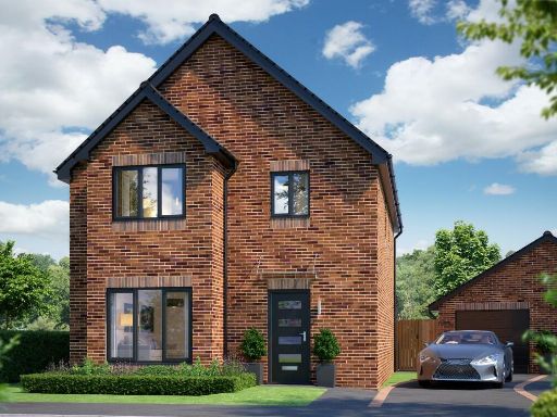 4 bedroom detached house for sale in Primrose Close, Killamarsh,
Sheffield,
S21 2AD, S21 — £415,000 • 4 bed • 2 bath • 1393 ft²
4 bedroom detached house for sale in Primrose Close, Killamarsh,
Sheffield,
S21 2AD, S21 — £415,000 • 4 bed • 2 bath • 1393 ft²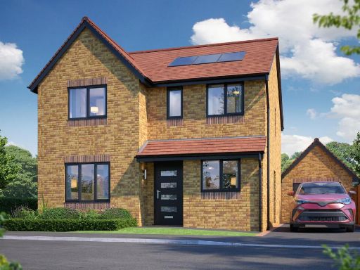 4 bedroom detached house for sale in Gongoozlers Walk, Killamarsh, S21 — £430,000 • 4 bed • 2 bath
Meta
- {
"@context": "https://schema.org",
"@type": "Residence",
"name": "4 bedroom detached house for sale in Gongoozlers Walk, Kill…",
"description": "",
"url": "https://propertypiper.co.uk/property/8ec0f547-9431-4311-8e3e-43884e9bfd05",
"image": "https://image-a.propertypiper.co.uk/7afb8ec3-585b-4c1b-b2c6-7f37ae27a661-1024.jpeg",
"address": {
"@type": "PostalAddress",
"streetAddress": "Gongoozlers Walk, Killamarsh, S21",
"postalCode": "S21 1JQ",
"addressLocality": "North East Derbyshire",
"addressRegion": "North East Derbyshire",
"addressCountry": "England"
},
"geo": {
"@type": "GeoCoordinates",
"latitude": 53.32823069638385,
"longitude": -1.3082978049811935
},
"numberOfRooms": 4,
"numberOfBathroomsTotal": 2,
"offers": {
"@type": "Offer",
"price": 414950,
"priceCurrency": "GBP",
"availability": "https://schema.org/InStock"
},
"additionalProperty": [
{
"@type": "PropertyValue",
"name": "Feature",
"value": "modern"
},
{
"@type": "PropertyValue",
"name": "Feature",
"value": "newly constructed"
},
{
"@type": "PropertyValue",
"name": "Feature",
"value": "detached house"
},
{
"@type": "PropertyValue",
"name": "Feature",
"value": "two-story"
},
{
"@type": "PropertyValue",
"name": "Feature",
"value": "solar panels"
},
{
"@type": "PropertyValue",
"name": "Feature",
"value": "brick"
},
{
"@type": "PropertyValue",
"name": "Feature",
"value": "asphalt driveway"
},
{
"@type": "PropertyValue",
"name": "Feature",
"value": "outdoor space"
},
{
"@type": "PropertyValue",
"name": "Feature",
"value": "family home"
},
{
"@type": "PropertyValue",
"name": "Feature",
"value": "energy efficient"
},
{
"@type": "PropertyValue",
"name": "Feature",
"value": "modern"
},
{
"@type": "PropertyValue",
"name": "Feature",
"value": "bedroom"
},
{
"@type": "PropertyValue",
"name": "Feature",
"value": "contemporary"
},
{
"@type": "PropertyValue",
"name": "Feature",
"value": "clean lines"
},
{
"@type": "PropertyValue",
"name": "Feature",
"value": "lamp light fixture"
},
{
"@type": "PropertyValue",
"name": "Feature",
"value": "neutral colors"
},
{
"@type": "PropertyValue",
"name": "Feature",
"value": "white walls"
}
]
}
High Res Floorplan Images
Compatible Floorplan Images
FloorplanImages Thumbnail