CT5 3PU - 2 bedroom detached bungalow for sale in Rosemary Gardens, W…
View on Property Piper
2 bedroom detached bungalow for sale in Rosemary Gardens, Whitstable, Kent, CT5
Property Details
- Price: £327000
- Bedrooms: 2
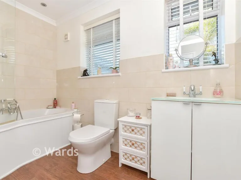
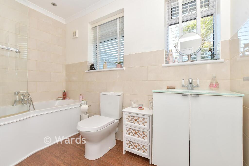
- Bathrooms: 1
- Property Type: undefined
- Property SubType: undefined
Image Descriptions
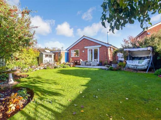
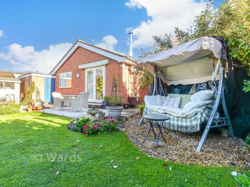
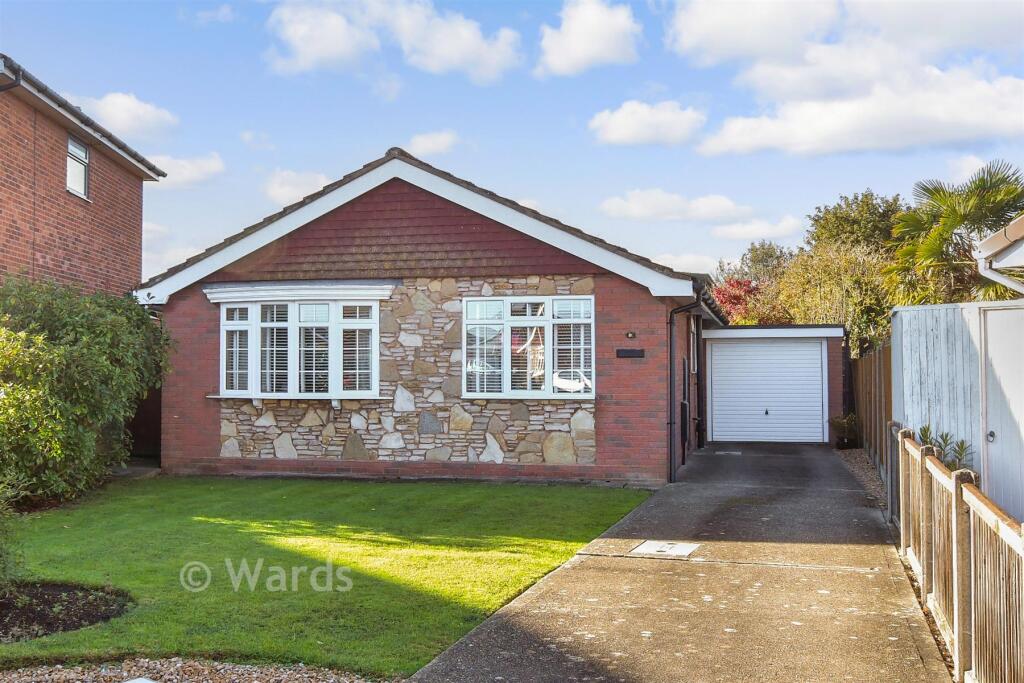
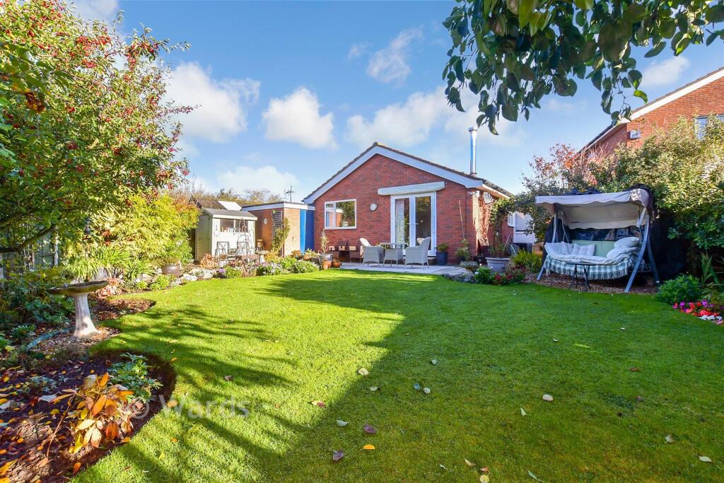
- bungalow modern
- bungalow modern bungalow
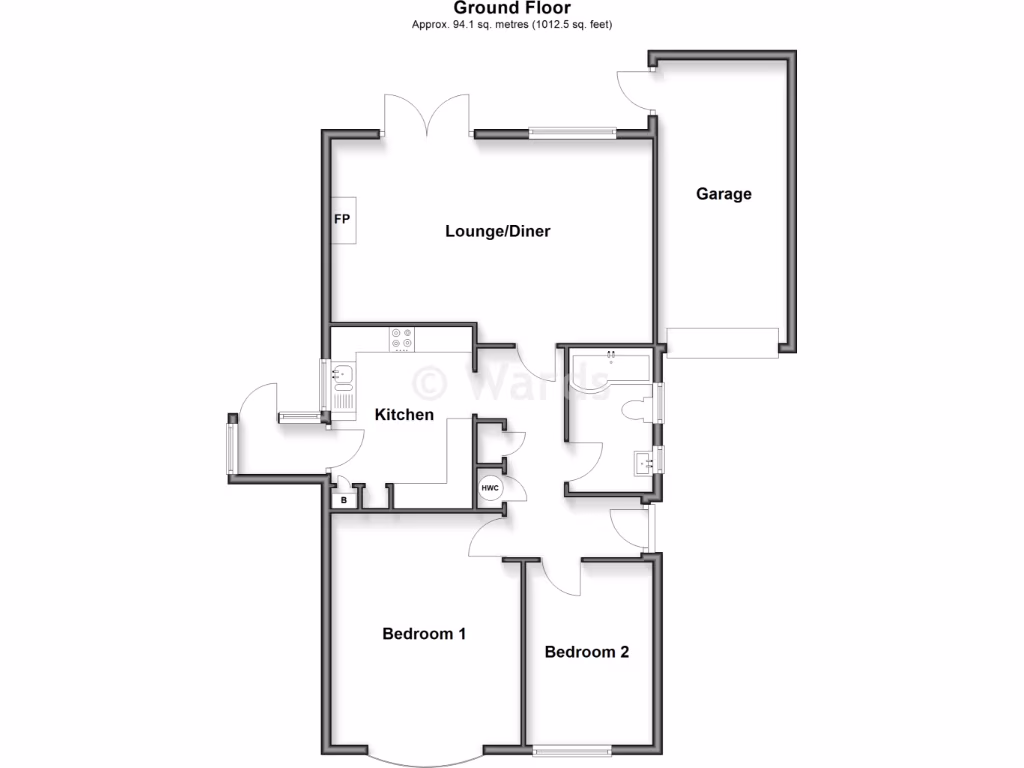
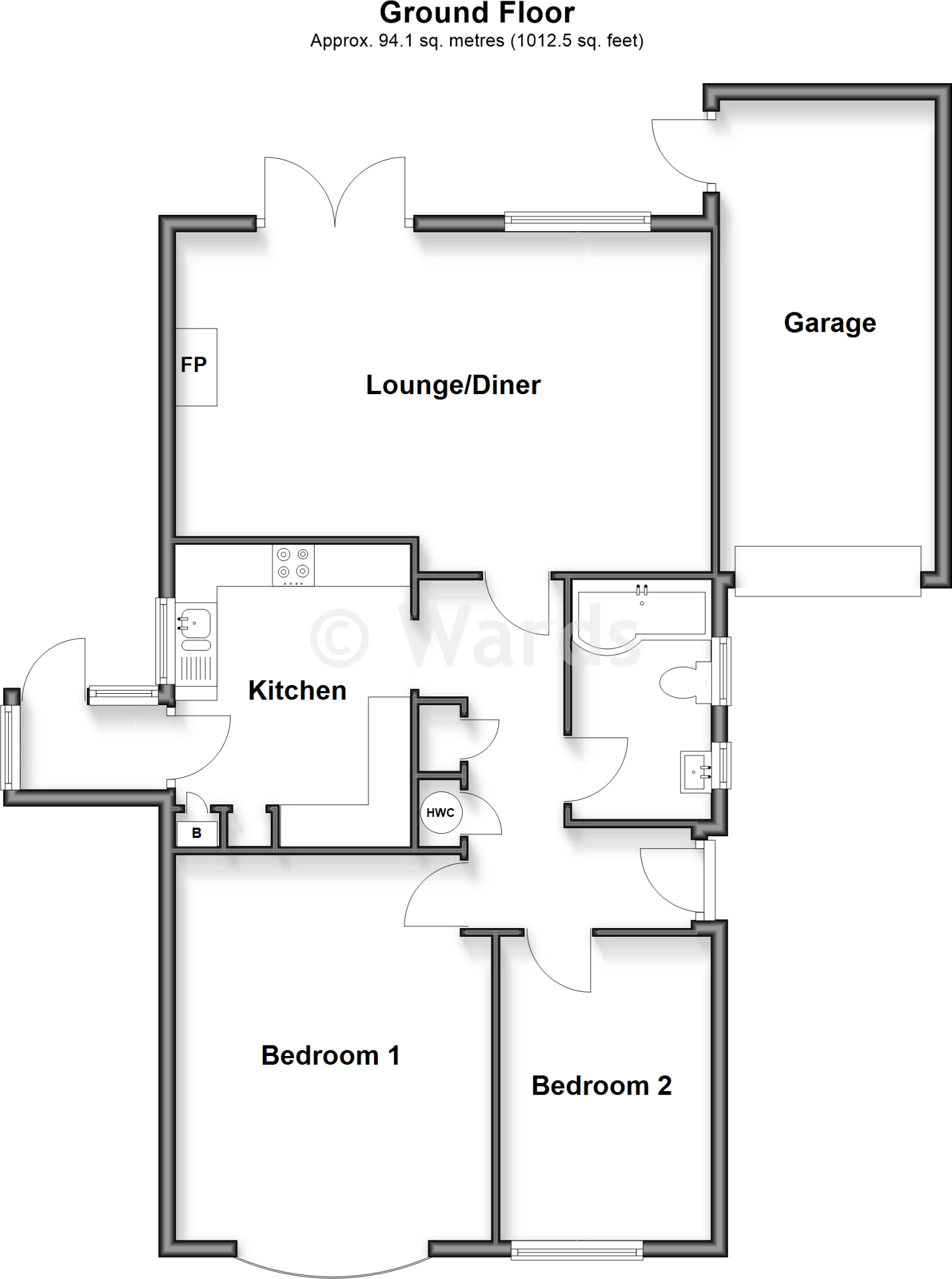
Rooms
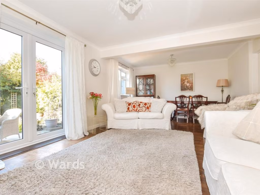
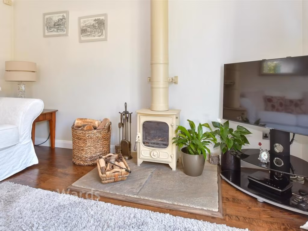
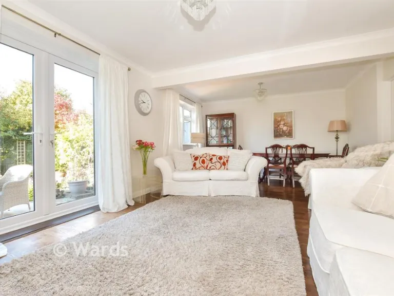
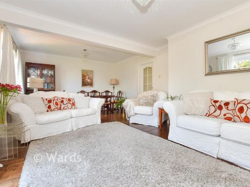
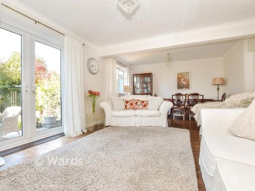
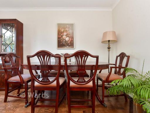
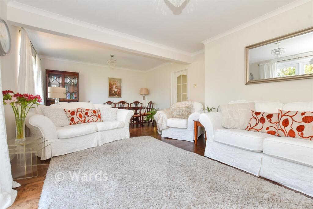
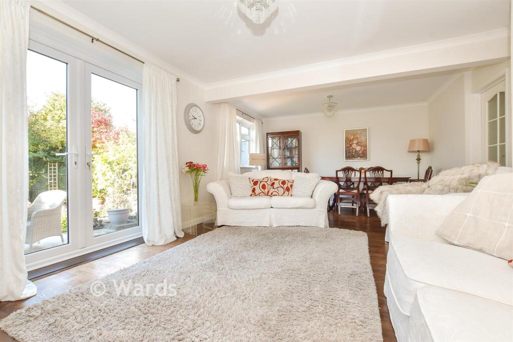
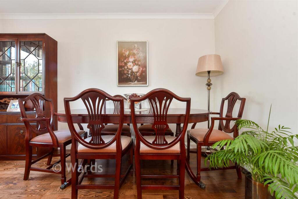
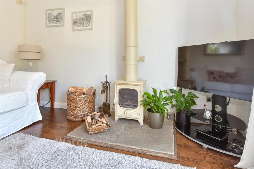
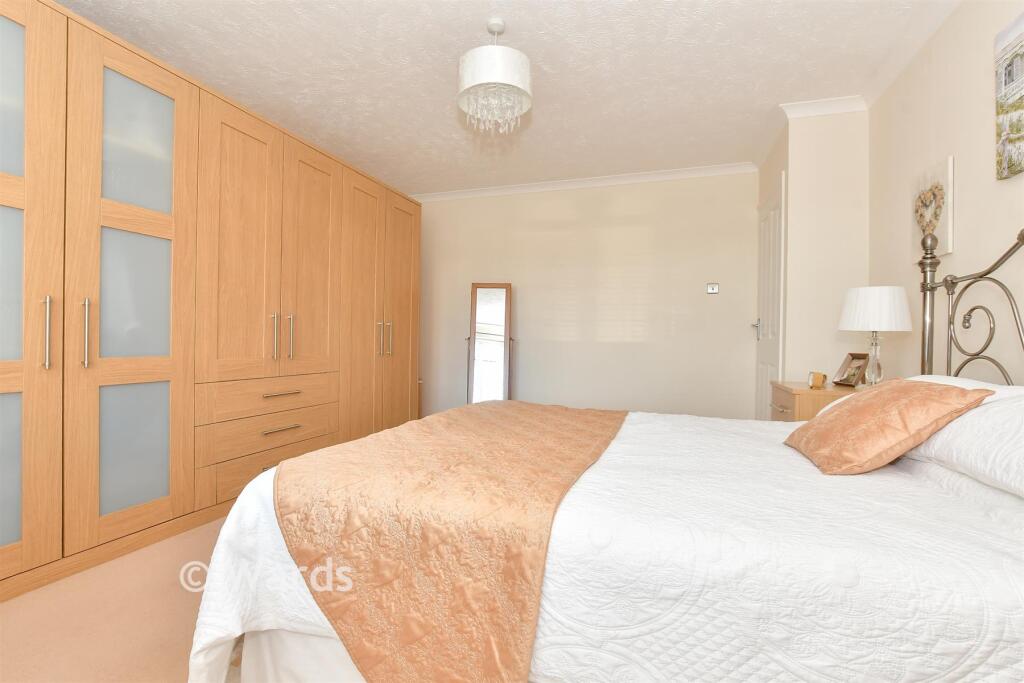
- Lounge/Diner:
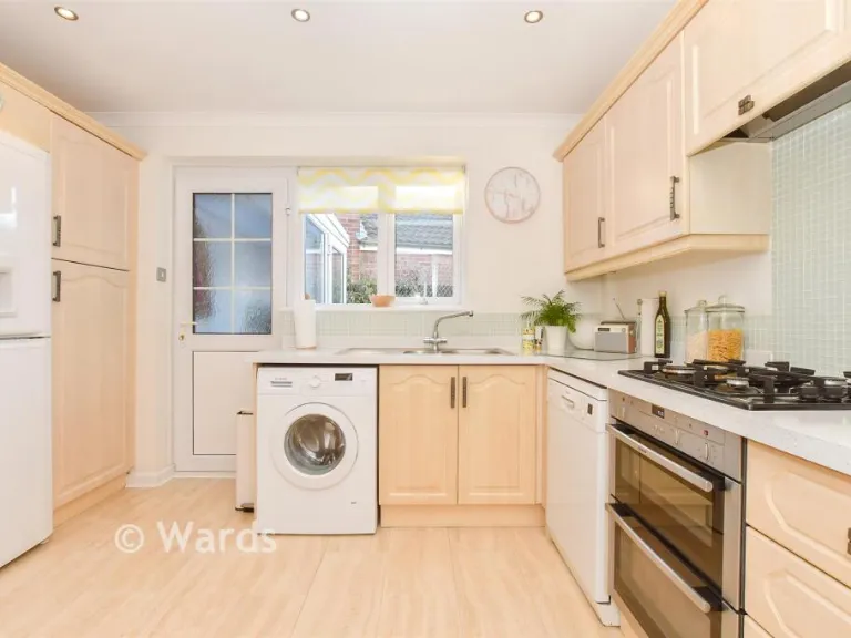
- Kitchen:
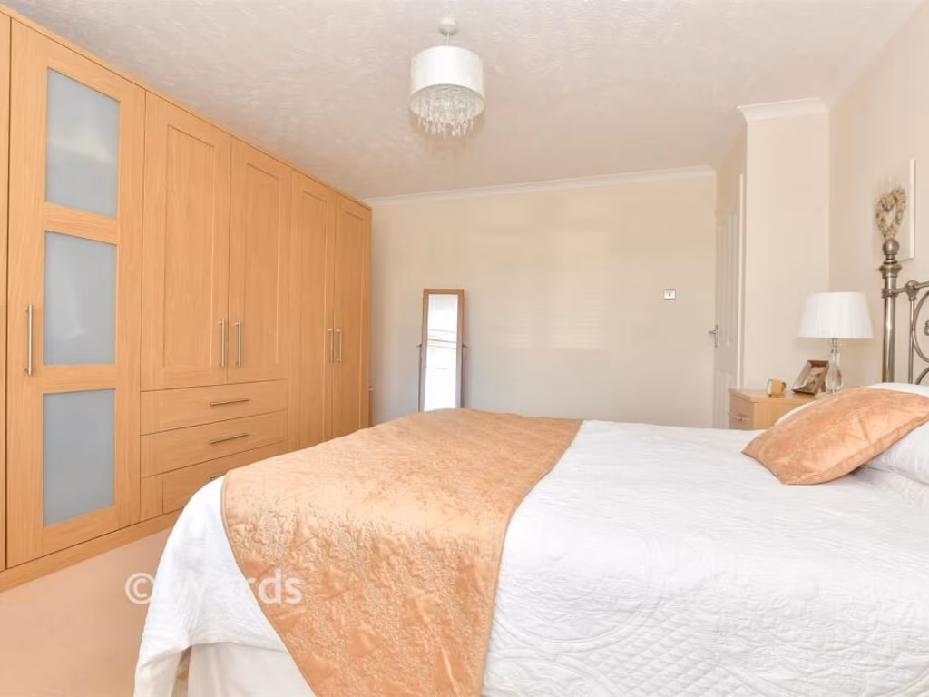
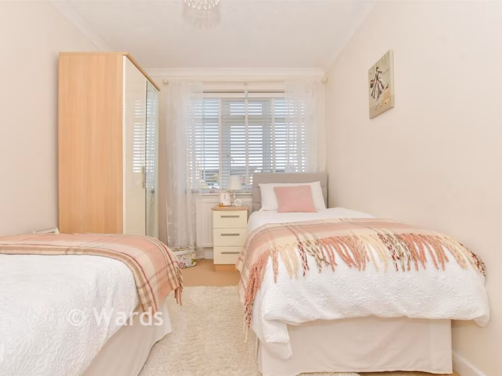
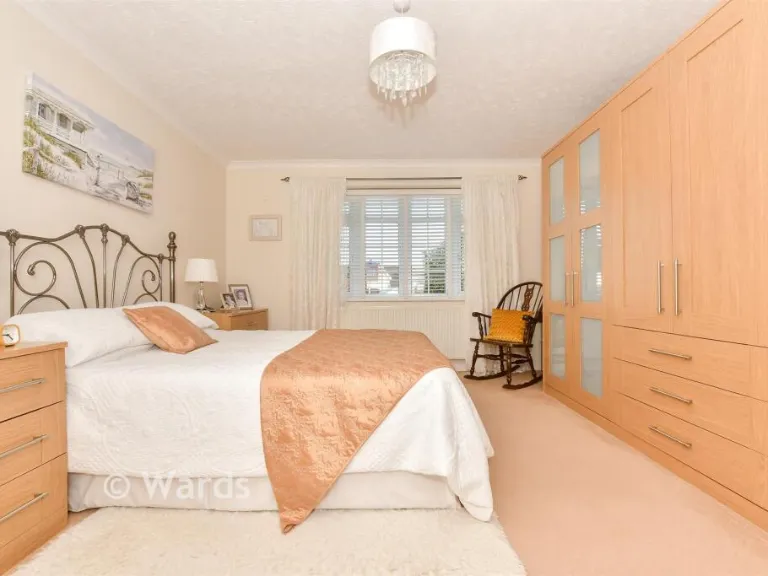
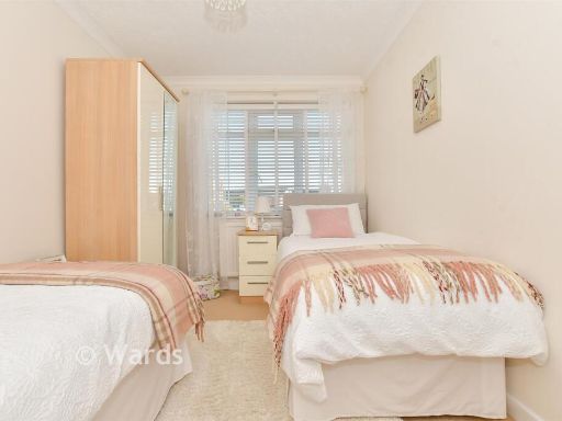
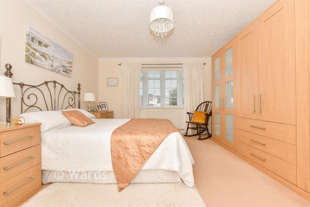
- Bedroom 1:
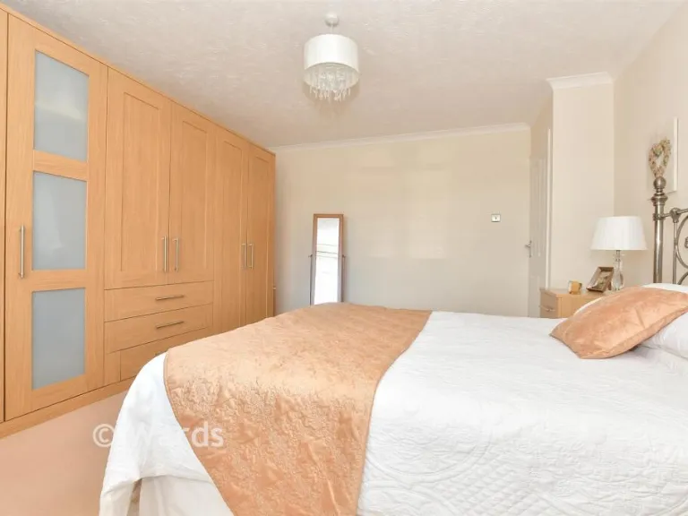
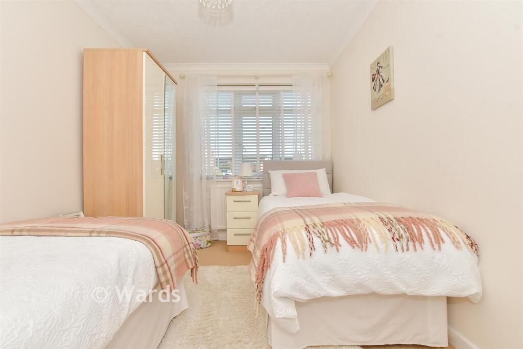
- Bedroom 2:
- Garage:
Textual Property Features
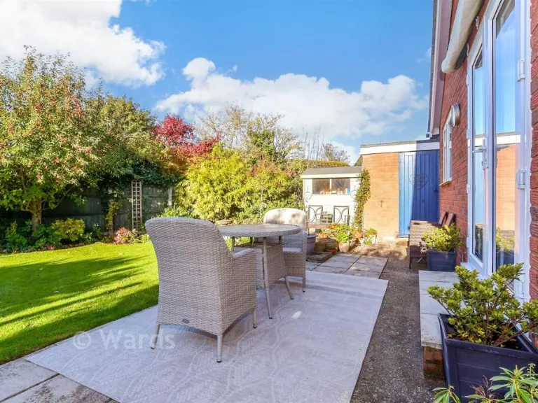
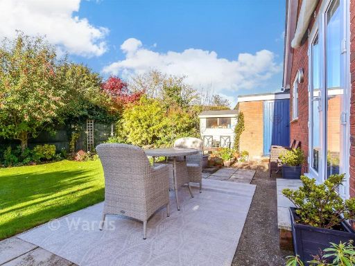
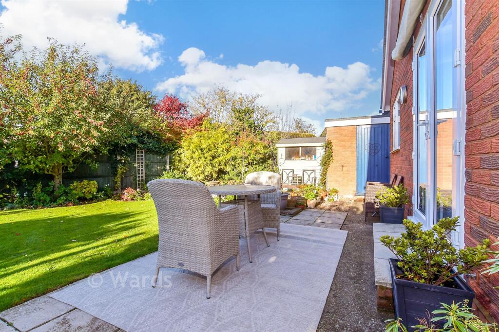
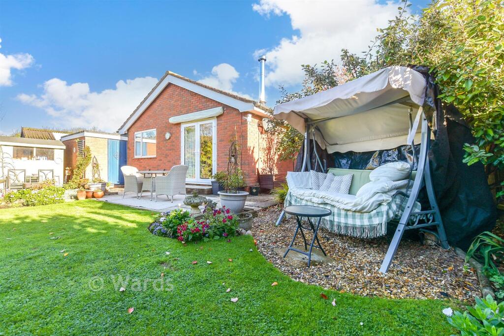
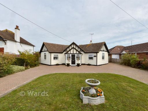
- Has Garden
- Is Retirement
- Success
Detected Visual Features
- bungalow
- detached
- modern
- driveway
- garage
- garden
- stone exterior
- single-story
- modern bungalow
- patio
- landscaped
- brick exterior
- residential
EPC Details
- Fully double glazed
- Cavity wall, filled cavity
- Boiler and radiators, mains gas
- Low energy lighting in all fixed outlets
- Solid, no insulation (assumed)
Nearby Schools
- Parkside Community Primary School
- St Stephen's Infant School
- Whitstable and Seasalter Endowed Church of England Junior School
- Swalecliffe Community Primary School
- St Peter's Methodist Primary School
- St Stephen's Junior School
- Briary Primary School
- Westmeads Community Infant School
- Herne Bay Infant School
- St Thomas' Catholic Primary School, Canterbury
- St Johns Church of England Primary School
- Kent College International Study Centre
- Kent College (Canterbury)
- The Archbishop's School
- Blean Primary School
- Joy Lane Primary Foundation School
- Hernhill Church of England Primary School
- The King's School Canterbury
- Kent College Nursery, Infant and Junior School
- St Edmund's School Canterbury
- The Whitstable School
- Whitstable Junior School
- St Alphege Church of England Infant School
- St Mary's Catholic Primary School, Whitstable
- Herne Bay High School
- Hampton Primary School
- Herne Bay Junior School
Nearest General Shops
- Id: 1244443632
- Tags:
- Addr:
- Name: Meadow Grange
- Shop: garden_centre
- TagsNormalized:
- Lat: 51.354653
- Lon: 1.027554
- FullGeoHash: u10spku4x9pv
- PartitionGeoHash: u10s
- Images:
- FoodStandards: null
- Distance: 1114.2
,- Id: 1090590161
- Tags:
- Addr:
- City: Whitstable
- Housenumber: 114-118
- Street: Cromwell Road
- Building: retail
- Name: Stocks of Whitstable
- Shop: doityourself
- TagsNormalized:
- retail
- stables
- doityourself
- shop
- Lat: 51.3576166
- Lon: 1.0308803
- FullGeoHash: u10spmqev38h
- PartitionGeoHash: u10s
- Images:
- FoodStandards: null
- Distance: 1037.9
,- Id: 566820430
- Tags:
- Addr:
- City: Whitstable
- Country: GB
- County: Kent
- Housenumber: 49
- Postcode: CT5 1RD
- Street: Old Bridge Road
- Building: retail
- Old_name: Krishna
- Shop: vacant
- Source:
- TagsNormalized:
- Lat: 51.3570073
- Lon: 1.0339557
- FullGeoHash: u10spt2bkbj1
- PartitionGeoHash: u10s
- Images:
- FoodStandards: null
- Distance: 826.7
}
Nearest Religious buildings
- Id: 144784679
- Tags:
- Amenity: place_of_worship
- Denomination: evangelical
- Name: Hamilton Road Evangelical Church
- Religion: christian
- TagsNormalized:
- place of worship
- evangelical
- church
- christian
- Lat: 51.3585054
- Lon: 1.029515
- FullGeoHash: u10spmt8vrq4
- PartitionGeoHash: u10s
- Images:
- FoodStandards: null
- Distance: 1172.5
,- Id: 167262214
- Tags:
- Addr:
- Amenity: place_of_worship
- Building: yes
- Denomination: roman_catholic
- Name: Our Lady of the Immaculate Conception
- Religion: christian
- TagsNormalized:
- place of worship
- catholic
- roman catholic
- christian
- church
- Lat: 51.3614221
- Lon: 1.0381134
- FullGeoHash: u10spw5cvz12
- PartitionGeoHash: u10s
- Images:
- FoodStandards: null
- Distance: 1074.9
,- Id: 93138048
- Tags:
- Addr:
- City: Whitstable
- Postcode: CT5 1PG
- Street: Church Street
- Amenity: place_of_worship
- Building: church
- Building:architecture: gothic
- Denomination: anglican
- Fhrs:
- Name: All Saints Church
- Religion: christian
- Website: www.allsaintswhitstable.com/
- Wikidata: Q17556995
- TagsNormalized:
- place of worship
- church
- anglican
- christian
- Lat: 51.3558359
- Lon: 1.0396549
- FullGeoHash: u10sptj13twv
- PartitionGeoHash: u10s
- Images:
- FoodStandards:
- Id: 1438778
- FHRSID: 1438778
- LocalAuthorityBusinessID: CP/21/00265
- BusinessName: All Saints Church, Whitstable
- BusinessType: Restaurant/Cafe/Canteen
- BusinessTypeID: 1
- AddressLine1: All Saints Church
- AddressLine2: Church Street
- AddressLine3: Whitstable
- AddressLine4: Kent
- PostCode: CT5 1PG
- RatingValue: 5
- RatingKey: fhrs_5_en-GB
- RatingDate: 2022-02-17
- LocalAuthorityCode: 180
- LocalAuthorityName: Canterbury City
- LocalAuthorityWebSite: http://www.canterbury.gov.uk
- LocalAuthorityEmailAddress: null
- Scores:
- Hygiene: 5
- Structural: 5
- ConfidenceInManagement: 5
- NewRatingPending: false
- Geocode:
- Longitude: null
- Latitude: null
- Distance: 463.7
}
Nearest Medical buildings
- Id: 1765965155
- Tags:
- Addr:
- City: Whitstable
- Postcode: CT5 1AP
- Street: High Street
- Amenity: pharmacy
- Brand: Boots
- Brand:wikidata: Q6123139
- Brand:wikipedia: en:Boots UK
- Healthcare: pharmacy
- Name: Boots
- Source:
- Addr:
- Postcode: code-point_open;interpolation
- Website: https://www.boots.com/stores/1090-whitstable-high-street-ct5-1ap
- TagsNormalized:
- pharmacy
- boots
- health
- healthcare
- Lat: 51.359288
- Lon: 1.0244979
- FullGeoHash: u10spmdj891n
- PartitionGeoHash: u10s
- Images:
- FoodStandards: null
- Distance: 1511.1
,- Id: 10298360710
- Tags:
- Amenity: pharmacy
- Name: Numark Pharmacy
- TagsNormalized:
- Lat: 51.3631991
- Lon: 1.0310152
- FullGeoHash: u10spqqu26k9
- PartitionGeoHash: u10s
- Images:
- FoodStandards: null
- Distance: 1477.6
,- Id: 167255935
- Tags:
- Amenity: doctors
- Building: medical
- Healthcare: doctor
- Name: Whitstable Health Centre
- TagsNormalized:
- doctor
- doctors
- health
- healthcare
- health centre
- Lat: 51.3626633
- Lon: 1.0300445
- FullGeoHash: u10spqq11y2u
- PartitionGeoHash: u10s
- Images:
- FoodStandards: null
- Distance: 1469.8
,- Id: 729541494
- Tags:
- Amenity: hospital
- Emergency: no
- Name: Whitstable and Tankerton Hospital
- TagsNormalized:
- Lat: 51.3610152
- Lon: 1.0505891
- FullGeoHash: u10spvvp8e0j
- PartitionGeoHash: u10s
- Images:
- FoodStandards: null
- Distance: 1100.4
}
Nearest Airports
- Id: 103894219
- Tags:
- Aerodrome: international
- Aeroway: aerodrome
- Iata: SEN
- Icao: EGMC
- Name: London Southend Airport
- Old_name: Southend Municipal Airport
- Ref: SEN
- Wikidata: Q1415441
- TagsNormalized:
- airport
- international airport
- Lat: 51.5701749
- Lon: 0.6924624
- FullGeoHash: u10mru04p937
- PartitionGeoHash: u10m
- Images:
- FoodStandards: null
- Distance: 34311.4
}
Nearest Leisure Facilities
- Id: 580205098
- Tags:
- TagsNormalized:
- Lat: 51.34961
- Lon: 1.0418953
- FullGeoHash: u10speytjvj7
- PartitionGeoHash: u10s
- Images:
- FoodStandards: null
- Distance: 309.2
,- Id: 284358682
- Tags:
- Leisure: sports_centre
- Name: Whistable Sports Centre
- TagsNormalized:
- sports
- sports centre
- leisure
- Lat: 51.351804
- Lon: 1.03881
- FullGeoHash: u10spsk3yn0f
- PartitionGeoHash: u10s
- Images:
- FoodStandards: null
- Distance: 305.5
,- Id: 165014717
- Tags:
- TagsNormalized:
- Lat: 51.3516924
- Lon: 1.039336
- FullGeoHash: u10spskc6331
- PartitionGeoHash: u10s
- Images:
- FoodStandards: null
- Distance: 272.3
,- Id: 284350998
- Tags:
- Leisure: park
- Name: Plot 10
- TagsNormalized:
- Lat: 51.3516026
- Lon: 1.0403132
- FullGeoHash: u10spsm8c099
- PartitionGeoHash: u10s
- Images:
- FoodStandards: null
- Distance: 210.4
,- Id: 93138036
- Tags:
- TagsNormalized:
- Lat: 51.3538245
- Lon: 1.0421091
- FullGeoHash: u10spswvdysz
- PartitionGeoHash: u10s
- Images:
- FoodStandards: null
- Distance: 186.2
}
Nearest Tourist attractions
- Id: 483891386
- Tags:
- Addr:
- City: Canterbury
- Country: GB
- Postcode: CT5 2BW
- Street: Tower Hill
- Building: yes
- Name: Whitstable Castle
- Note: Not a true castle
- Old_name: Tankerton Towers
- Tourism: attraction
- Wikidata: Q54165863
- TagsNormalized:
- Lat: 51.3642444
- Lon: 1.0347741
- FullGeoHash: u10spw96rvpk
- PartitionGeoHash: u10s
- Images:
- FoodStandards: null
- Distance: 1451.8
,- Id: 9953124123
- Tags:
- Addr:
- City: Whitstable
- Housename: Foresters' Hall
- Housenumber: 5A
- Postcode: CT5 1DB
- Street: Oxford Street
- Name: Whitstable Museum and Gallery
- Tourism: museum
- Website: https://www.whitstablemuseum.org/
- TagsNormalized:
- Lat: 51.3567761
- Lon: 1.0246454
- FullGeoHash: u10spm4nguyy
- PartitionGeoHash: u10s
- Images:
- FoodStandards: null
- Distance: 1378.4
,- Id: 167363250
- Tags:
- Name: Primrose Cottage Caravan Park
- Tourism: camp_site
- TagsNormalized:
- Lat: 51.3466823
- Lon: 1.0403714
- FullGeoHash: u10spems47m4
- PartitionGeoHash: u10s
- Images:
- FoodStandards: null
- Distance: 651.5
}
Nearest Train stations
- Id: 6688385697
- Tags:
- Name: Sturry
- Naptan:
- Network: National Rail
- Platforms: 2
- Public_transport: station
- Railway: station
- Ref:
- Wikidata: Q2519465
- Wikipedia: en:Sturry railway station
- TagsNormalized:
- Lat: 51.300986
- Lon: 1.1222644
- FullGeoHash: u10gce11ysuv
- PartitionGeoHash: u10g
- Images:
- FoodStandards: null
- Distance: 7921.8
,- Id: 3453612249
- Tags:
- Name: Canterbury West
- Naptan:
- Network: National Rail
- Operator: Southeastern
- Platforms: 2
- Public_transport: station
- Railway: station
- Ref:
- Train: yes
- Wheelchair: yes
- Wikidata: Q671106
- Wikipedia: en:Canterbury West railway station
- TagsNormalized:
- Lat: 51.2842245
- Lon: 1.0753092
- FullGeoHash: u10gb2p0282e
- PartitionGeoHash: u10g
- Images:
- FoodStandards: null
- Distance: 7890.6
,- Id: 6743987558
- Tags:
- Name: Herne Bay
- Naptan:
- Network: National Rail
- Platforms: 2
- Public_transport: station
- Railway: station
- Ref:
- Wheelchair: yes
- Wikidata: Q2294609
- Wikipedia: en:Herne Bay railway station
- TagsNormalized:
- Lat: 51.3644375
- Lon: 1.1183071
- FullGeoHash: u10u1qw7d3nh
- PartitionGeoHash: u10u
- Images:
- FoodStandards: null
- Distance: 5391.3
,- Id: 3727341271
- Tags:
- Name: Chestfield & Swalecliffe
- Naptan:
- Network: National Rail
- Operator: Southeastern
- Platforms: 2
- Public_transport: station
- Railway: station
- Ref:
- Wikidata: Q5093891
- Wikipedia: en:Chestfield & Swalecliffe railway station
- TagsNormalized:
- Lat: 51.3602828
- Lon: 1.0674411
- FullGeoHash: u10u0mc734tu
- PartitionGeoHash: u10u
- Images:
- FoodStandards: null
- Distance: 1907.5
,- Id: 3726214975
- Tags:
- Name: Whitstable
- Naptan:
- Network: National Rail
- Platforms: 2
- Public_transport: station
- Railway: station
- Ref:
- Wikidata: Q2555569
- Wikipedia: en:Whitstable railway station
- TagsNormalized:
- Lat: 51.3576861
- Lon: 1.0343648
- FullGeoHash: u10spt3hnqw6
- PartitionGeoHash: u10s
- Images:
- FoodStandards: null
- Distance: 856.1
}
Nearest Hotels
- Id: 4766443435
- Tags:
- Amenity: restaurant
- Level: 0
- Name: Hotel Continental Restaurant
- TagsNormalized:
- Lat: 51.3644987
- Lon: 1.0322892
- FullGeoHash: u10spqxeyhd9
- PartitionGeoHash: u10s
- Images:
- FoodStandards: null
- Distance: 1553.7
,- Id: 358037827
- Tags:
- Addr:
- City: Whitstable
- Country: GB
- Postcode: CT5 2BE
- Street: Marine Parade
- Amenity: pub
- Brewery: Shepherd Neame
- Name: The Marine Hotel
- Not:
- Note: FHRS postcode disagrees with website as of Oct 2017
- Toilets:
- Wheelchair: yes
- Wheelchair:description: Follow signs as disabled access is at the back of the property
- TagsNormalized:
- Lat: 51.3645308
- Lon: 1.0432963
- FullGeoHash: u10spwxsndd1
- PartitionGeoHash: u10s
- Images:
- FoodStandards: null
- Distance: 1362.3
,- Id: 967871706
- Tags:
- Addr:
- City: Whitstable
- Country: GB
- County: Kent
- Housenumber: 72
- Postcode: CT5 1DA
- Street: Oxford Street
- Amenity: pub
- Brewery: Shepherd Neame
- Building: yes
- Contact:
- Phone: +44 1227 272018
- Website: http://www.eastkenthotel.co.uk/
- Diet:
- Fhrs:
- Food: yes
- Name: The East Kent Hotel
- Opening_hours: Su-Th 12:00-23:30; Fr 12:00-00:00; Sa 11:00-00:00
- Outdoor_seating: yes
- Source:
- Survey:
- Tourism: hotel
- TagsNormalized:
- bar
- pub
- vegetarian
- hotel
- tourism
- Lat: 51.3547526
- Lon: 1.0250978
- FullGeoHash: u10spkf7ne8r
- PartitionGeoHash: u10s
- Images:
- FoodStandards: null
- Distance: 1282.9
}
Tags
- bungalow
- detached
- modern
- driveway
- garage
- garden
- stone exterior
- single-story
- modern bungalow
- garden
- patio
- landscaped
- brick exterior
- residential
- single-story
Local Market Stats
- Average Price/sqft: £430
- Avg Income: £44200
- Rental Yield: 3.6%
- Social Housing: 4%
- Planning Success Rate: 87%
AirBnB Data
- 1km average: £67/night
- Listings in 1km: 10
Similar Properties
 2 bedroom detached bungalow for sale in Maydowns Road, Chestfield, Whitstable, Kent, CT5 — £396,500 • 2 bed • 1 bath • 1141 ft²
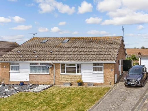 2 bedroom semi-detached bungalow for sale in Avondale Close, Whitstable, Kent, CT5 — £198,500 • 2 bed • 1 bath • 515 ft²
 2 bedroom semi-detached bungalow for sale in Freemans Close, Seasalter, Whitstable, Kent, CT5 — £241,000 • 2 bed • 1 bath • 480 ft²
 3 bedroom detached bungalow for sale in Clover Rise, Whitstable, Kent, CT5 — £327,000 • 3 bed • 2 bath • 1109 ft²
 2 bedroom detached bungalow for sale in Hazlemere Road, Seasalter, Whitstable, Kent, CT5 — £314,000 • 2 bed • 1 bath • 778 ft²
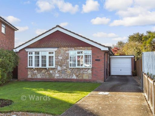 2 bedroom detached bungalow for sale in Rosemary Gardens, Whitstable, Kent, CT5 — £495,000 • 2 bed • 1 bath • 819 ft²
Meta
- {
"@context": "https://schema.org",
"@type": "Residence",
"name": "2 bedroom detached bungalow for sale in Rosemary Gardens, W…",
"description": "",
"url": "https://propertypiper.co.uk/property/8c242db2-97f8-4bb7-99c2-4562e8812e4b",
"image": "https://image-a.propertypiper.co.uk/2764d017-e456-43c7-b405-be14eaf97e5e-1024.jpeg",
"address": {
"@type": "PostalAddress",
"streetAddress": "10 ROSEMARY GARDENS WHITSTABLE",
"postalCode": "CT5 3PU",
"addressLocality": "Canterbury",
"addressRegion": "Canterbury",
"addressCountry": "England"
},
"geo": {
"@type": "GeoCoordinates",
"latitude": 51.3522795452121,
"longitude": 1.0431429280275604
},
"numberOfRooms": 2,
"numberOfBathroomsTotal": 1,
"floorSize": {
"@type": "QuantitativeValue",
"value": 819,
"unitCode": "FTK"
},
"offers": {
"@type": "Offer",
"price": 327000,
"priceCurrency": "GBP",
"availability": "https://schema.org/InStock"
},
"additionalProperty": [
{
"@type": "PropertyValue",
"name": "Feature",
"value": "bungalow"
},
{
"@type": "PropertyValue",
"name": "Feature",
"value": "detached"
},
{
"@type": "PropertyValue",
"name": "Feature",
"value": "modern"
},
{
"@type": "PropertyValue",
"name": "Feature",
"value": "driveway"
},
{
"@type": "PropertyValue",
"name": "Feature",
"value": "garage"
},
{
"@type": "PropertyValue",
"name": "Feature",
"value": "garden"
},
{
"@type": "PropertyValue",
"name": "Feature",
"value": "stone exterior"
},
{
"@type": "PropertyValue",
"name": "Feature",
"value": "single-story"
},
{
"@type": "PropertyValue",
"name": "Feature",
"value": "modern bungalow"
},
{
"@type": "PropertyValue",
"name": "Feature",
"value": "garden"
},
{
"@type": "PropertyValue",
"name": "Feature",
"value": "patio"
},
{
"@type": "PropertyValue",
"name": "Feature",
"value": "landscaped"
},
{
"@type": "PropertyValue",
"name": "Feature",
"value": "brick exterior"
},
{
"@type": "PropertyValue",
"name": "Feature",
"value": "residential"
},
{
"@type": "PropertyValue",
"name": "Feature",
"value": "single-story"
}
]
}
High Res Floorplan Images
Compatible Floorplan Images
FloorplanImages Thumbnail